“Climb the mountains and get their good tidings. Nature’s peace will flow into you as sunshine flows into trees. The winds will blow their own freshness into you, and the storms their energy, while cares will drop away from you like the leaves of Autumn” – John Muir, 1901.
Klehini River near the AK/BC BorderGhost ForestFirefall Tundra and Swirling MistAutumn Colors at Rainy Hollow BCLate Run Sockeye at Klukshu, YukonMush Lake TrailAutumn Colorizing and Yukon MountainsYukon GoldStoked to Be…Deep ForestA Serene and Peaceful Scenario…Glorious Yukon Light and WeatherFall Aspens…Razor Sharpness and Crisp Colors
It had been a grand summer in the northern interior, but is was time to head south to meet up with Angela and have an adventure in the Yukon, so after tying up loose ends in Fairbanks and getting the archaic Toyota back into travel mode, I say goodbye to Sven and all the great folks I had met during my stay in Fairbanks this summer, gas up, and hit the highway. Driving south and seeing once again the massive central Alaska Range dominating the skyline, it is decided nearly instantly that I wish to head back to Delta for a few days to have a closer look around to do my own thing, shoot some photos and video, and look for animals. That evening at my familiar camp along the Delta River, another sublime sunset graces the southern horizon and showcases the white giants I dream of so often.
The areas around Delta Junction had fascinated me for sometime, and a venture with Dennis up nearby Donnelly Dome just south of town had wet my appetite for the vast tundra and river valleys of the region. It’s an area of concentrated wildlife, dense forest mixed with open tundra, raging glacial rivers, and giant mountains. In the morning following, I whip up some tailgate coffee and breakfast and soon head south to an area surrounding Donnelly featuring herds of wild Bison, Caribou, Moose, Grizzly Bear, and a vast network of dirt roads unexplored by yours truly. After stomping the brush filled valley below Donnelly and scaring up a large bull Moose near the Alaska Pipeline, I decide to drive up a dirt road I had spied some weeks prior that led past an old military installation and winding down to Jarvis Creek, but a sizable pool of water and it’s inherent mud hole prevents passage to the places I seek. So I stomp the area on foot on search of anything of interest. Grizzly tracks lead from and abandoned military bunker where once inside, I scare up several big Owls who are surprised by my presence and flee the scene entirely. Walking through the thickets, a large bull Caribou trots past not far off and climbs a short brushy hill to get a better look at me. Such a magnificent animal in silhouette against the storm encumbered sky; he smells the air briefly before descending the north side of the escarpment and soon is gone from my sight. Another Caribou appears and gallops fast to catch up, and soon I am alone walking the old dirt road en-route back to the truck. It begins to rain in earnest and soon it I am engulfed in a frigid downpour; in the dry and warm confines of the truck, I call Angela to solidify our plans to meet in the Yukon in another week or so for a climb up Mt Archibald in the beautiful and enchanting Kluane region less than a three hour drive from Haines. But for me, the drive will take a full day or so, but I have time to kill and decide to take my time and explore and maybe even climb a peak on the way south. I drive the old truck back north to Delta and back to my camp along the Delta River, where it rains hard for most of the night.
The next day is spent driving slowly, stopping often, exploring dirt roads and gawking at one of my favorite parts of Alaska. This place has the sensation to me of an ancient and somehow significant nature; people have lived in these vast northern valleys for thousands of years, flourishing in this striking and beautiful land. So many rivers, creeks, and un-named mountains here… It is a staggering thought to try to encompass all of its geography into my psyche. There is a thousand lifetimes of exploring to do here, and I can only hope to come back again and again to see and experience as much of it as I can in this one life. I pull down a dirt road and scope out an area for a hike and possible peak climb in an area north of Tok about 20 miles. Feeling satisfied that I have my bearings about me, I head down the road to Yerrick Creek, one of my favorite creeks in the area, to gather drinking water and bathe my stinking carcass. After a pleasant bath I drive to Tok for supplies and head back up valley to a sweet camp along the Yerrick. Once again, that night it rains a rain that can only be described as intense. Morning arrives and the rain shows little signs of dissipating, so I pack the truck and ponder my next move.
I decide to head back to Tok and do some laundry and fuss around town some where I drop into the visitor’s center for a look at the weather forecast that tells of inclement weather gaining momentum; after a walk through the old Tok cemetery during a rush of raindrops, I decide that the best way to spend my time before Archibald is to simply head back to Haines and catch up on much needed house projects that have been neglected all summer. Driving south of Tok through the maze of high forested ridges and immense wetlands, I emerge into the great taiga filled river valleys of the Robertson River, Johnson River, White River, and the beautiful Donjek River, all giant glacial fed braided specimens born of true and unrelenting wilderness. The Kluane region is now at hand and a pair of blonde Grizzlies graze at road’s edge as I pass. I camp down an old dirt road overlooking the fantastic St Elias Range where a small herd of Dall Sheep can be seen on a neighboring hillside grazing in the midnight twilight. Passing near Haines Junction the following day, the mass of Mt Archibald comes clear and its steep and glaciated east face dominates my view. Back in Haines hours later, I settle into my little house and fondly breathe in its strangeness; I have not been here for over two months, and it seems foreign to me. Nonetheless, a good nights sleep is to be had, and now preparing myself for the new electrical breaker panel that needs to be installed at the power lines adjacent to my house was in order. Five days later, the breaker panel is installed, the truck worked on, and gear and supplies gone through for the next Yukon adventure with Angela mostly taken car of.
The day before departing again back into the Yukon, Angela comes over and we spend several hours organizing gear and prepping for the Archibald climb. It feels good to be in a state of anticipation of an adventure goal once again, and soon we are ready. The plan is to leave late morning or even mid-day and casually head to Haines Junction to re-group and find the dirt road that leads Thunderegg Creek where we will spend the night before the hike in to our basecamp for Mt Archibald. Casually driving up the Haines Highway and up and over Haines Pass, AKA Chilkat Summit, it feels good to be in the high country once again. We take our time stopping from time to time to explore a little here and there and taking in the peaceful valley where the stimulating Klukshu River flows; it is a tiny river with runs of large King Salmon, but none are seen here today. It is a place of crossroads where cultures of the Aishihik and Champagne peoples would meet with the Chilkat Tlingits to trade goods and furs for the highly sought after Hooligan fish oil. In Haines Junction to gas up, we get to the visitor’s center just before closing time to secure our permits for backcountry travel, but are told that we need no permit to enter the area we are going as it is just outside of the Kluane National Park boundaries. Suits us fine, and we hit the Little Green Apple, Haines Junction’s tiny grocery store, for our supper supplies and hit the road north towards Thunderegg Creek.
Thunderegg creek is the drainage that flows from the un-named glacier that grows from Mt Archibald’s southeastern flanks and is named so for the marvelous round “eggs” of stone that grace the corridors of the raging river. In the morning, we pack up casually and shoulder our relatively light packs and begin the stomp up valley towards the glacier. The accounts we had read on-line gave a thin description of a faint game trail that peters out into thickets of Alder, Willow, and Aspen that must be navigated in order to avoid the impassable shores of Thunderegg Creek. Soon we find the trail disappearing and the thrashing through Alder thickets begins. The descriptions mentioned that the bushwhacking should last “no more than an hour”. True to the description, we emerge from this dense northern jungle in short time to find ourselves clamoring up an exposed ridge where two drainages parallel one another. At the ridge’s top, flat walking lead to a decision: either continue bushwhacking higher to where tree line ends and the glacier and moraine begin, or bushwhack down and to the left into the drainage of the creek that flows from the ice. It seems the downward option is our best bet, and another great and thrashing jungle session begins. The going is slow and methodical; it is very dense, but it is fairly short and soon we are deposited into the dry and rocky creek bottom, sans creek. We had hoped for water here, but none is found. An uphill trudge of about an hour and a half brings us to the very base of Archibald herself, where sprouts of tundra meadows appear. We ponder camping here, but realize quickly that not only is there still no water here, but the base of the Southeast Ridge that we intend to climb would be much better gained higher up the moraine. Getting both dehydrated and exhausted, we trudge on in hopes that drinking water and a suitable bivouac will reveal itself. Following the lead of the description we had read, drinking water could be found at the base of the terminal moraine; we gain the base of the massive scree to find none at all. Working up and around the lower portion of the moraine, a decision is made that we must go up and over this beast to find salvation. Another 20 minutes of scrambling and we are on top of the moraine and looking down slightly to a flowing creek of fine glacial drinking water. Dumping packs, we scamper downward to the creeks edge and fill ourselves with the glorious liquid. Bringing no tent along on this adventure due to the outstanding weather forecast and wishing to save every once of burden from our backs, we spy a small shelf situated at the exact starting point of our proposed climb. It is stupendously perfect. After moving rocks around for a few minutes, we have ourselves a perfectly flat and relaxing spot to throw down our sleeping bags; but it is hot. Very hot. The sun will not be behind the rim for another two hours and all we want to do after supper is go to sleep for our 3 am wake up call for the climb. So we wait… After the sun begins it’s descent behind Archibald’s summit ridge, we close our eyes and…. not sleep. We are both gifted with a bout of insomnia that allows us just scant minutes here and there of real rest. This seems to happen to me a lot on these high mountain bivy’s. Not sure why, but it seems I am just too much in awe of the glorious alpine setting and can’t seem to get my eyes or mind to sleep. Occasionally, when I am camped in these high glacial cirques, there exists sometimes the sensation of faint voices; like souls wandering these glaciers and whispering slightly. It is a strange phenomenon and Angela speaks of it as well… a curious thing these voices. The northern summer twilight that never really gets dark soon gives way to a display of the Aurora Borealis that sets our hearts on fire as we gawk in awe at it’s offering. Soon, the Aurora dissolves into the early morning dawn as the 3 am alarm goes off and we are up packing, cooking oatmeal and tea, and rubbing the lack of sleep from our bewildered eyes.
Following Dall Sheep trails up endlessly steep and sliding scree, we emerge on the top of the lower ridge to find a staggering sight: the un-named peaks to the west of Archibald are adorned with glaciers exhibiting broken seracs and icefalls, lit up by a full moon rising above their rarely seen summits. A post-Aurora alpenglow that sears the sky with streaks of pink and orange light outlines the mountain horizon to the east and north. The sight fills me with the notion of being a part of this grand and ethereal landscape that is not to be taken lightly. I find that being in these place gives me a sense of deep spiritual and emotional connection to the natural world that allows me completeness as a Human Being living on this strange and beautiful planet.
The southeast ridge of Mt Archibald is a long and rocky ridge, perhaps 3 miles in length and rising nearly 6000 feet from Thunderegg Creek to it’s 8,491 foot summit. This ridge is a steep and sometimes narrow feature sporting many sizable ‘summits” along it’s way, several gendarmes up to class 4-5 climbing, and near it’s top, the glacial ice from it’s east face creeps over the top of the upper ridge where steep and exposed snow and ice climbing accesses Archi’s true summit. It is a big mountain with a huge elevation gain for a peak of its height, and requires a variable set of skills to reach its summit. One must be comfortable with loose rock, exposed class 4 rock climbing, route finding, and snow and ice climbing skills. Given the length and elevation gain of Archi’s bulk, exceptional fitness is also a must.
A short scramble from our perch atop the lower ridge and we are surmounting the first of many gendarmes, most of which are in the solid class 3 range. Up and over, side hilling scree, of traversing back and forth across rock ranging from shattered Schist, to loose scree, to blocky talus generally accomplishes dealing with these many features and false summits. The hardest part of this ridge is the elevation gain… then loss, which one must deal with when going up and over these false ridge summits.
After a couple of hours of traversing and scrambling, the sun begins to crest just above the distant horizon and the ridge begins to get steeper, looser, and more exposed. Sections of steep scree lead to flatter sections of the ridge, where Dall Sheep sleeping platforms appear; there are several spots grouped together and have been manicured by hoof to produce flat and comfortable sleeping arrangements. Most are right on the apex of the ridge itself where wind and exposure are a way of life for these magnificent and hardy animals.
Higher up, another steep gendarme is negotiated by means of traversing left and scrambling the steep, exposed and shattered rock diagonally and then climbing directly upward and over it’s tiny summit; a brief down climb leads to another short traverse on it’s right flank to a point where the ridge eases off once again before climbing abruptly to the base of what had been described as the crux of the route: a true summit in it’s own right, a sub-peak of sizable proportions that bars access to the upper ridge, and the final stretch of chaotic mass of shattered debris below the steep and forbidding summit snow and ice where the glacier bends itself agonizingly over the summit ridge’s lip. Once the bulk of the gendarme is reached, the climbing turns to extremely exposed and loose class 4 climbing. We brought no rope so great care was taken climbing through this section. Once gaining the broken, tiny summit of this mammoth sub-peak, a view towards the final rib of snow and ice can be seen for the first time on the climb; it appears to be a steep knife-edge leading directly to the Archibald’s summit.
We are extremely lucky today to have the unbelievably outstanding weather we are experiencing, and from this point on the upper ridge, a view west reveals completely unobstructed and crystalline views of the entire Mt Logan massif and all of the big peaks of one of the most expansive glaciated mountain ranges on the planet. After moving through a section of broken towers and blocks, we find a pool of drinking water and fill our bottles and eat; we are both getting tired.
Another long, steep section of extremely loose scree forms a knife-edge and leads to a long flat section of ridge where, at its end rises the final snow and ice where the summit lie just beyond. After donning crampons and ice axe, we begin up the steep snow, Angela above of me front pointing then plunging the axe’s shaft, and repeating till there was no more. We are standing on the tiny summit; in fact it is just barely big enough for both of us to sit. The weather is striking and the views are mind blowing; however, I had been developing vision problems for the last hour or so from sunscreen dripping into my eyes, and now sitting here on Archibald’s summit, the pain is increasing, and my vision getting very bad indeed. We have 6000 feet of dangerous and time consuming ridge to down climb and here I am with only one working eyeball. We snap some photos and then begin the long and arduous descent back down the snow rib and the long loose section leading to the big gendarme. By the time we reach the dangerous class 4 sections, my vision is really bad and the pain increasing still. I have one semi-working eye in which to navigate the down climbing past a deadly exposed section, where if one fell or slipped, it would be the end of you. After managing, I stay close to Angela and she down climbs the bad section; relief hits us both and we are soon traversing and side hilling the long mid section of the route; I have managed to sort of “ski” the scree in my mountain boots, making downward progress a little less tiring, ice axe in hand just in case. After a few more hours, we are at the top of the Dall Sheep trail that leads back to the bivi. I am so tired, I can barely stand, but commit to this last section with abandon. Angela does the same and when we reach our bivi site, we collapse for a brief spell and ponder what we are doing.
Again, my eyes are inflamed and I cannot see at all out of the left eye, leaving only my bad right one still working, which has been of poor vision since childhood. We decide that hiking back to the truck is in order and the possibility of seeking medical attention a reality. After packing up our alpine ghetto, we shoulder our packs, our bodies scream, and we begin descending the debris covered glacier towards the dry creek bed and the route home. The going is slow, but soon we are at the point where we had bushwhacked from the ridge and into the drainage. Not feeling like going up through the thickets, we opt to stay in the dry bed in hopes that we may find a way to navigate around the toe of the buttress and it’s inherent Alder thickets. After stomping down through the Bear tunnels and shouting “Hey Bear!!” every so often so as to not startle one and provoke an encounter, we find ourselves on the shore of Thunderegg Creek. Fed by the glacier we had just come from, this specimen is no creek, but a dangerous and massive river, dark chocolate with debris, very deep, very fast, and very cold. We walk it’s shores for a very short time before realizing that we are trapped by the dense thickets leading directly to the edge of the raging torrent. Everything we had done to avoid the bushwhack just exploded in our faces and the only option left is to aim uphill and attack the matrix of the dense and unforgiving web of Alder, Aspen, Willow and small Spruce. Not 50 feet into it, we are encountering the worst bushwhacking of our lives. I once was a part of a conversation with some Washington climbers years ago about how the locals had a “bushwhacking rating system” for back country travel and mountaineering approaches in Washington state. I thought it was kind of of funny at the time, but now, after living and stomping in Alaska and the Yukon for a few years, it is no joke. This thicket we are in is definitely “class 5+” bushwhacking. Add a full pack and a pair of trekking poles to the mix and you’ve got some real fun. After about an hour or so of this, we emerge on a faint trail that leads to the cliffs at Thunderegg where the truck is parked and rest awaits.
The exhaustion we feel is overwhelming, and my eye is in horrible pain; perhaps the worst pain I have ever felt. It is late and we decide that staying here for the night is the best option, since the closest clinic is in Haines Junction or possibly even Whitehorse over 100 miles away. Oddly, there is phone reception here and Angela gets on the telephone and inquires about the clinics and general eye care with a nurse in Whitehorse. Not only would the drive be horrendous, but the cost of such an endeavor would be very difficult for me. We hunker down for the evening in the tent, sipping a cup of wine and me trying desperately to hold on. The pain is overwhelming. After a few agonizing hours, I pass out and wake hours later to my eye feeling slightly better, but still not good. We pack it in, drive out the long and sustained 4WD road back to the highway and head into Haines Junction for some grub and decide to head home and go to the SEARHC clinic in Haines.
The drive back over the pass is striking as always; the tundra surrounding the peaks laid out like a sub –arctic blanket and the peaks themselves jutting proudly to meet the sky. The drive from the alpine at the pass down the Chilkat corridor to Haines is always an interesting one to me as witnessing the transition from one ecosystem to another is always a joy, even with one eye. At the clinic in Haines, the visiting eye doctor examines my eyes and runs me through a series of tests that determines that the sun screen was in fact the culprit, and that applying some eye drops and rest will alleviate the pain and irritation. The entire experience, from the sleepless bivouac and the early morning Aurora, to a long and arduous route and it’s subsequent beautiful summit, to a terrible bushwhack and a murderously painful eye condition, has been one of great significance in a lifetime of outrageous adventures spent in an array of wilderness places that continue to touch our hearts and souls. It is being in these places that both Angela and I seek, both on a physical and spiritual plane.
The Kluane area of the western Yukon remains one of my most revered place on this planet; it is a place where some of the largest glaciers on Earth are born from some of the mightiest and remote mountains… it is home to scores of Grizzly Bears, Black Bears, Wolf, Lynx, Dall Sheep, Moose, and has an ancient Human cultural spanning thousands of years. The wilderness here is far reached and commands respect from any creature passing through it. It is a place near my home and one that I will return to visit time and time again to explore and experience magic.
The Ridge Between BushwhacksAngela entering the TundraDall Sheep trails On The Lower Southeast Ridge Of Mt Archibald
The Bivi
The Lower RidgeThe Upper Ridge And The Summit Of Archi
.
A Magic Moment
Mt Logan Dominating the Far Skyline
The Exposed Class 4-5 Crux Of The Route
At The Watering Hole Up High
Angela Putting On CramponsThe Steep Snow Rib Just Below The Summit
The Last Few FeetAngela On The Tiny Summit
On The SummitThe Long and Un-Named Glacier And Our Bivi WAY down At The EndThe St Elias Range And Mt Logan Far Off
Getting on the road by 10:00 am or so following town chores and paying bills, I am happily cruising up the Haines highway and northbound for the Yukon and beyond. I approach the Eagle Preserve at 20 mile and the engine alternator idiot light comes on… funny, never saw that before on this truck. I pull off the road and pop the hood for an inspection. Using a volt meter, I check voltages of the battery with both with the engine running and not running. A nominal voltage of 12.4 with the engine running indicates that the alternator is not doing it’s job. In fact, it has shit the bed… Reluctantly, I turn around and baby the 30 year old Toyota back to town to re-group. Pulling into the parts store, I am amazed that they have one in stock. 142 bucks and two hours later, I have the alternator installed and the last bolt tightened and I am on the pavement rolling north once again.
At the Canadian the border, there is a length of vehicles waiting I have never seen here before. After an hour wait, I am flagged in and questioned. I am asked to exit the vehicle and wait inside while my car is searched, which the Canadian border cops do with abandon. Again, I have never experienced this before. Another hour and I am free to go after they come to terms with the fact that I have nothing to hide. Two hours to get into Canada. I am beyond happy to have the Chilkat Valley behind me. Driving over the Haines Summit and into the high country sees me smiling and as the Yukon border comes ’round. I am washed over by an array of mixed feelings; most of me is extremely happy to be on the road and rolling away from Haines, but part of me dreads the inevitable slash of loneliness that will undoubtedly come in short order. In fact, as I near the Tahkini River, the dreaded sensation enters me, invades my space and riddles my ravaged heart with bullet holes. I shuffle this back to a place of inner strength that is there for survival reserves and continue. Â I get to the Tahkini and make a fine camp there; it was a familiar camp as I had spent time there on past trips. The evening colors around 1 am filter the sky orange and pink and patches and fills my heart and soul with much needed color and softens the dramatic episodes within me. I sleep.
I awake to the warmth of sunshine and something splashing in the river. I pack up and pull out onto the Alaska Highway again heading towards Whitehorse. These feelings I cannot seem to shake and I hope that once past Carmacks or Dawson, they will fade. In Whitehorse waiting for the Fireweed Bookstore to open, I am accosted by a pair of drunks jabbering nonsense at me. Soon, my maps and food are purchased and I am driving the wide open spaces of the North Klondike Highway bound for Carmacks. A torrential rain storm ensues. The roadway becoming a slab of dangerous water; I slow down but other traffic does not. I won’t be bullied by these vehicles and I pull off when I can, but it is up to them to pass if they wish to drive at unsafe speeds. Camping that night in the Taiga forests among Aspen and Willow, tiny yellow birds flutter my camp and a Red Squirrel chirps in the forest nearby. These trips, when I am by myself, which is 95 percent of the time, tend to promote moving along, bound for a destination and goal. It is sometimes difficult to just set back, especially these past weeks, as the creeping dreaded sensations that have filled me lately prevail when I have come to a stop. So I simply keep moving. Regret is futile, and yearning for an undeniably uncertain future is equally so. I have no past, and working toward the future like some kind of mystic jewel seems pointless; I simply am. My heart and desire are too big for this world and most cannot deal with my intensity and passion… the heart is the only guiding force. Chalk it all up to a lifetime of amazing experiences. I am the wind…
The morning sees me drifting closer to Dawson City; nearing the Klondike river at the entrance to the mind bogglingly beautiful Dempster Highway, I spot a pair of bright blond Grizzlies grazing the grass on the side of the highway. So beautiful these magnificent creatures; I often wonder what attracts them to the highway like this… is there something that grows only near the road that they find edible and tasty? I pass the Dempster and head to Dawson for fuel and a snoop around and maybe a nice espresso drink. It had been 4 years since I had been to Dawson, and not much had changed. That is a good thing. Dawson is a gem in the far north to me; it is a place of historical significance, color and interest. I get an Americano at the lovely Alchemy Cafe and soon I am back down the highway the 25 miles to the start of the Dempster. My plan is to hike into Grizzly Lake in the Tombstone Mountains and spend the night there, taking photographs and shooting video. But when I get to the trailhead, there is a notice that the trail is closed. This is the second time that this happened… I was here in 2013 to not only hike to Grizzly Lake, but to also ride the Ogre all the way to Inuvik in the Northwest Territories. Neither happened on that trip. After pedaling for three days, the road was washed out north of the Ogilvie River, and I was forced by the road crews to turn back. The Grizzly Lake Trail was closed due to high Bear activity in the area at that time; this time it was closed due to heavy snow still on the ground. So in 2013, I stashed my backpack under a rotting Spruce log and continued my bike trip up to Deadhorse and beyond. But today I was in my truck, bound for who knew where. I walk into the forest and immediately locate the pack I had stashed 4 years prior, and skedattled up the gravel Dempster to my favorite section. It is a place where the second of three continental divide crossing occur on the Dempster. A place north of the Blackstone River in the Taiga Range; birth home to Engineer Creek, Mountain Goats, Grizzly Bears, and Caribou. I am looking for a peak to climb in the area, and a ridge leaving the pass right from the road directly on the continental divide leads to an un-named summit of perhaps 6,000-7,000 feet. I decide on it, but first I wish to continue north and do it on the way back. A couple miles down the road is a beautiful alpine canyon situated directly at tree line with the headwaters of Engineer Creek flowing through it’s guts. I find a wonderful camp and set down upon it happily. Glassing the slopes nearby, I spot a heard of a dozen strong Mountain Goats, including several babies who seem to be happy to be jumping around and playing wildly amidst the high and treacherous slopes they are perched. This area north of the Blackstone in the continental divide country is by far my favorite part of the Dempster experience. Late that night, perhaps around 1 am, I awake with a yearning to leave the tent and go on a “night” stomp. I exit the tent and walk across the road and disappear into the muskeg and Taiga. Tussock tundra appears and I run as fast as I can towards a barren hillside, where Willow Ptarmigan scatter. Being spontaneous is what sometimes drives me, for better or worse. It is simply fun, and nothing beats the sensation of just making a snap decision and going for it. I look out over the alpine valley I am in and it occurs to me that every Human on this planet is going through some form of struggle largely unknown to the rest of us. I am not alone…
With my cup of Green Tea in the morning, I make a toast to the South, East, West, and of course, the North in thanks and offering of gratitude. I drive north again, this time paralleling the Ogilvie River at at point further that I got on my bicycle in 2013. A Grizzly slowly walk across the road in front of me a couple hundred meters off and disappears into the Taiga, and more Ptarmigan flutter about at road’s edge.
Many miles after leaving the high country, the road drops into river valley’s and enters First Nation native hunting lands. The Dempster at this point climbs to a high point on Ogilvie Ridge, where unobstructed views of the Ogilvie and far, far off, the Peel River, heading to the great und vast McKenzie River flowing to the Arctic Ocean. The road continues along this high Taiga bench for many, many miles. It is dry up here. And exposed. And monotonous… till finally Eagle Plains comes around where I gas up the Toyota and continue on. Soon the Arctic Circle appears and beyond are the rounded tundra summits of the Richardson Mountains, which, in essence are an extension of the British Mountains in the Yukon which are an extension of the Brooks Range in Alaska. The Richardson’s are unique in three ways; They are the final continental divide crossing on the Dempster, dumping all water from them on the northeastern side into the Arctic Ocean, they form the border of the Yukon and Northwest Territories, and they are the last formidable geologic uplift barrier between the interior and the arctic plains of the Canadian “north slope”. Beyond which lie the extremely remote communities of Inuvik and Tuktoyaktuk. The road travels directly north along the western escarpment of the Richardson’s for many miles, traversing some of the most incredible Arctic scenery I have ever seen; in fact it equals the Brooks Range in beauty and remoteness. Although it is not nearly as big as the Brooks, it is even more remote really. Soon the road turn east and climbs over Wright pass at the final continental divide and crosses into the Northwest Territories. This place is absolute magic. It is quite chilly here, this far north at the continental divide. The last time I was in a similar place was in 2013 on the summit of Atigun Pass in the Brooks Range on The solstice at midnight. It was cold then too… The road continues through the Richardson Mountains, revealing tundra, high peaks, wild flowers, and wild rivers. After descending the last great decline out of these magnificent mountains, the Canadian Arctic slope appears in the distance, extending for hundreds of miles to the McKenzie Delta. I pull off the road, some 30 kilometers into the Northwest Territories and notice the immense trail of numerous Grizzly prints decorating each side of the road. At night these massive creatures must use this road as a path. There are more Grizzly prints here than I have ever seen anywhere in my life.
Finally, after saying farewell to the NWT’s and wishing to continue on to the Arctic slope, but becoming increasingly paranoid about the 30 year old Toyota Truck’s engine with a quarter million miles on it, I turn back and drive back to from which I came. Passing once again the Arctic Circle and gassing up in Eagle Plains again, a few hours later I am back in my favorite and stunning alpine valley north of the Blackstone River. I am exhausted and plan on a peak climb in the morning. In the tent, I sleep like a dead man.
After crossing a short bit of tundra in the morning, I begin climbing up the class 1-2 talus of the ridge line to where it nearly flattens out but continues in a westerly stretch for about a half mile before the final summit pyramid rises abruptly and ends. After 4 hours from the truck, I stand on the unknown summit and marvel at the other peaks around me and the strange and unknown alpine valley’s that separate them. I decide to descend a different route in order to walk out one of these valleys following a creek where I hope to see signs of animals. The decent was treacherous; some of the loosest scree and talus I have ever encountered kept my attention level extremely high and after considerable time and effort, I find myself at the head of this glorious alpine valley, flowing within it the beautiful little creek mentioned. On the way down valley, I see no animal prints of any kind, but spot a pair of caribou antlers lying in the tussock. The are from a small and possibly younger animal, with part of the skull still attached; taken down by wolves I imagine. After a bit I am back at the truck and I blast off again, this time bound south for Dawson, where contrary to my intentions to keep this an alcohol free trip, I decide to duck into a tavern and have a beer. I order my beer and when I go to pay for the beverage in U.S. dollars, the First Nation’s woman in the chair next to me starts ridiculing me for being an American. She proceeds to stick her finger in her mouth indicating forced vomiting, therefore expressing her displeasure. I tell her, “I’m not American, I’m Alaskan”; she was not pleased and continued the harassment. After a bit, I told her she didn’t know me and that she was a no good judgmental SOB (as it were). I left my lone beer sitting there on the bar and left. All I wish for is friendship, love, and understanding – hard resources to find on this here planet. Later, at a makeshift camp, the cops show up to kick me out, but tell me where I might go for a low profile and free bivy.
That night, I toss and turn and sleep eludes me nearly completely. Tomorrow I will ferry across the Yukon River and drive the Top of the World road (AKA the Ridge Road) and into the deep interior of Alaska. I had ridden this road on my bicycle a few years ago and found it to be one of the toughest rides in the north. I’m happy that the old ‘Yota and me will be traversing this together this time.
Tahkini River… Yukon TerritoryKlondike Woods Camp
Tombstone Mountains, Yukon
Blackstone River Ice Pack
The Blackstone uplands and the start of the Taiga Ranges
The Dempster Highway
The View From Ogilvie RidgeEagle Plains
The Beginning of Canada’s Arctic North SlopeGrizzly Tracks, Richardson Mountains, Northwest Territories
A bit early in the season still, but an escape from town and into the Yukon seems prudent, so I pack the truck with food, water, and gear, point it north and fly up the Haines Highway towards the border. Once past said political nonsensical imaginary line in the sand, I am cruising the upper corridors of the Haines Summit area and whisping down into the interior. I am surprised to find the great and vast Aspen stands here are just now beginning to bud with no leafing yet having occurred. I see three Black Bears between Haines and Haines Junction today… they are out foraging and the roadsides seem to attract them; for whatever reason I do not know.
My mind and heart are a wreck and a good stiff hike into the Yukon wild is in order; I have chose to explore the Slim’s River West trail, which travels up the Slim’s to it’s source at the toe of the enormous Kaskuwalsh Glacier and until recently, was the source for the Yukon’s largest lake – Kluane Lake. The Slim’s native name is A ay Chu, but the english name comes from the name of a horse who got stuck in the river’s quicksand and subsequently died. Poor ‘ol Slim. The Kluane region of the Yukon is much more than just a beautiful and vast place. It is a place of ancient history, eminent cultural treasures of the Kluane, Aishihik, Tutchone, and Champagne first nation peoples, and has been for thousands of years. It is also an enormously beautiful and mysterious place that holds the northern hemispheres largest non-polar icefields, including the remote and seldom seen Mt Logan, Canada’s highest peak at 19,551 feet above sea level. Recently, due to glacial retreat of the Kaskuwalsh, the Slim’s River has changed it’s course and now no longer empties into Kluane Lake. In a short time, the mighty lake has already lost a great deal of it’s holdings.
I head to the visitor center in Haines Junction to buy a map and get some info; an enjoyable and slightly flirtatious conversation with the Kluane woman who sold me the map reveals that the Slim’s River West trail has been closed down due to high Grizzly activity in the area. Apparently, a large boar Griz walked right through two hikers kitchen just a couple days prior. She informs me that the Slim’s River East route is in fact open, but I may have difficulty with route finding this time of year and especially since the geologic upset in the area recently. I ponder this briefly and I am out the door heading north to find my old campsite up on Bear Creek Summit. I had last camped here in 2011 while riding my Ogre up from Moab. A lovely little spot amongst the White Spruce and Aspens with views to the west of the Kluane front range, and to the east, the low sub arctic hills of the vast and wild Dawson Plateau. Later, after my supper of Turkey and avocado sandwiches on home made sourdough, I set up my trusty tent and then set on the tailgate and crack open a beer. Something is amiss here; my mind is struggling, my heart bleeding. I realize that my passion, intensity, and perseverance tend to drive those away that I wish to hold close. This set of traits works great for backcountry trips, mountaineering, and all out survival, but seems to be of little help regarding people. My constant need for self expression seems to always do more harm than good. At 49 years old, I still seem to be learning life’s hard lessons. I am as tough as nails, but have a tender heart; a winning combination it would seem, but it is not always so. I come from a place of only love, but my execution seems constantly in need of improvement. I fear not the furry four legged creatures of this planet, but fear greatly the hostile and unpredictable two leggeds. Melancholy grips me and I am unable to enjoy my surroundings…
I crawl into my tent and ponder the coming the midnight sun. There seems to be too much of it these days. I wish for winters return so I may fold myself into it; all this sunshine is nurturing my sadness. The Slim’s seems a far fetched notion at this point and my alternate, Mt Decoeli is still under much of winters snow. All I feel now, here in my tent is emptiness and without hope. In a flash, I pack my shit into the back of the decrepit Toyota and pull onto the Alaska Highway, and head home.
After getting mentally and physically prepped for the last couple of weeks, I awake one Monday morning and decide that leaving several days early on a ride of the North’s “Golden Triangle” is in order. My boss and co-workers seem to have no issue with the notion, and off I go to take care of last minute details at home.
Some folk’s call the ride in question the ”Alaska Golden Triangle”, which is a misconception since most of the ride occurs in Canada’s Yukon Territory. The route however, starts in Alaska, crosses British Columbia, traverses about 180 miles of the Yukon’s mighty interior, crosses back into B.C., and finally ending in Alaska at Skaguay. The first few miles and the entirety of my first day pedaling consist of the Chilkat and Klehini River corridors through the beautiful Chilkat Valley, ending at the Canadian/ U.S. border and the beginning of the climb up to Haines Summit, more locally known as Chilkat Pass. This Pass separates the interior of Northern B.C. and the Yukon from the coastal and heavily glaciated Chilkat Mountains and Alaska’s ice capped Coast Range, of which temperate and maritime systems exist at their feet. It is in this coastal region that Haines, and my home exist.
Going to bed a bit late and waking casually, I dress in my normal bicycle traveler garb consisting of loose fitting nylon pants, t-shirt, Loose fitting long-sleeve shirt, and lace up cross training footwear. Onto the Ogre, I spin into town to meet with Angela and grab some coffee and breakfast before commencing to the endless highway.
After a casual time at Sarah J’s eatery in Haines, I say goodbye to Angela and begin the flat and pleasant cruise up the highway in hopes of finding a good camp near the border. Hours later, a faint path appears on the river side of the road leading through the Alder thickets and ends abruptly on the Cotton Grass flats above the Klehini River. A great camp with views of the Saksaia Glacier and fine and tasty drinking water direct from the river has me smiling on this first evening of the trip.
Many bicycle travelers it seem have a burning desire, especially in the northern tier, to seek out camping in “official” and pay campgrounds where other people gather. To my thinking, this never really made any sense, not here in the northern wilderness, where some of the best and most plentiful free range camping are to be had for the taking. Why pay to sleep when one can create their own world wherever one wishes? Many claim it is their fear of Bears. After spending more nights out in the Alaskan and Yukon bush than I can count, I believe that the Bears have far more to fear from Humans than the contrary. Of course extreme occurrences can happen, but being smart about the way one camps greatly diminishes these chances. In fact, I believe that having Bear problems are increased in public camping areas where Bears may be conditioned to Humans and their glorious trash. As far as the social thing is concerned, well, to each there own. Camping alone in these wild places allows me breathing room and a purposeful reflection towards the natural world and creates in me a great and humbling respect for it. This is where I can watch the river flow and the Falcon soar; hear the wind blow and smell the sweetness of the North in the air unencumbered by a Human world that tends to feel dominance toward all I see before me. That said, loneliness could from time to time drop in for an unexpected visit. But not tonight.
The morning sees rain pattering the rain fly of the tent and I must say I dread it, since today is a big climb up to Chilkat Pass, where I am hoping to spend more than a day hiking and bagging a peak or two if the weather cooperates, But, cooperating it is not and I pack up my little world and spin the mile up the road to the Canadian Customs gate and soon I am climbing upward into the big grind known as “Marinka’s Hill”, the primary climb up to the pass. The rain shows no sign of letting up and I don rain gear and continue, sweating as much on the inside of the clothing as the rain on the opposite. As the storm intensifies, I realize there will be no hanging around and leisurely climbing mountains, but instead, waiting the fury out tent bound. Just past Three Guardsmen Lake, in a low hollow just before the main summit, I pitch my tent and dive in. For the next 18 hours I read, eat, drink a beer or two, and sleep. The following morning the rain is continuing, but I must go on and the tent is put away wet and the pedaling continues. At the pass proper, the rain stops, clouds open, and glorious sunshine reveals itself, if only for a few minutes. Then it begins again. But heavier this time. Soon torrential downfalls of drops appear, and for a moment, even the roadway ahead is barely visible to my eyes. Although a part of the journey, especially in the North, rain can make the difference between pure suffering and pure bliss on a bicycle voyage.
Later, after the rain lets up, I cross the Yukon’s Takhanne River and set up a pleasant camp next to the water and bathe my foul clothing and myself. Snacking on my supper that evening, I watch a Hawk harass the Swallows at the entrance to their mud nests burrowed deep into the ancient riverbank. Clouds gather and then part again while the sun peeks in to cast great and colorful splashes of yellow and orange against the rocky mountainsides before me. Patches of deep blue sky swirl around the sun/cloud union like a predator in pursuit. At midnight, a Loon cries out from somewhere nearby, and the only thing stirring now is the soft and occasional breeze gently touching the tops of the Spruce and Aspen stands situated nearby camp.
To my ears, the call of the Loon is one of the most enjoyable and haunting sounds coming from the forest and lakes. It is nearly as engaging as the sound of the Wolf howling in the dark of night. And as I pedaled the next morning up a monstrous Yukon hill, one of the biggest of the trip, the Loons were creating a symphony of joyous monotony pushing me upward and over that mound and deeper into the great Yukon interior I love so much. I meet a 64 year old French man on a decrepit bicycle, heavily loaded and carrying an axe for which to chop twigs for his home made hobo stove. He has spent a great deal of his life traveling by bicycle in various parts of the planet, and travel in these parts is not alien to him. Later in the day, I take a side trip to the ancient native village of Klukshu. A side trip of about a half mile leads to the small but Salmon heavy Klukshu River, where native people have been harvesting Chinook, Sockeye, and Coho Salmon for millennia. I arrive at the bank of the tiny river; a Sockeye splashes about as it sees me, there is not a soul around but the fish and myself, lest a Bear hidden in the forest nearby. The village is deserted. There is something going on here that is unexplainable; there is an ancient sensation that I am somehow connected to that feels both like sadness and deep connected love. The air feels thick with history and community. Tears swell my eyes as I sit next to the river; this strange place I have never been feels like home. It is strange indeed. If there is such a thing as past lives, then I’m certain I was a Native North American. I pedal onward and past the equally haunting and beautiful Kathleen Lake and the beginning of the colorful and rugged Kluane Range, forefront to the overwhelmingly enormous St Elias Range and Mt Logan. Home to the second tallest peak in North America and some of the biggest and expansive ice fields and glaciers on Earth. The Yukon is a mind-blowing place indeed. Soon I am rolling into Haines Junction for a meal and some re-supply on food and luxuries.
Now I am into the thick of things. The Alaska Highway is traffic heavy compared to the mellow Haines Highway, where trucks shipping supplies from Canada to Alaska whiz by at maximum speed and clueless tourons barely in control of bloated recreational homes-on-wheels as big as my house meander down the pavement, gawking at the scenery and not watching the road, too lazy or disinterested to actually stop and explore beyond their steering wheel, most of these southern travelers never really see much at all.
The pedaling is flat and windless; miles fly by. The Ogre slithers along in silence. The endless boreal forest of the interior swallows me up and I am one with it. Arctic Ground Squirrels scurry in and out of the roadway as if attempting to throw themselves under passing vehicles. I often hear bicycle travelers complain about the sometimes endless and monotonous stretches of Alaska and the Yukon’s boreal timberland, saying that it is a dread to ride through it. Beats riding through most anywhere down south if you ask me. I connect with this forest; to me, this boreal play land is an endless supply of tranquility, animals, lakes, rivers, muskeg, swamp, taiga, streams, and beauty. There is a living breathing force here that cannot be ignored. To me, there is nothing monotonous about it. Riding through endless highway traffic and Human civilization is monotonous, dangerous, and disturbing-nowhere to camp either.
The climate and terrain is changing rapidly from a wet mountain environment, to an almost desert like boreal landscape that reminds me somewhat of western Colorado. A several mile gravel section of road appears near the Native village of Champagne, and I unknowingly watch as the last stream goes past and some 25 miles later, I am running low on water. At the 61 mile mark for the day, I emerge on the banks of Stoney Creek; a crystal clear mountain stream perfect for both drinking and bathing, and with an endless supply of ripened Raspberries growing adjacent to it’s flanks. I call this lovely place home for the evening and settle in with a sizeable grin adoring my mug, all the while snacking on raspberries for dessert.
In Whitehorse, I’m tossed into a world I have not seen in a long time. Since moving to Haines nearly three years ago, I have not left at all, except to go see an orthopedic last year when I broke my ankle at work. Haines is a quiet little Alaskan town; very little commotion at all. Whitehorse on the other hand, although quite tame by modern city standards, was abrupt, fast, and in my face a bit. I actually like Whitehorse. It is a small city of about 40,000 souls, with tons of mountain bike and hiking trails, the glorious Yukon River, and surrounded by endless wilderness. But on this day, to me here and now, I just wanted to get through it and back to my forest. Pedaling through town finds me along the Yukon River and past the hydro power dam and on the shores of Schwatka Lake, a Human made reservoir with float planes and powerboats here and there, but still a beautiful and serene place to be camped. That night, I awake about 1:00 am and noticed the first star in the northern sky since late April. Summer is slowly closing down and the days are getting a hair shorter each cycle. Before you know it, there will be some of the white stuff back on the ground, the tourists will be back in Florida, Texas and all parts south, and the Bears will be heading to their high country denning grounds to await the next round of Salmon entering the rivers in May.
Heading south on the Klondike Highway in the morning, I pedal all the way to Spirit Lake and devour a breakfast there before spinning down into Carcross (Caribou Crossing) and the beginning of what is known as the “southern lakes region” of the Yukon. In this part of the Province, there are many, many extremely long, deep, cold water lakes; meltwater remnants of the massive glaciers that covered this part of the Yukon a millennia ago. These lakes are a thing of beauty to say the least. Encased in wilderness, and rising from them mighty mountain ranges so remote, few have seen their endless and omnipotent shores outside of a powerboat. Soon, I can see the coastal mountains rising from the horizon and the beginnings of small yet prominent glaciers adorning their sides. The road now traverses the Windy Arm of Tagish Lake and around the bulk of Tutshi Lake, where this highway begins to tilt upward a bit, and the Yukon/B.C. border comes and goes. More climbing in the distance I can see, for White Pass is ahead, separating Canada from Alaska and the end of my Journey at Skaguay.
Finding no outstanding place to camp, I reluctantly pedal mile after mile, passing mediocre spots hoping the Golden Camp Spot will appear. After 76 long and exhausting miles, the fabled glory camp does not appear, and I throw down my nylon ghetto onto a deserted gravel pit and enjoy myself regardless, happy to be off the bike once and for all for the day.
Up bright and early the following morning I am sore, and there are rapidly moving clouds and wind coming through, but I feel good. It is only about 20 miles to White Pass from here according to my calculations. The road turns gently and ever so slightly upward from here and the landscape changes once again from the sub-alpine boreal forest to the higher and more colorful alpine arena of tundra, swiftly moving streams, and low lying brush and stunted Pine and Spruce. The route follows a glorious emerald river, adorned with many rapids and small waterfalls. A Bald Eagle soars overhead, and a Gull meanders behind, perhaps hoping to reap any benefits the Baldy might conjure. The wind picks up and it is a struggle to keep the Ogre upright on the hills. At timberline, the first of many low lying alpine lakes appear, and the stiff breeze grows fierce. Glaciers show themselves briefly during interludes in the cloud cover and before long they disappear once again into the thick alpine mist. Near the pass, I clamber over granite boulders to get a good look at Summit Lake and onslaught of the storm; wind and whitecaps embellish the lakes surface. A Gull scares up and hovers over me, squawking loudly that I must leave. She must be protecting a nest. I wish her well and skedaddle back to the bike and finish the last bit of the climb to the pass. At the top, a great and magnificent alpine meadow sits below and decorated with a mighty waterfall, so picturesque it is difficult to believe it real. At the pass, the weather is foul, and thoughts of espresso and a hot meal entice me. I peer at the highway ahead and it is a steep downhill for 14 miles to the sea. I had ridden up this massive hill back in 2013 when I rode from Skaguay to Deadhorse to Valdez, so I had gained a healthy respect for it’s magnitude. After tossing on my jacket and sporting hat and gloves, I fly downward and into the fantastic canyon, past more waterfalls and jagged peaks and soon there is no more. A gigantic cruise ship appears a half mile off; perched in the waters of the upper Lynn Canal, it’s passengers flooding the streets of Alaska’s biggest tourist attraction. I meander through the insanely crowded streets attempting not to hit or be hit by those not paying attention, which are many. It is a shock to the senses again. Haines will feel quiet and pristine compared to this insane asylum. Later, after a meal and some casual town observation, I board the marine vessel Le Conte for an hour ride down the canal to Haines, where a six mile ride from the ferry terminal deposits me back at my quiet little crib.
All in all, I had ridden most of this trip previously: the Alaska Highway portion back in 2011 when riding from Moab to Fairbanks, and the Klondike Highway/White Pass section in 2013 on the way to the arctic. Only the Home stretch of the Haines Highway over Chilkat Pass were new, but it is an outstanding pedal through some of the most beautiful countryside the North has to offer. I may even ride it again. Complete with a side trip to Klukshu, some exploring of random dirt roads in the forest and the pedaling in Whitehorse and looking for camp spots, I had pedaled about 385 miles over eight days. I can’t think of any reason why one would attempt to do it any faster; there would be too much to be missed, and in my opinion, far less enjoyable. These trips are not a race folks; they are to be felt and appreciated.
The Ogre pulls off another one.
Klehini River CampStormboundChilkat Pass ClimbHaines Summit AKA Chilkat PassStickered SignAlpine Tundra LandscapeThe Green Hut Emergency Shelter Near The PassWhite Spruce And B.C. GlacierNorther British ColumbiaTakhanne River YukonTakhanne CampApen StandsEntering The Native Village Of KlukshuMoose Antlers And Satellite DishCabin and Fish Drying HutCache and Fish HutAspen GrovesMountains Near Kathleen LakeKluaneThe New Grocery Store In Haines JunctionAlaska Highway Gravel Near ChampagneTakhini River Area Yukon InteriorGood SnacksWild Rasberries At Stoney CreekTakhini Bridge GraffitiLove These!CarcrossTagish LakeHistoric Abandoned Mining Structure Along Windy ArmSummit LakeSummit CreekWhite Pass AreaLooking Down From White PassWhite PassMoore Creek Near Skaguay
One of the key players from my “new” life in Alaska as a home owner has been largely absent these past two years. It is something that sparks my soul and makes precious life even more so. It is something to maintain a youthful and vibrant self and outlook. It is spontaneity. Seems these last many, many months, every move in my life needs to be planned, calculated, examined, and inspected, largely taking any playfulness out of it. Spontaneity is what makes trips and adventures youthful and fun.
Spontaneity is what I crave. Adventure is what I crave.
I wake up Monday morning, 4 days before my planned departure date for my two week bike ride into the Yukon. I am not feeling it; I want to go now. I dress for work as usual, but hope that my employer Dave and the rest of the crew will see fit to set me free upon myself so I may leave right away. Everyone at work gives me the thumbs up, wishes me well, and I drive home casually with a grin on my face to pack the bike, smoke some Salmon, shop for supplies, and relax a bit.
The next morning I awake and am totally ready: everything is in order, Angela is coming by at 8 for some coffee and I will hit the road. It is raining a bit, but hey, it’s Alaska in the summer, that’s what is does here! I’ll be out of range for the next couple of weeks; when I return, I’ll do a full write up and photo share here on JRB.
The bicycle know to me as the Surley Ogre has been on hiatus for some time now…over two years in fact. Like a horse put out to pasture, she has endured this lengthy time situated in the garage amongst the miter saw, planer, router, and other tools of construction. Not fitting in with these apparatus, she squeals and begs for a letting of road miles. In anticipation of an upcoming trip upon her to the mighty Yukon and beyond, I strip the old gal down to her bones and a cleansing and rebuilding ensues.
It has been far too long since the Ogre and I have embarked upon the open road together, and in a quick fit, I work out a stretch of time off from work and make preparations for us to engage the Alaska Golden Triangle; Riding from my house in Haines to Haines Junction to Whitehorse to Skagway. A 360 mile loop through the northern panhandle and into B.C. and the Yukon, ending back in the good ‘ol AK in Skagway, where a quick ferry ride home ends the adventure. With plans to leave on the 29th of July, and returning on the 13th of August, I must say that these bicycle trip are certainly not about the bike. Or even riding them. These excursions are about being there. Or more precisely, being out there and taking in the tundra, mountains, rivers, and wildlife. If I was in shape and looking to make some quick time, I would theoretically make the journey in six or seven days. I think not. I intend on going slowly and enjoying the vast and wonderful summer in the North. Summertime in the regions of Alaska, Northern B.C., and the Yukon are stuff of fantasy to me. It is a time of exploding life and glorious exploration. There is nothing better on Earth than summer in the North.
Having a couple of weeks lead time to the trip in question, I head out to test the newly constructed Ogre for a quick 20 mile excursion up the wonderful Haines Highway, and as luck would have it, a spectacular day of temps in the 70’s, glorious sunshine, and the glaciers of the Chilkat’s shining brightly.
The old girl, spaced out from many months at pasture, bucks wildly when I attempt to pedal forward. After a rough patch, we hit our stride and suddenly it’s just like old times.
As out of shape as I am, I am looking forward to that big nasty climb up Chilkat Pass and into the Yukon I love so much. Two weeks and counting…
Stay posted friends!
The omnipotent Surley OgreThe Rivet PearlThe Ogre rests by the mighty Chilkat RiverChilkat Cathedrals and Ogre
Let’s see now: I moved to Haines on November 3rd 2013 and it is now June 8th 2016. Now mind you, other than going to Juneau twice to see quack doctors about my broken ankle (I am not a fan of going to Juneau), and once heading up to Haines Junction in the Yukon with my Mom and Angela for a day trip, I have not really left Haines since that chilly day rolling down from Fairbanks in November more than 31 months back.
Seems my attitude has been at an all time low and a need for adventure has been halted due to my buying a house that I really cannot afford. Seems I have no time or money to enjoy the very reason I live here in Alaska. Things have been difficult for me at work as a result and finally, something had to give. Summer has finally arrived in Alaska, with temperatures in the 60’s and 70’s and daylight exceeding 22 hours now, I decide to break free for a weekend and head up to the Haines Summit area of British Columbia for a couple days of exploring and such. “The Pass” as it is locally known, is the dividing factor in separating the temperate maritime environment of the Chilkat Valley and Peninsula from the rugged alpine interior of B.C. and the Yukon. The Canadian border being 40 miles from Haines leads to the climb up Three Guardsmen Pass, and finally the higher Haines Summit being another 10 miles beyond. One Enters B.C., climbs the pass, then another 25 or 30 miles brings one to the mighty Yukon. The area around the pass is an area of high peaks, alpine tundra, glaciers, rivers, Ptarmigan, Marmot, Wolf, and Grizzly Bear. It is my kinda place to say the least.
After a quick visit with my buddy Gene on his sailboat in the Haines Harbor, I fire up the truck and head north. After a quick stop at Canadian Customs where I am grilled by the always grouchy Canadian Border Patrol, I am soon spinning the vehicle up the majestic landscape higher and higher to the land of rock and ice.
That evening I camp near the outlet of Kelsall Lake along side the mysterious Kelsall River. The mosquitos are thick, but the calls of the Loon and of the distant Coyote’s lull me to sleep. At 4am I pack up and continue north, into the Yukon just because I can. Being in the Yukon again is a fulfilling and sensational feeling once again. I really love the Yukon; there really is no place like it. It has a very distinct and isolated, yet remarkable feeling about it. It’s being up in the interior again that is putting wind in my sails…
After a bit, I turn the truck around and head back south towards the trailhead for the Samuel Glacier, where and old mining road, after disappearing 4 or 5 kilometers in and turning into a true back country wilderness experience, leads to the wonderful Samuel Glacier, some 10 or 11 kilometers from the highway.
After finishing a breakfast of eggs and tortillas grilled over the trusty MSR, I pack up the backpack as light as I can to help make up for the fact that I will be carrying my Sony X70 video camera. I have currently my Canon DSLR listed on eBay, so decide not to bring it in fear of damaging it before a critical sale. The unfortunate reality of this particular photographic situation, is that my only photo option for this trip is the ever stupid iPhone! Man that camera sucks. But it’s what I’ve got for this adventure and after a brief packing session, I am on the trail.
The trail consists of an old mining road that is very easy to follow and is in exceptionally good condition. The trail wanders slightly uphill into a high alpine valley surrounded by streams, rivers and peaks. Groundhogs and Marmots seem to be everywhere; Ptarmigans scare up out of the low lying brushy tundra around every corner. The place is alive! I keep my eyes peeled for Grizzly Bears and Wolves, and soon I come to the first stream crossing that I must remove shoes for. The water is bitterly cold, but is refreshing to hot feet. After a couple more kilometers, the trail disappears under a vast snowfield hundreds of meters wide. I figure this is where my feet get wet permanently and dive in. Across the snowfield, the trail is no where in sight. I spy a river below and bushwhack to it’s shores, where another full blown crossing is in order. The trail re-appears briefly and I follow it till it once again dives beneath snow and tundra bogs. Gaining a high ridge, I spy a trail of in the distance, following the fast moving river I had just crossed. Had I gone the wrong way? It occurs to me at this point that I am here a bit too early in the year. July or August would be best I reckon. I trudge onward.
Soon, there is no sign of trail nor of human travel of any kind. It is just me and my running shoes, the snowfields and tundra tussocks, the mudbogs and river crossing, the Marmots and Ptarmigans. It is now genuine wilderness and I begin to feel at home. At every river crossing I come to, I simply charge right in, shoes and all and accept the fact that I now have wet feet. Traveling the valleys and ridges of pure trail-less tundra tussocks and mudbogs is fatiguing to say the least. I am nearing what I see is the end of my journey: The highland I am traveling suddenly stop up ahead another kilometer or so and what lies beyond can only be one thing: Glacier.
The tundra gives way to an alluvial plane of gravel and glacial deposits, with braid after braid of swift and dangerous stream crossings. At the edge of the plane, where it meets up with the endless tundra, lies a snowbank fitted with a long string of animal tracks. Getting closer, I see that the tracks in question are one of Wolf. A big one too. The tracks could be no more than an hour old as they appear fresh and crisp and un- molested by the exceedingly hot midday sun. I marvel at them and spin my head around in anticipation of seeing the animal, but I am alone. I cross the alluvial gravel bed and once agin climb onto the steepening tundra for a rather quick jaunt to it’s edge where the magnificent Samuel Glacier comes into view. I decide to drop down the other side of the tundra ridge and camp on a small hummocked shelf just a couple hundred meters above creaking ice. I am exhausted and once in the tent, I sleep a fitful sleep as the overhead sun is blazing hot in this barren and endless alpine tundra land.
A while later, I emerge from the tent, sun still high, and walk to nearby stream for water and photographs and some video shots. I see the Samuel Glacier and it adjoining glacial arm like tentacles from an icy giant protruding from the massive fault block pyramids of the Alsek Ranges that extend into the largest glacially active non-polar area of our planet, and home to the largest unspoiled wilderness on earth. I am fulfilled with great and massive appreciation for this place and I am happy to call it my home; Haines is a mere 80 miles away.
Back to the tent for supper and more sleep, I awake the following morning at 3:30 am to a gathering storm. I pack quickly and soon I am again bounding over tundra and listening to the rushes of the strangely human-like squawking of the Rock Ptarmigans. The first time I ever heard these creatures talking was in the Tombstone Mountains in the high Yukon back in 2013. The sounds they make are vaguely human and sound like a babbling insane person speaking nonsense. The first time I heard them was in the middle of the arctic “night”, and it disturbed me so much, I thought I was being stalked by a maniacal stranger hell bent on harming me. Then I peered from my nylon domicile and spotted the strange bird making these sounds, Since then, I have come to listen for their cries in anticipation.
Eventually, I come to where I have to make a choice and decide to follow the “trail” along the river back to the vast snowfield. I cross the river back and forth a dozen times or more and soon come to the snow and then the real trail beyond. I am back at the truck by 9 am and happily changing into dry socks and shoes.
A slow and pleasant drive south via the magnificent Haines Highway finds me back at home by mid morning, where a shower, hot cup of coffee, and a reflection of a successful weekend are in order.
Lush Alpine VegetationOne of Many Alpine Rivers to be CrossedLone Wolf TracksTundra Overlooking the Samuel GlacierSamuel Glacier and Alsek Ranges PanoramaAlpine Camp SpotSupper with a ViewA.K.A. the Samuel Glacier TrailThe Good Trail Across the TundraEasy TrailMy Mobile GhettoThe Kelsall RiverKelsall PanoramaAnother River CrossingAlsek Ranges and Tundra
Here we go again. My mind has spent the day wandering about the empty landscape of my skull and coming up with lots of groovy ideas for trips and adventure in the Great White North. Problem is, I currently have a busted ankle, and no matter how much I work and scrape, I have yet to get a leg (as it were) over these damn house payments and bills to be able to leave long enough to have some time to myself and enjoy the art of traveling, bicycle touring, and mountaineering. This has to change. And it will.
26 months ago, I was sitting in a little shack next to the Ogilvie River, just after breakup, at a time of magnificent high water in the northern Yukon. The ice pack over most of the river was still 36” thick and the water level so high, the mighty stream swelled up, changed course, and destroyed the road not 2 miles from that little shack I sat in to pass the time. The all dirt and gravel Dempster Highway, which leads from Dawson City (essentially) Yukon, to Inuvik Northwest Territories is one of the grandest places I have ever been. It is a spectacle of utterly wild and northern arctic and subarctic landscapes, filled with massive rivers, barren and rugged mountains, tundra, pingos, Caribou, Grizzly Bear, Moose, and Wolf. It crosses the continental divide three times and after traversing the barren and tundra covered arctic landscapes of the far north, ends at the small NWT’s village of Inuvik, a place thanks to the Ogilvie’s bad temperament, I have not yet seen. I reckon August would be a good time for another attempt. Due to broken ankle, no money and other factors, this August is out. I’ve got another year to figure it out and make it happen. I figure riding directly from Haines is an option. On the other hand, driving to Dawson City and starting from there would be best, besides I’ve already ridden all of the way from Haines Junction to Dawson anyhow. Then, when I returned from Inuvik, I could drive the truck across the Ridge Road into Alaska and do a quick jaunt up the Nabessna Road and into the northern portion of the Wrangell Mountains, an area I have not yet become acquainted with.
I miss it up north, I miss the Interior. Haines is a great place to live, but I miss the vast forests and tundra of the far north. I must heal up, make some dough, and get this shit into gear. Three years is too long to have to wait between these adventures. The following months will be challenging indeed. After taking off the air boot today to inspect my “broken ankle”, I have begun to seriously doubt the reliability and integrity of the medical profession. I stiil have yet to even speak to a genuine doctor about this. I was simply told, after 5 weeks of being in a cast, that I was “in need of surgery” by an unknown radiologist whom I have never met or spoken with. That was going on two weeks ago, and still have not heard from anyone in regards to when this supposed operation might take place. After I called the clinic in Juneau a week ago, I was instructed to not call again. “We will call you” I was told. This whole thing is starting to feel like nonsense to me. Looking at my ankle today makes me think it is fine and I should get on with life. I’ll hold out for a while longer I guess, hopefully someone will call soon. All I know right now is that my bicycle is calling my name….
Anticipation of the upcoming Sockeye run has been getting me excited. The freezer, now devoid of last year’s catch and sitting unplugged awaits. Set netting these critters opened legally on June 1st and will close again on the 15th for six long weeks in order to protect the mishap harvesting of the rarer and rarer King Salmon. Just because the season is open, does not mean neccesarilly that the fish are actually running. Truth be told, after spending a number of hours attending the net at various points along the mighty Chilkat, I have not brought home a single fish.
Today, I pack the truck with camera gear and fishing gear and head for the hills, as it were. I decide to drive up to 18 mile where the previous winter I had bushwhacked and post holed into the deepening forest to discover a Salmon stream where Bears had their way with many a Salmon, judging from the months’ old Chum carcasses Lying about. Today, I wanted to see if there were any signs of both Bear and Salmon in this very spot. Once again, I bushwhack into the now overgrown and spooky, and potentially Bear populated forest, bound for said creek. Soon I am billowing through five foot tall grasses and thickets, talking to myself and singing softly in hopes of deterring any Bear encounters. Soon I am at the splendid little creek, running clear and strong. No fish. No signs of Bear. I make my way back to the truck and head north.
This time, I aim to get to the braided confluence of the Klehini and Chilkat river’s where I had fished last year for Coho. At that time, I had seen the biggest Grizzly tracks of my life there and felt a presence of great and large beasts around me. Today, after sifting through the maze of dirt roads in the area, I come to the place where I take off on foot to inspect what the creatures are up to. As expected, I see large Brown (Griz) Bear prints. There are two sets, a mother and adolescent cub I believe. I bounce back to the truck and meander along a series of dirt roads not previously traveled by me, and soon the highway comes round again and it is decided to head up to Dalton Cache at the Canadian Border where there is a beautiful pond next to the Haines Highway and often portraying a pair of Swans I hope to shoot footage of.
Heading up the highway, I spy magnificent views of the peaks of the upper Chilkat and Boundary ranges. The Jarvis Glacier comes to view and I marvel at it’s presence. The clouds have parted just enough to cast an epic nature on the scene unfolding.
I feel blessed, and the underlying nature of these mountains and glaciers become me once again. Summer is unfolding and the Bear and the Salmon are just now emerging in an unstoppable and exponential fashion. It is a glorious time of year in Alaska…
The sensation evoked in this time lapse video I just finished putting together is an accurate depiction of how my heart feels about the North Country… Some of the shots are from the past, some have never been seen before. Shot entirely on Canon’s 60D with various lenses, and edited in Final Cut Pro 7 and After Effects CS6. Photographed in British Columbia, Alberta, The Yukon, and of course, Alaska. Enjoy…
That morning, leaving Fairbanks, in the dark, I had to concentrate enormously on the snowy, icy road. Two weeks prior I had an apiphany: I had to leave and go to Haines to make a life for myself and Angela. My job here, caring for and training 30 dogs was a mixed bag for me. I loved the dogs and I loved the forest and Sven’s beautiful cabin, and the quite and the solitude. But it was a seven days a week gig with little pay, and it was not Haines, which is where I wanted to be. Leaving, unfortunately, has damaged my friendship with Sven, a man whom I respect a great deal. So on the road I am, once again. Excitment now fills my heart as I pull away from Fairbanks, headed south, bound for Alaska’s northern panhandle.
It is 22 degrees, snowing lightly and the traffic thin. It is November 1st, 2013. I drive south, through Delta Junction, the scene of an earlier disaster back in June, whene I had lost an envelope containing my life savings; a sum of nearly 4000 dollars. I had a crazy idea or two that I might actually find the missing envelope in one of perhaps three places I could think of: A road side pullout, with views of the omnipotent Alaska Range, where a picture was taken on that day, a creek where a bath had been taken, a campspot in the woods near Tok, where I had spent two nights regrouping. Searching these places for my goods felt both empowering and futile at the same time. I was looking for a needle in the gigantic haystack of Alaska. I pull into Tok and proceed to walk to my usual camp there, located adjecent to the school in the woods near the edge of town. It is a nice spot and it feels somewhat like home to me. However, the envelope was not recovered, and on I went.
On the way from Delta to Tok, one becomes the Alaska Range. Mountains and streams appear, high counrty unfolds. It feels good to be in the highlands once again, and out of the beautiful but routine forest of the Fairbanks area. Being in the area of Tok, I am reminded how much I love this part of Alaska; it truly is one of my favorite places. The white spruce forests here are remarkable, the creeks and streams clear, the rivers deep, and the Alaska Range towering. It is a deeply beautiful and spiritual place to me. Earlier in the summer, I had stopped the bicycle to gaze upon a lone moose fiording the mighty Tanana River, keeping her head high and swimming madly. Southward I continue. Stopping for a walk along the icy banks of the Chisana River, I am gifted the sight of wolf tracks; mother and cub, traveling the river corridor, hunting and living the life they were born to live. The morning is crisp and cold and the Chisana is forming a skin of ice that looks as though could be walked upon but cannot. A breeze picks up a bit and it is getting colder still. I bushwack back to the truck and point it southeast, towards the Yukon border. After crossing, I see the sights of the mightiest Black Spruce Taiga forests I have ever seen. I remeber these from riding this part of the Alaska Highway back in 2011. Tha taiga goes on everlasting and my heart soars at it’s perseverance.
Eventually, I pull of the highway and drive up a small dirt road to a high point with a view. It is exactly what I had hoped for. From this vatage point, I can see all of the major peaks of the Icefield region of the Northern St Elias Range: Mt Luciana 17,147′, Mt Steele 16,644′ Mt Wood 17,000+, and several other unamed 15,000-16,000 footers. This section of mountains, the St Elias, and physically connected to the Wrangel Mountains in Southeast Alaska, is the largest chain of mountains in North America. The Alaska Range, though sporting the Queen Denali, and nearly 600 miles long, is still smaller than the Wrangel/St Elias. These Mountains are the real deal: Big, bad, remote and heavilly glaciated. In fact, the St Elias, the area surrounding Mt Logan in particular, contains the western hemispheres largest non polar glaciers.
I arrive, a bit later, at the hamlet of Haines Junction. With friendly folks, views of the tremendoulsy striking Kluane Range, and one of the best loved bakeries in North America, Haines Junction is a place I always look forward to visiting. However, upon entering town, I see first off that the great little grocey store there, the only one in town, has burned to the ground. Even worse, there is a “Closed” and “For Sale” sign on the bakery. Dissapointed, I buy 10 dollars worth of gas and head for glaciers of the Coast Range and the Chilkoot Valley, home of Haines, Alaska.
I cross the border, back into the USSR, and roll down valley, along the Chilkoot River, with forests of magnificent Sitka Spruce, Western Hemlock, Cedar and Cottonwood. I camp in a pullout, excited to see Haines in the daylight. Morning time, I pass through the Bald Eagle Preserve there, and see more Eagles within my field of view than I had ever seen in all the years of my life previously. 60? 70? 120? Who knows… There are many. It is the last bit of the Chum Salmon run as well, and the Eagles are feeding well upon them. One brute of a fish, pink and black and bruised to hell, swims towards the shore and is nearly 4 feet long. I see no bears however; they have all crawled off to their winter nap and won’t be seen again till spring.
Haines is a great little town of about 2500 people, located along the inlets of the Chilkoot and the Chilkat, at the head of the Lynn Canal, North America’s longest Fiord. There are glaciers visible from town and is surrounded by the incredibly jagged peaks of the Chilkat Range to the east, and the Coast Range of the Glacier Bay region to the west. There are a ton of Brown (Grizzly) Bears here as well. It is truly one of the most beautiful places I have ever been.
The first week of being in Haines was rough on me, however. Cold nights, crammed into the back of my truck, looking for a job and a place to live, and not knowing anyone in town, was challenging to say the least. Self doubt began to creep into my heart. Had I made the right choice to leave Fairbanks and come to Haines? Should I just go back to Utah, which I had left more than 30 months ago? Should I just stick it out? A conversation with Angela on the telephone cheered me up and convinced me that I had made the correct decision. After a week or so, I had scored a free slide in camper for the truck, and a full time building job with some folks whom I enjoy being around. Each night I camp in a different, beautiful spot along the coastal waters of the inlets of the Lynn Canal, surrounded by the most beatuful mountains one can imagine, and dream of a long life here.
After a relaxed evening camped on the outskirts of Dawson, I get my nylon ghetto packed up and myself into town for the prep errands necessary for the Dempster Highway. Make calls, update website, buy groceries, get package together to leave at Interpretive Center for a passer by to pick up and drop off at Eagle Plains. Out of town by 3:30 pm… Pedal the 25 miles back to the Dempster I had ridden yesterday.
About 5 miles from the Dempster, a monstrous thunder storm ensues, dropping copious amounts of rain along with it. At the Dempster junction, there is the Klondike River Lodge, but it has unfortunately burned down this last winter. I figure it will at least serve me to stand under the fuel pump overhangs and dry off a bit. The storm rages on, and a French-Canadian Man pulls up in a ragged truck, just to make sure I am not in peril. I assure him I am fine and away he goes, heading south. The storm continues to increase it’s fury, and I find myself gaining courage in investigating the seemingly abandoned trailers across the compound. The trailers are empty, dry, and warm. But I am apprehensive about invading someone else’s space even if they are clearly not around. So I stick to the porch… and drink up some of my precious beer supply-next beer, Inuvik.
About 8:00 pm, the storm passes over and I decide to roll on down the Dempster a bit and find my home for the evening. An old gravel pit will do just fine, and I camp.
The following morning is glorious.. I feel so lucky to be here now. It is early in the season and I am positive I am the first and only cyclist on the Dempster this year. I pedal across the North Klondike River and dive into the Dempster. Rolling through the upper Yukon’s boreal forests and into the heart of the Tombstone Mountains, I stop at the trailhead for Grizzly Lake, where I stash a backpack I have been carrying all this time in order to make a 2 or 3 day trip into the wilderness. I had planned on doing this now in fact, but there is way too much snow too contemplate. Besides, the trail has been closed due to flooding. I hope this is not an omen of things to come. So, for now, I stash the pack in hopes of hiking in to Grizzly Lake on the way back from Inuvik.
On down the road, I stop at a fine little stream and strip down for a wash. Suddenly, an unexpected tour bus rolls past, slowly at first, I am standing there naked and wet and grinning and waving. The driver accelerates quickly in order to avert his touron’s eyes from the crazy, blasphemous Mountain Man, who is grinning shamelessly at them.
I pedal most of the steep climb of North Fork Pass to the Tombstone Mountain Overlook. At 4800′, it is the Dempster’s highest summit. I camp here due to it’s spectacular views and shoot a time-lapse of an approaching storm, moving over Tombstone Mountain and Mt Monolith.
I awake the 2nd morning to clear skies, but that changes very quickly. However, the weather manages to hold for several more hours, and I am able to pedal on, unmolested by the rain. Over the last bit of the summit, and crossing the Continental Divide, I am thrown into a world of fairytale peaks surrounded by tundra.
The Dempster Highway is the northern most road in Canada, and one of the 2 northern most roads in North America, the other, being the Haul Road (Dalton Highway) in Alaska. Like the Haul Road, the Dempster also crosses the Arctic Circle and additionally crosses and enters the largest river delta in Canada, home to the 10th largest river in the world and the third largest in the western Hemisphere: The McKenzie River. It ends at the community of Inuvik, Canada’s northern most village accessible by vehicular land travel. It is a dirt and gravel road that traverses 500 miles, one way, some of the most intense wilderness one can encounter.
Eventually, I pass through a small,yet majestic little range called the Taiga Ranges, a beautiful set of high alpine mountains, with the Dempster passing through it’s boreal forests, river valley’s, and above timberline area’s, where Marmots and Collared Pika’s chirp as I wheel past. It is stung scenery and I climb the 2nd pass of the Dempster, Windy Summit, at 3500′, and down it’s back side for a ride of many miles through more forest and unbeatable mountain scenery. The Ogre glides silently northward, as if a giant magnet is pulling us both, onward and into the Arctic. I see a moose, then another. Then a Blackie, then a Hare. Then I spy a Golden Eagle, a first for me. Ptarmigan’s are squawking at me, no, singing to me as I move into their turf. I see wolf tracks, then tracks of the moose it is following.
It begins to rain, briefly, but stoutly, and after 76 dirt road miles today, I pull into Engineer Creek Campground which is closed, and I utilize it’s cooking shelter to dry off, cook supper, and get re organized. Fantastic Dolomite cliffs festoon the nearby ridge, known locally as Sapper’s Hill. I find out that the road up ahead is washed out and closed. My only hope is that a bicycle and it’s operator might find a place to wiggle past said washout, and pedal dance onward. At the moment, I am just about one quarter of the way to Inuvik; if I can keep up the pace, I’ll have made the trip in 8 days. Then there’s the return trip. Backtracking has always been tough for me and I’m sure that the return trip to Dawson of 500 miles will be no less challenging. Ultra long distant travel via bicycle has it’s ups and downs like anything. The biggest struggle for me, at times, is simply the mental willpower to keep going, when you haven’t had a decent meal in 4 days and your stock is low, everything you own to wear is filthy and your body stinks like hell and you are sore everywhere, especially the backside. Did I mention the rain? Everything is soaked, including your tent and sleeping bag, not to mention you. But I love it, really. I love being in these places that it affords. It is an experience similar to that of multi day big wall climbing, where, one is immersed into the vertical realm for days on end, complete with it’s discomforts. This is no different, except that there is no fear factor, really, not when compared to scaling the big stones.
I decide to sleep in the abandoned campgrounds’ screened in cooking hut, and investigate the road damage in the morning.
I awake, and feel as though I have had a stay at the Hilton, and have a leisurely breakfast and pack up the Ogre in a nice, dry, state. However, 2 1/2 miles up the road, the entire trip changes course. After crossing the Ogilvie River, and passing the “Road Closed” signs, I am greeted by a man in a pickup, who pulls up next to me.
“Can’t You read?”.
Yes Sir! I CAN read, Yep!
“Can Ya’ swim?”.
Uh, Yessir, I can swim too!
“Well, that’s what You’ll be doin’ on up ahead, cuz The Ogilvie is runnin’ across the road now. I can’t let You pass on till the water drops and we can do repairs. I might be later today, but it might not be. Best you hole up back at that campground and settle in. I’ll let you know when the road is open”.
He was very firm on this and was not about to let me pass, so I turn tail back to the cook hut and here I now sit, writing and waiting. Even if the road were open, I would be cutting it very close on food, as I do not believe my food package ever made it out of Dawson, since no one is heading this way due to the washout and it being seriously early season. In fact, the river’s are half froze over still, and the lakes are too. If the road does not open by tomorrow morning, I will have no choice but to high tail it back to Dawson, get re grouped, and head for Alaska. This is a major disappointment for me as I want to see this Canadian Arctic soo badly…
Sometime later, a pickup with 4 nice folks from Idaho drop in and inform me that the road crew has told them that the road will be closed for at least 2 or 3 more days. I must turn back. The only question is how…Even though my short stint with this part of the Yukon has been thwarted, I am thrilled to have seen even a little of it. I have seen enough to know just how glorious it truly is and I shall return. I toss my bike into the back of their truck, and what took me 3 days to pedal, flies by at warp speed and I am deposited back into the land of Robert Service and Jack London; Good ‘ol Dawson City. I drop by the Interpretive Center, and there is my food box, still waiting.


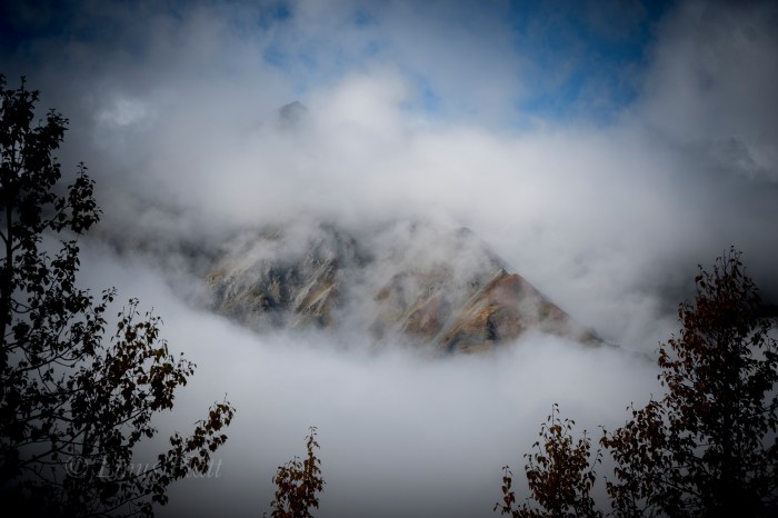


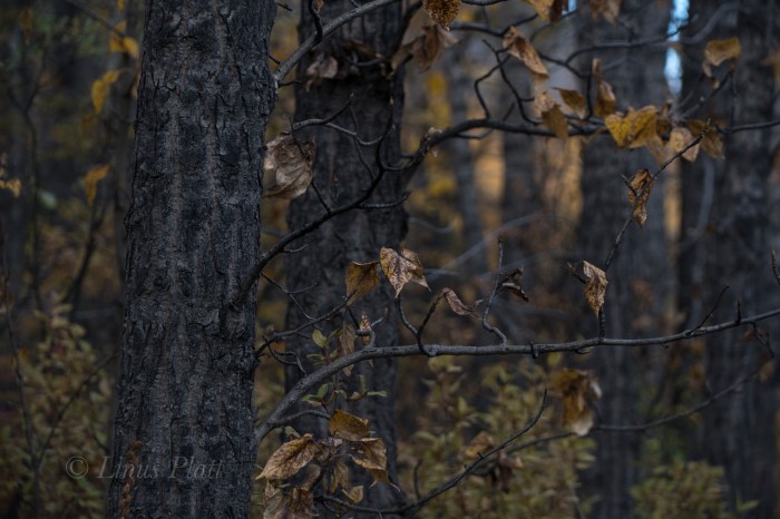


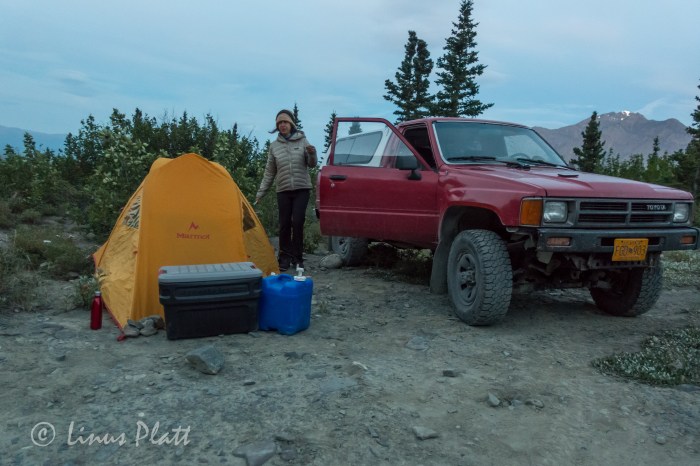


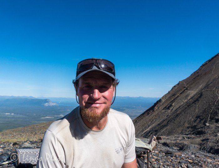
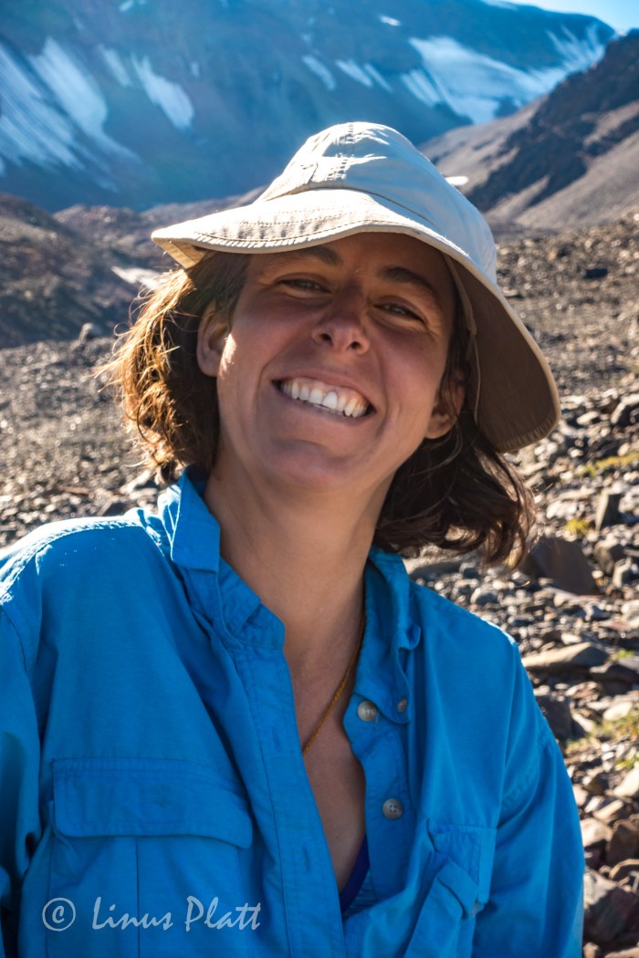


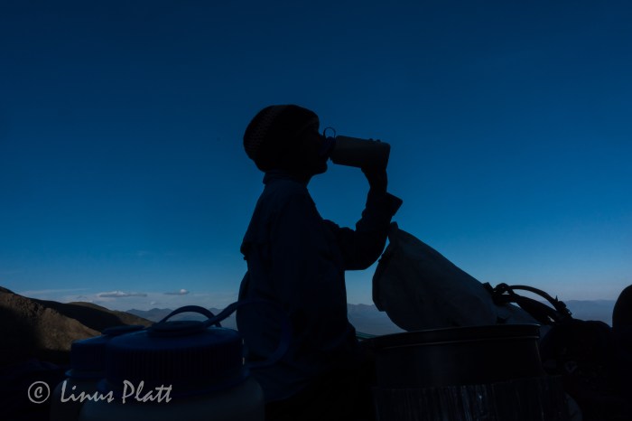


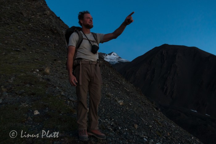

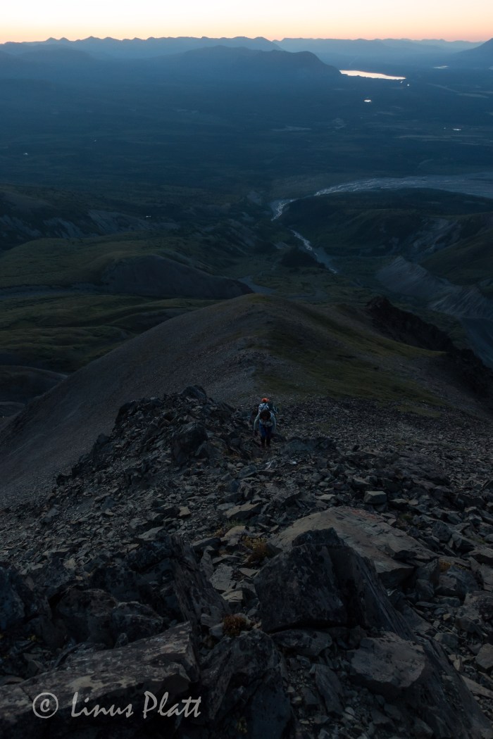
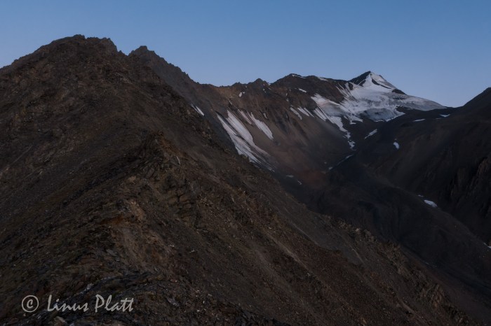


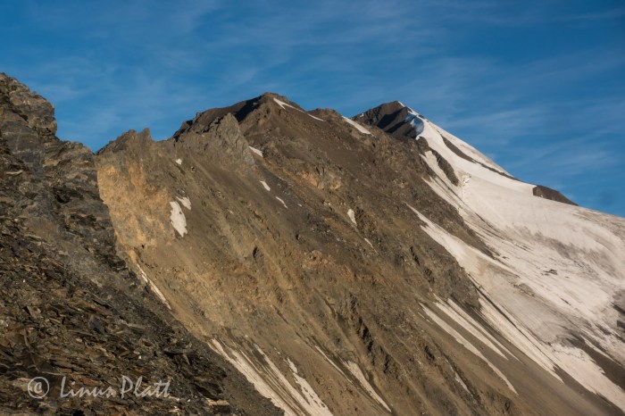


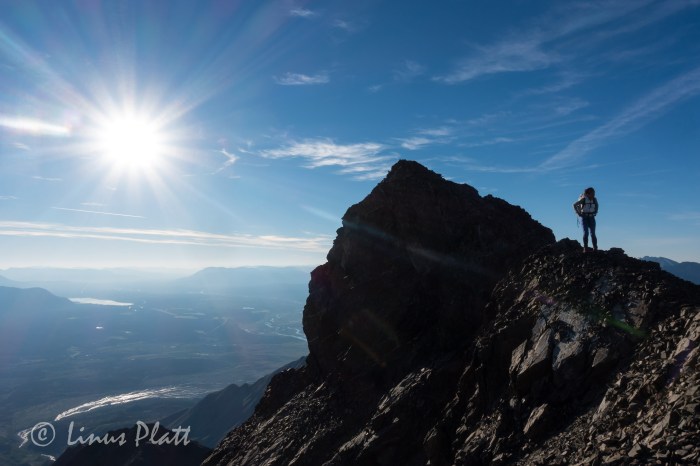

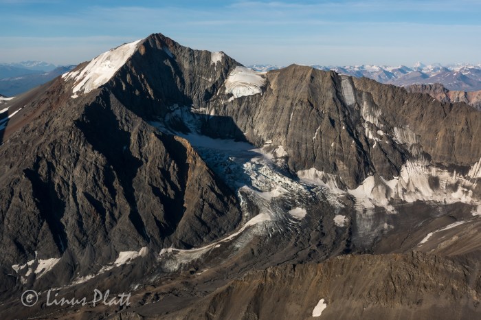
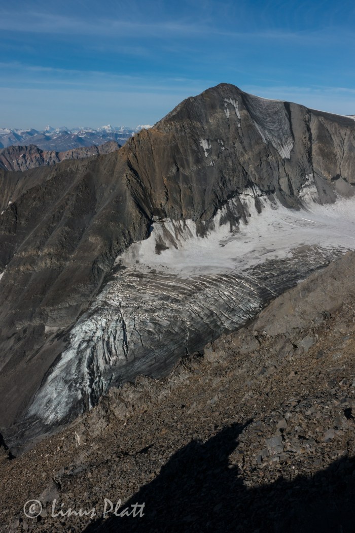


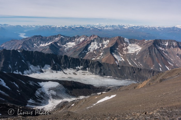

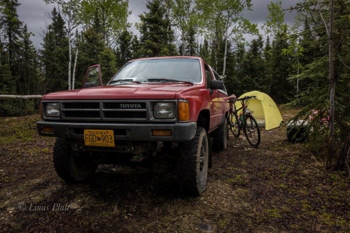
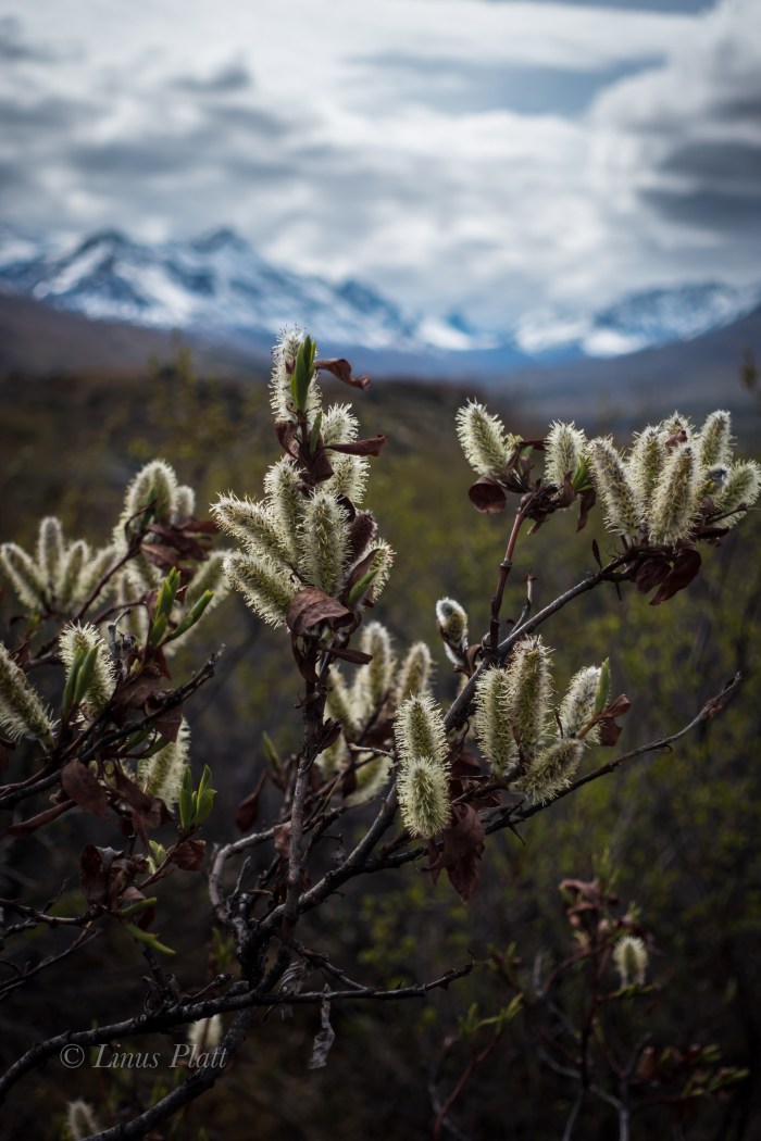


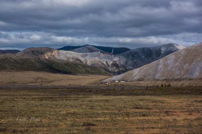


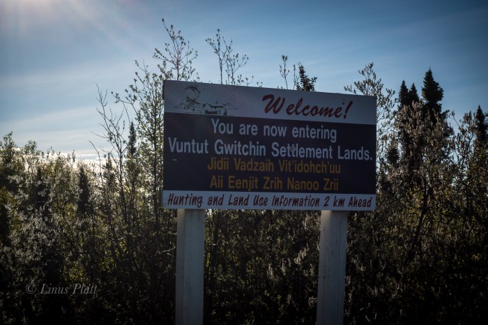


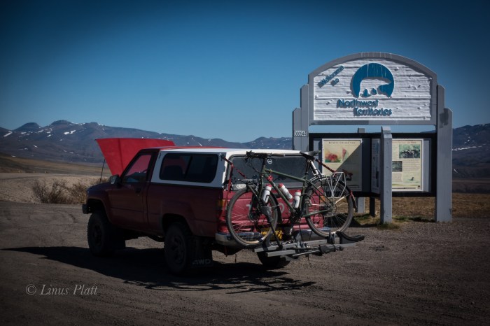
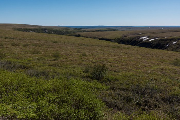
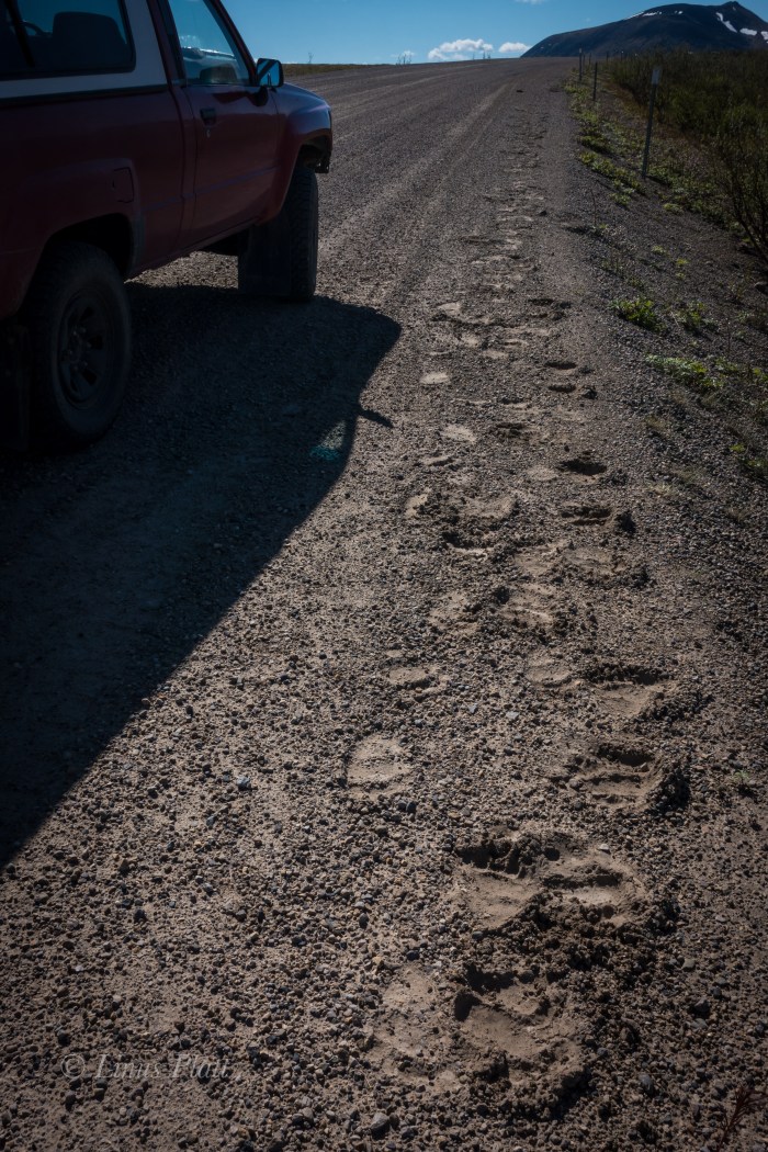
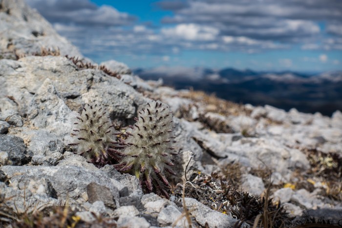
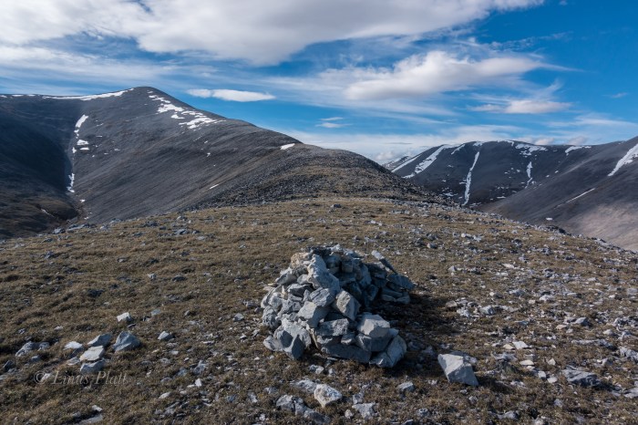


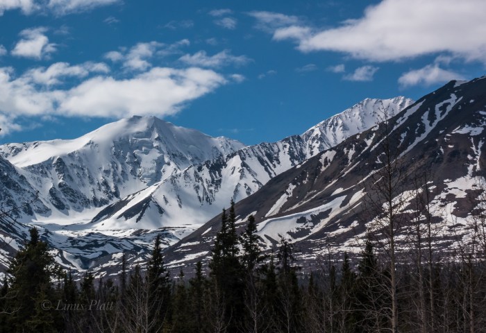


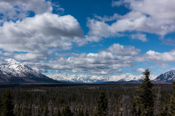


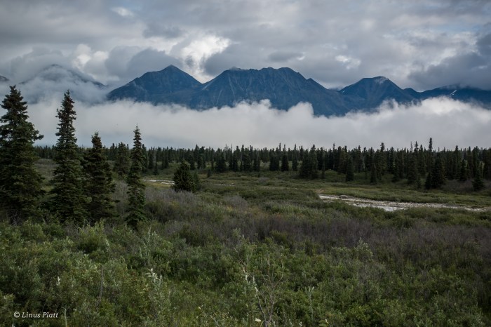

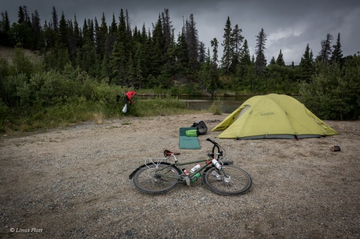
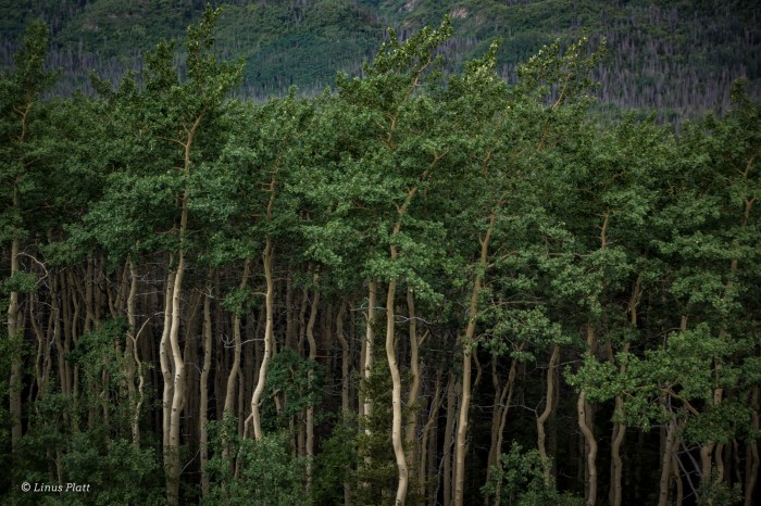


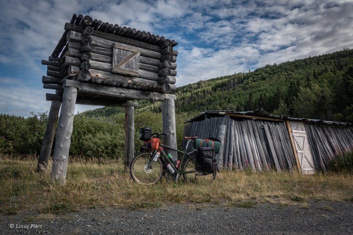


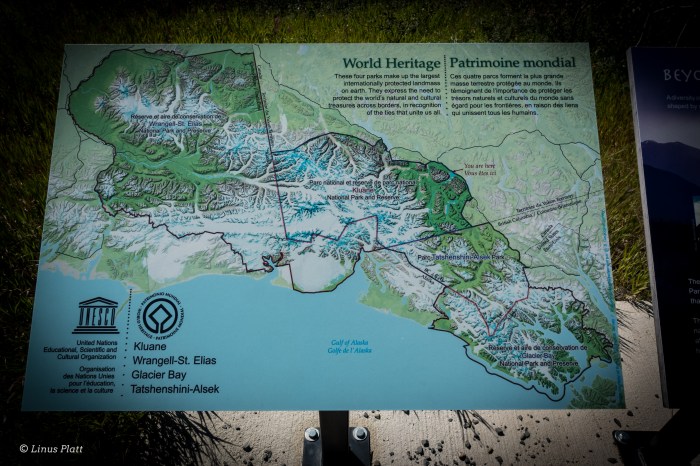

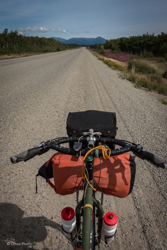


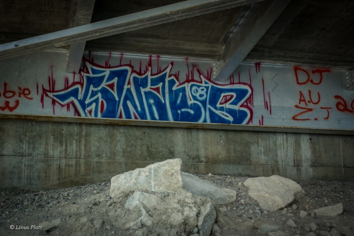


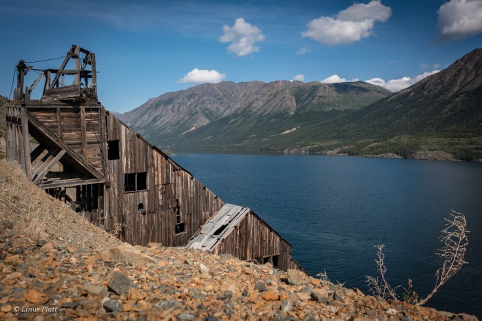


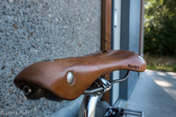


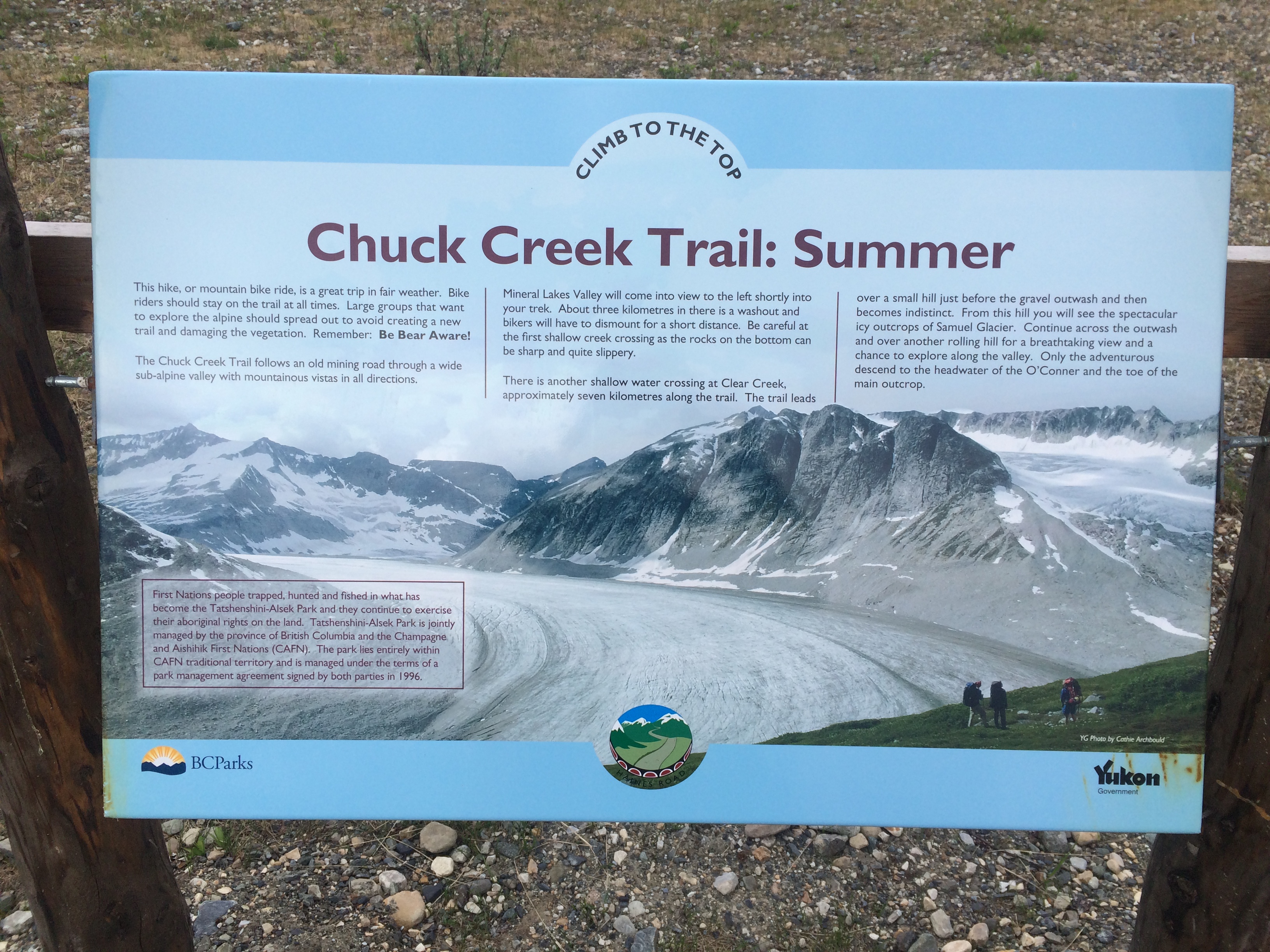


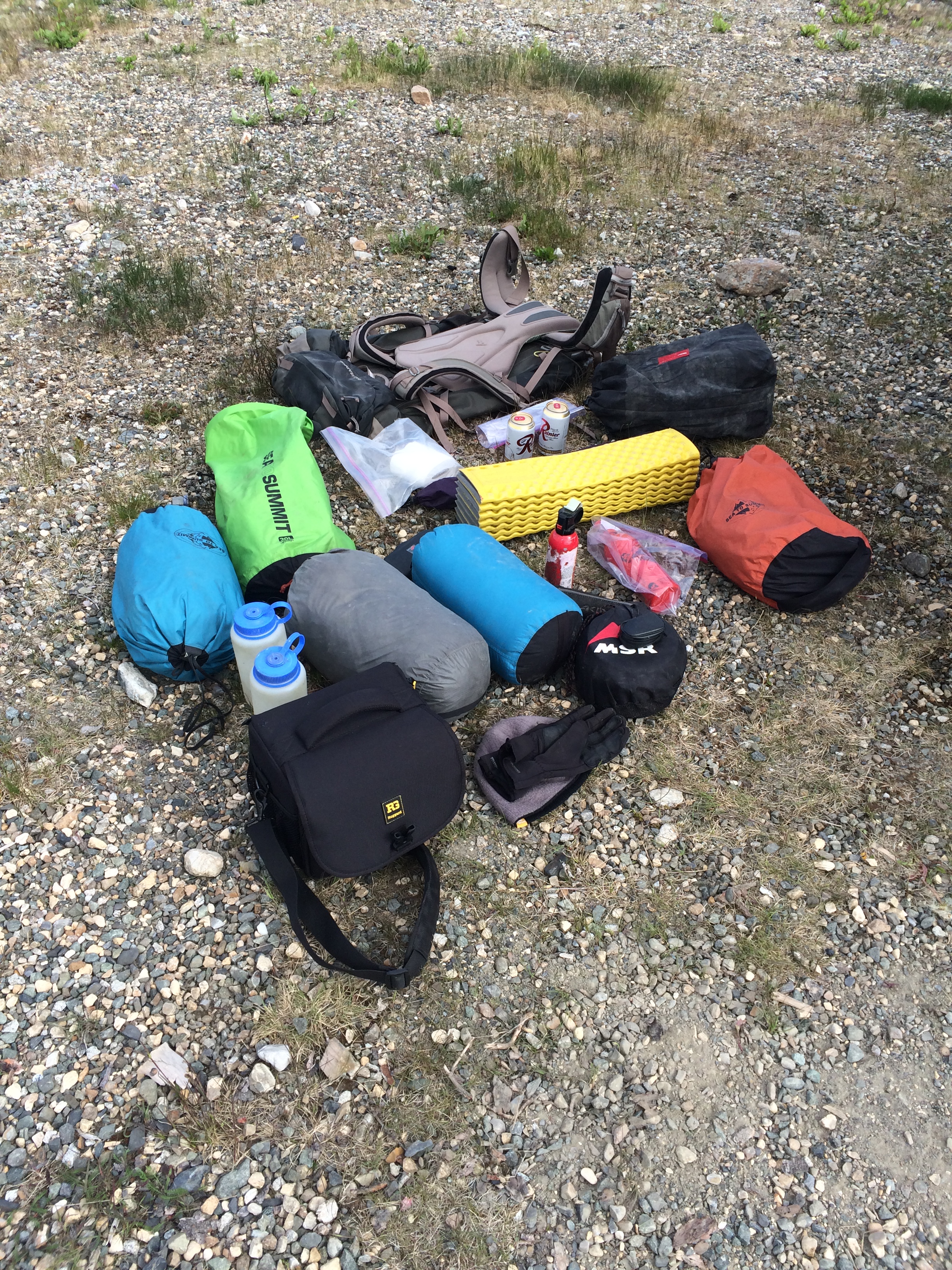


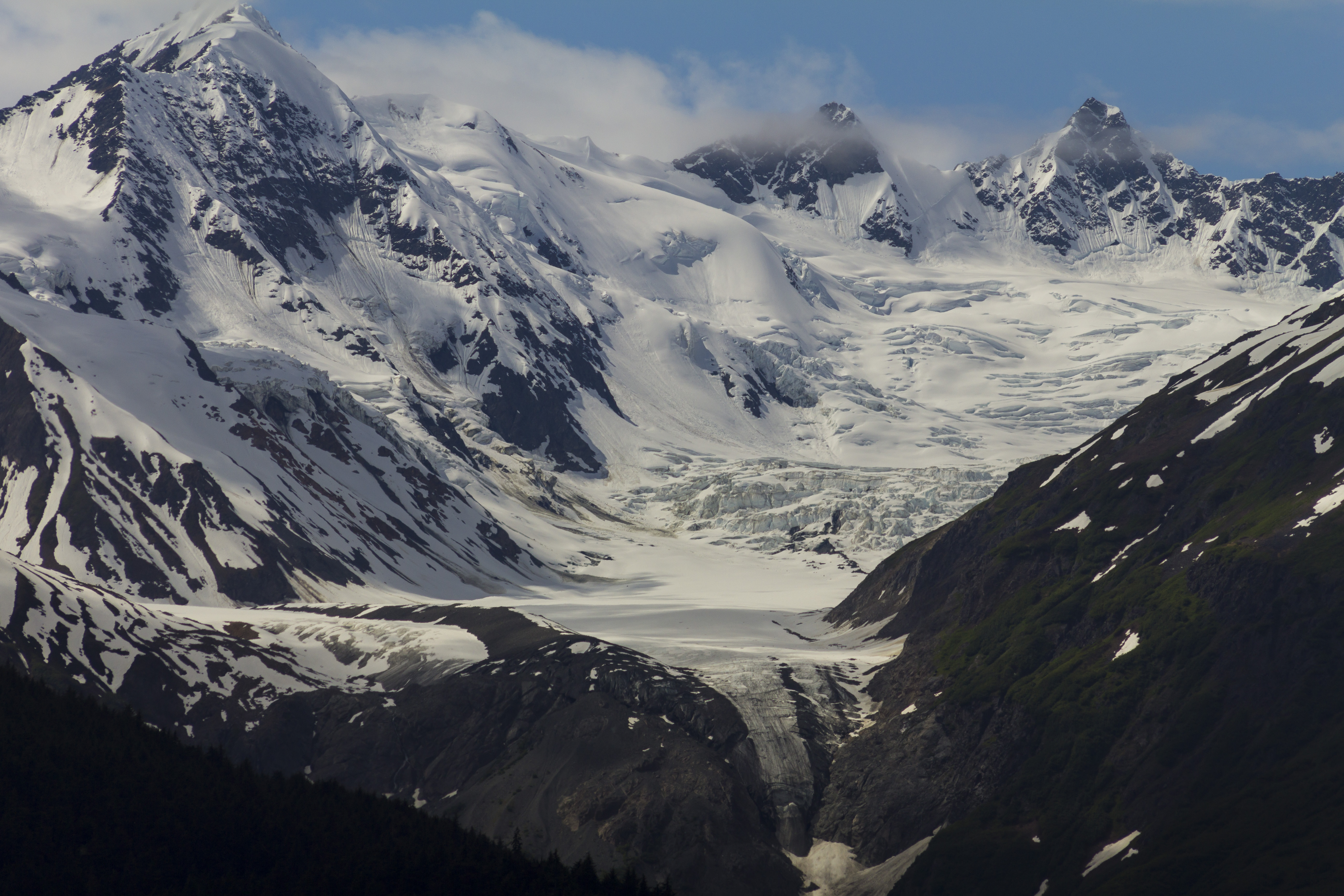
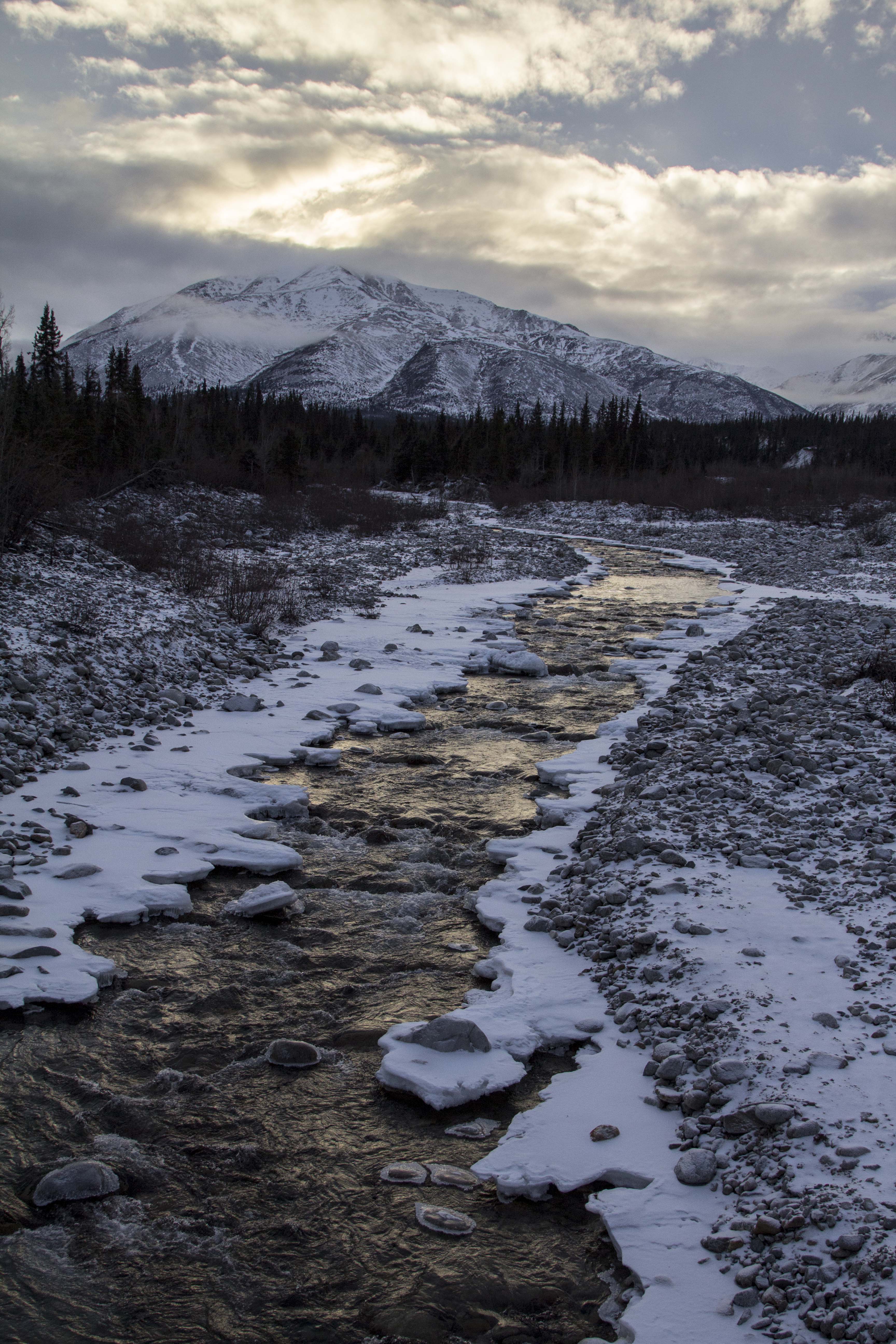

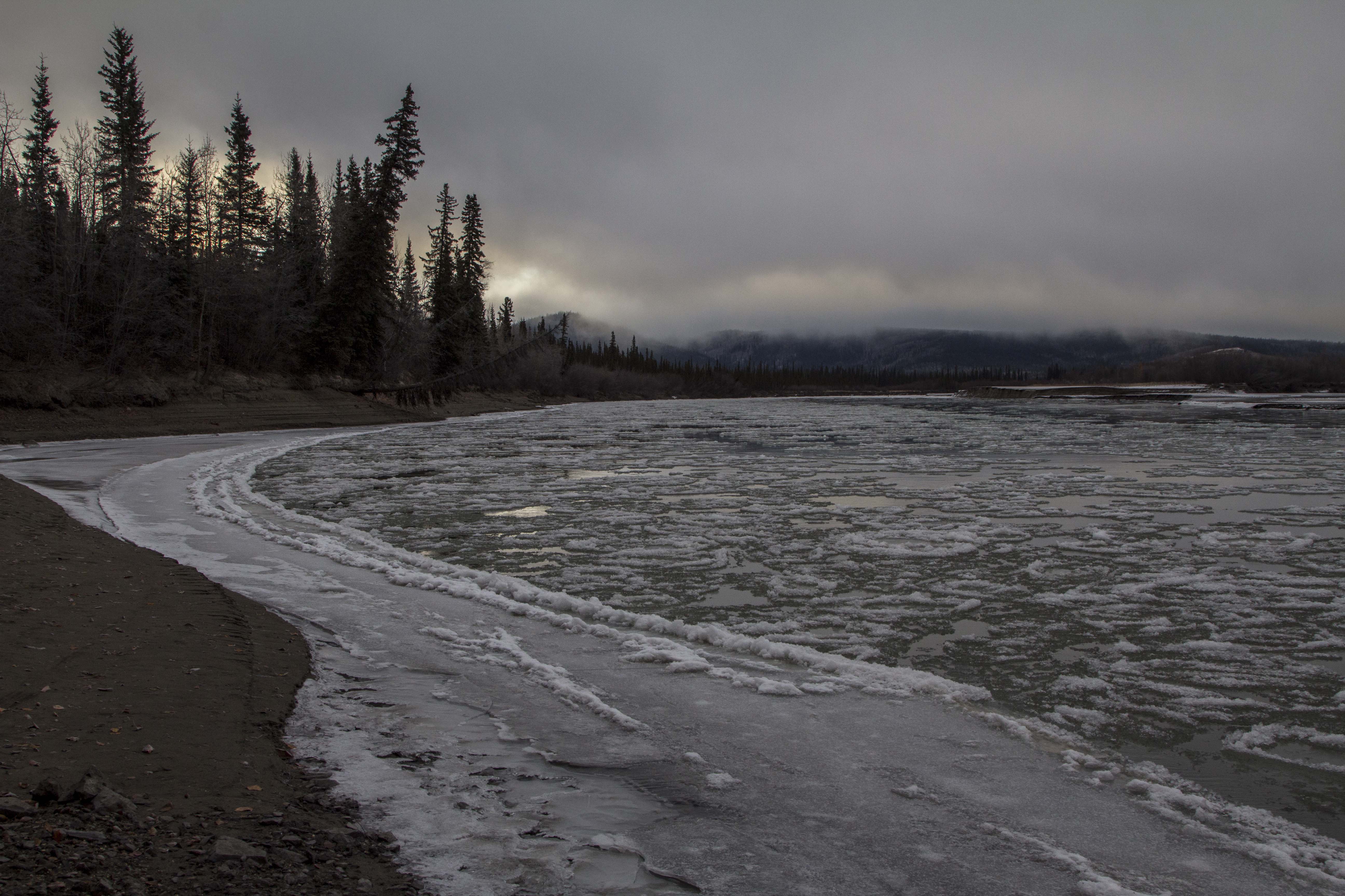
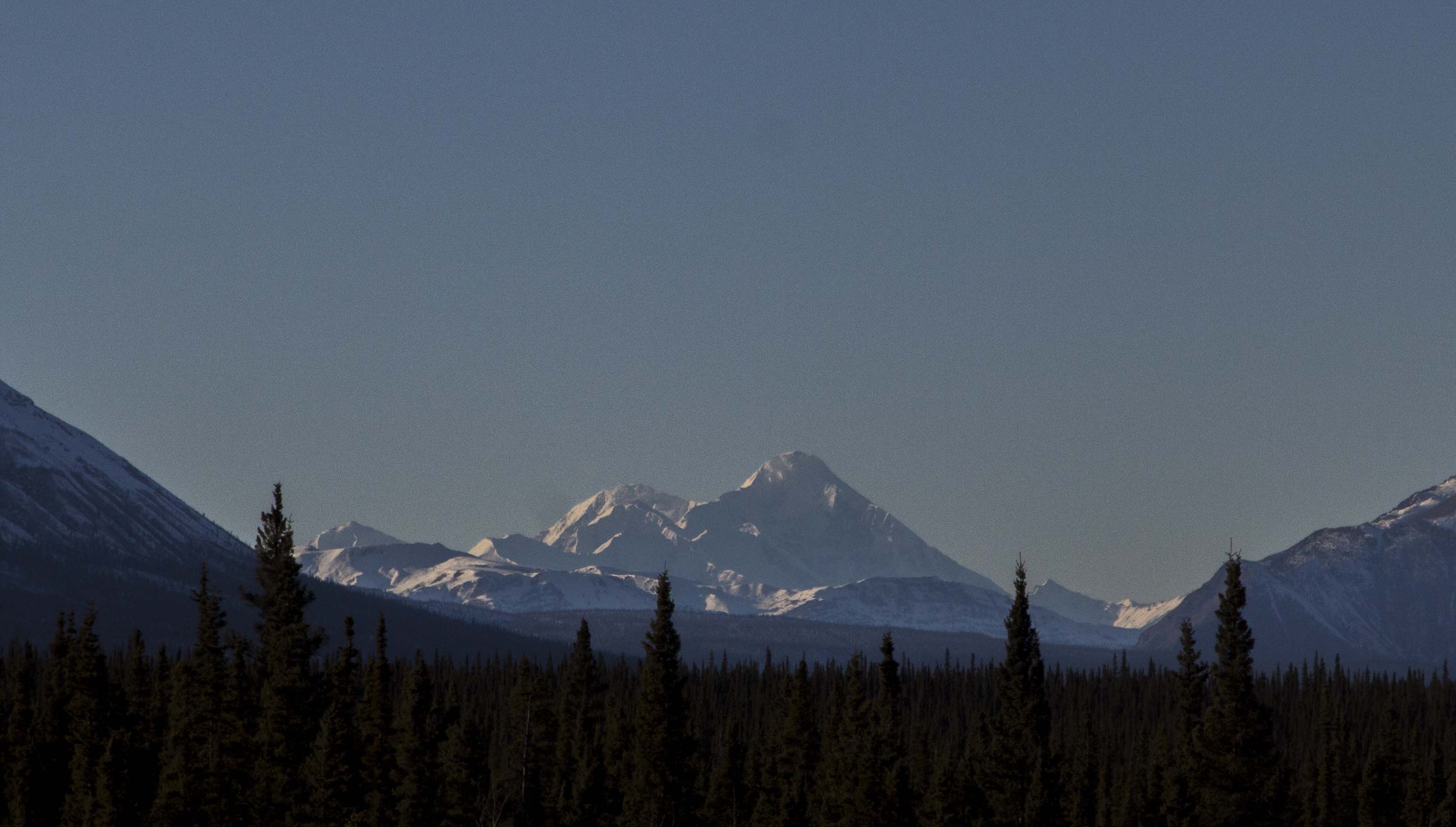


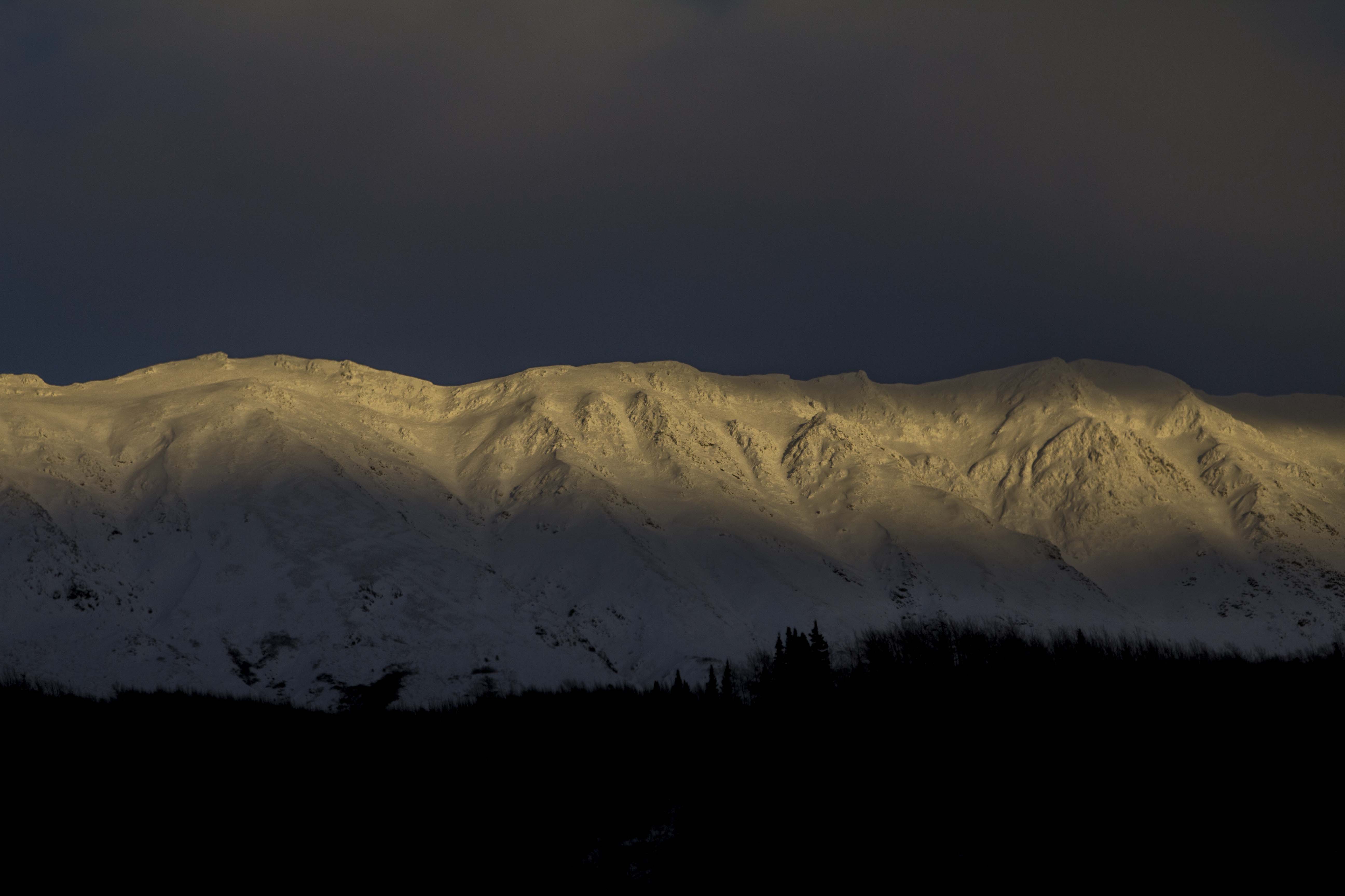
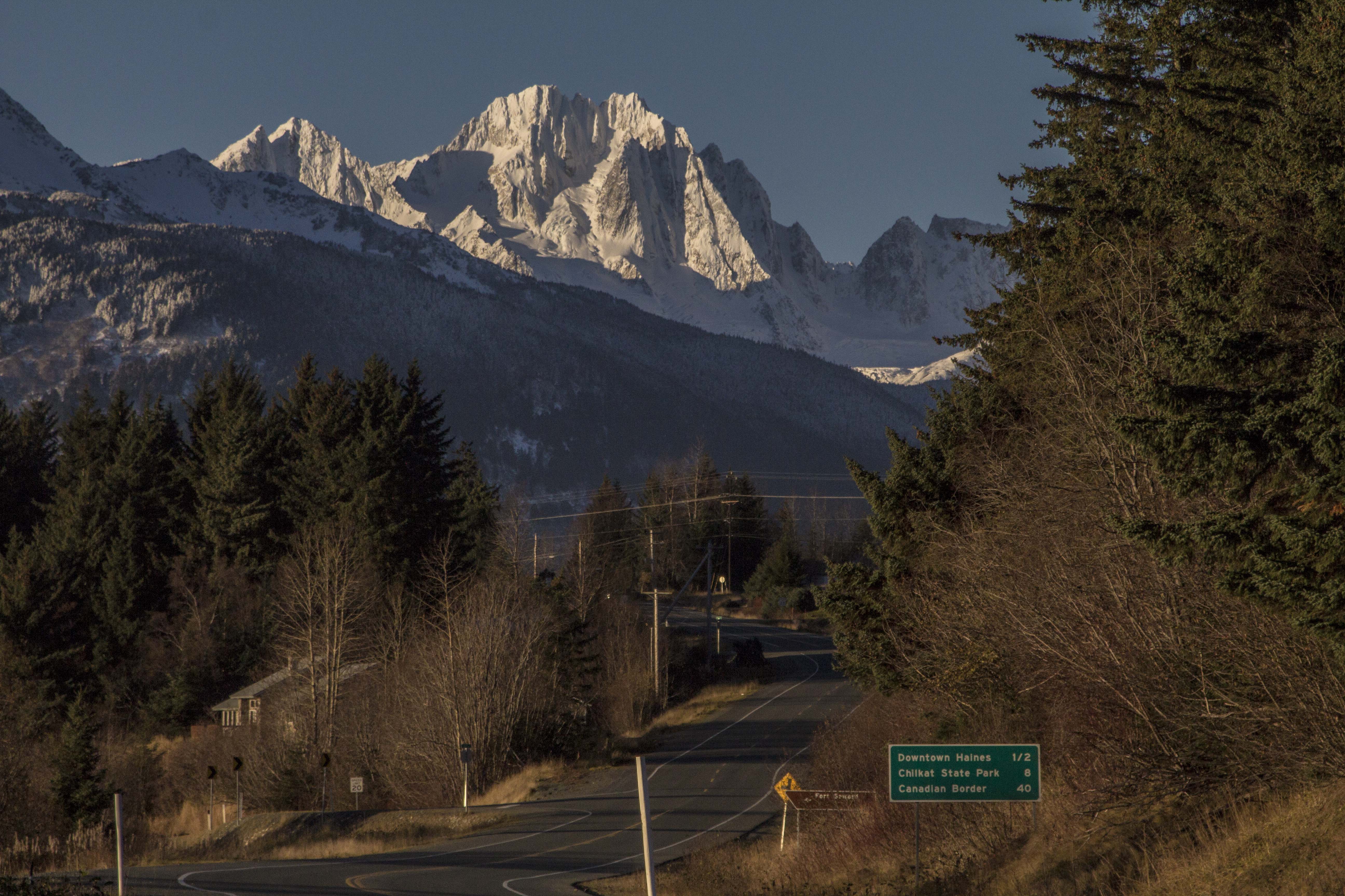
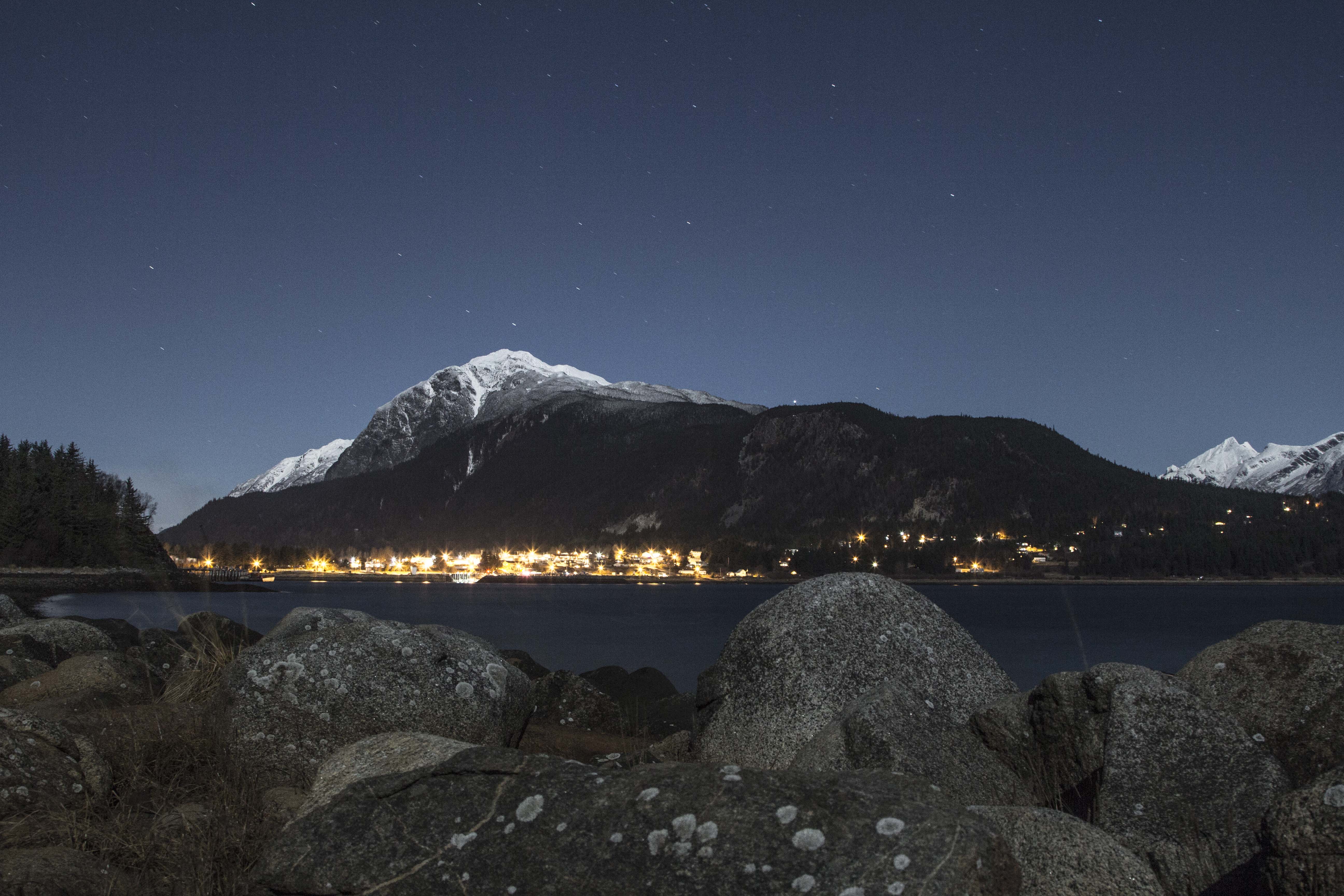
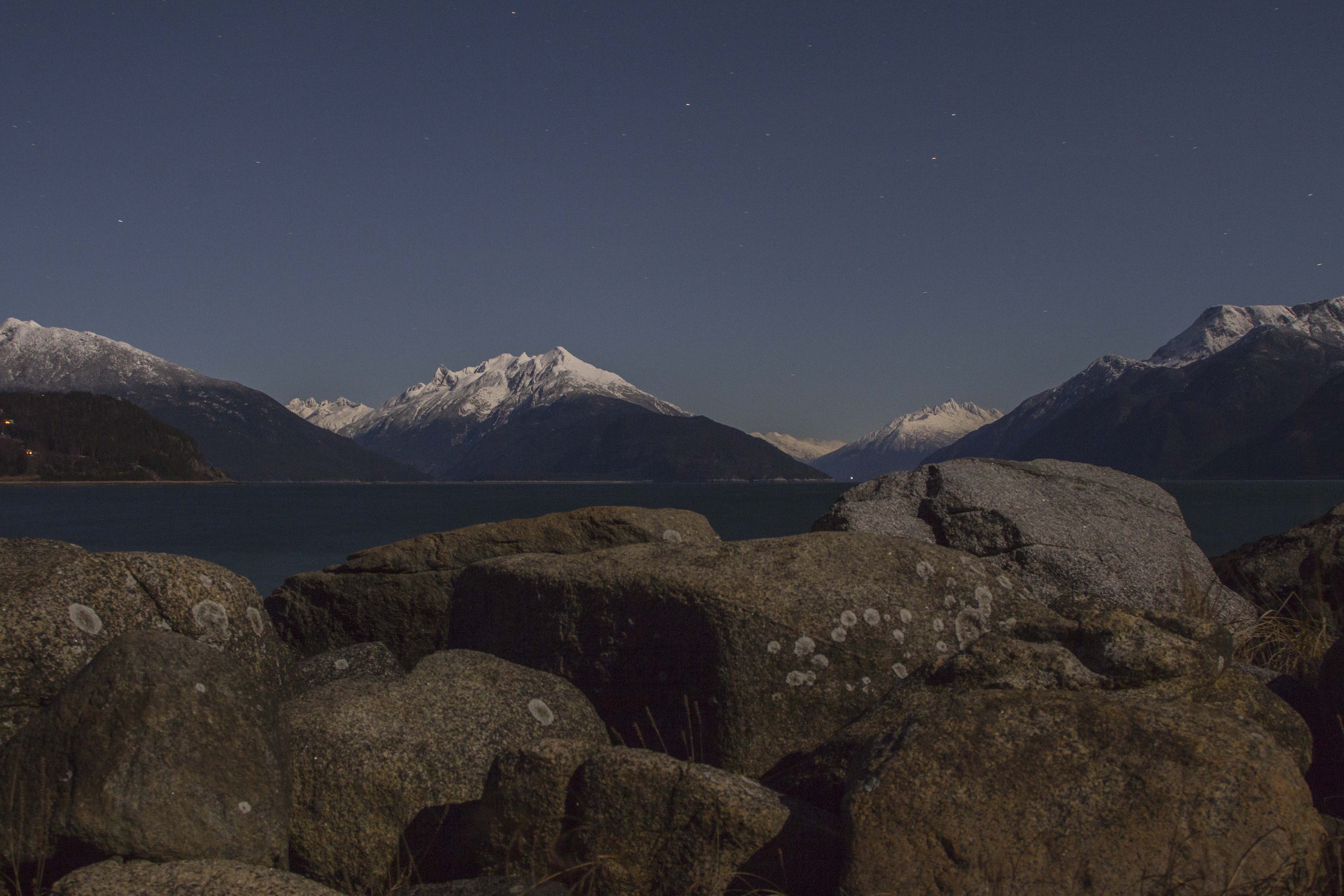


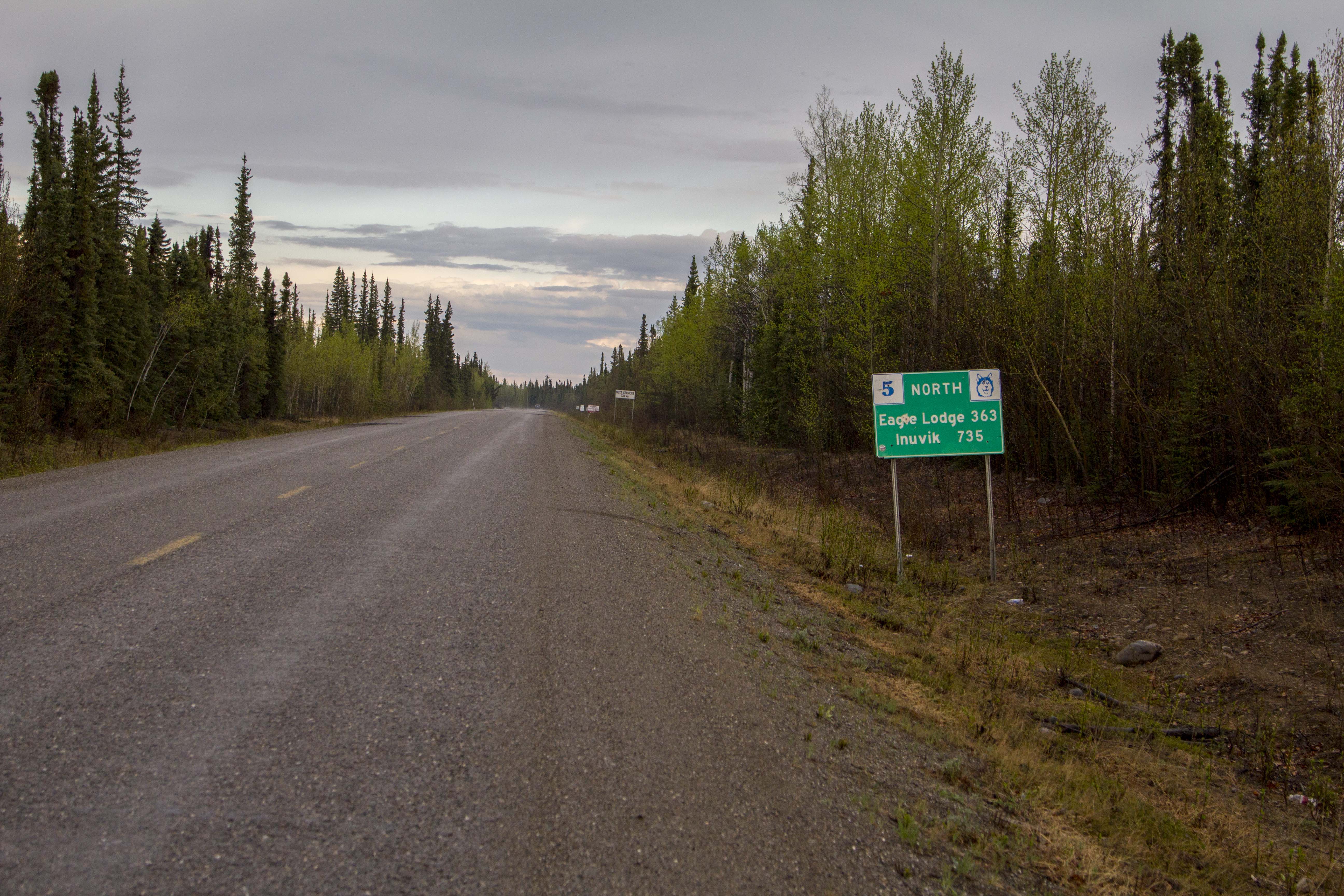


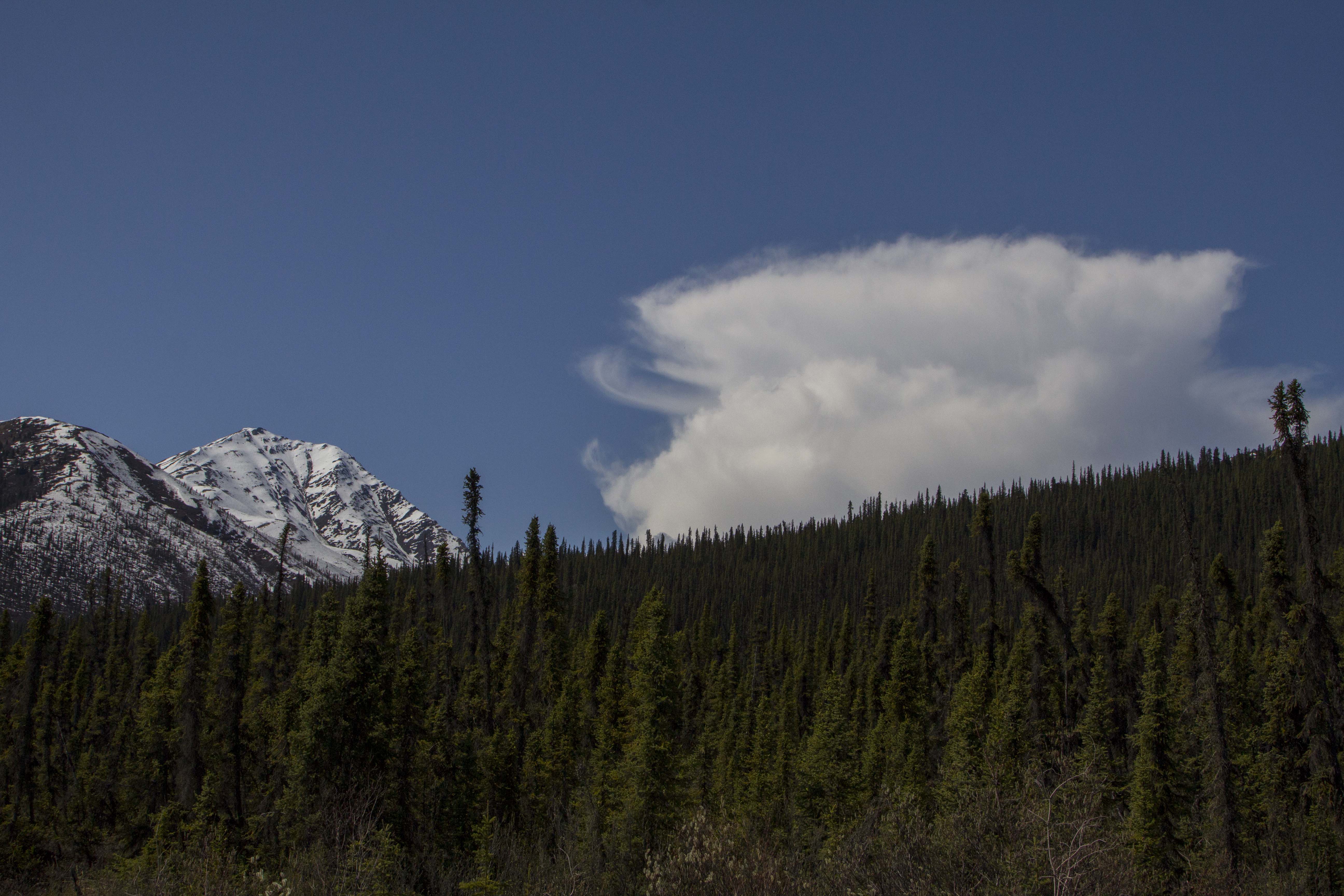

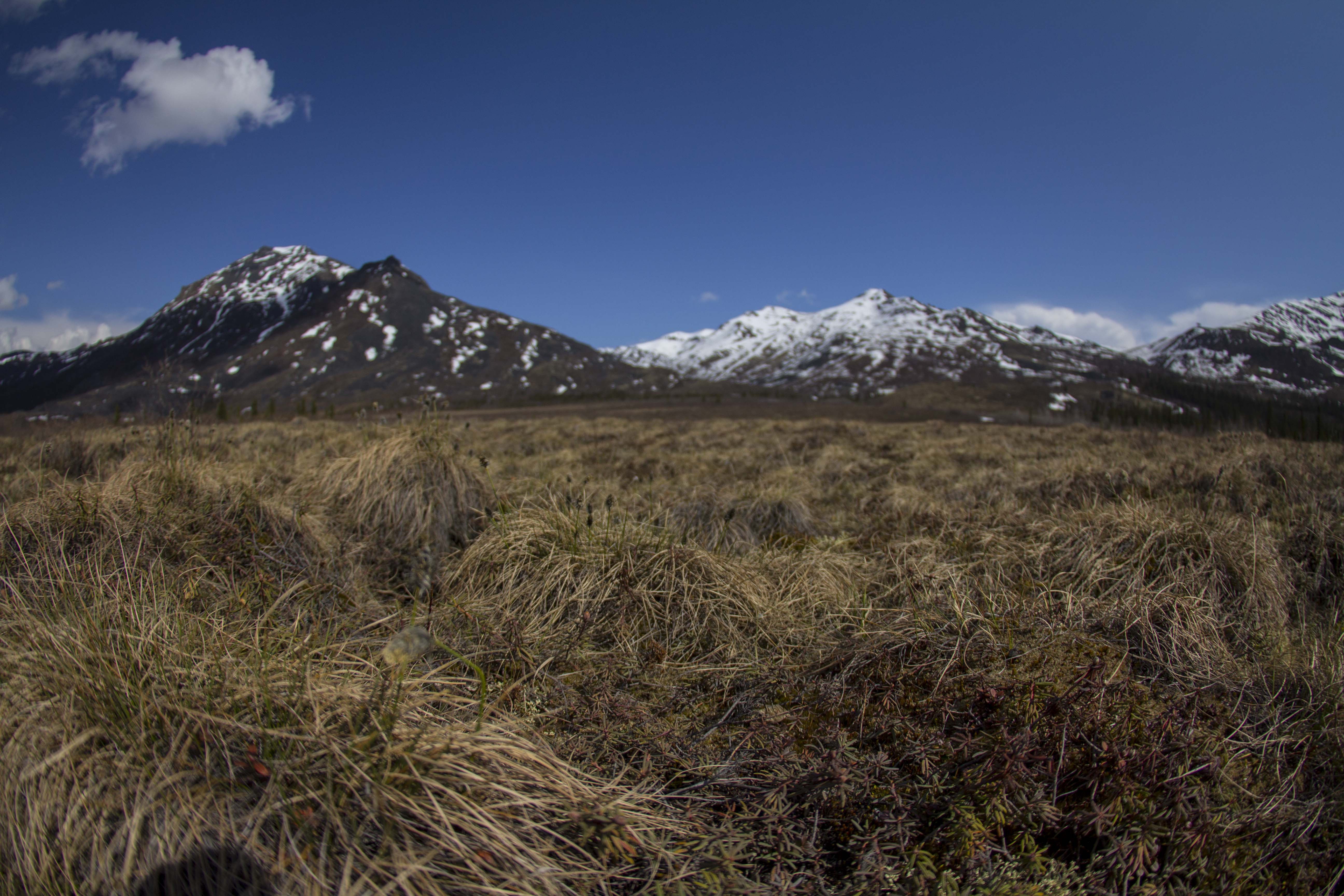


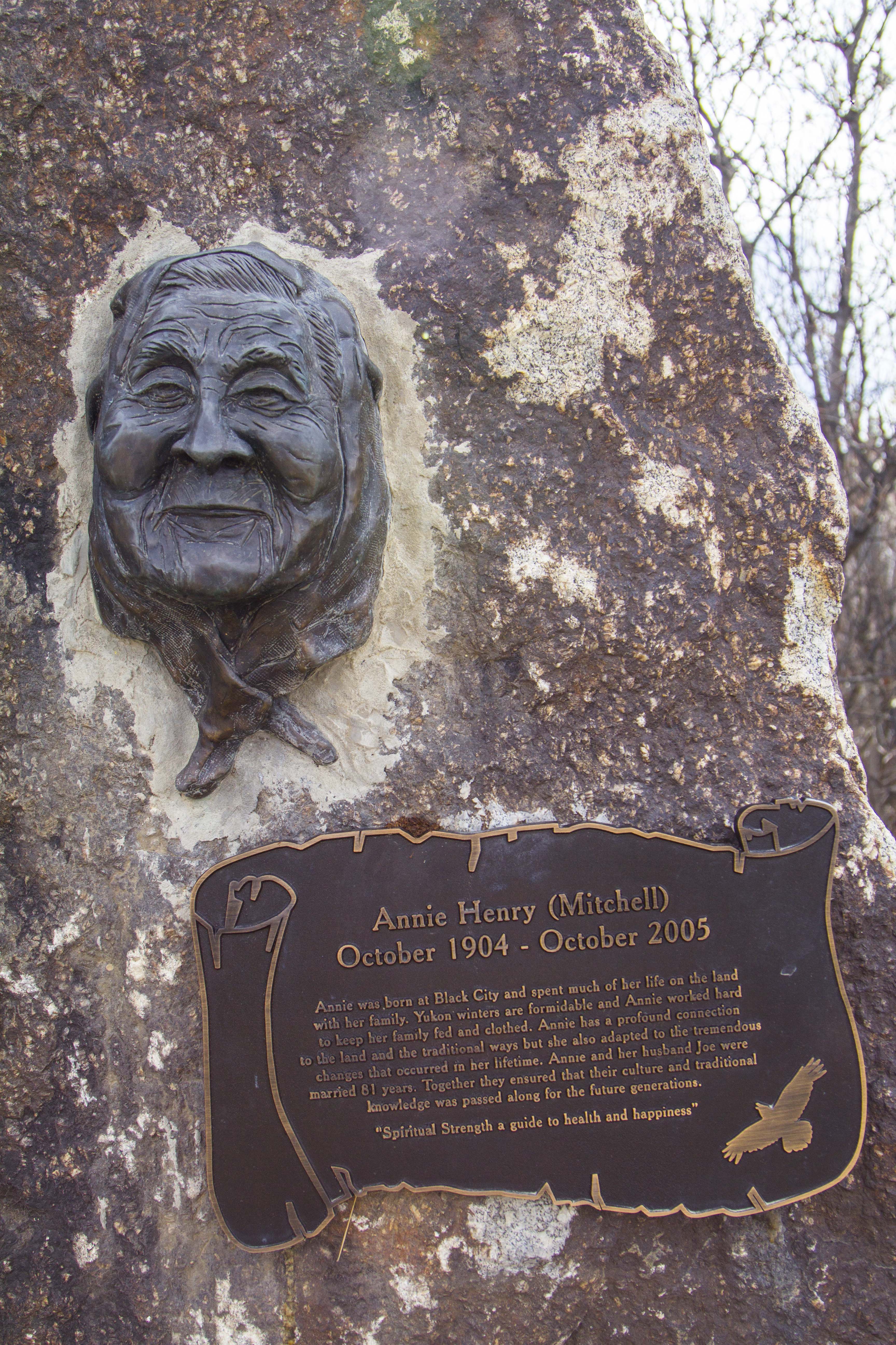


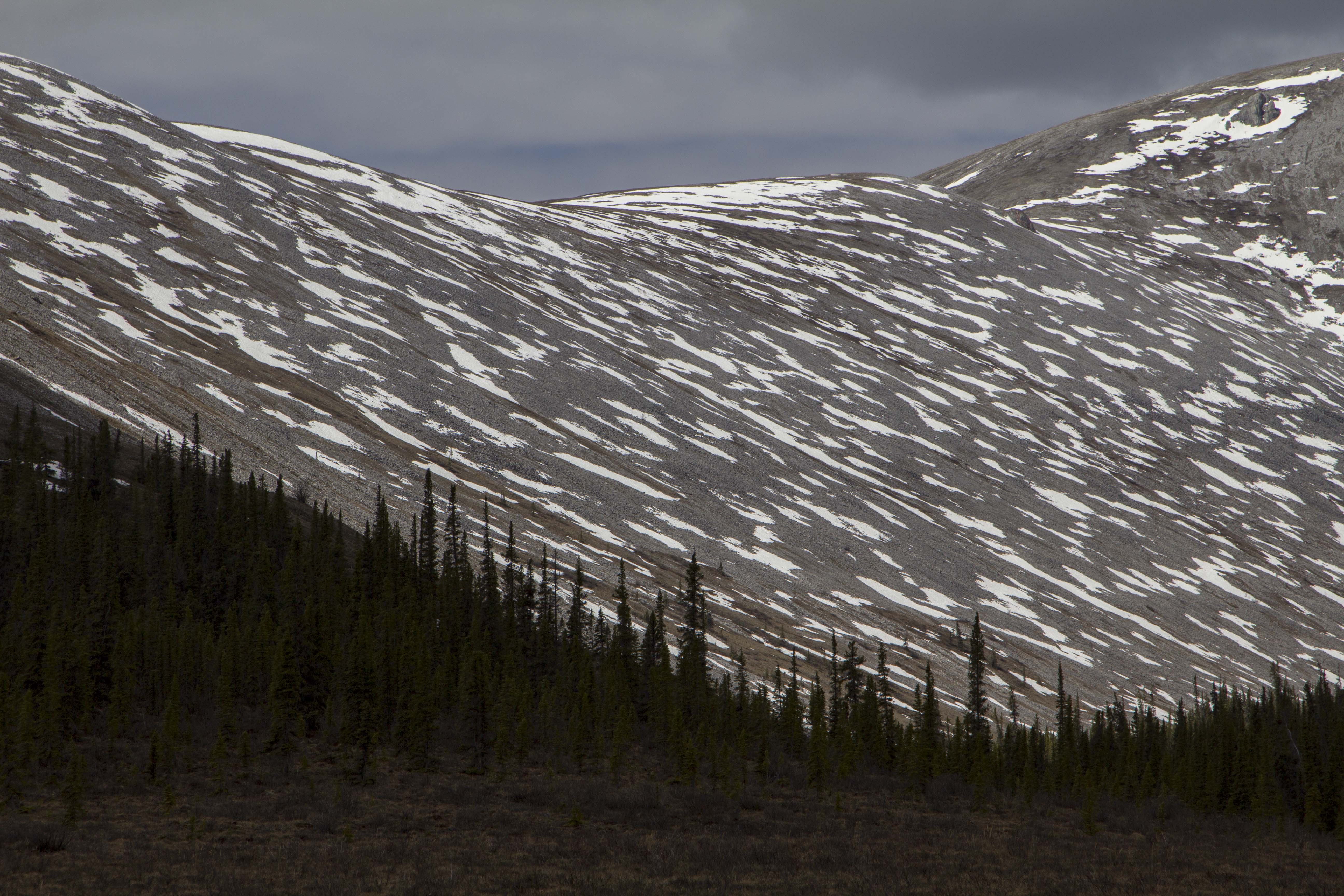


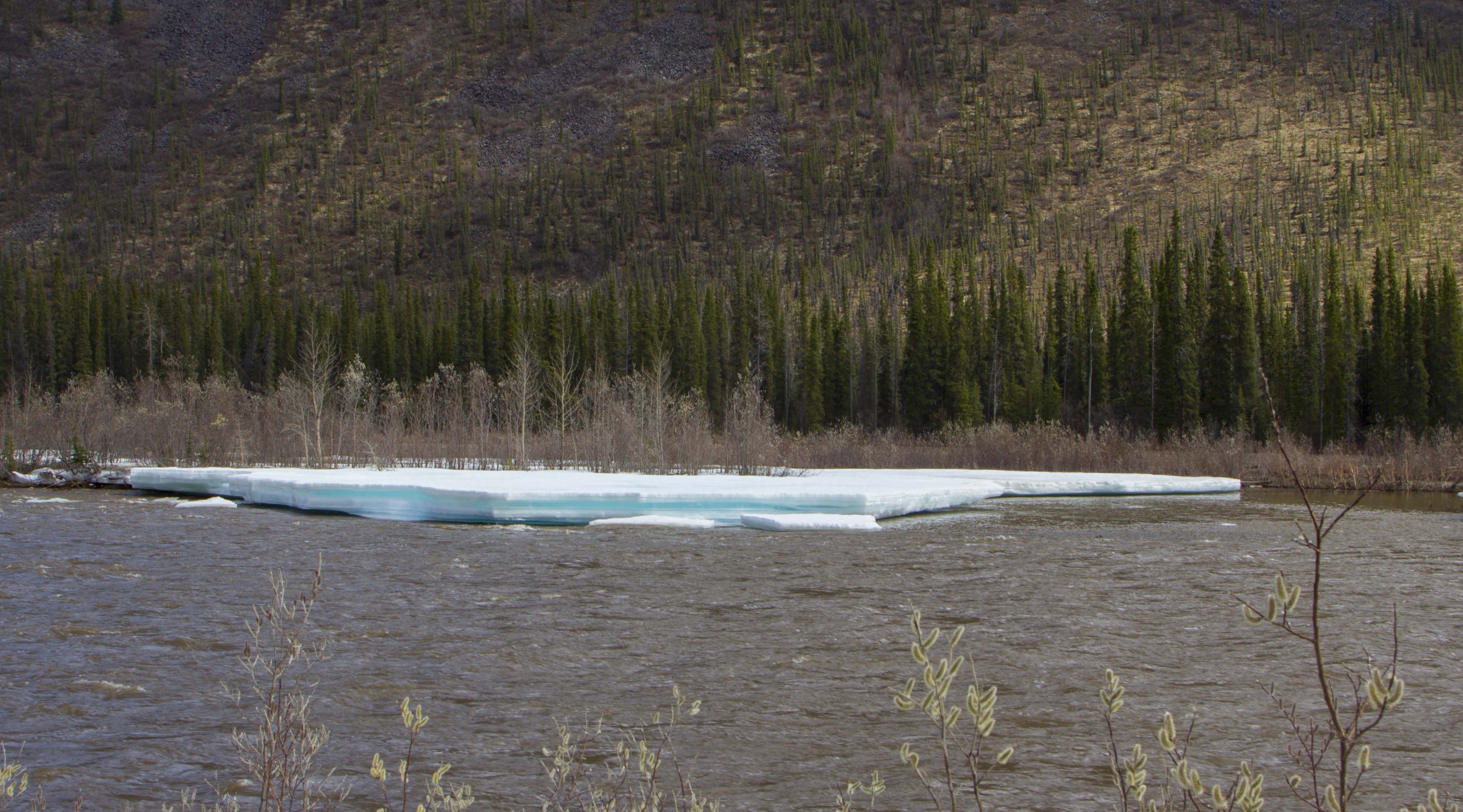


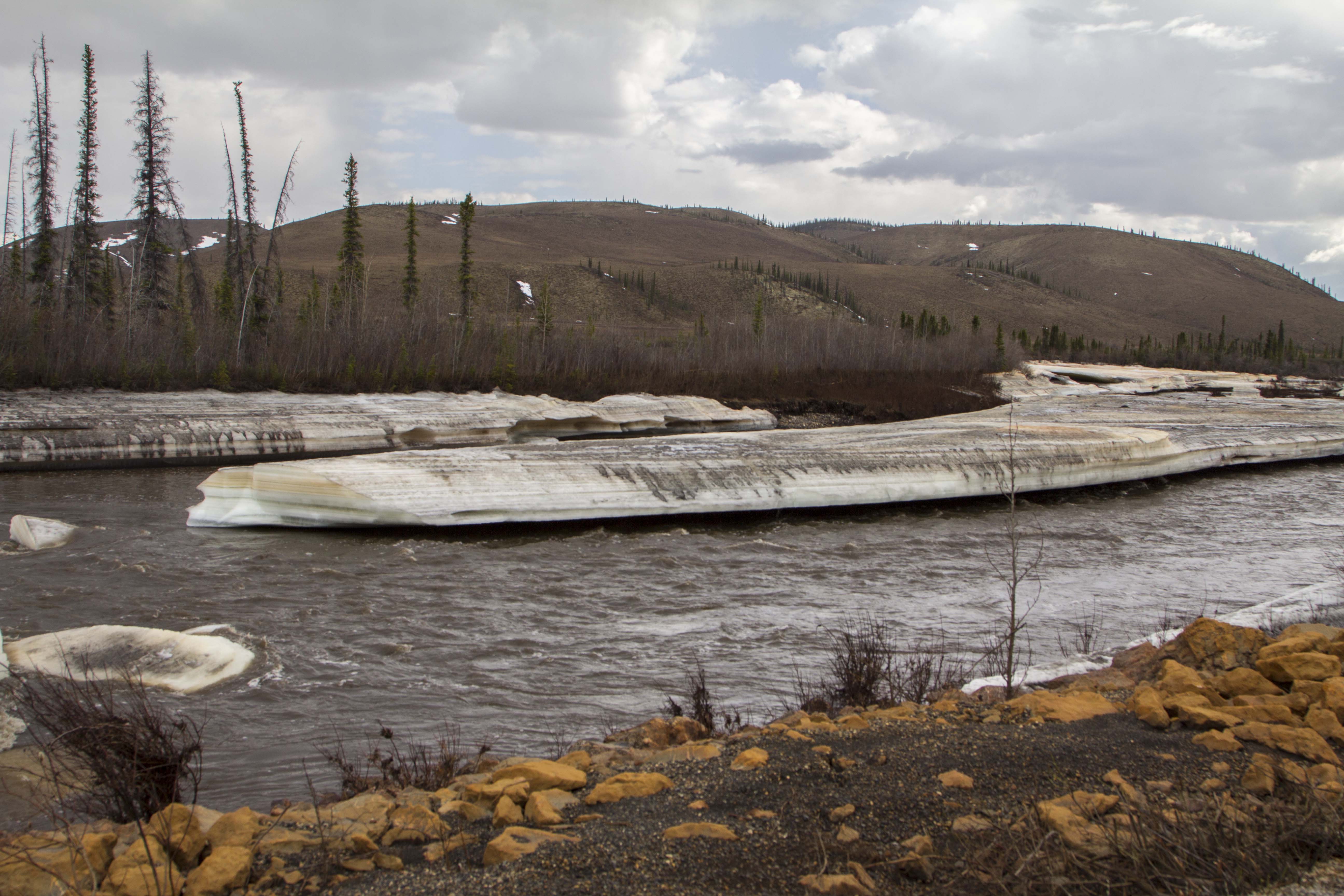

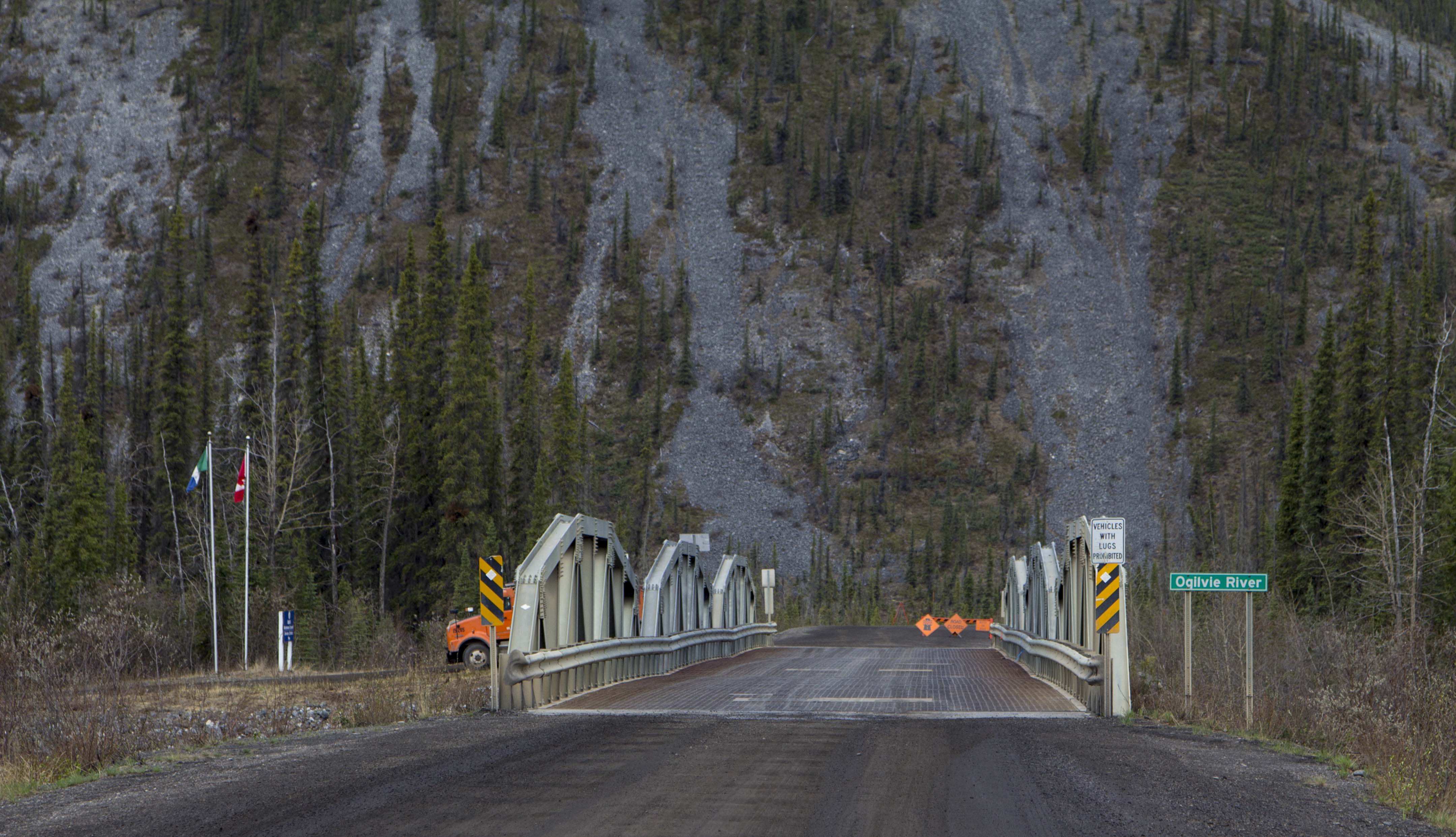
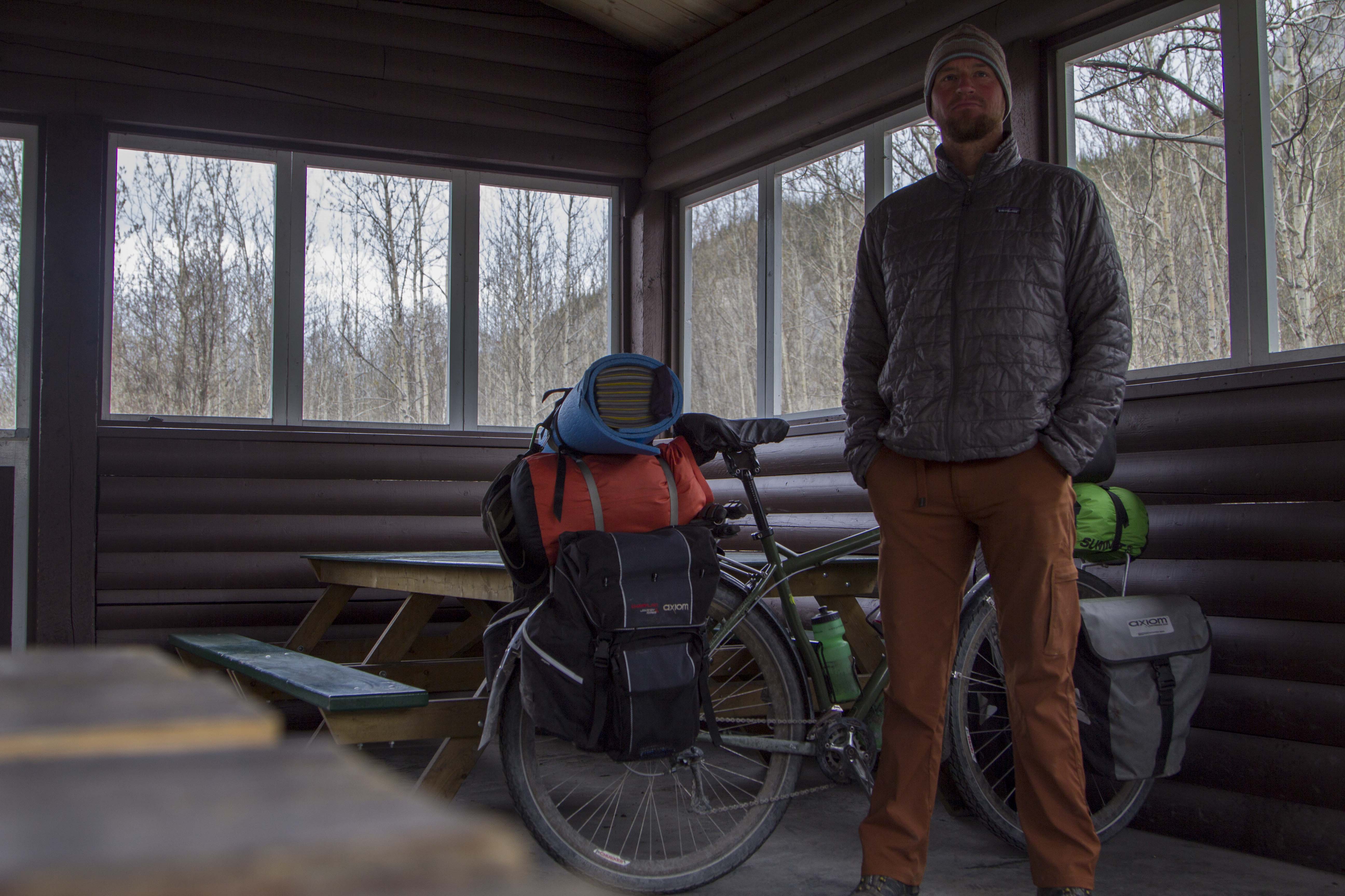


You must be logged in to post a comment.