The Haul Road (Into the Arctic)

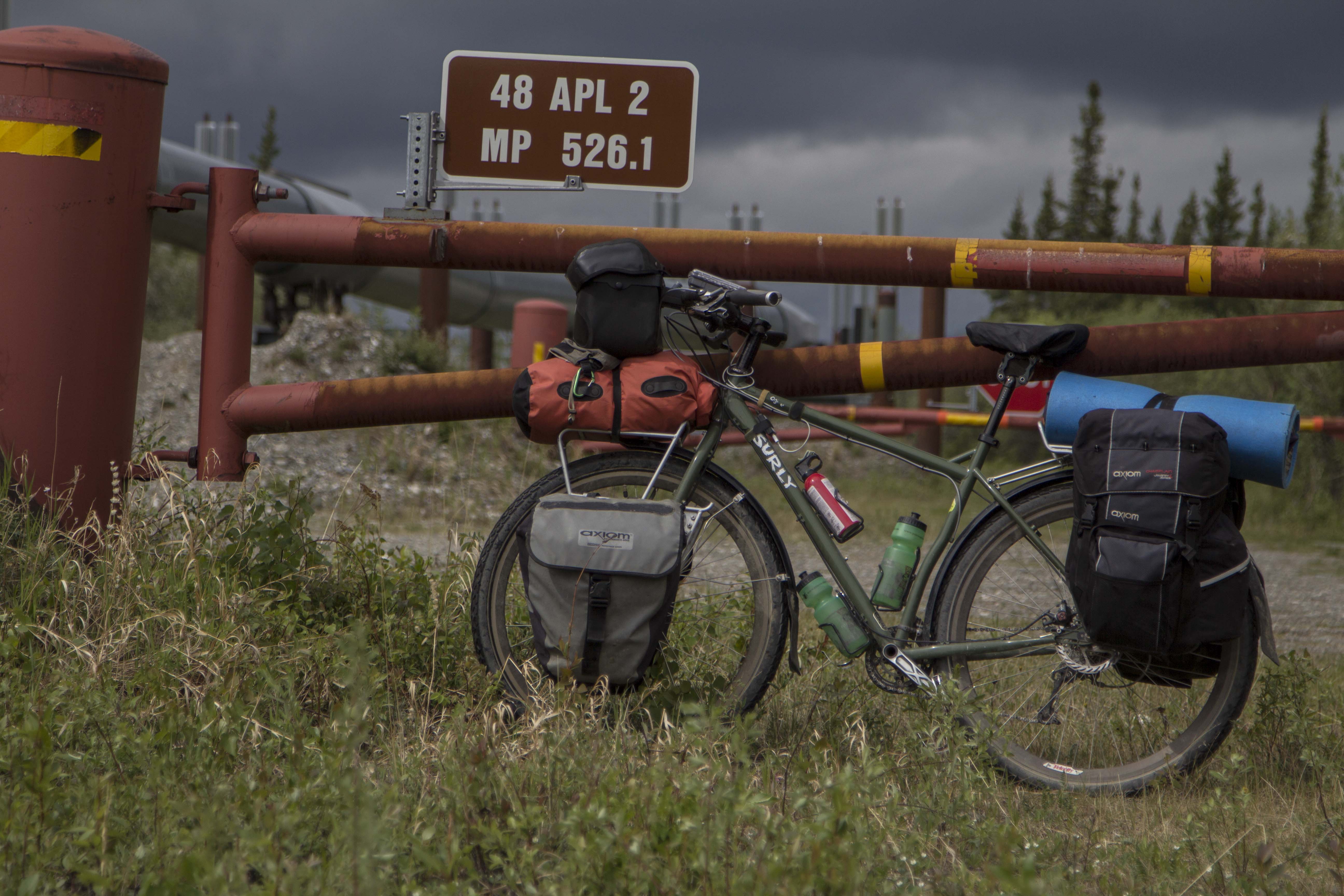
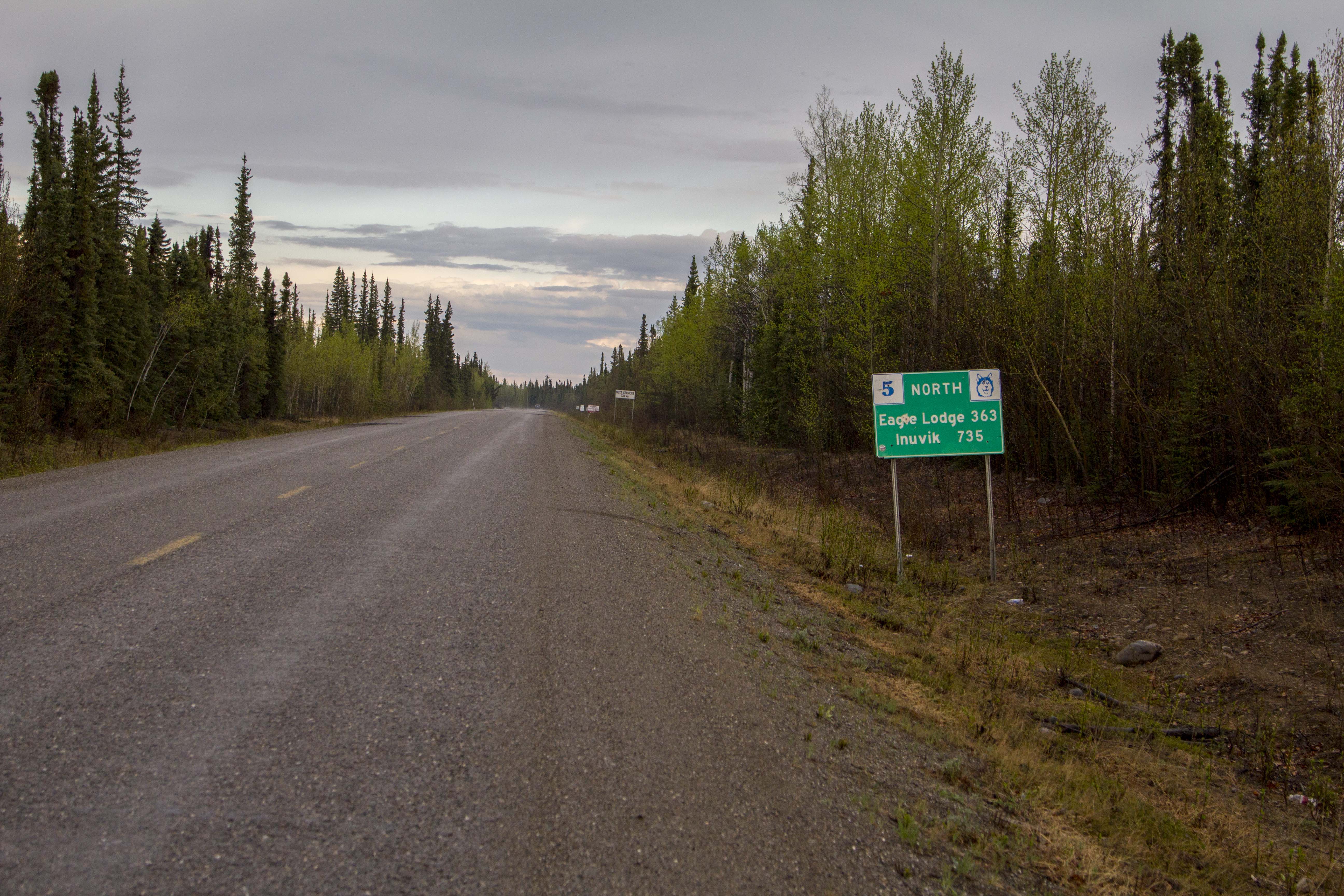
There are only two roads, in North America, that one might pilot a vehicle of some sort, which lead to this continents Arctic area’s. As far as I know, there is only one other road in the world that leads into the Arctic outside of North America, the Arctic Highway in Norway, which might just be the northern most connecting road in the world. The two roads in question are the Dempster Highway in the Yukon and Northwest Territories, of which I attempted to ride weeks prior, and the Dalton Highway, AKA “The Haul Road” in Alaska.  Both of these paths’ through the wilderness are of the dirt and gravel variety, however, there are bits of pavement and chip seal surfaces as well, scattered about, here and there. The Haul Road, remote indeed, was built in 1974 as a supply line to the north slope oil fields at the Arctic Ocean, and parallels the Trans-Alaska Pipe-Line, was not open to use by the general public until 1996. Up to that point, the truckers had it solely to themselves. The Haul Road, as it was called in the 70’s, traverses a rugged landscape north of Fairbanks and leads to Deadhorse, Alaska. It crosses terrain varying from the endless, forested hill country beginning at Fairbanks, to Taiga swamps and open tundra, crosses many, many rivers and streams, and penetrates the “Alaskan Rockies”, the continental divide at the bastion of true roadless Alaskan wilderness, the mighty Brooks Range. The Brooks, since I was a teenager, has been a source of great mystery and a true icon of the remote and windswept tundra of northern Alaska. It has also been a dream to visit that whimsical place since that time.

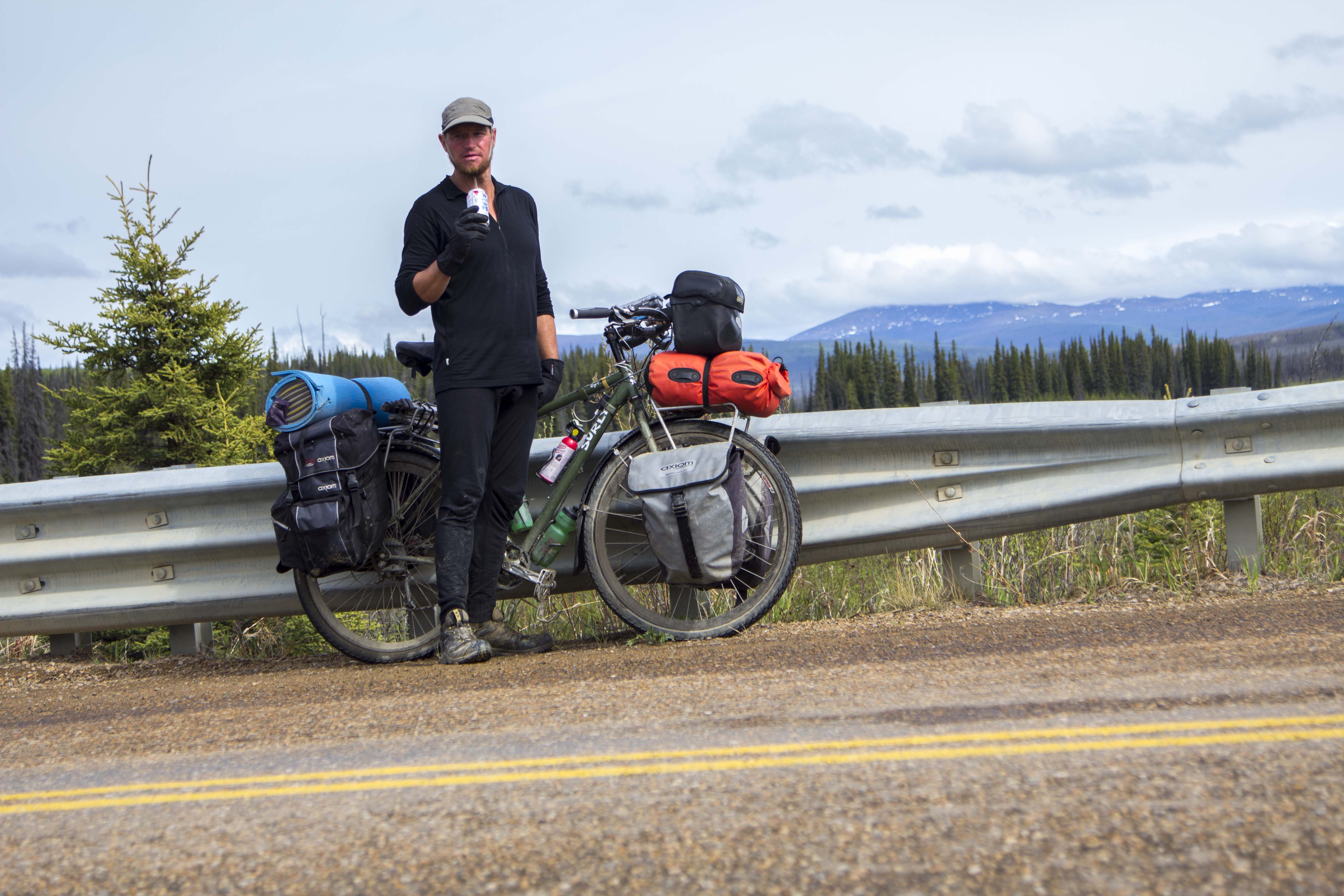
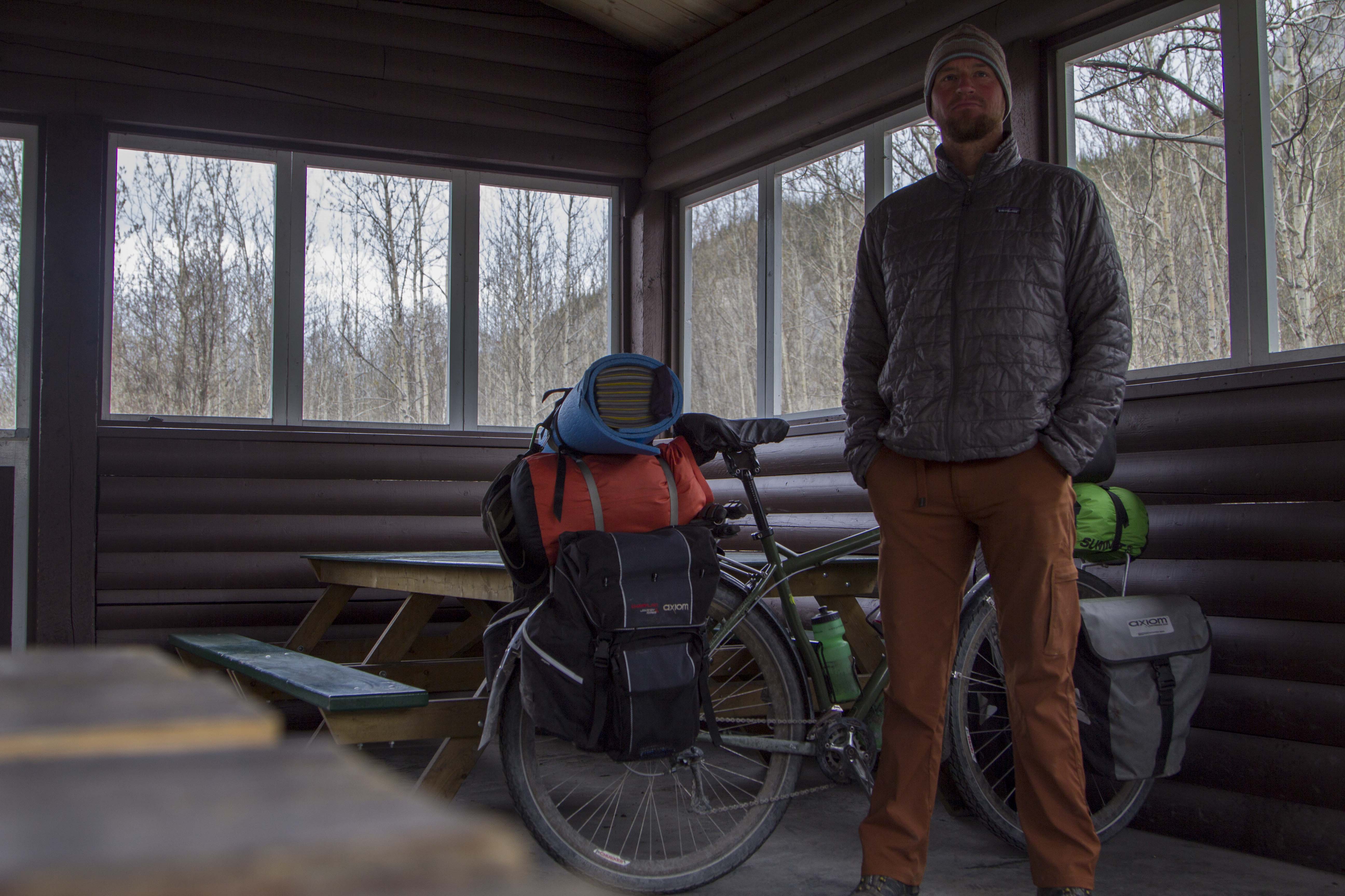
Saturday morning I am up, gearing up.  At Sven’s, all is quiet. There is not a soul stirring, most likely all are sleeping late from the inevitability of staying up too late in the bright Alaskan night time. Two night prior, I give a food bag to Sven’s trucker friend, Tommy. He is heading up the Haul Road to Deadhorse and will drop of my feedbag at Coldfoot. This will alleviate the need to carry 10 to 12 days worth of food, but cutting that amount in half. Thank You Tommy!  I slowly pack my things and secure the Ogre for a lengthy trip into the wilderness. I pedal out of Sven’s area and on to downtown Fairbanks in hopes of finding some breakfast. After Eating, I head north, up the Steese Highway, toward Fox and Livengood. The coming onslaught of slim eating over the next week, prompts me to catch yet another grubstake near the edge of town and off I go, north.

That day was filled with some of the worst up and down hill climbing on a bicycle I had ever encountered and was indeed thankful for all the food I consumed; every calorie accounted for as I pedaled hill after hill after hill. Finally crossing Snowshoe Summit at the apex of Alaska’s White Mountains, I am rewarded with a long downhill and a natural stream of spring water shooting from a pipe near the road’s edge. The water is clear, cold, and delicious. Onward, passing a few creeks and abandoned cabins, I look for a camp. I pull onto a dirt track next to the Tatalina River and dive into the water after setting up. I am then greeted by terrible swarms of Alaska’s favorite insect. That night, I talk and drink Rum with pipeline workers from Pumpstation #7, just a few miles south.

The next day, more of the same hill climbing ensued, only worse this time. The hills are 12-14%, made up of loose, unconsolidated gravel, and the truck traffic is thicker than usual due to the summer time road maintenance. This day turned out to be the hardest of the entire Haul Road. By day’s end, I was so exhausted, I could do nothing but dismount the Ogre and push the dead beast upward and over the hilltops, coast down the other side and repeat. I was jello.

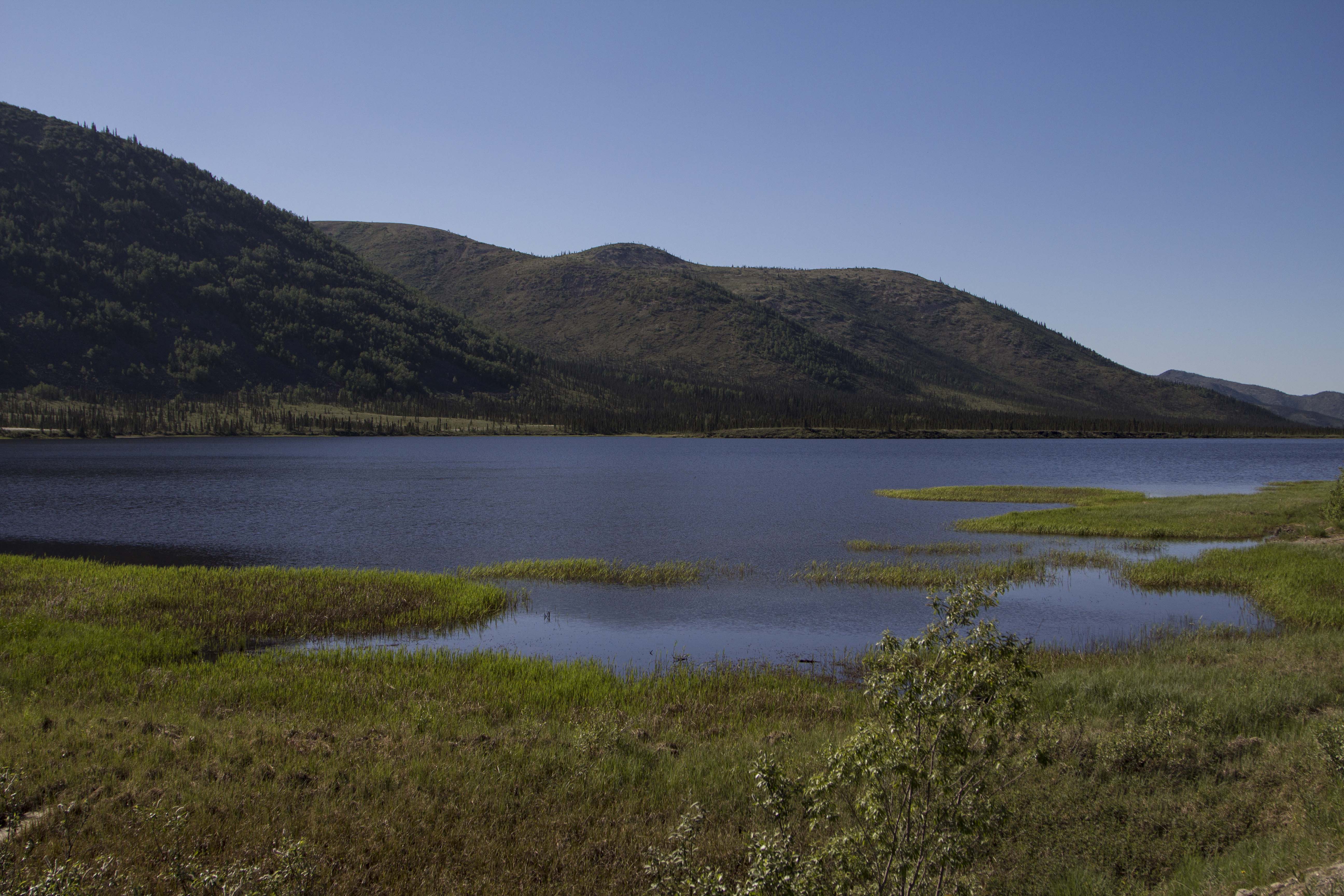
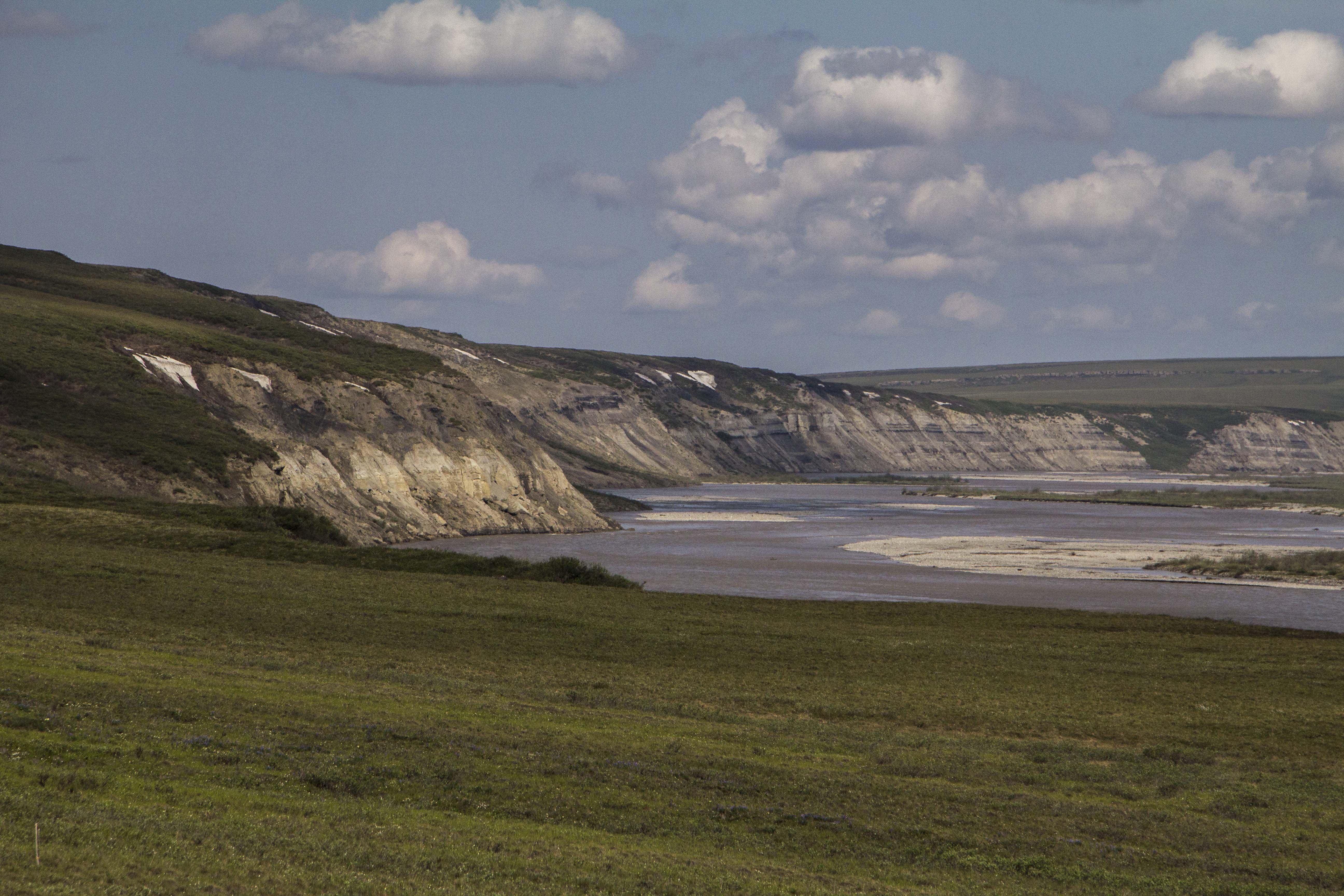
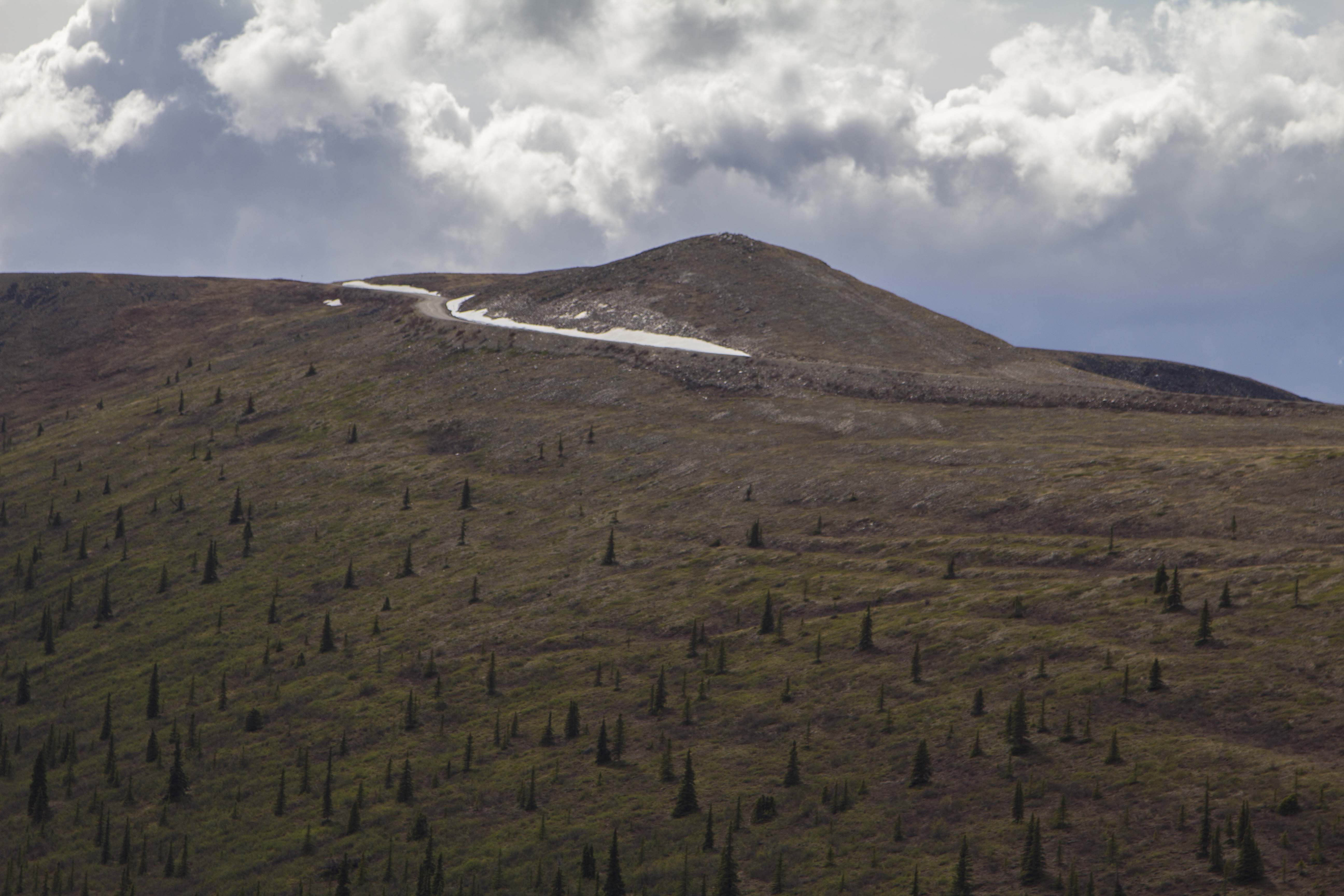
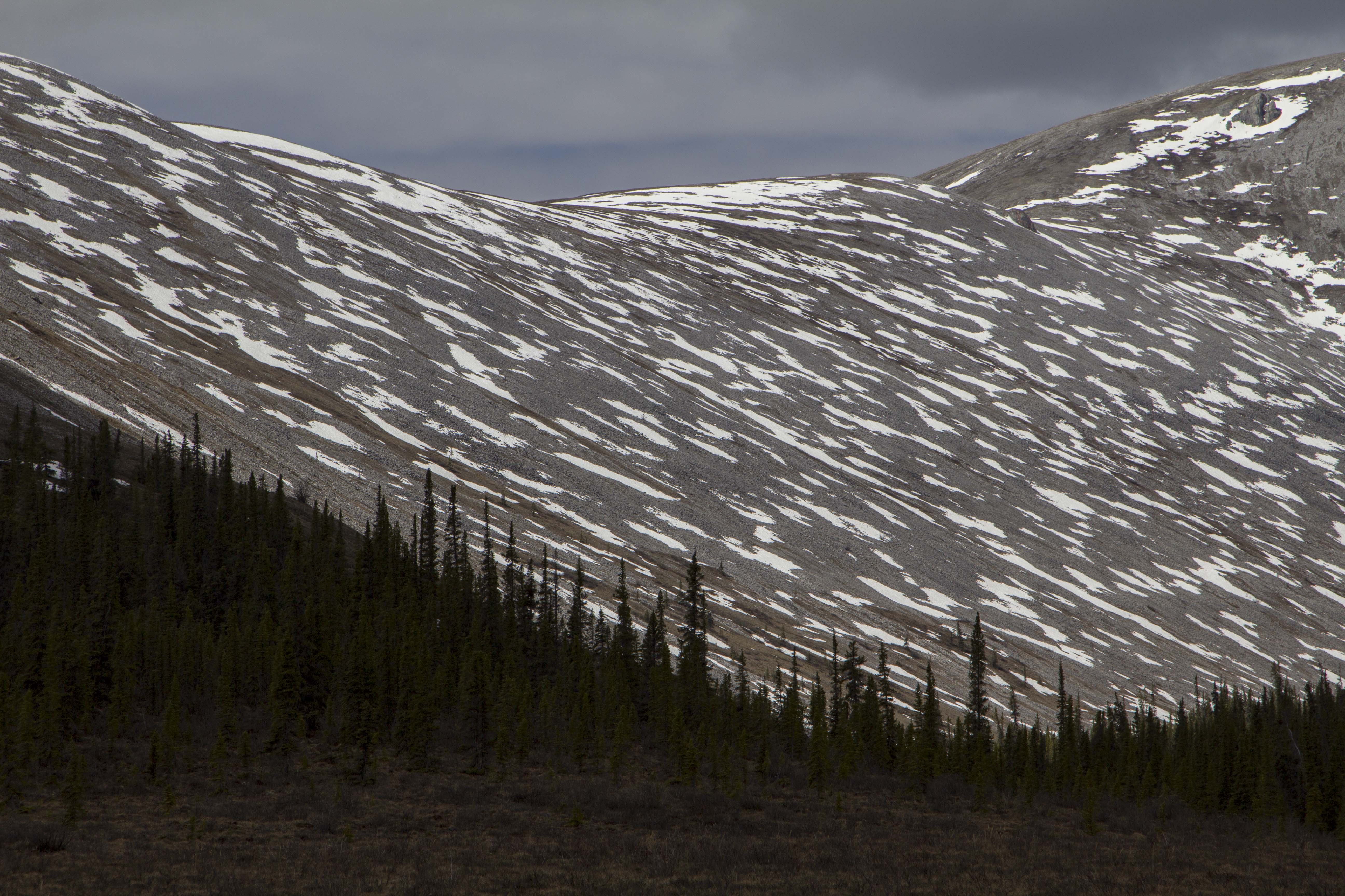
More big hills the following morning, lead, thankfully, to the Yukon River, where , once across, the road flattens out a bit and some nice forested Alaskan countryside sprouts from the earth like Grandfather Forest’s beard. Eventually, however, the hills re appeared and the grinding continued. After 70 miles, I find a gravel pit to call home right on the fringe of Finger Mountain and south of the Arctic circle maybe 25 miles. I am now seeing the first bits of true Arctic Tundra.. permafrost meltwater lakes, unglaciated Tors of granite, and windswept mountain passes are now within my eyesight.

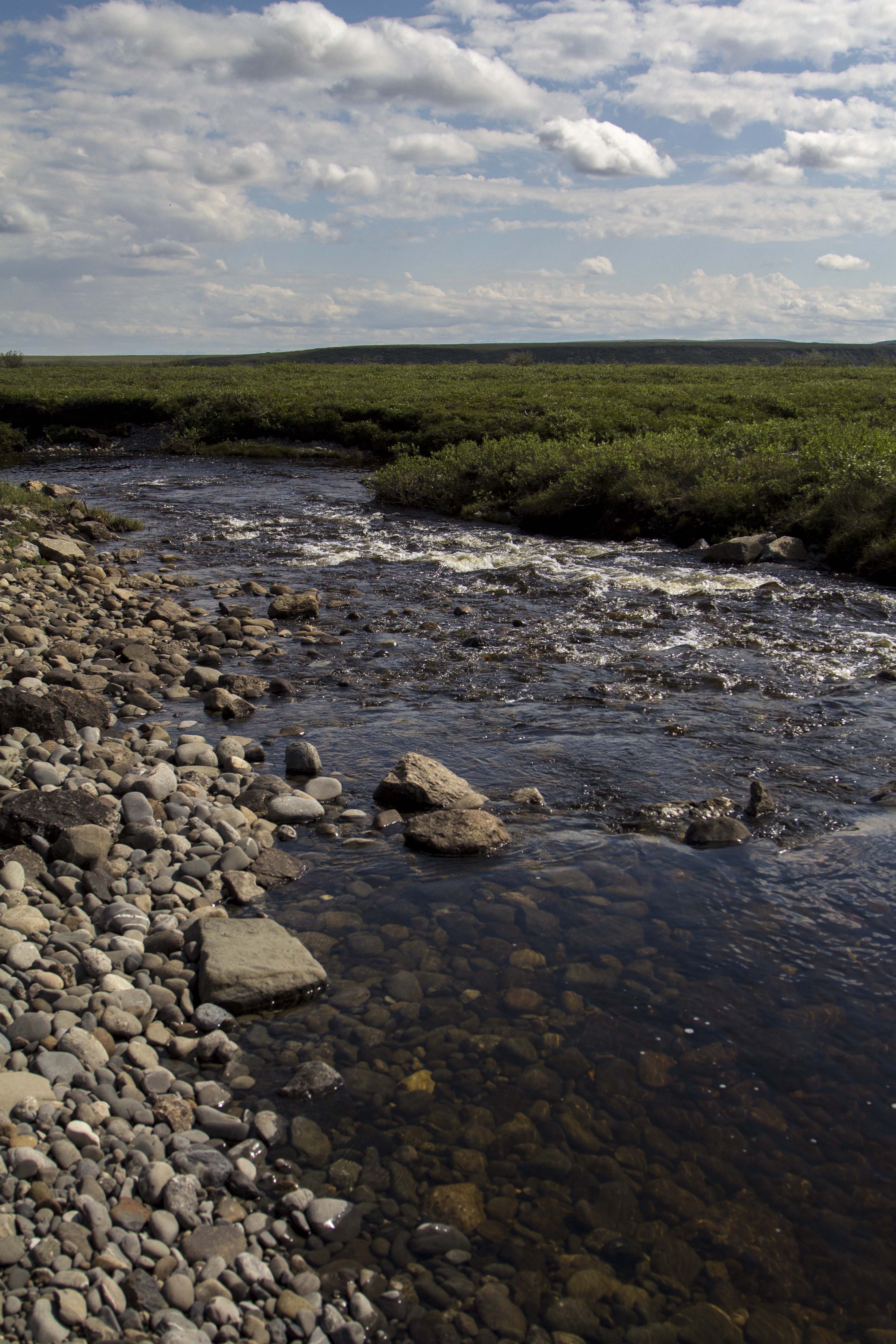
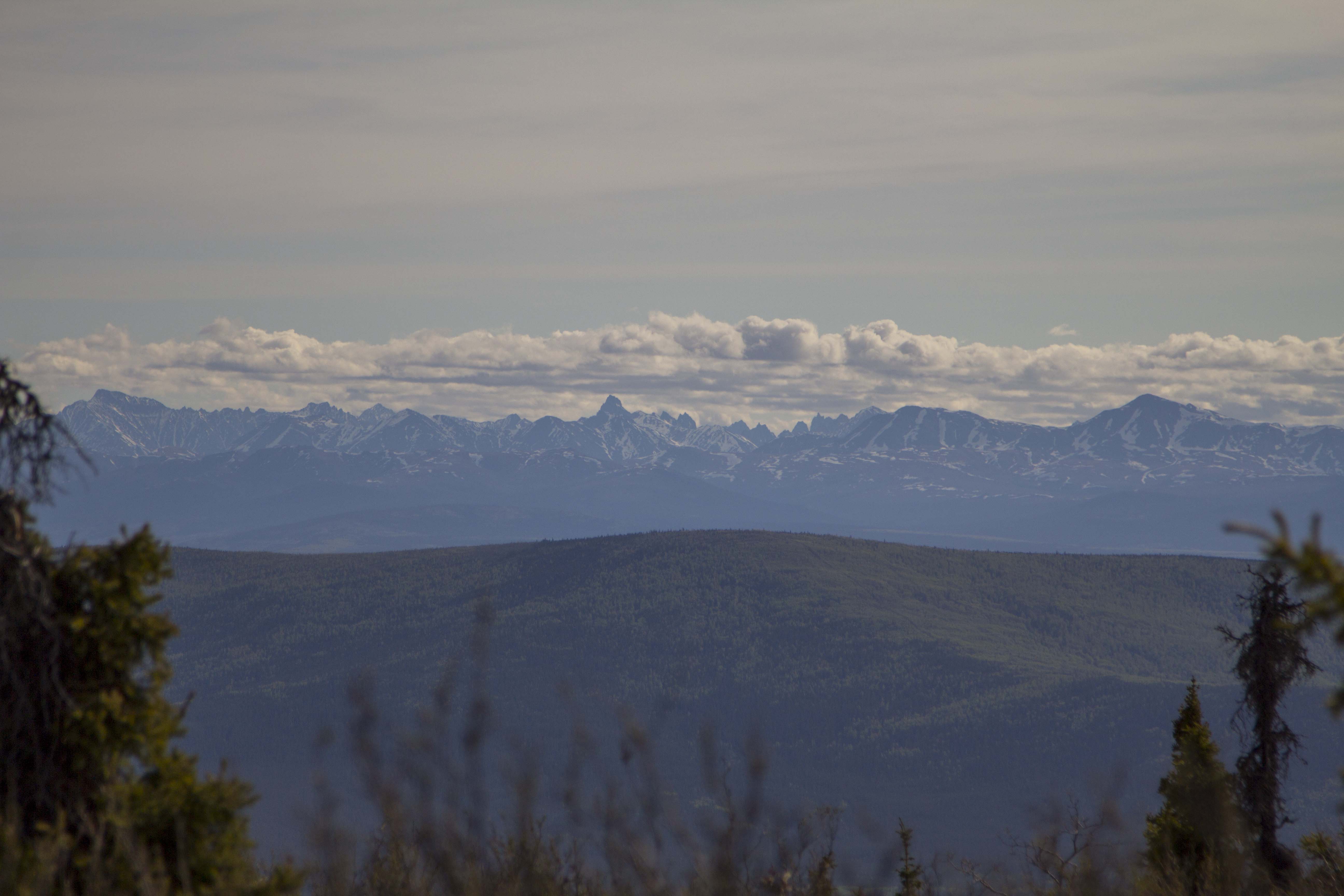
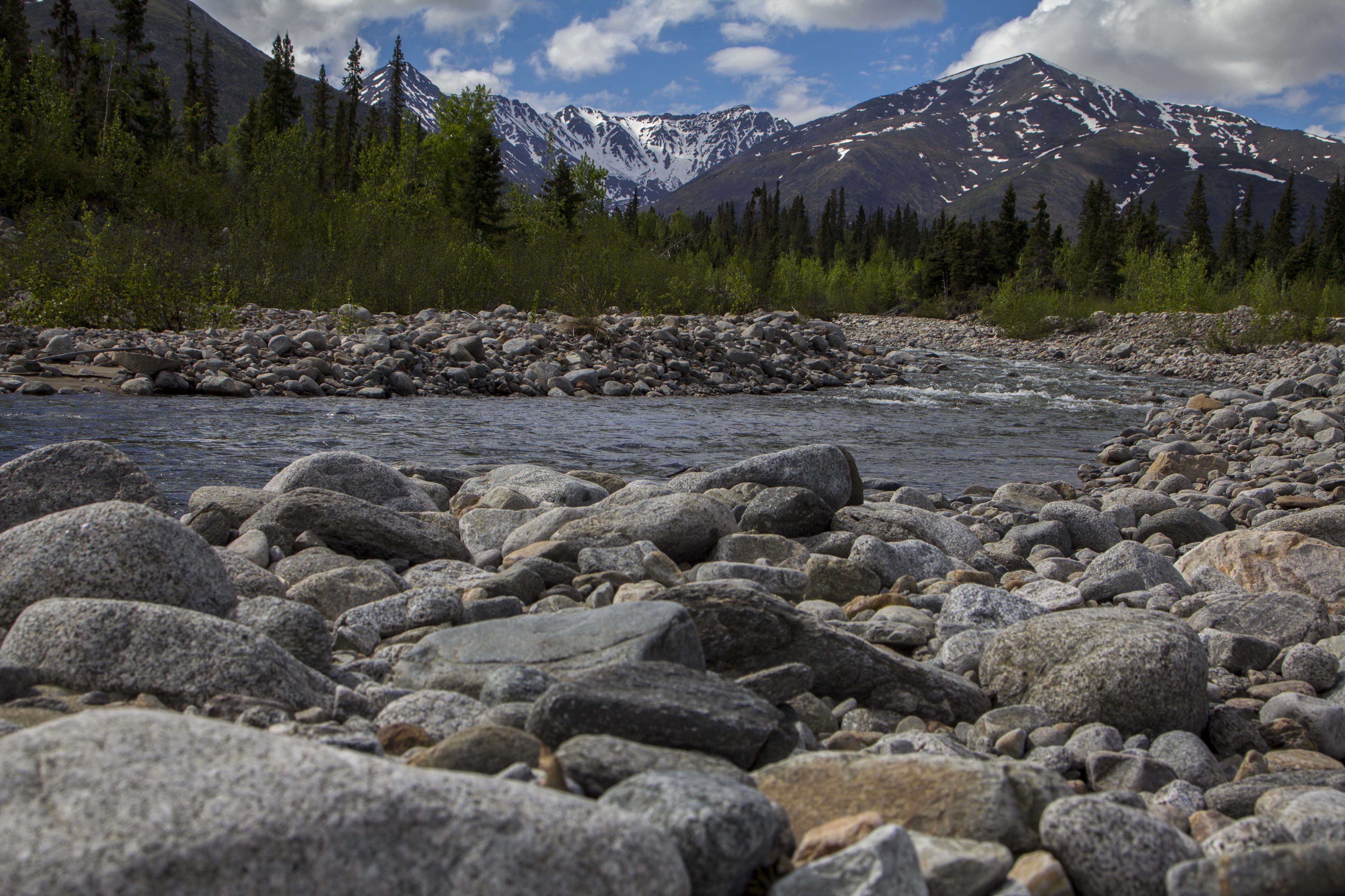
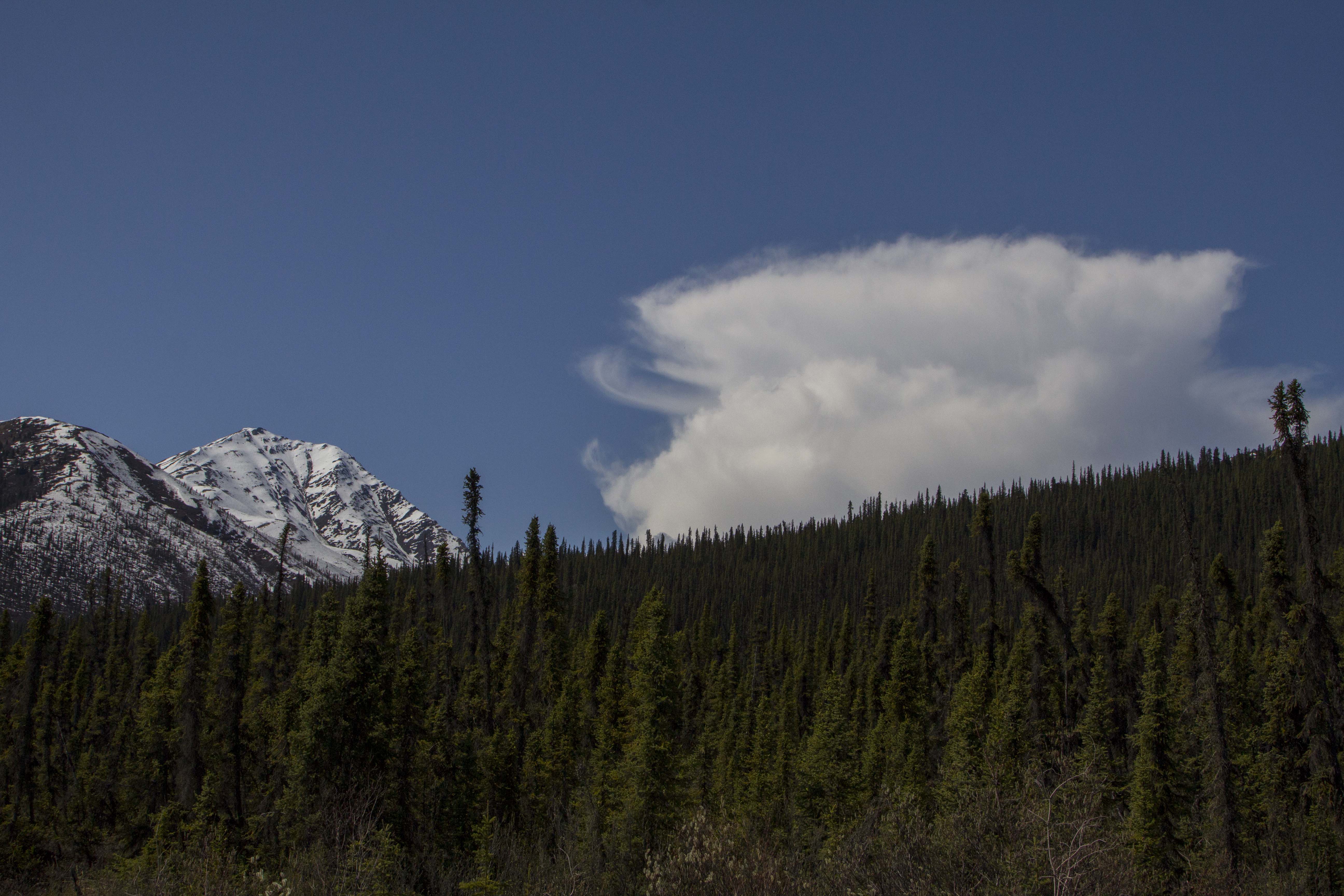
The next day, the landscape changes dramatically to the type of high country I so desire. After crossing the imaginary Arctic Circle, I cross over a small mountain pass and catch my first glimpses of the mighty Brooks Range. I drop into the valley below, and am greeted with magnificent spruce forest, and creeks filled with 24 inch Grayling. There is drinking water everywhere, a far cry from the relative dryness of the last few days out of Fairbanks. In fact the dryness was accentuated by the fact that north central Alaska has been experiencing one of the hottest, driest spells in history this week. The second day out of Fairbanks it tipped the scales at 94 degrees! This new landscape was what I came  here for… unparalleled high country filled with river’s, mountains, forest, and animals.

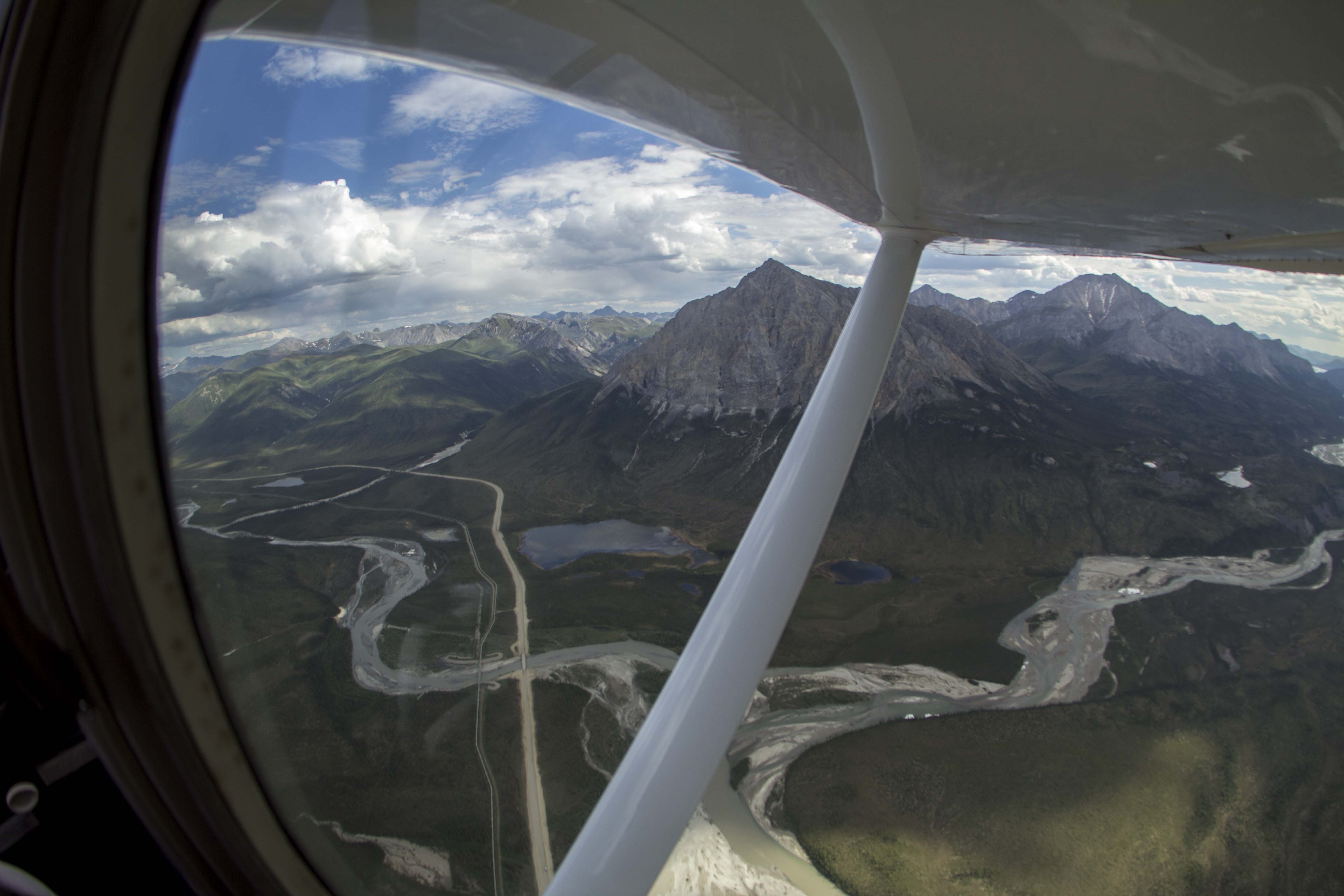
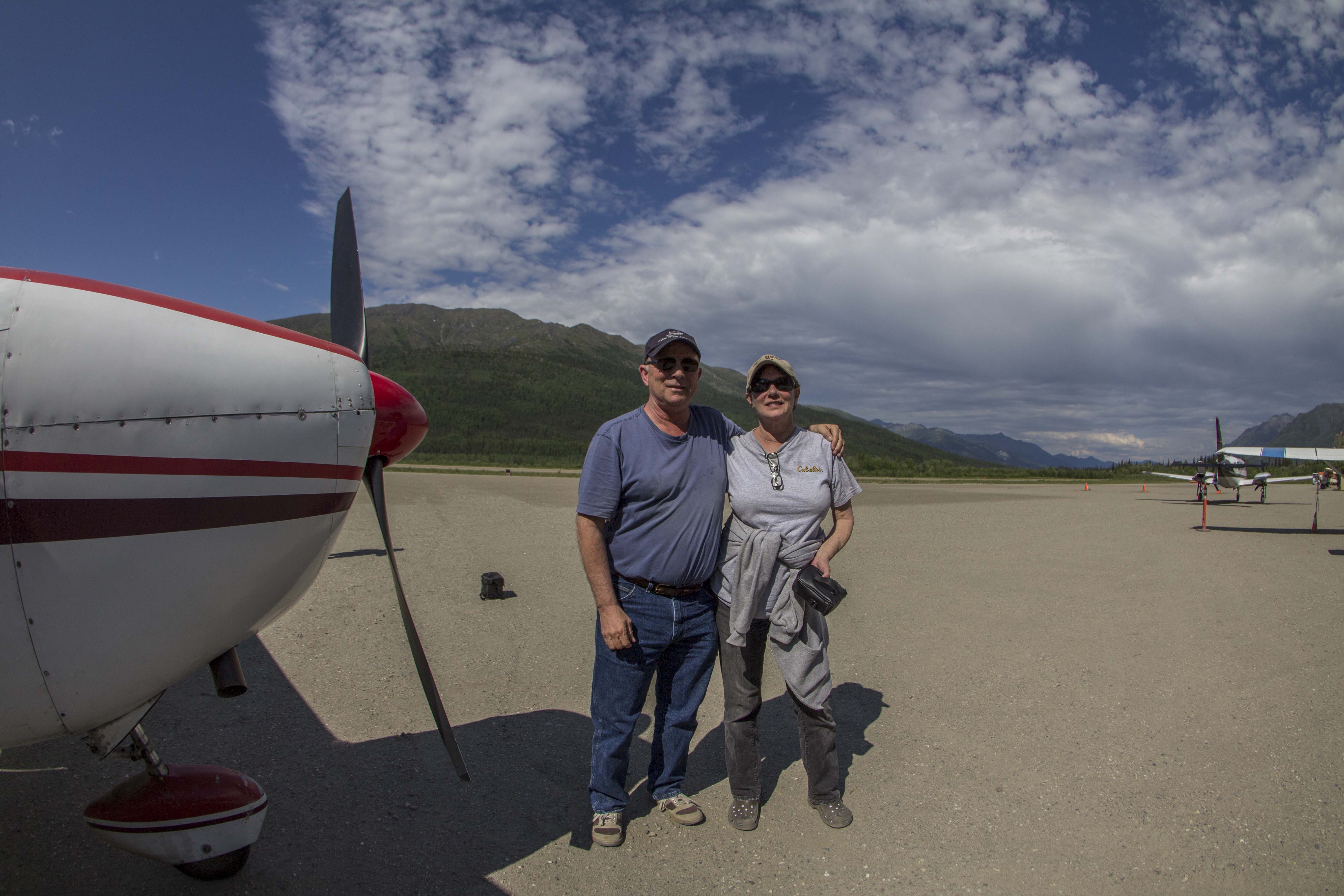
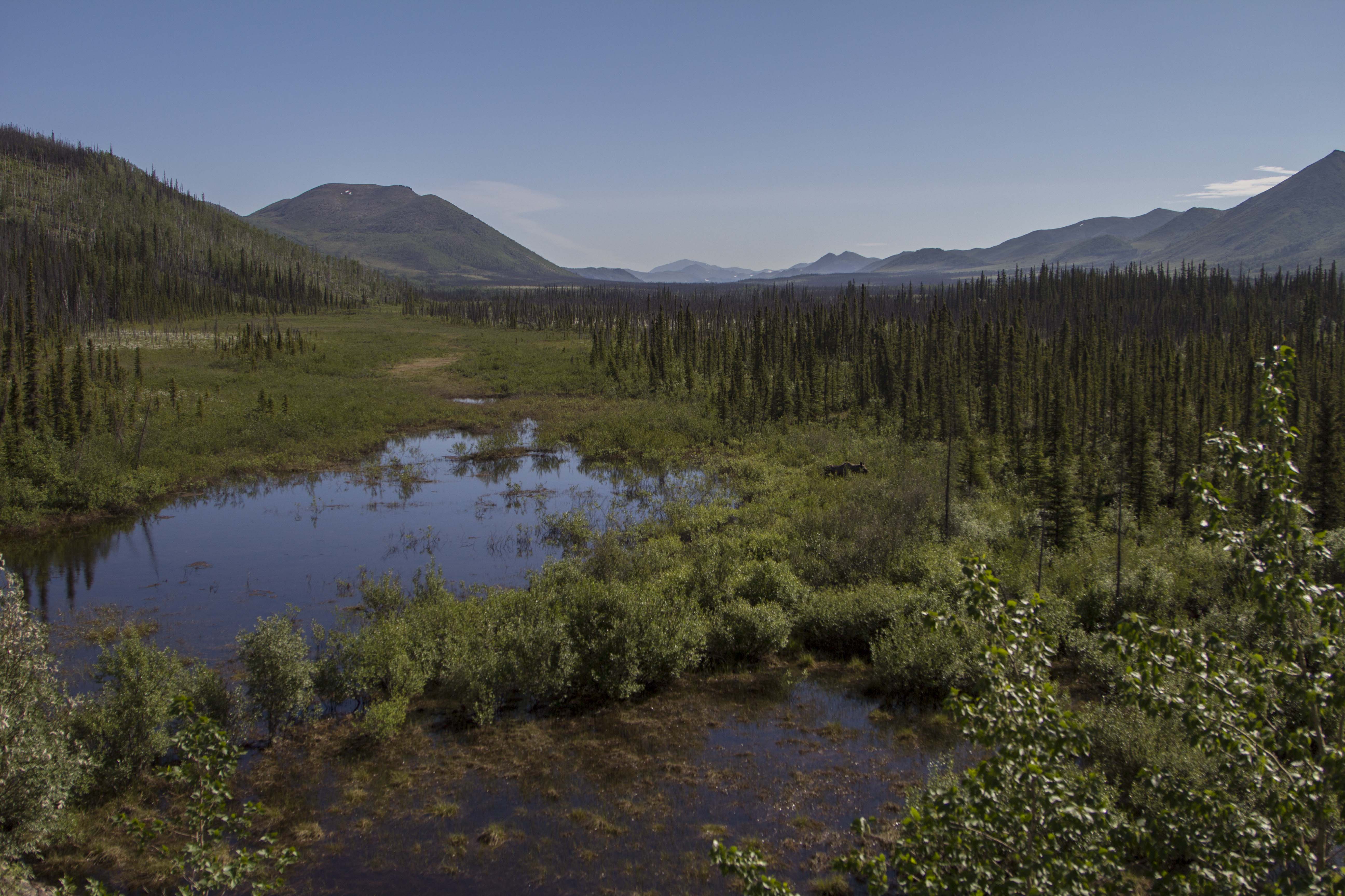
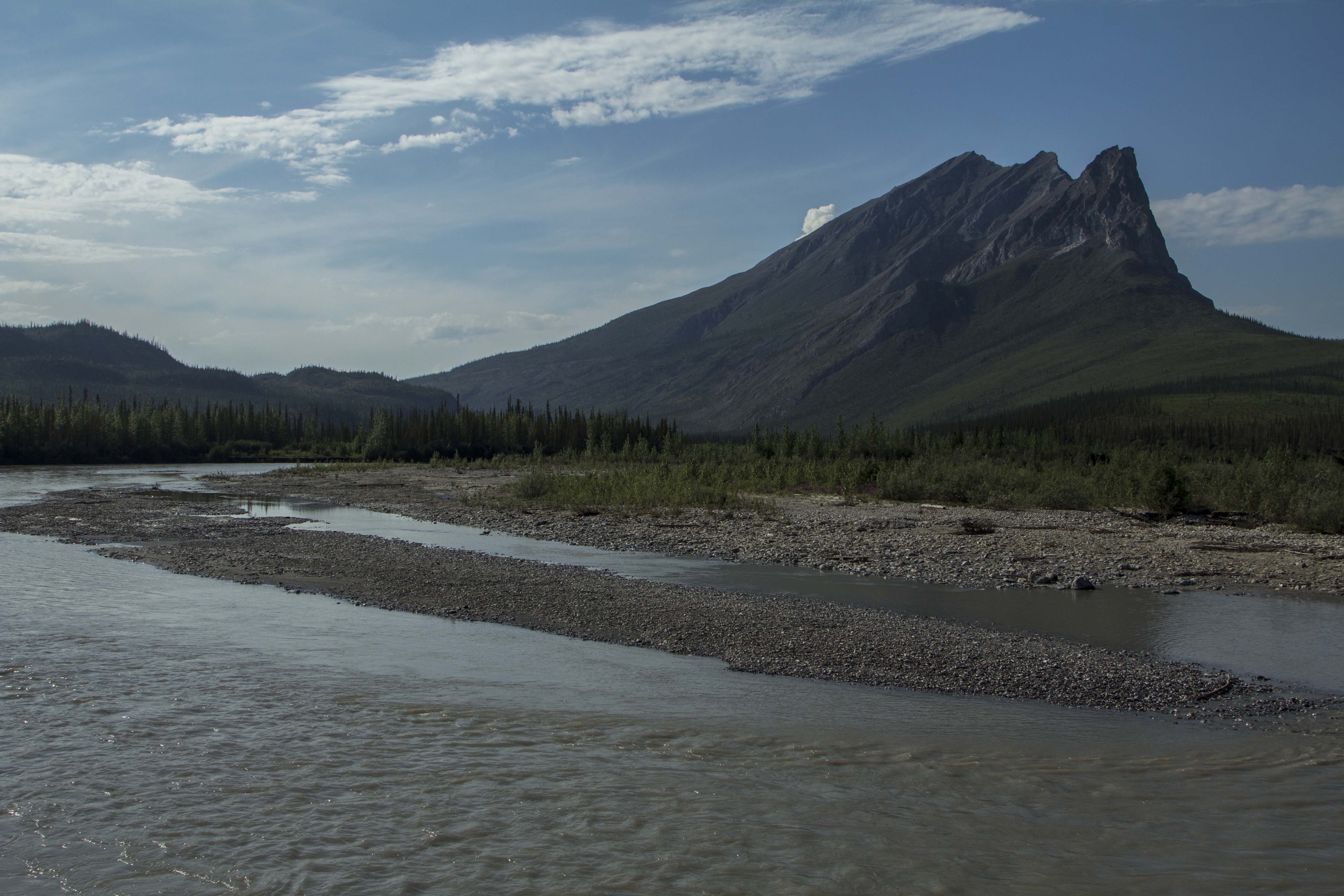
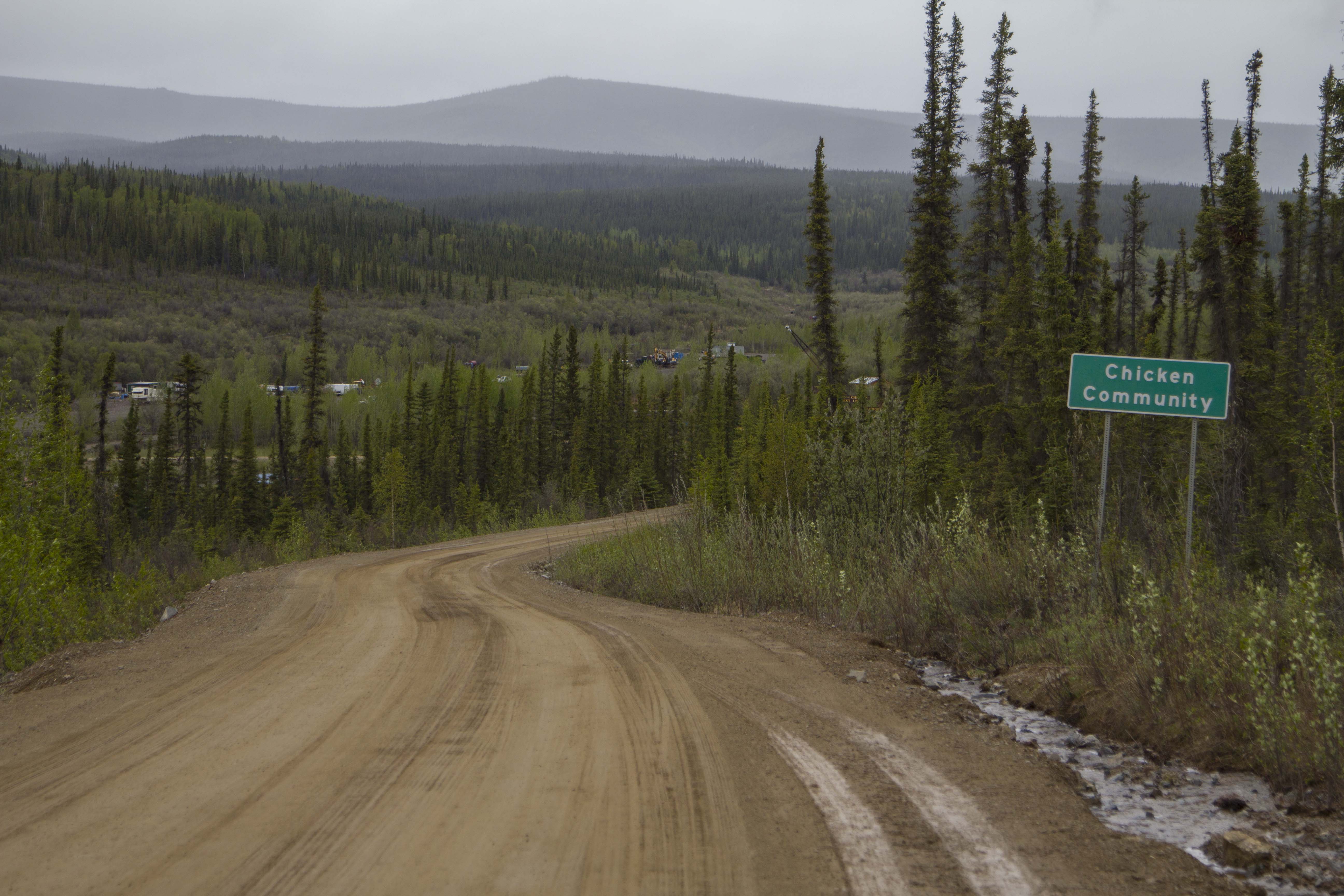
I roll into Coldfoot, the half-way point on this path, nestled in the Koyakuk River valley, in the heart of the entrance to the Brooks Range. I find a decent camp next to the river and go into “town” to find my food box. The box is not there.. Tommy had not made the trip, but had relayed the box to a friend of his to drop, but so far, it has not shown. There is a bar and a restaurant here and the food is decent and the folks here are nice and the scenery is unbeatable, so I have no problem sitting tight for a spell. Over a couple of beers, I meet Tom and Jane, a couple of extremely nice folks from the Hood Canal area of Washington state. They have flown up here from the states in their Cessna 180, and offer to take me on a short flight over the Brooks tomorrow if I wasn’t doing anything. Are you kidding? This notion makes me grin as wide as wide can be, and I accept. I meet with them the next day and, by noon or so, we are in the sky, flying over what can only be described as pure and simple wilderness bliss. Huge, craggy peaks, endless tundra mountains and rivers of a proportion that I can barely comprehend unfold before my very eyes. I hold back the tears of joy as I witness a childhood dream come true. There are no words to describe how my heart feels in this place, even from an airplane. How will I feel when I am actually in it? After about an hour, we head back to the Coldfoot landing field, and I thank Tom and Jane for their generosity. I wish them the best, and I hop on my bike, high as kite from the last hour’s experience, and eagerly pedal directly into what I had just witnessed, looking now for a direct contact with the landscape before me, which is exactly what I got.

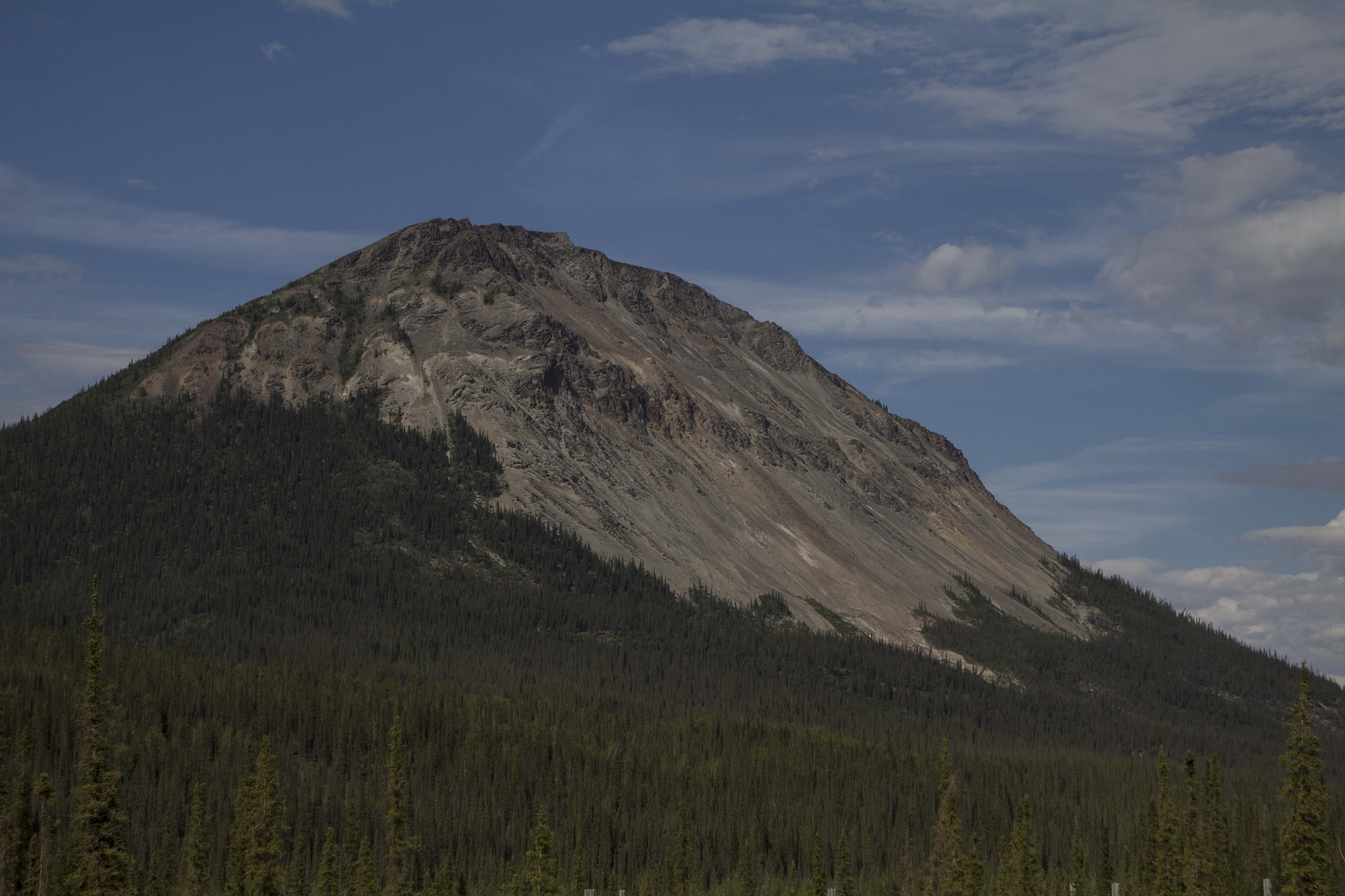
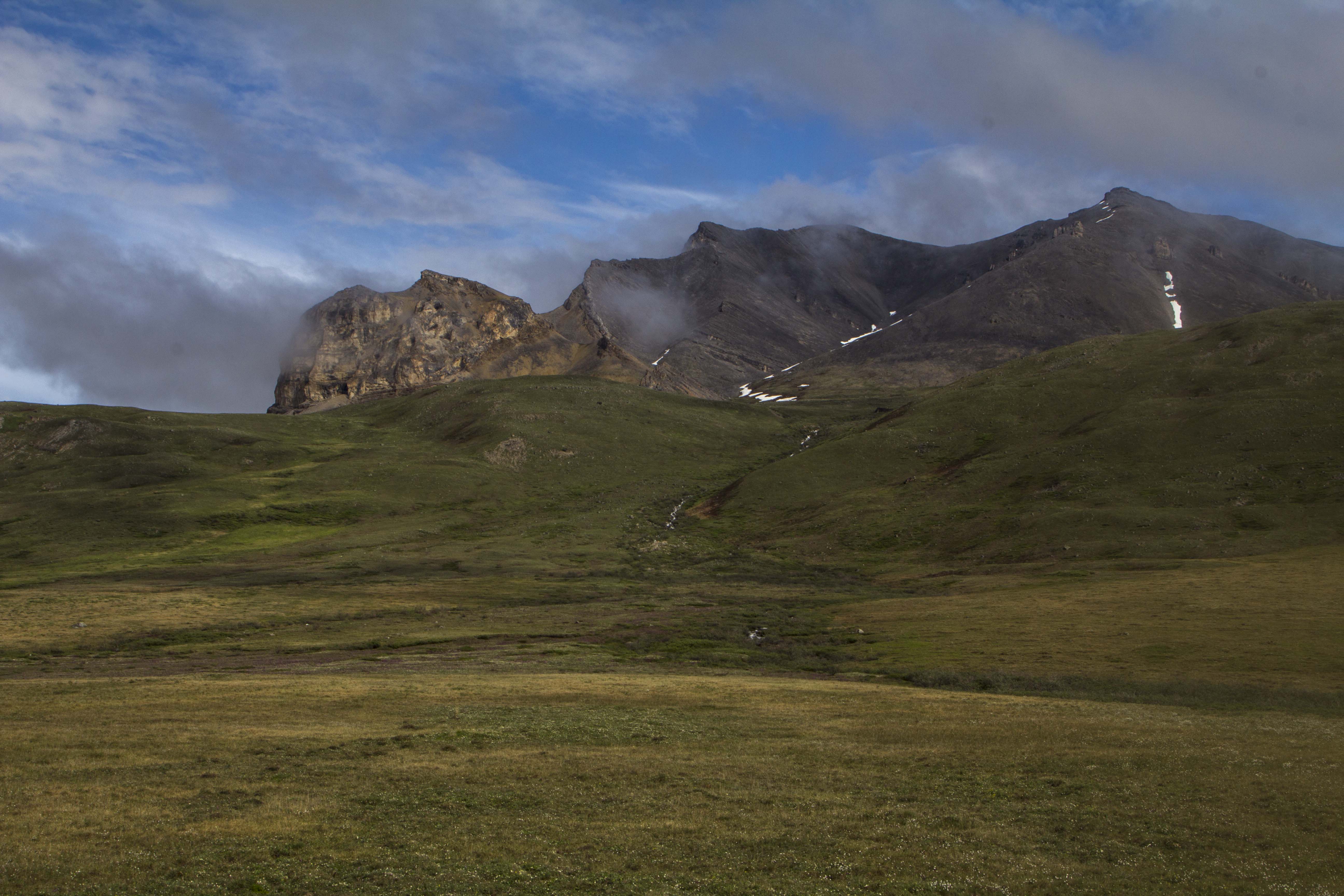
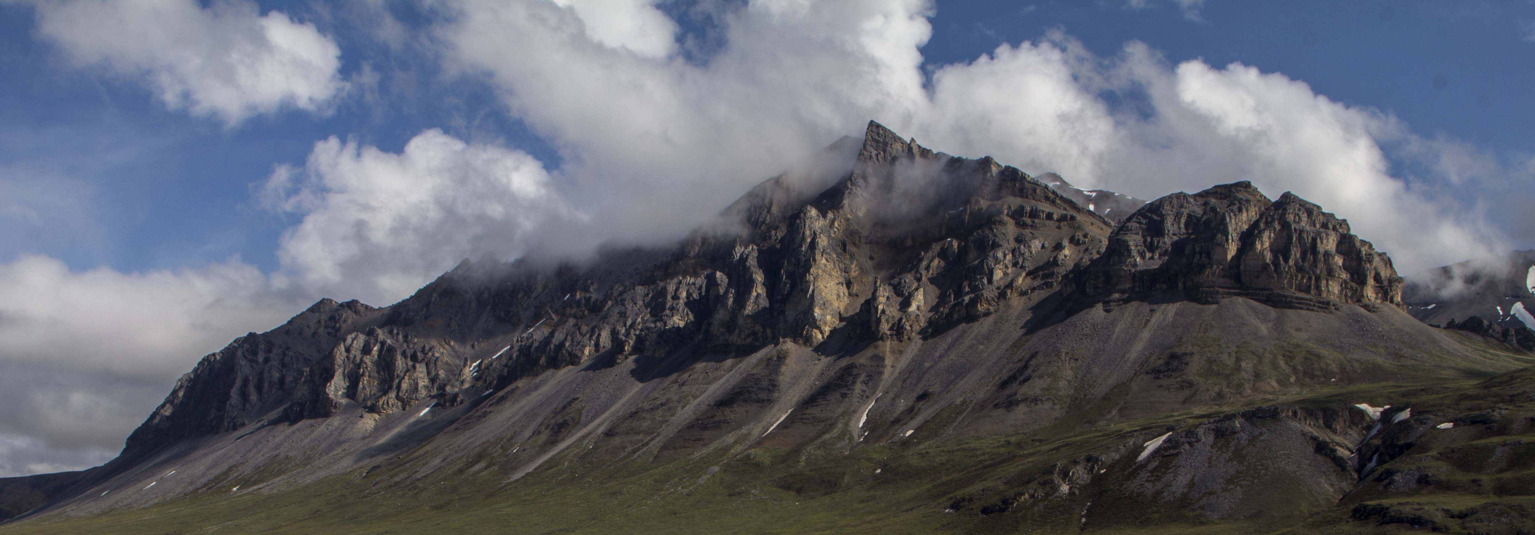
A couple of hours pedaling through mind boggling, awesome  scenery, I decide to get off of the Haul Road proper, and get onto the pipeline pad road, which offers a bit more of the deeply spooky solitude that this unbelievable place can offer. Eventually the road dead ends when the pipeline disappears underground, which will dictate me backtracking to the Haul Road for a couple of mile. BUT, at it’s end, a spectacular campsite is to be had, on the Koyakuk, and facing a “sunset” view of the mighty southwest face of Sukakpak Mountain, an impressive chunk of pre cambrian limestone real estate. After swimming in the Koyakuk, I set up the camera for an evening time-lapse of Sukakpaks’ dramatic episode of color and changing light. I feel I have finally entered the place on this leg where I want to be; The High Country.

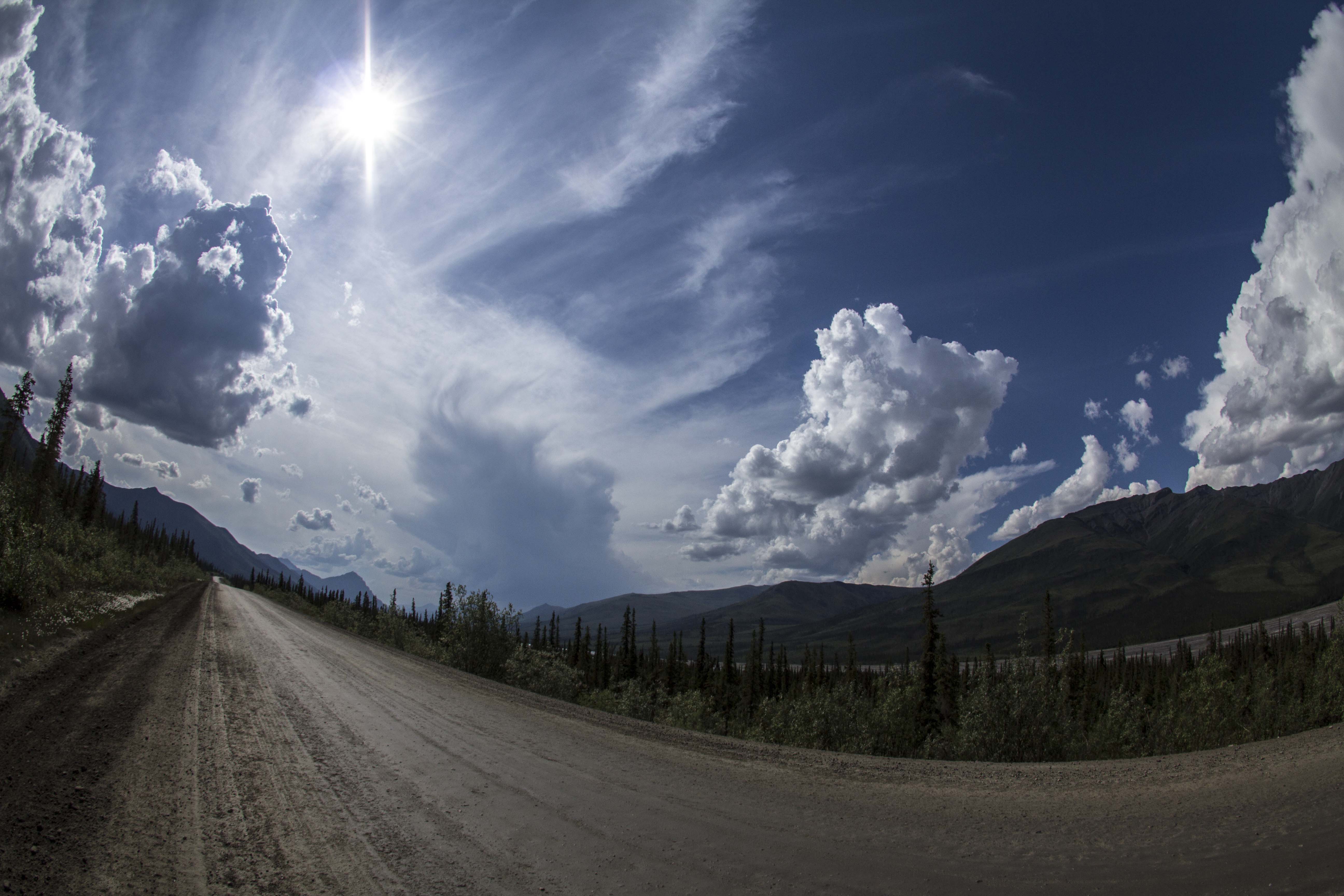
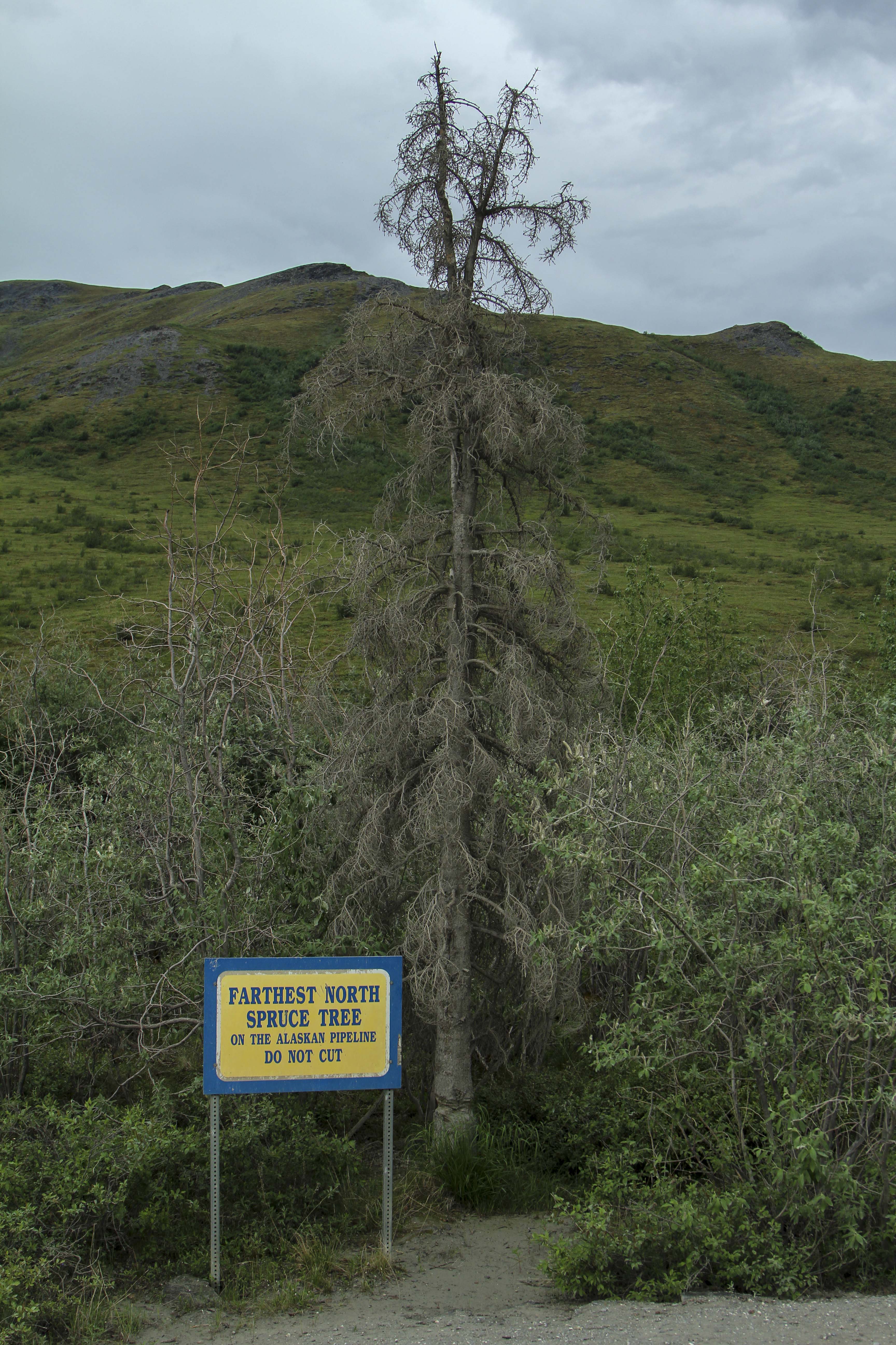
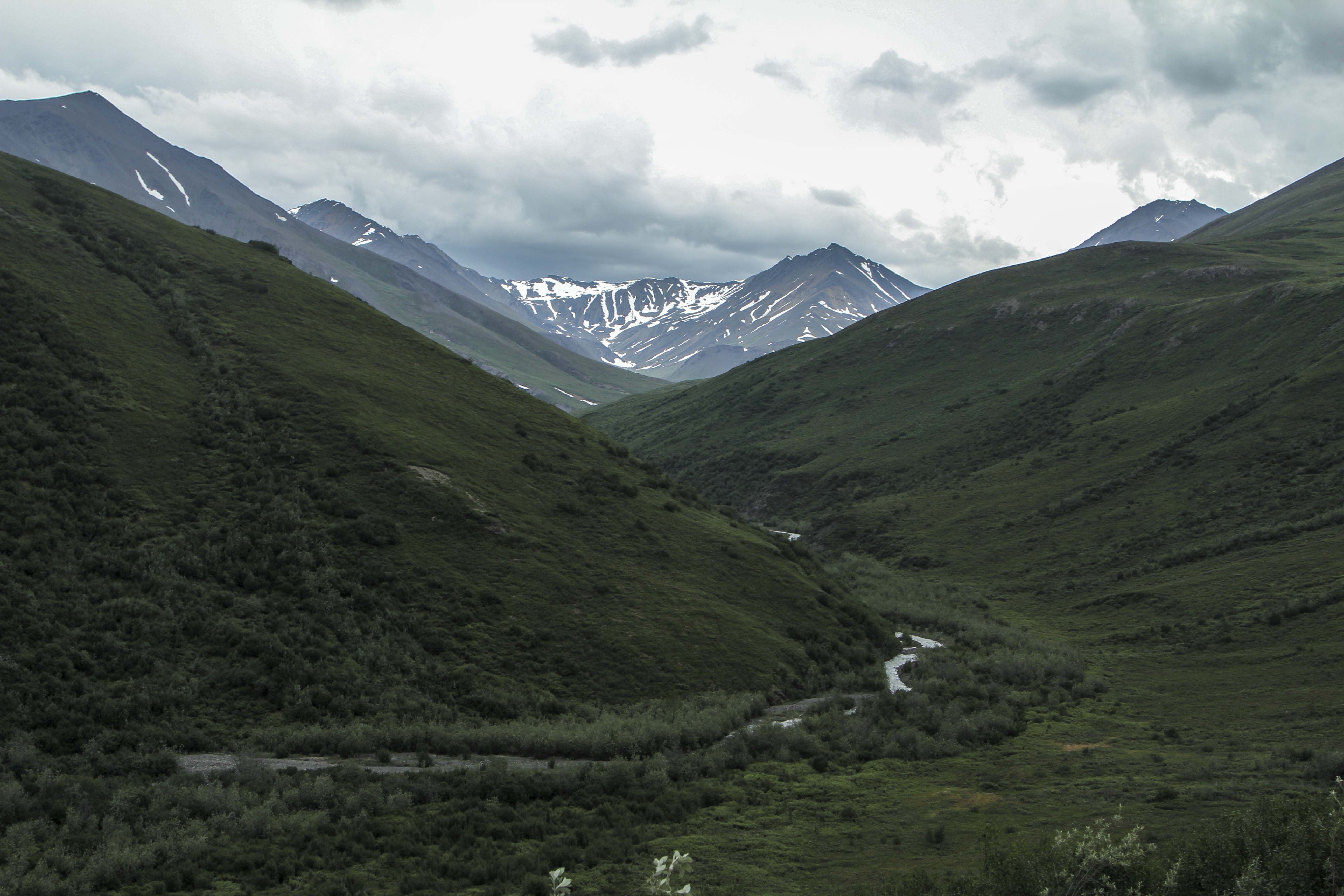
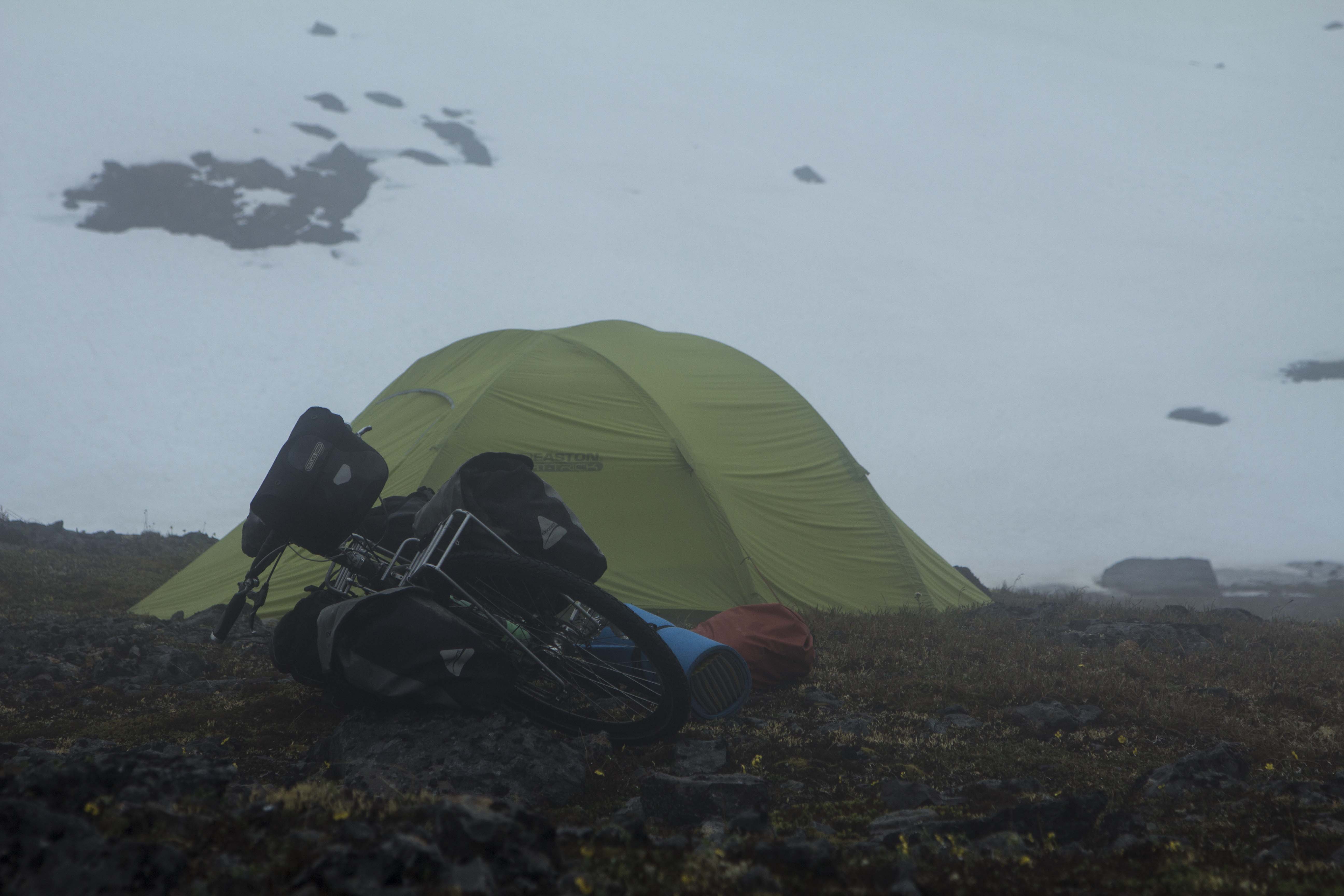
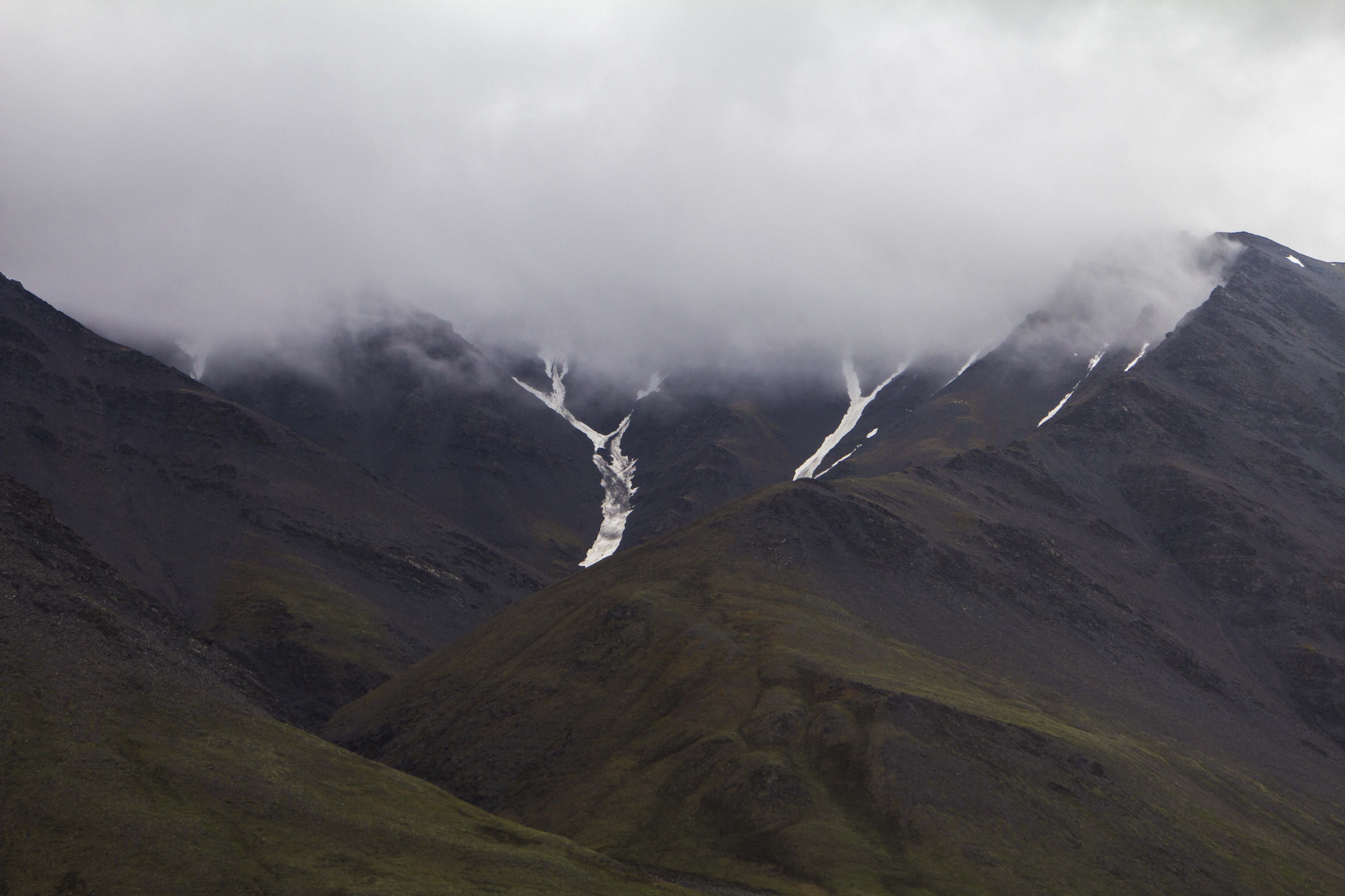
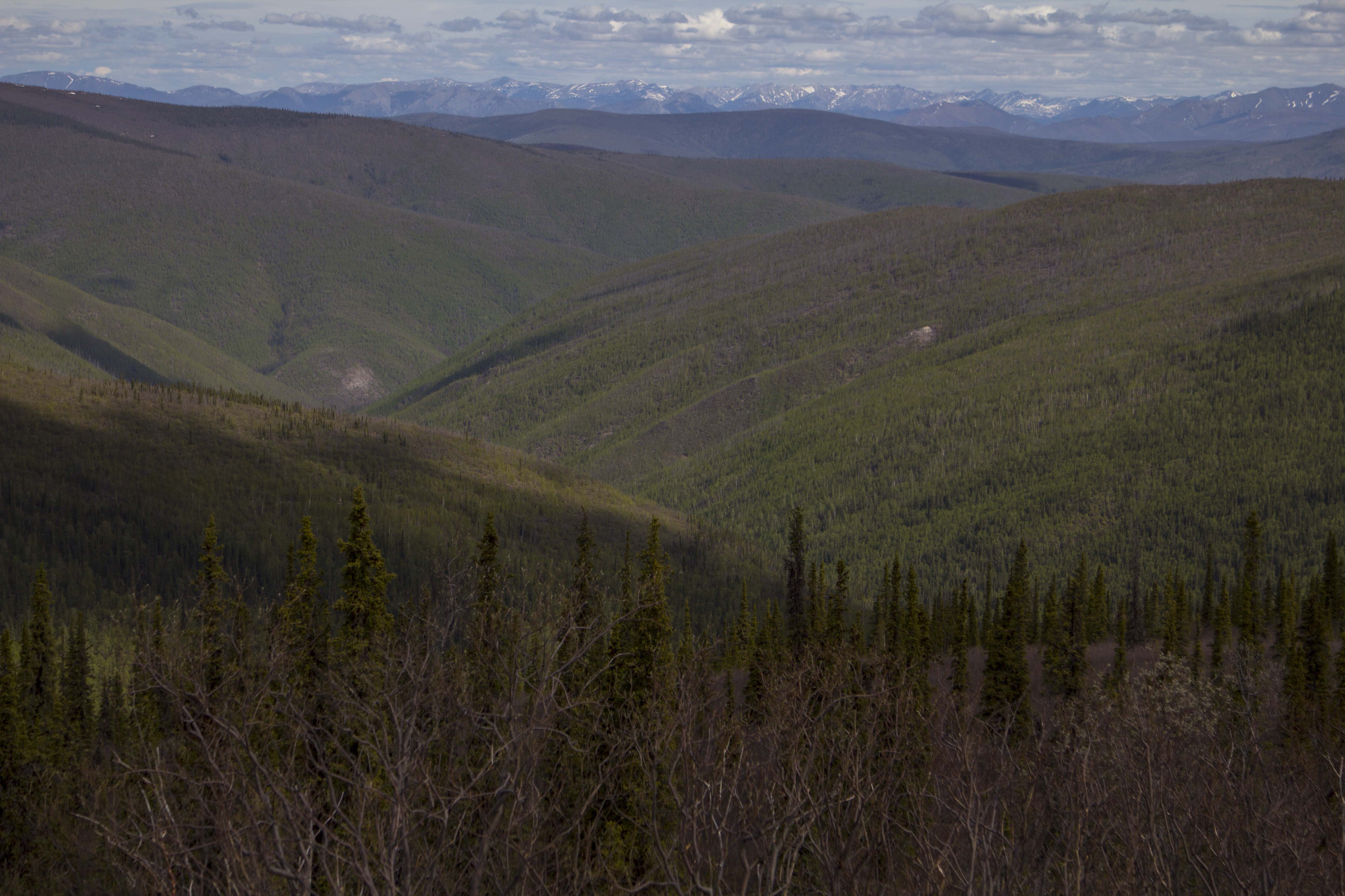
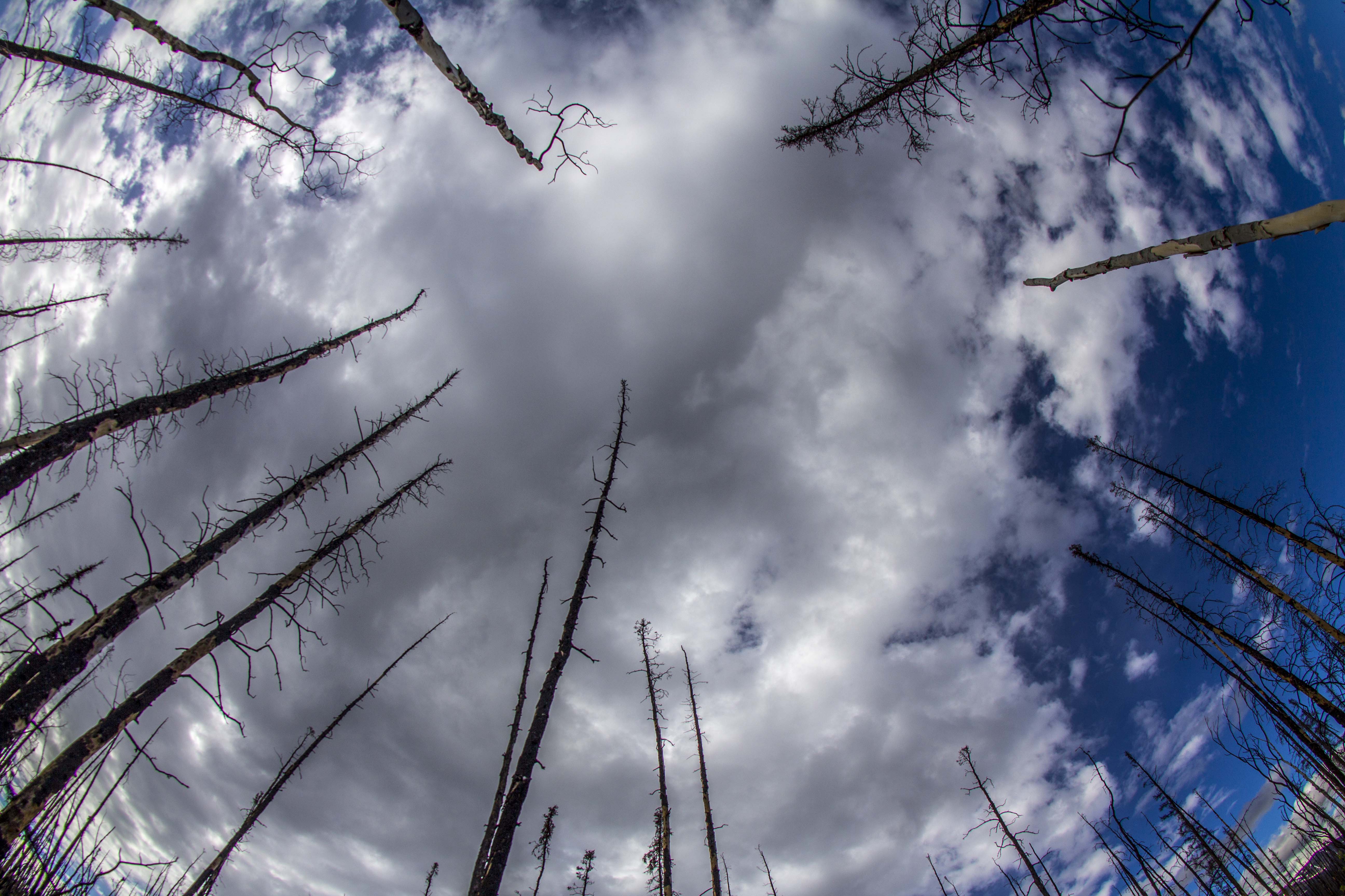
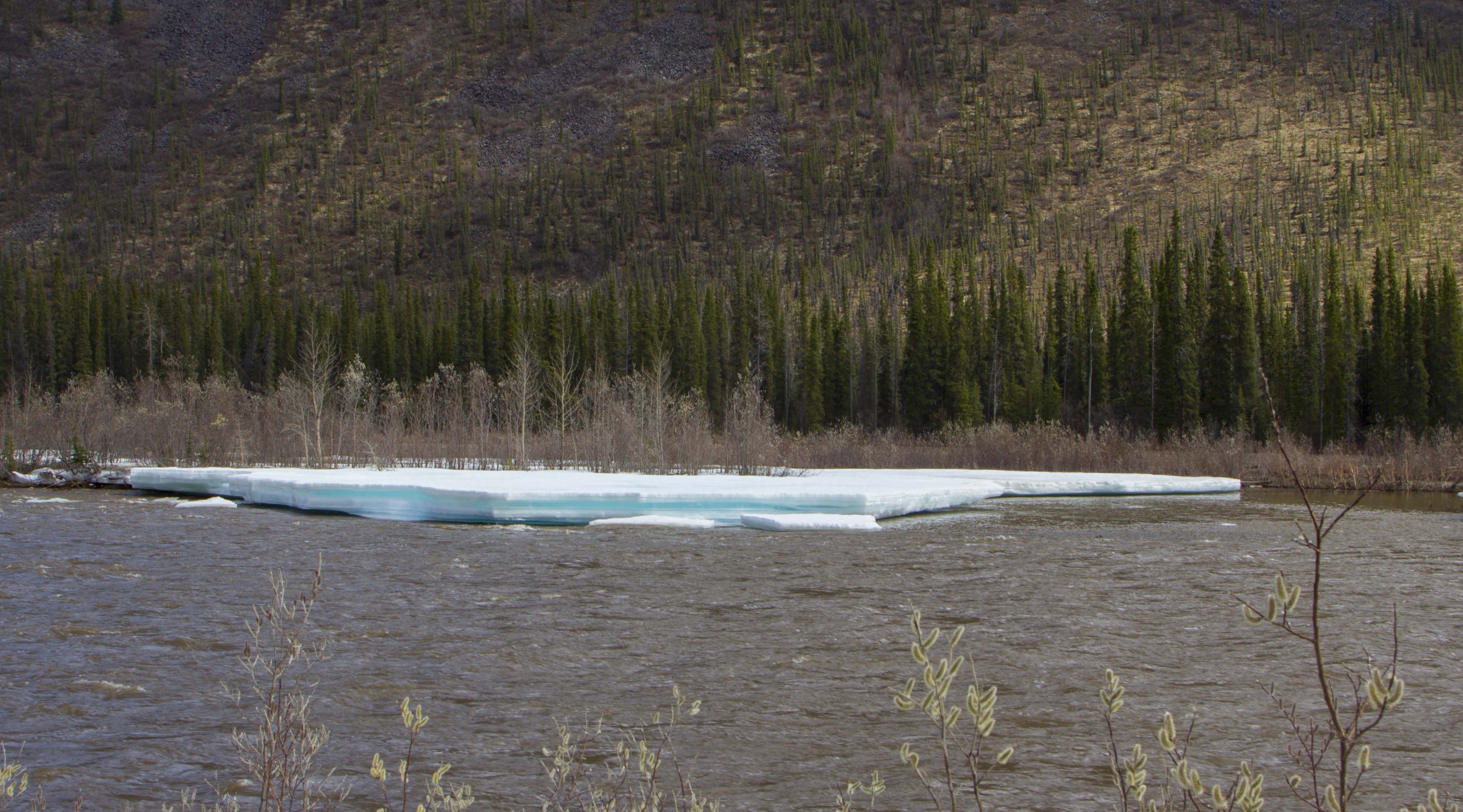
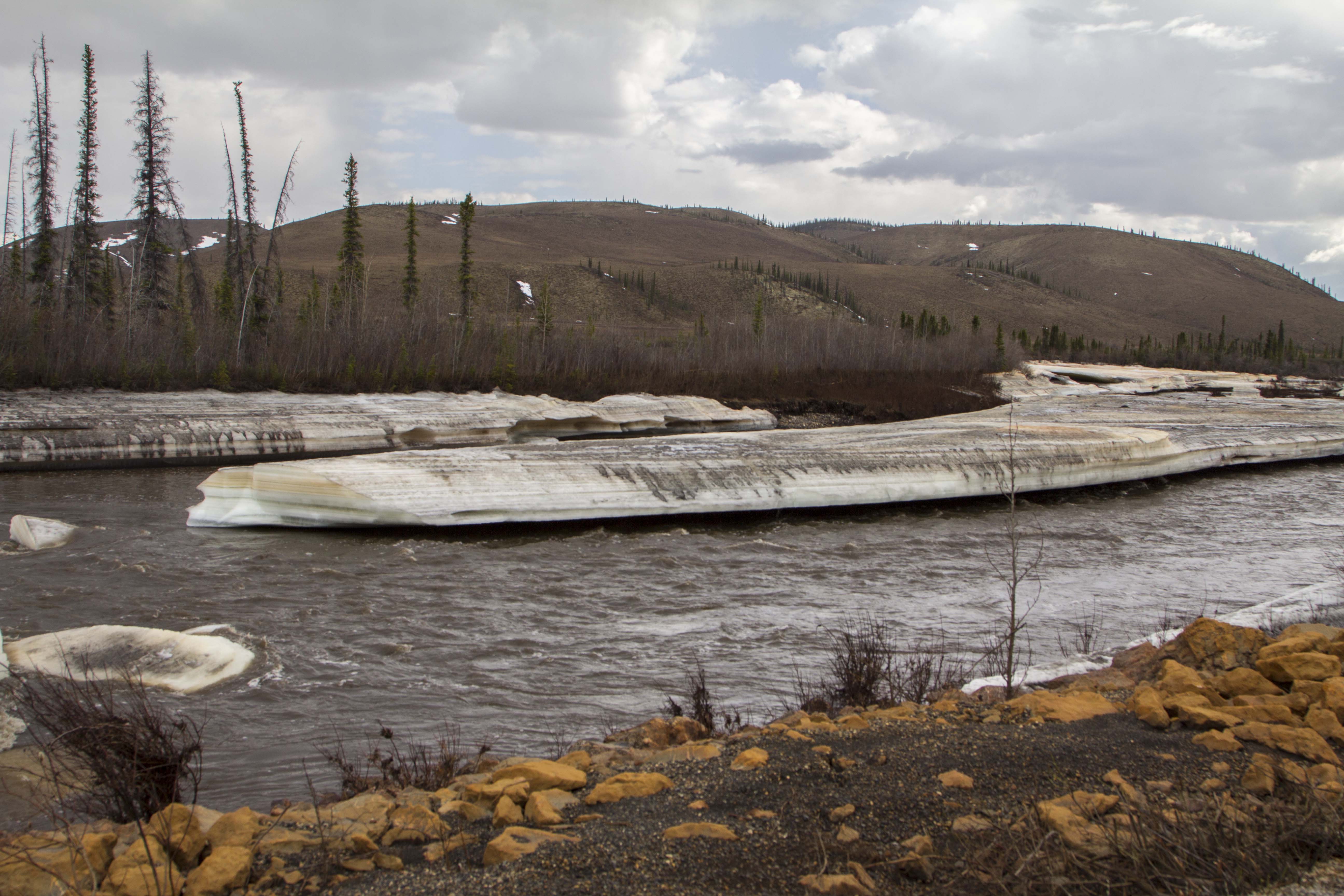
The following day is the creme de la creme; 40 miles of dead flat, yet scenery of a mesmerizing nature ensue. I see Eagles, Moose, and Fox, but no Bear, Caribou, or Wolf. The river becomes heavily braided; the forest begins to thin out. Signs of a changing ecosystem; of a different stature, more rugged than the previous mile, unfold. The weather begins to change too.. Thunderclouds build, then unleash, I retreat under a bridge and watch the storm from beneath, sitting next to river ice pack still 36 inches thick, here on June 20th. The storm breaks and and so do I. A few short miles and I pass the final spruce tree in this part of North America. No more trees at all, in fact. It is all tundra and the road begins to climb. Up, up, I go; the road flattens once again onto the spectacular Chandler Shelf, a flat area of a couple hundred square miles of tundra in the heart of the Brooks, just below the continental divide of Atigun Pass, Alaska’s Highest and most northerly road pass at 4800′. As I near Atigun’s summit, the storm once again decides to unleash it’s fury. High winds, sideways rain, and plummeting temperatures commence. I top out at 9:30 pm and find a patch of snow free tundra a way off the road and pitch my tent right there on Atigun’s high point. Even with guying the tent, I still have to brace the 4-season Easton shelter from the inside to prevent poles from snapping. Finally, the wind dies off and I drift to sleep, dreaming that night of being yet deeper into this range of magic mountains in the North, father in than I am now, traveling high valleys among Grizzly Bear and Caribou.

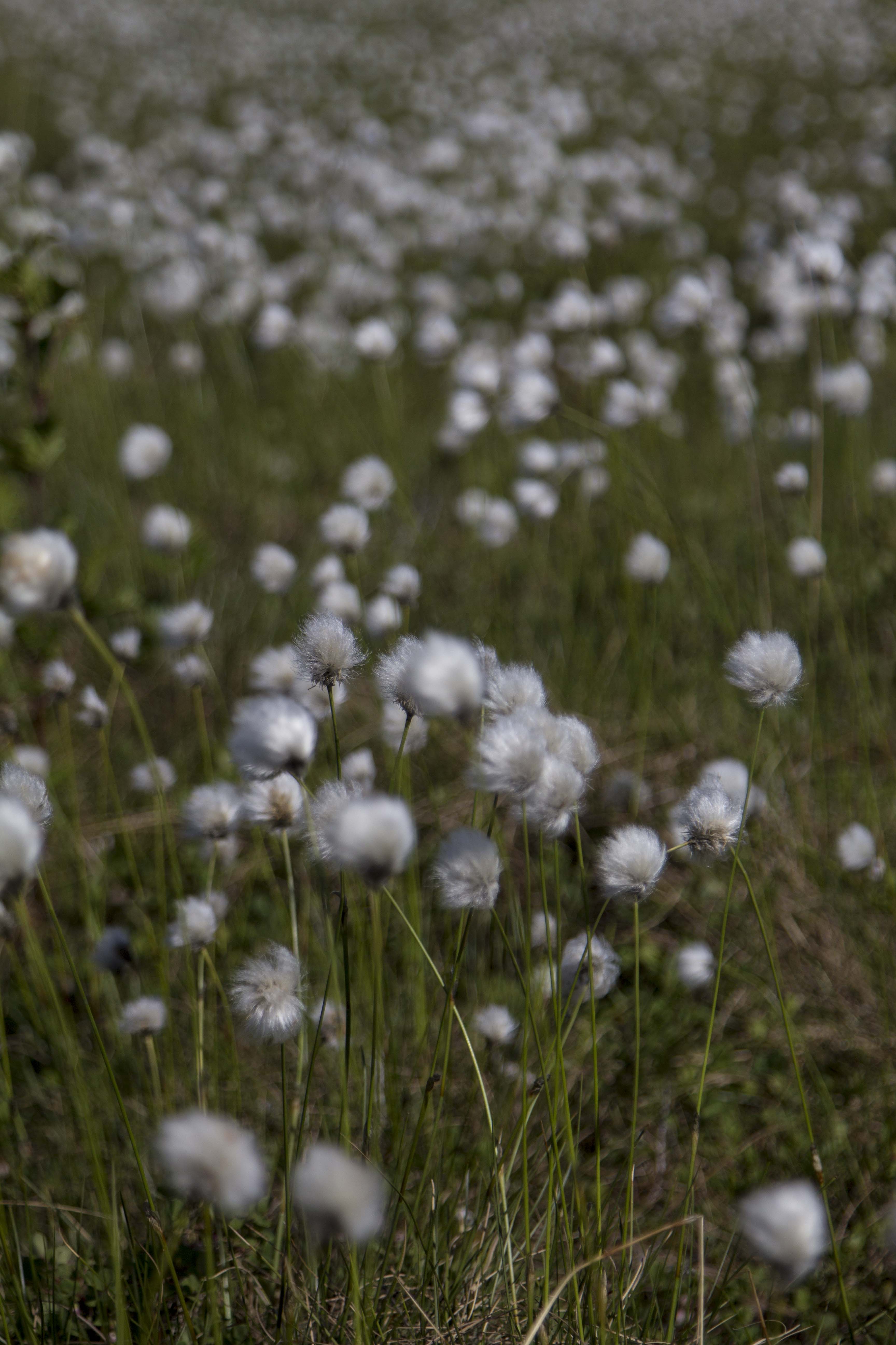
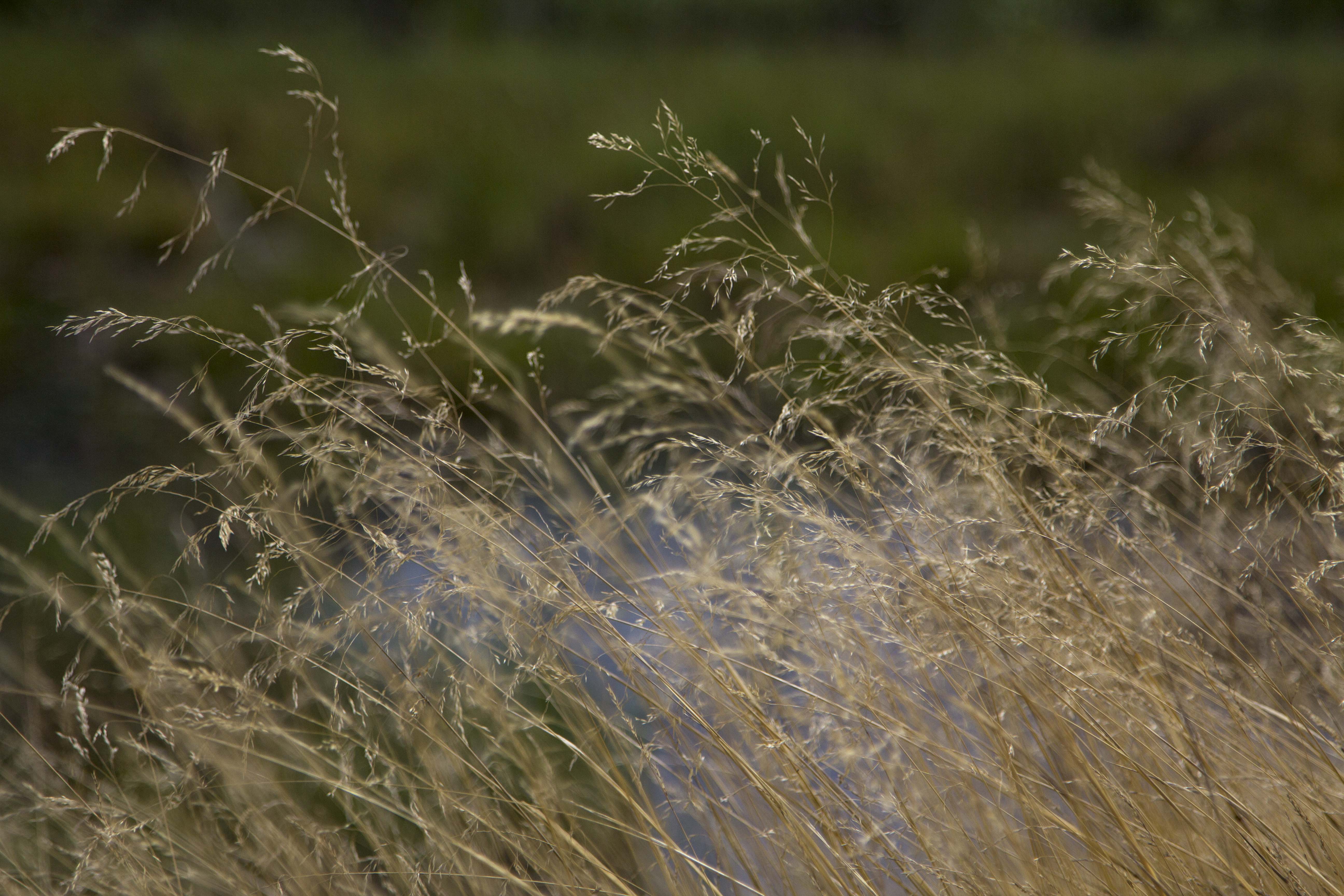
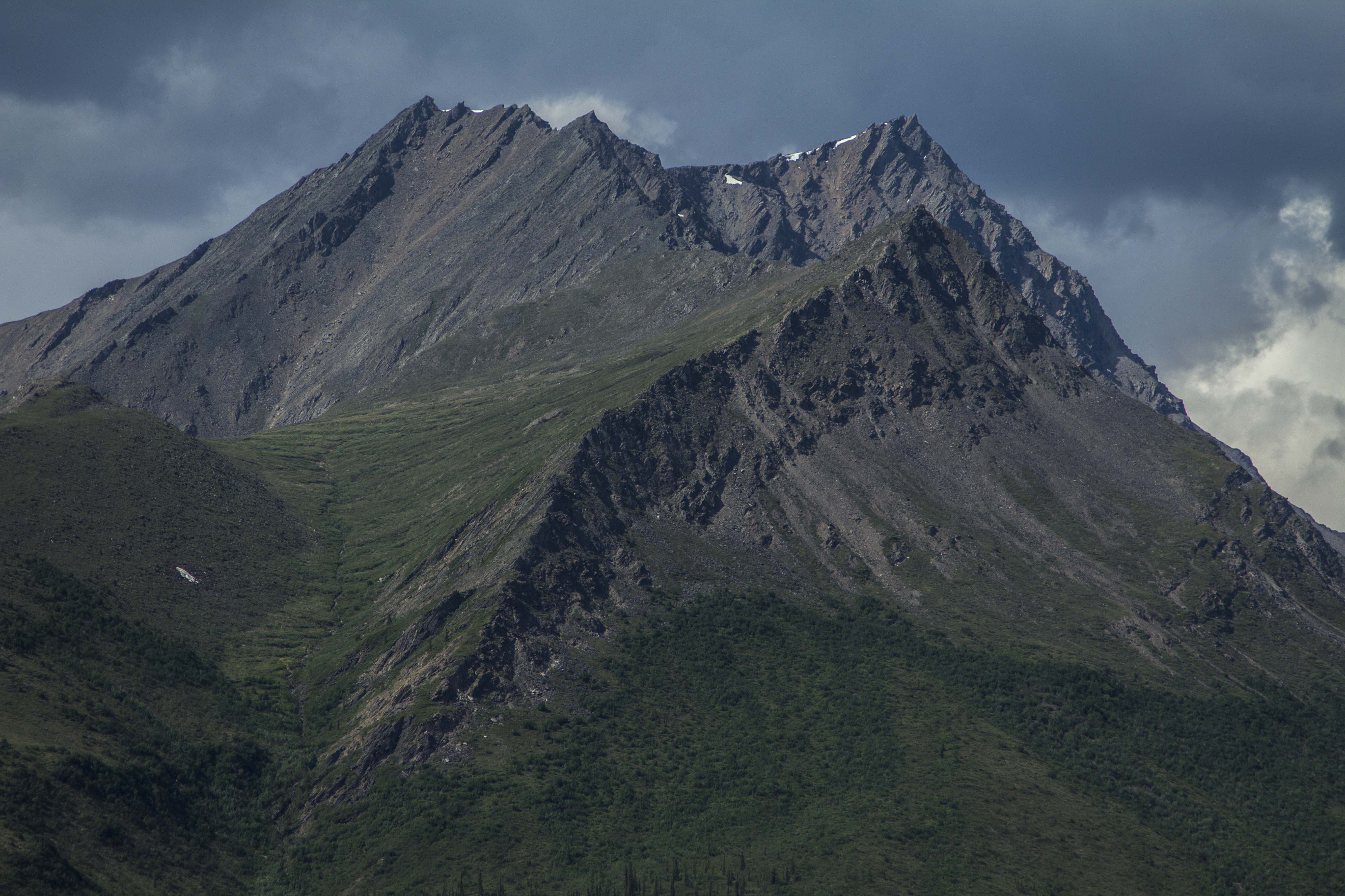
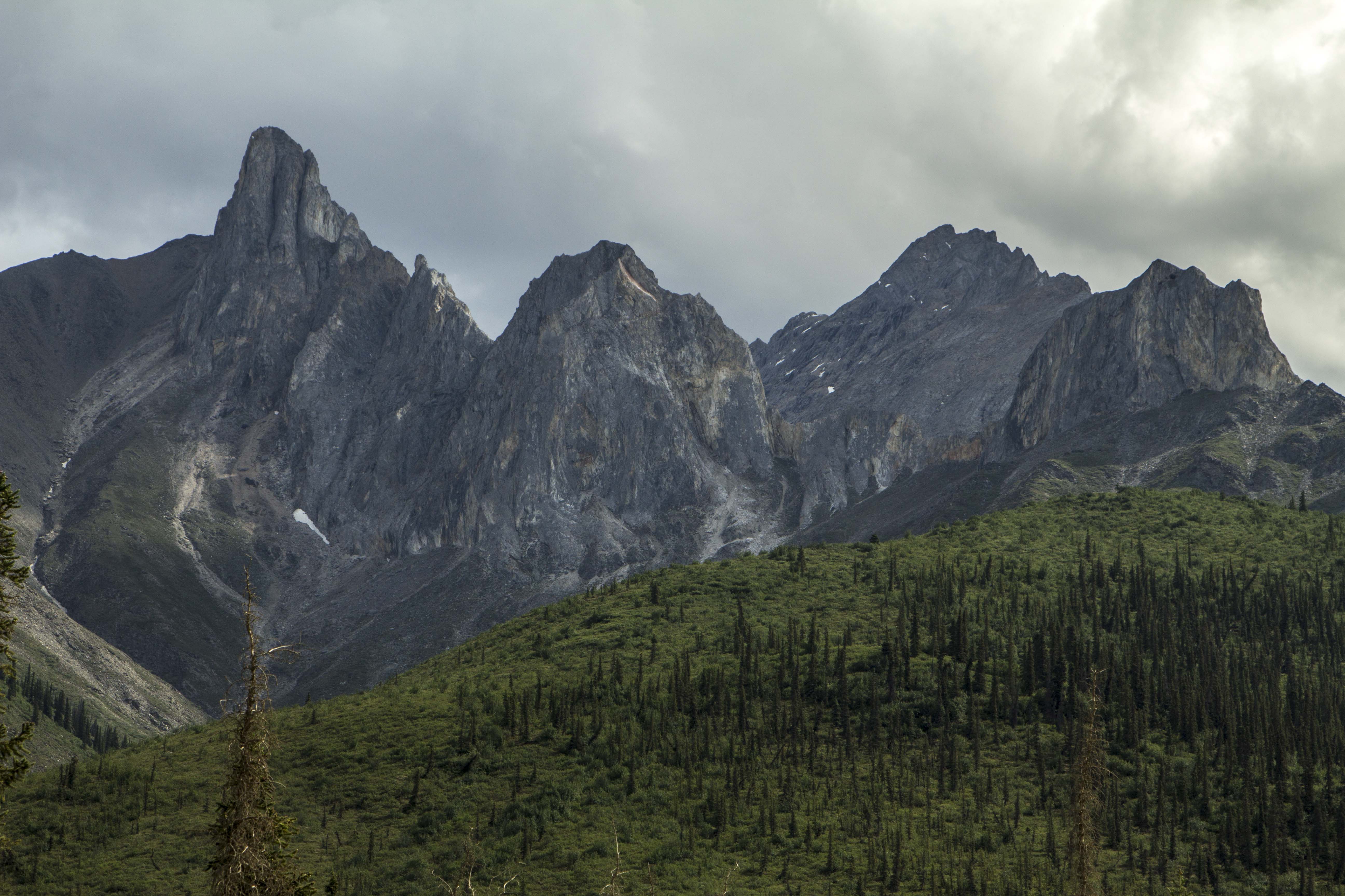
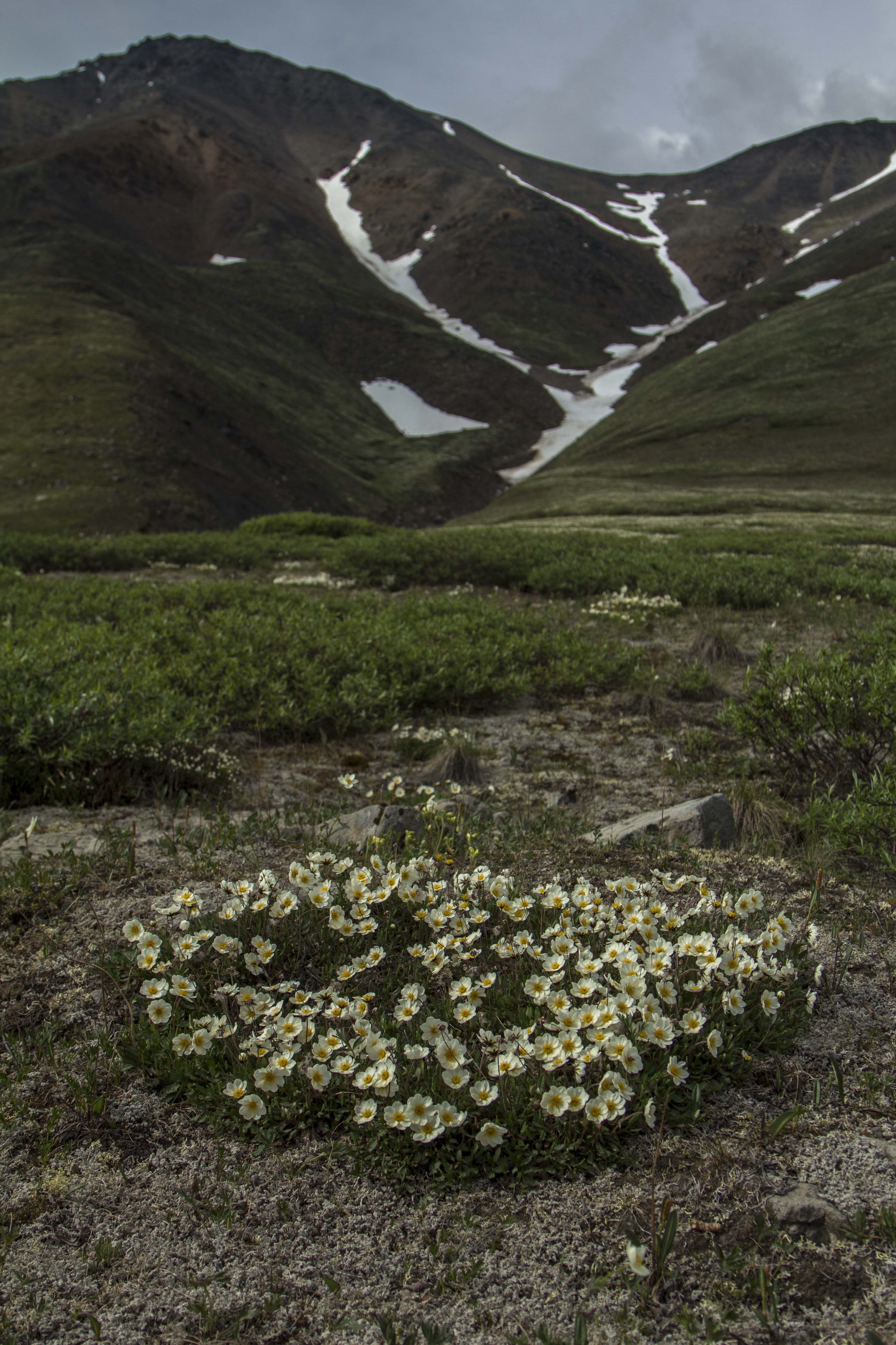
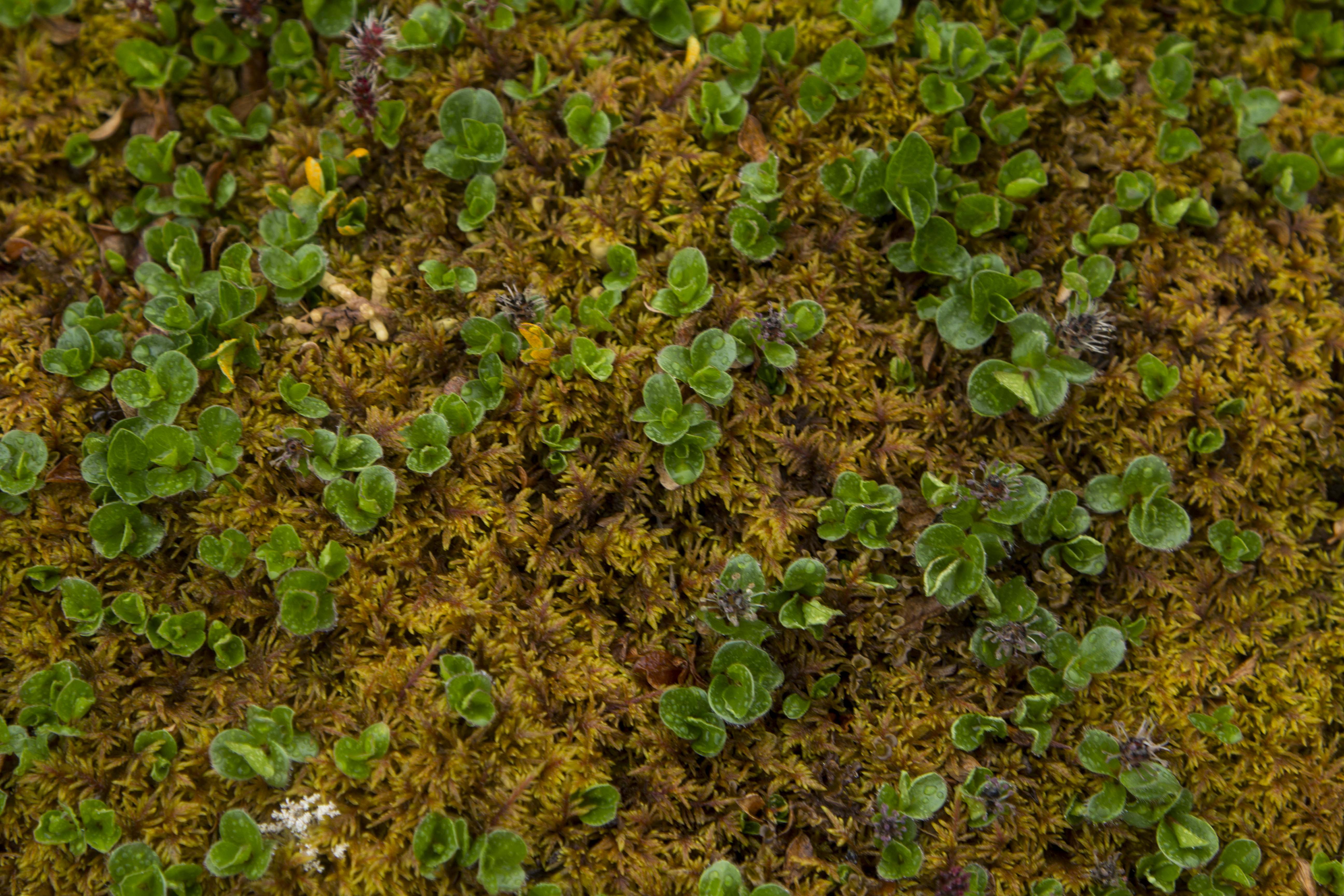
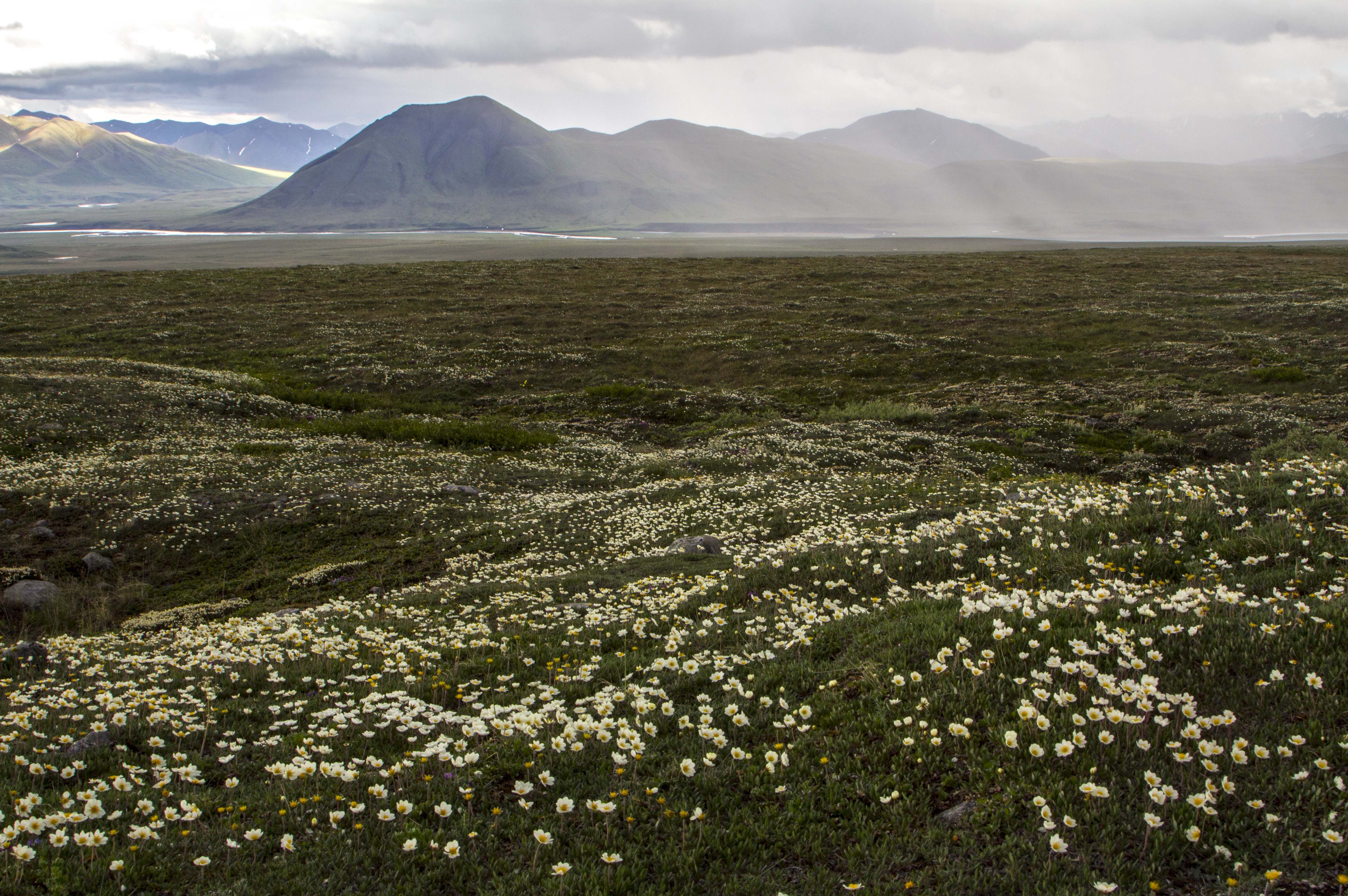
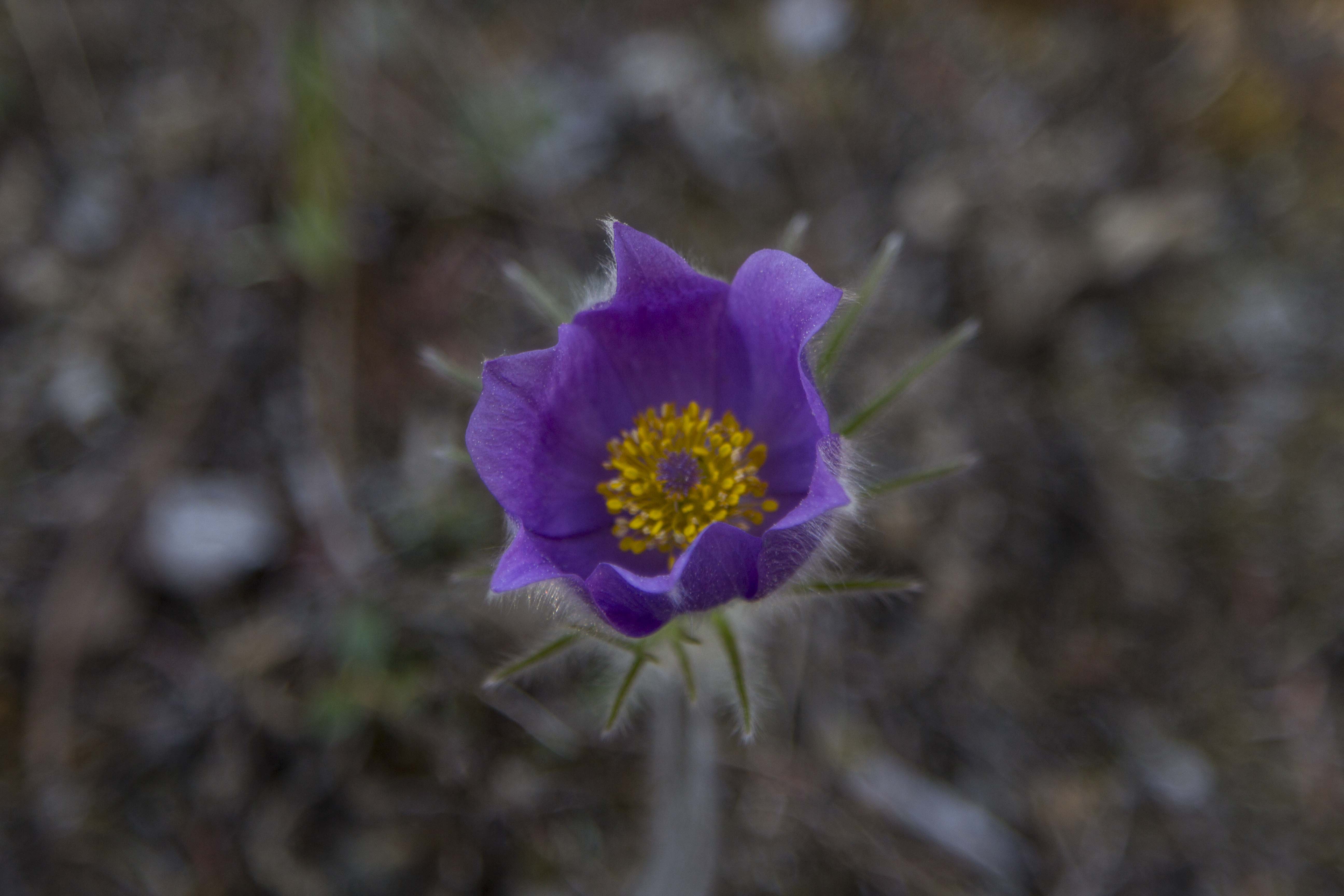
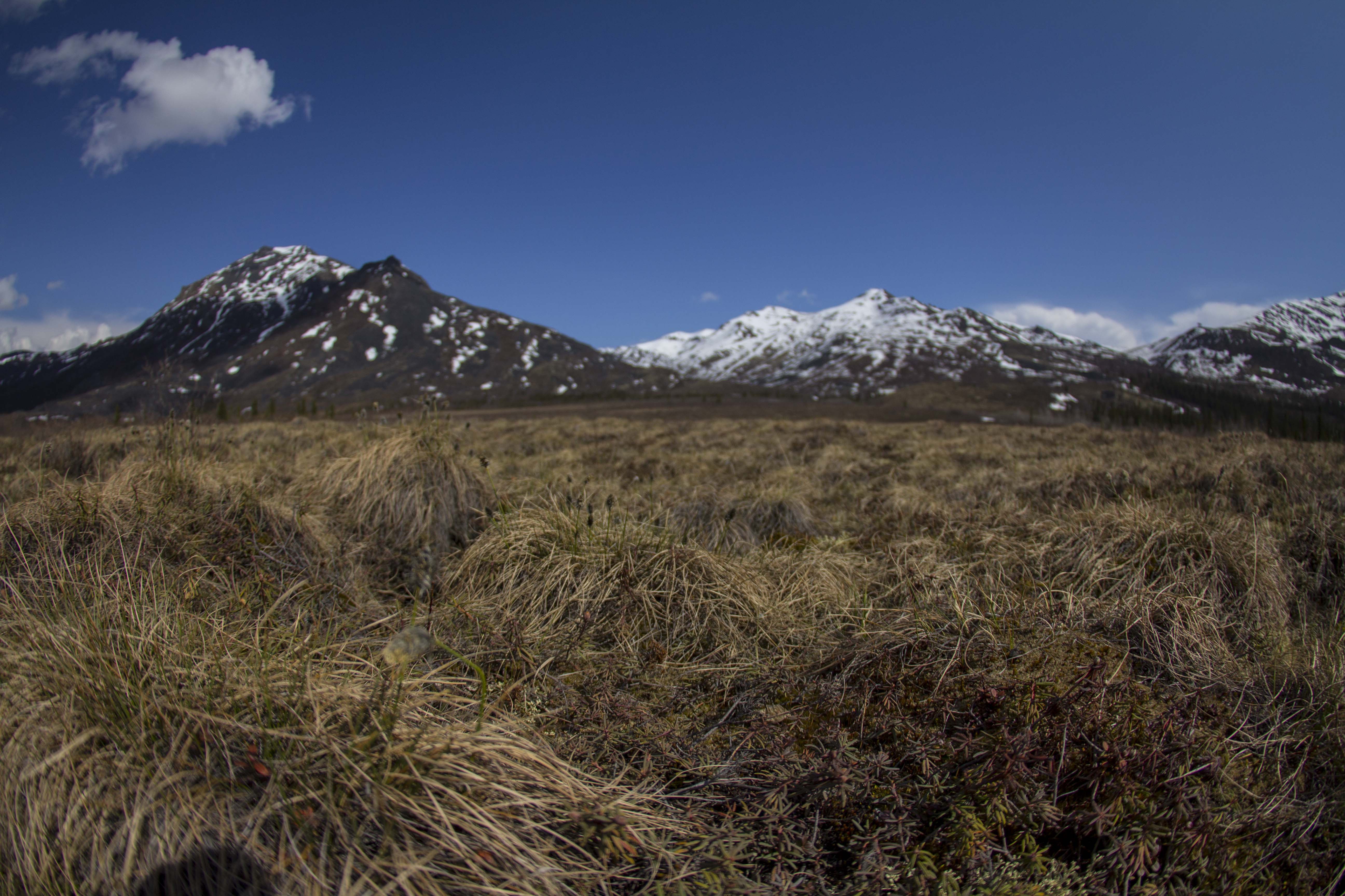
I awake to a deeply silent atmosphere of near whiteout conditions; it is eerily calm. I pack up, and descend the pass slightly to the shelf on the north side and park the Ogre for a hike up to a ridge top. The tundra here is short and squat and is easily traveled upon. It is festooned with tiny wildflowers of all shapes and colors.  I pass the remains of a young Caribou, probably taken by Wolve’s. Farther up, I glimpse down great gully’s of rock towards a massive creek with outstanding waterfalls feeding it’s need to descend into the Atigun River and beyond into the Arctic Ocean. The peaks are mere 6000 footers, but are massive just the same. The Brooks is a dry region, as is the Arctic in general. It really is mostly an Arctic desert. There are a few small glaciers scattered in a couple of places in the Brooks, namely, the Arrigetch Range to the west and the Romanofz Moutains to the north east. But not here. There are thin gully’s of snow descending from the rocky summits of these peaks, providing a striking contrast to their nearly black and orange coloring. Eventually, I descend back to the bike, and continue on, down Atigun Canyon, and onto the great Arctic Plains of the Alaska’s North Slope.

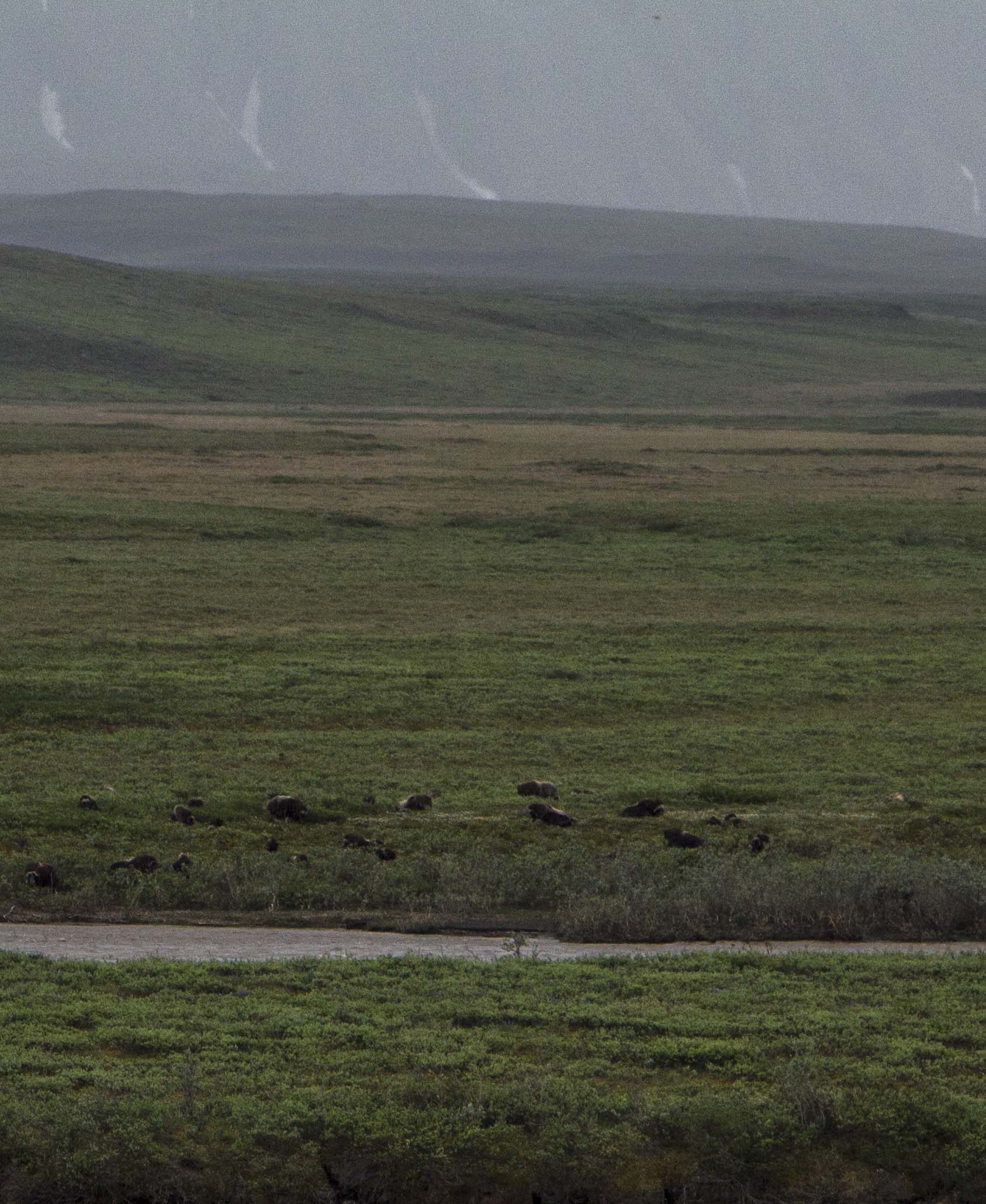
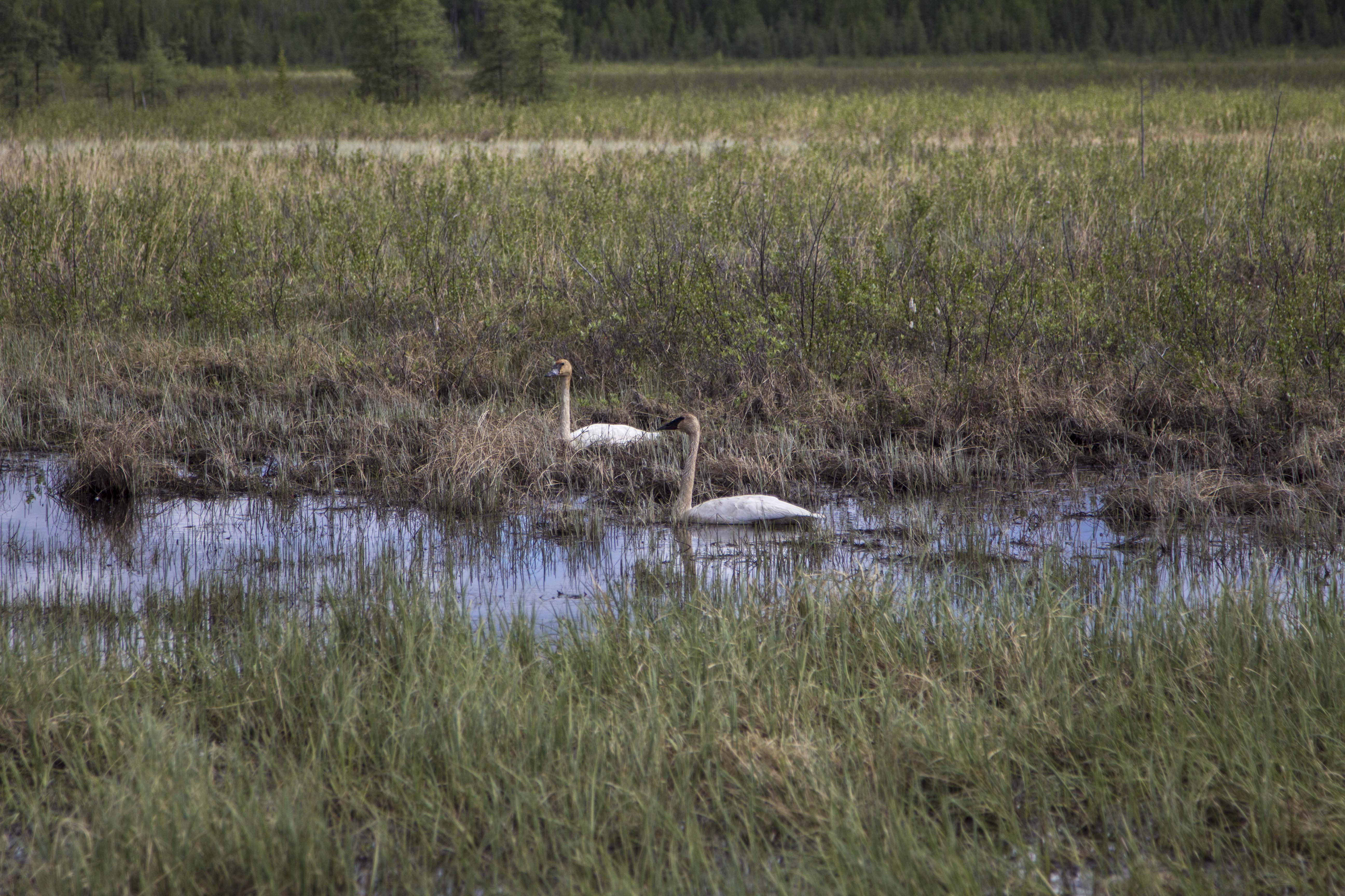
The next two days are flat tussock tundra, starkly beautiful, and swelling with my favorite insects. I still see no Bears, but, plenty of Fox and Caribou.  Alas, I spot a herd of twenty strong Musk Ox; the pre-historic, ice age creatures of the North American Arctic; an iconic figure of strength and endurance in this vast, untamed arctic landscape.

The next day, rolling into Deadhorse, it is 28 degrees F, and 40 MPH winds, but othersise uneventful. Deadhorse is the center of North America’s largest oilfield, which stretches for over 70 miles to the west. Camping looks grim, so I stay at the Prudhoe Bay Hotel, which, for 125 bucks, includes 3 meals and free laundry. I figure it is a good deal here at the end of the continent and decide to pull the trigger. After a fitful night sleep in a strange bed, I pedal out of town a couple of miles and lay the bike down and put out my thumb…

…Later, after no success in hitching a ride back to Fairbanks, I catch an hour and a half flight back to Fairbanks, where, as it turns out, I have a job waiting for me to start right away. So, without time for rest or reflection, I begin work..  Operating a chainsaw in the woods 8 hours a day.  Thing could be worse…

I am happy, but tired…

IMG_2459
Dalton Mud
IMG_2512
Cotton Grass
IMG_2542
Tundra Near Finger Mountain
IMG_2612
The Grayling Filled Jim River
IMG_2650
The Brooks From Above
IMG_2654
Pilot Tom
IMG_2666
Tom and Jane From Washington State
IMG_2701
Sukakpak Mountain

IMG_2429 IMG_2433 IMG_2440 IMG_2443 IMG_2455 IMG_2456 IMG_2558 IMG_2567 IMG_2577 IMG_2579 IMG_2582 IMG_2609 IMG_2610 IMG_2616 IMG_2624 IMG_2634 IMG_2671 IMG_2679 IMG_2681 IMG_2698 IMG_2715 IMG_3124 IMG_3129 IMG_3139 IMG_3142 IMG_3144 IMG_3149 IMG_3162 IMG_3167 IMG_3169 IMG_3188 IMG_3198 IMG_3206 IMG_3218 IMG_3223 IMG_3227 IMG_3230 IMG_3240 IMG_3243 IMG_3254 IMG_3257 IMG_3277 IMG_3290 IMG_3296 IMG_3298 IMG_3317 IMG_3324 IMG_3334 IMG_3345 IMG_3347 IMG_3357 IMG_3361 IMG_3371 IMG_3385 IMG_3399 IMG_3413 IMG_3415 IMG_3434 IMG_3438 IMG_3446 IMG_3447 IMG_3450 IMG_3463 IMG_3465 IMG_3470 IMG_3475 IMG_3480 IMG_3484 IMG_3505 IMG_3515 IMG_3517 IMG_3524

Brooks Range Teaser

Well, I’ve returned from pedaling from Fairbanks to Deadhorse, across the Brooks Range and into the Alaskan arctic; that be told, I’m tired and possibly starting a job for a couple of weeks to earn cash for the continuing journey. I do not have time to do a full update at the moment, but soon come, so check back!  Here’s a couple of teaser shots from the Brooks Range…

IMG_3358 IMG_3163 IMG_3363

Sven’s Base Camp

I bailed out of Delta Junction, a little bewildered and unsure of what next lay ahead. The pedaling is mostly flat, but follows the Tanana River Valley pretty much all the way to Fairbanks. The following morning, I got a fantastic view of the Centarl Alaska Range, but then, it was gone and it was flat forest pedaling for the remainder of the ride into Fairbanks, where I have been a resident now for a few days, getting rested, fed, and organized. After looking online for a Hostel to pitch my tent at, I came across the one I was sure was right for me. I was right! Sven’s Base Camp is a neat little place right in town, so it’s kinda noisy, but it has wall tents, cabins, a teepee, showers, a kitchen hut, and a tenting area. It is surrounded by woods and is shady and somewhat private. It is a relaxing place and is close to amenities one may need. Sven is really nice guy in his mid thirties who moved here from Switzerland 15 years ago. He spends his summers here running the day to day at the Base Camp, but in the winter, he lives in Bettles, AK, a bush village up off of the Haul Road, where he has a Dog Mushing tour business.  He say’s he has around 30 dog’s, but only one accompanies him to Fairbanks in the summer. She’s a real sweetheart girl-dog named Blaze. Sven has made everyone here feel right at home. We have talked a little in regards to me doing a little work around the Base Camp in exchange for a place to stay, and to possibly make a little money as well.

There is another guy staying here, Jim, who is to begin a job on the north coast as an electrician. He and I are  talking of perhaps taking a quick overnighter down the Chena River in a canoe and do a little fishing. Not totally sure on this though as my plan is to leave tomorrow morning for the Haul Road and the Arctic. Sven’s friend, Tommy, who is a Haul Road trucker, picked up my food box containing six days worth of supplies for me this morning, and will drop off at Coldfoot. Thanks Man!

IMG_1948 IMG_1951 IMG_1957 IMG_1960 IMG_2370 IMG_2371 IMG_2375 IMG_2376 IMG_2397 IMG_2405 IMG_2406 IMG_2407 IMG_2409 IMG_2410 IMG_2411

Keep Calm and Carry on

I awoke last night around midnight and lay quietly in the forest. My deep fears festering in the darkest hours of night. Not literally, since it does not actually get dark, but metaphorically. I kept thinking to myself, “How could I be so foolish.” “Where did the envelope go”. Too many possibilities to contemplate. Like in needle in the monstrous haystack of Alaska. I do have a few bucks left, and family and friends have been extremely supportive. But another question kept itching the back of my skull. Is this a sign?  Should I call it quits? Am I in over my head? Or am I just a monumental screwup? These questions kept me awake last night. Angela confirmed to me the notion that these hours can be the worst on a temporarily troubled mind. I know it to be so.

I have decided that I will carry on, the torch of my spirit and the handlebars of my bike. Keep calm and carry on…

Curveball

So I left Dawson City behind.. a town rich in it’s past and present history. I’ll be back. Hopefully to engage the elusive Dempster again at some point. Leaving town around 4:00 pm and crossing the Yukon River on the constantly running free ferry, I was thrown into a world of steep hill climbing that would not let up for another 110 miles. Right off the ferry, the road turns skyward, straight up at angle of about 10-12%. For 8 miles straight without mercy. Near it’s “top”, there is a rest area of sorts and I call it home for the evening. Over the course of the next days’ 68 miles of pedaling, I must have gained and lost 5000′ of elevation, without really gaining or losing any. This highway, a dirt path through the forest for 110 miles, connecting Dawson City, Yukon, and Chicken, Alaska, is known as “The Top of The World Highway”. And for good reason too. The path leads across the bald, tundra coated, ridges and summits of the western Yukon and eastern Alaska “hill country”. The views are stupendous; I now am looking across to the continental divide, 150 miles to the north east. In fact, from this vantage, I can see the Tombstone Mountains that I was forced to retreat from just days earlier. Only this time my view of them is from the directly opposite side and over 200 miles past. It is a  truly remarkable place. After landing in Chicken, in a rainstorm of rainstorms, mud, landslides and all, I secure a Salmon Burger from the tiny grill located there; It is a real surprise to find the food quite fantastic. I chat with the locals a bit and down a couple of beers. I must go back into the forces of the rain, hill climbs, mud, and misery. Back on the bike, the storm eases up a bit, and I begin to find a rhythm that breeds peace. A big bull moose crosses the road in front of me and magic is afoot once again.

The next day, after crossing the flanks of Mt. Fairplay, I turn the corner and am greeted with an unexpected surprise. The almighty Alaska Range is standing before me, clearly demonstrating my subordinance. Once again, I am in awe.

Finally reaching Tetlin Junction at the merging of the Taylor Highway and the Alaska Highway, it occurs to me that the hill climbing is over for the next several days, as, if memory serves me correctly, the stretch between Tok and Fairbanks is flat pedaling, but a spectacle of the foothills of the Alaska Range. This combo makes for some blissful times indeed.

I spend a couple of nights in Tok, at my old camp in the woods to the southwest of the school. I always have, and do now, find Tok and this part of Alaska in particular, very satisfying. It’s close proximity to the Alaska Range, great country side, and a relaxed atmosphere is unique, even for Alaska. It’s winter’s are another matter, however. Locals confirm it’s reputation as a scene of brutal cold; Winter time temps of -60F are not just occurrences, they are outright common. Land is cheap here, there is no sales tax, no property tax, no building codes, and no jobs. Sounds like a good place to retire to for part of the year.

Moving on, I head north along the northern and eastern flats below the impending Alaska Range. The creeks are plentiful and crystal clear, and I drink copious amounts of water from them; gorging myself on their nectar. Another night of thunderstorms and another morning of packing it up in the rain today. It is getting to be routine. I am finding myself able to pack it in with my eyes closed. Later in the day when the sun is out, I pull out the fly and it dries while I snack. No big deal.

I am now in Delta Junction, camped on the gravel beaches of the wildly braided Tanana River, looking to the south at the appearances of my favorite mountains on Earth.The central Alaska Range’s  Mt’s Deborah, Hayes, and Kimball, all are reaching upward in an attempt to put on a show for me, but the storm just won’t have it. I have never seen this side, the north side of these peaks, and I decide to camp here tonight in hopes of catching a time-lapse of these marvelous peaks in the morning, with the sunlight splattered across their eastern escarpment and embellishing their glacially clad, icy armor.

What’s up next, You ask? Perhaps an adventure up the Steese Highway for a trailride on the Pinnel Mountain Trail and the Circle-Fairbanks Trail. Or perhaps it is time again to settle the score with the Arctic once and for all, and head up the Haul Road, into the Brooks Range. I don’t know yet.

You’ll know, when I know…

Well, now I know, well, sort of… Life just threw me a curveball.  I awoke this morning and while packing up and getting ready for a northward stint, I noticed that the envelope containing 90% of my cash is gone. I knew instantly that this was not a case of misplacing it within my kit, but one of absolute disappearance. I spend the entire morning on the phone to all places past I had visited and with no avail. I suspect it is a case of carelessness on my part; possibly left at the counter of a shop somewhere in Tok, or who knows where. Maybe it fell out of my bag when I pulled over to take a photograph. I just do not know, and suspect I never will. Either way, it is gone, and so is this journey, at least in it’s current fashion. Again, Ill let You know when I know. If by chance there is a person out there who knows something of an envelope labeled only “Trip”, that contains nearly 4000 dollars in cash, gimme a call.. Please! (435) 260-1990.

That’s all I have to say at the moment.

IMG_0800 IMG_0814 IMG_0827 IMG_0840 IMG_0845 IMG_0858 IMG_0862 IMG_0871 IMG_0875 IMG_0877 IMG_0883 IMG_0886 IMG_0892 IMG_0899 IMG_0906 IMG_0909 IMG_0911 IMG_0916 IMG_0934 IMG_0939 IMG_0940 IMG_0942 IMG_0950 IMG_0979 IMG_0986 IMG_0993 IMG_1005


Success and Failure on the Dempster

After a relaxed evening camped on the outskirts of Dawson, I get my nylon ghetto packed up and myself into town for the prep errands necessary for the Dempster Highway. Make calls, update website, buy groceries, get package together to leave at Interpretive Center for a passer by to pick up and drop off at Eagle Plains. Out of town by 3:30 pm… Pedal the 25 miles back to the Dempster I had ridden yesterday.

About 5 miles from the Dempster, a monstrous thunder storm ensues, dropping copious amounts of rain along with it. At the Dempster junction, there is the Klondike River Lodge, but it has unfortunately burned down this last winter. I figure it will at least serve me to stand under the fuel pump overhangs and dry off a bit.  The storm rages on, and a French-Canadian Man pulls up in a ragged truck, just to make sure I am not in peril. I assure him I am fine and away he goes, heading south.  The storm continues to increase it’s fury, and I find myself gaining courage in investigating the seemingly abandoned trailers across the compound. The trailers are empty, dry, and warm. But I am apprehensive about invading someone else’s space even if they are clearly not around. So I stick to the porch… and drink up some of my precious beer supply-next beer, Inuvik.

About 8:00 pm, the storm passes over and I decide to roll on down the Dempster a bit and find my home for the evening. An old gravel pit will do just fine, and I camp.

The following morning is glorious.. I feel so lucky to be here now. It is early in the season and I am positive I am the first and only cyclist on the Dempster this year.  I pedal across the North Klondike River and dive into the Dempster.  Rolling through the upper Yukon’s boreal forests and into the heart of the Tombstone Mountains, I stop at the trailhead for Grizzly Lake, where I stash a backpack I have been carrying all this time in order to make a 2 or 3 day trip into the wilderness.  I had planned on doing this now in fact, but there is way too much snow too contemplate. Besides, the trail has been closed due to flooding. I hope this is not an omen of things to come. So, for now, I stash the pack in hopes of hiking in to Grizzly Lake on the way back from Inuvik.

On down the road, I stop at a fine little stream and strip down for a wash. Suddenly, an unexpected tour bus rolls past, slowly at first, I am standing there naked and wet and grinning and waving. The driver accelerates quickly in order to avert his touron’s eyes from the crazy, blasphemous Mountain Man, who is grinning shamelessly at them.

I pedal most of the steep climb of North Fork Pass to the Tombstone Mountain Overlook. At 4800′, it is the Dempster’s highest summit. I camp here due to it’s spectacular views and shoot a time-lapse of an approaching storm, moving over Tombstone Mountain and Mt Monolith.

I awake the 2nd morning to clear skies, but that changes very quickly. However, the weather manages to hold for several more hours, and I am able to pedal on, unmolested by the rain. Over the last bit of the summit, and crossing the Continental Divide, I am thrown into a world of fairytale peaks surrounded by tundra.

The Dempster Highway is the northern most road in Canada, and one of the 2 northern most roads in North America, the other, being the Haul Road (Dalton Highway) in Alaska. Like the Haul Road, the Dempster also crosses the Arctic Circle and additionally crosses and enters the largest river delta in Canada, home to the 10th largest river in the world and the third largest in the western Hemisphere: The McKenzie River. It ends at the community of Inuvik, Canada’s northern most village accessible by vehicular land travel. It is a dirt and gravel road that traverses 500 miles, one way, some of the most intense wilderness one can encounter.

Eventually, I pass through a small,yet majestic little range called the Taiga Ranges, a beautiful set of high alpine mountains, with the Dempster passing through it’s boreal forests, river valley’s, and above timberline area’s, where Marmots and Collared Pika’s chirp as I wheel past. It is stung scenery and I climb the 2nd pass of the Dempster, Windy Summit, at 3500′, and down it’s back side for a ride of many miles through more forest and unbeatable mountain scenery.  The Ogre glides silently northward, as if a giant magnet is pulling us both, onward and into the Arctic.  I see a moose, then another. Then a Blackie, then a Hare. Then I spy a Golden Eagle, a first for me. Ptarmigan’s are squawking at me, no, singing to me as I move into their turf. I see wolf tracks, then tracks of the moose it is following.

It begins to rain, briefly, but stoutly, and after 76 dirt road miles today, I pull into Engineer Creek Campground which is closed, and I utilize it’s cooking shelter to dry off, cook supper, and get re organized. Fantastic Dolomite cliffs festoon the nearby ridge, known locally as Sapper’s Hill. I find out that the road up ahead is washed out and closed. My only hope is that a bicycle and it’s operator might find a place to wiggle past said washout, and pedal dance onward.  At the moment, I am just about one quarter of the way to Inuvik; if I can keep up the pace, I’ll have made the trip in 8 days. Then there’s the return trip.  Backtracking has always been tough for me and I’m sure that the return trip to Dawson of 500 miles will be no less challenging. Ultra long distant travel via bicycle has it’s ups and downs like anything. The biggest struggle for me, at times, is simply the mental willpower to keep going, when you haven’t had a decent meal in 4 days and your stock is low, everything you own to wear is filthy and your body stinks like hell and you are sore everywhere, especially the backside. Did I mention the rain? Everything is soaked, including your tent and sleeping bag, not to mention you. But I love it, really. I love being in these places that it affords. It is an experience similar to that of multi day big wall climbing, where, one is immersed into the vertical realm for days on end, complete with it’s discomforts. This is no different, except that there is no fear factor, really, not when compared to scaling the big stones.

I decide to sleep in the abandoned campgrounds’ screened in cooking hut, and investigate the road damage in the morning.

I awake, and feel as though I have had a stay at the Hilton, and have a leisurely breakfast and pack up the Ogre in a nice, dry, state. However, 2 1/2 miles up the road, the entire trip changes course. After crossing the Ogilvie River, and passing the “Road Closed” signs, I am greeted by a man in a pickup, who pulls up next to me.

“Can’t You read?”.

Yes Sir! I CAN read, Yep!

“Can Ya’ swim?”.

Uh, Yessir, I can swim too!

“Well, that’s what You’ll be doin’ on up ahead, cuz The Ogilvie is runnin’ across the road now. I can’t let You pass on till the water drops and we can do repairs. I might be later today, but it might not be. Best you hole up back at that campground and settle in. I’ll let you know when the road is open”.

He was very firm on this and was not about to let me pass, so I turn tail back to the cook hut and here I now sit, writing and waiting. Even if the road were open, I would be cutting it very close on food, as I do not believe my food package ever made it out of Dawson, since no one is heading this way due to the washout and it being seriously early season. In fact, the river’s are half froze over still, and the lakes are too.  If the road does not open by tomorrow morning, I will have no choice but to high tail it back to Dawson, get re grouped, and head for Alaska.  This is a major disappointment for me as I want to see this Canadian Arctic soo badly…

Sometime later, a pickup with 4 nice folks from Idaho drop in and inform me that the road crew has told them that the road will be closed for at least 2 or 3 more days. I must turn back. The only question is how…Even though my short stint with this part of the Yukon has been thwarted, I am thrilled to have seen even a little of it. I have seen enough to know just how glorious it truly is and I shall return. I toss my bike into the back of their truck, and what took me 3 days to pedal, flies by at warp speed and I am deposited back into the land of Robert Service and Jack London; Good ‘ol Dawson City.  I drop by the Interpretive Center, and there is my food box, still waiting.

Off to Alaska…

IMG_0151 IMG_0165 IMG_0171 IMG_0181 IMG_0187 IMG_0197 IMG_0200 IMG_0215 IMG_0224 IMG_0227 IMG_0647 IMG_0648 IMG_0659 IMG_0661 IMG_0674 IMG_0678 IMG_0680 IMG_0683 IMG_0690 IMG_0691 IMG_0693 IMG_0701 IMG_0706 IMG_0715 IMG_0720 IMG_0723 IMG_0733 IMG_0734 IMG_0749 IMG_0751 IMG_0755 IMG_0760 IMG_0762 IMG_0769 IMG_0773 IMG_0776 IMG_0777 IMG_0780