RAVENS ON THE GULKANA

By Linus Lawrence Platt


It had been over two years since the Over The Hill Expeditions gang had gotten together to hit the hills so to speak; in 2019 it was an attempt to climb and ski Mt Sanford (16,237′) the second highest peak in the Wrangell Mountains of South Central Alaska with Rich Page, Jeff Rogers, and Cameron Burns. It was trip filled with good times, friendship, and adventure regardless of our not reaching the summit. After the Sanford expedition, Rich and I conjured up a trip idea for an attempt on the East Ridge of Mt Hayes to take place the following spring, but the plandemic took shape, I lost my job, and the notion to climb Hayes pretty much went up in smoke. Disgusted with too many things about Haines, I built a custom tiny home/camper (dubbed The Raven), sold my house, and hit the road for Fairbanks to re-locate. It was later in the spring that the plan to do a packrafting trip of some sort in the summer or fall of 2021 was born.

Rich, a former Denali guide from Colorado, managed to free himself from his business, Savage Gear, in North Conway, New Hampshire, of building packs and repairing outdoor gear and bought a plane ticket to Fairbanks for the end of August. Thinking a third person would be fun, I invited my friend Chris Gavin from Baltimore to join us on an adventure. Chris and I had first met in Fairbanks in 2017, and we had remained in contact ever since. We had often discussed doing some type of backcountry trip together, and when the notion of the Hayes trip was born, Chris agreed to be a team member, but of course that expedition never saw the light of day. For 2021, Rich and I mused over several possibilities, initially considering something in the Brooks Range, but the time frame for this trip dictated something further south, and we finally settle on paddling the Gulkana River from its source near Paxson Lake in the Alaska Range all the way to its terminus at the Copper River at the foot of the Wrangell Mountains in South Central Alaska. The Gulkana River is a beautiful Class II-IV river that flows through the dense boreal forests of Central Eastern Alaska, ancestral home to the Athabascans, and a major tributary to the world famous Copper River.

After losing my job in March 2020, I spent an entire year building The Raven, remodeling the house for re-sale, and modifying and repairing both vehicles for my departure in April 2021. It was an exhausting period with little time for much else. For me, leaving Haines and relocating to the interior was no simple task; I had two trucks, a home built truck cabin, and a cargo trailer that held my carpentry tools and the bulk of my belongings. It took the last year in Haines selling, giving away, and throwing out material possessions to make this happen. In a time when most Americans are busy collecting things and spreading out, I am quite content, ecstatic in fact, to be reducing my world load and becoming as compact and efficient as possible. Even still, not one, but two trips had to be made to Fairbanks. The first would be in the Toyota truck pulling the cargo trailer and stashing both at my good friend Tony’s place in Fairbanks, then flying back to Juneau, taking the ferry back up to Haines, and repeating the process; the second time armed with the Ford F250 and The Raven, my custom made truck cabin built with Alaskan winters in mind. Of course, with Canada closing its borders to “non-essential” travel (all travel is essential, for one reason or another) this made for a tricky escape out of Southeast Alaska. Luckily, my buddy Sven wrote me up a semi-fake employment agreement, and by the skin of my teeth, I made it across the Canadian border 40 miles from Haines. When I finally got back across the Alaskan border and arrived in Tok, I literally got out of the truck and kissed the ground. Back in the Real Alaska… After arriving in Fairbanks, I got a post office box, changed my driver’s license, car insurance address, and vehicle registration. And just like that, I was now a resident of Fairbanks, ensuring the Canadian Border Robots would give me a pass on the 2nd trip. My primary concern after the fact is that they would remember me from the week prior (I have a very unique and somewhat memorable name) Alas, it was a non-issue and and before I knew it, The Raven and I were camped along the Gerstle River near the Alaska Range in one of my favorite parts of the state. All said and done the escape from Haines was literally the single most difficult task yet in my lifetime. Not long after, Angela boards a ferry with her truck bound for Whittier, and makes the drive to Fairbanks. She too had felt the need for something different than what Haines has to offer.

Haines, Alaska… well sort of Alaska; it feels a bit more like a Canadian province than a de facto Alaskan town, is a beautiful place indeed, but contrary to the arrogance of its locals, Haines does not in fact have the monopoly on “Alaskan Beauty”. In fact the Central Interior with its majestic mountains, enormous glaciers, rivers, forests, and expansive valleys are far more appealing to this soul. As are the people and the weather; I found Haines, and by a margin, the people (especially the outdoor adventure community) of Haines to be somewhat cavalier and impudent. Obviously this does not apply to everyone; there are a number of Haines-folk whom I hold in high regard and have the deepest respect for (you know who you are). The winters are heinous for the most part, where it will snow, then rain on top of snow, then freeze, then turn to ice, then repeat… all winter. I’ll take minus 20 degrees F in the semi-dry subarctic climate of the central interior over the plus 30 degrees F and 90 percent humidity of Haines any day of the week. After nearly 8 years living in Haines, I’d had enough. So back to from which I came was in order (I’d lived in Fairbanks for a stint prior to taking up in Haines).

The entire spring and summer was filled with many, many work and carpentry projects for my good friend Sven at his Hostel, converting an old cabin into a genuine public espresso shop, getting my own scene together on my friend Tony’s land at a place I now dub The Raven’s Roost, cutting firewood for the impending winter, and countless other activities regarding work and life preparation. In between all of this, I still managed a day trip to the Alaska Range, a three day fly-in trip to the Brooks Range, a two day pack rafting trip on the upper Chatanika River with Sven, another 2 day driving trip to the Brooks, and several other hikes and forays into the fantastically beautiful White Mountains just outside of Fairbanks. The Raven’s Roost is a good place to throw down for an undetermined amount of time; it sits on several acres of boreal forest, is mostly quiet and private, is close to town (3-5 miles), and on appropriate days, just down the hill from my place, one can see all the high peaks of the Central Alaska Range dominating the skyline.

By the time late August rolled around, I was deeply ready for a needed break; I had only paddled once all summer, and it was a good one. Sven and I paddled a great two-day trip down the upper Chatanika, a beautiful class II paddle on the edge of the White Mountains where we paddled for almost 11 hours straight the first day, finally landing on a good camping beach where we roasted sausages on an open fire, sipped whiskey, and had some laughs.

On August 26th Chris Gavin flies in and having a few hours to kill, we step out for Thai food at the consistently great Lemongrass Restaurant, followed by a tour of my Raven tiny home. Once Rich arrives a few hours later, it’s game on to get organized and gear together at Sven’s hostel. The next couple days are spent roaming town in search of this and that, generally followed by a steak or Sockeye Salmon BBQ from when Sven and I had dip-netted in Chitina weeks before.

August had been a typical rain-fest, and honestly the weather was downright miserable (this IS Alaska after all) in the days before we headed out for the drive down the Richardson Highway toward Paxson Lake, but as luck would have it, the clouds part the morning we start driving and one might even consider it a beautiful day. With Chris and Rich driving my Toyota pickup, and me in the lead driving my big Ford diesel, we caravan south through arguably my favorite part of the state. It is here that the Richardson passes through the Central/Eastern Alaska Range and has been the scene of many mountaineering and hiking adventures over the years. Our destination and put in is Paxson Lake, just south of Isabel Pass on the Richardson Highway about three hours south of Fairbanks.

Paxson Lake is fairly large glacially fed lake in Alaska’s interior that is about 12 miles long by about 4 miles wide, and is home to Lake Trout, Dolly Varden, Northern Pike, Burbot, two species of Whitefish, Arctic Grayling, and hoards of spawning Sockeye Salmon from June through September. There is also a King Salmon run in June. The BLM operates a campground and a boat ramp on the east side of the lake, so we opted to spend the night here and get ready for the several mile flat lake paddling tomorrow. The Gulkana River begins its life born from Summit Lake a few miles to the north, where it runs very thin down a treacherous class IV canyon before entering Paxson Lake, where it drains at the Lake’s southern end.

Late that night, from a deep slumber within my tent, I hear Chris outside trying to wake us as the Aurora Borealis is out and wildly going off. I dress quickly and scamper out; the sky is ablaze with one of the true gifts from the north. Chris and I decide to take a walk to the lake shore to catch the show, and seeing the brilliance dancing above the peaks of the Central and Eastern Alaska Range reminded me of why I live in such a beautiful, challenging, and sometimes inhospitable place. Alaska is a genuine treasure 12 months out of the year, and calling its interior my home is something I am extremely happy about and proud of. After the show fizzles down, we walk back to camp and hit the rack.

The morning of September 1st, Chris and I do our truck shuttle to Sourdough Camp further south down the Richardson Highway; luckily we have two trucks so this is an easy operation, save for one minor detail. When Sven and I had gone to Chitina to dip net for Sockeye weeks earlier, there was and still is a major road re-construction of the Richardson, with multiple delays along a 20 mile stretch. I had completely forgotten about this fact when Chris and I rallied south, but ultimately it only added about an hour to the task.

Back at Paxson, Rich has everything laid out and we pack the boats, inflate, and hit the water.
It feels good to paddle and luck is on our side with no headwind. After a couple of hours on the lake, we reach the beginning of the Gulkana where hundreds of Sockeye are spotted in the depths beneath our rafts. This clearly a spawning bed, with as many dead fish as alive. We pull off to a bear trampled area and have a welcomed lunch.

The next section is the real beginning of the Gulkana proper with long, fast and fun sections of class II waves and rollers. After a spell, an old trappers cabin from the late 19th century gold rush era appears and adorning a nice flat and grassy camp spot. We pull off and settle in for the night. The weather is now certifiably glorious and watching the sun set behind the Taiga sees me happily drifting to sleep. Later in the evening, a Cow Moose and Calf zip right past my tent and fjord the river. More Alaska wonderment that makes everything seem all the more special.

The morning brings ethereal mist and mesmerizing light over the enchanted Alaska landscape, and later in the morning we see more Moose both in the river and in the woods on shore. The critters are out and about. This next section is fairly slow and twisty as the river makes its way through the thick taiga of the upper Copper River Basin; an immense area that once held the enormous prehistoric Lake Atna that formed during the Wisconsin Glaciation period more than 40,000 years ago. The lake was formed when what is now the Childs Glacier grew and subsequently dammed what is now the Copper River. After the glaciation period ended, the glacier receded, draining the lake. The Lake Atna basin is fairly flat and covered in Boreal forest with several remnant lakes remaining, one of the largest of these being Lake Louise, a popular fishing and camping destination for Alaskans during both summer and winter. Later, a few splashy sections follow here and there just to make sure one is paying attention, which we must do in order to spot the take out for the upcoming Gulkana Canyon portage. I had been eager to get to this place in order to scout the Gulkana’s biggest rapids in hopes of running them, but after close inspection, I decide that it is better to portage and live to paddle another day. These class III/IV boilers and pour offs looked dangerous to me, and being at least 40 trail-less miles from the highway means be fucking careful.

This section of the river at the canyon was a special place for sure; the roar of the rapids, the granite walls and boulders, the Bear trails, fishing holes, and great camping spots impose upon us the idea of doing no paddling at all the following day and instead do some hiking, fishing, and relaxing.

A nice late sleep in the morning followed by a lengthy round of coffee finds us wandering Bear trails up river to have a good hard look at the Class III/IV chaos in the main canyon. The roar is deafening in spots and there are good side trails leading to the waters edge for close inspection of the drops and hydraulics. I had it in my mind that I might reconsider running the canyon rapids today. One very noticeably absent feature of this canyon is any trace of a real eddy line. On the contrary, there is a significant undercut that looks difficult to avoid. I stick to my decision not to run it, and Chris, who also had notions of running it today, decided to duck out as well in the interest of group safety being this far out from rescue or medical attention. Rich did bring along his Garmin InReach GPS communicator for emergencies, but regardless, pushing the envelope seemed a bit reckless to me. It might have been different if I had been paddling a ton all summer, but sadly this was simply not the case. Upon returning to camp, Rich surprises us by whipping up a batch of Cinnamon rolls on the MSR stove, complete with sweet frosting and hot coffee. We sit with our treats and listen to the roar of the river and I watch as a pair of mated Ravens chase one another through the treetops, each one changing the conversation between them frequently with yet another sequence from their extended vocabulary. The Ravens always have a special place in this world to my thinking and Ravens on the Gulkana that much more so.

A bit later, Chris and I decide to hike up to Canyon Lake, for which there is actually a trail, which in most parts of the Alaska backcountry is pretty much unheard of. The “trail” as it turns out is a muddy, rutted Moose path complete with anticipated bushwhacking. We reach the tiny little lake and being somewhat underwhelmed by it’s size and presence, we turn back and head back to camp. Later, we glance at the map, and Canyon Lake is a much, much bigger body of water no more than 5 minutes further past the pond we visited. Ah well…

Next, we decide to partake in an effort to catch some fish for an anticipated fish taco feast later in the evening. Chris and I grab rod and reel and head downstream to a hole we had spotted earlier on our hike. The very first cast I nab a 17″ Rainbow Trout, and over the course of about 10 minutes, had another smaller Rainbow, and two nice Graylings. All caught using spinning gear with a small sized spoon. Four fish is plenty to feed the three of us for supper I reckon. After cleaning the fish, I build up an existing campfire ring with more river rocks to create a nice oven-like enclosure. Next, a trip up the hillside to a stash of firewood I had spotted earlier, and we were ready. I crank up the fire, wrap the fish in aluminum foil, sprinkle with olive oil and salt, and crack open the bottle of whiskey for a round of shots between us as we feed the fire and wait for the ensuing coals to develop. Soon we are munching delicious fish tacos and feeling quite content. Later, Rich, in his usual Denali mountain guide style, puts together a grand cheesecake adorned with fresh blueberries picked on site, and serves it up adorning his fake hillbilly halloween teeth set. A good laugh was had by all and as darkness set upon us, we hit the sack. At 2 am I hear Chris outside rummaging around and rapping about the explosion in the sky. I’m out of the tent in a flash and setting up camera and gawking at the miracle above. The Aurora was out and taunting us again, this time spread across the sky in a dazzling display of brilliance and color from horizon to horizon.

In the early morning hours, I wake to the pitter patter of a steady rain on the tent, shrug it off, and roll back asleep. At 9 am, still in the tent, the rain seems to be letting up, but the silence in camp is tell tale; no one in camp is eager to get up and pack things up wet. As many hundreds of nights I’ve spent in the wilderness and packing it in wet, the task eventually becomes routine, yet is never enjoyable no matter the level of efficiency. After a damp round of coffee and breakfast, we pack it in and hit the water. The rain has all but stopped, but there is a chill in the air that has mostly been absent so far on this journey. For the first time, I’m wearing gloves and beanie, and under my drysuit are layered clothing. The river is outstanding today… loads and loads of twisty rapids, beautiful scenery, and the ever present sensation of being deep into an Alaska back country adventure.

In looking for a camp spot on rivers, I like the sort of gravel beach that meets certain criteria; the size of the gravel need be small, not too many fist sized rocks, but a good mix of gravel, a little sand, and possibly a few larger rocks for a wind break if a fire is desired, and I always look for stashes of driftwood to make said fire. Additionally, I look for ones that are elevated a bit from river level… not much, perhaps only a foot or two to keep a potentially fluctuating water level at bay. Of course it must also afford flat areas for pitching tents and such. Luckily, the Gulkana is graced with many of these aforementioned bivouacs. On this day, it seemed we had been paddling for a very long time; it wasn’t any longer than the other days, but we were all feeling a bit exhausted and felt accordingly, so when an ideal camp appears meeting the above requirements, we pull off, set up tents, and build a nice fire, mostly just for the psychological comfort a camp fire can provide. The nearby river line is dotted with extremely large King Salmon skeletons and skulls, remnants from the run many weeks earlier. A Grizzly Bear track or two lets us know we share this beach with others. The sun sets and a brilliant display of color paints the sky over a vast section of taiga adjacent to our camp as I crawl into my nylon cocoon and sleep like the dead.

The next day, we anticipate making it to Sourdough where the truck is, and within a few hours, it comes around, and after deflating packrafts and peeling off drysuits, we pack the truck loosely, pile in, and head to Glennallen about 35 miles down the Richardson. After picking up dinner supplies, diesel fuel, and beer, we drive back north to Sourdough and setup a fine truck camp and have a feast of New York Strip, baked potatoes, and a much welcomed salad. Anything but the usual backcountry food and freeze dried meals we normally carry was a treat to the tastebuds and body.

After breakfast and coffee, we decide to keep paddling to at least the Gulkana River bridge near the native village of Gulkana, where the Richardson Highway passes over the river. Many of the accounts we had read spoke only of the section of river north of Sourdough, as the BLM designates that section as “wild and scenic”, which is really nonsense, since the entire river certainly meets that description. To our absolute delight, the section of river south of the “scenic and wild” designation, and the section that few people paddle, turns out to be possibly the best section of the entire 85 miles of river. The river at this point is twisty, fast flowing, and full of many, many class II/III splashy sections. Furthermore, the beauty of this portion is really outstanding, with countless 300 foot high cut banks displaying the colorful geology of the area. Additionally, the fall colors are mesmerizing. Mother nature has painted the landscape all measures of gold and orange hues. The river is big here as well, with hidden boulders and pour offs difficult to see from upriver, commanding one pay close attention. Another long day ends at a good beach camp with a striking view of Mt Drum (12,010′) gracing the horizon.

The following day, we arrive at the Gulkana Bridge, where we ponder the options of either stopping here and hitching to the truck, or continue on to the Copper River and paddle down it a day or so to the community of Copperville. For whatever reason, there was some tension developing between us, and after some poorly concocted discussion, we decide to keep going, which pleased me as I really want to paddle the Gulkana in its entirety. After a couple hours, I see the big, open drainage containing the mighty Copper River, and soon the Gulkana’s crystal clear water slices into the glacial silt of the Copper, creating an often seen phenomena in Alaska when two rivers of different origins merge. Both the Copper and the Gulkana are born of the ice, so it might make one wonder why the Gulkana is clear and the Copper is silty, and as far as my thinking takes me, it is because the Gulkana passes through Paxson Lake near it’s headwaters where the glacial silt is filtered, where as the Copper is a wild and raging specimen shooting directly from glacier to sea.

The Copper River is a beast of a river, born straight from the monolithic mass of Mt Sanford, and known for its treachery, volume, and history, both modern and ancient. It is also known for being festooned with one of the worlds largest Sockeye Salmon runs, As soon as I hit the main Copper channel, everything feels like it went up a notch or three. I suddenly feel intimidated as the sheer size and volume of this mighty river is a whole different experience compared to the little Gulkana. Several days earlier, at a Bear print covered beach where we ate lunch, I managed to paddle off, leaving my PFD behind, and it wasn’t noticed for at least an hour downstream. Now here, on the Copper River, without a PFD, and Rich’s rental packraft, an old school Alpacka boat with a leaky spray deck taking on water, we pull off onto an island in the middle of the river to contemplate the situation.

The main channel we must take looks a tad uncivilized for both Rich and I with our said equipment disabilities. Chris was the only one in the group currently equipment-rich, but we all decide to ponder the possibility of escape. The issue is the main channel that separates us from the highway side of the river. The water is fast and cold. I am suddenly thrown into a psychological battle with myself as a similar scenario last summer on the Klehini River with Angela arises in my thoughts. We decide that the best way is to start a Hairy Ferry (paddling upstream in order to make a crossing) at the most upstream point on the island. Chris goes first, with Rich and I downstream with throw lines in hand ready for a rescue if needed. I see Chris paddle as hard as he can, fighting the current in an attempt to keep the boat pointed upstream. If the not done correctly, the bow will catch the current and turn downstream. If that happens, our plan will fail, and a commitment to the raging channel will ensue, putting us in a much more dire situation. Chris makes the next island, where he pulls boat up on gravel and pulls out throw bag for the next participant, which is me. I paddle like my life depends on it (it does) as adrenaline carries me to the second island. Once again, Chris and I are in rescue mode as Rich makes the third crossing. Since we are on yet another island, we must duplicate these maneuvers one more time, this time matters most as wave train in the main channel could grab us if we are not extremely careful. After another adrenaline fueled crossing, we are on the western bank of the Copper River, and an unknown number of miles from the highway. Had we continued down river to Copperville, we would have been all set to simply hitch hike to the truck at Sourdough, but here, we are at the confluence of the Gulkana and Copper Rivers essentially in the wilderness, unwilling to paddle further, with an unknown and trail-less escape to the highway, which we have no idea it’s distance.

We shortline the boats up a sizable embankment utilizing our rescue ropes and find a pretty nice flat section overlooking the river in which to make a camp. We are all in good spirits since the escape incident went without harm or injury, and we polish off the last of the whiskey, eat a quiet supper and get some sleep. In the wee hours of the morning, it rains solidly, and thus, coercing the three of us to sleep late as per normal during the wet spells. After packing up everything into packs, we shoulder the monster loads, and follow a faint Bear trail north, where we turn west when a drainage appears. Soon we are soaked to the bone from bushwhacking in the wet taiga, but soon it appears we are on track and heading due west toward the Richardson Highway. After an hour or so, I hear trucks on the highway, and without further adieu, we stand on the shoulder of the pavement, feeling pretty ragged and worn. I toss down my bloated pack and begin to stomp north with my thumb out as Rich and Chris guard our packs.

After two separate rides, the first being a couple of Native folks from Gakona, and the second, a Native man from Slana, I’m at Sourdough and walk the quarter mile to the truck. Soon I’m back with Rich and Chris, where we decide to drive to Glennallen for supplies and afterward make the drive back north to Paxson Lake where the other truck is. The next morning a nice
late start sees us happily entering the Denali Highway, 135 miles of glorious dirt road traversing the Central Alaska Range. It had been a few years since I had been out here and was shocked at the sheer number of hunters. Dozens upon dozens of hunting towns of RV’s and 4-wheelers are scattered about the landscape, making it clear there are literally thousands of people out here for the Caribou hunt.

Over a decade ago I rode my bicycle to Alaska starting in my home of 21 years in Moab, and after 3800 miles of pedaling, I found myself on the Denali Highway on a hilltop camp over looking the giants of Mt Hayes and Mt Deborah, the Clearwater Mountains, and the headwaters of the mighty Susitna River. It was at this exact hilltop camp, found by pushing my bicycle up old ATV and game trails, that I fell in love with Alaska and it was at that very moment I vowed to make it my home forever. It was mesmerizing to see this exact place again years later and even more so with the fall colors of the Willow, Blueberry, and Tundra on fire… I named this place Revelation Hill and without a doubt in every way it changed my life forever.

That nigh, camped at Brushkana Creek near the western end of the road, we witnessed yet another spectacular showing of the Northern Lights. Time after time, it never fails to remind me of what a gift the far north is to me. Late that afternoon, we roll back into Fairbanks, where I drop off Chris and Rich at Sven’s and I head home to The Raven to sleep in my own bed for the first time in 12 days. In all, we paddled over 85 miles and spent 8 days on the river including the rest day at the Gulkana Canyon.

A couple days later, the three of us embark the final paddling adventure of the season and hit the Upper Chatanika and repeat the trip Sven and I had had done back in June. Once again, the fall colors are off the hook, and the water levels are surprisingly high, making for an outstanding paddle. That said, the night time temps are dropping and I can feel Old Man Winter poking his head in the door. A couple days later, Rich and Chris board airplanes bound for home and I head home to Raven’s Roost, a hot cup of tea, and a ponder of the coming winter.

The Parton River: A Weekend Packraft Adventure

Living in Haines for the past six years has given me great thirst for the remote and mysterious Takshanuk and Alsek Ranges on the SE fringes of the St Elias mountains. This is an area of smaller peaks and moderately sized glaciers that give way to the monster peaks and glaciation of the the bigger icefields to the west all the way to the remote outer coast at the Gulf of Alaska. The areas between the Kelsall Valley to the east and the St Elias Range to the west are riddled with remote valleys, seldom seen rivers, and rarely climbed or even seen peaks. It is an extremely convoluted area that sparks my imagination and love for this magnificent landscape. One of the easier to access areas that involves a variety of travel on both land, glacier, and river is the Samuel Glacier region that gives birth to the short but spectacular Parton River. Access via the Chuck Creek trail is straightforward, scenic, and enjoyable.

On July 5th 2019, Angela, Tully, and myself set out on foot armed with hiking, camping, and packrafting gear to explore this area with the intention of camping in the glaciated upper valleys of the Parton River and packrafting back to the truck at Horse Camp on the Tatshenshini River the following day.

Immediately after leaving the trailhead, the bugs and heat are overwhelming; it is downright hot and the Black Flies and Horse Flies are swarming in droves around our sweaty bodies. But the landscape is dreamy and the smoke from the forest fires further north seem to be clearing somewhat. The wildflowers are blooming in full force and the stream crossings managable. We see a few people along the trail, but for the most part, it is quiet. After about 5 miles, the trail dissipates and cross country travel on the tundra leads to an overlook into the headwaters of the O’Connor River and the southern arm of the Samuel Glacier. It is here we must turn north and travel high tundra benches to gain the central arm oif the Samuel Glacier, cross over its flanks, and drop into the upper Parton River region, where, after 13 miles of travel, we find a spectacular camp along the shores of a great glacial tarn with close views of flowing glaciers and jagged peaks.

Before we reach the glacier however, a 500 foot slope of steep and loose glacial moraine must be descended to the ice; it is a bit dicey, but soon Tully and I are at glaciers edge. Angela is still about half way through the ordeal when a thunder shower of epic proportions descends upon our weary and unprepared selves. The weather forcast called for no rain, and since it was a short trip, I opted to leave rain gear behind, and soon, the torrent has us totally soaked and doesn’t seem to be stopping; Tully and I huddle under the lip of the ice in hopes of staying drier, but it is futile. Angela emerges from the mist a soaked and muddy mess and the rain continues to thrash us. The possibility of hypothermia is very real and I’m getting genuinely concerned. Suddenly the drops become somewhat lesser, so we shoulder our packs, hop onto the ice, and start hoofing it. The rain stops completely and soon we are dry and happy and admiring the notion of crossing this sizeable glacier at it’s toe in July in running shoes. There are no crevasses to speak of so it is a safe passage all the way to the headwaters were were set up camp next to a large granite boulder. We see another party camped about a mile down valley and want to give everyone space, so we call this lovely spot home for the evening. The weather is grand once again, and I even sleep outside under the northern sky where I can eyeball the peaks and glaciers of this incredible and spiritual place. I would have to say it it is one of the finest camp sites of my life. The blue of the ice and the starkness of the granite are mezmerizing to me.

Morning time is coffee time and sitting on the shores of this glass smooth glacial tarn is spent talking and joking about nearly getting into a bad situation in the previous afternoon’s thunder shower. We sip our cold coffee (we did not bring a stove) and look about this incredible little valley with it’s six glaciers, numerous peaks, and two lakes. I vow to back here and climb at least one of these glaciated granite peaks. We pack up and head down valley, where we are greeted by the party ahead; turns out it is Dan Humphreys, Gina St Clair, and several others from Haines. They are not here to packraft, but to hike up the valley above and cross over the mountains by way of West Nadahini Creek back to the Haines Highway in a 4 day through hike. 

After scouting out the upper Parton where it leaves this tarn, we descend slightly and make a dicey river crossing on foot, where we then walk the troubling looking class IV territory as the tumbling torrent finagles it’s way through the terminal moraine of a long gone ancient glacier. perhaps 2 or 3 miles down river from Dan and Gina’s camp, we find a good spot to stop and inflate the boats. Up ahead, there is some fun looking terrain consisting of some class II rollers. We roll through only to find several miles of flat, unintersting terrain riddled with bouts of butt dragging and boat hauling through shallow braided channels. I am becoming frustrated with the lack of actual paddling and the Horse Flies are increasing their intensity. I’m feeling ornery, but the thin braids finally give way to a single channel deep enough for real paddling. The river however is flat in dull… up ahead, we can see the river entering the canyon and losing altitude. The roar of the rapids ahead has us thinking. We pull over to grab some lunch and watch as a large Bull Moose crosses the channel and thrashes about with the irritating Horse Flies. Soon he is gone and so are we, paddling almost immediately into enjoyable class II/III waves and rollers. This is what we came for! This river is steep, and the intensity does not let up nor are there many places to eddy out. It becomes more and more intense and it occurs to me that during this record heat and afternoon thunder storms, the river is much bigger than “normal”. This torrent is really pushing hard. The river is running so strong and fast, there are very few boulders sticking out of the water; instead it becomes a twisting set of massive hydraulics, deep holes, and monster waves with substantial consequences at every hit. I had been told this river maxes out at about class III, but it definetely feels more like class IV to me. This is BIG water today.

Finally, and eddy appears and I pull off while Tully and Angela appear coming around upstream; they are wild eyed and some concerns about the river ahead are voiced. The roar of the rapids is defeaning. We must continue on… a quick thumbs up and the battle through the hydraulics begins again. One giant wave sends me into a big hole with a boulder sticking out of it; invisible from above. I nearly flip the boat but manage to swing it around. Things are getting hairy to say the least. I pull off again just slightly and let Angela and Tully pass and give them both some room figuring I’ll pull up the rear. Back into it, it is becoming more and more intense and soon it commands ALL attention. Catching air off of giant hydraulics increases my speed substantially and soon I am within sight of two empty boats ahead of me with both Angela and Tully swimming for their lives. There is nothing I can do for either of them and keep paddling another half mile where it mellows to class II and and eddy appears on river right. I get my boat to shore and out of the corner of my eye I see Tully’s boat coming right at me. I lunge for it and touch it, but but am knocked off my feet. After barely making it onto the shore once again, I see it far down stream, heading for Dry Bay and the Gulf of Alaska. I see angela’s boat next… this time in the middle off the torrent. Instinctively, I dive into the water and swim after it, and for a split second, I regret the move, but I grab hold of the boat and struggle for a quarter mile to get it to shore. Breathing as hard as I ever have in my life, I ditch the boats and begin stomping through the boreal spruce forest enroute upstream to find my companions. I spot Tully with Angela not far behind thrashing through the willow thickets up ahead. We are all together and safe, but now minus two paddles and one boat, our only option is to hike out to the highway where the truck is parked perhaps 4 or 5 long bushwhacking miles away. 

Angela and Tully – a harrowing experience and a close call for them both. Angela lost only a paddle, but Tully lost everything; a packraft, a backpack full of camping gear, his phone, an expensive camera, etc. We begin the arduous bushwhack to the road via Bear trails next the river bank and keep an eye out for Tully’s boat, hoping it might have snagged itself on a strainer or somehow managed to eddy out. Exhaustion is taking its toll on all of us, but we continue on, shouting out every 30 seconds or so “Hey Bear!” in an attempt not to startle one. After a couple of miles, the river turns NW and flattens out, sending water into several shallow braids that makes for traveling in-water feasable; I find it easier to simply wade through the shallower braids of the river than to attempt to navigate the heainous willow thickets shore-wise. Tully and Angela are back behind me a ways, so they do not see what I see down river just yet. Its Tully’s boat, backpack and all, hung up on a shallow gravel bar. I swim toward it and rescue it as fast as I can in fear of it somehow sprouting fins and swimming away from me. It is full of water and is going nowhere. After getting it to shore, I see the others up river.

Somehow, I had it in my head that the truck was parked just past the confluence with the Tatashenshini River, so when we arrived at the Tat, Angela and I swim across, while tully navigates his vessel and we continue further down stream. Tully questions my notions that the truck is down stream, and I assure him that it is. Tully’s instincts were spot on, and after another hour of thrashing, we realize that the truck is nowhere near where we are or where we are heading. We are so exhausted that each step is becoming an excercise in agony; the willow thickets becoming more and more challenging with each minute. We come back to the Tatshenshini and head north along it’s shores, seeing several Beaver along the way and swatting their tails at us each time. I pass a Moose skull and suddenly spot the truck not far off. Days later I realized from inspecting the map the err of my judgment. There is an old faint dirt road heading to the river crossing at Horse Camp and the truck, but in our exhasted state of mind, must have walked right past it. Lesson learned. Somehow, I had not completed my homework…

The drive home was a real challenge due to exhaustion, but looking back, we had one helluva fine 36 hours of real northern adventure. I totally and completely live for this stuff, and sometimes the pain and discomfort of fatigue and stress are what makes a trip more than a trip in a tense and potentially dangerous situation. Yet it is this philosophy that keeps me meandering this wilderness time after time to experience the spirit of The North and all her glorious treasures, wether it be mountaineering and alpinism, skiing, packrafting, or just simply going on a pleasant and simple day hike. It all counts and adds value to my life here. In the end, we walked almost 20 miles, paddle some 10-12 miles of river including some stuff at the boundaries of my paddling ability, endured intense heat, terrible insects, powerful thunder storms, saw wildlife and good friends, camped in one of the most spectacular places in The North, had great adventure, and lost two paddles, one hat, and a pair of cheap sunglasses.

I’ll take it…

Parton River-1Parton River-2Parton River-3Parton River-4Parton River-5Parton River-6Parton River-7Parton River-8Parton River-9Parton River-10Parton River-11Parton River-12Parton River-13Parton River-14Parton River-15Parton River-16Parton River-17Parton River-18Parton River-19Parton River-20Parton River-21Parton River-22Parton River-23Parton River-24Parton River-25Parton River-26Parton River-27Parton River-28Parton River-29Parton River-30Parton River-31Parton River-32Parton River-33Parton River-34Parton River-35Parton River-36Parton River-37

Over The Hill Expeditions: Mt Sanford 2019

Over The Hill Mr Natural II

2019 marks the first year of trips by the newly formed Over The Hill Expeditions. This years objective, primarily to get the ball rolling, get to know one another, and become organized both as a team and entity, will be Alaska’s Mt Sanford, which is the 6th highest peak in Alaska and thus the United States. The first week of May 2019,  we will be leaving Chistochina, Alaska via bush plane to the foot of the Sheep Glacier at around 5500′ of elevation. Our plan is to ski up, then down the 11,000′ of glacier bagging Sanford’s 16,237′ summit in the process. This years team will consist of Rich Page, Cameron Burns, Jeff Rogers, and Linus Platt. Our ages range from 26 to 61 and we plan on being on the mountain for approximately 2 weeks. Cam Burns, a noted writer of climbing, skiing, and adventure, will be compiling a story of the trip for Senior Hiker Magazine, while Linus Platt will be shooting as many photographs and video he can to document the expedition.  Our statement at Over The Hill Expeditions is to set forth the concept that over 50 years of age is synonymous with alpine mountaineering, exploration of Earth’s wild places, and high adventure, while utilizing our experience to navigate safely the challenges these trips afford us; retirement age people in the U.S. are a distinct and formidable denominator in our population, and we aim to demonstrate that youth is not the only factor in goal oriented physical accomplishments. We encourage and seek like minded climbers, mountaineers, and adventurers to share in our forays and also seek acknowledgment and support from the outdoor industry that we are a capable and enduring team.

Mt Sanford From East
Mt Sanford’s East Face with the beautiful and skiable Sheep Glacier route following the right skyline…


Northbound: Leaving Haines and Into the Far Yukon

Getting on the road by 10:00 am or so following town chores and paying bills, I am happily cruising up the Haines highway and northbound for the Yukon and beyond. I approach the Eagle Preserve at 20 mile and the engine alternator idiot light comes on… funny, never saw that before on this truck. I pull off the road and pop the hood for an inspection. Using a volt meter, I check voltages of the battery with both with the engine running and not running. A nominal voltage of 12.4 with the engine running indicates that the alternator is not doing it’s job. In fact, it has shit the bed… Reluctantly, I turn around and baby the 30 year old Toyota back to town to re-group. Pulling into the parts store, I am amazed that they have one in stock. 142 bucks and two hours later, I have the alternator installed and the last bolt tightened and I am on the pavement rolling north once again.

At the Canadian the border, there is a length of vehicles waiting I have never seen here before. After an hour wait, I am flagged in and questioned. I am asked to exit the vehicle and wait inside while my car is searched, which the Canadian border cops do with abandon. Again, I have never experienced this before. Another hour and I am free to go after they come to terms with the fact that I have nothing to hide.  Two hours to get into Canada. I am beyond happy to have the Chilkat Valley behind me. Driving over the Haines Summit and into the high country sees me smiling and as the Yukon border comes ’round. I am washed over by an array of mixed feelings; most of me is extremely happy to be on the road and rolling away from Haines, but part of me dreads the inevitable slash of loneliness that will undoubtedly come in short order. In fact, as I near the Tahkini River, the dreaded sensation enters me, invades my space and riddles my ravaged heart with bullet holes. I shuffle this back to a place of inner strength that is there for survival reserves and continue.  I get to the Tahkini and make a fine camp there; it was a familiar camp as I had spent time there on past trips. The evening colors around 1 am filter the sky orange and pink and patches and fills my heart and soul with much needed color and softens the dramatic episodes within me. I sleep.

I awake to the warmth of sunshine and something splashing in the river. I pack up and pull out onto the Alaska Highway again heading towards Whitehorse. These feelings I cannot seem to shake and I hope that once past Carmacks or Dawson, they will fade. In Whitehorse waiting for the Fireweed Bookstore to open, I am accosted by a pair of drunks jabbering nonsense at me. Soon, my maps and food are purchased and I am driving the wide open spaces of the North Klondike Highway bound for Carmacks. A torrential rain storm ensues. The roadway becoming a slab of dangerous water; I slow down but other traffic does not. I won’t be bullied by these vehicles and I pull off when I can, but it is up to them to pass if they wish to drive at unsafe speeds. Camping that night in the Taiga forests among Aspen and Willow, tiny yellow birds flutter my camp and a Red Squirrel chirps in the forest nearby. These trips, when I am by myself, which is 95 percent of the time, tend to promote moving along, bound for a destination and goal. It is sometimes difficult to just set back, especially these past weeks, as the creeping dreaded sensations that have filled me lately prevail when I have come to a stop. So I simply keep moving. Regret is futile, and yearning for an undeniably uncertain future is equally so. I have no past, and working toward the future like some kind of mystic jewel seems pointless; I simply am. My heart and desire are too big for this world and most cannot deal with my intensity and passion… the heart is the only guiding force. Chalk it all up to a lifetime of amazing experiences. I am the wind…

The morning sees me drifting closer to Dawson City; nearing the Klondike river at the entrance to the mind bogglingly beautiful Dempster Highway, I spot a pair of bright blond Grizzlies grazing the grass on the side of the highway. So beautiful these magnificent creatures; I often wonder what attracts them to the highway like this… is there something that grows only near the road that they find edible and tasty? I pass the Dempster and head to Dawson for fuel and a snoop around and maybe a nice espresso drink. It had been 4 years since I had been to Dawson, and not much had changed. That is a good thing. Dawson is a gem in the far north to me; it is a place of historical significance, color and interest. I get an Americano at the lovely Alchemy Cafe and soon I am back down the highway the 25 miles to the start of the Dempster. My plan is to hike into Grizzly Lake in the Tombstone Mountains and spend the night there, taking photographs and shooting video. But when I get to the trailhead, there is a notice that the trail is closed. This is the second time that this happened… I was here in 2013 to not only hike to Grizzly Lake, but to also ride the Ogre all the way to Inuvik in the Northwest Territories. Neither happened on that trip. After pedaling for three days, the road was washed out north of the Ogilvie River, and I was forced by the road crews to turn back. The Grizzly Lake Trail was closed due to high Bear activity in the area at that time; this time it was closed due to heavy snow still on the ground. So in 2013, I stashed my backpack under a rotting Spruce log and continued my bike trip up to Deadhorse and beyond. But today I was in my truck, bound for who knew where. I walk into the forest and immediately locate the pack I had stashed 4 years prior, and skedattled up the gravel Dempster to my favorite section. It is a place where the second of three continental divide crossing occur on the Dempster. A place north of the Blackstone River in the Taiga Range; birth home to Engineer Creek, Mountain Goats, Grizzly Bears, and Caribou. I am looking for a peak to climb in the area, and a ridge leaving the pass right from the road directly on the continental divide leads to an un-named summit of perhaps 6,000-7,000 feet. I decide on it, but first I wish to continue north and do it on the way back. A couple miles down the road is a beautiful alpine canyon situated directly at tree line with the headwaters of Engineer Creek flowing through it’s guts. I find a wonderful camp and set down upon it happily. Glassing the slopes nearby, I spot a heard of a dozen strong Mountain Goats, including several babies who seem to be happy to be jumping around and playing wildly amidst the high and treacherous slopes they are perched. This area north of the Blackstone in the continental divide country is by far my favorite part of the Dempster experience. Late that night, perhaps around 1 am, I awake with a yearning to leave the tent and go on a “night” stomp. I exit the tent and walk across the road and disappear into the muskeg and Taiga. Tussock tundra appears and I run as fast as I can towards a barren hillside, where Willow Ptarmigan scatter. Being spontaneous is what sometimes drives me, for better or worse. It is simply fun, and nothing beats the sensation of just making a snap decision and going for it. I look out over the alpine valley I am in and it occurs to me that every Human on this planet is going through some form of struggle largely unknown to the rest of us. I am not alone…

With my cup of Green Tea in the morning, I make a toast to the South, East, West, and of course, the North in thanks and offering of gratitude. I drive north again, this time paralleling the Ogilvie River at at point further that I got on my bicycle in 2013. A Grizzly slowly walk across the road in front of me a couple hundred meters off and disappears into the Taiga, and more Ptarmigan flutter about at road’s edge.

Many miles after leaving the high country, the road drops into river valley’s and enters First Nation native hunting lands. The Dempster at this point climbs to a high point on Ogilvie Ridge, where unobstructed views of the Ogilvie and far, far off, the Peel River, heading to the great und vast McKenzie River flowing to the Arctic Ocean. The road continues along this high Taiga bench for many, many miles. It is dry up here. And exposed. And monotonous… till finally Eagle Plains comes around where I gas up the Toyota and continue on. Soon the Arctic Circle appears and beyond are the rounded tundra summits of the Richardson Mountains, which, in essence are an extension of the British Mountains in the Yukon which are an extension of the Brooks Range in Alaska. The Richardson’s are unique in three ways; They are the final continental divide crossing on the Dempster, dumping all water from them on the northeastern side into the Arctic Ocean, they form the border of the Yukon and Northwest Territories, and they are the last formidable geologic uplift barrier between the interior and the arctic plains of the Canadian “north slope”.  Beyond which lie the extremely remote communities of Inuvik and Tuktoyaktuk. The road travels directly north along the western escarpment of the Richardson’s for many miles, traversing some of the most incredible Arctic scenery I have ever seen; in fact it equals the Brooks Range in beauty and remoteness.  Although it is not nearly as big as the Brooks, it is even more remote really. Soon the road turn east and climbs over Wright pass at the final continental divide and crosses into the Northwest Territories. This place is absolute magic. It is quite chilly here, this far north at the continental divide. The last time I was in a similar place was in 2013 on the summit of Atigun Pass in the Brooks Range on The solstice at midnight. It was cold then too… The road continues through the Richardson Mountains, revealing tundra, high peaks, wild flowers, and wild rivers. After descending the last great decline out of these magnificent mountains, the Canadian Arctic slope appears in the distance, extending for hundreds of miles to the McKenzie Delta. I pull off the road, some 30 kilometers into the Northwest Territories and notice the immense trail of numerous Grizzly prints decorating each side of the road. At night these massive creatures must use this road as a path. There are more Grizzly prints here than I have ever seen anywhere in my life.

Finally, after saying farewell to the NWT’s and wishing to continue on to the Arctic slope, but becoming increasingly paranoid about the 30 year old Toyota Truck’s engine with a quarter million miles on it, I turn back and drive back to from which I came. Passing once again the Arctic Circle and gassing up in Eagle Plains again, a few hours later I am back in my favorite and stunning alpine valley north of the Blackstone River. I am exhausted and plan on a peak climb in the morning. In the tent, I sleep like a dead man.

After crossing a short bit of tundra in the morning, I begin climbing up the class 1-2 talus of the ridge line to where it nearly flattens out but continues in a westerly stretch for about a half mile before the final summit pyramid rises abruptly and ends. After 4 hours from the truck, I stand on the unknown summit and marvel at the other peaks around me and the strange and unknown alpine valley’s that separate them. I decide to descend a different route in order to walk out one of these valleys following a creek where I hope to see signs of animals. The decent was treacherous; some of the loosest scree and talus I have ever encountered kept my attention level extremely high and after considerable time and effort, I find myself at the head of this glorious alpine valley, flowing within it the beautiful little creek mentioned. On the way down valley, I see no animal prints of any kind, but spot a pair of caribou antlers lying in the tussock. The are from a small and possibly younger animal, with part of the skull still attached; taken down by wolves I imagine. After a bit I am back at the truck and I blast off again, this time bound south for Dawson, where contrary to my intentions to keep this an alcohol free trip, I decide to duck into a tavern and have a beer. I order my beer and when I go to pay for the beverage in U.S. dollars, the First Nation’s woman in the chair next to me starts ridiculing me for being an American. She proceeds to stick her finger in her mouth indicating forced vomiting, therefore expressing her displeasure. I tell her, “I’m not American, I’m Alaskan”; she was not pleased and continued the harassment. After a bit, I told her she didn’t know me and that she was a no good judgmental SOB (as it were). I left my lone beer sitting there on the bar and left. All I wish for is friendship, love, and understanding – hard resources to find on this here planet. Later, at a makeshift camp, the cops show up to kick me out, but tell me where I might go for a low profile and free bivy.

That night, I toss and turn and sleep eludes me nearly completely. Tomorrow I will ferry across the Yukon River and drive the Top of the World road (AKA the Ridge Road) and into the deep interior of Alaska. I had ridden this road on my bicycle a few years ago and found it to be one of the toughest rides in the north. I’m happy that the old ‘Yota and me will be traversing this together this time.

Leaving Haines-07702
Tahkini River… Yukon Territory

Leaving Haines-07726
Klondike Woods Camp

Leaving Haines-07733

Leaving Haines-07739
Tombstone Mountains, Yukon

Leaving Haines-07748

Leaving Haines-07759
Blackstone River Ice Pack

Leaving Haines-07764Leaving Haines-07773Leaving Haines-07778Leaving Haines-07781

Leaving Haines-07787
The Blackstone uplands and the start of the Taiga Ranges

Leaving Haines-07790Leaving Haines-07794Leaving Haines-07804

Leaving Haines-07881
The Dempster Highway

Leaving Haines-07883

Leaving Haines-07887
The View From Ogilvie Ridge

Leaving Haines-07907
Eagle Plains

Leaving Haines-07910Leaving Haines-07927

Leaving Haines-07948
The Beginning of Canada’s Arctic North Slope

Leaving Haines-07952
Grizzly Tracks, Richardson Mountains, Northwest Territories

Leaving Haines-00584Leaving Haines-08909

Leaving Haines-08913
The Un-named Peak North Of The Blackstone Uplands

Leaving Haines-00585Leaving Haines-09726Leaving Haines-09727Leaving Haines-00580

Leaving Haines-00608
Caribou Antlers


From The Past… To The Future

I am the Salmon… Forever swimming upstream towards the source. Swimming great and swift currents to achieve the impossible; battling great and unforeseen obstacles that bar the way to my own destiny.

am  the Bear, on top, and managing a foothold in said place, but struggling none the less. I am a protector of my family and my territory, forever destined to do so.

am the Fox, cunning and sly to achieve what is mine for the taking. I only wish for harmony.

I am the Wolf, taken into a sense of community that entrusts a commitment of not only survival, but one of love and companionship.

I am the Willow, blowing in the glacial winds that give to me a sense of animation; my roots digging deep within the soil to accomplish what so many of us desire.

am  the writer, constantly in a state of desire to express myself, for better or worse. Words are what live inside of me and I must share them, regardless.

But most of all, I am a Man, one who wishes only for love, compassion, and connection… for those around me and for the wilderness that encompasses my landscape. I am full of desire and hope, my shortcomings entangled in self doubt, but knowing that I have passion and offerings that all of us have. I wish for sincerity amongst us all, so that we all may flourish. For what is a Man that does not possess these?

As it has always been and always will be, my mind is in a constant state of desire for wilderness and exploration, both externally and from within. These forays and trips into wild places has always been what has driven me.

Included here are photographs from past adventures, not to behold them for their keepsake, but to remind me, and us all, that the flame still burns and cannot be extinguished. So many ideas, so many thoughts… the Brooks Range, the Alaska Range, the deep interiors of the Yukon and the Northwest Territories, the home front of the mighty Chilkat and the ephemeral outer “lost” coast of Alaska’s vast and wild Pacific. I persevere to such notions and they dominate my thoughts and desires…


End Of The Haul Road
The end of the Haul Road Alaska 2013

IMG_4122
Dennis Belillo on the North Coulior of North Peak, Yosemite 2012

DSCN0860
Freeride Explorations near Moab 2008

Promised Land '00-7
The Promised Land, Half Dome Yosemite 1998

Ropeless at Wall Strret
Ropeless in Moab 1992

South Seas:P.O. '98 -1
South Seas, El Capitan 1997

Spectreman 11c, Vedawoouo
Vedauwooo Wyoimg 2000

Mt Athabasca '8601
North Face of Mt Athabasca, Alberta 1986

Native Son '01-1
Iron Hawk with Ralph Ferrara, El Capitan 1999

Angela on the Root Glacier
Angela Carter on the Root Glacier, McCarthy Alaska 2013

Angela Wheelie
Angela Carter Riding Out a Wheelie

Dalton 2013
Dempster Highway Yukon 2013

AOTE @ Keystone-6
Angela going big in Keystone Colorado 2008

Wet Denim '99-3
Wet Denim Daydream with Allan King 1999

Indian Creek '90
Indian Creek Utah 1995

Iron Hawk '99-11
Iron Hawk, El Cap 1999


Lyzz@Vedawouoo
Lyzz Byrnes taping up for another Vedawouoo grind fest, 1999

OK In The AK

2016 has been a good year. There has been much activity on my end regarding photography and video production and the hope and dream of one day not having to build houses for a living are just a teensy bit closer. There have been many small adventures in the form of day hikes, or stomps, as I like to call them, generally along the forested Bear trails along the Chilkat and Tsirku Rivers.  Often is the case when I simply head out into the Alaskan forests and thickets and stomp, off trail, to glorious and unheralded spots for my own simple pleasure.

There was even one big adventure this year when I embarked on a pedaling trip aboard the omnipotent Surly Ogre and rode from my house in Haines to Skagway via Whitehorse. A mere eight day voyage that was over far too soon. Next year there are tentative plans for a ten day trip down a portion of Alaska’s magical and seldom visited outer coast, AKA the Lost Coast. A trip that will involve both legs, packraft, and bush plane. Also planned is a mountaineering trip somewhere locally with a friend from down south coming for an adventure in August.

Unfortunately, writing has been on the back burner, but capturing the Alaska world on video has been my focus. This latest video “OK In The AK” is all footage from the venerable Autumn here in Haines, and compiled as both a show piece for selling stock video as well as an artistic expression of the wilderness prevailing.

I hope you enjoy!

Spontaneity

One of the key players from my “new” life in Alaska as a home owner has been largely absent these past two years. It is something that sparks my soul and makes precious life even more so. It is something to maintain a youthful and vibrant self and outlook. It is spontaneity. Seems these last many, many months, every move in my life needs to be planned, calculated, examined, and inspected, largely taking any playfulness out of it. Spontaneity is what makes trips and adventures youthful and fun.

Spontaneity is what I crave. Adventure is what I crave.

I wake up Monday morning, 4 days before my planned departure date for my two week bike ride into the Yukon. I am not feeling it; I want to go now. I dress for work as usual, but hope that my employer Dave and the rest of the crew will see fit to set me free upon myself so I may leave right away. Everyone at work gives me the thumbs up, wishes me well, and I drive home casually with a grin on my face to pack the bike, smoke some Salmon, shop for supplies, and relax a bit.

The next morning I awake and am totally ready: everything is in order, Angela is coming by at 8 for some coffee and I will hit the road. It is raining a bit, but hey, it’s Alaska in the summer, that’s what is does here! I’ll be out of range for the next couple of weeks; when I return, I’ll do a full write up and photo share here on JRB.

Stay tuned!!

A Weekend in British Columbia – The Samuel Glacier

Let’s see now: I moved to Haines on November 3rd 2013 and it is now June 8th 2016. Now mind you, other than going to Juneau twice to see quack doctors about my broken ankle (I am not a fan of going to Juneau), and once heading up to Haines Junction in the Yukon with my Mom and Angela  for a day trip, I have not really left Haines since that chilly day rolling down from Fairbanks in November more than 31 months back.

Seems my attitude has been at an all time low and a need for adventure has been halted due to my buying a house that I really cannot afford. Seems I have no time or money to enjoy the very reason I live here in Alaska. Things have been difficult for me at work as a result and finally, something had to give. Summer has finally arrived in Alaska, with temperatures in the 60’s and 70’s and daylight exceeding 22 hours now, I decide to break free for a weekend and head up to the Haines Summit area of  British Columbia for a couple days of exploring and such. “The Pass” as it is locally known, is the dividing factor in separating the temperate maritime environment of the Chilkat Valley and Peninsula from the rugged alpine interior of B.C. and the Yukon. The Canadian border being 40 miles from Haines leads to the climb up Three Guardsmen Pass, and finally the higher Haines Summit being another 10 miles beyond. One Enters B.C., climbs the pass, then another 25 or 30 miles brings one to the mighty Yukon. The area around the pass is an area of high peaks, alpine tundra, glaciers, rivers, Ptarmigan, Marmot, Wolf, and Grizzly Bear. It is my kinda place to say the least.

After a quick visit with my buddy Gene on his sailboat in the Haines Harbor, I fire up the truck and head north. After a quick stop at Canadian Customs where I am grilled by the always grouchy Canadian Border Patrol, I am soon spinning the vehicle up the majestic landscape higher and higher to the land of rock and ice.

That evening I camp near the outlet of Kelsall Lake along side the mysterious Kelsall River. The mosquitos are thick, but the calls of the Loon and of the distant Coyote’s lull me to sleep. At 4am I pack up and continue north, into the Yukon just because I can. Being in the Yukon again is a fulfilling and sensational feeling once again. I really love the Yukon; there really is no place like it. It has a very distinct and isolated, yet remarkable feeling about it. It’s being up in the interior again that is putting wind in my sails…

After a bit, I turn the truck around and head back south towards the trailhead for the Samuel Glacier, where and old mining road, after disappearing 4 or 5 kilometers in and turning into a true back country wilderness experience, leads to the wonderful Samuel Glacier, some 10 or 11 kilometers from the highway.

After finishing a breakfast of eggs and tortillas grilled over the trusty MSR, I pack up the backpack as light as I can to help make up for the fact that I will be carrying my Sony X70 video camera. I have currently my Canon DSLR listed on eBay, so decide not to bring it in fear of damaging it before a critical sale. The unfortunate reality of this particular photographic situation, is that my only photo option for this trip is the ever stupid iPhone! Man that camera sucks. But it’s what I’ve got for this adventure and after a brief packing session, I am on the trail.

The trail consists of an old mining road that is very easy to follow and is in exceptionally good condition. The trail wanders slightly uphill into a high alpine valley surrounded by streams, rivers and peaks. Groundhogs and Marmots seem to be everywhere; Ptarmigans scare up out of the low lying brushy tundra around every corner. The place is alive! I keep my eyes peeled for Grizzly Bears and Wolves, and soon I come to the first stream crossing that I must remove shoes for. The water is bitterly cold, but is refreshing to hot feet. After a couple more kilometers, the trail disappears under a vast snowfield hundreds of meters wide. I figure this is where my feet get wet permanently and dive in. Across the snowfield, the trail is no where in sight. I spy a river below and bushwhack to it’s shores, where another full blown crossing is in order. The trail re-appears briefly and I follow it till it once again dives beneath snow and tundra bogs. Gaining a high ridge, I spy a trail of in the distance, following the fast moving river I had just crossed. Had I gone the wrong way? It occurs to me at this point that I am here a bit too early in the year. July or August would be best I reckon. I trudge onward.

Soon, there is no sign of trail nor of human travel of any kind. It is just me and my running shoes, the snowfields and tundra tussocks, the mudbogs and river crossing, the Marmots and Ptarmigans. It is now genuine wilderness and I begin to feel at home. At every river crossing I come to, I simply charge right in, shoes and all and accept the fact that I now have wet feet. Traveling the valleys and ridges of pure trail-less tundra tussocks and mudbogs is fatiguing to say the least. I am nearing what I see is the end of my journey: The highland I am traveling suddenly stop up ahead another kilometer or so and what lies beyond can only be one thing: Glacier.

The tundra gives way to an alluvial plane of gravel and glacial deposits, with braid after braid of swift and dangerous stream crossings. At the edge of the plane, where it meets up with the endless tundra, lies a snowbank fitted with a long string of animal tracks. Getting closer, I see that the tracks in question are one of Wolf. A big one too. The tracks could be no more than an hour old as they appear fresh and crisp and un- molested by the exceedingly hot midday sun. I marvel at them and spin my head around in anticipation of seeing the animal, but I am alone. I cross the alluvial gravel bed and once agin climb onto the steepening tundra for a rather quick jaunt to it’s edge where the magnificent Samuel Glacier comes into view. I decide to drop down the other side of the tundra ridge and camp on a small hummocked shelf just a couple hundred meters above creaking ice. I am exhausted and once in the tent, I sleep a fitful sleep as the overhead sun is blazing hot in this barren and endless alpine tundra land.

A while later, I emerge from the tent, sun still high, and walk to nearby stream for water and photographs and some video shots. I see the Samuel Glacier and it adjoining glacial arm like tentacles from an icy giant protruding from the massive fault block pyramids of the Alsek Ranges that extend into the largest glacially active non-polar area of our planet, and home to the largest unspoiled wilderness on earth. I am fulfilled with great and massive appreciation for this place and I am happy to call it my home; Haines is a mere 80 miles away.

Back to the tent for supper and more sleep, I awake the following morning at 3:30 am to a gathering storm. I pack quickly and soon I am again bounding over tundra and listening to the rushes of the strangely human-like squawking of the Rock Ptarmigans. The first time I ever heard these creatures talking was in the Tombstone Mountains in the high Yukon back in 2013.  The sounds they make are vaguely human and sound like a babbling insane person speaking nonsense. The first time I heard them was in the middle of the arctic “night”, and it disturbed me so much, I thought I was being stalked by a maniacal stranger hell bent on harming me. Then I peered from my nylon domicile and spotted the strange bird making these sounds, Since then, I have come to listen for their cries in anticipation.

Eventually, I come to where I have to make a choice and decide to follow the “trail” along the river back to the vast snowfield. I cross the river back and forth a dozen times or more and soon come to the snow and then the real trail beyond. I am back at the truck by 9 am and happily changing into dry socks and shoes.

A slow and pleasant drive south via the magnificent Haines Highway finds me back at home by mid morning, where a shower, hot cup of coffee, and a reflection of a successful weekend are in order.


IMG_1092
Lush Alpine Vegetation

IMG_1105
One of Many Alpine Rivers to be Crossed

IMG_1111
Lone Wolf Tracks

IMG_1116
Tundra Overlooking the Samuel Glacier

IMG_1122
Samuel Glacier and Alsek Ranges Panorama

IMG_1127
Alpine Camp Spot

IMG_1129
Supper with a View

IMG_1143
A.K.A. the Samuel Glacier Trail

IMG_1089
The Good Trail Across the Tundra

IMG_1086
Easy Trail

IMG_1084
My Mobile Ghetto

IMG_1077
The Kelsall River

IMG_1070
Kelsall Panorama

IMG_1097
Another River Crossing

IMG_1093
Alsek Ranges and Tundra

A Closer Look

The following Story, “A Closer Look” was published  this last fall in a fantastic collection of stories entitled, “Adventure at High Risk: Stories From Around The Globe”

After waiting an obligatory 3 or 4 months since it’s release, I am now publishing said piece to Just Rolling By for my readers to check out.

I am currently writing a novel sized book on the entire journey.

Hope you like it…

A Closer Look

By Linus Lawrence Platt

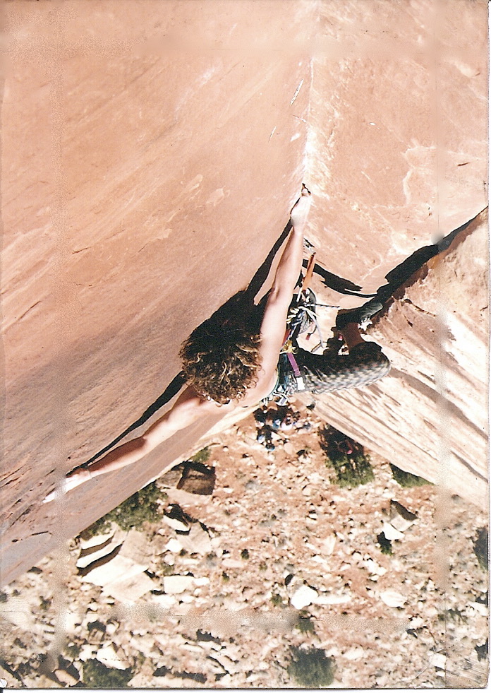
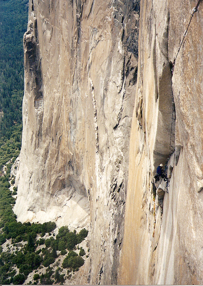
 I first fell in love with Alaska when I was 15. Having grown up in California, Alaska seemed as far away and as wild as any place on Earth. I’d heard of this land when I was even younger, perhaps at age 8 or 9, when my father and his brother decided to drive to the Great White North to “check it out.” My Dad and Uncle never made it to Alaska, but the notion that it was an endless wilderness full of giant mountains, feral people, and wild animals, was born into my young mind. When I was 15, as a young neophyte climber, I read as many books about mountaineering and rock climbing as I could; these books spoke of far away places and far away ideas that left deep impressions on me. One such book was Art Davidson’s “Minus 148”, a tale of the ground-breaking, first winter ascent of Denali. It was this read that left on me an ironed-in impression of Alaska.

Over the years, as mountaineering became less and less important to me, I began to realize that my desires to be in the wild places that climbing afforded, was as important as ever. Being in the mountains was paramount, and climbing was a mere vehicle. Early on in life, I developed a love affair with bicycles and the notion of traveling long distances on one appealed to me, in the same manner that expedition mountaineering appealed to me in earlier years. So in the summer of ’93, I set out from Utah and pedaled to San Francisco, via Idaho and Oregon. This journey demonstrated all that I desired: to be self sufficient on a long, physical trip; one that allowed an element of adventure while traveling through high country and mountains. It was an eye opener for what might be possible; and somewhere, in the back of my mind, revelatory ideas about wilderness and ways to travel through it, began to hatch. I do believe it was on this trip, that I began to see and feel something greater in the world than just the routine of human life; to understand a deeper connection to all things wild and free and to appreciate the fact that we, as humans, were actually a part of this great wildness — and not separate from it. In late April 2011, I set out, from my home in Moab, Utah, on my bicycle — bound for Alaska.

It was a terrible winter that year, with record snowfall in many northern areas, and unusually low temperatures. I travel north, through Utah and into Wyoming, all the while feeling overwhelming joy that such a trip had finally started. I enter a different world as I pedal into Montana. No longer in the high desert of the past 1000 miles, I cross a threshold into the beginning’s of the Earth’s great boreal forests; forests that do not stop ’till high above the Arctic Circle, 3300 miles to the north.

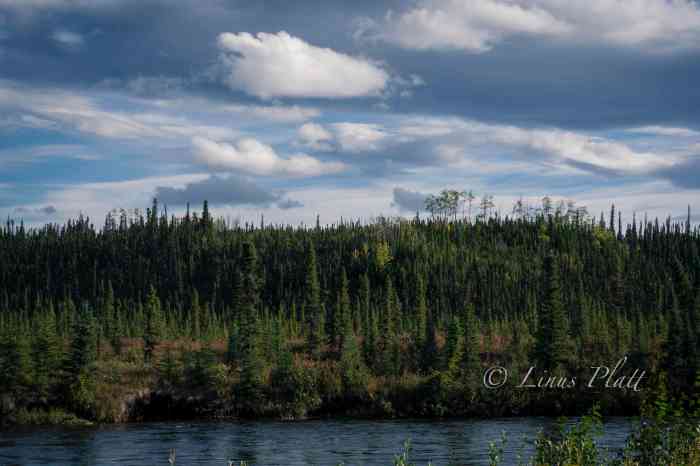
I travel on, into British Columbia, and climb into the Canadian Rockies; I enter Alberta, the scene of many past climbing memories with people from another time and place. It was magnificent to see, after all these years, the Ice Fields, and all of her adjoining peaks and glaciers; this time armed not with ice axe, but with bicycle. The wheels turn, and soon I witness the vast boreal plateau of central British Columbia; I see more Black Bears than I can count. I roll through Smithers B.C. and marvel at this place, surrounded by glaciers and mighty, salmon filled rivers. Tribal elders and native fisherman tell me stories of long winters and their anticipation of the upcoming Moose Hunt. Alas, on June 9th, I cross the Skeena River and turn onto the mysterious Cassiar Highway. This road is a westerly alternative to the far more popular Alaska Highway in northern B.C., and gifts mountain scenery and remoteness. My first night on the Cassiar, I pull into an open area and spot a dead Grizzly; shot, I presume. I am too fatigued from pedaling a full day of rain to search out another camp. I am gripped by my short lived, but intense paranoia of the bears and sleep with one eye open. Over the next eight days, I witness some of the most remote and incredible scenery visible from a road in North America; fantastic glaciated peaks, bear, moose, eagles, rivers, and lakes. This natural balance I see before me brings tears to my eyes, and I think hard on where the human race is heading — and why. Rain falls like it will never stop. Spinning through this much rain . . . this many miles . . . this many hours, instigates bizarre things within my mind. I take a hard look at myself and the world around me.

Days later, past Whitehorse, I flow into the Kluane Range, the guardian front range to the mighty St Elias. Out of these mountains, flow the some of the largest glaciers in the Western Hemisphere. I journey on, around Kluane Lake, the Yukon’s largest; and once beyond it, the ecosystem changes yet again, and I see the first of many Black Spruce Taiga Forest, the hallmark of the True North. On June 27th, 2011, 59 days after leaving Moab — I enter Alaska.

An Alaskan native once told me, in jest, that the Pacific Northwest of the lower 48, was “a desert”. On this day, upon penetrating the Alaskan border, a rain begins to fall that is everything that man inferred. And for the next five days, that’s indeed what it does — with no end in sight. The setting up and taking down of the tent, the moisture consuming my sleeping bag, and the inability to keep or get anything dry, begins to take it’s toll on me. Worst of all, now nearing the Alaska Range, the storm obscures views of the peaks I came so far to see. I turn south on the Richardson Highway and the clouds part and for the first time in what seems like eternity, the sun bares brightly and the glaciers of the Central Alaska Range shine deep within me.

I learn, from a woman in Delta Junction, that a narrow two-track would lead, some fifty miles south, into an area known as Rainbow Ridge, and that an excursion there would reward me with access to the Canwell Glacier and the lesser, but enormously beautiful peaks of the Eastern Alaska Range. After some time scouting, I spy the two-track, and head off into the innards of the Alaska I really desire to see. I ride and push the bike back far from the highway, perhaps eight or nine miles, until I come to the lateral moraine of the glacier. I camp perched atop the moraine, overlooking the ice. I am home. The next day, as fine as the one prior, I embark on a scramble up a nearby granite peak, surrounded by nameless glaciers and tundra. The sensation of this magical place sinks into me, and there is no turning back.

A day later I enter the Denali Highway, 135 miles of dirt road traversing some of the finest wilderness in North America, in which I slow down, breath deeply, and take it all in. I spend four days out there marveling at the grand peaks of Mt Hayes, Hess, and Deborah, eventually turning south on the Park’s Highway and heading toward Talkeetna and Anchorage. As I move south, I feel civilization creeping in on me. I know that the part of this journey to encompass supreme wilderness is nearing closure.

I had pedaled over 3800 miles, and on August 9th, I board the Marine Vessel Columbia for a trip down the whimsical Inside Passage, ending port at Bellingham, Washington.  I spend the next two weeks pedaling down the west coast’s of Washington, Oregon, and California. This is another world to me; cars, traffic lights, cities, towns, and difficult camp spots, at least in comparison to Alaska, where I could easily push my bike into any section of woods and have my own palace for the evening. Within the cities of central California, I feel trapped and overwhelmed; I long for the quiet and solitude that Alaska affords. After 4700 miles, this trip is over with a quickness. What I really want is to get back to Alaska and spend less time  getting there, and more time  being there. I crave a closer look.

Settling down in Sacramento for the winter to visit family and earn money for my return to Alaska was in order. The unfortunate event of having my bicycle stolen the following spring, just one month prior to my planned departure date, thwarted all that I had worked toward and my dreams of returning that summer shattered. I kept my head up and pushed on, hanging tough through the next 12 months and creating a tight and sound itinerary for the following summer; I developed an acute taste for the Yukon during this time, and wanted to see more of it. The following May, I drive my pickup to Bellingham, park at a friend’s house, and board another Marine Vessel, this time heading north to Skagway, Alaska.

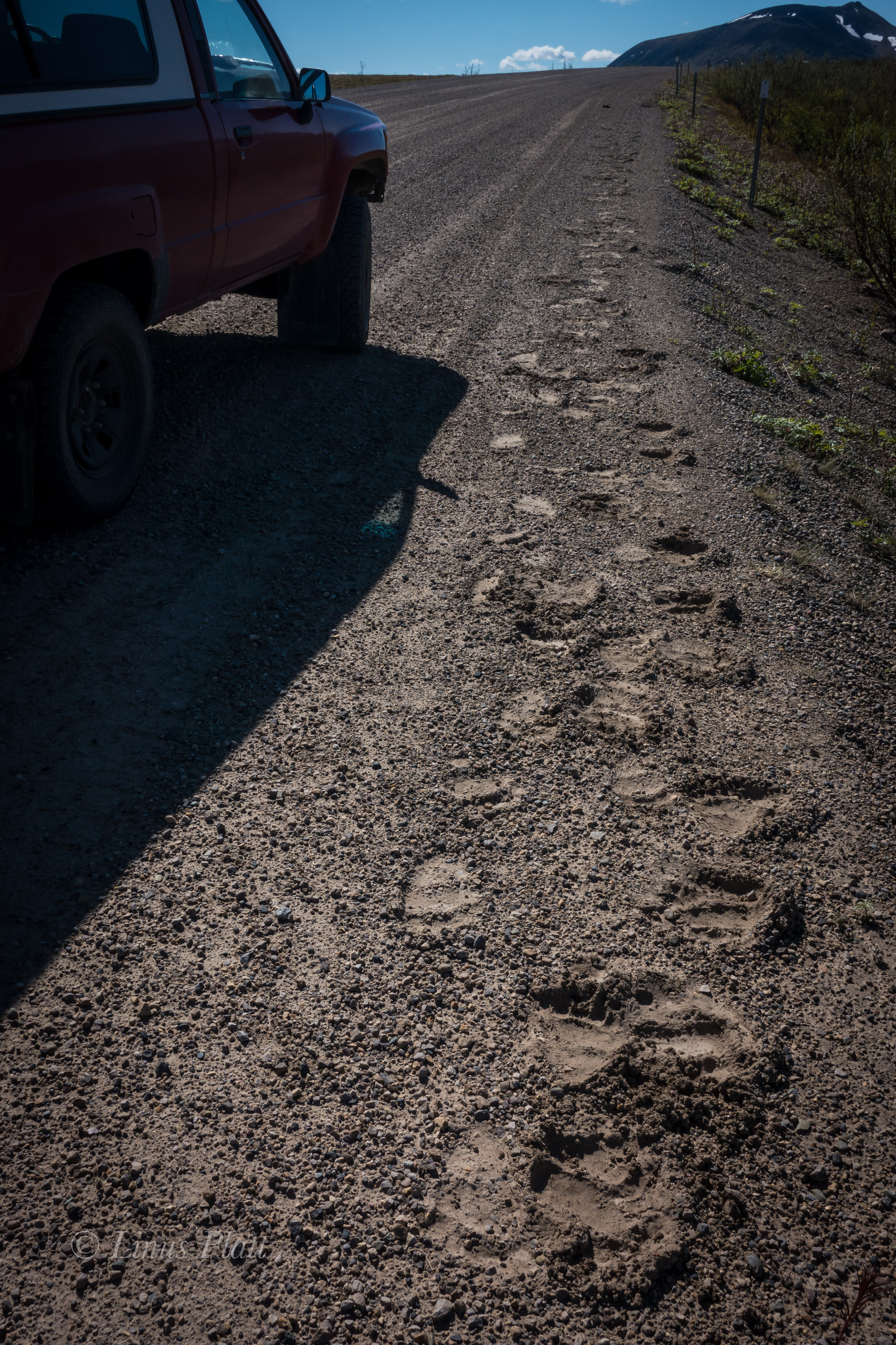
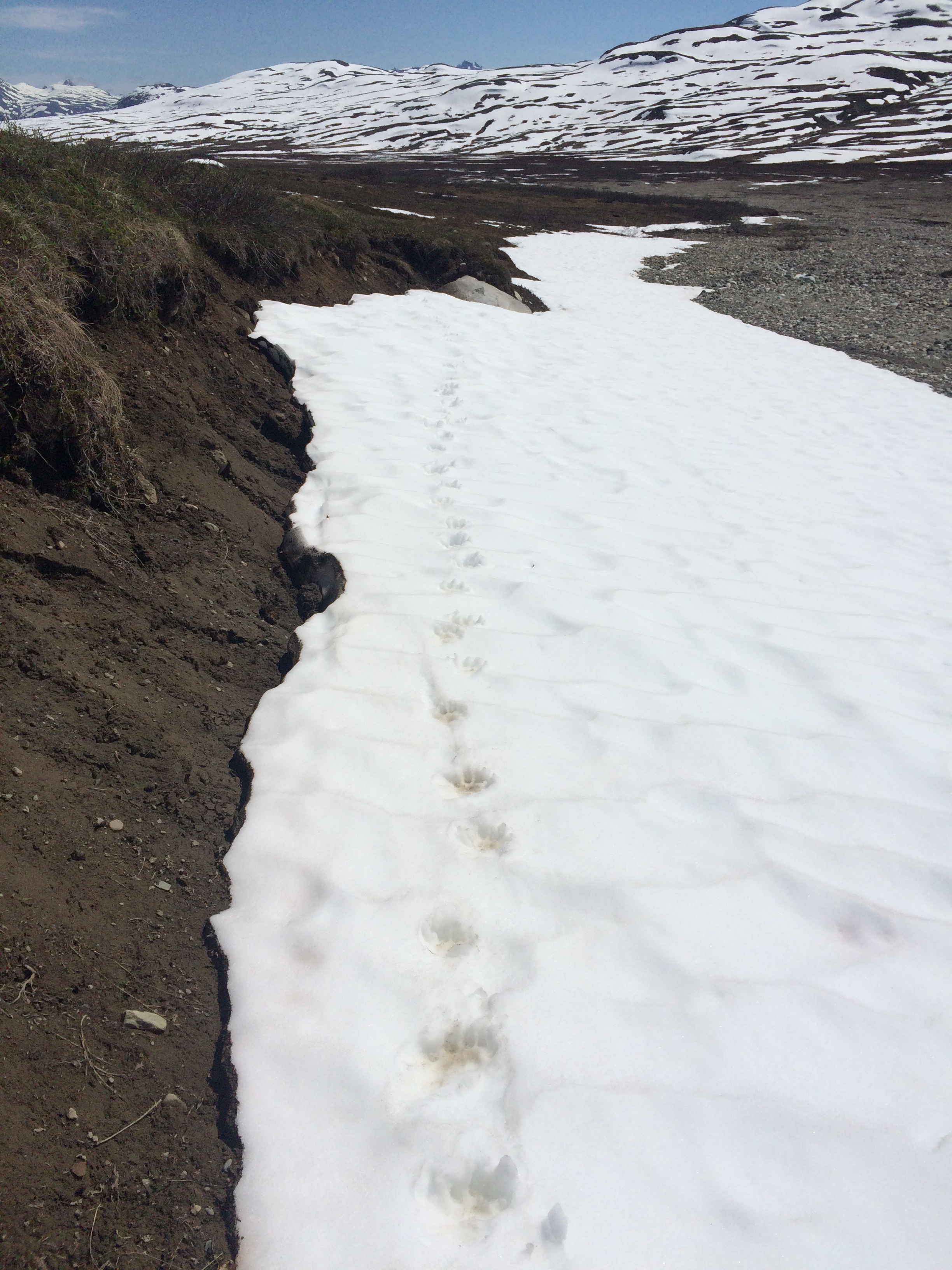
The first day I face the biggest climb of the entire trip; from sea level at Skagway to the summit of 2864 foot White Pass at the B.C. border. I  offload the ship, and dive into the dragon’s mouth. By dusk, I make the pass and have my tent set up in time to witness the alpenglow cover the glaciers to the east. It is may 20th, 2013 and it feels surreal to be back, as if I never left, but merely awakened from a long dreamy nap. I pedal up the Klondike Highway, passing through Whitehorse and embarking on many side trips down old mining roads in search of beautiful campsites, old cabins, wild rivers, grizzly bears, and eagles. I find all of these things in the Yukon and much, much more. About 2 days south of Dawson City, I spot a large mammal up ahead on the shoulder; I slow down and approach cautiously. At first, I take it to be a small Black Bear, but it doesn’t move like a bear; It dances and darts in a way that tells me only one thing — Wolf. As I move closer, it sees me and flies into the brush; as I move past, I can still see it’s legs behind the shrubbery, moving laterally with me. I stop. The Wolf stops. I move and the Wolf darts back out, into sight. We stop. We lock eyes. I am mesmerized by this magnificent animal; It appears to be an older wolf, perhaps lone; his coat, thick from a recent cold winter; his color nearly solid black. We tire of this staring contest and and in a flash, the wolf is gone. The next day, I spot a large Grizzly on a nearby ridge, digging for food. It is far away, but it’s motion and heft clearly demonstrate it’s kind.

In 2011, I had developed a hunger to visit the Arctic. To me, the Arctic represents the last bastion of real wilderness left on the planet; it is a place that few travel, and it is a place that, for all of it’s supreme ruggedness, remains one of the most fragile places on earth. I imagined it to be one of the most beautiful as well. I had to get there. I roll into Dawson City, centerpiece for the historical mining heralds of the Yukon, past and present. It is May 28th, which meant that it is still very early in the season for travel into regions of the Dempster Highway, but not impossible. If I am to embark on a trip up the 500 miles of dirt road on the Dempster, there might be weather and road conditions that are not favorable. But to me, it seems perfect.  After spending a day in Dawson, I decide the only way to do this stretch is to do it round trip; 1000 miles total. The Dempster ends at the village of Inuvik, Northwest Territories, where one can buy food and supplies, but the two villages on the way are situated along the road as to make carrying the necessary food impractical. To alleviate this matter, I box up 4 days worth of food and leave it at the Dempster Interpretive Center in hopes that a traveler might pick it up and take it to Eagle plains, some 300 miles to the north. I spend the day gathering the remainder of supplies for a venture into a fantastic arena of mountains and arctic plains. In the morning, I pedal the 25 miles to the start of the Dempster and am pinned down by a several hour rainstorm that began calm enough, but was soon a torrential flood of monstrous proportions. I hole up at a defunct gas station at the junction of said road, and eat and drink to pass the time. Over the next two days, I cross the Tombstone Mountains and into the Blackstone uplands, famous for it’s crossing of the mighty Porcupine Caribou Herd, which, during it’s migration through the region, numbers in the high thousands. Passing the continental divide, the terrain is of an alpine nature of which I am most happy. From here, all water from these mountains flow to the Mackenzie River, and ultimately, the Arctic Ocean. More rain comes and I dive into the Engineer Creek Campground, which is still closed for the season; the place is deserted. It has a screened in cook hut and a luxurious evening was to be had. The following morning, I cross the Ogilvie River, and see the unfortunate sign ahead. “Road Closed”. A road worker chases me down after I sneak past the closure in hopes of somehow working myself and my bicycle around whatever obstacle lie ahead. The road worker says:

“Can’t you read?”

“Yes Sir, I can read just fine”, I say.

As I attempt to keep pedaling, he whips his truck in front of me and informs me that NO ONE will pass through here.

“The River has changed course from flooding and has taken out the road. Go back to Engineer Creek and hole up there ’till I send word you can continue.”

Reluctantly, I turn around, head back to the campground, and down the last couple of beers I had stashed. In the morning, a truck pulls in and some folks from Washington inform me they have heard that it will be several days before the situation is rectified. I felt sunk. I don’t have enough food to stay here sitting and waiting. They offer me a ride the 130 miles back to Dawson and I sheepishly accept. That night in Dawson, I wrestle  my thoughts: Had I made the right decision? Could I have stretched the food I had? I put it all behind me and went to bed, hoping I wouldn’t be discovered, camped illegally on the outskirts of town. After breaking camp, I board the ferry across the omnipotent Yukon River, and commit myself to what’s known as the “Top of the World” highway; a hundred or so miles of gravel traversing the hilly, sub arctic dome country of the western Yukon and eastern Alaska. The monotony of the endless forest and the ever growing number of hills are putting a hurt on me, but I manage to get across the Alaska border the next day.

More rain ensues; more spectacular scenery begins to appear. Great, wild rivers in the areas surrounding this stretch of the Taylor Highway begin to cheer me up, and soon the Dempster/Top of the World episode is behind me. Near the junction of the Taylor and Alaska Highways, about 30 miles from Tok, I crest a hill, and as if on cue, the clouds part, and the sun shines down upon the ever magnificent Alaska Range. I feel, once again as if I’d come home. They appear almost himalayan in size and have the sensation, to me, of seeing an old friend. I spend a couple of nights in Tok, then pedal along the northern and eastern flats below the impending Alaska Range. The creeks are plentiful and crystal clear, and I drink copious amounts of water from them. Another night of thunderstorms and packing up in the rain today. It is getting to be routine; I am finding myself able to pack it in with my eyes closed. Later in the day when the sun is out, I pull out the tent fly and it dries while I snack.

In Delta Junction, I camp on the gravel beaches of the wildly braided Tanana River, looking to the south at the appearance the central Alaska Range’s Mt’s Deborah, Hayes, and Hess; all are visible. I have never seen the north side of these peaks; I decide to camp here in hopes of catching a time-lapse of these giants’ in the morning, with the sunlight splattered across their eastern escarpment and embellishing their glacial armor. The scene before me stirs my desires for reaching the Arctic again.

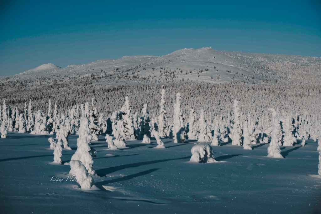
There are only two roads, in North America, that one might pilot a vehicle of some sort, leading to this continents Arctic area’s. The Yukon’s Dempster Highway, and the Dalton Highway, aka “The Haul Road”, in Alaska.  Both of these paths are of the dirt and gravel variety. The Haul Road, remote indeed, was built in 1974 as a supply line to the north slope oil fields at the Arctic Ocean, and parallels the Trans-Alaska Pipe-Line, was not open to use by the general public until 1996. Up to that point, the truckers had it solely to themselves. The Haul Road traverses a rugged landscape north of Fairbanks and leads to Deadhorse, Alaska, crossing terrain varying from the forested hill and dome country beginning at Fairbanks, to Taiga swamps and open tundra, crosses many, many rivers and streams, and penetrates the “Alaskan Rockies”; the continental divide at the bastion of true roadless Alaskan wilderness: the venerable Brooks Range.

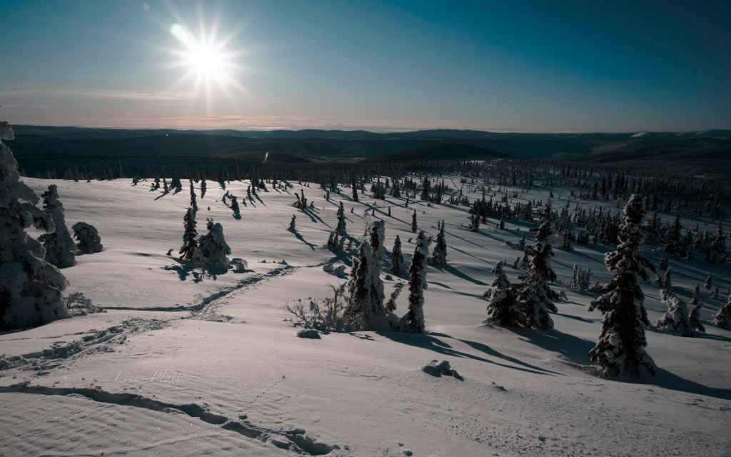
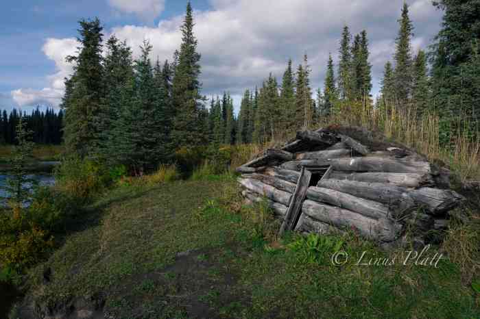
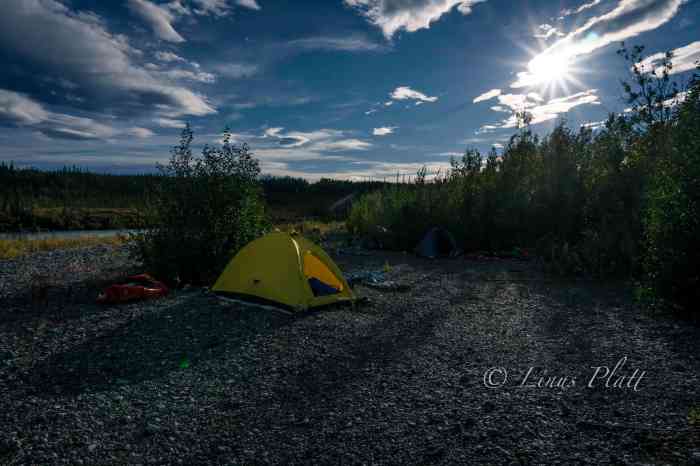
Saturday morning I gear up, and soon my bicycle is spinning north. The day is filled with some of the worst hill climbing I have ever encountered. Finally crossing Snowshoe Summit at the apex of Alaska’s White Mountains, I am rewarded with a long downhill and a stream of spring water shooting from a pipe near the road’s edge. The water is clear, cold, and delicious. Passing creeks and abandoned cabins, I look for a camp, and pull onto a dirt track next to the Tatalina River and dive into the water after setting up. I am then greeted by terrible swarms of Alaska’s famous insect.

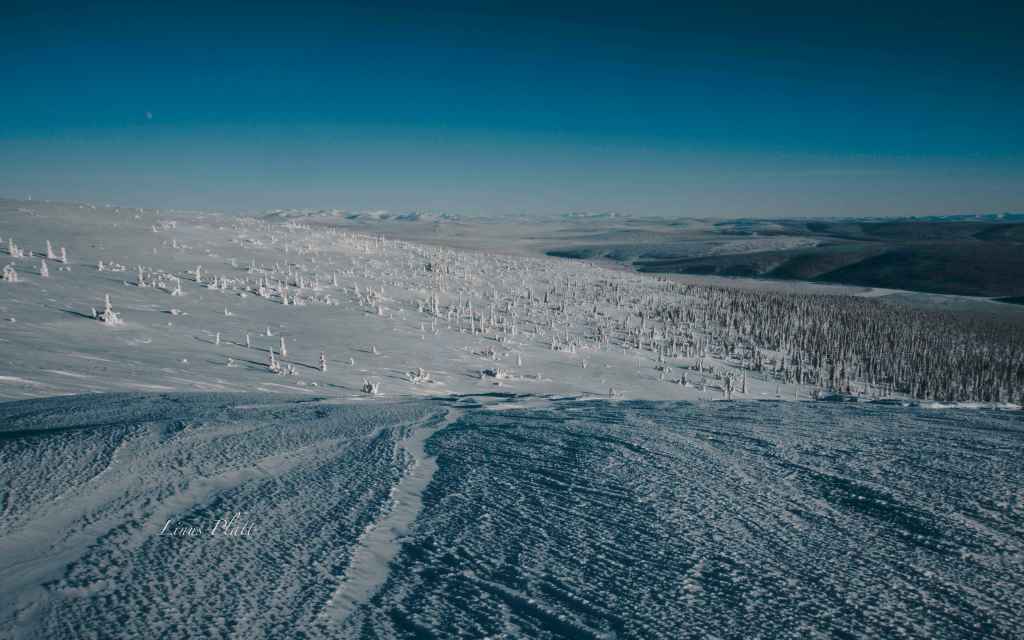
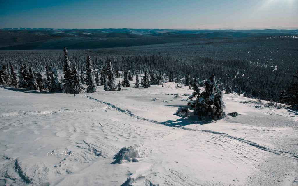
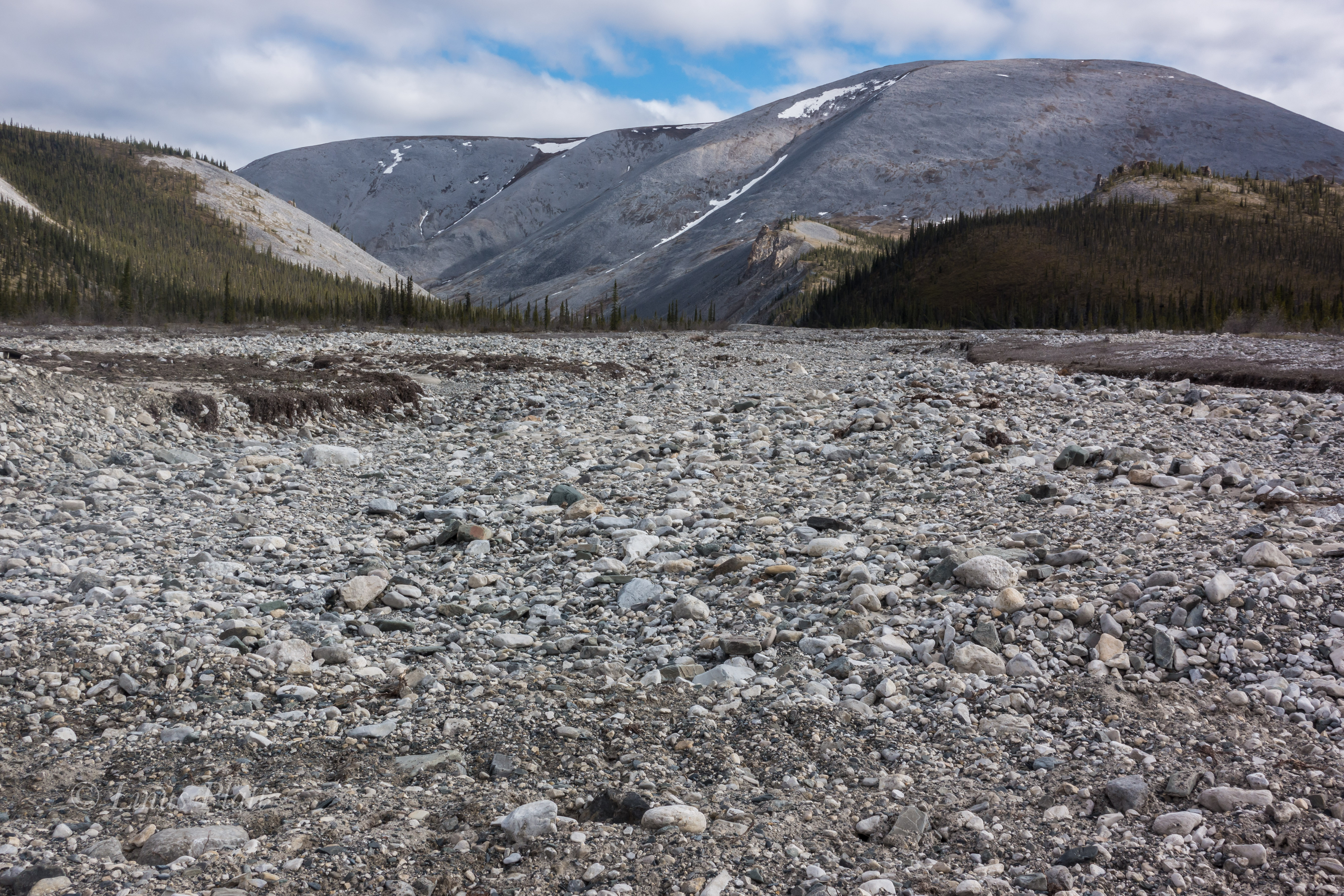
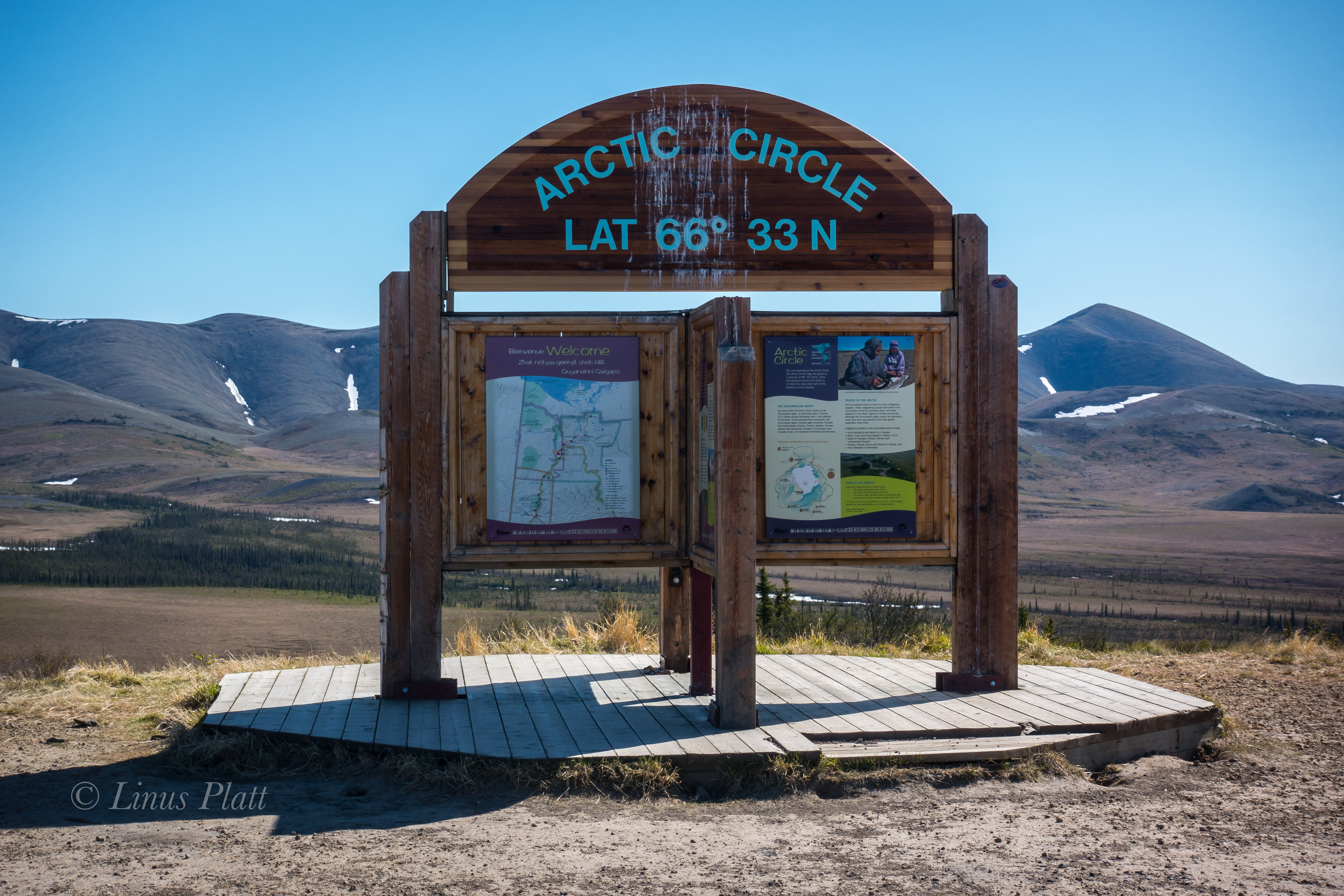
The next day, more of the same hill climbing ensue, only worse this time. The hills are 12 to 14 percent, made up of loose, unconsolidated gravel, and the truck traffic is thick. This day turned to be the hardest of the entire road. By day’s end, I am so exhausted, I can do nothing but dismount the bike and push the dead beast upward and over the hilltops, coast down the other side and repeat. More big hills the following morning, lead, thankfully, to the Yukon River, where once across, the road flattens out a bit and some pristine forested Alaskan countryside sprouts up. Eventually, however, the hills re appear and the grind continues. After 70 miles, I find a gravel pit to call home on the fringe of Finger Mountain, 25 miles south of the Arctic Circle. The first bits of Arctic tundra, permafrost meltwater lakes, tors of granite, and windswept mountain passes are now within my eyesight. The next day, the landscape changes dramatically to the type of high country I so desire. After crossing the Arctic Circle, I penetrate a  small mountain pass and catch my first glimpse of the mighty Brooks Range. I drop into the valley below, and am greeted with magnificent spruce forest, and creeks filled with 24 inch Grayling. There is drinking water everywhere, a far cry from the relative dryness of the last few days out of Fairbanks. This landscape is what I came here for… unparalleled high country filled with rivers, mountains, forest, and animals.

In the morning, I am excited to enter the Brooks Range. After a couple of hours pedaling through soaring scenery, I decide to get off Haul Road proper, and get onto the pipeline access road, which offers a bit more of the deep solitude that this unbelievable place offers. Eventually the road dead ends as the pipeline disappears underground, which dictates back tracking to the Haul Road a couple of miles. However, at it’s end, a spectacular campsite is to be had, on the Koyakuk, and facing a sunset view of the mighty southwest face of Sukakpak Mountain, an impressive chunk of  limestone real estate. After swimming in the Koyakuk, I set up the camera for an evening time-lapse of Sukakpaks’ dramatic episode of color and changing light.

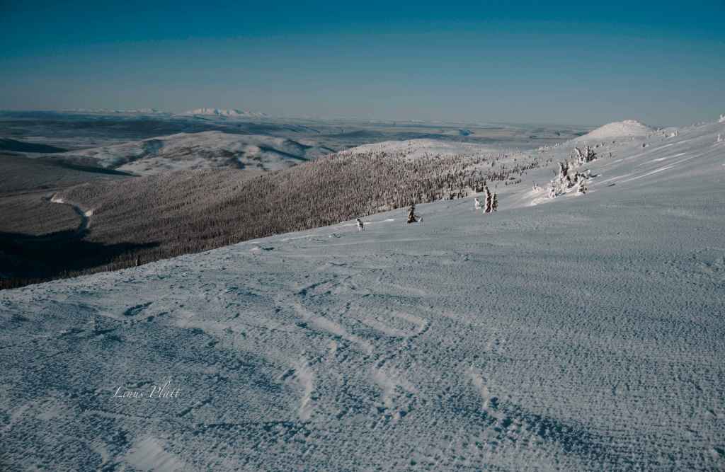
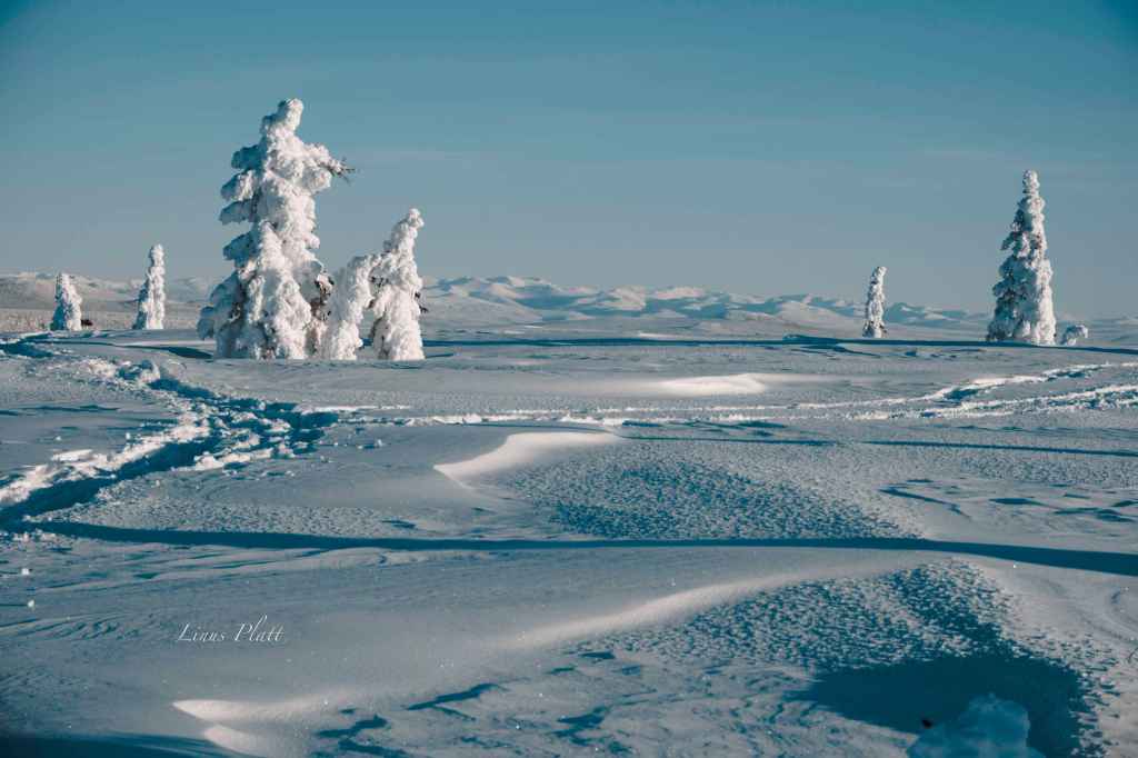
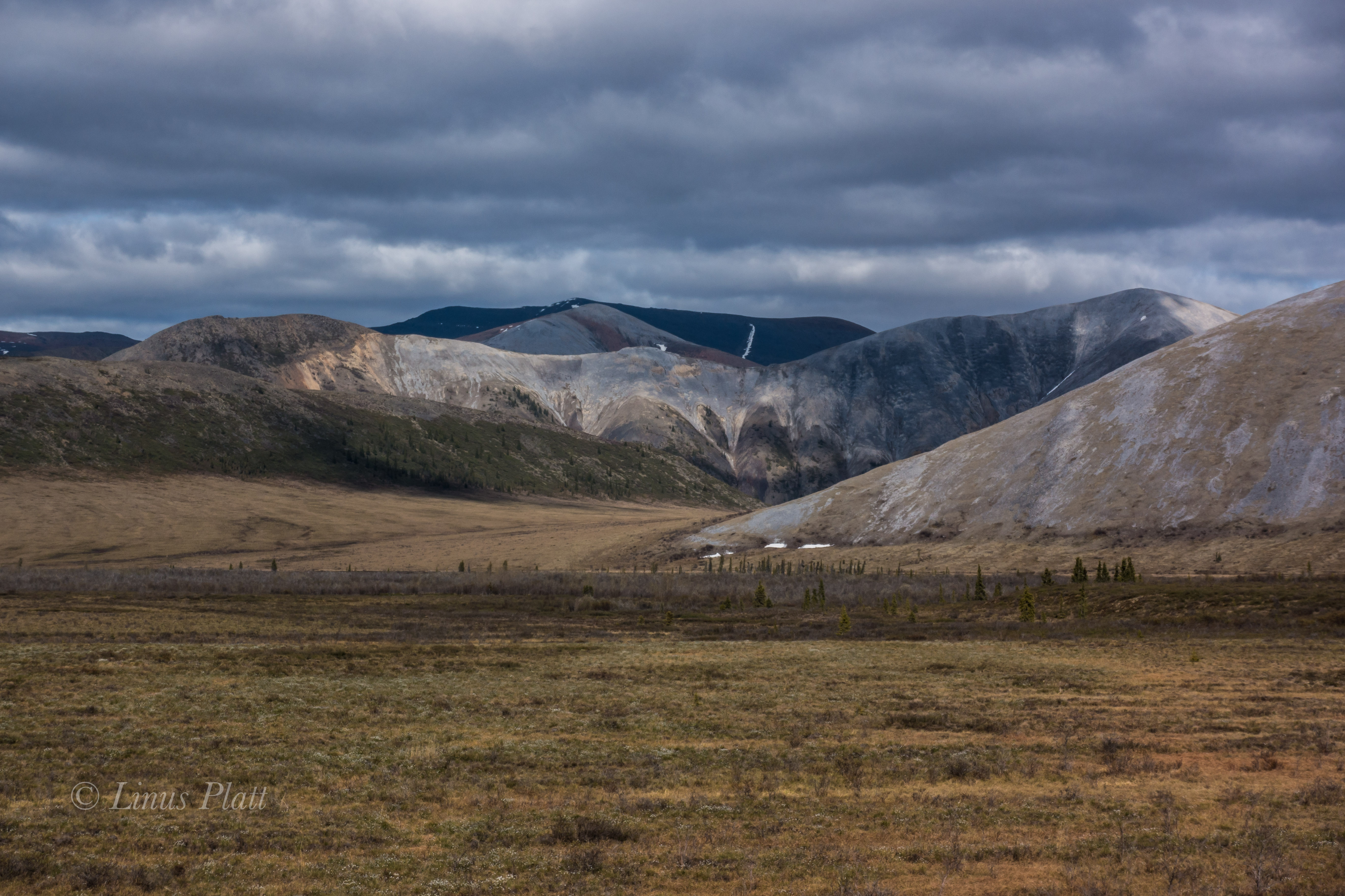
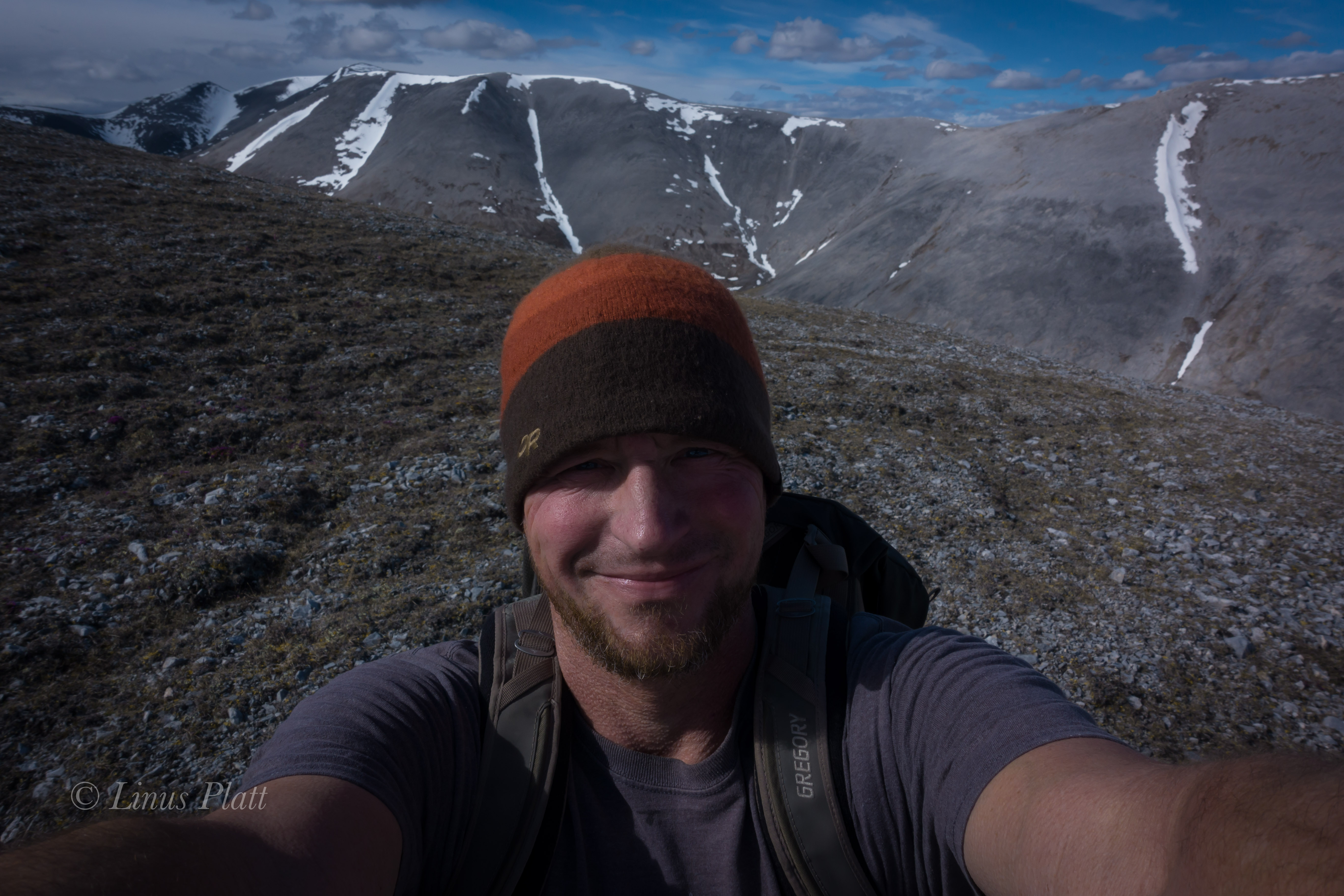
A fine morning follows, and 40 miles of dead flat, yet gorgeous scenery ensue. The river becomes heavily braided; the forest begins to thin out. Signs of a changing ecosystem; of a different stature, unfold. The weather begins to change too. Thunderclouds build, then unleash; I retreat under a bridge and watch the storm from beneath, sitting next to river ice pack still 36 inches thick, here on June 20th. A few short miles and I pass the final spruce tree in this part of North America. It is all tundra and the road begins to climb. Up I go; the road flattens once again onto the spectacular Chandalar Shelf, a couple of hundred square miles of flat tundra in the heart of the Brooks, just below the continental divide of Atigun Pass, Alaska’s Highest and most northerly road pass at 4800′. As I near Atigun’s summit, the storm once again decides to unleash it’s fury. High winds, sideways rain, and plummeting temperatures commence. I top out at 9:30 pm and find a patch of snow free tundra a ways off the road and pitch my tent right there on Atigun’s high point. Even with guying the tent, I still have to brace it from the inside to prevent the poles from snapping. Finally, the wind dies off and I drift to sleep, dreaming that night of being deeper into this range of magic mountains in the North, father in than I am now, traveling high valleys among Grizzly Bear and Caribou.

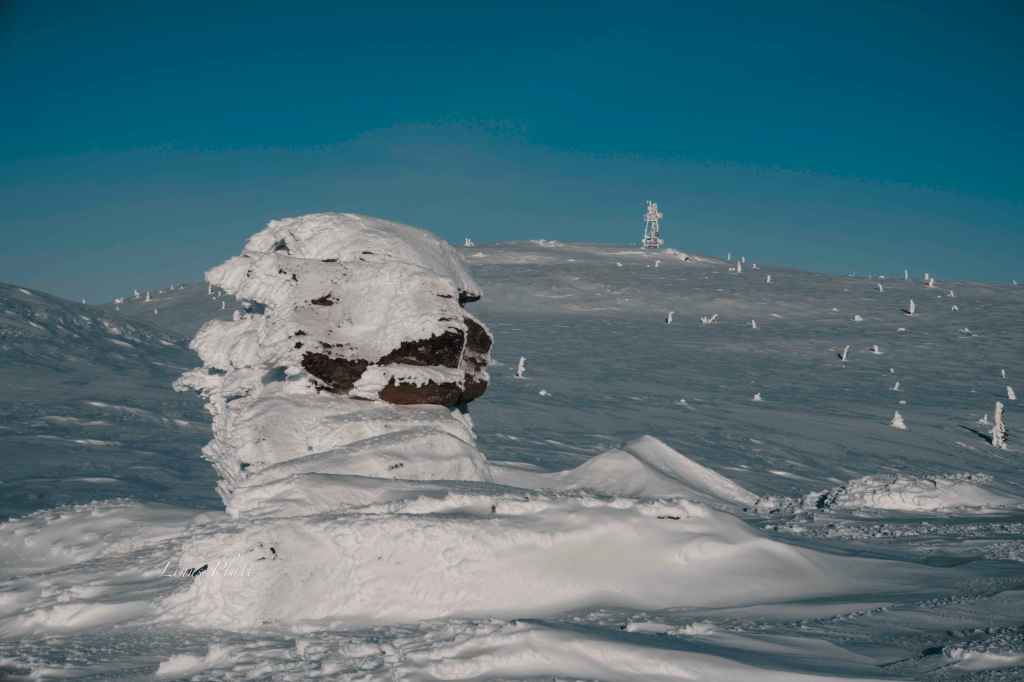
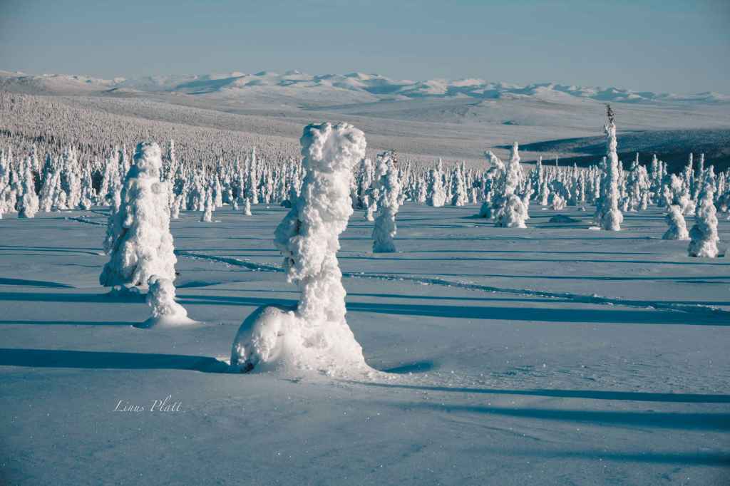
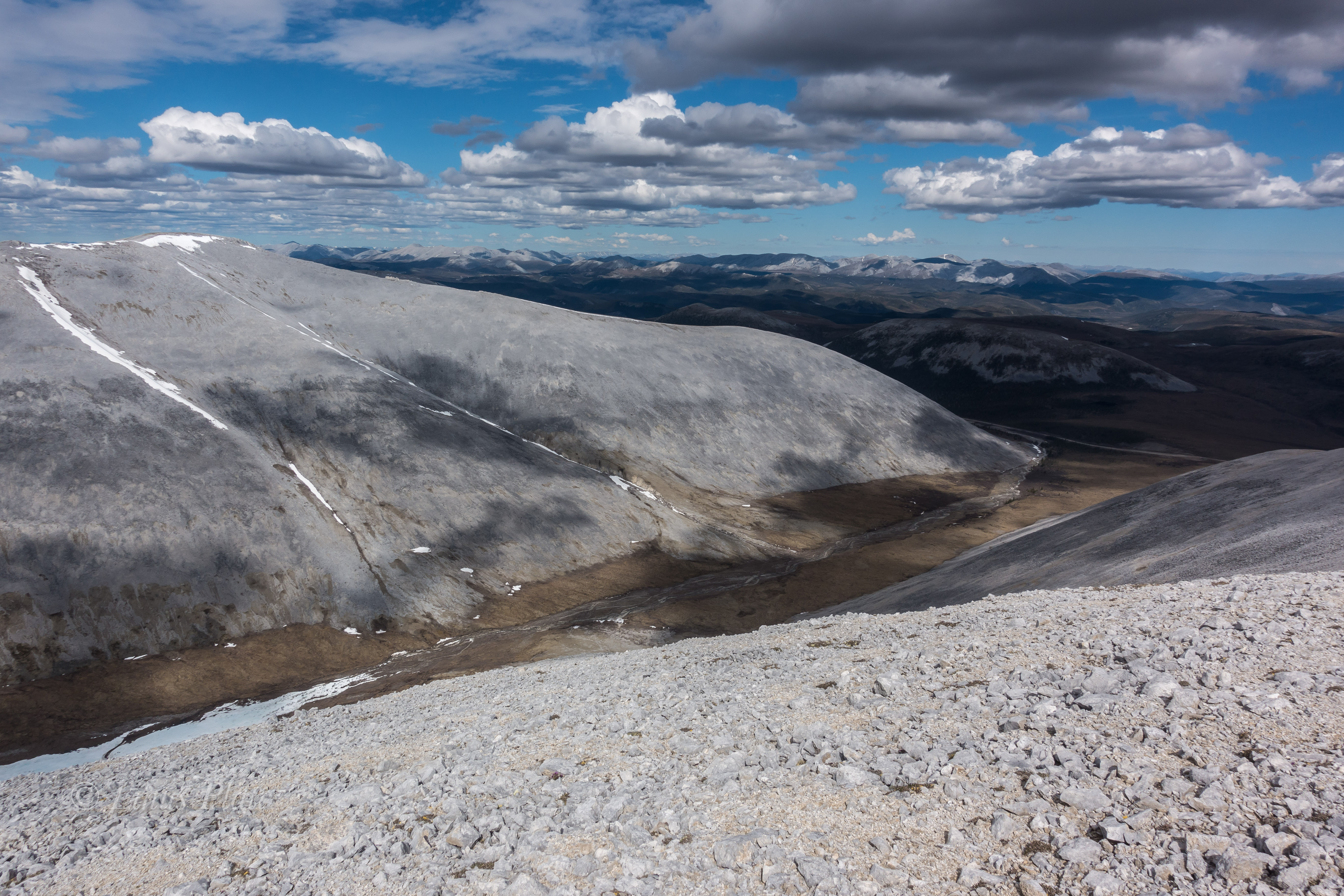
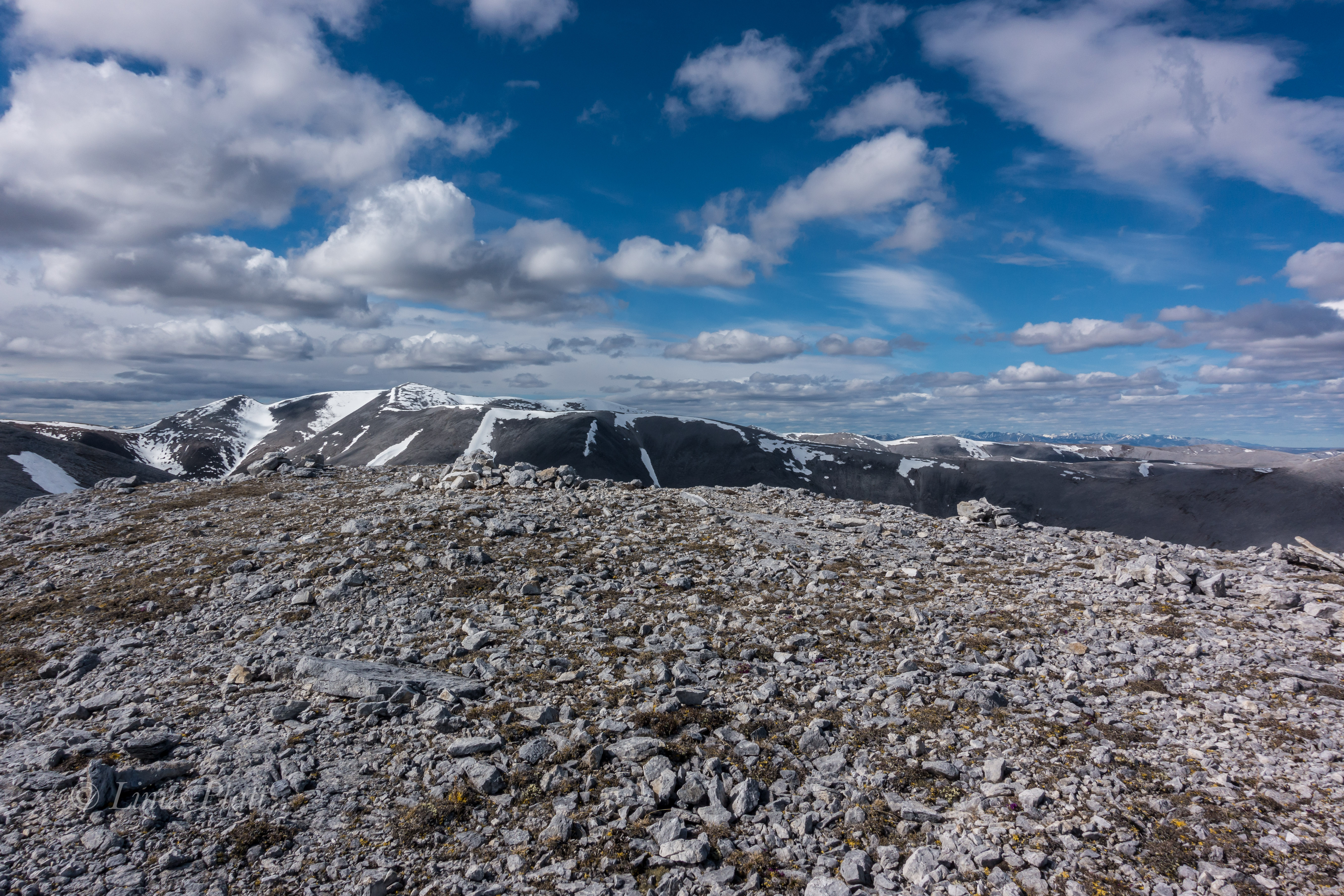
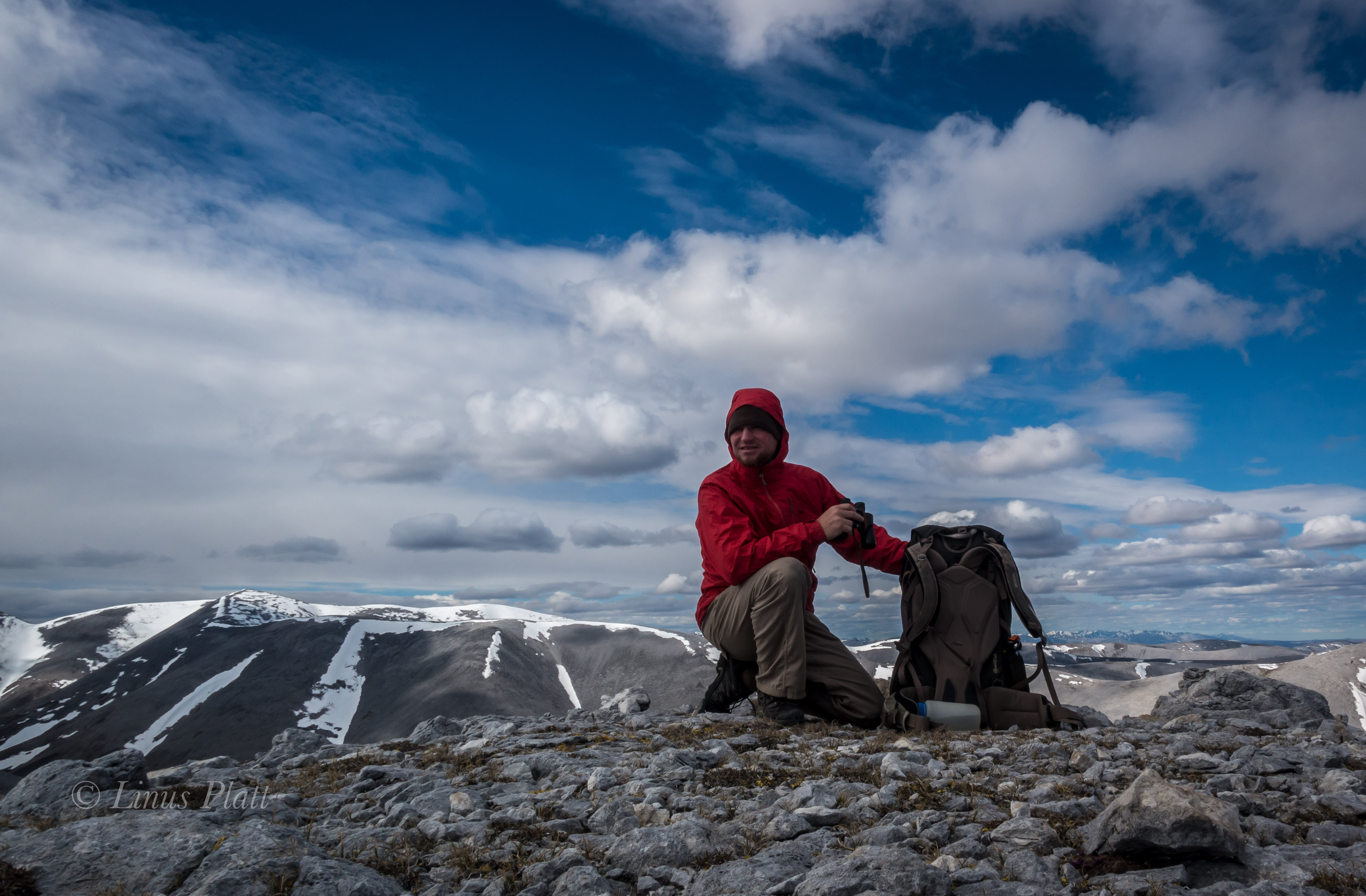
I awake to a deeply silent atmosphere of near whiteout conditions; it is eerily calm. I pack up, and descend the pass slightly to the shelf on the north side and stop for a hike up to a ridge. The tundra here is squat and is easily traveled upon. It is crowded with tiny wildflowers of all shapes and colors. I pass the remains of a young Caribou, probably taken by Wolves’. Farther up, I glimpse down great gully’s of rock towards a massive creek with outstanding waterfalls feeding it’s descent into the Atigun River and beyond to the Arctic Ocean. The peaks are mere 6000 footers, but are massive just the same. The Brooks is a dry region; however, there are a few small glaciers scattered in a couple of places in the Brooks, but not here. There are thin gully’s of snow descending from the rocky summits of these peaks, providing a striking contrast to their nearly black and orange coloring. Eventually, I descend back to the bike, and continue on, down Atigun Canyon, and onto the great Arctic Plains of the Alaska’s North Slope.

The next two days are flat tussock tundra, starkly beautiful, and swelling with my favorite insects. I still see no Bears, but, plenty of Fox and Caribou.  Alas, I spot a herd of Musk Ox, twenty strong, pre-historic, ice age creatures of the North American Arctic; an iconic figure of strength and endurance in this vast, untamed arctic landscape.

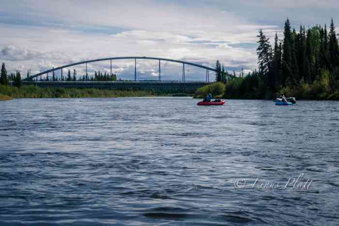
The next day, rolling into Deadhorse, it is 28 degrees F, 40 MPH winds, but otherwise uneventful. Deadhorse is the center of North America’s largest oilfield, which stretches for over 70 miles to the west.  After a fitful night’s sleep, I pedal out of town a couple of miles, lay the bike down, and put out my thumb… Later, after no success in hitching a ride, I catch an hour and a half flight to Fairbanks, where in a couple of weeks, my lover, friend, and companion, Angela, is to meet up with me where we will continue the last legs of this journey, together.

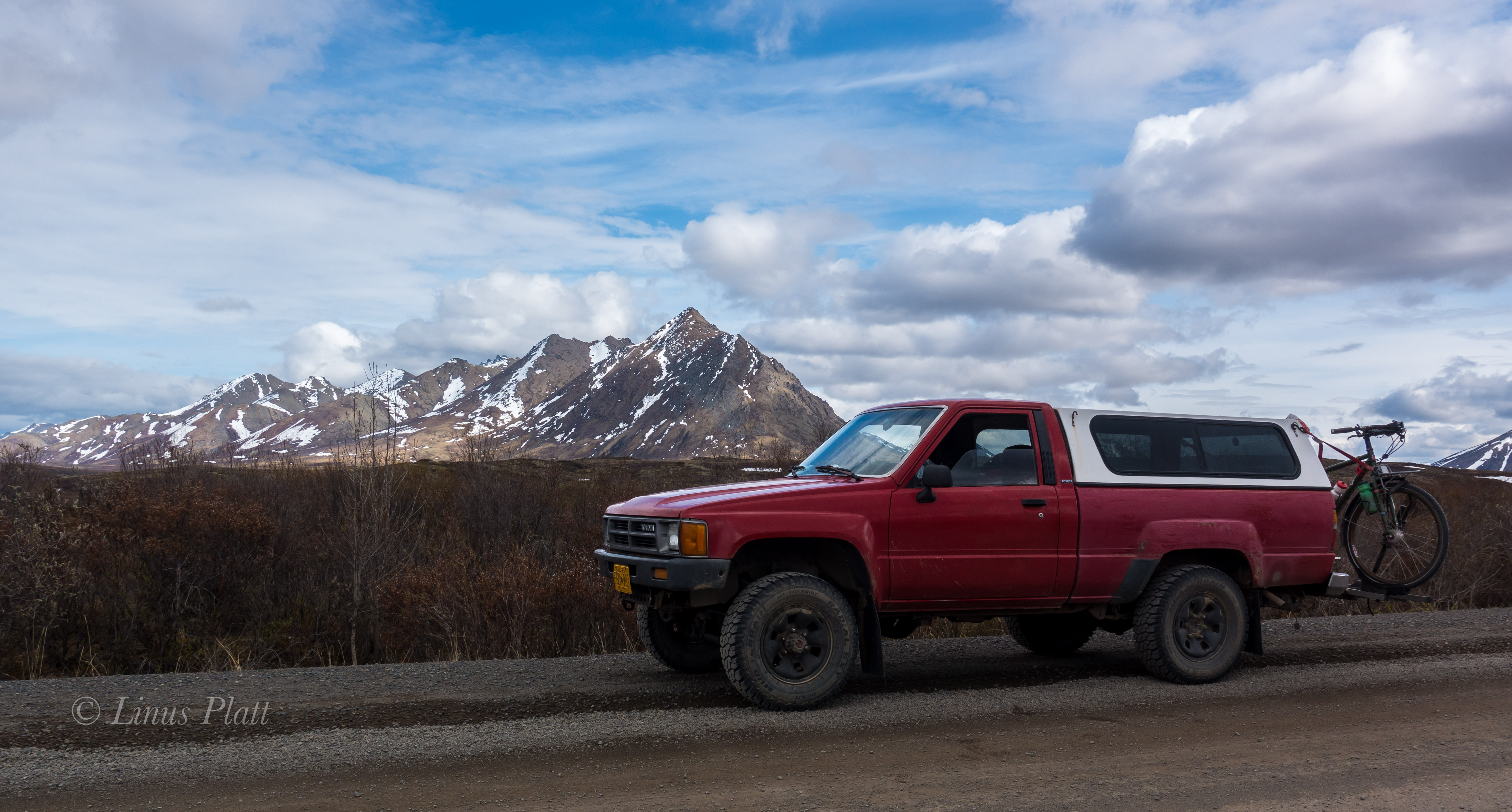
These long bicycle trips had, until this point, always been done solo. Angela coming aboard for this adventure was new territory for me. It will be a new and wonderful experience to share this monumental place with her; a tough and beautiful soul, she also shares a desire for all things wild and free, and is a lover of animals, mountains and lakes. She has never been to Alaska, and I will be proud to show her what I know of this endless, magical place. On the late night of August 2nd, Angela, driving my truck up from Bellingham, pulls into Fairbanks, and within 24 hours, we are ready to go; and Angela, now riding the bike that I rode on that first trip back in ’93, is out to prove that old bikes don’t really die. I painted it green some time back, just before giving it to her. She set forth about calling the machine “The Green Bastard”, named after Bubbles’ superhero character in the Canadian TV show, “Trailer Park Boys”, and off we went.

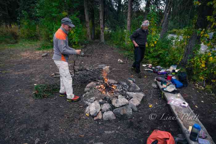
We leave Fairbanks at three in the afternoon on August 4th, and still manage to pedal 34 miles to a nice woods camp in the Nenana Hills. The forest is a splendid place to be as the past two weeks of being in Fairbanks had been wearing thin upon me. After a hearty supper and a victory cocktail, we fall into a deep sleep that only two tired yet happy people can achieve. Pedaling the next few days brings us to Nenana, Healy, and McKinley Park; the third day of which, a car, speeding up behind me, veers onto the shoulder and nearly kills me, inches away from my handlebars. That night at a peaceful lakeside camp just north of Cantwell, we watch as the sun sets behind the western rim and an alpenglow on the opposing peaks highlights a small herd of Dall Sheep, clinging wildly to the upper slopes. After entering the Alaska Range, we sail into Cantwell, beginning of the glorious Denali Highway, and entrance to some of the most fantastic scenery Alaska has to offer.

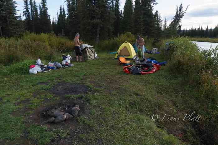
The Denali Highway, which I had pedaled two years before, was built in 1957 and for many years prior to the Parks Highway’s completion, was the only way to approach Denali National Park, hence it’s name. The road is 135 miles long and connects Cantwell to Paxson; 120 miles of that are dirt and gravel.  The DH, as I call it, traverses the entire Central Alaska Range, crosses uncountable streams and rivers, features tundra, forest, mountains and lakes aplenty. It also has some of the best free range camping anywhere. It is a true mountain paradise. We roll out onto the welcome relief of the gravel and with the exception of the dust from occasional traffic, we sail smoothly along the grandiose Alaska Range, surrounded by tundra, taiga, and wilderness. We spy a two track leading into the forest and think there might be a reward at it’s end. We ride through beautiful forest and brush, spotting a large Bull Caribou along the way. After a mile or so, the forest thins and the road turns downward to gain the roaring river below. Here, at this transition, lie one of the most spectacular camp spots of our lives. It is an open view of all the big peaks of the range; Mt’s Hess, Hayes, Deborah, Geist, Balchen, and Shand. After recently reading David Robert’s “Deborah: A Wilderness Narrative”, I was especially happy to be witnessing this spectacular place again. In from of us are towering peaks encompassing one of the great wilderness regions on the continent. Watching the sun set upon this picture, with it’s hues of red and orange, mixed with the deep blue of the glacial spectacle in front of us, is a sight we will not soon forget.

The following morning it is raining; we commit to the mud, and soon the McClaren River Lodge comes around and we drop in for a beer and a snack. We leave the lodge during a brief interlude in the storm, and climb the thousand feet to the summit. We are exhausted and wet, and it’s raining solidly. We ride down the two track of the McClaren Summit trail, and throw down our nylon ghetto onto the soft and sopping tundra and dive into the tent. In the morning, it is still raining, but our spirits are high as we prepare for the last day on the DH. Cool temperatures and more rain bring us to the pavement 20 miles from Paxson and signaling the end of the highway. We stop at the Paxson Lodge for a spell and some dry time; the weather begins to abate, and as we leave, we are granted fine weather for a pedal down the Richardson in search of another fine Alaskan camp.

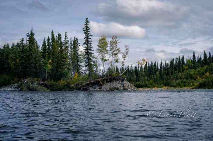
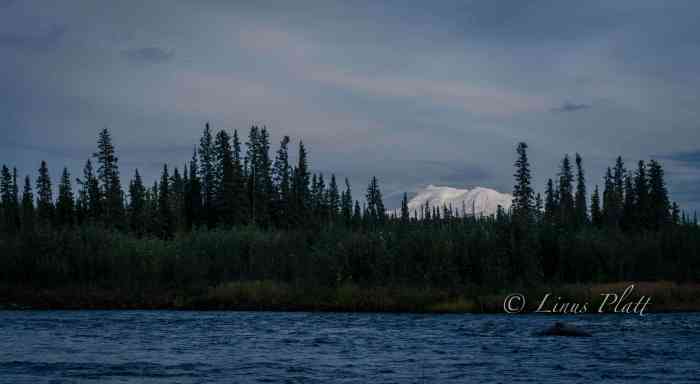
We awake the following morning to outstanding weather and an early start sends us down the Richardson Highway to the Gulkana river for an afternoon of bathing and river laundry. It feels good to be in the river, the sun overhead and our clothing, now clean, drying on the clothesline I have rigged. Unfortunately, the camp is very moist, and our clothing doesn’t dry till noon the following day, which puts us on the road late. It works for the best, as we roll into a fine camp early in the day. It is extraordinary; consisting of perfect, flat forest right next to a steep 300 foot embankment that drops to the mighty Copper River below; infested with Salmon and running ever so strong. It also sports unobstructed view of Mt’s Sanford, Drum, Wrangell, and the enormous Mt Blackburn, all encased in glacial ice, and piercing the deep blue, cloudless sky. To me, it is a camp to behold. The Wrangell Mountains are a special place to me; They are remote, and, according to some bush pilots’ I spoke with, the most beautiful place in all Alaska

We continue onward, down the Richardson, and turn in on the old Elliott cutoff; a dirt track leading for ten miles, to the hamlet of Kenny Lake, an area of rare Alaskan agriculture featuring, pigs, yaks, chickens, and pastures. We stock up on a thing or two at the tiny store, and continue on, en route to Chitina. We roll on through, eager to get ourselves established onto the dirt and gravel of the McCarthy Road, and away from the troublesome traffic. Crossing the Copper River Bridge, we are greeted with a fine, Alaskan sight; the confluence of the Copper and Chitina River’s, the Chugach Mountains to the south and the Wrangells to the North, and the dip netter’s, still pulling late season Red’s from the icy waters’. I catch fine glimpses of the enormeous Mt Blackburn, at 16,390’, the sixth highest peak in Alaska.

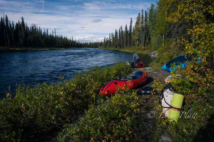
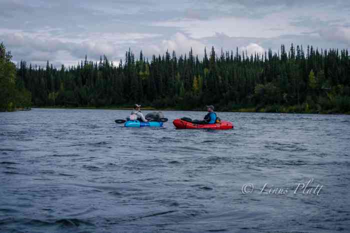
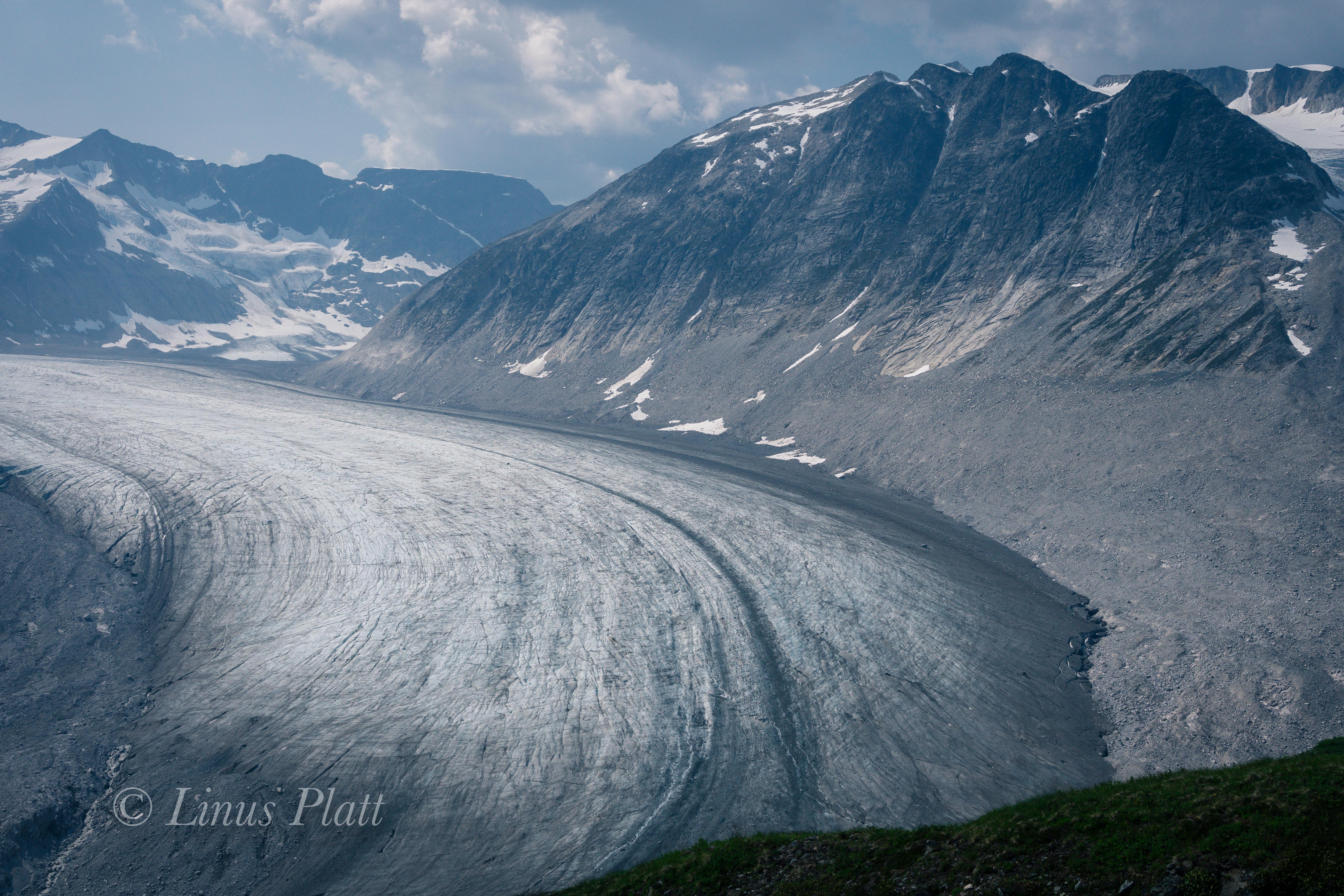
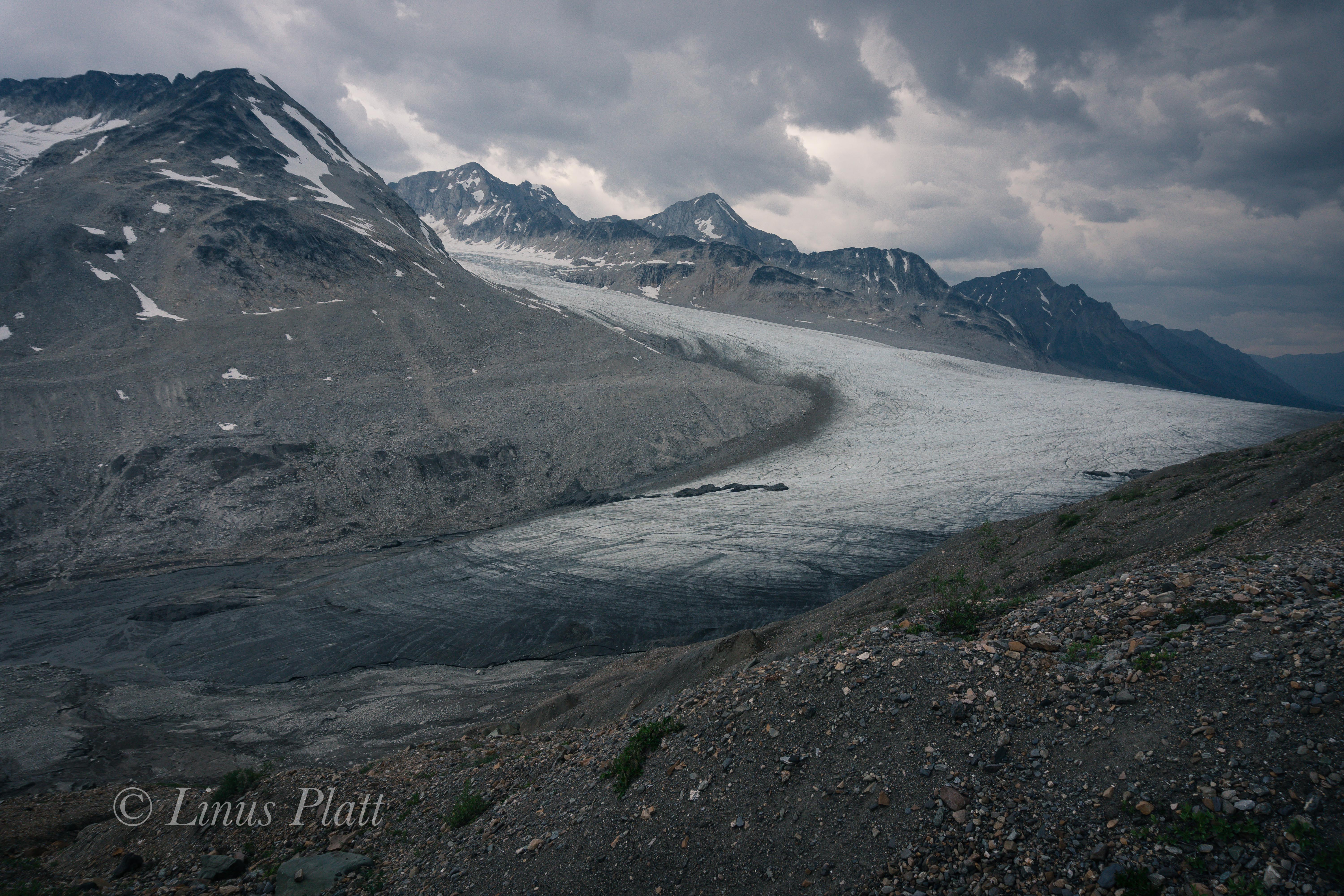
The McCarthy Road is blessed with many small creeks and rivers’, all crystal clears specimens, born of the ice and flowing to the Sea. There are fewer lakes, however. Angela feels at peace when she is swimming in a lake, so we are always keeping our eyes peeled for an opportunity to do so. Further up, Long Lake appears, and Angela declares the place her spiritual home. Unfortunately, we find no spot to camp on it’s shores, but a site within it’s view were to be had, with the best Loon calls I have ever heard. Even Salmon enter the lake to spawn and the resulting Bears can often be seen catching their lunch. The next day was a fine one, with perfect weather and a short pedal to McCarthy, we were rolling through town by noon. About a half mile before reaching the tiny village, one is greeted by a splendid sight; in front of us lie the Kennicott and the Root Glaciers, both giants and flowing from towering peaks. As the rivers of ice rise to it’s birth place above the firn line, an enormous ice fall shows itself, the “Staircase Icefall” as it is known, is a sea of jumbled and towering blocks and seracs, all destined to crumble and become a part of the valley glacier below.

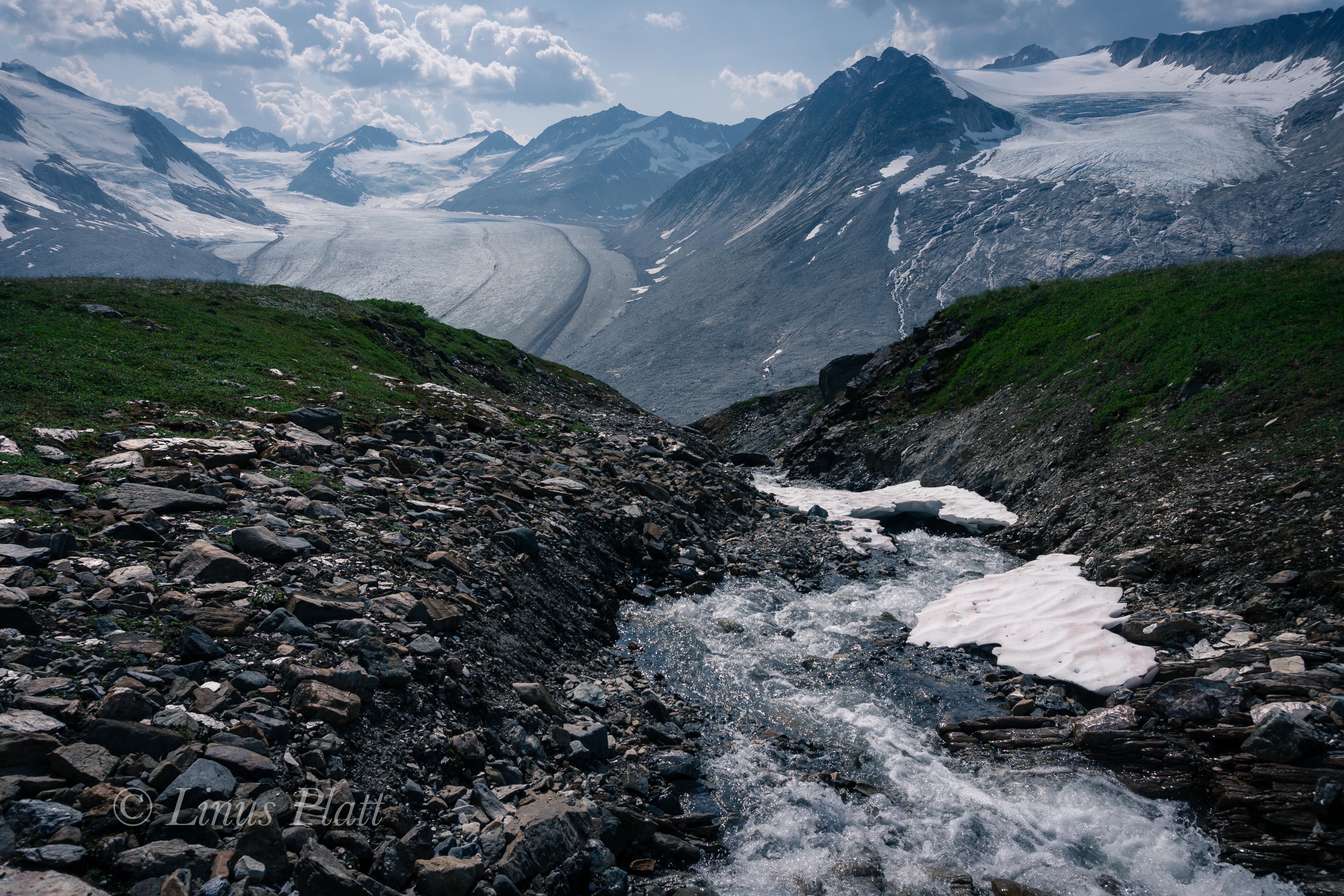
We find McCarthy more than pleasing; a tiny town full of laid back folks, tourists, flight seers, bush pilots, and mountain folk. We buy a few groceries at the unexpected store, and chat with a some folks before departing to find a camp. A local tells us of a trail that leads to the toe of the Kennicott Glacier, and we head out. After getting temporarily lost, we find our way and are rewarded by a great field of gravel, ice, and water. The Kennicott’s tarn, the size of an Alaskan air strip, is under constant barrage from it’s gravel covered ice source just above, and great splashes can be heard every so often. We camp near the shores of the tarn and admire the unbelievable glacial view from our camp. Later, we hike out, away from the tent, to inspect bear prints Angels had spotted earlier.

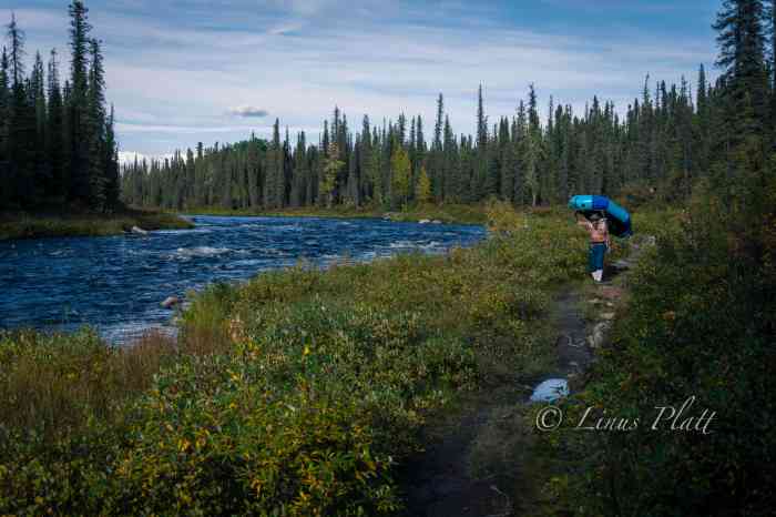
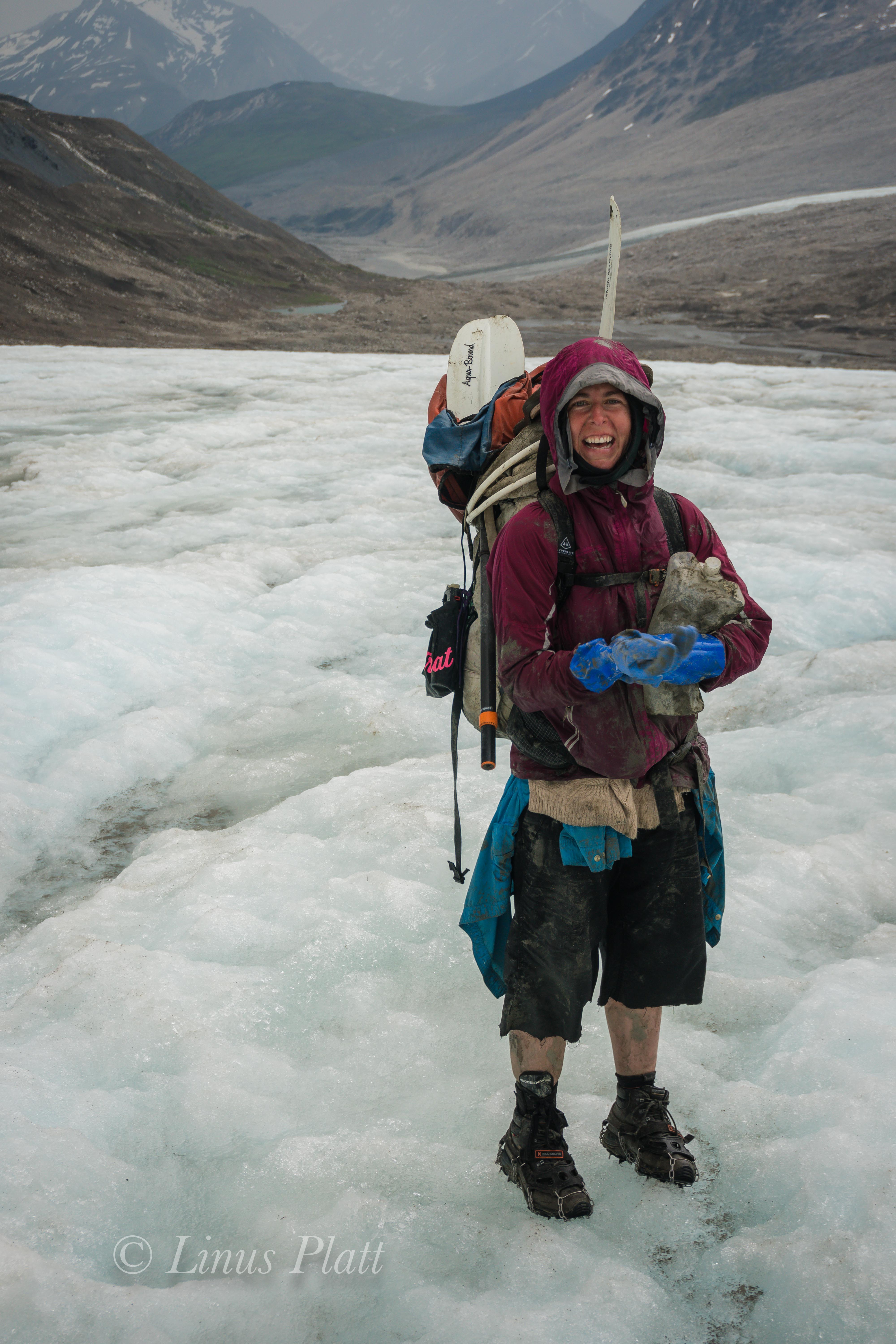
A day of hiking is in order and we pedal up the road, past the historic Kennicott Copper Mine, once the largest copper operation in North America. Passing through the mine area, we continue on a deteriorating trail, park the bikes, and continue on foot. Five six or miles up valley, paralleling the Root Glacier we hike, where we find a place that looks reasonable to descend, and down we go, crawling across scree covered ice hills to reach the main body of ice. Angela has never been on a glacier before, and it had been a while since I had last been on one of this size. We step out onto the flat ice, well below the firn line, and small, but open crevasses appear. A giant Moulin is flowing wildly upon the giant’s back and we drink freely from it’s source. We ascend back up the loose scree to the trail and skedattle down valley to our bikes. A quick blast back to McCarthy takes only minutes and soon we are in camp again. That night, very late, I get up and a slight tinge of the Aurora Borealis was beginning to appear. Summer was coming to an end.

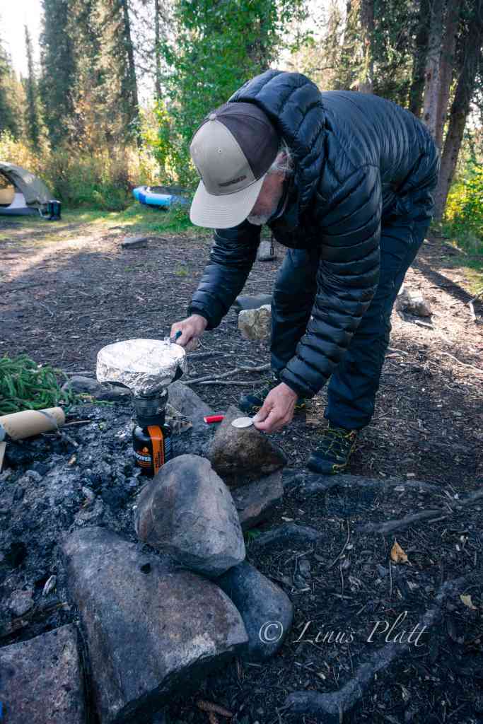
The day following is Angela’s birthday, and it is raining badly. We take cover in the local coffee shack and put off getting into the mud till past noon. The day is spent mostly in wet conditions and endless, grinding, mud. This signals the end of my bottom bracket, rear hub, and drivetrain. My bicycle is very tired indeed. The next few days are spent pedaling south on the Richardson Highway, crossing the fantastic Thompson Pass, en route to Valdez, where we catch the ferry to Whittier and pedal to Anchorage. Angela and I say our goodbyes, which is hard since I will not see her again for five months, as I am staying the winter in Alaska. She boards a plane bound for the “outside”, as Alaskans are sometimes fond of calling the lower 48, and I, catching a rare and outstanding view of Denali from The Glenn Highway, shift back into gear, and pedal north, in search of another fine Alaskan camp.

Some Thoughts

112 days. That’s not to long, is it? Only 112 days left till the open road is mine once again. 112 days till I  get in my truck (ugh) and drive to Bellingham to catch the ferry to Skagway. These days, lately, have been filled with wrenching at Edible Pedal, editing video, working on TV commercials and feature productions, doing construction projects, and just about any other thing I can muster up in order to make the funds necessary for my up coming yearly adventure by bicycle. This years’ adventure, as well as last years’, will be a northern one.  When I’m not engaged in the above evil activities as a worker bee, I am sewing gear, repairing holes, altering tents, studying maps, reading web blogs, pouring over “The Milepost”, dreaming of Bears and Wolves, flying with Eagles, preparing my bike, and living a life of adventure in the city.  I long for the forest and the mountains and the lakes, and the animals, and the valleys, and the glaciers, and the open coastlines of the North. I miss it’s smell of spruce and of berry patches and of the salty coastal air. I miss bearing witness to 30 mile long glaciers and Bears half the size of my truck.  I miss the quiet and the solitude that these places offer my mind and my soul. A place to rest; not body, but mind. I miss the daily bicycle or foot travel that affords one a chiseled and lean structure in which to live. I miss sleeping in a sleeping bag and cooking my meals in a simple and enjoyable fashion. And yes, I miss emptying my bowels into the open forest, as all animals do…  Only 112 days.