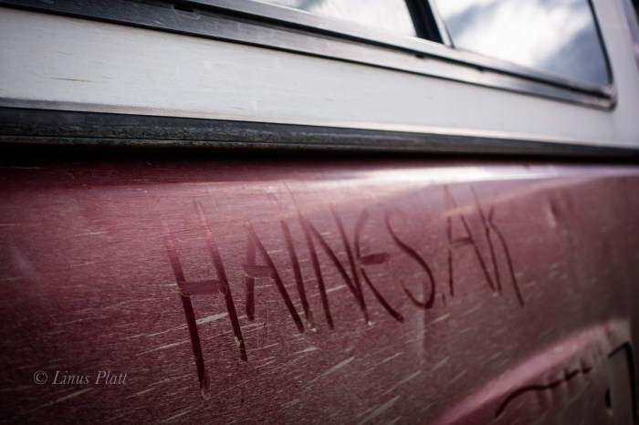
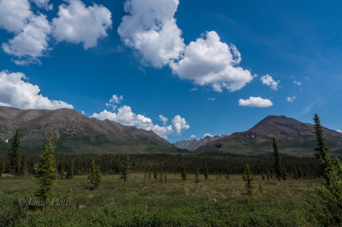
As mentioned here before, for me, the primary reason for living in Haines is its close proximity and access to the incredible Yukon Territory. I could care less for the Sea and it’s subsequent maritime weather and inherent jungle. Instead, I prefer the deep interior with its immediate access to the alpine, it’s well defined and cold winters, its clear, crisp winter nights, its commonly seen Aurora Borealis, and its plethora of wild animals. I care not for cruise ships, inflated prices, and difficult access to the alpine landscape. Consequently, I tend to spend the bulk of my spare time on the north side of Chilkat Pass aka Haines Summit.
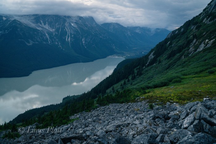
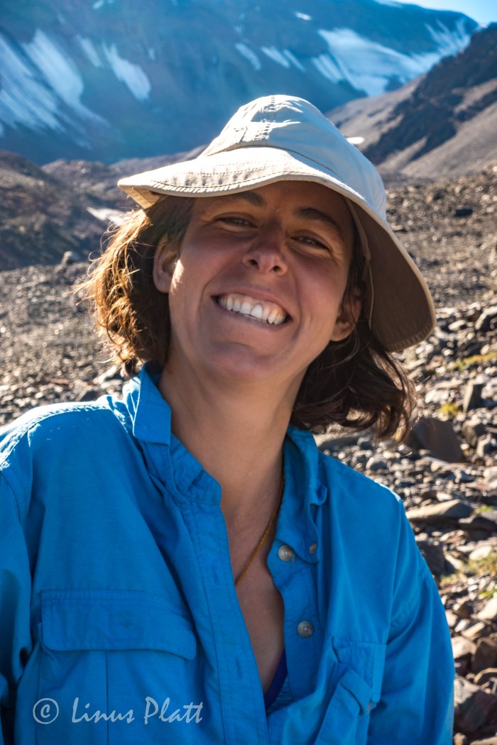
For Angela’s birthday we decide that a juant to the Yukon is in order, but an issue with a forgotten passport once on the road sees us turning the truck around in search of an alpine adventure within the confines of the narrow strip of land in the area surrounding the upper Lynn Canal. My good friend and workmate Tully has spent a great deal of time in the alpine areas above and beyond Chilkoot Lake and has expressed nothing but gratitude that this area exists. After showing me a photo of a small alpine lake sitting on the very edge of steepening mountain sides and overlooking the Chilkoot region and surrounding ranges, Angela and I decide that a closer look is in order. Tully had described the approach to me some time back to this place he calls Wolverine Lake, but my memory is foggy and we figure on finding said place regardless.
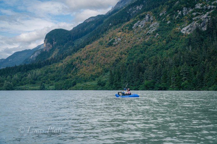
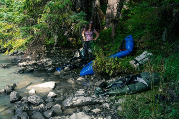
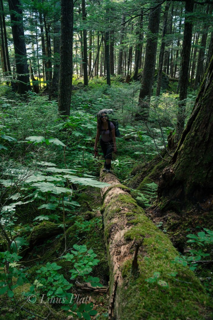
Driving in to Chilkoot is nothing short of chaotic. Fishermen, RV’s, tourists, tour busses, Bear watchers, campers, boaters, and riffraff clutter this overused area; its one of the finest examples of a Salmon filled Alaskan river with the ability to witness Bears fishing all through the summer. There are so many people here during July and August that I generally stay clear of this place. Once past the jumbling madness of the roadside river and boat ramp at lake’s shore, we find ourselves paddling packrafts across the lake a short distance to access the forest and the steep approach to Wolverine lake. We find a good place to stash the boats and ExtraTuffs upon a fallen Spruce, repack our bags, and begin trudging up the ever steepening hillside studded with the usual artifacts that atemperate rainforest has to offer. Soon it becomes very steep and in places requires both hands and feet to clamber up and over rotting logs, granite boulders, and dense thickets. It is tiring hiking for sure, but still relatively easy comparitively.
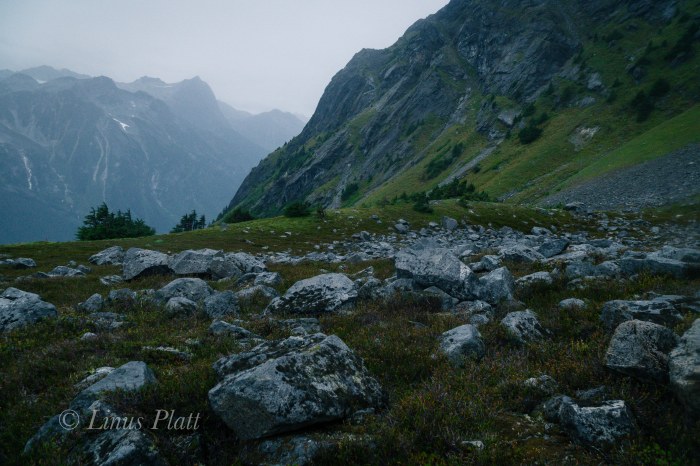
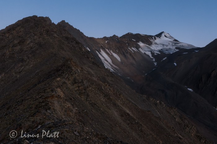
A vertical granite cliff of a couple hundred feet appears and we decide to skirt it on its left where a right leaning ramp leads to a boulder strewn sub-alpine valley. We think that Wolverine Lake is up at the top of this valley and pursue a jaunt of boulder hopping, which after the steep and cluttered hike down low, feels a welcome relief. Nothing makles me happier than to be on bare rock and boulders for travel. Up higher, the boulder field ends in another dense forest where we begin to doubt the location of the lake. It occurs to me that we are perhaps in the wrong drainage all together. We are exhausted and it is getting late; we decide that we must make our way up and over the ridge to our left to get to the proper drainage, but the means of navigating this requires some serious and painful bushwacking. An hour or so of battling some of the most heinous Devil’s Club and Alder thrashing I have yet to encounter puts us on a traverse into another boulder fiels in what we hope is the correct drainage. Boulder jumping once again upward sees us gaining altitude quickly. A young Black Bear darts from the Alder thicket just ahead and dashes across the tundra into another thicket. A group of 8-10 Mountain Goats are on a high bench off to our left. We are thirsty, tired, and in need of a camp.
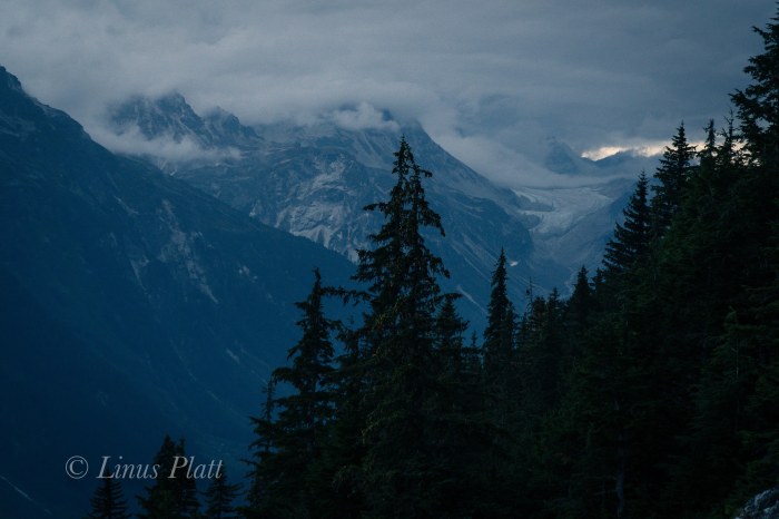
After topping out the last of the hikeable terrain, we find no Wolverine Lake but instead a beautiful but dry alpine cirque surrounded by high granite walls. We can hear water and begin descending into the bowl where we are thankful to find find a massive snow bank and small alpine pond – we have water. Setting up the tent on a ridge of tundra just as dusk hits, we dive in and spend the evening eating, drinking wine, talking, and listening to the rain come down, which it does for the entire night.
After coffee and breakfast the rain slows and we pack up camp and begin the slippery descent. Steep rock slabs must be negotiated before entering the forest and the ensuing bushwacking can begin. A thrash of epic proportions concludes us arriving at our boats torn to shreds. My arms looke like I was in a knife fight in an Anchorage bar, and Devil’s Club thorns embedded in hands, legs, and thighs. Exhausted, we paddle the short distance to the truck and call it another epic 30 hour Alaska adventure… In retrospect, had we stayed in the original drainage before bushwacking over the ridge, we would have run smack dab into our destination. Chalk it all up to adventure exploration in SE Alaska…
It had been a grand summer in the northern interior, but is was time to head south to meet up with Angela and have an adventure in the Yukon, so after tying up loose ends in Fairbanks and getting the archaic Toyota back into travel mode, I say goodbye to Sven and all the great folks I had met during my stay in Fairbanks this summer, gas up, and hit the highway. Driving south and seeing once again the massive central Alaska Range dominating the skyline, it is decided nearly instantly that I wish to head back to Delta for a few days to have a closer look around to do my own thing, shoot some photos and video, and look for animals. That evening at my familiar camp along the Delta River, another sublime sunset graces the southern horizon and showcases the white giants I dream of so often.
The areas around Delta Junction had fascinated me for sometime, and a venture with Dennis up nearby Donnelly Dome just south of town had wet my appetite for the vast tundra and river valleys of the region. It’s an area of concentrated wildlife, dense forest mixed with open tundra, raging glacial rivers, and giant mountains. In the morning following, I whip up some tailgate coffee and breakfast and soon head south to an area surrounding Donnelly featuring herds of wild Bison, Caribou, Moose, Grizzly Bear, and a vast network of dirt roads unexplored by yours truly. After stomping the brush filled valley below Donnelly and scaring up a large bull Moose near the Alaska Pipeline, I decide to drive up a dirt road I had spied some weeks prior that led past an old military installation and winding down to Jarvis Creek, but a sizable pool of water and it’s inherent mud hole prevents passage to the places I seek. So I stomp the area on foot on search of anything of interest. Grizzly tracks lead from and abandoned military bunker where once inside, I scare up several big Owls who are surprised by my presence and flee the scene entirely. Walking through the thickets, a large bull Caribou trots past not far off and climbs a short brushy hill to get a better look at me. Such a magnificent animal in silhouette against the storm encumbered sky; he smells the air briefly before descending the north side of the escarpment and soon is gone from my sight. Another Caribou appears and gallops fast to catch up, and soon I am alone walking the old dirt road en-route back to the truck. It begins to rain in earnest and soon it I am engulfed in a frigid downpour; in the dry and warm confines of the truck, I call Angela to solidify our plans to meet in the Yukon in another week or so for a climb up Mt Archibald in the beautiful and enchanting Kluane region less than a three hour drive from Haines. But for me, the drive will take a full day or so, but I have time to kill and decide to take my time and explore and maybe even climb a peak on the way south. I drive the old truck back north to Delta and back to my camp along the Delta River, where it rains hard for most of the night.
The next day is spent driving slowly, stopping often, exploring dirt roads and gawking at one of my favorite parts of Alaska. This place has the sensation to me of an ancient and somehow significant nature; people have lived in these vast northern valleys for thousands of years, flourishing in this striking and beautiful land. So many rivers, creeks, and un-named mountains here… It is a staggering thought to try to encompass all of its geography into my psyche. There is a thousand lifetimes of exploring to do here, and I can only hope to come back again and again to see and experience as much of it as I can in this one life. I pull down a dirt road and scope out an area for a hike and possible peak climb in an area north of Tok about 20 miles. Feeling satisfied that I have my bearings about me, I head down the road to Yerrick Creek, one of my favorite creeks in the area, to gather drinking water and bathe my stinking carcass. After a pleasant bath I drive to Tok for supplies and head back up valley to a sweet camp along the Yerrick. Once again, that night it rains a rain that can only be described as intense. Morning arrives and the rain shows little signs of dissipating, so I pack the truck and ponder my next move.
I decide to head back to Tok and do some laundry and fuss around town some where I drop into the visitor’s center for a look at the weather forecast that tells of inclement weather gaining momentum; after a walk through the old Tok cemetery during a rush of raindrops, I decide that the best way to spend my time before Archibald is to simply head back to Haines and catch up on much needed house projects that have been neglected all summer. Driving south of Tok through the maze of high forested ridges and immense wetlands, I emerge into the great taiga filled river valleys of the Robertson River, Johnson River, White River, and the beautiful Donjek River, all giant glacial fed braided specimens born of true and unrelenting wilderness. The Kluane region is now at hand and a pair of blonde Grizzlies graze at road’s edge as I pass. I camp down an old dirt road overlooking the fantastic St Elias Range where a small herd of Dall Sheep can be seen on a neighboring hillside grazing in the midnight twilight. Passing near Haines Junction the following day, the mass of Mt Archibald comes clear and its steep and glaciated east face dominates my view. Back in Haines hours later, I settle into my little house and fondly breathe in its strangeness; I have not been here for over two months, and it seems foreign to me. Nonetheless, a good nights sleep is to be had, and now preparing myself for the new electrical breaker panel that needs to be installed at the power lines adjacent to my house was in order. Five days later, the breaker panel is installed, the truck worked on, and gear and supplies gone through for the next Yukon adventure with Angela mostly taken car of.
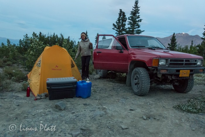
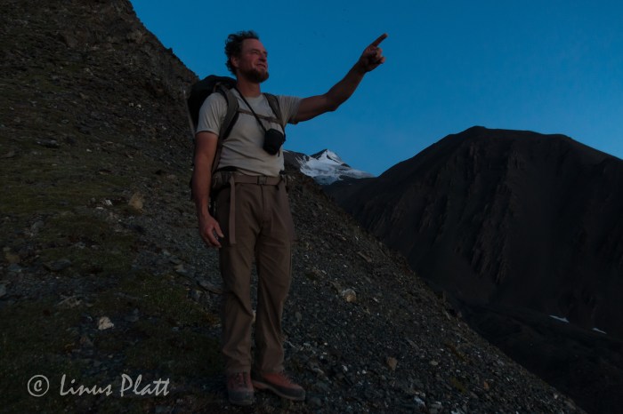
The day before departing again back into the Yukon, Angela comes over and we spend several hours organizing gear and prepping for the Archibald climb. It feels good to be in a state of anticipation of an adventure goal once again, and soon we are ready. The plan is to leave late morning or even mid-day and casually head to Haines Junction to re-group and find the dirt road that leads Thunderegg Creek where we will spend the night before the hike in to our basecamp for Mt Archibald. Casually driving up the Haines Highway and up and over Haines Pass, AKA Chilkat Summit, it feels good to be in the high country once again. We take our time stopping from time to time to explore a little here and there and taking in the peaceful valley where the stimulating Klukshu River flows; it is a tiny river with runs of large King Salmon, but none are seen here today. It is a place of crossroads where cultures of the Aishihik and Champagne peoples would meet with the Chilkat Tlingits to trade goods and furs for the highly sought after Hooligan fish oil. In Haines Junction to gas up, we get to the visitor’s center just before closing time to secure our permits for backcountry travel, but are told that we need no permit to enter the area we are going as it is just outside of the Kluane National Park boundaries. Suits us fine, and we hit the Little Green Apple, Haines Junction’s tiny grocery store, for our supper supplies and hit the road north towards Thunderegg Creek.
Thunderegg creek is the drainage that flows from the un-named glacier that grows from Mt Archibald’s southeastern flanks and is named so for the marvelous round “eggs” of stone that grace the corridors of the raging river. In the morning, we pack up casually and shoulder our relatively light packs and begin the stomp up valley towards the glacier. The accounts we had read on-line gave a thin description of a faint game trail that peters out into thickets of Alder, Willow, and Aspen that must be navigated in order to avoid the impassable shores of Thunderegg Creek. Soon we find the trail disappearing and the thrashing through Alder thickets begins. The descriptions mentioned that the bushwhacking should last “no more than an hour”. True to the description, we emerge from this dense northern jungle in short time to find ourselves clamoring up an exposed ridge where two drainages parallel one another. At the ridge’s top, flat walking lead to a decision: either continue bushwhacking higher to where tree line ends and the glacier and moraine begin, or bushwhack down and to the left into the drainage of the creek that flows from the ice. It seems the downward option is our best bet, and another great and thrashing jungle session begins. The going is slow and methodical; it is very dense, but it is fairly short and soon we are deposited into the dry and rocky creek bottom, sans creek. We had hoped for water here, but none is found. An uphill trudge of about an hour and a half brings us to the very base of Archibald herself, where sprouts of tundra meadows appear. We ponder camping here, but realize quickly that not only is there still no water here, but the base of the Southeast Ridge that we intend to climb would be much better gained higher up the moraine. Getting both dehydrated and exhausted, we trudge on in hopes that drinking water and a suitable bivouac will reveal itself. Following the lead of the description we had read, drinking water could be found at the base of the terminal moraine; we gain the base of the massive scree to find none at all. Working up and around the lower portion of the moraine, a decision is made that we must go up and over this beast to find salvation. Another 20 minutes of scrambling and we are on top of the moraine and looking down slightly to a flowing creek of fine glacial drinking water. Dumping packs, we scamper downward to the creeks edge and fill ourselves with the glorious liquid. Bringing no tent along on this adventure due to the outstanding weather forecast and wishing to save every once of burden from our backs, we spy a small shelf situated at the exact starting point of our proposed climb. It is stupendously perfect. After moving rocks around for a few minutes, we have ourselves a perfectly flat and relaxing spot to throw down our sleeping bags; but it is hot. Very hot. The sun will not be behind the rim for another two hours and all we want to do after supper is go to sleep for our 3 am wake up call for the climb. So we wait… After the sun begins it’s descent behind Archibald’s summit ridge, we close our eyes and…. not sleep. We are both gifted with a bout of insomnia that allows us just scant minutes here and there of real rest. This seems to happen to me a lot on these high mountain bivy’s. Not sure why, but it seems I am just too much in awe of the glorious alpine setting and can’t seem to get my eyes or mind to sleep. Occasionally, when I am camped in these high glacial cirques, there exists sometimes the sensation of faint voices; like souls wandering these glaciers and whispering slightly. It is a strange phenomenon and Angela speaks of it as well… a curious thing these voices. The northern summer twilight that never really gets dark soon gives way to a display of the Aurora Borealis that sets our hearts on fire as we gawk in awe at it’s offering. Soon, the Aurora dissolves into the early morning dawn as the 3 am alarm goes off and we are up packing, cooking oatmeal and tea, and rubbing the lack of sleep from our bewildered eyes.
Following Dall Sheep trails up endlessly steep and sliding scree, we emerge on the top of the lower ridge to find a staggering sight: the un-named peaks to the west of Archibald are adorned with glaciers exhibiting broken seracs and icefalls, lit up by a full moon rising above their rarely seen summits. A post-Aurora alpenglow that sears the sky with streaks of pink and orange light outlines the mountain horizon to the east and north. The sight fills me with the notion of being a part of this grand and ethereal landscape that is not to be taken lightly. I find that being in these place gives me a sense of deep spiritual and emotional connection to the natural world that allows me completeness as a Human Being living on this strange and beautiful planet.
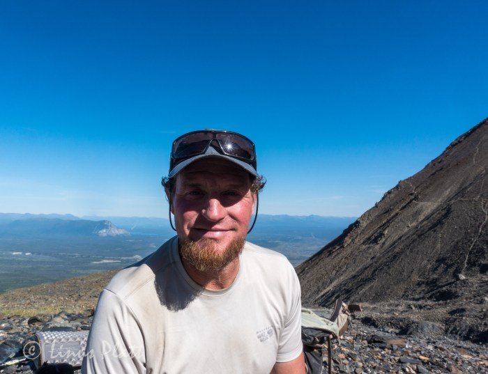
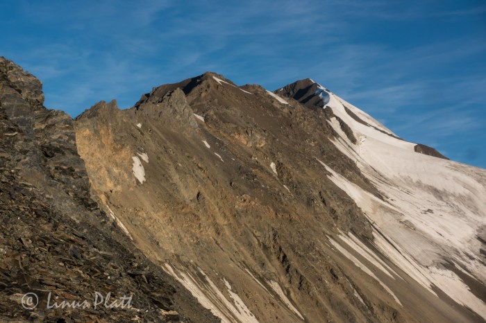
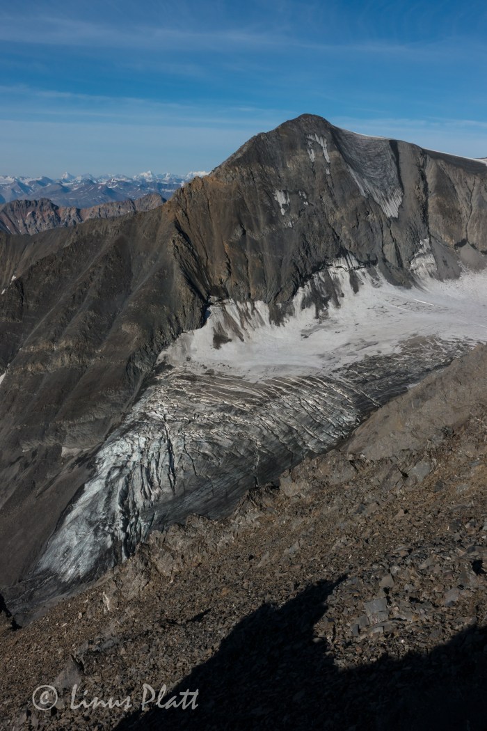
The southeast ridge of Mt Archibald is a long and rocky ridge, perhaps 3 miles in length and rising nearly 6000 feet from Thunderegg Creek to it’s 8,491 foot summit. This ridge is a steep and sometimes narrow feature sporting many sizable ‘summits” along it’s way, several gendarmes up to class 4-5 climbing, and near it’s top, the glacial ice from it’s east face creeps over the top of the upper ridge where steep and exposed snow and ice climbing accesses Archi’s true summit. It is a big mountain with a huge elevation gain for a peak of its height, and requires a variable set of skills to reach its summit. One must be comfortable with loose rock, exposed class 4 rock climbing, route finding, and snow and ice climbing skills. Given the length and elevation gain of Archi’s bulk, exceptional fitness is also a must.
A short scramble from our perch atop the lower ridge and we are surmounting the first of many gendarmes, most of which are in the solid class 3 range. Up and over, side hilling scree, of traversing back and forth across rock ranging from shattered Schist, to loose scree, to blocky talus generally accomplishes dealing with these many features and false summits. The hardest part of this ridge is the elevation gain… then loss, which one must deal with when going up and over these false ridge summits.
After a couple of hours of traversing and scrambling, the sun begins to crest just above the distant horizon and the ridge begins to get steeper, looser, and more exposed. Sections of steep scree lead to flatter sections of the ridge, where Dall Sheep sleeping platforms appear; there are several spots grouped together and have been manicured by hoof to produce flat and comfortable sleeping arrangements. Most are right on the apex of the ridge itself where wind and exposure are a way of life for these magnificent and hardy animals.
Higher up, another steep gendarme is negotiated by means of traversing left and scrambling the steep, exposed and shattered rock diagonally and then climbing directly upward and over it’s tiny summit; a brief down climb leads to another short traverse on it’s right flank to a point where the ridge eases off once again before climbing abruptly to the base of what had been described as the crux of the route: a true summit in it’s own right, a sub-peak of sizable proportions that bars access to the upper ridge, and the final stretch of chaotic mass of shattered debris below the steep and forbidding summit snow and ice where the glacier bends itself agonizingly over the summit ridge’s lip. Once the bulk of the gendarme is reached, the climbing turns to extremely exposed and loose class 4 climbing. We brought no rope so great care was taken climbing through this section. Once gaining the broken, tiny summit of this mammoth sub-peak, a view towards the final rib of snow and ice can be seen for the first time on the climb; it appears to be a steep knife-edge leading directly to the Archibald’s summit.
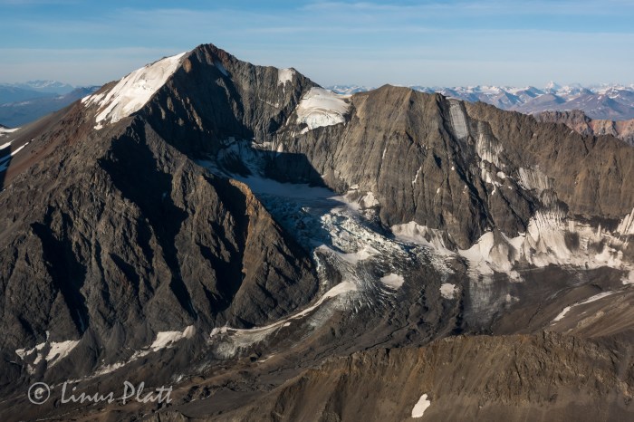
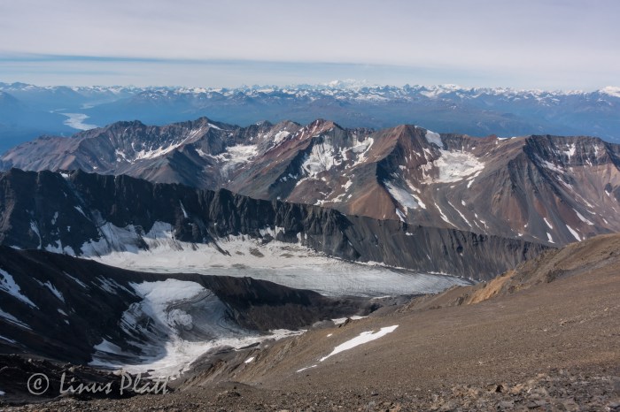
We are extremely lucky today to have the unbelievably outstanding weather we are experiencing, and from this point on the upper ridge, a view west reveals completely unobstructed and crystalline views of the entire Mt Logan massif and all of the big peaks of one of the most expansive glaciated mountain ranges on the planet. After moving through a section of broken towers and blocks, we find a pool of drinking water and fill our bottles and eat; we are both getting tired.
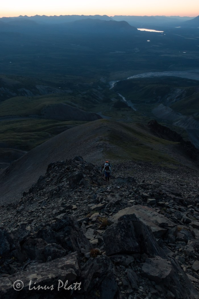
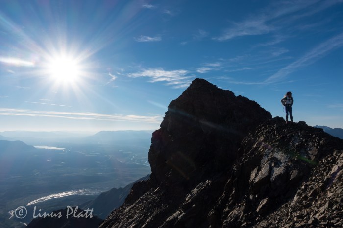
Another long, steep section of extremely loose scree forms a knife-edge and leads to a long flat section of ridge where, at its end rises the final snow and ice where the summit lie just beyond. After donning crampons and ice axe, we begin up the steep snow, Angela above of me front pointing then plunging the axe’s shaft, and repeating till there was no more. We are standing on the tiny summit; in fact it is just barely big enough for both of us to sit. The weather is striking and the views are mind blowing; however, I had been developing vision problems for the last hour or so from sunscreen dripping into my eyes, and now sitting here on Archibald’s summit, the pain is increasing, and my vision getting very bad indeed. We have 6000 feet of dangerous and time consuming ridge to down climb and here I am with only one working eyeball. We snap some photos and then begin the long and arduous descent back down the snow rib and the long loose section leading to the big gendarme. By the time we reach the dangerous class 4 sections, my vision is really bad and the pain increasing still. I have one semi-working eye in which to navigate the down climbing past a deadly exposed section, where if one fell or slipped, it would be the end of you. After managing, I stay close to Angela and she down climbs the bad section; relief hits us both and we are soon traversing and side hilling the long mid section of the route; I have managed to sort of “ski” the scree in my mountain boots, making downward progress a little less tiring, ice axe in hand just in case. After a few more hours, we are at the top of the Dall Sheep trail that leads back to the bivi. I am so tired, I can barely stand, but commit to this last section with abandon. Angela does the same and when we reach our bivi site, we collapse for a brief spell and ponder what we are doing.
Again, my eyes are inflamed and I cannot see at all out of the left eye, leaving only my bad right one still working, which has been of poor vision since childhood. We decide that hiking back to the truck is in order and the possibility of seeking medical attention a reality. After packing up our alpine ghetto, we shoulder our packs, our bodies scream, and we begin descending the debris covered glacier towards the dry creek bed and the route home. The going is slow, but soon we are at the point where we had bushwhacked from the ridge and into the drainage. Not feeling like going up through the thickets, we opt to stay in the dry bed in hopes that we may find a way to navigate around the toe of the buttress and it’s inherent Alder thickets. After stomping down through the Bear tunnels and shouting “Hey Bear!!” every so often so as to not startle one and provoke an encounter, we find ourselves on the shore of Thunderegg Creek. Fed by the glacier we had just come from, this specimen is no creek, but a dangerous and massive river, dark chocolate with debris, very deep, very fast, and very cold. We walk it’s shores for a very short time before realizing that we are trapped by the dense thickets leading directly to the edge of the raging torrent. Everything we had done to avoid the bushwhack just exploded in our faces and the only option left is to aim uphill and attack the matrix of the dense and unforgiving web of Alder, Aspen, Willow and small Spruce. Not 50 feet into it, we are encountering the worst bushwhacking of our lives. I once was a part of a conversation with some Washington climbers years ago about how the locals had a “bushwhacking rating system” for back country travel and mountaineering approaches in Washington state. I thought it was kind of of funny at the time, but now, after living and stomping in Alaska and the Yukon for a few years, it is no joke. This thicket we are in is definitely “class 5+” bushwhacking. Add a full pack and a pair of trekking poles to the mix and you’ve got some real fun. After about an hour or so of this, we emerge on a faint trail that leads to the cliffs at Thunderegg where the truck is parked and rest awaits.
The exhaustion we feel is overwhelming, and my eye is in horrible pain; perhaps the worst pain I have ever felt. It is late and we decide that staying here for the night is the best option, since the closest clinic is in Haines Junction or possibly even Whitehorse over 100 miles away. Oddly, there is phone reception here and Angela gets on the telephone and inquires about the clinics and general eye care with a nurse in Whitehorse. Not only would the drive be horrendous, but the cost of such an endeavor would be very difficult for me. We hunker down for the evening in the tent, sipping a cup of wine and me trying desperately to hold on. The pain is overwhelming. After a few agonizing hours, I pass out and wake hours later to my eye feeling slightly better, but still not good. We pack it in, drive out the long and sustained 4WD road back to the highway and head into Haines Junction for some grub and decide to head home and go to the SEARHC clinic in Haines.
The drive back over the pass is striking as always; the tundra surrounding the peaks laid out like a sub –arctic blanket and the peaks themselves jutting proudly to meet the sky. The drive from the alpine at the pass down the Chilkat corridor to Haines is always an interesting one to me as witnessing the transition from one ecosystem to another is always a joy, even with one eye. At the clinic in Haines, the visiting eye doctor examines my eyes and runs me through a series of tests that determines that the sun screen was in fact the culprit, and that applying some eye drops and rest will alleviate the pain and irritation. The entire experience, from the sleepless bivouac and the early morning Aurora, to a long and arduous route and it’s subsequent beautiful summit, to a terrible bushwhack and a murderously painful eye condition, has been one of great significance in a lifetime of outrageous adventures spent in an array of wilderness places that continue to touch our hearts and souls. It is being in these places that both Angela and I seek, both on a physical and spiritual plane.
The Kluane area of the western Yukon remains one of my most revered place on this planet; it is a place where some of the largest glaciers on Earth are born from some of the mightiest and remote mountains… it is home to scores of Grizzly Bears, Black Bears, Wolf, Lynx, Dall Sheep, Moose, and has an ancient Human cultural spanning thousands of years. The wilderness here is far reached and commands respect from any creature passing through it. It is a place near my home and one that I will return to visit time and time again to explore and experience magic.
The Ridge Between BushwhacksAngela entering the TundraDall Sheep trails On The Lower Southeast Ridge Of Mt Archibald
The Bivi
The Lower RidgeThe Upper Ridge And The Summit Of Archi
.
A Magic Moment
Mt Logan Dominating the Far Skyline
The Exposed Class 4-5 Crux Of The Route
At The Watering Hole Up High
Angela Putting On CramponsThe Steep Snow Rib Just Below The Summit
The Last Few FeetAngela On The Tiny Summit
On The SummitThe Long and Un-Named Glacier And Our Bivi WAY down At The EndThe St Elias Range And Mt Logan Far Off
After an icy morning dunk in the Yukon River to scrub both body and clothing, I head to the RV park in Dawson to use one of their clothes dryers and then blast through town to pick up a cup of coffee and some supplies. The dirt streets of town are quiet and pleasant, with only the sound of the Yukon ferry doing it’s early morning chores on the swelling river. After my clothes have dried, I board the truck onto said boat and in moments I am easing the Toyota up the big climb out of the Yukon River drainage and up to the high forested spines of the Ridge Road, Also known more commonly as the Top of the World Highway. I remember this grueling 8 mile climb mounted to the inexhaustible Ogre back in 2013. I found the TOTW road to be an epic ride; one massive hill climb after another, up and down, rarely flat, always challenging, and doing so for 120 miles before the final assault at the border consisting of a 12 degree climb to it’s apex, before a descent to the border crossing itself, after of which there is a long descent into the Forty Mile River region of eastern Alaska. This area has the small and interesting communities of both Chicken and Eagle, Alaska, and is an area of heavy mining activity, vast plateaus of forested wilderness, wild rivers, and the Forty Mile Caribou herd. Once past the river region beyond Chicken, the road flattens for a bit through vast and swampy Taiga valleys, followed by more endless up and down hill climbing. Eventually, one comes to see a lone peak in the distance; it is a high point in this part of Alaska called Mt Fairplay which the Taylor Highway (The TOTW Highway becomes known as the Taylor Highway once entering Alaska) skirts on it’s northerly shoulder. It is at this magnificent high point that one is treated (assuming a clear day) to glorious views of the entire Alaska Range from Mt’s Hayes and Deborah, past Denali, and all the way to the start of the Wrangell-St Elias. It is a grand view of beginnings of the greatest chain of mountains on the continent. Soon one descends slightly to the remainder of the hill climbs that signal final descent into the Tetlin Valley and the Tanana River. Once to the Tanana, the community of Tok is not far off.
I chill out in Tok for a couple of hours simply trying to get a grasp at my next move and keep my mind calm. Looking over my maps, it occurs to me that the Nabesna Road is not far away… perhaps 70 miles down the Tok Cut-Off, which I had neither ridden or driven before. So to me at this time a moment of excitement hits me as I am now prepared to explore one of the many, many areas of Alaska that I had never been. That always gets me in a good mood, and soon I am spinning down the Tok Cut-Off, a beautiful highway that essentially splits the Alaska Range from the Wrangell Mountains to the south. It follows beautiful river drainages and sports mature boreal forest galore. Tall alpine peaks adorn both sides of the path, and a dull sight is never at hand. It is getting late and I pull down a dirt road along the Little Tok River to find a wonderful camp next to a deep blue pool in the river, where Grayling are surfacing everywhere. After setting up my camp, I grab the fishing rod and commence to catching my supper. I build a fire and wrap the Grayling in tin foil with some onions and butter, whip up some tea, and proceed to shoot a time lapse of the deepening hues of the midnight sky. Sleep comes around and I dream once again of being in high peaks surrounded by wilderness and animals in the most glorious vast areas of this amazing continent.
I seem to only sleep maybe 5 hours a night this time of year, at least for a week or so at a time, when it catches up to me and I then sleep for ten hours or more for a day or two. This morning was another early one for me, and I have the truck packed up and rolling down the Cut-Off by about 5 am. Stopping at a roadside lake, a walk to the shore reveals Swans, Geese, Moose, and literally thousands of fish swimming and visible from shore. I see what appears to be spawning colors; I grab the rod from the truck, not because I wish to eat, but because I must know what these fish are. After a couple of casts, I pull in a Grayling, and release it. Another cast, another Grayling. Finally, two more casts produce yet another Grayling. I inspect the beautiful fish; Grayling are by far the most common fish in the Alaskan interior and are easily identifiable due to the very long and undeniably prominent dorsal fin; No other freshwater fish has a dorsal like this. This is fine and good, but is still have not found the information I seek. I peer into the water hard to inspect and can only assume that these are a small variety of spawning Sockeye, or Red Salmon. The nearby Slana River flows into the Salmon infested Copper River to the southwest, and forms sloughs that feed this lake. The Copper River is famous for it’s amazing runs of Sockeye, so I must then assume that this fish I see are such.
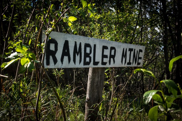
Soon I am pulling onto the Nabesna road and park the truck in a pullout and off the road a fair bit, as It will be here for a couple days at least. My plan is to ride the Ogre to the end of the road 42 miles out and into the Wrangell’s, camp out, inspect the abandoned Rambler Gold Mine, and then pedal back to the truck; maybe three days I think.
The Nabesna Road is one of only two roads that penetrate the Wrangell Mountains in Alaska, and is the northerly of the two. Angela and I and ridden the other one to the south a few short years ago all the way to McCarthy and hiked up the Root Glacier for several miles before pedaling back out to Chitina and on to Valdez. The Nabesna however, comes in from the north and travels Taiga forest and tundra with unbelievable views of the 16,237’ Mt Sanford, the second highest volcano in the United States behind the 16,421’ Mt Bona, and also 14,163’ Mt Wrangell and the beginnings of the high glaciated plateaus that lead to the enormous centerpiece of the Wrangell’s, the 16,391’ Mt Blackburn. These peaks are nothing short of Himalayan in size, rise nearly 14,000 feet from their bases, and feature massive glaciers and ice sheets. They also support large populations of Dall Sheep, Grizzly Bear, and Moose. Lynx, Wolverine, and Caribou also grace these ephemeral mountains. It is a true rugged mountain sub arctic environment and true deep wilderness in North America. It is also an area of amazing geologic wonder, being primarily volcanic, but segments are also of a fault block uplift, and the combination produces unequalled beauty in one of the most striking set of mountains one is likely to encounter. It is also very lightly traveled by Humans. It simply is not an area tourists go, regardless of the fact that the entire region is contained within the Wrangell-St Elis National Park, the largest national park in the United States, from exploring this mighty region. The combination is what drives me… remote and largely untraveled regions of Alaska that feature gifts of wilderness, solitude, and beauty.
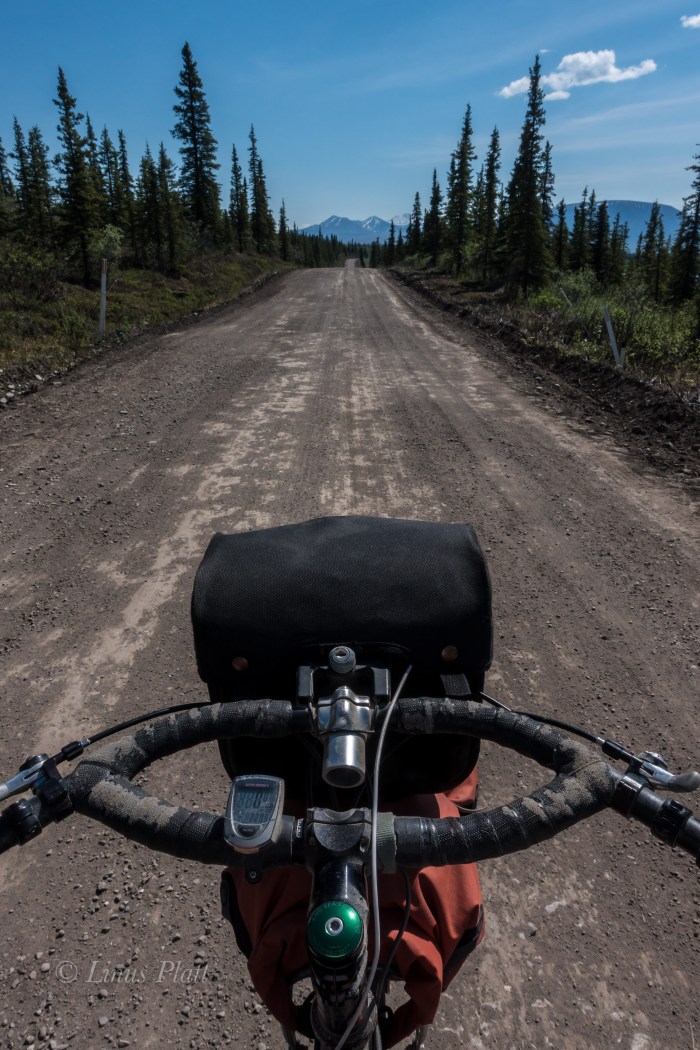
After casually getting my gear and bike together, the Ogre and I are rolling the Nabesna past the Slana River and onto the vast Taiga plateau that marks the beginning of the slight ascent into the high country. The beast beneath me bucks wildly for a bit till she tames down some and soon we are synchronized into a union of one pedal stroke after another. It has been quite some some since I had ridden the old girl fully loaded. It is extremely hot… 83 degrees in fact, and a hot, cloudless blue sky penetrates me and I feel sunburned already. Layer after layer of sunscreen, but sweating does me no favors. It is fairly dry in this area as well. In fact for the first 20 miles, there are no good streams for drinking from, so one must be prepared for this scenario. The first 15 or 16 miles of the Nabesna are either paved or chip seal, but soon after, the main dirt road section appears and the Ogre and I glide along it’s length silently.
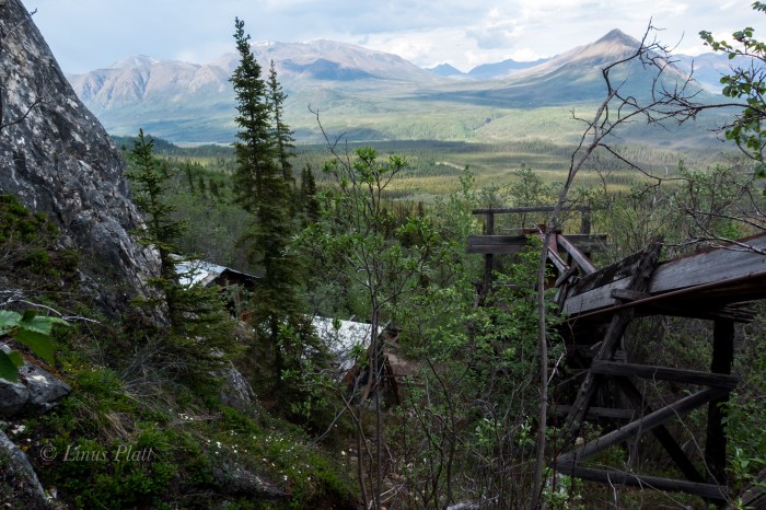
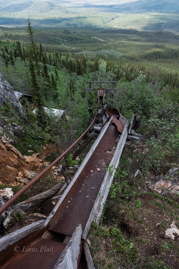
Between expanses of Taiga, long stretches of tussock tundra dominate the landscape, leading for as far as the eye can witness into forays of untold peaks, valleys and wilderness. Finally a clear crystalline creek appears, jutting from a deep cleft in the barren mountainside and tumbling feverishly to the road, where it meets up with moi and I drink copious amounts and fill all of my bottles. I tend to carry many bottles on bike trips as I consume huge amounts of water in an attempt to remain hydrated, and today is definitely no exception. I find the heat to be stifling and although the Nabesna, for the first 30 miles is relatively flat, I am sweating bullets and feel deeply overheated. At 29 mile, the Sportsman’s Paradise Lodge comes around and I drop in for a root beer. I walk inside and say hello to Doug, the owner if the lodge, and grab my icy drink from the cooler. As I sit at the bar, I pop out my debit card, as I have forgotten cash… Doug says “nope”, “We got no connection for that sort of thing out here, but don’t worry, I’ll cover ya… Just make sure to send me two dollars in the mail when you get a chance. Ain’t no one ever stiffed me yet” he says. The sweetness and chill of the root beer are unbelievably refreshing, and aside from Doug’s chain smoking cigs inside the lodge, we had a pleasant conversation regarding the local wildlife, weather conditions, and the current Sockeye run at the Copper River near Slana. After finishing my beverage, I reluctantly leave the coolness of the lodge and continue pedaling the remaining 13 miles to the end of the road, the last three or four of which included some steep hill climbing and descending. At the end of the Nabesna road is an old air strip, lodge, two bed and breakfast type places, and a couple cabins, all of which are closed up or abandoned. The place is deserted. From here, an old jeep trail leads a few miles back to the Nabesna Gold Mine and the Rambler Gold Mine. I am extremely exhausted and I find no where acceptable to camp; the dirt track becoming narrower and narrower, with no water and no where to pitch a tent. Large piles of Grizzly scat appear and I start singing to myself and decide that the Bear spray belongs in my hand and not in the pannier. Eventually I decide that I am far too tired to continue and I must turn back pedal the three miles to Skookum Creek for a decent camp. I figure if I do this, I might lose motivation to come back here in the morning, so I decide, regardless of my exhausted state, that I must hike the 500 vertical feet and 3/4 mile up to the Rambler mine. I park the steed and begin the uphill stomp. I am so tired I can barely pull it off, but as I near the mine a second wind takes me and soon I am ambling about the old buildings, sluice boxes, ore cart rails, mine shafts, and mining debris from another and forgotten era in Alaskan History. The Rambler mine was active, and abandoned in the 40’s, and now sits as an untouched monument to a short lived gold rush memory that created the settlement of Nabesna. The views from the mine are nothing short of spectacular; the Nabesna River clearly visible, it’s source, the Nabesna Glacier just out of view, but the endless deep wilderness of the region unfolds dramatically as far my eyes can take me.
I pedal in a dilapidated state all the way back to the best camp on the whole road at Jack Creek, which unfortunately means I must pedal all of the hill climbs again today to reach it. I manage to do it and once to Jack Creek, I strip down to my birthday suit and fire myself into the drink. The water is ice cold and the shock hits me hard, but my body is refreshed and clean and I meander off to get my camp set. Sleep comes easily and I am awake at 4 am… pedaling back to the truck by 5, and at the truck by 11. The entire journey including hiking to the mine took only 23 hours, however it should be noted that there are more mines and many more trails to discover and explore in the area and a trip of several days would not be considered lengthy. As noted previously, like a Shark, I am on the move.
Later on, after de-rigging my vessel and loading up, I drive through Glenallen, where hoards of tourists and dip netters clog the town and highway. I am all too happy to leave it behind and mosey on up the Richardson Highway bound for my absolute favorite place in all Alaska: The Central and Eastern Alaska Range.
Zen Cairns At The Top Of The WorldOld Mining Equipment On The TundraTop Of The World Abandoned TankerFor The Home TeamThe Little Tok RiverLake Of A Zillion FishMt Sanford 16,237″The Nabesna RoadWrangell High Country Taiga and TundraOne Of Several Stream CrossingsThe OgreThe Rambler MineRambler Mine Ore CartMine ShaftThe Nabesna Valley As Viewed From The Rambler MineMine StructuresSkookum CreekThe Skookum Volcano
I really like Whitehorse, really, I do. But the hustle and bustle of even a cool town can wear me down. I’m not much for seeing the usual tourist sites of a given local, generally getting on with my business, and then heading for the hills. I had numerous things to attend to, however. The 11 litter MSR bladder I had lovingly carried through many thousands of miles, had sprung a leak. Besides, previously having traveled with a trailer made it possible to simply strap the apparatus to the top of the trailer and carry on; but traveling with panniers is another thing altogether, and the bladder concept wasn’t as useful now. So I needed water bottles. I needed to purchase a phone card, do laundry, buy food, convert U.S. dollars into Canadian fun tickets, make phone calls, buy a reading book, and get my load straightened out. Without much fanfare, I accomplished these tasks and skinned out by 1:00 pm. In all honesty, Yukon hospitality has been hit or miss for me in the past and now as well. It seems 2/3 ‘rds of the folks I meet are friendly and open. And all of the first nations peoples I talk with are open to conversation, it’s always been this way. There seems to be that reserved crowd who just don’t dig folks on bicycles around. For example: at the Braeburn Lodge, the proprietor, an enormous bellied, white bearded dude, who could have passed as Santa Clauses’ cousin, sporting a Harley Davidson T-shirt, simply grunted when I spoke, and barely gave me the time of day. He sure took my money for the regionally famous Braeburn Cinnamon Bun that I purchased though. Paradoxically, when speaking to a First Nation’s man in Carmacks, we chatted and chuckled, and he wanted to know why I didn’t have a fishing pole with me, as some mighty fine suppers’ could be had ahead. Why don’t I have a fishing pole I contemplated?
A ways past Braeburn, the terrain opened up to an unexpected valley of agriculture. Soon though, the North Klondike Highway turned upward once again, and we rose into the Spruce, and my favorite forests, revealing rivers and meadows. I take a short 2 track leading into said forest, and it dead ends into a splendid old cabin, long since forgotten. It looks to have been built during the Klondike gold rush years at the turn of the century, but it could have been a tad bit more recent, I don’t really know. Rusted tin cans, old miner’s boots, fragments of tools, and a caved in sod roof, rounded out this historic and peaceful camp. I walk down the hill, after setting up camp, and a spectacular site unfolds before me.. Fox Creek, teeming with Grayling, and surrounded by meadows and high mountains to the west are a treat to my eyes and senses. What a place to have lived at one time.
After a bit, the mighty Yukon River herself appears, and after following her course at river level for a short while, the road climbs upward, diagonally across the ancient alluvial plane, and settles down upon the flat bottomed benches overlooking the great river. Sprouting from this bench, are great forests of Spruce as big as any I have ever seen.
Onward, a car pulls over and two fellows I had met previously, from Juneau, inform me that there is a big Grizzly just up the road. I say farewell and cautiously pedal on. Not much further, I spot the large brown mass, way further off than I expected. The creature is perhaps 800 meters away, on a hillside, digging for rodents; it looks to be a big one too.. perhaps 800 lbs. I say farewell again, and off I go. The North Klondike Highway, from Whitehorse to Dawson City, largely follows the relative path of the Dawson Overland route taken by gold seekers of the great Klondike Goldrush of 1898. The treasure I seek on this passage is not gold, but animals. Today I spotted a large rabbit; like none I have seen before, with large furry white feet and belly, brown back, and shorter ears than I am accustomed to seeing. This was no cottontail or jackrabbit. I mention this to locals and they say it is an Arctic Hare.
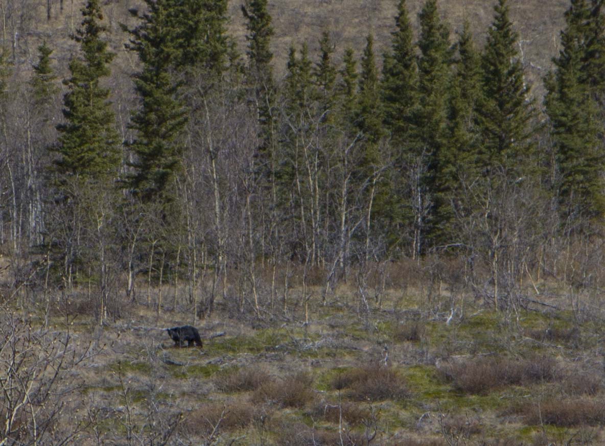
The daytime temperatures are nearing the mid 80’s.. This seems astronomical for this time of year to me, and the locals tell me that the ice breakup was literally last week! It went from winter to summer almost overnight, skipping spring altogether. Wacky.. This part of the Yukon is definitely drier than other parts of The North, it reminds me bit of central and western Colorado at around the 6,000′ to 8,000′ elevations, although here, the mean elevation is nearer to 2,000′. Today, as I passed through the areas north of McGregor Creek, I spot the Klondike Treasure I have been so anxious to see.. In addition to the big Grizzly spotted the other day, today I spy another Arctic Hare, two separate Black Bears, And another creature that has been so elusive to my eyes until now. I was pedaling along on a flat straightaway, ipod cranking out the Allman Brother’s “An Evening With The Allman Brothers”, and I see up ahead, maybe 300 meters off, a dark shape, clearly cruising the tree-lined corridor of the Klondike Highway. I thought it was a bear at first, perhaps even two bears considering the movement I was witnessing. I stop way early in order to change the lens on my camera from a 10mm wide angle to a 24-105mm telephoto zoom. I put the camera around my neck and pedal on, cautiously. Getting to within around 75 meters or so, it dawns on me: It is a Wolf.
At first, the wolf does not see or hear me, (one of the real advantages of bicycling The North) and I am able to fire off a couple shots of the camera. Then it looks up, we lock eyes for a solid 5 or 6 seconds, then the Wolf turns and gallops into the brush. I cautiously pedal a bit more, as I wish to continue on, just as as the Wolf. It re appears from the thicket and we stare at each other for a bit, and then it is gone. What an exhilarating experience seeing this magnificent creature.. It was mostly black, with bits of grey streaking, and a long, long, bushy tail that too was black and grey. It’s face was grey around the eyes and it’s snout was as black as a northern winter’s night. I pedal on, and after 65 miles of hammering, I am exhausted and in need of a place to call home. I spot another Blackie, and just passed there is a small two track leading into the woods. Not spectacular camping tonight, but it will do. After supper, I go looking around and spot both Grizz and Blackie prints. I am truly where I want to be! The next morning, en route to Dawson, I catch the views of three more Hares, a fat, wallowing, Porcupine, and another elusive creature, the Black Marten.
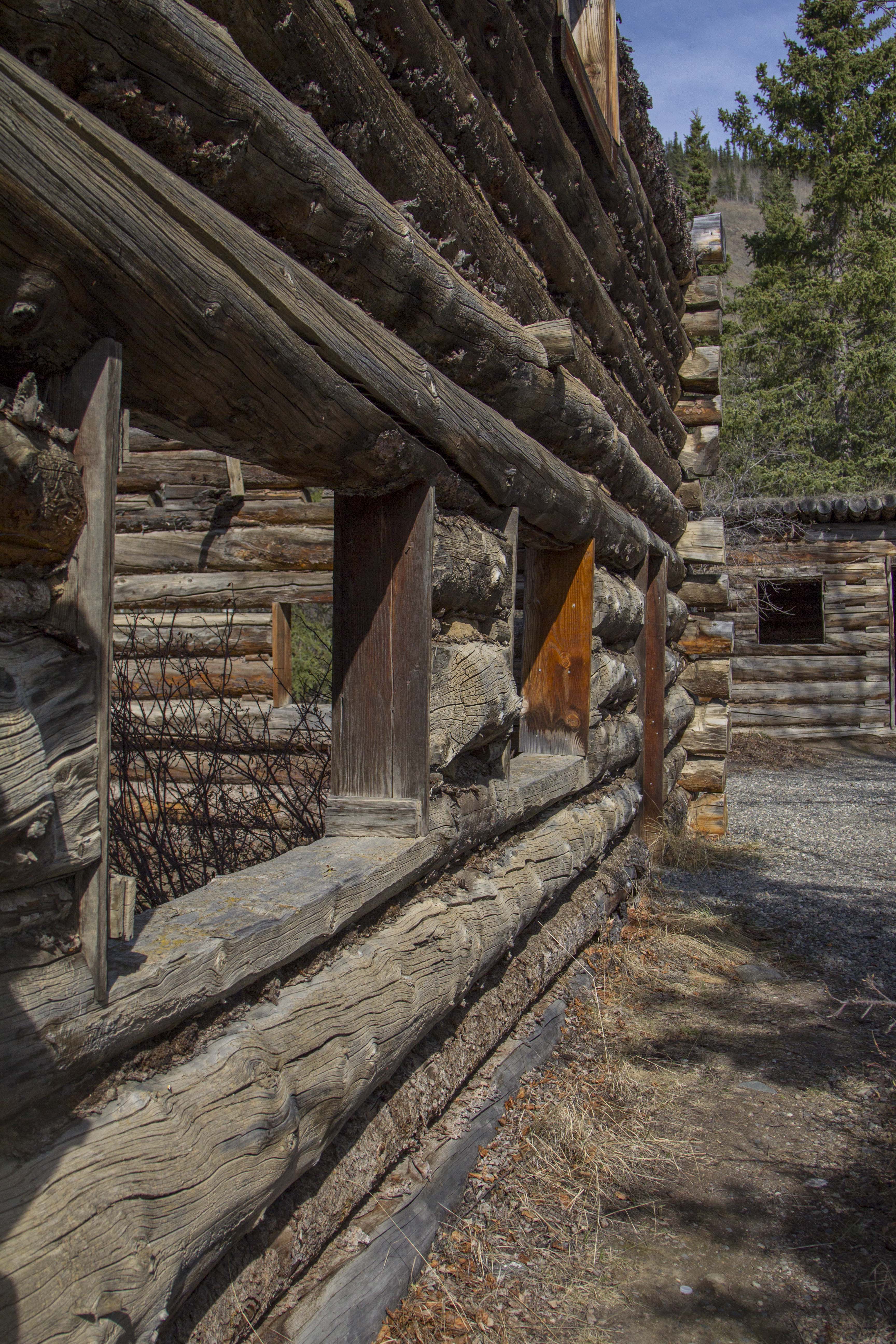
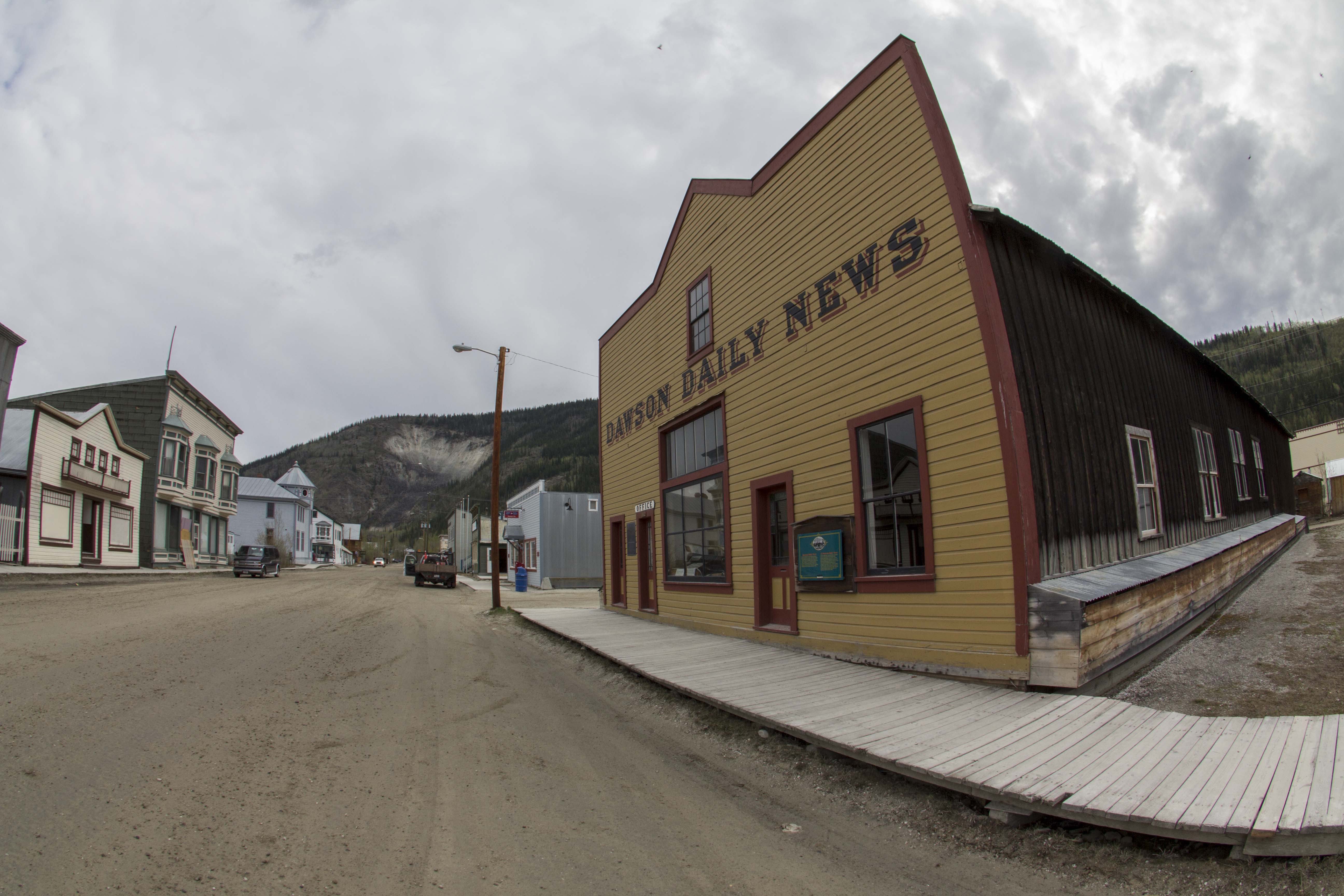
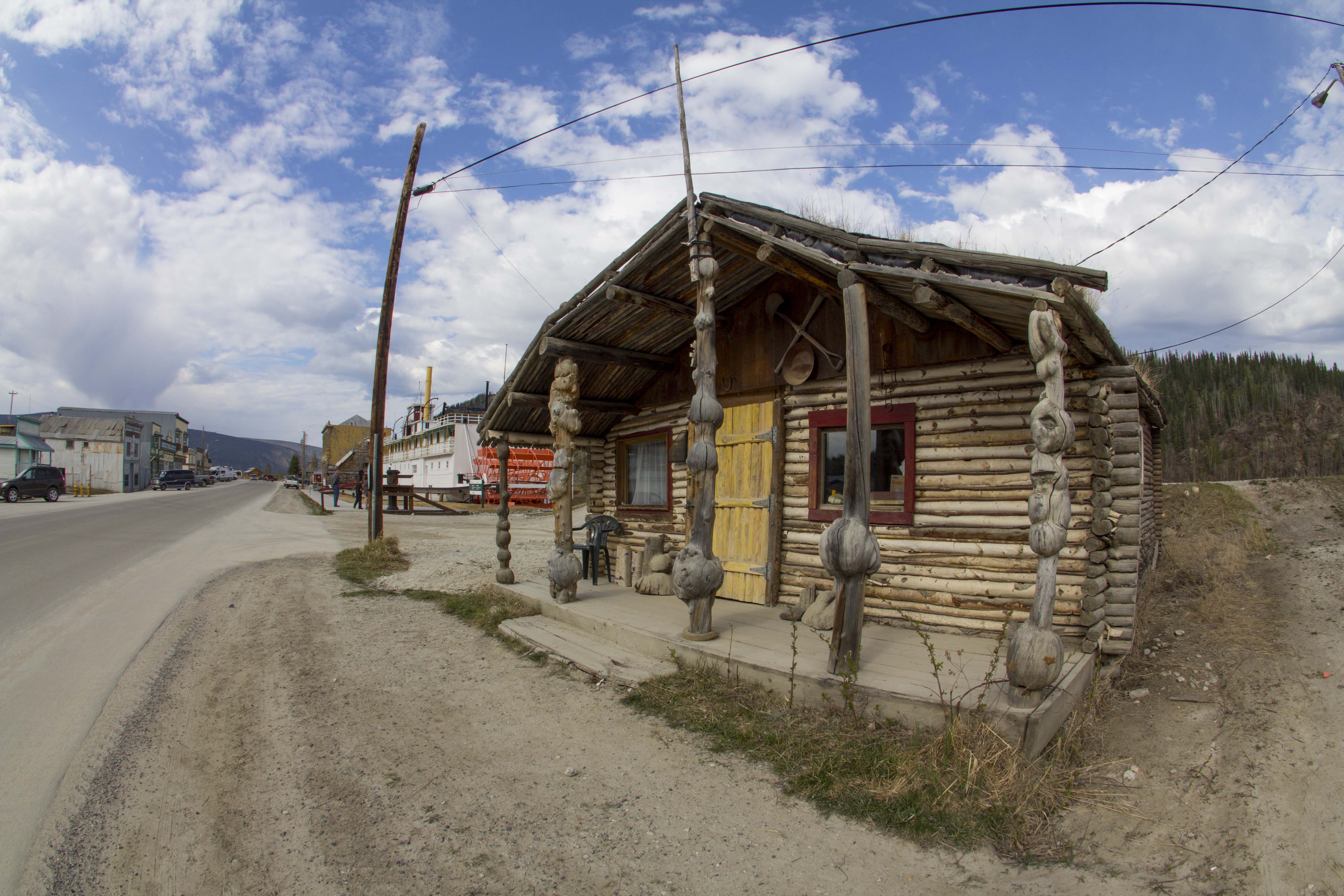
I met a couple of guys from Dawson City, Jordan and Cafrey, who were hitchhiking back after a visit with friends in Carmacks. They mention for me to stop by “The Pit” for a round of drinks when I get to town. Anyhow, I’ll be in Dawson by tomorrow night. Dawson is the farthest north town in the Yukon accessible by car, so I guess you could call it the hub of the northern Yukon. It has much the same appearance as I’m sure it did 100 years ago. It’s streets are dirt, sidewalks wood, and false fronts galore. Many of the old, original buildings are sinking or leaninginto the melting permafrost. I grab a couple of beers and head to the outskirts to camp.
The Dempster is now weighing heavily on my mind. The plan is to go to Dawson for a day or so, then head back out and up the Dempster, hike into the Tombstone Mountains for 2 or 3 days for a peak bag and some photography, then continue for a pedal up to Inuvik, above the Arctic Circle, in the Northwest Territories near the Arctic Ocean, over 500 miles from Dawson, then, turn around and pedal back. Am I biting off more than I can chew?


You must be logged in to post a comment.