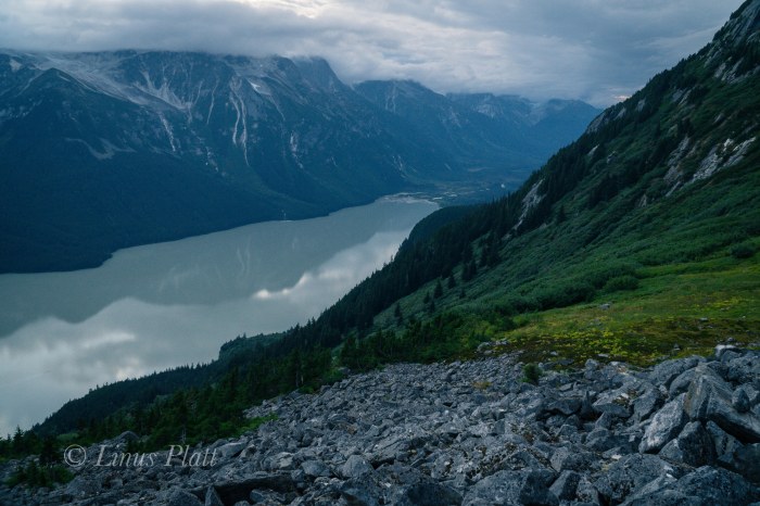
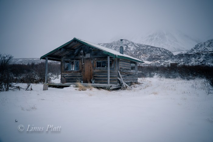
Upper Lynn Canal featuring the tiny town of Haines, Alaska below. Panorama taken from just below Mt Ripinski’s summit utilizing 4 separate 6K RAW images from Sony a6300 with 16-50mm kit lens stitched together in Adobe LR…

…A Life Simplified Is A Life Fully Lived
Upper Lynn Canal featuring the tiny town of Haines, Alaska below. Panorama taken from just below Mt Ripinski’s summit utilizing 4 separate 6K RAW images from Sony a6300 with 16-50mm kit lens stitched together in Adobe LR…
It’s springtime in Haines and it’s also the time of year I start getting the itch to get out of dodge and head for the hills on some overnight ski or snowshoe trips. Since the COVID madness began in earnest here recently, and the border now closed, homebase destinations are now in order.
Since being laid off from my job, countless house and other projects have taken precedence. A spell of clear and gorgeous weather inspires me to take a break from chores and do an overnight stomp up Mt Ripinski… one of our local summits.
The trail leaving the Young Road trailhead was easy to follow until it spurs with the Ridge trail, where many folks this time of year simply double back towards town via the Piedad Trail. Far fewer continue on to the summit this time of year. As a result, the trail dissapears, and I am now comitted to memory as the deep snow cover has hidden all normally familiar features.
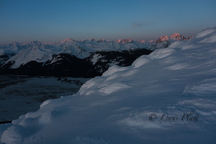
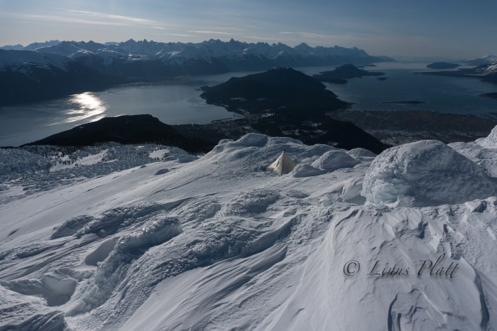
At about treeline, I run into a guy named Harry who had been up and down Ripinski more than once this week… traveling lightly and armed with practically no gear at all. We chat for a bit and I continue on to a semi sheltered place where I can dig out a shelter platform and build some snow-igloo walls for wind protection. That night, the temps dip into the single digits, but as the sun rises over the Chilkoot Range and splatteres sunlight over the Takhinsha mountains to the NW, it warms me deeply, and after a pleasant time eating breakfast and drinking coffee, I blast up to tag the real summit and take in the changing light before descending to my camp and back down to my truck.


As mentioned here before, for me, the primary reason for living in Haines is its close proximity and access to the incredible Yukon Territory. I could care less for the Sea and it’s subsequent maritime weather and inherent jungle. Instead, I prefer the deep interior with its immediate access to the alpine, it’s well defined and cold winters, its clear, crisp winter nights, its commonly seen Aurora Borealis, and its plethora of wild animals. I care not for cruise ships, inflated prices, and difficult access to the alpine landscape. Consequently, I tend to spend the bulk of my spare time on the north side of Chilkat Pass aka Haines Summit.
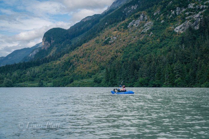
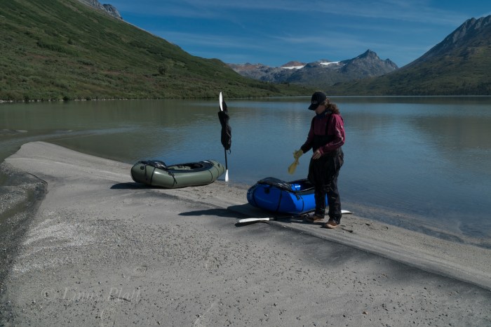
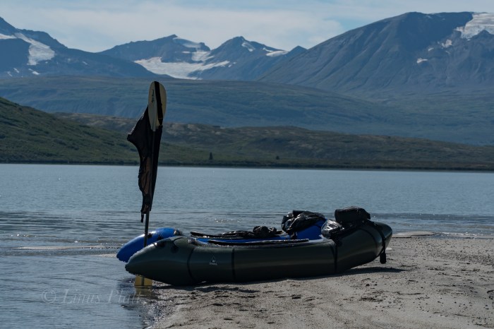
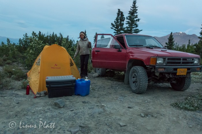
For Angela’s birthday we decide that a juant to the Yukon is in order, but an issue with a forgotten passport once on the road sees us turning the truck around in search of an alpine adventure within the confines of the narrow strip of land in the area surrounding the upper Lynn Canal. My good friend and workmate Tully has spent a great deal of time in the alpine areas above and beyond Chilkoot Lake and has expressed nothing but gratitude that this area exists. After showing me a photo of a small alpine lake sitting on the very edge of steepening mountain sides and overlooking the Chilkoot region and surrounding ranges, Angela and I decide that a closer look is in order. Tully had described the approach to me some time back to this place he calls Wolverine Lake, but my memory is foggy and we figure on finding said place regardless.
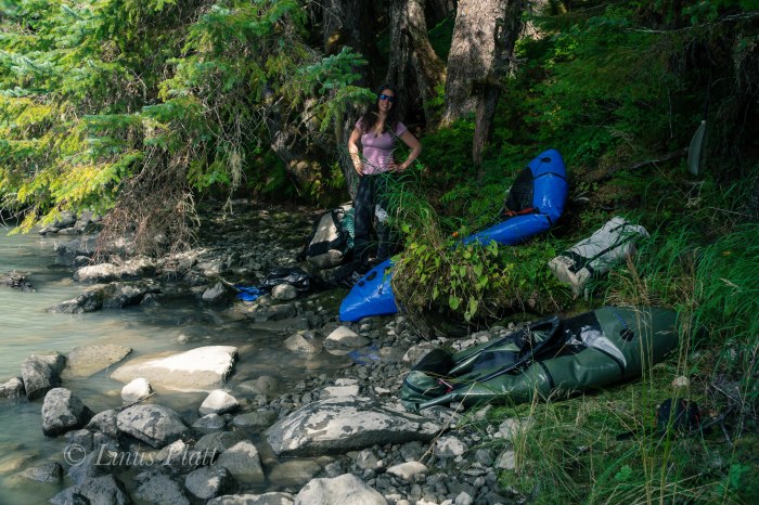
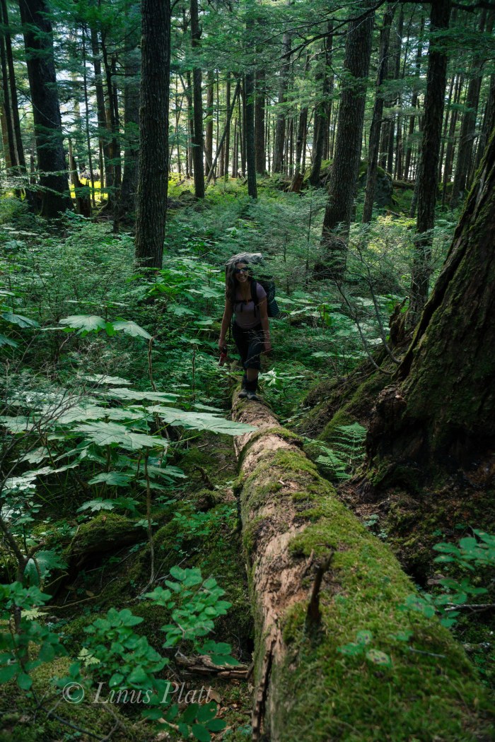
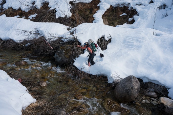
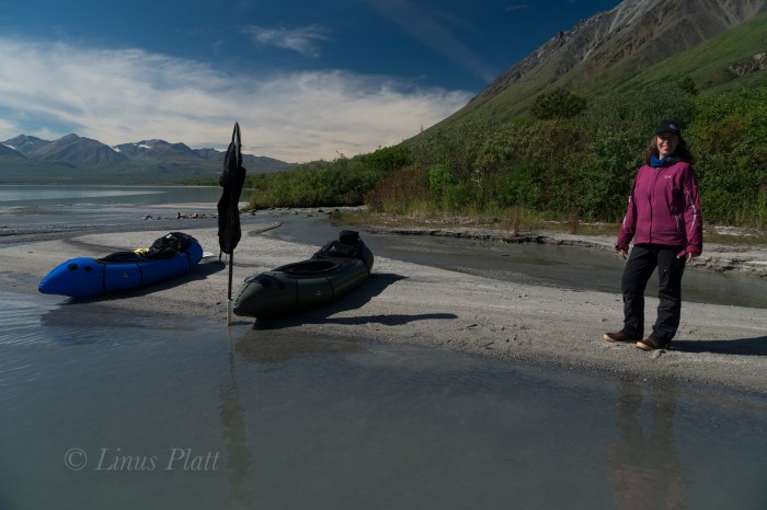
Driving in to Chilkoot is nothing short of chaotic. Fishermen, RV’s, tourists, tour busses, Bear watchers, campers, boaters, and riffraff clutter this overused area; its one of the finest examples of a Salmon filled Alaskan river with the ability to witness Bears fishing all through the summer. There are so many people here during July and August that I generally stay clear of this place. Once past the jumbling madness of the roadside river and boat ramp at lake’s shore, we find ourselves paddling packrafts across the lake a short distance to access the forest and the steep approach to Wolverine lake. We find a good place to stash the boats and ExtraTuffs upon a fallen Spruce, repack our bags, and begin trudging up the ever steepening hillside studded with the usual artifacts that a temperate rainforest has to offer. Soon it becomes very steep and in places requires both hands and feet to clamber up and over rotting logs, granite boulders, and dense thickets. It is tiring hiking for sure, but still relatively easy comparitively.
A vertical granite cliff of a couple hundred feet appears and we decide to skirt it on its left where a right leaning ramp leads to a boulder strewn sub-alpine valley. We think that Wolverine Lake is up at the top of this valley and pursue a jaunt of boulder hopping, which after the steep and cluttered hike down low, feels a welcome relief. Nothing makles me happier than to be on bare rock and boulders for travel. Up higher, the boulder field ends in another dense forest where we begin to doubt the location of the lake. It occurs to me that we are perhaps in the wrong drainage all together. We are exhausted and it is getting late; we decide that we must make our way up and over the ridge to our left to get to the proper drainage, but the means of navigating this requires some serious and painful bushwacking. An hour or so of battling some of the most heinous Devil’s Club and Alder thrashing I have yet to encounter puts us on a traverse into another boulder fiels in what we hope is the correct drainage. Boulder jumping once again upward sees us gaining altitude quickly. A young Black Bear darts from the Alder thicket just ahead and dashes across the tundra into another thicket. A group of 8-10 Mountain Goats are on a high bench off to our left. We are thirsty, tired, and in need of a camp.
After topping out the last of the hikeable terrain, we find no Wolverine Lake but instead a beautiful but dry alpine cirque surrounded by high granite walls. We can hear water and begin descending into the bowl where we are thankful to find find a massive snow bank and small alpine pond – we have water. Setting up the tent on a ridge of tundra just as dusk hits, we dive in and spend the evening eating, drinking wine, talking, and listening to the rain come down, which it does for the entire night.
After coffee and breakfast the rain slows and we pack up camp and begin the slippery descent. Steep rock slabs must be negotiated before entering the forest and the ensuing bushwacking can begin. A thrash of epic proportions concludes us arriving at our boats torn to shreds. My arms looke like I was in a knife fight in an Anchorage bar, and Devil’s Club thorns embedded in hands, legs, and thighs. Exhausted, we paddle the short distance to the truck and call it another epic 30 hour Alaska adventure… In retrospect, had we stayed in the original drainage before bushwacking over the ridge, we would have run smack dab into our destination. Chalk it all up to adventure exploration in SE Alaska…


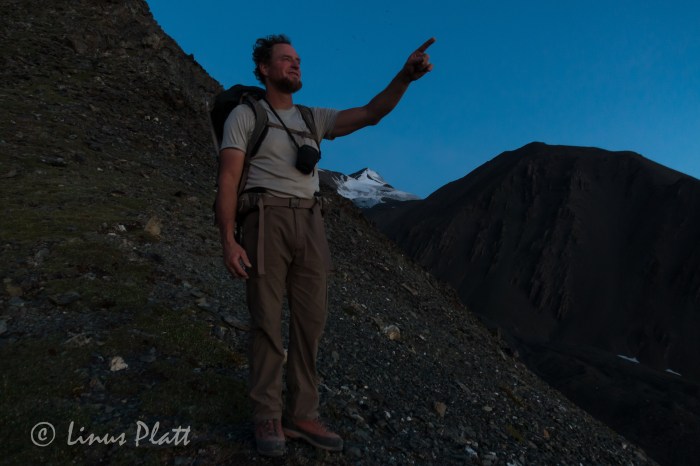
These last weeks have flown by so fast in preparation for the upcoming Over The Hill Expeditions trip to climb and ski Mt Sanford in Alaska’s Wrangell Mountains, that I barely noticed that the departure date is just next week! Gear is together, money is (well, mostly) together, and fitness, well… ahem, uh, well…
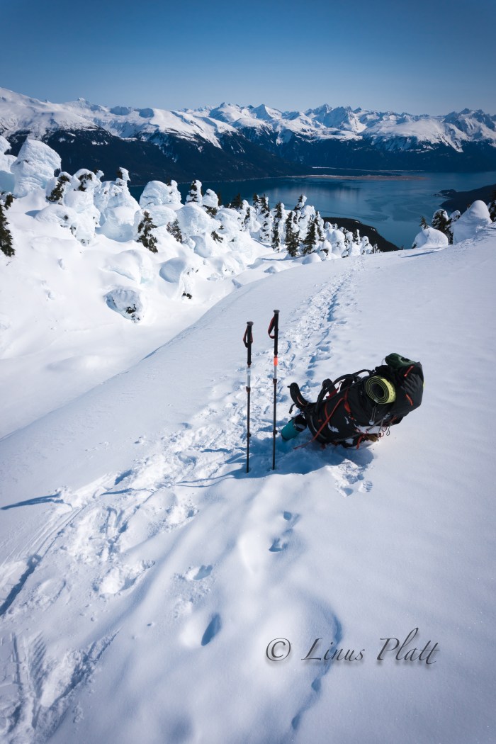
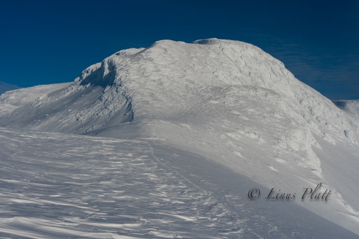
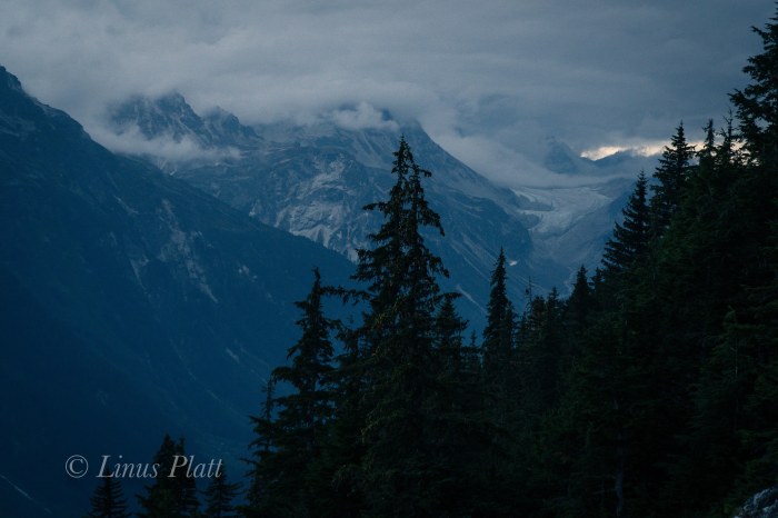
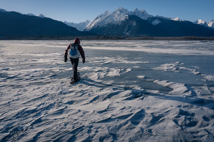
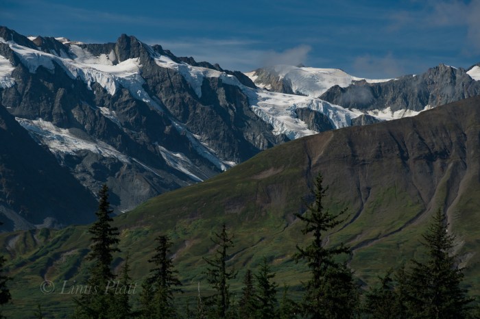
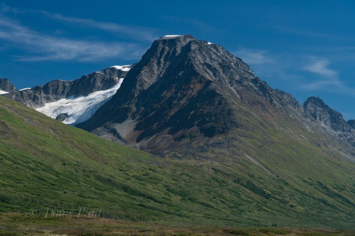
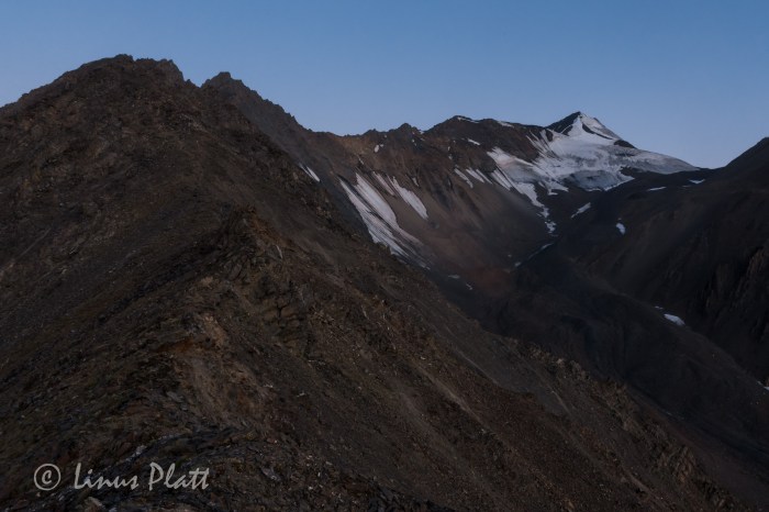
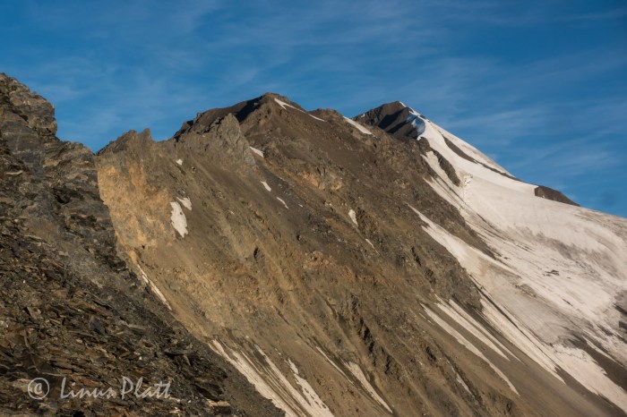
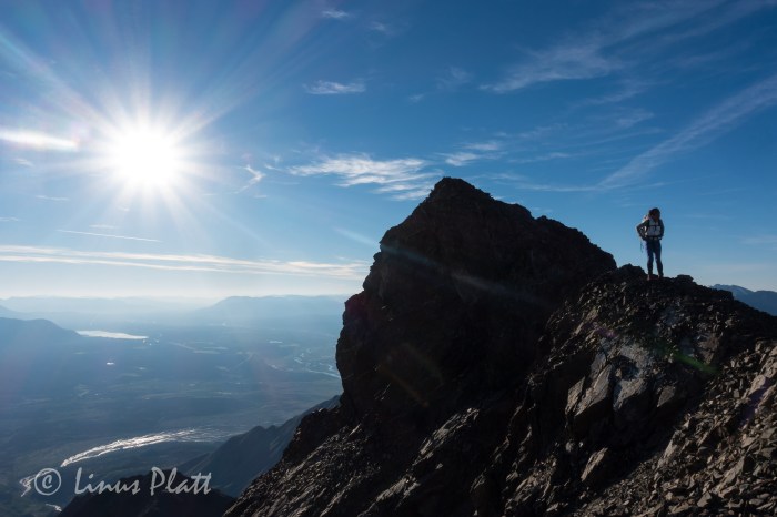
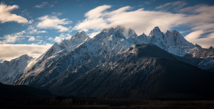
So… the last Saturday before I leave to drive up north to pick up Rich, Cam, and Jeff in Anchorage, I decide that a jaunt up Mt Ripinski is in order; Angela also wants to go, so that is even better. Ripinski is a coastal, non-glaciated peak sitting directly on the waters edge of the mighty Lynn Canal; it’s summit clearly seen from most anywhere near or in Haines. It’s summit is a 3600′ rocky point amidst small rolling hollows of tundra and outcroppings, where Mountain Goat, Wolf, and Grizzly Bear all roam.
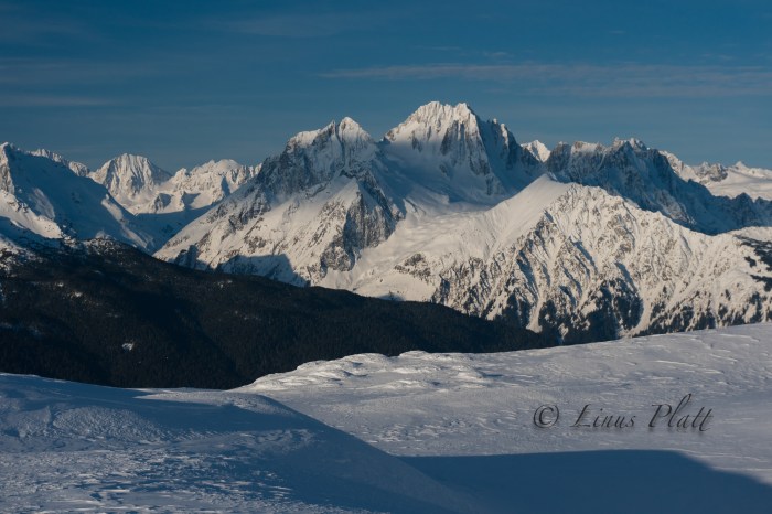
From the end of Young Road in Haines, at an approximate elevation of 400′, the trail climbs rapidly to it’s summit 4.5 miles and 3200′ later. It is considered a local classic and the views from the summit encompass the Chilkat Range, the Lynn Canal, the Chilkat Inlet, the Chilkoot Inlet and lake, the Alaska Coast Range, Skagway, and many of the area’s surrounding glaciers. It’s the best bang for your buck view-wise around.
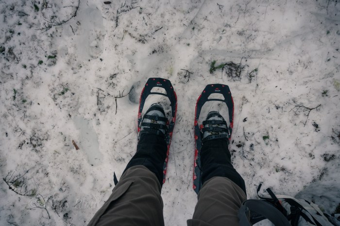
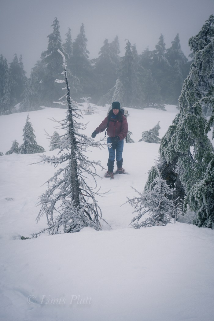
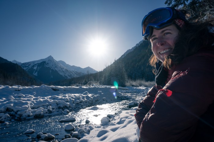
Leaving Mountain Market at about 9:30 am, we head for the trail and begin to stomp up the muddy, root infested path to snow line, where we swap running shoes for mountain boots and snowshoes. The forest is becoming increasingly engulfed in a mystical dream state of fog; the trees appear tortured from they’re entombment in rime ice; an indication of the severity of the wind coming off the Pacific waters of the icy Lynn Canal below.
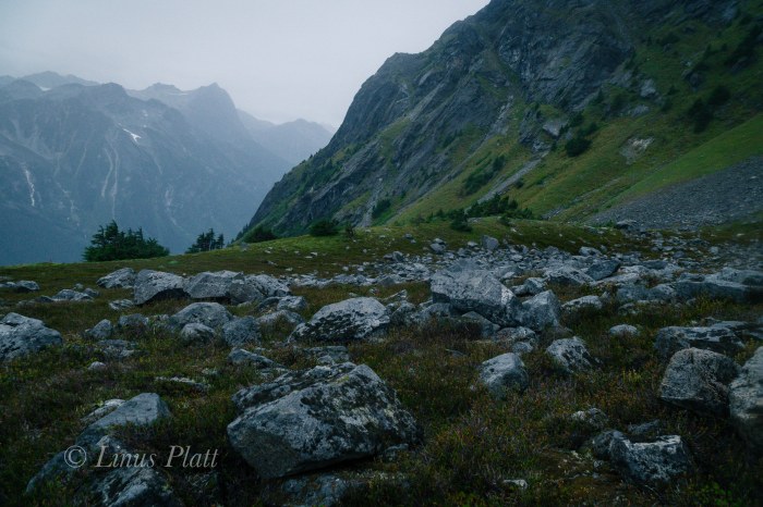
Soon we are lost and grappling with creating a zigzagging, weaving line through the struggling stunted alpine Spruce at timber-line; the snow very deep and the steepness increasing to the point I would gladly trade in my snowshoes for an ice axe and a set of ‘pons. Alas, we stumbe into the second meadow, where we lose the trail again, but finally find “The Overlook”, a place on the edge of a great chasm overlooking town when the weather is clear. Not today however, as visibility has been reduced now to about 10 meters, and the wind, now picking up velocity and numbing my fingers severely.
We somehow manage, after me considering bailing several times, to find the final summit climb up a spiny, rocky ridge. On top, visibility is basically zero, and the wind raging. I put the camera away and go into survival mode, donning all layers and with special attention to my hands, which now are useless chunks of lumber somehow attached to my arms. We aren’t even sure we are on the summit, so we blindly stagger further, where I slip off a steep edge of snow that is completely invisible to my eyes in this torrential whiteout. No harm done and we scramble back in the direction from which we came, ponder for a moment at the highest rocky point, and then skedaddle. The whiteout seems to be increasing, but the further we descend, the warmer my hands become, and soon we find our tracks near the overlook and enter the trees below.
Back in the forest below the snow line, I’m too tired to put my running shoes back on and finish up the stomp in my expedtion boots back to the truck. Angela looks tired, but happy, and I feel the same. Just another semi-epic day-adventure in Alaska…
Up next: Mt Sanford departure in T-Minus 7 days.
Stay tuned!


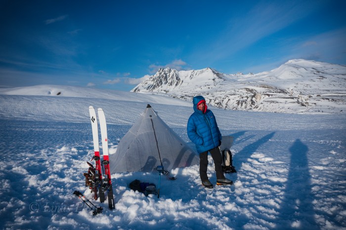
Mt Sanford practice run this weekend… 2 day ski tour out by Copper Butte… glorious views from our camp, followed by skiing some 25 degree ice and windslab in mountaineering boots and a full pack… Get some!


Winter is a great time of year for exploring local wilderness generally too out of reach during summer months. Some of the local watersheds and glacial valleys become severely overgrown with dense thickets of Alder and Devil’s Club, essentially turning these locations into Alaskan Jungles
I’ve been up the Kicking Horse River on several occasions during the winter months in past years and this year is no exception… The Chilkat River is covered in anywhere from 4-10 inches of solid ice, making acces to the confluence of the Kicking Horse a simple matter. In summertime, a packraft or other vessel is neccesary to cross the raging highwater torrent. Not today; an easy (if slippery) stroll to the other side from 7 mile Haines Highway sees Angela and I snowshoeing up the Kicking Horse (also mostly frozen, making for easy travel) and all the way to the base of Mt Emmerich.
One day before winter ends, I would like very much to ski or snowshoe all the way to the Garrison Glacier for an overnighter.
Today is an exemplary day; crystal clear blue skies, plenty of snow on the ground, and temps in the mid 20’s beckons a long day out. Once reaching the Sitka Spruce at the base of The Cathedrals and Mt Emmerich, we eat a snack, take in this special and not often visited place, and happily agree to come back for a closer look before the snow melts.


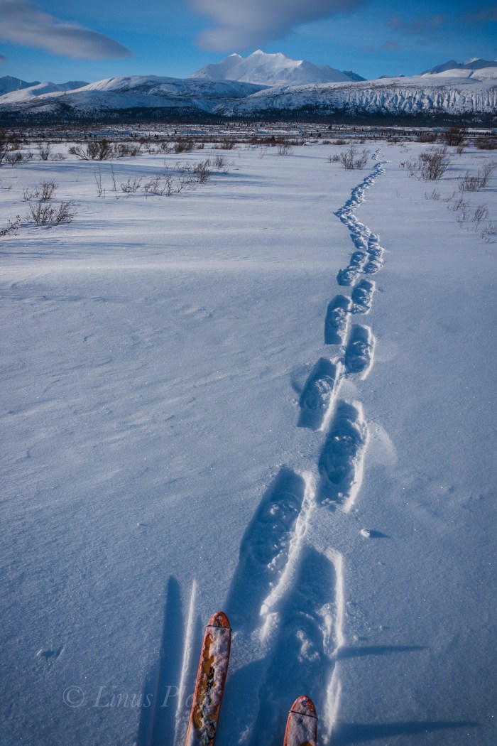
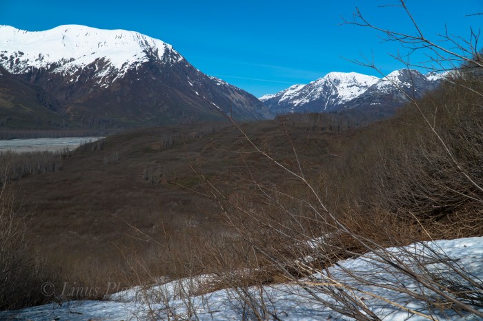
As one drives north over and beyond Chilkat Pass, a broad and beautiful alpine valley is entered; the beginnings of the White and Black Spruce, Aspen, and high Tundra dominate the landscape here. Once past Kelsall Lake, the road climbs up and over an ancient moraine and drops to an expansive river filled valley; the birthplace of the fantastic Tatshenshini River at Goat Creek and the terminus of the short but spectacular Parton River. Fitness training and gear testing for an upcoming alpine adventure sees me driving up near the Yukon border for a solo ski into the Parton River region. I wish to scout the take out of the Parton River area for a future summer packrafting trip trip and get a layout of the landscape.
For me, the primary reason as an American to live in Haines is the access to the great and mighty Yukon Territory; a land full of wilderness, mountains, rivers, glaciers, and animals. Similar to the interior of Alaska, it too offers a lifetime of exploring, climbing, and packrafting that beckons me as often as I can muster.
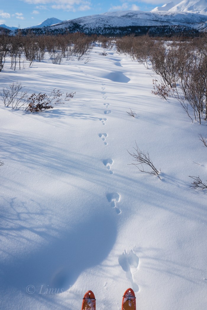
Parking the truck on the shoulder of the Haines Highway, a short one mile ski down a dirt road leads to the first of three put-ins for the Tatshenshini known as Bear Camp. Here, the Tat is frozen and I ski across happily and pick up the faint and snow covered old mining road beyond; shortly after, I come to the frozen Parton River and once again ski across and beyond into the fields of stunted arctic Willow and deep snow. Someone else has been in the area recently, and at first I begin to follow a relatively fresh set of snowshoe tracks, but soon veer off course to find my own way. I spot Arctic Hare tracks and soon spot Wolf, Lynx, and Ptarmigan tracks… A couple of miles skiing in and out of the Willow thickets and up and over several creeks finds me entering the White Spruce of the Parton River corridor where it enters a canyon to the south and it’s headwaters lie.
A quick snack and a few clicks of the camera see me skiing back to the Parton River, this time further upstream to inspect the river herself. Always fun skiing down frozen rivers this time of year… easy skinning with no obstructions gives me the opporotunity to inspect the area for log jams, debris, and other future packrafting concerns.
With the sun getting low, I head back down stream, cross the Tatshenshini, and skin back to the truck just in time to see the beginning evening Alpenglow.
Till next time…


An early winter stomp up in Northern BC at Kwatini Creek in search of skiable snow produces little snow but a great hike up Kwatini Canyon past the old cabin there and into the alpine… complete with a mountaineering finish. A perfect day marred only by me pretty much destroying my brand spanking new (first time wearing) Arcteryx bibs…😫😢


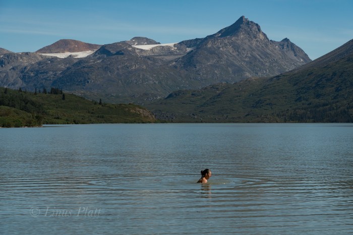
Looking for a bit of fun and adventure finds Angela and I heading north out of town and up into the high country to parts unknown. We packed the truck with bicycles, packrafts, hiking paraphernalia and some snacks. About halfway up Marinka’s Hill, we stop to gawk at the Northern Takhinsha/Southern Alsek’s baring their blue and stoney ice in the spectacular late summer light. I have never seen these peaks so devoid of the previous winter’s snow. The result is visually striking; the glaciers are on full display and the rocky summits piercing the deep blue hue above. Once past Three Guardsmen, it is decided a paddle across the mystical Kelsall Lake is in order, and soon we are bouncing the truck down the 4WD track to it’s shores.
Once in the water, a pleasant paddle two or three miles to the inlet stream that feeds the lake comes around and we stop for lunch and a swim on the sandy beach below the glacier of Kelsall Peak. Back in the boats, a great wind swells up and we fight the lateral rollers all the way back to the truck and happily scurry back over The Pass and head back home.


Since moving to Haines from Fairbanks nearly 5 years ago, I have been fascinated by a local piece of wilderness called the Takhin River Valley; a river born of the Takhin Glacier high at the western end of the Takhinsha Mountains at the far northern most tip of Southeast Alaska. The nearby Tsirku River is born from the Tsirku Glacier far into the western reaches of the range where massive ice sheets dominate the landscape. Further down stream a Tsirku feeder, the Le Blondeau Glacier, comes very close to the Takhin Headwaters and is separated from it by a 500 foot high, two mile wide swath of an ancient moraine covered in Alder thickets and Devil’s Club, and is know locally as Heartbreak Ridge. I had heard many folks talk of the Tsirku… it is of fairly easy access by bush plane, or by foot, is big enough for a full size raft at spring and summer water levels, and is fairly tame overall. But I never ever heard anyone speak of it’s sister, the Takhin. After asking around about it, I discovered that there is a locally operated bush airstrip about 3/4 the way up the Takhin Valley known as the Fox Airstrip, but it seemed there was no way to gain plane access to the headwaters at the Takhin Glacier itself.
Last year I decided that the best way to investigate was to hike up the Tsirku on foot from the Devil’s Elbow, where one can park a vehicle, and attempt to get to the Le Blondeau and have a look at Heartbreak Ridge. At the time, I had no packraft, and made many dicey river crossings on foot until deep snow, and high water blocked passage about a mile and a half from the landing strip near the Le Blondeau. After spending a night in the upper Tsirku watching and listening to a pair of Wolves, I packed out, vowing to return better equipped.
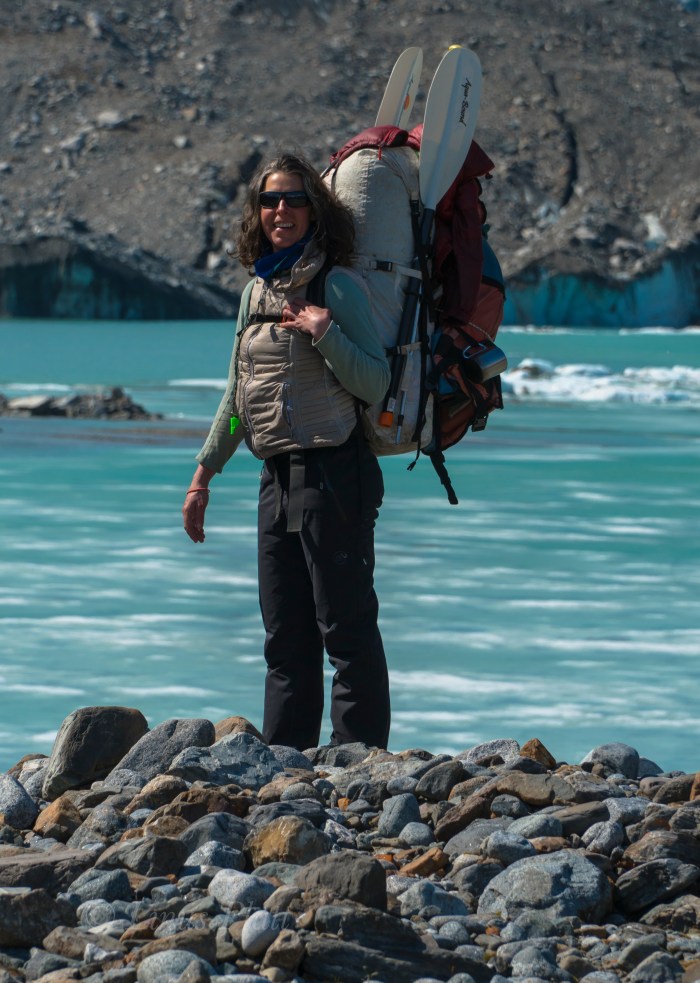
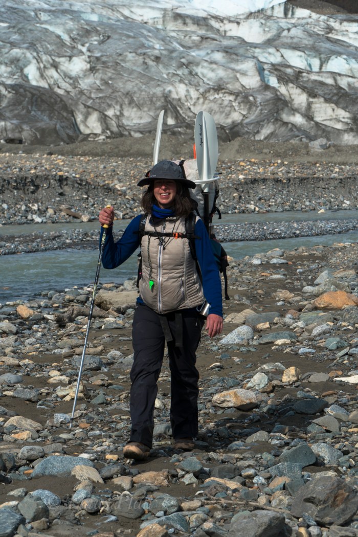
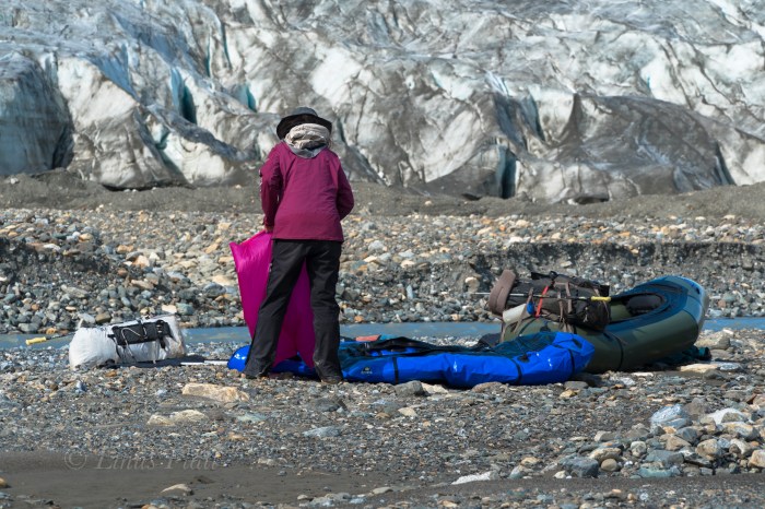
This year, Angela and I, armed with packrafts, hired Drake Olsen and his Super Cub to get us landed on the tiny gravel air strip near the Le Blondeau near what is locally known as Horse Camp, a group of seasonal tin cabins from which hunting and guided Tsirku River trips begin. It’s from this place we could easily hike to Heartbreak Ridge, and begin it’s Alder thrashing, which more than one person had guessed would be “extreme”.
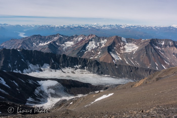
The tiny Super Cub plane holds one pilot, one passenger, and a wee bit of gear. That’s it… so Drake takes Angela in first; it is about a 20-25 minute flight in and I wait by the Haines landing strip for his return, eagerly anticipating viewing the Takhin from the air to inspect for any obstacles we may encounter. The Super Cub re-appears, and in minutes gear is loaded and we are airborne and slicing through the crystalline sky along the lower reaches of the Takhin. Drake flies as low as possible so we can look for log jambs, wildlife, gravel bars, and any other thing of interest on the ground. We pass the fantastic Bertha Glacier and her giant iceberg filled tarn; the lake is still partially frozen over. It is May 17th 2018…
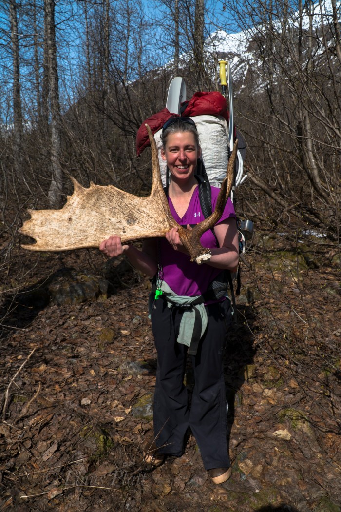
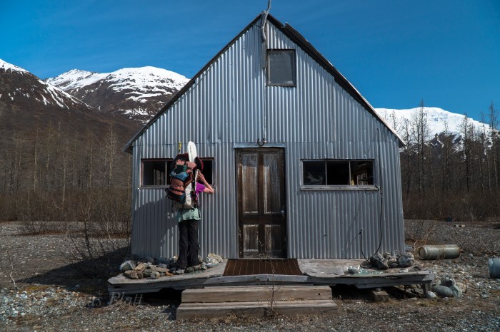
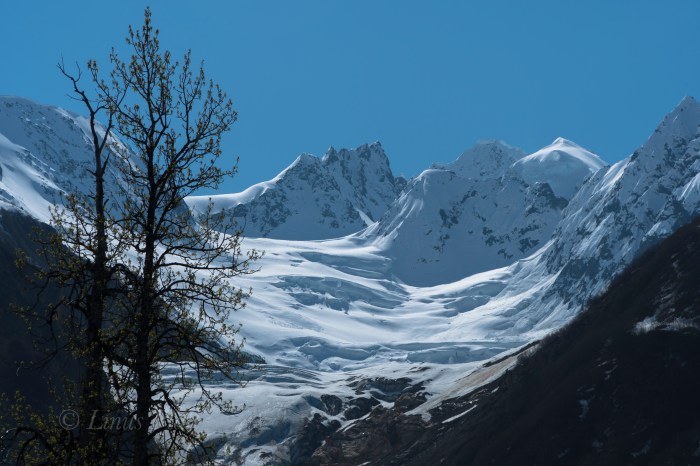
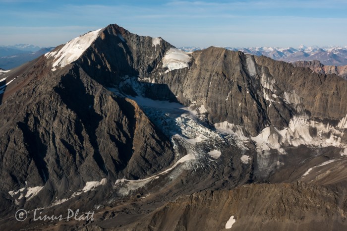
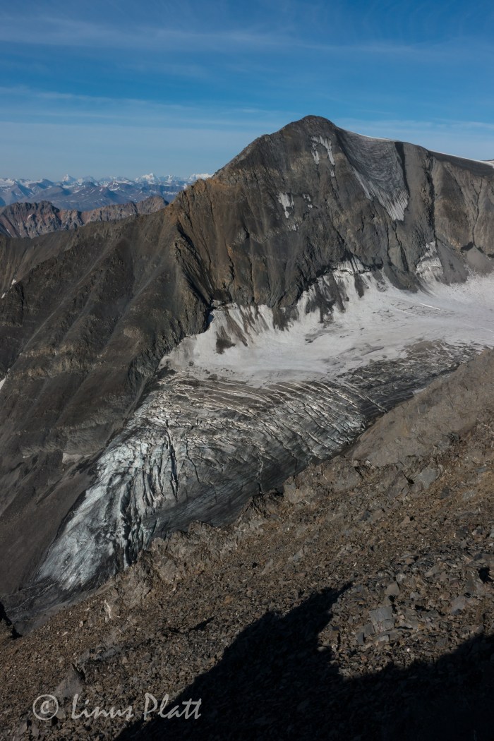
After Drake drops me off, Angela and I watch as he hits the air and disappears over the ridge and is gone. We shoulder packs and begin walking the Gravel bars of the Tsirku in search of a supposed trail leading through the forest to Horse Camp. After a bit of wandering and doubling back, we find the trail and find ourselves deep within the confines of the bush. A large Moose antler is found on the ground, likely dropped the previous Winter. The cabins of Horse Camp are dilapidated and run down… animals have had their way with them and are in pretty bad shape. The tarn of the Le Blondeau Glacier is partially frozen over, and great slabs of icebergs are float here and there. The views of the glacier and peaks are amazing… one peak, known as Tomahawk, has gorgeous plumes and flutings descending from its jagged and corniced summit. Not all mountain ranges have these flutings, but are common in Alaska, The Andes, and Himalaya. Truly a signature of deeply glaciated peaks and severe weather.
We stomp around the east side of the lake all the way to just shy of the ice and right up against the mountain where we believe the easiest passage through the two miles of Alders might be. After having spoke with some people who had seen it, and seeing it from the air myself, I estimated it would take us about 4 hours to get through it, over Heartbreak Ridge, and to the toe of the Takhin Glacier. Soon, we cannot go any further and so we dive into the Alders to our left and begin the extreme thrashing. The paddles sticking out the tops of our packs make the going much worse. Alders are notoriously bad for this sort of bushwhacking and this is no exception. We gain a lateral snowfield and follow it, postholing in knee deep snow to ankle breaking downed Alders beneath. Two hours later we come to a stream where we break for snacks and water before committing to more thrashing. Occasionally, we find old avalanche chutes to traverse up, then down, up, then down, avoiding short sections of thickets. It is time consuming and exhausting to say the least. Hours later, we are at the base of the final climb up Heartbreak Ridge proper. It’s nothing short of a heinous and evil Alder thrash. Did I mention Devil’s Club? We gots that too folks. Lots of it. We emerge on top, bloody, sweating, exhausted… and ornery. The Alder thrashing we did last year on the approach to Mt Archibald in the Yukon was actually worse, but this was sustained. It had kicked our ass, but we did it. In fact, I do not believe any one in recent memory (or ever) has gone over Heartbreak Ridge during the non-winter months (skis, snowmachines, etc) The view down to the Takhin Glacier is breathtaking and the descent looks steep and dangerous. After the initial loose and steep drop in, it is easy going and soon we are on the rubble covered glacier and boulder hopping to the toe to find our camp.
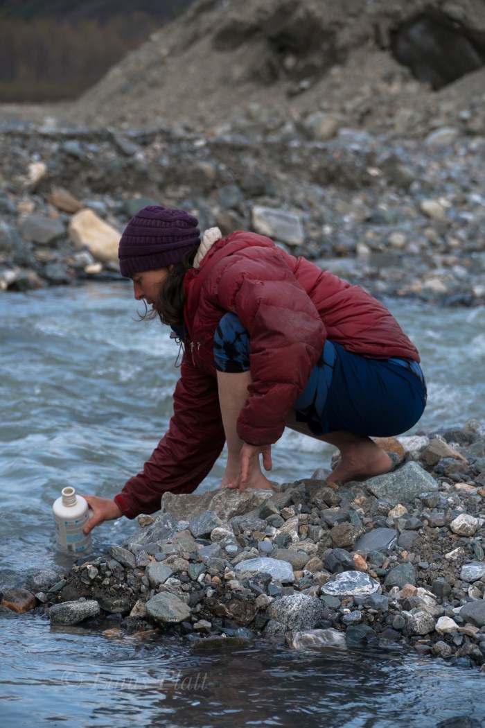
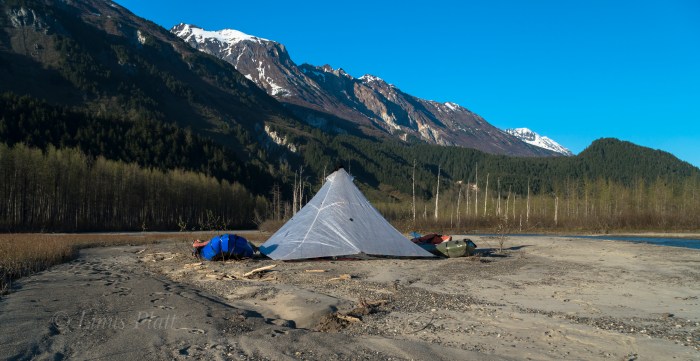
After reaching the snout of the Takhin Glacier, a gaping ice cave appears and the very utmost of the Takhin River is born, emerging as a rapid and icy tongue from it’s innards. We thought since the goal of this trip was to packraft the entire Takhin from it’s beginning, it would be especially cool to start from inside the ice cave and emerge in true fashion. However, it looks dicey so we decline, stumbling off to find a camp spot. We pitch the awesome Hyperlight Mountain Gear Ultamid 4 that was loaned to us by the company for testing and inspecting; I find it extremely light, easy to setup, and bombproof. Many thanks to HMG for this shelter. After camp is constructed and I lay in my sleeping bag, it occurs to me that it took us over ten hours to get from the landing strip on the Tsirku to the Takhin Glacier; I severely underestimated Heartbreak Ridge.
The morning sees the weather in fine shape with early morning light splattering the fluted ridges high above us. We walk for about a half mile downstream on the gravel bars in search of water deep enough to put the boats in. Since it is morning and the temps still chilly, the water has not yet come up, but we finally find adequate water and we inflate the rafts. A pleasant float downstream on class I-II, puts us in a forested area, where log jams and shallow water force us once again on foot. Another paddling section begins and a mishap with a strainer and a missing paddle ensues. We thought that the paddle had floated away, but was in fact stuck underwater in the submerged thicket. We were soaked and needed to dry out. Luckily it was hot out… too hot in fact and we were both getting somewhat sunburned. back in the water, we paddle through another alluvial fan and spot a large Mountain Goat about 200 meters off walking right towards us. We eddy out and watch silently; the Goat stops and finally takes notice to us. We stare back and forth and the Goat decides these strange creatures near by are best not to get tangled with and starts trotting south and away from us. What a magnificent animal…
Back on foot again to avoid low water levels, we decide the best way to travel is to mount the inflated rafts to the tops of our backpack and hanging down with the bottom of the boat facing behind you; doing this makes one look like a giant alien Beetle. We walk through the open forest like this for a spell and I spot a Grizzly 100 meters away (close!) staring us down. I freeze, Angela freezes. It appears to be a lone male Grizzly, not giant, but not small either. We stare at each other for several seconds and the Bear flips 180 and bolts the opposite direction. After that, I decide that the Bear spray will go in one pocket, and the Colt 1911 .45 in the other.
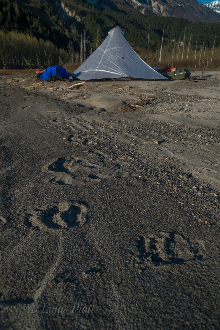
Eventually, we begin paddling again, and even though the water is low, we are able to float big sections and simply drag the boats through the shallow areas and then jump back in. Soon we come to end of the big braided section of the Takhin near where the Fox Airstrip is, and realize that it is getting late and that we are very tired. We pitch the ‘Mid on a sandbar riddled with Grizzly prints and attempt to sleep. Soon however, a great wind pick up and after a bit, blows a steady 30 knots, showering us with sand and dust. It was miserable, but we hunkered into our bags deeper and got through it. Eventually it died off and we drifted into needed slumber.
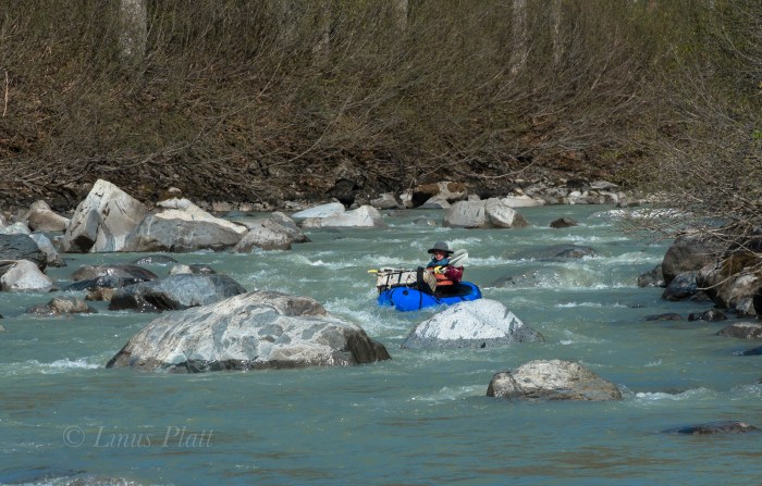
Another fine morning of gorgeous weather finds us paddling immediately and entering the “Boulder Field” we had heard about from one person who claims to have jet boated up the Takhin. The river slices through the tight forest here and turns into a different animal than we had previously seen. Small rapids appear… class II-III; twists and turns and rocks and holes all become the experience. The paddling is excellent; this is what we came for. One nasty looking class III section with a big rock at it’s bottom that would surely flip you we decide to portage around. Following that, the Takhin turns into one set of glorious Class II-III rollers after another for several miles. It is an instant classic Alaskan paddle in my mind. We pass the Dickinson, Willard, and Bertha Glaciers, and into the final twists of the river a few mile before it’s confluence with the Chilkat River, where enormous log jams bar passage and force us out of the boats. We drag the rafts through the sand past Wolf and Bear prints and back into the water where more Class II rollers and some technical navigation around strainers and timber force a keen and sharp attention. Angela has a mishap with a pesky log and flips the boat, but all is well. We stop for a breather and laugh about the incident as we pour the water from our Extra-Tuffs and wring out our wool socks.
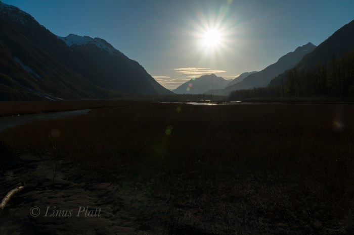
Back in the water and around the next bend in the river, we can now see the peaks of the Tahshanuk, indicating that we were extremely close to the Chilkat. We ponder for a moment if we should spend another night, or just simply paddle down the Chilkat back to the Haines airport where the truck is parked. After reaching the mother Chilkat, a great wind picks up and it is decided instantly that paddling home is the ticket; three days and 35 miles of bushwhacking and paddling behind us, our weather window had closed, and it was time to end this adventure and begin looking forward to the next…


It had been a grand summer in the northern interior, but is was time to head south to meet up with Angela and have an adventure in the Yukon, so after tying up loose ends in Fairbanks and getting the archaic Toyota back into travel mode, I say goodbye to Sven and all the great folks I had met during my stay in Fairbanks this summer, gas up, and hit the highway. Driving south and seeing once again the massive central Alaska Range dominating the skyline, it is decided nearly instantly that I wish to head back to Delta for a few days to have a closer look around to do my own thing, shoot some photos and video, and look for animals. That evening at my familiar camp along the Delta River, another sublime sunset graces the southern horizon and showcases the white giants I dream of so often.
The areas around Delta Junction had fascinated me for sometime, and a venture with Dennis up nearby Donnelly Dome just south of town had wet my appetite for the vast tundra and river valleys of the region. It’s an area of concentrated wildlife, dense forest mixed with open tundra, raging glacial rivers, and giant mountains. In the morning following, I whip up some tailgate coffee and breakfast and soon head south to an area surrounding Donnelly featuring herds of wild Bison, Caribou, Moose, Grizzly Bear, and a vast network of dirt roads unexplored by yours truly. After stomping the brush filled valley below Donnelly and scaring up a large bull Moose near the Alaska Pipeline, I decide to drive up a dirt road I had spied some weeks prior that led past an old military installation and winding down to Jarvis Creek, but a sizable pool of water and it’s inherent mud hole prevents passage to the places I seek. So I stomp the area on foot on search of anything of interest. Grizzly tracks lead from and abandoned military bunker where once inside, I scare up several big Owls who are surprised by my presence and flee the scene entirely. Walking through the thickets, a large bull Caribou trots past not far off and climbs a short brushy hill to get a better look at me. Such a magnificent animal in silhouette against the storm encumbered sky; he smells the air briefly before descending the north side of the escarpment and soon is gone from my sight. Another Caribou appears and gallops fast to catch up, and soon I am alone walking the old dirt road en-route back to the truck. It begins to rain in earnest and soon it I am engulfed in a frigid downpour; in the dry and warm confines of the truck, I call Angela to solidify our plans to meet in the Yukon in another week or so for a climb up Mt Archibald in the beautiful and enchanting Kluane region less than a three hour drive from Haines. But for me, the drive will take a full day or so, but I have time to kill and decide to take my time and explore and maybe even climb a peak on the way south. I drive the old truck back north to Delta and back to my camp along the Delta River, where it rains hard for most of the night.
The next day is spent driving slowly, stopping often, exploring dirt roads and gawking at one of my favorite parts of Alaska. This place has the sensation to me of an ancient and somehow significant nature; people have lived in these vast northern valleys for thousands of years, flourishing in this striking and beautiful land. So many rivers, creeks, and un-named mountains here… It is a staggering thought to try to encompass all of its geography into my psyche. There is a thousand lifetimes of exploring to do here, and I can only hope to come back again and again to see and experience as much of it as I can in this one life. I pull down a dirt road and scope out an area for a hike and possible peak climb in an area north of Tok about 20 miles. Feeling satisfied that I have my bearings about me, I head down the road to Yerrick Creek, one of my favorite creeks in the area, to gather drinking water and bathe my stinking carcass. After a pleasant bath I drive to Tok for supplies and head back up valley to a sweet camp along the Yerrick. Once again, that night it rains a rain that can only be described as intense. Morning arrives and the rain shows little signs of dissipating, so I pack the truck and ponder my next move.
I decide to head back to Tok and do some laundry and fuss around town some where I drop into the visitor’s center for a look at the weather forecast that tells of inclement weather gaining momentum; after a walk through the old Tok cemetery during a rush of raindrops, I decide that the best way to spend my time before Archibald is to simply head back to Haines and catch up on much needed house projects that have been neglected all summer. Driving south of Tok through the maze of high forested ridges and immense wetlands, I emerge into the great taiga filled river valleys of the Robertson River, Johnson River, White River, and the beautiful Donjek River, all giant glacial fed braided specimens born of true and unrelenting wilderness. The Kluane region is now at hand and a pair of blonde Grizzlies graze at road’s edge as I pass. I camp down an old dirt road overlooking the fantastic St Elias Range where a small herd of Dall Sheep can be seen on a neighboring hillside grazing in the midnight twilight. Passing near Haines Junction the following day, the mass of Mt Archibald comes clear and its steep and glaciated east face dominates my view. Back in Haines hours later, I settle into my little house and fondly breathe in its strangeness; I have not been here for over two months, and it seems foreign to me. Nonetheless, a good nights sleep is to be had, and now preparing myself for the new electrical breaker panel that needs to be installed at the power lines adjacent to my house was in order. Five days later, the breaker panel is installed, the truck worked on, and gear and supplies gone through for the next Yukon adventure with Angela mostly taken car of.
The day before departing again back into the Yukon, Angela comes over and we spend several hours organizing gear and prepping for the Archibald climb. It feels good to be in a state of anticipation of an adventure goal once again, and soon we are ready. The plan is to leave late morning or even mid-day and casually head to Haines Junction to re-group and find the dirt road that leads Thunderegg Creek where we will spend the night before the hike in to our basecamp for Mt Archibald. Casually driving up the Haines Highway and up and over Haines Pass, AKA Chilkat Summit, it feels good to be in the high country once again. We take our time stopping from time to time to explore a little here and there and taking in the peaceful valley where the stimulating Klukshu River flows; it is a tiny river with runs of large King Salmon, but none are seen here today. It is a place of crossroads where cultures of the Aishihik and Champagne peoples would meet with the Chilkat Tlingits to trade goods and furs for the highly sought after Hooligan fish oil. In Haines Junction to gas up, we get to the visitor’s center just before closing time to secure our permits for backcountry travel, but are told that we need no permit to enter the area we are going as it is just outside of the Kluane National Park boundaries. Suits us fine, and we hit the Little Green Apple, Haines Junction’s tiny grocery store, for our supper supplies and hit the road north towards Thunderegg Creek.
Thunderegg creek is the drainage that flows from the un-named glacier that grows from Mt Archibald’s southeastern flanks and is named so for the marvelous round “eggs” of stone that grace the corridors of the raging river. In the morning, we pack up casually and shoulder our relatively light packs and begin the stomp up valley towards the glacier. The accounts we had read on-line gave a thin description of a faint game trail that peters out into thickets of Alder, Willow, and Aspen that must be navigated in order to avoid the impassable shores of Thunderegg Creek. Soon we find the trail disappearing and the thrashing through Alder thickets begins. The descriptions mentioned that the bushwhacking should last “no more than an hour”. True to the description, we emerge from this dense northern jungle in short time to find ourselves clamoring up an exposed ridge where two drainages parallel one another. At the ridge’s top, flat walking lead to a decision: either continue bushwhacking higher to where tree line ends and the glacier and moraine begin, or bushwhack down and to the left into the drainage of the creek that flows from the ice. It seems the downward option is our best bet, and another great and thrashing jungle session begins. The going is slow and methodical; it is very dense, but it is fairly short and soon we are deposited into the dry and rocky creek bottom, sans creek. We had hoped for water here, but none is found. An uphill trudge of about an hour and a half brings us to the very base of Archibald herself, where sprouts of tundra meadows appear. We ponder camping here, but realize quickly that not only is there still no water here, but the base of the Southeast Ridge that we intend to climb would be much better gained higher up the moraine. Getting both dehydrated and exhausted, we trudge on in hopes that drinking water and a suitable bivouac will reveal itself. Following the lead of the description we had read, drinking water could be found at the base of the terminal moraine; we gain the base of the massive scree to find none at all. Working up and around the lower portion of the moraine, a decision is made that we must go up and over this beast to find salvation. Another 20 minutes of scrambling and we are on top of the moraine and looking down slightly to a flowing creek of fine glacial drinking water. Dumping packs, we scamper downward to the creeks edge and fill ourselves with the glorious liquid. Bringing no tent along on this adventure due to the outstanding weather forecast and wishing to save every once of burden from our backs, we spy a small shelf situated at the exact starting point of our proposed climb. It is stupendously perfect. After moving rocks around for a few minutes, we have ourselves a perfectly flat and relaxing spot to throw down our sleeping bags; but it is hot. Very hot. The sun will not be behind the rim for another two hours and all we want to do after supper is go to sleep for our 3 am wake up call for the climb. So we wait… After the sun begins it’s descent behind Archibald’s summit ridge, we close our eyes and…. not sleep. We are both gifted with a bout of insomnia that allows us just scant minutes here and there of real rest. This seems to happen to me a lot on these high mountain bivy’s. Not sure why, but it seems I am just too much in awe of the glorious alpine setting and can’t seem to get my eyes or mind to sleep. Occasionally, when I am camped in these high glacial cirques, there exists sometimes the sensation of faint voices; like souls wandering these glaciers and whispering slightly. It is a strange phenomenon and Angela speaks of it as well… a curious thing these voices. The northern summer twilight that never really gets dark soon gives way to a display of the Aurora Borealis that sets our hearts on fire as we gawk in awe at it’s offering. Soon, the Aurora dissolves into the early morning dawn as the 3 am alarm goes off and we are up packing, cooking oatmeal and tea, and rubbing the lack of sleep from our bewildered eyes.
Following Dall Sheep trails up endlessly steep and sliding scree, we emerge on the top of the lower ridge to find a staggering sight: the un-named peaks to the west of Archibald are adorned with glaciers exhibiting broken seracs and icefalls, lit up by a full moon rising above their rarely seen summits. A post-Aurora alpenglow that sears the sky with streaks of pink and orange light outlines the mountain horizon to the east and north. The sight fills me with the notion of being a part of this grand and ethereal landscape that is not to be taken lightly. I find that being in these place gives me a sense of deep spiritual and emotional connection to the natural world that allows me completeness as a Human Being living on this strange and beautiful planet.
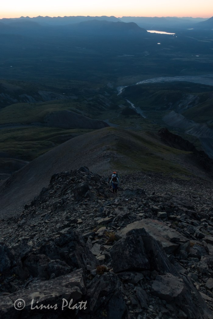
The southeast ridge of Mt Archibald is a long and rocky ridge, perhaps 3 miles in length and rising nearly 6000 feet from Thunderegg Creek to it’s 8,491 foot summit. This ridge is a steep and sometimes narrow feature sporting many sizable ‘summits” along it’s way, several gendarmes up to class 4-5 climbing, and near it’s top, the glacial ice from it’s east face creeps over the top of the upper ridge where steep and exposed snow and ice climbing accesses Archi’s true summit. It is a big mountain with a huge elevation gain for a peak of its height, and requires a variable set of skills to reach its summit. One must be comfortable with loose rock, exposed class 4 rock climbing, route finding, and snow and ice climbing skills. Given the length and elevation gain of Archi’s bulk, exceptional fitness is also a must.
A short scramble from our perch atop the lower ridge and we are surmounting the first of many gendarmes, most of which are in the solid class 3 range. Up and over, side hilling scree, of traversing back and forth across rock ranging from shattered Schist, to loose scree, to blocky talus generally accomplishes dealing with these many features and false summits. The hardest part of this ridge is the elevation gain… then loss, which one must deal with when going up and over these false ridge summits.
After a couple of hours of traversing and scrambling, the sun begins to crest just above the distant horizon and the ridge begins to get steeper, looser, and more exposed. Sections of steep scree lead to flatter sections of the ridge, where Dall Sheep sleeping platforms appear; there are several spots grouped together and have been manicured by hoof to produce flat and comfortable sleeping arrangements. Most are right on the apex of the ridge itself where wind and exposure are a way of life for these magnificent and hardy animals.
Higher up, another steep gendarme is negotiated by means of traversing left and scrambling the steep, exposed and shattered rock diagonally and then climbing directly upward and over it’s tiny summit; a brief down climb leads to another short traverse on it’s right flank to a point where the ridge eases off once again before climbing abruptly to the base of what had been described as the crux of the route: a true summit in it’s own right, a sub-peak of sizable proportions that bars access to the upper ridge, and the final stretch of chaotic mass of shattered debris below the steep and forbidding summit snow and ice where the glacier bends itself agonizingly over the summit ridge’s lip. Once the bulk of the gendarme is reached, the climbing turns to extremely exposed and loose class 4 climbing. We brought no rope so great care was taken climbing through this section. Once gaining the broken, tiny summit of this mammoth sub-peak, a view towards the final rib of snow and ice can be seen for the first time on the climb; it appears to be a steep knife-edge leading directly to the Archibald’s summit.
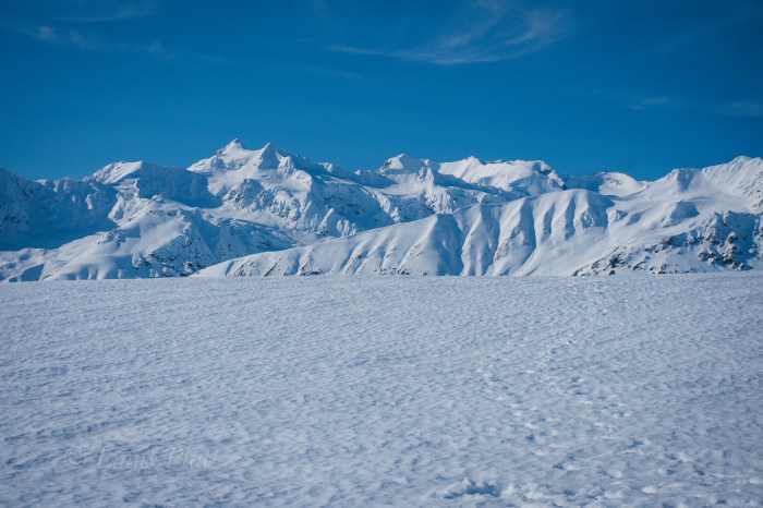
We are extremely lucky today to have the unbelievably outstanding weather we are experiencing, and from this point on the upper ridge, a view west reveals completely unobstructed and crystalline views of the entire Mt Logan massif and all of the big peaks of one of the most expansive glaciated mountain ranges on the planet. After moving through a section of broken towers and blocks, we find a pool of drinking water and fill our bottles and eat; we are both getting tired.
Another long, steep section of extremely loose scree forms a knife-edge and leads to a long flat section of ridge where, at its end rises the final snow and ice where the summit lie just beyond. After donning crampons and ice axe, we begin up the steep snow, Angela above of me front pointing then plunging the axe’s shaft, and repeating till there was no more. We are standing on the tiny summit; in fact it is just barely big enough for both of us to sit. The weather is striking and the views are mind blowing; however, I had been developing vision problems for the last hour or so from sunscreen dripping into my eyes, and now sitting here on Archibald’s summit, the pain is increasing, and my vision getting very bad indeed. We have 6000 feet of dangerous and time consuming ridge to down climb and here I am with only one working eyeball. We snap some photos and then begin the long and arduous descent back down the snow rib and the long loose section leading to the big gendarme. By the time we reach the dangerous class 4 sections, my vision is really bad and the pain increasing still. I have one semi-working eye in which to navigate the down climbing past a deadly exposed section, where if one fell or slipped, it would be the end of you. After managing, I stay close to Angela and she down climbs the bad section; relief hits us both and we are soon traversing and side hilling the long mid section of the route; I have managed to sort of “ski” the scree in my mountain boots, making downward progress a little less tiring, ice axe in hand just in case. After a few more hours, we are at the top of the Dall Sheep trail that leads back to the bivi. I am so tired, I can barely stand, but commit to this last section with abandon. Angela does the same and when we reach our bivi site, we collapse for a brief spell and ponder what we are doing.
Again, my eyes are inflamed and I cannot see at all out of the left eye, leaving only my bad right one still working, which has been of poor vision since childhood. We decide that hiking back to the truck is in order and the possibility of seeking medical attention a reality. After packing up our alpine ghetto, we shoulder our packs, our bodies scream, and we begin descending the debris covered glacier towards the dry creek bed and the route home. The going is slow, but soon we are at the point where we had bushwhacked from the ridge and into the drainage. Not feeling like going up through the thickets, we opt to stay in the dry bed in hopes that we may find a way to navigate around the toe of the buttress and it’s inherent Alder thickets. After stomping down through the Bear tunnels and shouting “Hey Bear!!” every so often so as to not startle one and provoke an encounter, we find ourselves on the shore of Thunderegg Creek. Fed by the glacier we had just come from, this specimen is no creek, but a dangerous and massive river, dark chocolate with debris, very deep, very fast, and very cold. We walk it’s shores for a very short time before realizing that we are trapped by the dense thickets leading directly to the edge of the raging torrent. Everything we had done to avoid the bushwhack just exploded in our faces and the only option left is to aim uphill and attack the matrix of the dense and unforgiving web of Alder, Aspen, Willow and small Spruce. Not 50 feet into it, we are encountering the worst bushwhacking of our lives. I once was a part of a conversation with some Washington climbers years ago about how the locals had a “bushwhacking rating system” for back country travel and mountaineering approaches in Washington state. I thought it was kind of of funny at the time, but now, after living and stomping in Alaska and the Yukon for a few years, it is no joke. This thicket we are in is definitely “class 5+” bushwhacking. Add a full pack and a pair of trekking poles to the mix and you’ve got some real fun. After about an hour or so of this, we emerge on a faint trail that leads to the cliffs at Thunderegg where the truck is parked and rest awaits.
The exhaustion we feel is overwhelming, and my eye is in horrible pain; perhaps the worst pain I have ever felt. It is late and we decide that staying here for the night is the best option, since the closest clinic is in Haines Junction or possibly even Whitehorse over 100 miles away. Oddly, there is phone reception here and Angela gets on the telephone and inquires about the clinics and general eye care with a nurse in Whitehorse. Not only would the drive be horrendous, but the cost of such an endeavor would be very difficult for me. We hunker down for the evening in the tent, sipping a cup of wine and me trying desperately to hold on. The pain is overwhelming. After a few agonizing hours, I pass out and wake hours later to my eye feeling slightly better, but still not good. We pack it in, drive out the long and sustained 4WD road back to the highway and head into Haines Junction for some grub and decide to head home and go to the SEARHC clinic in Haines.
The drive back over the pass is striking as always; the tundra surrounding the peaks laid out like a sub –arctic blanket and the peaks themselves jutting proudly to meet the sky. The drive from the alpine at the pass down the Chilkat corridor to Haines is always an interesting one to me as witnessing the transition from one ecosystem to another is always a joy, even with one eye. At the clinic in Haines, the visiting eye doctor examines my eyes and runs me through a series of tests that determines that the sun screen was in fact the culprit, and that applying some eye drops and rest will alleviate the pain and irritation. The entire experience, from the sleepless bivouac and the early morning Aurora, to a long and arduous route and it’s subsequent beautiful summit, to a terrible bushwhack and a murderously painful eye condition, has been one of great significance in a lifetime of outrageous adventures spent in an array of wilderness places that continue to touch our hearts and souls. It is being in these places that both Angela and I seek, both on a physical and spiritual plane.
The Kluane area of the western Yukon remains one of my most revered place on this planet; it is a place where some of the largest glaciers on Earth are born from some of the mightiest and remote mountains… it is home to scores of Grizzly Bears, Black Bears, Wolf, Lynx, Dall Sheep, Moose, and has an ancient Human cultural spanning thousands of years. The wilderness here is far reached and commands respect from any creature passing through it. It is a place near my home and one that I will return to visit time and time again to explore and experience magic.


.


Since I was a teenager, I have been enthralled by the far north. Epic stories of high adventure on Alaska’s queen Denali filled my young mind in the readings of early accounts of her ascent. To me, the very notion of Alaska was something of a mysterious and rare prize that few had conjured the gumption to explore for themselves’s. Of course this was far from the truth… Alaska’s history has unfolded in countless ways, spanning multiple races and generations. From the crossing of the Bering Straights untold thousands years back, to the gold rush bonanzas and oil field exploitations of modern memory, the Alaska frontier has always bee a place of not only fascination, but one of an inexplicable location for far fetched dreams and far fetched exploration. And when I first came here in 2011, having ridden my bicycle from the “outside” into her glorious womb, I then felt, as I do now, that Alaska and the untold prevailing of the Yukon and Northern B.C., were to beheld as nothing short of treasures. The first time crossing into the Alaskan frontier, I felt I had somehow stumbled across some great and archaic secret: something that the rest of white society had either forgotten, ignored, or simply knew nothing about. To me, it was a sensation of unfounded beauty and treasure. One that I still do not take lightly or for granted to this day.
Alaska is a place of mystery to most; and understandably. The ways of life here are not of the ordinary… even by un-ordinary standards. There exists a faction that demands one’s attention to detail regarding everyday life, to the omnipotent realization that nature is not only your absolute friend, but your foe at times as well. This balance is what defines this place; a place where you must have a kinship with surroundings and be capable of a transformative resolution on a daily basis. In a nutshell, the ebb and flow of the natural world is always at hand, and one must be not only willing, but ecstatic about it’s rapture and grace.
Every year, in the spring, the salt water inlets of Southeast Alaska are coming alive with life. The seasonal shift from a potentially long and harsh winter begin to unfold into something greater. The river’s break up, the ice floats to the sea, and life in the form of all animals and plants begin to explode in a monstrous display of grandeur.
One of the earliest signs of this magnificent occurrence comes in the form of the early spring smelt runs… At first it is the Herring, then a short time passes and the massive swarms of the Hooligan, also known as eulachon or candlefish, called so due to their high oil content, and once dried, can be lit on fire, begin to run into the omnipotent rivers of the upper Lynn Canal: The Chilkoot and the Chilkat. These precious Hooligan fish have been a staple of nutrition, culture, and economics for the native Tlingit nation for untold hundreds of generations. The fish are small, perhaps six inches long or so, and contain within them, essential fatty oils that are not only prized for there taste and nutritional value, but for their ancient economic value among the historic peoples of the Alaska panhandle and the ability to trade these wonderful gifts from nature to the southern Tutchone and Tagish peoples of the southern Yukon. Hence, the trade routes between the Chilkat Valley in modern day Alaska and the broad valleys and lake districts of the southern Yukon and northern B.C. have become known as the historic “Grease Trails” where the Tlingit natives of the coastal valleys of the Lynn Canal traded with northern interior peoples for such commodities as furs and other goods. These fish are regarded as gold by many, and not only signifies the coming of the summer ahead, but also the fact that the life giving runs of Salmon are not far behind. This is a time of celebration and thanks the the Earth that another time has passed and another will ensue.
I begin to hear the birds at first; the ocean Gulls swarming and squawking, then the Eagles, chirping in their usual ways, but at this time of year, it is somehow greater, as if something is about to explode. I hear these sounds early in the spring Alaska mornings as the light from the rising sun shines itself upon the northern landscape and gracing the land with light at about 3:30 am… something is happening. The North is coming alive; the Bears are awakening, and the fish are beginning to run the rivers on their yearly migration to spawn and dye as they have been born to do for untold eons.
This day opens and I head out to the Chilkoot river, the first of this year’s Hooligan run to inspect. Upon pulling into the narrow river valley, I spy hoards of Gulls and Eagles: A sure sign that the run has started. I peer to the river and notice immediately that is is black with fish. Untold thousands of these Hooligans have entered the river from the Sea and are finishing their life cycle in the form of spawning and dying. There are Brown Bear prints about and the entire river corridor is coming alive.
The next day, this time I return with a bucket, one I have drilled holes in to let the water escape as I scoop the Hooligan. The common method for capturing a harvest of these fantastic creatures is by means of a long handled dip net, but I do not possess one. Instead, my bucket will do… I have not a desire for more than I need, and my needs are small. I dip the bucket into the blackened mass of a million fish, but they scatter as the motion of the bucket rifles the water. Each scoop manages a few scant Hooligan, but after an hour or so, I have what I need. I thank the Earth for this treasure and I return home with my earnings. After inspection of the harvest, it is revealed that I have taken exactly what I need: enough to fill my little smoker and just a tad bit more for the evening’s supper.
After, I look out over the Chilkat Inlet, the scene of the next Hooligan run in a week or so, and revel at how blessed I am to live in such a world.
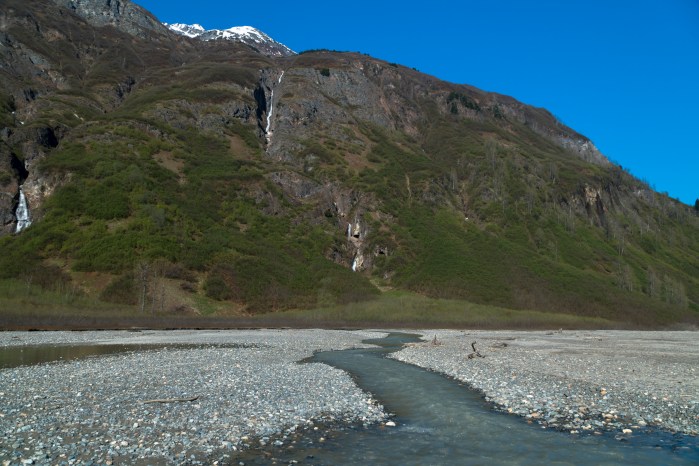
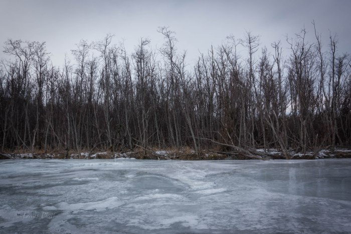
Adjacent to the tiny village of Haines, Alaska, and across the emerald saltwaters of the Chilkat Inlet, lie the deceptively remote and jagged peaks of the Chilkat Mountains. These peaks are of a particularly steep and heavily glaciated nature and include the enormous mass of the Cathedral group that includes the mighty Mt Emmerich, clearly visible from town. Emmerich is the visual centerpiece of this group and rises out of the Kicking Horse River valley just east of it’s convoluted mass. The Kicking Horse River is a river born of the ice; it’s scant origins flowing from the snout of the Garrison Glacier situated at the northeastern end of the range, where it flows for a relatively short distance to it’s confluence with the heavily braided and Salmon infested Chilkat River. At the point where this confluence occurs, the Chilkat narrows to perhaps a half mile across, and on this 9th day of February 2017, winter temperatures has frozen the Chilkat solidly enough to allow crossing on foot.
This winter in Haines has been one of mostly consistently cold temps, with snow on the ground for the entirety of the winter season so far; only once or twice has rain been allowed passage to our winter Alaskan landscape. This is the way I like it and having the rivers frozen over has gained me the chance to explore the “far side” of the Chilkat several times this season. The far, or wilderness side of the river gains access to the peaks of the Chilkat and home to a wolf pack twenty strong. Once, last fall, I had the ultimate pleasure of viewing, with binoculars, several wolves attempting to take down two separate Moose. Ultimately, both moose escaped with lives intact. The visual experience left a deep impression on me and the deep wilderness just across the river has been enchanting me ever since.
Earlier in the winter, I had the pleasure of wandering across the river in other places; once at 10 mile and across to the dense Alder thickets of the Tahkin River, and another time near to 8 mile where once across and beyond the barrier of Cottonwoods lining the shore, I found open snow covered meadows full of Moose, Wolf, Lynx, and Rabbit tracks a plenty. For me though, these were just to test the waters of crossing the Chilkat and the ultimate goal was to reach the confluence of the Kicking Horse River. While there are other, more remote rivers that flow from the Cathedrals, the Kicking Horse to me was one that had a special interest. It was more accessible and equally as wild. So today it was to be…
Parking on the Haines Highway at the state fish and game run fish wheels, I meander out onto the ice and instantly feel the bitterness of the biting wind. The surface is a mixture of crystal clear ice several inches thick and more opaque sections requiring more care in regard to judging the thickness. As I walk the slippery clear sections, I look to see the bottom of the river a few feet below and imagine the thousands of Salmon swimming upstream as they do every year as they have for thousands. Chinook, Chum, Pink, Sockeye, and Coho all run in these waters. Soon I am near the other side and the frozen Kicking Horse is a mere 300 feet ahead. However, there is a channel of open and running river water just in front of me, blocking access to my destination. Further east, I can see that the channel slides under the winter ice pack and disappears. How thick is this newer ice I ask myself? I walk further downstream to where the ice re-appears and gingerly step into this new zone. I can see immediately that is is very thick and soon I am completely across the Chilkat and standing on the gravel shores of the braided Kicking Horse confluence.
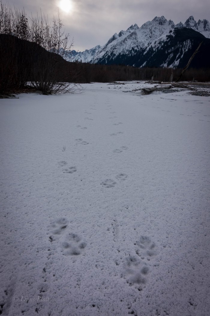
It feels downright sublime to be standing here and looking up the Kicking Horse for the first time; gravel bars and Alder thickets lead to a narrowing of the river before it disappears into the bowels of the wilderness. I walk these frozen river banks, occasionally crossing thinly veiled ice sheets over rocky surface, boots crunching loudly and the stiff breeze from earlier dissipating. A long stretch of snow leads to the forest where hundreds of Wolf tracks appear. At least part of the pack has traveled through here recently. I look around and see more Wolf tracks than I have ever seen and realize that the Kicking Horse must be some sort of Wolf highway; a passage leading from the wilderness of the Cathedrals to the shores of the Chilkat herself.
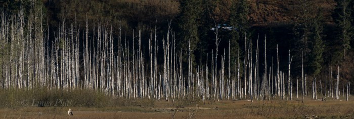
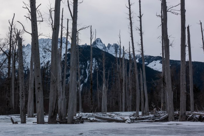
I travel further into the corridor till passage is barred by river ice with a couple inches of running water. Here, the forest at river’s edge are many dead Cottonwoods stripped of their bark and treetops. They stand like monuments guarding the inner access to the wildness beyond, Mt Emmerich towers over head, displaying intricate ridge lines, towers, gendarmes, and gullys. This is the closest I have ever been to this peak and I am awestruck by it size and complexity.
This is my turning around point and it is getting late and the temperature is dropping, so back through the Adler thickets and gravel bars and the multitudes of Wolf tracks to the frozen Chilkat, where an easy stomp back to the highway is in order.
The Kicking Horse has always held a great deal of fascination for me and today was a teaser that strengthened that notion.
I will return …


After 43 long months of not seeing my family in California, it was time to head south out of the Great Alaskan Empire, and into the realm of family and old friends not forgotten. It was a strenuous voyage of ferrys and plane rides, airports and freeways, but eventually I was home to catch up with my Mom, Sister, Nephew, Pop, brother-in-law Dutch and old time friends not seen in quite some time. Catching up with John Boyer of Edible Pedal in Sacramento, and Debra Banks of Rivet Cycle Works was a joy. My old friend and climbing partner Dennis even drove up from the Bay Area so the two of up could discuss our plans for an Alaska Range climbing trip this coming August. Ten days later finding myself looking back with fondness of my visit upon an Alaska Marine Vessel heading north from Juneau, I am once again in awe of the magnitude of the Upper Lynn Canal and it’s mountains, waterways, and glaciers. Two days in Juneau prior to being aboard this vessel, I had the pleasure of catching up with another old friend not seen in many years. Amelia was in Juneau visiting her boyfriend James and the three of us celebrated with beers and lunch along Juneau’s waterfront.
Now in the waters of southeast Alaska once again, I am getting the fond sensation of being home. The Alaskan air is crisp and cold, but I spend a great deal of the boat ride home outside perched on the vessels decks gazing at the scene unfolding. It is breathtaking to see it again. Back in my crib later, I sift through mile after mile of unseen footage and unfortunately few photos. For some reason I had been so preoccupied with shooting video to make a living with I had neglected much in the way of photos or even snapshots of my family. This makes me feel deeply sad, and I vow to not let that happen next time.
The next couple days are spent not only in front of the computer editing and working, but getting out a bit exploring, shooting video with friends Gene and Michele, shooting photos and stomping around the hills.
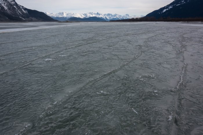
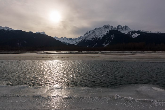
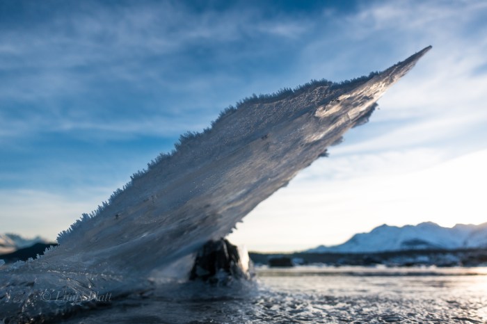
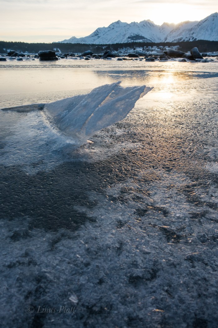
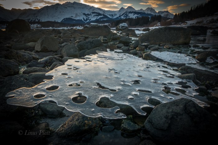
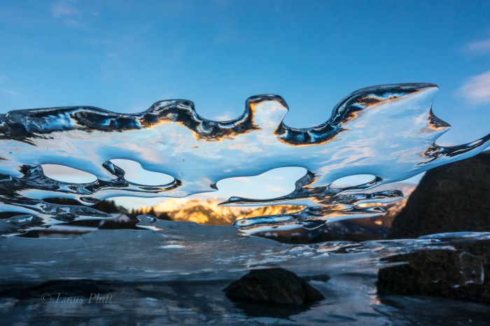
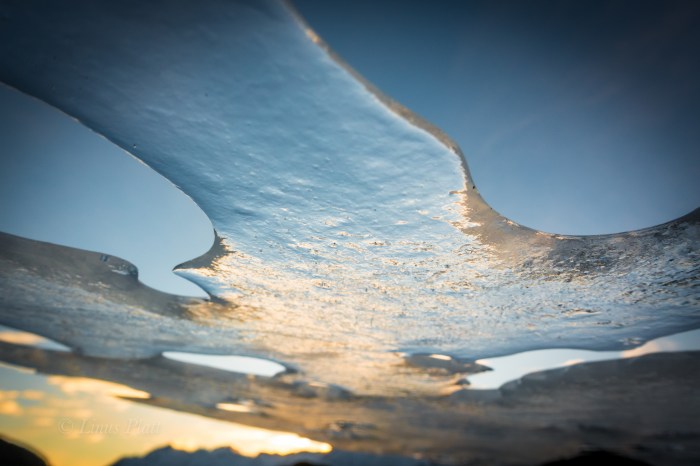
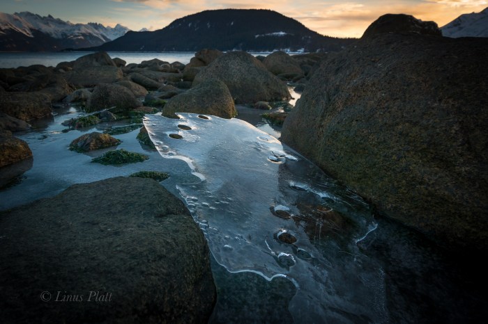
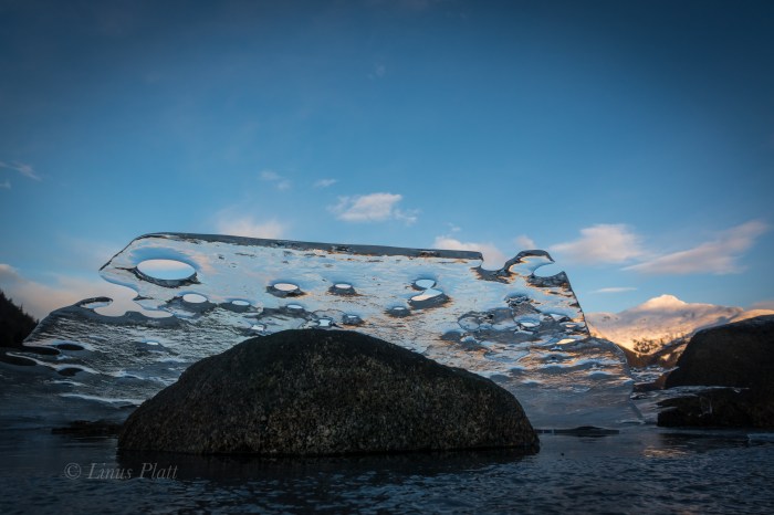
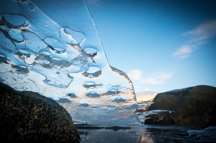
It has been two or three years since we have had a “real” winter here in Haines, and this winter is a real treat and a joy for me to call it such: Winter! The temps have been, more or less, consistently cold, and there has been snow on the ground for many weeks. The resulting ice at Picture Point along thee Lynn Canal and the Chilkat Estuary beaches has been extraordinary.
Going back to work next week after three solid weeks off will be another challenge upcoming. I keep reminding myself of the upcoming adventures to be had that need paying for to drive me back. The Lost Coast in May, and the Alaska Range trip with Dennis in August I look forward to immensely.
In the meantime, I have ice…


“The more I see as I sit here among the rocks, the more I wonder about what I am not seeing.” ― Richard Proenneke
The untold tales of paths trodden, fears conquered and battles won.
tracking inner and outer landscapes along the road to creating community
Adventures starting in the heart of Alaska
...A Life Simplified Is A Life Fully Lived
More than just a Summer in Alaska
Indulge- Travel, Adventure, & New Experiences
News and opinions on the environment in the Haines area and greater North.
Exploring and Photographing the Alaska Range
The Adventures of a Man, His Heart, and His Bike
Mapping the bicycle travel revolution.
Just another WordPress.com site
A fine WordPress.com site
Just another WordPress.com site
Since 1999
Iowa City ~ (319) 338-8900

You must be logged in to post a comment.