The Sheen Of The Great Nunatak

By Linus Lawrence Platt

One day in 2018 I get a Facebook Messenger text from Rich Page of Hyperlight Mountain Gear in Maine, asking me if there was any truth to a rumor he had heard from Danny McGee, a mutual friend of ours from La Sal, Utah. Rich and I had neither met nor spoken previously, but in a recent telephone conversation with Danny, I had mentioned I was pondering the idea of writing a short biography of the late, great Kyle Copeland, a mutual friend and well know Colorado and Utah rock climber. Turns out, Rich had known Kyle back in the late 70’s and early 80’s in Colorado, a few short years before Kyle took up in Moab. Kyle would often drop by Steve Komito’s Boot Shop where Rich spent time working and hanging out in Estes Park. After being diagnosed with Crohn’s Disease sometime around 84′ or ’85, Kyle relocated to Moab where he and I met in 1990 and we became good friends and climbing partners. I texted Rich back and leveled with him that the biography idea was likely never going to see the light of day, but I was happy that it got he and I introduced. Rich is an outdoor gear developer and manufacturer who has been involved in the outdoor equipment business since the 70’s in one way or another. His specialty is designing and manufacturing backpacks, and at the time of our introduction, was a gear developer for Hyperlight Mountain Gear in Maine. Since I lived in Alaska, and Rich being a former Denali guide who has a long history of adventures in Alaska, we hit it off and over the course of time, came to conjure up doing some kind of an Alaskan adventure together.

Later That summer, Rich proposes the idea of skiing Mt Sanford, a 16,237′ glacier covered volcano in the Wrangell Mountains of South Central Alaska. While I have never really called myself a skier, I always identified as a climber. I had seen Mt Sanford several times over the years and without a doubt I stood in awe of it’s size and magnitude; The first time was on a multi month bicycle journey where I found myself atop McClaren Summit on Alaska’s Denali Highway. At the time, I knew not of its existence, but there it was, certainly one of the biggest peaks I had ever seen. Over the years, it would catch my eye when on various trips around that part of Alaska, dominating the skyline when it was clear enough. Mt Sanford is the second highest peak in the Wrangell’s and rises over 11,000′ from its base, making it as big or bigger than many mountains on Earth. Only Mt Blackburn (16,390′), also in the Wrangell’s is higher. Skiing to me had always been more something to do to fill time during winter months while waiting for climbing season to sprout, but the thought of ski mountaineering up a giant Alaskan peak sounded appealing to me, so Rich and I began to hatch the plan.

We agree that late April or early May 2019 would be the time frame, since that is the standard “big mountain” climbing season in Alaska; stable weather (mostly), cold temperatures at higher altitude, and strong crevasse bridges from the tail end of winter. Any earlier and a climb is more or less considered a “winter ascent”, and later, the lower mountain becomes soggy and melted out with crevasse bridges becoming increasingly soft and fragile. We begin to sort out the details and logistics, finally settling on hiring Jake Combs at 40 Mile Air in Tok to fly us in to the base of the Sheep Glacier via Super Cub. The Piper Super Cub is the standard de facto Alaska bush plane when one wishes to get into tight spots in the backcountry. Of course there are thousands of Cessna 185’s in Alaska flying in and out of the bush, but nothing can beat the Super Cub for its ability to land and take off in a very short distance on a remote gravel bar or short strip of tundra. The downside to a Super Cub is its size; it holds one pilot, one passenger, and a tiny bit of gear, perhaps one fully loaded backpack; that’s about it.

Eventually, Rich purchases a plane ticket and the deal is sealed, but a trip of this sort is safer and more fun with a team, so we ponder some of our contacts and my old friend Cameron Burns whom I had not seen in many years comes to mind immediately since he and I had recently re-connected via the good ‘ol internet. Cam and I first met in Indian Creek, Utah nearly 30 years prior, where we climbed the Lightning Bolt Cracks on North Six Shooter peak together with Steve Porcella and Sue Kemp. A couple years later, I had temporarily re-located to Boulder, Colorado from Moab, where Cam and his now wife Ann would drop by my house for social visits. Cam is an Australian and lives in Colorado still, along with Ann and their daughters. He is a world traveler and accomplished writer with a wild sense of humor and a penchant for telling stories. After inviting Cam on the Sanford Expedition, he ponders for a while, then accepts the invite. Now we are three… Danny McGee, who made the introduction for Rich and I, was also invited, but situational and family issues prevent Danny from making a commitment at this time, so his spot is left open for him should he be able to join us. In the meantime, Rich invites Jeff Rogers, a 26 year old accomplished ski mountaineer who had skied Denali a year or two prior. With Jeff’s addition, we were now a solid team of four, with Danny’s spot still available to him should his situation change. Before Jeff was brought in to the picture, it was looking like it was going to be Rich, Danny, Cam, and myself… all of us were over 50 years old and jokingly, I said “Hey we’re kinda like Over The Hill Expeditions”… and the name stuck. So when a 26 year old hot shot skier was added to the picture, I was skeptical. Luckily, Jeff turned out to be not only a great asset and expedition partner, but an excellent friend as well and I’m very happy to know him.

Once the plan was made and we had our crew together, it was time to start preparing equipment wise. Going through all my expedition gear, I realize that much of the stuff I had been getting by with for the last few years was simply not up to the task any longer. I wound up buying a new sleeping bag, down parka, shell set, and various odds and ends. The previous winter I had bought a brand new pair of alpine touring boots and had been using them in my Silvretta mountaineering bindings, with plans to upgrade to a nice pair of modern skis with proper AT bindings, but at this point, the boots I bought just weren’t working out with my feet (pain), so I sold them. My choice was to buy a whole new AT setup that would set me back a couple thousand bucks, or just use my mountaineering skis on Sanford with my double mountaineering boots. Due to financial reasons, I chose the latter. Rich also chose this type of setup utilizing an old school mountaineering package. Jeff and Cam both both would be on state of the art modern AT skis, boots and bindings. I believe it is safe to say that both Rich and I regretted this decision in the long run, as some of the outcome of the trip might have been different had we chose different ski gear. Rich, being currently employed at Hyperlight, got us a small sponsorship and each of us were sent backpacks, stuff sacks, and other goodies. Rich also managed to get us set up with a sponsorship from Mountain House who provided us with all of our freeze dried food needed for the expedition. I even set up an “Over The Hill Expeditions” Facebook page for us all to collaborate and share ideas.

For me, going on a big extended trip like Mt Sanford ultimately represents my freedom and dedication to exploring as much as Alaska as humanly possible. Although I worked full time and now had a mortgage, I had made a promise to myself when I came to Alaska nearly a decade prior that I would not allow a normal life to interfere with my spiritual connection and vow to fully explore the planet known as Alaska, it’s people, landscapes, animals, climate, and way of life. A life in Alaska is very different than a life in 95 percent of the lower 48 (known as “The Outside” to some Alaskans). Life here has a way of commanding one to take up in self reliance and responsibility. Nowhere I have been where the Do It Yourself mentality is as crystalline as the mountain stream or surging glacier that exist here. While there are certainly pockets of similar disposition in the Outside, it is not the norm, Conversely, there are also pockets in Alaska that exhibit more of an Outside type mentality (Anchorage comes to mind). The climate and remoteness keep most people at bay, so when the tourists arrive in May and go home in August, the Alaskan landscape becomes still and quiet, and the fall colors arrive, turning Birch, Cottonwood, Aspen, and Tundra to fire hue. The crispness of the Autumn/Early winter time period is an extremely fascinating time for me in Alaska. It is a time of deep reflection and nurturing that is hard to put to word, but the crispness of the air and the stillness of the landscape prompts one to feel a deeper connection to the Earth and its beauty. Merging with the fall colors, hunting season begins, and soon after the beginning of 6 – 7 months of winter arrives, leaving the entire 665,000 square miles of unimaginable beauty blanketed in snow.

Winter is a time to work, ski, gain fitness, save money, and be thinking about Sanford. I saw a thread on the internet by a woman who had skied Sanford a few years prior, and wrote to her asking for some beta on the Sheep Glacier’s First Icefall. She got back to me with some pictures with a hand drawn line indicating the path they took through the fractured maze of crevasses and seracs. From her description and photos, the icefall looked like a route finding challenge at best and a dangerous proposition at worst. There were several internet articles and blog posts on skiing Sanford, so information was not too difficult to come by, but big mountain glaciers have a way of changing year after year. By far the most interesting essay I had read was Terris Moore’s account of he and Bradford Washburn’s first ascent in July of 1938, utilizing a dog team to reach 10,000′, followed by skiing from its 16,237′ summit. They had started in Chistochina, fjorded the Copper River, and utilized horses to carry skiis, supplies, food, and a dog sled up Sheep Creek to the toe of the Sheep Glacier, where they harnessed up the dogs and continued. It still amazes me that they managed to navigate a dog team through the maze of the icefalls without harmful incident. Since that time, it has been skied more times than can be counted; in fact it has become somewhat of an Alaskan ski mountaineering classic due to its fairly non-technical nature and gentle angle below 13,000′.

Early spring is spent working, fixing vehicles, and skiing in the Yukon and trips up and down Haine’s local mountain; Mt Ripinski rises right from town out of the ocean to an elevation of about 3600 feet where a myriad of ski and snowshoe trails lead to backcountry cirques, alpine ridges, couloirs, and summits, and being at this latitude and proximity to the Gulf of Alaska, receives many feet of snow every year. Aside from being non-glaciated, Mt Ripinski and the surrounding coastal peaks make a good training ground for the bigger interior mountains of Alaska and the Yukon. In late April, I leave Haines, driving north in my pickup headed for Anchorage where Rich, Cam, and Jeff would be flying to. I had been looking forward to this drive as much as the expedition itself; I had taken enough time off from work to allow several days of alone time for exploring the great Alaskan landscape at my leisure. Having free time in Alaska with no work commitments at hand, with vehicle and equipment at my disposal to do what ever I want is one of my greatest satisfactions. For me, driving slowly through Alaska, stopping frequently, hiking up this hill or that, fishing a small river, and camping where one pleases is paramount. Being free in Alaska is the ultimate in personal freedom and nothing else comes even remotely close.

Driving over Haines Pass, where the Takhinsha and St Elias mountains collide, I spot a thickly furred Fox lying in the snow beside a tussle of Willow; it does not look injured, but merely relaxing perhaps. I pull over and approach the creature and it lifts its head to look at me and simply yawns. I speak to it in gentle tones and wish it farewell as it curls its tail over its nose for a slumber. I zip Past Desdeash Lake and soon I’m topping the truck’s fuel tank in Haines Junction. I’m not sure where I’ll spend the night, but I find the temperature near Beaver Creak in the Yukon hovering right around ten degrees Fahrenheit, so I keep driving, thinking warmer temps are coming. Pretty soon I’m in Tok, where it is almost always much colder than any other place in the state, but on this lucky day it is 35 degrees, so I opt to head to one of my favorite standard camp spots in the area at Yerrick Creek just 20 mile north of town. I had brought my packraft on this trip because I had always wanted to hike up Yerrick Creek to the foot of the Alaska Range and paddle back down to the Alaska Highway, but of course now at this time, it is still frozen. Perhaps on my way back after Sanford it will afford a paddle. Back in Tok the following morning, I hit the market and pick up some supplies and head down the Tok Cutoff towards Anchorage. The Tok Cutoff is a short 125 mile stretch of glorious highway connecting Tok to the Richardson Highway just north of Glennallen; it slices through some of the finest countryside in the state, where it follows a corridor right smack through the middle of two of Alaska’s major mountain Ranges. When one is heading south west on the Cutoff, The Wrangell Mountains are on one’s left and the Alaska Range on the right. I find a typically free and spectacular camp along the Little Tok River, catch a nice Grayling for supper, and revel at the days growing longer each day. Winter has left the building.

A couple days of screwing around and suddenly I’m in Eagle River about 10 miles north of Anchorage looking for a place to camp. I like to tell people that there is generally no need to pay for camping in Alaska, since there is an abundance of free and wild camping to be had nearly everywhere… except anywhere near Anchorage. Personally, I can’t stand Anchorage, or Anchoraugua, as some people I know sometimes call it. Camping is always a problem whenever I am near here. As the saying goes “The best thing about Anchorage is that it’s only an hour away from Alaska”. It’s true, yet to me, it is a congested slice of crime, traffic, and sprawl. It is a fairly beautiful place however, sitting at the foot of the Chugach Range and reminds me vaguely of Salt Lake City. It is desperately crowded (for Alaska) and I am always on edge when I am here. But finding myself in Eagle River, which is essentially a sleeper community of Anchorage, I decide to just grab a cheap motel since Rich comes in tomorrow. After neighboring crackheads keep me awake for portions of the night, I stagger out in the morning and hit a diner for coffee and grub and check on everyone’s flights.

Rich Page and I had never met, Jeff Rogers and I had never met, and Cam Burns I hadn’t seen in 30 years. An interesting expedition lineup I thought to myself as I entered the airport terminal to grab Rich. Before I get 10 feet in the door, I spot him; sporting a ball cap atop a head of long gray hair, feet adorned in flip flops, and a big grinning smile plastered to his face. After we grab his massive duffle bag full of expedition gear off of the carousel, we head to the Air B&B he had rented, drink beers, grill steaks, and get to know one another. I immediately like Rich and there seems to exist between us a certain bond regardless of having just met. We have a lot of laughs telling stories and after the last beer is finished at 1am it is time to crash out; Cam and Jeff will be arriving tomorrow.

Cam flies in at 2 pm and I go in the terminal to grab him while Rich waits in the truck, warding off any potential police waving a ticket book around. Cam is taller than I remember him being, appears to be about 6′, 2″, and like Rich has a massive grin on his face when we greet. We load the truck and head back to the Air B&B; Jeff will be here soon and we can all settle in to prep for the trip. Hours later, Jeff lands and takes a taxi to the house, saving us from having to pick him up. Spending the next couple of days running around Anchorage is taxing on me; not only do I have absolutely no idea where I am or where I am going most of the time, the traffic is overwhelming. In Haines, there are exactly zero stoplights, and if you have to wait more than 20 seconds at a stop sign it is a rare occurrence. But here in Anchorage, we are running all over the place looking for a pair of puffy pants for Cam, a foam sleeping pad for Rich, and buying all of our trip lunches, snacks, booze, and other extras. Finally, completion is made of these tasks and we settle in at the house to repackage the mountain of freeze dried breakfasts and dinners courtesy of Mountain House. Re-packaging these meals saves a tremendous amount of space and a tiny bit of weight. We pack for 15 days on the mountain, plus have another box to stash at basecamp at the landing strip a couple of miles below the toe of the Sheep Glacier. In the morning we hit the road, heading up the Glenn Highway toward our destination of Chistochina, where there is a small airstrip next to the highway where will meet our pilot Jake. Also in Chistochina is the Red Eagle Lodge, where we are certain we will spend at least one night.

One of my greatest thrills is being tour guide on these trips when folks from down south come up for a visit, and heading up the Glenn Highway into the great vast openness of Alaska’s truly face melting scenery, I point out this and that; we pass the Matanuska Glacier in the heart of the Chugach Range, stop at Eureka Summit, among other places frequently to observe various monster peaks and glaciers off in the distance. We stop to observe a small herd of Dall Sheep on a hillside near the Chikaloon River. Soon it is raining, and we continue on to Red Eagle, where the weather is simply nasty and cold. We decide to rent a one room cabin and settle in for the evening, listening to the downpour outside. A call to Jake in Tok reveals a no fly condition as things are currently. We will check back in the morning for an update. Anticipating the weather clearing and a monster day tomorrow getting base camp established, I am concerned, as I often am with getting proper sleep, and Cam offers a solution.

Cam hands me a couple of pills “for Sleep” he says. “I Guarantee that you will sleep”.
So after dinner and a couple of beers, we pack our packs just in case the weather works in our favor in the morning, I swallow the pills Cam gave me, and we all settle in. In the timeframe of a light switch engaging, I slowly peel my eyelids back to see everyone up and about, dressed, packed and ready for action. Seems they had been trying to wake me for a couple of hours. I feel like shit, and can barely walk once out of my sleeping bag. My mind is a haze that only pharmaceuticals can induce. The next hour is spent simply getting oriented, and I pray that we do not fly today. “What in the hell were those Cam?” I ask. “Anti-depressants Mate! They help me sleep…” he replies.

Unfortunately for me and the unbelievable “pill” hangover, the weather is improving slightly, and Rich talks with pilot Jake in Tok, and afterwards walks over and says “Jake will be here in a couple of hours”. So we pack the truck, get our gear together, and suit up with superhero mountaineering regalia before heading to the lodge for breakfast, that way if Jake happens to show up early, we are ready.

Richard and Judy Dennis, the owners of Red Eagle Lodge, have done a fine job of making us feel at home… Richard, a former educator and Alaska bush pilot has lived in Alaska for over 3 decades and his wife Judy, a registered nurse, has spent a great deal of time working in the African bush prior to coming to Alaska, where they discover the Red Eagle Lodge in 2006 and sign ownership papers in 2007. They have worked diligently to make the Red Eagle into what it is today, befitting a reputation for a pleasant and rewarding stay for travelers on the Tok Cutoff.

After breakfast with Dennis and Judy, we finish packing the truck and relocate it to a spot adjacent to the lodge where it will be out of everyone’s way for the time we will be up on the mountain. We then make a pile of the gear we’ll be taking. When Jake lands, he will be flying us in one at a time each with a backpack. After all of us have been flown in, he’ll make one more trip for our remaining gear for 5 trips total. It is only about 35 air miles from Red Eagle to the Sheep Glacier landing strip, which is but a gravel area that Jake has cleared by hand just enough to get his Super Cub to land. We spend the next hour or so milling about; excited for the flight in. As far as I know, I’m the only one in our group who has ever flown in a Super Cub; the year previous, Angela and I had flown with Drake Olsen of Haines in his Super Cub into the upper Tsirku river drainage for a 3 day packrafting trip down the seldom visited Takhin River.

Jake had left Tok about 45 minutes earlier and at just about noon, I hear the distant but always familiar sound the Super Cub makes; Jake will be landing momentarily. The Super Cub always amazes me in the very little distance required for a take-off or landing, and Jake piloting the little craft today is no exception as he comes in fairly high, then suddenly drops down steeply and rolls the machine to a stop right in front of us. Rich, Cam, and Jeff all have this shit-eating grin plastered to their faces having just seen how impressive it’s landing capabilities are and anticipating the coming joy ride. It’s decided Rich will go in first; Jake loads his expedition pack into the tiny area behind the passenger seat, then Rich climbs in, followed by Jake. The little yellow beast fires up and soon another prime example of the Super Cub is at hand as Jake taxis the machine to the start of the road side landing strip, adds heavy RPM’s, and they are off, gaining speed in an incredibly short amount of time with wings abruptly airborne and elevation rapidly gained; soon they are gone beyond the tree tops, only the faint hum of the engine audible as it slowly dissipates into the still Alaskan air.

Each flight takes about an hour round trip, and by late afternoon the 4 of us are at the makeshift gravel landing strip along Sheep Creek, an unknown number miles from the toe of the Sheep Glacier. Jake takes off for a fifth and final trip to grab the rest of our gear at Red Eagle and we use the time to get tents setup and become organized. By the time shelters are in place, Jake comes around again and we take some group photos with Jake included; we shake hands, and Jake, back in the air, does a nice low 180 tipping his wings at us as he slowly gains casual elevation before disappearing behind the low peaks down valley and is suddenly gone, leaving us there at our makeshift base camp to the silence of the snow and the rocks. After the sting of the silence has worn down to an acceptable level, we continue organizing and getting things setup for a possible stay here at basecamp as the weather report on the GPS indicates some snowfall this evening. After our initial chores are accomplished, someone opens up a bottle of whiskey and after a few rounds of shots, we decide to don skis and skin up a nearby hill to catch a few turns. Snow conditions are quite terrible really, and we are all slightly inebriated. Being somewhat of a lousy skier to begin with, I did not fare well. Neither did Rich… Cam fares slightly better, and Jeff, being the young hot shot skier he is, cuts a flawless line of turns down said hill like it’s just another day at the office, because it is.

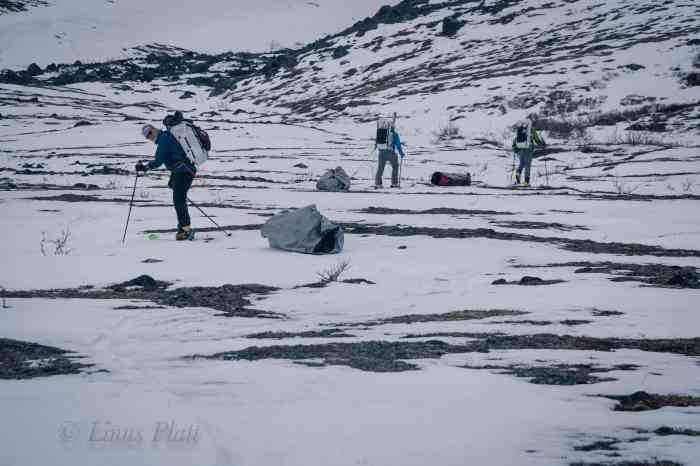
That night it snows a bit, and the morning brings cloudy, but snow free weather, so after a hearty breakfast of pancakes, sausage, and coffee, we pack up a load and see what the upper reaches of the valley reveal, hoping to get to the toe of the glacier and make a cache. We are utilizing duffle bags wrapped in plastic tarps for their slippery sliding capabilities and pulling them like sleds in classic “drag bag” style. We meander up valley, pulling our loads through the thin snow and every now and then engage in a wrestle getting the bags through sections of rocks and embankments. Soon we are faced with a choice; we can either stay low and follow the drainage, pretty much guaranteeing a certain, but possibly long ski to the toe of the Sheep Glacier, or, as at least two of us believe, a possible shortcut up and left. We choose the latter, but after a dead end up high amongst volcanic outcroppings, we descend back to the creek where we commit to the flattish trudge continuing up valley. After a couple of hours, we come to a small headwall of sorts, where we decide to make a cache amongst the large pumice boulders. We have fallen short of our goal of making it to the glacier, but everyone is feeling tired and the decision is made to return back to basecamp.

That night it snows again, but we wake to blue sky, sunshine, and mild temperatures. After another round of breakfast decadence, we pack up everything but a spare stove, extra fuel, and a box of food, which we make a cache of and pile rocks atop as to deter animals from pilfering. Our packs and drag bags are full and heavy, and we begin a slow trudge once again up valley. Not wasting time with meandering this way and that, we arrive at our cache in a reasonable time frame, where we decide to grab only a few items and continue on to the toe of the glacier. After topping out above the cache we expected to be near the glacier, but were surprised to find a long flat valley of pumice; according the topo maps we had, the glacier had been here sometime in the last 50 years or so, but it has receded about a mile back. We drop our load here and make a dash down the boulders to the previous cache which was only about a quarter mile distant and ferry that gear back up to the north end of the pumice flats. We make a temporary stash here and continue skiing south across the pumice flats towards the now visible glacier. Not knowing what to expect in regard to a location for an advanced basecamp, we figure it will just all come together as needed. Skiing in and out of boulders and creek drainages, the toe of the Sheep Glacier is directly above us, and it getting late in the day, we decide that here and now is the place for camp, since the weather is deteriorating and we have no idea what lay above on the ice. In fact, the wind is picking up as Rich, Cam, and Jeff proceed to setup our tents, while I make the commitment to ski back across the pumice to retrieve the last of our gear stash. Skiing back with a 100 pound pack plus a drag bag makes for some strenuous work and the going is slow, but by the time I make it back, they have three tents setup – Cam and Jeff each have solo tents, while Rich and I share a big expedition tent, plus we have 4 person Hyperlight UltaMid with a dedicated pole to serve as a cook hut. This “Pumice Camp” as we have not-so-affectionately dubbed it is a terrible place to camp; it is made up entirely of pumice rocks ranging in size from golf ball to Volkswagen, and covered in just a few inches of barely skiable snow, making purchase for tent stakes grim at best. We have brought along dedicated snow stakes for use higher up, but manage utilize them here in the frozen pumice. I set about to getting the ‘Mid erected so we can fire up the stoves for hot drinks. Getting the mid setup is a difficult task, as it absolutely relies and solid staking of its 4 corners. Additionally, since the ground (I use this word loosely) is nowhere near flat; there is a hump in the middle making the single center pole too long. I manage to get it setup just as the big winds started coming down from the glacier, gaining velocity as it hits the pumice flats where by the time it gets to us feels like a freight train hitting us. I grab my camera, intent on attempting to document this expedition, which quite frankly is generally a giant pain in the ass. I pan the camera around camp as the wind accelerates, and then hear a virtual explosion of wind followed by seeing Rich’s big expedition tent tumbling across the pumice full of our gear. Rich, running as fast as he can in mountaineering boots to catch our needed survival supplies, I continue filming. As he drags back the tent, he shoots me a rather unaccepting look and asks if I wouldn’t mind giving him a hand. I holster the camera and sheepishly apologize for not dropping everything and running after the tent with him. Of course, Rich was right and that is certainly what I should have done, but it was way hard putting that camera down once the action started. After getting the tent back up and making some repairs to the ripped fly with duct tape, we manage to get the stove going inside the mid and brew up. The wind is ferocious, and the rocky surface we are sitting on is not enjoyable with all 4 of us cramped in with 2 stoves running. After we eat and drink hot liquids, the wind comes now in heavier bursts, one of which simply flattens the ‘Mid with us in it. We scramble out and decide to just let it alone and stack rocks on it to keep it from blowing away and retreat to the tents to weight them down as well, where Rich and I spend the next 14 hours sleeping and wondering what the upper mountain was going to be like.

During the endless daylight night we listen to the wind attempting to shred our camp into oblivion, sometimes putting a leg up on the pole structure to help stabilize the shelter from collapsing, then later drifting off into a fitful sleep only to be woken by and variable and treacherous gale outside; additionally, the wind has a serious chill to it since it as it rolls off the bare ice of the lower glacier just above us. Eventually, the wind settles down and we sleep into the later hours of the following morning, where I awake to find Rich outside setting up a makeshift kitchen outside of the collapsed ‘Mid. I crawl out and head over to the frozen creek where Rich had broken through the ice to expose the water below; I fill water bottles for drinking, coffee, and breakfast. Jeff is out of his tent, followed by Cam and as we all set down upon the pumice to collect ourselves, it occurs to me yesterdays events took a small toll on us all as we all appear somewhat disheveled; from the looks of it, none of us seem to have any affinity for this Pumice Camp, we all vow to get moving after breakfast and get this wagon train up on the glacier.

After breakfast, we spot a group of three skiing toward us; carrying full packs and sleds and exhibiting the same look on their faces that we had only worse. They told us of a night spent at about 11,000′ during the hurricane force winds that ravaged the mountain, and describe the conditions up high as “Himalayan”. They had had enough and were retreating to the gravel bar where they hoped to send a GPS text to their pilot to come and pick them up. It occurs to us that we did not even know there was another party on the mountain, but after they ski off down valley, it seems reasonable that we are entirely alone on Mt Sanford.

The plan all along, for better or worse, was to climb Sanford in a more or less “expedition style” versus going lean, fast and light. This method generally allows, or even requires that each incremental advancement up the mountain be made twice, or a “double carry” if you will. This also allows for the notion of “climb high, sleep low”, a technique that allows one to become acclimated to the high altitude, there alleviating altitude related illness. The downside to this approach is more gear, more weight, more work, and more time. I personally prefer the “fast and light” approach, but on a big peak like Sanford, this approach has its advantages. Today’s progress out of Pumice Camp will be no exception, and we pack up the supplies we will need higher, flatten our tents, leaving most of our camp behind, and set out on skis to gain the glacier and make another cache. The weather has improved for the moment so we capitalize on this and get moving. Soon we are at the toe of the glacier and as luck would have it was covered in skiable snow, rather than bare ice I was expecting which would have required us to put on crampons and carry our skis, slowing our progress significantly. Skiing up the lower glacier was a cinch and soon we emerged upon the flat and mildly crevassed lower Sheep Glacier, where only a mild breeze was felt. We don our harnesses and rope up; Conditions are great with the sun pouring out from the sky, we ski further towards the First Icefall, where we come upon an abandoned camp that the previous party we had built on their way up the glacier. Consisting of a large ring of snow blocks to protect tents from the ferocious wind, it has a kitchen pit dug into its center, but the whole thing is in bad need of repair. We stash our loads in the kitchen pit and ski down glacier back to Pumice Camp, where we all dreaded to spend another night. Upon arriving back at the rocky hell hole of a camp, we are feeling tired, but good, and a nice long celebratory supper and whiskey cocktails was to be had. By the time we all went to bed, the conditions were eerily calm; warm even.

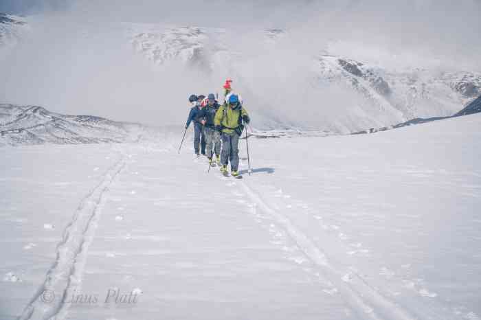
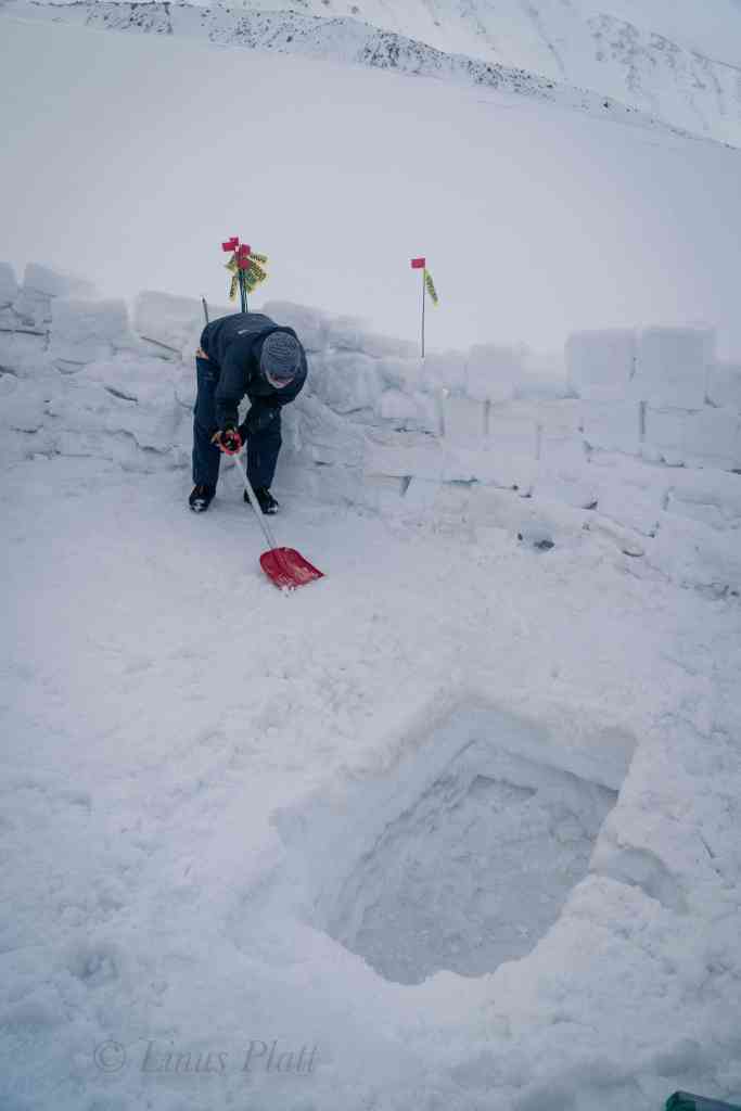
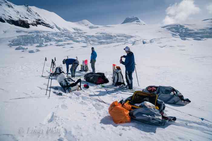
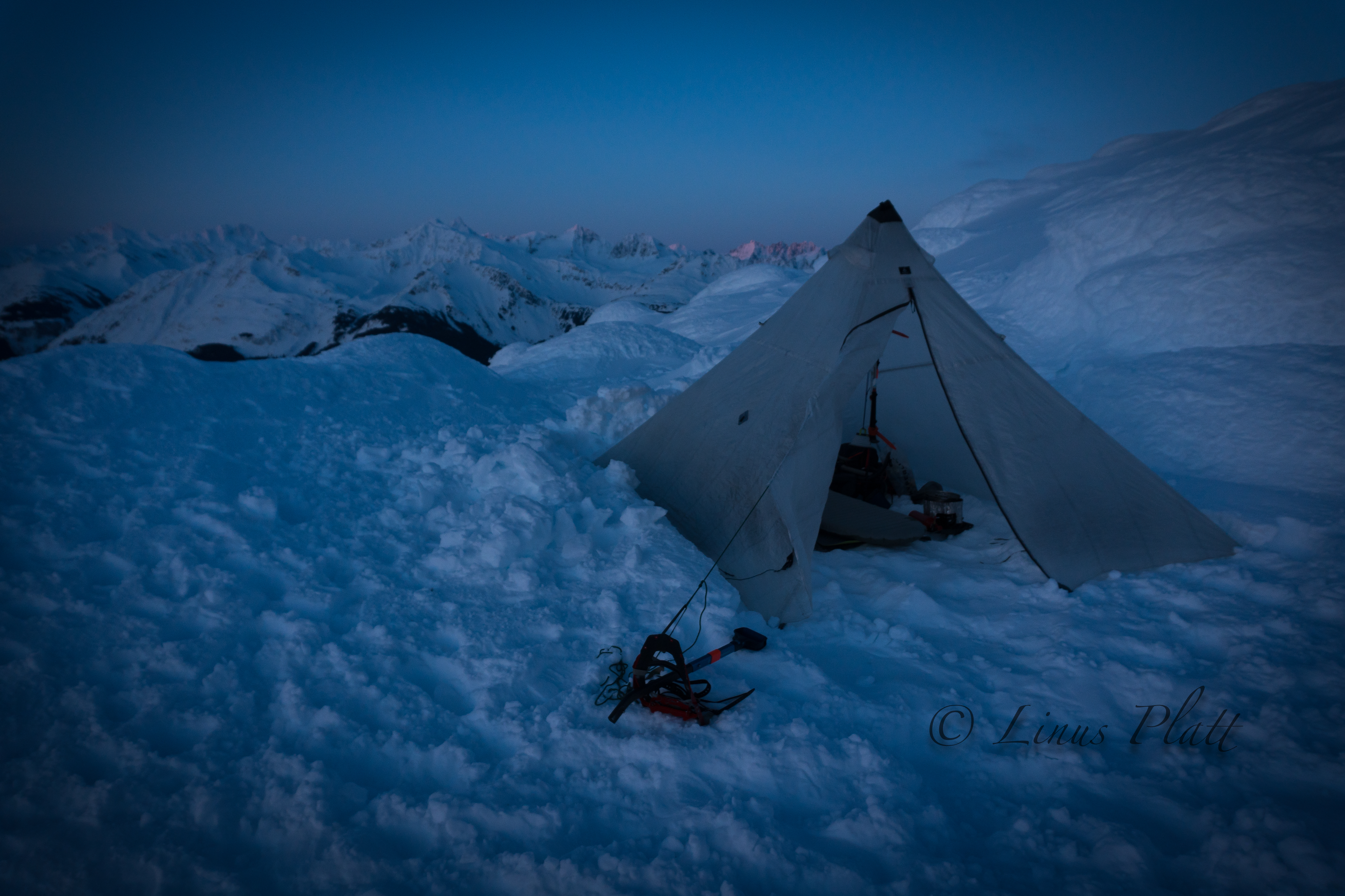
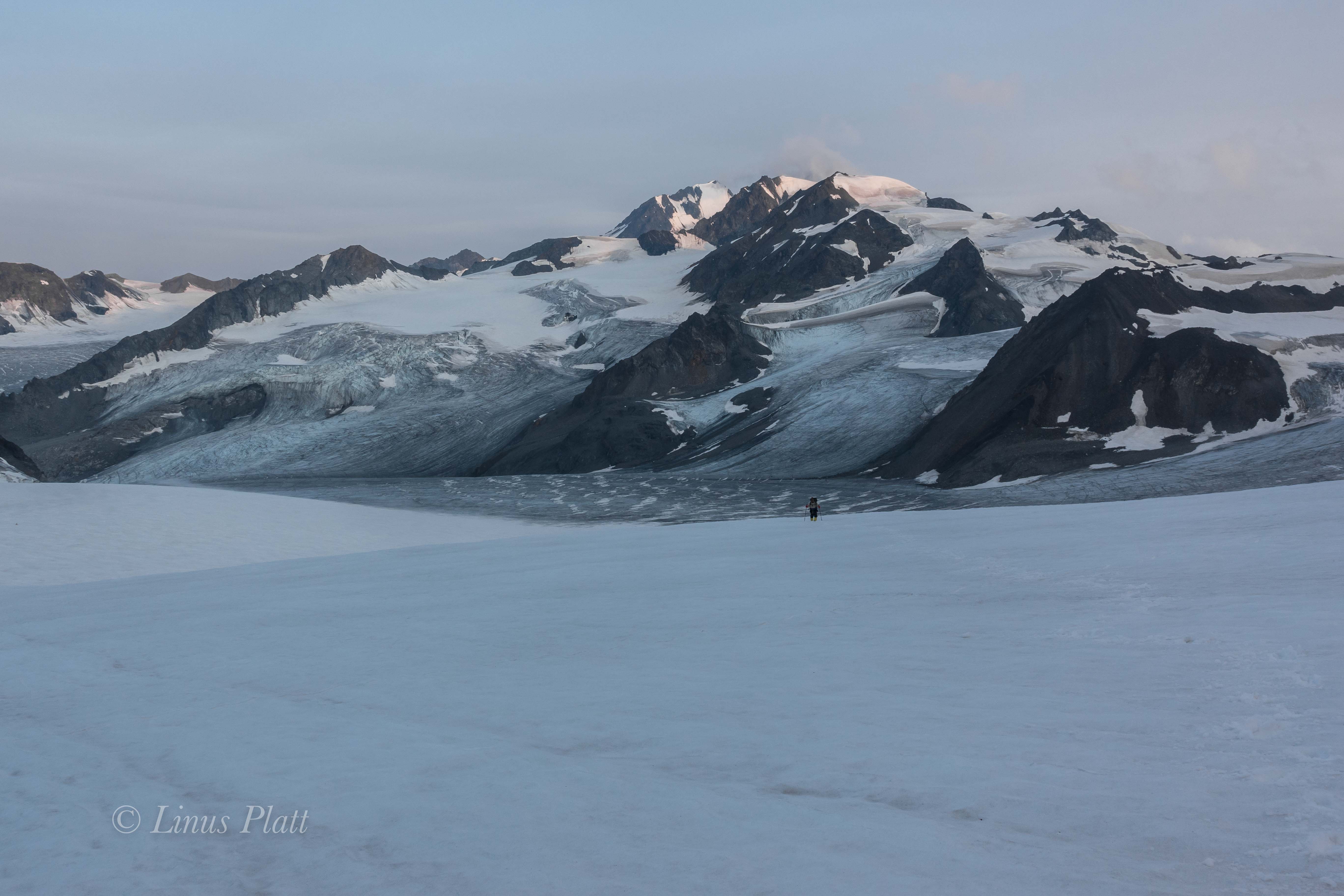
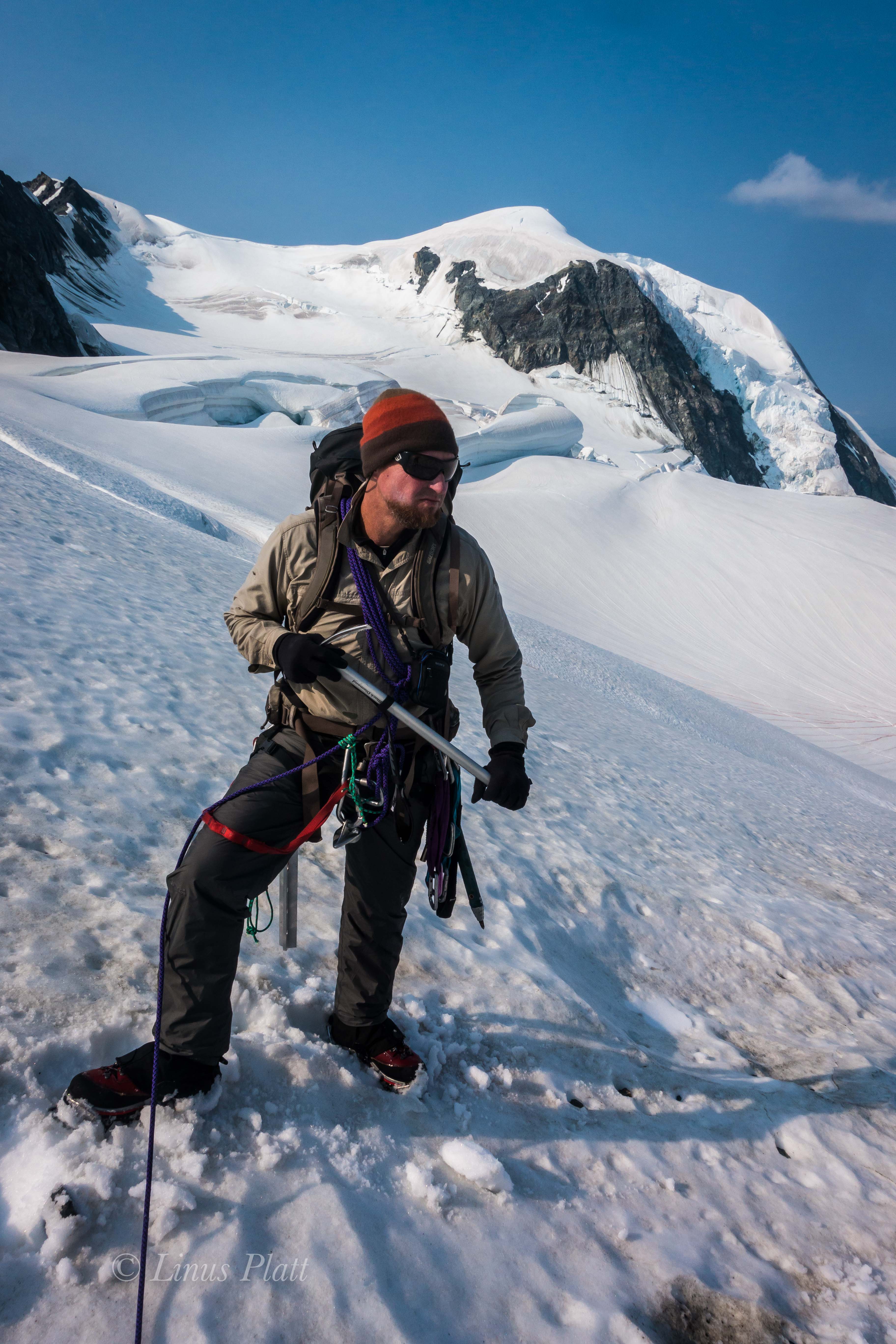
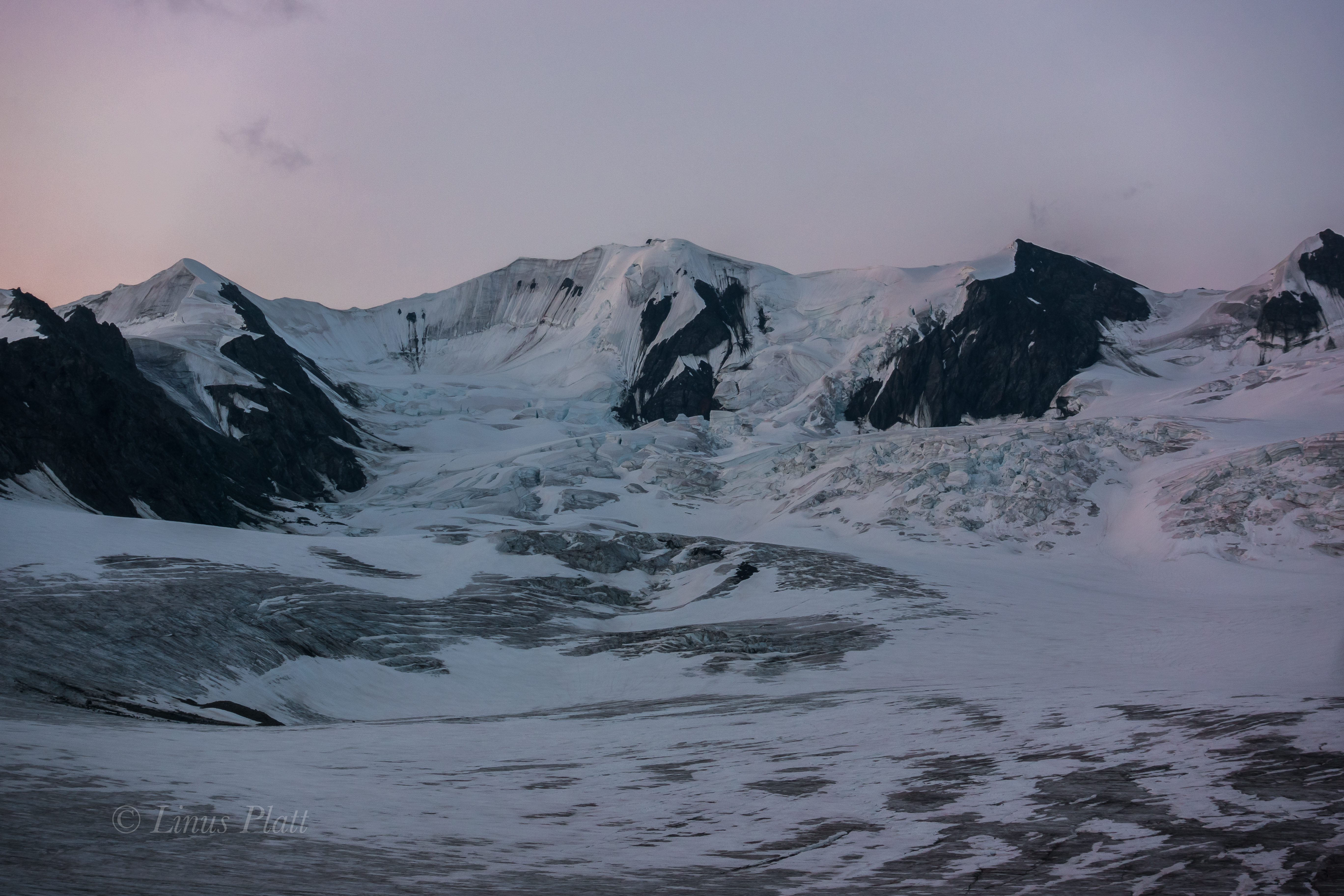
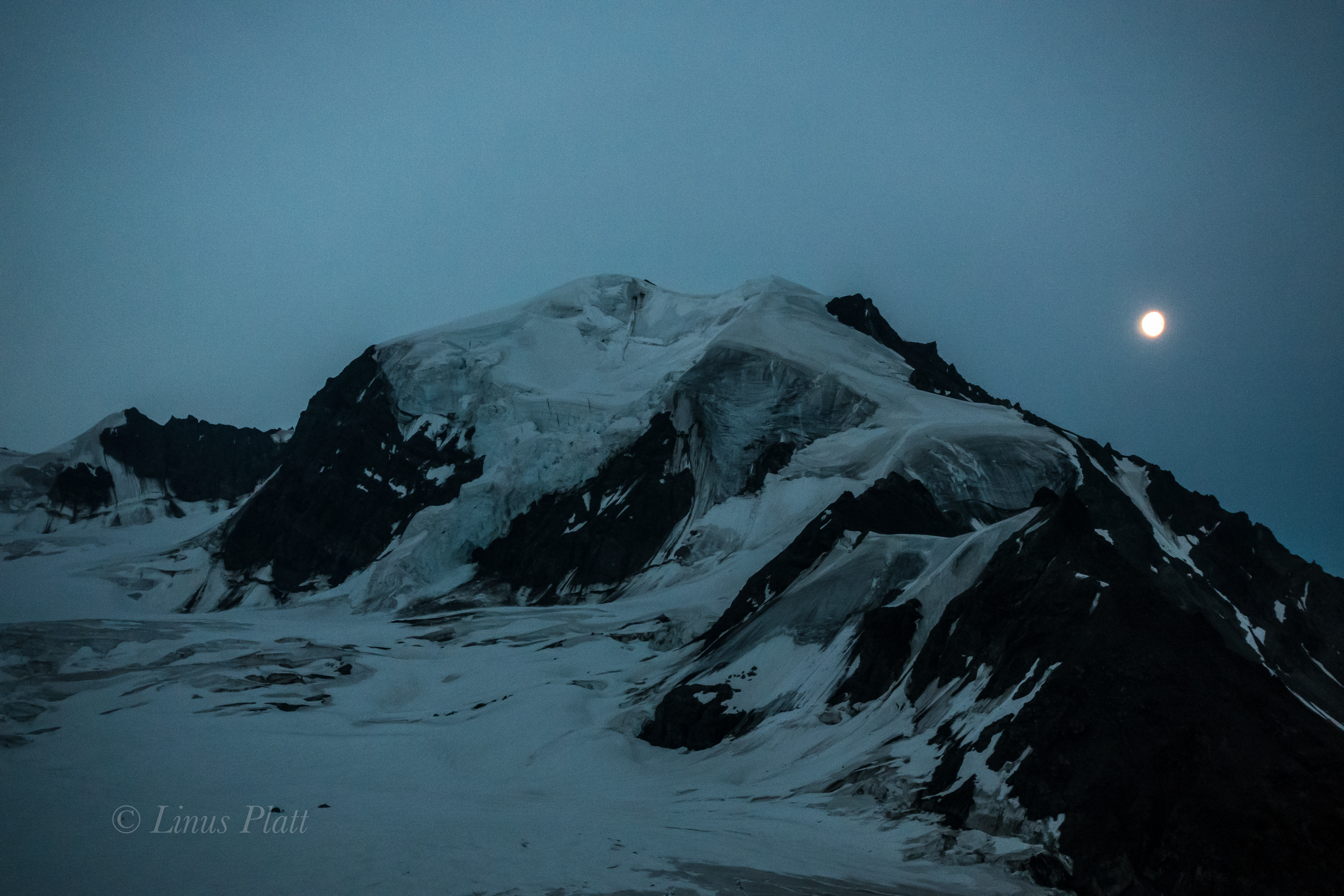
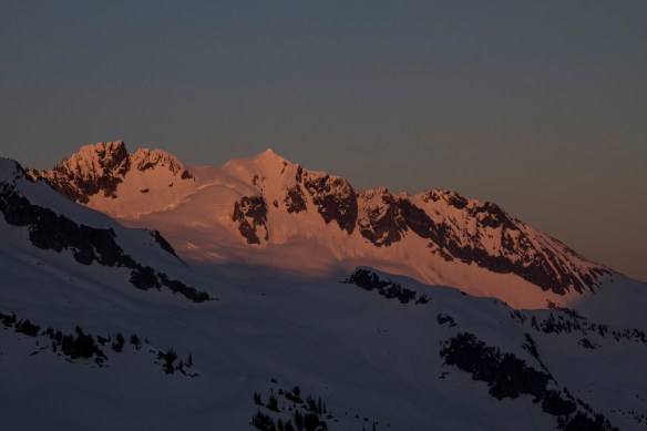
I sleep exceptionally well that night and morning finds us experiencing fortuitous conditions and a casual breakfast followed by an acceptable late start. By the time I roll out of the tent, Rich is firing up the stoves in the 2-3 inches of fresh snow that had fallen during the night. About an hour later, the sun peeks up behind the upper glacier and it appears we are in for a glorious weather day, and after breaking camp, we bask in the sun for a spell, lay out the solar panel to charge phones and GPS, and check on the weather forecast. Sitting upon a semi flat pumice boulder in the sunshine feels fantastic; it’s the first real comfort any of us have felt since leaving the gravel landing strip a week earlier. By noon we are traversing the lower tongue of the glacier; our skis gliding crisply through the fresh snow, the only sound audible are climbing skins gliding and crunching, a wisp of breeze sailing through our jackets from time to time. We emerge on the flat glacier above; this time with all of our gear and ready for the tasks ahead in general and the navigating of the First Icefall in particular. Rich and I share a rope, Cam and Jeff on another. Eventually we find ourselvesIt at the abandoned snow block camp where we must repair its deteriorating condition. After some time cutting dozens of blocks with our snow saw, we had stacked the walls high enough for all three of our tents to be sheltered adequately from the monstrous winds we have been experiencing on this trip. Next, we widen and deepen the kitchen pit, build a couple of steps leading in to it, begin setting up our new “nylon ghetto” which we figure under traditional standards would be called Camp I. Once tents are up and gear organized, we head down glacier for a quick jaunt to collect the gear and wands left earlier. The lower portion of the glacier where we are is lightly crevassed and are generally very small; the situation is a such that I would feel extremely comfortable skiing unroped, but in the interest of safety and group continuity, we remain roped and with crevasse safety equipment engaged, creating a mind set that this is how life on any glacier is. The fact of the matter is that even seemingly tame sections of a glacier can be extremely dangerous, especially if one takes a cavalier attitude by making assumptions that it is safe. Back at camp, I study the landscape ahead, observing the icefall we must tackle tomorrow. The aerial photographs I had seen recently indicates that the glacier has changed significantly since the pictures were taken. In the photos, the icefall was a massive, chaotic array of giant crevasses and enormous seracs sized bigger than the average house; in fact the photos indicated we may have difficulty finding a way through the quandary, but from my perspective here at Camp I, it does not appear to be what it once was; the glacier at this level has melted enough to smooth itself out and undermine the potency of what is commonly referred to as The First Icefall. That evening at just around midnight, the daylight night turns into a short lived dusk; the Nunatak at around 10,000 feet becomes an unpropitious orange, and the sinister line of menacing seracs atop of the West Face shift a glaring purple timbre as if to amplify their threat to anything below. Exhaustion takes over and soon camp is still and silent; sleep becomes us.

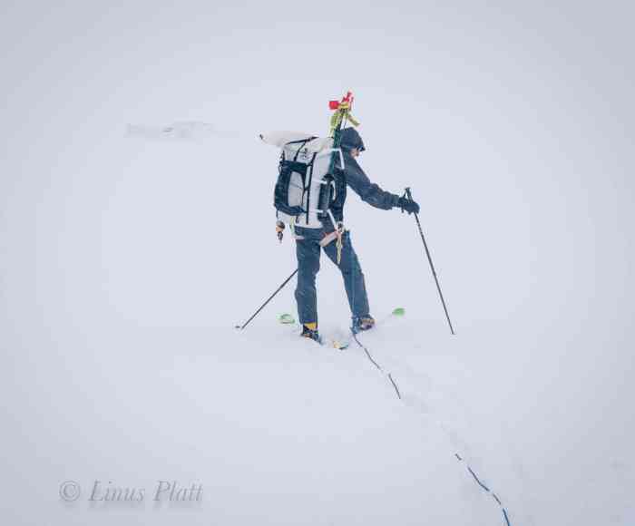
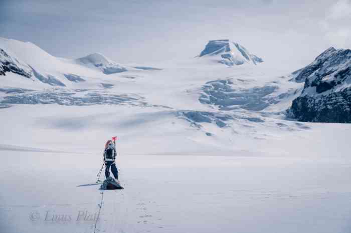
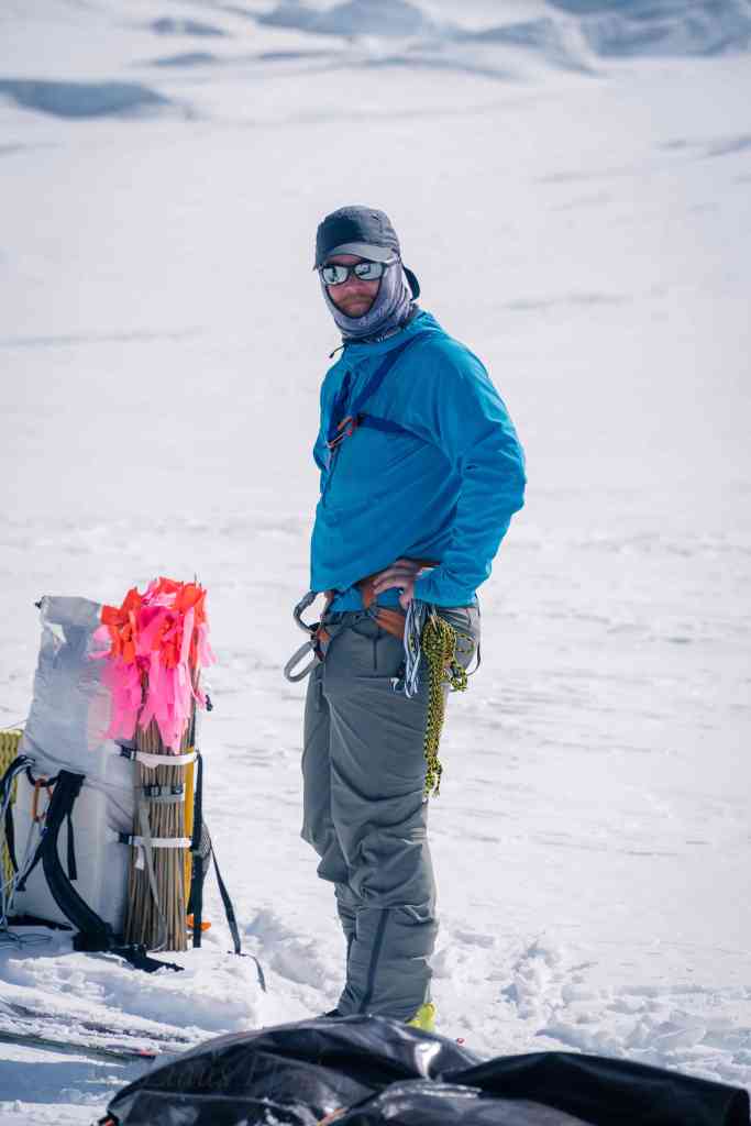
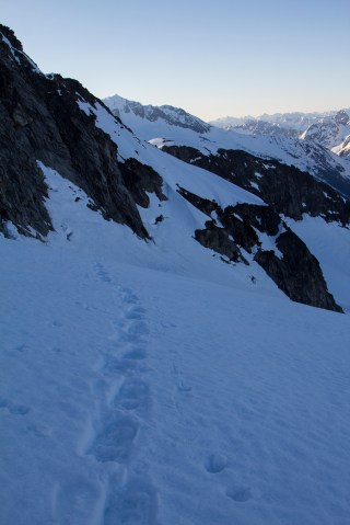
Rich is almost always the first one up and out of the tent, and by the time I awake, he is already outside with stoves firing, melting snow for filling water bottles and brewing coffee. The cooking pit works well; we can sit on the rim with our legs inside of it with stoves and cook gear around the perimeter. We have a dedicated area outside the walls for shoveling snow to melt water and a dedicated latrine area far away from said water source. The ring of snow blocks is perfectly sized for its intended use to house three tents plus kitchen. After a hearty breakfast, The weather is deteriorating again as we rope up and shoulder our packs, but we figure we’ll ski up the glacier as far as we can till conditions prevent otherwise. After a spell, we can no longer see the icefall, and a steady snow descends from a darkening sky. We continue regardless, hoping that it might let up a bit, but even with goggles there are stinging blasts of spindrift peppering my face and getting past the foam seal, making visibility a further challenge. In the lead, Rich plants 36″ home made bamboo wands with bright pink marking tape attached to its end into the glacier for future route finding in similar conditions. Pretty soon, I can’t even see him at the end of the rope a mere 50 feet away. Rich has stopped and I catch up to him; Jeff and Cam are up ahead somewhere and we hope they are stopped as well, so we plod on looking for our team mates. Through the wavering spindrift, two figure appear and we all convene for a pow wow and it’s agreed we ‘ll make a cache here and head back to camp, We dig a pit in the snow till we hit bare glacial ice about 18 inches down, toss in gear and set wands so we can find it again when we return. Once past the flat area of the cache, there is a nice easy incline about a quarter mile from camp, where, unfettered with packs and the snow now letting up slightly, we carve turns in the pleasantly light snow which puts a smile on my face. Back at camp, we check the GPS for a weather report and are pleased to hear of improving weather tomorrow. That evening, more snow follows by a still silence that entombs the camp and I am thankful we are dug in as well as we are.

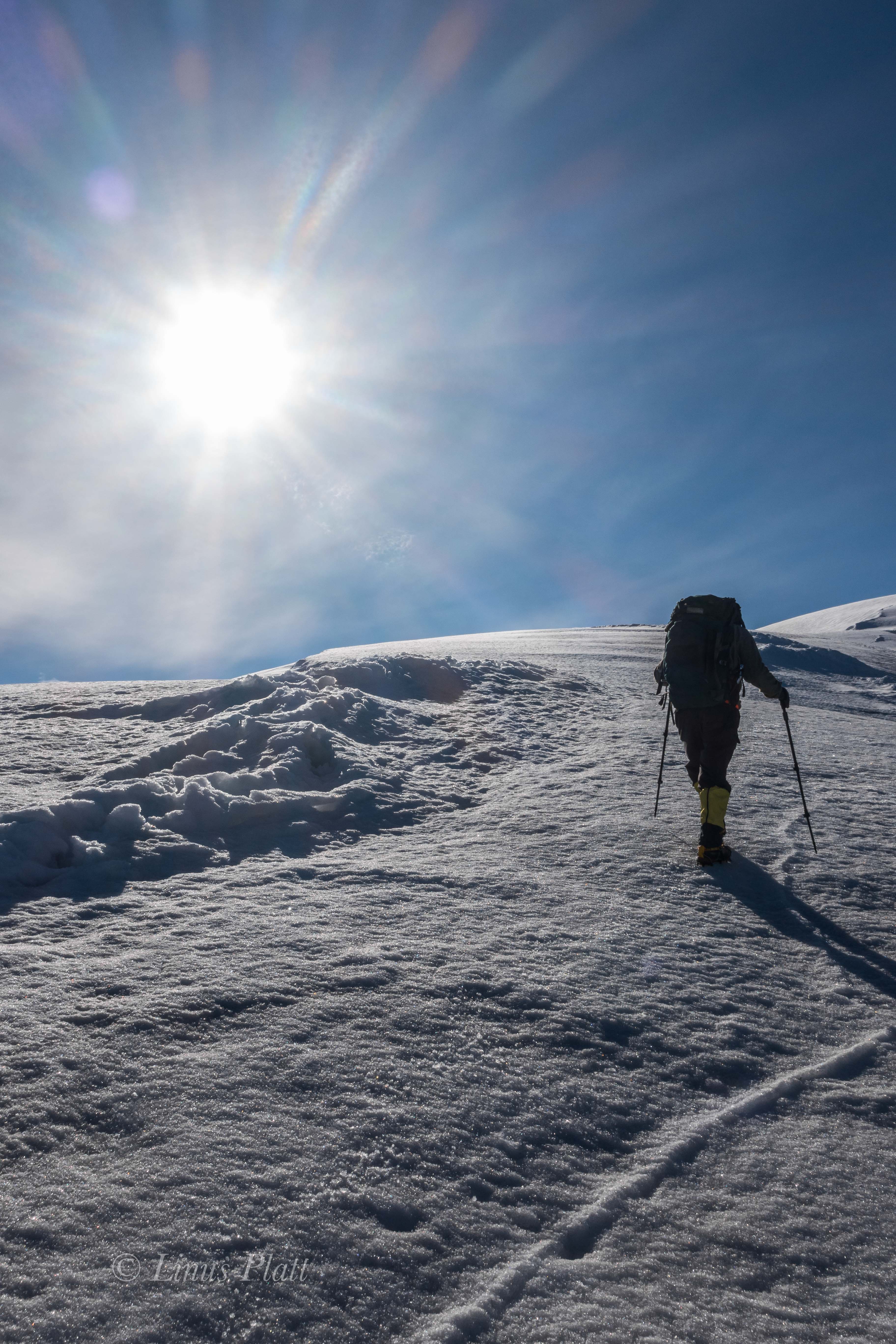
The morning sees bright, sunny, and cold conditions; we shovel tents free from the clutches of last nights dump, and afterwards sit down to fire up stoves for coffee and food. For the first time on the trip, it’s cold enough to warrant my big puffy down parka and puffy pants, of which I am grateful for. Today we will climb above the First Icefall and find a place to dig in a new camp. We pack up nearly all the remaining food, fuel, and wands to move up to the next camp, which having no idea where that might be, we hope to make it somewhere above the icefall at around 9,000 or 10,000. We also pack up tents and bivi gear, essentially leaving Camp I indefinitely. Skiing up the glacier is sensational; the sun is bright and the icefall, visible to this extent is the first of the trip. There is an artistic expression to it that is singularly unique, the seracs are lined up and are poised to do what all seracs must ultimately do: collapse and fall. There are great crevasses that are exposed and hold depths unknown. One serac near the bottom of the puzzle has a giant round hole in it, resembling an arch from the desert southwest. It’s bare blue ice shimmering a color that really only happens on a glacier; to call it blue would be simplified – it is far more complex than that. There are hues and abstracts no human words exist for. A glacier to me is a spiritual representation of life itself… growing from the womb of the mountain, picking up speed and flowing with intensity; crumbling along the way. Power, beauty, destruction, re-birth. It reveals textures and patterns not seen anywhere else on Earth – the smoothness of it’s terminus is somehow what we might all wish for at the time of our own demise…My infatuation with glaciers has been alive within me since I was 14 years old. The sensation they provoke in me is a deep sense of connection to the mountains and the Earth as a whole. I am the glacier. These magnificent rivers of ice are a truly unique entity; they are ancient beings and the environment they provide is as exclusive as its danger. Falling into a crevasse is one of my biggest fears, and the possibility of being deposited into one of these icy tombs commands the utmost respect and precaution. Passing our cache from yesterday, we figure we’ll continue on in search of Camp II, then return later for the stashed food and fuel. We zig zag around some of the bigger blocks and carefully around some open crevasses where the incline of the icefall steepens. Skiing upward gains a bit of altitude and soon we are looking down upon most of the seracs where a diagonal traverse puts us at the base of a great and stable serac at about 8500′ where we decide to dig out tent platforms. There are some disagreements among us about how and where exactly to dig created a minor chaos that we had to work through. During this event, it was decided to simply dig out a basic shelf in the incline, make a cache, and ski back to Camp I for one more night before committing to going higher.

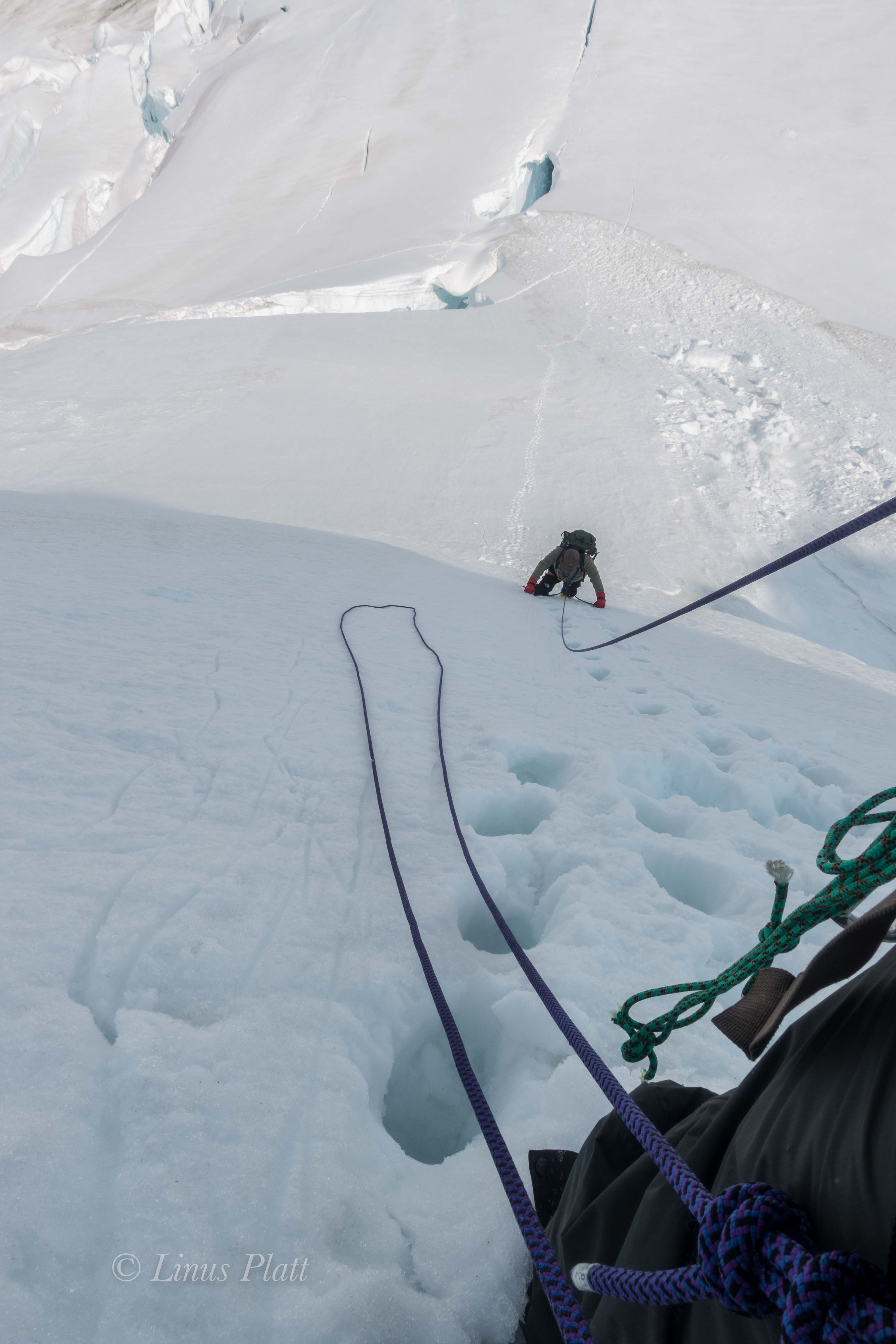
The intense sun on this beautiful day has a negative effect in that the snow conditions are deteriorating rapidly; there is a dreadful breakable crust on top of sugary powder that, had I been skiing in modern alpine touring gear (and was a better skier) would still give me trouble. Skiing down this steep incline in my double boots and Silvretta mountaineering bindings was, at least for me, pretty much impossible. Rich was also having a difficult time of it, and looking back up towards Camp II, I see Cam and Jeff carving long graceful arcs whooping and hollering in joyous outburst. The four of us convene and I decide the best way for me to descend the icefall is to take my skis off and posthole down through the crevasse field. Rich agrees and after removing skis and affixing to our packs we begin the descent as Cam and Jeff pass us with lightning speed and are soon at the base of the First Icefall, where they remove packs and wait for Rich and I. We descend slowly and carefully, roped up and employing safety measures for crevasse danger. We no longer have the safety net of having our weight spread out with skis on our feet, instead we take each step with care into the breakable crust, penetrating 18 inches or so till boots hit solid snow. There is no need for crampons at this point as the snow is soft with the intense, glaring sunlight. One foot in front of the other, gently as she goes. Suddenly, my left foot punches through into black space and my body drops. The butt end of my pack hits the snow and I stop; my leg dangling in space. I yell out “falling!” a little late in the game, but I turn to see Rich already dug in ready to catch a crevasse fall. I easily extract myself from the hole; I peer into the black hole of the crevasse to see exactly nothing but menacing darkness. We continue on, more gingerly this time until we reach Jeff and Cam basking in the sunlight. They were unaware of the crevasse incident, and after a brief rest, Rich and I don skis and we all ski the gentle slopes back to Camp I, where in classic fashion, Rich fires up the stove and cranks out a batch of cinnamon rolls on the stove, aided by Jeff’s “pot parka”, a fireproof fabric cover that fits over the pot on top of the MSR stove that aids in heating and reduces fuel consumption. It also makes for a good make shift oven of sorts, hence cinnamon rolls.

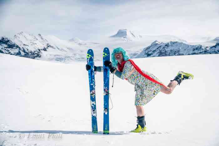
Another night at the snow block camp and in the morning we disassemble everything in its entirety for a second time. This morning we are being extremely casual regarding time, as the weather is decent, and we are all enjoying just hanging around drinking coffee; it should not take us long to make our accomplishments today. Cam is an accomplished writer and has a penchant for sometimes bizarre humor and tends to be pretty successful at making everyone laugh. When I lived in Boulder back in the early 90’s, Cam and Ann would drop by my house for from time to time, often times dressed up in an array of unusual costumes; sometimes he would show up as a drag queen or lumberjack, he always had some kind of shock value humor happening. Today is no exception as he disappears around the back side of the snow blocks, emerging minutes later wearing a multi-colored dress, a bright blue wig, and clutching in his arms his beloved blow up sex doll “Sheila”. We were all laughing pretty hard at the ridiculousness of this scenario up here on the flanks of Mt Sanford, camped in a crevasse field on the Sheep Glacier. Cam and Jeff both had the benefit of being sponsored with skis and boots for the expedition, so we figure we owe the sponsors some photos, and the drag queen/sex doll outfit commanded to be apart.

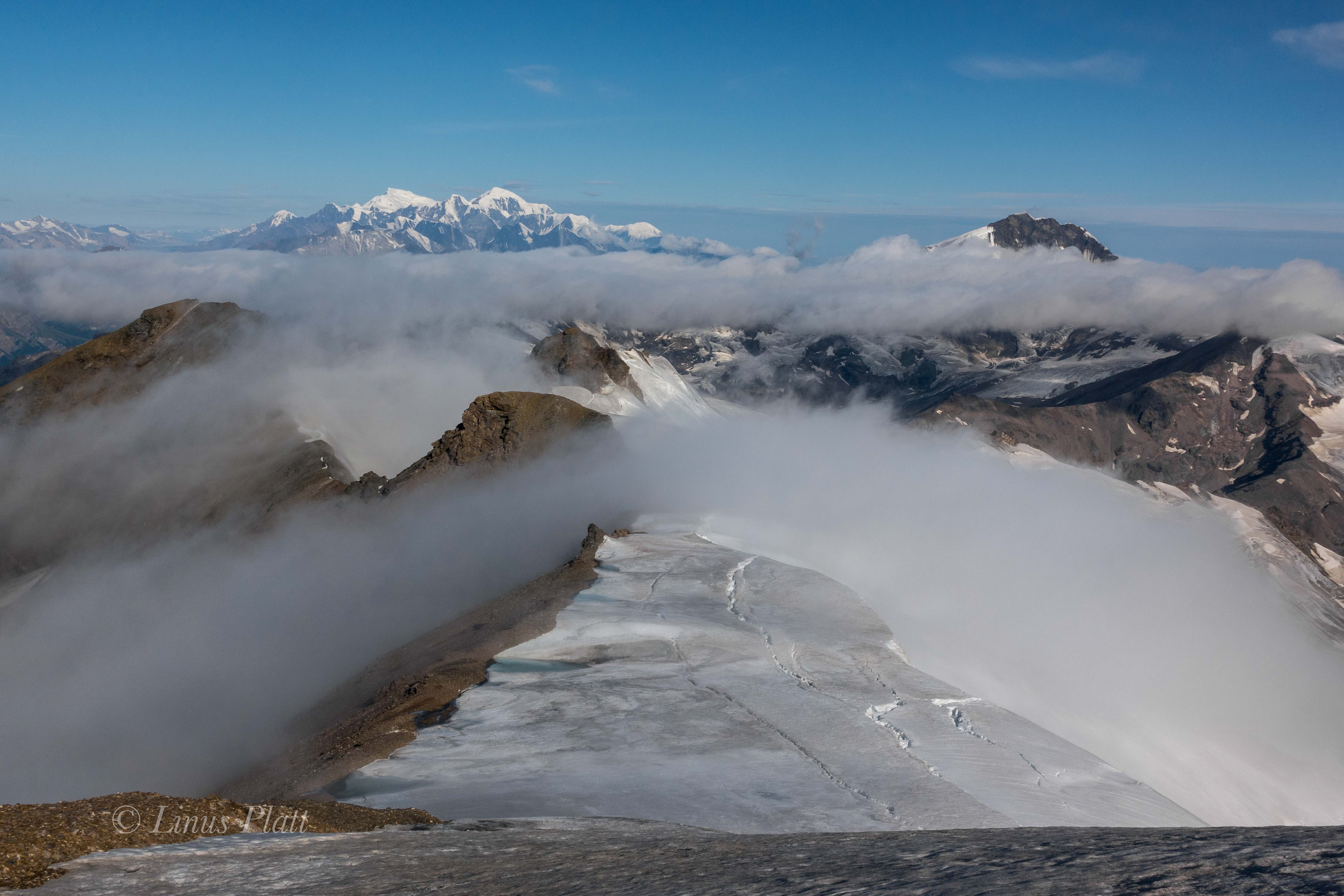
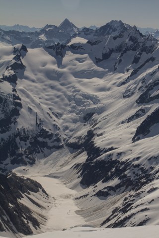
After the photoshoot, we pack up in a fashion that concludes our stay at Camp I, rope up, and ski upwards toward the icefall. The weather is another fine day, and I can’t help but feeling like we have not been taking advantage of it fully. I feel we should be higher on the mountain by now, but regardless I am happy to be here with my friends as I look north across the great drainages that separate the Alaska Range from The Wrangell Mountains. Far, far off, I can see the peaks of the Central and Eastern Alaska Range: Mt Hayes, Mt Moffit, The White Princess, Mt Gakona, and at the far eastern terminus of the range is the remote and seldom climbed Mt Kimball. This drainage is a unique and beautiful area of Alaska and is home to the headwaters of the Tok, Slana, and Copper rivers. It is an area of incredible white spruce forests, Athabaskan native villages, wildlife, and expansive wilderness and natural history. Far, far off to the northwest, I can just barely make out the faint outline of Denali, The Great One. We ski silently till we near the base of the seracs of the First Icefall; Rich has been moving slowly today and is quiet, something is on his mind. Jeff and Cam were ahead of us and were taking a break as Rich and I skied closer. After all four of us were back together, we took off our skis and had lunch with the bright glacial sun beating down. After some discussion, Rich and I both agreed that the skiing was a bit over our heads given the equipment choices we had made. At the beginning of the trip, Rich and I discussed this before even leaving Anchorage and we came to the conclusion that should the need arise, we could always take skis off and simply crampon up Sanford, but after punching through a crevasse yesterday, removal of the safety net the skis provide was not really acceptable. After a brief GPS weather check and the realization that another storm was developing, Rich stated that he did not wish to continue, and me being his rope partner, I agreed to accompany him back to Camp I while Jeff and Cam opted to continue on to our dugout for Camp II and beyond if possible. So it was decided; We emptied our packs to split up gear and food. Since Rich had one stove and I the other, I hand Jeff the stove and cook pot, while Rich and Cam divided up most of the food we have. After a brief discussion on logistics, Cam and Jeff saddle up and begin the ascent through the icefall, as Rich and I turn and head back to the snow block camp. When we arrive, we realize that the wind barrier was deteriorating from the intense sunlight, and with the impending weather front moving in, we spend the remainder of the afternoon cutting snow blocks and reinforcing the walls of camp. Looking back up the mountain, we spot Cam and Jeff; two tiny figures just reaching the platform of Camp II. Later, we spot a lone figure skiing down from the camp and through the icefall. Not long after, Jeff comes skiing into camp by himself and wanting to know why there was not a lighter in the stove kit. Rich and I informed him that lighters belong in ones personal kit (pocket) and it was his responsibility to have one. For whatever reason, neither Jeff nor Cam had a lighter between them. Baffled by this, I dig through my bag and find my 3 – 4 lighters and hand him one. At first Jeff seemed annoyed by the fact that there wasn’t one with the stove, but by the time he started his ski back, we were all in good spirits once again. I did find it disconcerting however that he was willing to ski 2500 feet down through an ice fall and back by himself and unroped. Skiing down unroped is one thing and is a more or less an accepted practice, but going up at a snails pace is quite another. Regardless, for whatever reason, He and Cam had decided on this and so it was. Rich and I bid Jeff farewell and he began his long arduous ski back to where Cam was holding down camp. That night, Rich and I settle in, preparing ourselves for a stay at Camp I for an undetermined amount of time, as we are hoping that the weather holds and Cam and Jeff will simply make a big push for the summit in a day or two. Later, it begins to snow again and this time is accompanied with intense wind. Our reinforced snow walls are giving great protection, but we imagine that Jeff and Cam at the precarious platform at 8500′ might not be faring as well.

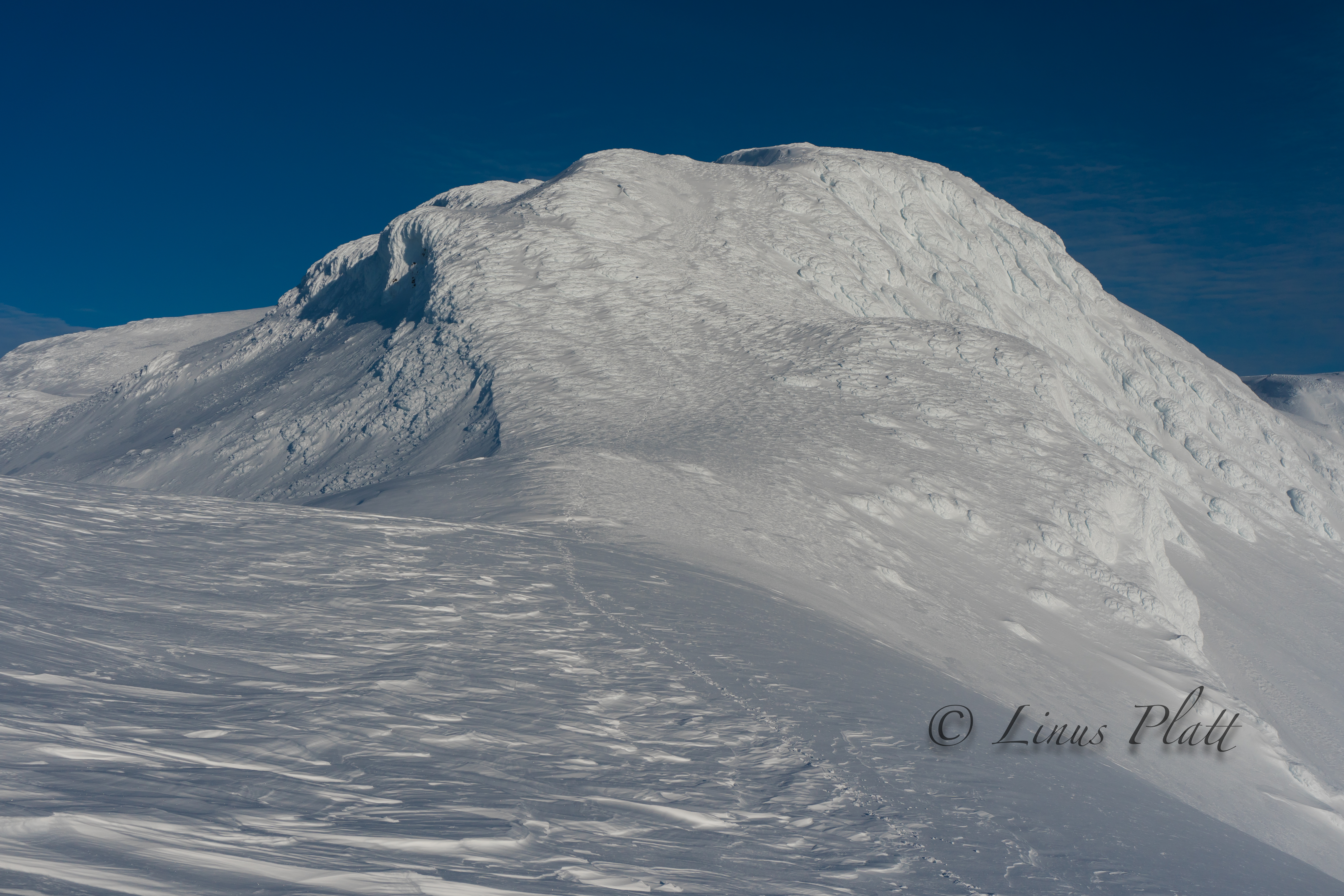
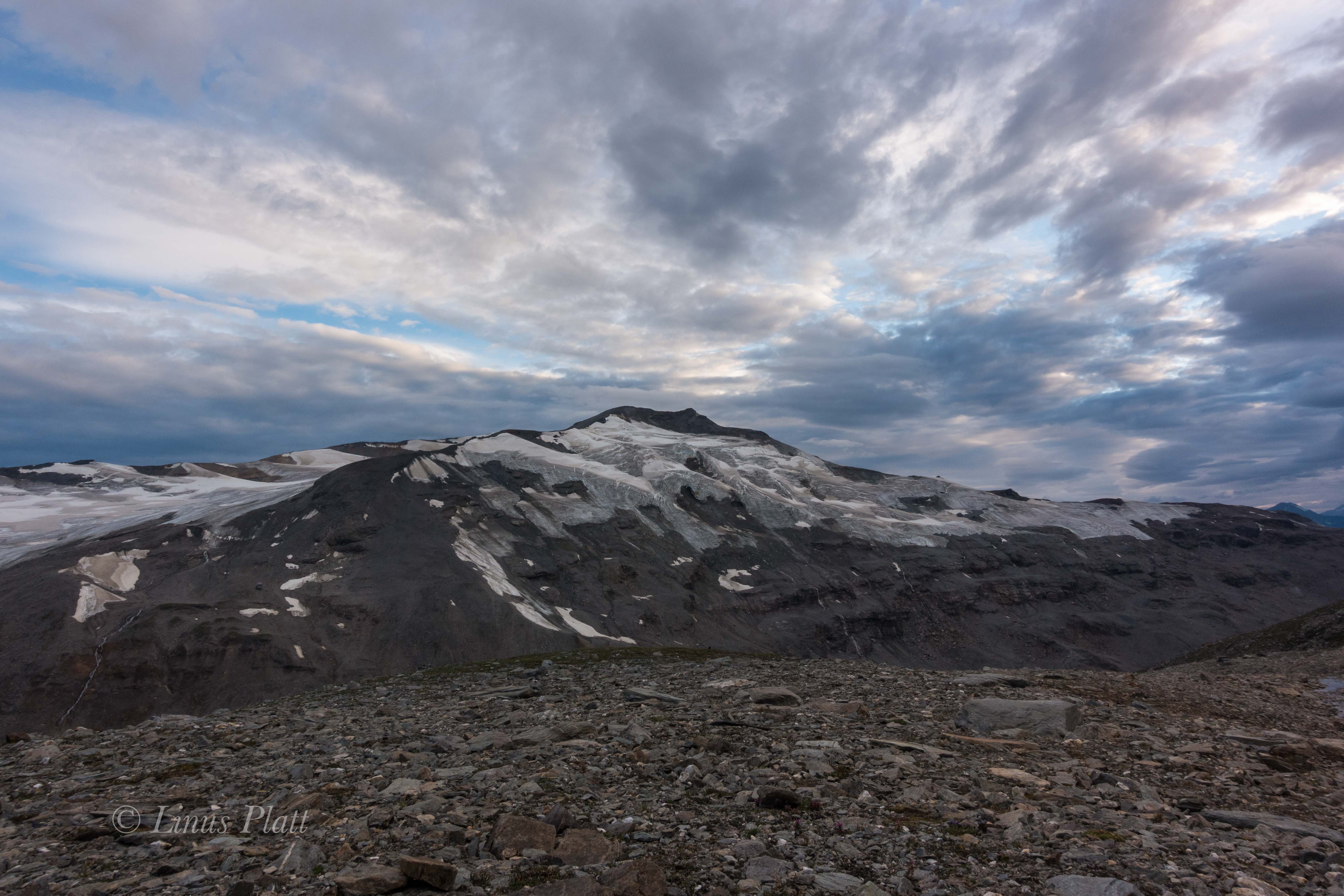
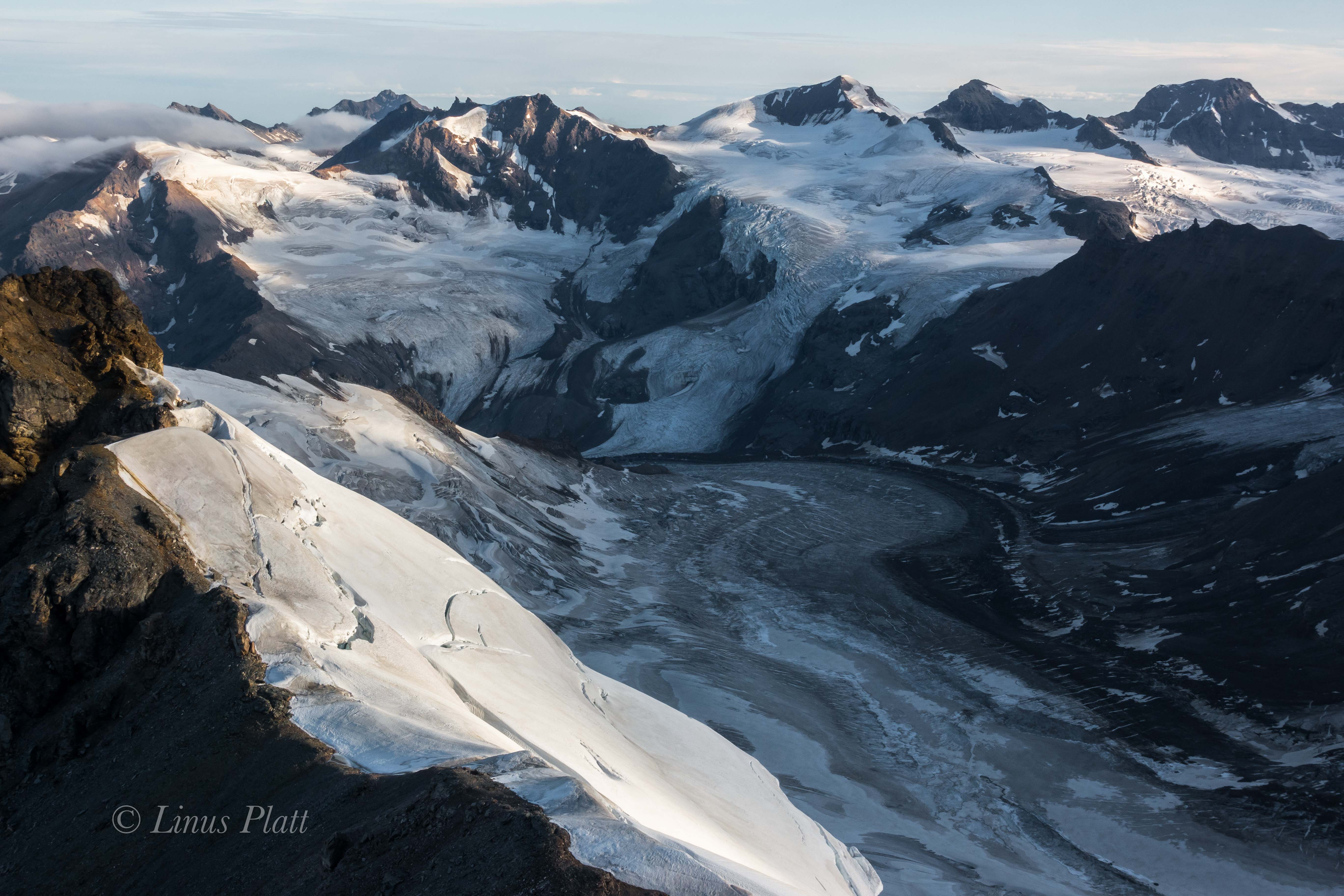
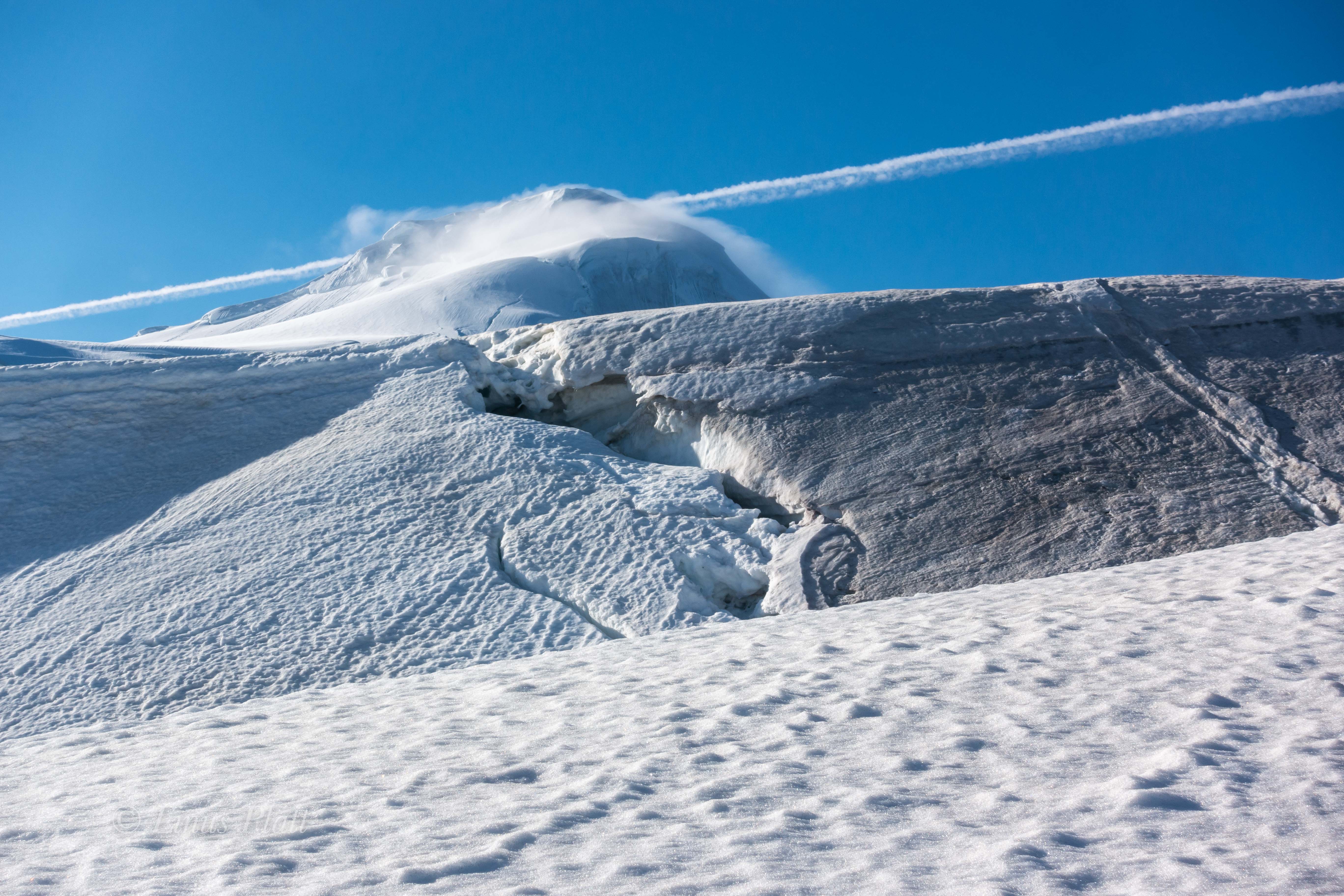
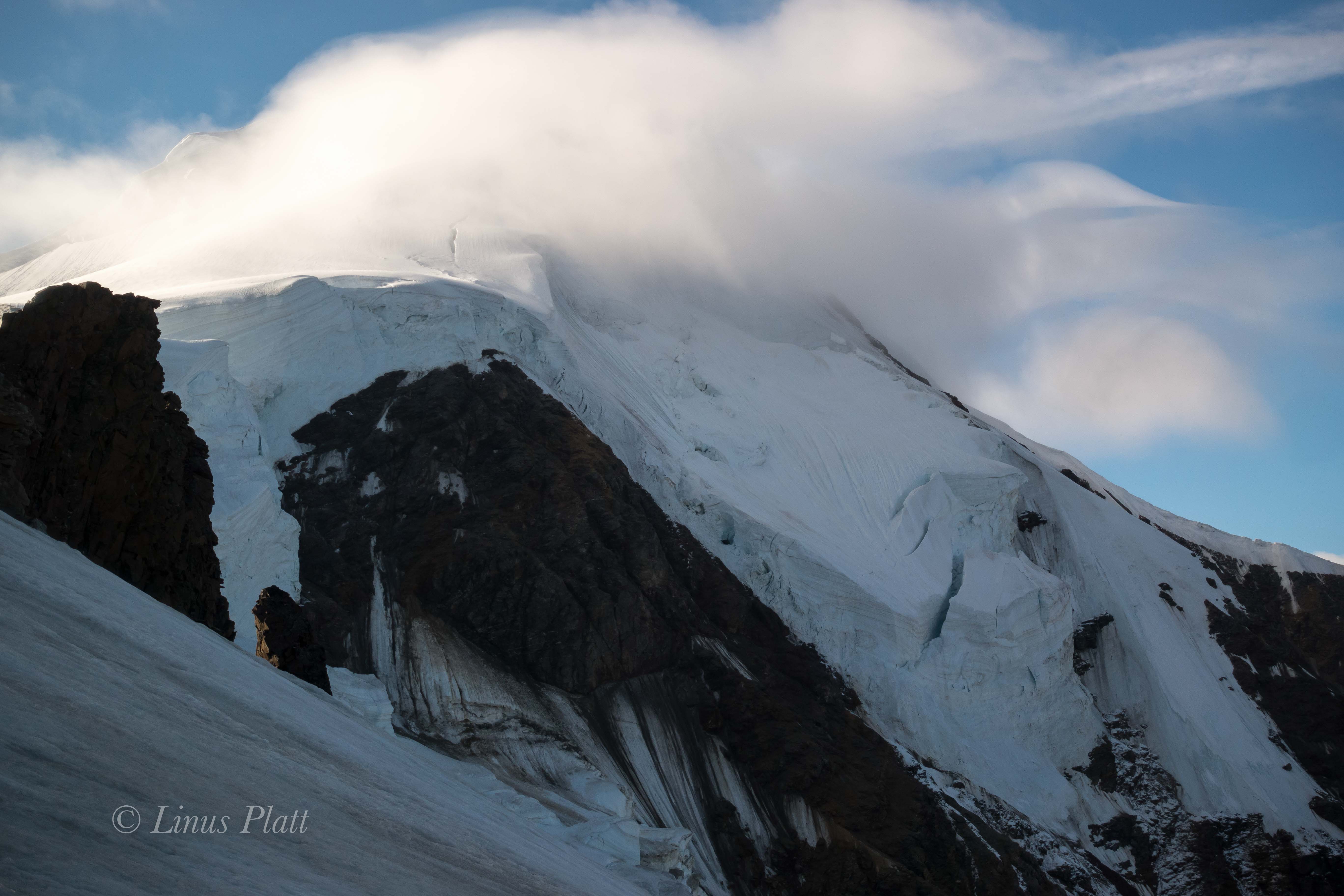
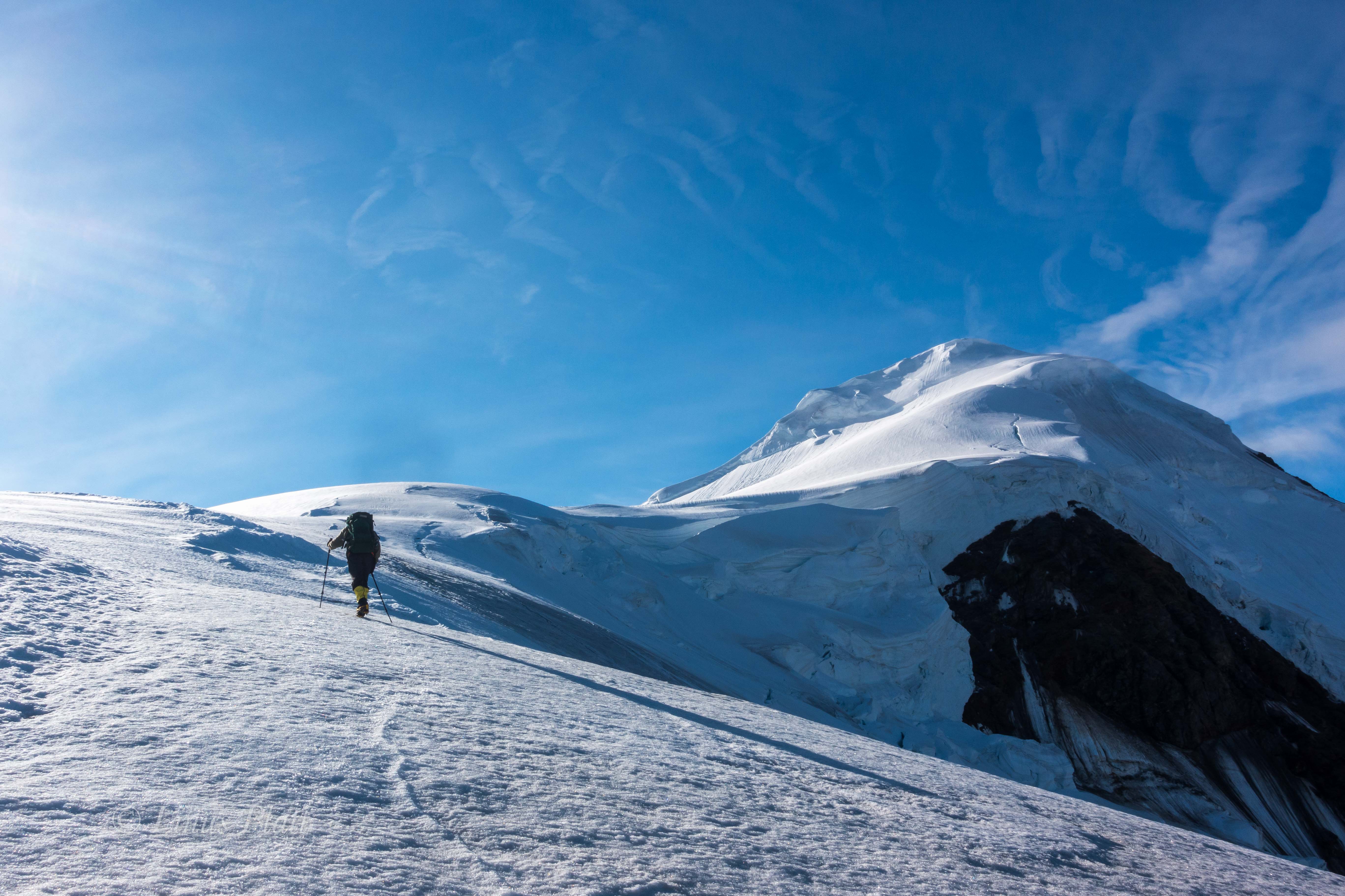
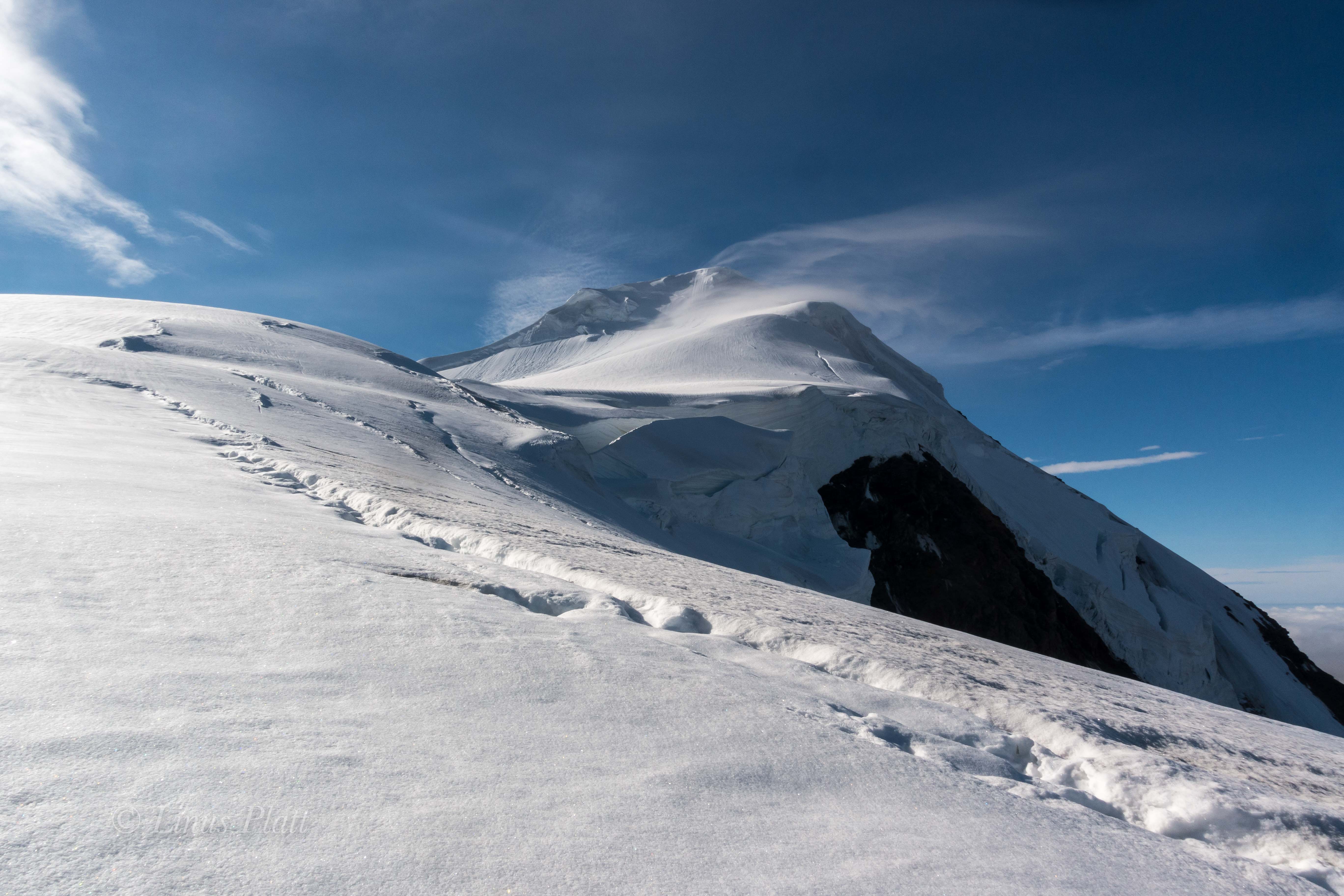
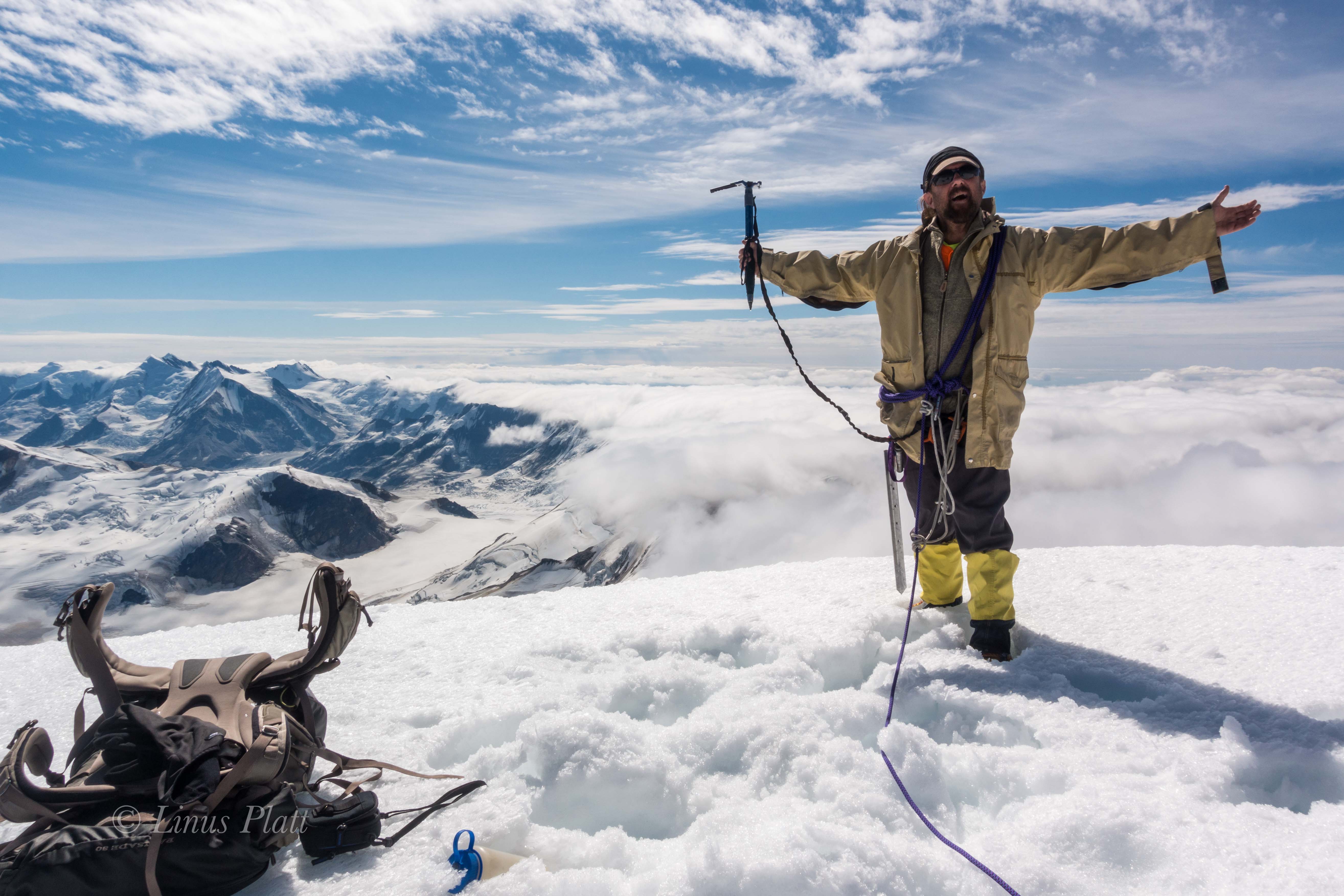
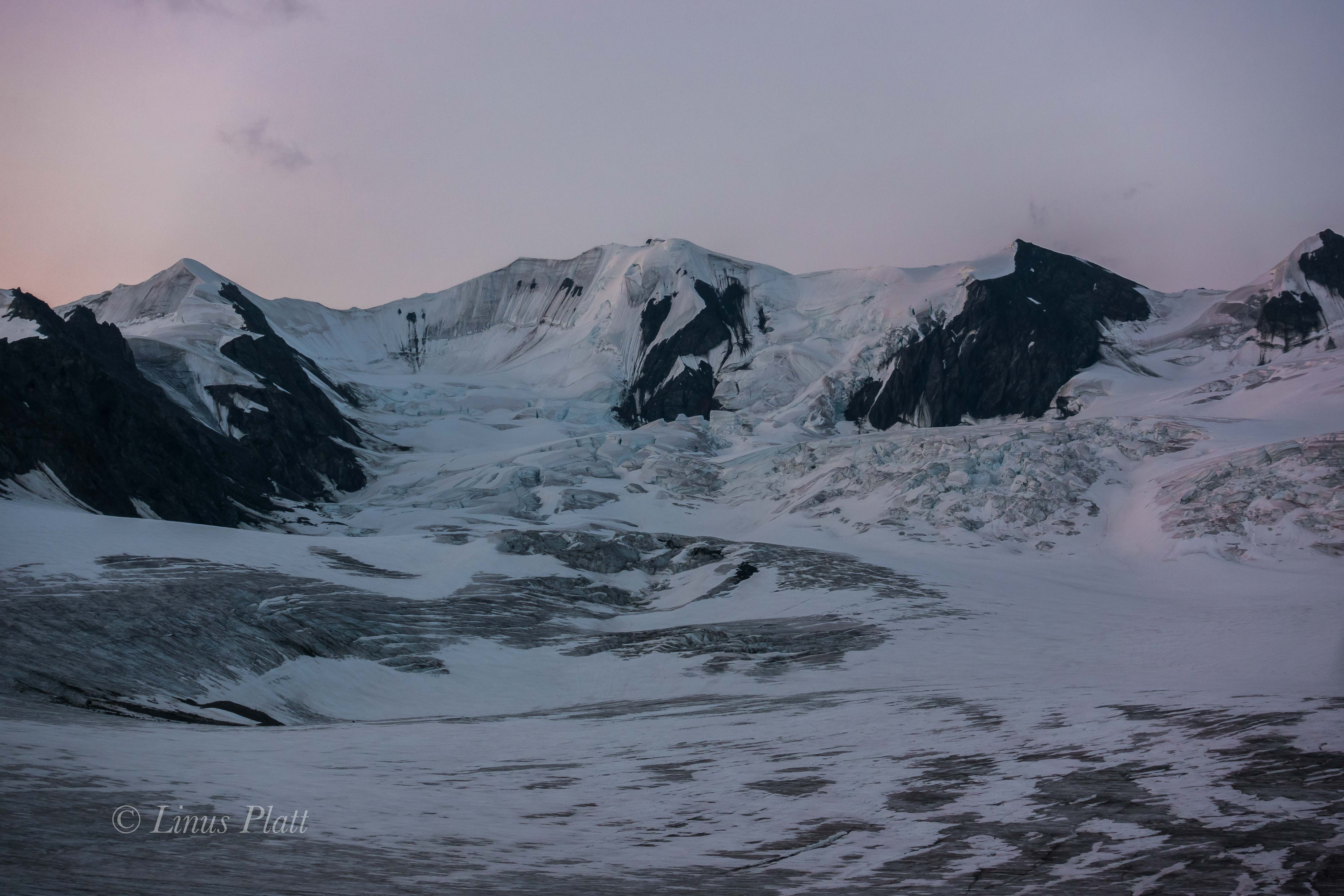
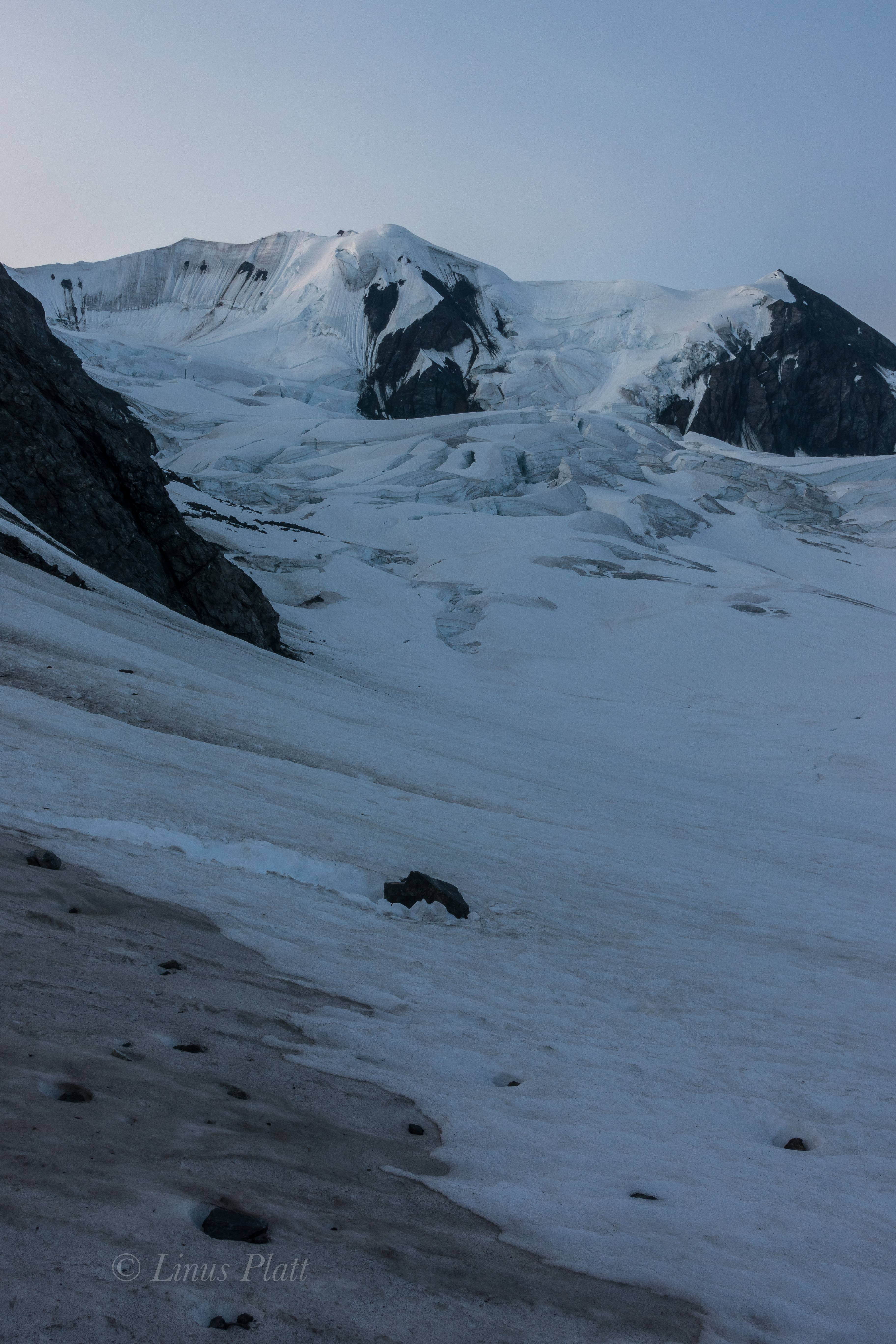
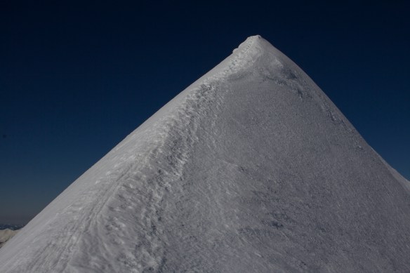
The morning brings sunshine and a calmness that was unexpected, so Rich and I spend most of the day just lounging about soaking up the sun, talking, eating, and sleeping. By late morning, we see Cam and Jeff as two tiny specs advancing beyond the serac camp and are now just below the amazing and unique Nunatak whose summit it at just about 10,000′. For many days I have marveled at this Nunatak and its amazingly smooth ice walls that just beg to be climbed, which is exactly what Paul Tureki and partner did in the 80’s on an expedition that involved a dog team and skiing from Sanford’s summit. Like so many of Alaska’s 26,000 glaciers, the Sheep Glacier has been around for approximately 30,000 years; the Nunatak in question is likely a great and monolithic rock formation jutting from the flanks of the mountain, but thousands of years of glacial ice have all but buried it to the point it is literally a part of the glacier today as we see it. There is no rock exposed, only massive sheets of ice and an overwhelming serac barrier east of its smooth rounded summit. Its west face, the one that Tureki climbed is a steep 800′ slab of beautiful shimmering glacial ice that later in the day exhibits a haunting sheen giving the entire structure an eerie yet alluring quality.

By late afternoon, we can no longer see Jeff and Cam, and all we can do is speculate on their whereabouts and condition. Rich and I will remain here on the glacier to provide Cam and Jeff any support they may need. The barometer indicates another low pressure building, but at the moment the weather remains somewhat decent. The following day, clouds begin moving in, but remains windless and snow free for several hours till late afternoon rolls around and a light but steady snow begins to fall. Not long after, the wind pick up and it’s just like old times, and a laborious session of snow block cutting and stacking sees Rich and I fortifying camp once again in the deepening squall. After finishing the task, Rich cranks up the stove from the vestibule of the tent and we sip on some soup and tea, pondering where and what Cam and Jeff are up to. Sleep eludes me on this evening and as I lay in the tent I feel something is taking hold. Suddenly and with out warning, I am dashing from the tent and running for the latrine hole in the glacier, where I empty my bowels of liquid and stand pant-less staring into the blasting spindrift of the daylight night. I crawl back into the tent and slither back into my sleeping bag, fully aware that something nasty now resides inside of my body. Thankfully, I did not have another episode like that the remainder of the night, but instead I fight off a massive headache, stomach cramps, and an oddly sore throat. This persists well into the next day, and by mid afternoon the weather has improved just enough for me to lay my sleeping bag out in open to observe the upper glacier and Nunatak. Drifting in and out of sleep, Rich hollers that he sees the boys coming down from the area just above the icefall; two tiny figures seen skiing at a brisk pace, descending from the upper reaches and into the bowels of the seracs. Before long, the two of them are clearly visible below the icefall and within 10 minutes ski right into camp, where Rich has hot water waiting for them to re-hydrate and eat.

After a night battling the storm on the tent platform of Camp II , Cam and Jeff had broken camp completely, ditched one of their tents, some food and fuel and made a cache there, deciding on moving fast and light up past the Nunatak where they dig in to the side of a giant serac, setup the tent, and proceeded to take advantage of the temporarily clearing weather by skiing to and from the summit of the Nunatak. That night once again being hit by the increasing storm, it was decided that come morning they would descend back to Rich and I at Camp I.

The four of us back together again, we have a big feast and a hidden stash of whiskey allows a couple shots each. The weather is not great, but we are all having a good time; myself included regardless of my slowly improving stomach illness. The air is mostly still, but a light snow continues to fall and we decide that the best plan of action is to get out in the morning, and we send a GPS message to pilot Jake giving him the heads up. In the morning, the weather is about the same and no one really wants to deal with much; camp is a silent monastery for a long, long time before Rich and Jeff bust out breaking the silence. It is another cold morning wrapped in puffy gear whilst making breakfast, taking down tents, and reorganizing everything in order to do a single carry back to basecamp. By the time we leave, the temperature had risen significantly and the snowing had stopped. We all stand there gazing at the empty ring of snow blocks; each of us with a massive pack on our backs and a fully loaded drag bag behind us. We gingerly ski down glacier; the weight of the packs and the menacing instability of the sleds making the ski descent unnerving, but by the time we got to the tongue, we had worked ourselves into skiing groove and we were all able to carve a few last turns of the trip before descending completely to the now barren talus below.

Two weeks prior, there had been enough snow on the pumice scree to both ski and drag our sleds effortlessly. But now, the snow not far beyond the glacier had disappeared, exposing the jagged pumice underneath. We have no choice but to remove skis and walk. We can either make a double carry to basecamp, coming back for the sleds tomorrow, or just drag them through the rocks and get it done. We choose the latter, since our duffle bags are wrapped in cheap plastic tarps giving a decent sliding action even on the pumice and also protecting the more expensive duffle bag material. Eventually we are past the cree and talus and are traveling previously unseen tundra, where a lone Caribou crosses our path; likely a scout for a herd not far off. I am having difficulty with the drag bag, so I decide to ditch it and come back tomorrow for it. Cam, Jeff, and Rich and continue with both pack and sled; the going is very slow, but by late afternoon, we are all back at the landing strip setting up tents and getting organized. Later, a call to Jake confirms that he will attempt to pick us up in the morning, but it’s all up in the air since the weather is deteriorating and it is beginning to snow.

I sleep deeply for 10 or more hours and when I awake I find the ‘Mid sagging in from what looks to be several inches of new snow. I can’t help to feel a bit of dread, since this could prevent Jake from landing, as he has tundra tires fixed to the Super Cub that do not fare well in fresh snow. He was able to land previously because the old snow on the gravel airstrip was packed and settled. But this new snow could be an issue. Regardless, I have a drag bag to go and get up valley about halfway way to the glacier. Luckily it is very early as I crawl out of the shelter and even though there are several inches of fresh powder, the sun is out and it is an outstanding day. It is quite cold in the morning, but by the time I had gotten moving to retrieve my drag bag, the sun felt almost hot. Alone, I stomp up valley in mountaineering double boots across the scree and tundra to my stash, where I fill my empty backpack for hauling back to the airstrip. The pack is monstrously heavy and I can barely get it shouldered, and once I do, vow not to take it off again till I reach camp. Regardless of the weight of the troublesome pack, It feels incredible to be out here hiking across the snowy tundra; it was the first time I had been alone in 15 days and as I turn to look back at Sanford, she bares her true summit for me in the glaring sunlight. Ironically, this was the one and only time I would see the summit on the entire trip. Once back in camp, I drop the pack and a great sigh of relief pours from me. The warmth of the sun is extremely intense, and Rich is busy skiing back and forth, shirtless and in his boxers, up and down the airstrip attempting to get it packed down enough for Jake to land. We all join in and after a bit we are satisfied with the results and another call to Jake is made: he is on his way. By noon, we hear the unmistakeable growl of the Super Cub, and Jake lands the aircraft effortlessly on the packed snow of the runway we had tailored. A man pops out of the plane, it’s not Jake but his pilot Leif, who is filling in for Jake. One by one, Leif ferries us back to Red EagleOnce in the air, I look back to see the tongue of the Sheep Glacier disappearing over the massive moraines below it, and soon we are flying low above the endless tundra and Alaska’s great Boreal Forest.

Stepping out of the plane at Red Eagle, my boots hit the grass of the landing strip and once Jake takes off to retrieve the others, the boots come off and sore feet and toes do the same. It feels sublime to walk on grass and be surrounded by trees rather than snow, ice, and rock; there is a gentle breeze that drifts through the treetops giving way to a faint and pleasant hissing sound that is absent in the higher alpine environment. Once the last gear load is dropped off, we settle finances with Leif and he lifts the Super Cub into the air and heads east towards Tok. The four of us stand there for a moment, unsure of what or how to make a move. We stagger over to the lodge, where Rich and I rent a cabin for the night and Jeff and Cam do the same. After getting the truck and dumping all of our gear, we all take much needed showers and then convene at the truck for a plan. It’s late afternoon, and we all want beer and food, but the nearest tiny store is about 40 miles up the Tok Cutoff. It has to be done so we pile in the truck and blast off for an 80 mile round trip beer run. The little store at Menstasta has the bare provisions of which we make do with and happily drive back to our cabins at Red Eagle. After too many beers and some makeshift supper, we all stagger off to bed; Cam being so drunk, I had to quite literally carry him to his cabin and put him to bed. Sometimes when I am overly exhausted I cannot sleep; it is a strange anomaly and tonight is a template for that theory, and at 3 am I stagger out to my truck and grab tent and sleeping bag. The cabin is just too stuffy and the bed too soft. Once in the tent, I fall into a coma-like state that allows me to sleep till 10 am. We drop by the lodge where Judy asks us to join them for breakfast and we all eagerly accept. It feels fantastic to sit at a table with hot food and coffee and listen to Judy and Richard’s stories about their lives in and around Alaska, their bush piloting to and from Siberia and the tales of them becoming the owners and operators of Red Eagle Lodge.

After breakfast and a casual organizing of our entire kit, we decide to head off for some R&R and sightseeing. Two years prior I had ridden my bicycle from Slana to Nebesna along the incredible and wild Nebesna Road; it is the only road access into Wrangell St Elias National park from the north, and features an assortment of mining and natural history, wildlife, stream crossings, great camping and incredible Alaskan scenery. Spending most of the day slowly traveling the road and stopping often to gawk at the incredible views of the East Face of Mt Sanford, we are amazed that the entire mountain is free and clear from any sort of cloud, mist, or storm; the summit is clearly visible. I can’t help but to think what it would have been like for us if we were up there during this weather window. That night a Jack Creek we make a camp and grill burgers, enjoying the outstanding weather and calm. In the morning I break out my packraft and we each do a quick lap on Jack Creek just for giggles. After breaking camp, we drive up the road for a hike to the historic abandoned Rambler Mine, where views out to the massive headwaters of the Nabesna River and Nabesna Glacier snake out of one of Alaska’s most intensely wild regions between the Wrangell Mountains to the south and the Mentasta Mountains to the north. A day later and we in Anchorage, and a trip to the local butcher shop to procure makings for shish kabob, a few beers, and we head off to find the Air B&B we had scored for the night. 24 hours later after dropping off my three team mates at the airport, I find myself once again within the “civilized” circle of the Anchorage and Mat-Su borough, and once again struggle to find a place to camp. I settle on heading up the Knik River to find a semi reasonable albeit makeshift camp on its sandy shores where ATV’s and fisherman are never far off.

With plans to meet Angela to climb the Yukon’s Mt Archibald in a few days, I have a little bit of time to kill, so I hit the road in the early morning and head north up the Richardson Highway towards Delta Junction, where I know of great and wild camp spots and for the first time since leaving Anchorage, I feel at peace and I’m able to properly rest. After a casual day on the Jarvis River eating, napping, and going on short walks, I pack up and drive towards Tok, where passing Yerrick Creek north of town I see that the river is far too low for paddling, so I continue down the Alaska Highway where cresting a hill in a remote area of Eastern Alaska, I pause briefly to gaze at the far, far away silhouette of of Mt Sanford, her cloak of thick glacial ice shimmering phosphorescent hues of purple and red penetrating the high altitude sub arctic air, and at that moment in time, I feel my intense and deep connection to this amazing place and the knowing that nothing can ever take that away.

Social Distancing – Mt Ripinski Style


It’s springtime in Haines and it’s also the time of year I start getting the itch to get out of dodge and head for the hills on some overnight ski or snowshoe trips. Since the COVID madness began in earnest here recently, and the border now closed, homebase destinations are now in order.

Since being laid off from my job, countless house and other projects have taken precedence. A spell of clear and gorgeous weather inspires me to take a break from chores and do an overnight stomp up Mt Ripinski… one of our local summits.

The trail leaving the Young Road trailhead was easy to follow until it spurs with the Ridge trail, where many folks this time of year simply double back towards town via the Piedad Trail. Far fewer continue on to the summit this time of year. As a result, the trail dissapears, and I am now comitted to memory as the deep snow cover has hidden all normally familiar features.

At about treeline, I run into a guy named Harry who had been up and down Ripinski more than once this week… traveling lightly and armed with practically no gear at all. We chat for a bit and I continue on to a semi sheltered place where I can dig out a shelter platform and build some snow-igloo walls for wind protection. That night, the temps dip into the single digits, but as the sun rises over the Chilkoot Range and splatteres sunlight over the Takhinsha mountains to the NW, it warms me deeply, and after a pleasant time eating breakfast and drinking coffee, I blast up to tag the real summit and take in the changing light before descending to my camp and back down to my truck.

Ripinski Overnighter 4-4-5-20-14Ripinski Overnighter 4-4-5-20-13Ripinski Overnighter 4-4-5-20-11Ripinski Overnighter 4-4-5-20-10Ripinski Overnighter 4-4-5-20-12Ripinski Overnighter 4-4-5-20-7Ripinski Overnighter 4-4-5-20-9Ripinski Overnighter 4-4-5-20-8Ripinski Overnighter 4-4-5-20-6Ripinski Overnighter 4-4-5-20-5Ripinski Overnighter 4-4-5-20-2Ripinski Overnighter 4-4-5-20Ripinski Overnighter 4-4-5-20-3Ripinski Overnighter 4-4-5-20-4


Rime And Reason On Mt Ripinski

These last weeks have flown by so fast in preparation for the upcoming Over The Hill Expeditions trip to climb and ski Mt Sanford in Alaska’s Wrangell Mountains, that I barely noticed that the departure date is just next week! Gear is together, money is (well, mostly) together, and fitness, well… ahem, uh, well…

So… the last Saturday before I leave to drive up north to pick up Rich, Cam, and Jeff in Anchorage, I decide that a jaunt up Mt Ripinski is in order; Angela also wants to go, so that is even better. Ripinski is a coastal, non-glaciated peak sitting directly on the waters edge of the mighty Lynn Canal; it’s summit clearly seen from most anywhere near or in Haines. It’s summit is a 3600′ rocky point amidst small rolling hollows of tundra and outcroppings, where Mountain Goat, Wolf, and Grizzly Bear all roam. 

From the end of Young Road in Haines, at an approximate elevation of 400′, the trail climbs rapidly to it’s summit 4.5 miles and 3200′ later. It is considered a local classic and the views from the summit encompass the Chilkat Range, the Lynn Canal, the Chilkat Inlet, the Chilkoot Inlet and lake, the Alaska Coast Range, Skagway, and many of the area’s surrounding glaciers. It’s the best bang for your buck view-wise around.

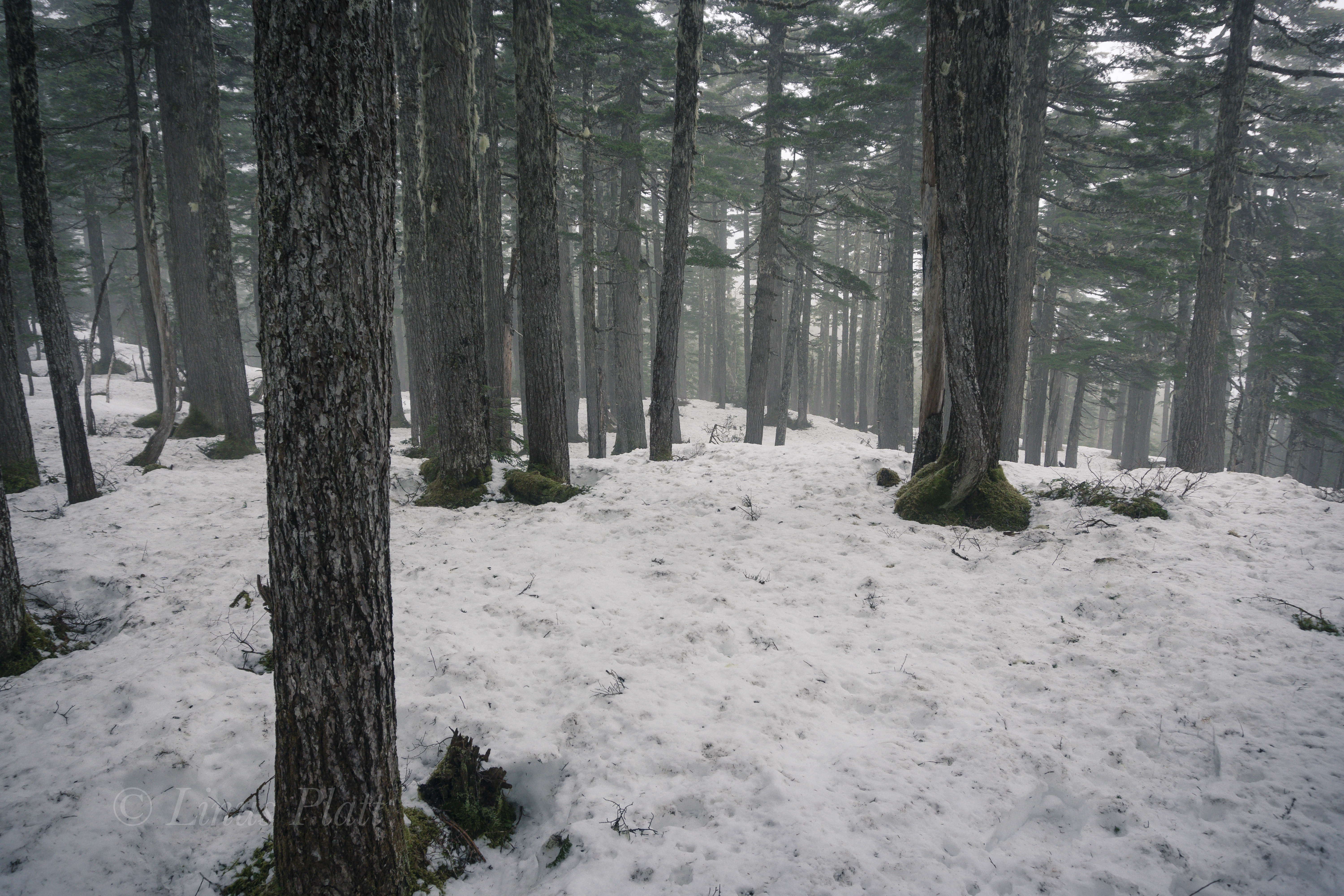
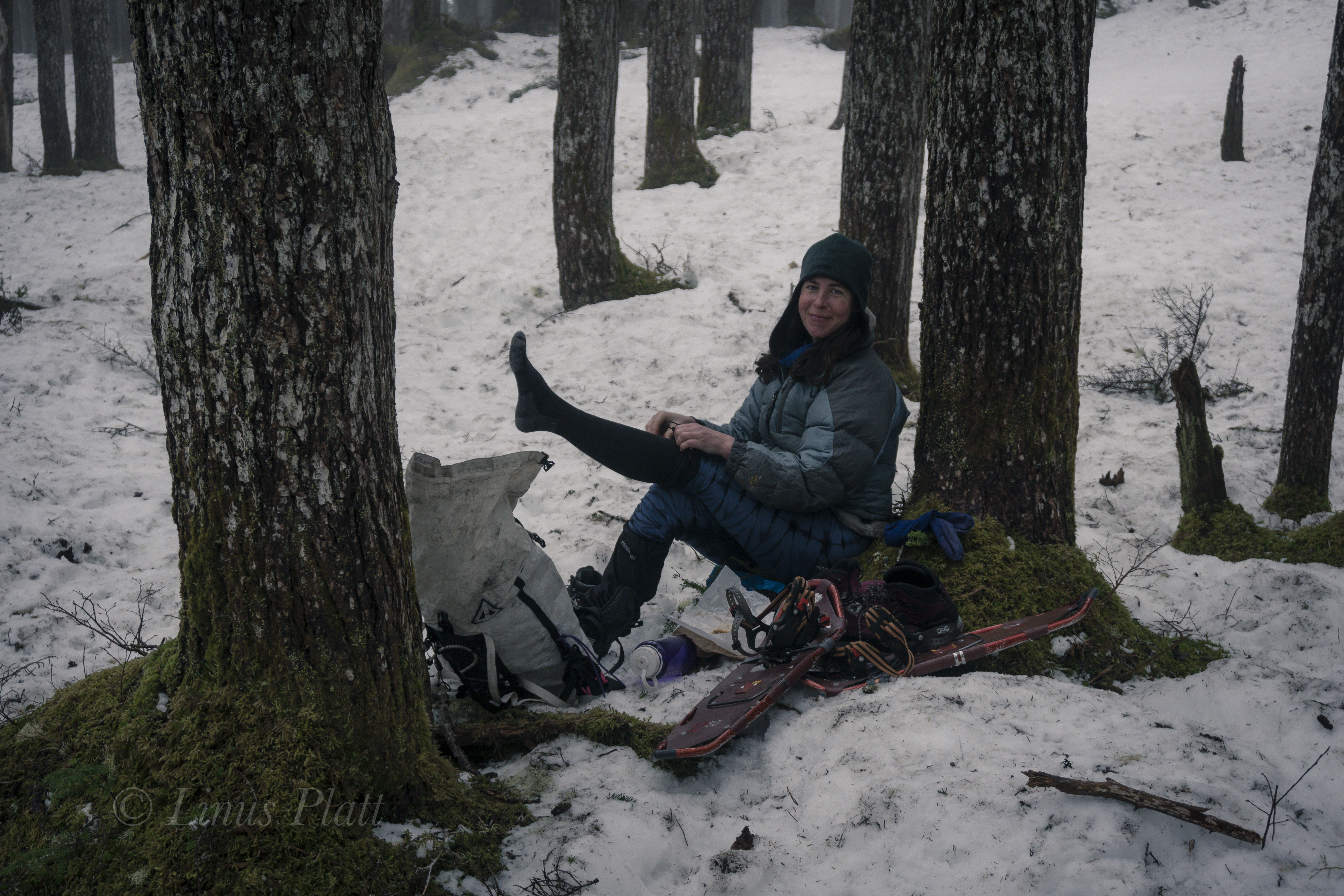
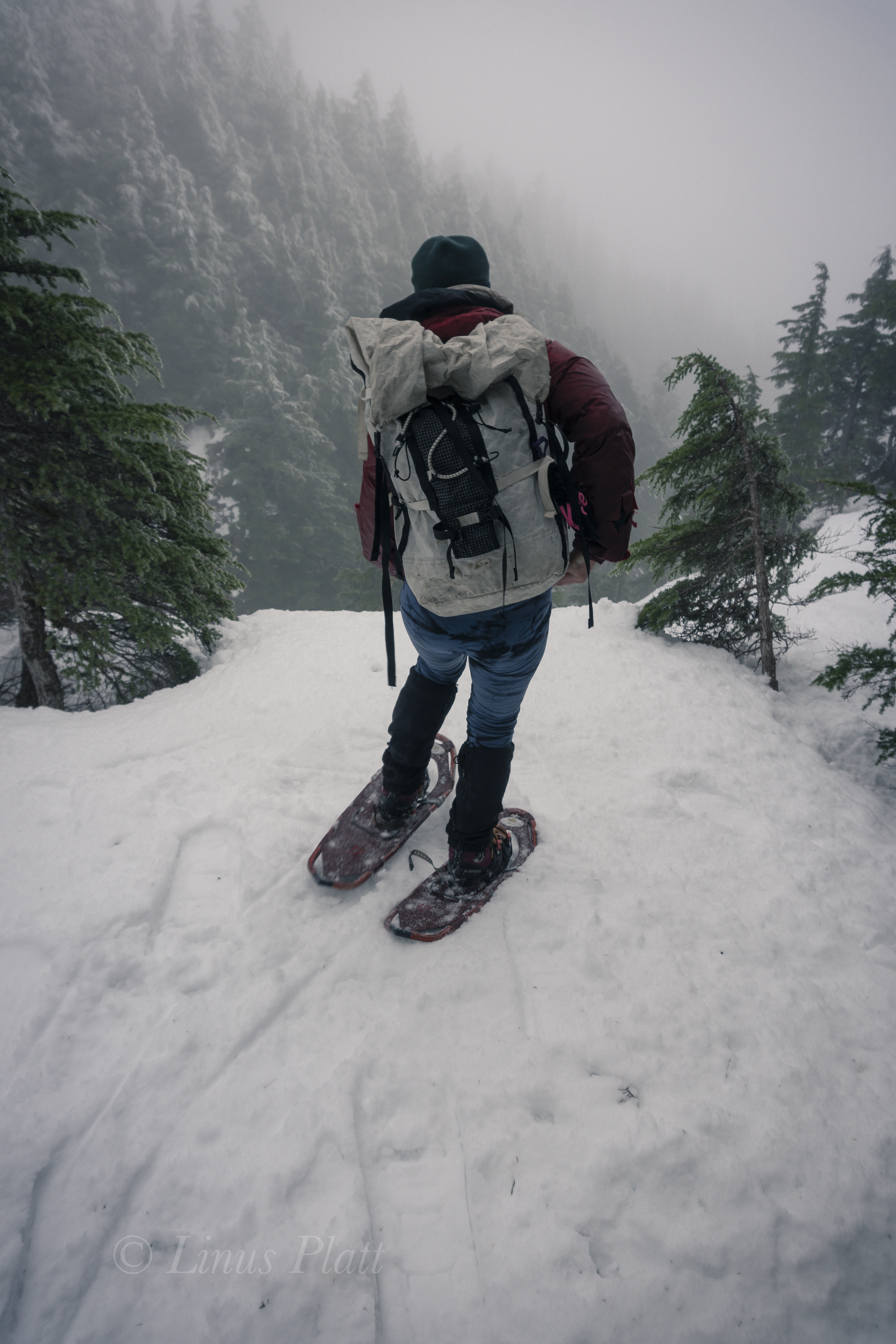
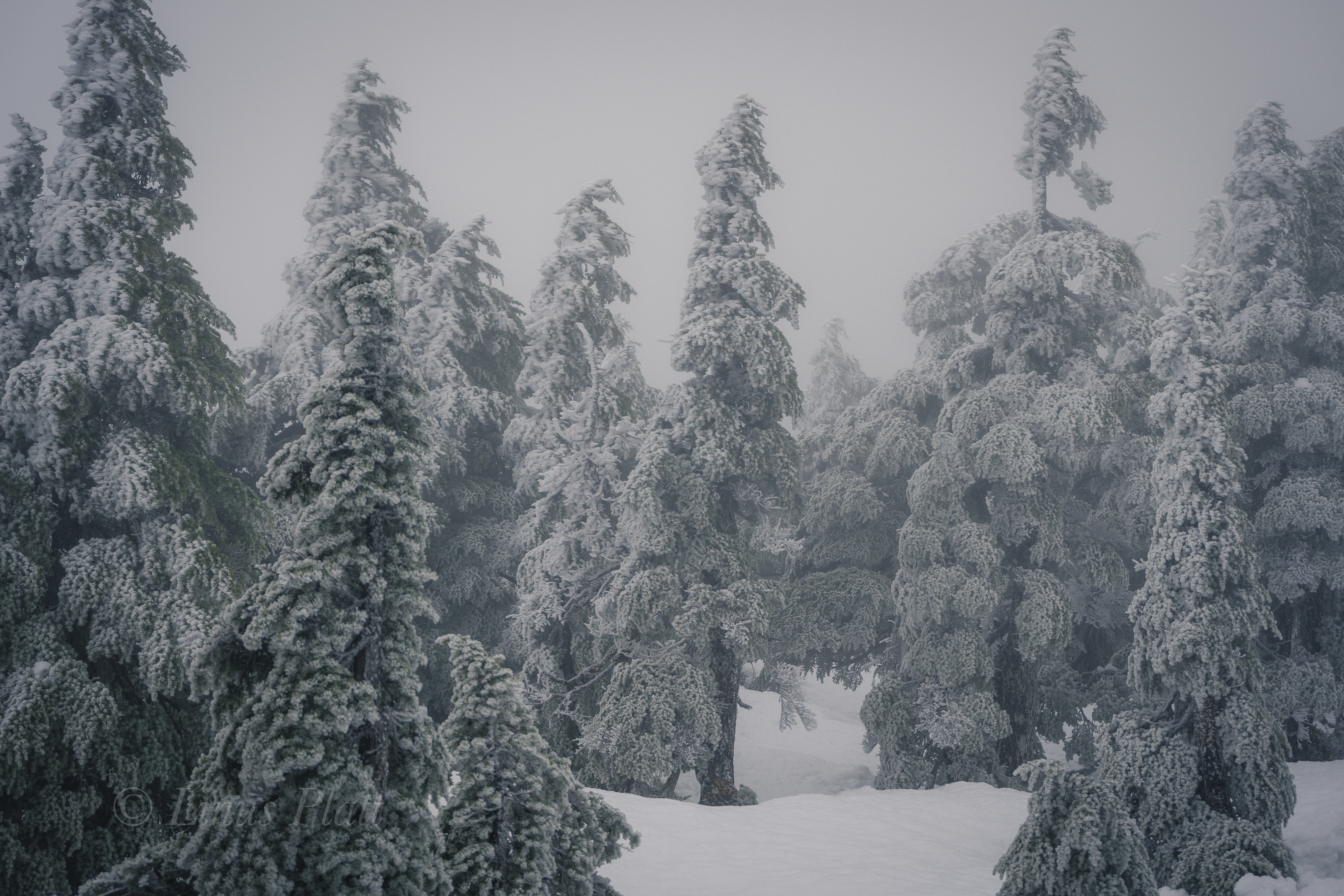
Leaving Mountain Market at about 9:30 am, we head for the trail and begin to stomp up the muddy, root infested path to snow line, where we swap running shoes for mountain boots and snowshoes. The forest is becoming increasingly engulfed in a mystical dream state of fog; the trees appear tortured from they’re entombment in rime ice; an indication of the severity of the wind coming off the Pacific waters of the icy Lynn Canal below.

Soon we are lost and grappling with creating a zigzagging,  weaving line through the struggling stunted alpine Spruce at timber-line; the snow very deep and the steepness increasing to the point I would gladly trade in my snowshoes for an ice axe and a set of ‘pons. Alas, we stumbe into the second meadow, where we lose the trail again, but finally find “The Overlook”, a place on the edge of a great chasm overlooking town when the weather is clear. Not today however, as visibility has been reduced now to about 10 meters, and the wind, now picking up velocity and numbing my fingers severely. 

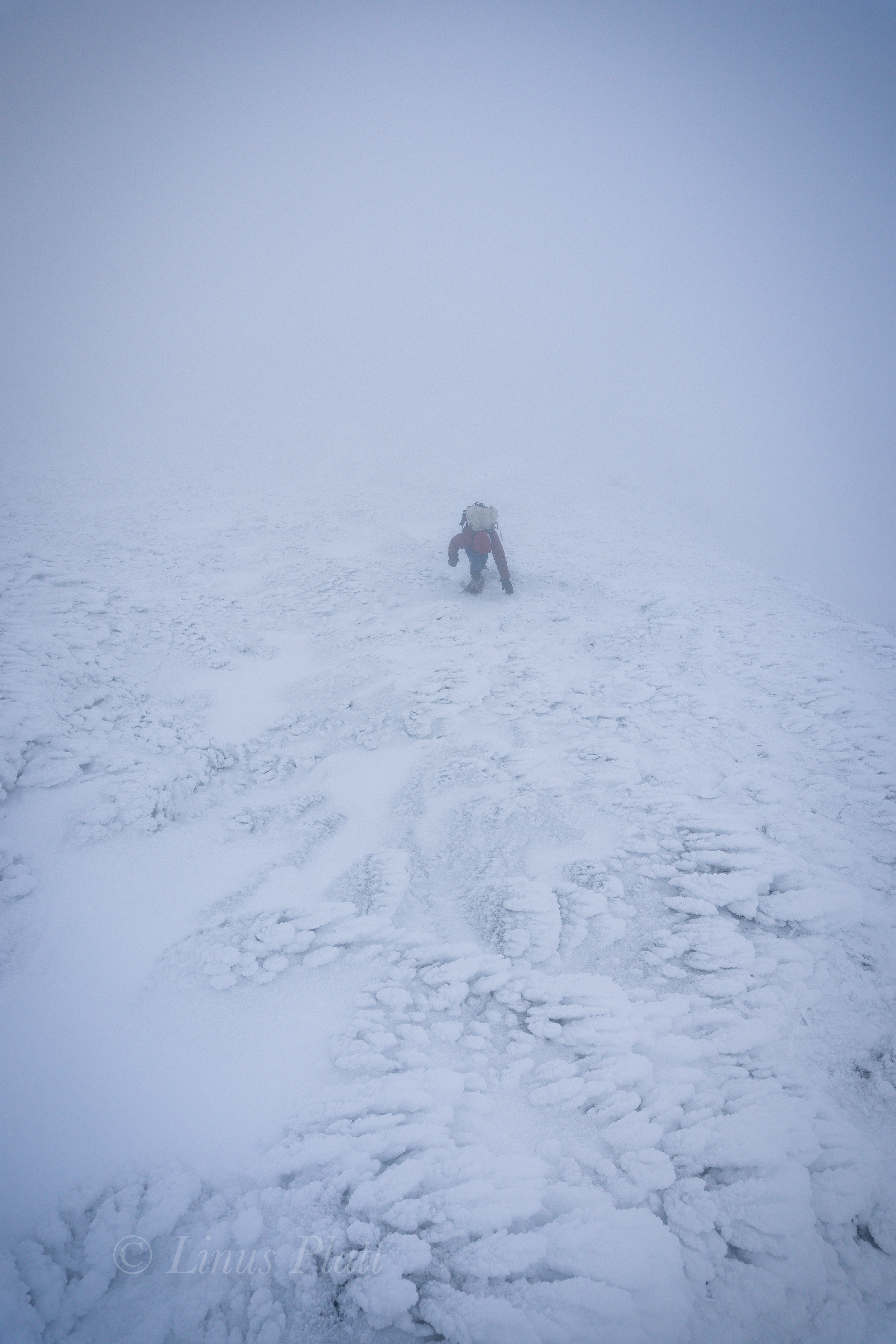
We somehow manage, after me considering bailing several times, to find the final summit climb up a spiny, rocky ridge.  On top, visibility is basically zero, and the wind raging. I put the camera away and go into survival mode, donning all layers and with special attention to my hands, which now are useless chunks of lumber somehow attached to my arms. We aren’t even sure we are on the summit, so we blindly stagger further, where I slip off a steep edge of snow that is completely invisible to my eyes in this torrential whiteout. No harm done and we scramble back in the direction from which we came, ponder for a moment at the highest rocky point, and then skedaddle. The whiteout seems to be increasing, but the further we descend, the warmer my hands become, and soon we find our tracks near the overlook and enter the trees below.

Back in the forest below the snow line, I’m too tired to put my running shoes back on and finish up the stomp in my expedtion boots back to the truck. Angela looks tired, but happy, and I feel the same.  Just another semi-epic day-adventure in Alaska…

Up next: Mt Sanford departure in T-Minus 7 days.

Stay tuned!

Winter Ripinski-1
Down low below the springtime snow line

Winter Ripinski-2
And so it begins

Winter Ripinski-3
Donning boots and snowshoes

Winter Ripinski-4Winter Ripinski-5

Winter Ripinski-6
Tortured trees

Winter Ripinski-7
A silent rime forest

Winter Ripinski-8

Winter Ripinski-9
The final summit climb

Winter Ripinski-10
Mt Ripinski from Main St downtown Haines

Over The Hill Expeditions: Mt Sanford 2019

Over The Hill Mr Natural II

2019 marks the first year of trips by the newly formed Over The Hill Expeditions. This years objective, primarily to get the ball rolling, get to know one another, and become organized both as a team and entity, will be Alaska’s Mt Sanford, which is the 6th highest peak in Alaska and thus the United States. The first week of May 2019,  we will be leaving Chistochina, Alaska via bush plane to the foot of the Sheep Glacier at around 5500′ of elevation. Our plan is to ski up, then down the 11,000′ of glacier bagging Sanford’s 16,237′ summit in the process. This years team will consist of Rich Page, Cameron Burns, Jeff Rogers, and Linus Platt. Our ages range from 26 to 61 and we plan on being on the mountain for approximately 2 weeks. Cam Burns, a noted writer of climbing, skiing, and adventure, will be compiling a story of the trip for Senior Hiker Magazine, while Linus Platt will be shooting as many photographs and video he can to document the expedition.  Our statement at Over The Hill Expeditions is to set forth the concept that over 50 years of age is synonymous with alpine mountaineering, exploration of Earth’s wild places, and high adventure, while utilizing our experience to navigate safely the challenges these trips afford us; retirement age people in the U.S. are a distinct and formidable denominator in our population, and we aim to demonstrate that youth is not the only factor in goal oriented physical accomplishments. We encourage and seek like minded climbers, mountaineers, and adventurers to share in our forays and also seek acknowledgment and support from the outdoor industry that we are a capable and enduring team.

Mt Sanford From East
Mt Sanford’s East Face with the beautiful and skiable Sheep Glacier route following the right skyline…


A Dance With The White Princess

It had been raining now for days in Delta Junction, and I felt that we might be close to wearing out our welcome at the Delta Public Library and at the coffee lounge at the IGA food market, if for nothing else than for simply being; loitering as it were. I figured the troopers would show at any moment to arrest us for vagrancy. Of course that is just me being sarcastic, as Alaska in general, and this part of Alaska specifically is certainly a place where one can do as they please without vexation from others. Folks here respect individuality and personal rights and property. In fact, we had been camped along the Delta River on the outskirts of town for a long spell now. Our tents and some belongings left there daily as we meander around town and take up space at the library. This practice has resulted in absolutely zero harassment, theft, damage, or chaos of any kind. One of the many, many reasons I am proud to call Alaska my home. Some years back I had been camped on this same river beach on a long bicycle journey, and as I eat my lunch and listen to the rippling river, gun shots are heard alarmingly close. I look back toward the tree line at rivers edge and see a man leaned across the hood of his truck, pistol in hand and firing again. This time a great cloud of dust and debris explode not 20 feet from my position and I realize that either his is shooting at me (and is a terrible aim), or he is not shooting at me but does not see me. I assume the latter and scream at him. He looks more surprised than I do and screams back a shaken apology and gets in his trucks and skedaddles fast. Another time on this same beach, on yet another long bicycle journey, I had lost an envelope containing some 4000 dollars in cash. No shit… not stolen… lost. This beach has always been a strange yet somehow beckoning place to me… I simply can’t explain it, but I always like camping here when I am in the area. We had been killing time here for several days and except for a jaunt up Donnelly Dome during a brief, hours long lull in the storm, we had become a fixture in this tiny Alaskan town. The foray up Donnelly was a pleasant and rewarding surprise: as soon we pull into the parking area off the dirt road south of Delta about 20 miles, a massive Bull Moose trots past us, not 30 feet away and paying not the slightest bit of attention to either Dennis nor I and our dropped and gaping jaws. Donnelly’s summit, a mere 2500 feet above the surrounding tundra sports some arresting views of the countryside below, and were it not stormy, I’m sure the views of the Alaska Range some 40 miles to the south would have been nothing short of incredibly spectacular. At the summit, a Marmot skull sits upon a small stone, as if to peer southward to the omnipotent Alaska Range. Was it an omen? Was the creature’s skull a sign of imminent death in those magnificent mountains. I thought not and held the little critter’s head piece in my hand for a bit before setting it back down and retreating to the truck. Later in Delta, a weather report brings a light ray of hope in our little world and we hit the sack and prep for another mountain adventure to the south.


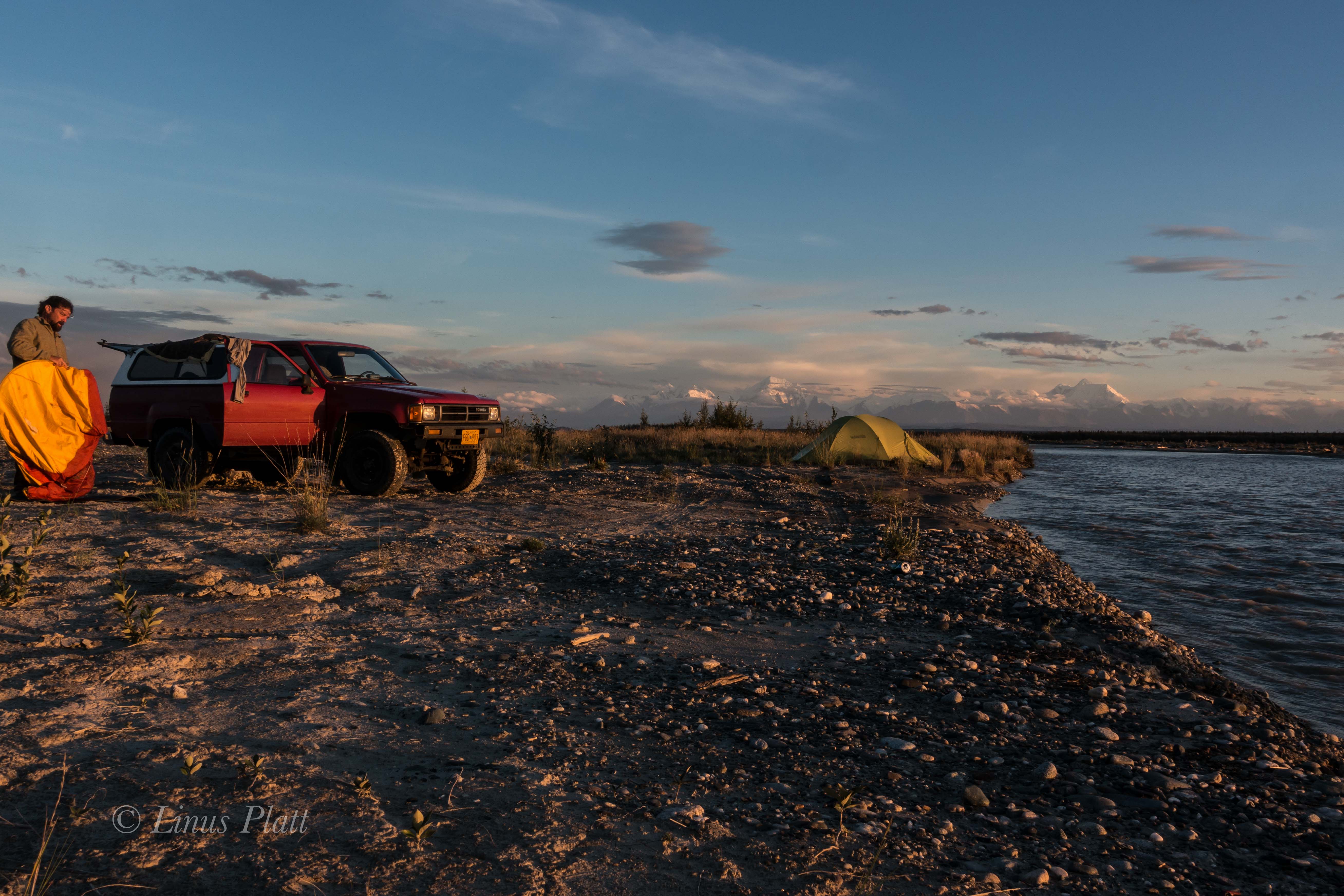
In the morning, I awake to a stillness and warmth that has been absent these last days; I peer from my tent to see a crystalline sky of deep blue and a calm that follows it. Walking out onto the beach, the central range has a clarity to it not seen yet on this trip: the massive peaks of Mt Hayes, Shand, Moffit, Balchen, and Deborah rise from the tundra with intent and sharpness, with not a wisp of mist or cloud surrounding their stature. The summits and ridges are sharp and full of contrast and color. This is a rare sight in these parts and I shout to Dennis in his tent of the spectacle. Soon we are up, packed, and off to our favorite diner for a celebratory omelette and endless cups of coffee. After a relaxing breakfast, there is nothin left to do but to begin the hour drive south on the Richardson Highway to the little 4WD dirt road I had discovered weeks earlier and the beginning of our hike onto the Castner Glacier and our goal deep within these mysterious mountains. We gas up and head south. On the drive down, a tourist has stopped at the bottom of a long full speed hill with a long lens poking from the vehicle’s window, shooting photos of a Moose foraging in a roadside pond. He is stopped squarely in the middle of the road in a high speed section and I pass doing 60 leaning on the horn. Soon we are at the dirt road, and the Toyota crawling along slowly, bouncing from rock to rock, emerges at the rough path and ends at the beginning of a faint game trail with the treacherous and thunderous Castner Creek roaring past with violence and intensity.

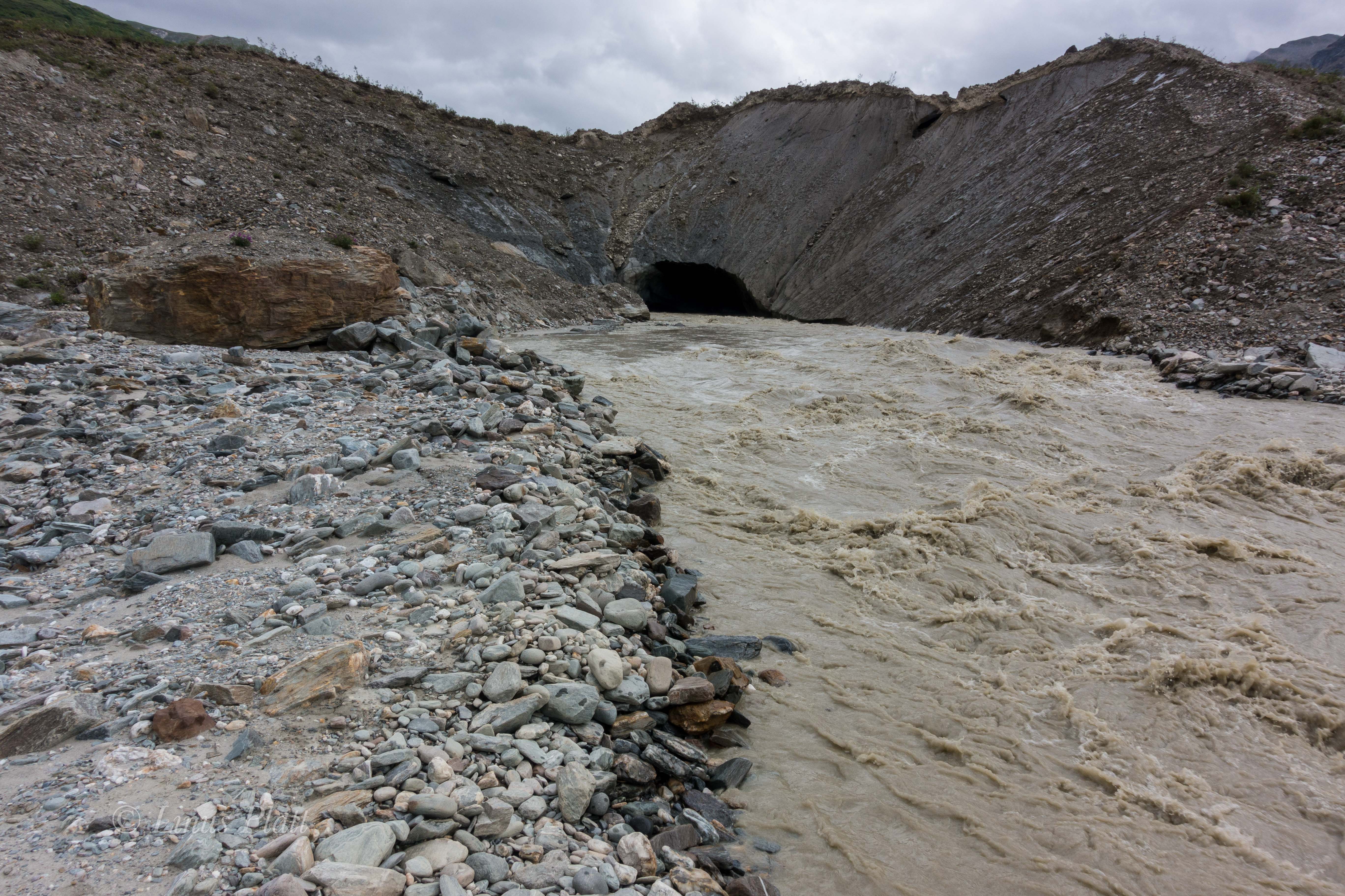
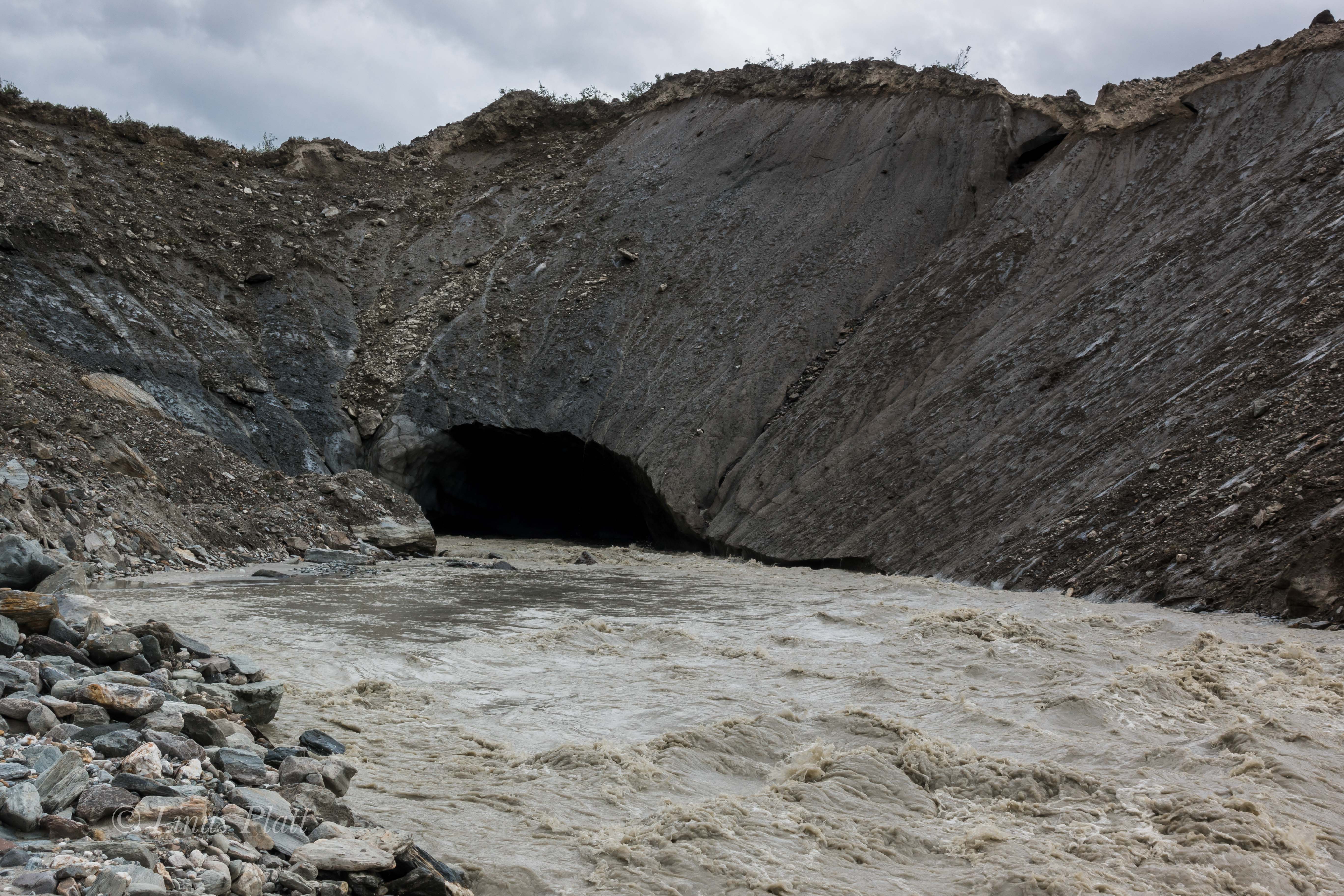
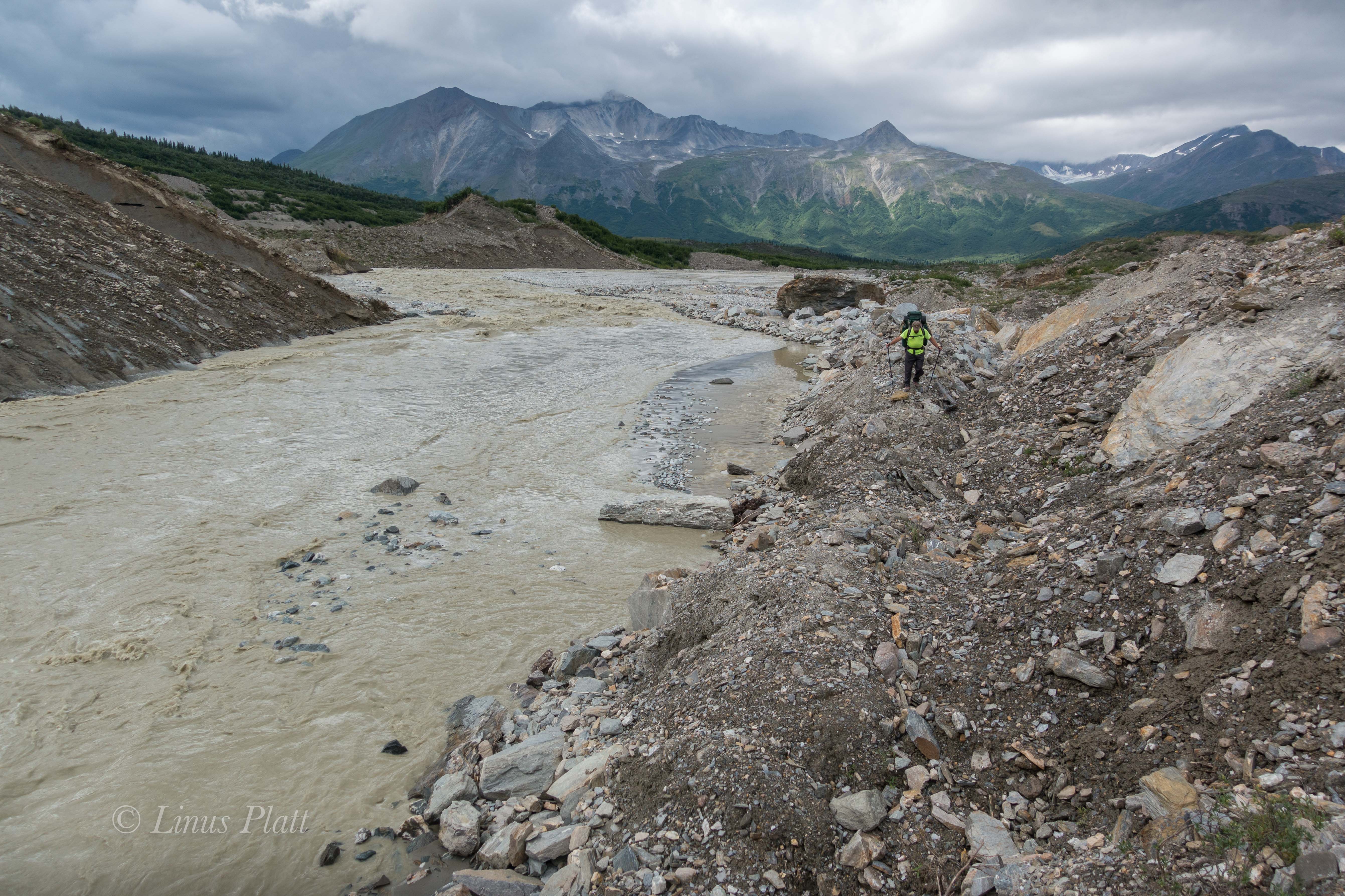
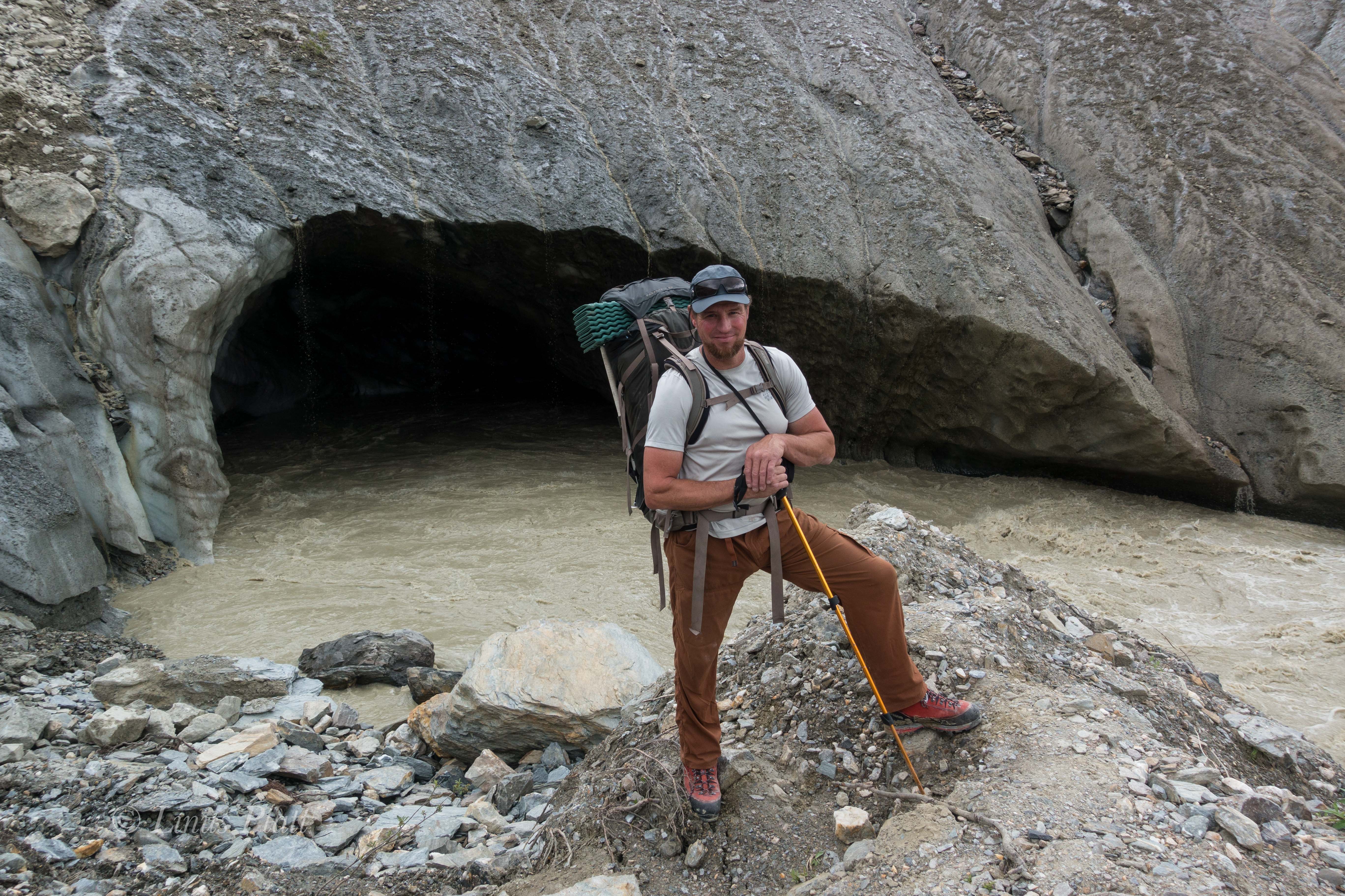
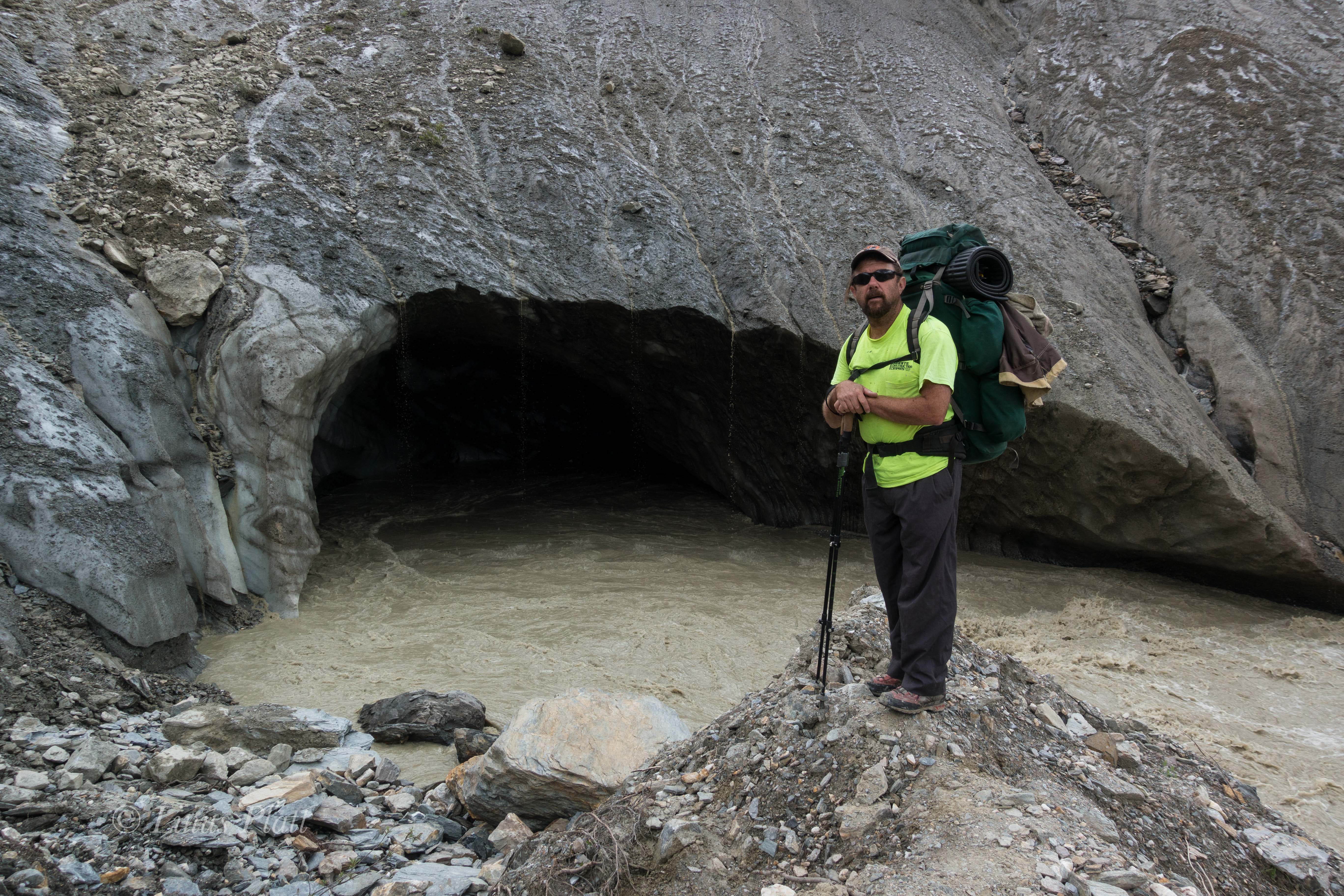
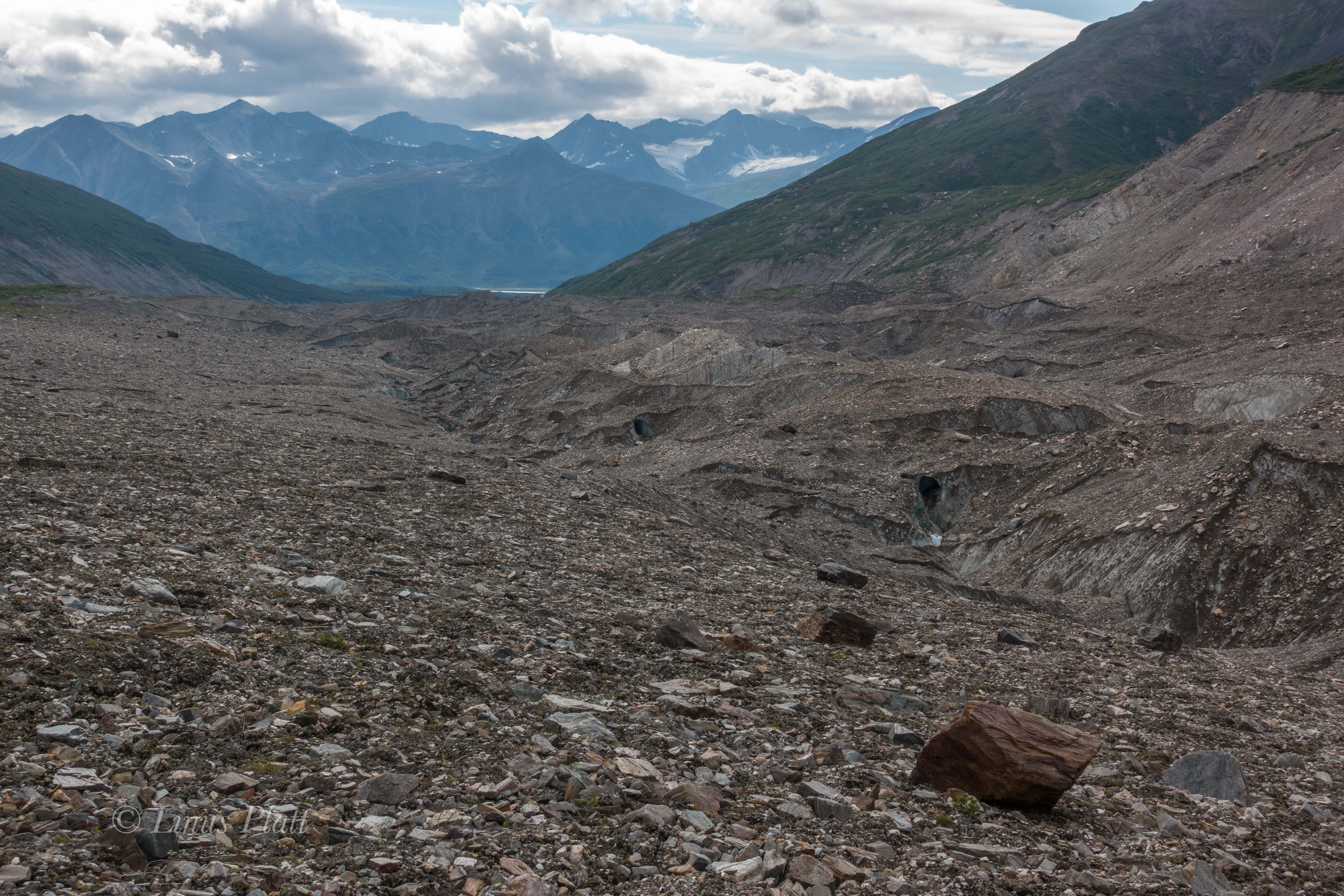
Our goal on this adventure is a peak known as the White Princess; a striking glaciated triangular peak of 9,800 feet, and one of the highest in the Delta Mountains. Descending from the summit of it’s 4000 foot west face are two distinct ridges, the Northwest Ridge and the Southwest Ridge. Our goal of the Northwest Ridge sits above a fork of the Castner Glacier called the M’Ladies fork, called so due to it’s origins from the cirque below the neighboring M’Ladies Mountain. After studying the maps purchased from the UAF in Fairbanks, and after reading scant accounts on the internet, it appears that our goal is to head up the Castner for about 8 miles to where the Castner splits into three separate forks, all leading to different cirques and several different peaks. From the fork in the glacier, another three or so miles up the M’Ladies Branch will take us to the base of our route. The first mile is flat and pleasant and meanders the Castner Creek corridor to the toe of the glacier, where a massive ice cave penetrates the snout of the beast and from it spits out the raging river beside us. A short scramble up the scree and mud to it’s left brings us to the top of the moraine and the debris covered serpent we will be traveling for many miles ahead.

After breaking through the Alder thicket near the top of the moraine, we are greeted with a sobering sight. Now, I am no stranger to traveling upon debris covered glaciers, full of scree, talus, medial moraines, crevasses, and moulins, but what lay ahead was another matter all together. For as far as the eye could see, all the way back to the M’Ladies Branch, lie what can only be described as an endless field of unstable talus, mud, Alder thickets, and boulders. I have never seen a glacier so entombed in such a disastrous array of debris and ankle busting madness… for miles. It becomes clear that the Castner is a big, dying glacier that has become entrenched in more chaos than I thought possible. All accounts I had read were all done in the earlier months; meaning most trips into this region have been done on skiis, allowing relatively sane passage along this corridor and into the high cirques, but we were here in July. The thought of endless mile after mile of this sort of blistering travel filled me with dread. However, what must be done must be done, and the beginnings of a very long day of tedious route finding, side hilling loose scree, and heinous bushwhacking through Alder and Willow thickets ensues. After navigating the initial moraine and figuring out a path of least resistance, we emerge on the far right side of the glacier/moraine where dense thickets are growing. Off to the right of these thickets, steep mud slopes lead far below to the emerging ice and it is at this delicate spine that we must adhere to in order to make this trek feasible. Hours of meandering the Willows and mud fields brings us to more open areas where the glacier is obviously now just below the surface of this undulating and heaving mass of mud, Willows, and scree. A small ridge is gained and we stick to it’s intent; the sides of which peel off to both sides to ice caves and mud fields. Eventually we come to where we are high enough on the glacier to where it is now simply a matter of traveling monotonous talus and it feels a welcome relief.  Miles from the truck, and hours later, we emerge at the fork in the glacier, where we find exhaustion and fatigue taking it’s toll and decide to make a bivi.

Glacial moraines are not always the most forgiving places to sleep, resulting in some time spent clearing areas out for our bivi sacks by moving the razor sharp rocks and layering them appropriately into level and reasonably comfortable slumber platforms. Once this was accomplished, supper was prepared and we eagerly crawled into our sleeping bags just as the evening alpenglow engulfed the imposing North Face of M’Ladies Mountain and the un-named peaks to the south. It was a lovely sight for my eyes as I drifted into much needed sleep. I dream that night of Dall Sheep and glaciers…

The morning we sleep somewhat late since we are under no pressure to get going early, as the 3 miles of glacier travel in front of us to move our bivi to the base of the route should only take a few scant hours. This feels luxurious and after a relaxing breakfast, we are moving back onto the ice; the sky above filled with a mixture of blue and scattered clouds. The ice of the glacier crunching beneath our crampon-less boot soles and the swooshing of the many runnels of moulins flowing on the surface of the ice. Once in a while, one of these glacial rivers disappears into a “sink hole”, where the water travels to the bottom of the glacier to become a part of it’s ever growing subterranean river. Peering into these dark and bottomless holes is downright spooky; if one were to fall in, you would certainly be done for. Dennis suggests we set up a rope and rappel into one for photographic and filming purposes, but the thought of even entering one of these icy tombs frightens me endlessly. Being who I am, I feel always best when I am in the Alpine Zone, far above the tree line, high on a cliff, or on a mountain top. Tight places, caves, tunnels and whatnot have always been something I drastically avoid: my phobia of these places sometimes even invades my sleep. We continue up glacier and large boulders appear; marbled Schist ranging from a dull grey, to shining silver with great veins of quartz meandering through it, to swirls of bright orange and red, indicating there are a variety of minerals in these mountains.

Soon, we come to where we are looking directly up at the western arm of the Northwest Ridge of the Princess; between the bottom of the ridge and where we now stand are great cliffs of shattered rock and an enormous waterfall cranking past the entrance to the upper valley where another large, but dying glacier flows from the Princess’s massive, if crumbling and treacherous West face. A desperate looking scree slope rises to the north of these menacing obstacles perhaps 500 feet to where there is green tundra and small alpine meadows. This, I’m thinking will be a splendid spot for our new bivi. Upwards to the scree finds us both clamoring foolishly; two feet up, one foot back, until at the nasty looseness culminates into an apex of sorts where what seems like class 5 scree leads directly to the lush and welcoming tundra. After some time scouting and going up another level higher to the base of the ridge proper, we find some level tundra and a small stream for water and call this home. Early to bed for a 3 am alpine start is in order; the weather is continuing to improve and after lying there in my bag wide awake for several hours, the sky clears completely, and one of the finest displays of Alaska midnight alpenglow I have ever witnessed takes hold. The giant peaks of the Hayes Range thirty miles on the other side of the Delta River Valley are immersed into the pink glowing alpine madness; the West Face of the White Princess shows a magnificent transformation that earlier appeared hideous and grotesque, now exhibiting a beauty and elegance that emphasized it’s massive hanging glacier and heavily crevassed summit pyramid. M’Ladies Mountain is not left out of the grandness either, nor is Mt Silvertip, Mt Blackcap, Triangle Peaks, or any of the countless un-named peaks in this region. The sight is incredible, but only adds to my sleeplessness, as I am compelled to shoot photos till after 1 am… the alarm will sound in just two hours.

I drift to fitful sleep and what seemed a second later, the alarm goes off and I am up, shouting to Dennis at his bivi a couple hundred feet away that it is time to get a move on. After much time spent simply getting to a point where we can begin boiling water for tea and oatmeal, we finally do so and begin the trudge uphill beyond the tundra and into the seemingly endless talus towards the top of the lower ridge. It is already 4:30 am and it takes us another 2 hours just to reach the beginning of the exposed and treacherous looseness of the scree and mud knife edge that leads to one false summit after another.

Now one thing I know about alpine climbing is that in order to climb decent snow and ice, one must get out of camp at an extremely early hour. This means having one’s proverbial shit together for a lightning fast escape from camp after waking. For whatever reason, this did not happen on this morning and I felt we were on the route far later that to be desired; I knew the snow and ice conditions would be crap by the time we were upon them. Once to the ridge top, the sides dropped away to glaciers on either side; so steeply in fact that a fall here would be certain death under any circumstance. After each section, a small gendarme would have to be negotiated on one side or the other, and at other times, small summits would appear and endless loose talus would have to be climbed to go over it’s top, where we would then wistfully descend to yet another saddle, looking upwards toward yet another summit on the ridge. The last major summit to be climbed up and over was a big one and consisted of extremely loose scree and gained close to 900 feet of elevation, before descending it’s top and losing another 500. After this reluctant descent, we find ourselves deposited at the start of the ice and the first views into the hidden cirque containing the upper Castner Glacier, the NW Face of Blackcap, and a daunting set of sliver thin seracs clinging suspended like from the groaning and fractured ice below us. Directly underfoot lay the top of a great ice couloir; not far below it is a mighty bergshrund of epic proportions where darkness prevails just inside it’s frigid caverns. The couloir that lie below this fracture appears rock hard solid ice coated with a black film of sand and debris pitched back at an angle of about 70 degrees. Far below, perhaps 2000 feet, lay a field of steepening seracs and agonizing crevasses to reveal one of the more chaotic sections of glacier I had seen yet in this range.

Donning crampons and axes, we front point above the lower ridge line to where a crevasse must be negotiated and a traverse to the far left brings us to more open views of the airy cirque below. The exposure is greater here as well and once across the icy gap, we find the ridge flattens to a long and even stretch of neve and crevasses that are mostly easy to spot an avoid. Still unroped, we climb a steeper 45-50 degree bit of nice firm neve for about 300 feet which places us at the beginning of yet another long crevasse field. After probing into this area and finding holes, we decide to rope up and work our way across this crevassed plateau towards the rising and dominant summit pyramid. A great cornice sticks out from the summit and avalanche debris can be seen on the slopes below, perhaps 500 feet from the top. Off to the right, a serac that we could see clearly from our bivi has peeled away from the main body of the glacier and hangs precariously over the staunches of the west face, threatening to drop the entire 4000 feet at any give time, in fact this whole area to our right is a time bomb of falling seracs and ice. As we move further upwards and getting closer to the pyramid, the hanging tongue of the glacier can now be seen up close before spilling over the side and into the bowling alley chutes of the audibly disintegrating west face. We had both heard the ice falling from this tongue last night; it would come in waves… almost in perfect rhythm. A crash, then silence… repeat. As we enter the crevasse field, the neve gives way to deepening snow and crevasses that are not only skimmed over lightly making for dangerous conditions, but are hard to spot as well. After a spell, the summit block is near and Dennis expresses his concern with the route I had chosen to climb it via it’s more direct western side. I mention that if he thinks we should climb the longer and easier looking east side, then I am OK with that. I ask Dennis to lead the way and off into the worsening snow conditions we go, aiming for the east ridge and it’s juncture with the summit area. It was getting colder the higher we climbed, but it was late morning now and the intensity of the sun was incredible. The snow was softening and endless amounts of sunscreen and glacier cream had to be applied; sunglasses were adorned more sternly and as we trudged into the deepening snow, crevasses began to be a bit of an issue as my leg poked into one… then another. Dennis too was poking through to have a peek into the glacier from time to time. We neared the upper east ridge and soon I could see up it’s spine toward the summit; what now became obvious was that the east ridge was a corniced knife edge and would require much more care than had previously thought. In fact, the climbing looked dangerous and time consuming. I declared that we must return and instead of descending the treacherous crevasse field to re-join our original line, took the lead and began an arduous traverse across the base of the summit pyramid, working my way through the avalanche debris we had seen earlier. The conditions continued to worsen and now instead of merely being a nuisance from post holing, it was now what I would certainly call breakable crust. If you put your weight uopn the snow and stepped up, it would hold you for a half second before giving way and sending your leg deep within, sometimes all the way to one’s crotch. To alleviate this madness, I developed a technique twhere instead of hoping the crust would hold, I would forcibly thrust my foot through it and stomp the snow beneath to hold my weight; usually this was no more than 12”-16” below the surface. It was far better than giving mercy to the crust and the velocity of one’s weight depositing your foot 36” under. By the time we got across the avalanche debris, we were beginning to climb the lower slopes of the summit block. We were both working terribly hard and in between the sounds of my own gasping, I hear Dennis cussing wildly and damning this place all to hell. Tensions build between us and all I can think of to say is that this is all a part of mountaineering, and listening to the bitching is making it harder. I put it out of my mind and soon we are at the lip of a large crevasse creating a steeper pitch to the summit ridge. We stop to re-group and set up a belay where I lead up and over the final obstacle; suddenly there is no more going up and all sides around us peel off in every direction. To the north the summits of Blackcap and Old Snowy rise from the surrounding icefields, and beyond lie the endless tundra to the north. The Hayes group off to the west appear Himalayan in size and block all views of the western range including Denali herself. To the south and east, the magnificent icefields and serpents twist and wind down rarely seen corridors leading to rarely visited rivers and deep wilderness. The north faces of some of the visible peaks are nothing short of spectacular; there is a sea of ice before us. Most of these ice entombed peaks are un-named and rarely climbed and the sense of isolation here is somehow unexpected, yet glorious. These peaks of the Eastern Range are small compared to their western counterparts, but are ever omnipotent in their own right and absolutely command respect; this place, these peaks, the glaciers below us touch my heart in a way that makes me feel both very small, yet very big as my place on this planet reveals itself to be an important one and the unexplainable beauty of this place sinks into me so deeply it can never be extracted. I love Alaska and it’s mountain ranges, it’s animals and people, it’s wilderness, and endless possibilities. There is simply no other place like it.

After consuming calories and taking some photos, Dennis and I shake hands in celebration and descend the summit pyramid; the task is almost as difficult as the ascent was, but soon we are out of the treacherous snow conditions and happily cramponing somewhat firmer neve utilizing french technique and front pointing down the steeper sections to the ridge, where more crevasse negotiation takes place before we come to a place where 3000 feet of scree lead off the south side of the ridge to the glacier below. We opt for this alternate descent so that the endless gendarmes and false summits may be avoided all together, but this is an unknown route down, and I am a little apprehensive. After considering the alternative, I jump off the ridge and commit to the scree. After descending several hundred feet, I wave to Dennis and he commits to scree as well. Some of this stuff is small enough and loose enough that one can actually “ski” down it; boot soles kicking off tiny avalanches of ball bearing rocks and then attempting to stay on it’s surface. The technique works surprisingly well, and after about an hour, I am near the ice not far below. I wait for Dennis for a bit and when he arrives he says he wishes to traverse to a shelf off to the right as he believes it will lead back to our bivouac. I feel that descending to the glacier and stomping it’s length is a better alternative, so Dennis and I part ways for the remainder of the descent. Pretty soon, Dennis is out of sight and I am trudging along the muddy scattered surface of the glacier below the west face of the White Princess. Looking up, I see the littered path of the constant icefall heard the night before; the ice gullies and chutes a debris field for exploding ice chunks and rockfall, I figure it to be suicide to attempt to climb this face. In camp by 4:30 pm, I spot a mother Dall and her two babies on the edge of our bivi, but there is no sign of Dennis. I am too tired to eat and crawl into my sleeping bag and fall asleep almost instantly. Later, I awake to Dennis’ footsteps. We chat for a bit before he stumbles off to find his own sleeping bag to caress. Sometime later, I feel raindrops on my face and dig into my bivi sack deeper for cover. Sleep takes me completely and when I awake, it is 5 am and raining.

We decide that hanging out in our bivi sacks for the weather to improve sounded like a torturous idea; not only that, but my ankle injury from two years previous was flaring up; it was time to get out, but the thought of the death march back to the truck was daunting to say the very least. I downright dreaded  it. The initial scree slopes from our bivi down to the glacier were painfully slow and detrimental to my ankle, but soon the glacier appears and we are making headway down to the fork. After 8 hours of battling this beast, I make it back to the truck. Dennis is somewhere behind me, and I decide to bath in the icy cold Castner Creek, make a sandwich, and take a nap. Two hours later, Dennis comes rolling in and we fire up the “Yota and head north for Delta, where more sandwiches, a six pack of beer, and a glorious sunset over the Alaska Range impresses upon us a time for relaxation and deep sleep. The next morning, we casually head back to Fairbanks, where Dennis’ previous foot injury and my ankle injury are needing rest. Dennis fly’s back to California a day or so later, and I rest up for more unknown solo adventure and begin to think about heading south a bit, for in another 10 days, I will be meeting Angela in the Yukon for a climb up Mt Archibald in the Kluane region… but that’s another story.

White Princess-Delta Mountains-2
Dennis at the end of the rough dirt road at Castner Creek

White Princess-Delta Mountains-3
Linus just before starting the “Death March”

White Princess-Delta Mountains-4
The raging Castner Creek

White Princess-Delta Mountains-5
The ice cave from which Castner Creek is born at the toe of the Castner Glacier

White Princess-Delta Mountains-6
Dennis nearing the toe of the Castner Glacier

White Princess-Delta Mountains-7
Linus at the snout of the Castner Glacier

White Princess-Delta Mountains-8
Dennis at the snout of the Castner Glacier

White Princess-Delta Mountains-9
The beginning of the Death March up the Castner

White Princess-Delta Mountains-10
Beautiful exposed ice caves along the way

White Princess-Delta Mountains-11
Endless scree, talus, and Willow

White Princess-Delta Mountains-12
Willow thickets separating the lower and upper sections of the approach

White Princess-Delta Mountains-13
Getting higher on the glacier

White Princess-Delta Mountains-14

White Princess-Delta Mountains-15
Taking a break near the M’Ladies Branch

White Princess-Delta Mountains-16
Colorful boulders and high moraines

White Princess-Delta Mountains-17
The Broken Glacier… now buried under debris

White Princess-Delta Mountains-18
Interesting moraine features nearing the M’Ladies Branch

White Princess-Delta Mountains-19
The Castner’s medial moraine and the M’Ladies branch forking off to the right.

White Princess-Delta Mountains-20
Debris covered ice at the fork

White Princess-Delta Mountains-21
Looking up towards the main Castner fork

White Princess-Delta Mountains-22
Our first view of the lower face on M’Ladies Mountain

White Princess-Delta Mountains-23
Marbled Schist

White Princess-Delta Mountains-24
M’Ladies showing herself

White Princess-Delta Mountains-25
M’Ladies Branch bivi

White Princess-Delta Mountains-26
Linus at the bivi after the Death March

White Princess-Delta Mountains-27
Looking up the M’Ladies Branch of the Castner Glacier

White Princess-Delta Mountains-28
Dennis setting up his bivi

White Princess-Delta Mountains-29
Dennis Belillo… “Sure glad that Death March is over…”

White Princess-Delta Mountains-30
Evening light on M’Ladies


White Princess-Delta Mountains-31
Breakfast bivi

White Princess-Delta Mountains-32White Princess-Delta Mountains-33

White Princess-Delta Mountains-34
Finally on the ice…

White Princess-Delta Mountains-35
Looking up the Silvertip Branch of the Castner Glacier and the giant and complex Mt Silvertip

White Princess-Delta Mountains-36
The lower reaches of the East Face of Triangle Peak

White Princess-Delta Mountains-37
The waterfall and shattered cliffs guarding the upper valley below the West Face of the White Princess

White Princess-Delta Mountains-38
Dennis on the second day of the approach

White Princess-Delta Mountains-39
Nearing the bivi site and the West Face of White Princess

White Princess-Delta Mountains-40

White Princess-Delta Mountains-41
The second bivi

White Princess-Delta Mountains-42
A Dall Sheep inspects our bivi

White Princess-Delta Mountains-43
White Princess

White Princess-Delta Mountains-44
Traingle Peak

White Princess-Delta Mountains-45
Un-named Peak between M’Ladies and Triangle Peaks

White Princess-Delta Mountains-46
The NW Ridge of the White Princess follows the left skyline

White Princess-Delta Mountains-47
Mt Silvertip at 1 am

White Princess-Delta Mountains-48
The West Face of the White Princess and the NW Ridge on left

White Princess-Delta Mountains-49

White Princess-Delta Mountains-50
M’Ladies Mountain

White Princess-Delta Mountains-51White Princess-Delta Mountains-52

White Princess-Delta Mountains-53
The Hays Group, Central Alaska Range

White Princess-Delta Mountains-54
Dennis approaching one of several gendarmes

White Princess-Delta Mountains-55
Dennis nearing the top of the lower ridge

White Princess-Delta Mountains-56

White Princess-Delta Mountains-57
The lower section of the NW Ridge of the White Princess


White Princess-Delta Mountains-58
The hanging glacier and the upper part of the NW Ridge

White Princess-Delta Mountains-59
Looking down into the hidden cirque of the Upper Castner

White Princess-Delta Mountains-60
Mt Silvertip and the Hayes Group looming behind thirty plus miles off…

White Princess-Delta Mountains-61
The Upper Castner Glacier far below the NW Ridge

White Princess-Delta Mountains-62
Linus at the start of the upper NW Ridge of the White Princess

White Princess-Delta Mountains-63
Dennis really glad all that nasty scree is behind us…

White Princess-Delta Mountains-64

White Princess-Delta Mountains-65
The summit of the White Princess 2500 feet higher

White Princess-Delta Mountains-66
One of the level sections of the upper route

White Princess-Delta Mountains-67
The White Princess

White Princess-Delta Mountains-68
The beginning of steeper climbing

White Princess-Delta Mountains-69
Dennis on the lower part of the upper ridge

White Princess-Delta Mountains-70
The Hayes Group from the NW Ridge of the White Princess

White Princess-Delta Mountains-71White Princess-Delta Mountains-72White Princess-Delta Mountains-73White Princess-Delta Mountains-74White Princess-Delta Mountains-75White Princess-Delta Mountains-76

White Princess-Delta Mountains-77
Crevasses below the steep summit pyramid of the White Princess

White Princess-Delta Mountains-78
Blackcap Mountain

White Princess-Delta Mountains-79
Dennis traversing the avalanche slopes below the summit

White Princess-Delta Mountains-80White Princess-Delta Mountains-81


White Princess-Delta Mountains-82
Looking south from the summit

White Princess-Delta Mountains-83
Looking southeast from the summit of the White Princess

White Princess-Delta Mountains-84
Linus on the summit of the White Princess

White Princess-Delta Mountains-85
Dennis on the summit of the White Princess

White Princess-Delta Mountains-86
On the glacier below the West Face of the White Princess during the descent


White Princess-Delta Mountains-87
Back in Delta Junction after the White Princess with the alpenglow lighting up the central Alaska Range- Mt Hayes on the right

Icefall Peak: Building A Perspective

After leaving Haines and driving my thirty year old decrepit Toyota pickup across the Yukon to the Northwest Territories border, followed by penetrating the Alaskan Interior and riding my bicycle into the Wrangell Mountains by way of the splendid Nabesna Road, it was time to get down to some mountaineering. My old buddy Dennis from California was to meet me in Fairbanks on July 7th and after a day or two of re-grouping, planning, and getting the truck in order, we were off, heading south on the beautiful Richardson Highway bound for the Delta Mountains in the Eastern Alaska Range. The Delta’s are the most accessible and driest peaks in the Alaska Range and sit at it’s far eastern end in the rain shadow of the taller and more remote giants across the highway in the Hayes Range. Most of the peaks here are in the 8000 -10,000 foot range, moderate to heavily glaciated, and approaches are generally made from the Richardson Highway; however the eastern most peaks such as Mt Kimbal are approached via the Alaska Highway north of Tok and these approaches could be considered extreme, as in 40 miles up braided glacial rivers full of Alder thickets and Grizzly Bears. Our aim was to hike into an exceptionally easy area to access know as the Gulkana Group that is situated a few flat miles from the highway. In fact, from the Richardson, a 2 wheel drive dirt road leads to within a mile of the toe of the Gulkana Glacier.

Driving south from Fairbanks, we spot the central Alaska Range rising gloriously behind the Delta River and since this is Dennis’ first trip to Alaska, we pull of to gawk at these Himalayan sized (bulk, not height) peaks far to the south. Passing through Delta, we stop for gas and a cup of coffee before continuing south and into the spectacular scenery the next 70 miles has to offer; to me, it is one of the best places in all road accessible Alaska. It is an area just north of the Alaska Range, where tundra, Spruce and Aspen forest, creeks, rivers, and rising glacial peaks dominate the landscape. The incredible numbers of Moose and Caribou here is staggering. It is a blue bird sky today and as we approach Castner Creek near the toe of the Castner Glacier, the White Princess, a striking triangular ice clad peak pierces the deep blue and we stop for a gander through the binoculars, as it is one of our goals over the coming weeks. But today, we continue on to the Gulkana and our goal of climbing Icefall Peak, which at 7,772 feet would be considered minor at lesser latitudes, but at 62 degrees north latitude, it is of the heavily glaciated variety and carries beneath it a magnificent, if troubling set of broken and daunting seracs known as the Moore Icefall. The slightly lower peak to it’s south, an un-named peak called Peak 7,680’ on the map, is by far the most striking peak in the cirque, with a long and jagged hanging glacial tongue descending from it’s upper flanks down to it’s base in the bowels of the Moore Icefall, and beckons to be climbed. I had seen photos of it and not found any information on routes or description on either peak; such is mountaineering in Alaska, where many peaks are un-named, rarely climbed, and undocumented. It certainly adds to the remoteness and sense of adventure that being in these majestic mountains affords.

The old Toyota rattles up the dirt road perhaps 3 or 4 miles before petering out within a few hundred yards of a suspension foot bridge crossing Phelan Creek, allowing scientists, students, geologists, and climbers access across the small but raging glacial river and into the wide gravel valley beyond which accesses the tongue of the Gulkana Glacier itself. Due to it’s proximity to the road, the Gulkana Glacier area is a place of  much study from the University Of Alaska and it’s GeoPhysical Institution, the USGS, and scores of other scientists and geologists. The USGS even built a hut at the 5000’ level high in the cirque back in 1968, which has served as a haven for climbers and skiers ever since.

After spending a couple of hours getting our gear in order, we hit the trail and soon are delicately walking across the swaying suspension bridge just up river. On the other side, the trail climbs a short hill, then descends to the gravel basin beyond, where the trail meanders up valley for 1 or 2 miles, passing along the way a geologic gauging station, to the ice cave endowed snout of the Gulkana. We manage to get to the ice cave where we must make a choice: either cross the dreaded fury river in front of us, or climb up and over the massive cave via the endless talus and scree slopes above and traverse around it. Either way, we decide to make the decision in the morning and to make a bivi, but the last good flat spots are a half mile back, so reluctantly we head back down valley a bit to throw down our evening ghetto. That night, during the endless daylight, I hear crashing rock and icefall every so often, reminding me we are now in the real mountains and caution must be afforded. Coming to the ice cave once again in the morning, we decide that the safest way is to bypass the river by going up and over the cave from where the river flows. This circumnavigation leads to not only the toe of the Gulkana, but to another ice cave; this one is not blocking our way, but begs for exploration. I ask Dennis to join me, but he declines, so in I go alone. The ceiling is a deep blue color and scalloped smooth. It goes back a few hundred feet where I can see light… it is a beautiful example of a glacial ice cave and seems to connect with the cave that blocked us previously and the great and fearsome river can be heard erupting from it’s guts. After emerging from the cave, we are once again moving and soon on the tongue proper where a great moulin flows violently. We fill our water bottles and head upward on the debris covered glacier. Once the debris thins out, we are surprised to find that the bare ice is textured nicely with dirt and sand and that travel with out crampons is not only acceptable, but desirable.

A clouded mist forms above and just as the vast and colorful seracs of the Gabriel Icefall show themselves, the mist descends upon us to create a condition of somewhat eerie circumstance; the glacier is silent, the rocky moraines hidden, and visibility becomes low. We truck onward and soon crevasses begin to appear; all are easily zig zagged around, and as the firn line gets nearer, we begin to see the remains of snow bridges from winter, and soon the depths of the menacing cracks are skimmed over with dirty and forbidding snow.Luckily these obstacles are easily avoided, and once reaching the top of a steeper section of the glacier, the upper cirque opens up, yet visibility remains low. We continue to meander and zigzag around the maze of crevasses and looking up suddenly, I spot the USGS hut. The tiny A-frame structure sits atop a large moraine, perhaps 400 feet above the ice, and after another hour of crossing through the crevasse fields and climbing the talus we reach the hut and enter. The steep walls of the hut are a notebook for every climber and skier that has entered this cirque for the last 49 years. Every available space has been written upon. Tales of climbing, humor, and general chaotic nonsense fills these walls. It is entertaining to read these as we prepare our dinner. There is a plethora of food in the hut and decide to take advantage of a bag of military cuisine consisting of Mexican Chicken whatever… these single military pouches contain every aspect of a meal, from main course, to crackers, to dessert, and to coffee at the end, which we saved for morning. After supper, I step outside to see the weather worsening; it is beginning to rain. Let’s face it, in the Alpine Zone on a glacier, nothing feels nastier than rain. And so it is… raining.

Dennis, as I found out on a climb on Silverado Peak in the North Cascades a few years ago, snores terribly. For this reason, I cannot sleep within 150 feet of him. Not a chance… That sound goes right through earplugs. Dennis seems to like the confines of the hut, so I go out onto the moraine and pitch the tent. I crawl in just as the storm intensifies and most of that night was spent trying to keep the tent poles from snapping; Guying the tent out properly was something I got lazy with and was now paying the price. After a few hours bracing from the inside, I put on my parka and go outside to fix the problem by attaching more guy lines and stretching out to larger rocks nearby. That did the trick and soon I was able to drift into sleep. In the morning, the wind had died, but the storm was far from over, essentially eliminating possibility of climbing anything that day or advancing our camp any higher. After breakfast, Dennis and I go out to guy out my tenet even better. Then back to the dryness of the hut for reading some of my book “Shadows On The Koyukuk: An Alaskan Native’s Life Along The River”, the story of Sydney Huntington and his growing up on the Koyukuk River in the Brooks Range during the 1920’s and 30’s. The book is a pleasure to read and is full of vivid descriptions of a life and landscape that has mostly disappeared; one that during that period was indicative of the times. It’s a story of family and community, of hard work and strength, of hardship and survival, and of playfulness and joy. A damn good read. However, I tire of sitting in the hut and ask Dennis if he is interested in taking a trek across the upper glacier to inspect the ridge above us during a lull in the storm. He declines, so off I go alone, cramponing up the low angle ice of the upper lobe, in search of the ridge line and a view of the mighty Canwell Glacier below. It only takes about 30 minutes to gain the ridge and the view I was looking for revealed itself. The Canwell Glacier, 4 miles wide and maybe 20 miles long sits 2500 feet below me, is crevassed significantly, and splits into three branches just up valley, where more un-named peaks push from it’s jagged dormancy. I get some great views of the bigger peaks in the area before the storm intensifies, sending me running back to the hut. More food and reading ensue and we figure the storm will have blown itself out by tonight, so we pack for climbing the following day and hit the sack early.

The alarm awakes me at 3 am to a perfectly still and silent Alaskan dawn. I peer from the tent and the delicate purple alpenglow splashes down upon this amazing cirque. The Deep blues of the seracs of the Moore Icefall with the crisp lavender skyline, the nearly full moon rising over Peak 7680, and the creaking of the glacier as it too slowly wakes, is an experience I will not soon forget. We are moving by 4 am and cramponing the perfect ice and neve towards the Moore Icefall, where it becomes clear some tricky route finding will be a necessity in order to bypass the many clusters of seracs and crevasses which block our way to the upper NW Face of Icefall Peak. Soon we are above the firn line and after sticking my leg through a snow bridge covering a menacing crevasse, we rope up and get to some proper glacier travel. Weaving in and out of the crevasses brings us to the first of several steeper seracs that must be negotiated and sometimes climbed directly. At the top of the first serac obstacle, a short bit of steep unprotected ice is climbed and the upper crevasse field is gained. From here we can see that there are more seracs and gaping holes to weave. At one point, just below the final steep bit before the final face, a crevasse appears so large I can hardly believe my eyes. It is the largest single crevasse I have ever seen. Perhaps 70 feet across and 200+ feet deep, it’s top covered by an enormous and fragile snow bridge that can only be seen from our side vantage. I am happy that it is not something we need to deal with and can simply enjoy witnessing it from our far away position. After crossing this monster it it’s terminus with the upper face, we climb a steeper section of snow and neve to the base of the final face. The weather is glorious and the seracs of Peak 7680 are shining brightly; the blue ice radiating the entire upper cirque – it is a lovely sight.

After a short lunch break, we untie the coils used for traveling the crevassed sections below us and decide to set up a belay and climb the full rope length. I lead upwards toward the upper wall which is steepening significantly. Beyond this headwall is the summit; I can see it. After a rope length, I come to the unexpected: unseen from below, there now sits before me a hidden crevasse barring passage to the headwall. It is maybe 25 feet across and 80 feet deep; the walls below me severely overhanging and rotten. I bring Dennis up and we attempt to traverse to the right in hopes of going around the gaping crack, but we are then blocked by another vertical fracture, essentially splitting the lower crevasse block in two. We must go down and down climbing ensues, bringing us back to from which we came. Time wasted, energy spent. Dennis is feeling exhausted and expresses his wish for me to make all the decisions from this point forward. Again I lead off to the right, this time from our lower position below the serac. I then climb upward to meet the giant and perplexing crevasse it it’s terminus with the steepening headwall to the right. I plant an ice screw and a snow picket and bring Dennis up. Above us looks difficult indeed; a step across the narrowest part of the crevasse leads to vertical water ice and rotten neve and leads to a rotting honeycombed ramp. I can see that the ramp leads squarely to the headwall and the summit, which looks to be only 200 feet away. This ramp is the key to the route. Breaking out my ice hammer for the first time on the route, I gingerly front point upward to the lip of the fracture and manage to just barely stem across to touch it’s far wall and place an ice screw. It feels bad… the ramp is skimmed with honeycombed ice and underneath is rotting neve which crumbles as I plant tools into it. I move up reluctantly and plant the hammer as high as I can but just can’t make it stick to my liking. My feet are underneath a slight overhang and I can’t see my front points. The only thing that is keeping me from breaking my neck on the lip of the lower wall is the shitty ice screw, now just below my feet. I come down. Then ponder… we are so gawdam close. I can practically spit to the summit. I go up again. Getting to the same spot, I feel the risk is not worth the potential disaster of falling off this face and I retreat. My attitude dissolves entirely and suddenly I am in a very bad mood. Dennis looks exhausted and expresses relief that we are not continuing. This makes my mood even worse. I gaze out over the growing shadows of the Moore Icefall and the hanging glacier on Peak 7680 and vow to myself to come back to this place to climb it. For now, all I wish for is to leave this cirque. I belay Dennis down to the base of the serac and after joining him, we begin the long and arduous decent through the jumbled maze of seracs and crevasses. After this is behind us, we are once again back on the lower angle part of the glacier just above the firn line where earlier, perfect crampon conditions made travel easy. Now, in the afternoon heat, the neve has turned to soft and vicious snow which must be post hole’d back down past the firn line to the bare ice, which is now flowing with water in the heat of the day.
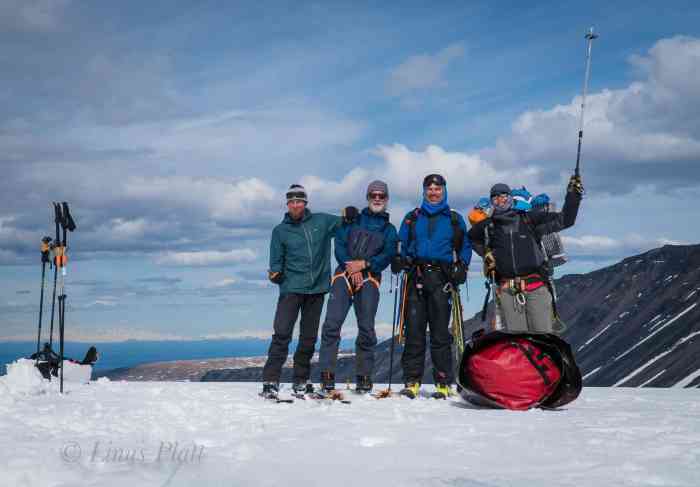
We are back at the hut by 2 pm and I am feeling like packing up and walking out to the truck. Dennis does not wish for this and we decide that he will stay the night at the hut and I will walk out alone. I pack up the tent, and load my pack and am back on the ice by 3 o’clock. I tell Dennis that if he is not at the truck in 24 hours, I will come back to look for him. He agrees and we say goodbye and I begin the arduous 5 mile glacier walk to the tongue. The sights along the way are spectacular, but my exhaustion is taking it’s toll. At the tongue, I am faced with the previous decision of whether to go around the ice cave or to fjord the river. I am far too tired to climb the talus to go around, so I opt for the river. I find the shallowest section and stomp across. My boots are mostly soaked but not caring, I stagger the last couple of flat miles to the truck where I collapse and take off my sopping boots. A jump into the icy Phelan Creek makes me feel alive and clean, and soon the tent is set up and I am happily cooking supper and thinking about the next move. The next day, Dennis ambles in about 2 pm and we decide to head back to Delta Junction and re -group. In Delta that night the sunset on the Alaska Range impresses us and a deep sleep comes easily. The following morning, rain drives us into a diner for breakfast and coffee, where we talked of our next climb: The White Princess.

Icefall Peak-Delta Mountains-1
A view of the Central Alaska Range AKA The Hayes Range. The Delta Range is out of frame to the left…

Icefall Peak-Delta Mountains-3
A view of the White Princess on the drive to Icefall Peak

Icefall Peak-Delta Mountains-5
Dennis at the end of the road near the Gulkana Glacier

Icefall Peak-Delta Mountains-7Icefall Peak-Delta Mountains-9

Icefall Peak-Delta Mountains-10
The suspension bridge over Phelan Creek

Icefall Peak-Delta Mountains-11

Icefall Peak-Delta Mountains-12
USGS gauging station

Icefall Peak-Delta Mountains-16

Icefall Peak-Delta Mountains-19
The ice cave and the birth of Phelan Creek at the toe of the Gulkana Glacier

Icefall Peak-Delta Mountains-21
The first bivi…

Icefall Peak-Delta Mountains-22
The second beautiful ice cave

Icefall Peak-Delta Mountains-23
The Gabriel Icefall appearing below the mist

Icefall Peak-Delta Mountains-24
The debris covered lower Gulkana

Icefall Peak-Delta Mountains-26
Negotiation…

Icefall Peak-Delta Mountains-29Icefall Peak-Delta Mountains-30

Icefall Peak-Delta Mountains-33
The USGS hut built in 1968

Icefall Peak-Delta Mountains-28
Military viddles

Icefall Peak-Delta Mountains-31
The beautiful middle Gulkana

Icefall Peak-Delta Mountains-34Icefall Peak-Delta Mountains-32Icefall Peak-Delta Mountains-35Icefall Peak-Delta Mountains-36Icefall Peak-Delta Mountains-37

Icefall Peak-Delta Mountains-38
The mighty Canwell Glacier

Icefall Peak-Delta Mountains-39

Icefall Peak-Delta Mountains-40
Moonrise over Peak 7680

Icefall Peak-Delta Mountains-41
The Gulkana Cirque

Icefall Peak-Delta Mountains-42
Icefall Peak

Icefall Peak-Delta Mountains-43Icefall Peak-Delta Mountains-44

Icefall Peak-Delta Mountains-45
The firn line

Icefall Peak-Delta Mountains-46
Looking west to Institute Peak, Minya Peak, and Cony Mountain

Icefall Peak-Delta Mountains-47
The incredible Peak 7680

Icefall Peak-Delta Mountains-48Icefall Peak-Delta Mountains-49

Icefall Peak-Delta Mountains-50
The Moore Icefall

Icefall Peak-Delta Mountains-51

Icefall Peak-Delta Mountains-52
A maze of seracs and crevasses

Icefall Peak-Delta Mountains-53Icefall Peak-Delta Mountains-54Icefall Peak-Delta Mountains-55Icefall Peak-Delta Mountains-56

Icefall Peak-Delta Mountains-58
Me and the biggest crevasse I have ever seen… from 200 feet away

Icefall Peak-Delta Mountains-59
The lower headwall

Icefall Peak-Delta Mountains-60
Shutdown 200 feet from the summit… feeling surly

Icefall Peak-Delta Mountains-61
Our final pitch on the upper headwall

Gulkana Group Photo Teaser

Gulkana Group in the Delta Mountains of the Eastern Alaska Range

Icefall Peak and Gulkana Group-49
Icefall Peak

Icefall Peak and Gulkana Group-42
The Gulkana Group and Icefall Peak

Icefall Peak and Gulkana Group-43
Moonrise Over the High Alpine

Icefall Peak and Gulkana Group-45
Crevasses Near the Firn Line on the Gulkana Glacier

Icefall Peak and Gulkana Group-48
The Incredibly Magical Peak 7680

Icefall Peak and Gulkana Group-50
Seracs and Crevasses of the Moore Icefall

Icefall Peak and Gulkana Group-40
Peak 7680 at Dawn

Lunar Ecstasy

After sending this story to Rock and Ice, the Alpinist, and Climbing Magazine with no interest, I’ve decided to publish it to Just Rolling By for all to read, for better or worse. Enjoy!


LUNAR ECSTASY

By Linus Lawrence Platt

 The early nineties was a confusing, but glorious time for me in regard to bouncing from location to location in search of a climbing scene with the most caliber and diversity. Having spent a year and a half in Moab, then heading to Boulder for a 5 month stint there, I was ready once again for a change. I had the wall itch flowing in my veins and I figured a trip to Zion for a spell was in order; at least it wasn’t too far out of the way going to the Valley from Boulder. Driving west, I swing the decrepit van south onto Highway 191 to my old stomping grounds in Moab to hang with my buddy Kyle and learn that an avalanche in the La Sal mountains just outside of town has killed several of my friends. It was a long and grievous week that followed and when I finally did get back on the road,  I felt like I was heading to a gregarious gathering of climbing and new friends that I hadn’t yet met. Zion was calling.

Back in those days one could drive into the Park and scope out climbs and approaches, cook meals in your van, and pull off the occasional incognito bivouac at the Zion Lodge parking lot, which, on that late evening in February 1992, is exactly what I did. Being a newbie to the walls of Zion, I set my eyes on soloing the Touchstone Wall on the Cerberus Gendarme, figuring it to be a good initiation; even though Navaho Sandstone was not unfamiliar to me, jumping in moderately seemed appropriate, especially solo. I fix the first couple of aid pitches and rap for a retreat to town. Later that night, at the Bit and Spur sitting at the bar, I strike up a conversation with local Springdale climber Brad Quinn, who mentions he wouldn’t mind doing the Touchstone with me if I wanted the company. Brad was a sandy haired, good natured fellow who was born and raised in Rockville and Springdale, making him a true local. His list of activity and first ascents in Zion were impressive and being so easy to get along with made me want his company on this climb; I liked him immediately. I say “Sure Thing” and by the next evening, we are happily descending from the Gendarme’s summit. The day had gone without a hitch and Brad and I seemed a good pair. On the descent, while simul-rapping, Brad tells me of an unclimbed route he had been scoping for a couple of years or so…  A thin line to the left of the omnipotent classic, Moonlight Buttress.

In those times, Brad’s house, the “Rock House”, named for it’s construction of stone blocks, proximity to the park entrance and world class bouldering, and the fact that it’s occupants were all climbers, was the de facto hang of the Zion Wall climbing scene; the Camp 4 of Zion, if you will. 1992 was an exciting year to be in Zion; there was an abundance of activity in the park that season and it was the year that I met the likes of Barry Ward, John Middendorf, Alan Humphrey, Jeff Hollenbaugh, Chris Circello, Eric Ramussen, Darren Cope, and many, many others.  An unusually high number of quality, modern classic aid lines were ticked that year. Brad and I spent hours at the Rock House contemplating his new proposed route, but it wasn’t for a couple more days ’till we drove up canyon to have a serious look. After scoping with binoculars and scribbling notes, we are certain it will go; thinking it will most likely be a semi difficult nail-up. Later, Ron “Piton Ron” Olevsky, a fixture of Zion climbing back then, had told us he had “scoped the line” but deemed it “too thin to climb in good conscience”. Thin was what we were looking for and the thought of such a new route stoked us up.

After a couple of days of free climbing, swimming in the river, and Brad showing me his secret bouldering circuit, we began the process of getting together the gear and logistics for the adventure ahead. Two days later, after procuring the necessary hardware and food, we found ourselves fiording the Virgin River and humping our loads to the base of the route. In an attempt to create a line of originality and a sense of it’s own, we opted not to follow the first couple of pitches of Moonlight Buttress, but instead start in a left leaning corner system that branched off Moonlight’s first 60 feet that we hoped would lead to the steep and monolithic features that characterize much of the route. And lead us to those features it did, but 2 or pitches of less than desirable rock had ensued to attain this. Such was the price. The first “real” pitch was one that concerned us slightly, as it appeared from the road to be a featureless wall of scallops and traversing that we certainly took for granted to be a drill fest. Upon casting off on this “Half Moon Traverse”, Brad found the pitch to be a mixture of drilled and natural hooking, some nailing, and the crafty use of Tri-Cams. After cleaning said pitch, I arrived to find Brad standing there, on a tiny ledge, the headwall we had so appreciably desired looming above his shoulders, and a shit-eating grin adorning his mustached face, with the wind blowing his sandy hair above his boater’s cap, signifying we had reached our goal and the route was under way. While perched upon that tiny ledge at our day’s high point, a clear view of the thinnest part of the route above lay clearly visible, even in the waning daylight. The crack in question was not even a seam at the level of this “Farewell Ledge”; in fact it didn’t become a feature capable of accepting even the thinnest of Bird Beaks for at least a couple of body lengths. We drill 3 bolts, rap to the deck, and head to the Rock House for celebration.
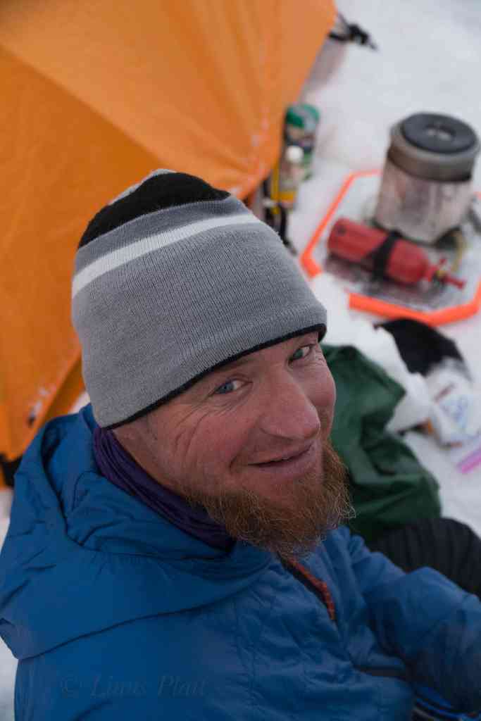
We spend the next 24 hours resting and getting some thin nailing gear together, revamping our drill kit, and swedging together rivet hangers and other miscellaneous. The year before, while putting up routes near Moab, Kyle Copeland, who had the year prior, made the first ascent of The Fang in Zion with John Middendorf, taught me a trick for an alternative to bathooking on sandstone. He would drill a 3/8″ hole, about 3/8″ deep, and instead of bat hooking the hole, tapped a Bird Beak into it. it’s removal could be achieved by a simple twist and the Beak would simply pop out. I figured that to reach the portion of the seam that would finally take gear would require a technique such as this, so we adjusted our drill bag accordingly. That evening, hitting the sack early, I dreamt of flawless vertical fractures and of pitons and of great exposure and of seeing the world from high above the earth. I sleep.

After jugging up fixed lines to Farewell Ledge, the sharp end is mine, and I cast off; a series of drilled Beak and hook moves then finally a sequence of Beaks in the fissure, gain reward by means of tied off KB’s, giving way to tied off Arrows. By the time I  sunk in a Baby Angle, I was in looking at a possible 60 footer right onto Brad. Finally getting in some TCU’s provided relief, and at ropes end, I drill another belay. Brad’s next lead was a dream pitch consisting of perfection in the form of  a parallel splitter, mostly blue Alien size. Leapfrogging this outstanding pitch, provided not one of the hardest, but certainly one of the best pitches of the route. Cleaning the pitch found me arriving at the belay with Brad already having set up the porta-ledge and sipping a victory beer. Soon joining in after organizing the rack for the following morning, I too felt the immense sense of gratitude, being on this magnificent first ascent of such a fine line, relaxing on the porta-ledge our first night out, sipping beer, and watching the phosphorescent moon rise above the north face of Angel’s Landing, we felt a place of purpose and dignity in the world. Soon we sleep… That night, very late, I awake and peer into the deep sky of night and the stars and moon come alive within me and I feel as free as any Man on Earth. The canyon’s presence is a deep impression in my soul and being on this climb, this wall, imposes a larger than life sensation that is a parallel to my own life and why I am here.

We are up before the sun and soon I am slithering up a thin KB corner, then gently tip toeing across a sizable Amoeba flake that seems to be entirely detached from the stone. Once past the offending protozoa, I am able to drill a Beak hook past a blank section where the corner changes direction; a dicey free move deposits me onto a small ledge and I am grateful for it. We are moving with intent on this new route: not too fast but not too slow; after Brad fires off another straightforward pitch, a big ledge appears and we are in the mood to relax and enjoy our last night on the route. The porta-ledge is assembled, regardless of the big ledge, and our gear spread out in a luxuriant fashion for reorganizing. Sleep comes earlier than usual and allows us an early start in the morning for what turns out to be the unexpected crux of the route: the final pitch.

After packing the bags and putting away the ledge in anticipation of descending from this Stone, I cast off, up a loose corner, and peer above. A headwall of steep and varnished rock looms wildly above. I consider this for a moment, and decide that it could be a time consuming nail fest and in the interest in getting off this route, opt for an escape to it’s right. On the third ascent of the route, Brad Jarret climbed this headwall and that’s the way it’s been done ever since. Traversing under the headwall, I spy an easy looking flake system that is topped by a small roof. Above, lay a shallow and sinister looking groove that spirals to the summit. I clamber up the hollow sounding flakes, aid climbing on questionable hardware, tossing in the occasional free move to shake it up, and peer beyond the roof. I can see the top, but to get there, I’ll have to pull some tricks out of the bag. Over the roof, a sloping hook and a KB put me into the groove and I can see all of it’s inability to receive gear. After fumbling with Beaks in the back of the groove to no avail, a small Tri-Cam decides to stick long enough for me to fire in a LA at the feature’s end. Soon I am running up 5.6 slabs with abandon and latching arms around the Juniper tree at the top. Brad cleans and I haul the worst haul of my life: the nasty ‘ol pig scraping loudly across loose choss and sandy slabs, all the while knocking debris onto Brad’s vulnerable skull. Soon and without mishap, Brad and I are standing on the summit, grinning wildly and filled with ecstasy that we pulled of a fine climb. A quick scramble down some 3rd class blocks puts us onto the paved tourist trail where friends are waiting to help hump loads to the bottom and ease our pain; we are a grateful pair, Brad and I.

Throughout the climb, I had been shooting pictures and once on the deck, I was anxious to get them developed for a slide show at the Rock House once we were settled and de-rigged. A couple days later, I stroll into the photo joint in Springdale to pick up the shots and look them over quickly on their light table. Anxious, I split for the Rock House where a party ensues. The photos, having never been looked at that night, were set aside and in a drunken haze, I crawl into my van for some much needed slumber. Upon entering the Rock House the following morning, I see Brad pacing nervously. Looking upset, he seems to be searching; the picture are gone he says. Only a couple of loose slides lying on the table remained.  Somehow, over the course of the evening party, the photos of the climb had disappeared. We spent the next few days searching and hoping they would turn up, but alas, they never did. A snapshot of climbing history vanished.

A week following, on the second ascent of Lunar Ecstasy, as we called the route, Jim Funsten, on that last mysterious pitch, couldn’t get the Tri-Cam to stick and wound up drilling a bolt at the crux. Such is the evolution of an aid climb, especially one on sandstone. Later, on the 3rd ascent, Brad Jarrett avoided the funky last pitch altogether and climbed the steep headwall at last, providing not another crux, but another fine pitch to the route. After Lunar X, I stayed in Zion for another 6 or 7 months, ticked off a few more walls, made a little money, and headed to The Valley in the Fall.


Southern Stones

Way back, in the winter of 2010-2011, my last winter in Moab, I shot a series of footage featuring some of Moab’s best known bouldering and some of Moab’s best kept secret bouldering. The climbers featured in those shots were locals Jake Warren, Lisa Hathaway, and Jim Mundell. I wanted to show the enormous potential of bouldering in the Moab area and it’s diversity from one extreme to the other. Alas, that winter I was preparing for a 5000 mile bicycle trip departing in just a few short months, and spent most of the time riding my bike, training, working, and planning. Little time it seemed, was available for filming, and in the end, I got what I got. After moving to Alaska, I began sifting through the footage and realized there was not much of it, and the project got shelved. I wish there was a lot more of it, but there is not. These last few weeks, I re-opened the project and began to cut together what I had and came up with this; “Southern Stones”. It is not spectacular, but it is a snapshot of some of the bouldering that was going on at that time. So, it is what it is, as they say. Enjoy….

Andromeda

West Shoulder Direct
The West Shoulder Direct on Mt Andromeda

Nearly every summer, between 1985 and 1992, I would, with various friends, travel to Alberta, Canada to climb. These mountains, I believed, were the real  Rockies. The Canadian Rockies.  I had spent a fair amount of time stomping around what most American’s think of when they think Rockies, the Colorado Rockies, but to me, since these peaks did not have glaciers adorning them, they seemed fraudulent. I remember going to a slide show at the now defunct Alpine West climbing shop in Sacramento, and hearing the prolific Dave Nettles speak about the Canadian Rockies for the first time around 1984. Dave’s list of remarkable ascents during those years really fired me up and I looked up to him immensely. He spoke of the Rockies as if it was the Chamonix of North America; an easy two day drive from California, with world class alpine mountaineering almost always within a day’s hike from the road; in fact some of these routes were actually right next to the road. After my first trip there in ’85, I was hooked.

That first trip consisted of Ron Alexander and myself. We drove his old ’79 Datsun hatchback in a non stop frenzy all the way from Sacramento to Lake Louis in seemingly record time. The first time I laid eyes on these peaks, these glaciers, my eyeballs nearly burst. We hung around Banff for a day or so getting our bearings together and looking at maps and talking to local climbers; trying to get a handle on the magnitude of this place. After a spell, we decided that the place to be was at the Columbia Icefields. The Icefield is a massive mother glacier to many smaller, but still sizeable valley glaciers that flow from it’s womb, with some of the Rockie’s biggest, baddest routes gracing it’s flanks. We spent the afternoon at our camp in the Icefields Campground, sharpening tools and crampons, eating food, and gawking at the north face of Mt Athabasca, clearly visible from most anywhere in the area. The standard North Face route on this peak is a classic trial of alpine ice climbing consisting of an easy approach via it’s heavilly crevassed glacier, and after crossing the berghshrund, twelve or thirteen pitches of ice up to about 70 degrees or so, including a mixed pitch with steeper angles busting through the rock band nearing the summit. We figured this would be a good warm up, and the following morning at 2 am, we head off. By 6 am, we were crossing the ‘shrund and cruising the pitches above. Conditions varied greatly from styrofoam to hard blue ice to rotton honeycomb, to trecherous snow. There was a party above us, so we attempted to stay off to the side of the face as much as possible. For safety’s sake, we decided to belay in a traditional manner, each and every pitch on this route, which ultimately we would pay for in the length of time it took to climb this sucker. After passing through the crux gully near the top, it was a cruise to the summit and we were happily descending the NW ridge at dusk. Once it got dark, progress slowed and we found ourselves blindly stumbling around open crevasses all the way to the moraine. Finally, at midnight, we reach camp and collapse in our bags for a sleep of the dead. Our “warm up” took us 18 hours. We decide to drive up to Jasper the following day, just for grins really. After lunch at a diner in Jasper, with the North Face of Mt Edith Cavell clearly visible from our table, we reluctantly head back to California, climbing, on the way a couple more routes. It wasn’t till august of ’86 that we returned to up the ante a bit.

Later that fall, I spent most of my time free climbing in the Valley, mixing it up with the occasional wall route. About this time, the gully ice in the Sierra begins to form up nicely, and a trip to the East Side provides some relief from the monotony that the Valley can produce. After climbing the V-Notch on Mt. Sill, the North Couloir on North Peak, The Dana Couloir, and finally, the Gully on Mt Gilbert, I began to really crave getting back to the peaks of the Columbia Icefields. So that next August, we were on our way once again to Alberta. The question was: what to climb. There were so many… North Face of Mt Fay? The Scottish Gullies on Mt Columbia? The Supercouloir on Deltaform? The mighty Grand Central Couloir on Kitchener? I wanted to climb them all. After a botched attemp on Mt Fay, due to poor routefinding on the approach, which put us in the wrong gully (the gully in question turned into an 8 pitch route climbed with headlamps; topping out near sunrise, at the base of Mt Fay. So tired, we bailed), we decided on a route that Jeff Lowe had soloed the first ascent of back in 1971: The West Shoulder Direct on Mt Andromeda. At grade III 5.8 AI4, this climb is considered a moderate technical route by modern standards, and sits to the right of many other, harder routes, including the difficult Andromeda Strain. To it’s right, lie the Skyladder, a short snow/ice face of around 45 degrees. The West Shoulder Direct, as the name implies, climbs directly up the faint buttress on the northwest face of the western shoulder of the peak, and ending directly at the more northerly, false summit. It certainly looked appealing enough; it appeared to be several pitches of steepish ice, climbing up the flutings of the face, interupted by what looked like a pitch or three of mixed, followed by steepening ice all the way to the summit cornice. We arrived at the icefields late that night, and got a short night’s sleep, waking up early to scope out conditions and get organized. A light rack seemed in order and that is what we compiled: 3 ice screws, 2 KB’s, a LA, a Baby Angle, 3 wired nuts, and three camming units, plus the usual sling assortment and a picket for good measure.

Hitting the hay early, I dreamt that night of terrible avalanches and rockfall; at one point I awoke to the sound of seracs cascading down Kitchener’s north face, only a couple of miles up the road. I realized at that moment how the Grand Central Couloir got it’s name. At 2 am we were up and gulping down nuts and granola as we hoofed it down the access road to the toe of the glacier, which would allow us access to the Andromeda Glacier stuated directly above. By headlamp, a mundane scramble up the seemingly endless scree of the moraine finally gave way to the ice, and away we trudged, aiming directly for the berghshrund at the foot of the route. Ron and I stopped at the ‘shrund, and had another bite to eat. Looking up, we could now see that merely getting across would involve some effort: a five foot gap and the upper wall overhanging somewhat significantly, capped by a lip forming a ceiling. What a way to start the climb, I thought. We rope up, and taking the first lead, I climb as high up the lower wall of the ‘shrund as I can, and standing on the most protruding ice I can find, allow myself to fall inward. If I timed it perfectly, I hoped to plant my tools into the overhang above. If I failed, into the chasm I would go. As I fell against the face of Andromeda, I could tell immediately that she was going to cooperate, and my ice hammer sunk deeply into solid alpine styrofoam. A quick front point up and throught he ceiling, and we were established on the route. I continue upward for a full rope length of 55 degree ice, stopping once or twice to place a screw. Ron and I swung leads like this for three or four more pitches until things got a bit harder. Ron belayed me up from a solid Lost Arrow and a nut, perched on a perfect limestone platform just big enough for the two of us to stand. Above, a chimney filled with ice in it’s recess seemed to lead to a strange looking arrangement of smooth ice. It appeared, at least from a hundred feet away, to have bits of rock, barely penetrating it’s surface. I hoped it was not what I thought it was: bare rock covered with verglass. Struggling up the narrow chimney, and occasionally getting a tool into the shallow ice of it’s innards, I could finally see the strange features not far above me. It wasn’t verglass, but perhaps 2 inches of rotten alpine ice over some of the shattered rock that the Rockies are famous for. At the top of the chimny, I sent home a truck stop of a Baby Angle, and fearfully planted a tool into the sugary choss above. Stemming my feet on the arete of the chimney, I was able to move upward, until I suddenely found myself completely planted on the face above. This was dicey shit. With emphasis on “shit”. I tried carefully to not disturb the loose, shattered gravel beneath the ice; allowing myself only the shallow tool placements of the honeycombed ice. With positively no protection to be had for the next 60 feet, I had to either commit, or retreat to the bar at the Icefields Interpretive Center. So up I went, into it’s harrowing arena, gingerly placing each tool, each crampon, one after the other, until the 70 degree “Wall of Shit” was sent. At it’s top, I manage to get in a decent ice screw, and step to the right for a belay on a small ice fluting. I chop a stance in the ice and bring up Ron, who grins at me as he reaches the belay, saying that he’s glad he had not lead the pitch. If he had, he would have chosen the Icefields Bar, he said.

Another pitch of mixed climbing up a fairly solid corner, lead to fine alpine ice once again. Here, on the face, great flutings began to appear on either side of us, and the route continued, up between them, in a straight forward fashion. Four more pitches of this dreamy climbing gains us a small stance, of which above, the final section to the false summit could be seen. The ice is steep here, nearly 80 degrees, and overhanging at the top where a great cornice protrudes like a giant’s chapeau. The final pitch was 85 degree ice, steepening to past verticalat at the cornice. Soon, I can climb no more as the cornice blocks the way; I punch through the beast with my axe and see the alpenglow on the other side. I cut the hole bigger still, and wiggle my way through for a belly flop onto the flat false summit. Soon, Ron and I are practically running to the main summit; the sun is setting. We are happy that we are not climbing in the dark, but the descent is notoriously treacherous, and doing it in the dark will provide challenging, to say the least.  We have two choices really; downclimb the Skyladder, or downclimb the regular route. The Skyladder seems out of the question to me, at least in the dark. We both agree that the standard route, while not as straightforward as the Skyladder, should be less technical. It is dark by now, so we begin descending the East Ridge; traversing this way and that way, around gendarmes and outcrops of colapsing limestone. Skirting gullys and downclimbing choss, we arrive at a rappel. Down we go; 120 feet or more. More downclimbing. We get suckered, by way of darkness, into a dead end gulley that drops magnificently to the glacier below; this could be the top of the Andromeda Strain for all we know. Eventually we find the correct gully and descend into it’s bowels. This dead ends into  flat shelf that must be trversed to the north to re gain the ridge. We are going off of memory from what a Banff local had told us a couple of days earlier. After gaining the ridge proper again, more downclimbing ensues till a col is reached; below the col, a 50 degree ice slope of around three pitches lead to the Andromeda Glacier below.

Ron never told me just how blind he is. He wears glasses, but I never knew the extent to which his eyesight suffered. His night vision, he says, is real bad. I downclimb the 400 feet of blue ice all the way to the berghshrund and wait for Ron. It takes him considerable time, and I, sitting in the gaping crevasse, am getting quite cold. He finally arrives; he too is cold and looks wiped out. We rope up for the heavily crevassed section of the glacier below, and start weaving the needle; in, out, and around the gaping holes of the beast. There is always a danger of falling into a crevasse when there is a thin snow bridge covering it’s chasm. It had snowed a few days prior, and it being late August, put our current location just above the firn line, where the most dangerous snow bridges can occur. We are descending at a steady pace when suddenly I am jerked backwards with a violent tug. I am pulled to the deck immediately and manage to get my axe in and get my weight on top of it. Ron was no where in sight; somewhere, at there in the dark, Ron was dangling from the rope inside of a crevasse. I yell out to him and he replies that he is hanging in space and bleeding. Once, the year before, Ron and I were descending the North West Face of Mt Stanley after a successful climb, near the bottom of the glacier and tired, Ron had slipped on the 40 degree ice and I had caught the scene out of the corner of my eye and managed to catch his fall in the nick of time. We had been downclimbing simultaneously and putting in ice screws every so often. Ron would put them in and upon reaching them, I would pull them out. After pulling the last one, I was so fatigued I forget to tell Ron, so when he fell, there was only what I like to call the “Whymper Method” in place; The deadly and ridiculous technique of simul-climbing with a rope btween the two of you and no gear or protection in. If one of you go, both of you go. Not cool. 

  After setting up an anchor consisting of both my ice tools and the snow picket, I threw down another length of rope for Ron to prussik. In another half hour, Ron was out, shivering, bleeding from his lip, and eyes as wide as silver dollars. We took a break to re group and sip some water; it was now 1 am. Thankfully, the renainder of the descent went smoothly, and we finally reached the road. The worst part now, was walking the 2 miles back to camp in our plastic boots., but it seemed like managable suffering to me. Finally, 22 hours after we left camp, we returned and downed a couple of victory beers and quickly fell asleep. It had been a fine adventure for Ron and I, but somehow, over the next couple of years, Ron and I rarely spoke. I had moved to Moab, and Ron had essentially quit climbing, focusing soley on gaining his Master’s Degree in music. In 1990, I was heading to the Valley for the summer, and decided to give Ron a call. His Mother answered the phone and informed me that Ron had been hit by a car on his bicycle and had been killed. Ron was one of my early climbing partners, a friend, and a good man. I think of Ron often, still to this day, and he is missed.


The Notch Couloir

Back in 1991, I split Moab in search of a hiatus, and found one in the form of a little cabin up in the back of Eldorado Canyon, near Boulder, Colorado. I shared it with two other dudes, Guy and Tony. I worked at a little bar downtown as a bouncer and had the whole upper canyon to myself most days. It was situated just past Supremacy Crack and The Web, was quiet, and out it’s front window, lay a million dollar view of the Rincon Wall. I spent most days in the canyon doing my usual soloing circuit or bouldering; but occasionally roping up for something worthy. Come February, there was a cold snap to be reckoned with and I figured if I was gonna be cold, I might as well be somewhere it didn’t matter, like high in the Mountains. So, at midnight, I left Boulder, in my old ’76 Chevy Van, and headed up to Estes Park and my goal of Long’s Peak, to solo the Notch Couloir on it’s East Face in Winter.

The Notch Couloir is a cleft on the left side of the East Face, interrupted primarily by the ledge system bisecting the face known as “Broadway Ledge”. To gain the Notch Couloir, one has to  start up a lower angle, but longer couloir, or gully, for 700 feet or so, then traverse Broadway for a spell, before entering the Notch Couloir proper. Sometimes this series of gullies and traverses are used by climbers looking to gain access to the  Diamond’s upper face, or conversely, it is sometimes used as a bailout for descent. In the summertime, when said rock routes are being climbed, these gullies do not pose much of a threat, the Lamb’s Slide, as the lower couloir is known, is generally easy snow early in the summer and by late summer most years it is a talus gully. The traverse across Broadway and the Notch Couloir itself, are generally rock and snow perspectively. However, by the end of August, the Notch Couloir turns to ice and a whole new animal is born.  It was this animal I was after.

The weather that fall and early winter was pretty mild, and it was reflected upon the number of routes I climbed in Eldo that season; it was no different up high in the mountains. In fact, the approach to the East Face was done almost entirely either on old, hard pack snow, or was simply snow free; no snowshoes or skis required.

As I drove up past Estes Park and into the realm of the Mountain Gods, my mind was filled with anticipation of the route. I figured the approach in the snow to be heinous, the Lamb’s Slide slog to be easy and cruise-worthy, the traverse out of Broadway straightforward, and the actual route of the Notch Couloir, probably Alpine Ice III, maybe up to 70 degrees or so… As it turned out, most of these notions were wrong.

I pull up to the trailhead around 2am and crawl in my sleeping bag and get an hour of shuteye. In those days, with an adventure mere hours away, a whole hour of sleep seemed like eternity and I awoke at 3 am, all fired up. I toss my axe, alpine hammer, and crampons into the pack, along with a few necessary clothes, snacks, and water, and hit the trail. I glance at the thermometer on my dashboard; 16 degrees F., about average for this time of morning, the second week of February, here in Colorado’s Northern Rockies.

Blazing up the trail in a couple of hours, I stop briefly at Chasm View Lake, and power down some calories before getting into the Lamb’s Slide. The slog to the base of the gully went by fast and soon I was happily slogging up the lower slopes, headlamp free and accompanied by the nearly full moon. Being here, in this place, alone, high in the mountains, with the moon lighting the distant peaks, an ice axe for company and the only thing stirring, my frozen breath escaping my mouth, is an extraordinary sensation.  It causes me to realize, once again, my own deep appreciation of these wild places and how small and fragile our lives and all lives really are. And of how deeply beautiful this planet is and of how fragile it really is.

My nearly overwhelming interlude of a greater appreciation for all that is in this haunting place, is suddenly interrupted by my ice axe, not sinking into frozen snow and neve, but instead, bouncing off of hard, blue ice. I swing again, and the tip of the old Chouinard standard penetrates a mere quarter inch. I readjust my mind to update my climbing style and mental awareness to meet these new, unexpected conditions. Adapt, adjust, prosper. Even though the angle of the ice is only 45 degrees or so, I switch to front pointing one foot and flat footing, french style, the other. Always my preferred technique on such a slope. Still with one axe, firmly planting overhead, front point, flat foot up, balance on free palm of other hand, remove axe, and repeat. I felt this was the best way to maintain my rhythm and speed; pulling out the ice hammer would have been awkward and, ultimately, I believe would slow me down by forcing another, slower technique of handling two ice tools on such seemingly moderate terrain. This seemed to be the ticket and I managed to gain a few hundred feet in the blink of an eye. I could see to top of the Lamb’s Slide from my new vantage point, and I could see the traverse to the right, leading overhead and onto the hopefully flat real estate of Broadway. As I moved upward from this spot, swinging the the old bamboo shaft in a truncated arc, I hear and see the tip plant itself solidly into the brittle, blue ice. I move my feet upward and balance. Suddenly, as I weight the axe, I hear the crack of the ice around my axe. I see an unusual sight as Vertical and horizontal fractures penetrate not only the surface of the couloir, but of my mind. Within a split second, my axe is no longer attached to the gully, but poised, in the air, mind fist tightly clenched around it. A plate of ice one inch thick, and a foot in diameter are still encased around the axe’s tip. I teeter there for a moment, as if the planet stopped spinning, and time itself seemed to freeze solid. But only for a millisecond. Then I was falling. Down.

Finding yourself in a weightless, gravity induced situation such as this is a funny thing, especially when it is nearly a given the end result will be certain death. The actual sensation is really one of euphoria, for lack of a better explanation. Time really does stand still, if only for a moment. A moment is all it takes…

At the moment of realizing what was happening, turn in my knees to keep my body facing inward, and try desperately to keep my knees bent to prevent my front founts from snagging as my body accelerated down the ice. The Lamb’s Slide has no real runout at the bottom, just a short bergshrund and rocky talus field below, which was 600 feet below me. As I slide, my life had mere moments left to live, and I struggled to somehow stop. Amazingly, stop is what I did; in a sea of ice, one lone atoll of softer snow jutted out from the Lamb’s Slide, as if put there for me to land. And land I did. Somehow. The patch, only a foot across, the slope, 45 degrees, and surrounded by ice, managed to field  a falling, sliding body, with sharp metal points sticking from it. Miraculously, I was totally unhurt, but badly shaken. My Axe was ripped from hand, leash and all; I could see it, high above me, maybe 200 feet up. It looks like I had fallen 500 or 600 feet total.

Then, another interesting thing happened: The sun, now beginning to rise, it’s bright crescent just barely surfacing the distant peaks, was like a second chance. It was life giving and rejuvenating to the point of tears to me. Somehow, I had managed to survive this madness. My drive and psyche had reached a peaking level, and without any more haste, I dig into my pack, sip some water, and untie my ice hammer. Only then do I gingerly move upward again, toward the old Chouinard Piolet. Going back to the same technique, I reach the Piolet, and now armed with two ice tools, motor up the Lamb’s Slide once again.

I move upward to the gullies’ top, and exit onto the rocky beginnings of Broadway. It is blocky and fifth class, so I rope up and throw in a couple of nuts for an anchor. This short pitch led to another traverse rightward, and I could now see into the Notch Couloir. It appeared to be hard ice and shot upward for several hundred feat, mixed, here and there, with a bit of rock for crampons to scrape. I attempt the second traverse, only to be thwarted by avalanche conditions on Broadway. Snow, piled at maximum angle, fluffed off for a thousand foot ride the moment I planted a foot. There seemed to be no way around this dilemma; I decide that enough is enough. Moving back to the anchors of the belay, I see that a rappel  will droop me straight down into the heart of the Lamb’s Slide., so down I go. Doing so, put me about 500 feet above the gullies’ start, which I down climb slowly and cautiously, as time is now no longer an issue. At the bottom, I scramble back over to Chasm View Lake, and sit there, quietly, and stare up at the mighty Diamond.
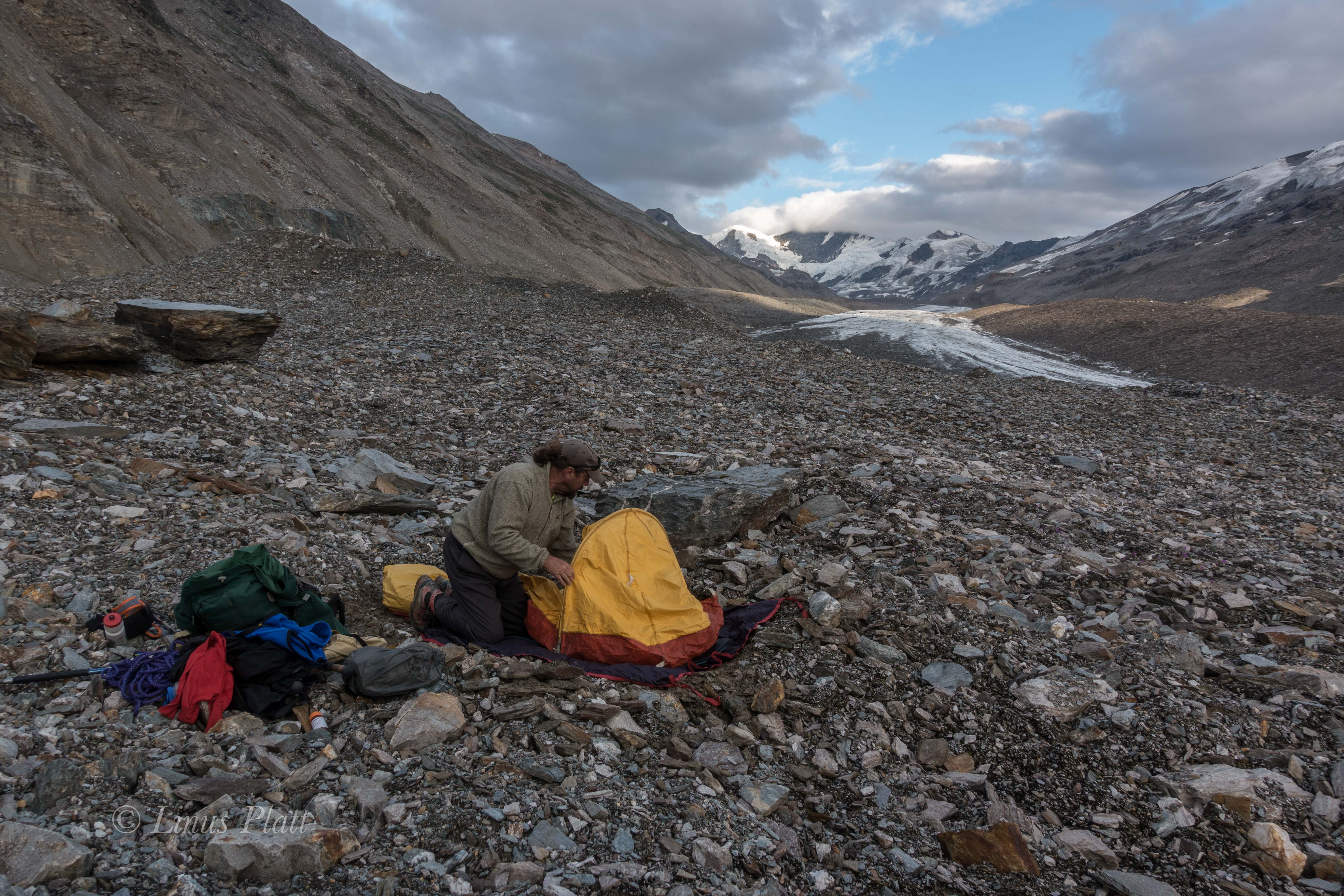
The drive back to Boulder and Eldo were totally forgettable, to the point I do not even remember driving. In fact, the whole next week was spent pretty much just hiking the canyon and being mesmerized by the towering sandstone walls. Climbing was not even considered at this point. A trip to Zion in another month to do a spectacular first ascent would change all of that… But that’s another story.

Edith Cavell

Edith Cavell

As a teenager, gripped in the throes of the beginnings of a long love affair with rock climbing and mountaineering, I, like many young neophytes of the time, was drawn to such books as Yvon Chouinard’s Climbing Ice, Mountaineering: The Freedom of the Hills, and Jeff Lowe’s The Ice Experience. These books taught me about the things I hadn’t yet done, and the places I hadn’t yet seen. The black and white photographs and haunting wordsmanship regarding miserable conditions, long approaches, and terrifying climbing escalated the already intense imagery in my eager and unspoiled mind. From the early forays to the Rocklin Quarry in California, at age 15, to my first real route ever at lovers leap, which I swung leads with my partner Seamus, and also taking my first ever lead fall, to the V-Notch Couloir in the Palisades just a year following, I had built up a thirst for wanting to expand the horizons of climbing locations to include farther away places and to up the ante in difficulty. Another book of the time that had fired my imagination and spawned a sensible and healthy desire for the great routes was Steve Roper’s 50 Classic Climbs of North America. Now, grant you, this book became, in a short time, to be regarded by some as a joke. Eventually it became not so lovingly known as “50 Crowded Climbs”.  It included some routes that were incredibly obscure, some that were not so good, and one route that hadn’t even seen a second ascent. Nonetheless, it had purpose and the result was profound on me. One of the routes in the book was the North Face of Mt Edith Cavell in the mighty Canadian Rockies. in 1988, after a couple of season’s climbing in the Rockies, I decided that it was time to do this thing. There were other routes in the Rockies that were more aesthetically pleasing, more remote, and possibly of better quality, but after all, it was in the 50 Classics book, right? It had the earmarks for a good outing I thought; The approach was short, the route moderate, and the descent reasonable. Why not? I also figured it would be a good warmup for Kitcheners’ Grand Central Couloir.

In the mid and late 80’s, often times, my climbing partner was the notorious Brian Knight, AKA “Mr Way”. Way had a talent for irritating people in a way few can do; his knack for debate and arguing was legendary. It is no wonder that years later he became a lawyer. He tended to piss a lot of folks off from time to time, but, in those days, he rarely got under my skin. That’s not to say it didn’t happen; one time, on a road trip to the East Side, I demanded that he pull over and I jumped out and hitchhiked far away from him. However, we managed to climb quite a lot together during those times and even managed to get up a few things. Way had an interest in Edith Cavell as well, and we both had been to the Rockies before and both cherished what it had to offer. So, in the fall of 1988, we set off, leaving from Tahoe and heading north in Way’s beater 1980 Subaru wagon.

We stopped in Bellingham to visit Way’s friend and spent the day water skiing in the Bellingham Sound, eating, sorting gear, and telling tales of past climbing forays. The next day, early in the morning, we took off, into Canada and across southern B.C., enroute to Alberta, and the Banff-Jasper Highway. As we approached the mountains from the B.C. side, a storm was starting to brew, and the climb to Vermillion Pass was obscured in clouds, as were the surrounding peaks. We descended the pass in near whiteout conditions, creeping the old Subaru down the snaking road, painfully slow. So slow, in fact that by the time we got down to the Icefields Parkway, there were a dozen trucks behind us, all furious, and seething to get around these absurd Americans who cannot drive in a snowstorm. The trucks passed, one by one; and after the last one disappeared into the storm ahead, we then saw the red and blue lights, an unfortunate and familiar sight for me in those days. As the cop approached we wondered what we had done to warrant this pullover. It seems, one of the impatient truck drivers had actually called the cops on us; the fuzz had stopped us for going too slow! This was a first, for sure. Next, the RMCP asks for our registration, driver’s license, and last but not least, proof of insurance. “Uh, how ’bout two outta three, man?” Way replies. No good. After running our records, the cop calls a tow truck and soon our little Subaru was loaded up and driven to the impound yard in Banff, until we could provide proof of insurance, which was going to be difficult, since we didn’t have any. The cop drove us to Banff, and allowed us to gather what we could carry from the car. So there we were, Way and I, standing there, in Banff, dressed in full mountaineering suits, complete with double boots on and full packs to boot. It started to snow again.

Back in those days, I rarely had more than two nickels to rub together and another rogue trip to the Canadian Rockies was no exception.

We heard there was a hostel there, so we trudged, through the woods and the freshly fallen snow, towards salvation. Except that we certainly could not afford to stay there. However, we did in fact stay there, we just did not pay. We snuck in and we snuck out. In fact, the whole trip had been pulled off with just a couple hundred bucks between us; in order to conserve money, we pulled off a series of “dine and dashes” across Oregon and Washington. Once, in Spokane, after an especially filling all you can eat breakfast buffet, Way and I decide that it is time to split. You go that way, I’ll go this way. After casually exiting the restaurant, and circling the block in opposite directions, we meet up again a block down. We begin strolling down towards the car in a care-free fashion, when suddenly we hear the shouts. “Come back here you punks!” We spin around to see the chef of the fine establishment we had duped, chasing after us, at a full run, complete with Chef’s hat and butcher knife in hand. We ran. Hard. Back in opposite directions and down a back alley to meet at car and a fast peel out towards the freeway. Onward… That was the last dine and dash of my career.

After we left the Hostel, we decided not to go back and set up camp in the woods near town, grabbed some clean duds, and headed for the bar. Maybe we could find a ride up to Edith Cavell, a three hour drive by car. As luck would have it, we meet Alex, a local climber, who not only agrees to give us a ride the next day, but lets us crash at his house to boot.

A late start the following morning puts the three of us on the road by 11:00, and soon we are flying past the Icefields, and soon after, cranking up the side road leading to Edith Cavell. Way and I hop out, grab packs, say goodbye and thanks, and start hoofing it towards the base of the Route. The North Face of Edith Cavell consists of 4000 feet of Ice and Limestone, with the bottom portion of the route a glacier and it’s tongue, flowing downward at an angle of about 55 degrees, and higher up, still below the main face, 2 or 3 sections of icefall and crevasses that must be negotiated in order to gain the “real” climbing. We hike in, with the wall above us staring us down, and find a bivy directly below the first ice pitch. We awake, at 4 am and realize that we are actually getting a late start, but decide to go for it anyway. A 2 am start would have been desirable in order to climb the 4000 foot route in a day, without a bivy. The Initial ice pitches flew by with ease, and soon we were hauling ass up the low angle glacier above. Crossing the ‘shrunk, we spy a ramp leading left to a narrow ice gully, which ended, it appeared, at a blank looking limestone wall, maybe 500 feet up. Again, the pitches flew past and soon we were climbing good quality 5.8 limestone in crampons, Canadian Rockies style. After a couple of rock pitches, another ice pitch leads to a big horizontal icefield that splits the face. At the ice field, it starts to snow. Heavily. Within minutes, we are engulfed in whiteout conditions. Before the storm hit, we though that a quick traverse to the left was in order, in hopes to gain a chimney/corner system that we thought was the key to gaining the upper face. However, here, now, in this storm, everything began to look as though we had never laid eyes above before. A horizontal pitch of snow and ice to the left, and all we could see were massive overhangs above us. These looked nearly unclimbable, and at the least, would require the use of aid. Mind you, the route is rated IV 5.8 AI3, which meant we were clearly off route. We could not see more than a few feet in the storm, and after a full hearted attempt at finding a way through the ceilings above, I lowered off and traversed to the right again; this time over an arete, my hands gone totally numb, crampons scraping the limestone in desperation. I gain a small ledge and bring up Way. After he scrapes up this last pitch, we sit there, bewildered, not knowing where to climb. Above us, more big overhangs; more desperate looking than the last ones. We knew we were sunk. It was 2 pm and we figured we had just enough gear to rappel what we had climbed. If we were lucky.

So down we went. Rappels, one after the other, snowing hard now, wind coming in on the face; rime ice is beginning to plaster every feature, including us. Soon, it is quite obvious that we will not have enough gear to rappel from as we have brought a meager rack: 2 camming units, 4 stoppers, 1 Lost Arrow, 1 Baby Angle, 1 KB, and 3 Ice Screws. We figure there is just enough gear for us to rap the route utilizing single anchors, which meant that the first person to go down got 2 anchors, and the second  guy pulls the backup. Dicey. In fact, the anchors were not great to begin with. The possibility of dying on this face were very real. The rock was extraordinarily compact, and finding suitable cracks was difficult. After about 10 raps, some long some short, some off of slings on natural features, we finally reached the Glacier having left all of our rock gear on the face; it couldn’t have been more perfect, really.  We still had to descend the Glacier and then rap/down climb the tongue. Fatigue, dehydration and cold were taking their toll, and soon it was dark. We did not know how far down it was to the base, and with only 1 ice screw left, and downclimbing in the dark out of the question, we find a ledge the size of a love seat, and decide to bivy. The temperature seemed to be dropping even further, and the snow, coming down harder. We donned all of our clothing, put our feet in our packs, and weaved the rope over us like spaghetti. After a couple of miserable hours, we realize that it is far too cold to merely sit, so we get up and jam the ice screw into a crumbling rock crack, tie in, and proceed to run in place off and on for the remainder of the night. With all of this going on on such a small ledge, it is no wonder that somehow, we managed to kick off my ice hammer, and my helmet. It was along night indeed. At one point, agonized by the misery of this bivouac, Way even threatened to pitch himself off the face to end the suffering. I encouraged him so that I might have peace and quiet; alas he feared death more than he feared the cold and heinous night, so pitch himself he did not. Just before dawn, we belayed off the shitty ice screw rock anchor, and I down climbed a half pitch of chose to find 45 degree blue ice of which made for quick front pointing down. After a short while, we could see the bottom of the tongue, and the ice steepened significantly. We thread the rope through some ice tunnels made with the ice screw and made a couple rappels to the bottom, where we pulled the rope hastily and bee lined it for the world. Luckily, the hike out was without incident and we even managed a quick hitchhike back to Banff, all in pretty poor weather. It was early November now, and this signified the end of the fall season; soon, these kinds of routes would be “out of condition” so to speak. It was time to leave Canada.

Way managed to secure some wired funds for a quick getaway which included a temporary insurance policy and some gas money; just enough to get us to Salt Lake City, where we though perhaps it would be a decent place to spend the winter; skiing, climbing, and making money for the next adventure. About an hour north of Ogden, the mighty Subaru blew it’s lid, and there we were again, on the side of the road, with a mound of gear and a dead car. A tow truck came to retrieve us, and took us to a service station, but we had to give the tow operator the car as payment! What’s the point I ask?

In the end, I wound up hopping a bus to California, got my old job back at the ski shop in Sacramento, and Way, having hitch hiked to SLC, spent the winter in the Wasatch.

Eldorado Peak

The day has finally come; obligations, chores, work and goodbyes taken care of, I head out of town and on to Martinez to fetch my friend Dennis. Hook up onto Highway 101 and wind up the coast to Crescent City and up a beauty of a road to Grant’s Pass. Up I-5 through Seattle and on to Bellingham to re group at Pat’s house. A couple of beers and an Avocado Tostada, put Dennis and I back on the road that night to the Eldorado Peak trailhead.

A crack of 8 start, an obligatory log crossing to get started, puts us on the undeveloped climber’s trail leading directly upward and into the bowels of the North Cascades. The route we have chosen, the East Ridge of Eldorado Peak, rises 6800 feet from the road. We are heading to the ridge separating the 2 lower basins beneath the Eldorado Glacier. This ridge is situated at about 6,000′, which makes our approach 4000′ in about a mile. That’s damn steep.

The approach was steep indeed; an undeveloped climber’s trail without switch backs, heading nearly straight up for 2000′, ending at the dreaded “Boulder Field”. Luckily for us, it was mostly melted out at the start, but higher, a post holing episode of monstrous proportions ensued. We post hole in deep snow for hours.

That evening at our bivy, the sky is clear as a bell, and the magnificent alpenglow become the stuff of fantasy. A 360 degree view of all the high peaks of the North Cascades are a dizzying notion to my mind. I want to climb them all. To me, there is nothing finer than being  in big, alpine, glaciated peaks.

A 5:00 am start see’s us descending slightly to the level of the Eldorado Glacier, then up said mass to it’s junction with the Inspiration Glacier, to form the largest continuous ice sheet not on a volcano in the lower 48. These peaks are fault block, glaciated, and made of Granite. This combo makes for my favorite kind of mountains.

Eventually, we climb up the last bit of it’s knife edged ridge, and on to Eldorado’s Icy summit; at just under 8,900′, we are just about as high as Carson Pass in California, but here, in the Cascades, this elevation and latitude and close proximity to the ocean, create an alpine environment that is unparalleled. The glaciers here are sizable indeed.

We descend the 6800 feet in a few short hours, that, over the last bit, had taken us 13 hours to ascend. Back at the truck by 5:00 pm, we head off to Pat’s for the evening. In the spirit of keeping the adventure alive, we experience a tire blowout on the drive out. A quick roadside fix and we are at Pat’s in Bellingham by 6:30.

Tomorrow I head out to San Juan Island to visit with my old friend Ben; then off to catch the ferry to Skagway and start pedaling to the Arctic…  Onward.

IMG_8487
Mt Johannesburg

IMG_8526
Eldorado Peak

Tomorrow I head out to San Juan Island to visit with my old friend Ben; then off to catch the ferry to Skagway and start pedaling to the Arctic…  Onward.IMG_8412 IMG_8414 IMG_8418 IMG_8421 copy IMG_8422 IMG_8424 IMG_8427 IMG_8433 IMG_8442 IMG_8456 IMG_8463 IMG_8471 IMG_8476 IMG_8488 IMG_8489 IMG_8501 IMG_8521 IMG_8522 IMG_8532 IMG_8537 IMG_8565 IMG_8570 IMG_8578 IMG_8582 IMG_8584

IMG_8586

Tales of Babel

Back in 1990, when I was a new to Moab, I wrote this story about a rock climbing experience that I had in Arches Nat’l Park. Sadly, the names of the people in the story, my friends’ Kyle Copeland, Mark Bebie, and Charlie Fowler, have all passed on.  My friend Sue Kemp helped me edit this many years back, and get it ready for publication in the now defunct magazine “Mountain”.  I decided at a later point, to not submit the story, and it has been shelved ever since. This is it’s first public appearance ever. Sue also gave up the ghost  a few years back.

RIP my friends…

TALES OF BABEL

It is a land free of disease.. It’s taste is of sweetness, not bitter.  It’s ancient varnish gleams like rust, redeeming it’s own relic nature.  Nowhere is there a place like it.  Tower’s and mesa’s touch the heavens’, reaching, searching, wandering..  solidified cathedrals of ancient sands, now standing and waiting to fall, split only by flawless vertical fractures, perfect and parallel, toward the Great Sky.

Sunday morning, a crack of noon start, a religious pilgrimage to the Main Street Broiler in Moab, to fill my lethargic body with life giving caffeine, slaps me into noticing what a fine day it is for desert climbing.

I leave the Broiler, strolling through town enroute to Kyle’s house in hopes of a day of craggin’.  No avail; I approach his doorstep, but suddenly remember all too well he is out of town for a couple of weeks.  But there is a note stuck to the door from yet another friend:

“Splibb, I got to town the other day, but couldn’t find you to do Zenyatta, so I’m on it solo.. Should be off it in a couple days, maybe Sunday afternoon.” – Mark

I guess Mark knew well enough how to get a message to me, but I wish he’d found me in time. In this red desert, the cracks are sometimes surgically perfect, or the quality of the rock often resembling sugar or mud, forming towers that make you wonder why they still stand as you look at them.  The Tower of Babel in Arches Nat’l Parking Lot, is one such tower.  Though not truly a tower at all, really, it sports 6 pitch walls, 1500 feet across, that come to narrow, square cut buttresses at either end.  Although it doesn’t appear to be falling down, when climbing upon it’s super soft Entrada Sandstone, one may envision it melting away with the coming of a heavy rain.  It’s most classic route, Zenyatta Entrada, put up by Charlie Fowler in 1986, is a line of all lines that bisects the fin-like southwest buttress.  It’s name mimicking a longer, once desperate nailup on a bigger stone further west.

“Shit!” it thought, it’s Sunday afternoon already, I’m too late.  “Might at least catch the final act of the show.”  With binoculars and gear, I race to Arches in hopes of catching him before he splits.  As I pull off the road, I see him even before I exit the van; he is plastered to the final A4 pitch like a slow, mutant lizard in the hot desert sun.  I watch through binoculars, gripped for him as he finishes and cleans the pitch.  Once done, I scream to him to meet me at the Rio for suds and celebration.

Later, at the pub, I tell him that I really want to bag Zenyatta, but now, minus a partner, it would have to be given the same treatment he’d given it:  solo.  Mark ponders the last couple of days a bit and remarks, “Zenyatta hasn’t seen many ascents, so it’s not totally beaten out.  It’s still plenty scary, with soft nailing and some super dicey nutting; just funky enough to be exciting!”

Leaving the pub in a rather poisoned stupor, I went home to fall into a deep, hazy sleep, with Zenyatta filling my mind as I hit the pillow.  I awake, not hungover, but psyched for what lay ahead.

Moab is a place where the world can, at times, seem to pass by unnoticed, a continuing saga of the desert and it’s ancient past.  The people that live there are as much a part of the gleaming red rocks and the shrub covered landscape.  They survive the unbearably hot summers and the cold, unemployed winters because they belong there. This is where their souls exist.

A lengthy trip through town to acquire the necessities dulled my senses.  With mark’s gear beta in hand, I set off to collect what I lacked in the iron department, plus stops at Rim Cyclery to pick up a new lead rope, Pemican Bars from the Co-Op, and a brief visit to Matrimony Springs to fill my bottles, put me at the base by noon.

The first three pitches flew by rather quickly and with surprising ease; an intricate mixture of nailing and nutting in a perfect knifeblade sized crack system that shot directly toward they summit, interrupted only by two short traverses that were cruxes.

This route lies “Where a drop of water will fall from the summit”.  Who said that any way?  The top of the third pitch, it’s getting late, so I decide to fix and rap.  I scan the Canyonlands skyline, burning hot and red, a land time and humankind has left alone.  It’s hostile beauty surrounded by three great mountain ranges, The Abajos, The La Sals, and The Henry mountains, as if left there to protect it’s hidden wealth of fortune and splendor.

I drive back to Moab in my archaic van in search of shower, suds, and Mark.  Two out of three were all I found, as Mark has left for Seattle to prepare for an expedition to climb a new route in the Karakoram.  “Lucky bastard”, I think, yet I know of the magnificence that lie right here.

Jumaring up fixed lines in the morning, I’m happy I’ll be on top by dusk, if all goes well; satisfied in knowing that yet another dessert tower is in The Bag.  The next pitch, one of the route’s cruxes, is like an interminable disease.  My mind is fighting me in this stretching traverse of tied off knifeblades and strangely stacked leeper’s.  Sixty feet of horror puts me to a few bad RP placements, and and one crumbling hook, earns me a perfect  #1-1/2 Friend crack, that, were it right off the ground, would be one primo 5.11+ free climb.  Soloing with clove hitches sees me aiding past with ease.  I polish off the last 20 feet and clip the belay.  Relief washes over me.  It’s over, only 3 1/2 hours after starting.

I rap, clean, and jumar, trying to get psyched for the next pitch – an A3 nailing corner capped by a large roof leading to yet another crux traverse.  Sliding up the corner, glibly dabbling in sideways lost arrows, the roof above somehow plants the seed of fear in my soul.  Ten feet below the roof,the only thing I can get in is a shitty #1 RP with it’s wires badly frayed from repeated sloppy removals.  I test it and the wires snap, leaving the “opportunity” for a more creative placement:  a leper hook in the back of blown out pin scar.  A Bird Beak and some other nebulous bullshit finds my aiders clipped to a drilled pin, half sticking out, beneath the five foot roof.  Once out the roof, the only placement in sight is  a perfectly bottomed out, 1″ deep hole.  I fire in a 2″ bong, tie it off, and start bouncing it.  Seeming do-able, I get on it, realizing all too well the rope now lies it’s course over the outside edge of the dihedral.  Sweating bullets and filled with terror, I understood it’s implications; I have no choice.  Reaching eye level with the bong, I am catapult into the atmosphere like a reject astronaut, rocketing straight towards hell and the scorching desert floor.

Enough slack in the system allows me to drop 25 feet before the rope begins to come tight.  As it does, I hear the sound of death, the sound of rope being sawed, the sounds of threads and fibers being ripped apart.  Flying around the back side of the moon and back, I look up to see if I’d been spared or not.  A 6″ section of utterly mangled rope was all that kept me from becoming a part of the talus below.

Adrenaline shoots painfully through my body as I tie the rappel line to every placement in the corner I can find.  Only then do I gingerly begin to jumar the wretched rope and onto the marginal safety beyond the cut.

Once there, a quick examination reveals less than 1/3 of my new ropes core still intact!!  I’d had enough.  At the drilled pin that held my fall, I drill another next to it and decide to rap.  So much for that.

Driving back to Moab, I begin to fully respect the seriousness of the testpieces found elsewhere on the Tower of Babel; the Jim Beyer nightmares put up just a couple of years back, in the late 80’s.

For the next two weeks, I didn’t climb at all.  Only when another friend from Seattle, Lee Cunninham, shows up and talks me into doing Standing Rock in Monument Basin, did my interest spark again.  Driving to Grandview Point, in Canyonlands, my thoughts were excited, but my memory still fresh with Zenyatta.  After downclimbing 1000 feet of 4th class chose, we crossed the White Rim and made a short rappel into Monument Basin.

Standing Rock is one of those towers that seems as though it could topple if the wind blew hard enough: a 400 foot totem of Cutler Sandstone that is, at best, 35 feet thick; a toothpick.

We fix the first pitch and bivy at the base under the spring desert sky.  On the summit by ten o’clock the next morning, we are delighted to find that ours is only the 16th ascent in 20 years.

Filled with an enlightened feeling of beauty and obscurity from climbing in this spiritual place, we hiked backed to the car in 95 degree heat, lusting for the warm beer stashed in the trunk.  We knew why we climbed here and why so many did not.  There is no fooling anybody in Canyonlands, where the climbing and the environment seem more real to me than any other place on earth.

Every time I drive past the Tower of Babel, I see it smiling at me, giving me the finger as I hurry past, yet I know I’ll return to this place time and time again, for when life’s bizarre scenarios seem like a wasted hell, the red rocks whisper to me, telling me that it really doesn’t matter.

The Tower of Babel