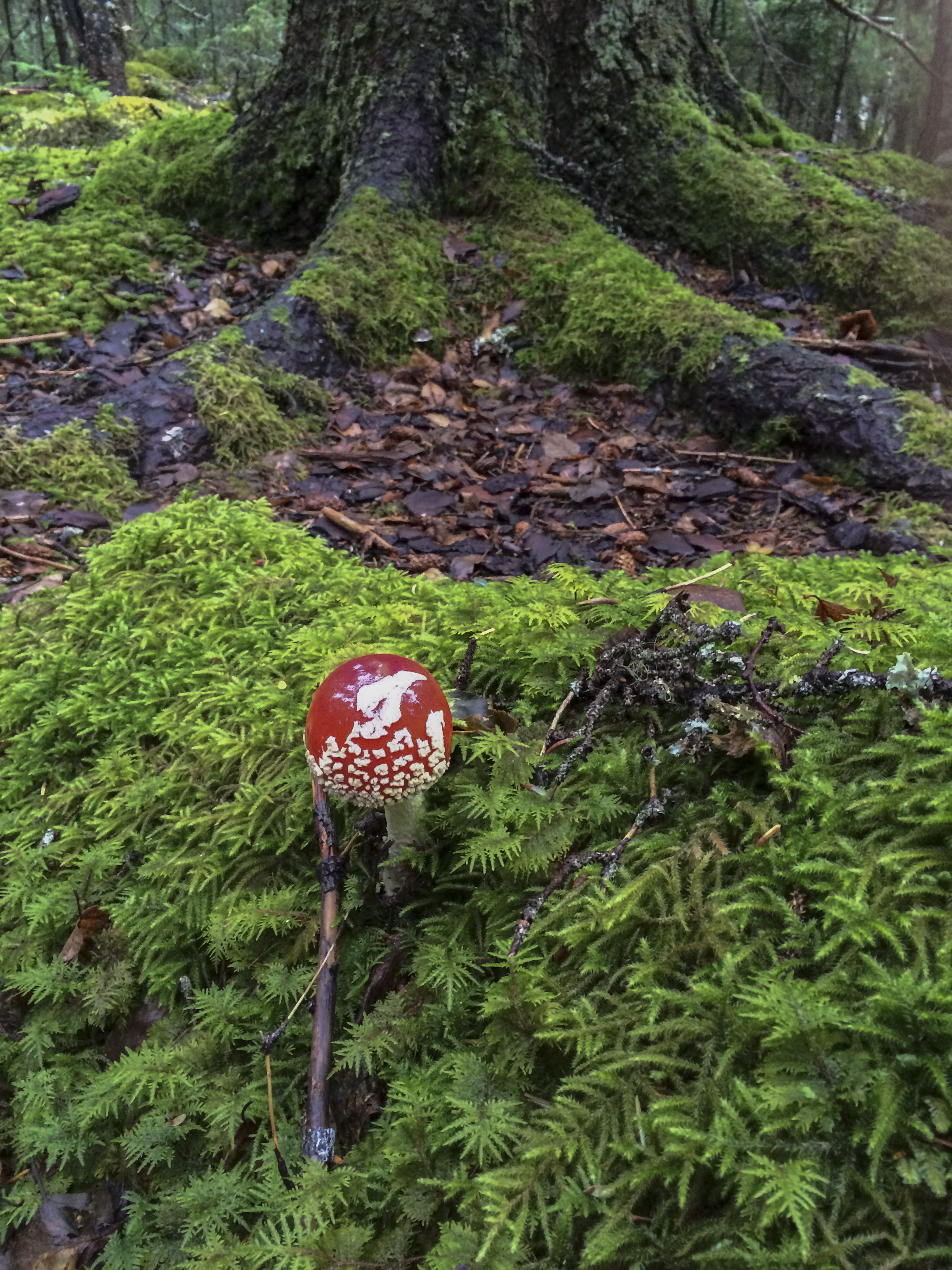
I am the Salmon… Forever swimming upstream towards the source. Swimming great and swift currents to achieve the impossible; battling great and unforeseen obstacles that bar the way to my own destiny.
I am the Bear, on top, and managing a foothold in said place, but struggling none the less. I am a protector of my family and my territory, forever destined to do so.
I am the Fox, cunning and sly to achieve what is mine for the taking. I only wish for harmony.
I am the Wolf, taken into a sense of community that entrusts a commitment of not only survival, but one of love and companionship.
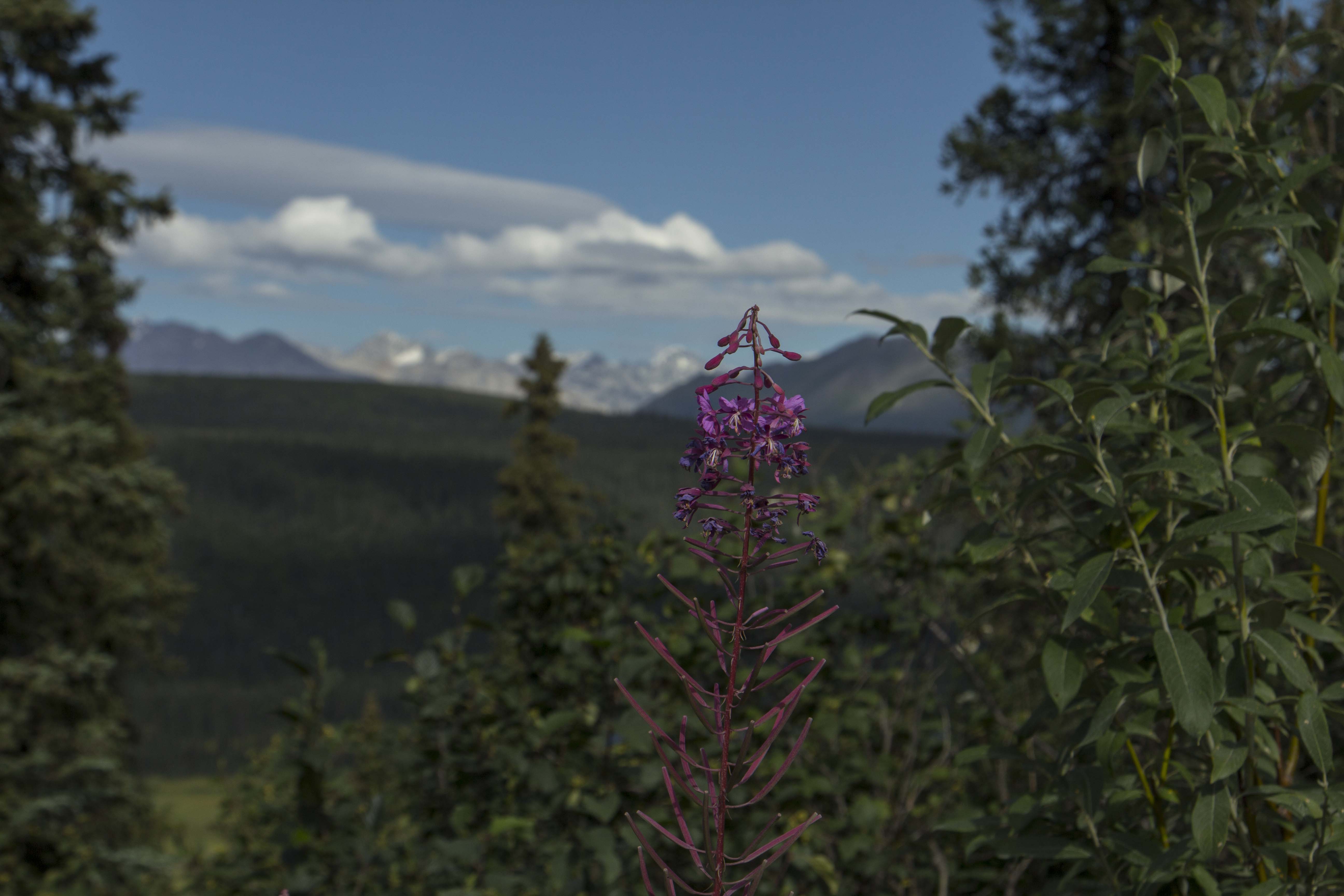
I am the Willow, blowing in the glacial winds that give to me a sense of animation; my roots digging deep within the soil to accomplish what so many of us desire.
I am the writer, constantly in a state of desire to express myself, for better or worse. Words are what live inside of me and I must share them, regardless.
But most of all, I ama Man, one who wishes only for love, compassion, and connection… for those around me and for the wilderness that encompasses my landscape. I am full of desire and hope, my shortcomings entangled in self doubt, but knowing that I have passion and offerings that all of us have. I wish for sincerity amongst us all, so that we all may flourish. For what is a Man that does not possess these?
As it has always been and always will be, my mind is in a constant state of desire for wilderness and exploration, both externally and from within. These forays and trips into wild places has always been what has driven me.
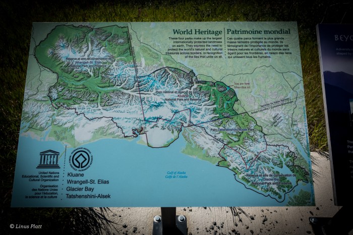
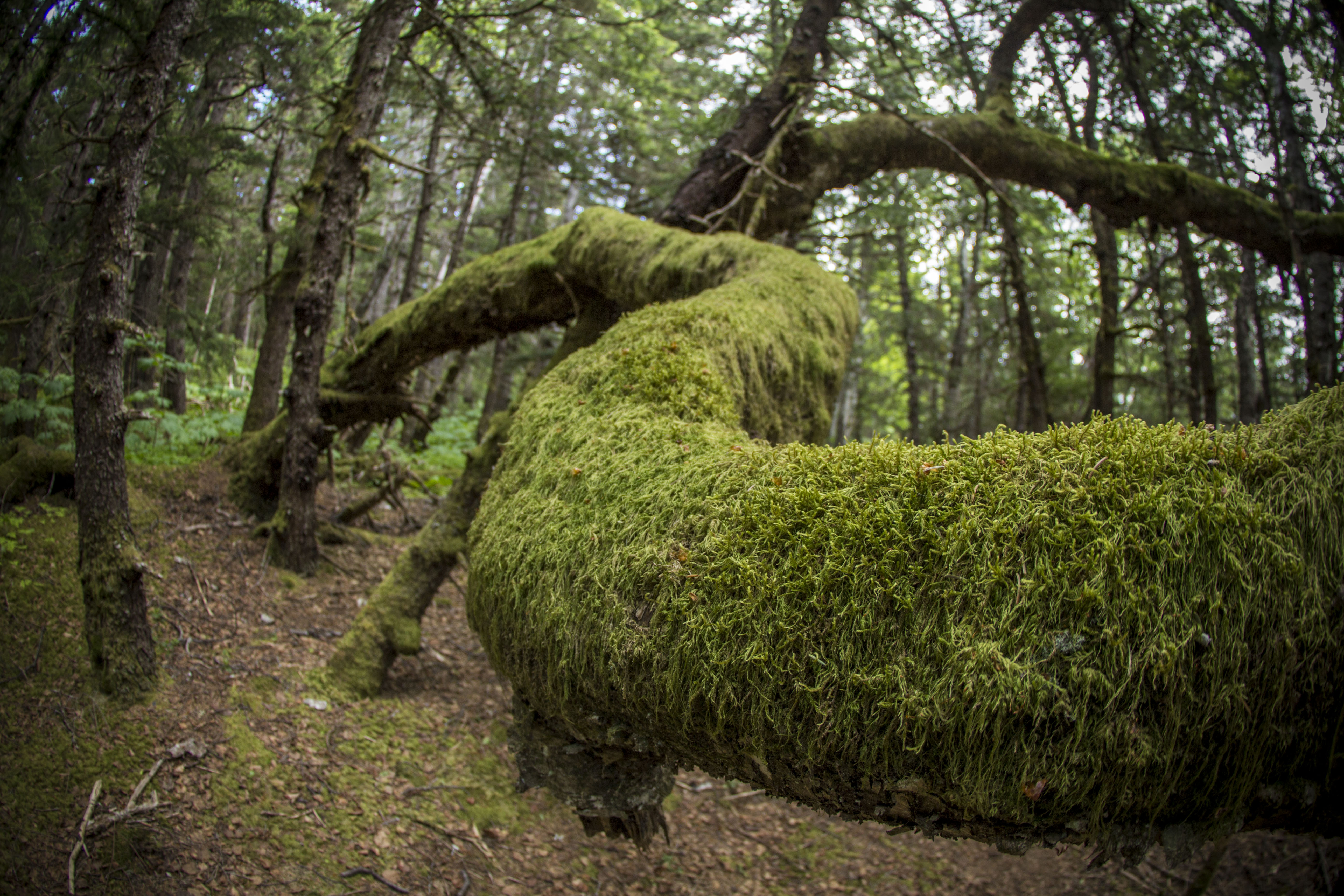
Included here are photographs from past adventures, not to behold them for their keepsake, but to remind me, and us all, that the flame still burns and cannot be extinguished. So many ideas, so many thoughts… the Brooks Range, the Alaska Range, the deep interiors of the Yukon and the Northwest Territories, the home front of the mighty Chilkat and the ephemeral outer “lost” coast of Alaska’s vast and wild Pacific. I persevere to such notions and they dominate my thoughts and desires…
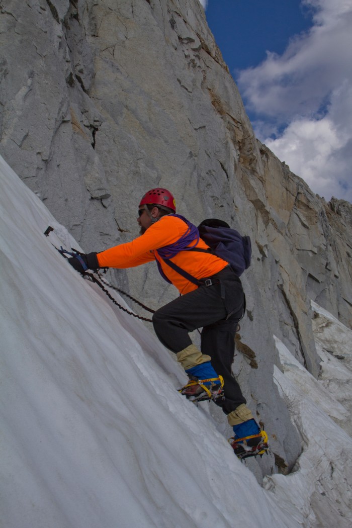
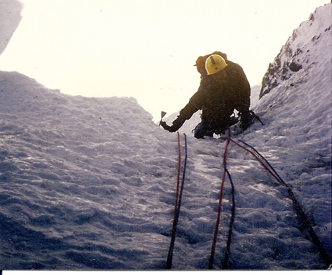
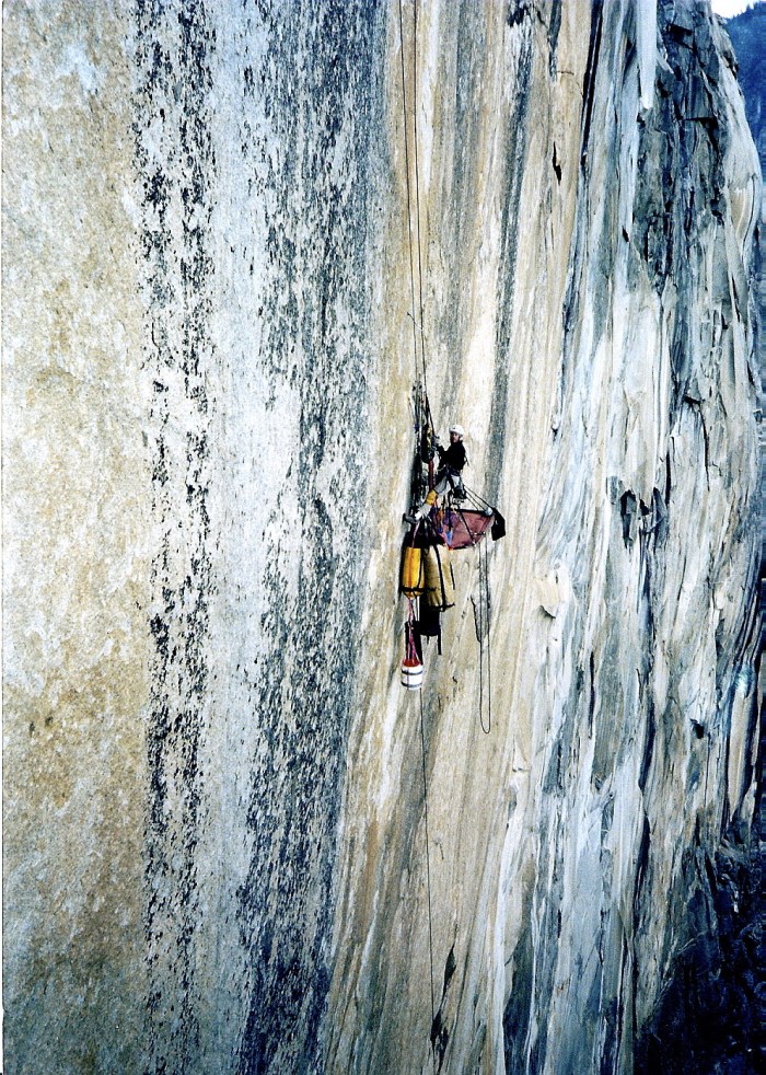
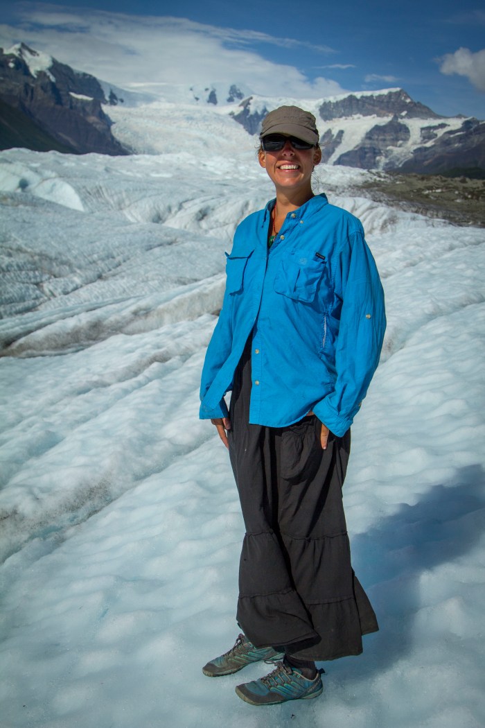
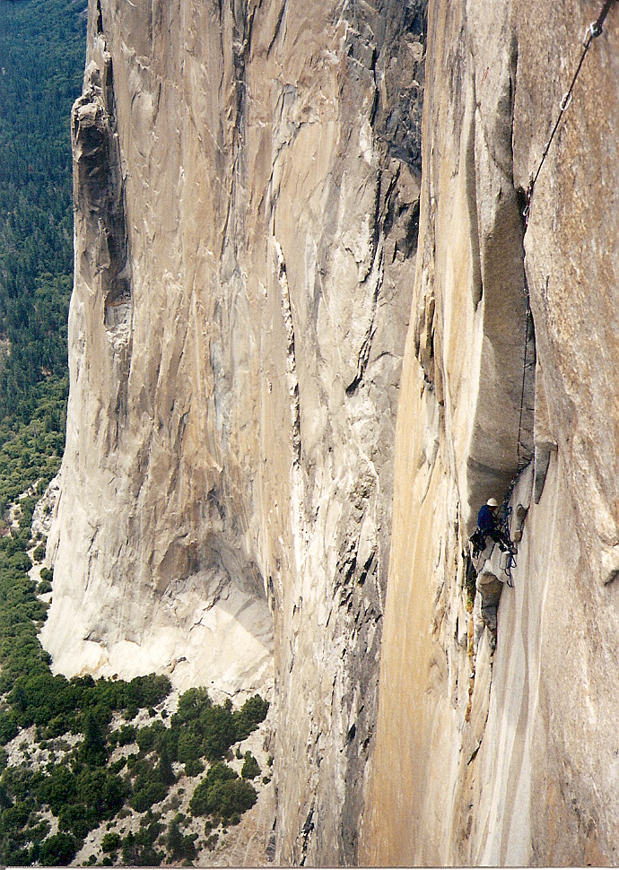
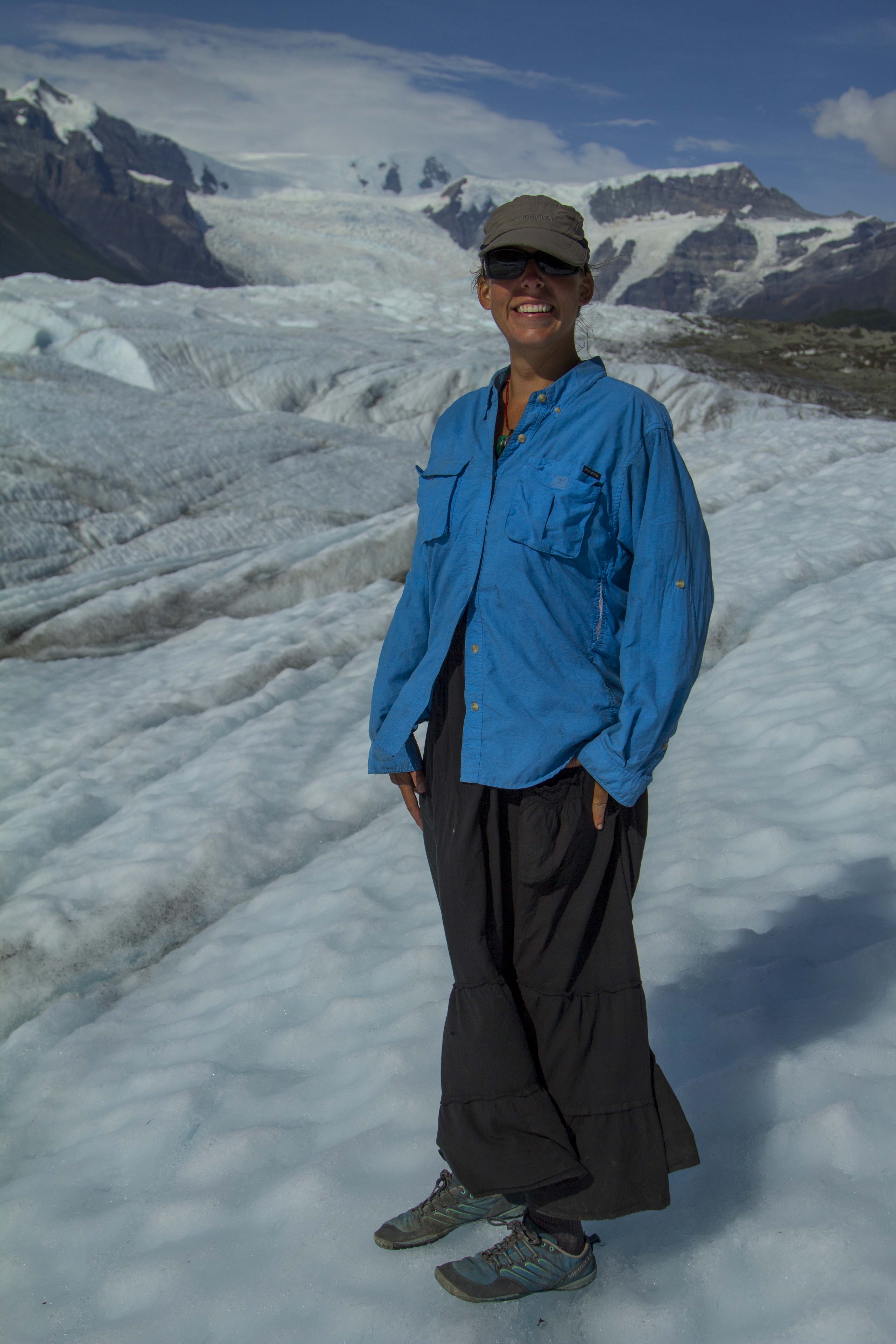
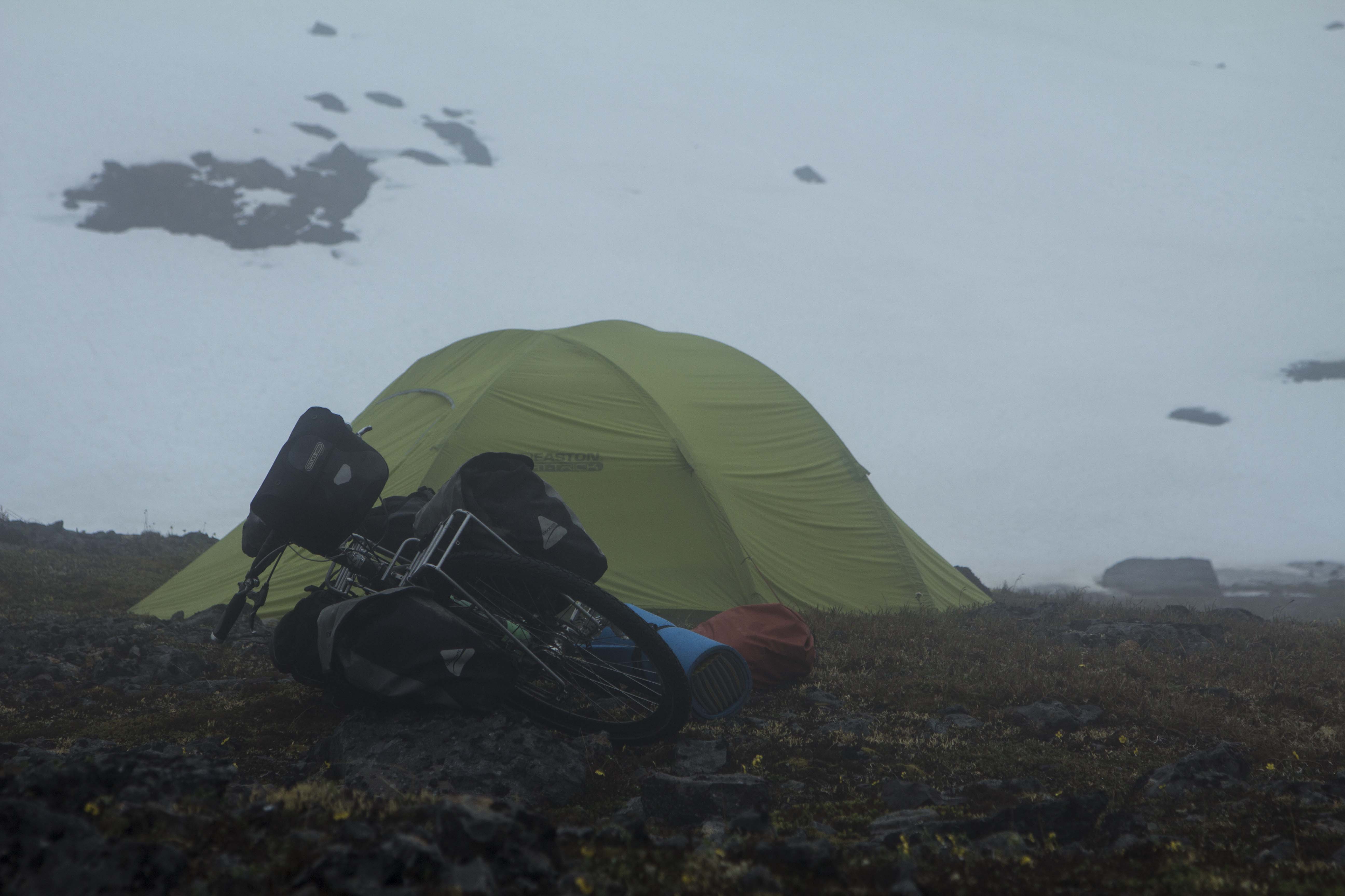
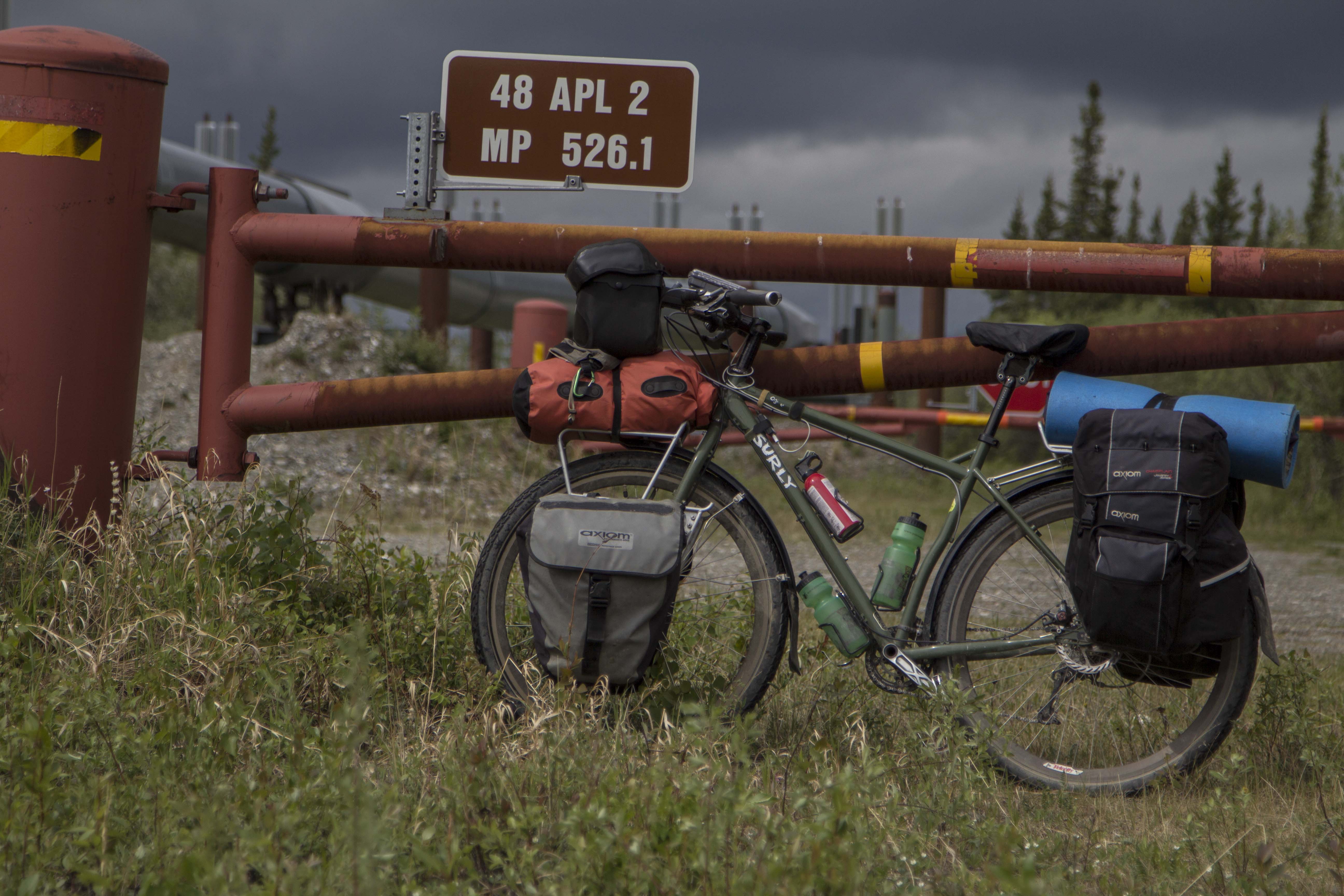
The end of the Haul Road Alaska 2013Dennis Belillo on the North Coulior of North Peak, Yosemite 2012Freeride Explorations near Moab 2008The Promised Land, Half Dome Yosemite 1998Ropeless in Moab 1992South Seas, El Capitan 1997Vedauwooo Wyoimg 2000North Face of Mt Athabasca, Alberta 1986Iron Hawk with Ralph Ferrara, El Capitan 1999Angela Carter on the Root Glacier, McCarthy Alaska 2013Angela Carter Riding Out a WheelieDempster Highway Yukon 2013Angela going big in Keystone Colorado 2008Wet Denim Daydream with Allan King 1999Indian Creek Utah 1995Iron Hawk, El Cap 1999
Lyzz Byrnes taping up for another Vedawouoo grind fest, 1999
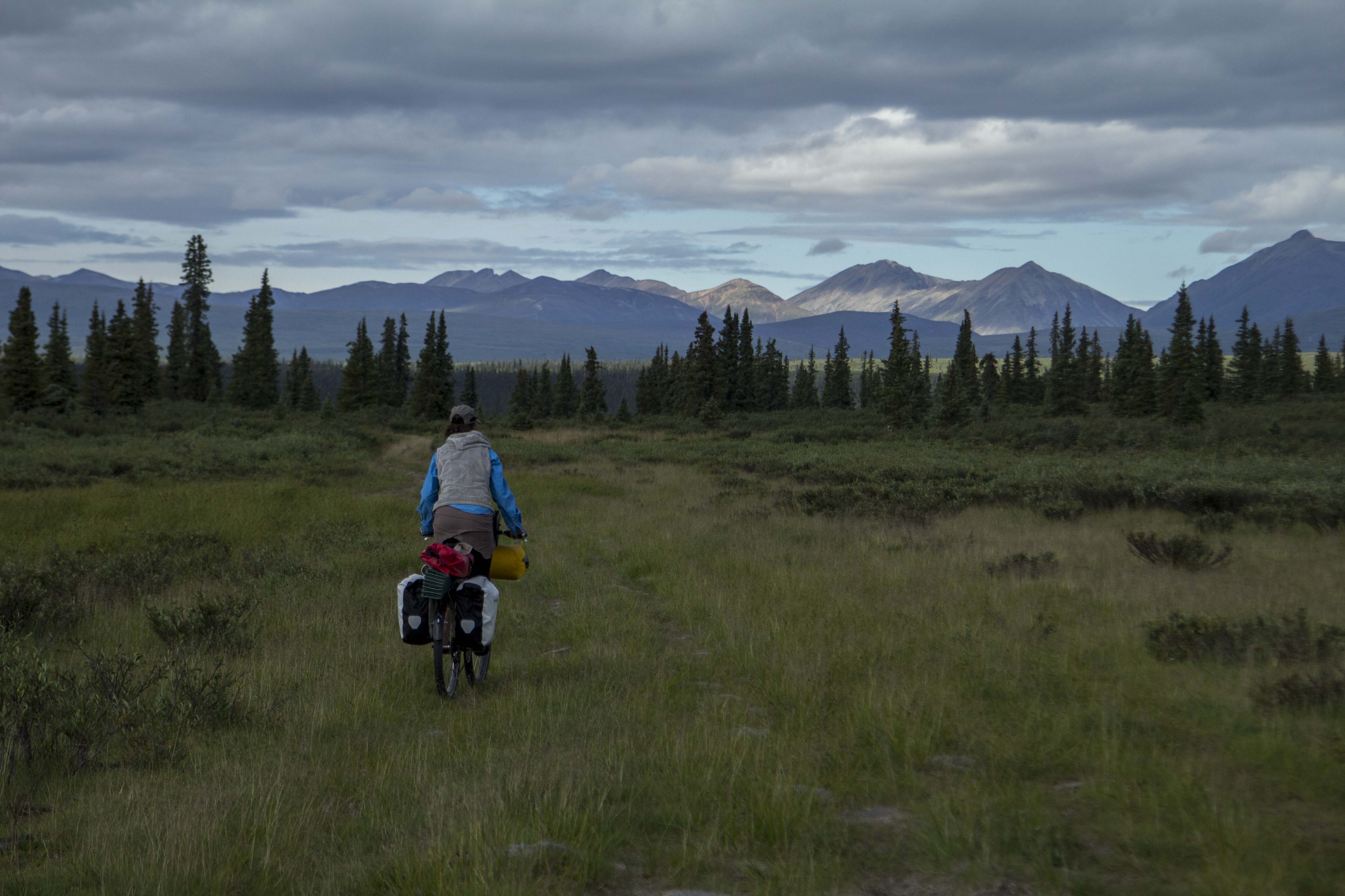
After getting mentally and physically prepped for the last couple of weeks, I awake one Monday morning and decide that leaving several days early on a ride of the North’s “Golden Triangle” is in order. My boss and co-workers seem to have no issue with the notion, and off I go to take care of last minute details at home.
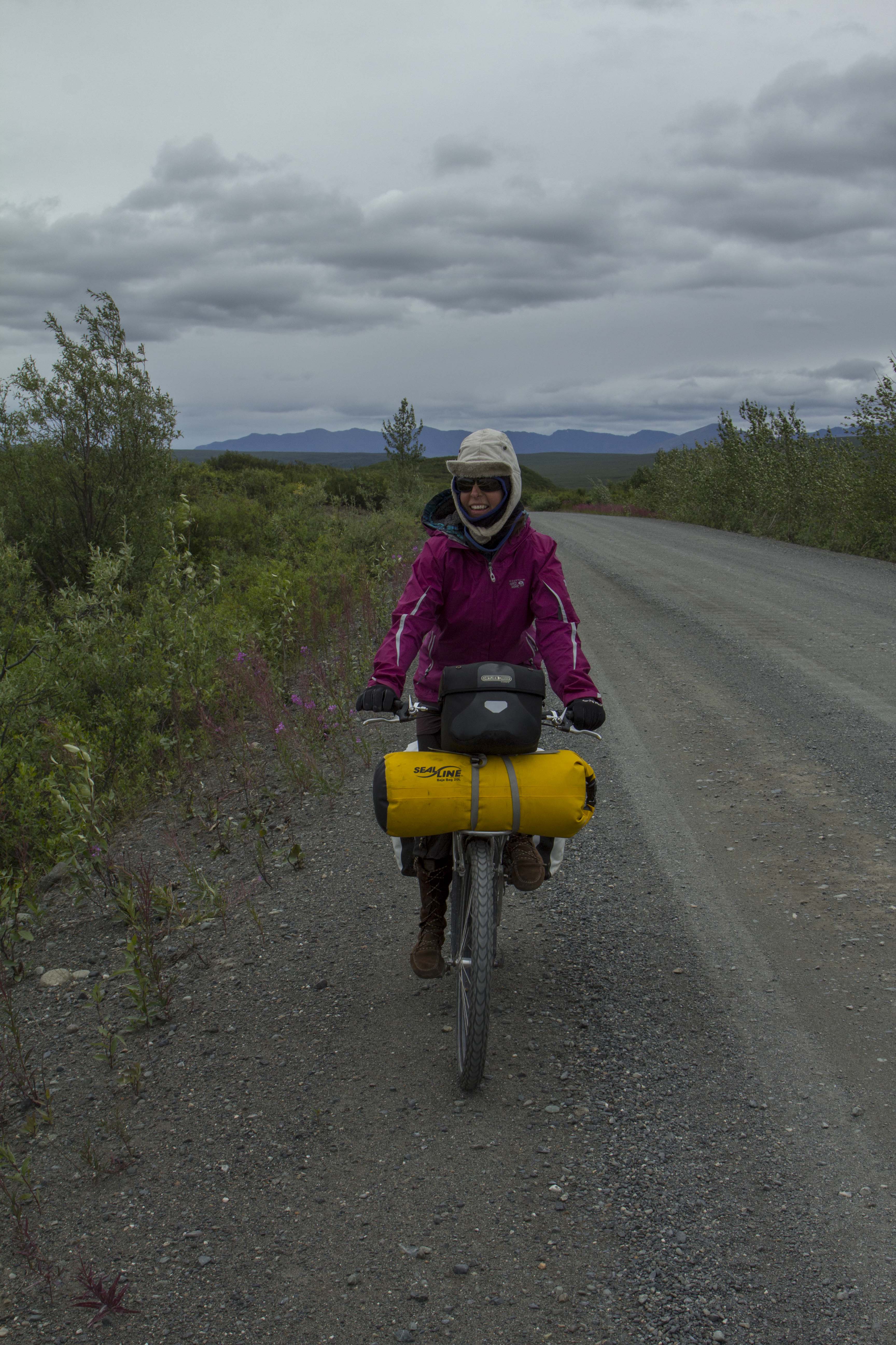
Some folk’s call the ride in question the ”Alaska Golden Triangle”, which is a misconception since most of the ride occurs in Canada’s Yukon Territory. The route however, starts in Alaska, crosses British Columbia, traverses about 180 miles of the Yukon’s mighty interior, crosses back into B.C., and finally ending in Alaska at Skaguay. The first few miles and the entirety of my first day pedaling consist of the Chilkat and Klehini River corridors through the beautiful Chilkat Valley, ending at the Canadian/ U.S. border and the beginning of the climb up to Haines Summit, more locally known as Chilkat Pass. This Pass separates the interior of Northern B.C. and the Yukon from the coastal and heavily glaciated Chilkat Mountains and Alaska’s ice capped Coast Range, of which temperate and maritime systems exist at their feet. It is in this coastal region that Haines, and my home exist.
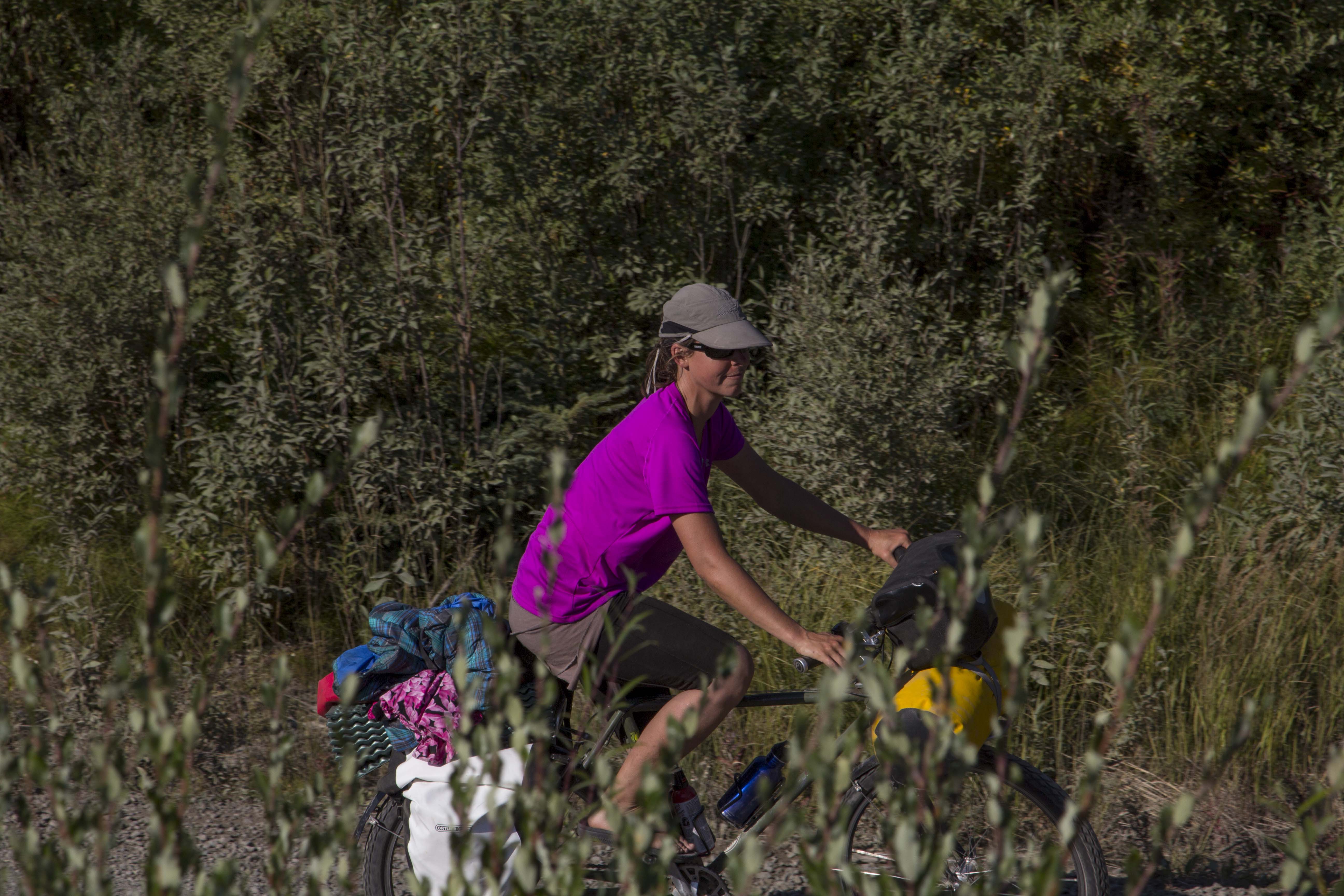
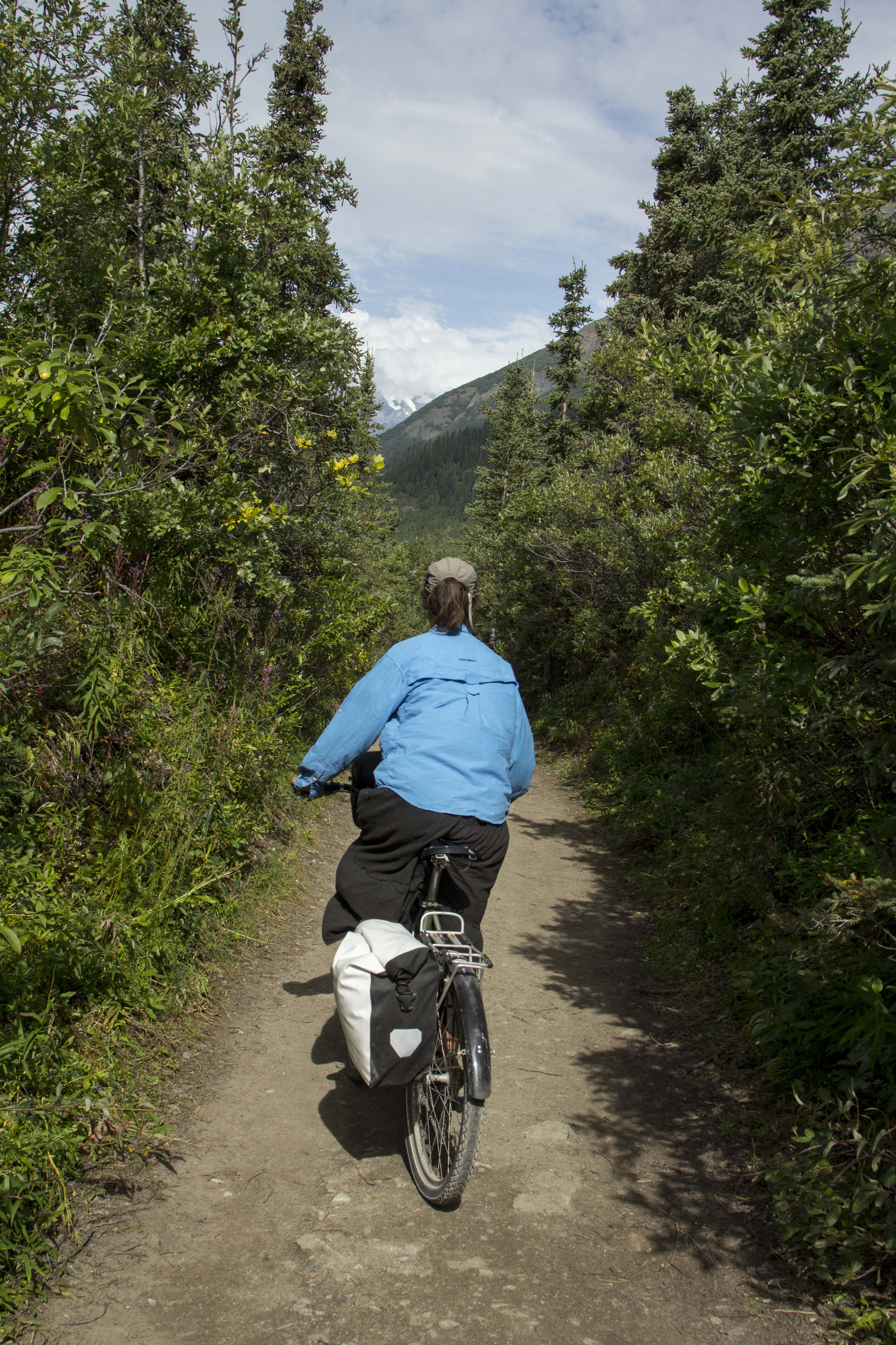
Going to bed a bit late and waking casually, I dress in my normal bicycle traveler garb consisting of loose fitting nylon pants, t-shirt, Loose fitting long-sleeve shirt, and lace up cross training footwear. Onto the Ogre, I spin into town to meet with Angela and grab some coffee and breakfast before commencing to the endless highway.
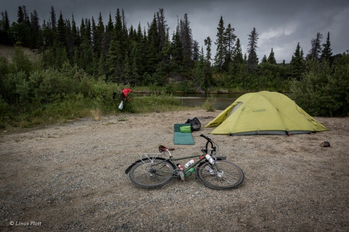
After a casual time at Sarah J’s eatery in Haines, I say goodbye to Angela and begin the flat and pleasant cruise up the highway in hopes of finding a good camp near the border. Hours later, a faint path appears on the river side of the road leading through the Alder thickets and ends abruptly on the Cotton Grass flats above the Klehini River. A great camp with views of the Saksaia Glacier and fine and tasty drinking water direct from the river has me smiling on this first evening of the trip.
Many bicycle travelers it seem have a burning desire, especially in the northern tier, to seek out camping in “official” and pay campgrounds where other people gather. To my thinking, this never really made any sense, not here in the northern wilderness, where some of the best and most plentiful free range camping are to be had for the taking. Why pay to sleep when one can create their own world wherever one wishes? Many claim it is their fear of Bears. After spending more nights out in the Alaskan and Yukon bush than I can count, I believe that the Bears have far more to fear from Humans than the contrary. Of course extreme occurrences can happen, but being smart about the way one camps greatly diminishes these chances. In fact, I believe that having Bear problems are increased in public camping areas where Bears may be conditioned to Humans and their glorious trash. As far as the social thing is concerned, well, to each there own. Camping alone in these wild places allows me breathing room and a purposeful reflection towards the natural world and creates in me a great and humbling respect for it. This is where I can watch the river flow and the Falcon soar; hear the wind blow and smell the sweetness of the North in the air unencumbered by a Human world that tends to feel dominance toward all I see before me. That said, loneliness could from time to time drop in for an unexpected visit. But not tonight.
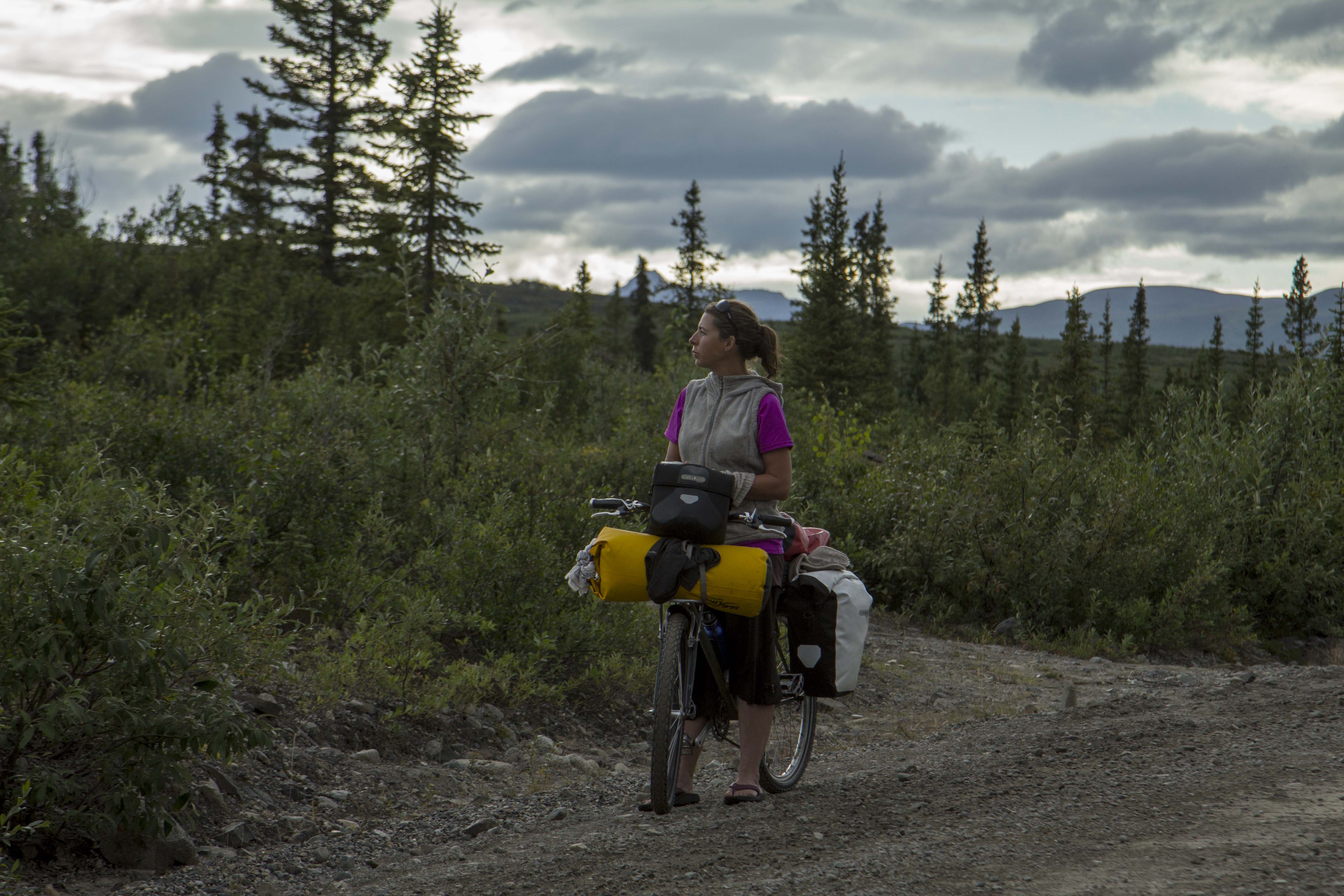
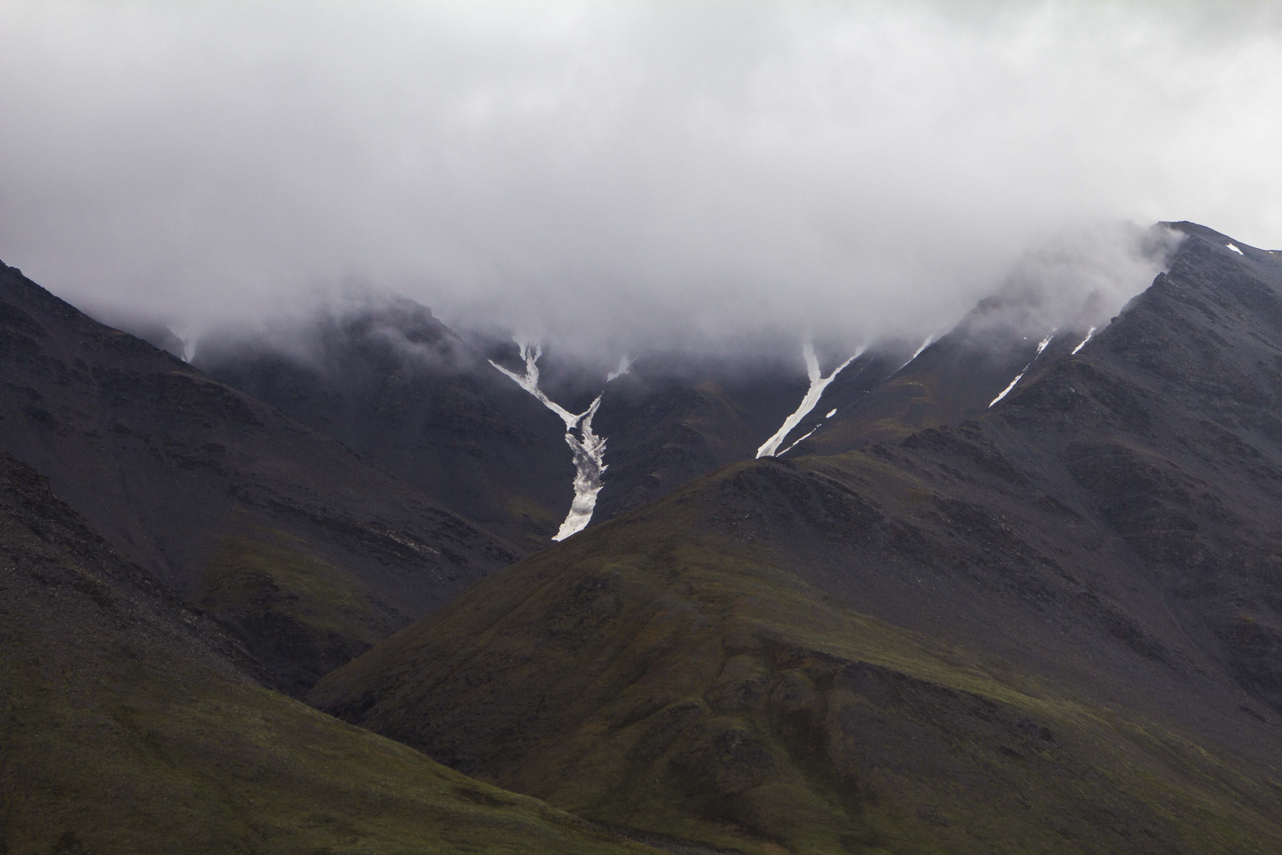
The morning sees rain pattering the rain fly of the tent and I must say I dread it, since today is a big climb up to Chilkat Pass, where I am hoping to spend more than a day hiking and bagging a peak or two if the weather cooperates, But, cooperating it is not and I pack up my little world and spin the mile up the road to the Canadian Customs gate and soon I am climbing upward into the big grind known as “Marinka’s Hill”, the primary climb up to the pass. The rain shows no sign of letting up and I don rain gear and continue, sweating as much on the inside of the clothing as the rain on the opposite. As the storm intensifies, I realize there will be no hanging around and leisurely climbing mountains, but instead, waiting the fury out tent bound. Just past Three Guardsmen Lake, in a low hollow just before the main summit, I pitch my tent and dive in. For the next 18 hours I read, eat, drink a beer or two, and sleep. The following morning the rain is continuing, but I must go on and the tent is put away wet and the pedaling continues. At the pass proper, the rain stops, clouds open, and glorious sunshine reveals itself, if only for a few minutes. Then it begins again. But heavier this time. Soon torrential downfalls of drops appear, and for a moment, even the roadway ahead is barely visible to my eyes. Although a part of the journey, especially in the North, rain can make the difference between pure suffering and pure bliss on a bicycle voyage.
Later, after the rain lets up, I cross the Yukon’s Takhanne River and set up a pleasant camp next to the water and bathe my foul clothing and myself. Snacking on my supper that evening, I watch a Hawk harass the Swallows at the entrance to their mud nests burrowed deep into the ancient riverbank. Clouds gather and then part again while the sun peeks in to cast great and colorful splashes of yellow and orange against the rocky mountainsides before me. Patches of deep blue sky swirl around the sun/cloud union like a predator in pursuit. At midnight, a Loon cries out from somewhere nearby, and the only thing stirring now is the soft and occasional breeze gently touching the tops of the Spruce and Aspen stands situated nearby camp.
To my ears, the call of the Loon is one of the most enjoyable and haunting sounds coming from the forest and lakes. It is nearly as engaging as the sound of the Wolf howling in the dark of night. And as I pedaled the next morning up a monstrous Yukon hill, one of the biggest of the trip, the Loons were creating a symphony of joyous monotony pushing me upward and over that mound and deeper into the great Yukon interior I love so much. I meet a 64 year old French man on a decrepit bicycle, heavily loaded and carrying an axe for which to chop twigs for his home made hobo stove. He has spent a great deal of his life traveling by bicycle in various parts of the planet, and travel in these parts is not alien to him. Later in the day, I take a side trip to the ancient native village of Klukshu. A side trip of about a half mile leads to the small but Salmon heavy Klukshu River, where native people have been harvesting Chinook, Sockeye, and Coho Salmon for millennia. I arrive at the bank of the tiny river; a Sockeye splashes about as it sees me, there is not a soul around but the fish and myself, lest a Bear hidden in the forest nearby. The village is deserted. There is something going on here that is unexplainable; there is an ancient sensation that I am somehow connected to that feels both like sadness and deep connected love. The air feels thick with history and community. Tears swell my eyes as I sit next to the river; this strange place I have never been feels like home. It is strange indeed. If there is such a thing as past lives, then I’m certain I was a Native North American. I pedal onward and past the equally haunting and beautiful Kathleen Lake and the beginning of the colorful and rugged Kluane Range, forefront to the overwhelmingly enormous St Elias Range and Mt Logan. Home to the second tallest peak in North America and some of the biggest and expansive ice fields and glaciers on Earth. The Yukon is a mind-blowing place indeed. Soon I am rolling into Haines Junction for a meal and some re-supply on food and luxuries.
Now I am into the thick of things. The Alaska Highway is traffic heavy compared to the mellow Haines Highway, where trucks shipping supplies from Canada to Alaska whiz by at maximum speed and clueless tourons barely in control of bloated recreational homes-on-wheels as big as my house meander down the pavement, gawking at the scenery and not watching the road, too lazy or disinterested to actually stop and explore beyond their steering wheel, most of these southern travelers never really see much at all.
The pedaling is flat and windless; miles fly by. The Ogre slithers along in silence. The endless boreal forest of the interior swallows me up and I am one with it. Arctic Ground Squirrels scurry in and out of the roadway as if attempting to throw themselves under passing vehicles. I often hear bicycle travelers complain about the sometimes endless and monotonous stretches of Alaska and the Yukon’s boreal timberland, saying that it is a dread to ride through it. Beats riding through most anywhere down south if you ask me. I connect with this forest; to me, this boreal play land is an endless supply of tranquility, animals, lakes, rivers, muskeg, swamp, taiga, streams, and beauty. There is a living breathing force here that cannot be ignored. To me, there is nothing monotonous about it. Riding through endless highway traffic and Human civilization is monotonous, dangerous, and disturbing-nowhere to camp either.
The climate and terrain is changing rapidly from a wet mountain environment, to an almost desert like boreal landscape that reminds me somewhat of western Colorado. A several mile gravel section of road appears near the Native village of Champagne, and I unknowingly watch as the last stream goes past and some 25 miles later, I am running low on water. At the 61 mile mark for the day, I emerge on the banks of Stoney Creek; a crystal clear mountain stream perfect for both drinking and bathing, and with an endless supply of ripened Raspberries growing adjacent to it’s flanks. I call this lovely place home for the evening and settle in with a sizeable grin adoring my mug, all the while snacking on raspberries for dessert.
In Whitehorse, I’m tossed into a world I have not seen in a long time. Since moving to Haines nearly three years ago, I have not left at all, except to go see an orthopedic last year when I broke my ankle at work. Haines is a quiet little Alaskan town; very little commotion at all. Whitehorse on the other hand, although quite tame by modern city standards, was abrupt, fast, and in my face a bit. I actually like Whitehorse. It is a small city of about 40,000 souls, with tons of mountain bike and hiking trails, the glorious Yukon River, and surrounded by endless wilderness. But on this day, to me here and now, I just wanted to get through it and back to my forest. Pedaling through town finds me along the Yukon River and past the hydro power dam and on the shores of Schwatka Lake, a Human made reservoir with float planes and powerboats here and there, but still a beautiful and serene place to be camped. That night, I awake about 1:00 am and noticed the first star in the northern sky since late April. Summer is slowly closing down and the days are getting a hair shorter each cycle. Before you know it, there will be some of the white stuff back on the ground, the tourists will be back in Florida, Texas and all parts south, and the Bears will be heading to their high country denning grounds to await the next round of Salmon entering the rivers in May.
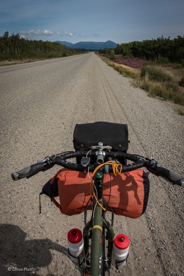
Heading south on the Klondike Highway in the morning, I pedal all the way to Spirit Lake and devour a breakfast there before spinning down into Carcross (Caribou Crossing) and the beginning of what is known as the “southern lakes region” of the Yukon. In this part of the Province, there are many, many extremely long, deep, cold water lakes; meltwater remnants of the massive glaciers that covered this part of the Yukon a millennia ago. These lakes are a thing of beauty to say the least. Encased in wilderness, and rising from them mighty mountain ranges so remote, few have seen their endless and omnipotent shores outside of a powerboat. Soon, I can see the coastal mountains rising from the horizon and the beginnings of small yet prominent glaciers adorning their sides. The road now traverses the Windy Arm of Tagish Lake and around the bulk of Tutshi Lake, where this highway begins to tilt upward a bit, and the Yukon/B.C. border comes and goes. More climbing in the distance I can see, for White Pass is ahead, separating Canada from Alaska and the end of my Journey at Skaguay.
Finding no outstanding place to camp, I reluctantly pedal mile after mile, passing mediocre spots hoping the Golden Camp Spot will appear. After 76 long and exhausting miles, the fabled glory camp does not appear, and I throw down my nylon ghetto onto a deserted gravel pit and enjoy myself regardless, happy to be off the bike once and for all for the day.
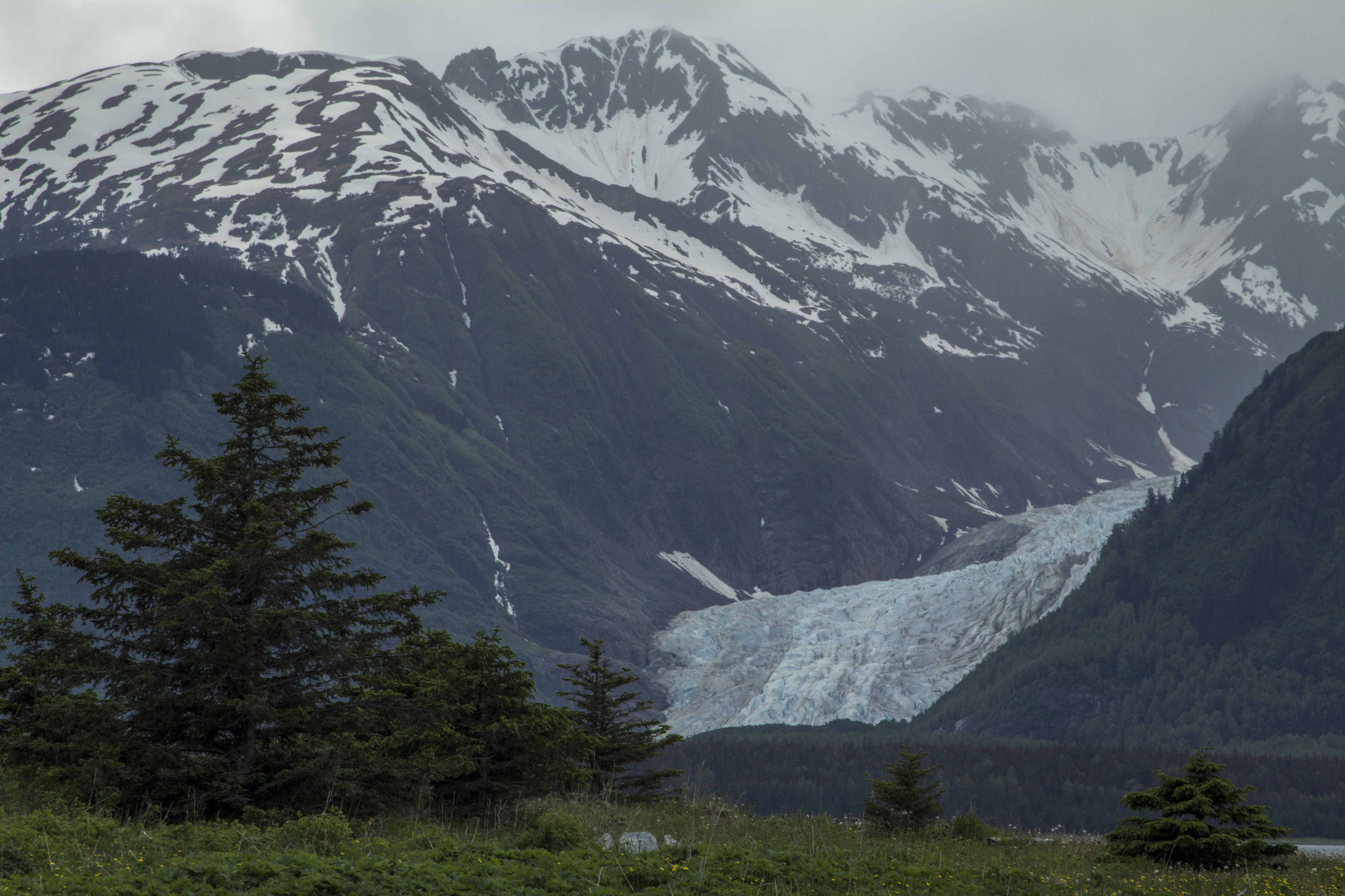
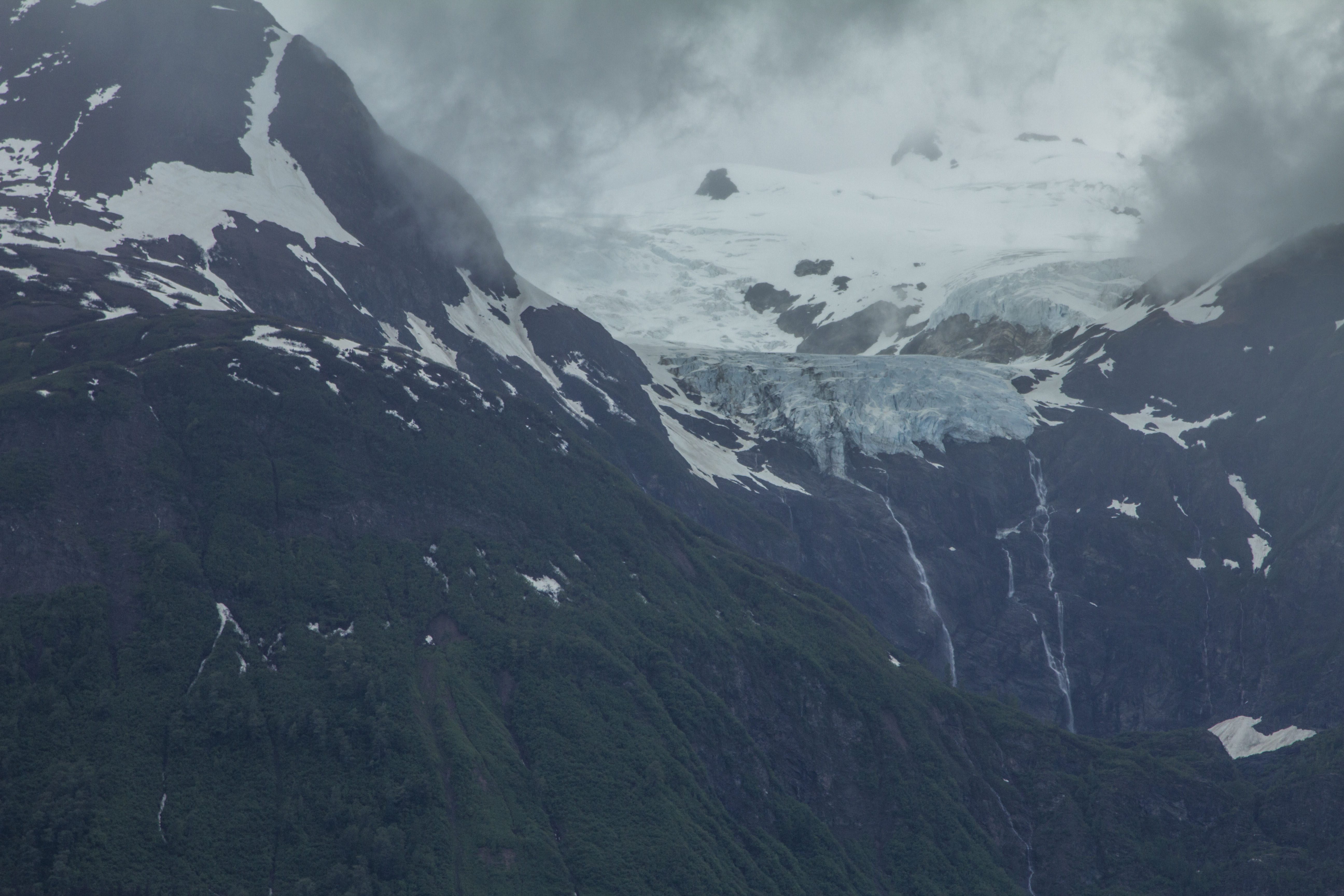
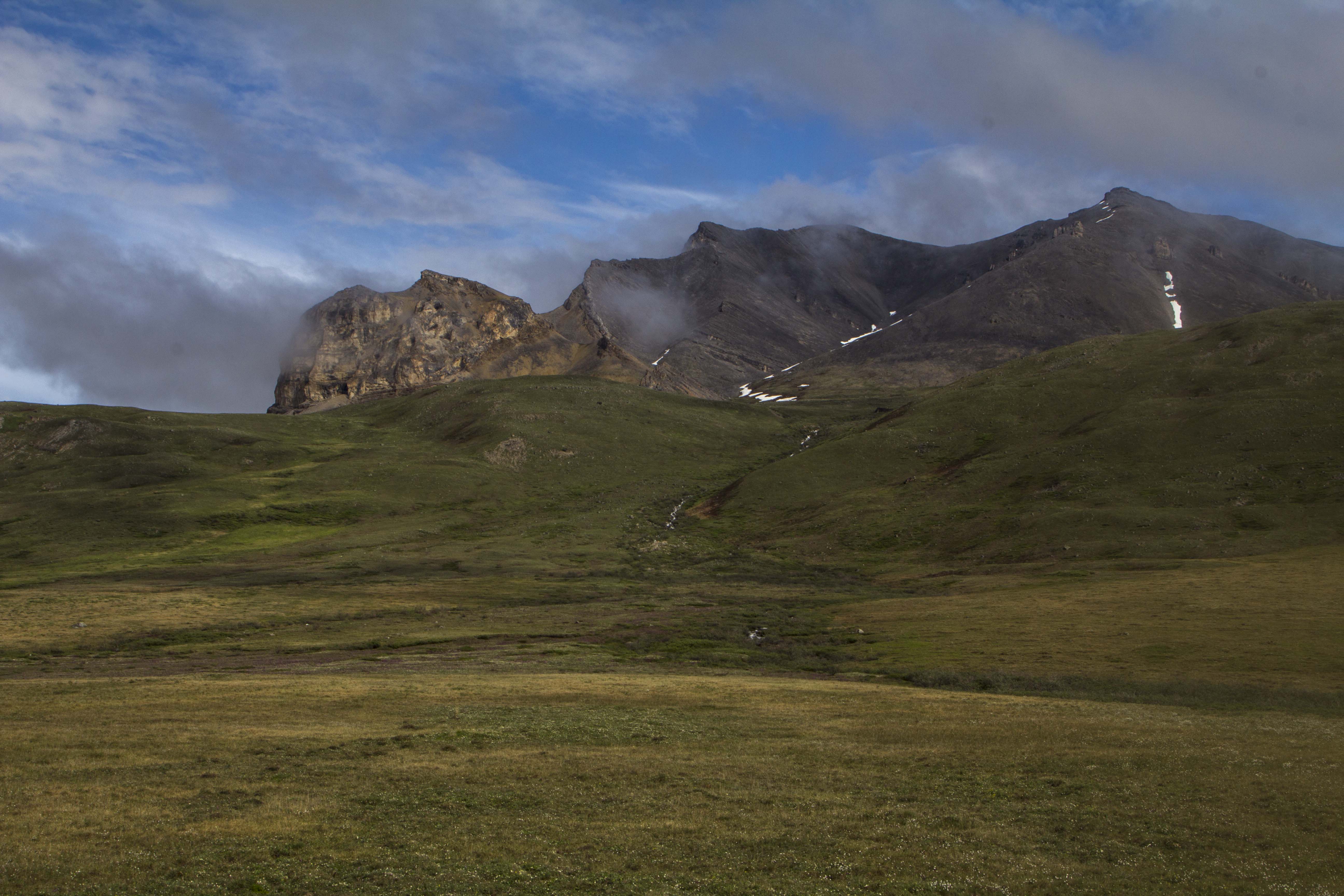
Up bright and early the following morning I am sore, and there are rapidly moving clouds and wind coming through, but I feel good. It is only about 20 miles to White Pass from here according to my calculations. The road turns gently and ever so slightly upward from here and the landscape changes once again from the sub-alpine boreal forest to the higher and more colorful alpine arena of tundra, swiftly moving streams, and low lying brush and stunted Pine and Spruce. The route follows a glorious emerald river, adorned with many rapids and small waterfalls. A Bald Eagle soars overhead, and a Gull meanders behind, perhaps hoping to reap any benefits the Baldy might conjure. The wind picks up and it is a struggle to keep the Ogre upright on the hills. At timberline, the first of many low lying alpine lakes appear, and the stiff breeze grows fierce. Glaciers show themselves briefly during interludes in the cloud cover and before long they disappear once again into the thick alpine mist. Near the pass, I clamber over granite boulders to get a good look at Summit Lake and onslaught of the storm; wind and whitecaps embellish the lakes surface. A Gull scares up and hovers over me, squawking loudly that I must leave. She must be protecting a nest. I wish her well and skedaddle back to the bike and finish the last bit of the climb to the pass. At the top, a great and magnificent alpine meadow sits below and decorated with a mighty waterfall, so picturesque it is difficult to believe it real. At the pass, the weather is foul, and thoughts of espresso and a hot meal entice me. I peer at the highway ahead and it is a steep downhill for 14 miles to the sea. I had ridden up this massive hill back in 2013 when I rode from Skaguay to Deadhorse to Valdez, so I had gained a healthy respect for it’s magnitude. After tossing on my jacket and sporting hat and gloves, I fly downward and into the fantastic canyon, past more waterfalls and jagged peaks and soon there is no more. A gigantic cruise ship appears a half mile off; perched in the waters of the upper Lynn Canal, it’s passengers flooding the streets of Alaska’s biggest tourist attraction. I meander through the insanely crowded streets attempting not to hit or be hit by those not paying attention, which are many. It is a shock to the senses again. Haines will feel quiet and pristine compared to this insane asylum. Later, after a meal and some casual town observation, I board the marine vessel Le Conte for an hour ride down the canal to Haines, where a six mile ride from the ferry terminal deposits me back at my quiet little crib.
All in all, I had ridden most of this trip previously: the Alaska Highway portion back in 2011 when riding from Moab to Fairbanks, and the Klondike Highway/White Pass section in 2013 on the way to the arctic. Only the Home stretch of the Haines Highway over Chilkat Pass were new, but it is an outstanding pedal through some of the most beautiful countryside the North has to offer. I may even ride it again. Complete with a side trip to Klukshu, some exploring of random dirt roads in the forest and the pedaling in Whitehorse and looking for camp spots, I had pedaled about 385 miles over eight days. I can’t think of any reason why one would attempt to do it any faster; there would be too much to be missed, and in my opinion, far less enjoyable. These trips are not a race folks; they are to be felt and appreciated.
The Ogre pulls off another one.
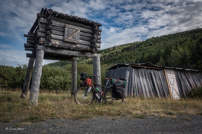
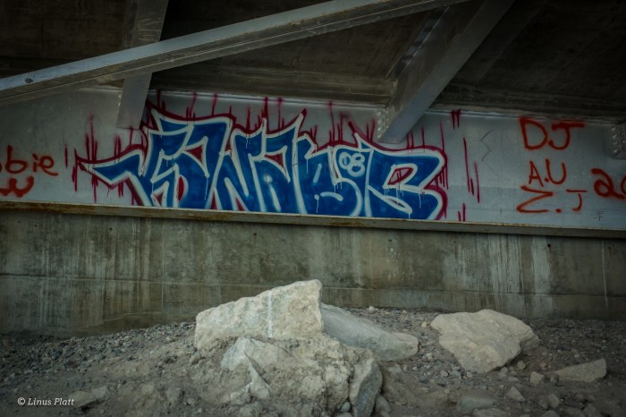
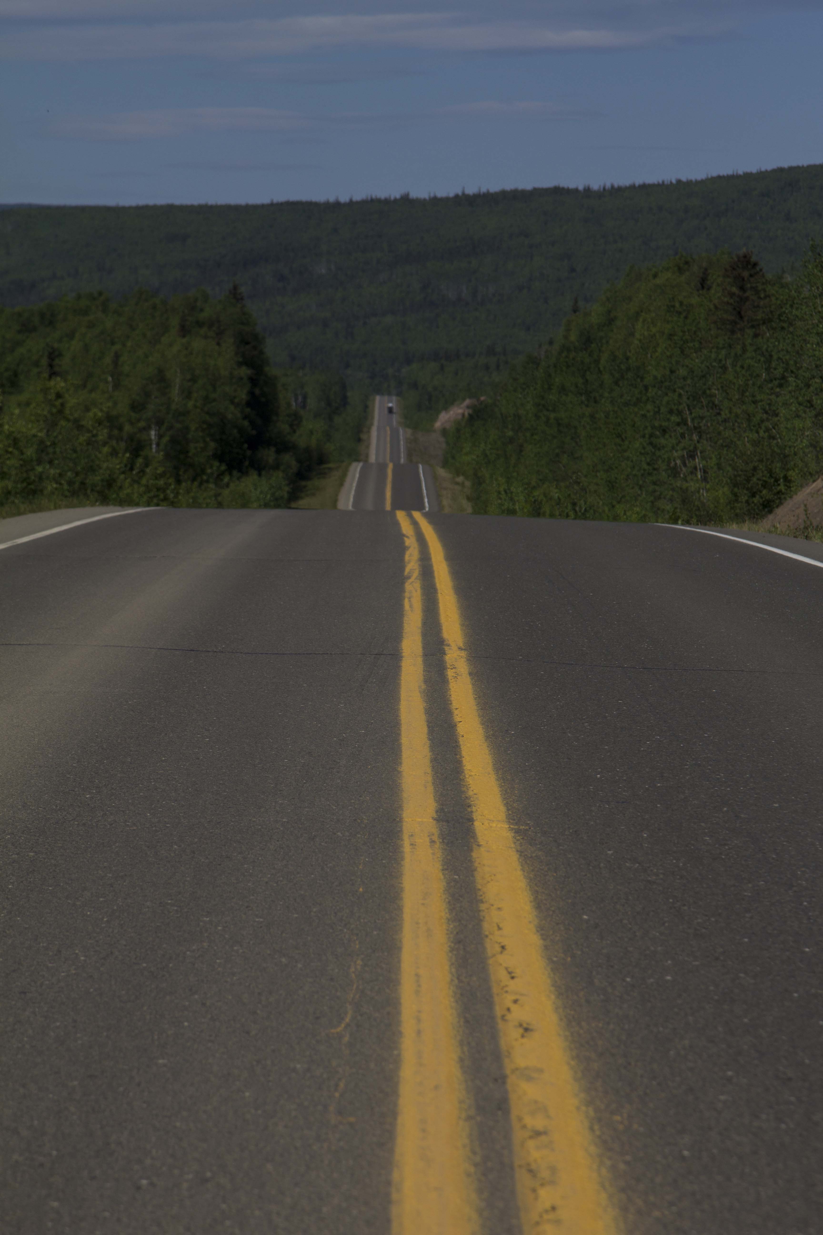
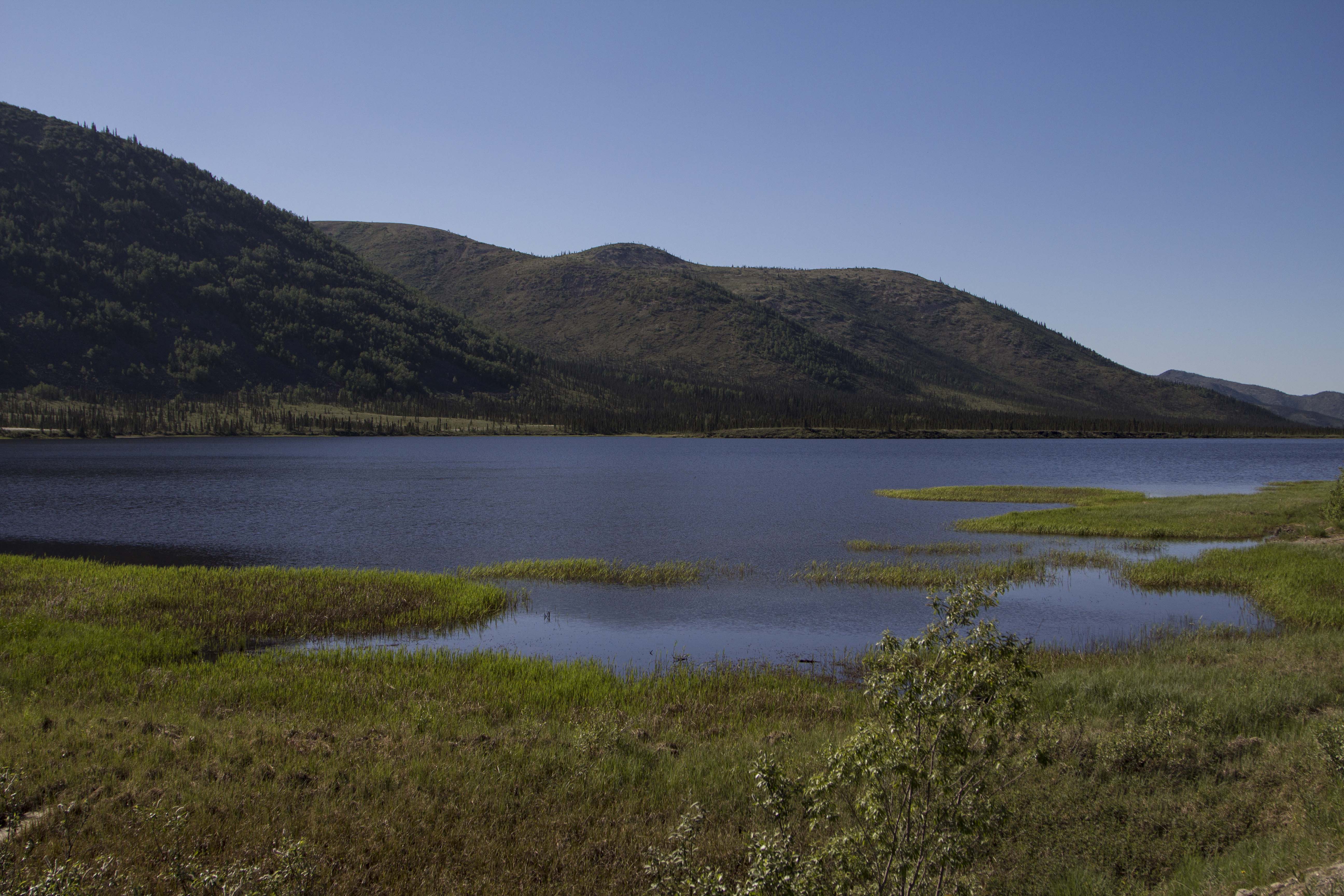
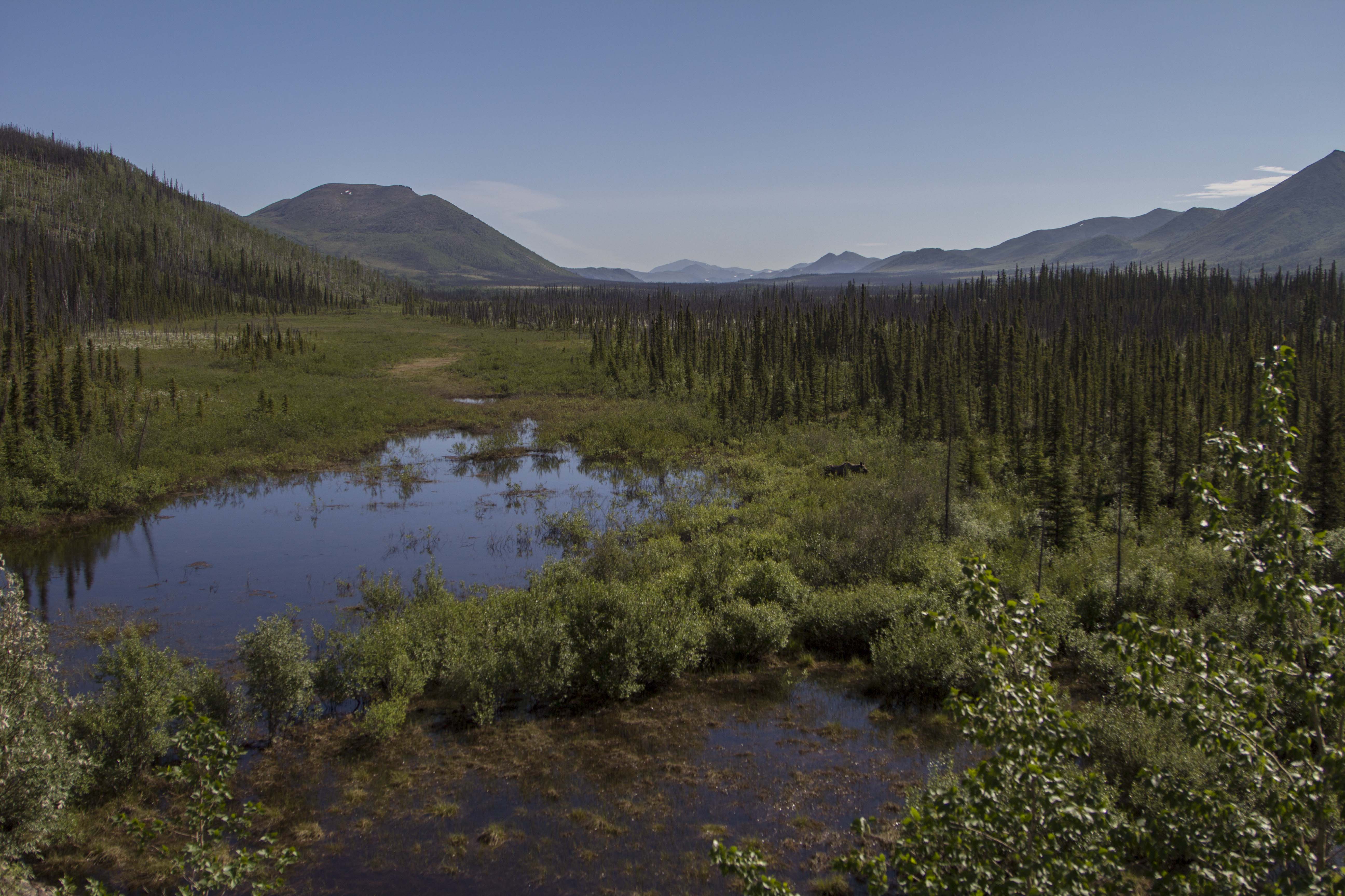
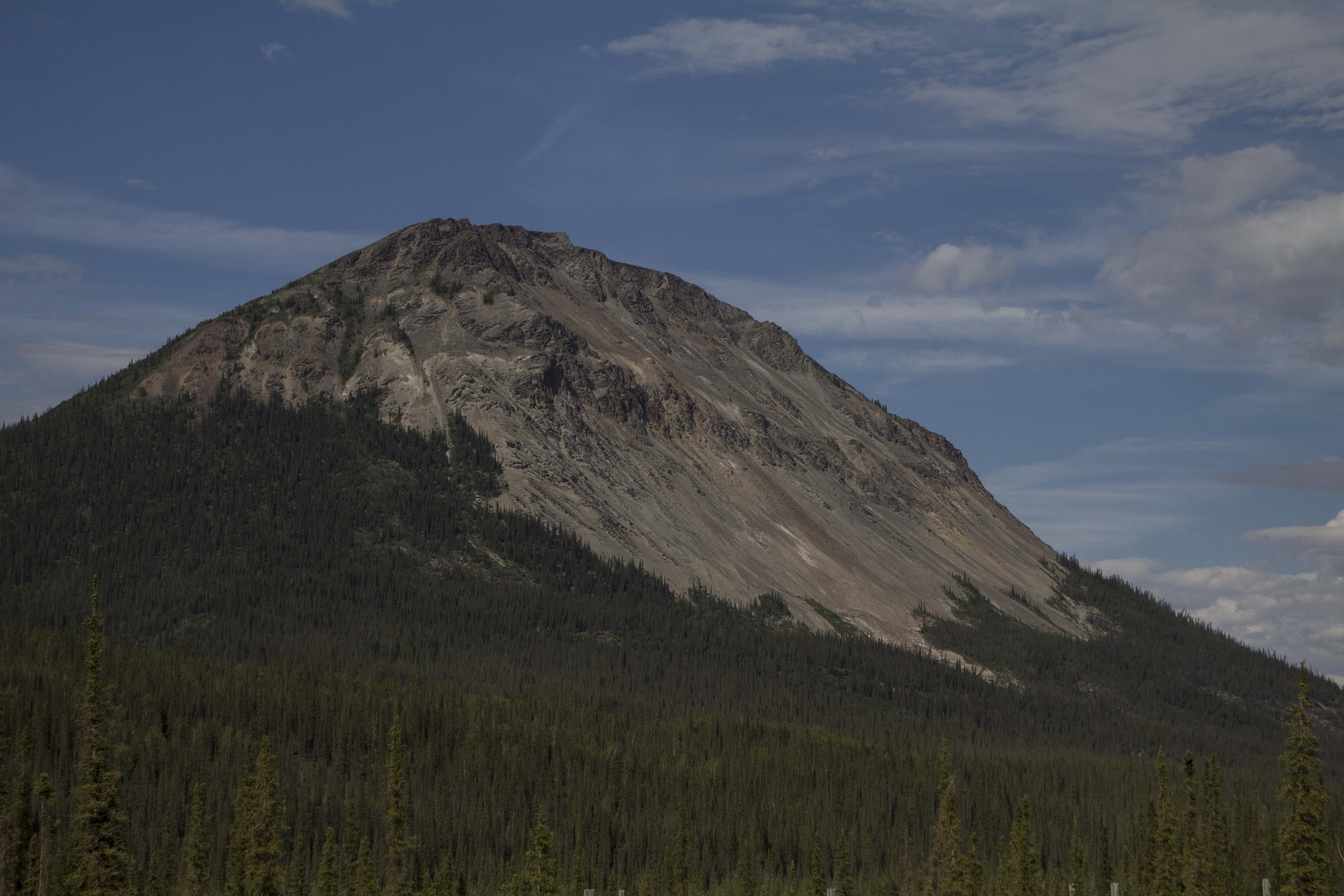
Klehini River CampStormboundChilkat Pass ClimbHaines Summit AKA Chilkat PassStickered SignAlpine Tundra LandscapeThe Green Hut Emergency Shelter Near The PassWhite Spruce And B.C. GlacierNorther British ColumbiaTakhanne River YukonTakhanne CampApen StandsEntering The Native Village Of KlukshuMoose Antlers And Satellite DishCabin and Fish Drying HutCache and Fish HutAspen GrovesMountains Near Kathleen LakeKluaneThe New Grocery Store In Haines JunctionAlaska Highway Gravel Near ChampagneTakhini River Area Yukon InteriorGood SnacksWild Rasberries At Stoney CreekTakhini Bridge GraffitiLove These!CarcrossTagish LakeHistoric Abandoned Mining Structure Along Windy ArmSummit LakeSummit CreekWhite Pass AreaLooking Down From White PassWhite PassMoore Creek Near Skaguay
Some time back, my former co-workers Dave and Ben Swift told me about a cabin that they had built with their father Paul Swift many years ago. The cabin was built in an area that I and been cutting firewood in and I knew the area some what. Located up a faint trail off of a four wheel drive road at mile 13 of the Haines Highway, it was built by hand utilizing logs and timbers of Spruce and Pine from the forest it is located in. Anything that the forest did not provide, had to be hauled in on foot up the 1500 foot climb up from river level through the steepening forest to the cabin site.
Angela and I had plans to go on a hike today, so we decided to drive up river for a hike across some Pine covered ledges overlooking the Chilkat River I had discovered and traversed a couple of weeks earlier. Upon arriving to the scene, we decided we wanted to do something different. I remembered the cabin Dave and Ben told me about, so another mile drive up river brought us to the four wheel drive logging road and the start of our forest walk.
Up the old road we go; some erosion and boulders had drifted into the roadway over the winter. Mental note: must remove boulders before firewood season this year in order to get the truck up here. Soon we come to the blotch of spray paint marking the trails entrance into the forest, and soon we are deep within it. The hike is ever slightly steepening for about 35-45 minutes and eventually one gains a flat shelf perched below the final steep section of the ridge. The cabin is located here and is in a nice location with obstructed views of the Chilkat below. A worthy hike indeed to a true blue Alaska wilderness cabin.
Fine spring weather and a weekend off urges me to pack up the skiff for a first -time-this-year-sailing. The 12 foot Lund has some leaky rivets, and the 39 year old Johnson 9.9 horse motor is about as decrepit as they come. Still, it was time to get out across the water and explore. I pack the boat and call Angela to roust her from whatever she was planning for the day, and soon we are humming along in dead calm ocean water; headed for the opposite side of the Chilkat Inlet to explore the Davidson Glacier and the areas around Glacier Point. We spot River Otters, Sea Lions, and Humpback Whales along the way. The weather is the sort you dream of in Haines: sunny and partly cloudy skies, warm temperatures, and not even a wisp of wind. Soon we are beached on the shores of Glacier Point, and before we can get camera gear into backpacks for a trek up to the glacier, we spot a Humpback whale surfacing and spouting it’s blow hole. Within seconds the creature is back in the depths and without notice, the Humpy has breached the water and is airborne. Our jaws drop, and we expect it to end there. Over the next 5 minutes or so, the Humpback breaches and spins and tail swats airborne style at least 10 more times, causing great and rewarding splashes. We are in awe of the spectacle we have just witnessed. I have never seen anything like it, not even close. I was so riveted by the performance, I refused to grab the camera for some action video. My dinky 105mm lens likely would have produced unsavory results anyhow. As it was, I’m certain I got much more out of the experience with out the camera in my hand. As much as I want so bad that great shot, I want the experience even more.
Soon we are trudging up the dirt access road to the Davidson Glacier where we marvel at the beauty of the magnificent and engaging ice, as well as admiring spectacular views of Mt Sinclair and Mt Elba and the bulk of the heavily glaciated Alaskan Coast Range visible north of Juneau. On the way back we find a flock of twenty strong Snow Geese nestled into the coastal grasses of the surf plane, catching up on some well earned rest.
That night, the wind picks up and we are thankful we had decided to pitch the tent after all. In the morning, we see the storm clouds a brewing and the wind picking up even further. A quick escape is in order, and soon the boat is packed and we struggle to get the tiny skiff past the swelling surf and into deeper water where we can fire her up. Soon the motor is running and we hightail it back up the inlet, punching the small vessel through the two to three foot swells. This feels like survival boating and Angela is wearing the only life preserver we have. For fear of capsizing the boat, I stay on the decaying throttle to keep the craft moving directy into the oncoming surf. I am white knuckled, cold, and concerned. After a bit, Letnikof Cove appears and soon we are pulling up to the boat ramp and loading the truck. The storm never actually took foot, but it sure made for some big waves in a little boat.
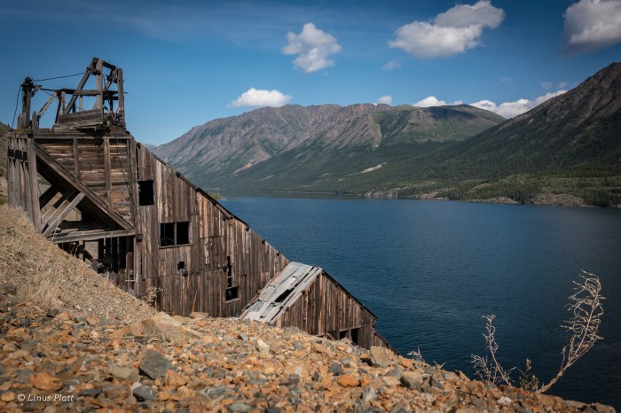
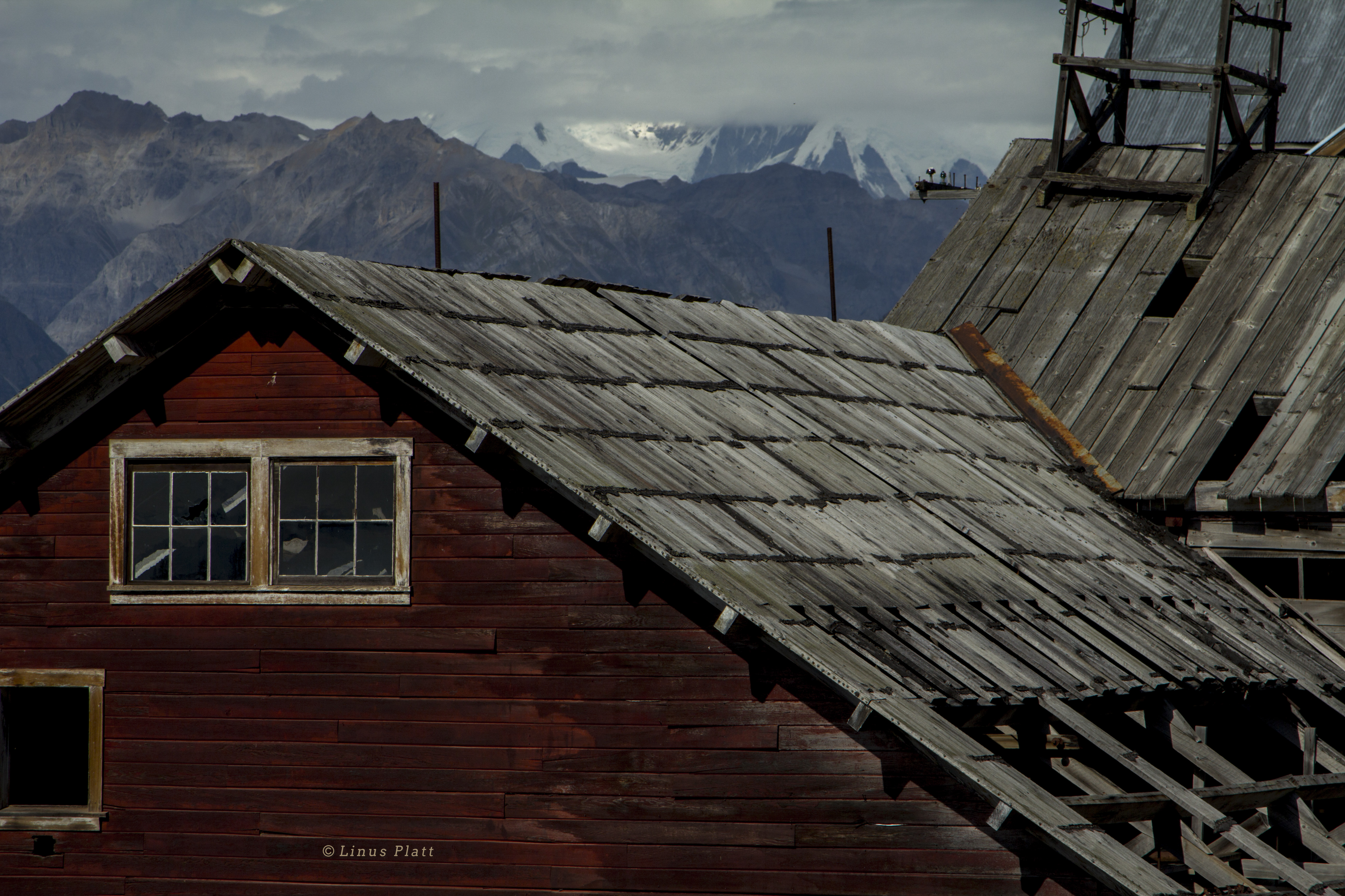
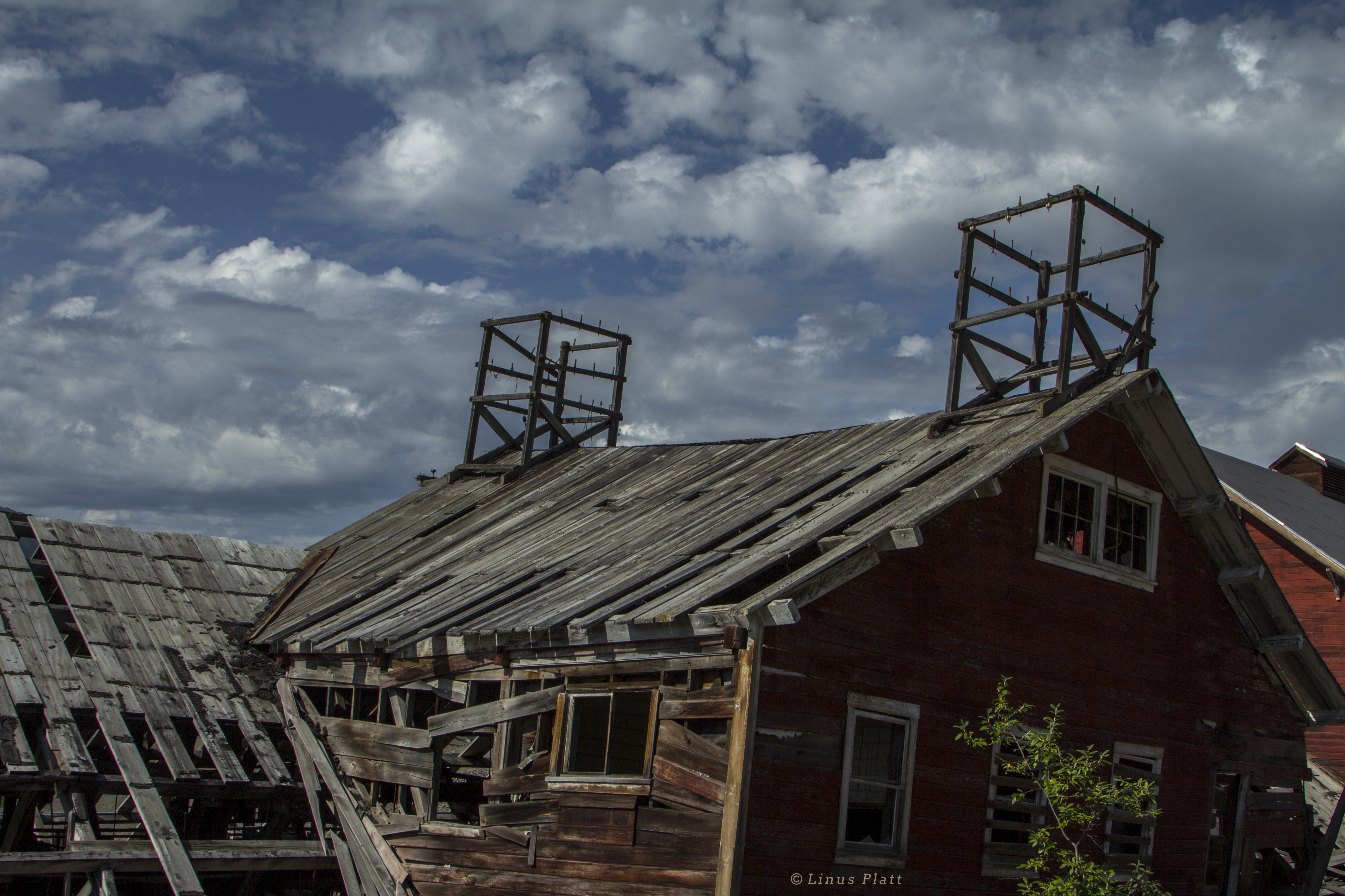
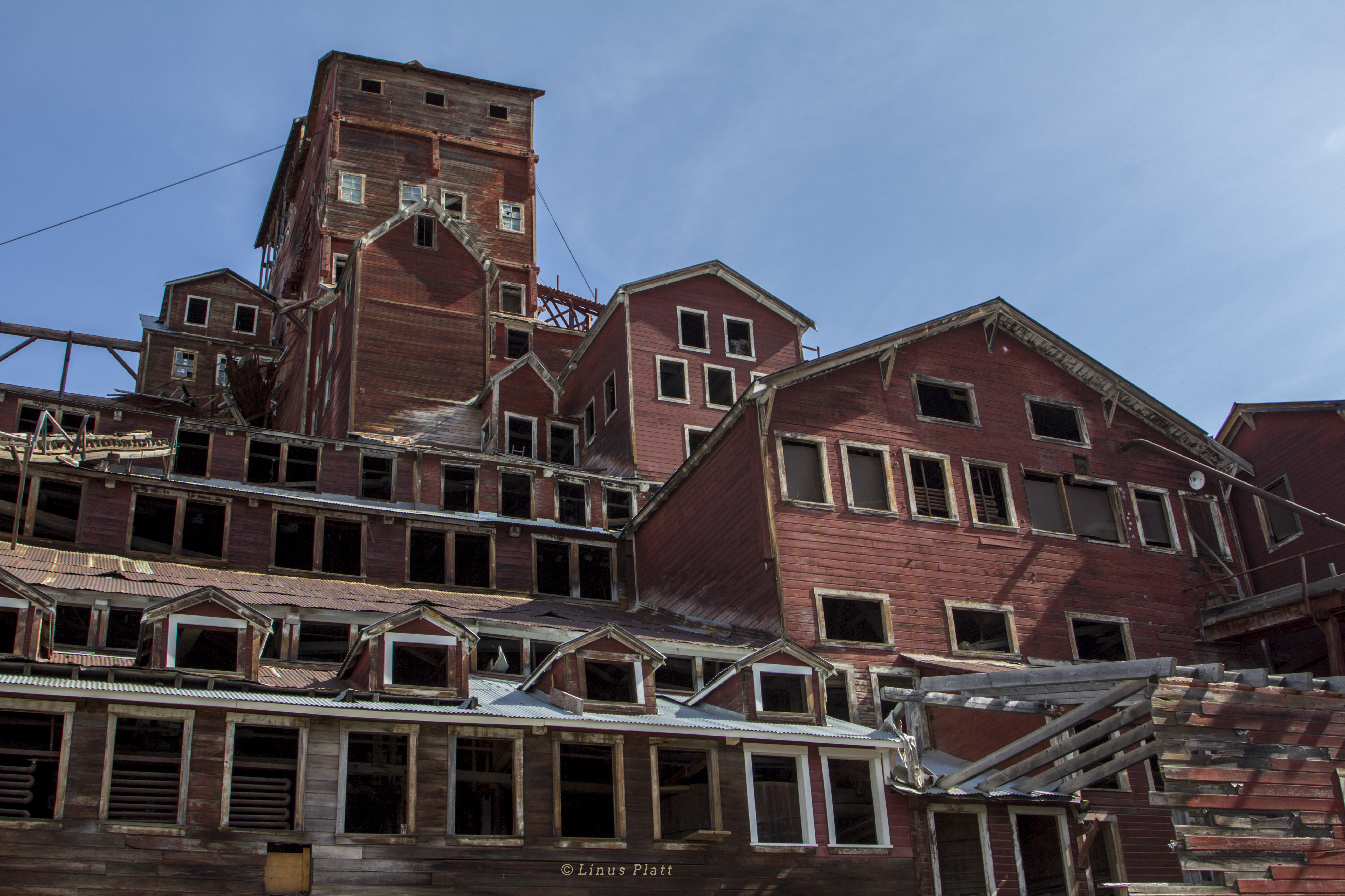
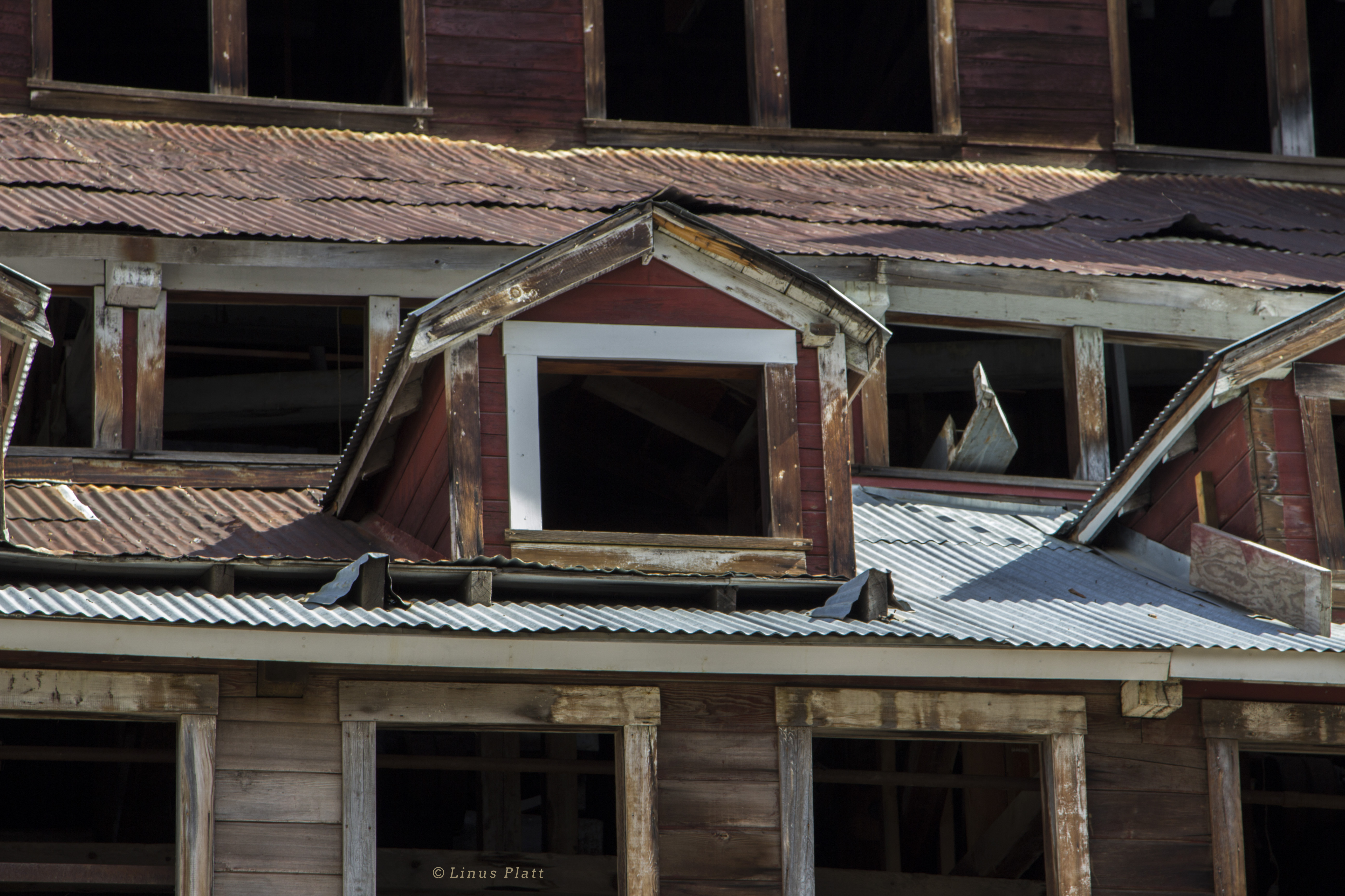
Abandoned buildings and structures, especially mining stuff, has always held fascination for me. Kennecott was spectacular… The hike up the lateral moraine of the Root Glacier above the mine was out of this world. Here’s a few of my favorite shots of the mine…
Even before moving from Fairbanks to Haines last November, then as now, Google Earth has been a friend to me insofar as giving me an opportunity to seek out many of Haines’ lesser known treasures. I remember the evenings in the cabin up on Himalaya Road, north of Fairbanks 30 miles or so, after my chores tending to the sled dogs were over for the day; I would skim the earth utilizing this amazing piece of technology to familiarize myself with the place I knew would become my home.
Last April, after the bulk of the winter’s snow had become a molecular part of the heavens’ above, I decided to drive out to explore an area I had “discovered” by means of the previously mentioned technology. But after getting out there, I became confused with what road was what, and not wanting to get tangled into someone’s property, I abandoned ship and opted for a hike across Mud Bay proper and over it’s adjoining ridge through the area’s old growth forests.
This morning looked reasonable, weather-wise, so I decided to let the Ogre out of the corral and saddle up. It was chilly out, but at least it wasn’t raining, and the cool wind felt downright invigorating. Spinning softly along the shores of the Chilkat inlet, I whizz past Letnikof Cove and the small harbor there, past the old cannery, through the Community of Mud Bay, past the road to Chilkat State Park, and on the the seemingly dead end of Mud Bay Road itself. This where I had been deterred before, but was determined to find what I was looking for.
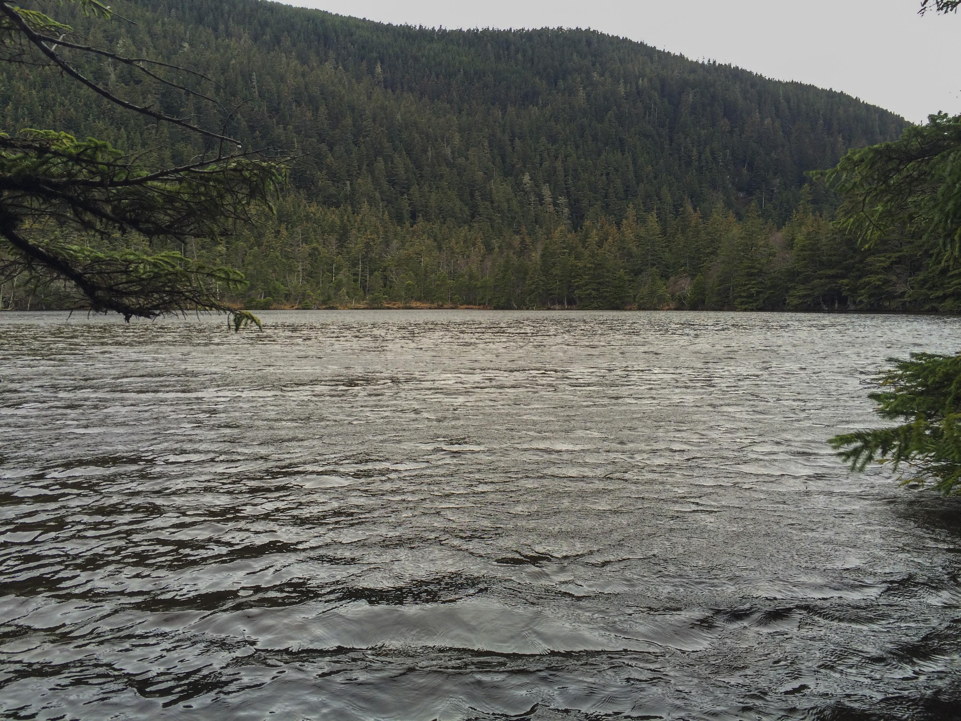
The Chilkat Penninsula, at just over 59 degrees north latitude, holds 2 or 3 tiny lakes on the flanks of it’s forested hills overlooking the Lynn Canal and it’s various arms. The most commonly known lake is Lilly Lake, which also serves as the drinking water supply for our little town. One other tiny lake, more remote than Lilly, called Rustabach Lake was what I wanted to see.
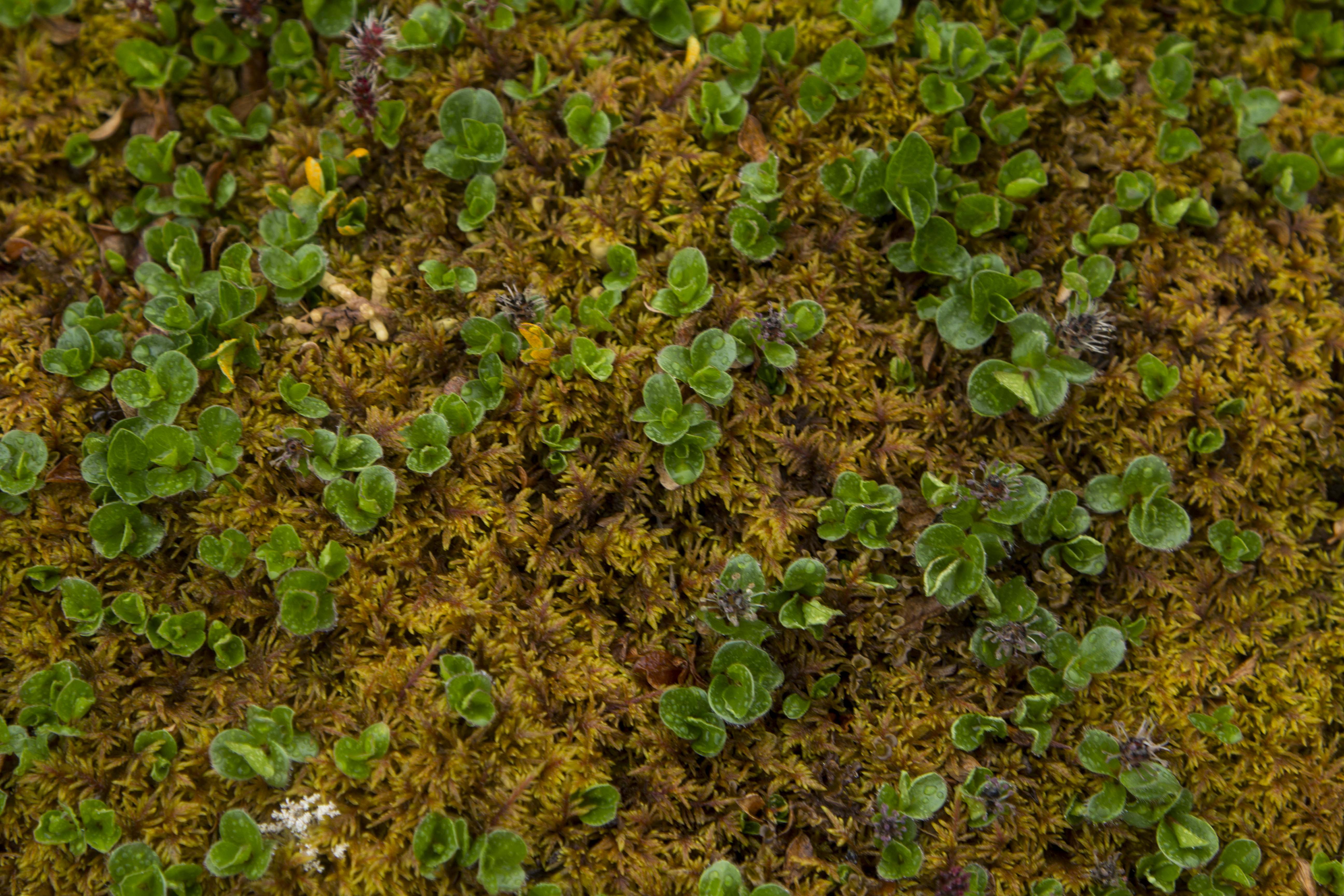
The Ogre seems to have a third eye for this sort of thing, so I shrug my shoulders and hang on for a steep climb up the narrow dirt track leading upward. Shifting into the wee tiny gears of the upper end finds us at a pull out about a mile up. I stop and can see that there is a well traveled trail leading from the pull out and decide that a short hike is in order. Not far into the old growth forest, the trail is smooth and I figure must lead to someone’s cabin. After a short bit, there is the Lake! Rustabach! It appears smaller than Lilly Lake and perhaps a shallow one at that, but it is a peaceful place surrounded by magnificent forest and some of the thickest, greenest moss forest carpet I have ever seen. I walk back to the bike and we continue on up the road and finally come to someone’s beautiful cabin homestead, complete with a big green peace symbol on it’s woodshed. Not wanting to disrupt, we turn around for a fast and fun blast down the road to the saltwater, where big views of Alaska’s great Coast Mountains and her mighty glaciers are visible. Also visible, is a storm quickly approaching from the open waters of Icy Strait, not far south. The peaks are quickly engulfed and the Ogre and I head back to from where we came…
A hike out the Seduction Point Trail on Saturday provides a relaxing atmosphere in which to take in the beauty of the Chilkat Mountains, glaciers, forest, ocean, and wildflowers; reminding us how glorious a place we live!
I first fell in love with Alaska when I was 15. Those early high school years were spent dreaming and executing all acts of climbing and mountaineering. I even tried to start a climbing club in high school; not a single taker. Climbing was off the map in the mid eighties, at least among high school students. In the evenings, I would often engage in as much climbing literature as I could stomach; Habeler and Messner’s’ “The Lonely Victory”, Doug Scott’s “Big Wall Climbing” and Art Davidson’s “Minus 148” were books that took me to far away places with far away ideas. It was “Minus 148” that took it’s toll on me and gave me an ironed-in impression of Denali and Alaska. Now, stomping around in this wild place, the memories of that book have come alive and they are hunting me down.
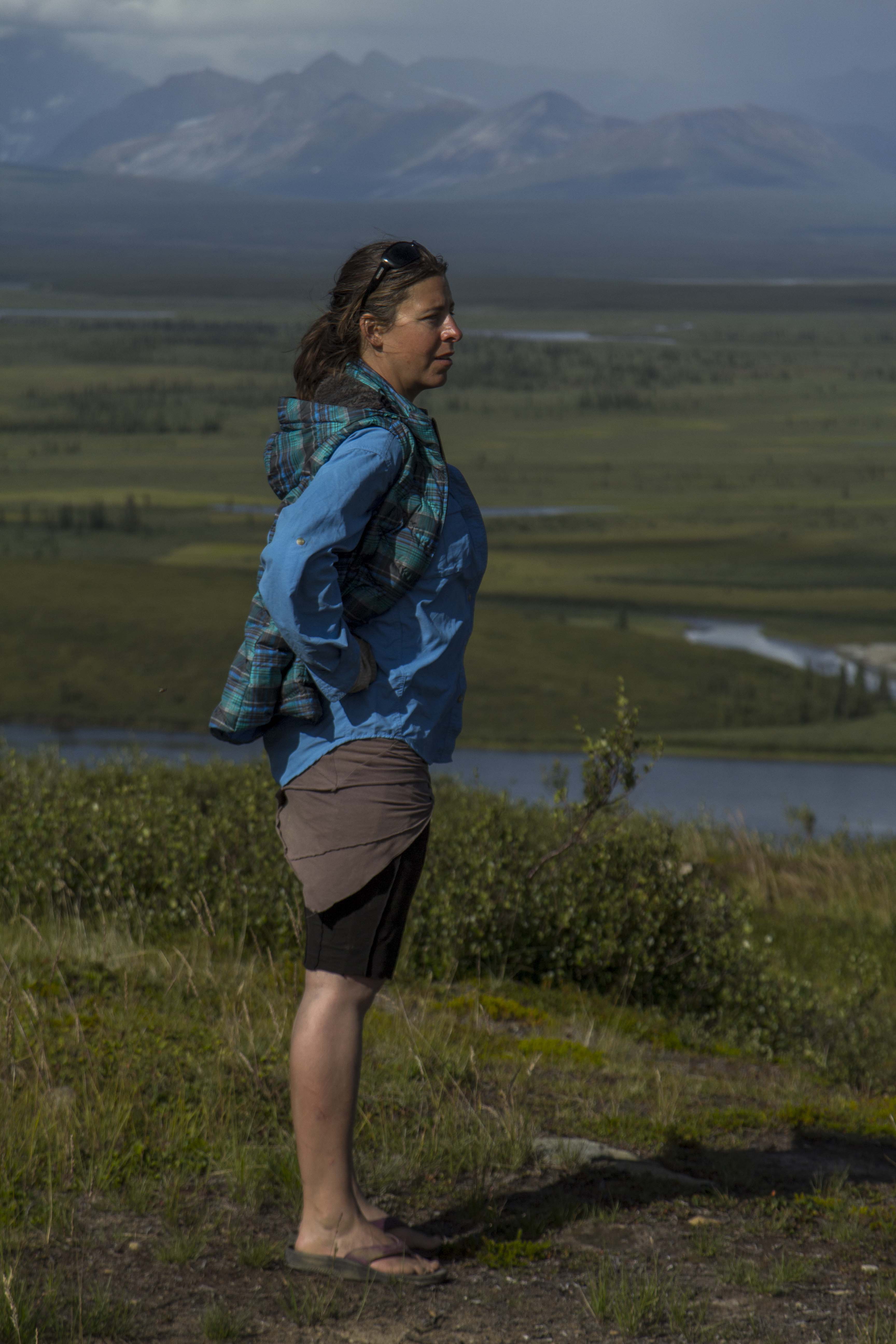
After leaving the Paxson Lodge that rainy afternoon, the Denali Highway still fresh in our hearts, we pedal onward, in search of a flat and comfortable spot to call our own for the night. When I look for a camp, I try as I must to fulfill the rules I have created for myself. An excellent camp must have at least two or three of the following: It must be flat, have water nearby, have a view, be protected from the wind, and be as far off the road as possible. A camp spot rarely has all of these attributes, but if there are a couple, then it’s usually deemed acceptable. Angela and I pedal down the Richardson about 15 miles or so and find a fine gravel pit that meets a couple of the criteria and we throw down our scene. A Loon cries out from nearby Paxson Lake, and makes the spot that much better even.
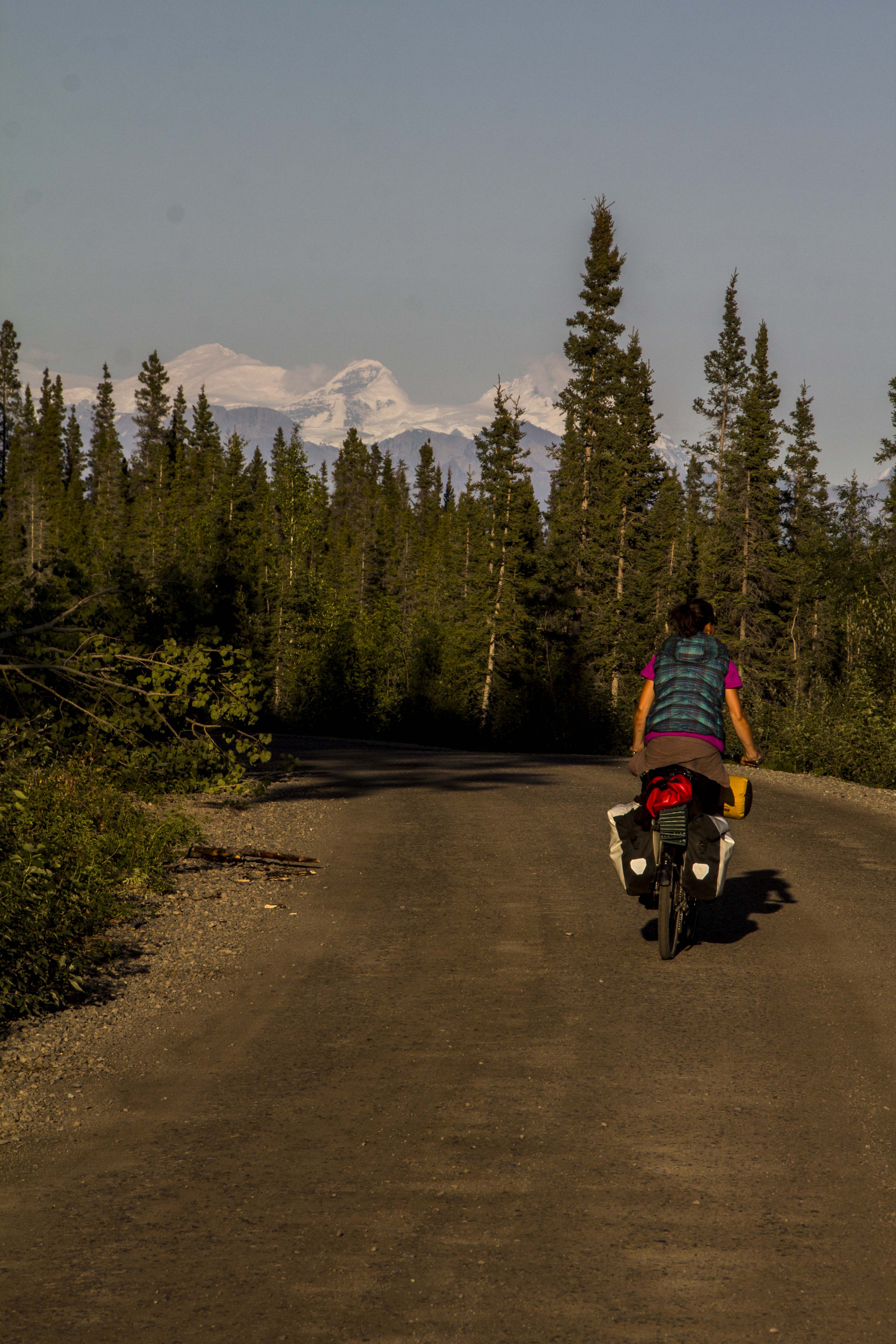
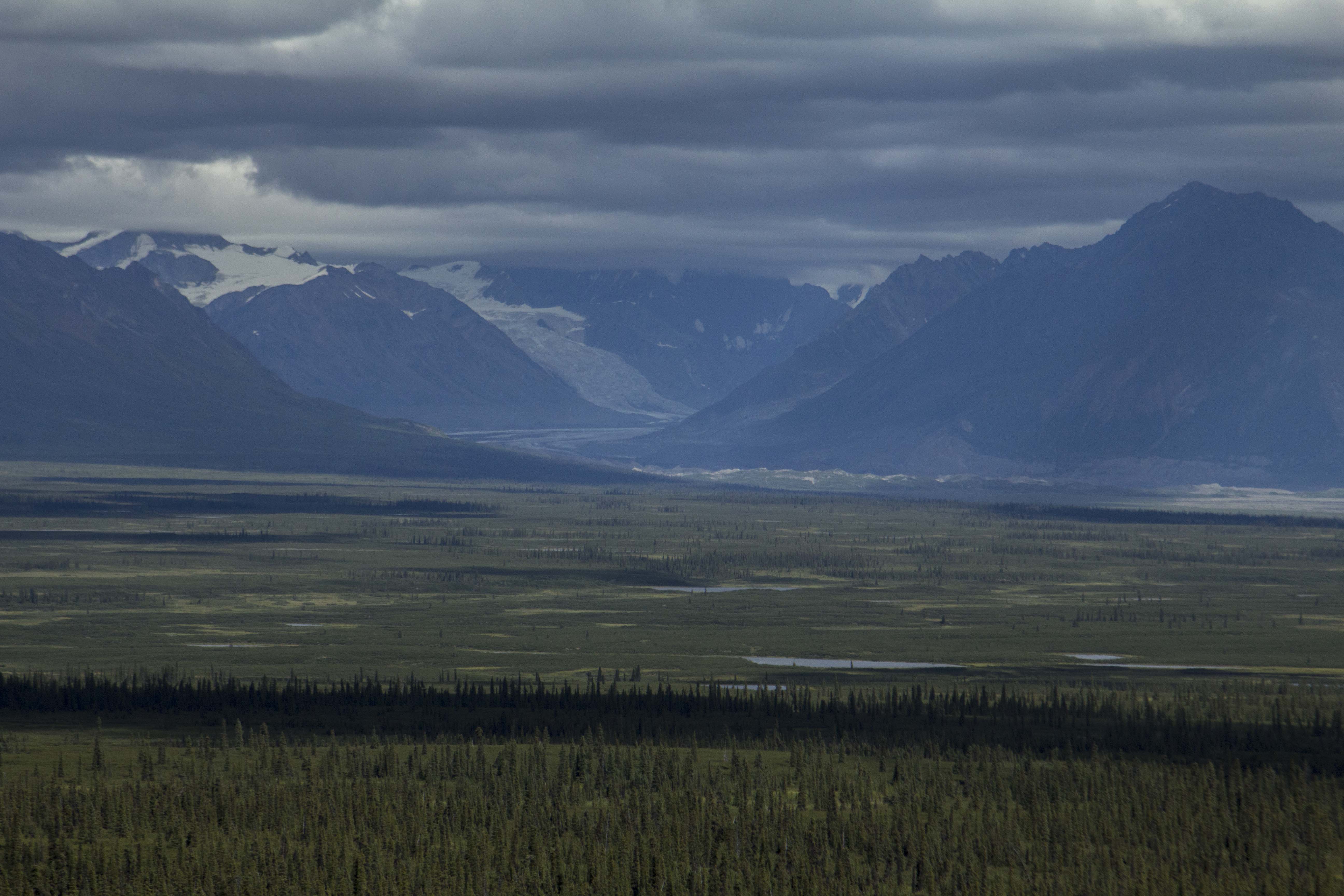
We awake the following morning to outstanding weather and an earlier than usual start sends us 55 miles down the Richardson Highway to the Gulkana river and an early camp for an afternoon of bathing and river laundry. It feels so good to be in the river, the sun overhead and our clothing, now clean, drying on the clothesline I have set up. Unfortunately, the river camp is very moist, and our clothing does not dry till nearly 1 o’clock the following day, which puts us on the road late and provides for a short pedaling day. It all works out for the best, because weeks prior I had scoped out a camp for us when Sven, Bill, and I were on a dip netting mission, out at Chitina. Now, on this afternoon, Angela and I roll into this fine camp. It is extraordinary to say the least; it consists of perfect, flat forest right next to a steep 300 foot cliff/embankment that drops to the mighty Copper River below; infested with Salmon and running strong. It also sports unobstructed view of Mt’s Sanford, Drum, Wrangell, and the enormous Mt Blackburn, all encased in glacial ice, and piercing the deep blue, cloudless sky. To me, it is a camp site to behold.
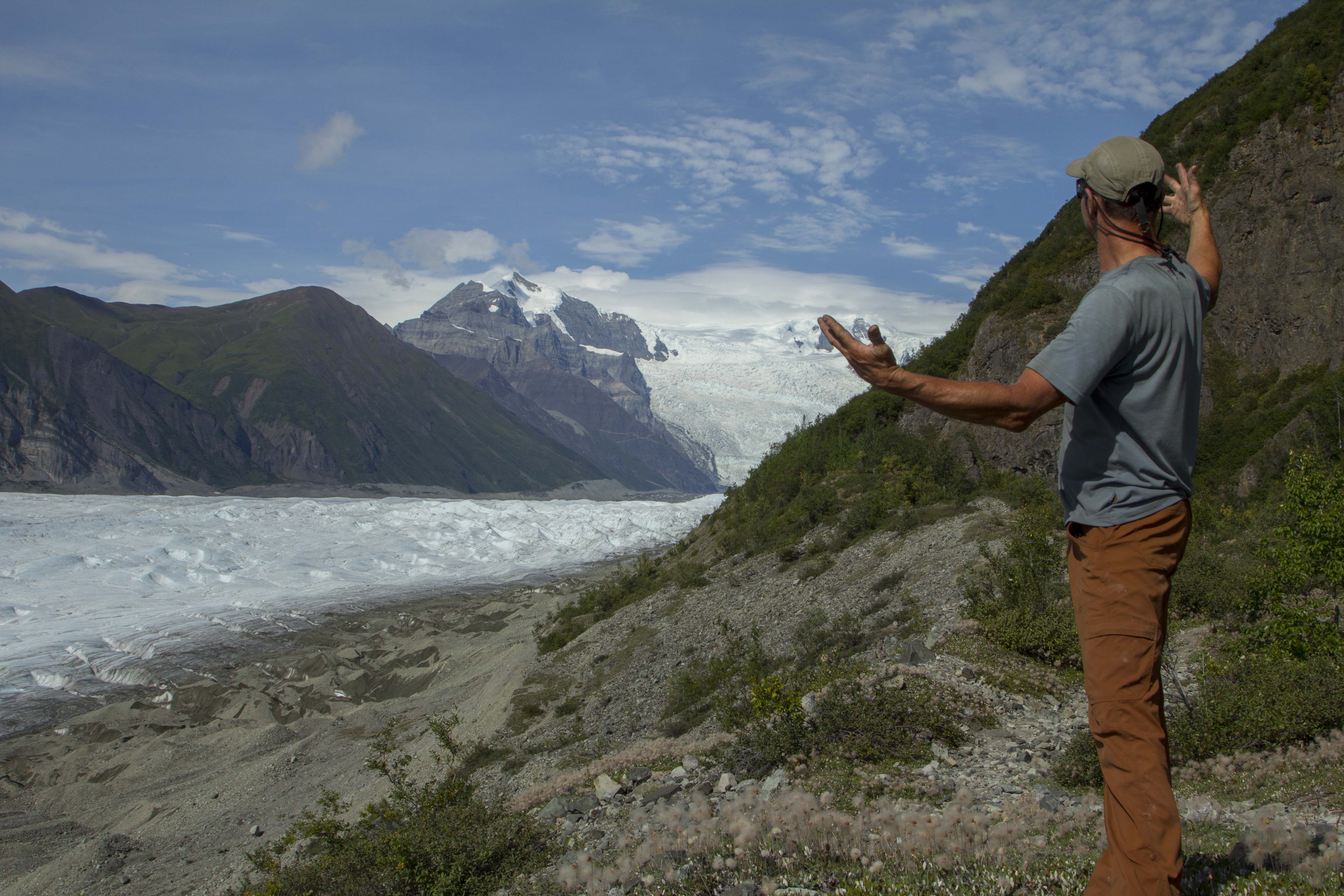
The Wrangell Mountains are a special place to me; they are nearly as mighty as the Denali area of the Alaska Range, but are connected to the monster of the St Elias Range further to the east. They are also more remote, and, according to some bush pilots I spoke with, the most beautiful place in all Alaska. That makes it pretty damn special indeed.
We continue onward, down the Richardson, and turn in on the old Elliott cutoff; a dirt track leading, for ten miles, to the hamlet of Kenny Lake, an area of rare Alaskan agriculture featuring pastures, Pigs, Yaks, and Chickens. We stock up on a thing or two here at the tiny store, and continue down the Elliott, enroute to Chitina, one of my favorite spots in Alaska. On the last hill into town, the headwinds are so strong, we must pedal hard to go downhill. We roll on through, eager to get ourselves established onto the dirt and gravel of the McCarthy Road, and away from the troublesome traffic. Crossing the Copper River Bridge, one is greeted with a fine, Alaskan sight; the confluence of the Copper and Chitina River’s, the Chugach Mountains to the south and the Wrangells to the North, and the dip netter’s, still pulling late season Red’s from the icy waters’. True Alaska. We roll across the bridge and turn into the free campground there, the only one we were to stay at on this trip.
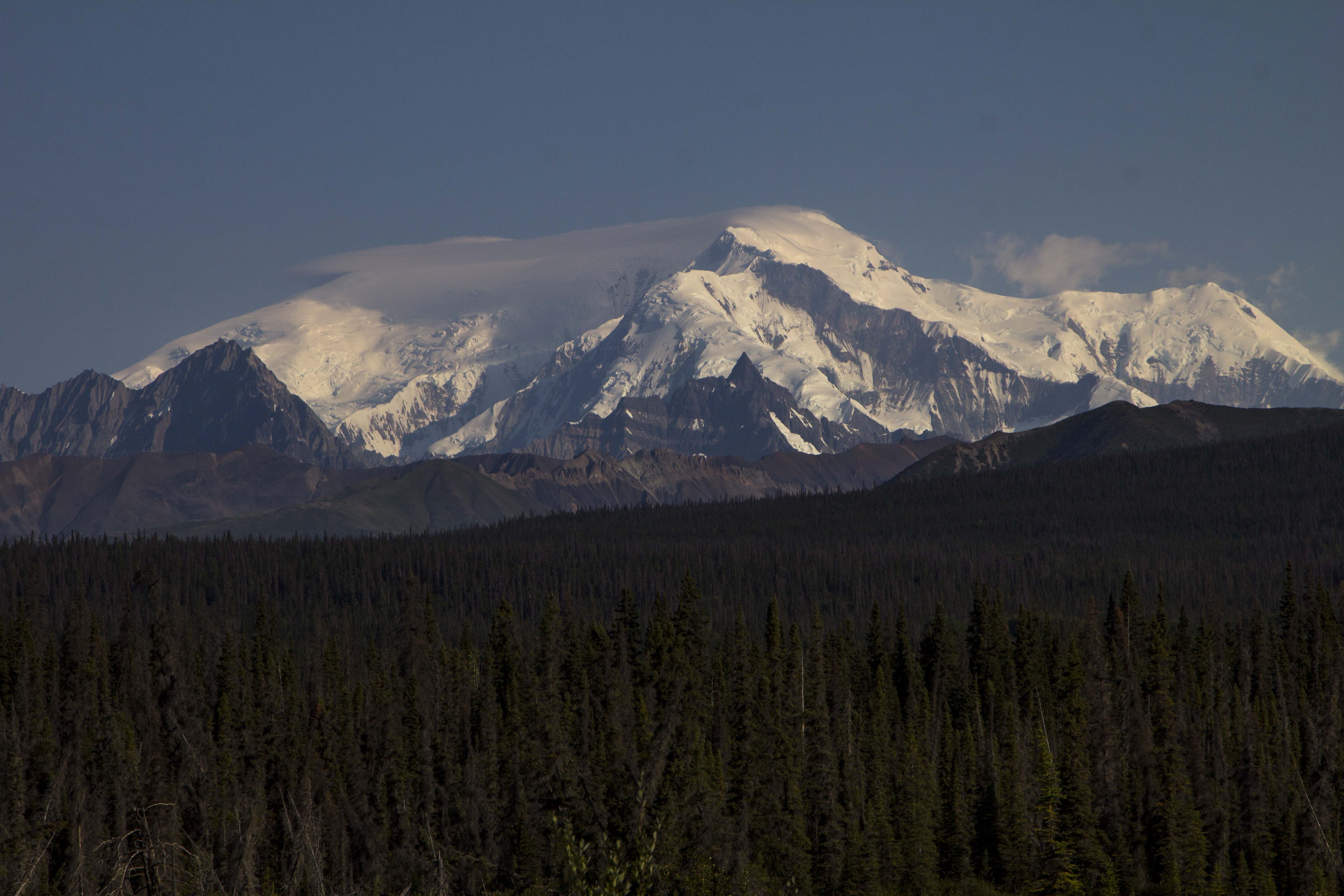
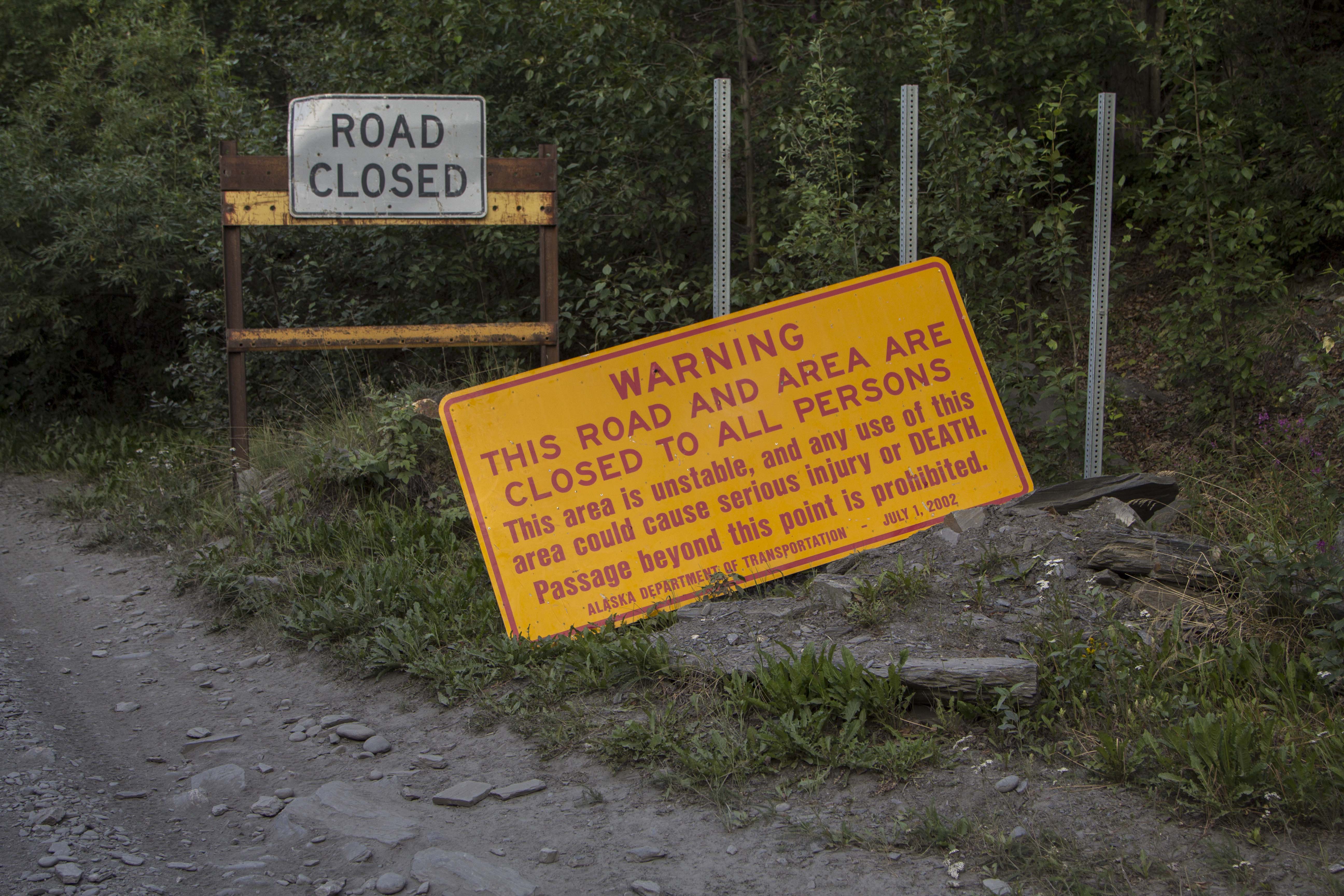
Some time back, I had an interest in scoping out the Kuskalana Glacier Trail, aka the Nugget Trail, which lies off of the McCarthy Road to the north and in from the western end by about 15 miles or so. The trail, built by miners near the turn of the century, ends at the Kuskalana Glacier and a tiny cabin there. Angela and I decide to pedal down the side road leading to the trails start and check it out for future adventure, as this time around we were a wee bit shy on time. The trailhead begins about 4 miles back, and requires one to cross Native Land and pay a fee, as we found out. Perhaps another time.. Back out to the McCarthy Road, I catch fine glimpses of the awesome Mt Blackburn, 16,000+’, which I believe is the fourth or fifth highest in Alaska. As we travel the road we are traversing it’s western, southern, and southeastern sides, and every time it appears from the road, it is as if Blackburn herself is mounted to a giant lazy suzan, rotating around me, not the other way around, showing off her best.
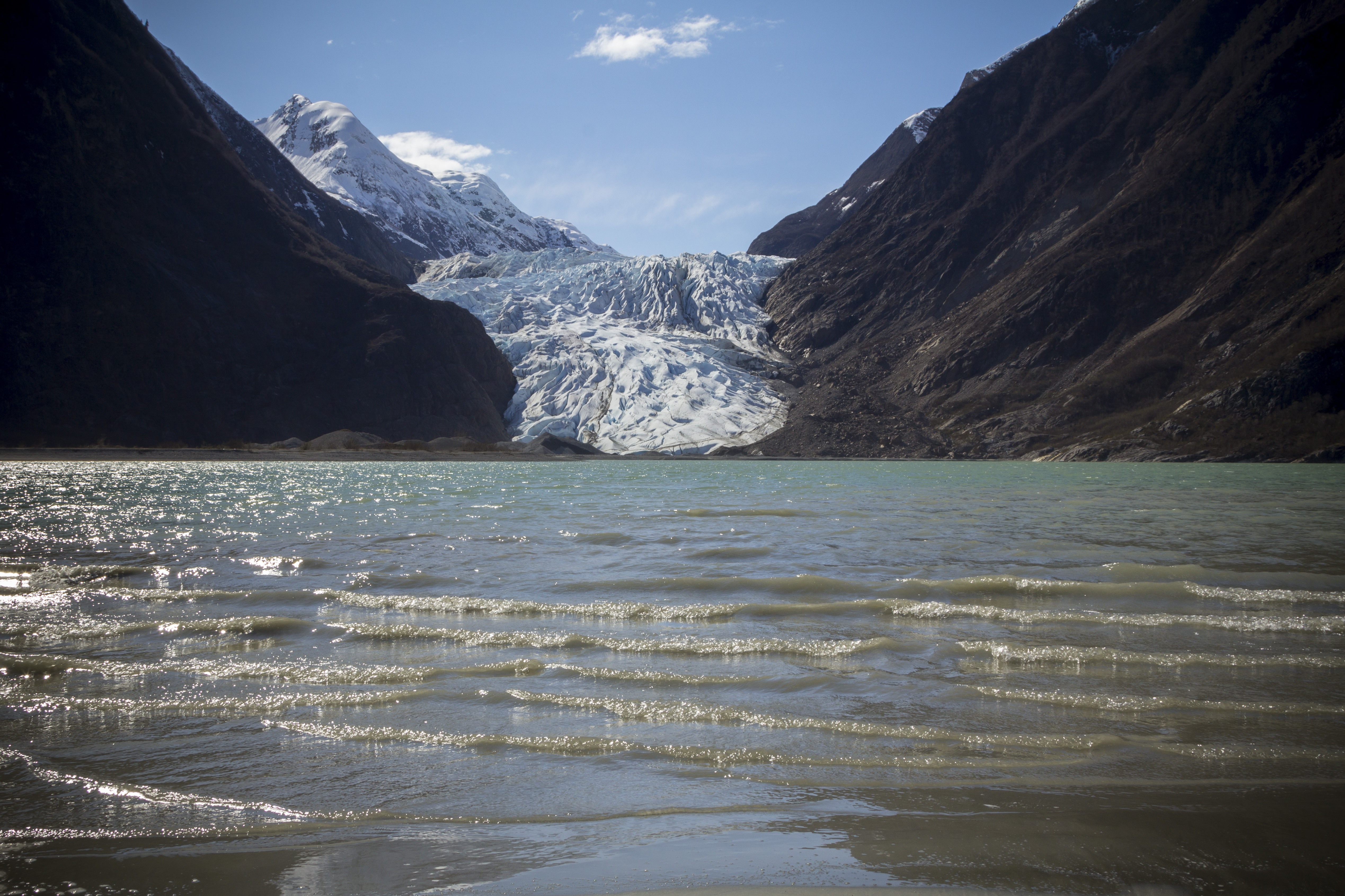
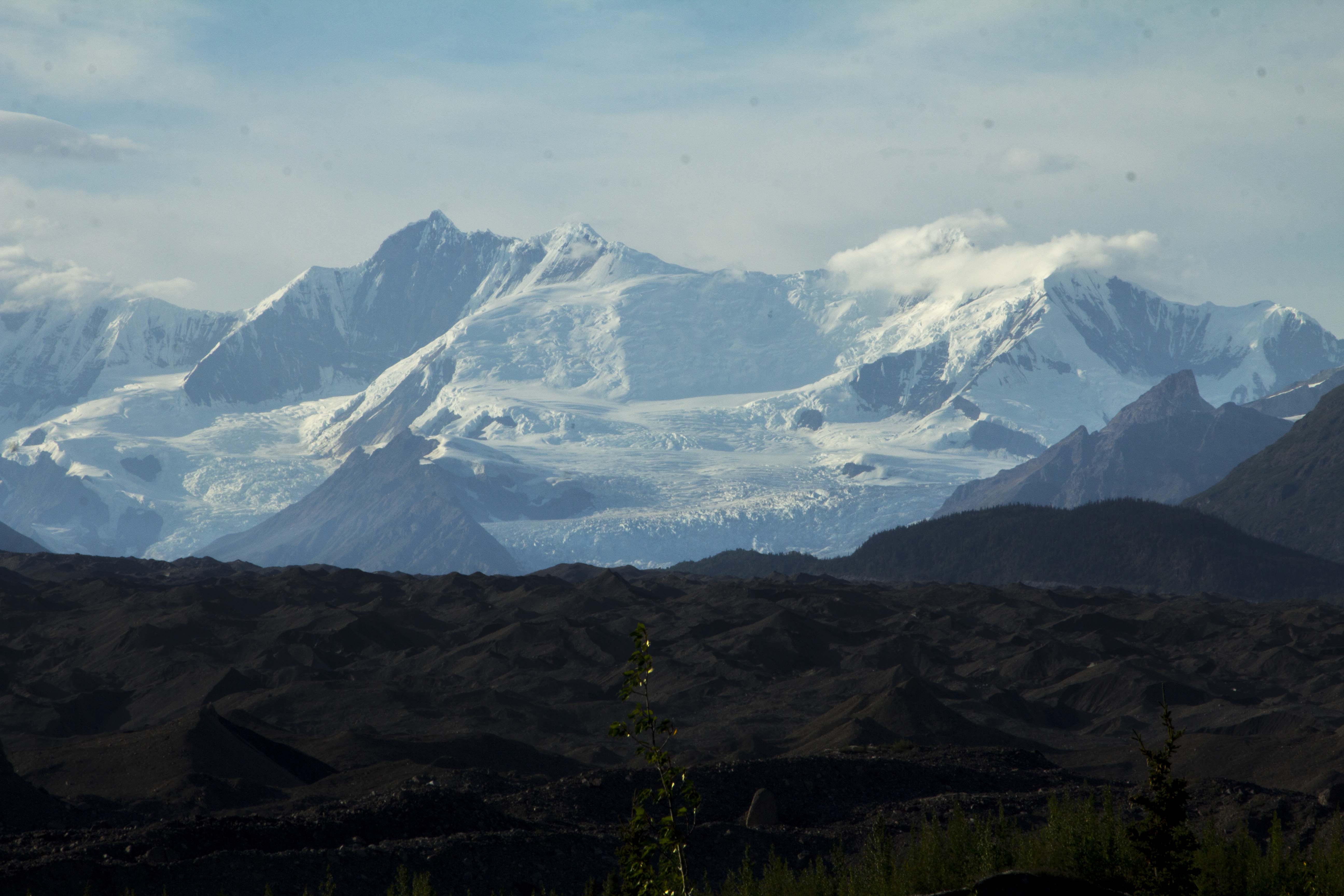
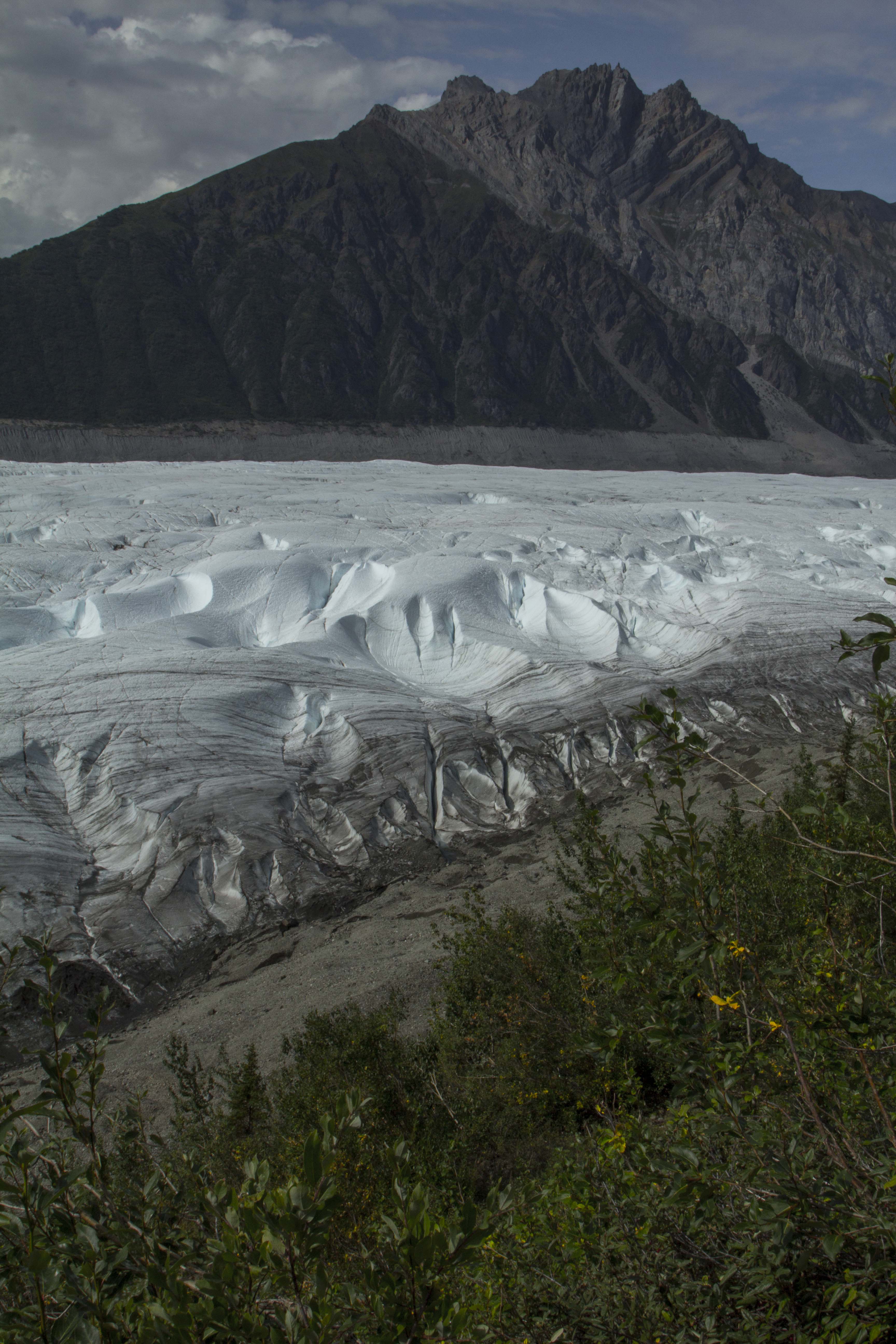
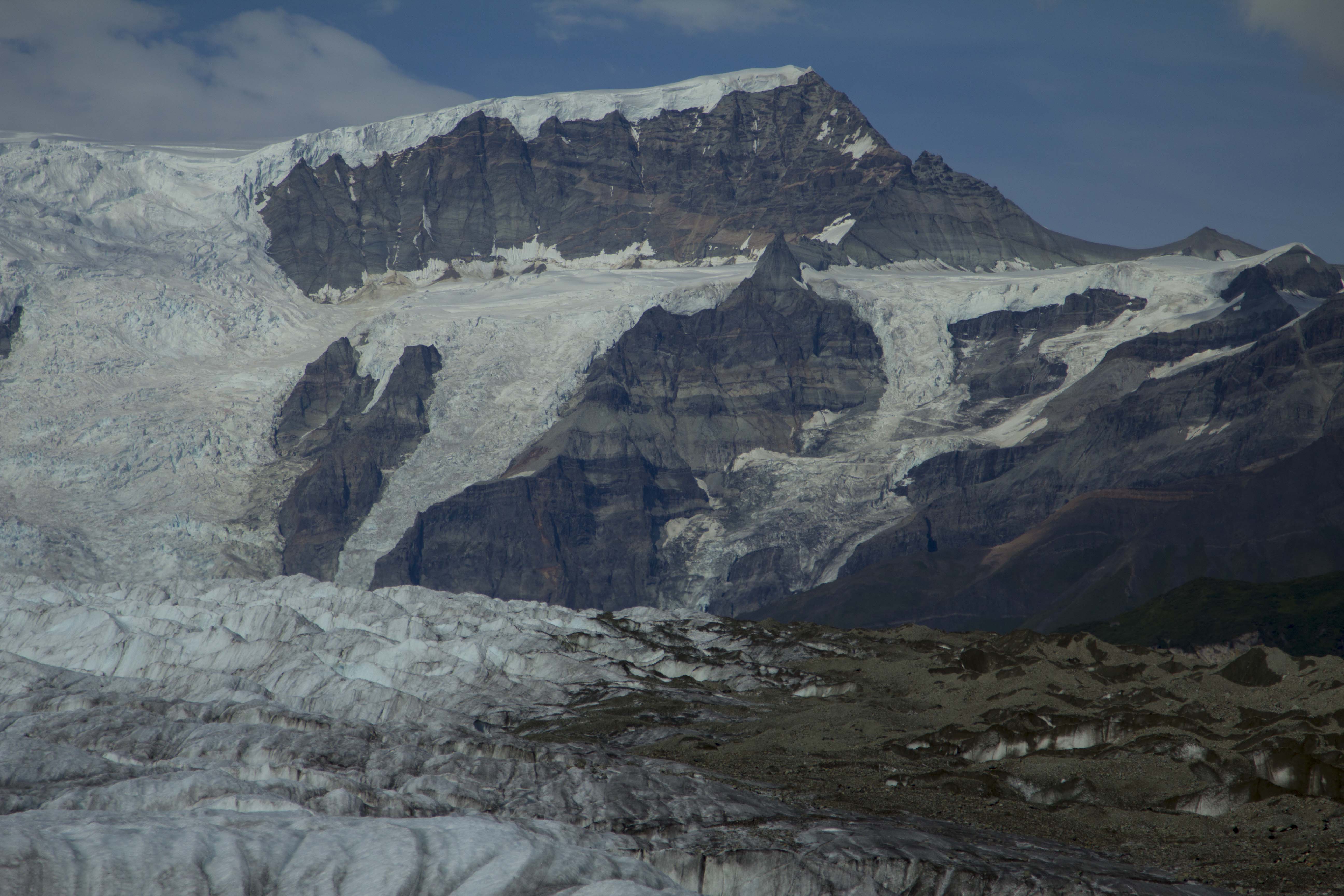
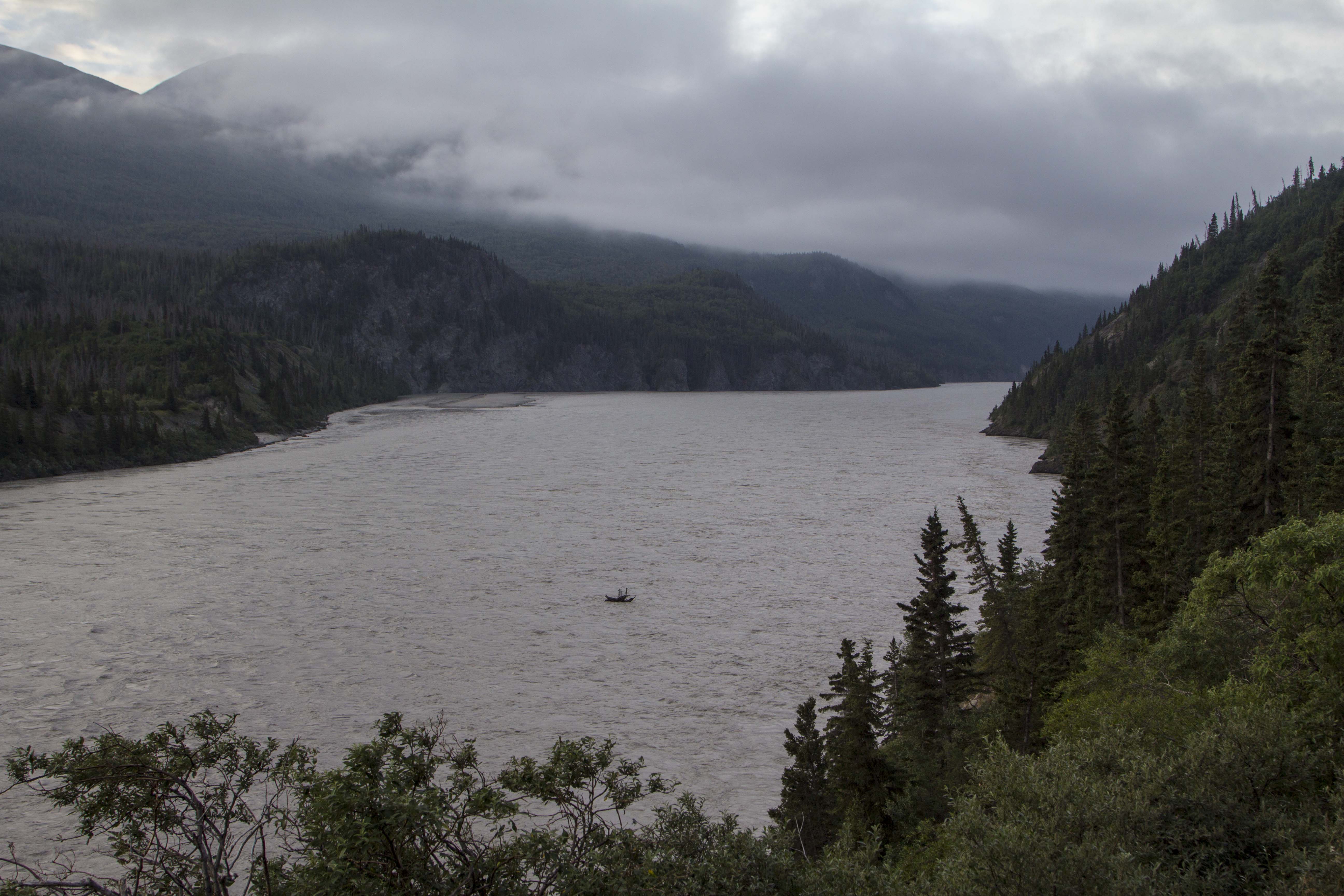
The McCarthy Road seems blessed with many small creeks and rivers’, all crystal clears specimens, born of the ice and flowing to the Sea. There are fewer lakes, however. Angela feels at peace when she is swimming in a lake, so we are always keeping our eyes peeled for an opportunity to do so. We pass Moose Lake and pull in for a spell, but decide to push on to another lake further up called “Long Lake”. The lake turned out to be a little farther than expected, but soon it appeares and Angela declares the place her spiritual home. She fell in love with Long Lake. Unfortunately, we find no spot to camp on it’s shores, but a site within it’s view were to be had; again, with the best Loon calls I have ever heard that evening. Even Salmon enter the lake to spawn and the resulting Bears can often be seen catching their lunch. The next day was a fine one, with perfect weather and a short pedal to McCarthy, we were rolling through town by noon. About a half mile before reaching the tiny village, one is greeted by a mountainous site that can hardly be called simply “a nice view”. That will not do. In front of us lithe Kennicott Glacier and the Root Glacier, both giants and flowing from towering peaks, smaller peaks nearing the flanks of the grand centerpiece of Mt Blackburn. As the ice river rises up to it’s birth place, an enormous ice falls shows itself, the “Staircase Icefall” as it is known is a sea of jumbled and towering blocks and seracs, all destined to crumbled downward and become a pat of the valley glacier below.
We find McCarthy more than pleasing; a tiny little town full of laid back folks, tourists, flight seers, bush pilots, and mountain folk. We buy a few groceries at the happily unexpected grocery, and chat with a few folks before departing to find a camp of our own. A local tells us of a trail that leads to the toe of the Kennicott Glacier.. We head out and after getting temporarily lost, we find our way and are rewarded by a great field of gravel ind ice and water. The Kennicott’s tarn, the size of an Alaskan air strip, is under constant barrage from it’s gravel covered ice source just above, and great splashes can be heard very so often. We camp near the shores of the tarn and admire the unbelievable glacial view from our camp. Later, we hike out, away from the tent, at dusk, to inspect bear prints Angels had spotted earlier.
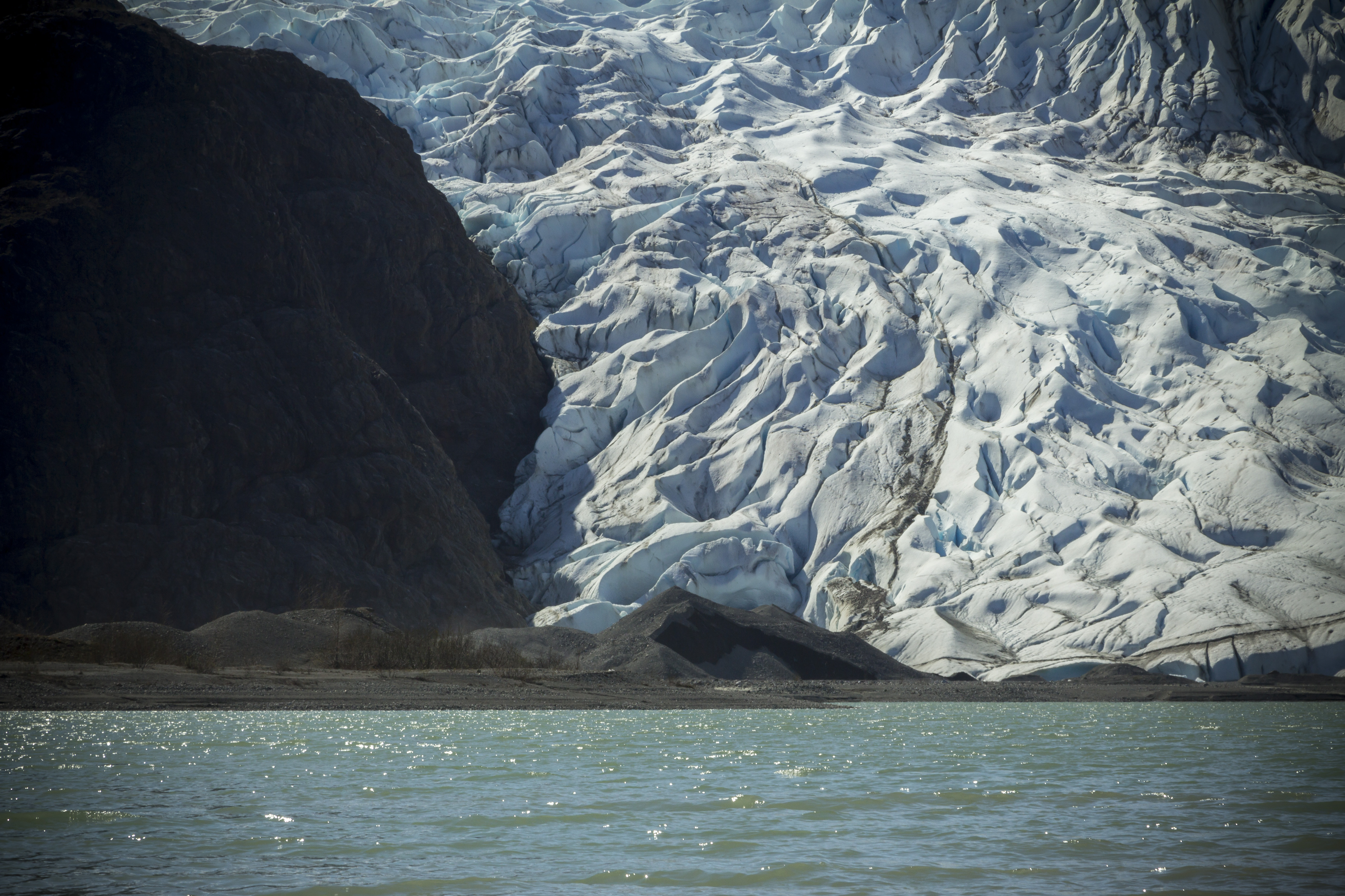
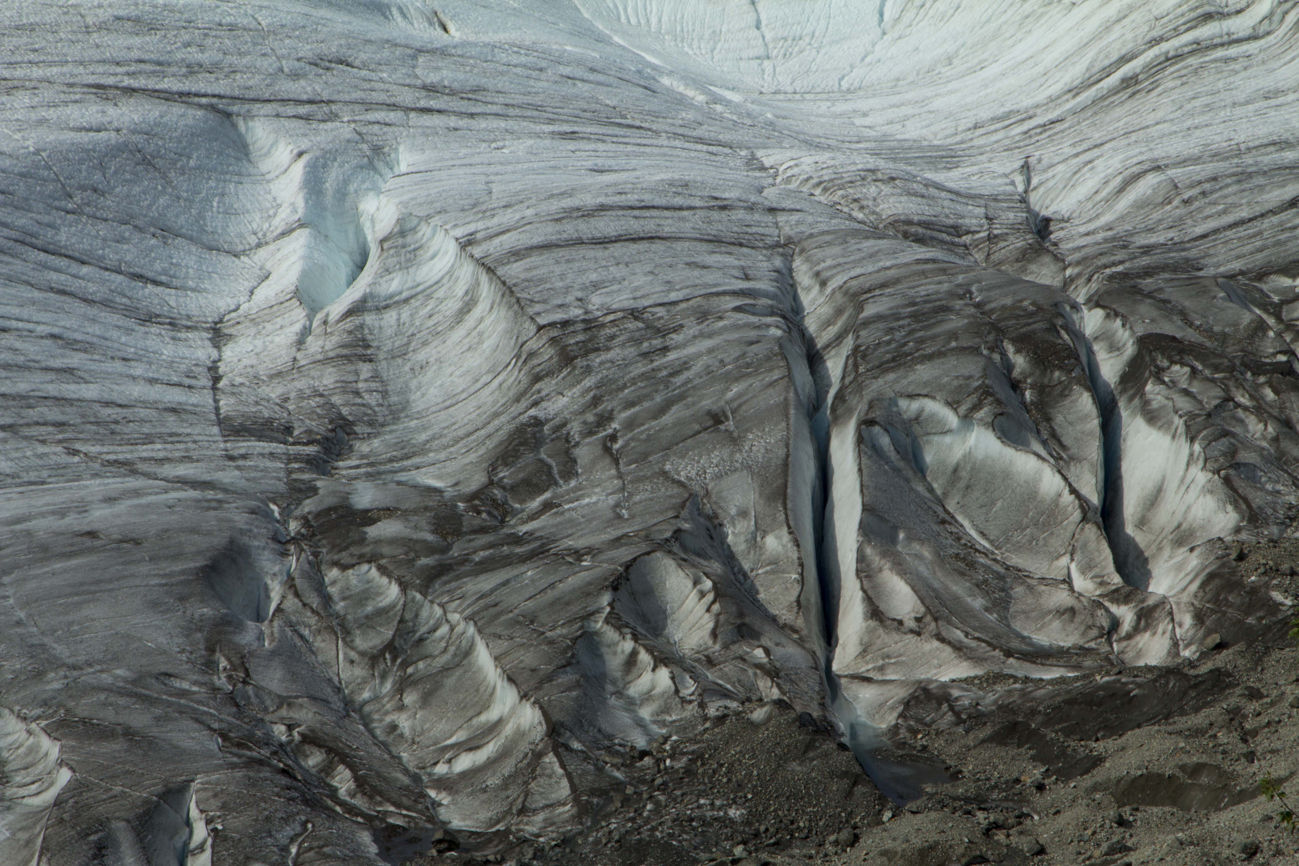
A day off of the bikes is in order and we decide to ride up the road 4 miles to the historic Kennicott Copper Mine, once the largest copper mining operation in North America. After passing through the mine area, we continue on a deterorating trail that soon requires the the bikes be parked behind a boulder and on foot we continue. We hike four, five six miles? up the valley, paralleling the Root Glacier, and high above it’s flanks. Eventually, we find a place that looks reasonable to descend, and down we go; crawling across the gravel covered ice hills to reach the main body of ice. Angela has never been on a glacier before, and it had been a while since I had last been on one this size. We cross out onto the flat ice, well below the firn line, and small, but open crevasses appear. A giant Mullion, the central body of exposed glacial water, is flowing wildly upon the giants back and we drink freely from it’s source. We ascend back up the loose scree to the trail and skedattle down valley to our bikes. A fast blast back to McCarthy takes only minutes and soon we are in camp once again. Our “rest” day consisted of riding ten or twelve miles and hike maybe thirteen or fourteen; we are spent. That night, very late, I got up and a bare twinge of the Aurora Borealis was beginning to appear. Summer was coming to an end.
The day following was Angela’s birthday, and it was raining badly. We take cover in the local coffee and burrito house and put off getting into the mud till past noon. The day was spent mostly in soaking wet conditions and endless amounts of mud. This signaled the impending end to my bottom bracket, rear hub, and drivetrain. We manage the day however; in the late afternoon, when we are ready to camp, an RV with two Europeans pull up and ask us about the road conditions to McCarthy. I tell them that the road is fine and they should have no problems with the road surface. As we were about to push on, the driver asks “Is it worth? I assumed that he meant is it worth the drive to visit a place such as McCarthy; I was taken aback and did not know what to say. Every where in Alaska (except Wasilla) “Is worth” in my opinion. The question of worth versus value is a question that I am constantly on the lookout for; everyones values are different, it seems. So that said, if one values what a place like McCarthy has to offer, then certainly “it is worth”. So I tell him: ‘ Look, if you are looking for 5 star accommodations, fine dining, a nightclub to attend to, or a theater, or a McDonalds, or a Walmart, then it is “not worth”, BUT, if you are looking to witness and experience some of the finest mountain scenery to be found on the planet, and have a great appreciation of all things wild and free, then sir, I promise you “It IS worth”!
The next morning we were back on pavement and headed back out to the Richardson Highway, in search of the next “worthy” wilderness.
After nearly a month of work in Fairbanks since returning from the Arctic, Angela and I decide that the best thing to do is for her to pick up my truck from my buddy Pat’s in Bellingham, and drive the damn thing to Alaska. This would accomplish two things; get her here and get my truck here, effectively getting two birds stoned at once. She navigates the truck through B.C., up the Cassiar Highway, and onto the Alcan for a 4 day trip to Fairbanks. One night around 1:00 am, Angela pulls up, wide eyed and exhibiting the thousand yard stare from many hours behind the windshield. We spend the next day and a half getting her bike prepped and our proverbial shit together, and together is comes. We leave Fairbanks at around 3 in the afternoon on August 4th, and still manage to pedal 34 miles to a nice woods camp in the Nenana Hills, including a stop at Skinny Dicks roadhouse for a beer and a laugh. The forest is a splendid place to be as the past weeks of being in Fairbanks had been wearing thin upon me. After hearty supper and a victory cocktail, we fall into a deep sleep that only two tired yet happy people can achieve. Pedaling the next couple of day brings us to Nenana, Healy, and McKinley Park; the third day of which, a car, speeding up behind me, veers onto the shoulder and nearly creams me, inches away from my handlebars. That night at a sweet lakeside camp just north of Cantwell, we watch as the sun sets behind the western rim and an alpenglow on the opposing peaks highlights a small herd of magnificent Dall Sheep, clinging wildly to the upper slopes. After entering the Alaska Range proper we finally sail into Cantwell, western end of the glorious Denali Highway, and an entrance into some of the most fantastic splendor and scenery Alaska has to offer.
The Denali Highway was built in 1957 and for many years prior to the George Parks Highway’s completion, was the only way to approach the areas of Denali National Park, hence it’s name. The road is 135 miles long and connects Cantwell to Paxson; 120 miles of that are dirt and gravel. To me, the DH, as I like to call it, is representative of the greatness that Alaska has to offer. Yes, that is saying something in a place that has greatness writ large across nearly every available foot of land spanning it’s monstrous heft. The DH traverses the entire Central Alaska Range, in all it’s glory, crosses uncountable streams and rivers, features tundra, forest, mountains and lakes galore. It also features some of the best free range camping anywhere I have ever seen. It is truly a mountain paradise.
We roll out onto the welcome relief of the gravel surface of the DH and, short of the dust from occasional traffic, sailed smoothly along the grandiose Alaska Range Central; surrounded by tundra, taiga, and wilderness. Dall Sheep and Caribou season starts in a couple of days and unlike the time I was here before, in 2011, the DH has more people roaming around, hunters in particular. We spy a two track leading into the forest and decide that there might be a reward at it’s end. We ride through beautiful forest and brush, spotting a large Bull Caribou along the way. After about a mile or so, the forest thins and the road turns downward to gain the roaring river below. But here, at this transition, lies one of the most spectacular camp spots of my life. It is an open view of all the big peaks of the range; Mt’s Hess, Hayes, Deborah, Geist, Balchen, and Shand. After recently reading Robert’s “Deborah: A Wilderness Narrative”, I was exited even more to once again be witnessing this spectacular place. In front of us was endless tundra and forest and river and towering peaks, encompassing one of the greatest wilderness regions on the continent. Watching the sun set upon this picture, with it’s hues of red and orange, mixed with the deep blue of the glacial spectacle in front of us, was a sight I will not soon forget.
The last time I was on the DH, I had found a camp , just west of the airstrip of the Gracious House, located atop a hill, overlooking the braided and surrealistic Susitna River, and it’s mother source, the Susitna Glacier. I had spent 2 days camped here prior, shooting time-lapse and photos and generally freaking out on how this place blew my mind. Angela and I hike up to the old camp for a looksie and a breather; and the view is as grand as my memory had served. We were looking to gain some mileage that day and decide to push on; we are rewarded later with a nice forest camp that is secluded from the road and offers a nice ridge top for an after supper hike before bed.
The following morning it is raining, the first of this leg of our journey. We pack it in and commit to the rain and the mud, and soon McClaren River Lodge comes ’round and we drop in for a beer and a cheeseburger. Back in 2011, when I was here before, I had ducked into the Lodge from a viscous rainstorm coming over McClaren Summit, and today was no exception. We leave the lodge during a brief interlude in the water’s descent, and climb the 1000′ up to the summit. We are exhausted and wet, and it is raining solidly. We ride down the two track of the McClaren Summit trail, and throw down our nylon ghetto onto the soft and sopping tundra and dive into the tent. In the morning, it is still raining, but our spirits are high as we prepare for the last day on the DH. Cool temps and more rain bring us to the beginning of the pavement 20 miles from Paxson and signaling the end of the highway. Again, we stop at the Paxson Lodge for a treat. The weather begins to abate, and as we leave, we are granted fine weather for a pedal down the Richardson Highway in search of another fine Alaskan camp.
Alaska is renowned for many things; big mountains, big rivers, and big Salmon to name a few. In fact Alaska has many, many of each. The Copper River is one such crick, born of the glacier and thrust knowingly towards a great and mighty sea to the south. It’s waters fast, deep, silty and cold; all the hallmarks of a great and fearsome Alaskan River. Being the tenth largest river in the United States, it is also home to one of the greatest Salmon runs in the world, and in a place festering with mighty river’s running full of the hardest working fish in North America, that’s saying something. July and early August are the time of Red Salmon or Sockeye as it is known; to me, the very tastiest of all Salmon’s. Theses beautiful fish congregate in large numbers at the mouth of the Copper, near Cordova, at the Gulf of Alaska. Over the course of a few short weeks, they swim, upriver, in search of their ancestral spawning grounds, to the place of their birth, to continue the cycle of life. Along the way, people have been harvesting these fantastic creatures for sustenance for thousands of years.
2 o’clock in the afternoon, Sven, Billy, and I pile into Sven’s truck and head south for the 6 hour drive from Fairbanks to Chitina, a tiny hundred year old fishing and mining community, born from the days of the mighty Kennicott. Chitina is a beautiful place indeed; nestled in a deep valley, surrounded by high forested and craggy walls, giant glaciated peaks of the Wrangell Mountains, festooned with wildlife, and situated at the confluence of the Copper and Chitina Rivers’. On the drive down, we stop at a pullout with mind numbing Alaska scenery, an eyeful of the central and eastern Alaska Range and it’s plentiful glaciers. It had been a couple of years since I had been to this place and it was as magnificent as I had remembered. We arrive in Chitina later, and meet up with Sven’s friends Cynthia and Diane. We will be crashing at Cynthia’s cabin and they will be joining us tomorrow, at the river. The last time friends were here, a couple of weeks past, they had caught their limit between the 4 of them: 70 fish! That’s a lot of cleaning and filleting, but in the end, it is a freezer full of the best eating there is.
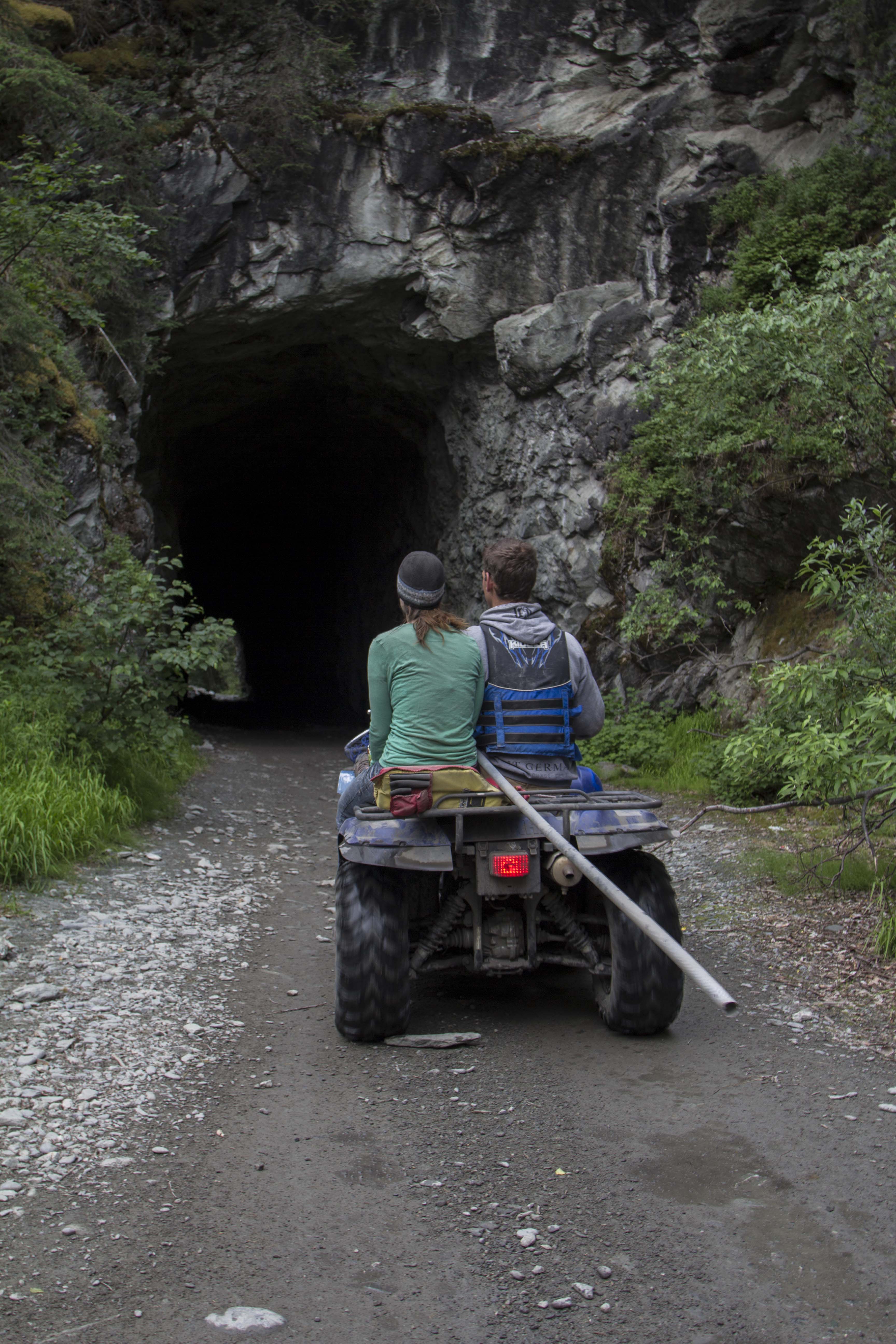
The trail in from the road to the good dip netting spots are 5 or 6 miles down river, however, Sven’s four wheeler ATV makes fairly quick work of ferrying 4 people, dip nets, gear and ice chests to the chosen location. By 8 o’clock, we have our ropes tied to the shore trees and to ourselves, and the nets are in the water. The river was intimidating at first; it is the sort that, if one fell in, you might be a goner. It is super fast and cold, with hidden logs, rocks, and all sorts of strainers, waiting to snag anything that happens to be in the water big enough to catch. It is also full of glacial silt; it’s appearance is that of fast, cold mud. It’s visibility is zero. But it is full of Salmon; I hope. After a couple of hours, Diane has managed to net 2 fish, a small one and a good sized one, and for the next 5 hours we were only able to land 3 more, for a total of 5 fish. Not the fish bonanza we had hoped for, as the cost of the trip necessitates a good yield. The river was definitely higher than normal; this probably attributed to the low numbers. One never knows when it comes to the Salmon running. One day they could be so strong that, could you see through the murky water, one might be able to walk across the river, supported only on the backs of the working Salmon. On other days, scarcely a few seem to be near by. Perhaps when the water is so high, they hide out in the eddy’s and holes, saving energy, awaiting the lower water and easier swimming, upriver and towards their goal.
By mid afternoon, we, with our 5 fish, decide to head out as it is a long drive home. As Sven is ferrying loads back to the truck, I clean the fish, pour the last bits of diesel fuel into the truck, and clean up. While the fishing was of limited success, the day was a fulfilling one, hanging with friends, taking in the best Alaska has to offer, and generally enjoying ourselves all around. Additionally, 3 of the 5 of us had seen bears today. Sven and Diane had seen a big Blackie earlier, and in the afternoon, Billy had come across a Griz crossing the trail and headed to the river, no doubt attracted the pungent odor of the Salmon. Afterwards, we say goodbye to our Chitina friends and hit Uncle Tom’s Tavern in Chitina, for a celebration beer; and afterwards, a long and tiring drive to Fairbanks, but with smiles on our faces.
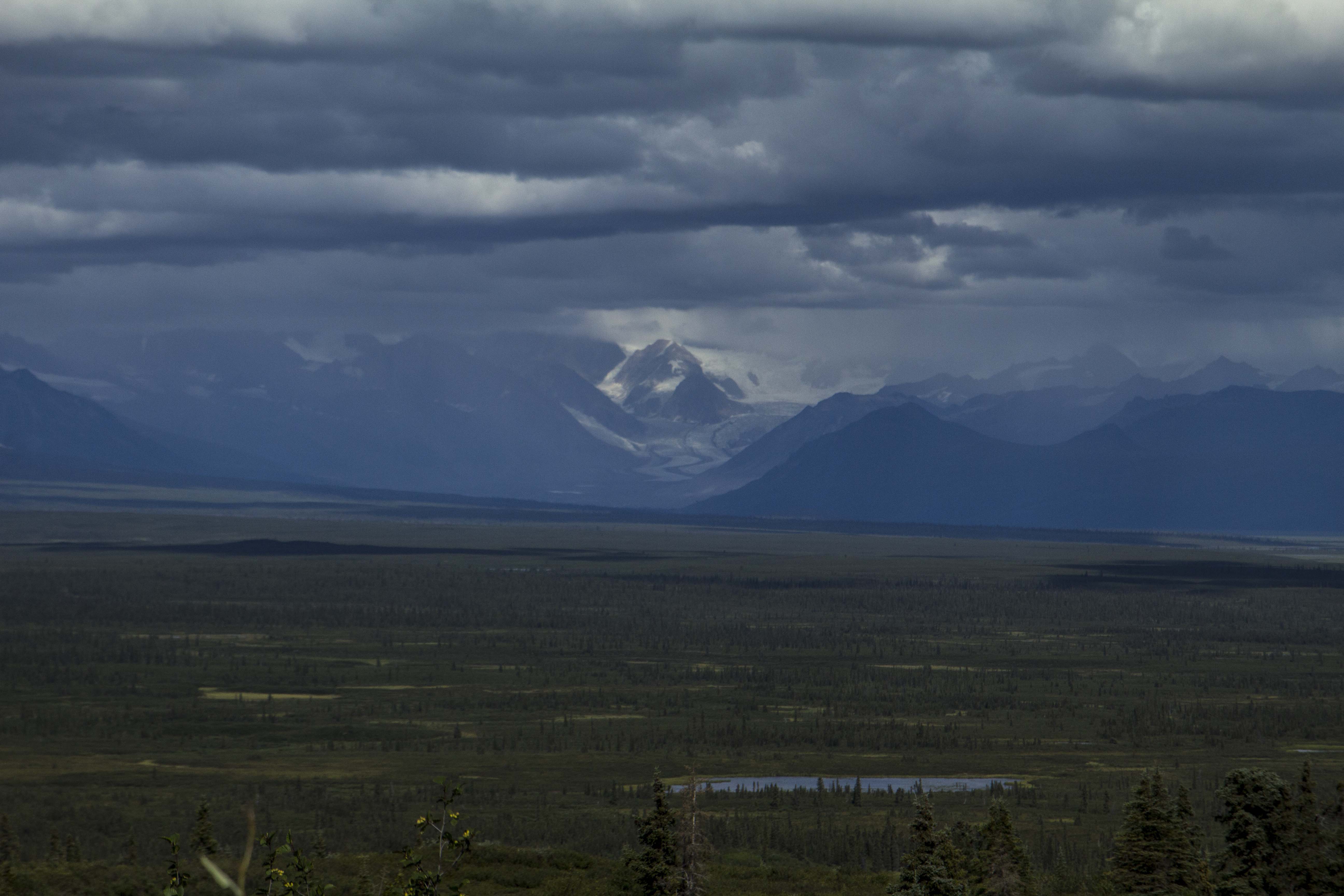
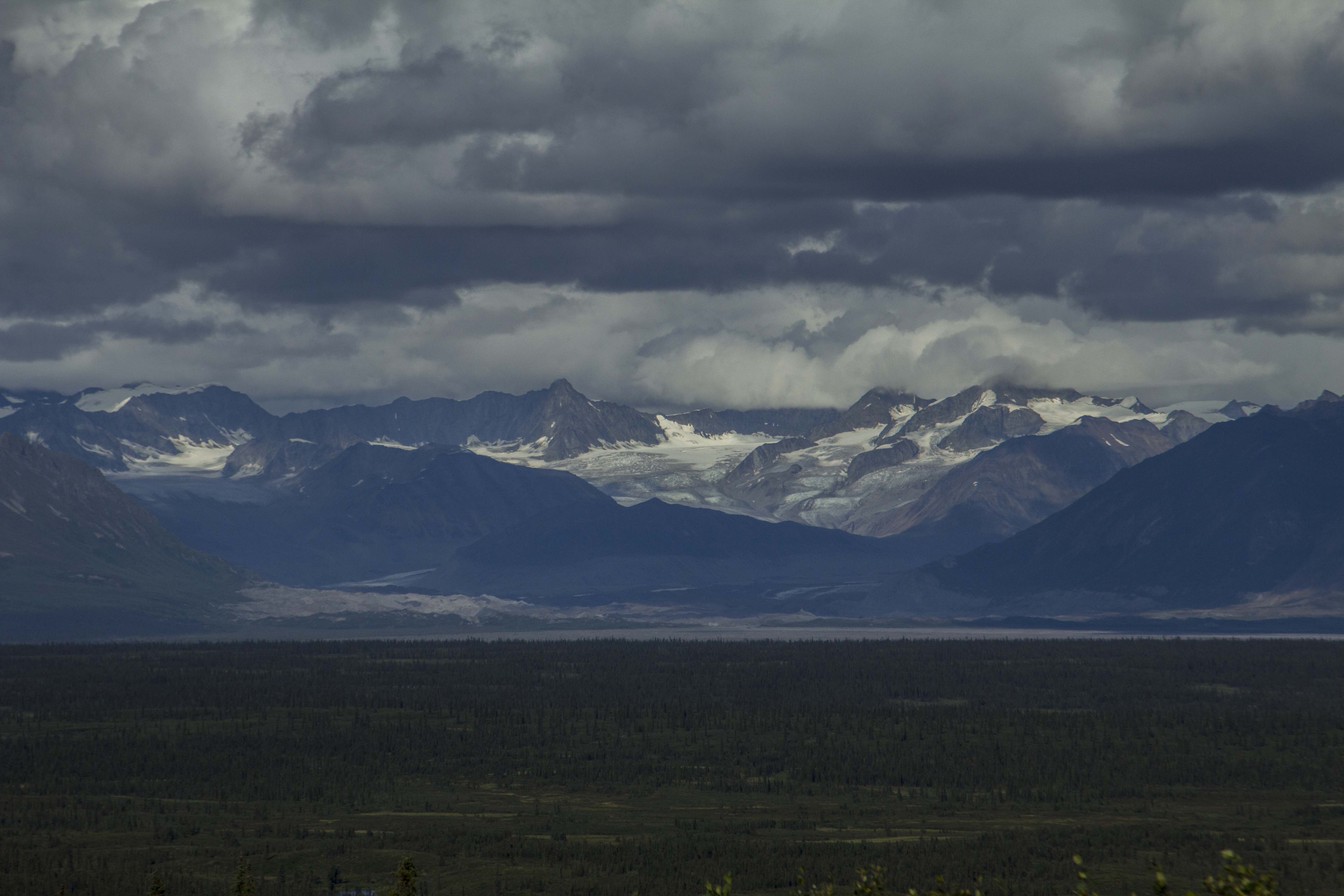
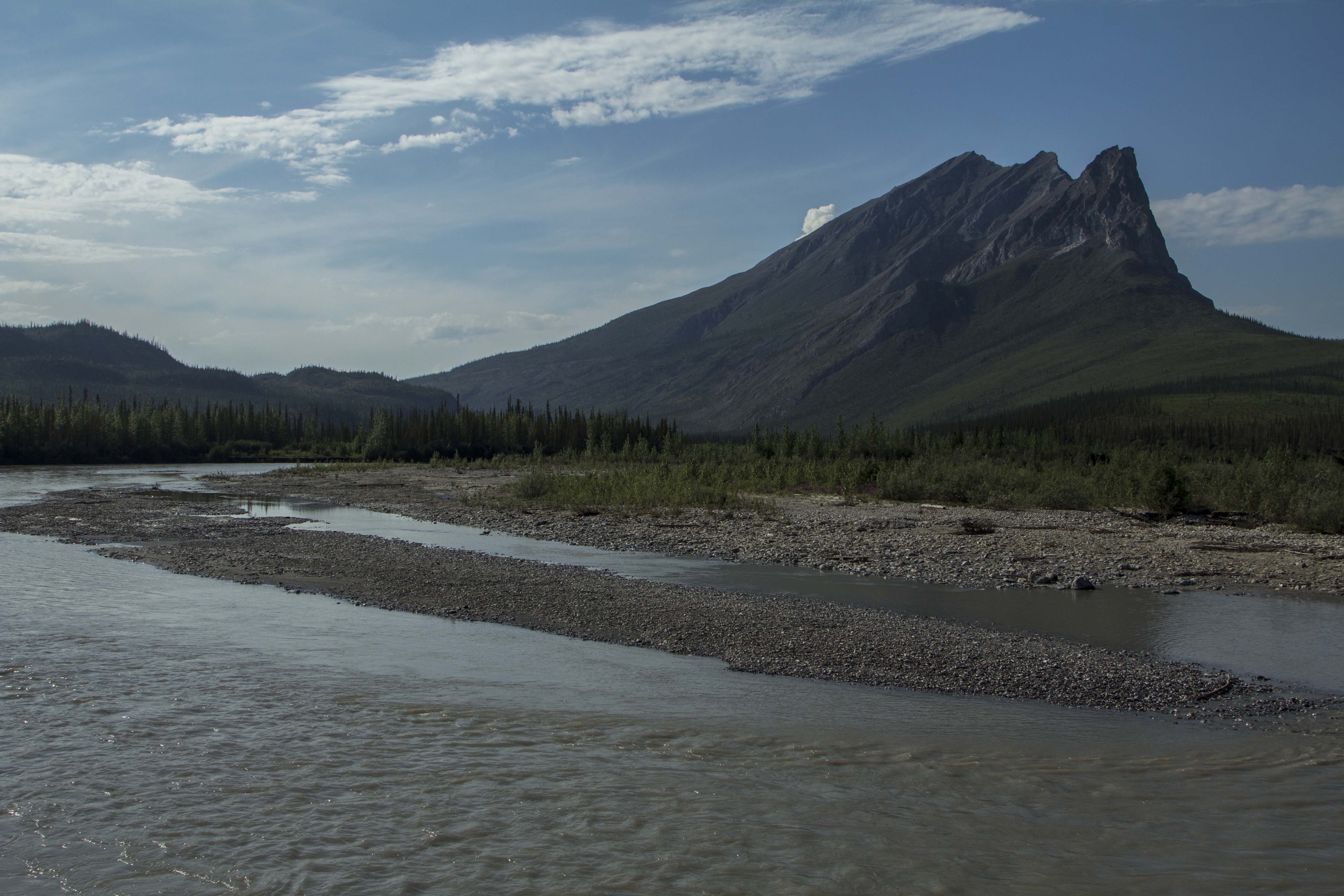
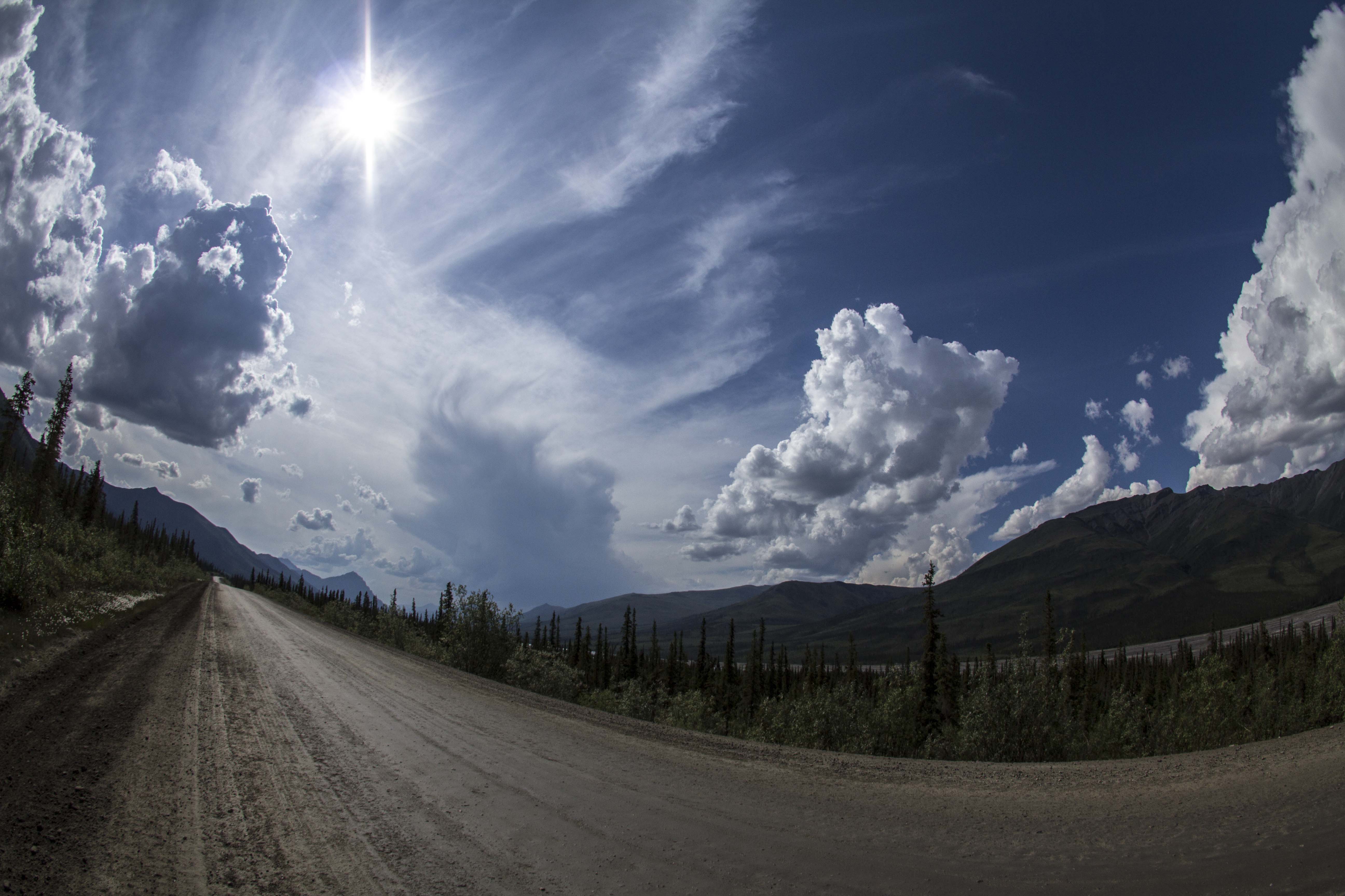
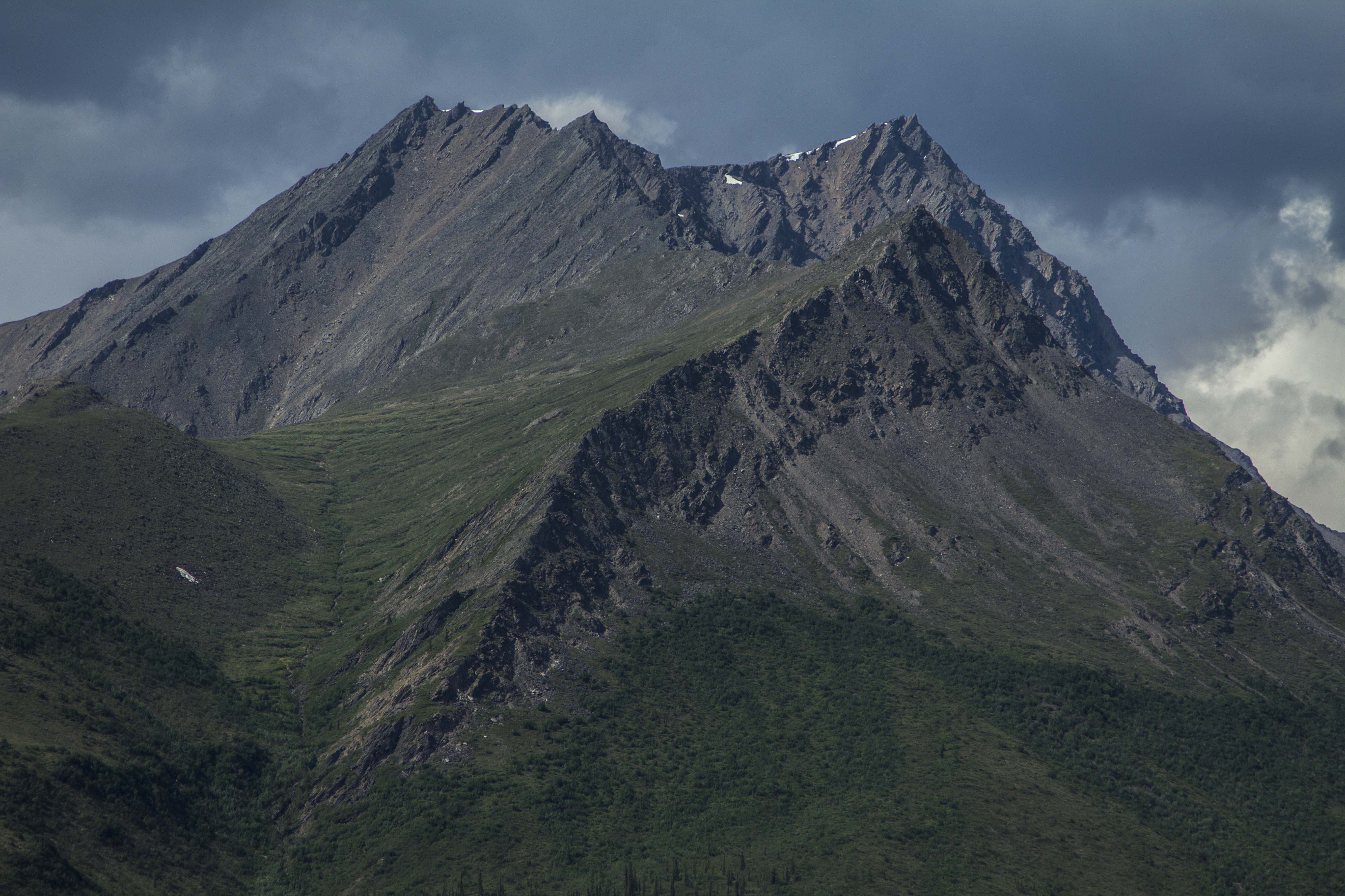
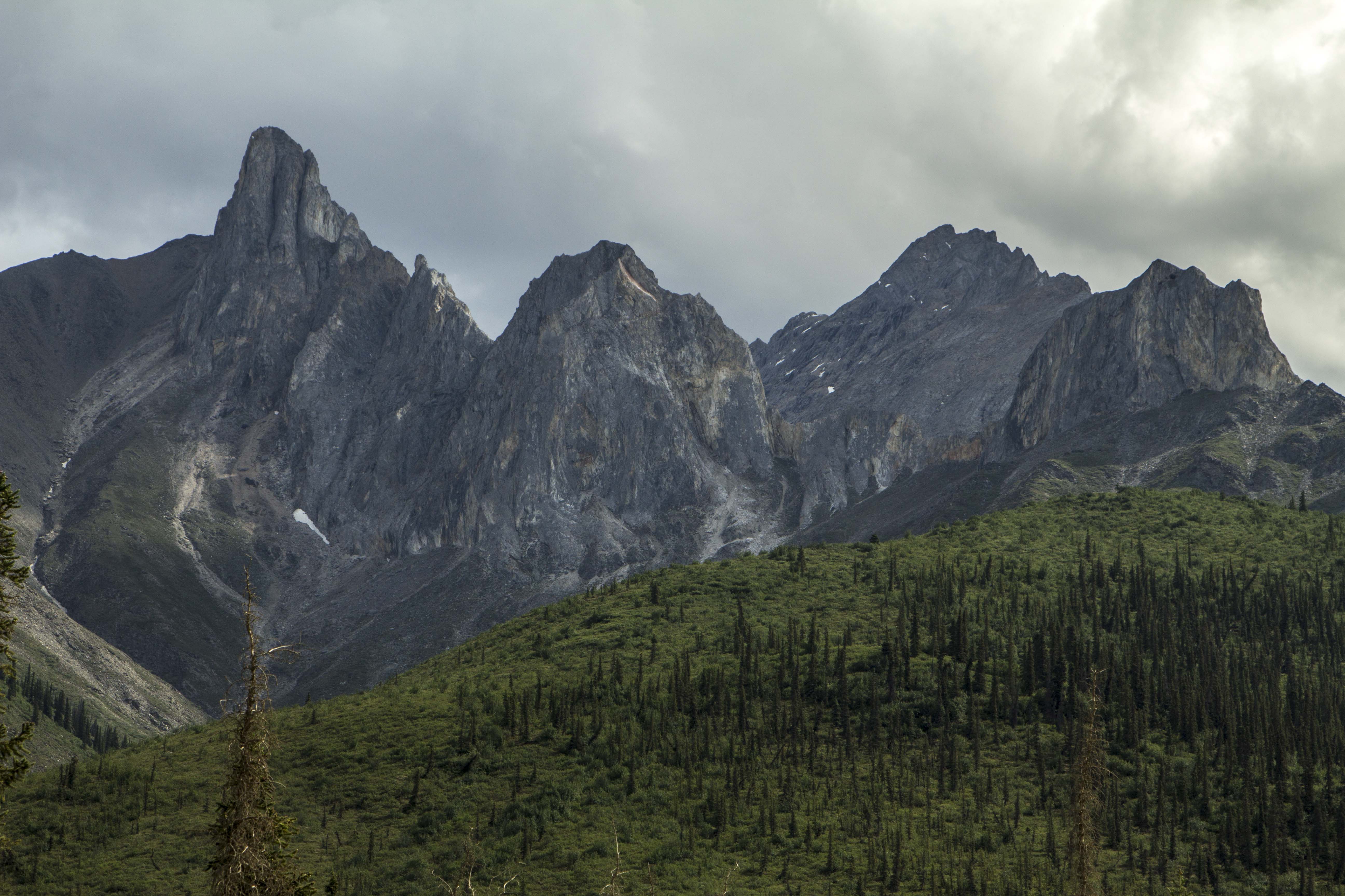
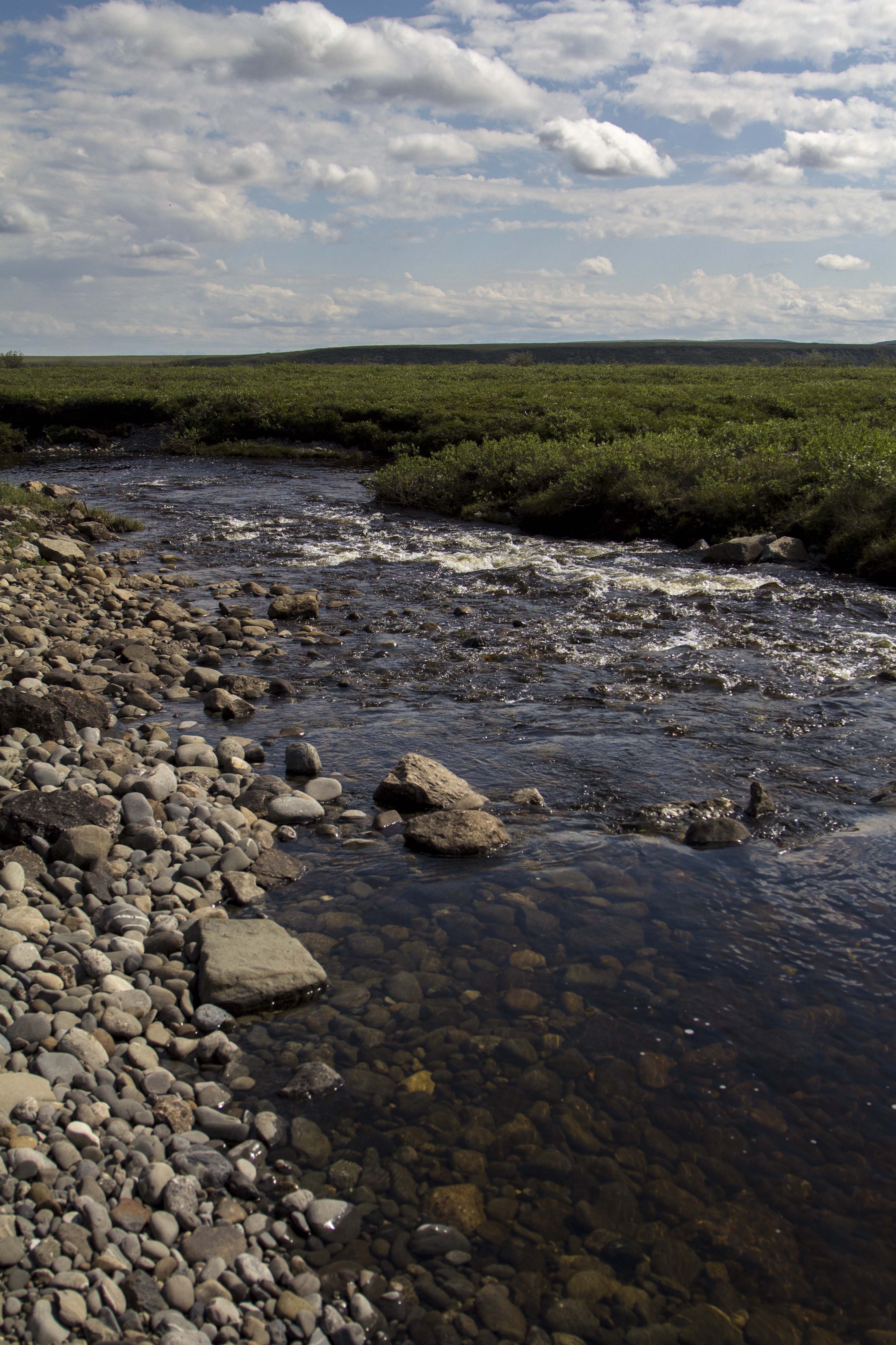
There are only two roads, in North America, that one might pilot a vehicle of some sort, which lead to this continents Arctic area’s. As far as I know, there is only one other road in the world that leads into the Arctic outside of North America, the Arctic Highway in Norway, which might just be the northern most connecting road in the world. The two roads in question are the Dempster Highway in the Yukon and Northwest Territories, of which I attempted to ride weeks prior, and the Dalton Highway, AKA “The Haul Road” in Alaska. Both of these paths’ through the wilderness are of the dirt and gravel variety, however, there are bits of pavement and chip seal surfaces as well, scattered about, here and there. The Haul Road, remote indeed, was built in 1974 as a supply line to the north slope oil fields at the Arctic Ocean, and parallels the Trans-Alaska Pipe-Line, was not open to use by the general public until 1996. Up to that point, the truckers had it solely to themselves. The Haul Road, as it was called in the 70’s, traverses a rugged landscape north of Fairbanks and leads to Deadhorse, Alaska. It crosses terrain varying from the endless, forested hill country beginning at Fairbanks, to Taiga swamps and open tundra, crosses many, many rivers and streams, and penetrates the “Alaskan Rockies”, the continental divide at the bastion of true roadless Alaskan wilderness, the mighty Brooks Range. The Brooks, since I was a teenager, has been a source of great mystery and a true icon of the remote and windswept tundra of northern Alaska. It has also been a dream to visit that whimsical place since that time.
Saturday morning I am up, gearing up. At Sven’s, all is quiet. There is not a soul stirring, most likely all are sleeping late from the inevitability of staying up too late in the bright Alaskan night time. Two night prior, I give a food bag to Sven’s trucker friend, Tommy. He is heading up the Haul Road to Deadhorse and will drop of my feedbag at Coldfoot. This will alleviate the need to carry 10 to 12 days worth of food, but cutting that amount in half. Thank You Tommy! I slowly pack my things and secure the Ogre for a lengthy trip into the wilderness. I pedal out of Sven’s area and on to downtown Fairbanks in hopes of finding some breakfast. After Eating, I head north, up the Steese Highway, toward Fox and Livengood. The coming onslaught of slim eating over the next week, prompts me to catch yet another grubstake near the edge of town and off I go, north.
That day was filled with some of the worst up and down hill climbing on a bicycle I had ever encountered and was indeed thankful for all the food I consumed; every calorie accounted for as I pedaled hill after hill after hill. Finally crossing Snowshoe Summit at the apex of Alaska’s White Mountains, I am rewarded with a long downhill and a natural stream of spring water shooting from a pipe near the road’s edge. The water is clear, cold, and delicious. Onward, passing a few creeks and abandoned cabins, I look for a camp. I pull onto a dirt track next to the Tatalina River and dive into the water after setting up. I am then greeted by terrible swarms of Alaska’s favorite insect. That night, I talk and drink Rum with pipeline workers from Pumpstation #7, just a few miles south.
The next day, more of the same hill climbing ensued, only worse this time. The hills are 12-14%, made up of loose, unconsolidated gravel, and the truck traffic is thicker than usual due to the summer time road maintenance. This day turned out to be the hardest of the entire Haul Road. By day’s end, I was so exhausted, I could do nothing but dismount the Ogre and push the dead beast upward and over the hilltops, coast down the other side and repeat. I was jello.
More big hills the following morning, lead, thankfully, to the Yukon River, where , once across, the road flattens out a bit and some nice forested Alaskan countryside sprouts from the earth like Grandfather Forest’s beard. Eventually, however, the hills re appeared and the grinding continued. After 70 miles, I find a gravel pit to call home right on the fringe of Finger Mountain and south of the Arctic circle maybe 25 miles. I am now seeing the first bits of true Arctic Tundra.. permafrost meltwater lakes, unglaciated Tors of granite, and windswept mountain passes are now within my eyesight.
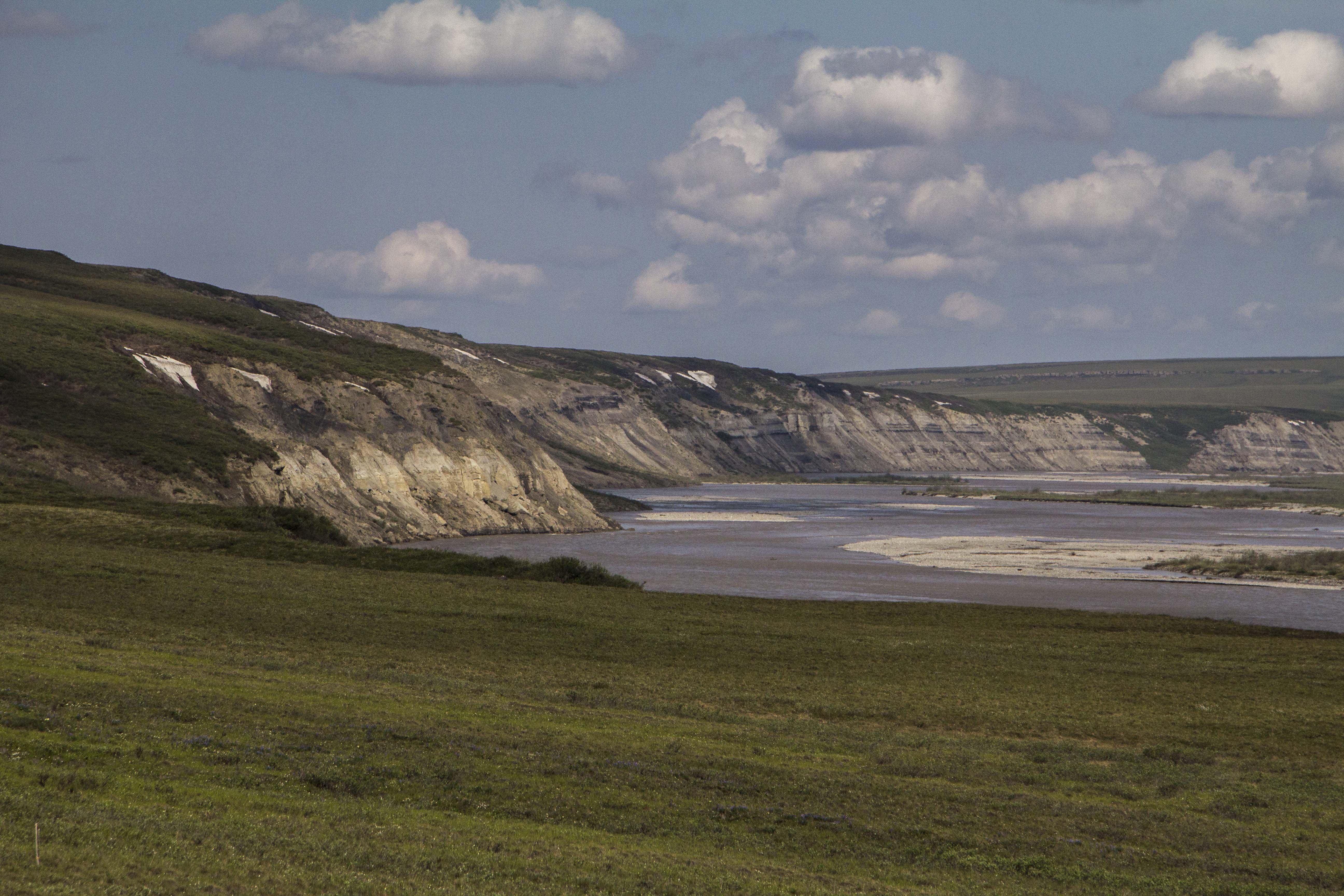
The next day, the landscape changes dramatically to the type of high country I so desire. After crossing the imaginary Arctic Circle, I cross over a small mountain pass and catch my first glimpses of the mighty Brooks Range. I drop into the valley below, and am greeted with magnificent spruce forest, and creeks filled with 24 inch Grayling. There is drinking water everywhere, a far cry from the relative dryness of the last few days out of Fairbanks. In fact the dryness was accentuated by the fact that north central Alaska has been experiencing one of the hottest, driest spells in history this week. The second day out of Fairbanks it tipped the scales at 94 degrees! This new landscape was what I came here for… unparalleled high country filled with river’s, mountains, forest, and animals.
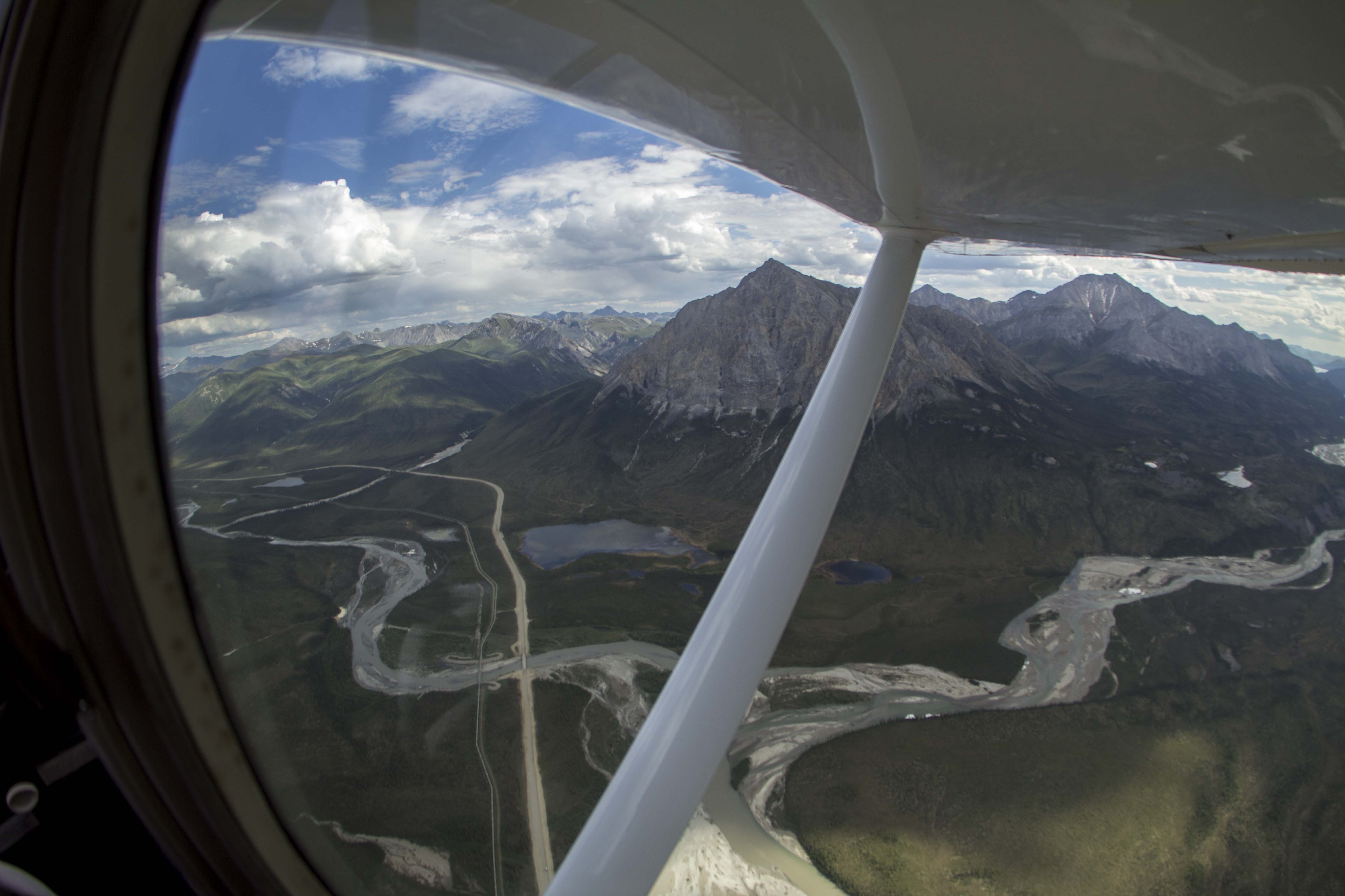
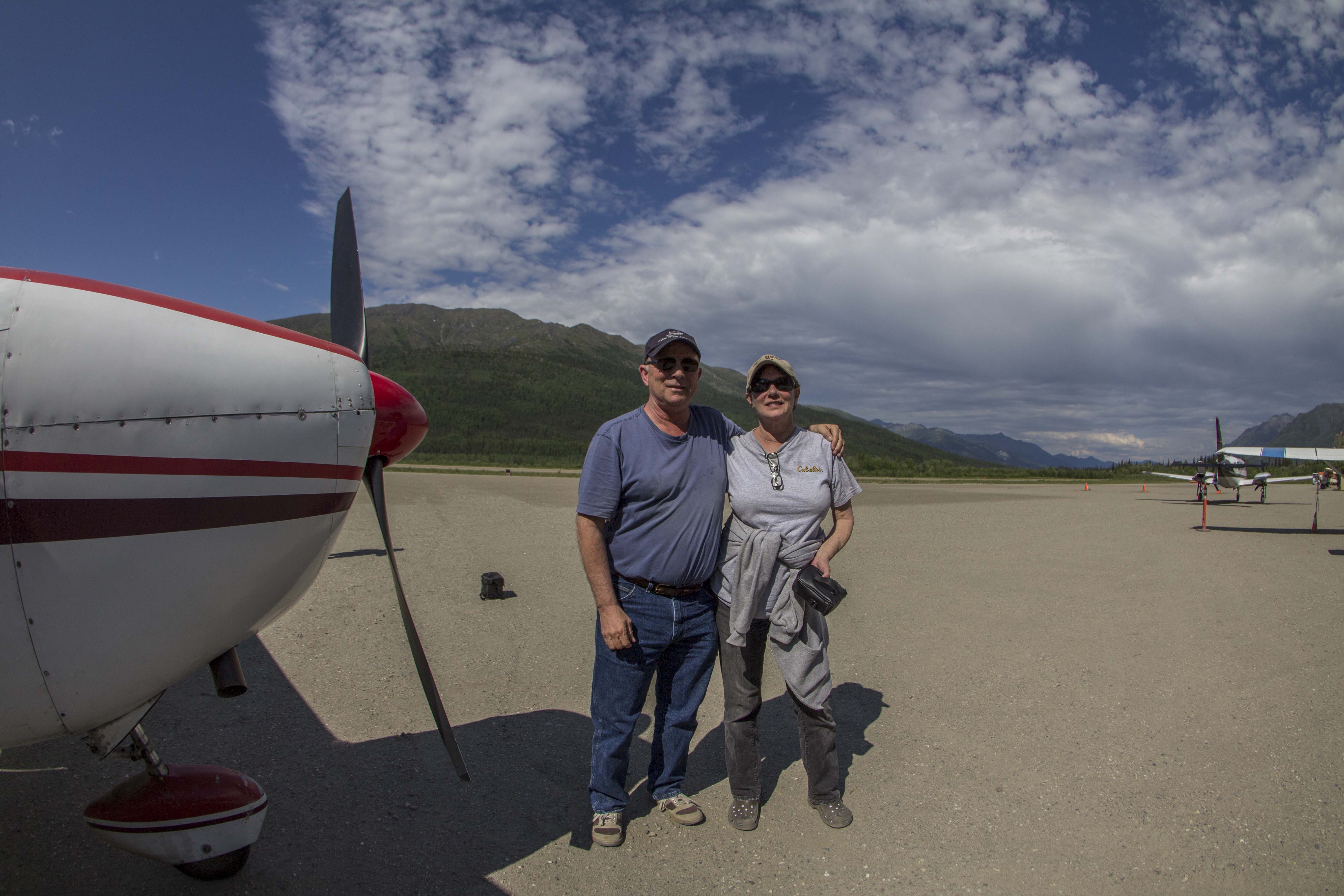
I roll into Coldfoot, the half-way point on this path, nestled in the Koyakuk River valley, in the heart of the entrance to the Brooks Range. I find a decent camp next to the river and go into “town” to find my food box. The box is not there.. Tommy had not made the trip, but had relayed the box to a friend of his to drop, but so far, it has not shown. There is a bar and a restaurant here and the food is decent and the folks here are nice and the scenery is unbeatable, so I have no problem sitting tight for a spell. Over a couple of beers, I meet Tom and Jane, a couple of extremely nice folks from the Hood Canal area of Washington state. They have flown up here from the states in their Cessna 180, and offer to take me on a short flight over the Brooks tomorrow if I wasn’t doing anything. Are you kidding? This notion makes me grin as wide as wide can be, and I accept. I meet with them the next day and, by noon or so, we are in the sky, flying over what can only be described as pure and simple wilderness bliss. Huge, craggy peaks, endless tundra mountains and rivers of a proportion that I can barely comprehend unfold before my very eyes. I hold back the tears of joy as I witness a childhood dream come true. There are no words to describe how my heart feels in this place, even from an airplane. How will I feel when I am actually in it? After about an hour, we head back to the Coldfoot landing field, and I thank Tom and Jane for their generosity. I wish them the best, and I hop on my bike, high as kite from the last hour’s experience, and eagerly pedal directly into what I had just witnessed, looking now for a direct contact with the landscape before me, which is exactly what I got.
A couple of hours pedaling through mind boggling, awesome scenery, I decide to get off of the Haul Road proper, and get onto the pipeline pad road, which offers a bit more of the deeply spooky solitude that this unbelievable place can offer. Eventually the road dead ends when the pipeline disappears underground, which will dictate me backtracking to the Haul Road for a couple of mile. BUT, at it’s end, a spectacular campsite is to be had, on the Koyakuk, and facing a “sunset” view of the mighty southwest face of Sukakpak Mountain, an impressive chunk of pre cambrian limestone real estate. After swimming in the Koyakuk, I set up the camera for an evening time-lapse of Sukakpaks’ dramatic episode of color and changing light. I feel I have finally entered the place on this leg where I want to be; The High Country.
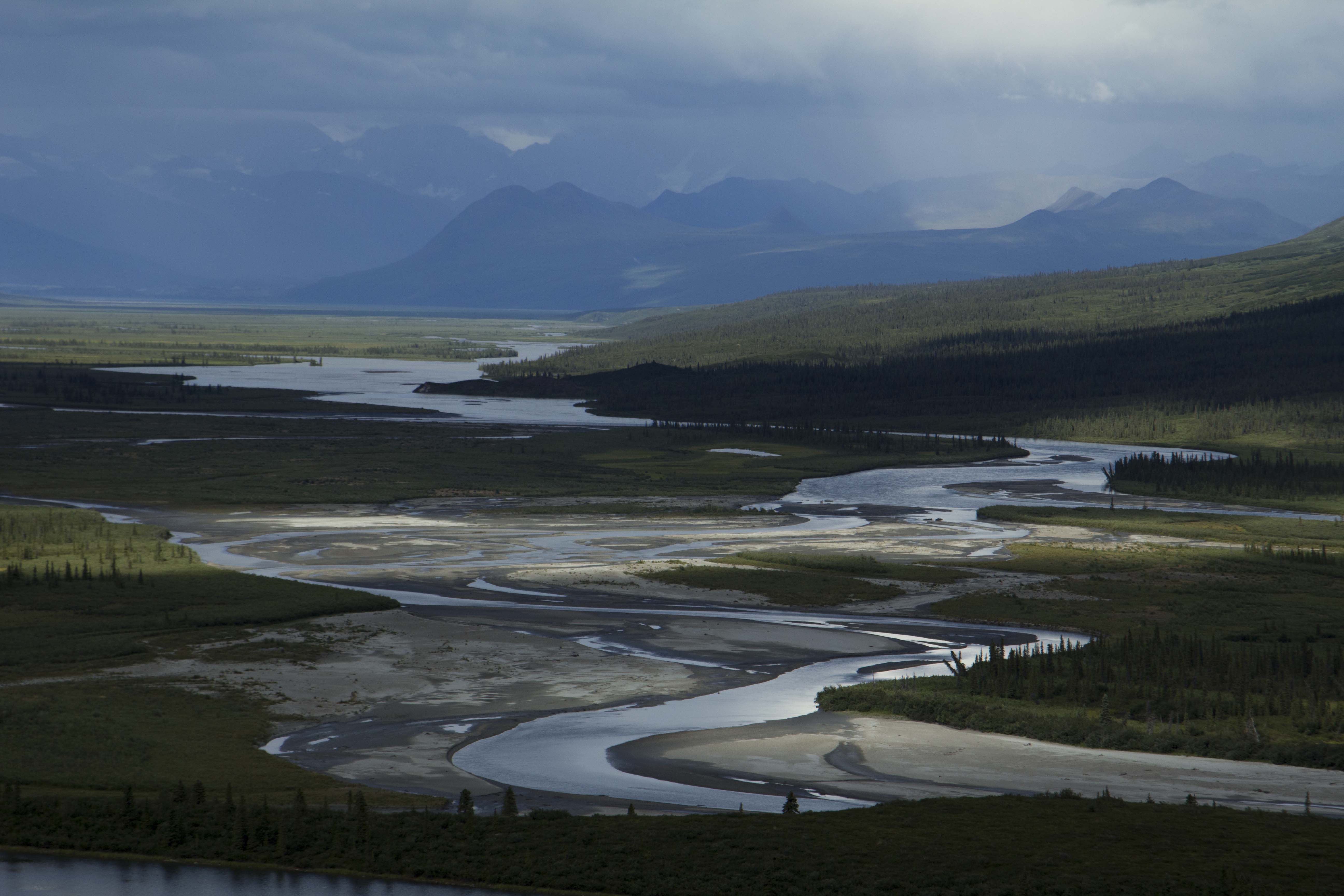
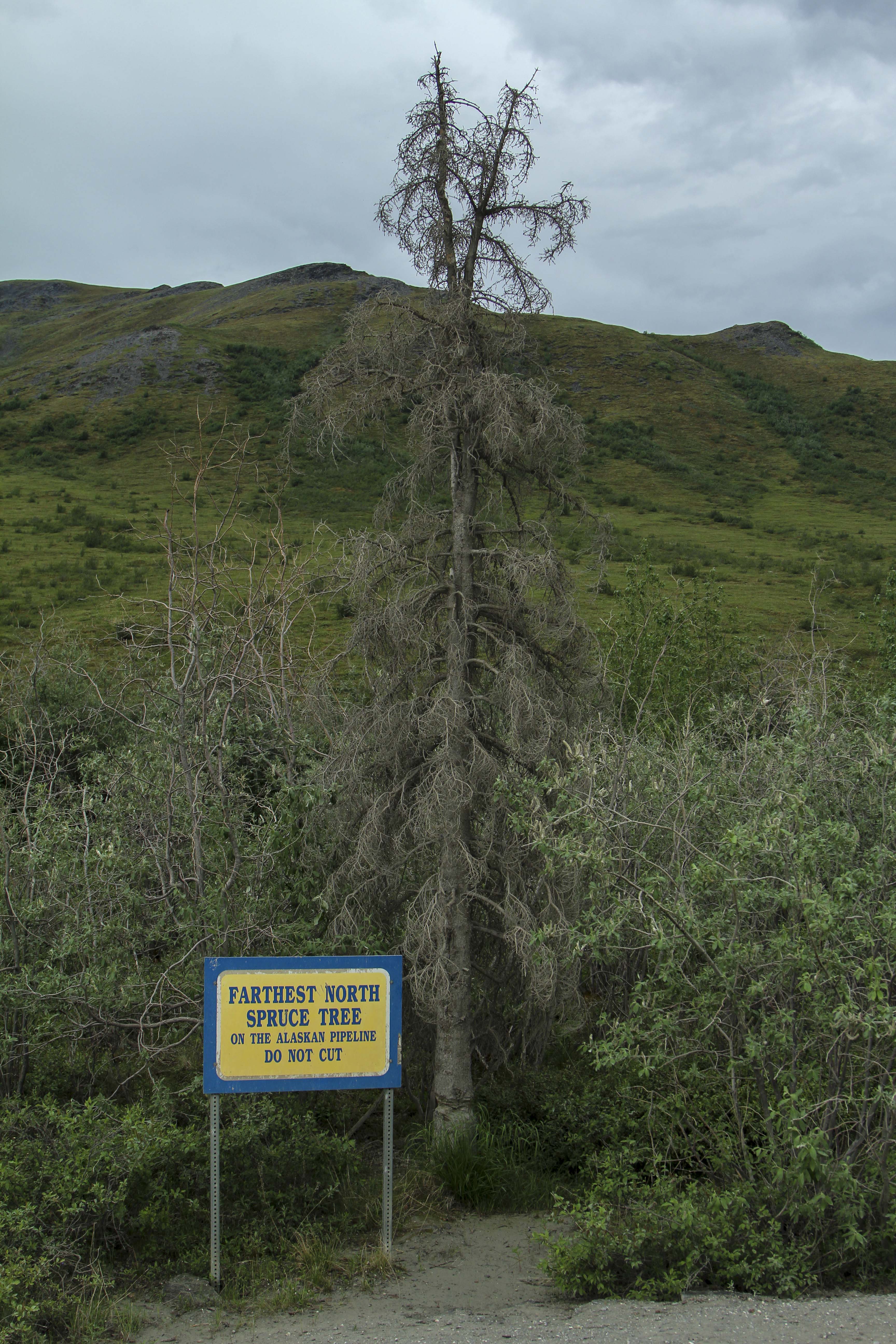
The following day is the creme de la creme; 40 miles of dead flat, yet scenery of a mesmerizing nature ensue. I see Eagles, Moose, and Fox, but no Bear, Caribou, or Wolf. The river becomes heavily braided; the forest begins to thin out. Signs of a changing ecosystem; of a different stature, more rugged than the previous mile, unfold. The weather begins to change too.. Thunderclouds build, then unleash, I retreat under a bridge and watch the storm from beneath, sitting next to river ice pack still 36 inches thick, here on June 20th. The storm breaks and and so do I. A few short miles and I pass the final spruce tree in this part of North America. No more trees at all, in fact. It is all tundra and the road begins to climb. Up, up, I go; the road flattens once again onto the spectacular Chandler Shelf, a flat area of a couple hundred square miles of tundra in the heart of the Brooks, just below the continental divide of Atigun Pass, Alaska’s Highest and most northerly road pass at 4800′. As I near Atigun’s summit, the storm once again decides to unleash it’s fury. High winds, sideways rain, and plummeting temperatures commence. I top out at 9:30 pm and find a patch of snow free tundra a way off the road and pitch my tent right there on Atigun’s high point. Even with guying the tent, I still have to brace the 4-season Easton shelter from the inside to prevent poles from snapping. Finally, the wind dies off and I drift to sleep, dreaming that night of being yet deeper into this range of magic mountains in the North, father in than I am now, traveling high valleys among Grizzly Bear and Caribou.
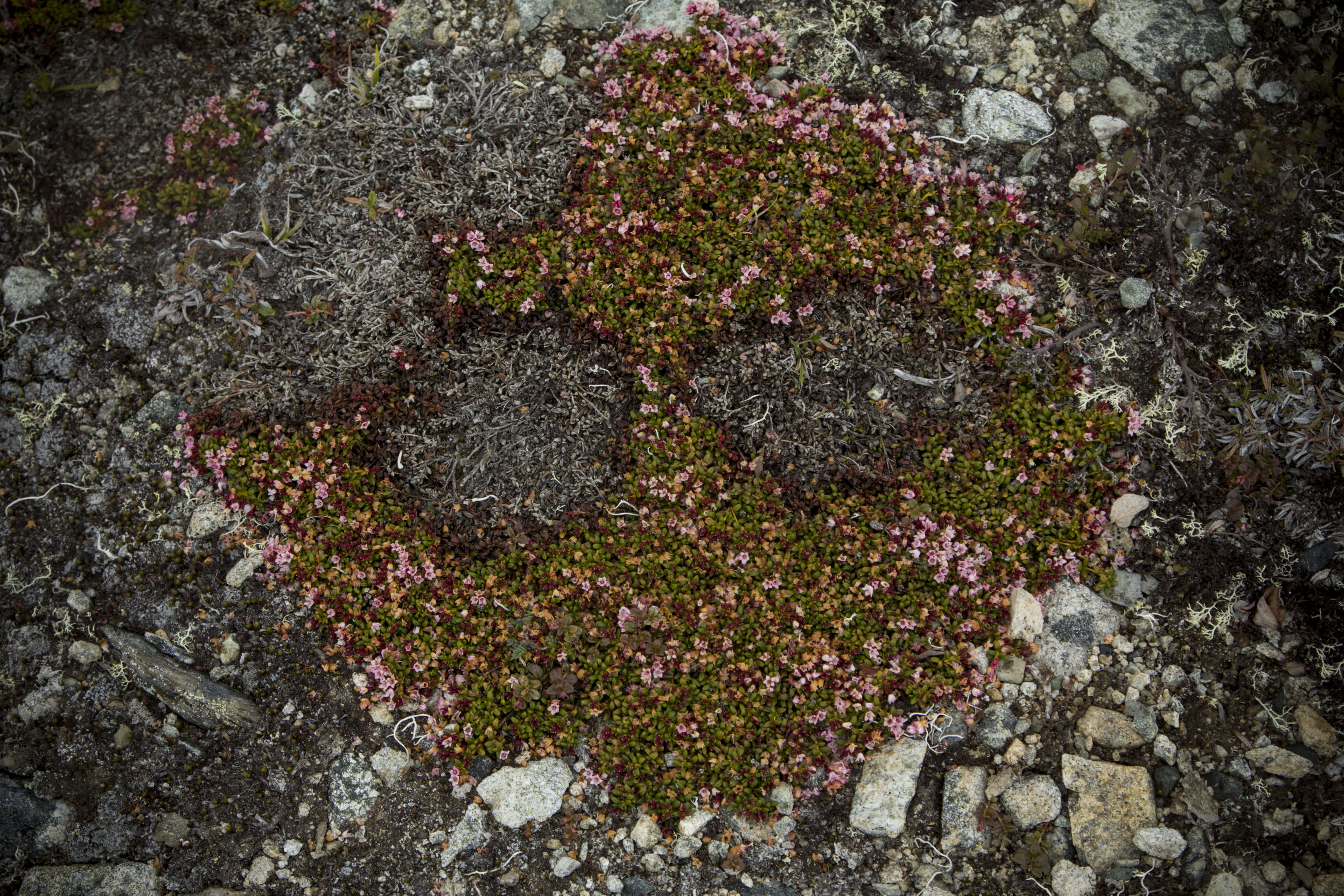
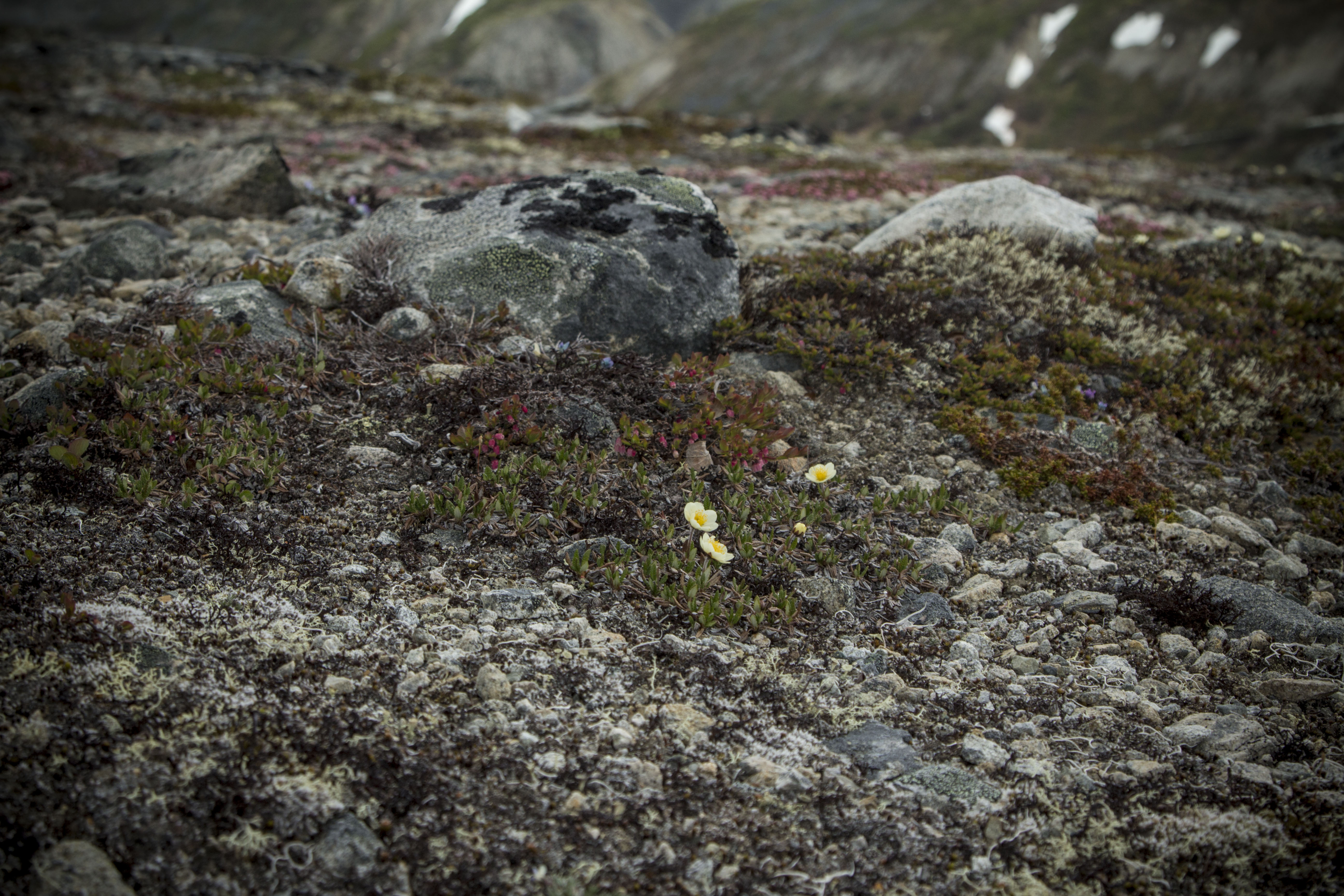
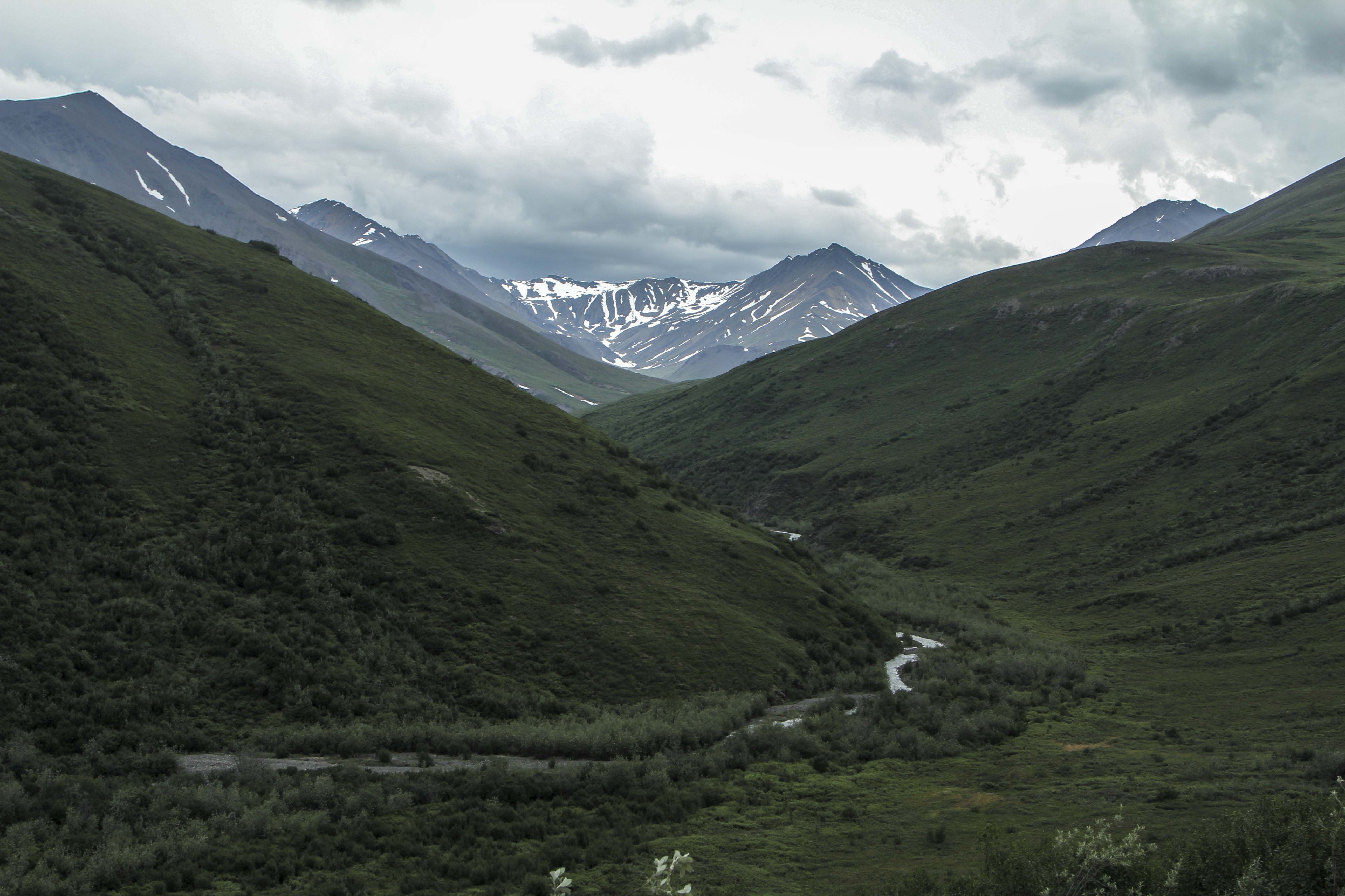
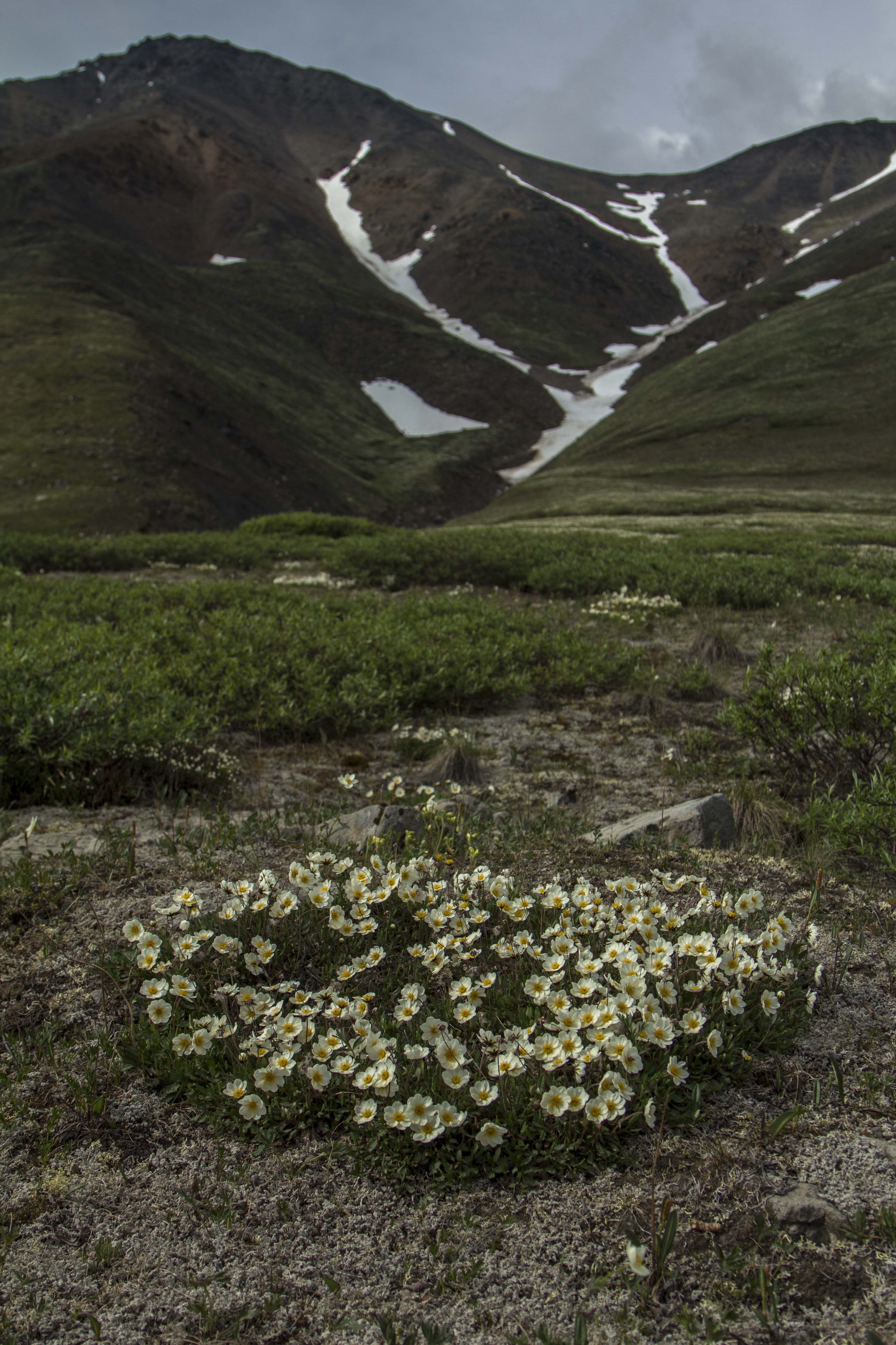
I awake to a deeply silent atmosphere of near whiteout conditions; it is eerily calm. I pack up, and descend the pass slightly to the shelf on the north side and park the Ogre for a hike up to a ridge top. The tundra here is short and squat and is easily traveled upon. It is festooned with tiny wildflowers of all shapes and colors. I pass the remains of a young Caribou, probably taken by Wolve’s. Farther up, I glimpse down great gully’s of rock towards a massive creek with outstanding waterfalls feeding it’s need to descend into the Atigun River and beyond into the Arctic Ocean. The peaks are mere 6000 footers, but are massive just the same. The Brooks is a dry region, as is the Arctic in general. It really is mostly an Arctic desert. There are a few small glaciers scattered in a couple of places in the Brooks, namely, the Arrigetch Range to the west and the Romanofz Moutains to the north east. But not here. There are thin gully’s of snow descending from the rocky summits of these peaks, providing a striking contrast to their nearly black and orange coloring. Eventually, I descend back to the bike, and continue on, down Atigun Canyon, and onto the great Arctic Plains of the Alaska’s North Slope.
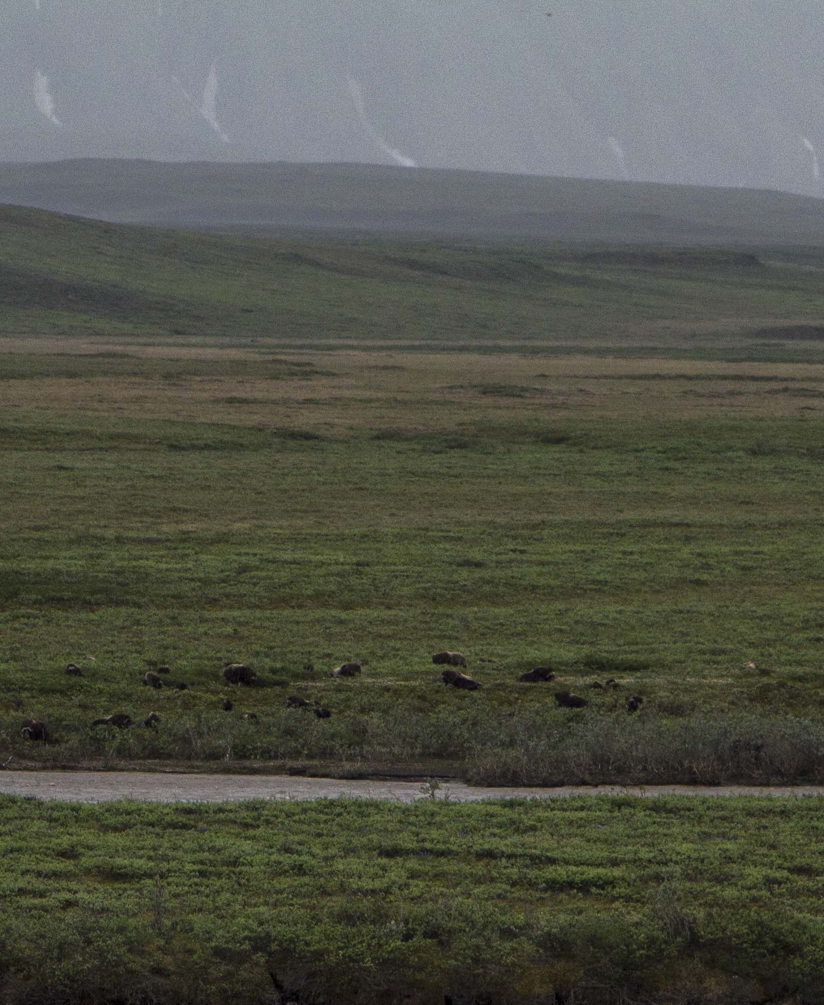
The next two days are flat tussock tundra, starkly beautiful, and swelling with my favorite insects. I still see no Bears, but, plenty of Fox and Caribou. Alas, I spot a herd of twenty strong Musk Ox; the pre-historic, ice age creatures of the North American Arctic; an iconic figure of strength and endurance in this vast, untamed arctic landscape.
The next day, rolling into Deadhorse, it is 28 degrees F, and 40 MPH winds, but othersise uneventful. Deadhorse is the center of North America’s largest oilfield, which stretches for over 70 miles to the west. Camping looks grim, so I stay at the Prudhoe Bay Hotel, which, for 125 bucks, includes 3 meals and free laundry. I figure it is a good deal here at the end of the continent and decide to pull the trigger. After a fitful night sleep in a strange bed, I pedal out of town a couple of miles and lay the bike down and put out my thumb…
…Later, after no success in hitching a ride back to Fairbanks, I catch an hour and a half flight back to Fairbanks, where, as it turns out, I have a job waiting for me to start right away. So, without time for rest or reflection, I begin work.. Operating a chainsaw in the woods 8 hours a day. Thing could be worse…
I am happy, but tired…
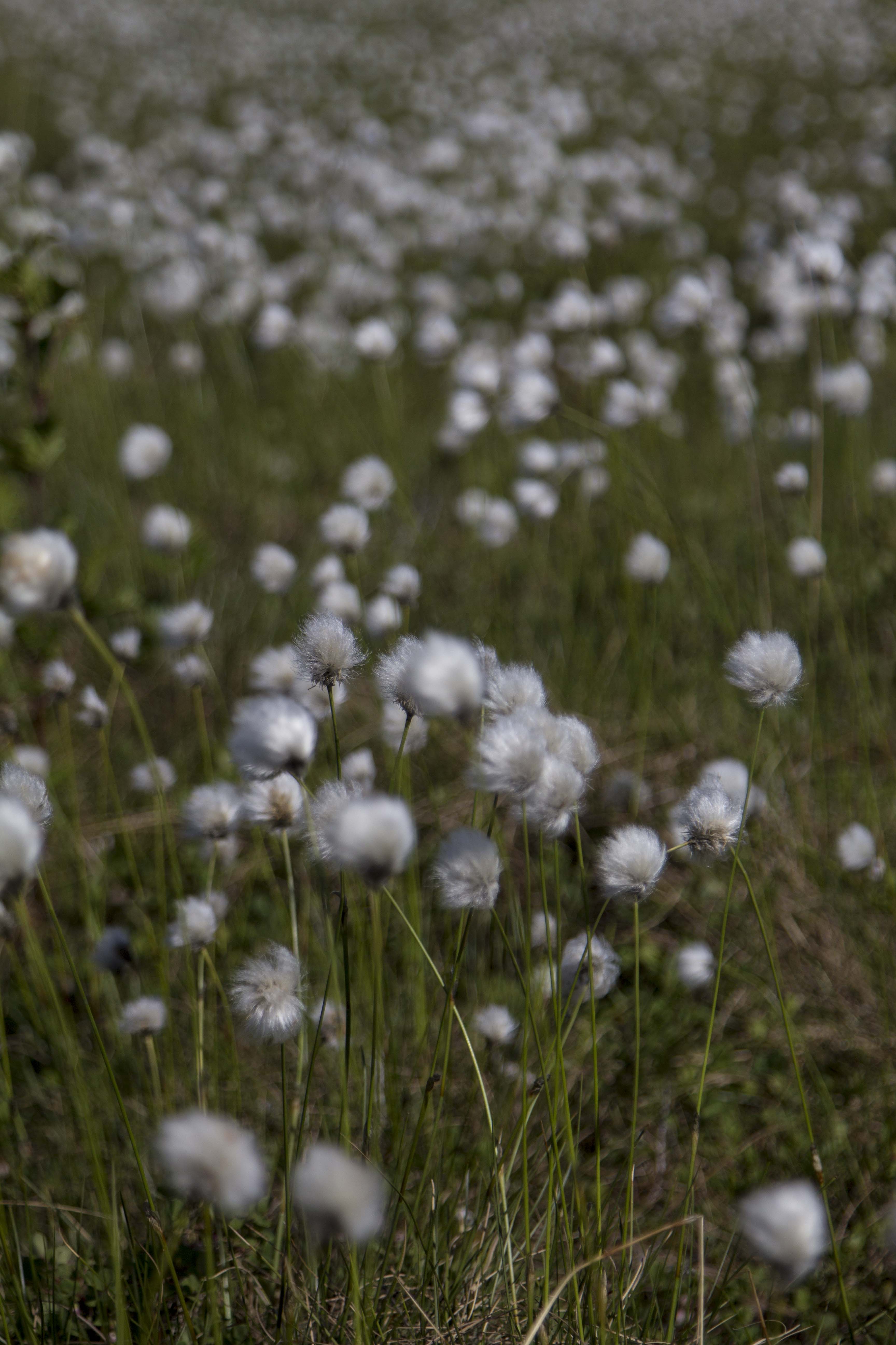
Dalton MudCotton GrassTundra Near Finger MountainThe Grayling Filled Jim RiverThe Brooks From AbovePilot TomTom and Jane From Washington StateSukakpak Mountain
Well, I’ve returned from pedaling from Fairbanks to Deadhorse, across the Brooks Range and into the Alaskan arctic; that be told, I’m tired and possibly starting a job for a couple of weeks to earn cash for the continuing journey. I do not have time to do a full update at the moment, but soon come, so check back! Here’s a couple of teaser shots from the Brooks Range…
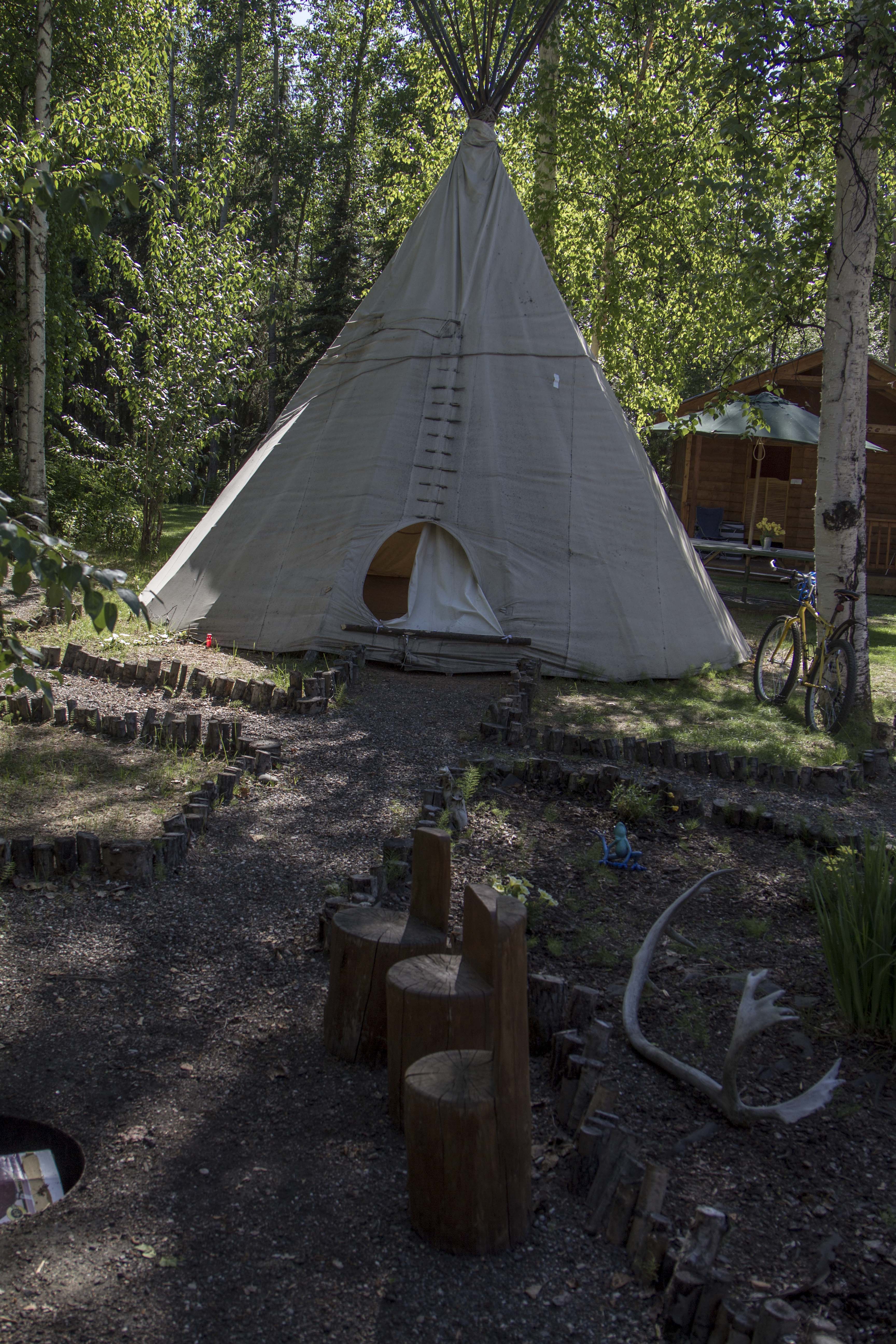
I bailed out of Delta Junction, a little bewildered and unsure of what next lay ahead. The pedaling is mostly flat, but follows the Tanana River Valley pretty much all the way to Fairbanks. The following morning, I got a fantastic view of the Centarl Alaska Range, but then, it was gone and it was flat forest pedaling for the remainder of the ride into Fairbanks, where I have been a resident now for a few days, getting rested, fed, and organized. After looking online for a Hostel to pitch my tent at, I came across the one I was sure was right for me. I was right! Sven’s Base Camp is a neat little place right in town, so it’s kinda noisy, but it has wall tents, cabins, a teepee, showers, a kitchen hut, and a tenting area. It is surrounded by woods and is shady and somewhat private. It is a relaxing place and is close to amenities one may need. Sven is really nice guy in his mid thirties who moved here from Switzerland 15 years ago. He spends his summers here running the day to day at the Base Camp, but in the winter, he lives in Bettles, AK, a bush village up off of the Haul Road, where he has a Dog Mushing tour business. He say’s he has around 30 dog’s, but only one accompanies him to Fairbanks in the summer. She’s a real sweetheart girl-dog named Blaze. Sven has made everyone here feel right at home. We have talked a little in regards to me doing a little work around the Base Camp in exchange for a place to stay, and to possibly make a little money as well.
There is another guy staying here, Jim, who is to begin a job on the north coast as an electrician. He and I are talking of perhaps taking a quick overnighter down the Chena River in a canoe and do a little fishing. Not totally sure on this though as my plan is to leave tomorrow morning for the Haul Road and the Arctic. Sven’s friend, Tommy, who is a Haul Road trucker, picked up my food box containing six days worth of supplies for me this morning, and will drop off at Coldfoot. Thanks Man!


You must be logged in to post a comment.