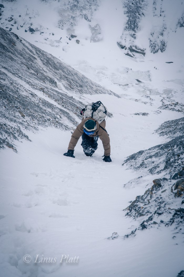
As one drives north over and beyond Chilkat Pass, a broad and beautiful alpine valley is entered; the beginnings of the White and Black Spruce, Aspen, and high Tundra dominate the landscape here. Once past Kelsall Lake, the road climbs up and over an ancient moraine and drops to an expansive river filled valley; the birthplace of the fantastic Tatshenshini River at Goat Creek and the terminus of the short but spectacular Parton River. Fitness training and gear testing for an upcoming alpine adventure sees me driving up near the Yukon border for a solo ski into the Parton River region. I wish to scout the take out of the Parton River area for a future summer packrafting trip trip and get a layout of the landscape.
For me, the primary reason as an American to live in Haines is the access to the great and mighty Yukon Territory; a land full of wilderness, mountains, rivers, glaciers, and animals. Similar to the interior of Alaska, it too offers a lifetime of exploring, climbing, and packrafting that beckons me as often as I can muster.
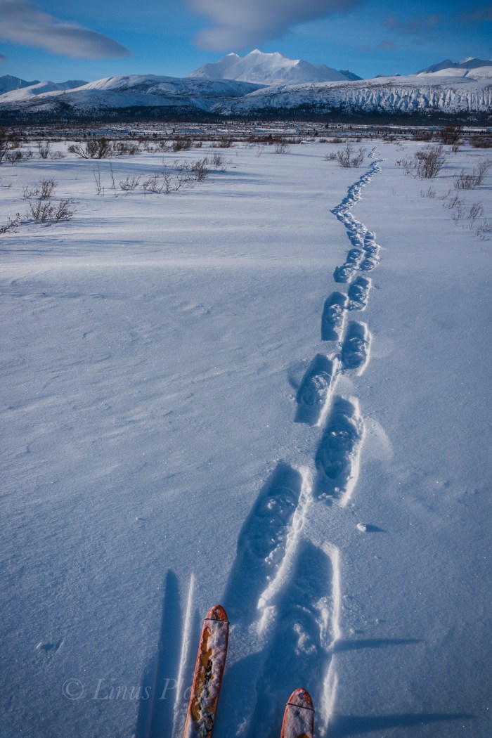
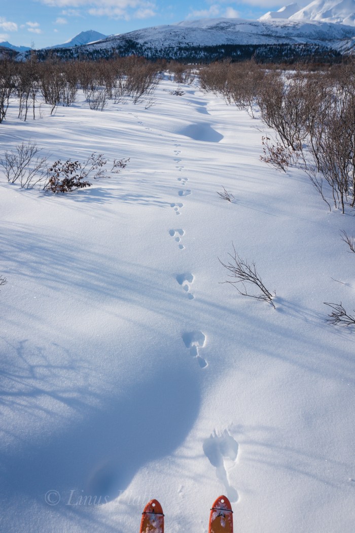
Parking the truck on the shoulder of the Haines Highway, a short one mile ski down a dirt road leads to the first of three put-ins for the Tatshenshini known as Bear Camp. Here, the Tat is frozen and I ski across happily and pick up the faint and snow covered old mining road beyond; shortly after, I come to the frozen Parton River and once again ski across and beyond into the fields of stunted arctic Willow and deep snow. Someone else has been in the area recently, and at first I begin to follow a relatively fresh set of snowshoe tracks, but soon veer off course to find my own way.I spot Arctic Hare tracks and soon spot Wolf, Lynx, andPtarmigan tracks… A couple of miles skiing in and out of the Willow thickets and up and over several creeks finds me entering the White Spruce of the Parton River corridor where it enters a canyon to the south and it’s headwaters lie.
A quick snack and a few clicks of the camera see me skiing back to the Parton River, this time further upstream to inspect the river herself. Always fun skiing down frozen rivers this time of year… easy skinning with no obstructions gives me the opporotunity to inspect the area for log jams, debris, and other future packrafting concerns.
With the sun getting low, I head back down stream, cross the Tatshenshini, and skin back to the truck just in time to see the beginning evening Alpenglow.
Till next time…
Someone’s been this way…Arctic Hare…The Parton River…White Spruce Landscape…
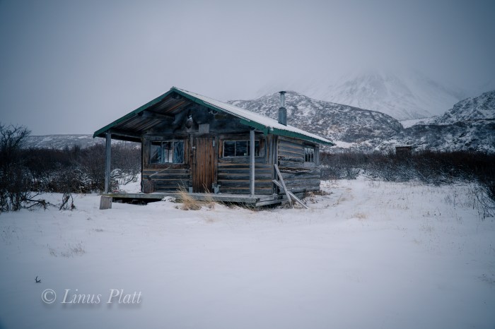
An early winter stomp up in Northern BC at Kwatini Creek in search of skiable snow produces little snow but a great hike up Kwatini Canyon past the old cabin there and into the alpine… complete with a mountaineering finish. A perfect day marred only by me pretty much destroying my brand spanking new (first time wearing) Arcteryx bibs…😫😢
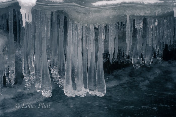
Grizz prints on the Haines highway near the BC borderThe old cabin at Kwatini CreekWillow-whackingAngela busts a sane move crossing in ice bridge sans cramponsIce is nice!Ice blobulesAngie bringing up the rear on the “mountaineering finish”Nearing the top of the gully leading to the sub-arctic plateau above
After getting mentally and physically prepped for the last couple of weeks, I awake one Monday morning and decide that leaving several days early on a ride of the North’s “Golden Triangle” is in order. My boss and co-workers seem to have no issue with the notion, and off I go to take care of last minute details at home.
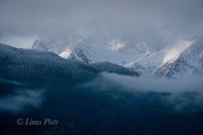
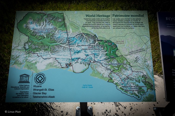
Some folk’s call the ride in question the ”Alaska Golden Triangle”, which is a misconception since most of the ride occurs in Canada’s Yukon Territory. The route however, starts in Alaska, crosses British Columbia, traverses about 180 miles of the Yukon’s mighty interior, crosses back into B.C., and finally ending in Alaska at Skaguay. The first few miles and the entirety of my first day pedaling consist of the Chilkat and Klehini River corridors through the beautiful Chilkat Valley, ending at the Canadian/ U.S. border and the beginning of the climb up to Haines Summit, more locally known as Chilkat Pass. This Pass separates the interior of Northern B.C. and the Yukon from the coastal and heavily glaciated Chilkat Mountains and Alaska’s ice capped Coast Range, of which temperate and maritime systems exist at their feet. It is in this coastal region that Haines, and my home exist.
Going to bed a bit late and waking casually, I dress in my normal bicycle traveler garb consisting of loose fitting nylon pants, t-shirt, Loose fitting long-sleeve shirt, and lace up cross training footwear. Onto the Ogre, I spin into town to meet with Angela and grab some coffee and breakfast before commencing to the endless highway.
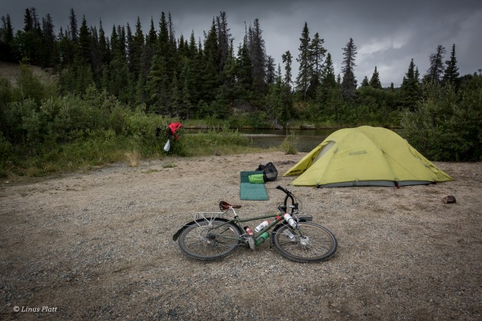
After a casual time at Sarah J’s eatery in Haines, I say goodbye to Angela and begin the flat and pleasant cruise up the highway in hopes of finding a good camp near the border. Hours later, a faint path appears on the river side of the road leading through the Alder thickets and ends abruptly on the Cotton Grass flats above the Klehini River. A great camp with views of the Saksaia Glacier and fine and tasty drinking water direct from the river has me smiling on this first evening of the trip.
Many bicycle travelers it seem have a burning desire, especially in the northern tier, to seek out camping in “official” and pay campgrounds where other people gather. To my thinking, this never really made any sense, not here in the northern wilderness, where some of the best and most plentiful free range camping are to be had for the taking. Why pay to sleep when one can create their own world wherever one wishes? Many claim it is their fear of Bears. After spending more nights out in the Alaskan and Yukon bush than I can count, I believe that the Bears have far more to fear from Humans than the contrary. Of course extreme occurrences can happen, but being smart about the way one camps greatly diminishes these chances. In fact, I believe that having Bear problems are increased in public camping areas where Bears may be conditioned to Humans and their glorious trash. As far as the social thing is concerned, well, to each there own. Camping alone in these wild places allows me breathing room and a purposeful reflection towards the natural world and creates in me a great and humbling respect for it. This is where I can watch the river flow and the Falcon soar; hear the wind blow and smell the sweetness of the North in the air unencumbered by a Human world that tends to feel dominance toward all I see before me. That said, loneliness could from time to time drop in for an unexpected visit. But not tonight.
The morning sees rain pattering the rain fly of the tent and I must say I dread it, since today is a big climb up to Chilkat Pass, where I am hoping to spend more than a day hiking and bagging a peak or two if the weather cooperates, But, cooperating it is not and I pack up my little world and spin the mile up the road to the Canadian Customs gate and soon I am climbing upward into the big grind known as “Marinka’s Hill”, the primary climb up to the pass. The rain shows no sign of letting up and I don rain gear and continue, sweating as much on the inside of the clothing as the rain on the opposite. As the storm intensifies, I realize there will be no hanging around and leisurely climbing mountains, but instead, waiting the fury out tent bound. Just past Three Guardsmen Lake, in a low hollow just before the main summit, I pitch my tent and dive in. For the next 18 hours I read, eat, drink a beer or two, and sleep. The following morning the rain is continuing, but I must go on and the tent is put away wet and the pedaling continues. At the pass proper, the rain stops, clouds open, and glorious sunshine reveals itself, if only for a few minutes. Then it begins again. But heavier this time. Soon torrential downfalls of drops appear, and for a moment, even the roadway ahead is barely visible to my eyes. Although a part of the journey, especially in the North, rain can make the difference between pure suffering and pure bliss on a bicycle voyage.
Later, after the rain lets up, I cross the Yukon’s Takhanne River and set up a pleasant camp next to the water and bathe my foul clothing and myself. Snacking on my supper that evening, I watch a Hawk harass the Swallows at the entrance to their mud nests burrowed deep into the ancient riverbank. Clouds gather and then part again while the sun peeks in to cast great and colorful splashes of yellow and orange against the rocky mountainsides before me. Patches of deep blue sky swirl around the sun/cloud union like a predator in pursuit. At midnight, a Loon cries out from somewhere nearby, and the only thing stirring now is the soft and occasional breeze gently touching the tops of the Spruce and Aspen stands situated nearby camp.
To my ears, the call of the Loon is one of the most enjoyable and haunting sounds coming from the forest and lakes. It is nearly as engaging as the sound of the Wolf howling in the dark of night. And as I pedaled the next morning up a monstrous Yukon hill, one of the biggest of the trip, the Loons were creating a symphony of joyous monotony pushing me upward and over that mound and deeper into the great Yukon interior I love so much. I meet a 64 year old French man on a decrepit bicycle, heavily loaded and carrying an axe for which to chop twigs for his home made hobo stove. He has spent a great deal of his life traveling by bicycle in various parts of the planet, and travel in these parts is not alien to him. Later in the day, I take a side trip to the ancient native village of Klukshu. A side trip of about a half mile leads to the small but Salmon heavy Klukshu River, where native people have been harvesting Chinook, Sockeye, and Coho Salmon for millennia. I arrive at the bank of the tiny river; a Sockeye splashes about as it sees me, there is not a soul around but the fish and myself, lest a Bear hidden in the forest nearby. The village is deserted. There is something going on here that is unexplainable; there is an ancient sensation that I am somehow connected to that feels both like sadness and deep connected love. The air feels thick with history and community. Tears swell my eyes as I sit next to the river; this strange place I have never been feels like home. It is strange indeed. If there is such a thing as past lives, then I’m certain I was a Native North American. I pedal onward and past the equally haunting and beautiful Kathleen Lake and the beginning of the colorful and rugged Kluane Range, forefront to the overwhelmingly enormous St Elias Range and Mt Logan. Home to the second tallest peak in North America and some of the biggest and expansive ice fields and glaciers on Earth. The Yukon is a mind-blowing place indeed. Soon I am rolling into Haines Junction for a meal and some re-supply on food and luxuries.
Now I am into the thick of things. The Alaska Highway is traffic heavy compared to the mellow Haines Highway, where trucks shipping supplies from Canada to Alaska whiz by at maximum speed and clueless tourons barely in control of bloated recreational homes-on-wheels as big as my house meander down the pavement, gawking at the scenery and not watching the road, too lazy or disinterested to actually stop and explore beyond their steering wheel, most of these southern travelers never really see much at all.
The pedaling is flat and windless; miles fly by. The Ogre slithers along in silence. The endless boreal forest of the interior swallows me up and I am one with it. Arctic Ground Squirrels scurry in and out of the roadway as if attempting to throw themselves under passing vehicles. I often hear bicycle travelers complain about the sometimes endless and monotonous stretches of Alaska and the Yukon’s boreal timberland, saying that it is a dread to ride through it. Beats riding through most anywhere down south if you ask me. I connect with this forest; to me, this boreal play land is an endless supply of tranquility, animals, lakes, rivers, muskeg, swamp, taiga, streams, and beauty. There is a living breathing force here that cannot be ignored. To me, there is nothing monotonous about it. Riding through endless highway traffic and Human civilization is monotonous, dangerous, and disturbing-nowhere to camp either.
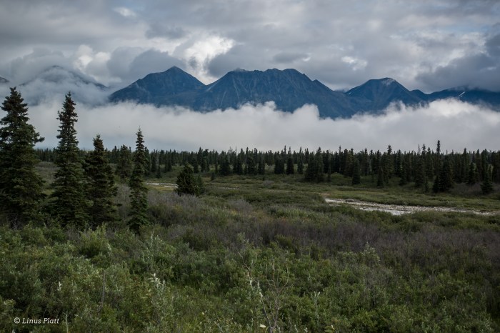
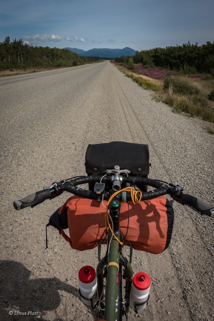
The climate and terrain is changing rapidly from a wet mountain environment, to an almost desert like boreal landscape that reminds me somewhat of western Colorado. A several mile gravel section of road appears near the Native village of Champagne, and I unknowingly watch as the last stream goes past and some 25 miles later, I am running low on water. At the 61 mile mark for the day, I emerge on the banks of Stoney Creek; a crystal clear mountain stream perfect for both drinking and bathing, and with an endless supply of ripened Raspberries growing adjacent to it’s flanks. I call this lovely place home for the evening and settle in with a sizeable grin adoring my mug, all the while snacking on raspberries for dessert.
In Whitehorse, I’m tossed into a world I have not seen in a long time. Since moving to Haines nearly three years ago, I have not left at all, except to go see an orthopedic last year when I broke my ankle at work. Haines is a quiet little Alaskan town; very little commotion at all. Whitehorse on the other hand, although quite tame by modern city standards, was abrupt, fast, and in my face a bit. I actually like Whitehorse. It is a small city of about 40,000 souls, with tons of mountain bike and hiking trails, the glorious Yukon River, and surrounded by endless wilderness. But on this day, to me here and now, I just wanted to get through it and back to my forest. Pedaling through town finds me along the Yukon River and past the hydro power dam and on the shores of Schwatka Lake, a Human made reservoir with float planes and powerboats here and there, but still a beautiful and serene place to be camped. That night, I awake about 1:00 am and noticed the first star in the northern sky since late April. Summer is slowly closing down and the days are getting a hair shorter each cycle. Before you know it, there will be some of the white stuff back on the ground, the tourists will be back in Florida, Texas and all parts south, and the Bears will be heading to their high country denning grounds to await the next round of Salmon entering the rivers in May.
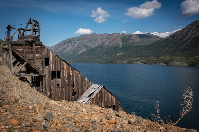
Heading south on the Klondike Highway in the morning, I pedal all the way to Spirit Lake and devour a breakfast there before spinning down into Carcross (Caribou Crossing) and the beginning of what is known as the “southern lakes region” of the Yukon. In this part of the Province, there are many, many extremely long, deep, cold water lakes; meltwater remnants of the massive glaciers that covered this part of the Yukon a millennia ago. These lakes are a thing of beauty to say the least. Encased in wilderness, and rising from them mighty mountain ranges so remote, few have seen their endless and omnipotent shores outside of a powerboat. Soon, I can see the coastal mountains rising from the horizon and the beginnings of small yet prominent glaciers adorning their sides. The road now traverses the Windy Arm of Tagish Lake and around the bulk of Tutshi Lake, where this highway begins to tilt upward a bit, and the Yukon/B.C. border comes and goes. More climbing in the distance I can see, for White Pass is ahead, separating Canada from Alaska and the end of my Journey at Skaguay.
Finding no outstanding place to camp, I reluctantly pedal mile after mile, passing mediocre spots hoping the Golden Camp Spot will appear. After 76 long and exhausting miles, the fabled glory camp does not appear, and I throw down my nylon ghetto onto a deserted gravel pit and enjoy myself regardless, happy to be off the bike once and for all for the day.
Up bright and early the following morning I am sore, and there are rapidly moving clouds and wind coming through, but I feel good. It is only about 20 miles to White Pass from here according to my calculations. The road turns gently and ever so slightly upward from here and the landscape changes once again from the sub-alpine boreal forest to the higher and more colorful alpine arena of tundra, swiftly moving streams, and low lying brush and stunted Pine and Spruce. The route follows a glorious emerald river, adorned with many rapids and small waterfalls. A Bald Eagle soars overhead, and a Gull meanders behind, perhaps hoping to reap any benefits the Baldy might conjure. The wind picks up and it is a struggle to keep the Ogre upright on the hills. At timberline, the first of many low lying alpine lakes appear, and the stiff breeze grows fierce. Glaciers show themselves briefly during interludes in the cloud cover and before long they disappear once again into the thick alpine mist. Near the pass, I clamber over granite boulders to get a good look at Summit Lake and onslaught of the storm; wind and whitecaps embellish the lakes surface. A Gull scares up and hovers over me, squawking loudly that I must leave. She must be protecting a nest. I wish her well and skedaddle back to the bike and finish the last bit of the climb to the pass. At the top, a great and magnificent alpine meadow sits below and decorated with a mighty waterfall, so picturesque it is difficult to believe it real. At the pass, the weather is foul, and thoughts of espresso and a hot meal entice me. I peer at the highway ahead and it is a steep downhill for 14 miles to the sea. I had ridden up this massive hill back in 2013 when I rode from Skaguay to Deadhorse to Valdez, so I had gained a healthy respect for it’s magnitude. After tossing on my jacket and sporting hat and gloves, I fly downward and into the fantastic canyon, past more waterfalls and jagged peaks and soon there is no more. A gigantic cruise ship appears a half mile off; perched in the waters of the upper Lynn Canal, it’s passengers flooding the streets of Alaska’s biggest tourist attraction. I meander through the insanely crowded streets attempting not to hit or be hit by those not paying attention, which are many. It is a shock to the senses again. Haines will feel quiet and pristine compared to this insane asylum. Later, after a meal and some casual town observation, I board the marine vessel Le Conte for an hour ride down the canal to Haines, where a six mile ride from the ferry terminal deposits me back at my quiet little crib.
All in all, I had ridden most of this trip previously: the Alaska Highway portion back in 2011 when riding from Moab to Fairbanks, and the Klondike Highway/White Pass section in 2013 on the way to the arctic. Only the Home stretch of the Haines Highway over Chilkat Pass were new, but it is an outstanding pedal through some of the most beautiful countryside the North has to offer. I may even ride it again. Complete with a side trip to Klukshu, some exploring of random dirt roads in the forest and the pedaling in Whitehorse and looking for camp spots, I had pedaled about 385 miles over eight days. I can’t think of any reason why one would attempt to do it any faster; there would be too much to be missed, and in my opinion, far less enjoyable. These trips are not a race folks; they are to be felt and appreciated.
The Ogre pulls off another one.
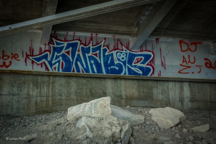
Klehini River CampStormboundChilkat Pass ClimbHaines Summit AKA Chilkat PassStickered SignAlpine Tundra LandscapeThe Green Hut Emergency Shelter Near The PassWhite Spruce And B.C. GlacierNorther British ColumbiaTakhanne River YukonTakhanne CampApen StandsEntering The Native Village Of KlukshuMoose Antlers And Satellite DishCabin and Fish Drying HutCache and Fish HutAspen GrovesMountains Near Kathleen LakeKluaneThe New Grocery Store In Haines JunctionAlaska Highway Gravel Near ChampagneTakhini River Area Yukon InteriorGood SnacksWild Rasberries At Stoney CreekTakhini Bridge GraffitiLove These!CarcrossTagish LakeHistoric Abandoned Mining Structure Along Windy ArmSummit LakeSummit CreekWhite Pass AreaLooking Down From White PassWhite PassMoore Creek Near Skaguay
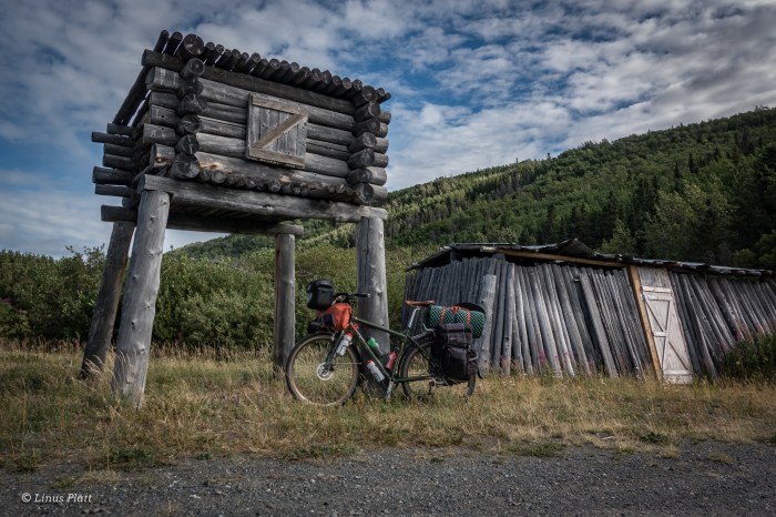
The bicycle know to me as the Surley Ogre has been on hiatus for some time now…over two years in fact. Like a horse put out to pasture, she has endured this lengthy time situated in the garage amongst the miter saw, planer, router, and other tools of construction. Not fitting in with these apparatus, she squeals and begs for a letting of road miles. In anticipation of an upcoming trip upon her to the mighty Yukon and beyond, I strip the old gal down to her bones and a cleansing and rebuilding ensues.
It has been far too long since the Ogre and I have embarked upon the open road together, and in a quick fit, I work out a stretch of time off from work and make preparations for us to engage the Alaska Golden Triangle; Riding from my house in Haines to Haines Junction to Whitehorse to Skagway. A 360 mile loop through the northern panhandle and into B.C. and the Yukon, ending back in the good ‘ol AK in Skagway, where a quick ferry ride home ends the adventure. With plans to leave on the 29th of July, and returning on the 13th of August, I must say that these bicycle trip are certainly not about the bike. Or even riding them. These excursions are about being there. Or more precisely, being out there and taking in the tundra, mountains, rivers, and wildlife. If I was in shape and looking to make some quick time, I would theoretically make the journey in six or seven days. I think not. I intend on going slowly and enjoying the vast and wonderful summer in the North. Summertime in the regions of Alaska, Northern B.C., and the Yukon are stuff of fantasy to me. It is a time of exploding life and glorious exploration. There is nothing better on Earth than summer in the North.
Having a couple of weeks lead time to the trip in question, I head out to test the newly constructed Ogre for a quick 20 mile excursion up the wonderful Haines Highway, and as luck would have it, a spectacular day of temps in the 70’s, glorious sunshine, and the glaciers of the Chilkat’s shining brightly.
The old girl, spaced out from many months at pasture, bucks wildly when I attempt to pedal forward. After a rough patch, we hit our stride and suddenly it’s just like old times.
As out of shape as I am, I am looking forward to that big nasty climb up Chilkat Pass and into the Yukon I love so much. Two weeks and counting…
Stay posted friends!
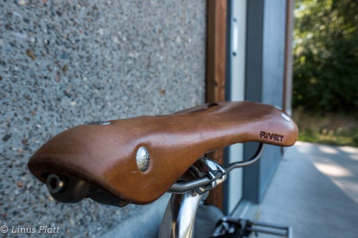
The omnipotent Surley OgreThe Rivet PearlThe Ogre rests by the mighty Chilkat RiverChilkat Cathedrals and Ogre
Let’s see now: I moved to Haines on November 3rd 2013 and it is now June 8th 2016. Now mind you, other than going to Juneau twice to see quack doctors about my broken ankle (I am not a fan of going to Juneau), and once heading up to Haines Junction in the Yukon with my Mom and Angela for a day trip, I have not really left Haines since that chilly day rolling down from Fairbanks in November more than 31 months back.
Seems my attitude has been at an all time low and a need for adventure has been halted due to my buying a house that I really cannot afford. Seems I have no time or money to enjoy the very reason I live here in Alaska. Things have been difficult for me at work as a result and finally, something had to give. Summer has finally arrived in Alaska, with temperatures in the 60’s and 70’s and daylight exceeding 22 hours now, I decide to break free for a weekend and head up to the Haines Summit area of British Columbia for a couple days of exploring and such. “The Pass” as it is locally known, is the dividing factor in separating the temperate maritime environment of the Chilkat Valley and Peninsula from the rugged alpine interior of B.C. and the Yukon. The Canadian border being 40 miles from Haines leads to the climb up Three Guardsmen Pass, and finally the higher Haines Summit being another 10 miles beyond. One Enters B.C., climbs the pass, then another 25 or 30 miles brings one to the mighty Yukon. The area around the pass is an area of high peaks, alpine tundra, glaciers, rivers, Ptarmigan, Marmot, Wolf, and Grizzly Bear. It is my kinda place to say the least.
After a quick visit with my buddy Gene on his sailboat in the Haines Harbor, I fire up the truck and head north. After a quick stop at Canadian Customs where I am grilled by the always grouchy Canadian Border Patrol, I am soon spinning the vehicle up the majestic landscape higher and higher to the land of rock and ice.
That evening I camp near the outlet of Kelsall Lake along side the mysterious Kelsall River. The mosquitos are thick, but the calls of the Loon and of the distant Coyote’s lull me to sleep. At 4am I pack up and continue north, into the Yukon just because I can. Being in the Yukon again is a fulfilling and sensational feeling once again. I really love the Yukon; there really is no place like it. It has a very distinct and isolated, yet remarkable feeling about it. It’s being up in the interior again that is putting wind in my sails…
After a bit, I turn the truck around and head back south towards the trailhead for the Samuel Glacier, where and old mining road, after disappearing 4 or 5 kilometers in and turning into a true back country wilderness experience, leads to the wonderful Samuel Glacier, some 10 or 11 kilometers from the highway.
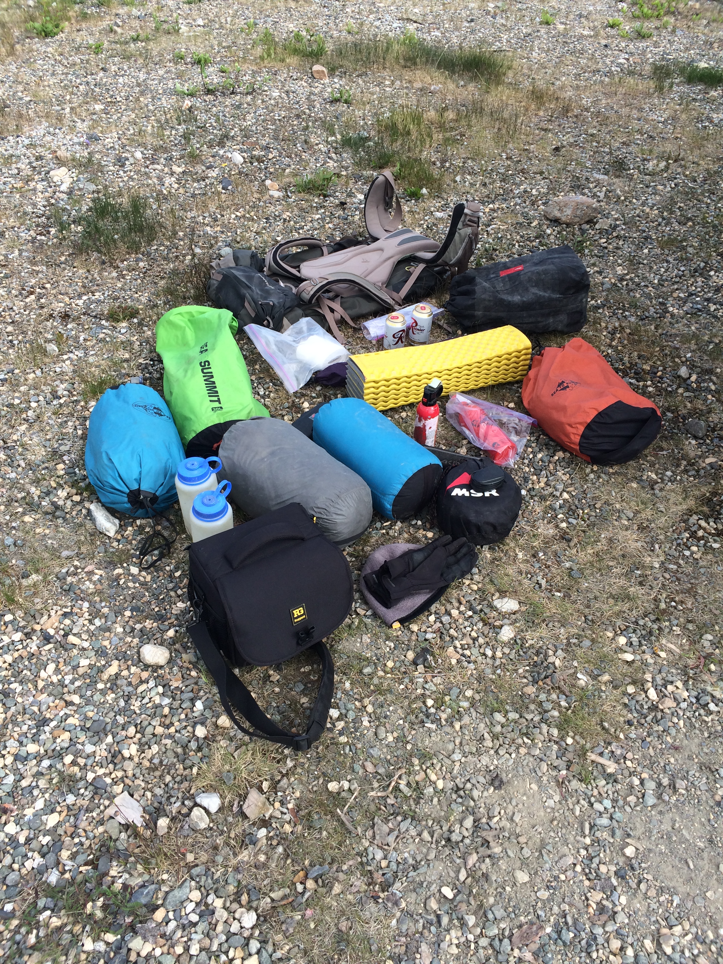
After finishing a breakfast of eggs and tortillas grilled over the trusty MSR, I pack up the backpack as light as I can to help make up for the fact that I will be carrying my Sony X70 video camera. I have currently my Canon DSLR listed on eBay, so decide not to bring it in fear of damaging it before a critical sale. The unfortunate reality of this particular photographic situation, is that my only photo option for this trip is the ever stupid iPhone! Man that camera sucks. But it’s what I’ve got for this adventure and after a brief packing session, I am on the trail.
The trail consists of an old mining road that is very easy to follow and is in exceptionally good condition. The trail wanders slightly uphill into a high alpine valley surrounded by streams, rivers and peaks. Groundhogs and Marmots seem to be everywhere; Ptarmigans scare up out of the low lying brushy tundra around every corner. The place is alive! I keep my eyes peeled for Grizzly Bears and Wolves, and soon I come to the first stream crossing that I must remove shoes for. The water is bitterly cold, but is refreshing to hot feet. After a couple more kilometers, the trail disappears under a vast snowfield hundreds of meters wide. I figure this is where my feet get wet permanently and dive in. Across the snowfield, the trail is no where in sight. I spy a river below and bushwhack to it’s shores, where another full blown crossing is in order. The trail re-appears briefly and I follow it till it once again dives beneath snow and tundra bogs. Gaining a high ridge, I spy a trail of in the distance, following the fast moving river I had just crossed. Had I gone the wrong way? It occurs to me at this point that I am here a bit too early in the year. July or August would be best I reckon. I trudge onward.
Soon, there is no sign of trail nor of human travel of any kind. It is just me and my running shoes, the snowfields and tundra tussocks, the mudbogs and river crossing, the Marmots and Ptarmigans. It is now genuine wilderness and I begin to feel at home. At every river crossing I come to, I simply charge right in, shoes and all and accept the fact that I now have wet feet. Traveling the valleys and ridges of pure trail-less tundra tussocks and mudbogs is fatiguing to say the least. I am nearing what I see is the end of my journey: The highland I am traveling suddenly stop up ahead another kilometer or so and what lies beyond can only be one thing: Glacier.
The tundra gives way to an alluvial plane of gravel and glacial deposits, with braid after braid of swift and dangerous stream crossings. At the edge of the plane, where it meets up with the endless tundra, lies a snowbank fitted with a long string of animal tracks. Getting closer, I see that the tracks in question are one of Wolf. A big one too. The tracks could be no more than an hour old as they appear fresh and crisp and un- molested by the exceedingly hot midday sun. I marvel at them and spin my head around in anticipation of seeing the animal, but I am alone. I cross the alluvial gravel bed and once agin climb onto the steepening tundra for a rather quick jaunt to it’s edge where the magnificent Samuel Glacier comes into view. I decide to drop down the other side of the tundra ridge and camp on a small hummocked shelf just a couple hundred meters above creaking ice. I am exhausted and once in the tent, I sleep a fitful sleep as the overhead sun is blazing hot in this barren and endless alpine tundra land.
A while later, I emerge from the tent, sun still high, and walk to nearby stream for water and photographs and some video shots. I see the Samuel Glacier and it adjoining glacial arm like tentacles from an icy giant protruding from the massive fault block pyramids of the Alsek Ranges that extend into the largest glacially active non-polar area of our planet, and home to the largest unspoiled wilderness on earth. I am fulfilled with great and massive appreciation for this place and I am happy to call it my home; Haines is a mere 80 miles away.
Back to the tent for supper and more sleep, I awake the following morning at 3:30 am to a gathering storm. I pack quickly and soon I am again bounding over tundra and listening to the rushes of the strangely human-like squawking of the Rock Ptarmigans. The first time I ever heard these creatures talking was in the Tombstone Mountains in the high Yukon back in 2013. The sounds they make are vaguely human and sound like a babbling insane person speaking nonsense. The first time I heard them was in the middle of the arctic “night”, and it disturbed me so much, I thought I was being stalked by a maniacal stranger hell bent on harming me. Then I peered from my nylon domicile and spotted the strange bird making these sounds, Since then, I have come to listen for their cries in anticipation.
Eventually, I come to where I have to make a choice and decide to follow the “trail” along the river back to the vast snowfield. I cross the river back and forth a dozen times or more and soon come to the snow and then the real trail beyond. I am back at the truck by 9 am and happily changing into dry socks and shoes.
A slow and pleasant drive south via the magnificent Haines Highway finds me back at home by mid morning, where a shower, hot cup of coffee, and a reflection of a successful weekend are in order.
Lush Alpine VegetationOne of Many Alpine Rivers to be CrossedLone Wolf TracksTundra Overlooking the Samuel GlacierSamuel Glacier and Alsek Ranges PanoramaAlpine Camp SpotSupper with a ViewA.K.A. the Samuel Glacier TrailThe Good Trail Across the TundraEasy TrailMy Mobile GhettoThe Kelsall RiverKelsall PanoramaAnother River CrossingAlsek Ranges and Tundra


You must be logged in to post a comment.