Tsirku Dreams

“The Less I Have, The More I gain… Off The Beaten Path I Reign…”


After a day outing to explore the possibilities of a foot journey into the upper Tsirku River region of northern Southeast Alaska, and scouring maps and extensively discussing the area of the upper Tsirku River with Dan Egolf in Haines, I decide that a  trip up into it’s innards was in order. It is springtime and the river is still somewhat low, but will be rising fast due to the onset of summertime temperatures.

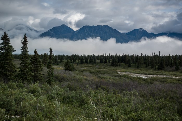
The area I wish to see is an area of historical significance in regards to local area mining operations regarding primarily Gold, but also Tungsten and Silver; these prospects date as far back as the 1890’s, and continue to be a source of local mining activity. Last year, while flying back from Alaska’s ephemeral Outer Coast in a friend’s DeHavilland Beaver, I spotted a magnificent peak with a thin, serpent-like glacier flowing from it’s summit and into the Tahkin River valley. It is a beautiful and mysterious mountain to me; I do not know even if it has been climbed, but I wish to. Having given much thought on how to approach such a mountain, I figure that bushwacking up the dense Tahkin River corridor was completely out of the question. Seems landing a bush plane anywhere near by is also problematic. After looking at the map, I see that the source for the Tahkin River is the Tahkin Glacier, which is separated by a narrow, ancient moraine from the Le Blondeau Glacier, one of the Tsirku River’s sources; it’s main source being the Tsirku Glacier many miles further up stream; a massive example of a meticulous icefield glacier with many forks, lobes, and peripherals. Along the way to the Tsirku Glacier, one will find several other un-named valley glaciers spilling from the high peaks and into the Tsirku Valley, adding more and more water.

But today, I merely wanted to see if I could somehow make it up to the Le Blondeau and see if it might be possible to cross over the moraine in question in order to gain access to the upper Tahkin River. I figure that if it is possible, a packraft will be necessary to descend from the valley after climbing the beautiful Serpentine Peak.

These past weeks have presented me with challenges and inquiry regarding matters of the heart that reflect within me the ultimate need to express myself, to find truth, and to seek happiness on this mysterious planet. Wilderness has always been the major component in my existence here; without it, I feel lost and empty. And today, with a heavy heart, I walk into her, seeking the nurturing convalesce of her Earth womb. To even maybe capture visual glimpses of the other wild creatures within.

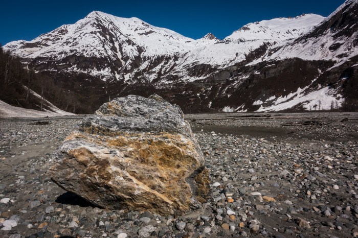
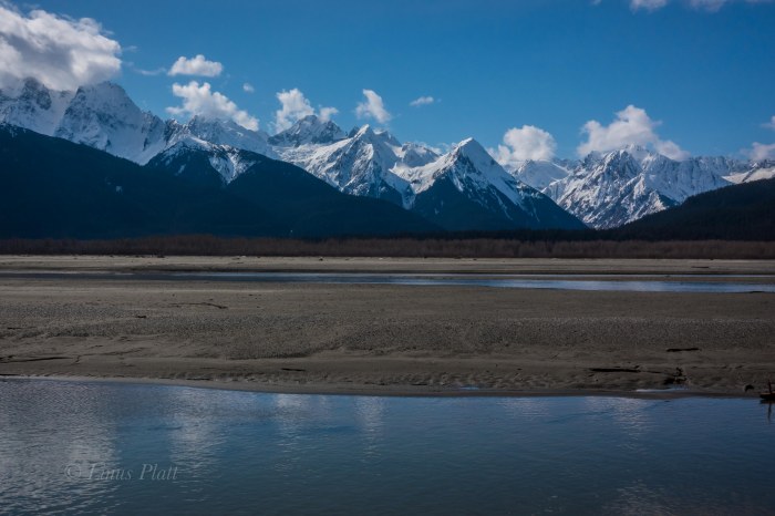
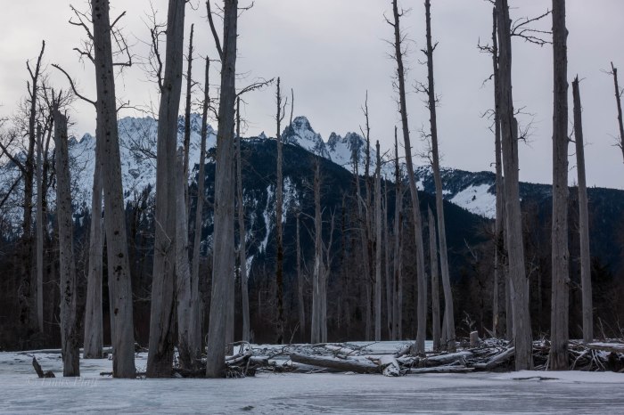
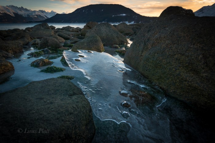
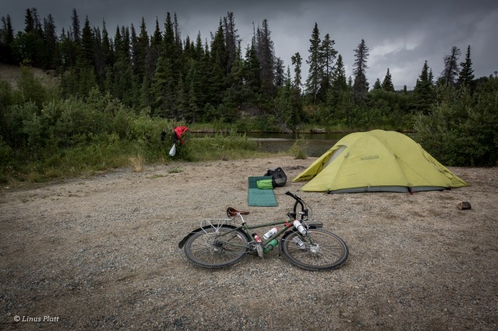
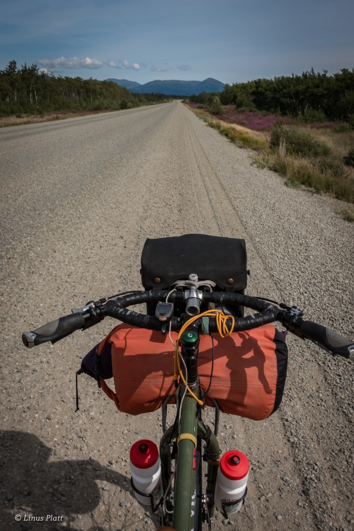
So today I lift a light 35 pound pack and begin the stomp up the Tsiku’s gravel bars and alluvial river flats; these glacial rivers can often times be heavily braided, wide, and treacherous. The Tsirku is a good example of this. Back some 20 or 30 years, a prospector walked a front end loader from the Devil’s Elbow all the way to Cottonwood and Nugget Creeks, forming a sort of road in places, but in others, not so much. The river has re-claimed much of it, and not only is much impassible when the water is anything but at it’s lowest, the channels themselves have changed a great deal and are continually evolving. At first I am able to follow faint ATV tracks leading away from the Devil’s Elbow, a point at which the Tsirku makes a dramatic near U-turn before opening itself into a massive river delta at it’s junction to the mother Chilkat.

The first three miles are straightforward: river flats, ATV tracks, and high gravel bars with only a few scant stream crossings to navigate, and I am soon far from the truck and at the entrance to the real wilderness. The first real river crossing is at a place the Tsirku is starting to gain momentum and takes a hard S-turn across the valley. Dense Alaskan jungle and steep cliff’s come direct to waters edge and one is forced into the water to fjord it’s icy current. The water looks deep, fast, and strong. I donn my water shoes, strip down to my birthday suit, shoulder the pack, and gingerly step into the ice coldness of the raging river. Soon I am in crotch deep water moving at a swift 4-6 knots. I am barely able to maintain a footing, but am now fully committed. My 190 pound frame is suddenly knocked from it’s foundation and I go down fast. The ski pole I am holding in one hand struggles for penetration among the bowling ball sized river rocks. My body and my pack plunge into the Tsirku, but only for a mere second as I am able to miraculously get back on my feet. Somehow, I am able to get to shallower ground and and eventually haul myself ashore. I am shaking wildly from adrenaline and the freezing water. After drying off and inspecting the pack and determining no real damage, I ponder the possibility of what I am trying to accomplish. If there are more of these crossings, and if the temperature increases and the water rises even slightly, I might be trapped back in the Upper Tsirku River drainage. Or worse, come into serious injury or peril if attempting overcome such obstacles.

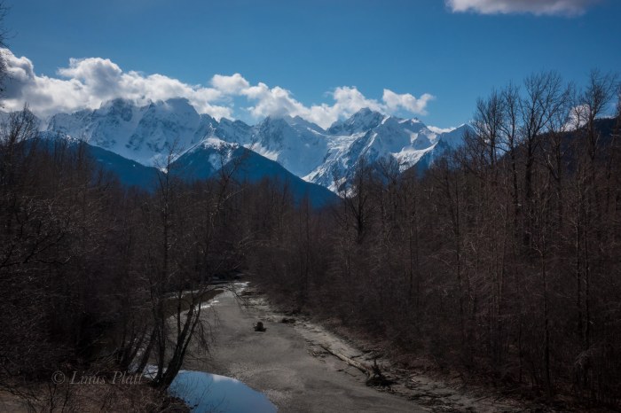
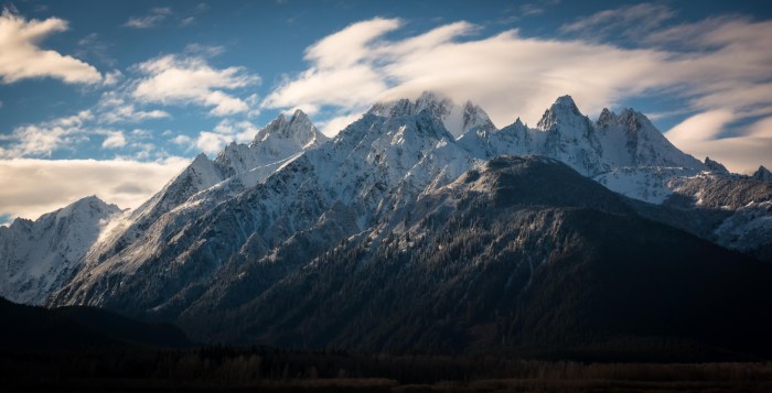
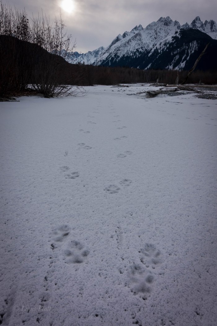
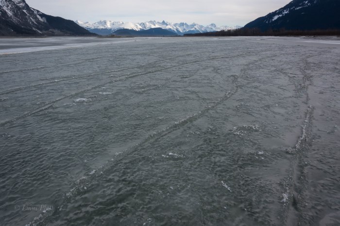
Another crossing about a mile past, this time much easier, brings me to a place where the massive glaciers of the Takhinsha Range come into view and their razor sharp prickly summits penetrates the endless sky. The striking sight propels me to continue scrambling among the softball sized rocks and endless gravel bars, in search of… something. Wolf tracks appear, many of them in fact. A sure sign that I am getting deeper in. Another river crossing, this time treacherous, but  I manage, just barely. It occurs to me that I must re-cross these on the way back out tomorrow, the next day, or the day after that. If the water rises any, I will be in peril.

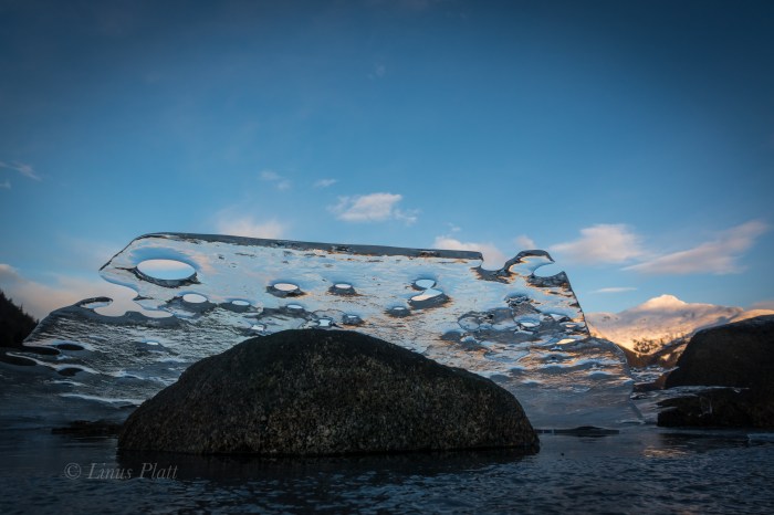
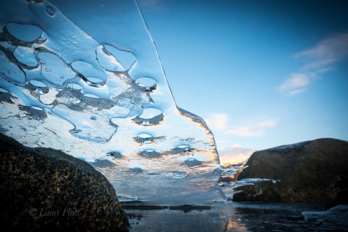
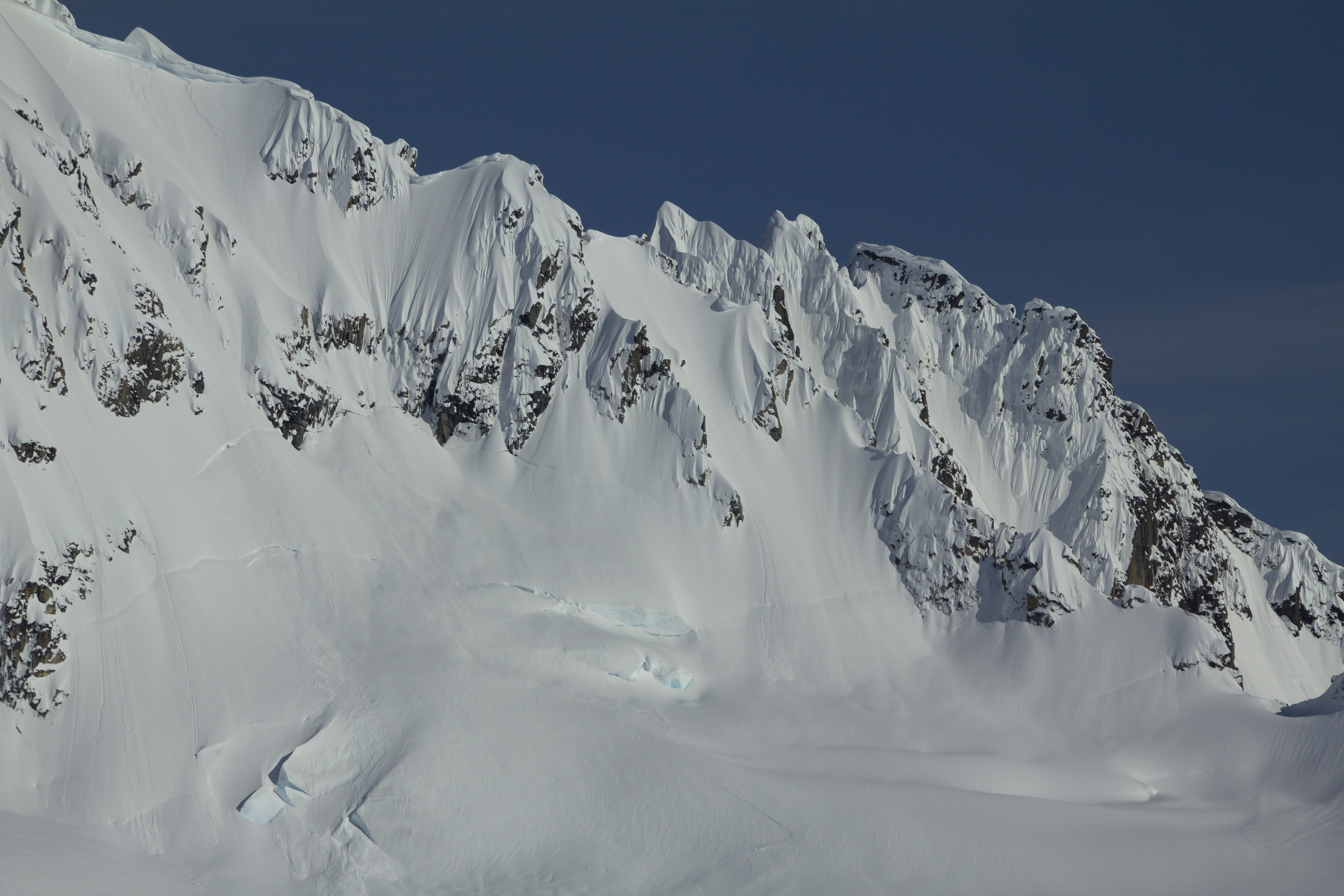
I look closely at the map, and guess that I have come about 10 miles or so; looking up valley to the base of the mighty peaks, I clearly see the Le Blondeau Glacier… both her forks, and the imposing icefall looming above one of them. I can just barely make out her tongue peeping out from around the low moraine separating the Tsirku from the Tahkin. The glacier has definitely shrunk according to the map, but not as much as I had expected. At least it was visible from this point in the river valley.

I come to another river crossing; this one is moving much faster that the previous braids, and appears to be deep. I have come more than ten miles, all of it essentially off trail and have fjorded 4 major river crossings and countless smaller ones. I am exhausted and cannot even consider attempting this in my state. So I pitch my tent, savor the salami, green beans, cheese and chocolate, and lay in my sleeping bag. I am not paying attention to my surroundings, and thoughts of the previous week continue to voilate my headspace. I grab my binoculars and scan the upper river flats ahead of my camp. Way off, I spot two Wolves. They are in a solid trot, but the lead turns and runs back to tackle the follow. They play fight for a moment before all eyes and ears are at full attention to whatever creaks in the woods nearby, and soon they are gone. A mated pair I assume, roaming this homeland valley of theirs.


“…And The Earth Becomes My Throne, I Adapt To The Unknown. Under Wandering Stars I’ve Grown. By myself, But Not Alone. I Ask No One.”


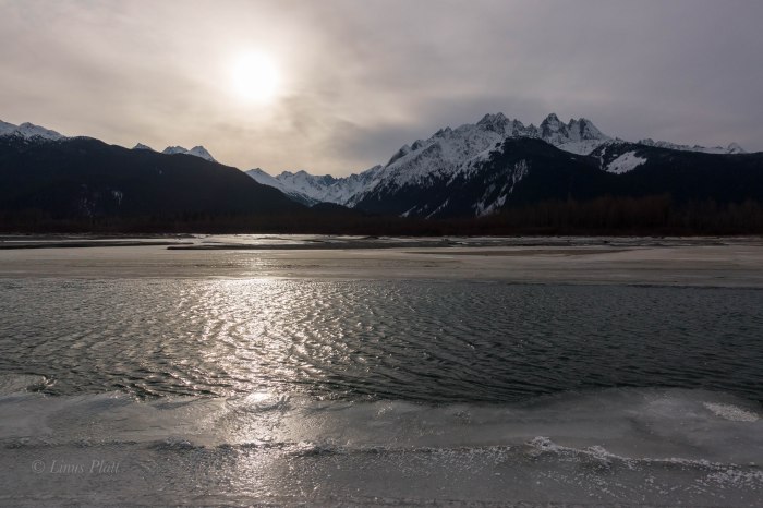
As the sun drifts behind the peaks and the shadows grow ever longer, the temperature drops and evasive thoughts enter me again. I feel fortunate and alive to be here, but silmutaneously alone and empty. The boundary between sanity and madness splits my heart in two, and a quiet desolation drifts over the Tsirku River valley and pierces deep within me. I am wide open, my heart is the sky. My body, a vessel. Hours pass without sleep, and the haunting echo of rockfall rattles the valley. It is dark for a brief time, then light begins to fill the peaks again; the morning alpenglow paints the summits and accentuates the seracs in a kaleidoscopic array of color and light. I manage to drift into sleep for a period, but soon I am awake again and realize that I am cold, so I decide to get up and inspect the world. Crawling out of the tent, I look at the dicey river crossing I am confronted with… a walk up and down the shore, reveals no place better in which to cross. If I could manage this crux of a crossing, would I be able to reverse it coming back? The thought penetrated me while I packed the tent and sleeping bag. I shouldered the pack, and in an instant, decided the risk was a foolish one. I turn to the Le Blondeau and and wish her farewell; The adjacent peaks beginning now to come alive with color.

On the way back out, I decide to attempt to find a better route, but in the process, make it worse and I encounter even more full sized river crossings, one of which swept me completely off my feet and dunked me into it’s icy depths. A close call by any standards, I am becoming fearful of the next and last of the crossings about a mile further down valley; it is the one that first knocked me from my feet in order to let me know who is in charge. I try not to think of it and traverse a willow flat with some of the largest Grizzly prints I have ever seen upon it. There is something very big roaming around here.

Soon I am at the dreaded crossing, and a look around reveals a shallower fjording upstream a bit. It was still nerve-wracking, but I managed it with out getting swept away, and a few hours later, I was stumbling across the final sandy river bottom to the truck. On the drive home traveling the swamps and wetlands of the Little Salmon River corridor, a young Black Bear ambles across the road, A cow Moose and yearling graze the willow thickets near the junction of the Porcupine Road, and me, being so tired I can barely drive, head home to grab some shut-eye.


sirku Re-Visited-4sirku Re-Visited-3sirku Re-Visited-2sirku Re-Visited-5sirku Re-Visited-6sirku Re-Visited-7sirku Re-Visited-8sirku Re-Visited-9sirku Re-Visited-10sirku Re-Visited

Hooligan

Since I was a teenager, I have been enthralled by the far north. Epic stories of high adventure on Alaska’s queen Denali filled my young mind in the readings of early accounts of her ascent. To me, the very notion of Alaska was something of a mysterious and rare prize that few had conjured the gumption to explore for themselves’s. Of course this was far from the truth… Alaska’s history has unfolded in countless ways, spanning multiple races and generations. From the crossing of the Bering Straights untold thousands years back, to the gold rush bonanzas and oil field exploitations of modern memory, the Alaska frontier has always bee a place of not only fascination, but one of an inexplicable location for far fetched dreams and far fetched exploration. And when I first came here in 2011, having ridden my  bicycle from the “outside” into her glorious womb, I then felt, as I do now, that Alaska and the untold prevailing of the Yukon and Northern B.C., were to beheld as nothing short of treasures. The first time crossing into the Alaskan frontier, I felt I had somehow stumbled across some great and archaic secret: something that the rest of white society had either forgotten, ignored, or simply knew nothing about. To me, it was a sensation of unfounded beauty and treasure. One that I still do not take lightly or for granted to this day.

Alaska is a place of mystery to most; and understandably. The ways of life here are not of the ordinary… even by un-ordinary standards. There exists a faction that demands one’s attention to detail regarding everyday life, to the omnipotent realization that nature is not only your absolute friend, but your foe at times as well. This balance is what defines this place; a place where you must have a kinship with surroundings and be capable of a transformative resolution on a daily basis. In a nutshell, the ebb and flow of the natural world is always at hand, and one must be not only willing, but ecstatic about it’s rapture and grace.

Every year, in the spring, the salt water inlets of Southeast Alaska are coming alive with life. The seasonal shift from a potentially long and harsh winter begin to unfold into something greater. The river’s break up, the ice floats to the sea, and life in the form of all animals and plants begin to explode in a monstrous display of grandeur.

One of the earliest signs of this magnificent occurrence comes in the form of the early spring smelt runs… At first it is the Herring, then a short time passes and the massive swarms of the Hooligan, also known as eulachon or candlefish, called so due to their high oil content, and once dried, can be lit on fire, begin to run into the omnipotent rivers of the upper Lynn Canal: The Chilkoot and the Chilkat. These precious Hooligan fish have been a staple of nutrition, culture, and economics for the native Tlingit nation for untold hundreds of generations. The fish are small, perhaps six inches long or so, and contain within them, essential fatty oils that are not only prized for there taste and nutritional value, but for their ancient economic value among the historic peoples of the Alaska panhandle and the ability to trade these wonderful gifts from nature to the southern Tutchone and Tagish peoples of the southern Yukon. Hence, the trade routes between the Chilkat Valley in modern day Alaska and the broad valleys and lake districts of the southern Yukon and northern B.C. have become known as the historic “Grease Trails” where the Tlingit natives of the coastal valleys of the Lynn Canal traded with northern interior peoples for such commodities as furs and other goods. These fish are regarded as gold by many, and not only signifies the coming of the summer ahead, but also the fact that the life giving runs of Salmon are not far behind. This is a time of celebration and thanks the the Earth that another time has passed and another will ensue.

I begin to hear the birds at first; the ocean Gulls swarming and squawking, then the Eagles, chirping in their usual ways, but at this time of year, it is somehow greater, as if something is about to explode. I hear these sounds early in the spring Alaska mornings as the light from the rising sun shines itself upon the northern landscape and gracing the land with light at about 3:30 am… something is happening. The North is coming alive; the Bears are awakening, and the fish are beginning to run the rivers on their yearly migration to spawn and dye as they have been born to do for untold eons.

This day opens and I head out to the Chilkoot river, the first of this year’s Hooligan run to inspect. Upon pulling into the narrow river valley, I spy hoards of Gulls and Eagles: A sure sign that the run has started. I peer to the river and notice immediately that is is black with fish. Untold thousands of these Hooligans have entered the river from the Sea and are finishing their life cycle in the form of spawning and dying. There are Brown Bear prints about and the entire river corridor is coming alive.

The next day, this time I return with a bucket, one I have drilled holes in to let the water escape as I scoop the Hooligan. The common method for capturing a harvest of these fantastic creatures is by means of a long handled dip net, but I do not possess one. Instead, my bucket will do… I have not a desire for more than I need, and my needs are small. I dip the bucket into the blackened mass of a million fish, but they scatter as  the motion of the bucket rifles the water. Each scoop manages a few scant Hooligan, but after an hour or so, I have what I need. I thank the Earth for this treasure and I return home with my earnings. After inspection of the harvest, it is revealed that I have taken exactly what I need: enough to fill my little smoker and just a tad bit more for the evening’s supper.

After, I look out over the Chilkat Inlet, the scene of the next Hooligan run in a week or so, and revel at how blessed I am to live in such a world.


Resurrection

Easter Sunday… fine spring weather in the northern panhandle is gracing the Chilkat Valley, and after a bout of home chores, I dig out the sleepy Surly Ogre from her months long nap for a kick up the Haines Highway to see what I can see. She snorts and growls, but soon is bucking wildly and fully resurrected. We spin down to Mountain Market for a cup of mud and then the highway is ours.

The sun is shining and it is a glorious day to be onboard the Ogre and spinning north. The high peaks of the Chilkat Range are spilling their sizable glaciers into magnificent sunlight, sending a deep chill down into me that strikes me every time I see it. I look to the north, into the mountains of British Columbia where friends are enjoying some spring backcountry skiing and I wish for them the same fine weather I am experiencing down here in the valley.

Coming into view at six mile of the Haines Highway is a small pond where two Swans float about grooming and obviously enjoying the beautiful day as well. Further past, the usual herd of Mountain Goats are clinging wildly to the flanks of Peak 3920, their white shapes ever so clear against the grey and rocky slopes they are suspended upon. I bet they too are happy that spring has finally arrived in Alaska.

It feels good to be on the Ogre again, sliding silently along while the beauty of the valley unfolds. The springtime is always a special time here; life is unfolding everywhere and the glaciers shine as bright as ever. The weather, such as days like this, seem to prevail. Not always of course, but often times the case.

At the 15 mile mark, I turn the beast around and we pedal home, stopping once more to speak with the Swans from earlier. At home later, I make some adjustment to the steed and vow to get aboard more often during this fine spring event.Easter RideEaster Ride-12

Easter Ride-11
The Beastly Steed
Easter Ride-10
Glaciers And Forest
Easter Ride-9
The Ogre Lives
Easter Ride-8
The Glaciers And Peaks of The Mighty Chilkat

Easter Ride-7Easter Ride-6

Easter Ride-2
There Are In Fact Mountain Goats In This Photo
Easter Ride-3
Just Rolling By

Easter Ride-4Easter Ride-5

Kicking Horse

alaska-wilderness-jagged-mountains

     Adjacent to the tiny village of Haines, Alaska, and across the emerald saltwaters of the Chilkat Inlet, lie the deceptively remote and jagged peaks of the Chilkat Mountains. These peaks are of a particularly steep and heavily glaciated nature and include the enormous mass of the Cathedral group that includes the mighty Mt Emmerich, clearly visible from town. Emmerich is the visual centerpiece of this group and rises out of the Kicking Horse River valley just east of it’s convoluted mass. The Kicking Horse River is a river born of the ice; it’s scant origins flowing from the snout of the Garrison Glacier situated at the northeastern end of the range, where it flows for a relatively short distance to it’s confluence with the heavily braided and Salmon infested Chilkat River. At the point where this confluence occurs, the Chilkat narrows to perhaps a half mile across, and on this 9th day of February 2017, winter temperatures has frozen the Chilkat solidly enough to allow crossing on foot.

     This winter in Haines has been one of mostly consistently cold temps, with snow on the ground for the entirety of the winter season so far; only once or twice has rain been allowed passage to our winter Alaskan landscape. This is the way I like it and having the rivers frozen over has gained me the chance to explore the “far side” of the Chilkat several times this season. The far, or wilderness side of the river gains access to the peaks of the Chilkat and home to a wolf pack twenty strong. Once, last fall, I had the ultimate pleasure of viewing, with binoculars, several wolves attempting to take down two separate Moose. Ultimately, both moose escaped with lives intact. The visual experience left a deep impression on me and the deep wilderness just across the river has been enchanting me ever since.

     Earlier in the winter, I had the pleasure of wandering across the river in other places; once at 10 mile and across to the dense Alder thickets of the Tahkin River, and another time near to 8 mile where once across and beyond the barrier of Cottonwoods lining the shore, I found open snow covered meadows full of Moose, Wolf, Lynx, and Rabbit tracks a plenty. For me though, these were just to test the waters of crossing the Chilkat and the ultimate goal was to reach the confluence of the Kicking Horse River. While there are other, more remote rivers that flow from the Cathedrals, the Kicking Horse to me was one that had a special interest. It was more accessible and equally as wild. So today it was to be…

     Parking on the Haines Highway at the state fish and game run fish wheels, I meander out onto the ice and instantly feel the bitterness of the biting wind. The surface is a mixture of crystal clear ice several inches thick and more opaque sections requiring more care in regard to judging the thickness. As I walk the slippery clear sections, I look to see the bottom of the river a few feet below and imagine the thousands of Salmon swimming upstream as they do every year as they have for thousands. Chinook, Chum, Pink, Sockeye, and Coho all run in these waters. Soon I am near the other side and the frozen Kicking Horse is a mere 300 feet ahead. However, there is a channel of open and running river water just in front of me, blocking access to my destination. Further east, I can see that the channel slides under the winter ice pack and disappears. How thick is this newer ice I ask myself? I walk further downstream to where the ice re-appears and gingerly step into this new zone. I can see immediately that is is very thick and soon I am completely across the Chilkat and standing on the gravel shores of the braided Kicking Horse confluence.

     It feels downright sublime to be standing here and looking up the Kicking Horse for the first time; gravel bars and Alder thickets lead to a narrowing of the river before it disappears into the bowels of the wilderness. I walk these frozen river banks, occasionally crossing thinly veiled ice sheets over rocky surface, boots crunching loudly and the stiff breeze from earlier dissipating. A long stretch of snow leads to the forest where hundreds of Wolf tracks appear. At least part of the pack has traveled through here recently. I look around and see more Wolf tracks than I have ever seen and realize that the Kicking Horse must be some sort of Wolf highway; a passage leading from the wilderness of the Cathedrals to the shores of the Chilkat herself.

     I travel further into the corridor till passage is barred by river ice with a couple inches of running water. Here, the forest at river’s edge are many dead Cottonwoods stripped of their bark and treetops. They stand like monuments guarding the inner access to the wildness beyond, Mt Emmerich towers over head, displaying intricate ridge lines, towers, gendarmes, and gullys. This is the closest I have ever been to this peak and I am awestruck by it size and complexity.

     This is my turning around point and it is getting late and the temperature is dropping, so back through the Adler thickets and gravel bars and the multitudes of Wolf tracks to the frozen Chilkat, where an easy stomp back to the highway is in order.

     The Kicking Horse has always held a great deal of fascination for me and today was a teaser that strengthened that notion.

     I will return …

kicking-horse-2kicking-horse-3kicking-horse-4kicking-horse-5kicking-horse-6kicking-horse-7kicking-horse-8kicking-horse-9kicking-horse-10kicking-horse-11kicking-horse-12kicking-horse

Home Sweet Home

After 43 long months of not seeing my family in California, it was time to head south out of the Great Alaskan Empire, and into the realm of family and old friends not forgotten. It was a strenuous voyage of ferrys and plane rides, airports and freeways, but eventually I was home to catch up with my Mom, Sister, Nephew, Pop, brother-in-law Dutch and old time friends not seen in quite some time. Catching up with John Boyer of Edible Pedal in Sacramento, and Debra Banks of Rivet Cycle Works was a joy. My old friend and climbing partner Dennis even drove up from the Bay Area so the two of up could discuss our plans for an Alaska Range climbing trip this coming August. Ten days later finding myself looking back with fondness of my visit upon an Alaska  Marine Vessel  heading north from Juneau, I am once again in awe of the magnitude of the Upper Lynn Canal and it’s mountains, waterways, and glaciers. Two days in Juneau prior to being aboard this vessel, I had the pleasure of catching up with another old friend not seen in many years. Amelia was in Juneau visiting her boyfriend James and the three of us celebrated with beers and lunch along Juneau’s waterfront.

Now in the waters of southeast Alaska once again, I am getting the fond sensation of being home. The Alaskan air is crisp and cold, but I spend a great deal of the boat ride home outside perched on the vessels decks gazing at the scene unfolding. It is breathtaking to see it again. Back in my crib later, I sift through mile after mile of unseen footage and unfortunately few photos. For some reason I had been so preoccupied with shooting video to make a living with I had neglected much in the way of photos or even snapshots of my family. This makes me feel deeply sad, and I vow to not let that happen next time.

The next couple days are spent not only in front of the computer editing and working, but getting out a bit exploring, shooting video with friends Gene and Michele, shooting photos  and stomping around the hills.

It has been two or three years since we have had a “real” winter here in Haines, and this winter is a real treat and a joy for me to call it such: Winter! The temps have been, more or less, consistently cold, and there has been snow on the ground for many weeks. The resulting ice at Picture Point along thee Lynn Canal and the Chilkat Estuary beaches has been extraordinary.

Going back to work next week after three solid weeks off will be another challenge upcoming. I keep reminding myself of the upcoming adventures to be had that need paying for to drive me back. The Lost Coast in May, and the Alaska Range trip with Dennis in August I look forward to immensely.

In the meantime, I have ice…


dfghxfcgthzxfgnfyuklfhgukfymulynn-canal-beach-iceryjxfcghn-2ryjxfcghn-6ryjxfcghn-7ryjxfcghn-8ryjxfcghn-9ryjxfcghnryjxfcghn-2ryjxfcghn-6ryjxfcghn-7ryjxfcghn-8ryjxfcghn-9ryjxfcghnryjxfcghn-3ryjxfcghn-4ryjxfcghn-5

Chilkat Spindrift Sunset

Out on the Chikat River ice after work today sees the sun dipping behind the omnipotent peaks of the mighty Chilkat Range and spindfift blasting from it’s summits. The wind must have been over 60 mph up there. Out there on the frozen river, the temps were close to zero with the windchill. Alaska in winter is spectacular to say the least…

The Great Northern Golden Triangle: The Ogre Pulls Off Another One

After getting mentally and physically prepped for the last couple of weeks, I awake one Monday morning and decide that leaving several days early on a ride of the North’s “Golden Triangle” is in order. My boss and co-workers seem to have no issue with the notion, and off I go to take care of last minute details at home.

Some folk’s call the ride in question the ”Alaska Golden Triangle”, which is a misconception since most of the ride occurs in Canada’s Yukon Territory. The route however, starts in Alaska, crosses British Columbia, traverses about 180 miles of the Yukon’s mighty interior, crosses back into B.C., and finally ending in Alaska at Skaguay. The first few miles and the entirety of my first day pedaling consist of the Chilkat and Klehini River corridors through the beautiful Chilkat Valley, ending at the Canadian/ U.S. border and the beginning of the climb up to Haines Summit, more locally known as Chilkat Pass. This Pass separates the interior of Northern B.C. and the Yukon from the coastal and heavily glaciated Chilkat Mountains and Alaska’s ice capped Coast Range, of which temperate and maritime systems exist at their feet. It is in this coastal region that Haines, and my home exist.

Going to bed a bit late and waking casually, I dress in my normal bicycle traveler garb consisting of loose fitting nylon pants, t-shirt, Loose fitting long-sleeve shirt, and lace up cross training footwear. Onto the Ogre, I spin into town to meet with Angela and grab some coffee and breakfast before commencing to the endless highway.

After a casual time at Sarah J’s eatery in Haines, I say goodbye to Angela and begin the flat and pleasant cruise up the highway in hopes of finding a good camp near the border. Hours later, a faint path appears on the river side of the road leading through the Alder thickets and ends abruptly on the Cotton Grass flats above the Klehini River. A great camp with views of the Saksaia Glacier and fine and tasty drinking water direct from the river has me smiling on this first evening of the trip.

Many bicycle travelers it seem have a burning desire, especially in the northern tier, to seek out camping in “official” and pay campgrounds where other people gather. To my thinking, this never really made any sense, not here in the northern wilderness, where some of the best and most plentiful free range camping are to be had for the taking. Why pay to sleep when one can create their own world wherever one wishes? Many claim it is their fear of Bears. After spending more nights out in the Alaskan and Yukon bush than I can count, I believe that the Bears have far more to fear from Humans than the contrary. Of course extreme occurrences can happen, but being smart about the way one camps greatly diminishes these chances. In fact, I believe that having Bear problems are increased in public camping areas where Bears may be conditioned to Humans and their glorious trash. As far as the social thing is concerned, well, to each there own. Camping alone in these wild places allows me breathing room and a purposeful reflection towards the natural world and creates in me a great and humbling respect for it. This is where I can watch the river flow and the Falcon soar; hear the wind blow and smell the sweetness of the North in the air unencumbered by a Human world that tends to feel dominance toward all I see before me. That said, loneliness could from time to time drop in for an unexpected visit. But not tonight.

The morning sees rain pattering the rain fly of the tent and I must say I dread it, since today is a big climb up to Chilkat Pass, where I am hoping to spend more than a day hiking and bagging a peak or two if the weather cooperates, But, cooperating it is not and I pack up my little world and spin the mile up the road to the Canadian Customs gate and soon I am climbing upward into the big grind known as “Marinka’s Hill”, the primary climb up to the pass. The rain shows no sign of letting up and I don rain gear and continue, sweating as much on the inside of the clothing as the rain on the opposite. As the storm intensifies, I realize there will be no hanging around and leisurely climbing mountains, but instead, waiting the fury out tent bound. Just past Three Guardsmen Lake, in a low hollow just before the main summit, I pitch my tent and dive in. For the next 18 hours I read, eat, drink a beer or two, and sleep. The following morning the rain is continuing, but I must go on and the tent is put away wet and the pedaling continues. At the pass proper, the rain stops, clouds open, and glorious sunshine reveals itself, if only for a few minutes. Then it begins again. But heavier this time. Soon torrential downfalls of drops appear, and for a moment, even the roadway ahead is barely visible to my eyes. Although a part of the journey, especially in the North, rain can make the difference between pure suffering and pure bliss on a bicycle voyage.

Later, after the rain lets up, I cross the Yukon’s Takhanne River and set up a pleasant camp next to the water and bathe my foul clothing and myself. Snacking on my supper that evening, I watch a Hawk harass the Swallows at the entrance to their mud nests burrowed deep into the ancient riverbank. Clouds gather and then part again while the sun peeks in to cast great and colorful splashes of yellow and orange against the rocky mountainsides before me. Patches of deep blue sky swirl around the sun/cloud union like a predator in pursuit. At midnight, a Loon cries out from somewhere nearby, and the only thing stirring now is the soft and occasional breeze gently touching the tops of the Spruce and Aspen stands situated nearby camp.

To my ears, the call of the Loon is one of the most enjoyable and haunting sounds coming from the forest and lakes. It is nearly as engaging as the sound of the Wolf howling in the dark of night. And as I pedaled the next morning up a monstrous Yukon hill, one of the biggest of the trip, the Loons were creating a symphony of joyous monotony pushing me upward and over that mound and deeper into the great Yukon interior I love so much. I meet a 64 year old French man on a decrepit bicycle, heavily loaded and carrying an axe for which to chop twigs for his home made hobo stove. He has spent a great deal of his life traveling by bicycle in various parts of the planet, and travel in these parts is not alien to him. Later in the day, I take a side trip to the ancient native village of Klukshu. A side trip of about a half mile leads to the small but Salmon heavy Klukshu River, where native people have been harvesting Chinook, Sockeye, and Coho Salmon for millennia. I arrive at the bank of the tiny river; a Sockeye splashes about as it sees me, there is not a soul around but the fish and myself, lest a Bear hidden in the forest nearby. The village is deserted. There is something going on here that is unexplainable; there is an ancient sensation that I am somehow connected to that feels both like sadness and deep connected love. The air feels thick with history and community. Tears swell my eyes as I sit next to the river; this strange place I have never been feels like home. It is strange indeed. If there is such a thing as past lives, then I’m certain I was a Native North American. I pedal onward and past the equally haunting and beautiful Kathleen Lake and the beginning of the colorful and rugged Kluane Range, forefront to the overwhelmingly enormous St Elias Range and Mt Logan. Home to the second tallest peak in North America and some of the biggest and expansive ice fields and glaciers on Earth. The Yukon is a mind-blowing place indeed. Soon I am rolling into Haines Junction for a meal and some re-supply on food and luxuries.

Now I am into the thick of things. The Alaska Highway is traffic heavy compared to the mellow Haines Highway, where trucks shipping supplies from Canada to Alaska whiz by at maximum speed and clueless tourons barely in control of bloated recreational homes-on-wheels as big as my house meander down the pavement, gawking at the scenery and not watching the road, too lazy or disinterested to actually stop and explore beyond their steering wheel, most of these southern travelers never really see much at all.

The pedaling is flat and windless; miles fly by. The Ogre slithers along in silence. The endless boreal forest of the interior swallows me up and I am one with it. Arctic Ground Squirrels scurry in and out of the roadway as if attempting to throw themselves under passing vehicles. I often hear bicycle travelers complain about the sometimes endless and monotonous stretches of Alaska and the Yukon’s boreal timberland, saying that it is a dread to ride through it. Beats riding through most anywhere down south if you ask me. I connect with this forest; to me, this boreal play land is an endless supply of tranquility, animals, lakes, rivers, muskeg, swamp, taiga, streams, and beauty. There is a living breathing force here that cannot be ignored. To me, there is nothing monotonous about it. Riding through endless highway traffic and Human civilization is monotonous, dangerous, and disturbing-nowhere to camp either.

The climate and terrain is changing rapidly from a wet mountain environment, to an almost desert like boreal landscape that reminds me somewhat of western Colorado. A several mile gravel section of road appears near the Native village of Champagne, and I unknowingly watch as the last stream goes past and some 25 miles later, I am running low on water. At the 61 mile mark for the day, I emerge on the banks of Stoney Creek; a crystal clear mountain stream perfect for both drinking and bathing, and with an endless supply of ripened Raspberries growing adjacent to it’s flanks. I call this lovely place home for the evening and settle in with a sizeable grin adoring my mug, all the while snacking on raspberries for dessert.

In Whitehorse, I’m tossed into a world I have not seen in a long time. Since moving to Haines nearly three years ago, I have not left at all, except to go see an orthopedic last year when I broke my ankle at work. Haines is a quiet little Alaskan town; very little commotion at all. Whitehorse on the other hand, although quite tame by modern city standards, was abrupt, fast, and in my face a bit. I actually like Whitehorse. It is a small city of about 40,000 souls, with tons of mountain bike and hiking trails, the glorious Yukon River, and surrounded by endless wilderness. But on this day, to me here and now, I just wanted to get through it and back to my forest. Pedaling through town finds me along the Yukon River and past the hydro power dam and on the shores of Schwatka Lake, a Human made reservoir with float planes and powerboats here and there, but still a beautiful and serene place to be camped. That night, I awake about 1:00 am and noticed the first star in the northern sky since late April. Summer is slowly closing down and the days are getting a hair shorter each cycle. Before you know it, there will be some of the white stuff back on the ground, the tourists will be back in Florida, Texas and all parts south, and the Bears will be heading to their high country denning grounds to await the next round of Salmon entering the rivers in May.

Heading south on the Klondike Highway in the morning, I pedal all the way to Spirit Lake and devour a breakfast there before spinning down into Carcross (Caribou Crossing) and the beginning of what is known as the “southern lakes region” of the Yukon. In this part of the Province, there are many, many extremely long, deep, cold water lakes; meltwater remnants of the massive glaciers that covered this part of the Yukon a millennia ago. These lakes are a thing of beauty to say the least. Encased in wilderness, and rising from them mighty mountain ranges so remote, few have seen their endless and omnipotent shores outside of a powerboat. Soon, I can see the coastal mountains rising from the horizon and the beginnings of small yet prominent glaciers adorning their sides. The road now traverses the Windy Arm of Tagish Lake and around the bulk of Tutshi Lake, where this highway begins to tilt upward a bit, and the Yukon/B.C. border comes and goes. More climbing in the distance I can see, for White Pass is ahead, separating Canada from Alaska and the end of my Journey at Skaguay.

Finding no outstanding place to camp, I reluctantly pedal mile after mile, passing mediocre spots hoping the Golden Camp Spot will appear. After 76 long and exhausting miles, the fabled glory camp does not appear, and I throw down my nylon ghetto onto a deserted gravel pit and enjoy myself regardless, happy to be off the bike once and for all for the day.

Up bright and early the following morning I am sore, and there are rapidly moving clouds and wind coming through, but I feel good. It is only about 20 miles to White Pass from here according to my calculations. The road turns gently and ever so slightly upward from here and the landscape changes once again from the sub-alpine boreal forest to the higher and more colorful alpine arena of tundra, swiftly moving streams, and low lying brush and stunted Pine and Spruce. The route follows a glorious emerald river, adorned with many rapids and small waterfalls. A Bald Eagle soars overhead, and a Gull meanders behind, perhaps hoping to reap any benefits the Baldy might conjure. The wind picks up and it is a struggle to keep the Ogre upright on the hills. At timberline, the first of many low lying alpine lakes appear, and the stiff breeze grows fierce. Glaciers show themselves briefly during interludes in the cloud cover and before long they disappear once again into the thick alpine mist. Near the pass, I clamber over granite boulders to get a good look at Summit Lake and onslaught of the storm; wind and whitecaps embellish the lakes surface. A Gull scares up and hovers over me, squawking loudly that I must leave. She must be protecting a nest. I wish her well and skedaddle back to the bike and finish the last bit of the climb to the pass. At the top, a great and magnificent alpine meadow sits below and decorated with a mighty waterfall, so picturesque it is difficult to believe it real. At the pass, the weather is foul, and thoughts of espresso and a hot meal entice me. I peer at the highway ahead and it is a steep downhill for 14 miles to the sea. I had ridden up this massive hill back in 2013 when I rode from Skaguay to Deadhorse to Valdez, so I had gained a healthy respect for it’s magnitude. After tossing on my jacket and sporting hat and gloves, I fly downward and into the fantastic canyon, past more waterfalls and jagged peaks and soon there is no more. A gigantic cruise ship appears a half mile off; perched in the waters of the upper Lynn Canal, it’s passengers flooding the streets of Alaska’s biggest tourist attraction. I meander through the insanely crowded streets attempting not to hit or be hit by those not paying attention, which are many. It is a shock to the senses again. Haines will feel quiet and pristine compared to this insane asylum. Later, after a meal and some casual town observation, I board the marine vessel Le Conte for an hour ride down the canal to Haines, where a six mile ride from the ferry terminal deposits me back at my quiet little crib.

All in all, I had ridden most of this trip previously: the Alaska Highway portion back in 2011 when riding from Moab to Fairbanks, and the Klondike Highway/White Pass section in 2013 on the way to the arctic. Only the Home stretch of the Haines Highway over Chilkat Pass were new, but it is an outstanding pedal through some of the most beautiful countryside the North has to offer. I may even ride it again. Complete with a side trip to Klukshu, some exploring of random dirt roads in the forest and the pedaling in Whitehorse and looking for camp spots, I had pedaled about 385 miles over eight days. I can’t think of any reason why one would attempt to do it any faster; there would be too much to be missed, and in my opinion, far less enjoyable. These trips are not a race folks; they are to be felt and appreciated.

The Ogre pulls off another one.


_DSC0996
Klehini River Camp
_DSC1472
Stormbound
_DSC1477
Chilkat Pass Climb
_DSC1482
Haines Summit AKA Chilkat Pass
_DSC1486
Stickered Sign
_DSC1487
Alpine Tundra Landscape
_DSC1495
The Green Hut Emergency Shelter Near The Pass
_DSC1497
White Spruce And B.C. Glacier
_DSC1499
Norther British Columbia
_DSC1504
Takhanne River Yukon
_DSC1506
Takhanne Camp
_DSC1899
Apen Stands
_DSC1905
Entering The Native Village Of Klukshu
_DSC1918
Moose Antlers And Satellite Dish
_DSC1920
Cabin and Fish Drying Hut
_DSC1924
Cache and Fish Hut
_DSC1926
Aspen Groves
_DSC1930
Mountains Near Kathleen Lake
_DSC1935
Kluane
_DSC1936
The New Grocery Store In Haines Junction
_DSC1940
Alaska Highway Gravel Near Champagne
_DSC1941
Takhini River Area Yukon Interior
_DSC1944
Good Snacks
_DSC1948
Wild Rasberries At Stoney Creek
_DSC1950
Takhini Bridge Graffiti
_DSC1970
Love These!
_DSC1984
Carcross
_DSC1994
Tagish Lake
_DSC2712
Historic Abandoned Mining Structure Along Windy Arm
_DSC2724
Summit Lake
_DSC2728
Summit Creek
_DSC2736
White Pass Area
_DSC2744
Looking Down From White Pass
_DSC2746
White Pass
_DSC2750
Moore Creek Near Skaguay


Preparation

The bicycle know to me as the Surley Ogre has been on hiatus for some time now…over two years in fact. Like a horse put out to pasture, she has endured this lengthy time situated in the garage amongst the miter saw, planer, router, and other tools of construction. Not fitting in with these apparatus, she squeals and begs for a letting of road miles. In anticipation of an upcoming trip upon her to the mighty Yukon and beyond, I strip the old gal down to her bones and a cleansing and rebuilding ensues.

It has been far too long since the Ogre and I have embarked upon the open road together, and in a quick fit, I work out a stretch of time off from work and make preparations for us to engage the Alaska Golden Triangle; Riding from my house in Haines to Haines Junction to Whitehorse to Skagway. A 360 mile loop through the northern panhandle and into B.C. and the Yukon, ending back in the good ‘ol AK in Skagway, where a quick ferry ride home ends the adventure. With plans to leave on the 29th of July, and returning on the 13th of August, I must say that these bicycle trip are certainly not about the bike. Or even riding them. These excursions are about being there. Or more precisely, being out there and taking in the tundra, mountains, rivers, and wildlife. If I was in shape and looking to make some quick time, I would theoretically make the journey in six or seven days. I think not. I intend on going slowly and enjoying the vast and wonderful summer in the North. Summertime in the regions of Alaska, Northern B.C., and the Yukon are stuff of fantasy to me. It is a time of exploding life and glorious exploration. There is nothing better on Earth than summer in the North.

Having a couple of weeks lead time to the trip in question, I head out to test the newly constructed Ogre for a quick 20 mile excursion up the wonderful Haines Highway, and as luck would have it, a spectacular day of temps in the 70’s, glorious sunshine, and the glaciers of the Chilkat’s shining brightly.

The old girl, spaced out from many months at pasture, bucks wildly when I attempt to pedal forward. After a rough patch, we hit our stride and suddenly it’s just like old times.

As out of shape as I am, I am looking forward to that big nasty climb up Chilkat Pass and into the Yukon I love so much. Two weeks and counting…

Stay posted friends!

Surley Ogre
The omnipotent Surley Ogre
Rivet Pearl
The Rivet Pearl
Ogre Resting
The Ogre rests by the mighty Chilkat River
Chilkat Ogre
Chilkat Cathedrals and Ogre


An Icy Wilderness


These last few months, my video-in-crime partner Gene and I have been building a working relationship with another old friend from the past Moab days, Paul Swanstrom. Paul is an true blue Alaska bush pilot and is also interested in shooting, editing, and collecting video of his plane and of the glorious “Ice Wilderness” that adorns our doorsteps here in Haines. Paul is an easy going guy who is easy to get along with and always eager for exploration of this magnificent place. Our first flight with Paul was last year out at Glacier Point on a calm and beautiful Autumn day. Last week, we went out again, but this time to the monster glaciers of the Alaska Coast Range and then into the  surrealistic Chilkat Mountains area of Glacier Bay Nat’l Monument, where the really big glaciers grow.

The day was filled with shooting footage of the plane flying high and low, touch and go, land and take off, all with a magical backdrop of icefall, peak, and crevasse. A stunning place that no photo or video can ever do justice.

Gene was shooting with hi Sony RX-100 MK/IV, and FS700/7Q+ RAW, with me gunning the scene on the Sony PXW-X70. My tripod was having issues in the snow, so a bit of homework is required before the next outing.

Yesterday, Paul came over to my house for the footage hand-off… after I had edited the clips, color corrected, stabilized, and labeled. He went home and cut together this short piece and posted it to YouTube. My filming, his editing…

So, other than working my day job and remodeling the house, this is what I am up to these days… Weather is supposed to be solid next week, so another trip into the Icy Wilderness is likely in order… Now if I can just get the time off work.

Here is the YouTube link and a few full res pics from that day:

Glacier Bay Area_1 Davidson Glacier Glacier Bay Area_2 Juneau Icefield Area Magic Mountains


Alaska Moods of Winter

Here is a short edit of some of the video I have been shooting this winter for stock video sales on Pond5, VideoBlocks, Fotolia, etc. It was shot entirely in the Haines area in the Chilkat Valley of Alaska’s northern panhandle. We actually got some snow here this winter, yet still not enough, but it sure was beautiful!


I hope you enjoy it!


The Swift Cabin

Some time back, my former co-workers Dave and Ben Swift told me about a cabin that they had built with their father Paul Swift many years ago. The cabin was built in an area that I and been cutting firewood in and I knew the area some what. Located up a faint trail off of a four wheel drive road at mile 13 of the Haines Highway, it was built by hand utilizing logs and timbers of Spruce and Pine from the forest it is located in. Anything that the forest did not provide, had to be hauled in on foot up the 1500 foot climb up from river level through the steepening forest to the cabin site.

Angela and I had plans to go on a hike today, so we decided to drive up river for a hike across some Pine covered ledges overlooking the Chilkat River I had discovered and traversed a couple of weeks earlier. Upon arriving to the scene, we decided we wanted to do something different. I remembered the cabin Dave and Ben told me about, so another mile drive up river brought us to the four wheel drive logging road and the start of our forest walk.

Up the old road we go; some erosion and boulders had drifted into the roadway over the winter. Mental note: must remove boulders before firewood season this year in order to get the truck up here. Soon we come to the blotch of spray paint marking the trails entrance into the forest, and soon we are deep within it. The hike is ever slightly steepening for about 35-45 minutes and eventually one gains a flat shelf perched below the final steep section of the ridge. The cabin is located here and is in a nice location with obstructed views of the Chilkat below. A worthy hike indeed to a true blue Alaska wilderness cabin.


The 59th Parallel

As winter marches forward, I am finally beginning to have a little more time to shoot and edit video. The shots in the following film were taken entirely in the Haines area of Alaska, which is where I live. Ninety percent of the shots were taken with the Sony PXW-X70 with a handful of shots from my old Canon 60D DSLR since they were on hand for the content I needed. Plus maybe one shot from the Sony FS-700. The purpose of this short is both as an artistic expression, and to show the stock video clips I sell in action.

The 59th Parallel (2015)