True form de-facto AT style backcountry skiing around my home of Fairbanks, Alaska is fairly non existent, but if you want to cut turns, two local ski area choices are available and are worthy in their own regard. However, if one wants to skin up for a day of adventuring, a drive south to the Eastern Alaska range is the best option. Another option is to head up the Steese Highway to 12 Mile Summit, where an endless landscape of above tree line skiing awaits. Both of these options require a fair bit of driving, with the Alaska Range being about 3 hours, and 12 Mile about half that. The third option within an hours drive is Wickersham Dome, located about 40 mile north of Fairbanks via the Elliott Highway. Located at the western apex of the White Mountains at Snowshoe Summit, two trail diverge from its parking area. The Summit Trail is a favorite; climbing gently from the highway and topping out at a rocky ridge adjacent to a radio tower further along the ridge. The climb through the boreal forest is a whimsical experience after a good snow dump with the stunted spruce trees resembling gargoyle like formations. After a short bit, a broad pass area is achieved and a short decent into another gargoyle forest ensues before the final climb up to the ridge. At ridge’s top are several small rock outcroppings at a place I call the Marmot Sanctuary. Further along the ridge another half mile is the aforementioned radio tower. The ski back is mellow, depending on the line picked, but i t’s worth mentioning that the wind can be ferocious up here and it usually leaves a thin layer of snow covering jagged rocks just under the surface. Angela warned of such a condition last week when I skied Murphy Dome. This time, I clipped a rock and gouged my ski pretty good and managed a short tumble as a result. This is not world class steep, but a mellow cruise through a gorgeous area with outstanding views of the entire Central Alaska Rang, Denali, the White Mountains, the Forty Mile range, and Sawtooth Mountain to the north.
One of the biggest factors in Leaving Haines after 8 consecutive winters living there and moving back to Alaska’s vast interior was simply a matter having access to both the Alaska Range and the Brooks Range. Fairbanks is a great focal point for both, especially for the central and eastern parts of the Alaska Range, and equally so to the monumental Brooks Range, one biggest and most remote mountain regions on the planet; a place to fill a dozen lifetimes worth of exploring.
For me, summer 2023 was getting off to a late start. At least that’s how it felt. What was originally proposed as a start to our work projects at Takahula Lake in mid-late June, began in earnest here in Fairbanks the first week of July. I spent that time cutting trees and clearing a site for a future cabin build here on my property in the Goldstream Valley to the north of Fairbanks. Eventually, my workmate Richard Baranow arrives in town, and along with our other workmate Jared Brantner, we embark on several days of material purchasing and logistics for three people, two dogs, and over 12,000 pounds of food, tools, building materials, and supplies for 8 weeks worth of construction projects. Our project site is a cabin situated on the shores of Takahula Lake, located within the Gates of the Arctic National Park and adjacent to both the Alatna River and the Arrigetch Peaks region.
Bettles, Alaska, located over 200 miles north of Fairbanks, is a tiny village situated along the prominent and historic Koyukuk River and home to less than thirty people. Angela has been living there recently for her new job at the Bettles weather watch station, but with all the chores at hand unloading airplanes and organizing, we barely have time to see one another. The launching point for a most trips into this part of the Brooks Range generally begin here, with an airstrip that can receive both small and large aircraft; and from which smaller bush planes can take one deeper into the heart of the Brooks. From Fairbanks, we charter a Cessna Caravan via Wright Air Service to get the three of us, the two dogs Taka and Hula, all of our personal tools and gear, and a weeks worth of food to Bettles. For the remainder of our nearly 10,000 pounds of lumber, food, and building materials, a Curtiss C-46 Commando is employed and scheduled to arrive in Bettles that very same day. Once in Bettles, the task of unloading and organizing everything was at hand so it could all be flown the 60 plus miles to Takahula Lake with smaller 1000 pound loads via DeHavilland Beaver, an aircraft of legendary status in the world of remote Alaska bush flying. After a couple days of rain in Bettles, I say a quick goodbye to Angela, and we climb into the Beaver with dogs, food, and tools bound for Takahula Lake
Heading west and flying just south of the massive Brooks Range divide, we follow the Koyukuk River before crossing both the Wild and John Rivers, then sneaking past the Alatna Hills and up The Malamute Fork that eventually leads to the Iniakuk River and the Alatna River, one of the central Brooks Range’s primary water systems. We turn north, just past Iniakuk Lake, where we drop into and continue up the Alatna river until Takahula comes into view. Flying over the Brooks Range region in the summer is a special treat, with literally hundreds of rivers, creeks, and ponds visible among the endless valleys and countless summits both un- named and many un-climbed. It’s vastness is quite overwhelming and getting ones mind around it’s true size is somewhat mind boggling. Soon, the 1957 DeHavilland Beaver touches its floats down on the lake surface and we find ourselves taxiing towards the obvious cabin on the northeast corner of the Lake. The next several days are spent organizing load after load from Bettles, getting our camp up and running, and handling some preliminary work details to align the summer’s work projects.
Across the lake, a prominent, sharp limestone peak commands our attention every single day after work as we eat our supper on the cabin porch overlooking the lake. Richard names it the Hula Horn after his lovely pooch Hula, whose namesake is also born of the region. After a couple of weeks of hard labor and accomplishing a portion of our set goals, we decide that a break is in order, and we set our eyes on the Hula Horn, which according to Richard, is most likely unclimbed.
The following day at around noon, we load up the canoes and paddle to the southwest side of the lake, where there is a large beach and is a popular spot for folks coming down the Alatna River to be picked up. It is one of the very few camp spots on the lake, and is thus overused and worn. We stash our canoes here and begin hiking north along the shore of the lake, searching for a way around the obvious tussock swamp adjacent to it. Once found, we make our way through the low lying taiga and aim for a high rocky point on the ridge, where once gained, a short thrash down a gully system leads us to the edge of the beautiful Takahula River. Regretting not bring a pair of running shoes or sandals for river crossings, I roll up pant legs and cross the knee deep torrent of ice cold mountain water barefoot. Richard has brought a lightweight pair of hip waders and crosses with the two dogs in tow with ease. Jared manages the crossing in his socks, and soon we are hiking up the sparse boreal forest towards another high point where just below, another river crossing awaits. This river, an un-named creek at the foot of the Hula Horn itself, we name Freya Creek, after Taka and Hula’s mother. Freya Creek is much narrower than the Takahula River, but it is deep, fast, and icy. In fact, it is narrow enough to allow Richard to go first with his deluxe hip waders, then once across, he rolls them up and tosses them to each Jared and I to use. Soon we are aiming for lightly vegetated areas comprised of mostly lichen and moss; interestingly, these areas tend to be dry and very easy to travel upon. Eventually, the going gets steep and we are skirting a great limestone cliff of perhaps 150 feet in height; at it’s top, the terrain is steeper yet, where it becomes what one might call class III or IV moss. At the top of the steepest section, we now find ourselves at tree line just below the North Ridge leading up the Hula Horn. A short scramble past a lone Spruce tree puts us on the firm tundra and lichen covered ridge, where we rest for a spell and take in the outstanding views of Takahula Lake, Takahula Peak, the Alatna River, and the several dozen un-named peaks surrounding the area.
From the ridge, the walking is incredibly casual where one meanders open tundra, Caribou trails, and skirting small limestone outcroppings to one side or the other. After a good long section of these pleasantries, the route becomes, steep, loose, and muddy. Jared being many years younger than both Richard and I is far, far ahead of us, and I catch a glimpse of him and the dogs on a shelf about a half mile off and many hundreds of feet higher. Richard and I are running low on water, but a seeping spring oozing from a mud entrenched limestone shelf provides relief to our searing throats and near empty water bottles. Ahead, the route continues its steepness; yet treacherous sections force us to begin skirting and scrambling to the west side of the ridge, where after a multitude of nuanced zig zags deposits us below a cliff band below the summit block. Jared is seen up near the summit, and the dogs are left below, where Richard ties them up out of harms way. Up a short limestone crack system with a couple of moves of class IV rock climbing and we are standing on the narrow rocky summit. The view from the top is mesmerizing; the long and jagged line of granite of the fabled Arrigetch Peaks stretches out before us, and way, way off to the west, the thin outline of Mt Igikpak (8510′), one of the highest peaks in the Brooks can be just barely seen. Igikpak lies in a remote region near the headwaters of the wild Noatak River, and was first climbed in 1968 by David Roberts, Chuck Loucks, and Al De Maria. Since then it has only seen a handful of ascents. To the south, endless valleys, rivers, and un-named peaks stretch for as far as the eye can see, leading to more unseen rivers and drainages feeding the Yukon River region of central Alaska. To the north and east massive peaks dot the horizon before the landscape gives way to the arctic plain commonly referred to as the North Slope. We build a cairn, sign our newly made summit register, and begin the long descent down the zig zagging traverses and rocky scrambles that lead to easier walking along the tundra covered ridge. Once back in the forest, the mosquitos come out in hordes and we make haste back to the canoes, where a paddle across the lake at almost 2 am in the Alaska twilight has me nearly passing out from exhaustion. 14 hours after starting the Hula Horn, we are back at the cabin sipping beer and eyeballing the peak we had just climbed.
The next day is spent doing absolutely nothing, but over the following days and weeks, we put a good dent in our primary work goal for the summer: a 16′ X 25′ wooden framed deck with a steel framed vinyl storage tent erected on its top, which is to serve as storage for the entire cabin site and 5 acre property, holding everything from tools and building materials, to hiking and backcountry gear, to hunting and fishing equipment, to fuel, propane, paints, goods, and supplies of most anything imaginable that one may need at a remote Brooks Range outpost.
A couple of days before we are scheduled to be picked up and flown out, I decide to head up the Takahula River solo to inspect and potentially packraft it. So late one morning I pack up my backcountry kit, inflate my raft, and paddle across the lake where I’m able to easily hike over the ridge to the Takahula drainage below. At river’s edge, a crossing is unrealistic and an epic bushwhack ensues up river, where I’m forced up a hillside to avoid the worst of it. Eventually the thrashing subsides slightly as I’m gaining altitude and the forest is thinning. A great set of rocky and turbulent rapids steers me up to a rocky vantage and some spectacular views of the previously unseen mountains to the northwest near the Takahula headwaters come into sight. Looking back downstream, I now see the Hula Horn; this time from an impressive alternate perspective. It’s elegant and complex lateral ledges and zig zags ever so visible. I descend the rocky point into an open stone filled valley situated at the foot of Takahula Peak near it’s west- north-west shoulder. The sun comes out and walking the rocky tundra is a pleasure; I half expect to spot a Bear, Moose, or Caribou traveling its confines, but never do. Up ahead, the roar of another hefty rapid entices me to inspect, where I find an undercut bank preceded by voluminous drops and tight maneuvering. I feel fearful of paddling these features as it has been two full years since I have done any paddling at all, and now being here alone on an extremely remote river that has likely never been packrafted before, I am reticent as I eyeball these rapids and passageways.
I’m getting tired from the bushwhacking and meandering, and when an exceptional camp spot is stumbled upon, I decide to pitch my tent and call it a day. After supper, I walk downstream slightly to inspect a potential put-in for paddling tomorrow should I accept the challenge. The little spot is ideal as it has a nice even sandy approach into the river channel with low initial consequences. I navigate back to my camp, where a night of bad dreams about dangerous rapids interrupt any chance for good rest. Early in the wee hours, a steady rain begins to fall, and feeling unrested and uneasy, I mentally cancel any possibility of paddling the beautiful Takahula River on this trip. Later, and in a steady rain, I pack up my sopping wet camp and begin the long thrash back up to the ridge above Takahula Lake, and back down to a mellow paddle to the cabin.
A few days later I’m back in Fairbanks installing gravel over the cabin site I had prepared back in June, getting myself rested, and preparing for my friend Chris Gavin’s arrival for he and I to head down to the Alaska Range for a week or two of late season packrafting before winter unveils its grinning face.
The Hula Horn in CloudburstHula HornTakahula PeakCurtiss C-46A Load of Lumber on the BeaverTakahula PeakFreya CreekHeadwaters of Freya CreekJared and Taka on the North RidgeRichard and TakaLooking Down the North RidgeThe Summit BlockRichard on the Final MovesJared and Richard on the SummitArrigetch PeaksPaddling Across Takahula LakeUpper Takahula RiverLooking south at the Hula HJorn from the Takahula RiverTakahula River
It had been a grand summer in the northern interior, but is was time to head south to meet up with Angela and have an adventure in the Yukon, so after tying up loose ends in Fairbanks and getting the archaic Toyota back into travel mode, I say goodbye to Sven and all the great folks I had met during my stay in Fairbanks this summer, gas up, and hit the highway. Driving south and seeing once again the massive central Alaska Range dominating the skyline, it is decided nearly instantly that I wish to head back to Delta for a few days to have a closer look around to do my own thing, shoot some photos and video, and look for animals. That evening at my familiar camp along the Delta River, another sublime sunset graces the southern horizon and showcases the white giants I dream of so often.
The areas around Delta Junction had fascinated me for sometime, and a venture with Dennis up nearby Donnelly Dome just south of town had wet my appetite for the vast tundra and river valleys of the region. It’s an area of concentrated wildlife, dense forest mixed with open tundra, raging glacial rivers, and giant mountains. In the morning following, I whip up some tailgate coffee and breakfast and soon head south to an area surrounding Donnelly featuring herds of wild Bison, Caribou, Moose, Grizzly Bear, and a vast network of dirt roads unexplored by yours truly. After stomping the brush filled valley below Donnelly and scaring up a large bull Moose near the Alaska Pipeline, I decide to drive up a dirt road I had spied some weeks prior that led past an old military installation and winding down to Jarvis Creek, but a sizable pool of water and it’s inherent mud hole prevents passage to the places I seek. So I stomp the area on foot on search of anything of interest. Grizzly tracks lead from and abandoned military bunker where once inside, I scare up several big Owls who are surprised by my presence and flee the scene entirely. Walking through the thickets, a large bull Caribou trots past not far off and climbs a short brushy hill to get a better look at me. Such a magnificent animal in silhouette against the storm encumbered sky; he smells the air briefly before descending the north side of the escarpment and soon is gone from my sight. Another Caribou appears and gallops fast to catch up, and soon I am alone walking the old dirt road en-route back to the truck. It begins to rain in earnest and soon it I am engulfed in a frigid downpour; in the dry and warm confines of the truck, I call Angela to solidify our plans to meet in the Yukon in another week or so for a climb up Mt Archibald in the beautiful and enchanting Kluane region less than a three hour drive from Haines. But for me, the drive will take a full day or so, but I have time to kill and decide to take my time and explore and maybe even climb a peak on the way south. I drive the old truck back north to Delta and back to my camp along the Delta River, where it rains hard for most of the night.
The next day is spent driving slowly, stopping often, exploring dirt roads and gawking at one of my favorite parts of Alaska. This place has the sensation to me of an ancient and somehow significant nature; people have lived in these vast northern valleys for thousands of years, flourishing in this striking and beautiful land. So many rivers, creeks, and un-named mountains here… It is a staggering thought to try to encompass all of its geography into my psyche. There is a thousand lifetimes of exploring to do here, and I can only hope to come back again and again to see and experience as much of it as I can in this one life. I pull down a dirt road and scope out an area for a hike and possible peak climb in an area north of Tok about 20 miles. Feeling satisfied that I have my bearings about me, I head down the road to Yerrick Creek, one of my favorite creeks in the area, to gather drinking water and bathe my stinking carcass. After a pleasant bath I drive to Tok for supplies and head back up valley to a sweet camp along the Yerrick. Once again, that night it rains a rain that can only be described as intense. Morning arrives and the rain shows little signs of dissipating, so I pack the truck and ponder my next move.
I decide to head back to Tok and do some laundry and fuss around town some where I drop into the visitor’s center for a look at the weather forecast that tells of inclement weather gaining momentum; after a walk through the old Tok cemetery during a rush of raindrops, I decide that the best way to spend my time before Archibald is to simply head back to Haines and catch up on much needed house projects that have been neglected all summer. Driving south of Tok through the maze of high forested ridges and immense wetlands, I emerge into the great taiga filled river valleys of the Robertson River, Johnson River, White River, and the beautiful Donjek River, all giant glacial fed braided specimens born of true and unrelenting wilderness. The Kluane region is now at hand and a pair of blonde Grizzlies graze at road’s edge as I pass. I camp down an old dirt road overlooking the fantastic St Elias Range where a small herd of Dall Sheep can be seen on a neighboring hillside grazing in the midnight twilight. Passing near Haines Junction the following day, the mass of Mt Archibald comes clear and its steep and glaciated east face dominates my view. Back in Haines hours later, I settle into my little house and fondly breathe in its strangeness; I have not been here for over two months, and it seems foreign to me. Nonetheless, a good nights sleep is to be had, and now preparing myself for the new electrical breaker panel that needs to be installed at the power lines adjacent to my house was in order. Five days later, the breaker panel is installed, the truck worked on, and gear and supplies gone through for the next Yukon adventure with Angela mostly taken car of.
The day before departing again back into the Yukon, Angela comes over and we spend several hours organizing gear and prepping for the Archibald climb. It feels good to be in a state of anticipation of an adventure goal once again, and soon we are ready. The plan is to leave late morning or even mid-day and casually head to Haines Junction to re-group and find the dirt road that leads Thunderegg Creek where we will spend the night before the hike in to our basecamp for Mt Archibald. Casually driving up the Haines Highway and up and over Haines Pass, AKA Chilkat Summit, it feels good to be in the high country once again. We take our time stopping from time to time to explore a little here and there and taking in the peaceful valley where the stimulating Klukshu River flows; it is a tiny river with runs of large King Salmon, but none are seen here today. It is a place of crossroads where cultures of the Aishihik and Champagne peoples would meet with the Chilkat Tlingits to trade goods and furs for the highly sought after Hooligan fish oil. In Haines Junction to gas up, we get to the visitor’s center just before closing time to secure our permits for backcountry travel, but are told that we need no permit to enter the area we are going as it is just outside of the Kluane National Park boundaries. Suits us fine, and we hit the Little Green Apple, Haines Junction’s tiny grocery store, for our supper supplies and hit the road north towards Thunderegg Creek.
Thunderegg creek is the drainage that flows from the un-named glacier that grows from Mt Archibald’s southeastern flanks and is named so for the marvelous round “eggs” of stone that grace the corridors of the raging river. In the morning, we pack up casually and shoulder our relatively light packs and begin the stomp up valley towards the glacier. The accounts we had read on-line gave a thin description of a faint game trail that peters out into thickets of Alder, Willow, and Aspen that must be navigated in order to avoid the impassable shores of Thunderegg Creek. Soon we find the trail disappearing and the thrashing through Alder thickets begins. The descriptions mentioned that the bushwhacking should last “no more than an hour”. True to the description, we emerge from this dense northern jungle in short time to find ourselves clamoring up an exposed ridge where two drainages parallel one another. At the ridge’s top, flat walking lead to a decision: either continue bushwhacking higher to where tree line ends and the glacier and moraine begin, or bushwhack down and to the left into the drainage of the creek that flows from the ice. It seems the downward option is our best bet, and another great and thrashing jungle session begins. The going is slow and methodical; it is very dense, but it is fairly short and soon we are deposited into the dry and rocky creek bottom, sans creek. We had hoped for water here, but none is found. An uphill trudge of about an hour and a half brings us to the very base of Archibald herself, where sprouts of tundra meadows appear. We ponder camping here, but realize quickly that not only is there still no water here, but the base of the Southeast Ridge that we intend to climb would be much better gained higher up the moraine. Getting both dehydrated and exhausted, we trudge on in hopes that drinking water and a suitable bivouac will reveal itself. Following the lead of the description we had read, drinking water could be found at the base of the terminal moraine; we gain the base of the massive scree to find none at all. Working up and around the lower portion of the moraine, a decision is made that we must go up and over this beast to find salvation. Another 20 minutes of scrambling and we are on top of the moraine and looking down slightly to a flowing creek of fine glacial drinking water. Dumping packs, we scamper downward to the creeks edge and fill ourselves with the glorious liquid. Bringing no tent along on this adventure due to the outstanding weather forecast and wishing to save every once of burden from our backs, we spy a small shelf situated at the exact starting point of our proposed climb. It is stupendously perfect. After moving rocks around for a few minutes, we have ourselves a perfectly flat and relaxing spot to throw down our sleeping bags; but it is hot. Very hot. The sun will not be behind the rim for another two hours and all we want to do after supper is go to sleep for our 3 am wake up call for the climb. So we wait… After the sun begins it’s descent behind Archibald’s summit ridge, we close our eyes and…. not sleep. We are both gifted with a bout of insomnia that allows us just scant minutes here and there of real rest. This seems to happen to me a lot on these high mountain bivy’s. Not sure why, but it seems I am just too much in awe of the glorious alpine setting and can’t seem to get my eyes or mind to sleep. Occasionally, when I am camped in these high glacial cirques, there exists sometimes the sensation of faint voices; like souls wandering these glaciers and whispering slightly. It is a strange phenomenon and Angela speaks of it as well… a curious thing these voices. The northern summer twilight that never really gets dark soon gives way to a display of the Aurora Borealis that sets our hearts on fire as we gawk in awe at it’s offering. Soon, the Aurora dissolves into the early morning dawn as the 3 am alarm goes off and we are up packing, cooking oatmeal and tea, and rubbing the lack of sleep from our bewildered eyes.
Following Dall Sheep trails up endlessly steep and sliding scree, we emerge on the top of the lower ridge to find a staggering sight: the un-named peaks to the west of Archibald are adorned with glaciers exhibiting broken seracs and icefalls, lit up by a full moon rising above their rarely seen summits. A post-Aurora alpenglow that sears the sky with streaks of pink and orange light outlines the mountain horizon to the east and north. The sight fills me with the notion of being a part of this grand and ethereal landscape that is not to be taken lightly. I find that being in these place gives me a sense of deep spiritual and emotional connection to the natural world that allows me completeness as a Human Being living on this strange and beautiful planet.
The southeast ridge of Mt Archibald is a long and rocky ridge, perhaps 3 miles in length and rising nearly 6000 feet from Thunderegg Creek to it’s 8,491 foot summit. This ridge is a steep and sometimes narrow feature sporting many sizable ‘summits” along it’s way, several gendarmes up to class 4-5 climbing, and near it’s top, the glacial ice from it’s east face creeps over the top of the upper ridge where steep and exposed snow and ice climbing accesses Archi’s true summit. It is a big mountain with a huge elevation gain for a peak of its height, and requires a variable set of skills to reach its summit. One must be comfortable with loose rock, exposed class 4 rock climbing, route finding, and snow and ice climbing skills. Given the length and elevation gain of Archi’s bulk, exceptional fitness is also a must.
A short scramble from our perch atop the lower ridge and we are surmounting the first of many gendarmes, most of which are in the solid class 3 range. Up and over, side hilling scree, of traversing back and forth across rock ranging from shattered Schist, to loose scree, to blocky talus generally accomplishes dealing with these many features and false summits. The hardest part of this ridge is the elevation gain… then loss, which one must deal with when going up and over these false ridge summits.
After a couple of hours of traversing and scrambling, the sun begins to crest just above the distant horizon and the ridge begins to get steeper, looser, and more exposed. Sections of steep scree lead to flatter sections of the ridge, where Dall Sheep sleeping platforms appear; there are several spots grouped together and have been manicured by hoof to produce flat and comfortable sleeping arrangements. Most are right on the apex of the ridge itself where wind and exposure are a way of life for these magnificent and hardy animals.
Higher up, another steep gendarme is negotiated by means of traversing left and scrambling the steep, exposed and shattered rock diagonally and then climbing directly upward and over it’s tiny summit; a brief down climb leads to another short traverse on it’s right flank to a point where the ridge eases off once again before climbing abruptly to the base of what had been described as the crux of the route: a true summit in it’s own right, a sub-peak of sizable proportions that bars access to the upper ridge, and the final stretch of chaotic mass of shattered debris below the steep and forbidding summit snow and ice where the glacier bends itself agonizingly over the summit ridge’s lip. Once the bulk of the gendarme is reached, the climbing turns to extremely exposed and loose class 4 climbing. We brought no rope so great care was taken climbing through this section. Once gaining the broken, tiny summit of this mammoth sub-peak, a view towards the final rib of snow and ice can be seen for the first time on the climb; it appears to be a steep knife-edge leading directly to the Archibald’s summit.
We are extremely lucky today to have the unbelievably outstanding weather we are experiencing, and from this point on the upper ridge, a view west reveals completely unobstructed and crystalline views of the entire Mt Logan massif and all of the big peaks of one of the most expansive glaciated mountain ranges on the planet. After moving through a section of broken towers and blocks, we find a pool of drinking water and fill our bottles and eat; we are both getting tired.
Another long, steep section of extremely loose scree forms a knife-edge and leads to a long flat section of ridge where, at its end rises the final snow and ice where the summit lie just beyond. After donning crampons and ice axe, we begin up the steep snow, Angela above of me front pointing then plunging the axe’s shaft, and repeating till there was no more. We are standing on the tiny summit; in fact it is just barely big enough for both of us to sit. The weather is striking and the views are mind blowing; however, I had been developing vision problems for the last hour or so from sunscreen dripping into my eyes, and now sitting here on Archibald’s summit, the pain is increasing, and my vision getting very bad indeed. We have 6000 feet of dangerous and time consuming ridge to down climb and here I am with only one working eyeball. We snap some photos and then begin the long and arduous descent back down the snow rib and the long loose section leading to the big gendarme. By the time we reach the dangerous class 4 sections, my vision is really bad and the pain increasing still. I have one semi-working eye in which to navigate the down climbing past a deadly exposed section, where if one fell or slipped, it would be the end of you. After managing, I stay close to Angela and she down climbs the bad section; relief hits us both and we are soon traversing and side hilling the long mid section of the route; I have managed to sort of “ski” the scree in my mountain boots, making downward progress a little less tiring, ice axe in hand just in case. After a few more hours, we are at the top of the Dall Sheep trail that leads back to the bivi. I am so tired, I can barely stand, but commit to this last section with abandon. Angela does the same and when we reach our bivi site, we collapse for a brief spell and ponder what we are doing.
Again, my eyes are inflamed and I cannot see at all out of the left eye, leaving only my bad right one still working, which has been of poor vision since childhood. We decide that hiking back to the truck is in order and the possibility of seeking medical attention a reality. After packing up our alpine ghetto, we shoulder our packs, our bodies scream, and we begin descending the debris covered glacier towards the dry creek bed and the route home. The going is slow, but soon we are at the point where we had bushwhacked from the ridge and into the drainage. Not feeling like going up through the thickets, we opt to stay in the dry bed in hopes that we may find a way to navigate around the toe of the buttress and it’s inherent Alder thickets. After stomping down through the Bear tunnels and shouting “Hey Bear!!” every so often so as to not startle one and provoke an encounter, we find ourselves on the shore of Thunderegg Creek. Fed by the glacier we had just come from, this specimen is no creek, but a dangerous and massive river, dark chocolate with debris, very deep, very fast, and very cold. We walk it’s shores for a very short time before realizing that we are trapped by the dense thickets leading directly to the edge of the raging torrent. Everything we had done to avoid the bushwhack just exploded in our faces and the only option left is to aim uphill and attack the matrix of the dense and unforgiving web of Alder, Aspen, Willow and small Spruce. Not 50 feet into it, we are encountering the worst bushwhacking of our lives. I once was a part of a conversation with some Washington climbers years ago about how the locals had a “bushwhacking rating system” for back country travel and mountaineering approaches in Washington state. I thought it was kind of of funny at the time, but now, after living and stomping in Alaska and the Yukon for a few years, it is no joke. This thicket we are in is definitely “class 5+” bushwhacking. Add a full pack and a pair of trekking poles to the mix and you’ve got some real fun. After about an hour or so of this, we emerge on a faint trail that leads to the cliffs at Thunderegg where the truck is parked and rest awaits.
The exhaustion we feel is overwhelming, and my eye is in horrible pain; perhaps the worst pain I have ever felt. It is late and we decide that staying here for the night is the best option, since the closest clinic is in Haines Junction or possibly even Whitehorse over 100 miles away. Oddly, there is phone reception here and Angela gets on the telephone and inquires about the clinics and general eye care with a nurse in Whitehorse. Not only would the drive be horrendous, but the cost of such an endeavor would be very difficult for me. We hunker down for the evening in the tent, sipping a cup of wine and me trying desperately to hold on. The pain is overwhelming. After a few agonizing hours, I pass out and wake hours later to my eye feeling slightly better, but still not good. We pack it in, drive out the long and sustained 4WD road back to the highway and head into Haines Junction for some grub and decide to head home and go to the SEARHC clinic in Haines.
The drive back over the pass is striking as always; the tundra surrounding the peaks laid out like a sub –arctic blanket and the peaks themselves jutting proudly to meet the sky. The drive from the alpine at the pass down the Chilkat corridor to Haines is always an interesting one to me as witnessing the transition from one ecosystem to another is always a joy, even with one eye. At the clinic in Haines, the visiting eye doctor examines my eyes and runs me through a series of tests that determines that the sun screen was in fact the culprit, and that applying some eye drops and rest will alleviate the pain and irritation. The entire experience, from the sleepless bivouac and the early morning Aurora, to a long and arduous route and it’s subsequent beautiful summit, to a terrible bushwhack and a murderously painful eye condition, has been one of great significance in a lifetime of outrageous adventures spent in an array of wilderness places that continue to touch our hearts and souls. It is being in these places that both Angela and I seek, both on a physical and spiritual plane.
The Kluane area of the western Yukon remains one of my most revered place on this planet; it is a place where some of the largest glaciers on Earth are born from some of the mightiest and remote mountains… it is home to scores of Grizzly Bears, Black Bears, Wolf, Lynx, Dall Sheep, Moose, and has an ancient Human cultural spanning thousands of years. The wilderness here is far reached and commands respect from any creature passing through it. It is a place near my home and one that I will return to visit time and time again to explore and experience magic.
The Ridge Between Bushwhacks
Angela entering the Tundra
Dall Sheep trails On The Lower Southeast Ridge Of Mt Archibald
The Bivi
The Lower Ridge
The Upper Ridge And The Summit Of Archi
.
A Magic Moment
Mt Logan Dominating the Far Skyline
The Exposed Class 4-5 Crux Of The Route
At The Watering Hole Up High
Angela Putting On Crampons
The Steep Snow Rib Just Below The Summit
The Last Few Feet
Angela On The Tiny Summit
On The Summit
The Long and Un-Named Glacier And Our Bivi WAY down At The End
After leaving Haines and driving my thirty year old decrepit Toyota pickup across the Yukon to the Northwest Territories border, followed by penetrating the Alaskan Interior and riding my bicycle into the Wrangell Mountains by way of the splendid Nabesna Road, it was time to get down to some mountaineering. My old buddy Dennis from California was to meet me in Fairbanks on July 7th and after a day or two of re-grouping, planning, and getting the truck in order, we were off, heading south on the beautiful Richardson Highway bound for the Delta Mountains in the Eastern Alaska Range. The Delta’s are the most accessible and driest peaks in the Alaska Range and sit at it’s far eastern end in the rain shadow of the taller and more remote giants across the highway in the Hayes Range. Most of the peaks here are in the 8000 -10,000 foot range, moderate to heavily glaciated, and approaches are generally made from the Richardson Highway; however the eastern most peaks such as Mt Kimbal are approached via the Alaska Highway north of Tok and these approaches could be considered extreme, as in 40 miles up braided glacial rivers full of Alder thickets and Grizzly Bears. Our aim was to hike into an exceptionally easy area to access know as the Gulkana Group that is situated a few flat miles from the highway. In fact, from the Richardson, a 2 wheel drive dirt road leads to within a mile of the toe of the Gulkana Glacier.
Driving south from Fairbanks, we spot the central Alaska Range rising gloriously behind the Delta River and since this is Dennis’ first trip to Alaska, we pull of to gawk at these Himalayan sized (bulk, not height) peaks far to the south. Passing through Delta, we stop for gas and a cup of coffee before continuing south and into the spectacular scenery the next 70 miles has to offer; to me, it is one of the best places in all road accessible Alaska. It is an area just north of the Alaska Range, where tundra, Spruce and Aspen forest, creeks, rivers, and rising glacial peaks dominate the landscape. The incredible numbers of Moose and Caribou here is staggering. It is a blue bird sky today and as we approach Castner Creek near the toe of the Castner Glacier, the White Princess, a striking triangular ice clad peak pierces the deep blue and we stop for a gander through the binoculars, as it is one of our goals over the coming weeks. But today, we continue on to the Gulkana and our goal of climbing Icefall Peak, which at 7,772 feet would be considered minor at lesser latitudes, but at 62 degrees north latitude, it is of the heavily glaciated variety and carries beneath it a magnificent, if troubling set of broken and daunting seracs known as the Moore Icefall. The slightly lower peak to it’s south, an un-named peak called Peak 7,680’ on the map, is by far the most striking peak in the cirque, with a long and jagged hanging glacial tongue descending from it’s upper flanks down to it’s base in the bowels of the Moore Icefall, and beckons to be climbed. I had seen photos of it and not found any information on routes or description on either peak; such is mountaineering in Alaska, where many peaks are un-named, rarely climbed, and undocumented. It certainly adds to the remoteness and sense of adventure that being in these majestic mountains affords.
The old Toyota rattles up the dirt road perhaps 3 or 4 miles before petering out within a few hundred yards of a suspension foot bridge crossing Phelan Creek, allowing scientists, students, geologists, and climbers access across the small but raging glacial river and into the wide gravel valley beyond which accesses the tongue of the Gulkana Glacier itself. Due to it’s proximity to the road, the Gulkana Glacier area is a place of much study from the University Of Alaska and it’s GeoPhysical Institution, the USGS, and scores of other scientists and geologists. The USGS even built a hut at the 5000’ level high in the cirque back in 1968, which has served as a haven for climbers and skiers ever since.
After spending a couple of hours getting our gear in order, we hit the trail and soon are delicately walking across the swaying suspension bridge just up river. On the other side, the trail climbs a short hill, then descends to the gravel basin beyond, where the trail meanders up valley for 1 or 2 miles, passing along the way a geologic gauging station, to the ice cave endowed snout of the Gulkana. We manage to get to the ice cave where we must make a choice: either cross the dreaded fury river in front of us, or climb up and over the massive cave via the endless talus and scree slopes above and traverse around it. Either way, we decide to make the decision in the morning and to make a bivi, but the last good flat spots are a half mile back, so reluctantly we head back down valley a bit to throw down our evening ghetto. That night, during the endless daylight, I hear crashing rock and icefall every so often, reminding me we are now in the real mountains and caution must be afforded. Coming to the ice cave once again in the morning, we decide that the safest way is to bypass the river by going up and over the cave from where the river flows. This circumnavigation leads to not only the toe of the Gulkana, but to another ice cave; this one is not blocking our way, but begs for exploration. I ask Dennis to join me, but he declines, so in I go alone. The ceiling is a deep blue color and scalloped smooth. It goes back a few hundred feet where I can see light… it is a beautiful example of a glacial ice cave and seems to connect with the cave that blocked us previously and the great and fearsome river can be heard erupting from it’s guts. After emerging from the cave, we are once again moving and soon on the tongue proper where a great moulin flows violently. We fill our water bottles and head upward on the debris covered glacier. Once the debris thins out, we are surprised to find that the bare ice is textured nicely with dirt and sand and that travel with out crampons is not only acceptable, but desirable.
A clouded mist forms above and just as the vast and colorful seracs of the Gabriel Icefall show themselves, the mist descends upon us to create a condition of somewhat eerie circumstance; the glacier is silent, the rocky moraines hidden, and visibility becomes low. We truck onward and soon crevasses begin to appear; all are easily zig zagged around, and as the firn line gets nearer, we begin to see the remains of snow bridges from winter, and soon the depths of the menacing cracks are skimmed over with dirty and forbidding snow.Luckily these obstacles are easily avoided, and once reaching the top of a steeper section of the glacier, the upper cirque opens up, yet visibility remains low. We continue to meander and zigzag around the maze of crevasses and looking up suddenly, I spot the USGS hut. The tiny A-frame structure sits atop a large moraine, perhaps 400 feet above the ice, and after another hour of crossing through the crevasse fields and climbing the talus we reach the hut and enter. The steep walls of the hut are a notebook for every climber and skier that has entered this cirque for the last 49 years. Every available space has been written upon. Tales of climbing, humor, and general chaotic nonsense fills these walls. It is entertaining to read these as we prepare our dinner. There is a plethora of food in the hut and decide to take advantage of a bag of military cuisine consisting of Mexican Chicken whatever… these single military pouches contain every aspect of a meal, from main course, to crackers, to dessert, and to coffee at the end, which we saved for morning. After supper, I step outside to see the weather worsening; it is beginning to rain. Let’s face it, in the Alpine Zone on a glacier, nothing feels nastier than rain. And so it is… raining.
Dennis, as I found out on a climb on Silverado Peak in the North Cascades a few years ago, snores terribly. For this reason, I cannot sleep within 150 feet of him. Not a chance… That sound goes right through earplugs. Dennis seems to like the confines of the hut, so I go out onto the moraine and pitch the tent. I crawl in just as the storm intensifies and most of that night was spent trying to keep the tent poles from snapping; Guying the tent out properly was something I got lazy with and was now paying the price. After a few hours bracing from the inside, I put on my parka and go outside to fix the problem by attaching more guy lines and stretching out to larger rocks nearby. That did the trick and soon I was able to drift into sleep. In the morning, the wind had died, but the storm was far from over, essentially eliminating possibility of climbing anything that day or advancing our camp any higher. After breakfast, Dennis and I go out to guy out my tenet even better. Then back to the dryness of the hut for reading some of my book “Shadows On The Koyukuk: An Alaskan Native’s Life Along The River”, the story of Sydney Huntington and his growing up on the Koyukuk River in the Brooks Range during the 1920’s and 30’s. The book is a pleasure to read and is full of vivid descriptions of a life and landscape that has mostly disappeared; one that during that period was indicative of the times. It’s a story of family and community, of hard work and strength, of hardship and survival, and of playfulness and joy. A damn good read. However, I tire of sitting in the hut and ask Dennis if he is interested in taking a trek across the upper glacier to inspect the ridge above us during a lull in the storm. He declines, so off I go alone, cramponing up the low angle ice of the upper lobe, in search of the ridge line and a view of the mighty Canwell Glacier below. It only takes about 30 minutes to gain the ridge and the view I was looking for revealed itself. The Canwell Glacier, 4 miles wide and maybe 20 miles long sits 2500 feet below me, is crevassed significantly, and splits into three branches just up valley, where more un-named peaks push from it’s jagged dormancy. I get some great views of the bigger peaks in the area before the storm intensifies, sending me running back to the hut. More food and reading ensue and we figure the storm will have blown itself out by tonight, so we pack for climbing the following day and hit the sack early.
The alarm awakes me at 3 am to a perfectly still and silent Alaskan dawn. I peer from the tent and the delicate purple alpenglow splashes down upon this amazing cirque. The Deep blues of the seracs of the Moore Icefall with the crisp lavender skyline, the nearly full moon rising over Peak 7680, and the creaking of the glacier as it too slowly wakes, is an experience I will not soon forget. We are moving by 4 am and cramponing the perfect ice and neve towards the Moore Icefall, where it becomes clear some tricky route finding will be a necessity in order to bypass the many clusters of seracs and crevasses which block our way to the upper NW Face of Icefall Peak. Soon we are above the firn line and after sticking my leg through a snow bridge covering a menacing crevasse, we rope up and get to some proper glacier travel. Weaving in and out of the crevasses brings us to the first of several steeper seracs that must be negotiated and sometimes climbed directly. At the top of the first serac obstacle, a short bit of steep unprotected ice is climbed and the upper crevasse field is gained. From here we can see that there are more seracs and gaping holes to weave. At one point, just below the final steep bit before the final face, a crevasse appears so large I can hardly believe my eyes. It is the largest single crevasse I have ever seen. Perhaps 70 feet across and 200+ feet deep, it’s top covered by an enormous and fragile snow bridge that can only be seen from our side vantage. I am happy that it is not something we need to deal with and can simply enjoy witnessing it from our far away position. After crossing this monster it it’s terminus with the upper face, we climb a steeper section of snow and neve to the base of the final face. The weather is glorious and the seracs of Peak 7680 are shining brightly; the blue ice radiating the entire upper cirque – it is a lovely sight.
After a short lunch break, we untie the coils used for traveling the crevassed sections below us and decide to set up a belay and climb the full rope length. I lead upwards toward the upper wall which is steepening significantly. Beyond this headwall is the summit; I can see it. After a rope length, I come to the unexpected: unseen from below, there now sits before me a hidden crevasse barring passage to the headwall. It is maybe 25 feet across and 80 feet deep; the walls below me severely overhanging and rotten. I bring Dennis up and we attempt to traverse to the right in hopes of going around the gaping crack, but we are then blocked by another vertical fracture, essentially splitting the lower crevasse block in two. We must go down and down climbing ensues, bringing us back to from which we came. Time wasted, energy spent. Dennis is feeling exhausted and expresses his wish for me to make all the decisions from this point forward. Again I lead off to the right, this time from our lower position below the serac. I then climb upward to meet the giant and perplexing crevasse it it’s terminus with the steepening headwall to the right. I plant an ice screw and a snow picket and bring Dennis up. Above us looks difficult indeed; a step across the narrowest part of the crevasse leads to vertical water ice and rotten neve and leads to a rotting honeycombed ramp. I can see that the ramp leads squarely to the headwall and the summit, which looks to be only 200 feet away. This ramp is the key to the route. Breaking out my ice hammer for the first time on the route, I gingerly front point upward to the lip of the fracture and manage to just barely stem across to touch it’s far wall and place an ice screw. It feels bad… the ramp is skimmed with honeycombed ice and underneath is rotting neve which crumbles as I plant tools into it. I move up reluctantly and plant the hammer as high as I can but just can’t make it stick to my liking. My feet are underneath a slight overhang and I can’t see my front points. The only thing that is keeping me from breaking my neck on the lip of the lower wall is the shitty ice screw, now just below my feet. I come down. Then ponder… we are so gawdam close. I can practically spit to the summit. I go up again. Getting to the same spot, I feel the risk is not worth the potential disaster of falling off this face and I retreat. My attitude dissolves entirely and suddenly I am in a very bad mood. Dennis looks exhausted and expresses relief that we are not continuing. This makes my mood even worse. I gaze out over the growing shadows of the Moore Icefall and the hanging glacier on Peak 7680 and vow to myself to come back to this place to climb it. For now, all I wish for is to leave this cirque. I belay Dennis down to the base of the serac and after joining him, we begin the long and arduous decent through the jumbled maze of seracs and crevasses. After this is behind us, we are once again back on the lower angle part of the glacier just above the firn line where earlier, perfect crampon conditions made travel easy. Now, in the afternoon heat, the neve has turned to soft and vicious snow which must be post hole’d back down past the firn line to the bare ice, which is now flowing with water in the heat of the day.
We are back at the hut by 2 pm and I am feeling like packing up and walking out to the truck. Dennis does not wish for this and we decide that he will stay the night at the hut and I will walk out alone. I pack up the tent, and load my pack and am back on the ice by 3 o’clock. I tell Dennis that if he is not at the truck in 24 hours, I will come back to look for him. He agrees and we say goodbye and I begin the arduous 5 mile glacier walk to the tongue. The sights along the way are spectacular, but my exhaustion is taking it’s toll. At the tongue, I am faced with the previous decision of whether to go around the ice cave or to fjord the river. I am far too tired to climb the talus to go around, so I opt for the river. I find the shallowest section and stomp across. My boots are mostly soaked but not caring, I stagger the last couple of flat miles to the truck where I collapse and take off my sopping boots. A jump into the icy Phelan Creek makes me feel alive and clean, and soon the tent is set up and I am happily cooking supper and thinking about the next move. The next day, Dennis ambles in about 2 pm and we decide to head back to Delta Junction and re -group. In Delta that night the sunset on the Alaska Range impresses us and a deep sleep comes easily. The following morning, rain drives us into a diner for breakfast and coffee, where we talked of our next climb: The White Princess.
A view of the Central Alaska Range AKA The Hayes Range. The Delta Range is out of frame to the left…
A view of the White Princess on the drive to Icefall Peak
Dennis at the end of the road near the Gulkana Glacier
The suspension bridge over Phelan Creek
USGS gauging station
The ice cave and the birth of Phelan Creek at the toe of the Gulkana Glacier
The first bivi…
The second beautiful ice cave
The Gabriel Icefall appearing below the mist
The debris covered lower Gulkana
Negotiation…
The USGS hut built in 1968
Military viddles
The beautiful middle Gulkana
The mighty Canwell Glacier
Moonrise over Peak 7680
The Gulkana Cirque
Icefall Peak
The firn line
Looking west to Institute Peak, Minya Peak, and Cony Mountain
The incredible Peak 7680
The Moore Icefall
A maze of seracs and crevasses
Me and the biggest crevasse I have ever seen… from 200 feet away
Getting on the road by 10:00 am or so following town chores and paying bills, I am happily cruising up the Haines highway and northbound for the Yukon and beyond. I approach the Eagle Preserve at 20 mile and the engine alternator idiot light comes on… funny, never saw that before on this truck. I pull off the road and pop the hood for an inspection. Using a volt meter, I check voltages of the battery with both with the engine running and not running. A nominal voltage of 12.4 with the engine running indicates that the alternator is not doing it’s job. In fact, it has shit the bed… Reluctantly, I turn around and baby the 30 year old Toyota back to town to re-group. Pulling into the parts store, I am amazed that they have one in stock. 142 bucks and two hours later, I have the alternator installed and the last bolt tightened and I am on the pavement rolling north once again.
At the Canadian the border, there is a length of vehicles waiting I have never seen here before. After an hour wait, I am flagged in and questioned. I am asked to exit the vehicle and wait inside while my car is searched, which the Canadian border cops do with abandon. Again, I have never experienced this before. Another hour and I am free to go after they come to terms with the fact that I have nothing to hide. Two hours to get into Canada. I am beyond happy to have the Chilkat Valley behind me. Driving over the Haines Summit and into the high country sees me smiling and as the Yukon border comes ’round. I am washed over by an array of mixed feelings; most of me is extremely happy to be on the road and rolling away from Haines, but part of me dreads the inevitable slash of loneliness that will undoubtedly come in short order. In fact, as I near the Tahkini River, the dreaded sensation enters me, invades my space and riddles my ravaged heart with bullet holes. I shuffle this back to a place of inner strength that is there for survival reserves and continue. Â I get to the Tahkini and make a fine camp there; it was a familiar camp as I had spent time there on past trips. The evening colors around 1 am filter the sky orange and pink and patches and fills my heart and soul with much needed color and softens the dramatic episodes within me. I sleep.
I awake to the warmth of sunshine and something splashing in the river. I pack up and pull out onto the Alaska Highway again heading towards Whitehorse. These feelings I cannot seem to shake and I hope that once past Carmacks or Dawson, they will fade. In Whitehorse waiting for the Fireweed Bookstore to open, I am accosted by a pair of drunks jabbering nonsense at me. Soon, my maps and food are purchased and I am driving the wide open spaces of the North Klondike Highway bound for Carmacks. A torrential rain storm ensues. The roadway becoming a slab of dangerous water; I slow down but other traffic does not. I won’t be bullied by these vehicles and I pull off when I can, but it is up to them to pass if they wish to drive at unsafe speeds. Camping that night in the Taiga forests among Aspen and Willow, tiny yellow birds flutter my camp and a Red Squirrel chirps in the forest nearby. These trips, when I am by myself, which is 95 percent of the time, tend to promote moving along, bound for a destination and goal. It is sometimes difficult to just set back, especially these past weeks, as the creeping dreaded sensations that have filled me lately prevail when I have come to a stop. So I simply keep moving. Regret is futile, and yearning for an undeniably uncertain future is equally so. I have no past, and working toward the future like some kind of mystic jewel seems pointless; I simply am. My heart and desire are too big for this world and most cannot deal with my intensity and passion… the heart is the only guiding force. Chalk it all up to a lifetime of amazing experiences. I am the wind…
The morning sees me drifting closer to Dawson City; nearing the Klondike river at the entrance to the mind bogglingly beautiful Dempster Highway, I spot a pair of bright blond Grizzlies grazing the grass on the side of the highway. So beautiful these magnificent creatures; I often wonder what attracts them to the highway like this… is there something that grows only near the road that they find edible and tasty? I pass the Dempster and head to Dawson for fuel and a snoop around and maybe a nice espresso drink. It had been 4 years since I had been to Dawson, and not much had changed. That is a good thing. Dawson is a gem in the far north to me; it is a place of historical significance, color and interest. I get an Americano at the lovely Alchemy Cafe and soon I am back down the highway the 25 miles to the start of the Dempster. My plan is to hike into Grizzly Lake in the Tombstone Mountains and spend the night there, taking photographs and shooting video. But when I get to the trailhead, there is a notice that the trail is closed. This is the second time that this happened… I was here in 2013 to not only hike to Grizzly Lake, but to also ride the Ogre all the way to Inuvik in the Northwest Territories. Neither happened on that trip. After pedaling for three days, the road was washed out north of the Ogilvie River, and I was forced by the road crews to turn back. The Grizzly Lake Trail was closed due to high Bear activity in the area at that time; this time it was closed due to heavy snow still on the ground. So in 2013, I stashed my backpack under a rotting Spruce log and continued my bike trip up to Deadhorse and beyond. But today I was in my truck, bound for who knew where. I walk into the forest and immediately locate the pack I had stashed 4 years prior, and skedattled up the gravel Dempster to my favorite section. It is a place where the second of three continental divide crossing occur on the Dempster. A place north of the Blackstone River in the Taiga Range; birth home to Engineer Creek, Mountain Goats, Grizzly Bears, and Caribou. I am looking for a peak to climb in the area, and a ridge leaving the pass right from the road directly on the continental divide leads to an un-named summit of perhaps 6,000-7,000 feet. I decide on it, but first I wish to continue north and do it on the way back. A couple miles down the road is a beautiful alpine canyon situated directly at tree line with the headwaters of Engineer Creek flowing through it’s guts. I find a wonderful camp and set down upon it happily. Glassing the slopes nearby, I spot a heard of a dozen strong Mountain Goats, including several babies who seem to be happy to be jumping around and playing wildly amidst the high and treacherous slopes they are perched. This area north of the Blackstone in the continental divide country is by far my favorite part of the Dempster experience. Late that night, perhaps around 1 am, I awake with a yearning to leave the tent and go on a “night” stomp. I exit the tent and walk across the road and disappear into the muskeg and Taiga. Tussock tundra appears and I run as fast as I can towards a barren hillside, where Willow Ptarmigan scatter. Being spontaneous is what sometimes drives me, for better or worse. It is simply fun, and nothing beats the sensation of just making a snap decision and going for it. I look out over the alpine valley I am in and it occurs to me that every Human on this planet is going through some form of struggle largely unknown to the rest of us. I am not alone…
With my cup of Green Tea in the morning, I make a toast to the South, East, West, and of course, the North in thanks and offering of gratitude. I drive north again, this time paralleling the Ogilvie River at at point further that I got on my bicycle in 2013. A Grizzly slowly walk across the road in front of me a couple hundred meters off and disappears into the Taiga, and more Ptarmigan flutter about at road’s edge.
Many miles after leaving the high country, the road drops into river valley’s and enters First Nation native hunting lands. The Dempster at this point climbs to a high point on Ogilvie Ridge, where unobstructed views of the Ogilvie and far, far off, the Peel River, heading to the great und vast McKenzie River flowing to the Arctic Ocean. The road continues along this high Taiga bench for many, many miles. It is dry up here. And exposed. And monotonous… till finally Eagle Plains comes around where I gas up the Toyota and continue on. Soon the Arctic Circle appears and beyond are the rounded tundra summits of the Richardson Mountains, which, in essence are an extension of the British Mountains in the Yukon which are an extension of the Brooks Range in Alaska. The Richardson’s are unique in three ways; They are the final continental divide crossing on the Dempster, dumping all water from them on the northeastern side into the Arctic Ocean, they form the border of the Yukon and Northwest Territories, and they are the last formidable geologic uplift barrier between the interior and the arctic plains of the Canadian “north slope”. Beyond which lie the extremely remote communities of Inuvik and Tuktoyaktuk. The road travels directly north along the western escarpment of the Richardson’s for many miles, traversing some of the most incredible Arctic scenery I have ever seen; in fact it equals the Brooks Range in beauty and remoteness. Although it is not nearly as big as the Brooks, it is even more remote really. Soon the road turn east and climbs over Wright pass at the final continental divide and crosses into the Northwest Territories. This place is absolute magic. It is quite chilly here, this far north at the continental divide. The last time I was in a similar place was in 2013 on the summit of Atigun Pass in the Brooks Range on The solstice at midnight. It was cold then too… The road continues through the Richardson Mountains, revealing tundra, high peaks, wild flowers, and wild rivers. After descending the last great decline out of these magnificent mountains, the Canadian Arctic slope appears in the distance, extending for hundreds of miles to the McKenzie Delta. I pull off the road, some 30 kilometers into the Northwest Territories and notice the immense trail of numerous Grizzly prints decorating each side of the road. At night these massive creatures must use this road as a path. There are more Grizzly prints here than I have ever seen anywhere in my life.
Finally, after saying farewell to the NWT’s and wishing to continue on to the Arctic slope, but becoming increasingly paranoid about the 30 year old Toyota Truck’s engine with a quarter million miles on it, I turn back and drive back to from which I came. Passing once again the Arctic Circle and gassing up in Eagle Plains again, a few hours later I am back in my favorite and stunning alpine valley north of the Blackstone River. I am exhausted and plan on a peak climb in the morning. In the tent, I sleep like a dead man.
After crossing a short bit of tundra in the morning, I begin climbing up the class 1-2 talus of the ridge line to where it nearly flattens out but continues in a westerly stretch for about a half mile before the final summit pyramid rises abruptly and ends. After 4 hours from the truck, I stand on the unknown summit and marvel at the other peaks around me and the strange and unknown alpine valley’s that separate them. I decide to descend a different route in order to walk out one of these valleys following a creek where I hope to see signs of animals. The decent was treacherous; some of the loosest scree and talus I have ever encountered kept my attention level extremely high and after considerable time and effort, I find myself at the head of this glorious alpine valley, flowing within it the beautiful little creek mentioned. On the way down valley, I see no animal prints of any kind, but spot a pair of caribou antlers lying in the tussock. The are from a small and possibly younger animal, with part of the skull still attached; taken down by wolves I imagine. After a bit I am back at the truck and I blast off again, this time bound south for Dawson, where contrary to my intentions to keep this an alcohol free trip, I decide to duck into a tavern and have a beer. I order my beer and when I go to pay for the beverage in U.S. dollars, the First Nation’s woman in the chair next to me starts ridiculing me for being an American. She proceeds to stick her finger in her mouth indicating forced vomiting, therefore expressing her displeasure. I tell her, “I’m not American, I’m Alaskan”; she was not pleased and continued the harassment. After a bit, I told her she didn’t know me and that she was a no good judgmental SOB (as it were). I left my lone beer sitting there on the bar and left. All I wish for is friendship, love, and understanding – hard resources to find on this here planet. Later, at a makeshift camp, the cops show up to kick me out, but tell me where I might go for a low profile and free bivy.
That night, I toss and turn and sleep eludes me nearly completely. Tomorrow I will ferry across the Yukon River and drive the Top of the World road (AKA the Ridge Road) and into the deep interior of Alaska. I had ridden this road on my bicycle a few years ago and found it to be one of the toughest rides in the north. I’m happy that the old ‘Yota and me will be traversing this together this time.
Tahkini River… Yukon Territory
Klondike Woods Camp
Tombstone Mountains, Yukon
Blackstone River Ice Pack
The Blackstone uplands and the start of the Taiga Ranges
I am the Salmon… Forever swimming upstream towards the source. Swimming great and swift currents to achieve the impossible; battling great and unforeseen obstacles that bar the way to my own destiny.
I am the Bear, on top, and managing a foothold in said place, but struggling none the less. I am a protector of my family and my territory, forever destined to do so.
I am the Fox, cunning and sly to achieve what is mine for the taking. I only wish for harmony.
I am the Wolf, taken into a sense of community that entrusts a commitment of not only survival, but one of love and companionship.
I am the Willow, blowing in the glacial winds that give to me a sense of animation; my roots digging deep within the soil to accomplish what so many of us desire.
I am the writer, constantly in a state of desire to express myself, for better or worse. Words are what live inside of me and I must share them, regardless.
But most of all, I ama Man, one who wishes only for love, compassion, and connection… for those around me and for the wilderness that encompasses my landscape. I am full of desire and hope, my shortcomings entangled in self doubt, but knowing that I have passion and offerings that all of us have. I wish for sincerity amongst us all, so that we all may flourish. For what is a Man that does not possess these?
As it has always been and always will be, my mind is in a constant state of desire for wilderness and exploration, both externally and from within. These forays and trips into wild places has always been what has driven me.
Included here are photographs from past adventures, not to behold them for their keepsake, but to remind me, and us all, that the flame still burns and cannot be extinguished. So many ideas, so many thoughts… the Brooks Range, the Alaska Range, the deep interiors of the Yukon and the Northwest Territories, the home front of the mighty Chilkat and the ephemeral outer “lost” coast of Alaska’s vast and wild Pacific. I persevere to such notions and they dominate my thoughts and desires…
The end of the Haul Road Alaska 2013
Dennis Belillo on the North Coulior of North Peak, Yosemite 2012
Freeride Explorations near Moab 2008
The Promised Land, Half Dome Yosemite 1998
Ropeless in Moab 1992
South Seas, El Capitan 1997
Vedauwooo Wyoimg 2000
North Face of Mt Athabasca, Alberta 1986
Iron Hawk with Ralph Ferrara, El Capitan 1999
Angela Carter on the Root Glacier, McCarthy Alaska 2013
Angela Carter Riding Out a Wheelie
Dempster Highway Yukon 2013
Angela going big in Keystone Colorado 2008
Wet Denim Daydream with Allan King 1999
Indian Creek Utah 1995
Iron Hawk, El Cap 1999
Lyzz Byrnes taping up for another Vedawouoo grind fest, 1999
As a teenager, gripped in the throes of the beginnings of a long love affair with rock climbing and mountaineering, I, like many young neophytes of the time, was drawn to such books as Yvon Chouinard’s Climbing Ice, Mountaineering: The Freedom of the Hills, and Jeff Lowe’s The Ice Experience. These books taught me about the things I hadn’t yet done, and the places I hadn’t yet seen. The black and white photographs and haunting wordsmanship regarding miserable conditions, long approaches, and terrifying climbing escalated the already intense imagery in my eager and unspoiled mind. From the early forays to the Rocklin Quarry in California, at age 15, to my first real route ever at lovers leap, which I swung leads with my partner Seamus, and also taking my first ever lead fall, to the V-Notch Couloir in the Palisades just a year following, I had built up a thirst for wanting to expand the horizons of climbing locations to include farther away places and to up the ante in difficulty. Another book of the time that had fired my imagination and spawned a sensible and healthy desire for the great routes was Steve Roper’s 50 Classic Climbs of North America. Now, grant you, this book became, in a short time, to be regarded by some as a joke. Eventually it became not so lovingly known as “50 Crowded Climbs”. It included some routes that were incredibly obscure, some that were not so good, and one route that hadn’t even seen a second ascent. Nonetheless, it had purpose and the result was profound on me. One of the routes in the book was the North Face of Mt Edith Cavell in the mighty Canadian Rockies. in 1988, after a couple of season’s climbing in the Rockies, I decided that it was time to do this thing. There were other routes in the Rockies that were more aesthetically pleasing, more remote, and possibly of better quality, but after all, it was in the 50 Classics book, right? It had the earmarks for a good outing I thought; The approach was short, the route moderate, and the descent reasonable. Why not? I also figured it would be a good warmup for Kitcheners’ Grand Central Couloir.
In the mid and late 80’s, often times, my climbing partner was the notorious Brian Knight, AKA “Mr Way”. Way had a talent for irritating people in a way few can do; his knack for debate and arguing was legendary. It is no wonder that years later he became a lawyer. He tended to piss a lot of folks off from time to time, but, in those days, he rarely got under my skin. That’s not to say it didn’t happen; one time, on a road trip to the East Side, I demanded that he pull over and I jumped out and hitchhiked far away from him. However, we managed to climb quite a lot together during those times and even managed to get up a few things. Way had an interest in Edith Cavell as well, and we both had been to the Rockies before and both cherished what it had to offer. So, in the fall of 1988, we set off, leaving from Tahoe and heading north in Way’s beater 1980 Subaru wagon.
We stopped in Bellingham to visit Way’s friend and spent the day water skiing in the Bellingham Sound, eating, sorting gear, and telling tales of past climbing forays. The next day, early in the morning, we took off, into Canada and across southern B.C., enroute to Alberta, and the Banff-Jasper Highway. As we approached the mountains from the B.C. side, a storm was starting to brew, and the climb to Vermillion Pass was obscured in clouds, as were the surrounding peaks. We descended the pass in near whiteout conditions, creeping the old Subaru down the snaking road, painfully slow. So slow, in fact that by the time we got down to the Icefields Parkway, there were a dozen trucks behind us, all furious, and seething to get around these absurd Americans who cannot drive in a snowstorm. The trucks passed, one by one; and after the last one disappeared into the storm ahead, we then saw the red and blue lights, an unfortunate and familiar sight for me in those days. As the cop approached we wondered what we had done to warrant this pullover. It seems, one of the impatient truck drivers had actually called the cops on us; the fuzz had stopped us for going too slow! This was a first, for sure. Next, the RMCP asks for our registration, driver’s license, and last but not least, proof of insurance. “Uh, how ’bout two outta three, man?” Way replies. No good. After running our records, the cop calls a tow truck and soon our little Subaru was loaded up and driven to the impound yard in Banff, until we could provide proof of insurance, which was going to be difficult, since we didn’t have any. The cop drove us to Banff, and allowed us to gather what we could carry from the car. So there we were, Way and I, standing there, in Banff, dressed in full mountaineering suits, complete with double boots on and full packs to boot. It started to snow again.
Back in those days, I rarely had more than two nickels to rub together and another rogue trip to the Canadian Rockies was no exception.
We heard there was a hostel there, so we trudged, through the woods and the freshly fallen snow, towards salvation. Except that we certainly could not afford to stay there. However, we did in fact stay there, we just did not pay. We snuck in and we snuck out. In fact, the whole trip had been pulled off with just a couple hundred bucks between us; in order to conserve money, we pulled off a series of “dine and dashes” across Oregon and Washington. Once, in Spokane, after an especially filling all you can eat breakfast buffet, Way and I decide that it is time to split. You go that way, I’ll go this way. After casually exiting the restaurant, and circling the block in opposite directions, we meet up again a block down. We begin strolling down towards the car in a care-free fashion, when suddenly we hear the shouts. “Come back here you punks!” We spin around to see the chef of the fine establishment we had duped, chasing after us, at a full run, complete with Chef’s hat and butcher knife in hand. We ran. Hard. Back in opposite directions and down a back alley to meet at car and a fast peel out towards the freeway. Onward… That was the last dine and dash of my career.
After we left the Hostel, we decided not to go back and set up camp in the woods near town, grabbed some clean duds, and headed for the bar. Maybe we could find a ride up to Edith Cavell, a three hour drive by car. As luck would have it, we meet Alex, a local climber, who not only agrees to give us a ride the next day, but lets us crash at his house to boot.
A late start the following morning puts the three of us on the road by 11:00, and soon we are flying past the Icefields, and soon after, cranking up the side road leading to Edith Cavell. Way and I hop out, grab packs, say goodbye and thanks, and start hoofing it towards the base of the Route. The North Face of Edith Cavell consists of 4000 feet of Ice and Limestone, with the bottom portion of the route a glacier and it’s tongue, flowing downward at an angle of about 55 degrees, and higher up, still below the main face, 2 or 3 sections of icefall and crevasses that must be negotiated in order to gain the “real” climbing. We hike in, with the wall above us staring us down, and find a bivy directly below the first ice pitch. We awake, at 4 am and realize that we are actually getting a late start, but decide to go for it anyway. A 2 am start would have been desirable in order to climb the 4000 foot route in a day, without a bivy. The Initial ice pitches flew by with ease, and soon we were hauling ass up the low angle glacier above. Crossing the ‘shrunk, we spy a ramp leading left to a narrow ice gully, which ended, it appeared, at a blank looking limestone wall, maybe 500 feet up. Again, the pitches flew past and soon we were climbing good quality 5.8 limestone in crampons, Canadian Rockies style. After a couple of rock pitches, another ice pitch leads to a big horizontal icefield that splits the face. At the ice field, it starts to snow. Heavily. Within minutes, we are engulfed in whiteout conditions. Before the storm hit, we though that a quick traverse to the left was in order, in hopes to gain a chimney/corner system that we thought was the key to gaining the upper face. However, here, now, in this storm, everything began to look as though we had never laid eyes above before. A horizontal pitch of snow and ice to the left, and all we could see were massive overhangs above us. These looked nearly unclimbable, and at the least, would require the use of aid. Mind you, the route is rated IV 5.8 AI3, which meant we were clearly off route. We could not see more than a few feet in the storm, and after a full hearted attempt at finding a way through the ceilings above, I lowered off and traversed to the right again; this time over an arete, my hands gone totally numb, crampons scraping the limestone in desperation. I gain a small ledge and bring up Way. After he scrapes up this last pitch, we sit there, bewildered, not knowing where to climb. Above us, more big overhangs; more desperate looking than the last ones. We knew we were sunk. It was 2 pm and we figured we had just enough gear to rappel what we had climbed. If we were lucky.
So down we went. Rappels, one after the other, snowing hard now, wind coming in on the face; rime ice is beginning to plaster every feature, including us. Soon, it is quite obvious that we will not have enough gear to rappel from as we have brought a meager rack: 2 camming units, 4 stoppers, 1 Lost Arrow, 1 Baby Angle, 1 KB, and 3 Ice Screws. We figure there is just enough gear for us to rap the route utilizing single anchors, which meant that the first person to go down got 2 anchors, and the second guy pulls the backup. Dicey. In fact, the anchors were not great to begin with. The possibility of dying on this face were very real. The rock was extraordinarily compact, and finding suitable cracks was difficult. After about 10 raps, some long some short, some off of slings on natural features, we finally reached the Glacier having left all of our rock gear on the face; it couldn’t have been more perfect, really. We still had to descend the Glacier and then rap/down climb the tongue. Fatigue, dehydration and cold were taking their toll, and soon it was dark. We did not know how far down it was to the base, and with only 1 ice screw left, and downclimbing in the dark out of the question, we find a ledge the size of a love seat, and decide to bivy. The temperature seemed to be dropping even further, and the snow, coming down harder. We donned all of our clothing, put our feet in our packs, and weaved the rope over us like spaghetti. After a couple of miserable hours, we realize that it is far too cold to merely sit, so we get up and jam the ice screw into a crumbling rock crack, tie in, and proceed to run in place off and on for the remainder of the night. With all of this going on on such a small ledge, it is no wonder that somehow, we managed to kick off my ice hammer, and my helmet. It was along night indeed. At one point, agonized by the misery of this bivouac, Way even threatened to pitch himself off the face to end the suffering. I encouraged him so that I might have peace and quiet; alas he feared death more than he feared the cold and heinous night, so pitch himself he did not. Just before dawn, we belayed off the shitty ice screw rock anchor, and I down climbed a half pitch of chose to find 45 degree blue ice of which made for quick front pointing down. After a short while, we could see the bottom of the tongue, and the ice steepened significantly. We thread the rope through some ice tunnels made with the ice screw and made a couple rappels to the bottom, where we pulled the rope hastily and bee lined it for the world. Luckily, the hike out was without incident and we even managed a quick hitchhike back to Banff, all in pretty poor weather. It was early November now, and this signified the end of the fall season; soon, these kinds of routes would be “out of condition” so to speak. It was time to leave Canada.
Way managed to secure some wired funds for a quick getaway which included a temporary insurance policy and some gas money; just enough to get us to Salt Lake City, where we though perhaps it would be a decent place to spend the winter; skiing, climbing, and making money for the next adventure. About an hour north of Ogden, the mighty Subaru blew it’s lid, and there we were again, on the side of the road, with a mound of gear and a dead car. A tow truck came to retrieve us, and took us to a service station, but we had to give the tow operator the car as payment! What’s the point I ask?
In the end, I wound up hopping a bus to California, got my old job back at the ski shop in Sacramento, and Way, having hitch hiked to SLC, spent the winter in the Wasatch.
The day has finally come; obligations, chores, work and goodbyes taken care of, I head out of town and on to Martinez to fetch my friend Dennis. Hook up onto Highway 101 and wind up the coast to Crescent City and up a beauty of a road to Grant’s Pass. Up I-5 through Seattle and on to Bellingham to re group at Pat’s house. A couple of beers and an Avocado Tostada, put Dennis and I back on the road that night to the Eldorado Peak trailhead.
A crack of 8 start, an obligatory log crossing to get started, puts us on the undeveloped climber’s trail leading directly upward and into the bowels of the North Cascades. The route we have chosen, the East Ridge of Eldorado Peak, rises 6800 feet from the road. We are heading to the ridge separating the 2 lower basins beneath the Eldorado Glacier. This ridge is situated at about 6,000′, which makes our approach 4000′ in about a mile. That’s damn steep.
The approach was steep indeed; an undeveloped climber’s trail without switch backs, heading nearly straight up for 2000′, ending at the dreaded “Boulder Field”. Luckily for us, it was mostly melted out at the start, but higher, a post holing episode of monstrous proportions ensued. We post hole in deep snow for hours.
That evening at our bivy, the sky is clear as a bell, and the magnificent alpenglow become the stuff of fantasy. A 360 degree view of all the high peaks of the North Cascades are a dizzying notion to my mind. I want to climb them all. To me, there is nothing finer than being in big, alpine, glaciated peaks.
A 5:00 am start see’s us descending slightly to the level of the Eldorado Glacier, then up said mass to it’s junction with the Inspiration Glacier, to form the largest continuous ice sheet not on a volcano in the lower 48. These peaks are fault block, glaciated, and made of Granite. This combo makes for my favorite kind of mountains.
Eventually, we climb up the last bit of it’s knife edged ridge, and on to Eldorado’s Icy summit; at just under 8,900′, we are just about as high as Carson Pass in California, but here, in the Cascades, this elevation and latitude and close proximity to the ocean, create an alpine environment that is unparalleled. The glaciers here are sizable indeed.
We descend the 6800 feet in a few short hours, that, over the last bit, had taken us 13 hours to ascend. Back at the truck by 5:00 pm, we head off to Pat’s for the evening. In the spirit of keeping the adventure alive, we experience a tire blowout on the drive out. A quick roadside fix and we are at Pat’s in Bellingham by 6:30.
Tomorrow I head out to San Juan Island to visit with my old friend Ben; then off to catch the ferry to Skagway and start pedaling to the Arctic… Onward.
Mt Johannesburg
Eldorado Peak
Tomorrow I head out to San Juan Island to visit with my old friend Ben; then off to catch the ferry to Skagway and start pedaling to the Arctic… Onward.

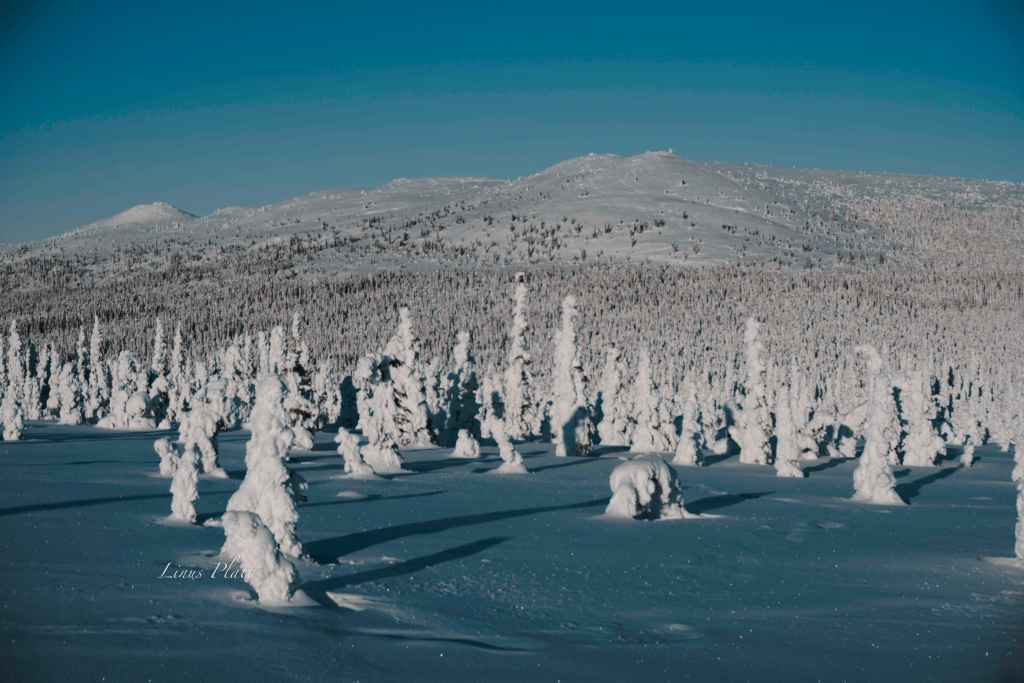


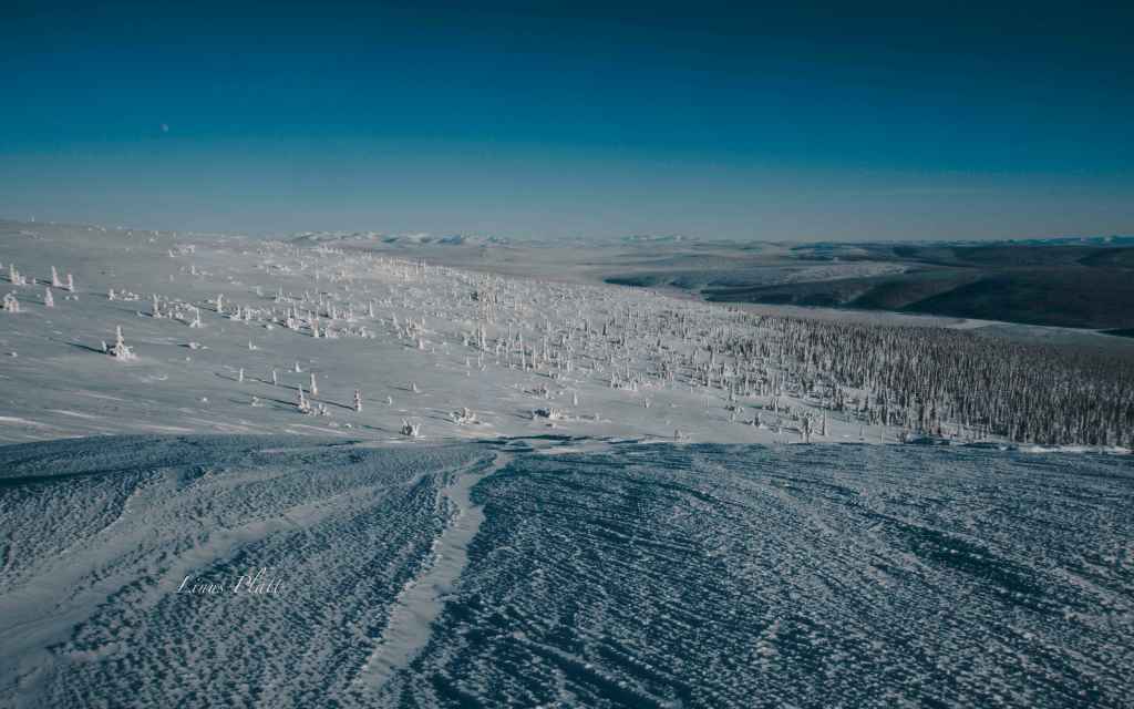
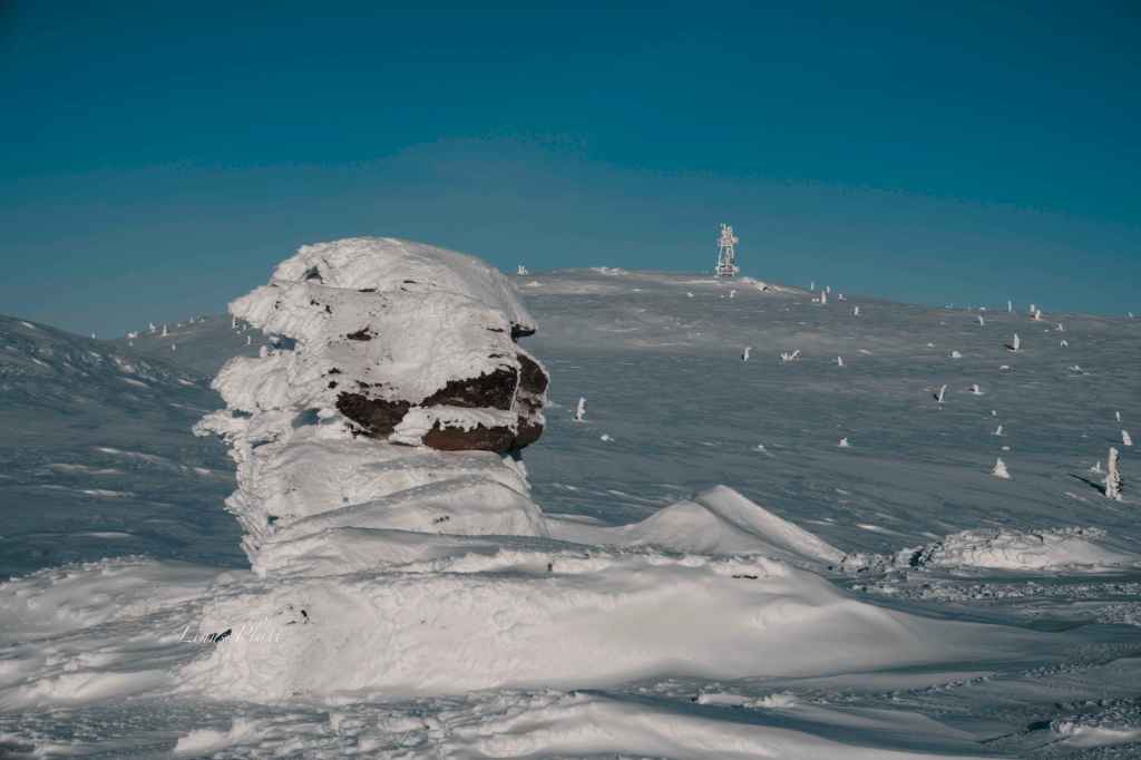
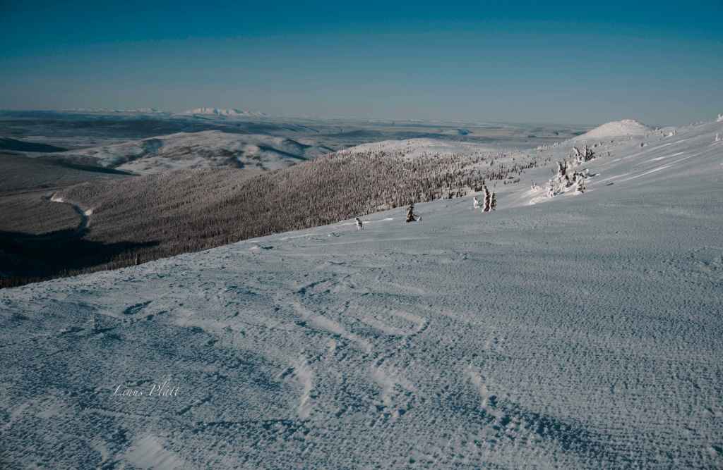

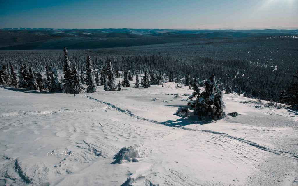

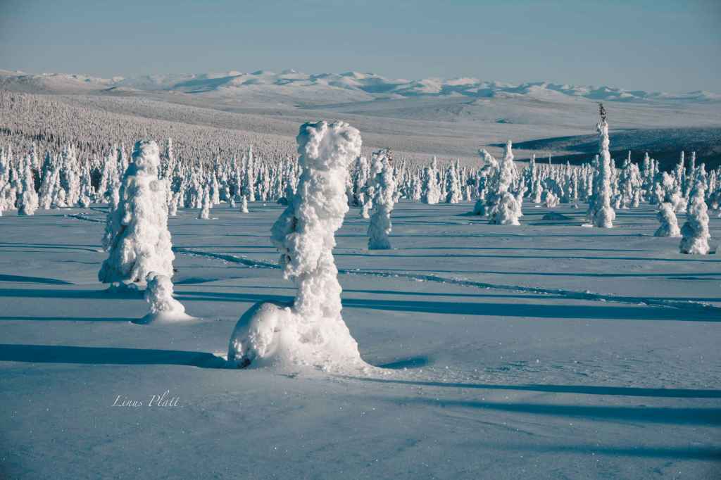
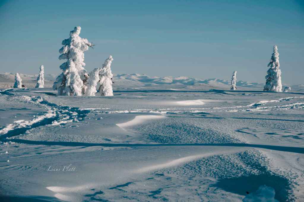

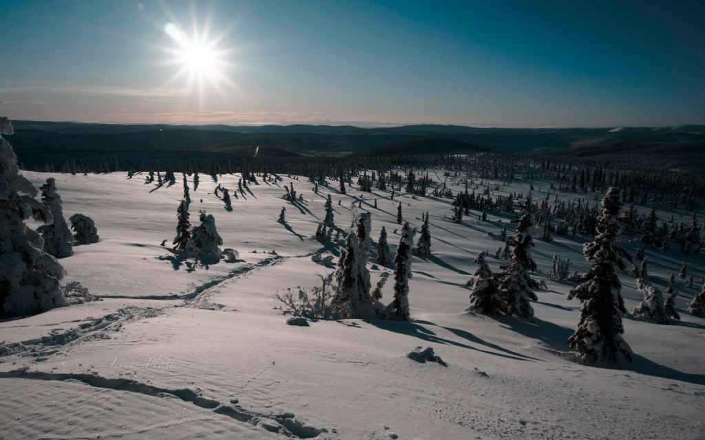


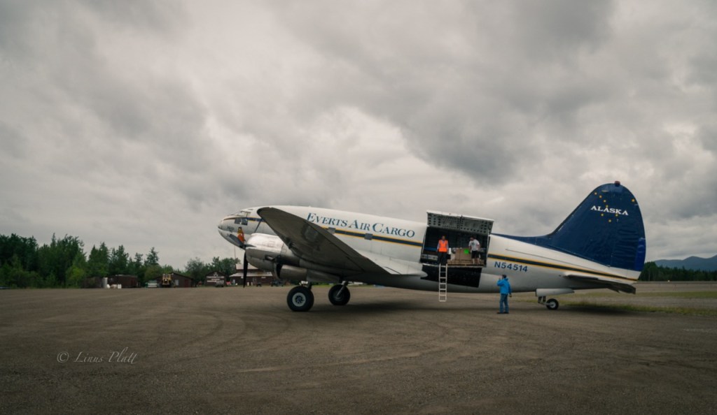


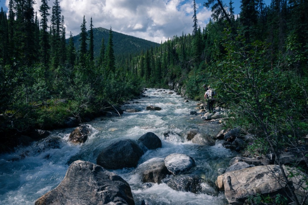

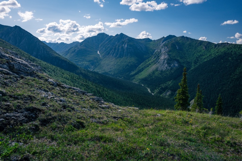


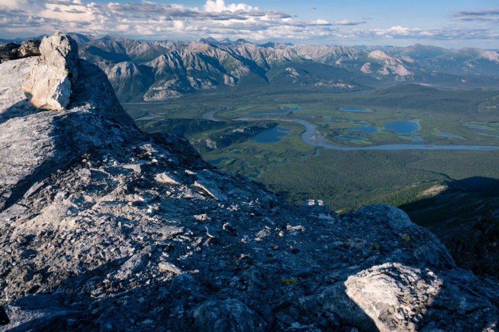

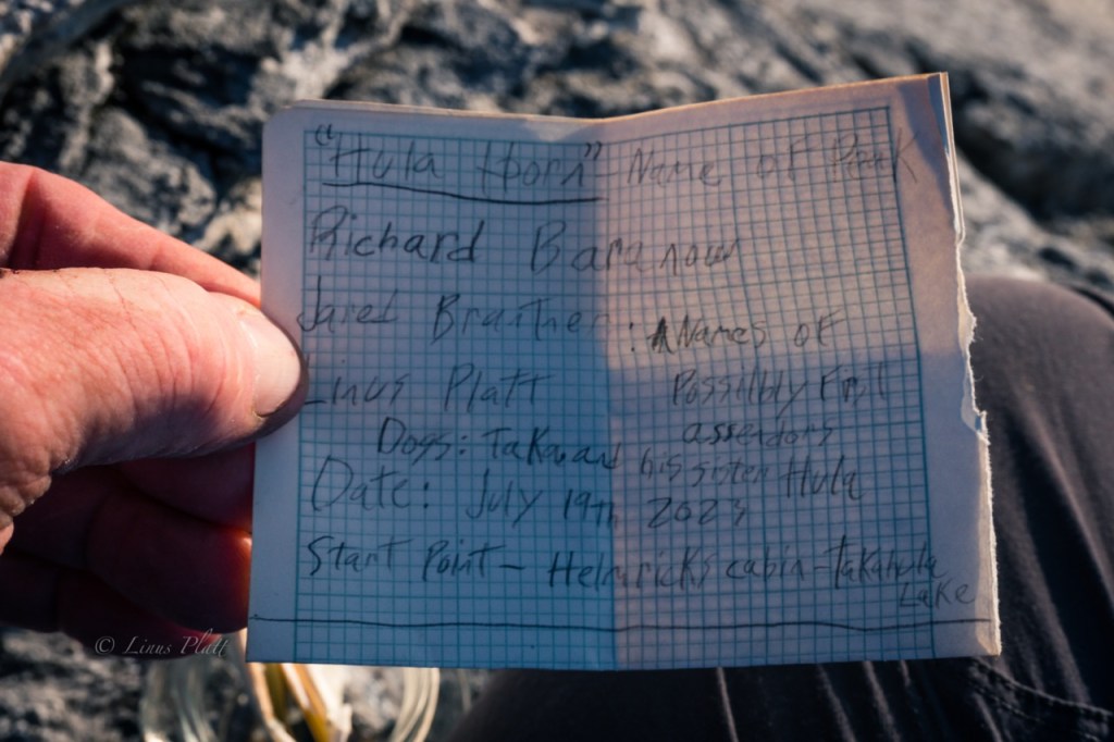

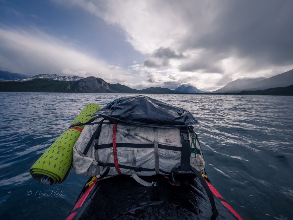


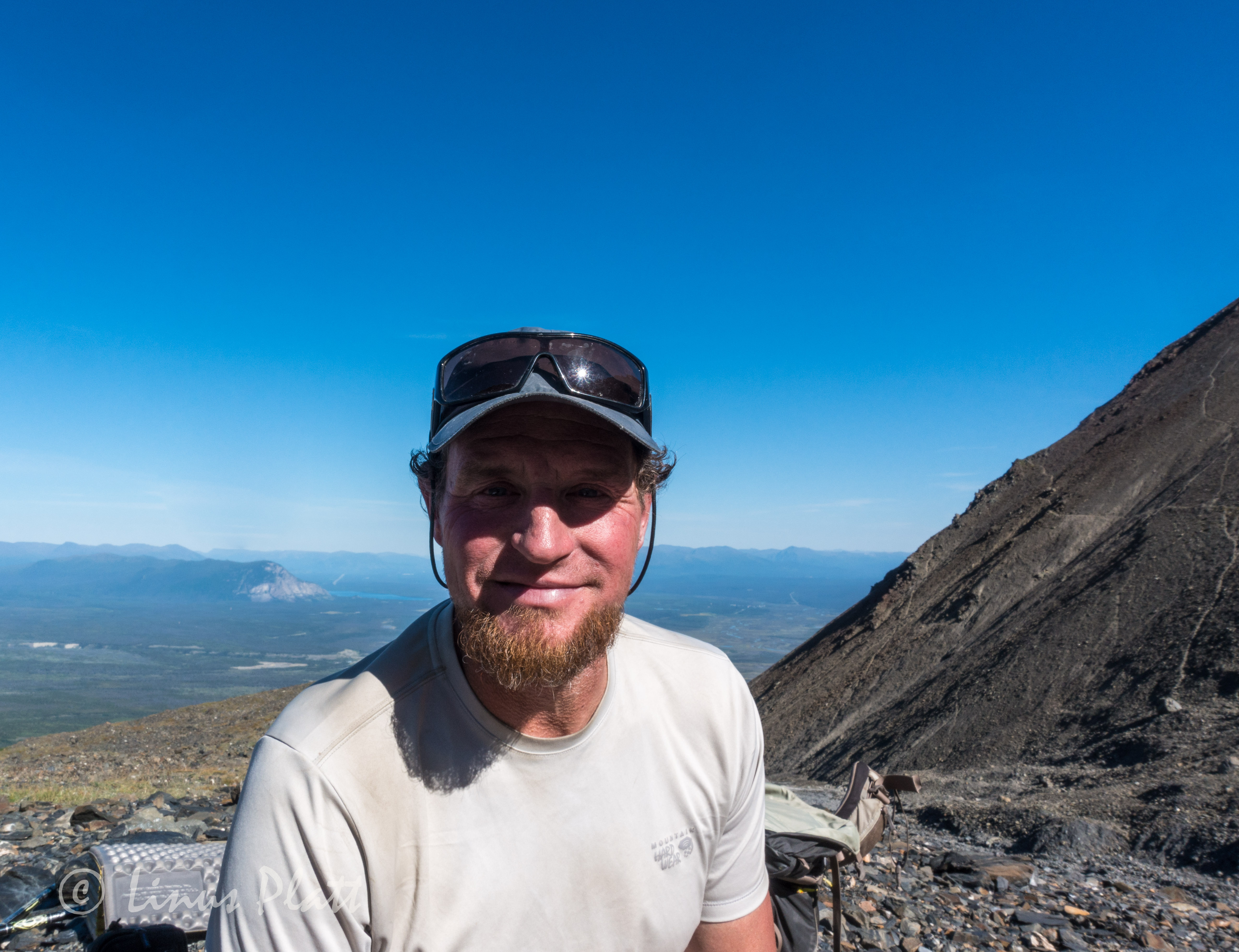

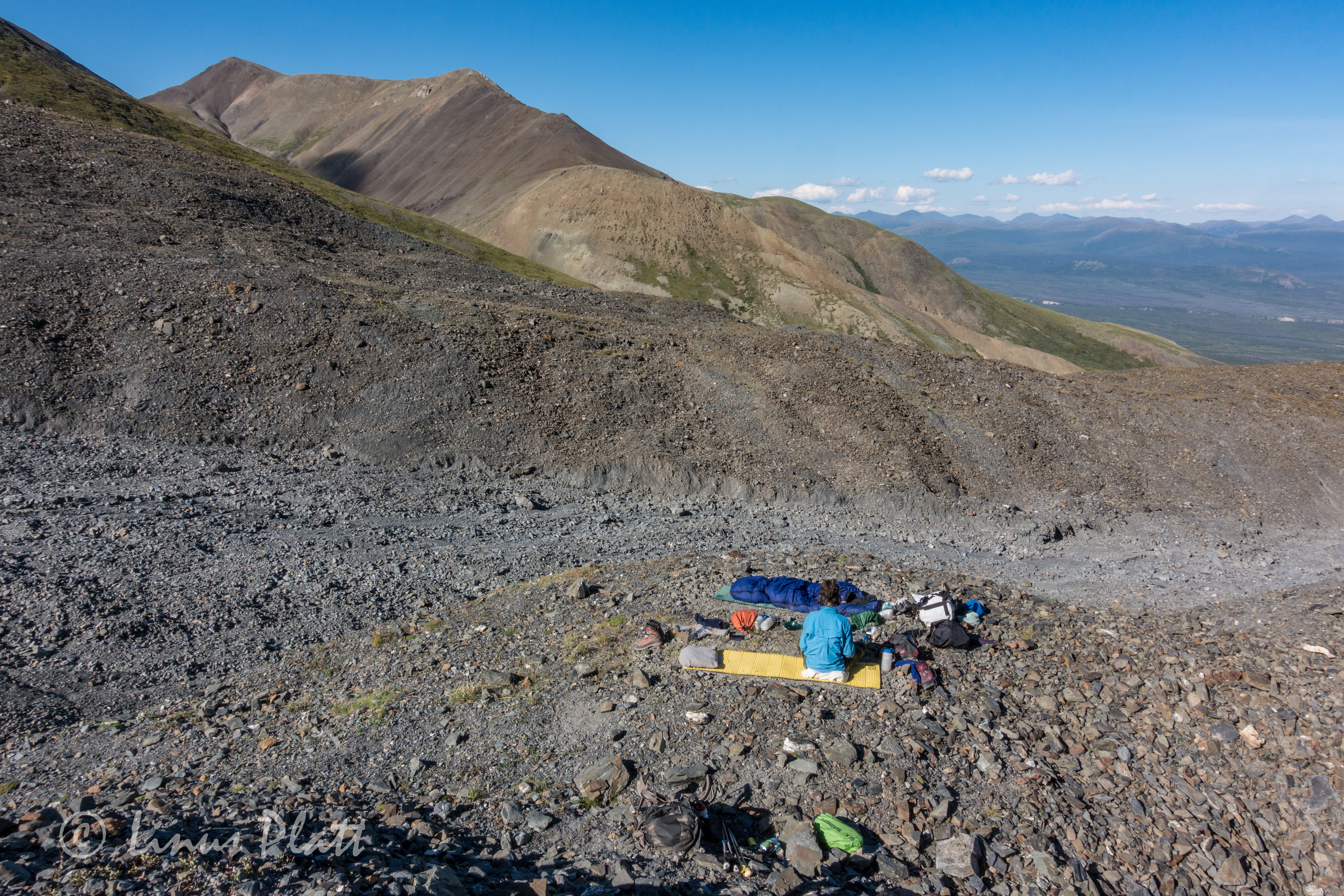
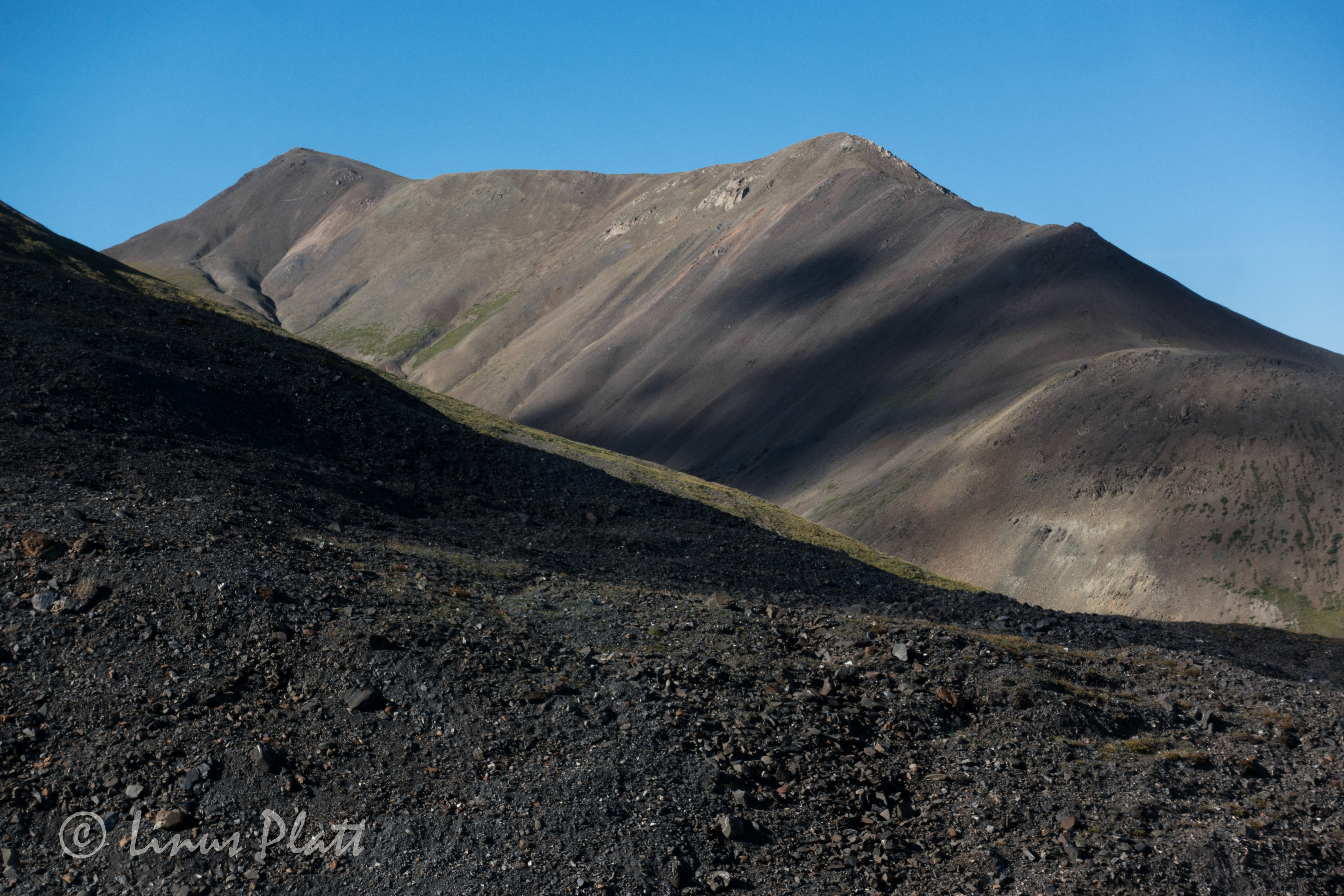


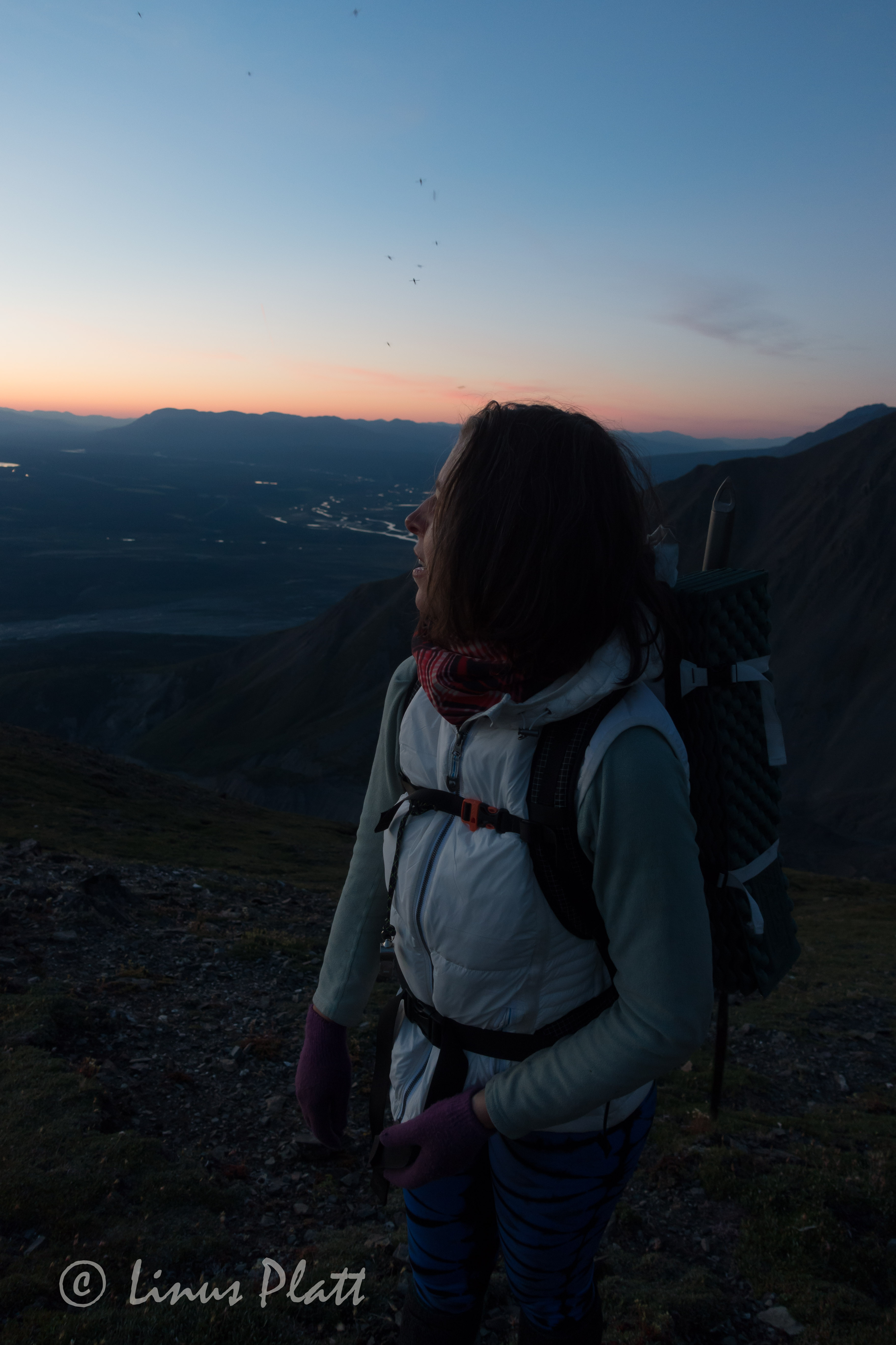
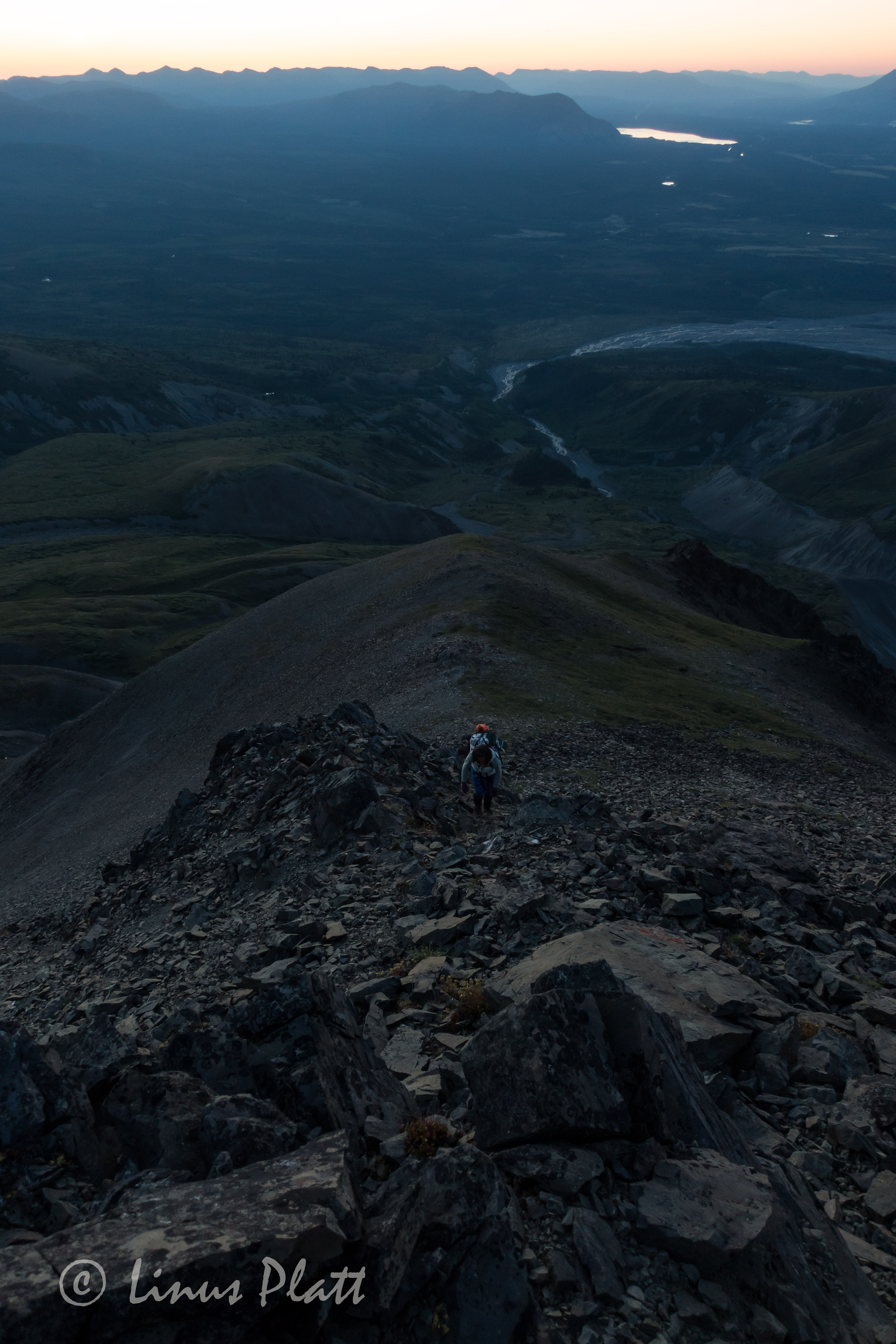


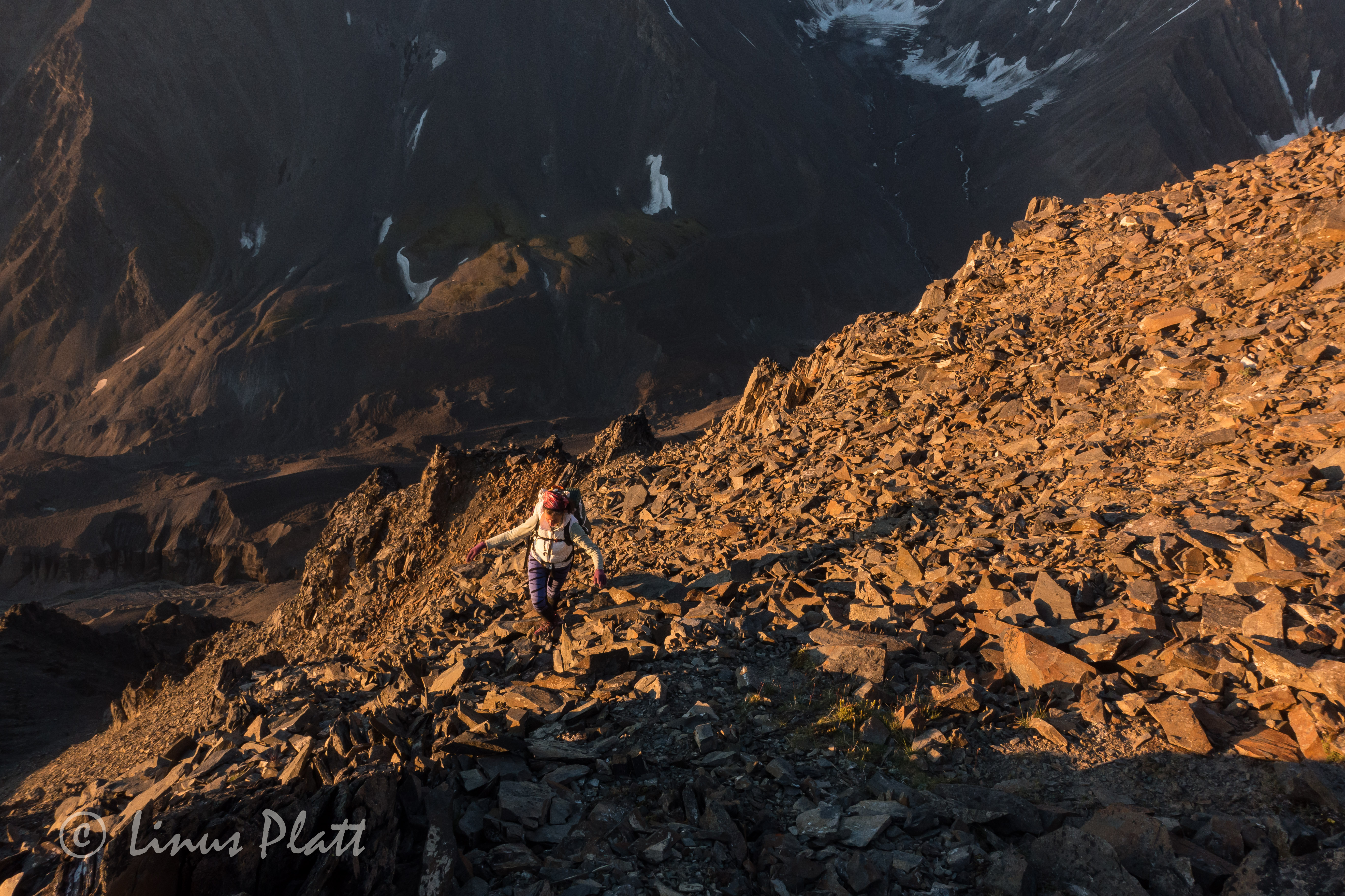


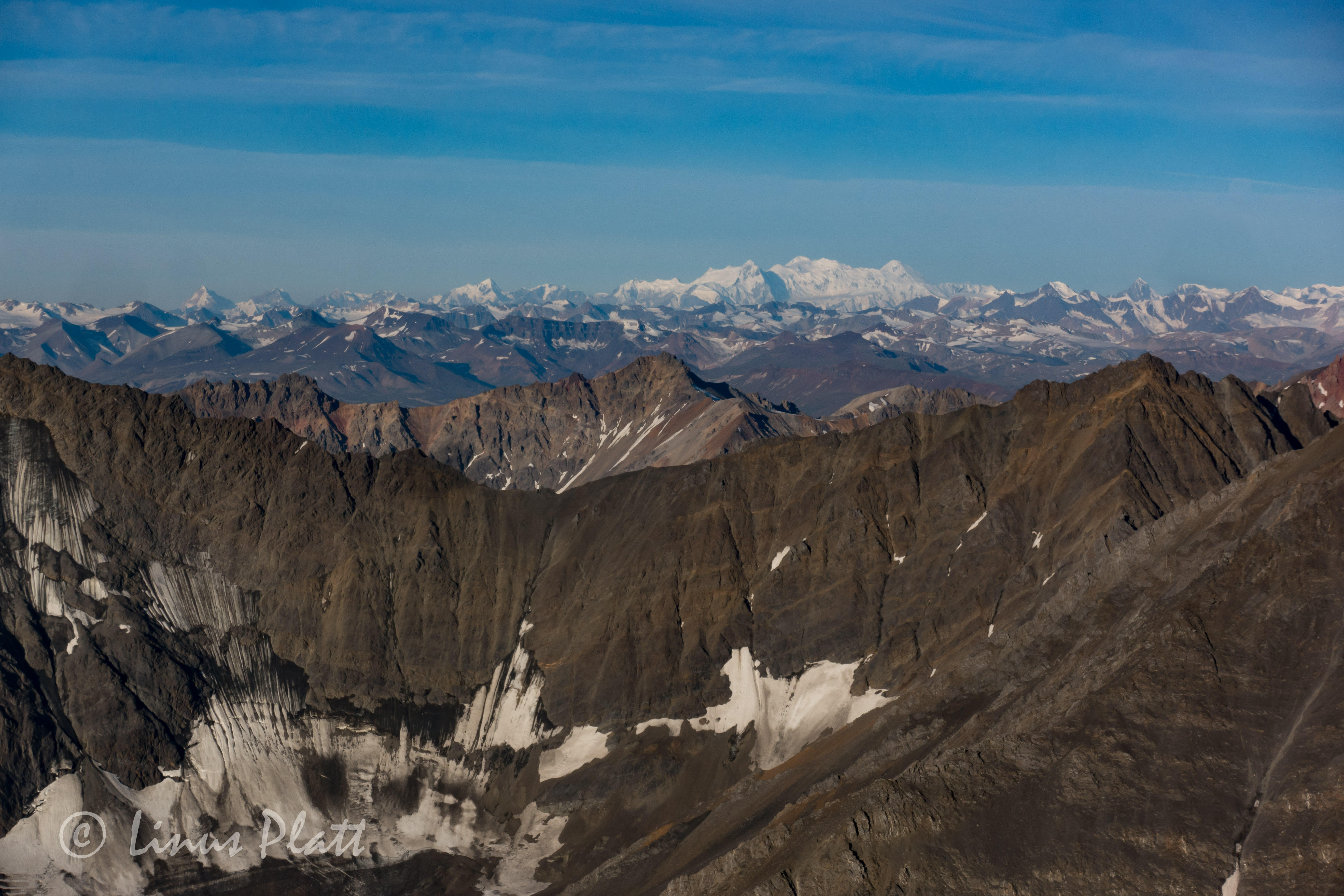

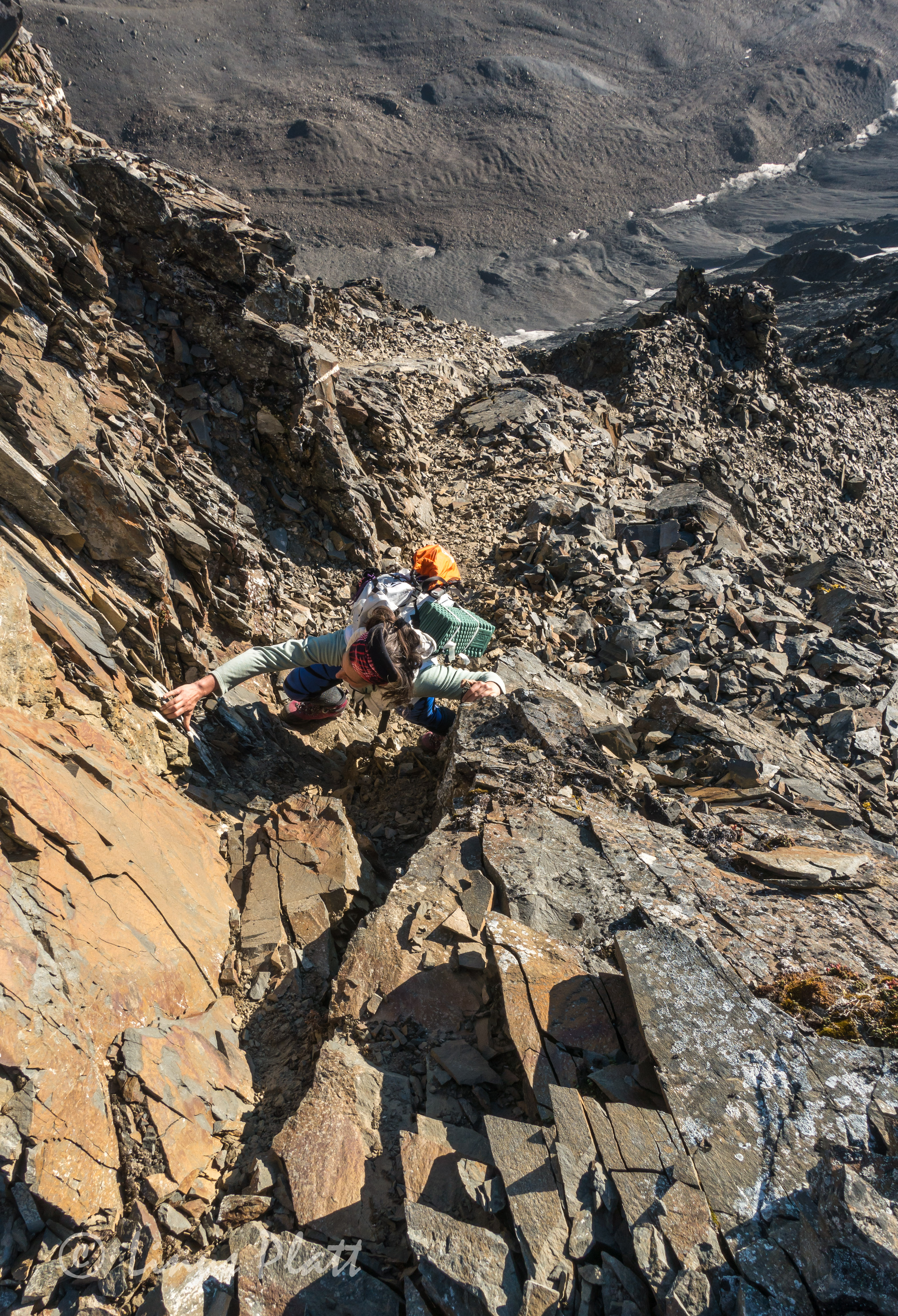


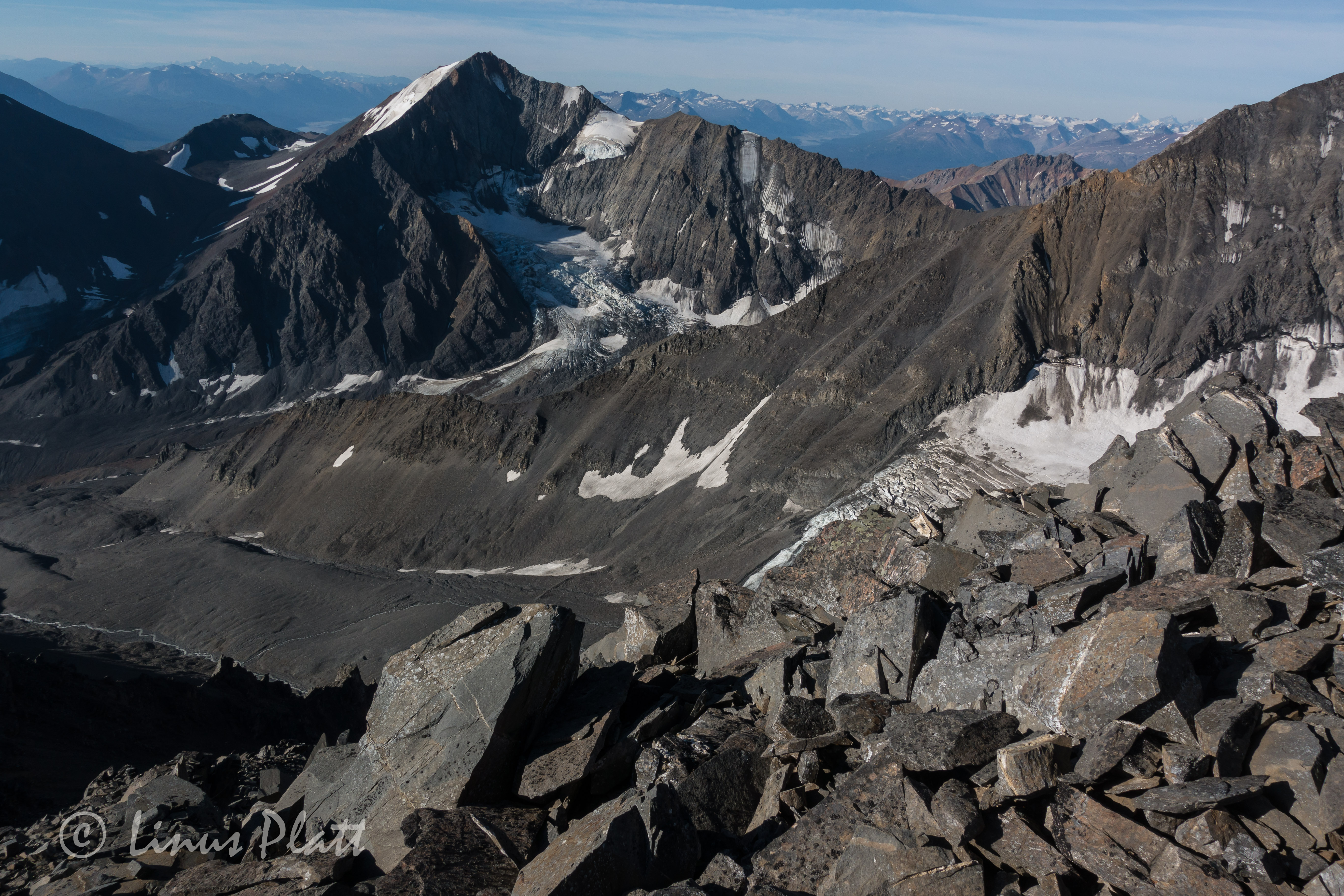


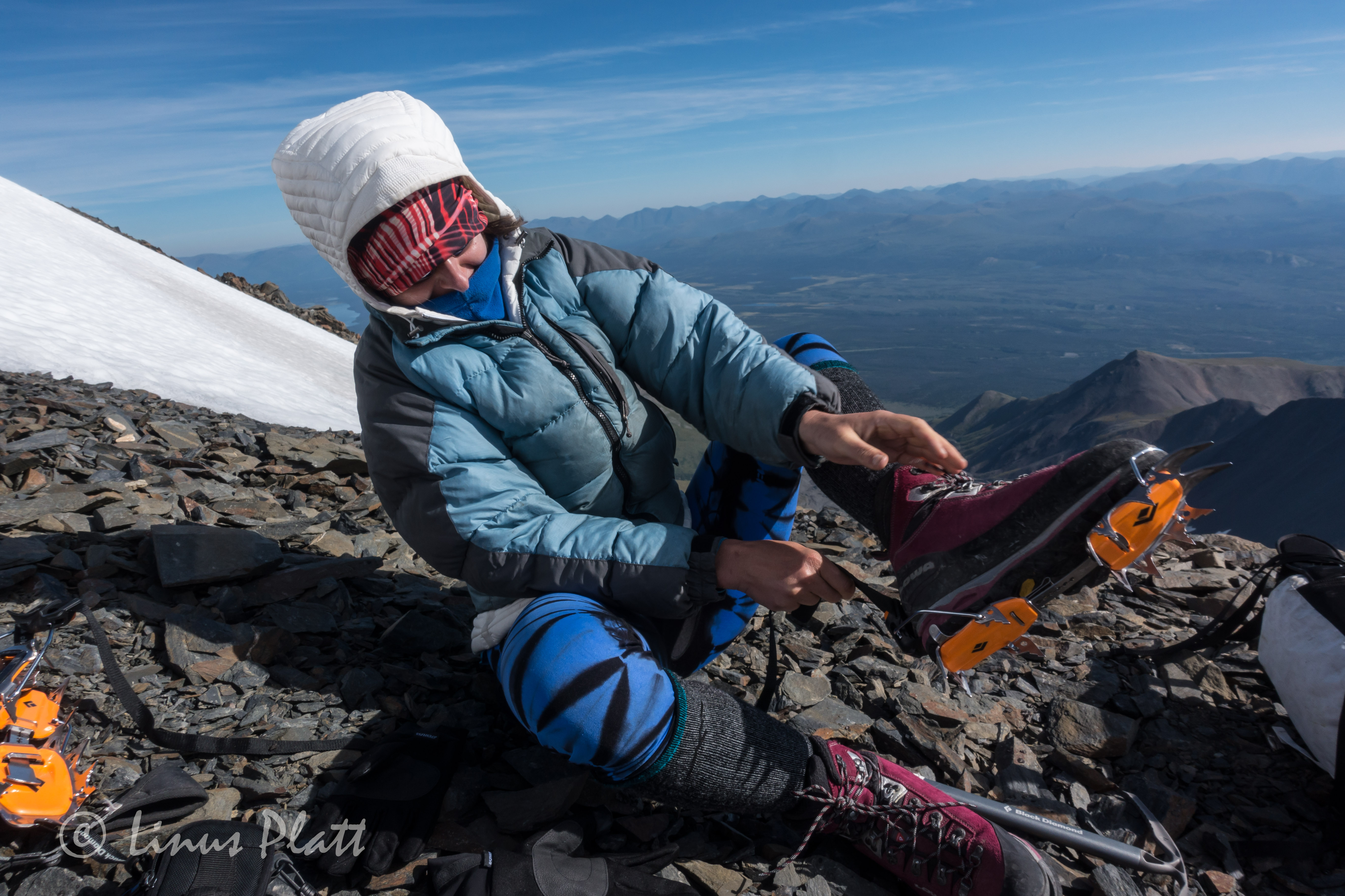


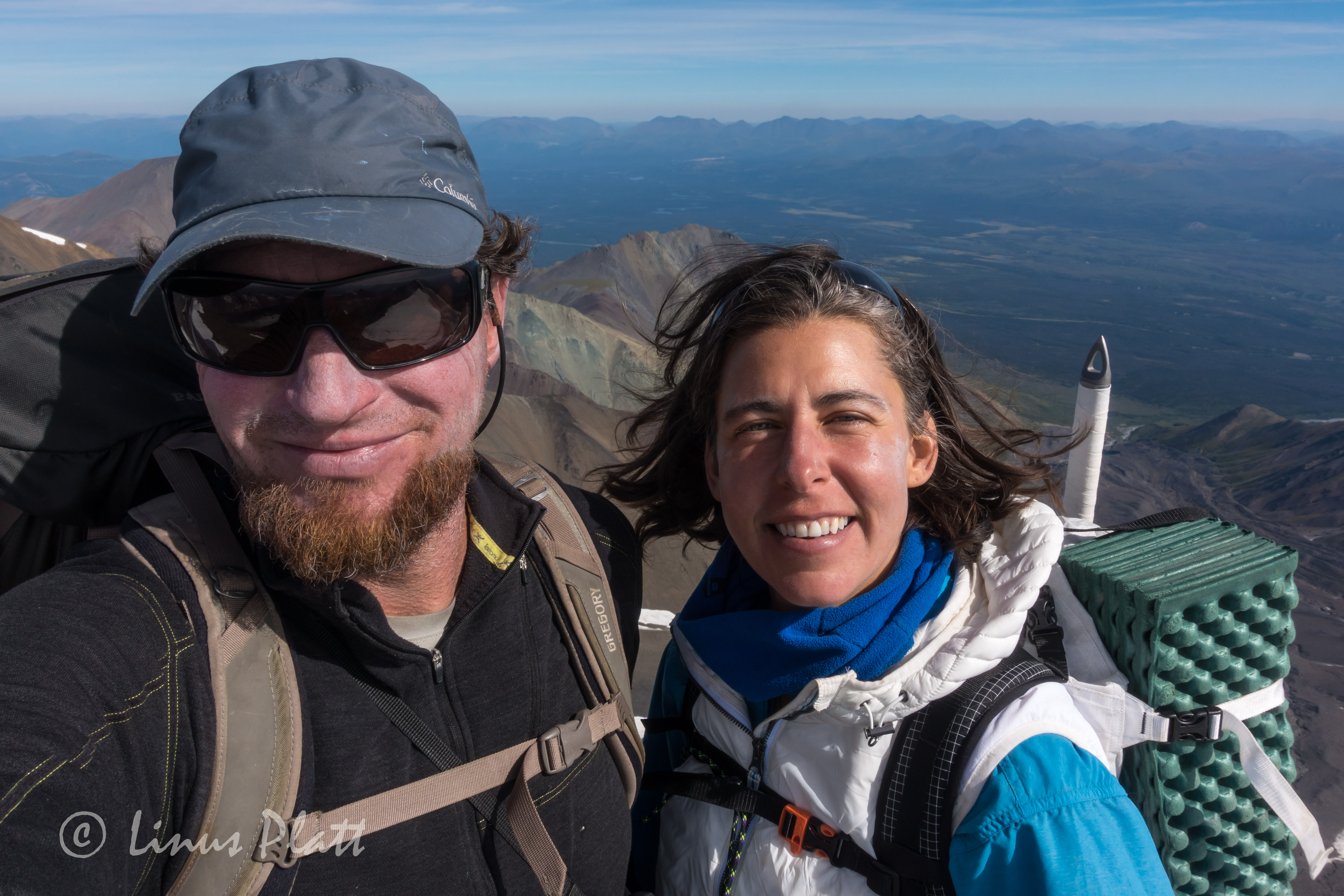


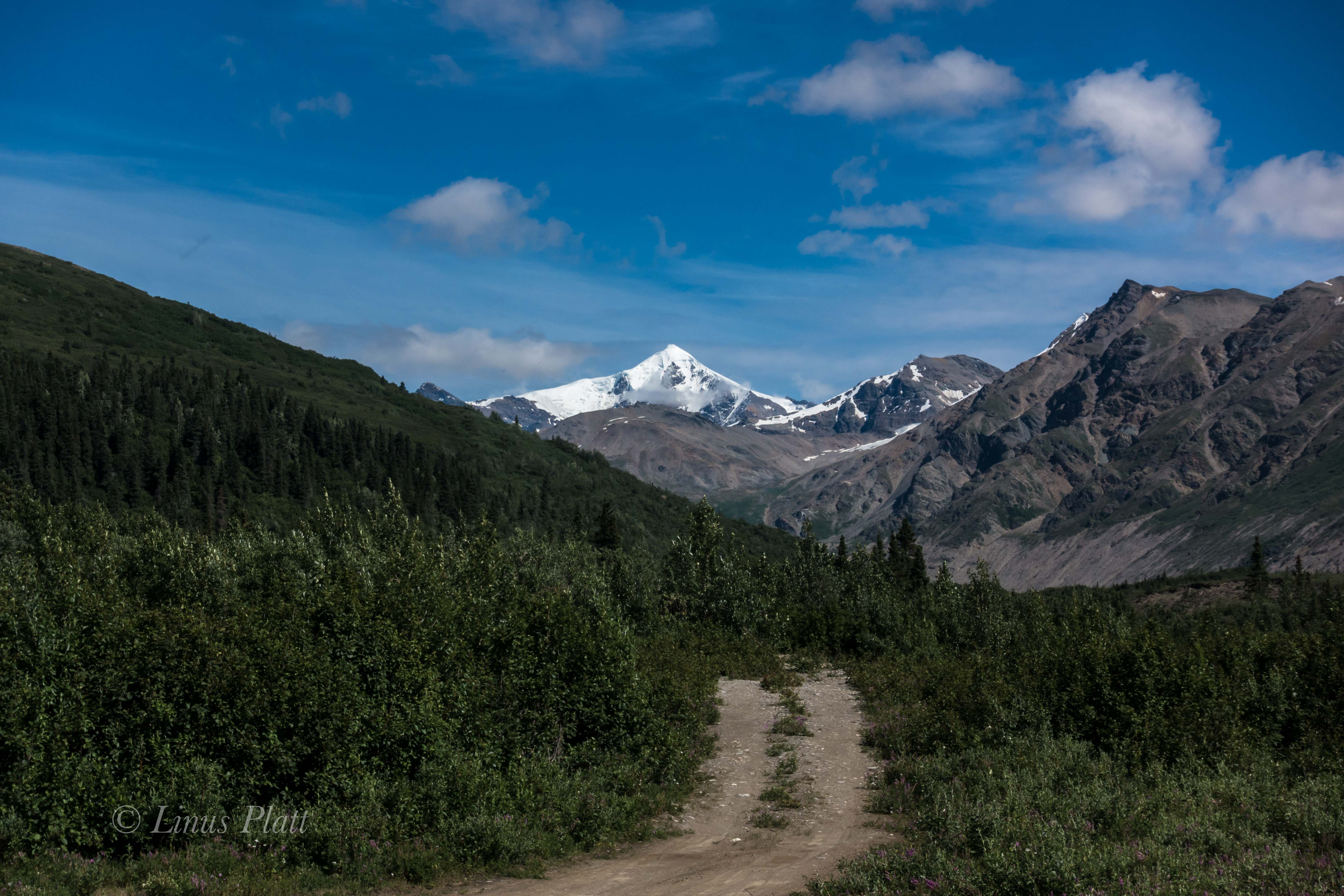

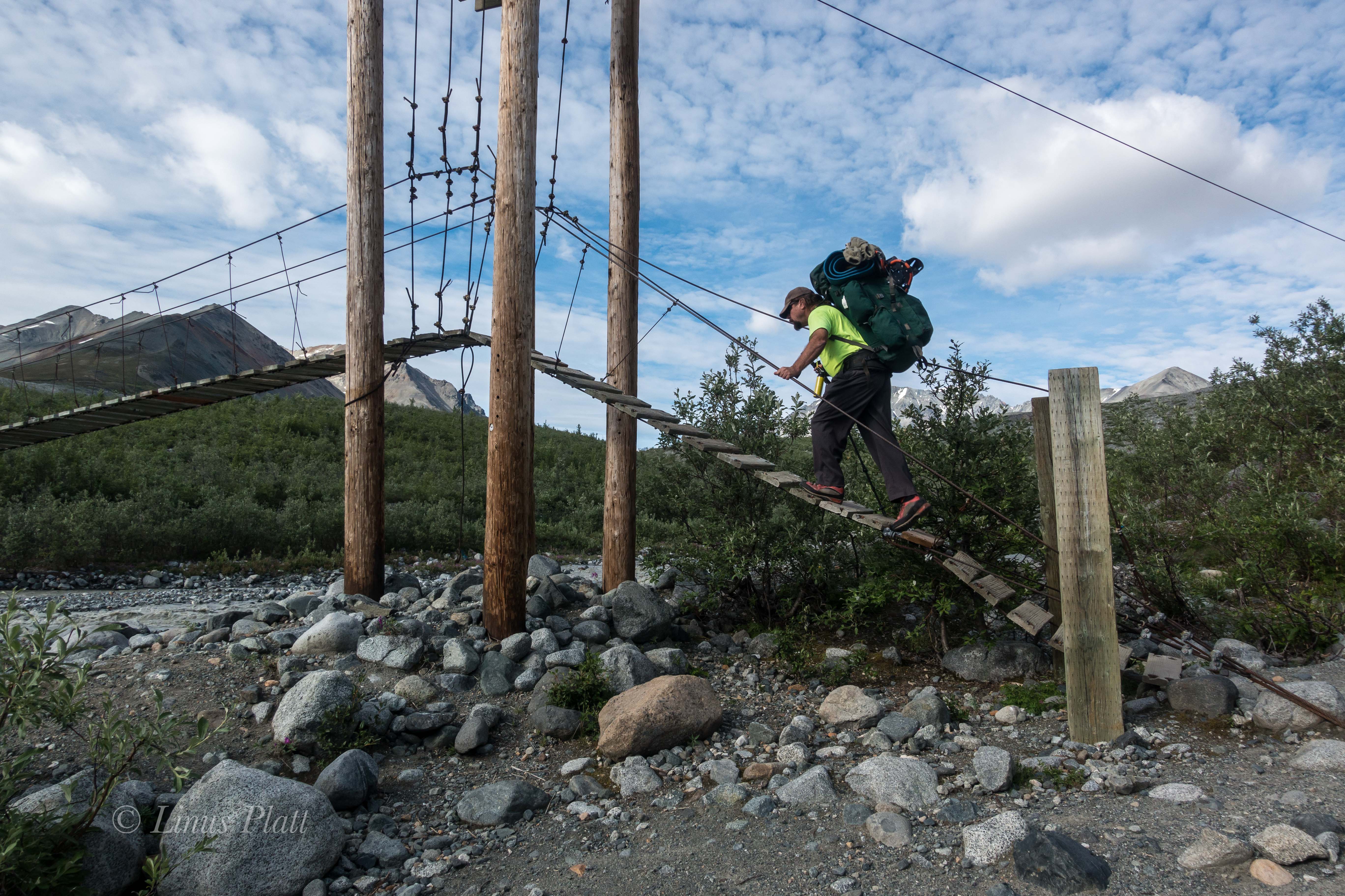
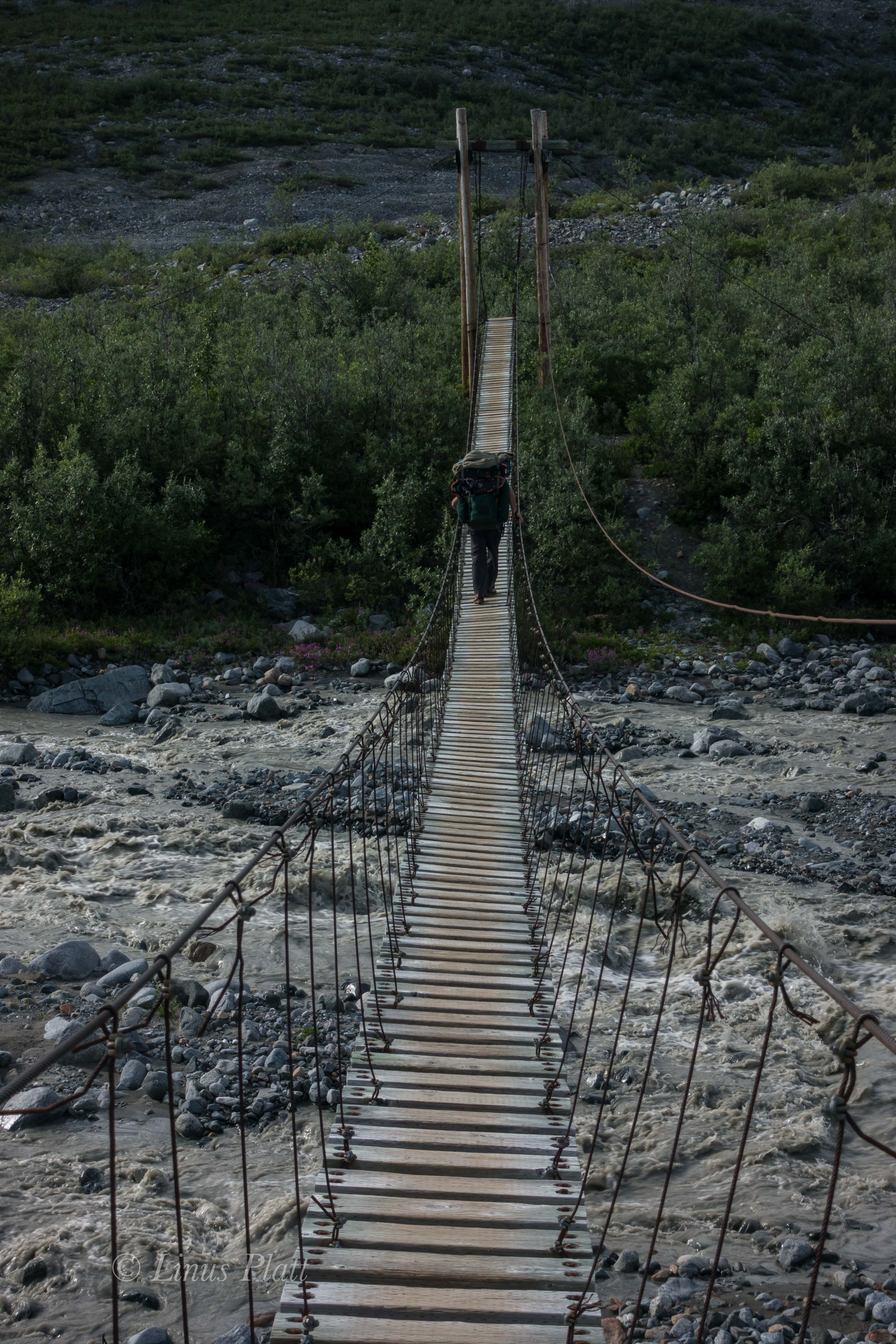
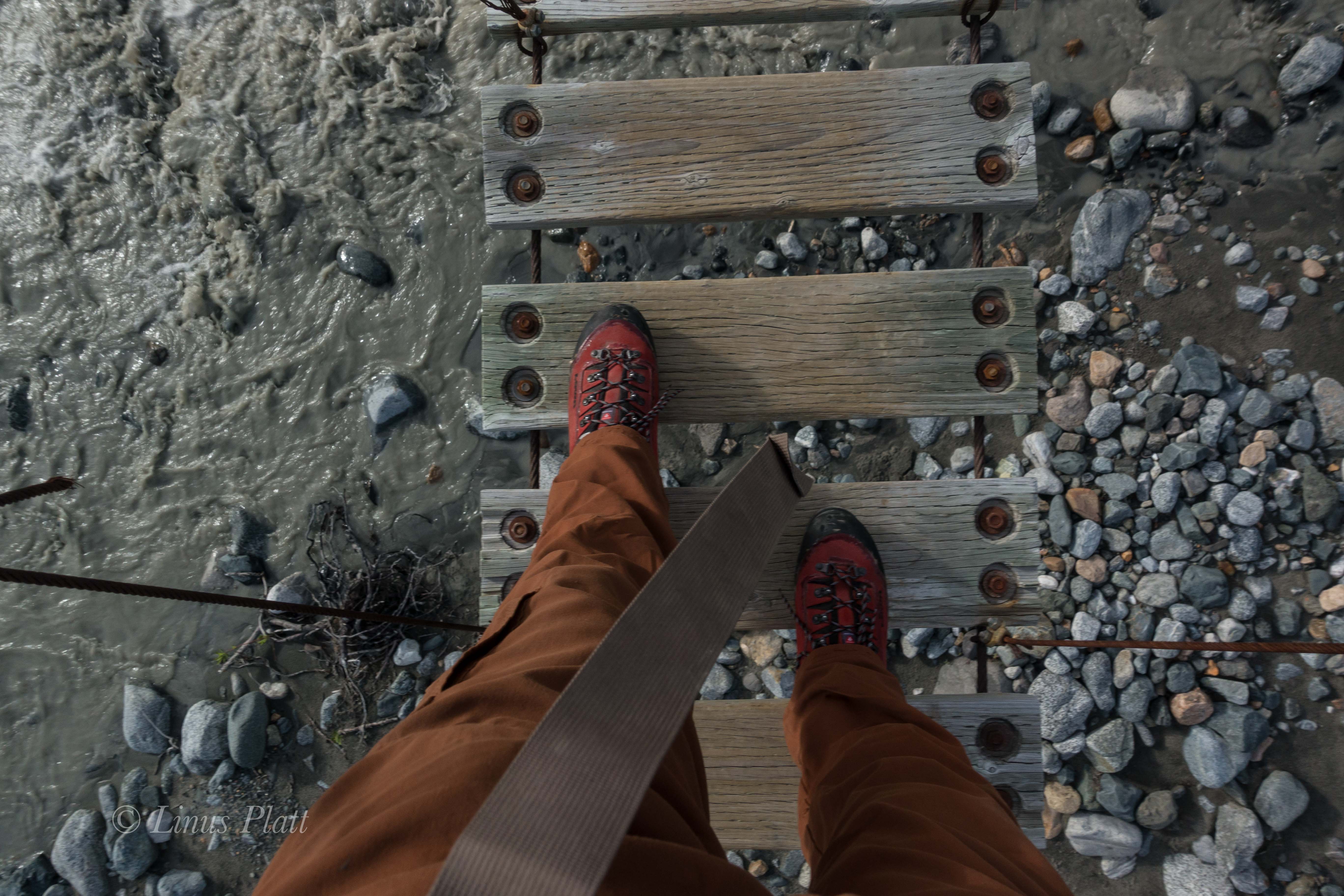


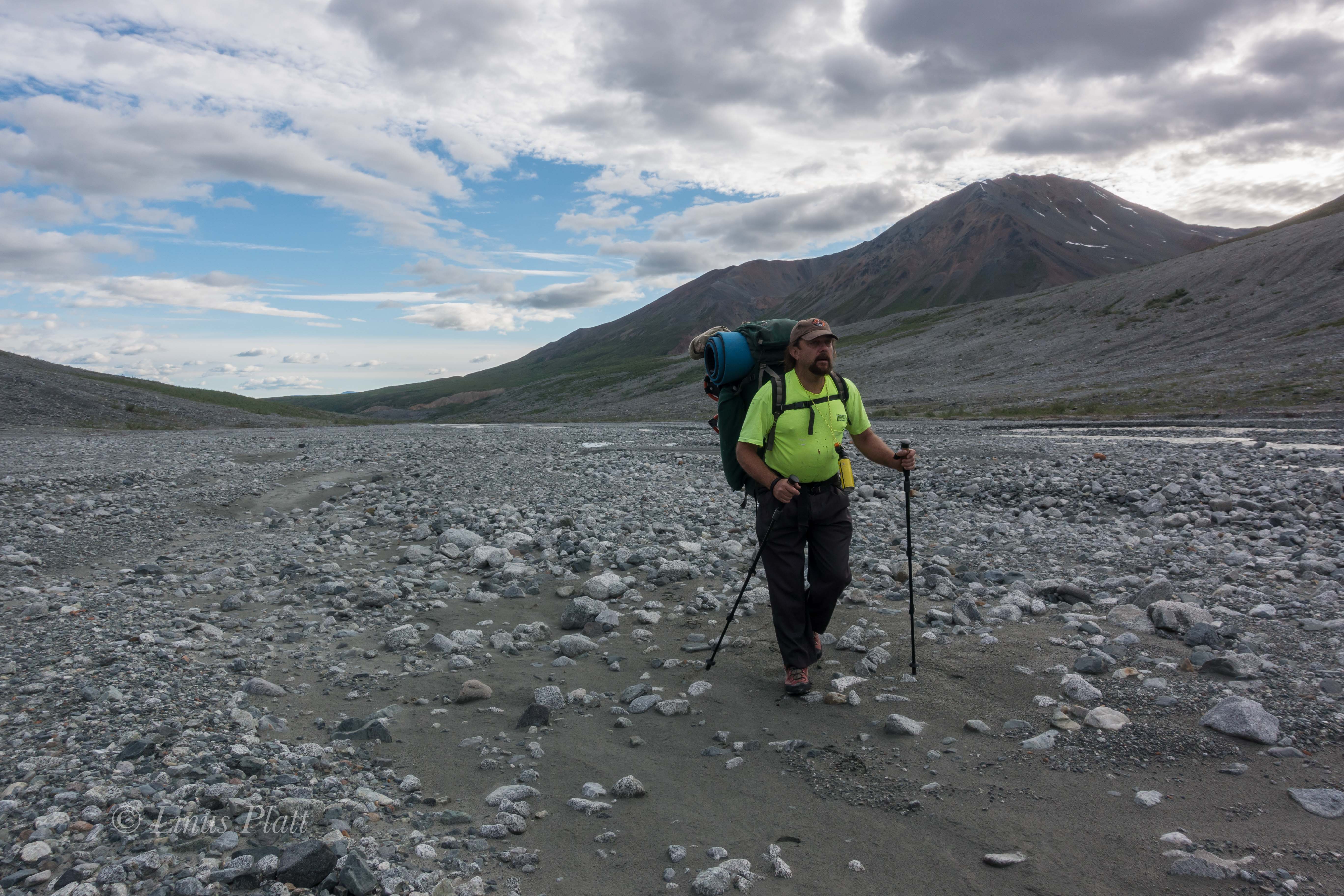


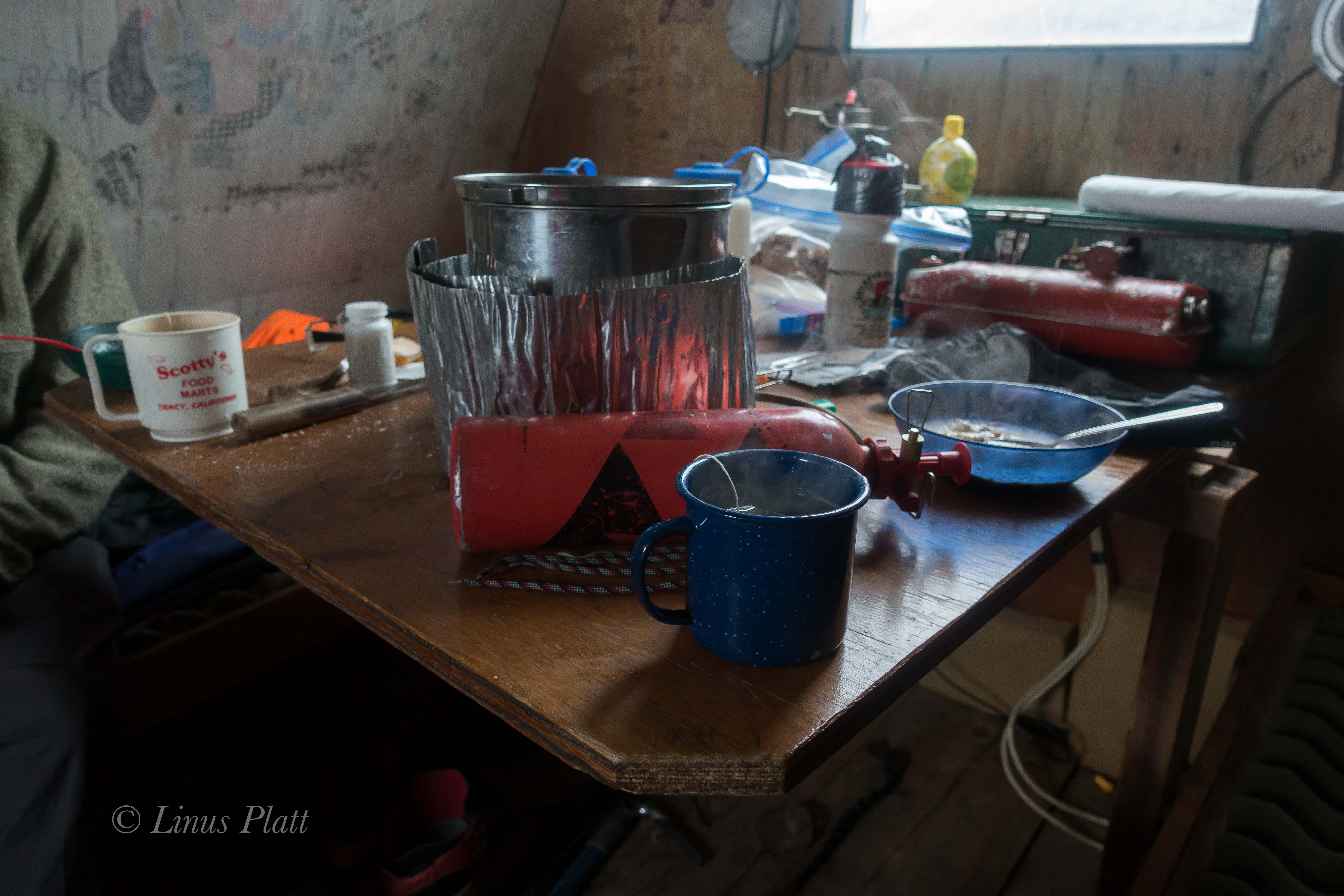


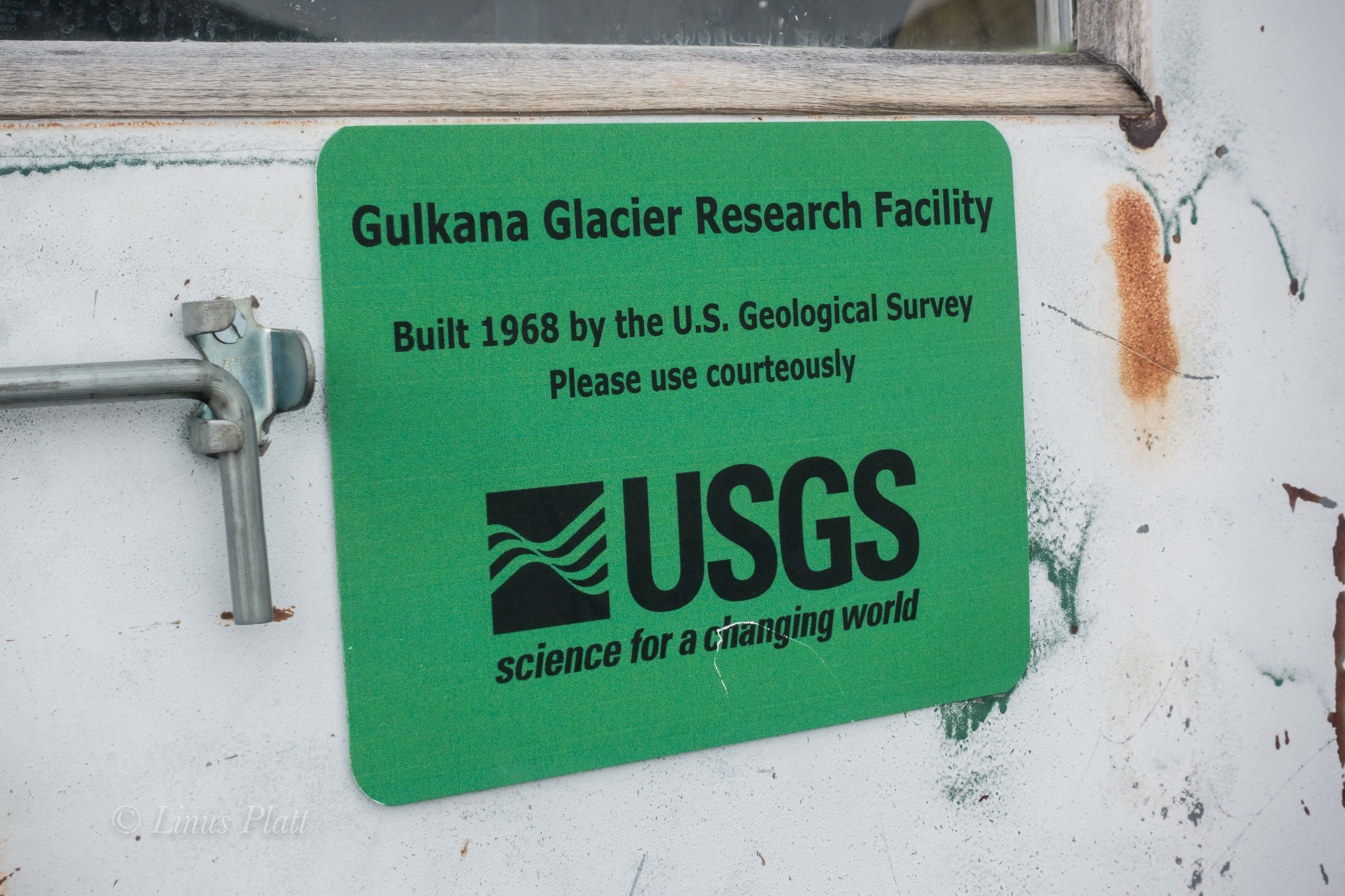


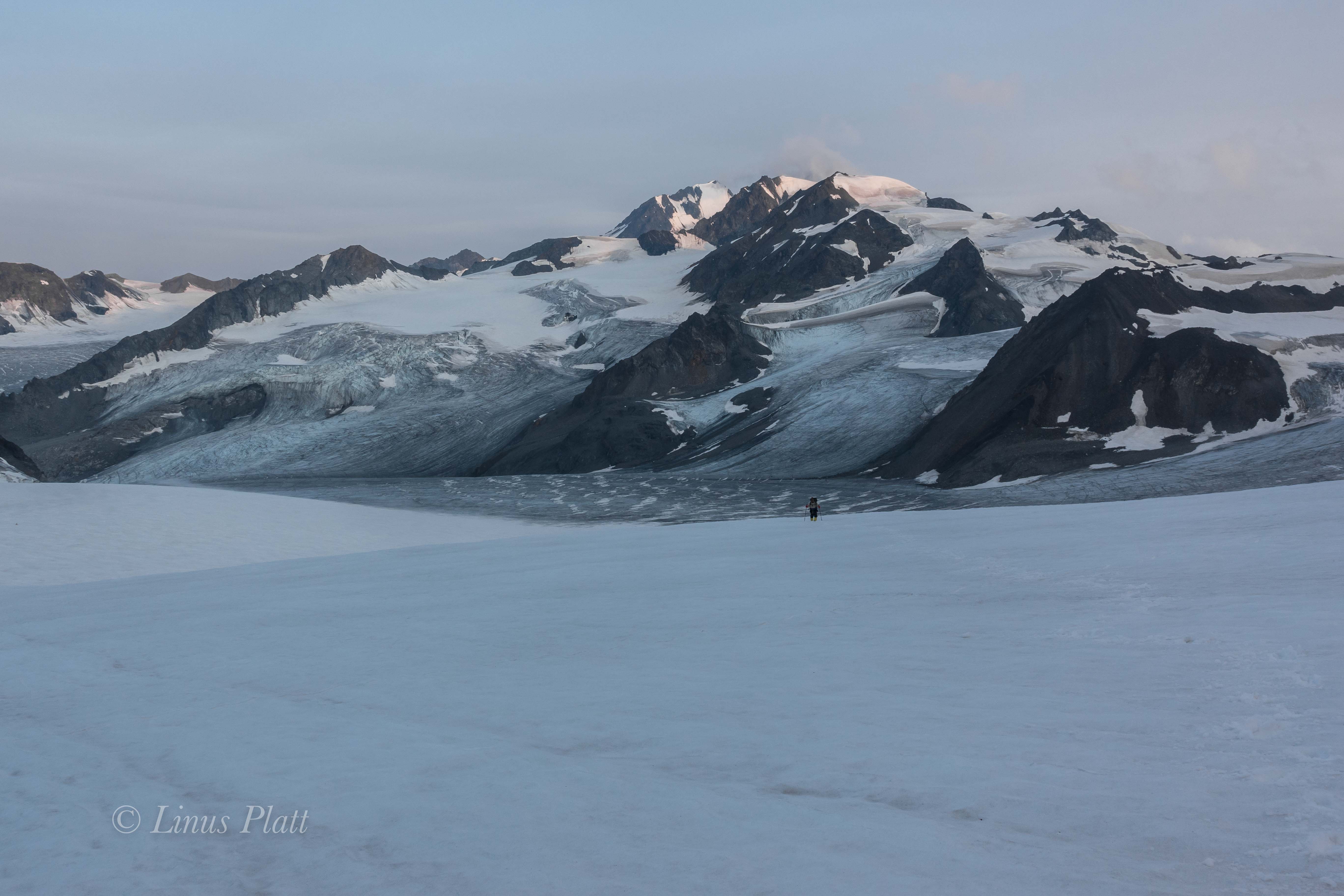


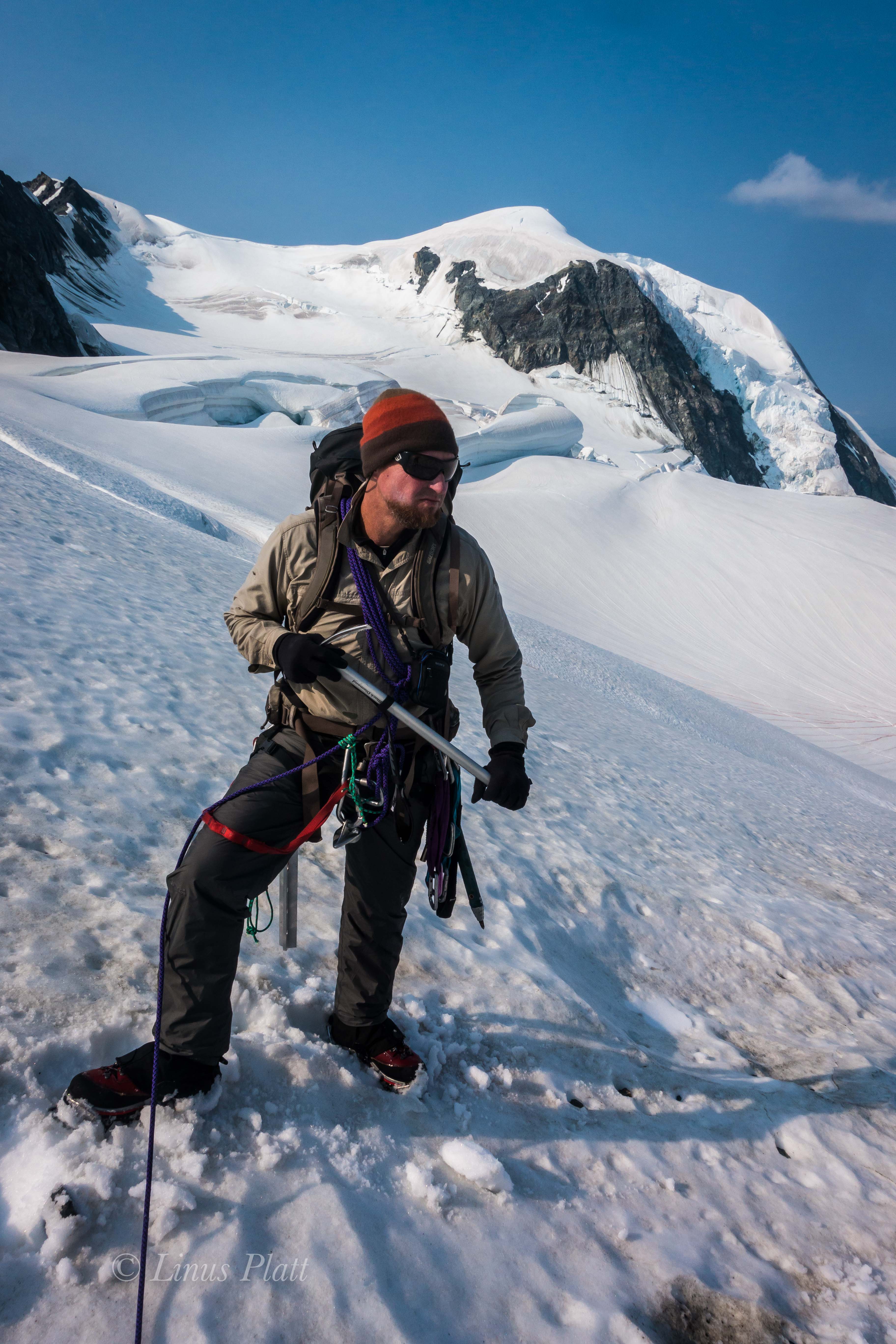


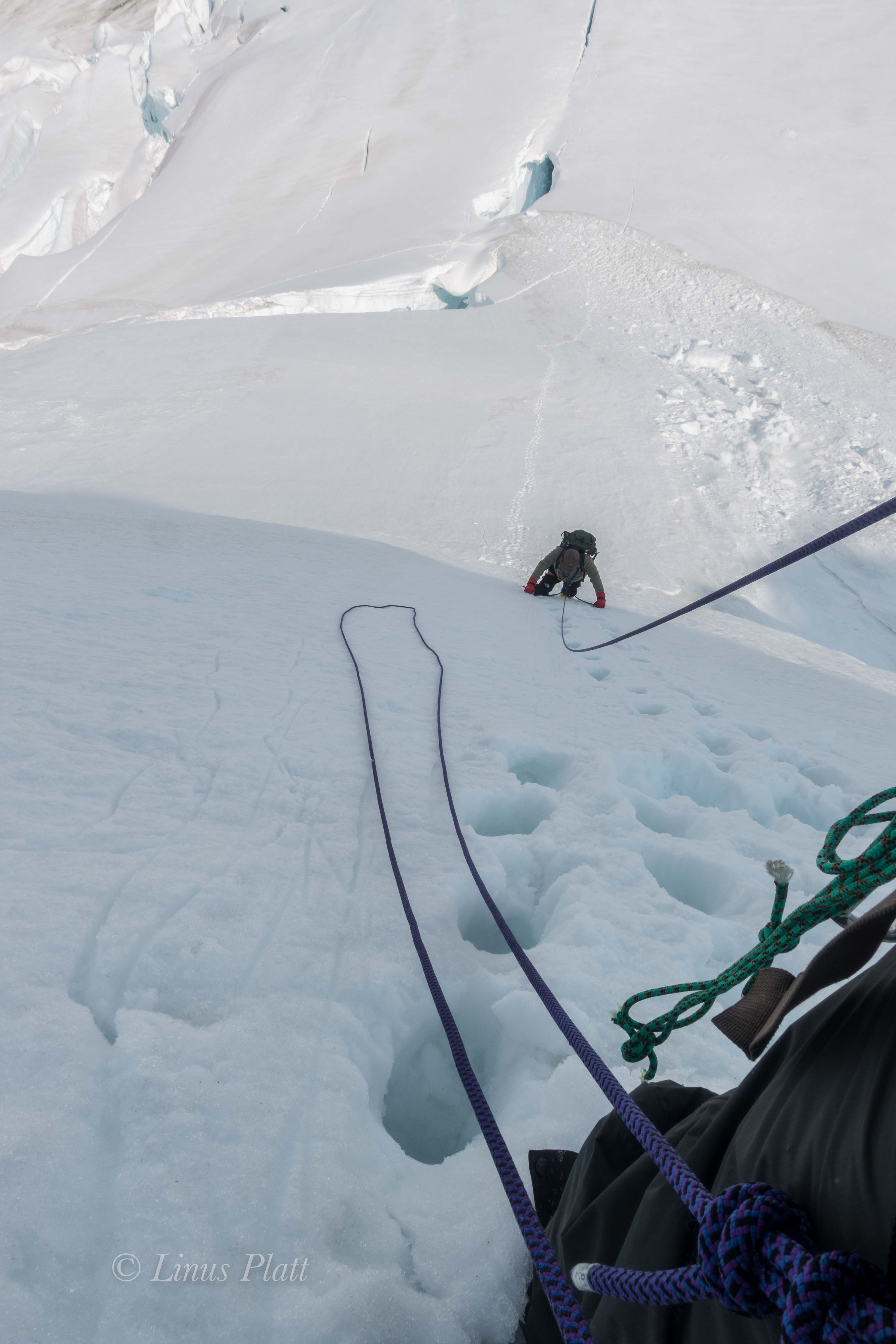


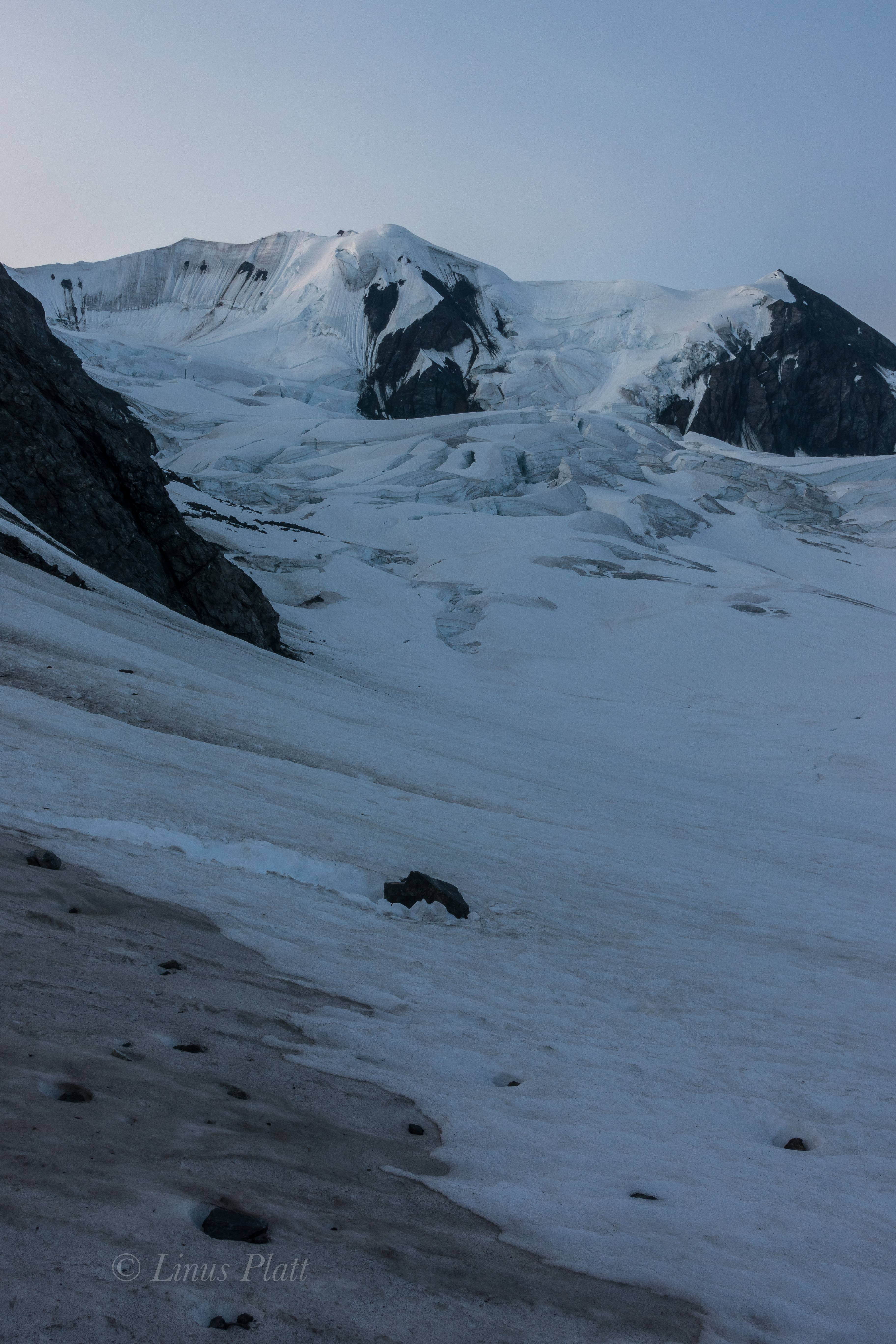
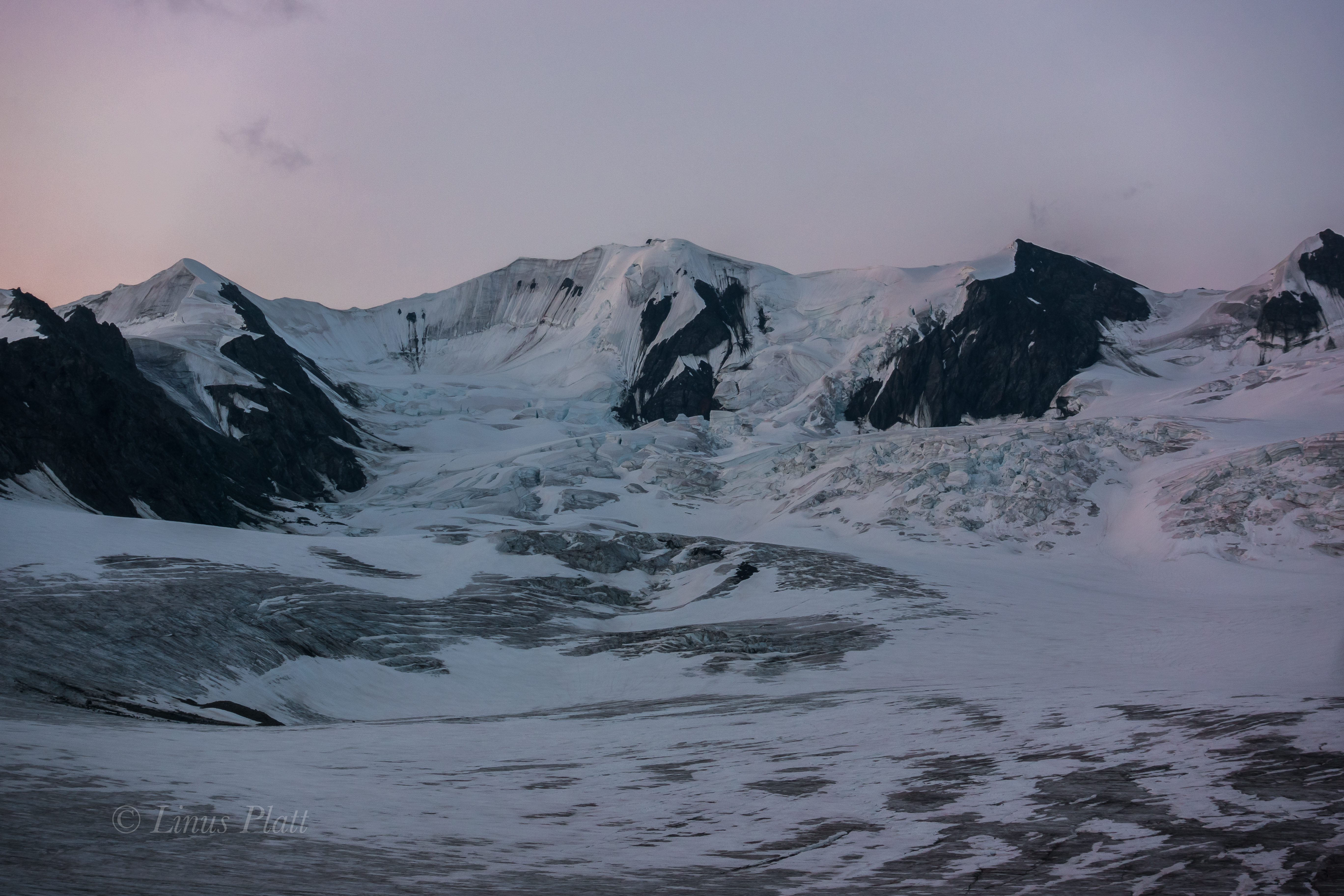


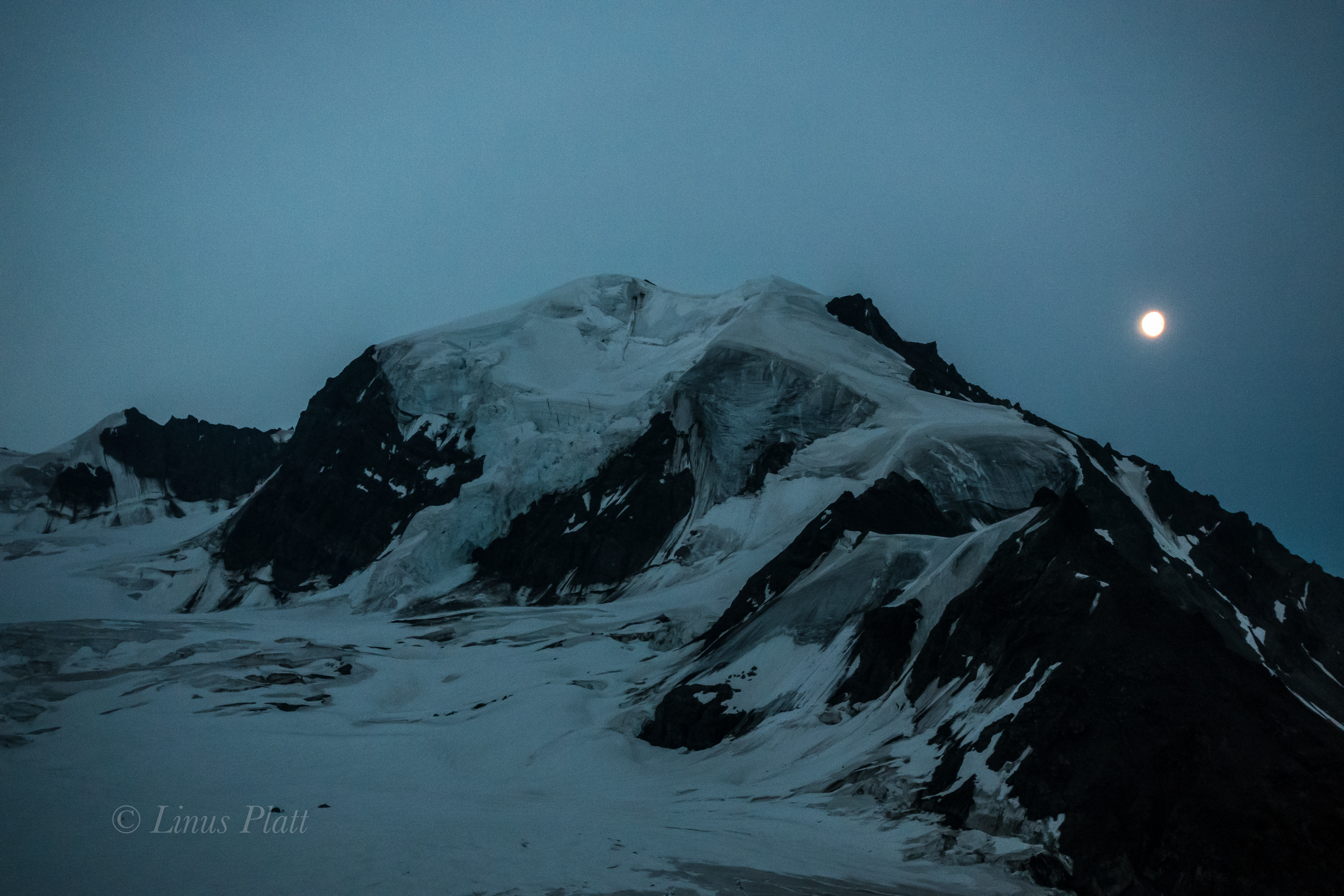


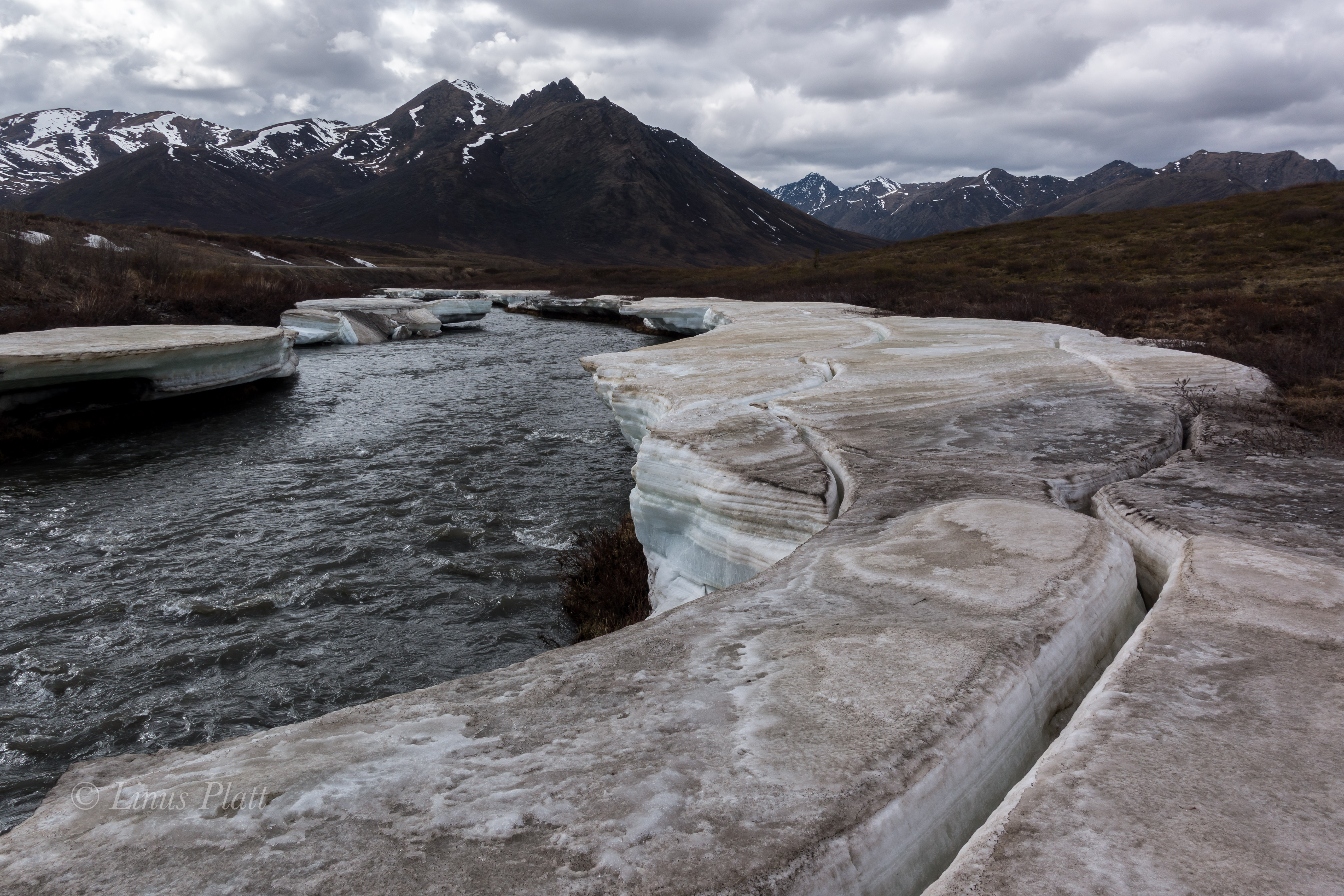

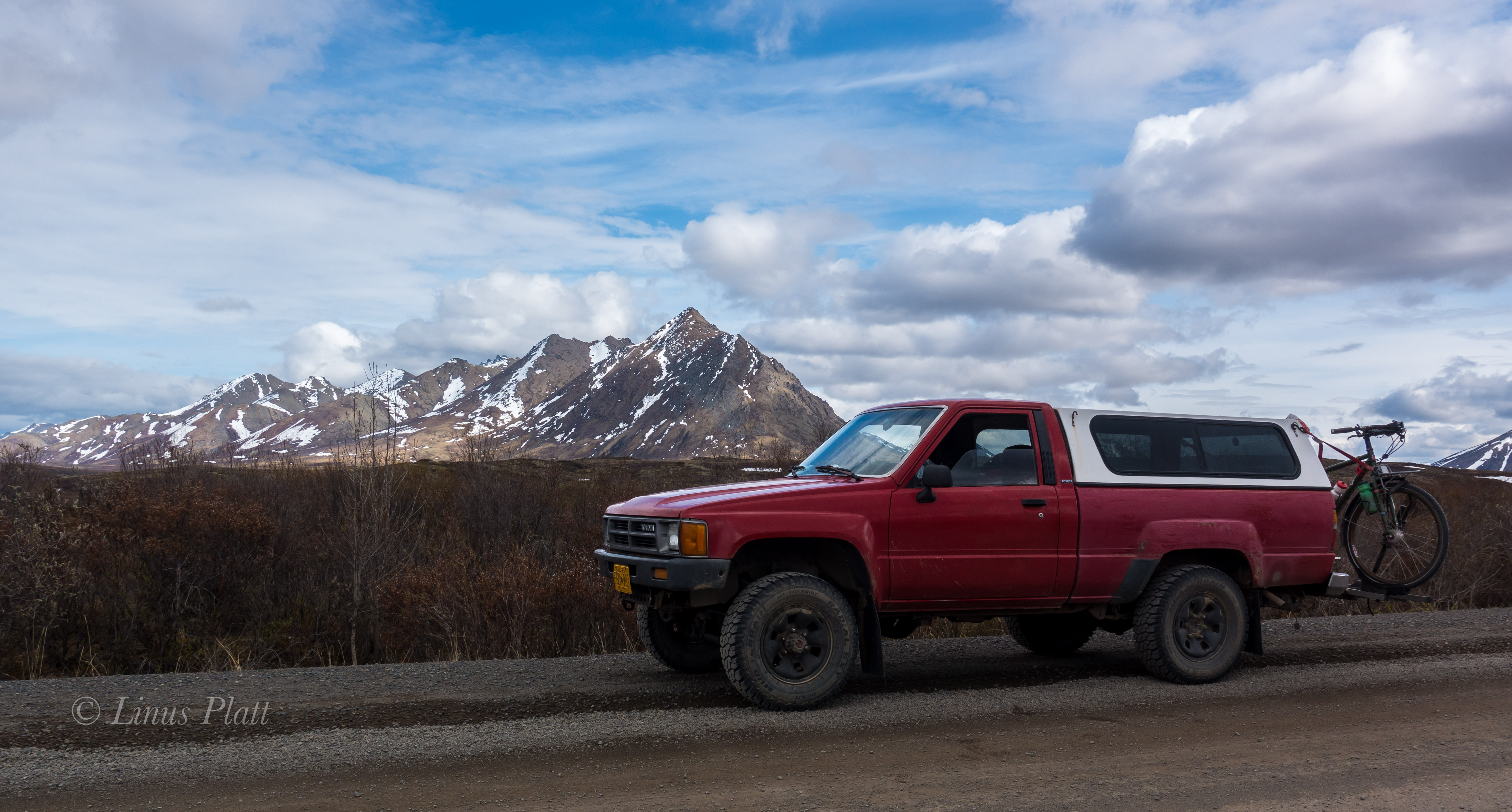


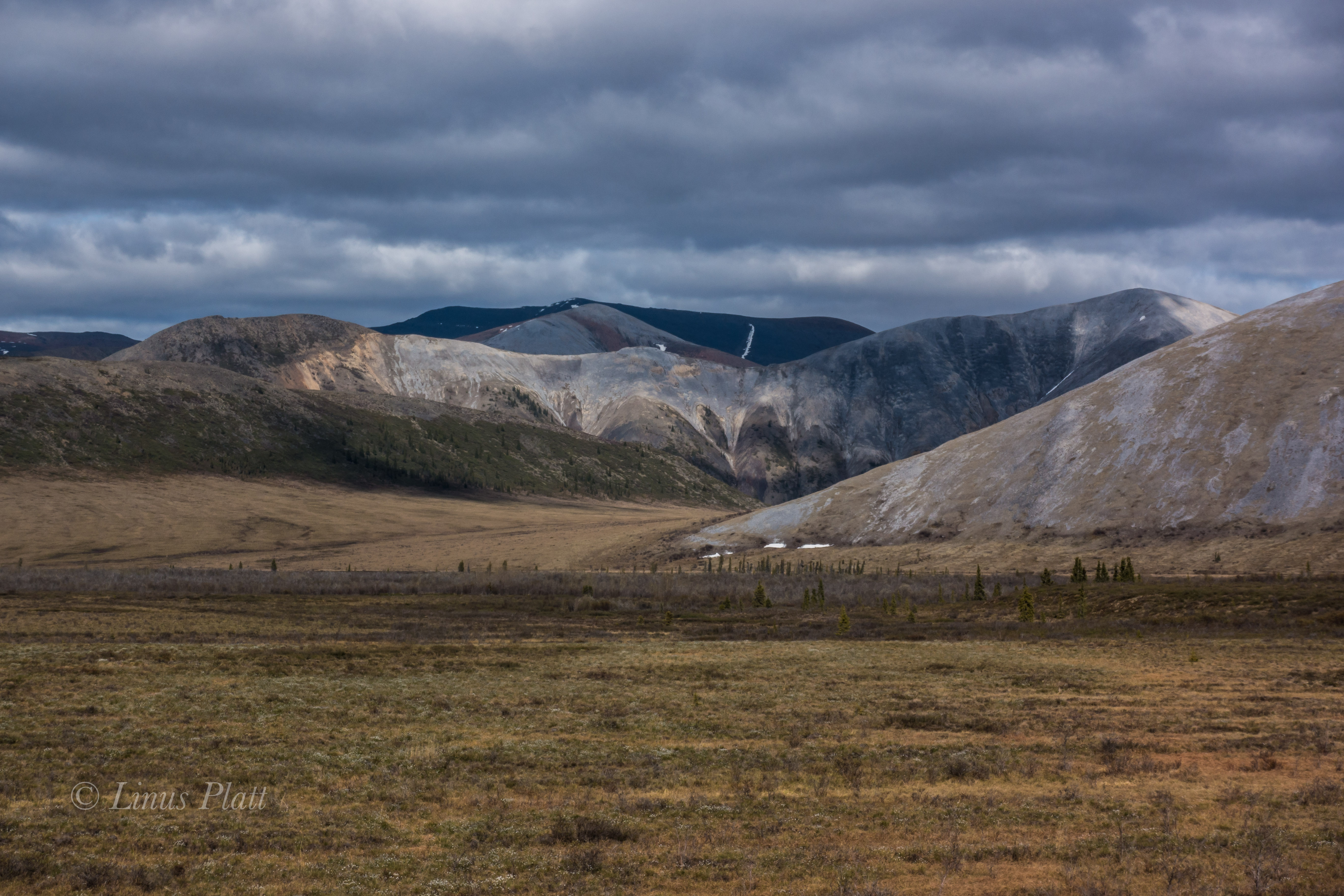

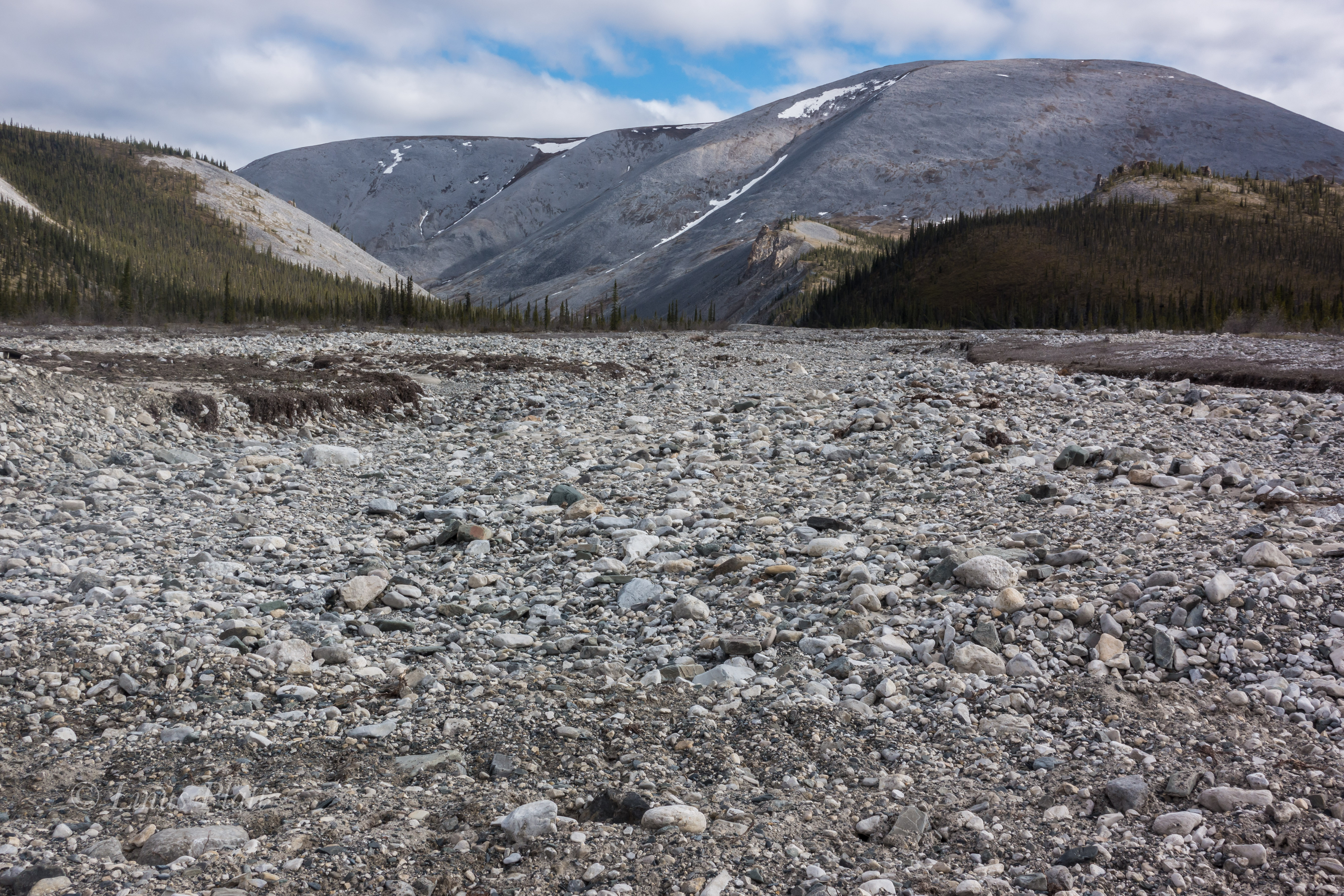


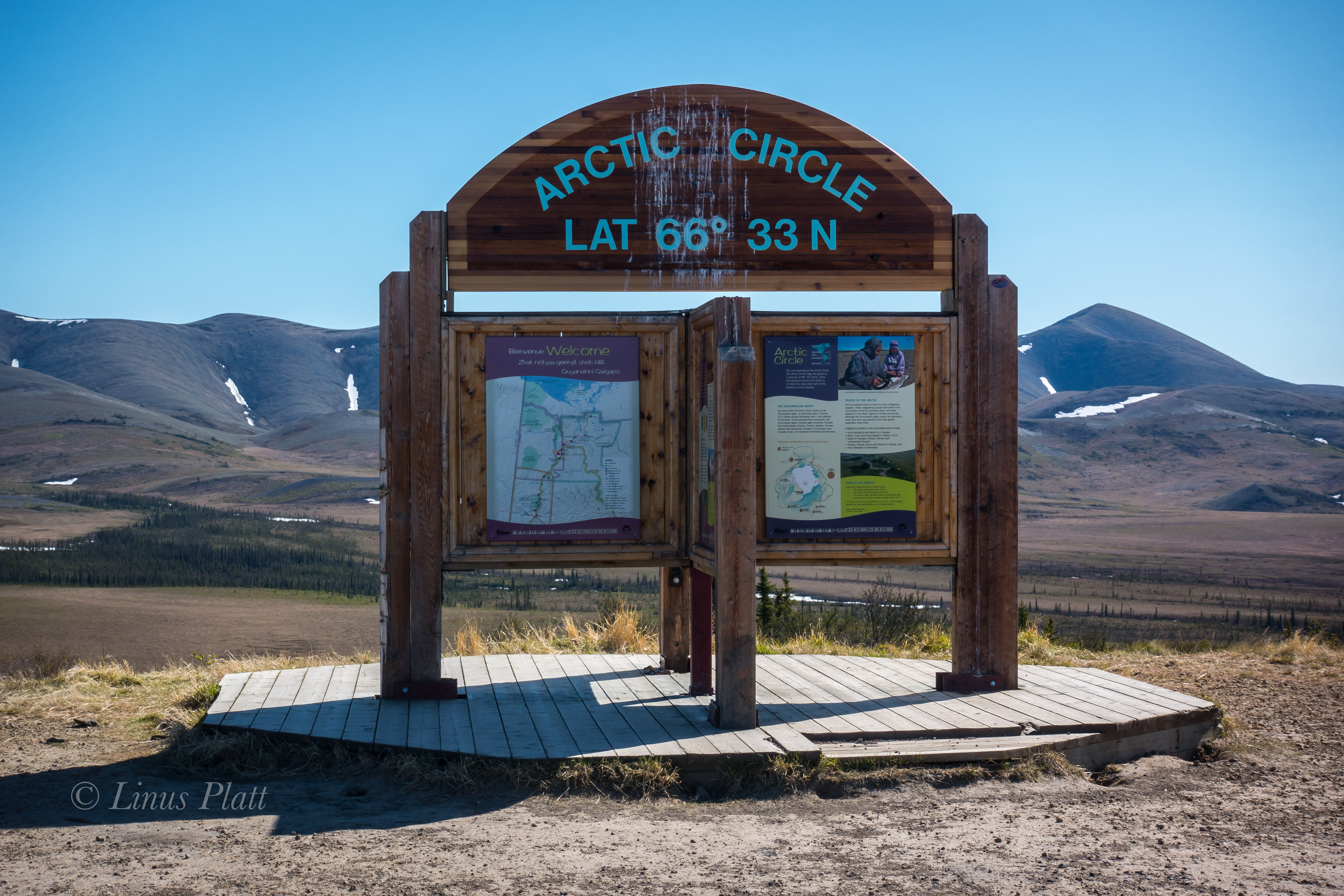


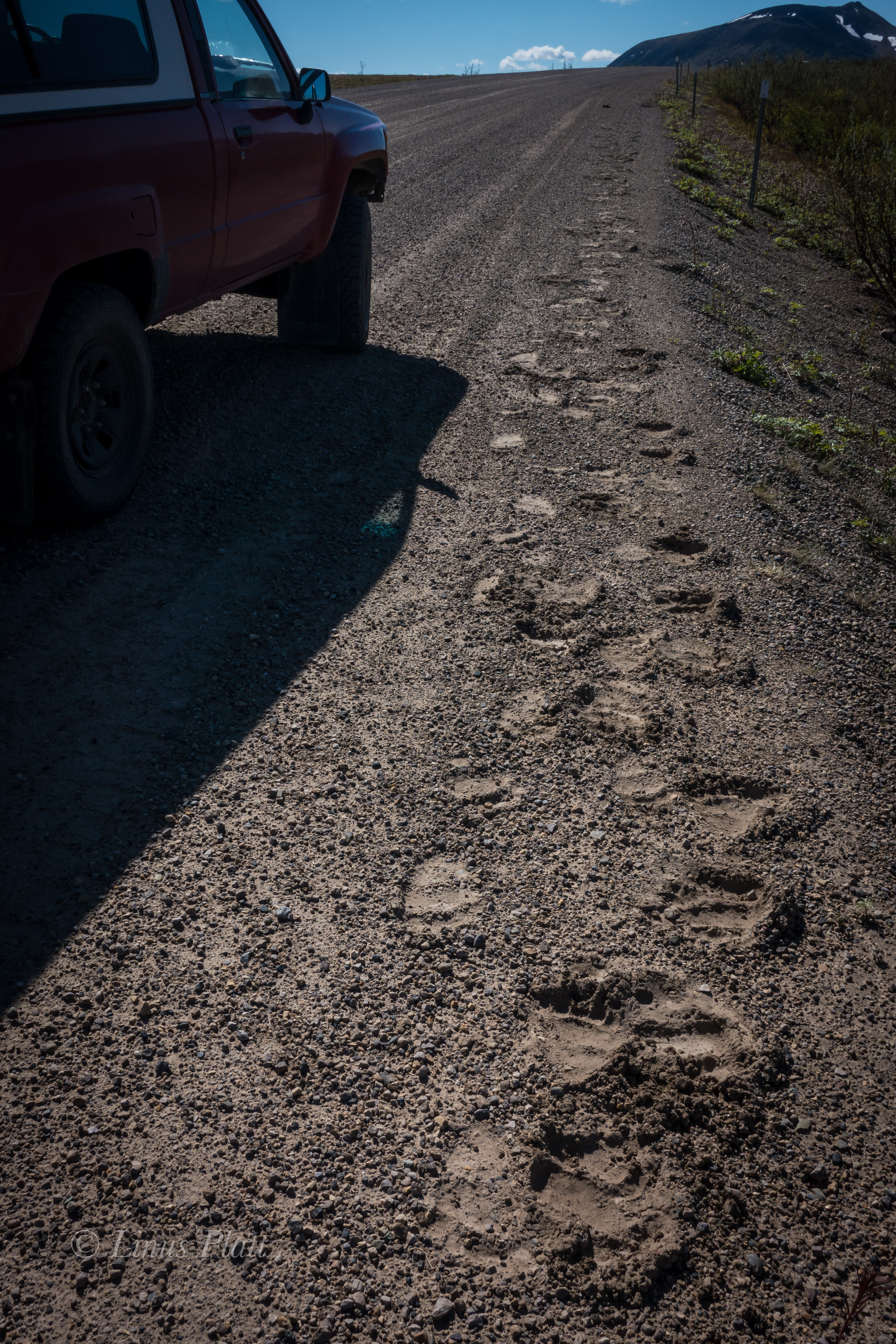
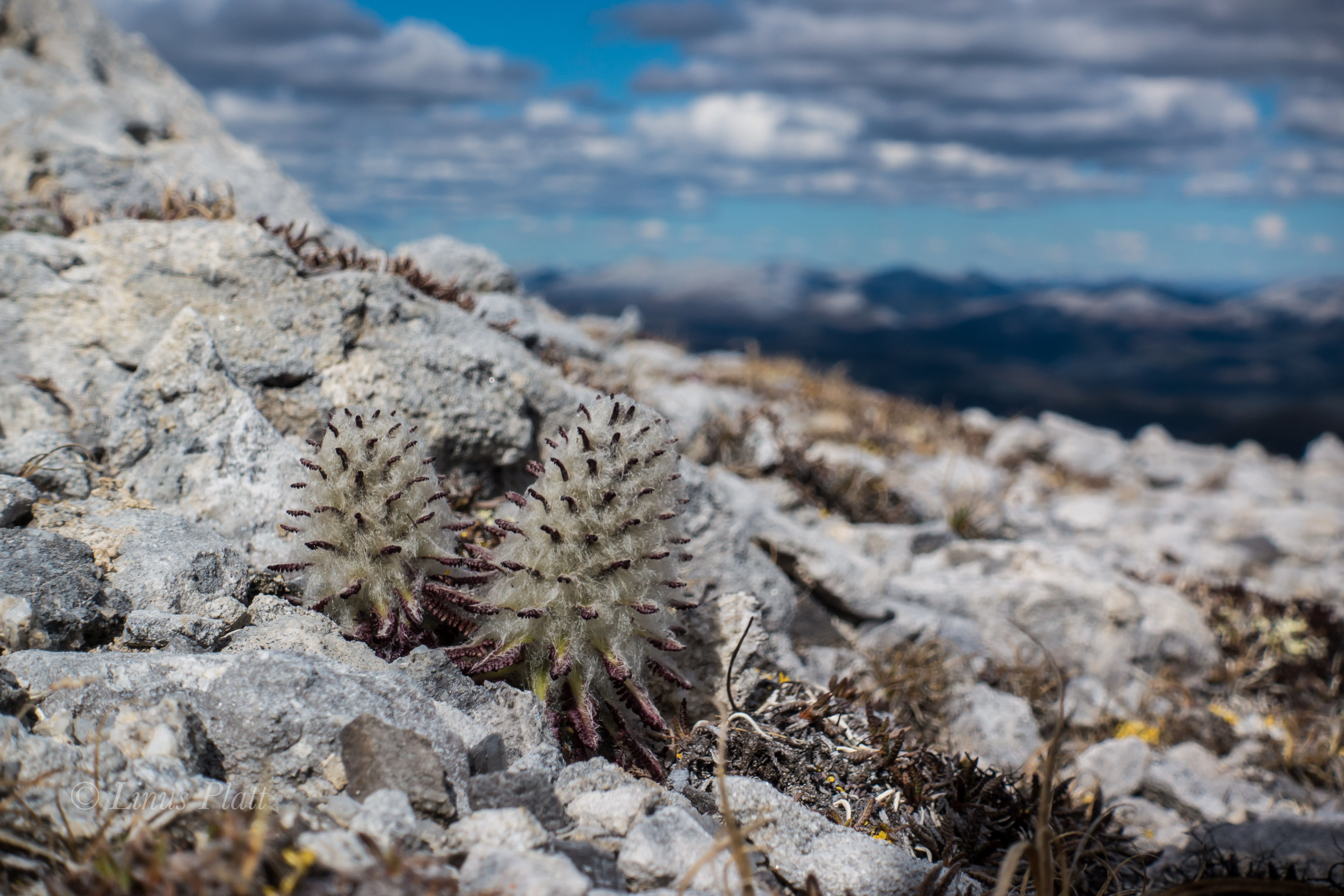


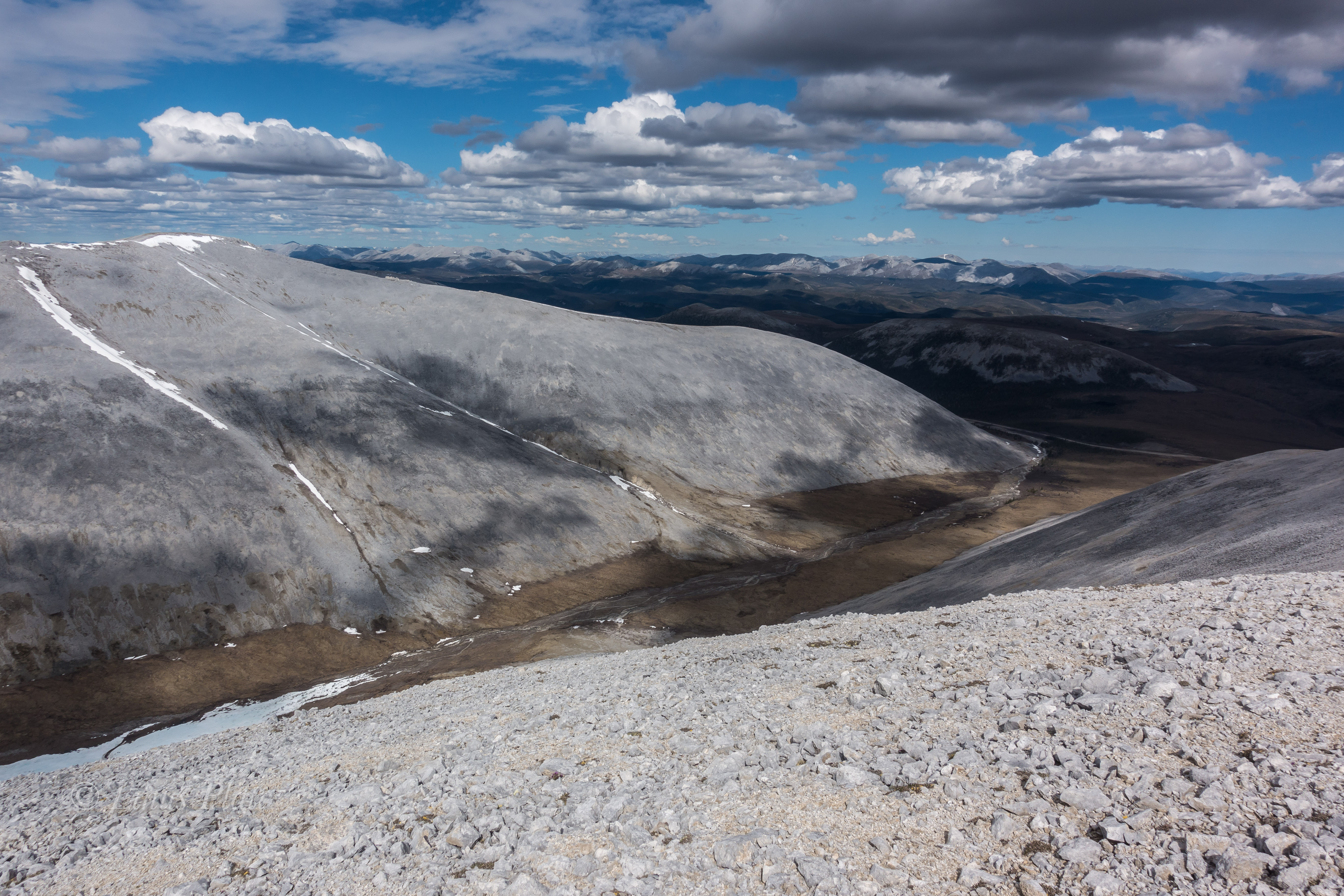
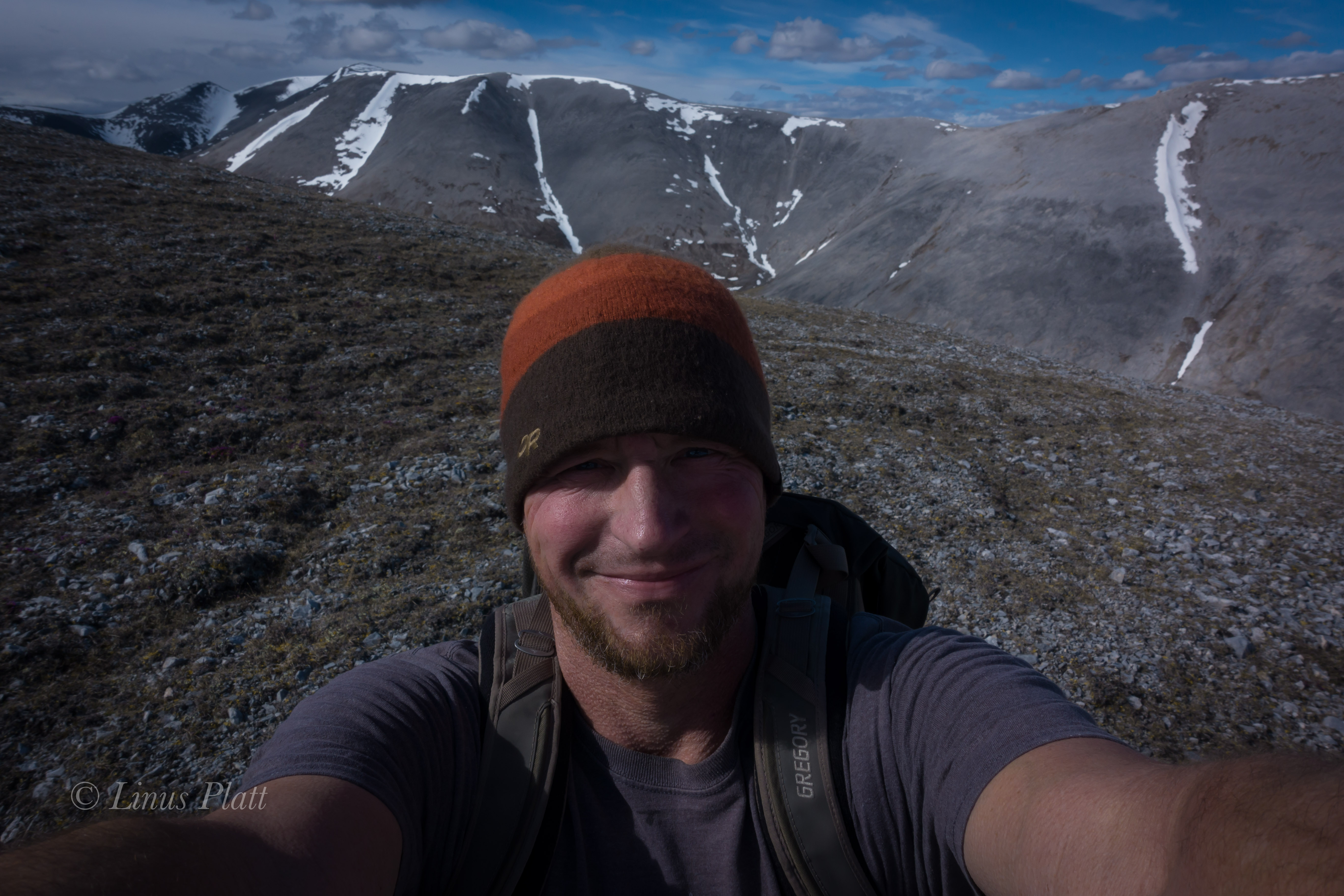
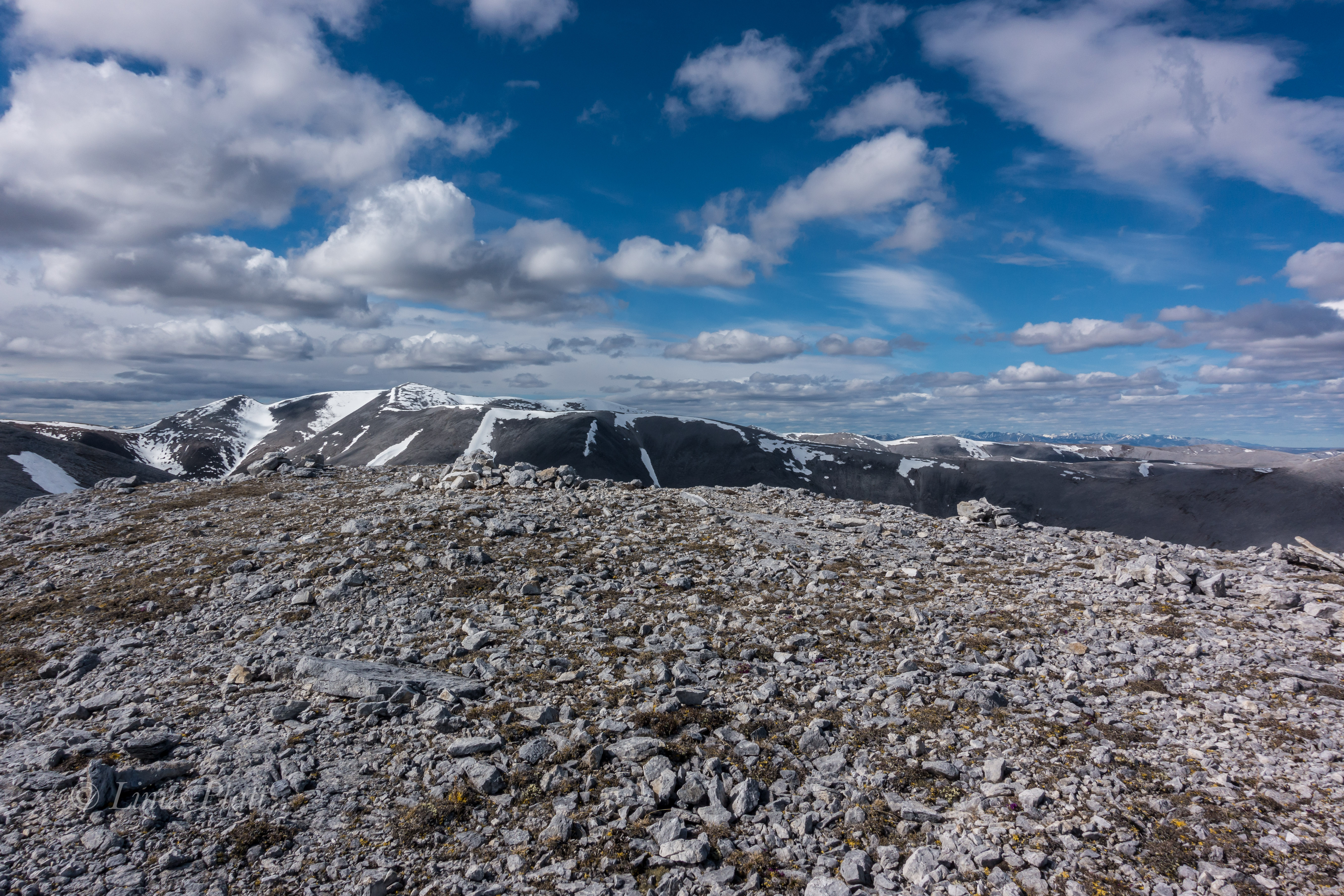
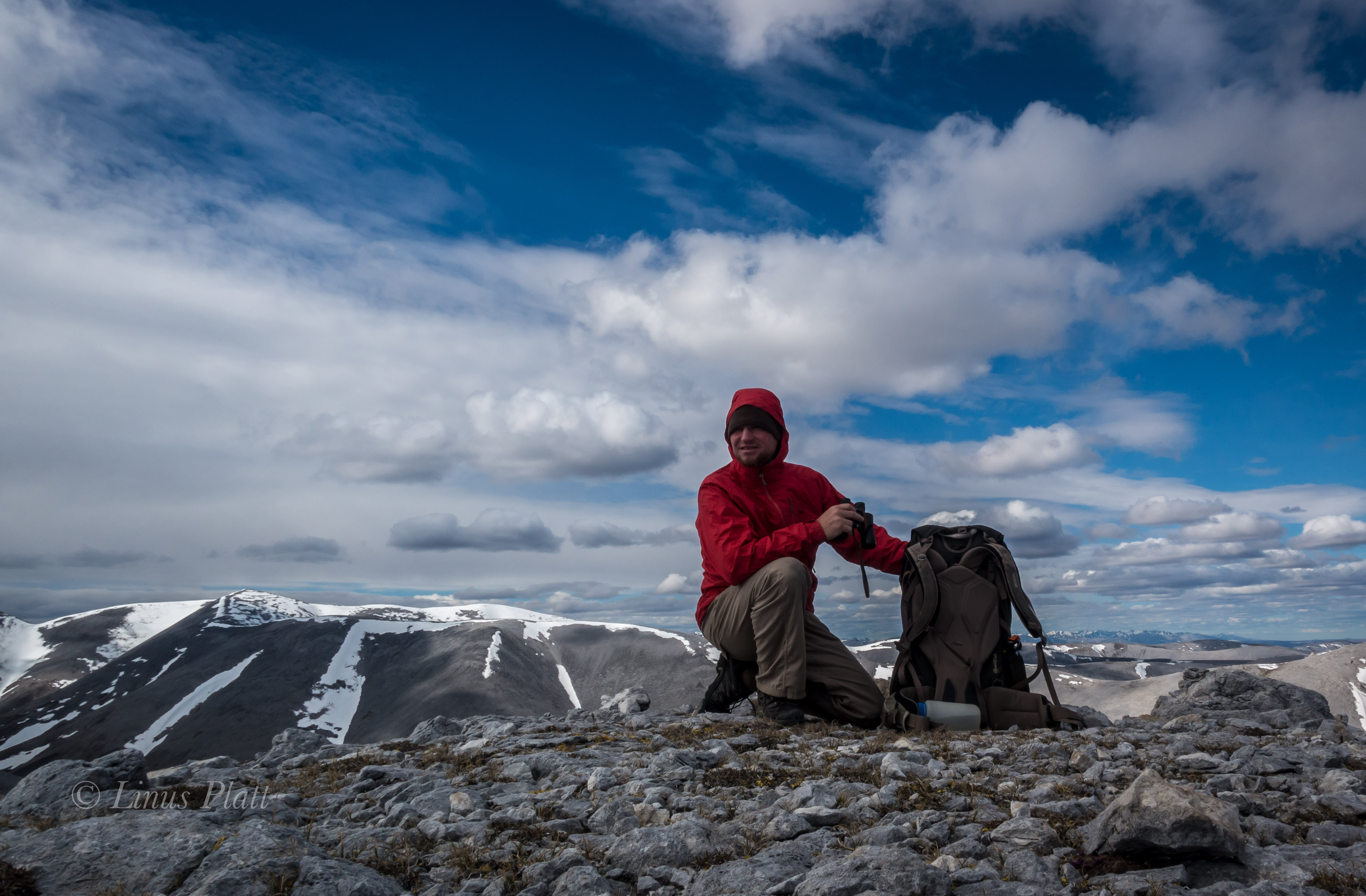


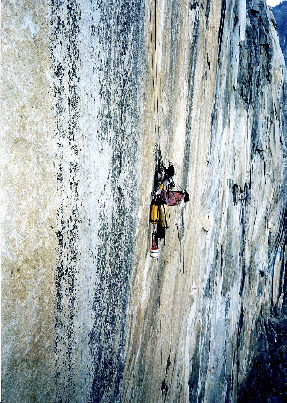


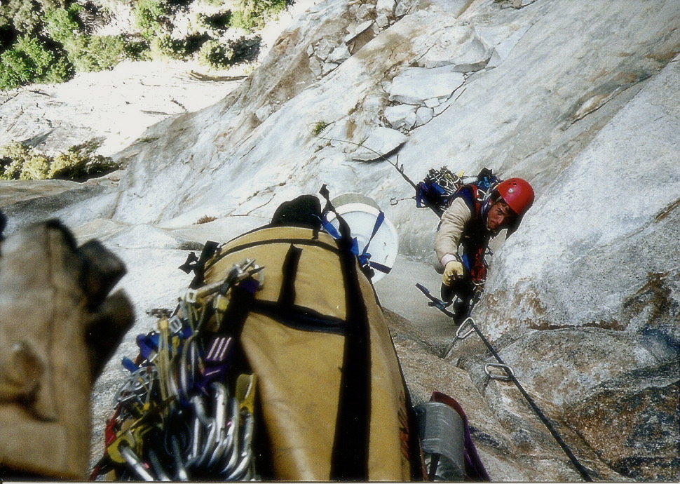
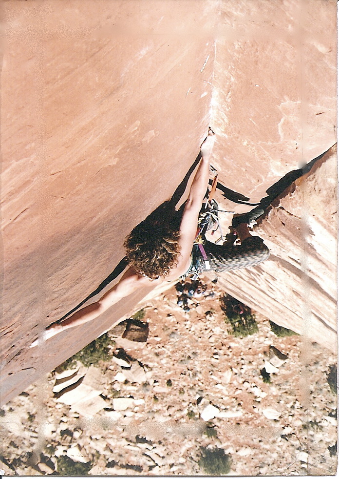
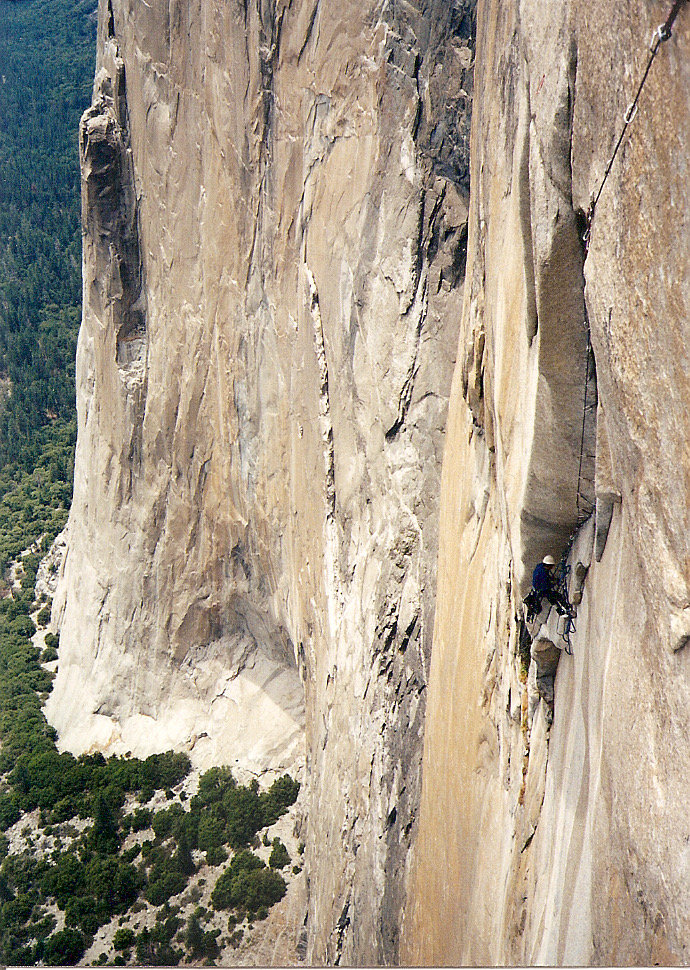


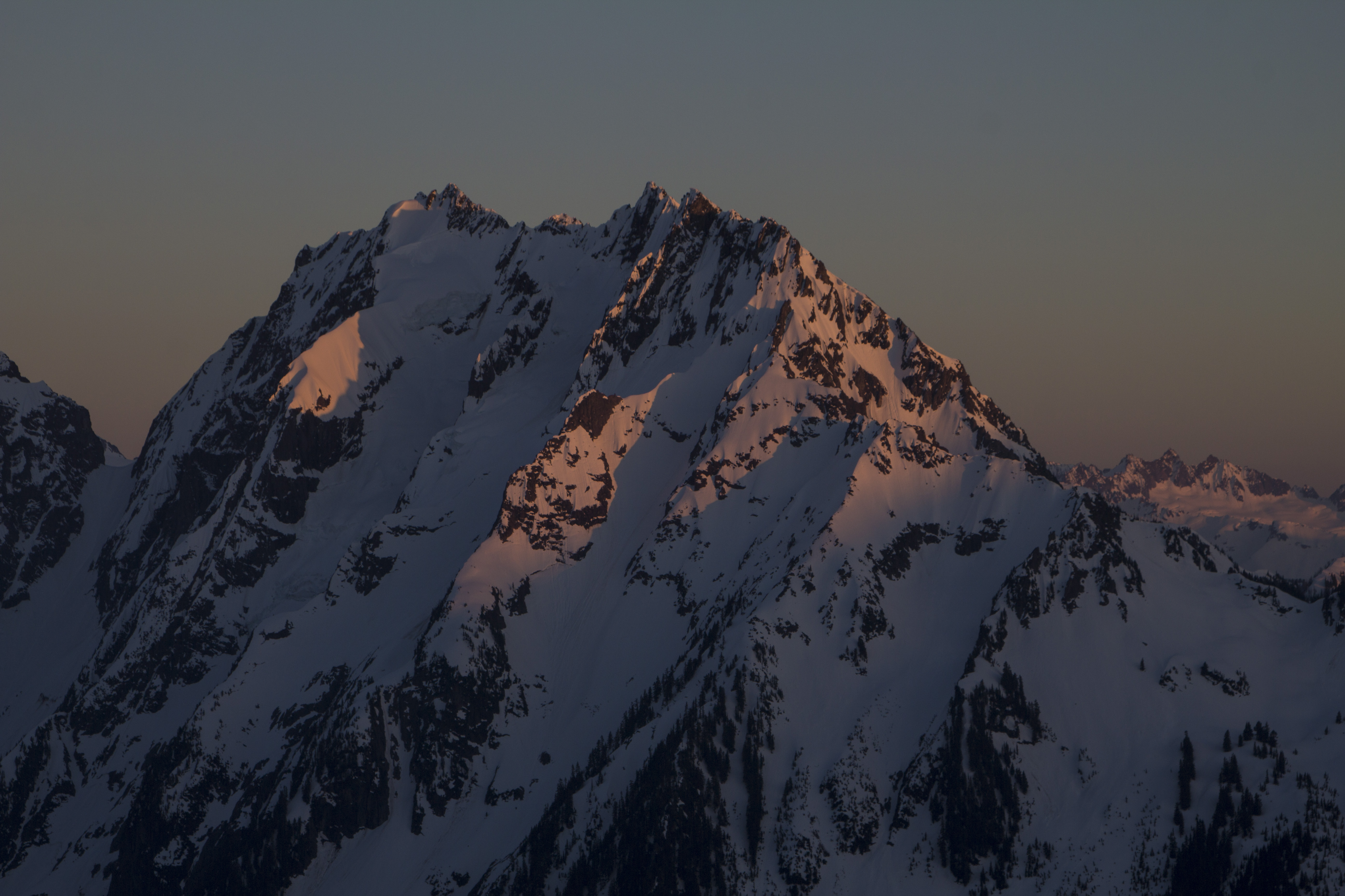
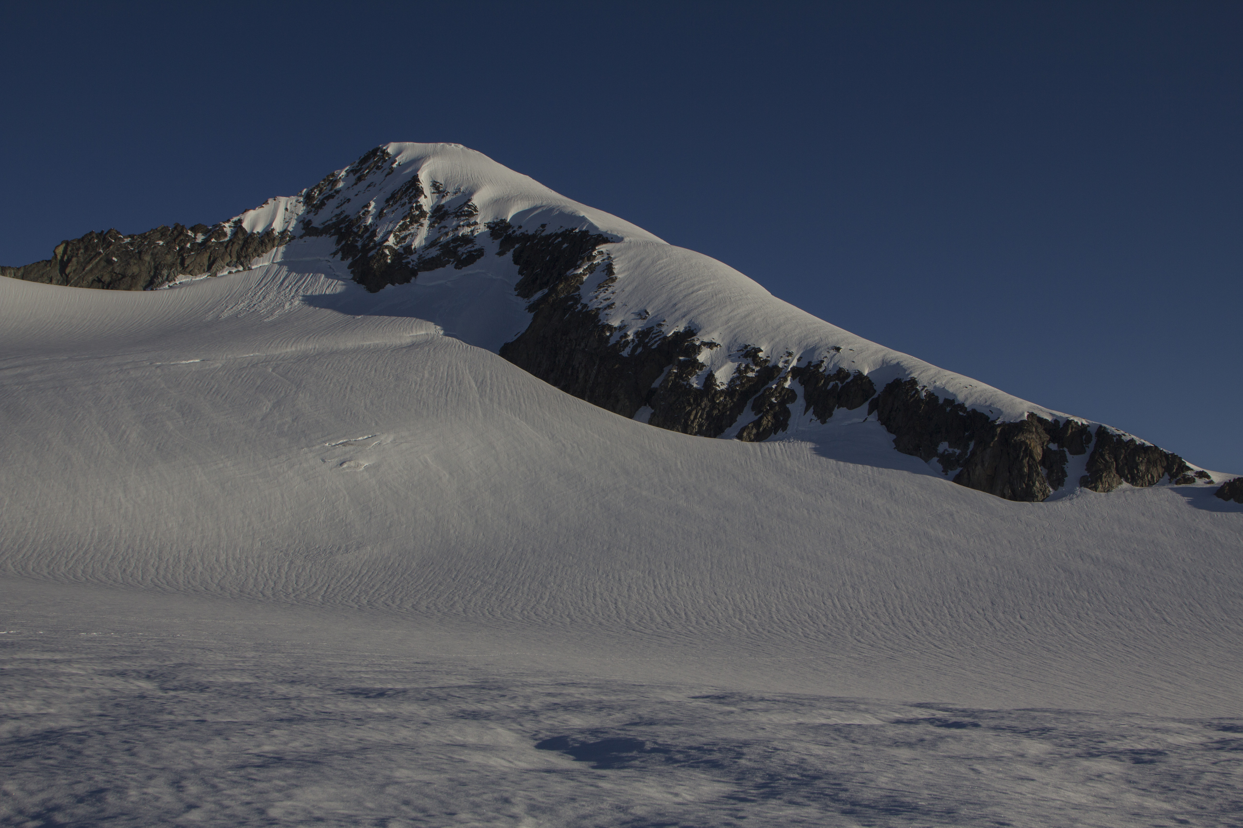


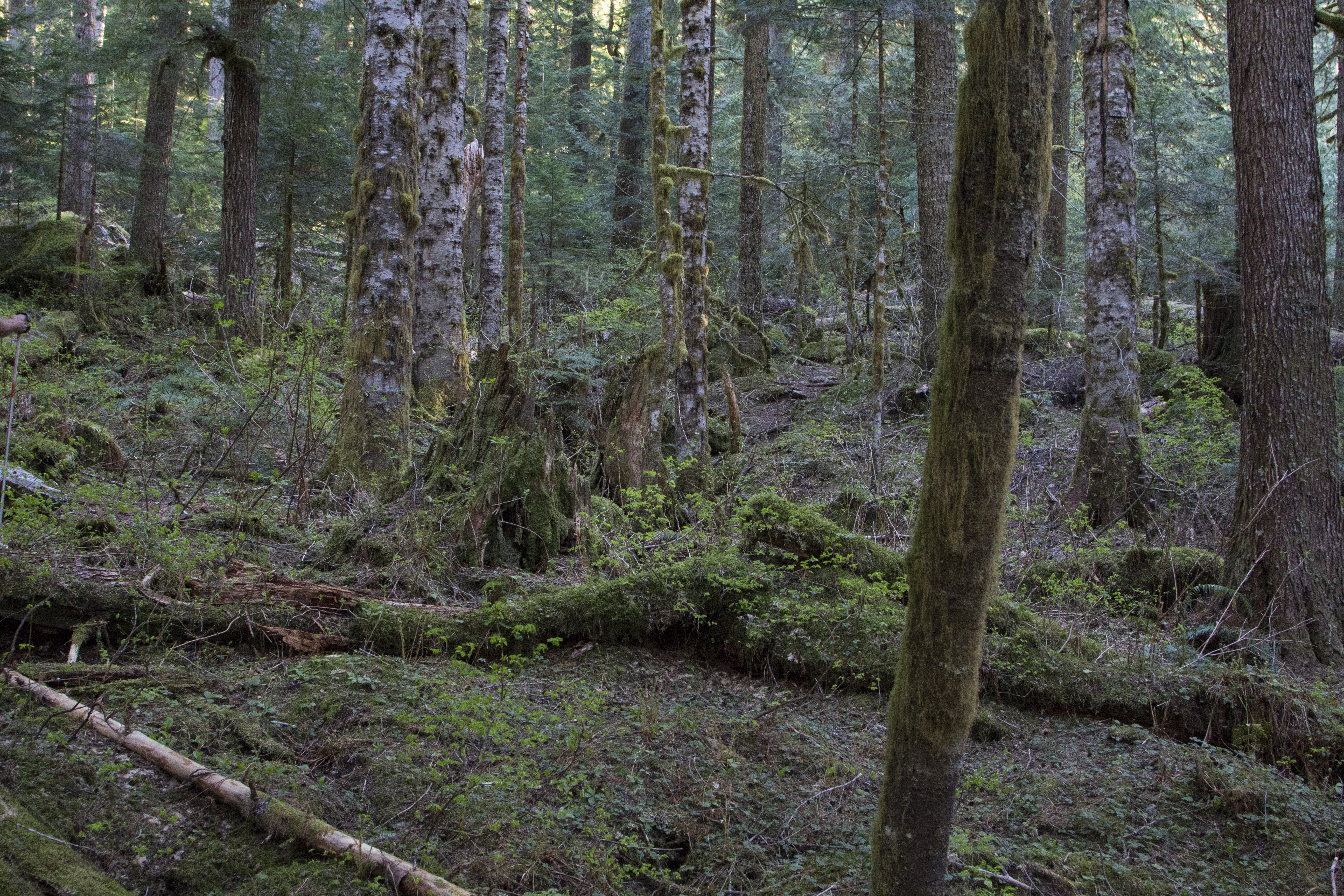


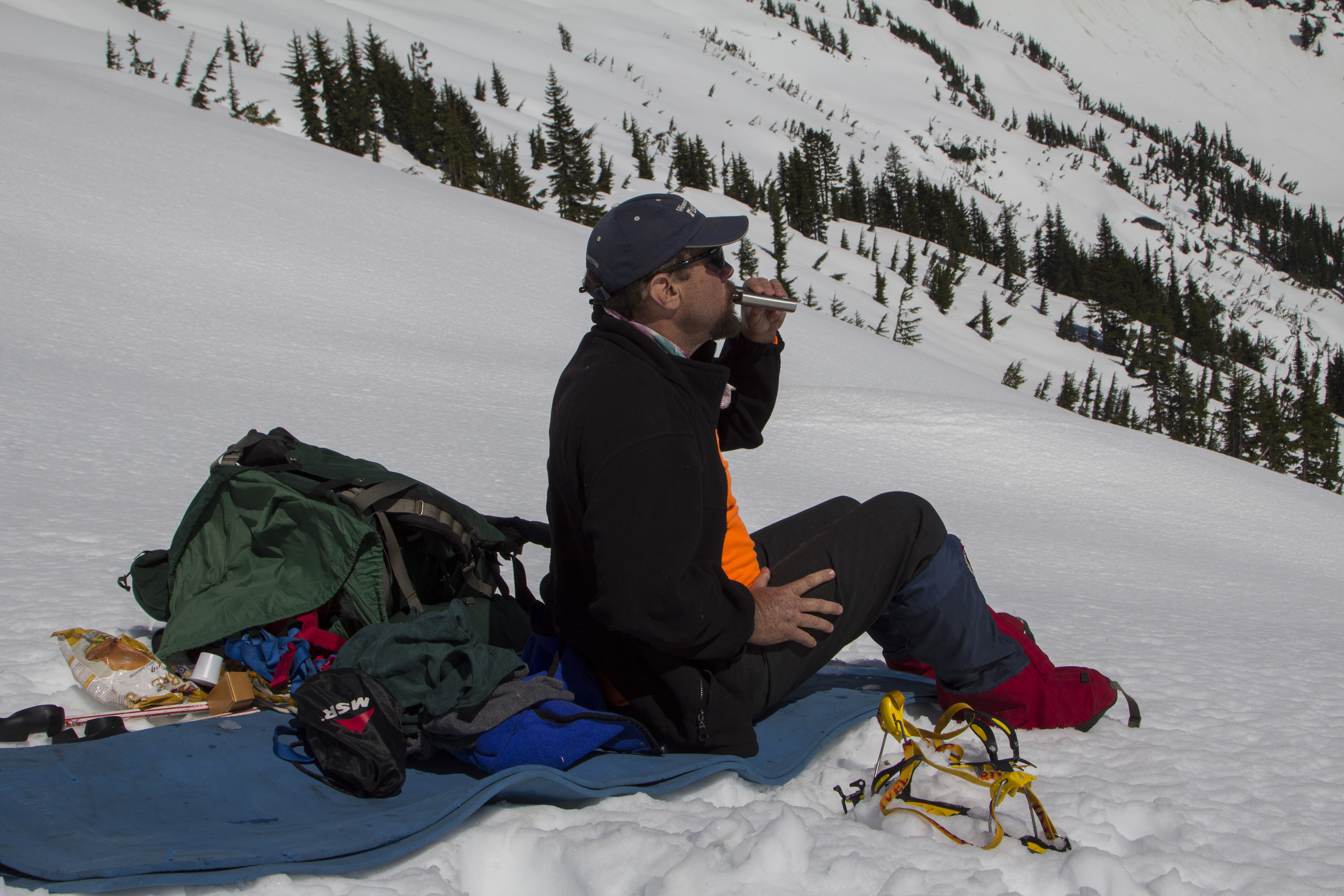
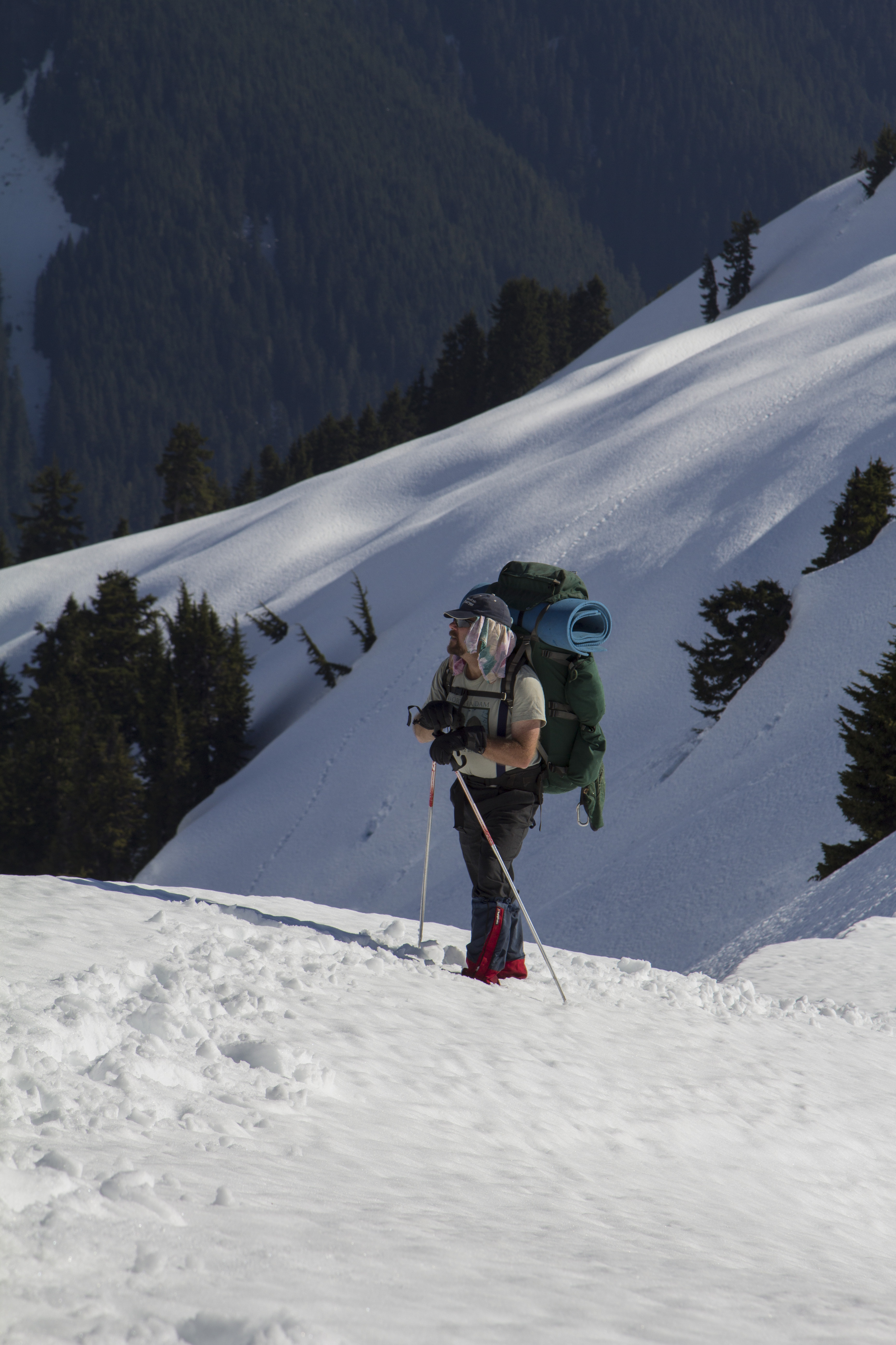

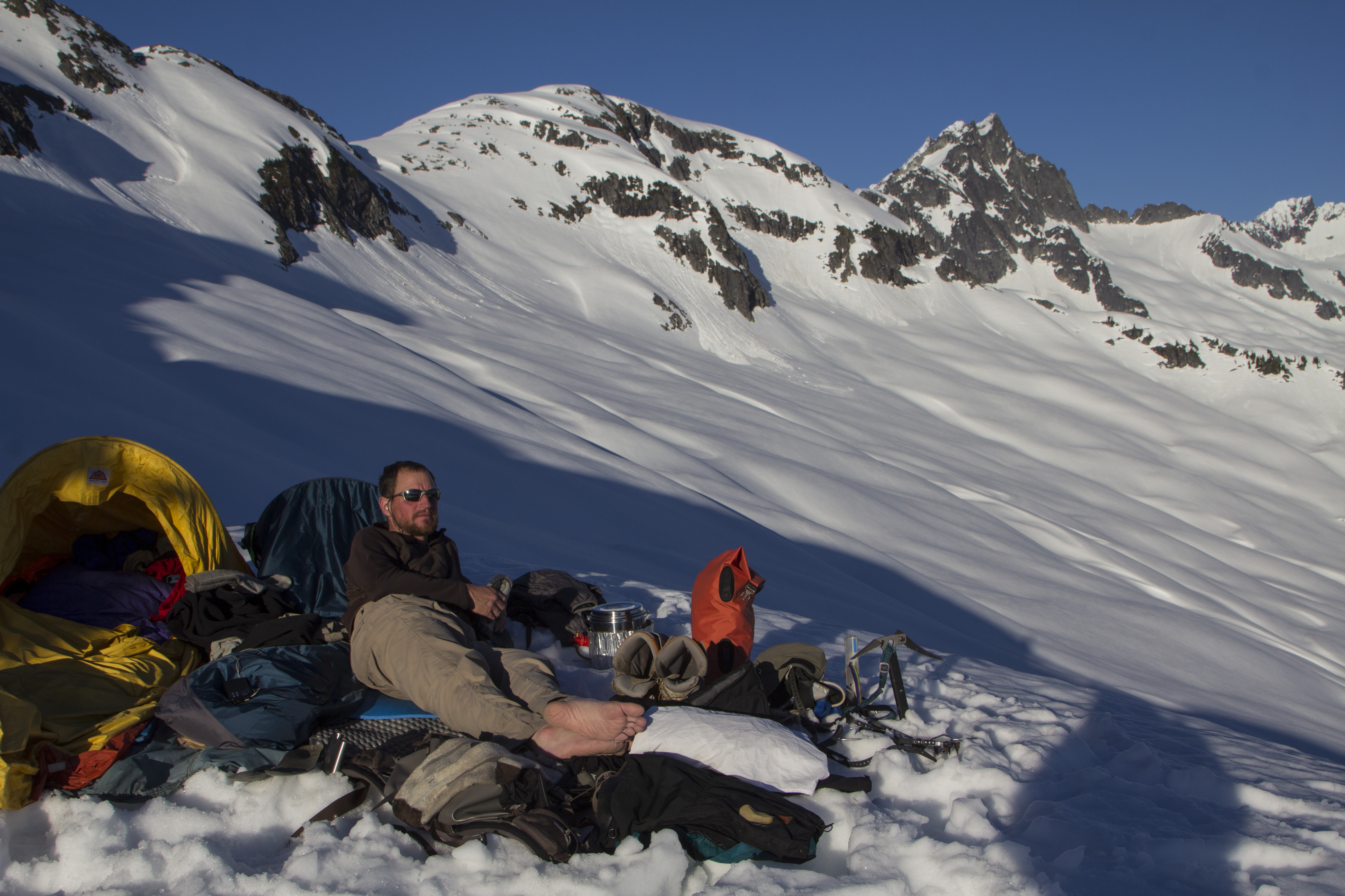


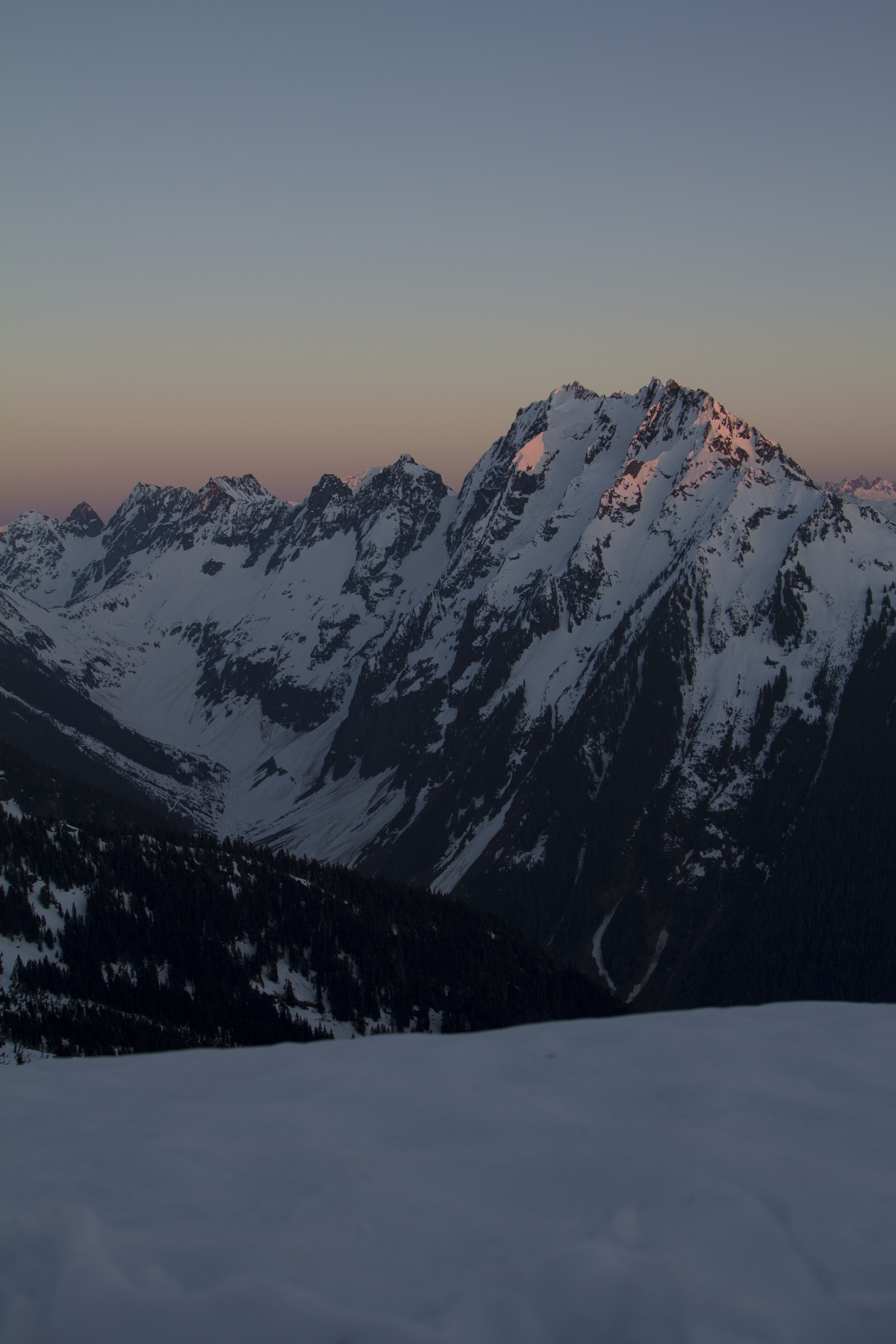


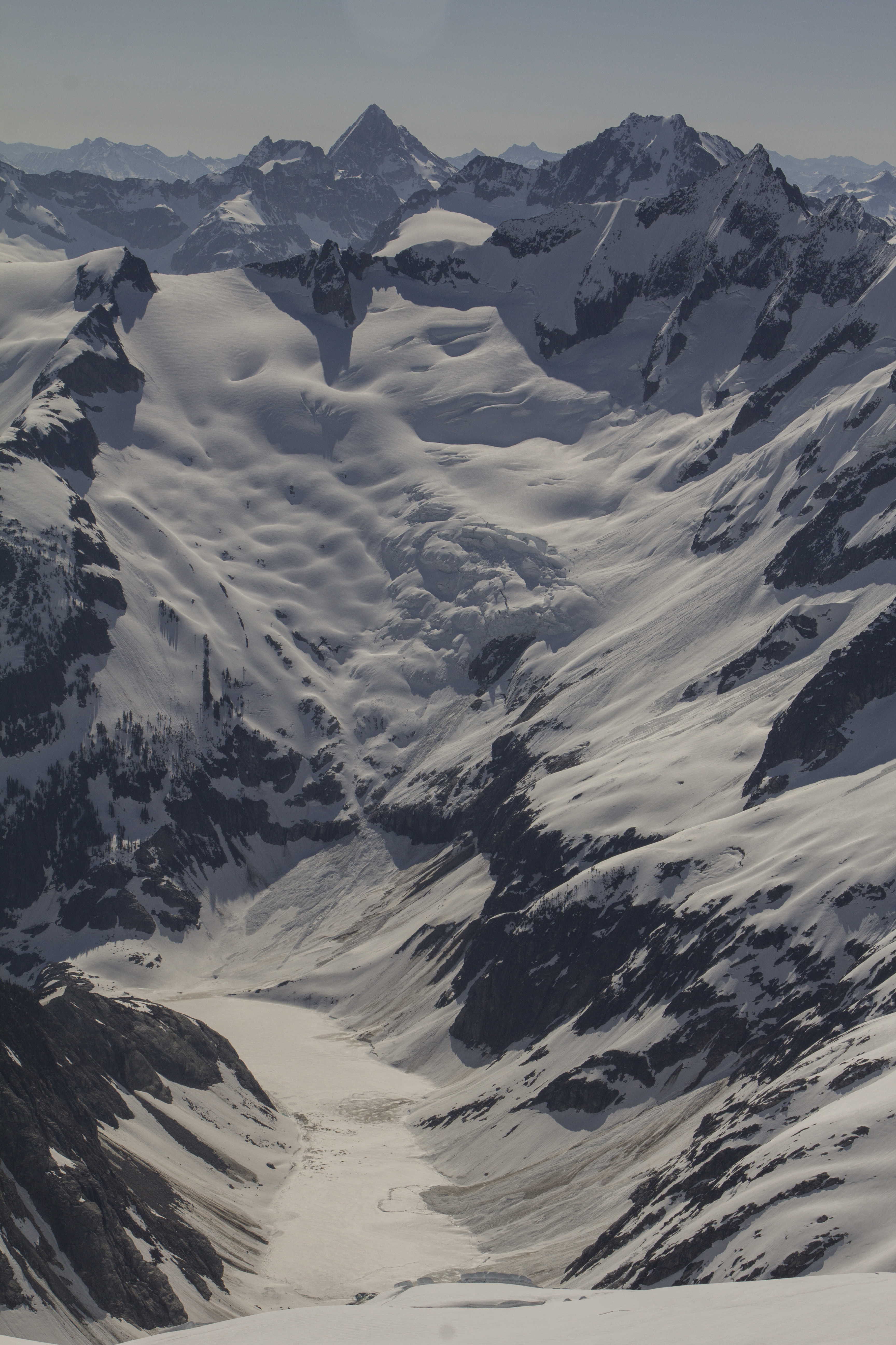


You must be logged in to post a comment.