Northbound: Leaving Haines and Into the Far Yukon

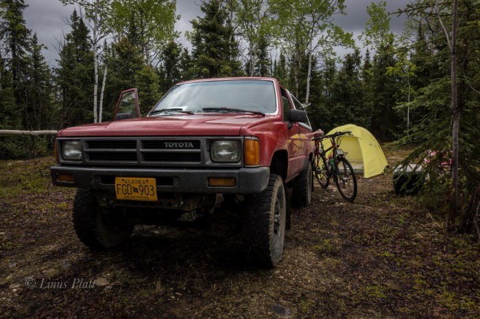
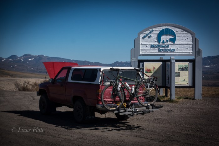
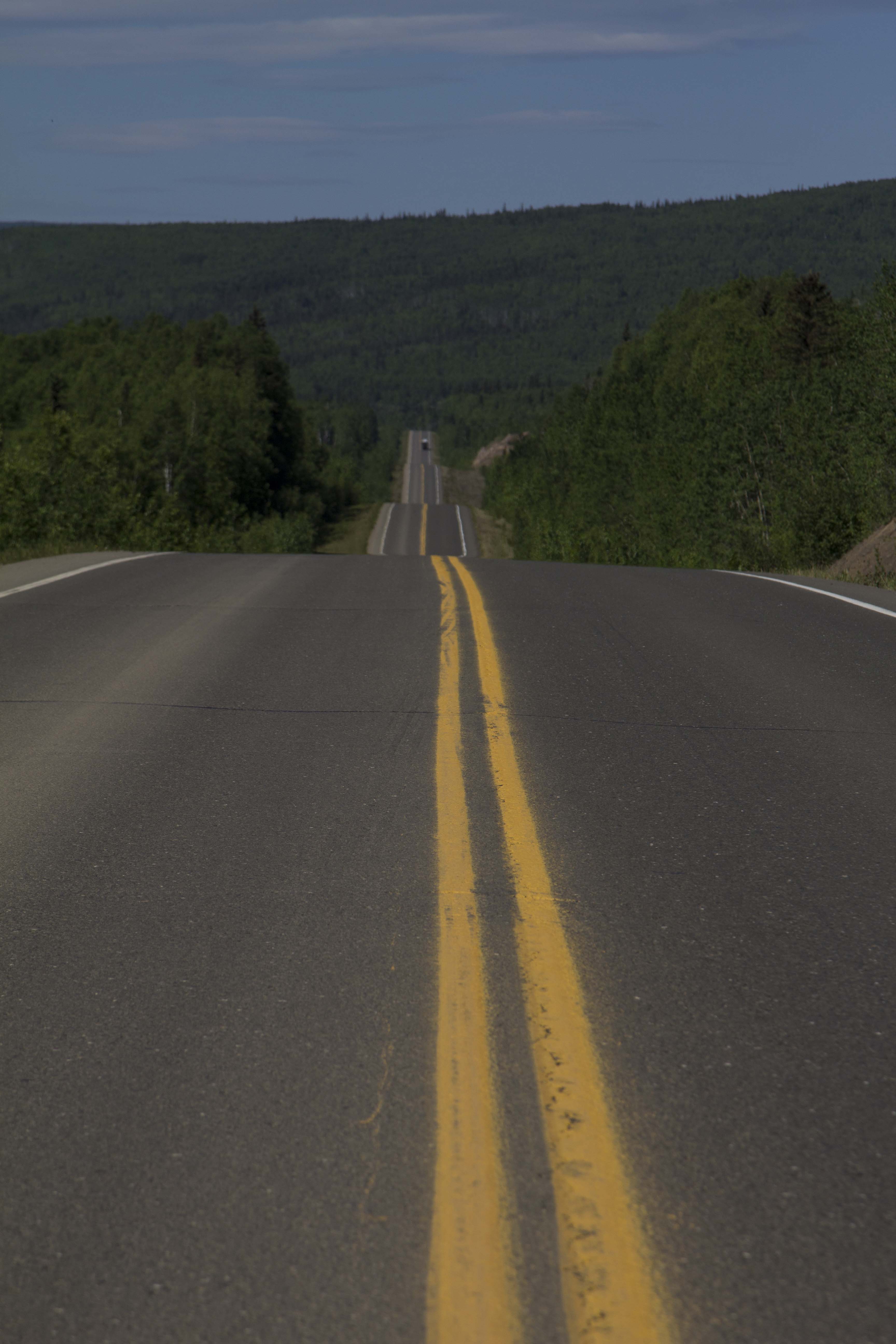
Getting on the road by 10:00 am or so following town chores and paying bills, I am happily cruising up the Haines highway and northbound for the Yukon and beyond. I approach the Eagle Preserve at 20 mile and the engine alternator idiot light comes on… funny, never saw that before on this truck. I pull off the road and pop the hood for an inspection. Using a volt meter, I check voltages of the battery with both with the engine running and not running. A nominal voltage of 12.4 with the engine running indicates that the alternator is not doing it’s job. In fact, it has shit the bed… Reluctantly, I turn around and baby the 30 year old Toyota back to town to re-group. Pulling into the parts store, I am amazed that they have one in stock. 142 bucks and two hours later, I have the alternator installed and the last bolt tightened and I am on the pavement rolling north once again.

At the Canadian the border, there is a length of vehicles waiting I have never seen here before. After an hour wait, I am flagged in and questioned. I am asked to exit the vehicle and wait inside while my car is searched, which the Canadian border cops do with abandon. Again, I have never experienced this before. Another hour and I am free to go after they come to terms with the fact that I have nothing to hide.  Two hours to get into Canada. I am beyond happy to have the Chilkat Valley behind me. Driving over the Haines Summit and into the high country sees me smiling and as the Yukon border comes ’round. I am washed over by an array of mixed feelings; most of me is extremely happy to be on the road and rolling away from Haines, but part of me dreads the inevitable slash of loneliness that will undoubtedly come in short order. In fact, as I near the Tahkini River, the dreaded sensation enters me, invades my space and riddles my ravaged heart with bullet holes. I shuffle this back to a place of inner strength that is there for survival reserves and continue.  I get to the Tahkini and make a fine camp there; it was a familiar camp as I had spent time there on past trips. The evening colors around 1 am filter the sky orange and pink and patches and fills my heart and soul with much needed color and softens the dramatic episodes within me. I sleep.

I awake to the warmth of sunshine and something splashing in the river. I pack up and pull out onto the Alaska Highway again heading towards Whitehorse. These feelings I cannot seem to shake and I hope that once past Carmacks or Dawson, they will fade. In Whitehorse waiting for the Fireweed Bookstore to open, I am accosted by a pair of drunks jabbering nonsense at me. Soon, my maps and food are purchased and I am driving the wide open spaces of the North Klondike Highway bound for Carmacks. A torrential rain storm ensues. The roadway becoming a slab of dangerous water; I slow down but other traffic does not. I won’t be bullied by these vehicles and I pull off when I can, but it is up to them to pass if they wish to drive at unsafe speeds. Camping that night in the Taiga forests among Aspen and Willow, tiny yellow birds flutter my camp and a Red Squirrel chirps in the forest nearby. These trips, when I am by myself, which is 95 percent of the time, tend to promote moving along, bound for a destination and goal. It is sometimes difficult to just set back, especially these past weeks, as the creeping dreaded sensations that have filled me lately prevail when I have come to a stop. So I simply keep moving. Regret is futile, and yearning for an undeniably uncertain future is equally so. I have no past, and working toward the future like some kind of mystic jewel seems pointless; I simply am. My heart and desire are too big for this world and most cannot deal with my intensity and passion… the heart is the only guiding force. Chalk it all up to a lifetime of amazing experiences. I am the wind…

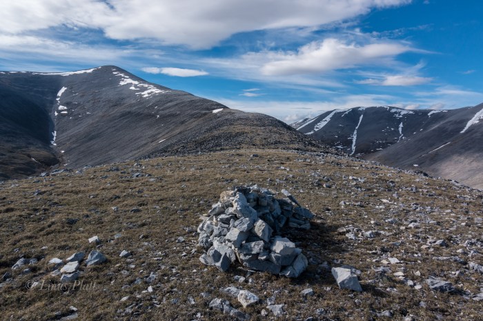
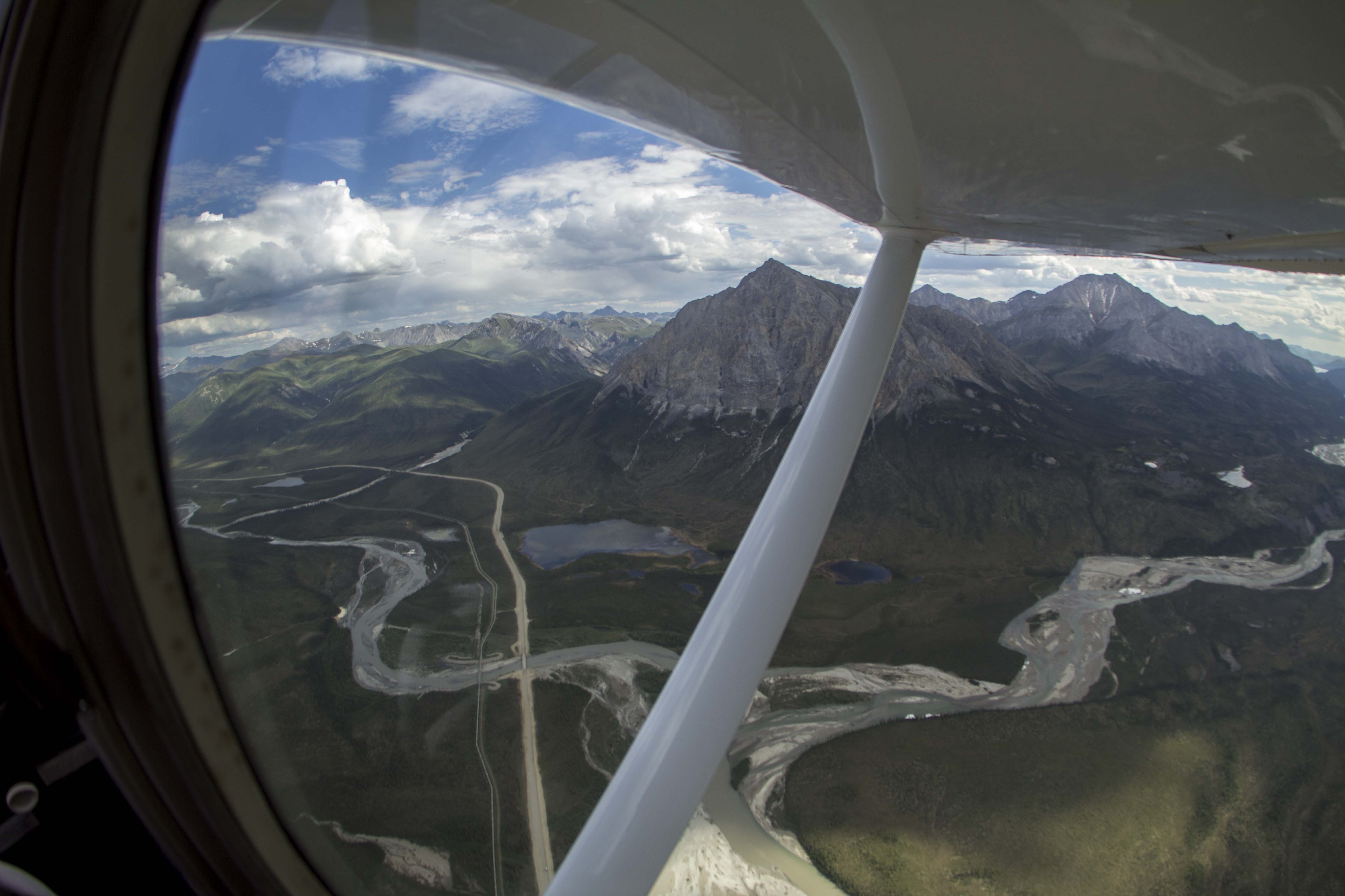
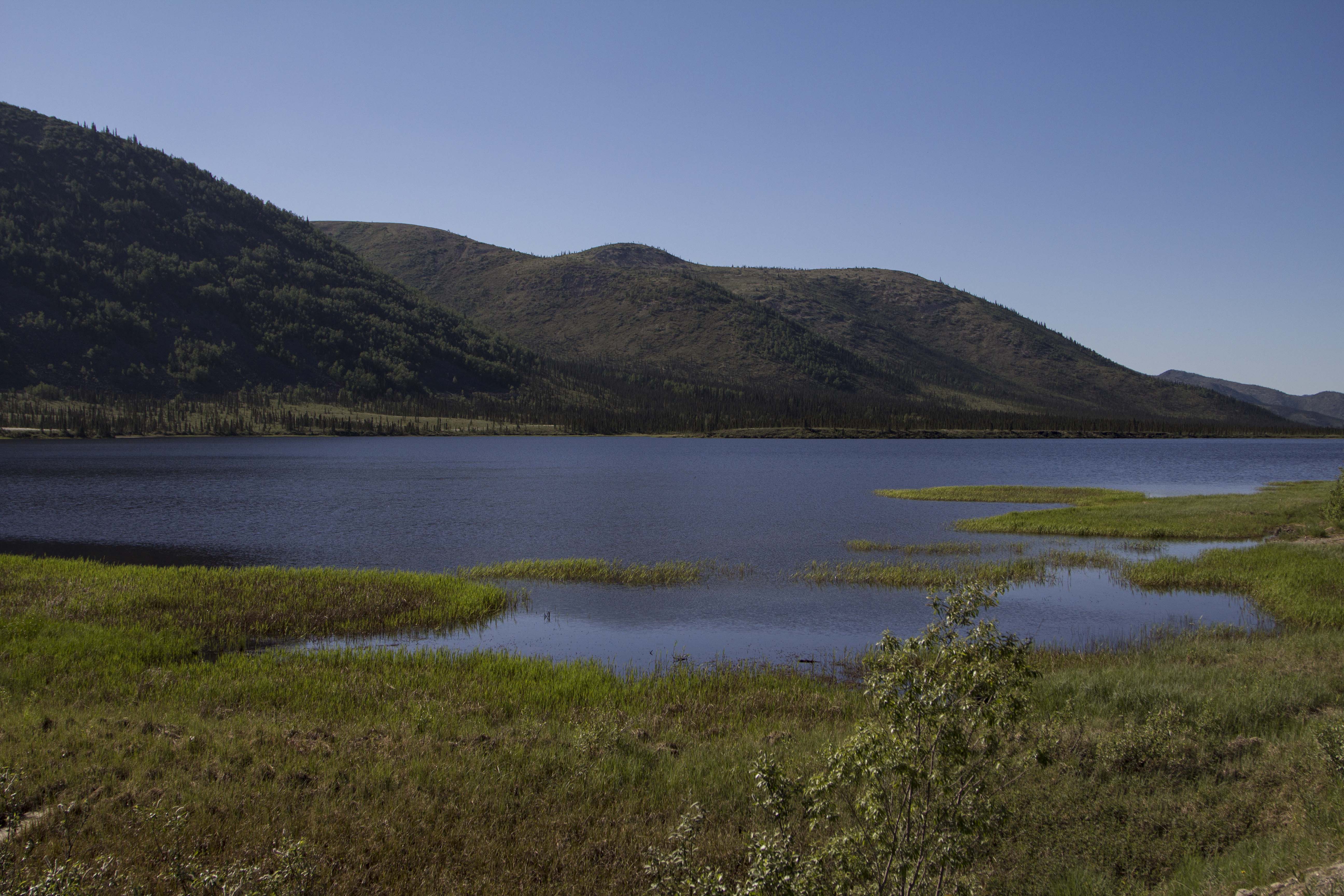
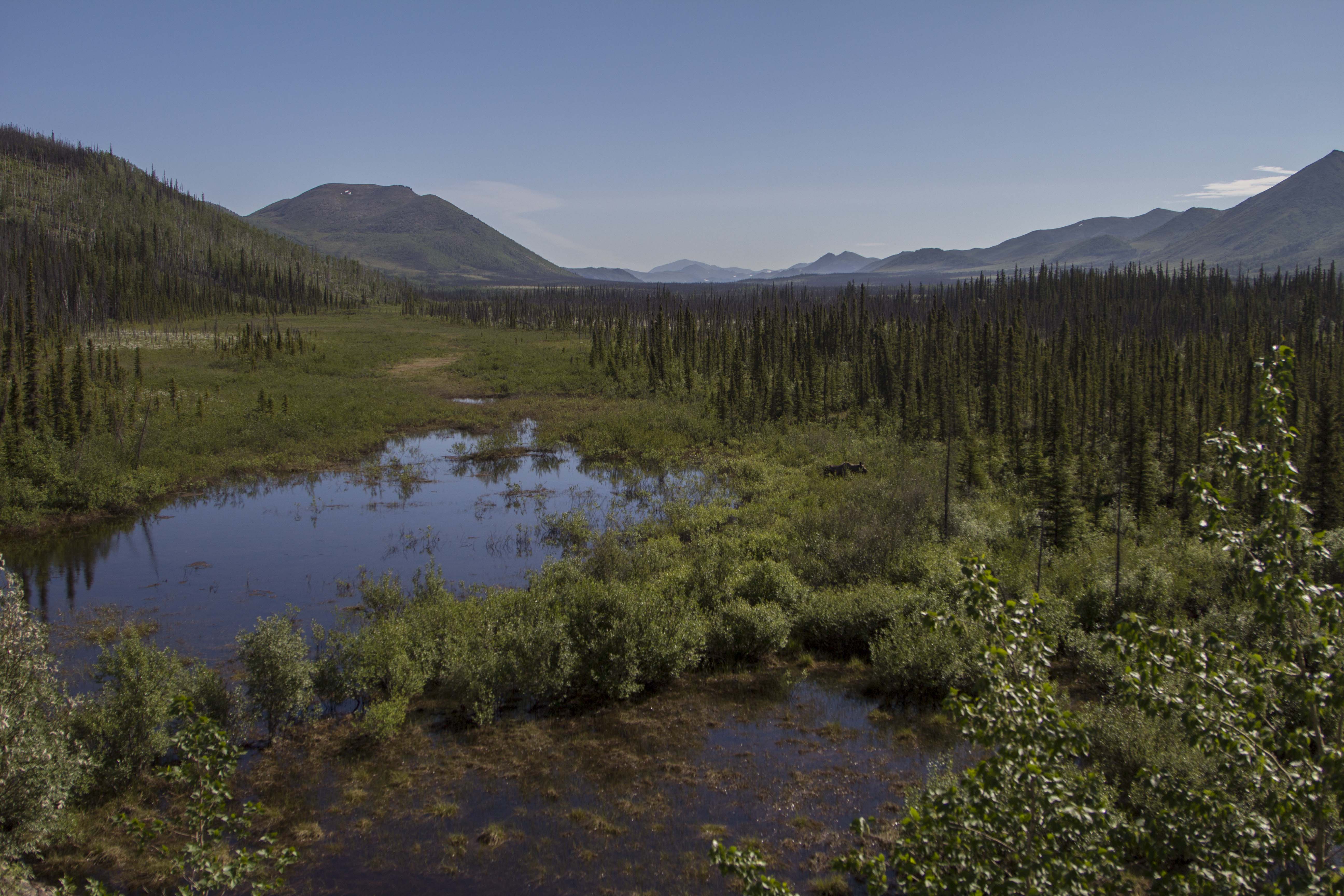
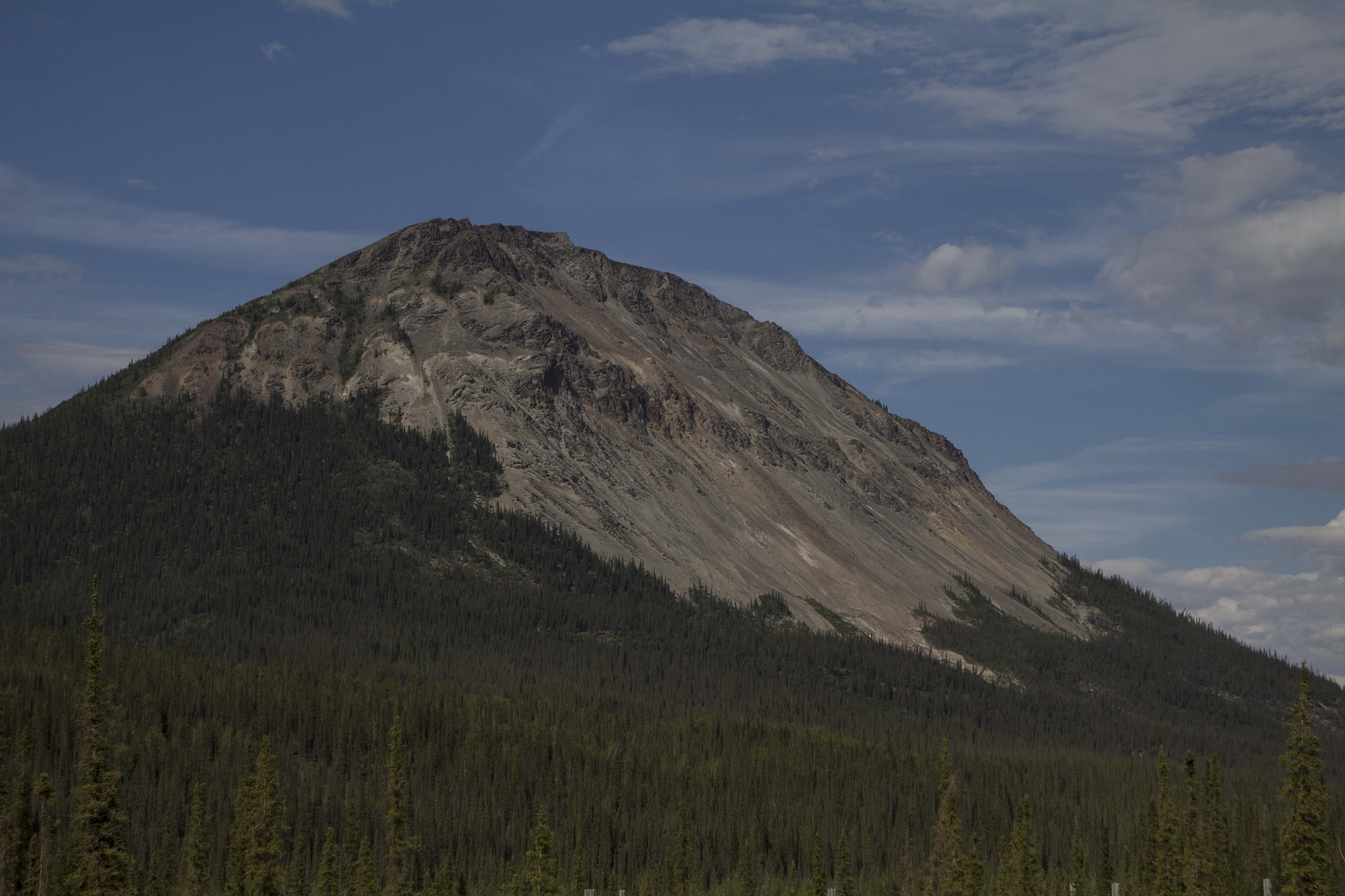
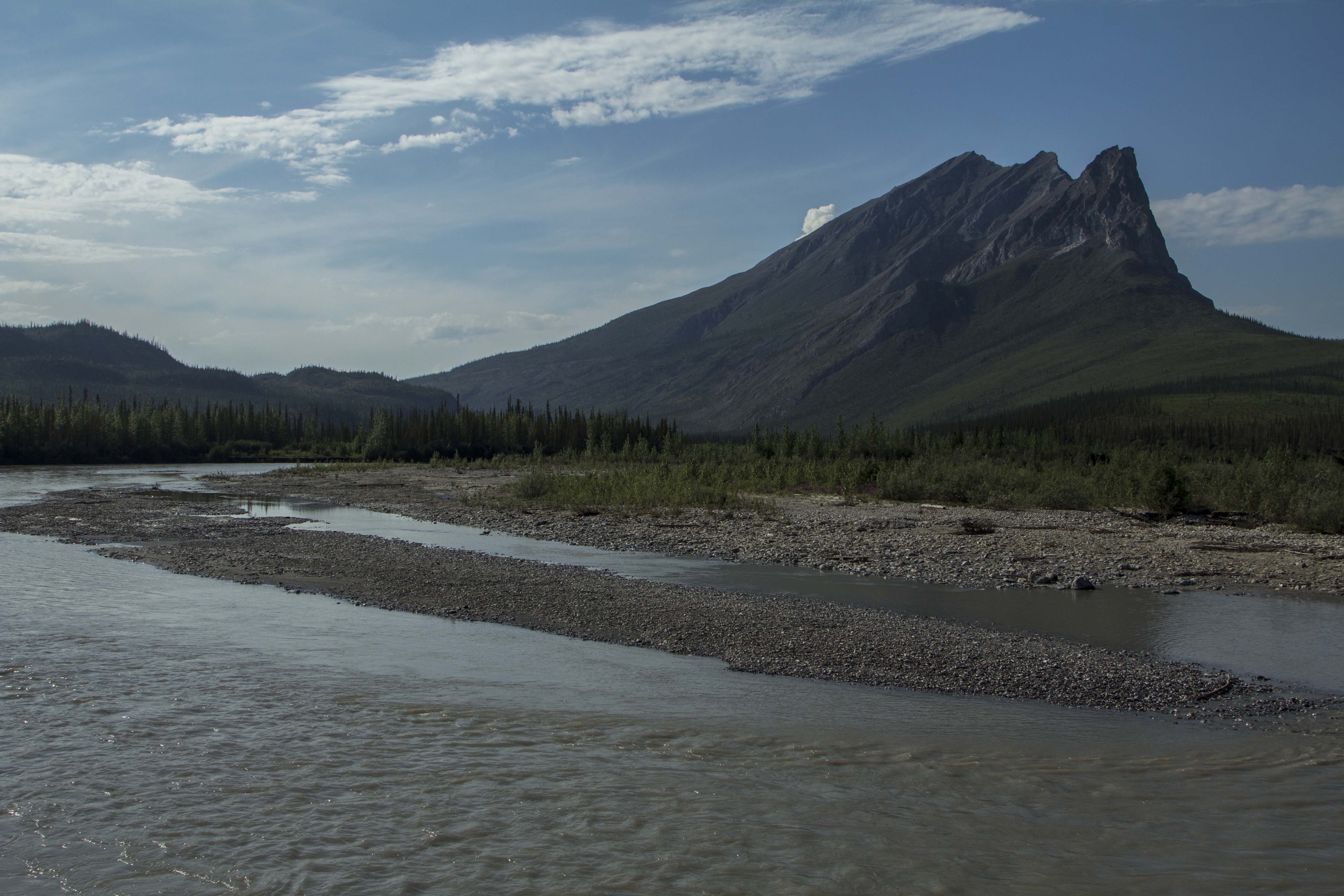
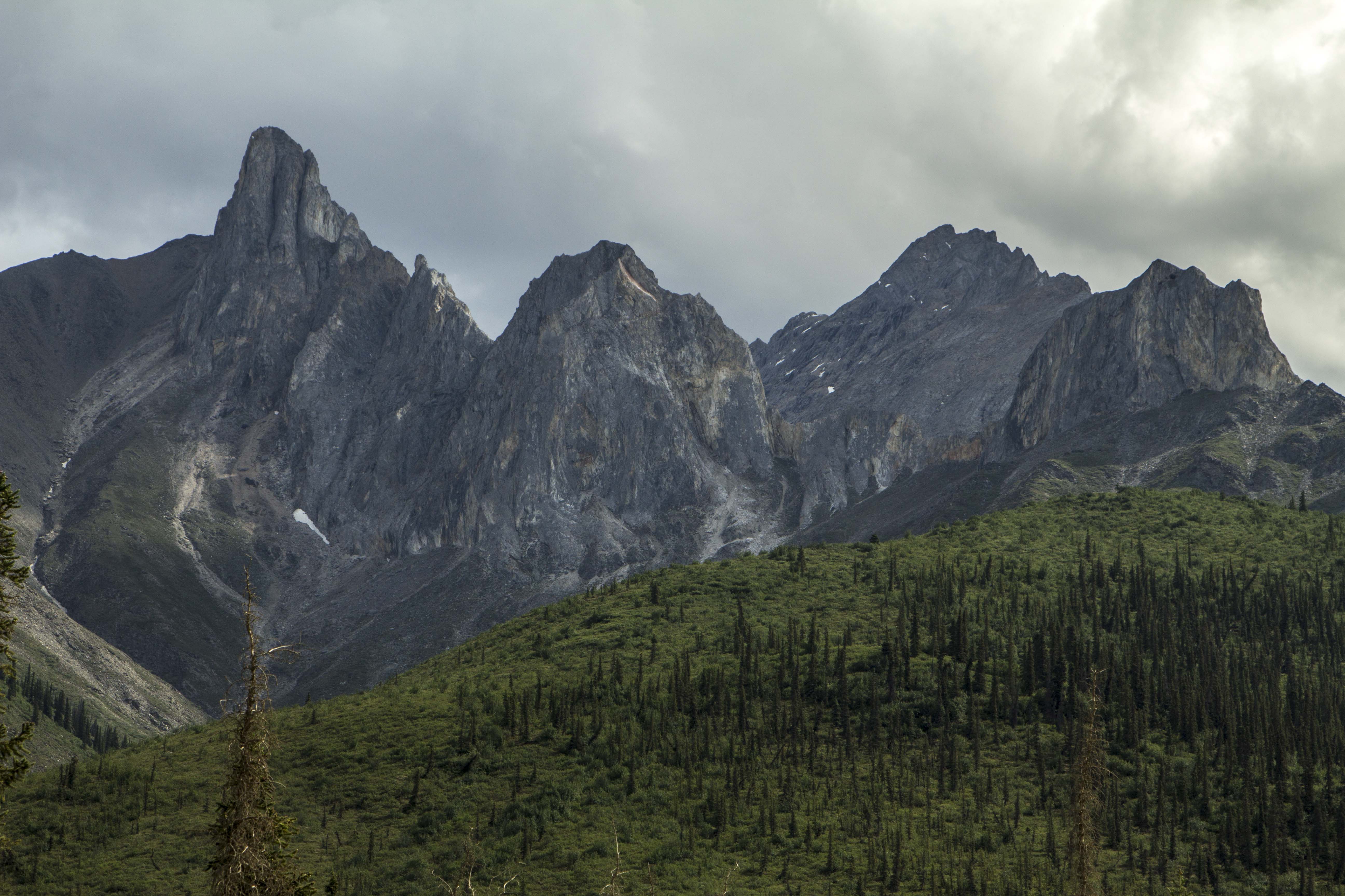
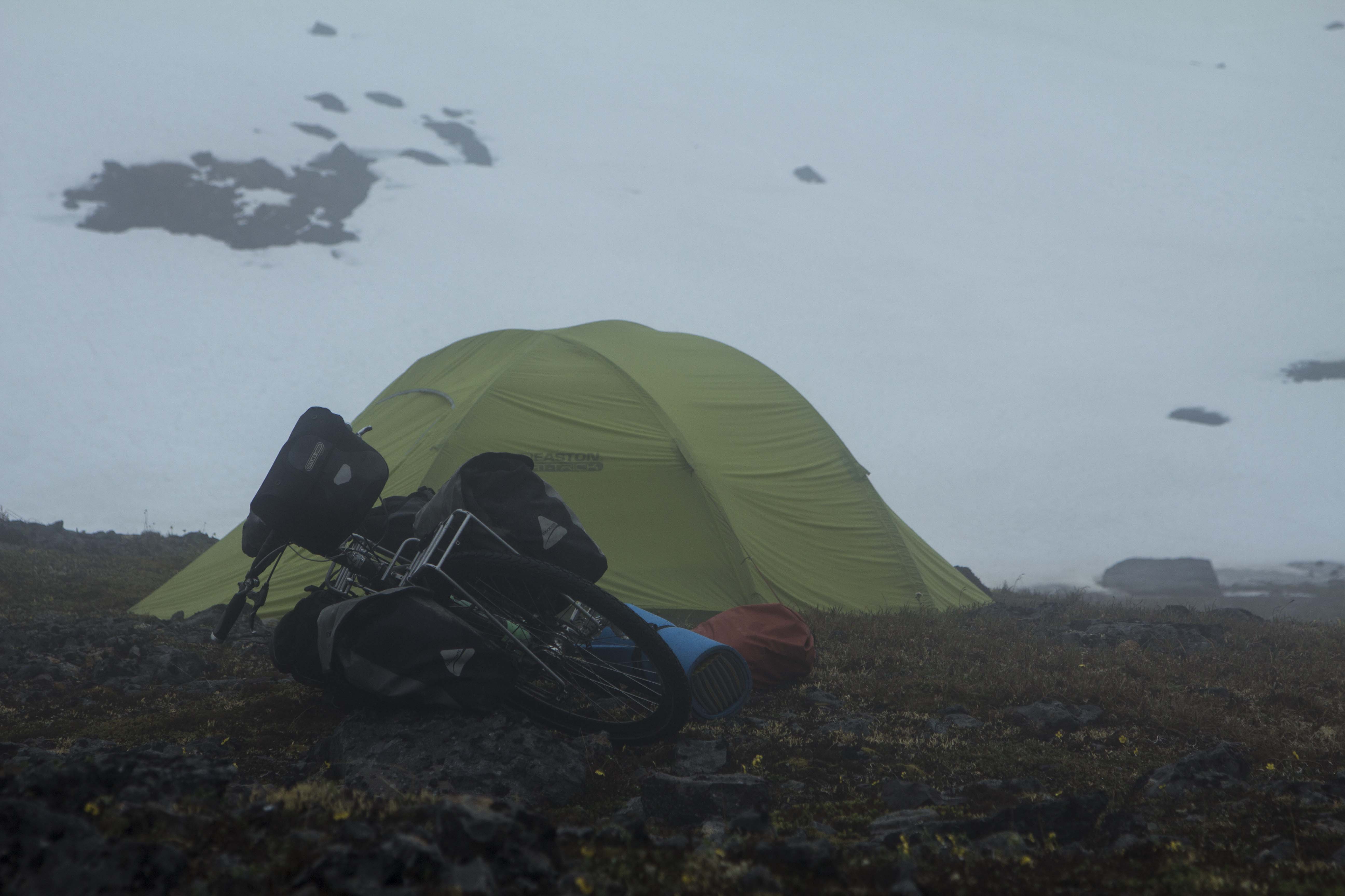
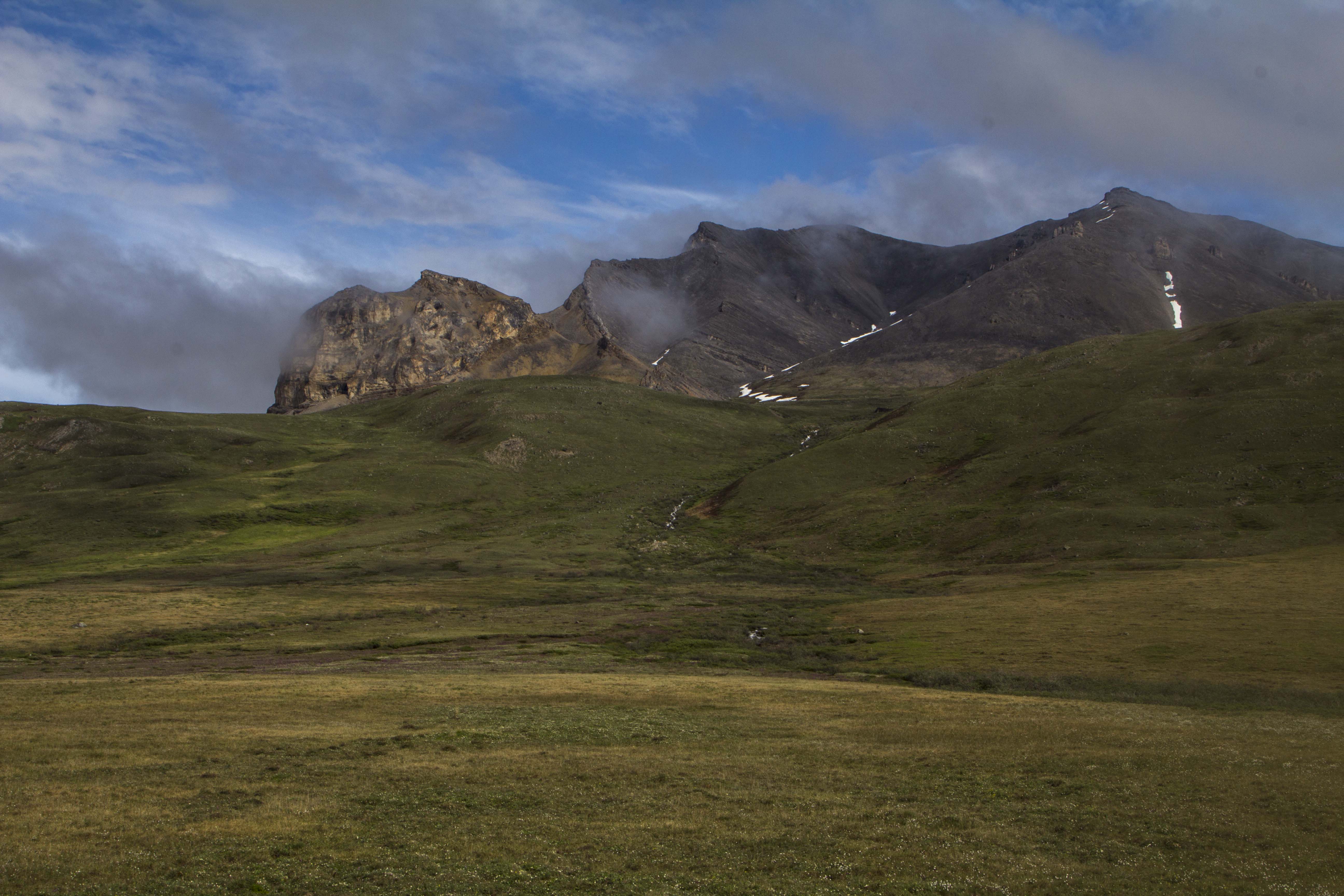
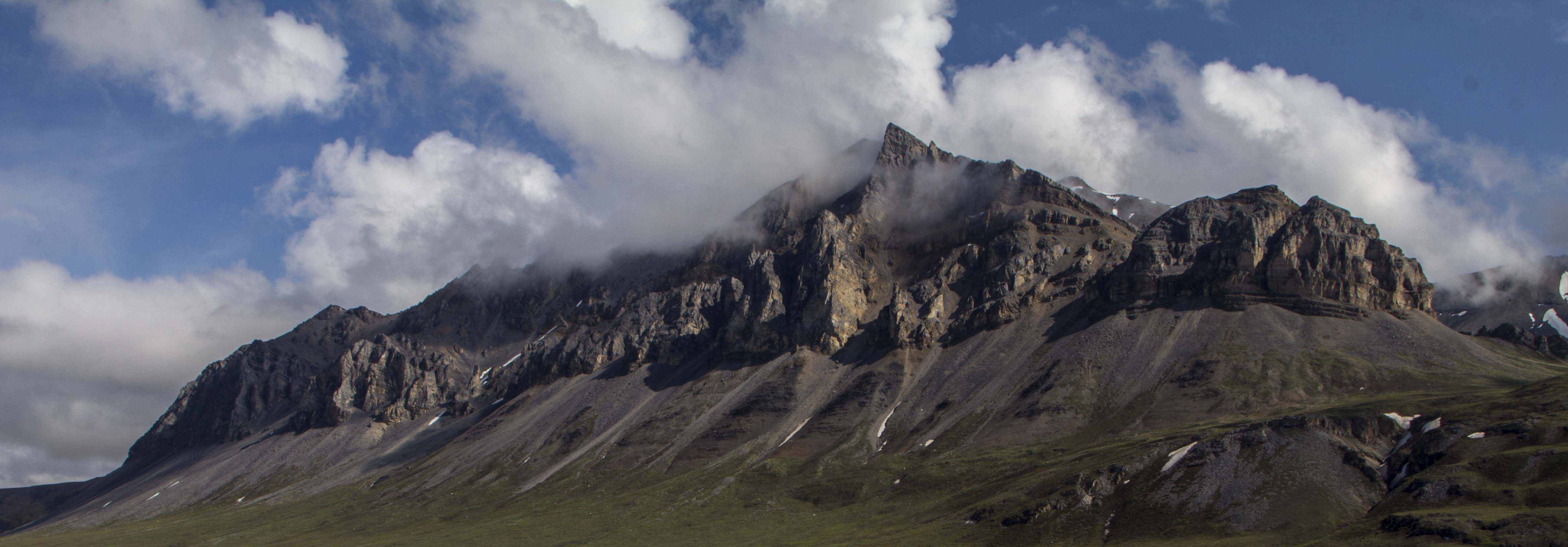
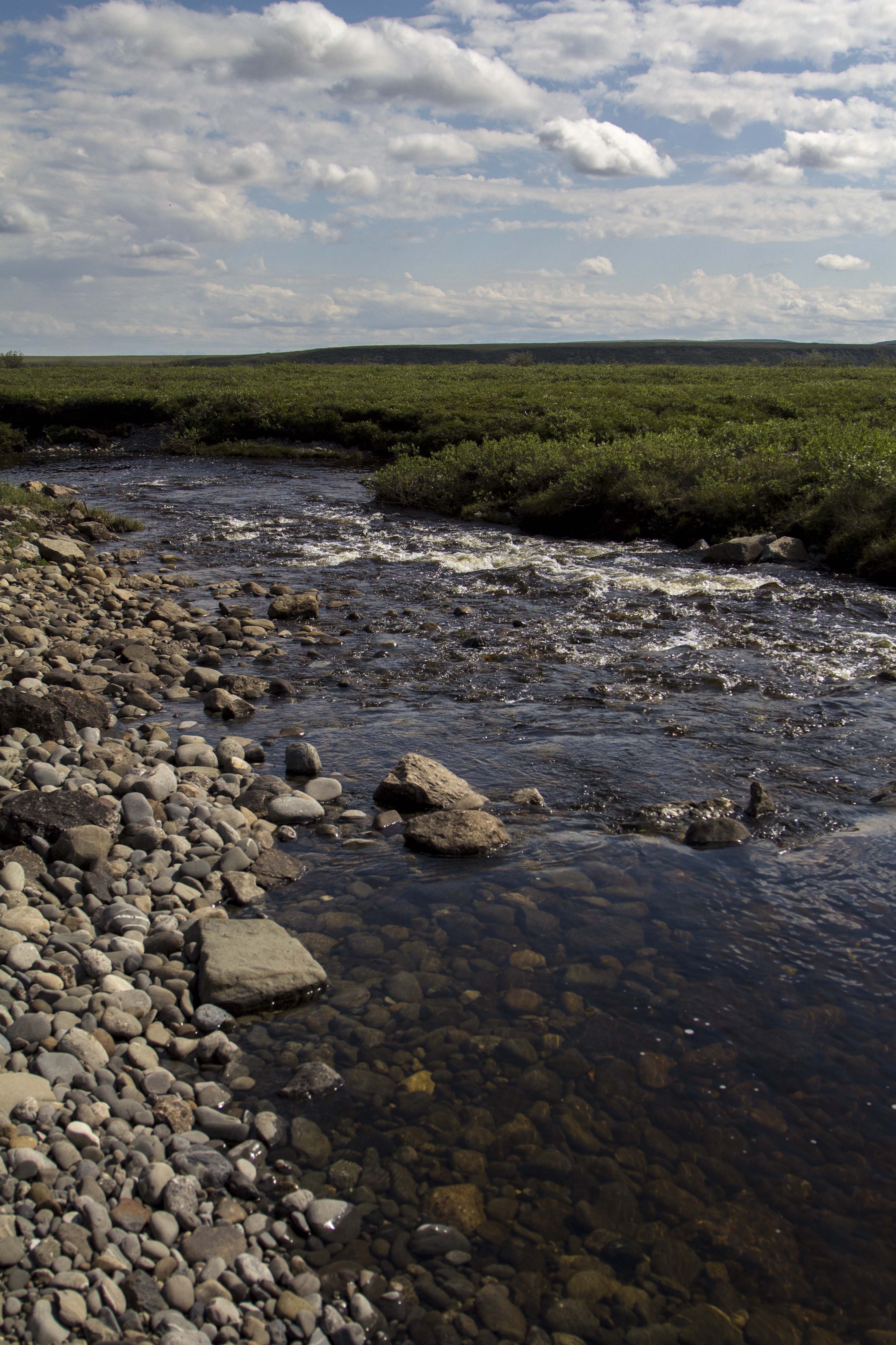
The morning sees me drifting closer to Dawson City; nearing the Klondike river at the entrance to the mind bogglingly beautiful Dempster Highway, I spot a pair of bright blond Grizzlies grazing the grass on the side of the highway. So beautiful these magnificent creatures; I often wonder what attracts them to the highway like this… is there something that grows only near the road that they find edible and tasty? I pass the Dempster and head to Dawson for fuel and a snoop around and maybe a nice espresso drink. It had been 4 years since I had been to Dawson, and not much had changed. That is a good thing. Dawson is a gem in the far north to me; it is a place of historical significance, color and interest. I get an Americano at the lovely Alchemy Cafe and soon I am back down the highway the 25 miles to the start of the Dempster. My plan is to hike into Grizzly Lake in the Tombstone Mountains and spend the night there, taking photographs and shooting video. But when I get to the trailhead, there is a notice that the trail is closed. This is the second time that this happened… I was here in 2013 to not only hike to Grizzly Lake, but to also ride the Ogre all the way to Inuvik in the Northwest Territories. Neither happened on that trip. After pedaling for three days, the road was washed out north of the Ogilvie River, and I was forced by the road crews to turn back. The Grizzly Lake Trail was closed due to high Bear activity in the area at that time; this time it was closed due to heavy snow still on the ground. So in 2013, I stashed my backpack under a rotting Spruce log and continued my bike trip up to Deadhorse and beyond. But today I was in my truck, bound for who knew where. I walk into the forest and immediately locate the pack I had stashed 4 years prior, and skedattled up the gravel Dempster to my favorite section. It is a place where the second of three continental divide crossing occur on the Dempster. A place north of the Blackstone River in the Taiga Range; birth home to Engineer Creek, Mountain Goats, Grizzly Bears, and Caribou. I am looking for a peak to climb in the area, and a ridge leaving the pass right from the road directly on the continental divide leads to an un-named summit of perhaps 6,000-7,000 feet. I decide on it, but first I wish to continue north and do it on the way back. A couple miles down the road is a beautiful alpine canyon situated directly at tree line with the headwaters of Engineer Creek flowing through it’s guts. I find a wonderful camp and set down upon it happily. Glassing the slopes nearby, I spot a heard of a dozen strong Mountain Goats, including several babies who seem to be happy to be jumping around and playing wildly amidst the high and treacherous slopes they are perched. This area north of the Blackstone in the continental divide country is by far my favorite part of the Dempster experience. Late that night, perhaps around 1 am, I awake with a yearning to leave the tent and go on a “night” stomp. I exit the tent and walk across the road and disappear into the muskeg and Taiga. Tussock tundra appears and I run as fast as I can towards a barren hillside, where Willow Ptarmigan scatter. Being spontaneous is what sometimes drives me, for better or worse. It is simply fun, and nothing beats the sensation of just making a snap decision and going for it. I look out over the alpine valley I am in and it occurs to me that every Human on this planet is going through some form of struggle largely unknown to the rest of us. I am not alone…

With my cup of Green Tea in the morning, I make a toast to the South, East, West, and of course, the North in thanks and offering of gratitude. I drive north again, this time paralleling the Ogilvie River at at point further that I got on my bicycle in 2013. A Grizzly slowly walk across the road in front of me a couple hundred meters off and disappears into the Taiga, and more Ptarmigan flutter about at road’s edge.

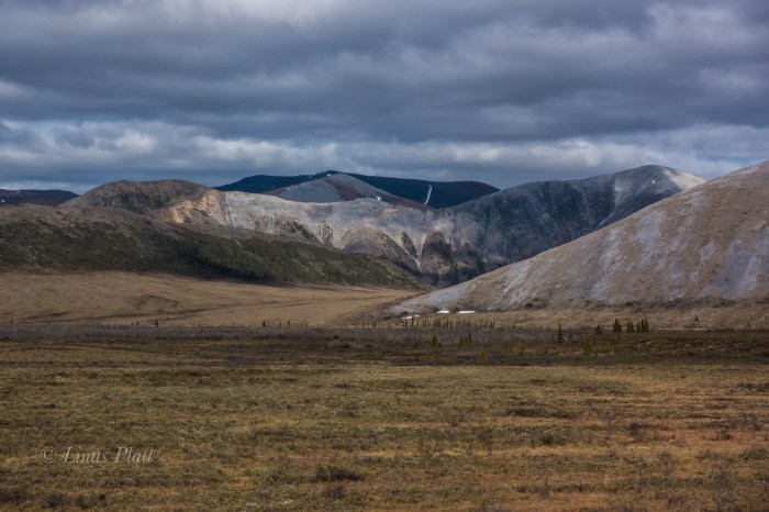
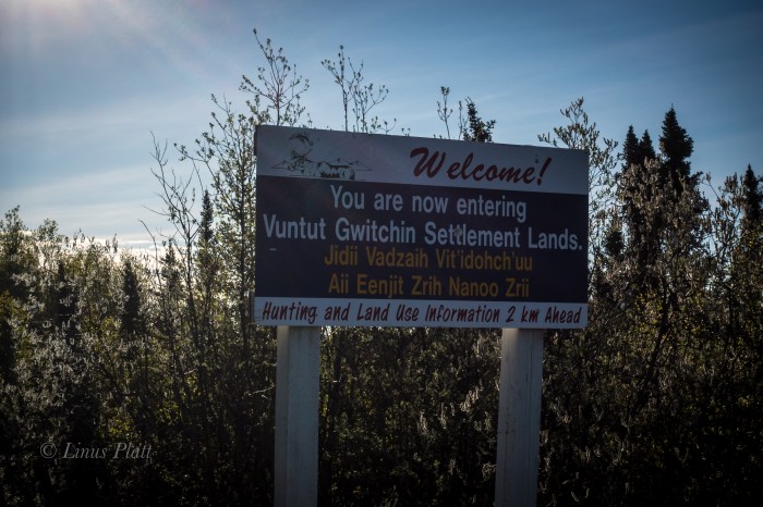
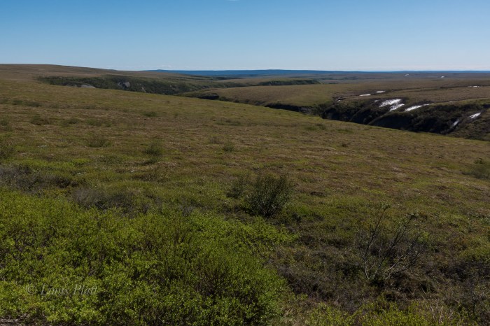
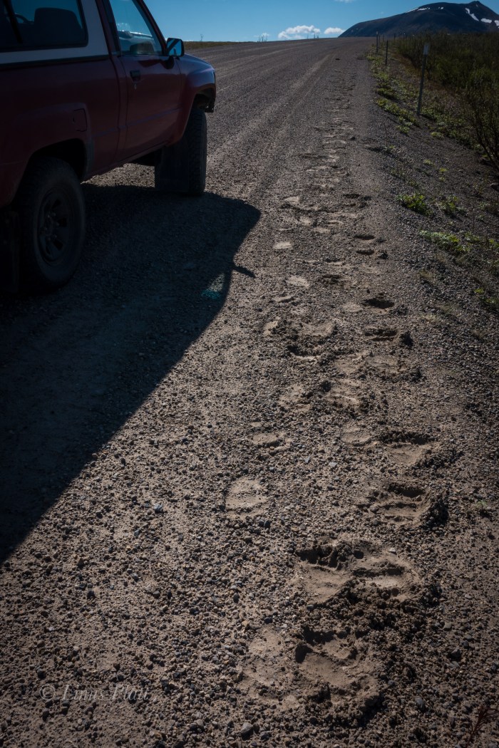
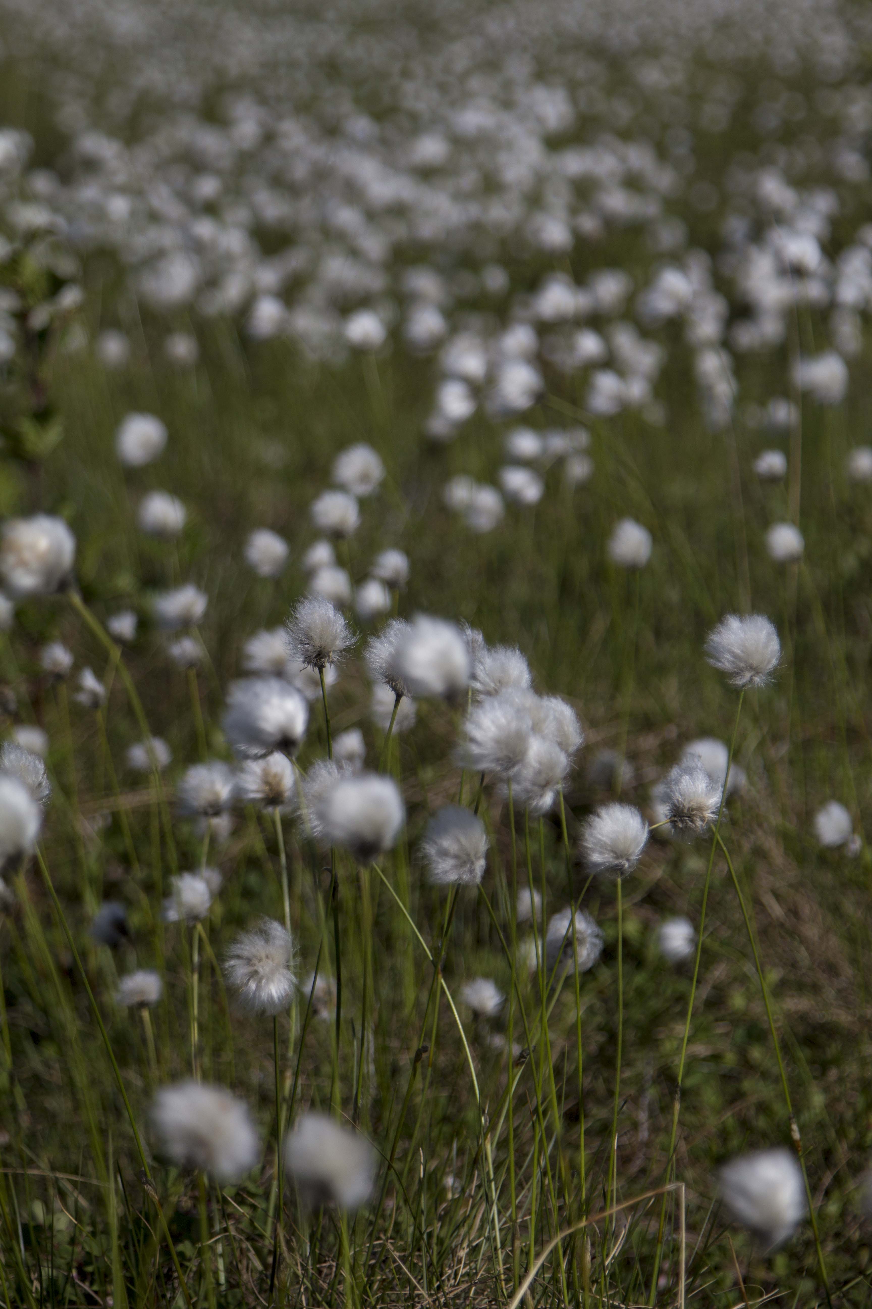
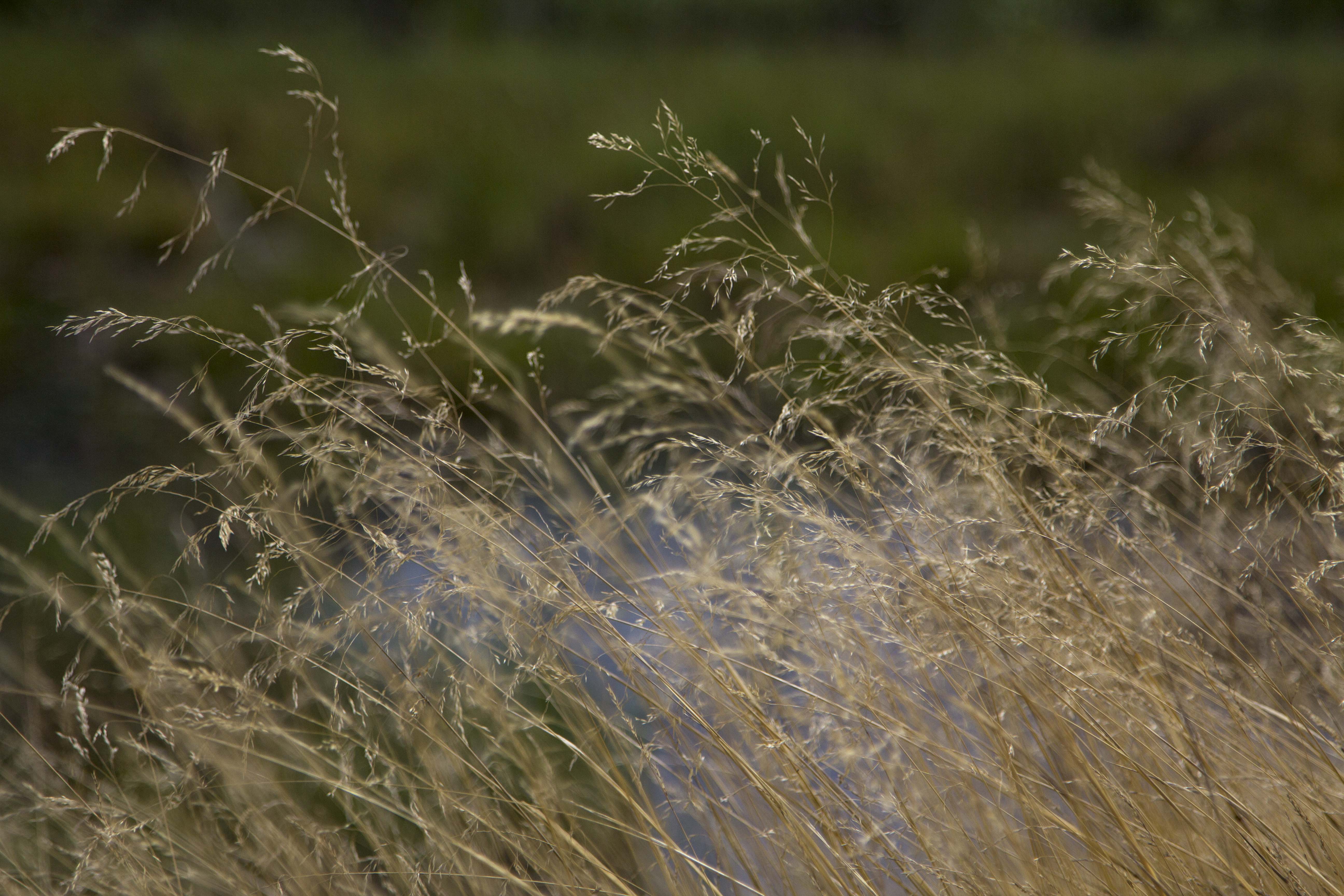
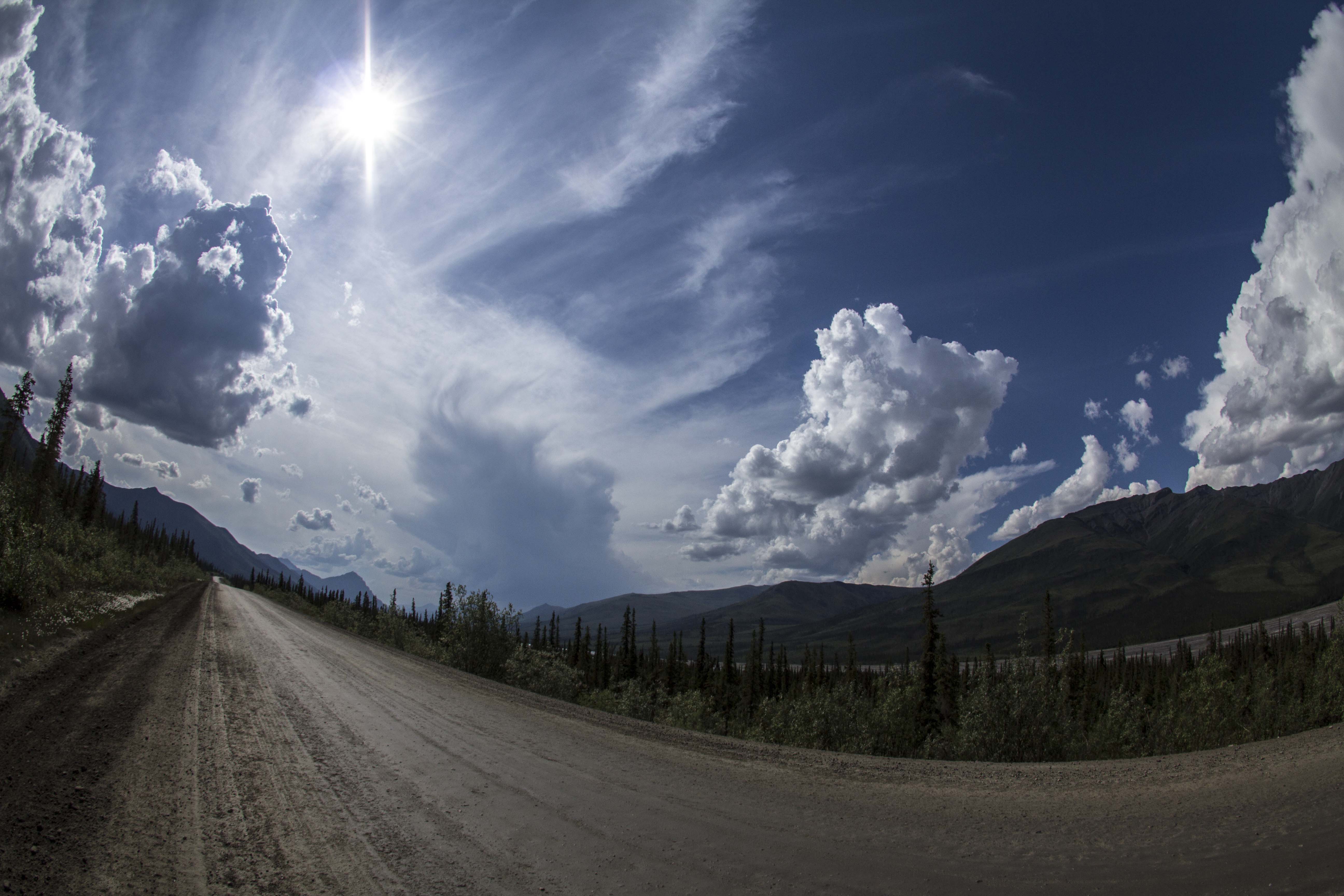
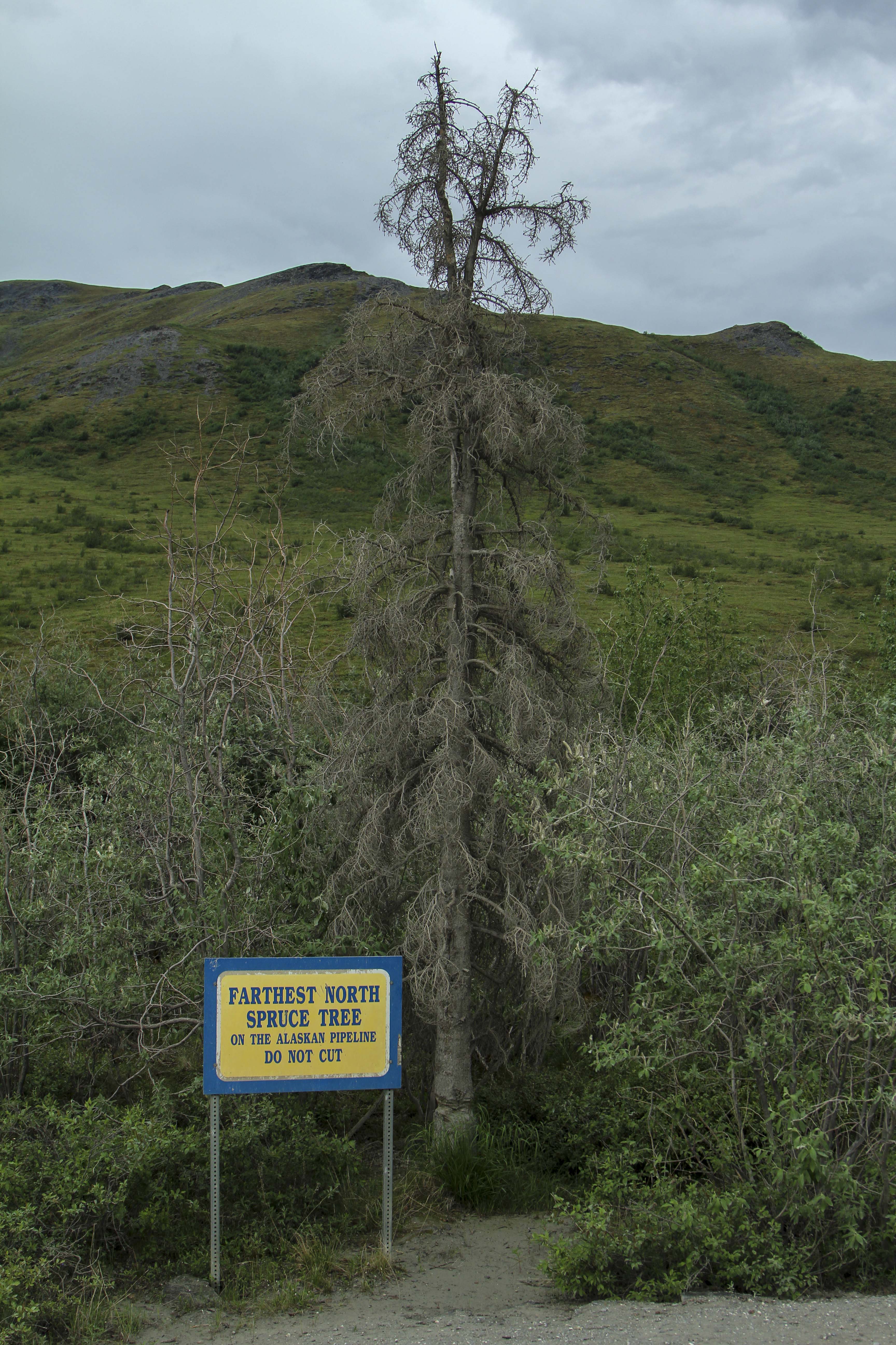
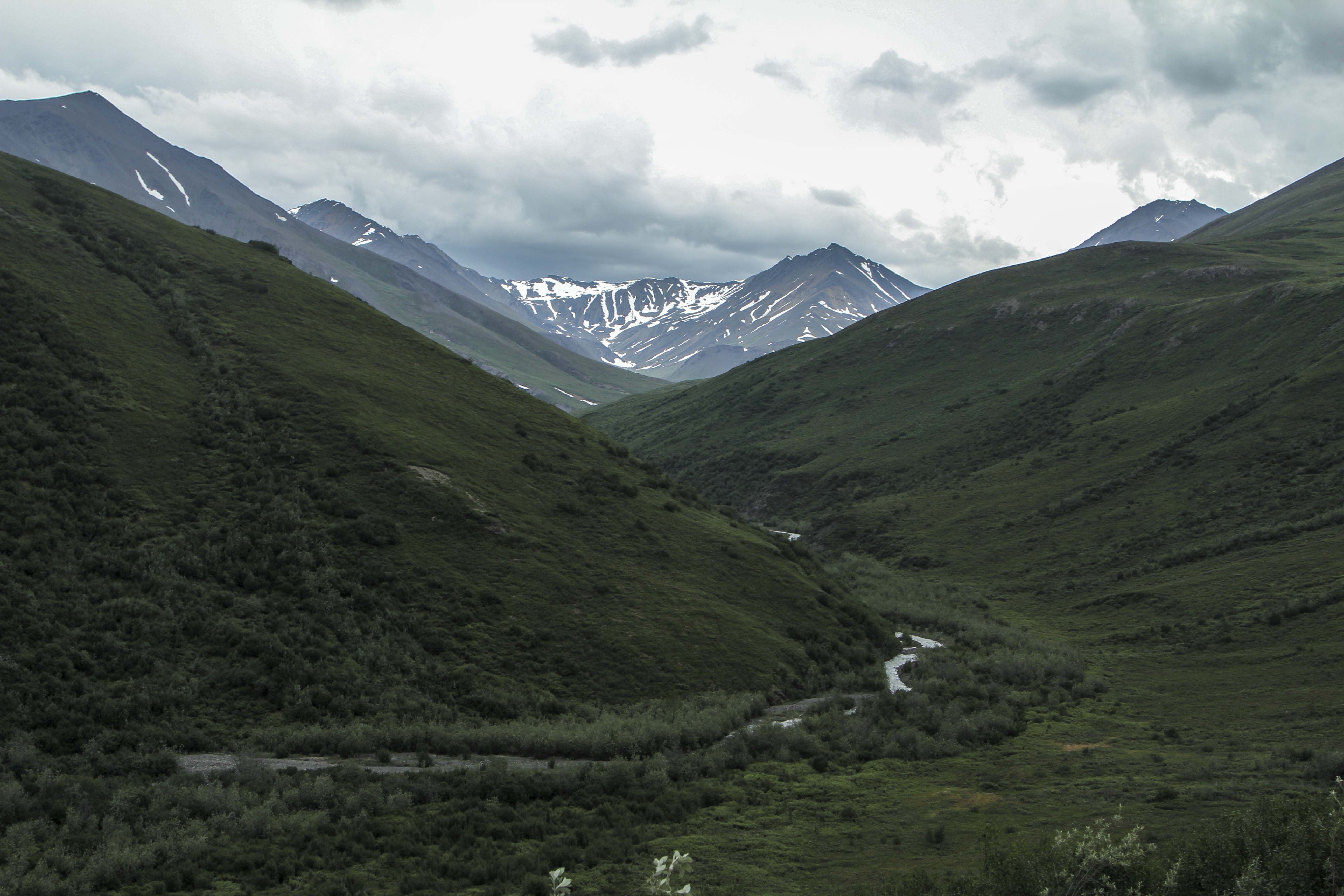
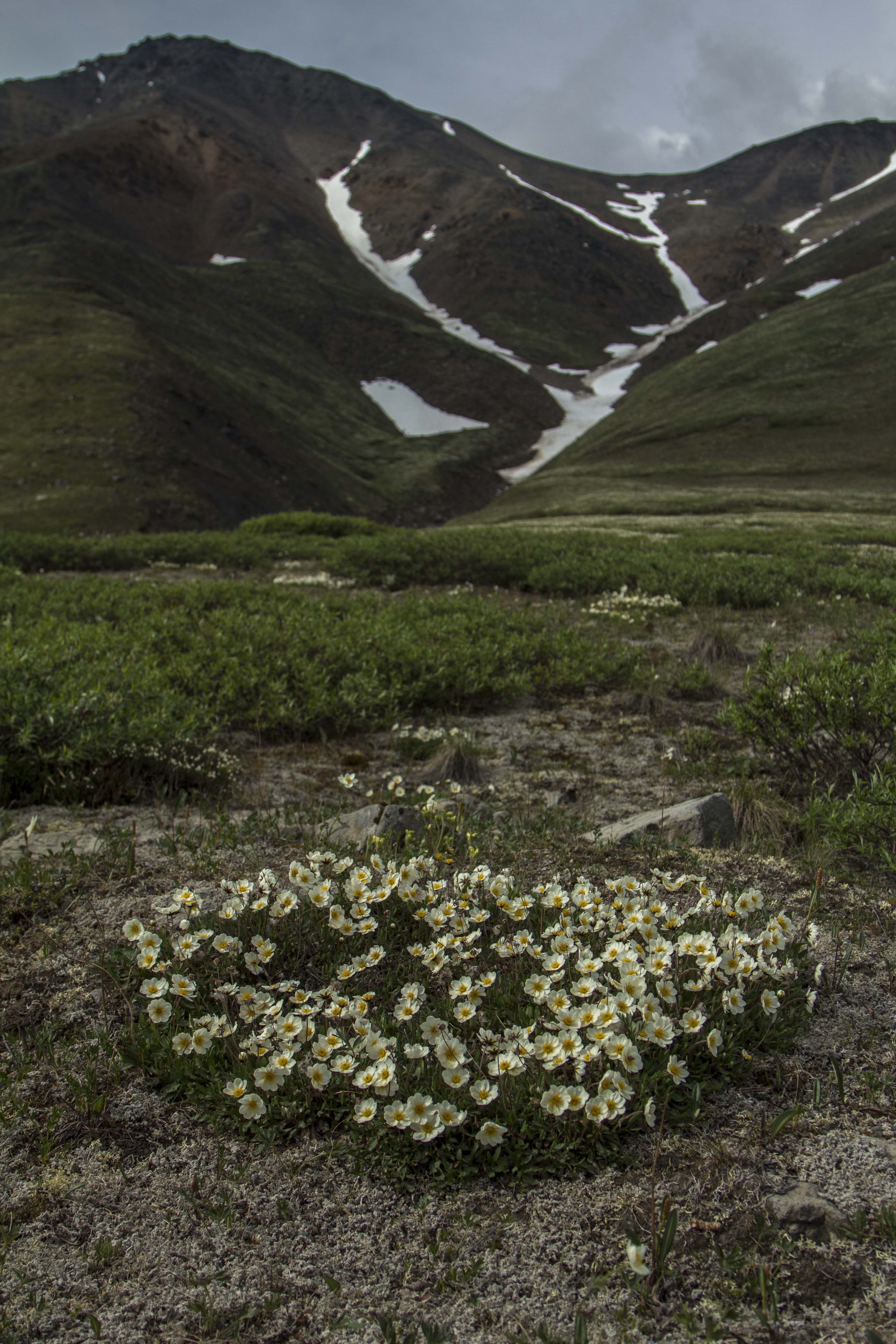
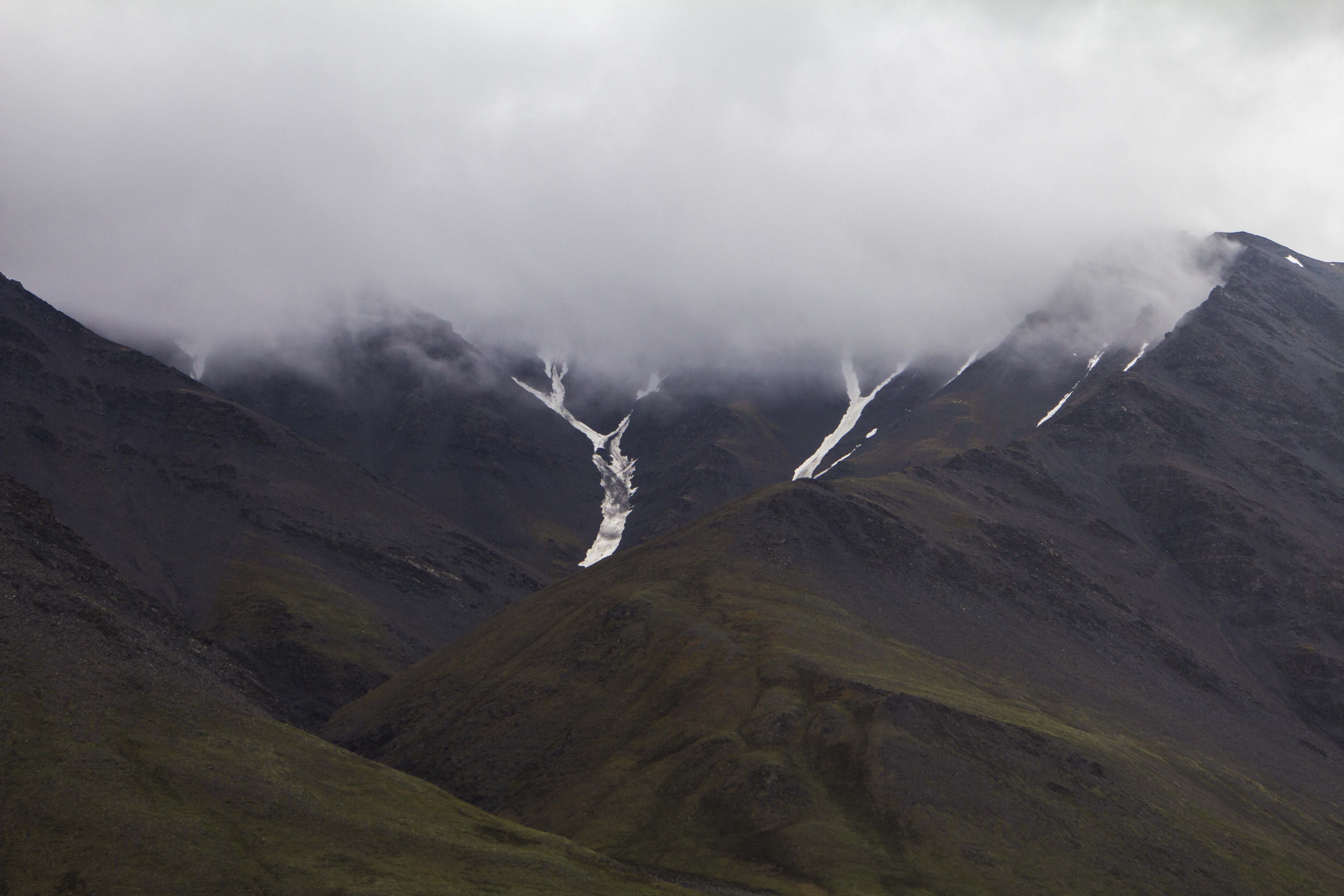
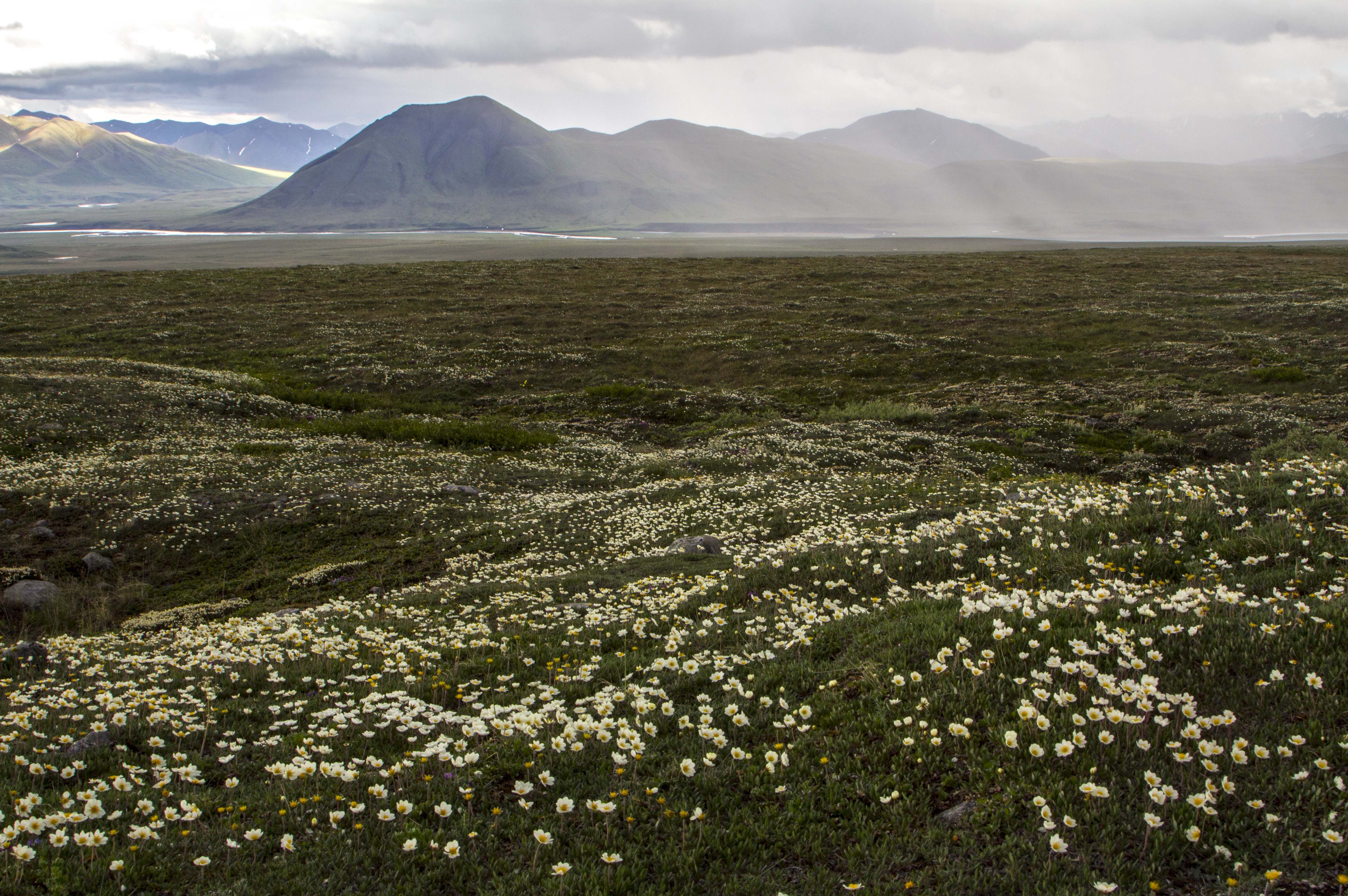
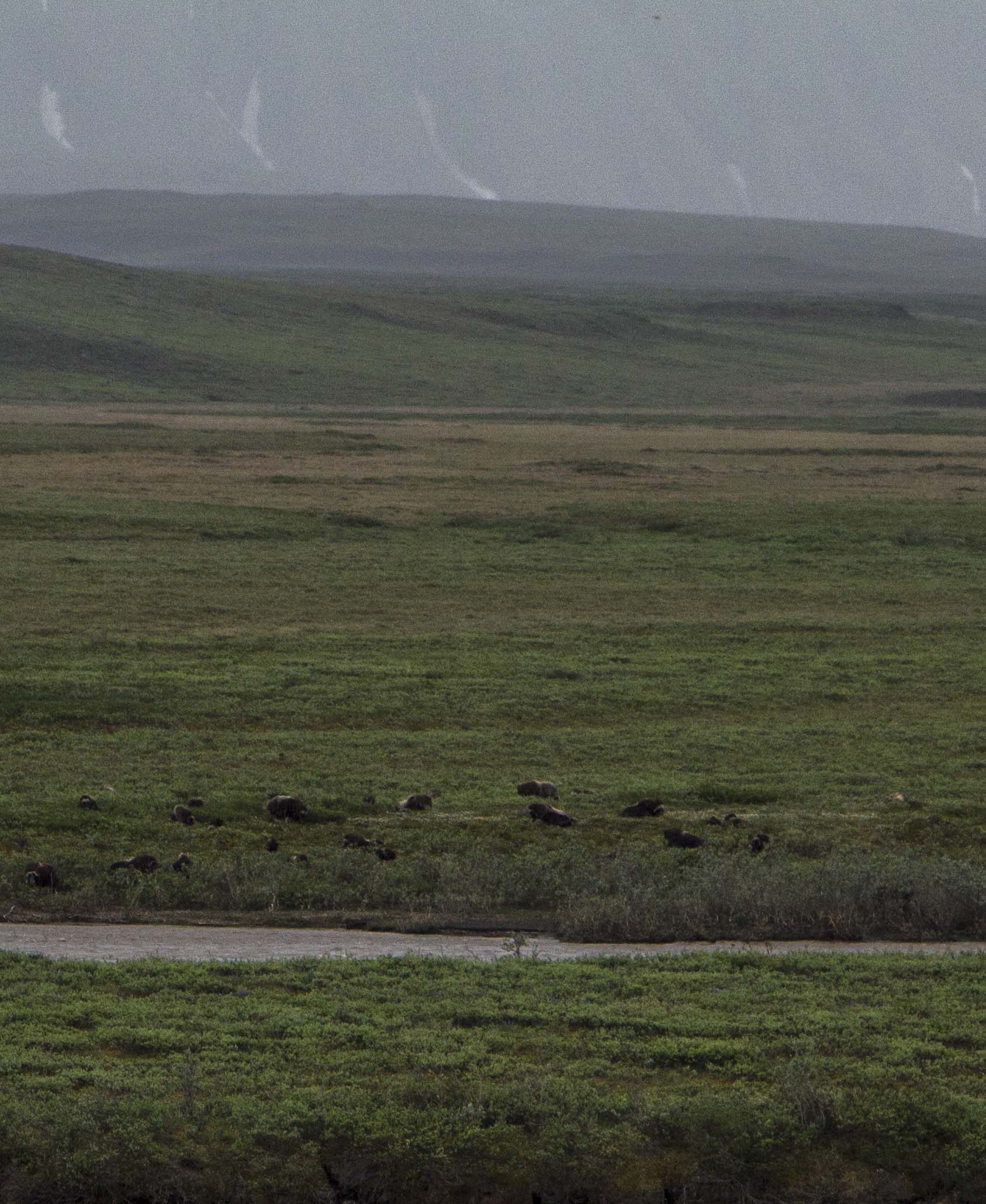
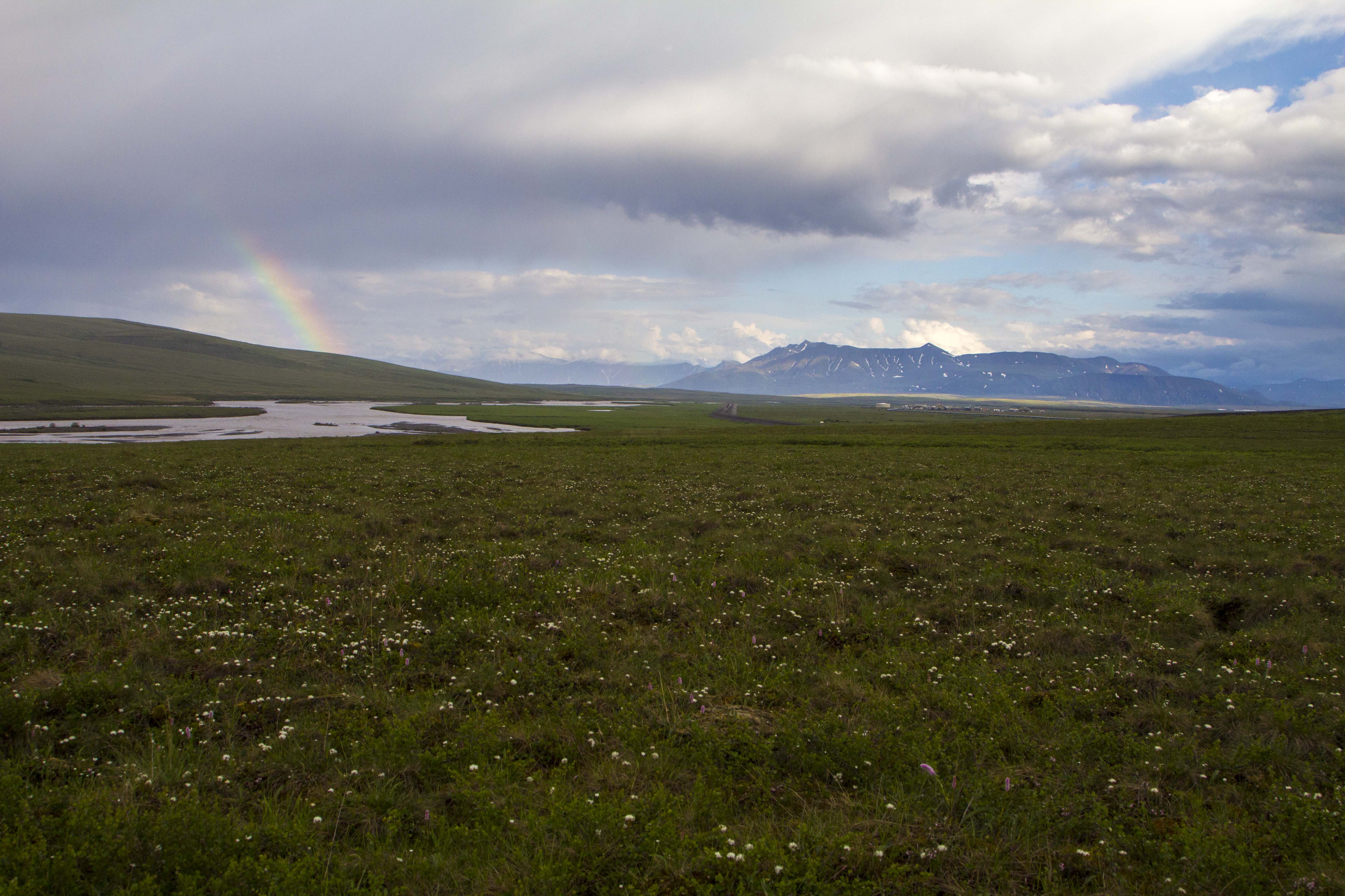
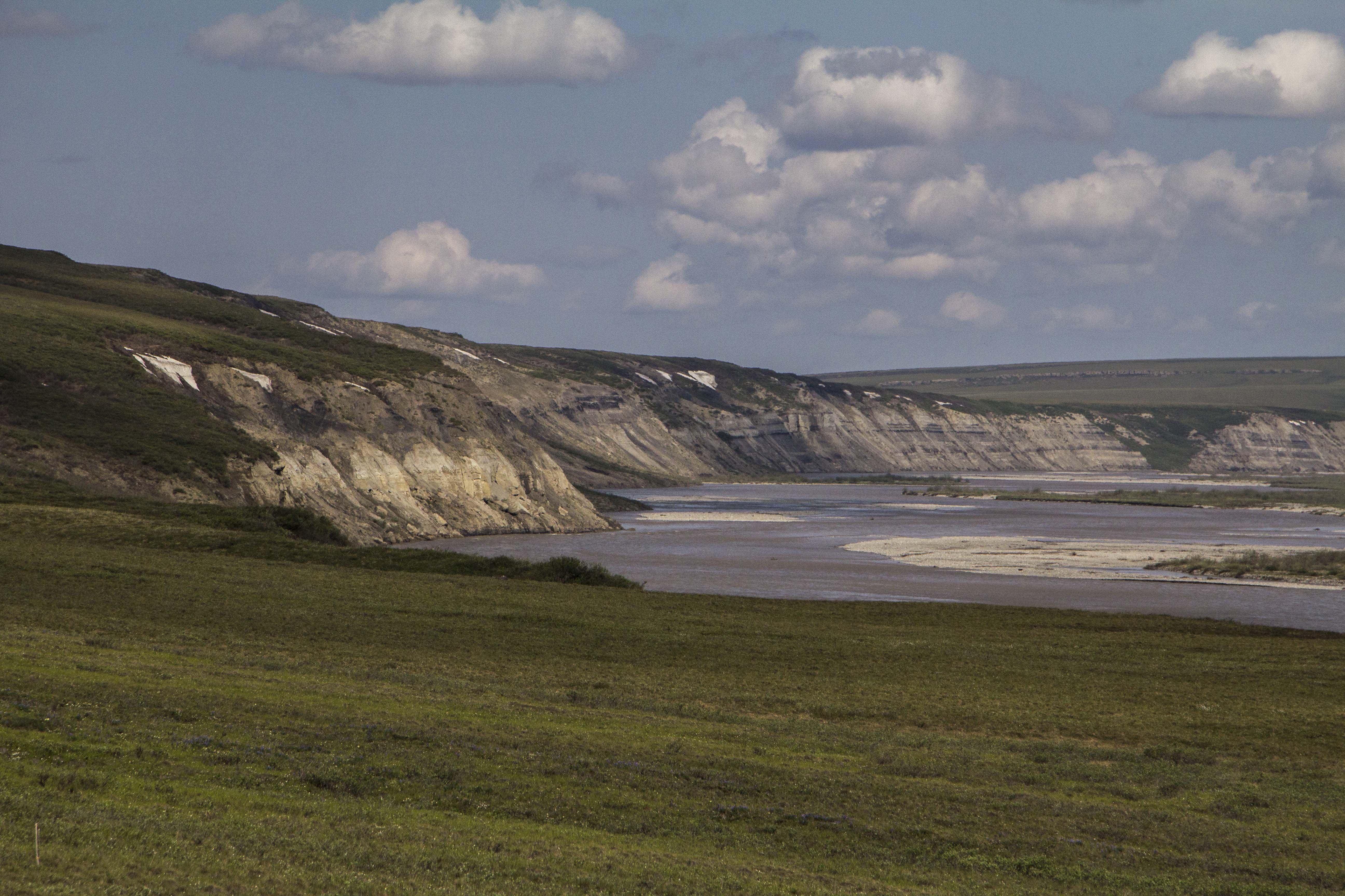
Many miles after leaving the high country, the road drops into river valley’s and enters First Nation native hunting lands. The Dempster at this point climbs to a high point on Ogilvie Ridge, where unobstructed views of the Ogilvie and far, far off, the Peel River, heading to the great und vast McKenzie River flowing to the Arctic Ocean. The road continues along this high Taiga bench for many, many miles. It is dry up here. And exposed. And monotonous… till finally Eagle Plains comes around where I gas up the Toyota and continue on. Soon the Arctic Circle appears and beyond are the rounded tundra summits of the Richardson Mountains, which, in essence are an extension of the British Mountains in the Yukon which are an extension of the Brooks Range in Alaska. The Richardson’s are unique in three ways; They are the final continental divide crossing on the Dempster, dumping all water from them on the northeastern side into the Arctic Ocean, they form the border of the Yukon and Northwest Territories, and they are the last formidable geologic uplift barrier between the interior and the arctic plains of the Canadian “north slope”.  Beyond which lie the extremely remote communities of Inuvik and Tuktoyaktuk. The road travels directly north along the western escarpment of the Richardson’s for many miles, traversing some of the most incredible Arctic scenery I have ever seen; in fact it equals the Brooks Range in beauty and remoteness.  Although it is not nearly as big as the Brooks, it is even more remote really. Soon the road turn east and climbs over Wright pass at the final continental divide and crosses into the Northwest Territories. This place is absolute magic. It is quite chilly here, this far north at the continental divide. The last time I was in a similar place was in 2013 on the summit of Atigun Pass in the Brooks Range on The solstice at midnight. It was cold then too… The road continues through the Richardson Mountains, revealing tundra, high peaks, wild flowers, and wild rivers. After descending the last great decline out of these magnificent mountains, the Canadian Arctic slope appears in the distance, extending for hundreds of miles to the McKenzie Delta. I pull off the road, some 30 kilometers into the Northwest Territories and notice the immense trail of numerous Grizzly prints decorating each side of the road. At night these massive creatures must use this road as a path. There are more Grizzly prints here than I have ever seen anywhere in my life.

Finally, after saying farewell to the NWT’s and wishing to continue on to the Arctic slope, but becoming increasingly paranoid about the 30 year old Toyota Truck’s engine with a quarter million miles on it, I turn back and drive back to from which I came. Passing once again the Arctic Circle and gassing up in Eagle Plains again, a few hours later I am back in my favorite and stunning alpine valley north of the Blackstone River. I am exhausted and plan on a peak climb in the morning. In the tent, I sleep like a dead man.

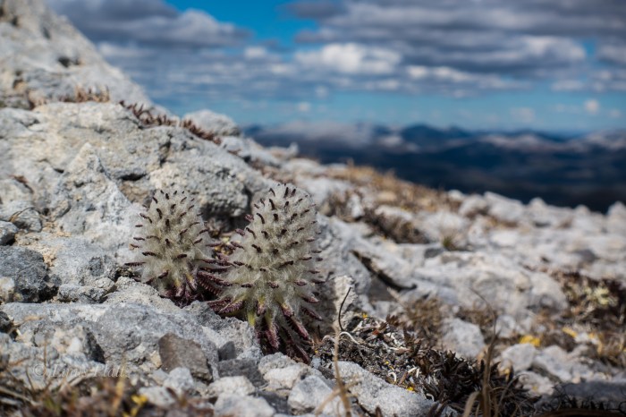
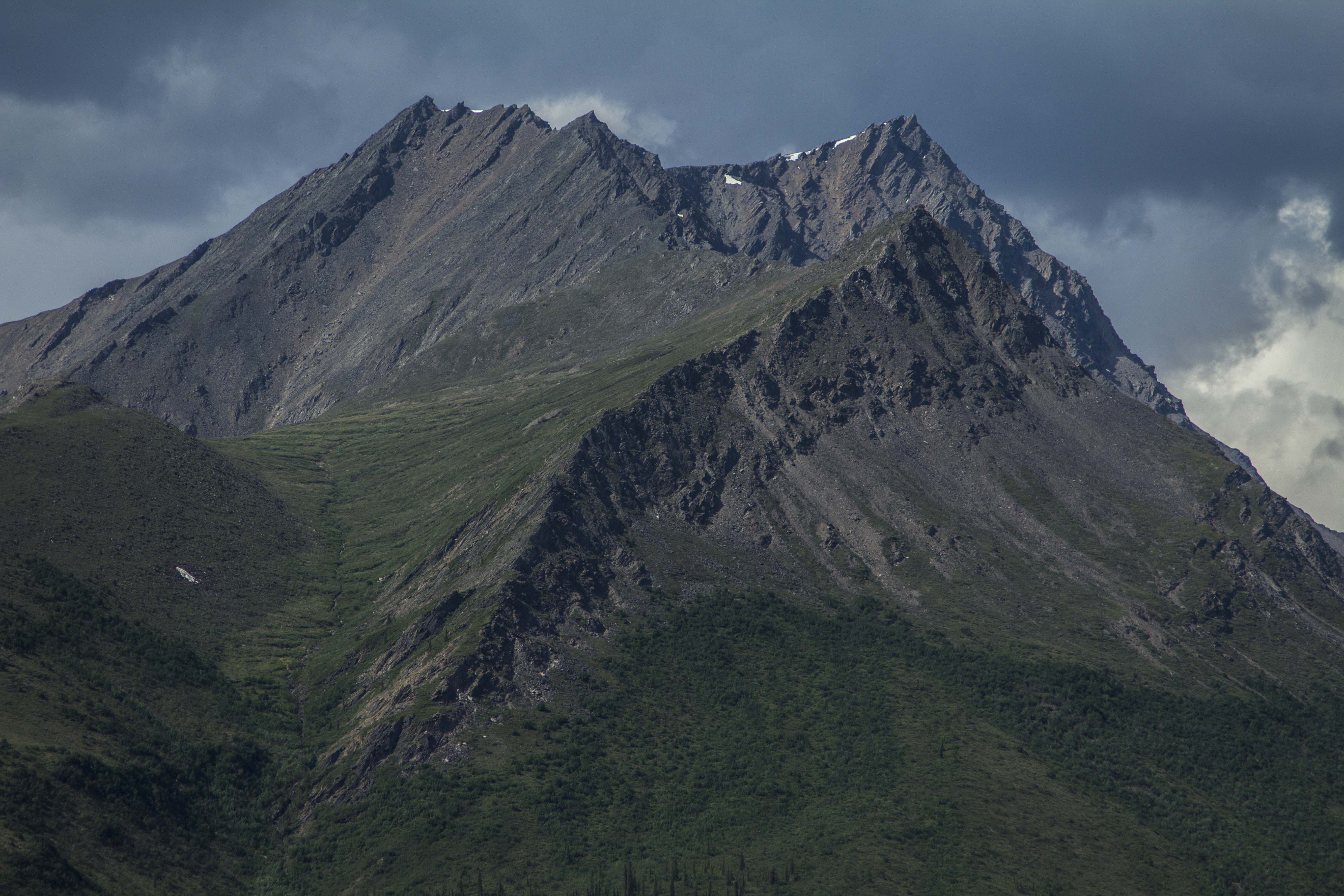
After crossing a short bit of tundra in the morning, I begin climbing up the class 1-2 talus of the ridge line to where it nearly flattens out but continues in a westerly stretch for about a half mile before the final summit pyramid rises abruptly and ends. After 4 hours from the truck, I stand on the unknown summit and marvel at the other peaks around me and the strange and unknown alpine valley’s that separate them. I decide to descend a different route in order to walk out one of these valleys following a creek where I hope to see signs of animals. The decent was treacherous; some of the loosest scree and talus I have ever encountered kept my attention level extremely high and after considerable time and effort, I find myself at the head of this glorious alpine valley, flowing within it the beautiful little creek mentioned. On the way down valley, I see no animal prints of any kind, but spot a pair of caribou antlers lying in the tussock. The are from a small and possibly younger animal, with part of the skull still attached; taken down by wolves I imagine. After a bit I am back at the truck and I blast off again, this time bound south for Dawson, where contrary to my intentions to keep this an alcohol free trip, I decide to duck into a tavern and have a beer. I order my beer and when I go to pay for the beverage in U.S. dollars, the First Nation’s woman in the chair next to me starts ridiculing me for being an American. She proceeds to stick her finger in her mouth indicating forced vomiting, therefore expressing her displeasure. I tell her, “I’m not American, I’m Alaskan”; she was not pleased and continued the harassment. After a bit, I told her she didn’t know me and that she was a no good judgmental SOB (as it were). I left my lone beer sitting there on the bar and left. All I wish for is friendship, love, and understanding – hard resources to find on this here planet. Later, at a makeshift camp, the cops show up to kick me out, but tell me where I might go for a low profile and free bivy.

That night, I toss and turn and sleep eludes me nearly completely. Tomorrow I will ferry across the Yukon River and drive the Top of the World road (AKA the Ridge Road) and into the deep interior of Alaska. I had ridden this road on my bicycle a few years ago and found it to be one of the toughest rides in the north. I’m happy that the old ‘Yota and me will be traversing this together this time.

Leaving Haines-07702
Tahkini River… Yukon Territory
Leaving Haines-07726
Klondike Woods Camp

Leaving Haines-07733

Leaving Haines-07739
Tombstone Mountains, Yukon

Leaving Haines-07748

Leaving Haines-07759
Blackstone River Ice Pack

Leaving Haines-07764Leaving Haines-07773Leaving Haines-07778Leaving Haines-07781

Leaving Haines-07787
The Blackstone uplands and the start of the Taiga Ranges

Leaving Haines-07790Leaving Haines-07794Leaving Haines-07804

Leaving Haines-07881
The Dempster Highway

Leaving Haines-07883

Leaving Haines-07887
The View From Ogilvie Ridge
Leaving Haines-07907
Eagle Plains

Leaving Haines-07910Leaving Haines-07927

Leaving Haines-07948
The Beginning of Canada’s Arctic North Slope
Leaving Haines-07952
Grizzly Tracks, Richardson Mountains, Northwest Territories

Leaving Haines-00584Leaving Haines-08909

Leaving Haines-08913
The Un-named Peak North Of The Blackstone Uplands

Leaving Haines-00585Leaving Haines-09726Leaving Haines-09727Leaving Haines-00580

Leaving Haines-00608
Caribou Antlers


The Haul Road (Into the Arctic)

There are only two roads, in North America, that one might pilot a vehicle of some sort, which lead to this continents Arctic area’s. As far as I know, there is only one other road in the world that leads into the Arctic outside of North America, the Arctic Highway in Norway, which might just be the northern most connecting road in the world. The two roads in question are the Dempster Highway in the Yukon and Northwest Territories, of which I attempted to ride weeks prior, and the Dalton Highway, AKA “The Haul Road” in Alaska.  Both of these paths’ through the wilderness are of the dirt and gravel variety, however, there are bits of pavement and chip seal surfaces as well, scattered about, here and there. The Haul Road, remote indeed, was built in 1974 as a supply line to the north slope oil fields at the Arctic Ocean, and parallels the Trans-Alaska Pipe-Line, was not open to use by the general public until 1996. Up to that point, the truckers had it solely to themselves. The Haul Road, as it was called in the 70’s, traverses a rugged landscape north of Fairbanks and leads to Deadhorse, Alaska. It crosses terrain varying from the endless, forested hill country beginning at Fairbanks, to Taiga swamps and open tundra, crosses many, many rivers and streams, and penetrates the “Alaskan Rockies”, the continental divide at the bastion of true roadless Alaskan wilderness, the mighty Brooks Range. The Brooks, since I was a teenager, has been a source of great mystery and a true icon of the remote and windswept tundra of northern Alaska. It has also been a dream to visit that whimsical place since that time.

Saturday morning I am up, gearing up.  At Sven’s, all is quiet. There is not a soul stirring, most likely all are sleeping late from the inevitability of staying up too late in the bright Alaskan night time. Two night prior, I give a food bag to Sven’s trucker friend, Tommy. He is heading up the Haul Road to Deadhorse and will drop of my feedbag at Coldfoot. This will alleviate the need to carry 10 to 12 days worth of food, but cutting that amount in half. Thank You Tommy!  I slowly pack my things and secure the Ogre for a lengthy trip into the wilderness. I pedal out of Sven’s area and on to downtown Fairbanks in hopes of finding some breakfast. After Eating, I head north, up the Steese Highway, toward Fox and Livengood. The coming onslaught of slim eating over the next week, prompts me to catch yet another grubstake near the edge of town and off I go, north.

That day was filled with some of the worst up and down hill climbing on a bicycle I had ever encountered and was indeed thankful for all the food I consumed; every calorie accounted for as I pedaled hill after hill after hill. Finally crossing Snowshoe Summit at the apex of Alaska’s White Mountains, I am rewarded with a long downhill and a natural stream of spring water shooting from a pipe near the road’s edge. The water is clear, cold, and delicious. Onward, passing a few creeks and abandoned cabins, I look for a camp. I pull onto a dirt track next to the Tatalina River and dive into the water after setting up. I am then greeted by terrible swarms of Alaska’s favorite insect. That night, I talk and drink Rum with pipeline workers from Pumpstation #7, just a few miles south.

The next day, more of the same hill climbing ensued, only worse this time. The hills are 12-14%, made up of loose, unconsolidated gravel, and the truck traffic is thicker than usual due to the summer time road maintenance. This day turned out to be the hardest of the entire Haul Road. By day’s end, I was so exhausted, I could do nothing but dismount the Ogre and push the dead beast upward and over the hilltops, coast down the other side and repeat. I was jello.

More big hills the following morning, lead, thankfully, to the Yukon River, where , once across, the road flattens out a bit and some nice forested Alaskan countryside sprouts from the earth like Grandfather Forest’s beard. Eventually, however, the hills re appeared and the grinding continued. After 70 miles, I find a gravel pit to call home right on the fringe of Finger Mountain and south of the Arctic circle maybe 25 miles. I am now seeing the first bits of true Arctic Tundra.. permafrost meltwater lakes, unglaciated Tors of granite, and windswept mountain passes are now within my eyesight.

The next day, the landscape changes dramatically to the type of high country I so desire. After crossing the imaginary Arctic Circle, I cross over a small mountain pass and catch my first glimpses of the mighty Brooks Range. I drop into the valley below, and am greeted with magnificent spruce forest, and creeks filled with 24 inch Grayling. There is drinking water everywhere, a far cry from the relative dryness of the last few days out of Fairbanks. In fact the dryness was accentuated by the fact that north central Alaska has been experiencing one of the hottest, driest spells in history this week. The second day out of Fairbanks it tipped the scales at 94 degrees! This new landscape was what I came  here for… unparalleled high country filled with river’s, mountains, forest, and animals.

I roll into Coldfoot, the half-way point on this path, nestled in the Koyakuk River valley, in the heart of the entrance to the Brooks Range. I find a decent camp next to the river and go into “town” to find my food box. The box is not there.. Tommy had not made the trip, but had relayed the box to a friend of his to drop, but so far, it has not shown. There is a bar and a restaurant here and the food is decent and the folks here are nice and the scenery is unbeatable, so I have no problem sitting tight for a spell. Over a couple of beers, I meet Tom and Jane, a couple of extremely nice folks from the Hood Canal area of Washington state. They have flown up here from the states in their Cessna 180, and offer to take me on a short flight over the Brooks tomorrow if I wasn’t doing anything. Are you kidding? This notion makes me grin as wide as wide can be, and I accept. I meet with them the next day and, by noon or so, we are in the sky, flying over what can only be described as pure and simple wilderness bliss. Huge, craggy peaks, endless tundra mountains and rivers of a proportion that I can barely comprehend unfold before my very eyes. I hold back the tears of joy as I witness a childhood dream come true. There are no words to describe how my heart feels in this place, even from an airplane. How will I feel when I am actually in it? After about an hour, we head back to the Coldfoot landing field, and I thank Tom and Jane for their generosity. I wish them the best, and I hop on my bike, high as kite from the last hour’s experience, and eagerly pedal directly into what I had just witnessed, looking now for a direct contact with the landscape before me, which is exactly what I got.

A couple of hours pedaling through mind boggling, awesome  scenery, I decide to get off of the Haul Road proper, and get onto the pipeline pad road, which offers a bit more of the deeply spooky solitude that this unbelievable place can offer. Eventually the road dead ends when the pipeline disappears underground, which will dictate me backtracking to the Haul Road for a couple of mile. BUT, at it’s end, a spectacular campsite is to be had, on the Koyakuk, and facing a “sunset” view of the mighty southwest face of Sukakpak Mountain, an impressive chunk of pre cambrian limestone real estate. After swimming in the Koyakuk, I set up the camera for an evening time-lapse of Sukakpaks’ dramatic episode of color and changing light. I feel I have finally entered the place on this leg where I want to be; The High Country.

The following day is the creme de la creme; 40 miles of dead flat, yet scenery of a mesmerizing nature ensue. I see Eagles, Moose, and Fox, but no Bear, Caribou, or Wolf. The river becomes heavily braided; the forest begins to thin out. Signs of a changing ecosystem; of a different stature, more rugged than the previous mile, unfold. The weather begins to change too.. Thunderclouds build, then unleash, I retreat under a bridge and watch the storm from beneath, sitting next to river ice pack still 36 inches thick, here on June 20th. The storm breaks and and so do I. A few short miles and I pass the final spruce tree in this part of North America. No more trees at all, in fact. It is all tundra and the road begins to climb. Up, up, I go; the road flattens once again onto the spectacular Chandler Shelf, a flat area of a couple hundred square miles of tundra in the heart of the Brooks, just below the continental divide of Atigun Pass, Alaska’s Highest and most northerly road pass at 4800′. As I near Atigun’s summit, the storm once again decides to unleash it’s fury. High winds, sideways rain, and plummeting temperatures commence. I top out at 9:30 pm and find a patch of snow free tundra a way off the road and pitch my tent right there on Atigun’s high point. Even with guying the tent, I still have to brace the 4-season Easton shelter from the inside to prevent poles from snapping. Finally, the wind dies off and I drift to sleep, dreaming that night of being yet deeper into this range of magic mountains in the North, father in than I am now, traveling high valleys among Grizzly Bear and Caribou.

I awake to a deeply silent atmosphere of near whiteout conditions; it is eerily calm. I pack up, and descend the pass slightly to the shelf on the north side and park the Ogre for a hike up to a ridge top. The tundra here is short and squat and is easily traveled upon. It is festooned with tiny wildflowers of all shapes and colors.  I pass the remains of a young Caribou, probably taken by Wolve’s. Farther up, I glimpse down great gully’s of rock towards a massive creek with outstanding waterfalls feeding it’s need to descend into the Atigun River and beyond into the Arctic Ocean. The peaks are mere 6000 footers, but are massive just the same. The Brooks is a dry region, as is the Arctic in general. It really is mostly an Arctic desert. There are a few small glaciers scattered in a couple of places in the Brooks, namely, the Arrigetch Range to the west and the Romanofz Moutains to the north east. But not here. There are thin gully’s of snow descending from the rocky summits of these peaks, providing a striking contrast to their nearly black and orange coloring. Eventually, I descend back to the bike, and continue on, down Atigun Canyon, and onto the great Arctic Plains of the Alaska’s North Slope.

The next two days are flat tussock tundra, starkly beautiful, and swelling with my favorite insects. I still see no Bears, but, plenty of Fox and Caribou.  Alas, I spot a herd of twenty strong Musk Ox; the pre-historic, ice age creatures of the North American Arctic; an iconic figure of strength and endurance in this vast, untamed arctic landscape.

The next day, rolling into Deadhorse, it is 28 degrees F, and 40 MPH winds, but othersise uneventful. Deadhorse is the center of North America’s largest oilfield, which stretches for over 70 miles to the west. Camping looks grim, so I stay at the Prudhoe Bay Hotel, which, for 125 bucks, includes 3 meals and free laundry. I figure it is a good deal here at the end of the continent and decide to pull the trigger. After a fitful night sleep in a strange bed, I pedal out of town a couple of miles and lay the bike down and put out my thumb…

…Later, after no success in hitching a ride back to Fairbanks, I catch an hour and a half flight back to Fairbanks, where, as it turns out, I have a job waiting for me to start right away. So, without time for rest or reflection, I begin work..  Operating a chainsaw in the woods 8 hours a day.  Thing could be worse…

I am happy, but tired…

IMG_2459
Dalton Mud
IMG_2512
Cotton Grass
IMG_2542
Tundra Near Finger Mountain
IMG_2612
The Grayling Filled Jim River
IMG_2650
The Brooks From Above
IMG_2654
Pilot Tom
IMG_2666
Tom and Jane From Washington State
IMG_2701
Sukakpak Mountain

IMG_2429 IMG_2433 IMG_2440 IMG_2443 IMG_2455 IMG_2456 IMG_2558 IMG_2567 IMG_2577 IMG_2579 IMG_2582 IMG_2609 IMG_2610 IMG_2616 IMG_2624 IMG_2634 IMG_2671 IMG_2679 IMG_2681 IMG_2698 IMG_2715 IMG_3124 IMG_3129 IMG_3139 IMG_3142 IMG_3144 IMG_3149 IMG_3162 IMG_3167 IMG_3169 IMG_3188 IMG_3198 IMG_3206 IMG_3218 IMG_3223 IMG_3227 IMG_3230 IMG_3240 IMG_3243 IMG_3254 IMG_3257 IMG_3277 IMG_3290 IMG_3296 IMG_3298 IMG_3317 IMG_3324 IMG_3334 IMG_3345 IMG_3347 IMG_3357 IMG_3361 IMG_3371 IMG_3385 IMG_3399 IMG_3413 IMG_3415 IMG_3434 IMG_3438 IMG_3446 IMG_3447 IMG_3450 IMG_3463 IMG_3465 IMG_3470 IMG_3475 IMG_3480 IMG_3484 IMG_3505 IMG_3515 IMG_3517 IMG_3524