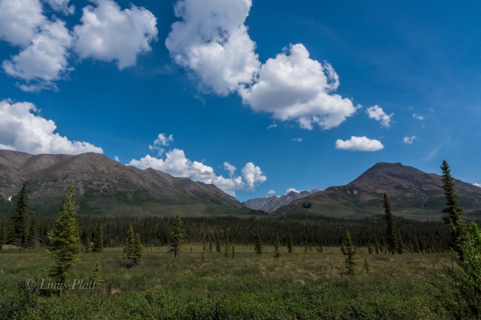
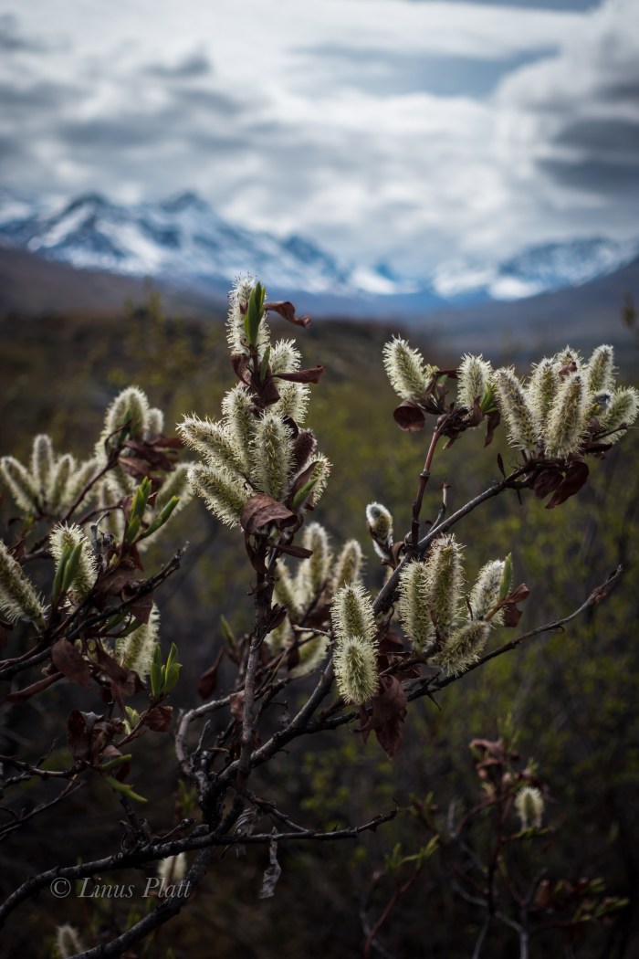
As one drives north over and beyond Chilkat Pass, a broad and beautiful alpine valley is entered; the beginnings of the White and Black Spruce, Aspen, and high Tundra dominate the landscape here. Once past Kelsall Lake, the road climbs up and over an ancient moraine and drops to an expansive river filled valley; the birthplace of the fantastic Tatshenshini River at Goat Creek and the terminus of the short but spectacular Parton River. Fitness training and gear testing for an upcoming alpine adventure sees me driving up near the Yukon border for a solo ski into the Parton River region. I wish to scout the take out of the Parton River area for a future summer packrafting trip trip and get a layout of the landscape.
For me, the primary reason as an American to live in Haines is the access to the great and mighty Yukon Territory; a land full of wilderness, mountains, rivers, glaciers, and animals. Similar to the interior of Alaska, it too offers a lifetime of exploring, climbing, and packrafting that beckons me as often as I can muster.
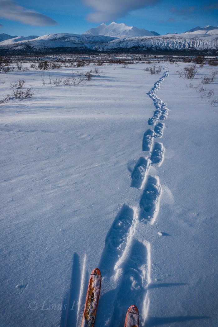
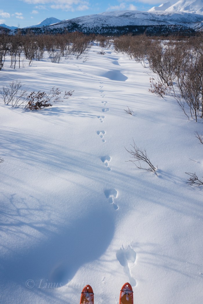
Parking the truck on the shoulder of the Haines Highway, a short one mile ski down a dirt road leads to the first of three put-ins for the Tatshenshini known as Bear Camp. Here, the Tat is frozen and I ski across happily and pick up the faint and snow covered old mining road beyond; shortly after, I come to the frozen Parton River and once again ski across and beyond into the fields of stunted arctic Willow and deep snow. Someone else has been in the area recently, and at first I begin to follow a relatively fresh set of snowshoe tracks, but soon veer off course to find my own way.I spot Arctic Hare tracks and soon spot Wolf, Lynx, andPtarmigan tracks… A couple of miles skiing in and out of the Willow thickets and up and over several creeks finds me entering the White Spruce of the Parton River corridor where it enters a canyon to the south and it’s headwaters lie.
A quick snack and a few clicks of the camera see me skiing back to the Parton River, this time further upstream to inspect the river herself. Always fun skiing down frozen rivers this time of year… easy skinning with no obstructions gives me the opporotunity to inspect the area for log jams, debris, and other future packrafting concerns.
With the sun getting low, I head back down stream, cross the Tatshenshini, and skin back to the truck just in time to see the beginning evening Alpenglow.
Till next time…
Someone’s been this way…Arctic Hare…The Parton River…White Spruce Landscape…
After an icy morning dunk in the Yukon River to scrub both body and clothing, I head to the RV park in Dawson to use one of their clothes dryers and then blast through town to pick up a cup of coffee and some supplies. The dirt streets of town are quiet and pleasant, with only the sound of the Yukon ferry doing it’s early morning chores on the swelling river. After my clothes have dried, I board the truck onto said boat and in moments I am easing the Toyota up the big climb out of the Yukon River drainage and up to the high forested spines of the Ridge Road, Also known more commonly as the Top of the World Highway. I remember this grueling 8 mile climb mounted to the inexhaustible Ogre back in 2013. I found the TOTW road to be an epic ride; one massive hill climb after another, up and down, rarely flat, always challenging, and doing so for 120 miles before the final assault at the border consisting of a 12 degree climb to it’s apex, before a descent to the border crossing itself, after of which there is a long descent into the Forty Mile River region of eastern Alaska. This area has the small and interesting communities of both Chicken and Eagle, Alaska, and is an area of heavy mining activity, vast plateaus of forested wilderness, wild rivers, and the Forty Mile Caribou herd. Once past the river region beyond Chicken, the road flattens for a bit through vast and swampy Taiga valleys, followed by more endless up and down hill climbing. Eventually, one comes to see a lone peak in the distance; it is a high point in this part of Alaska called Mt Fairplay which the Taylor Highway (The TOTW Highway becomes known as the Taylor Highway once entering Alaska) skirts on it’s northerly shoulder. It is at this magnificent high point that one is treated (assuming a clear day) to glorious views of the entire Alaska Range from Mt’s Hayes and Deborah, past Denali, and all the way to the start of the Wrangell-St Elias. It is a grand view of beginnings of the greatest chain of mountains on the continent. Soon one descends slightly to the remainder of the hill climbs that signal final descent into the Tetlin Valley and the Tanana River. Once to the Tanana, the community of Tok is not far off.
I chill out in Tok for a couple of hours simply trying to get a grasp at my next move and keep my mind calm. Looking over my maps, it occurs to me that the Nabesna Road is not far away… perhaps 70 miles down the Tok Cut-Off, which I had neither ridden or driven before. So to me at this time a moment of excitement hits me as I am now prepared to explore one of the many, many areas of Alaska that I had never been. That always gets me in a good mood, and soon I am spinning down the Tok Cut-Off, a beautiful highway that essentially splits the Alaska Range from the Wrangell Mountains to the south. It follows beautiful river drainages and sports mature boreal forest galore. Tall alpine peaks adorn both sides of the path, and a dull sight is never at hand. It is getting late and I pull down a dirt road along the Little Tok River to find a wonderful camp next to a deep blue pool in the river, where Grayling are surfacing everywhere. After setting up my camp, I grab the fishing rod and commence to catching my supper. I build a fire and wrap the Grayling in tin foil with some onions and butter, whip up some tea, and proceed to shoot a time lapse of the deepening hues of the midnight sky. Sleep comes around and I dream once again of being in high peaks surrounded by wilderness and animals in the most glorious vast areas of this amazing continent.
I seem to only sleep maybe 5 hours a night this time of year, at least for a week or so at a time, when it catches up to me and I then sleep for ten hours or more for a day or two. This morning was another early one for me, and I have the truck packed up and rolling down the Cut-Off by about 5 am. Stopping at a roadside lake, a walk to the shore reveals Swans, Geese, Moose, and literally thousands of fish swimming and visible from shore. I see what appears to be spawning colors; I grab the rod from the truck, not because I wish to eat, but because I must know what these fish are. After a couple of casts, I pull in a Grayling, and release it. Another cast, another Grayling. Finally, two more casts produce yet another Grayling. I inspect the beautiful fish; Grayling are by far the most common fish in the Alaskan interior and are easily identifiable due to the very long and undeniably prominent dorsal fin; No other freshwater fish has a dorsal like this. This is fine and good, but is still have not found the information I seek. I peer into the water hard to inspect and can only assume that these are a small variety of spawning Sockeye, or Red Salmon. The nearby Slana River flows into the Salmon infested Copper River to the southwest, and forms sloughs that feed this lake. The Copper River is famous for it’s amazing runs of Sockeye, so I must then assume that this fish I see are such.
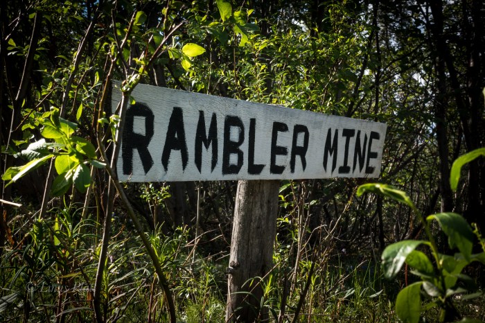
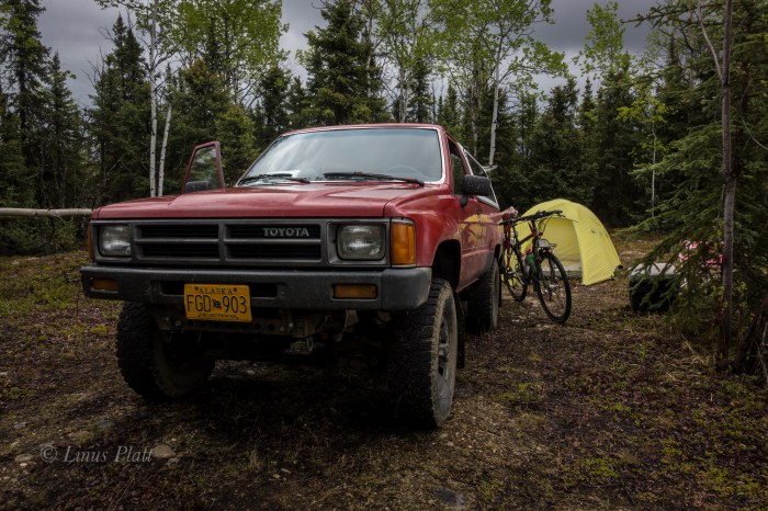
Soon I am pulling onto the Nabesna road and park the truck in a pullout and off the road a fair bit, as It will be here for a couple days at least. My plan is to ride the Ogre to the end of the road 42 miles out and into the Wrangell’s, camp out, inspect the abandoned Rambler Gold Mine, and then pedal back to the truck; maybe three days I think.
The Nabesna Road is one of only two roads that penetrate the Wrangell Mountains in Alaska, and is the northerly of the two. Angela and I and ridden the other one to the south a few short years ago all the way to McCarthy and hiked up the Root Glacier for several miles before pedaling back out to Chitina and on to Valdez. The Nabesna however, comes in from the north and travels Taiga forest and tundra with unbelievable views of the 16,237’ Mt Sanford, the second highest volcano in the United States behind the 16,421’ Mt Bona, and also 14,163’ Mt Wrangell and the beginnings of the high glaciated plateaus that lead to the enormous centerpiece of the Wrangell’s, the 16,391’ Mt Blackburn. These peaks are nothing short of Himalayan in size, rise nearly 14,000 feet from their bases, and feature massive glaciers and ice sheets. They also support large populations of Dall Sheep, Grizzly Bear, and Moose. Lynx, Wolverine, and Caribou also grace these ephemeral mountains. It is a true rugged mountain sub arctic environment and true deep wilderness in North America. It is also an area of amazing geologic wonder, being primarily volcanic, but segments are also of a fault block uplift, and the combination produces unequalled beauty in one of the most striking set of mountains one is likely to encounter. It is also very lightly traveled by Humans. It simply is not an area tourists go, regardless of the fact that the entire region is contained within the Wrangell-St Elis National Park, the largest national park in the United States, from exploring this mighty region. The combination is what drives me… remote and largely untraveled regions of Alaska that feature gifts of wilderness, solitude, and beauty.
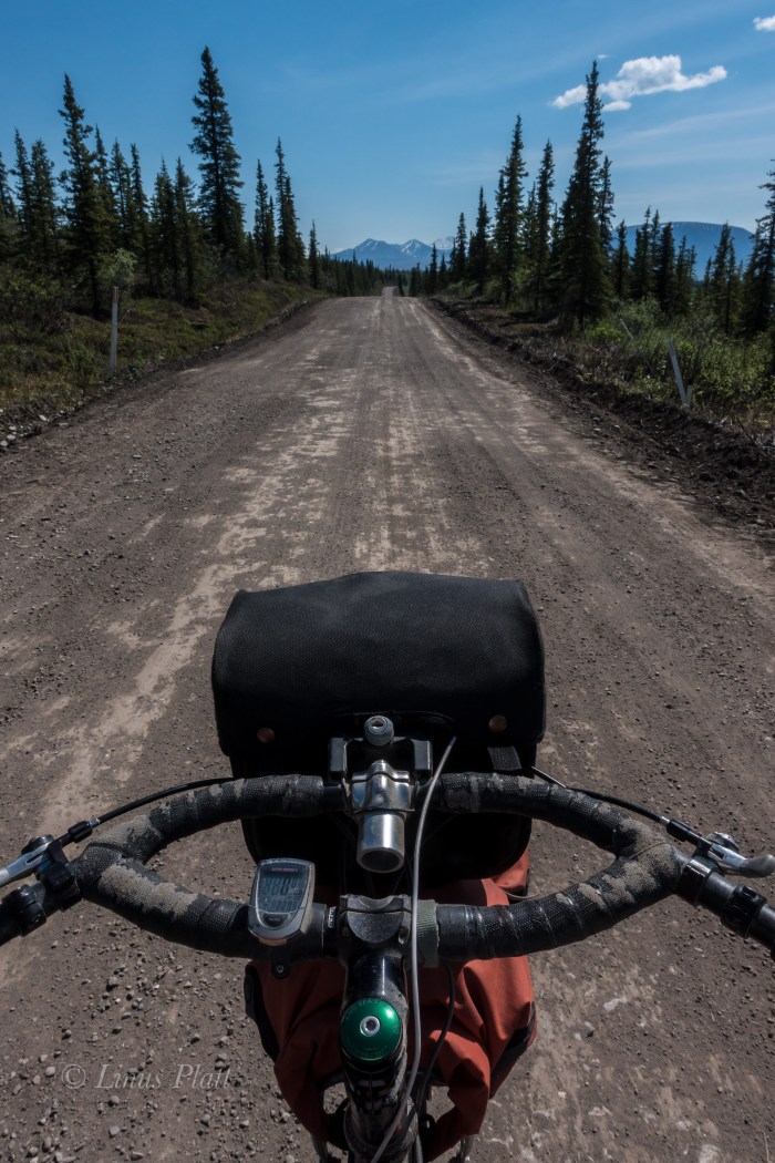
After casually getting my gear and bike together, the Ogre and I are rolling the Nabesna past the Slana River and onto the vast Taiga plateau that marks the beginning of the slight ascent into the high country. The beast beneath me bucks wildly for a bit till she tames down some and soon we are synchronized into a union of one pedal stroke after another. It has been quite some some since I had ridden the old girl fully loaded. It is extremely hot… 83 degrees in fact, and a hot, cloudless blue sky penetrates me and I feel sunburned already. Layer after layer of sunscreen, but sweating does me no favors. It is fairly dry in this area as well. In fact for the first 20 miles, there are no good streams for drinking from, so one must be prepared for this scenario. The first 15 or 16 miles of the Nabesna are either paved or chip seal, but soon after, the main dirt road section appears and the Ogre and I glide along it’s length silently.
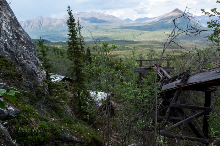
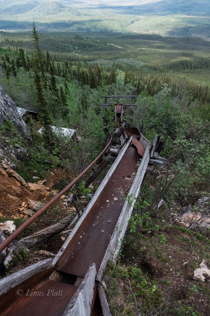
Between expanses of Taiga, long stretches of tussock tundra dominate the landscape, leading for as far as the eye can witness into forays of untold peaks, valleys and wilderness. Finally a clear crystalline creek appears, jutting from a deep cleft in the barren mountainside and tumbling feverishly to the road, where it meets up with moi and I drink copious amounts and fill all of my bottles. I tend to carry many bottles on bike trips as I consume huge amounts of water in an attempt to remain hydrated, and today is definitely no exception. I find the heat to be stifling and although the Nabesna, for the first 30 miles is relatively flat, I am sweating bullets and feel deeply overheated. At 29 mile, the Sportsman’s Paradise Lodge comes around and I drop in for a root beer. I walk inside and say hello to Doug, the owner if the lodge, and grab my icy drink from the cooler. As I sit at the bar, I pop out my debit card, as I have forgotten cash… Doug says “nope”, “We got no connection for that sort of thing out here, but don’t worry, I’ll cover ya… Just make sure to send me two dollars in the mail when you get a chance. Ain’t no one ever stiffed me yet” he says. The sweetness and chill of the root beer are unbelievably refreshing, and aside from Doug’s chain smoking cigs inside the lodge, we had a pleasant conversation regarding the local wildlife, weather conditions, and the current Sockeye run at the Copper River near Slana. After finishing my beverage, I reluctantly leave the coolness of the lodge and continue pedaling the remaining 13 miles to the end of the road, the last three or four of which included some steep hill climbing and descending. At the end of the Nabesna road is an old air strip, lodge, two bed and breakfast type places, and a couple cabins, all of which are closed up or abandoned. The place is deserted. From here, an old jeep trail leads a few miles back to the Nabesna Gold Mine and the Rambler Gold Mine. I am extremely exhausted and I find no where acceptable to camp; the dirt track becoming narrower and narrower, with no water and no where to pitch a tent. Large piles of Grizzly scat appear and I start singing to myself and decide that the Bear spray belongs in my hand and not in the pannier. Eventually I decide that I am far too tired to continue and I must turn back pedal the three miles to Skookum Creek for a decent camp. I figure if I do this, I might lose motivation to come back here in the morning, so I decide, regardless of my exhausted state, that I must hike the 500 vertical feet and 3/4 mile up to the Rambler mine. I park the steed and begin the uphill stomp. I am so tired I can barely pull it off, but as I near the mine a second wind takes me and soon I am ambling about the old buildings, sluice boxes, ore cart rails, mine shafts, and mining debris from another and forgotten era in Alaskan History. The Rambler mine was active, and abandoned in the 40’s, and now sits as an untouched monument to a short lived gold rush memory that created the settlement of Nabesna. The views from the mine are nothing short of spectacular; the Nabesna River clearly visible, it’s source, the Nabesna Glacier just out of view, but the endless deep wilderness of the region unfolds dramatically as far my eyes can take me.
I pedal in a dilapidated state all the way back to the best camp on the whole road at Jack Creek, which unfortunately means I must pedal all of the hill climbs again today to reach it. I manage to do it and once to Jack Creek, I strip down to my birthday suit and fire myself into the drink. The water is ice cold and the shock hits me hard, but my body is refreshed and clean and I meander off to get my camp set. Sleep comes easily and I am awake at 4 am… pedaling back to the truck by 5, and at the truck by 11. The entire journey including hiking to the mine took only 23 hours, however it should be noted that there are more mines and many more trails to discover and explore in the area and a trip of several days would not be considered lengthy. As noted previously, like a Shark, I am on the move.
Later on, after de-rigging my vessel and loading up, I drive through Glenallen, where hoards of tourists and dip netters clog the town and highway. I am all too happy to leave it behind and mosey on up the Richardson Highway bound for my absolute favorite place in all Alaska: The Central and Eastern Alaska Range.
Zen Cairns At The Top Of The WorldOld Mining Equipment On The TundraTop Of The World Abandoned TankerFor The Home TeamThe Little Tok RiverLake Of A Zillion FishMt Sanford 16,237″The Nabesna RoadWrangell High Country Taiga and TundraOne Of Several Stream CrossingsThe OgreThe Rambler MineRambler Mine Ore CartMine ShaftThe Nabesna Valley As Viewed From The Rambler MineMine StructuresSkookum CreekThe Skookum Volcano
Getting on the road by 10:00 am or so following town chores and paying bills, I am happily cruising up the Haines highway and northbound for the Yukon and beyond. I approach the Eagle Preserve at 20 mile and the engine alternator idiot light comes on… funny, never saw that before on this truck. I pull off the road and pop the hood for an inspection. Using a volt meter, I check voltages of the battery with both with the engine running and not running. A nominal voltage of 12.4 with the engine running indicates that the alternator is not doing it’s job. In fact, it has shit the bed… Reluctantly, I turn around and baby the 30 year old Toyota back to town to re-group. Pulling into the parts store, I am amazed that they have one in stock. 142 bucks and two hours later, I have the alternator installed and the last bolt tightened and I am on the pavement rolling north once again.
At the Canadian the border, there is a length of vehicles waiting I have never seen here before. After an hour wait, I am flagged in and questioned. I am asked to exit the vehicle and wait inside while my car is searched, which the Canadian border cops do with abandon. Again, I have never experienced this before. Another hour and I am free to go after they come to terms with the fact that I have nothing to hide. Two hours to get into Canada. I am beyond happy to have the Chilkat Valley behind me. Driving over the Haines Summit and into the high country sees me smiling and as the Yukon border comes ’round. I am washed over by an array of mixed feelings; most of me is extremely happy to be on the road and rolling away from Haines, but part of me dreads the inevitable slash of loneliness that will undoubtedly come in short order. In fact, as I near the Tahkini River, the dreaded sensation enters me, invades my space and riddles my ravaged heart with bullet holes. I shuffle this back to a place of inner strength that is there for survival reserves and continue. Â I get to the Tahkini and make a fine camp there; it was a familiar camp as I had spent time there on past trips. The evening colors around 1 am filter the sky orange and pink and patches and fills my heart and soul with much needed color and softens the dramatic episodes within me. I sleep.
I awake to the warmth of sunshine and something splashing in the river. I pack up and pull out onto the Alaska Highway again heading towards Whitehorse. These feelings I cannot seem to shake and I hope that once past Carmacks or Dawson, they will fade. In Whitehorse waiting for the Fireweed Bookstore to open, I am accosted by a pair of drunks jabbering nonsense at me. Soon, my maps and food are purchased and I am driving the wide open spaces of the North Klondike Highway bound for Carmacks. A torrential rain storm ensues. The roadway becoming a slab of dangerous water; I slow down but other traffic does not. I won’t be bullied by these vehicles and I pull off when I can, but it is up to them to pass if they wish to drive at unsafe speeds. Camping that night in the Taiga forests among Aspen and Willow, tiny yellow birds flutter my camp and a Red Squirrel chirps in the forest nearby. These trips, when I am by myself, which is 95 percent of the time, tend to promote moving along, bound for a destination and goal. It is sometimes difficult to just set back, especially these past weeks, as the creeping dreaded sensations that have filled me lately prevail when I have come to a stop. So I simply keep moving. Regret is futile, and yearning for an undeniably uncertain future is equally so. I have no past, and working toward the future like some kind of mystic jewel seems pointless; I simply am. My heart and desire are too big for this world and most cannot deal with my intensity and passion… the heart is the only guiding force. Chalk it all up to a lifetime of amazing experiences. I am the wind…
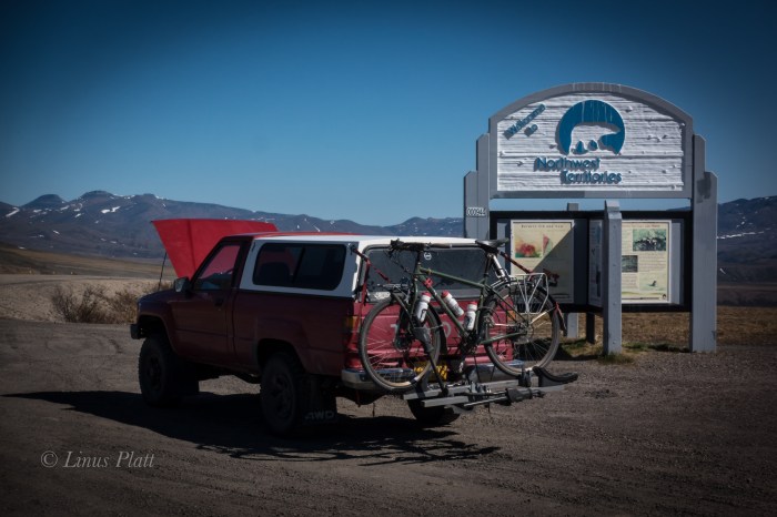
The morning sees me drifting closer to Dawson City; nearing the Klondike river at the entrance to the mind bogglingly beautiful Dempster Highway, I spot a pair of bright blond Grizzlies grazing the grass on the side of the highway. So beautiful these magnificent creatures; I often wonder what attracts them to the highway like this… is there something that grows only near the road that they find edible and tasty? I pass the Dempster and head to Dawson for fuel and a snoop around and maybe a nice espresso drink. It had been 4 years since I had been to Dawson, and not much had changed. That is a good thing. Dawson is a gem in the far north to me; it is a place of historical significance, color and interest. I get an Americano at the lovely Alchemy Cafe and soon I am back down the highway the 25 miles to the start of the Dempster. My plan is to hike into Grizzly Lake in the Tombstone Mountains and spend the night there, taking photographs and shooting video. But when I get to the trailhead, there is a notice that the trail is closed. This is the second time that this happened… I was here in 2013 to not only hike to Grizzly Lake, but to also ride the Ogre all the way to Inuvik in the Northwest Territories. Neither happened on that trip. After pedaling for three days, the road was washed out north of the Ogilvie River, and I was forced by the road crews to turn back. The Grizzly Lake Trail was closed due to high Bear activity in the area at that time; this time it was closed due to heavy snow still on the ground. So in 2013, I stashed my backpack under a rotting Spruce log and continued my bike trip up to Deadhorse and beyond. But today I was in my truck, bound for who knew where. I walk into the forest and immediately locate the pack I had stashed 4 years prior, and skedattled up the gravel Dempster to my favorite section. It is a place where the second of three continental divide crossing occur on the Dempster. A place north of the Blackstone River in the Taiga Range; birth home to Engineer Creek, Mountain Goats, Grizzly Bears, and Caribou. I am looking for a peak to climb in the area, and a ridge leaving the pass right from the road directly on the continental divide leads to an un-named summit of perhaps 6,000-7,000 feet. I decide on it, but first I wish to continue north and do it on the way back. A couple miles down the road is a beautiful alpine canyon situated directly at tree line with the headwaters of Engineer Creek flowing through it’s guts. I find a wonderful camp and set down upon it happily. Glassing the slopes nearby, I spot a heard of a dozen strong Mountain Goats, including several babies who seem to be happy to be jumping around and playing wildly amidst the high and treacherous slopes they are perched. This area north of the Blackstone in the continental divide country is by far my favorite part of the Dempster experience. Late that night, perhaps around 1 am, I awake with a yearning to leave the tent and go on a “night” stomp. I exit the tent and walk across the road and disappear into the muskeg and Taiga. Tussock tundra appears and I run as fast as I can towards a barren hillside, where Willow Ptarmigan scatter. Being spontaneous is what sometimes drives me, for better or worse. It is simply fun, and nothing beats the sensation of just making a snap decision and going for it. I look out over the alpine valley I am in and it occurs to me that every Human on this planet is going through some form of struggle largely unknown to the rest of us. I am not alone…
With my cup of Green Tea in the morning, I make a toast to the South, East, West, and of course, the North in thanks and offering of gratitude. I drive north again, this time paralleling the Ogilvie River at at point further that I got on my bicycle in 2013. A Grizzly slowly walk across the road in front of me a couple hundred meters off and disappears into the Taiga, and more Ptarmigan flutter about at road’s edge.
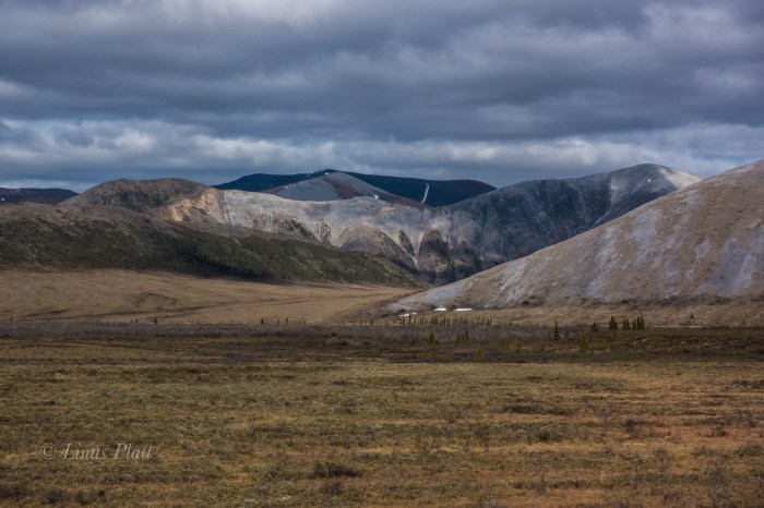
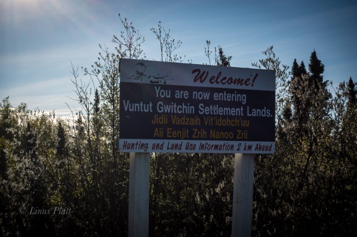
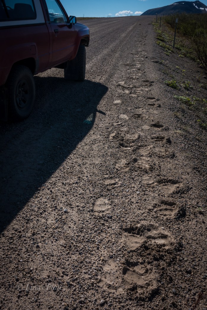
Many miles after leaving the high country, the road drops into river valley’s and enters First Nation native hunting lands. The Dempster at this point climbs to a high point on Ogilvie Ridge, where unobstructed views of the Ogilvie and far, far off, the Peel River, heading to the great und vast McKenzie River flowing to the Arctic Ocean. The road continues along this high Taiga bench for many, many miles. It is dry up here. And exposed. And monotonous… till finally Eagle Plains comes around where I gas up the Toyota and continue on. Soon the Arctic Circle appears and beyond are the rounded tundra summits of the Richardson Mountains, which, in essence are an extension of the British Mountains in the Yukon which are an extension of the Brooks Range in Alaska. The Richardson’s are unique in three ways; They are the final continental divide crossing on the Dempster, dumping all water from them on the northeastern side into the Arctic Ocean, they form the border of the Yukon and Northwest Territories, and they are the last formidable geologic uplift barrier between the interior and the arctic plains of the Canadian “north slope”. Beyond which lie the extremely remote communities of Inuvik and Tuktoyaktuk. The road travels directly north along the western escarpment of the Richardson’s for many miles, traversing some of the most incredible Arctic scenery I have ever seen; in fact it equals the Brooks Range in beauty and remoteness. Although it is not nearly as big as the Brooks, it is even more remote really. Soon the road turn east and climbs over Wright pass at the final continental divide and crosses into the Northwest Territories. This place is absolute magic. It is quite chilly here, this far north at the continental divide. The last time I was in a similar place was in 2013 on the summit of Atigun Pass in the Brooks Range on The solstice at midnight. It was cold then too… The road continues through the Richardson Mountains, revealing tundra, high peaks, wild flowers, and wild rivers. After descending the last great decline out of these magnificent mountains, the Canadian Arctic slope appears in the distance, extending for hundreds of miles to the McKenzie Delta. I pull off the road, some 30 kilometers into the Northwest Territories and notice the immense trail of numerous Grizzly prints decorating each side of the road. At night these massive creatures must use this road as a path. There are more Grizzly prints here than I have ever seen anywhere in my life.
Finally, after saying farewell to the NWT’s and wishing to continue on to the Arctic slope, but becoming increasingly paranoid about the 30 year old Toyota Truck’s engine with a quarter million miles on it, I turn back and drive back to from which I came. Passing once again the Arctic Circle and gassing up in Eagle Plains again, a few hours later I am back in my favorite and stunning alpine valley north of the Blackstone River. I am exhausted and plan on a peak climb in the morning. In the tent, I sleep like a dead man.
After crossing a short bit of tundra in the morning, I begin climbing up the class 1-2 talus of the ridge line to where it nearly flattens out but continues in a westerly stretch for about a half mile before the final summit pyramid rises abruptly and ends. After 4 hours from the truck, I stand on the unknown summit and marvel at the other peaks around me and the strange and unknown alpine valley’s that separate them. I decide to descend a different route in order to walk out one of these valleys following a creek where I hope to see signs of animals. The decent was treacherous; some of the loosest scree and talus I have ever encountered kept my attention level extremely high and after considerable time and effort, I find myself at the head of this glorious alpine valley, flowing within it the beautiful little creek mentioned. On the way down valley, I see no animal prints of any kind, but spot a pair of caribou antlers lying in the tussock. The are from a small and possibly younger animal, with part of the skull still attached; taken down by wolves I imagine. After a bit I am back at the truck and I blast off again, this time bound south for Dawson, where contrary to my intentions to keep this an alcohol free trip, I decide to duck into a tavern and have a beer. I order my beer and when I go to pay for the beverage in U.S. dollars, the First Nation’s woman in the chair next to me starts ridiculing me for being an American. She proceeds to stick her finger in her mouth indicating forced vomiting, therefore expressing her displeasure. I tell her, “I’m not American, I’m Alaskan”; she was not pleased and continued the harassment. After a bit, I told her she didn’t know me and that she was a no good judgmental SOB (as it were). I left my lone beer sitting there on the bar and left. All I wish for is friendship, love, and understanding – hard resources to find on this here planet. Later, at a makeshift camp, the cops show up to kick me out, but tell me where I might go for a low profile and free bivy.
That night, I toss and turn and sleep eludes me nearly completely. Tomorrow I will ferry across the Yukon River and drive the Top of the World road (AKA the Ridge Road) and into the deep interior of Alaska. I had ridden this road on my bicycle a few years ago and found it to be one of the toughest rides in the north. I’m happy that the old ‘Yota and me will be traversing this together this time.
Tahkini River… Yukon TerritoryKlondike Woods Camp
Tombstone Mountains, Yukon
Blackstone River Ice Pack
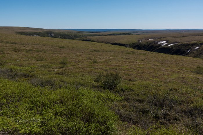
The Blackstone uplands and the start of the Taiga Ranges
The Dempster Highway
The View From Ogilvie RidgeEagle Plains
The Beginning of Canada’s Arctic North SlopeGrizzly Tracks, Richardson Mountains, Northwest Territories
I am the Salmon… Forever swimming upstream towards the source. Swimming great and swift currents to achieve the impossible; battling great and unforeseen obstacles that bar the way to my own destiny.
I am the Bear, on top, and managing a foothold in said place, but struggling none the less. I am a protector of my family and my territory, forever destined to do so.
I am the Fox, cunning and sly to achieve what is mine for the taking. I only wish for harmony.
I am the Wolf, taken into a sense of community that entrusts a commitment of not only survival, but one of love and companionship.
I am the Willow, blowing in the glacial winds that give to me a sense of animation; my roots digging deep within the soil to accomplish what so many of us desire.
I am the writer, constantly in a state of desire to express myself, for better or worse. Words are what live inside of me and I must share them, regardless.
But most of all, I ama Man, one who wishes only for love, compassion, and connection… for those around me and for the wilderness that encompasses my landscape. I am full of desire and hope, my shortcomings entangled in self doubt, but knowing that I have passion and offerings that all of us have. I wish for sincerity amongst us all, so that we all may flourish. For what is a Man that does not possess these?
As it has always been and always will be, my mind is in a constant state of desire for wilderness and exploration, both externally and from within. These forays and trips into wild places has always been what has driven me.
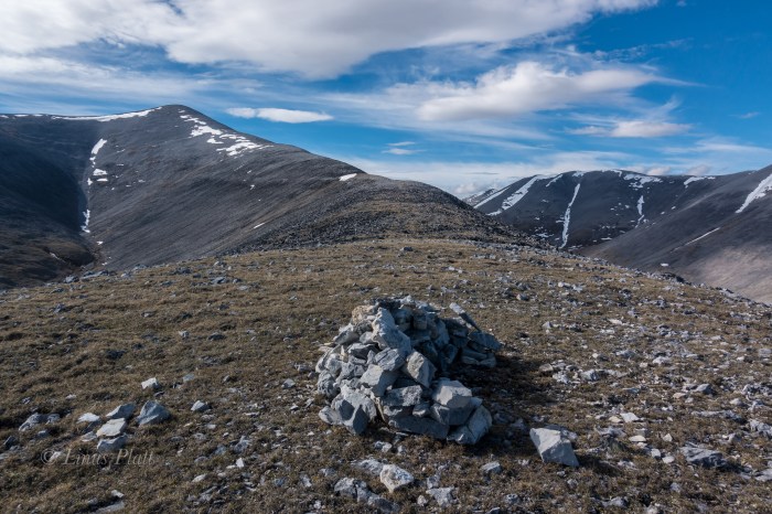
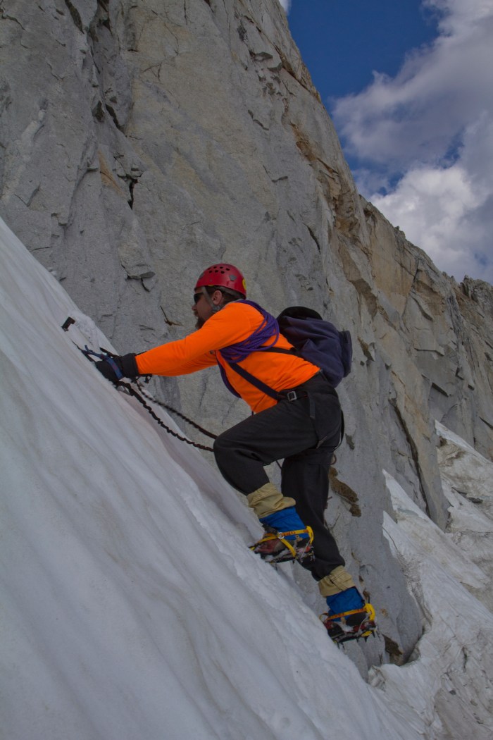
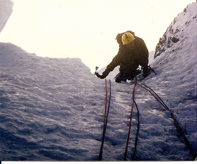
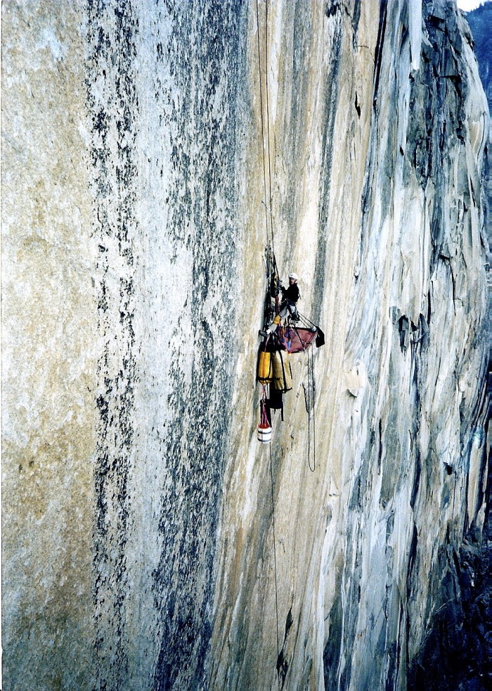
Included here are photographs from past adventures, not to behold them for their keepsake, but to remind me, and us all, that the flame still burns and cannot be extinguished. So many ideas, so many thoughts… the Brooks Range, the Alaska Range, the deep interiors of the Yukon and the Northwest Territories, the home front of the mighty Chilkat and the ephemeral outer “lost” coast of Alaska’s vast and wild Pacific. I persevere to such notions and they dominate my thoughts and desires…
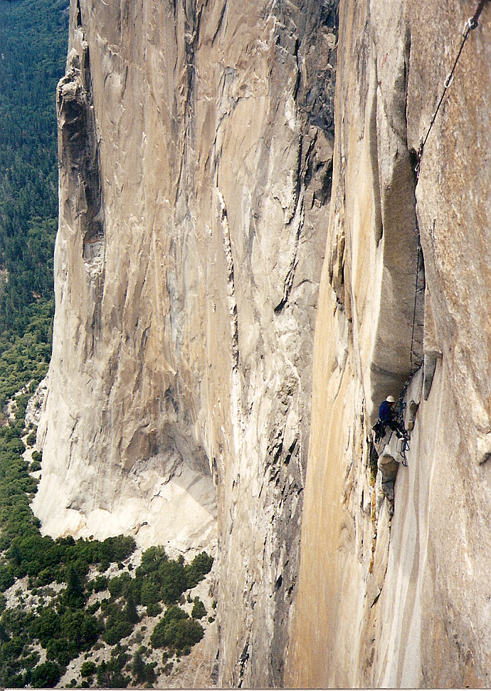
The end of the Haul Road Alaska 2013Dennis Belillo on the North Coulior of North Peak, Yosemite 2012Freeride Explorations near Moab 2008The Promised Land, Half Dome Yosemite 1998Ropeless in Moab 1992South Seas, El Capitan 1997Vedauwooo Wyoimg 2000North Face of Mt Athabasca, Alberta 1986Iron Hawk with Ralph Ferrara, El Capitan 1999Angela Carter on the Root Glacier, McCarthy Alaska 2013Angela Carter Riding Out a WheelieDempster Highway Yukon 2013Angela going big in Keystone Colorado 2008Wet Denim Daydream with Allan King 1999Indian Creek Utah 1995Iron Hawk, El Cap 1999
Lyzz Byrnes taping up for another Vedawouoo grind fest, 1999
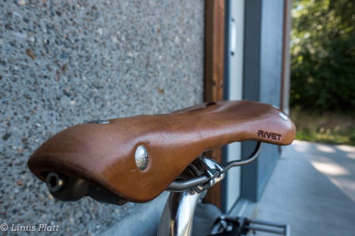
The bicycle know to me as the Surley Ogre has been on hiatus for some time now…over two years in fact. Like a horse put out to pasture, she has endured this lengthy time situated in the garage amongst the miter saw, planer, router, and other tools of construction. Not fitting in with these apparatus, she squeals and begs for a letting of road miles. In anticipation of an upcoming trip upon her to the mighty Yukon and beyond, I strip the old gal down to her bones and a cleansing and rebuilding ensues.
It has been far too long since the Ogre and I have embarked upon the open road together, and in a quick fit, I work out a stretch of time off from work and make preparations for us to engage the Alaska Golden Triangle; Riding from my house in Haines to Haines Junction to Whitehorse to Skagway. A 360 mile loop through the northern panhandle and into B.C. and the Yukon, ending back in the good ‘ol AK in Skagway, where a quick ferry ride home ends the adventure. With plans to leave on the 29th of July, and returning on the 13th of August, I must say that these bicycle trip are certainly not about the bike. Or even riding them. These excursions are about being there. Or more precisely, being out there and taking in the tundra, mountains, rivers, and wildlife. If I was in shape and looking to make some quick time, I would theoretically make the journey in six or seven days. I think not. I intend on going slowly and enjoying the vast and wonderful summer in the North. Summertime in the regions of Alaska, Northern B.C., and the Yukon are stuff of fantasy to me. It is a time of exploding life and glorious exploration. There is nothing better on Earth than summer in the North.
Having a couple of weeks lead time to the trip in question, I head out to test the newly constructed Ogre for a quick 20 mile excursion up the wonderful Haines Highway, and as luck would have it, a spectacular day of temps in the 70’s, glorious sunshine, and the glaciers of the Chilkat’s shining brightly.
The old girl, spaced out from many months at pasture, bucks wildly when I attempt to pedal forward. After a rough patch, we hit our stride and suddenly it’s just like old times.
As out of shape as I am, I am looking forward to that big nasty climb up Chilkat Pass and into the Yukon I love so much. Two weeks and counting…
Stay posted friends!
The omnipotent Surley OgreThe Rivet PearlThe Ogre rests by the mighty Chilkat RiverChilkat Cathedrals and Ogre
Let’s see now: I moved to Haines on November 3rd 2013 and it is now June 8th 2016. Now mind you, other than going to Juneau twice to see quack doctors about my broken ankle (I am not a fan of going to Juneau), and once heading up to Haines Junction in the Yukon with my Mom and Angela for a day trip, I have not really left Haines since that chilly day rolling down from Fairbanks in November more than 31 months back.
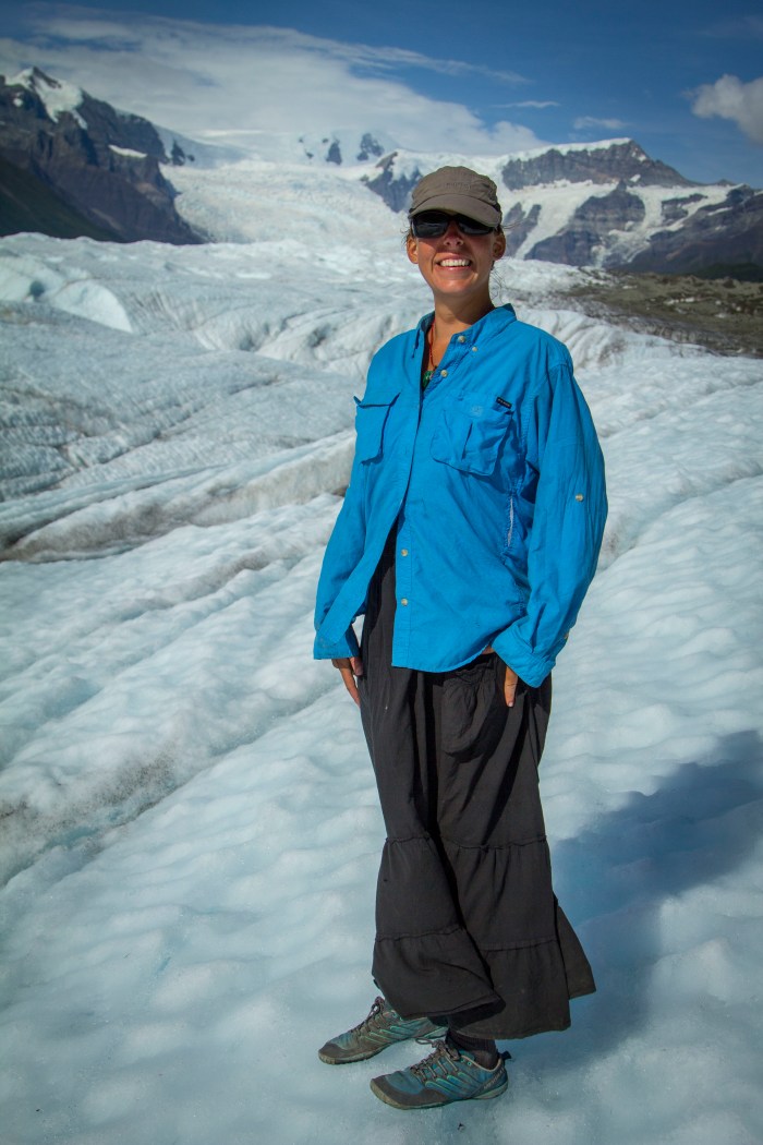
Seems my attitude has been at an all time low and a need for adventure has been halted due to my buying a house that I really cannot afford. Seems I have no time or money to enjoy the very reason I live here in Alaska. Things have been difficult for me at work as a result and finally, something had to give. Summer has finally arrived in Alaska, with temperatures in the 60’s and 70’s and daylight exceeding 22 hours now, I decide to break free for a weekend and head up to the Haines Summit area of British Columbia for a couple days of exploring and such. “The Pass” as it is locally known, is the dividing factor in separating the temperate maritime environment of the Chilkat Valley and Peninsula from the rugged alpine interior of B.C. and the Yukon. The Canadian border being 40 miles from Haines leads to the climb up Three Guardsmen Pass, and finally the higher Haines Summit being another 10 miles beyond. One Enters B.C., climbs the pass, then another 25 or 30 miles brings one to the mighty Yukon. The area around the pass is an area of high peaks, alpine tundra, glaciers, rivers, Ptarmigan, Marmot, Wolf, and Grizzly Bear. It is my kinda place to say the least.
After a quick visit with my buddy Gene on his sailboat in the Haines Harbor, I fire up the truck and head north. After a quick stop at Canadian Customs where I am grilled by the always grouchy Canadian Border Patrol, I am soon spinning the vehicle up the majestic landscape higher and higher to the land of rock and ice.
That evening I camp near the outlet of Kelsall Lake along side the mysterious Kelsall River. The mosquitos are thick, but the calls of the Loon and of the distant Coyote’s lull me to sleep. At 4am I pack up and continue north, into the Yukon just because I can. Being in the Yukon again is a fulfilling and sensational feeling once again. I really love the Yukon; there really is no place like it. It has a very distinct and isolated, yet remarkable feeling about it. It’s being up in the interior again that is putting wind in my sails…
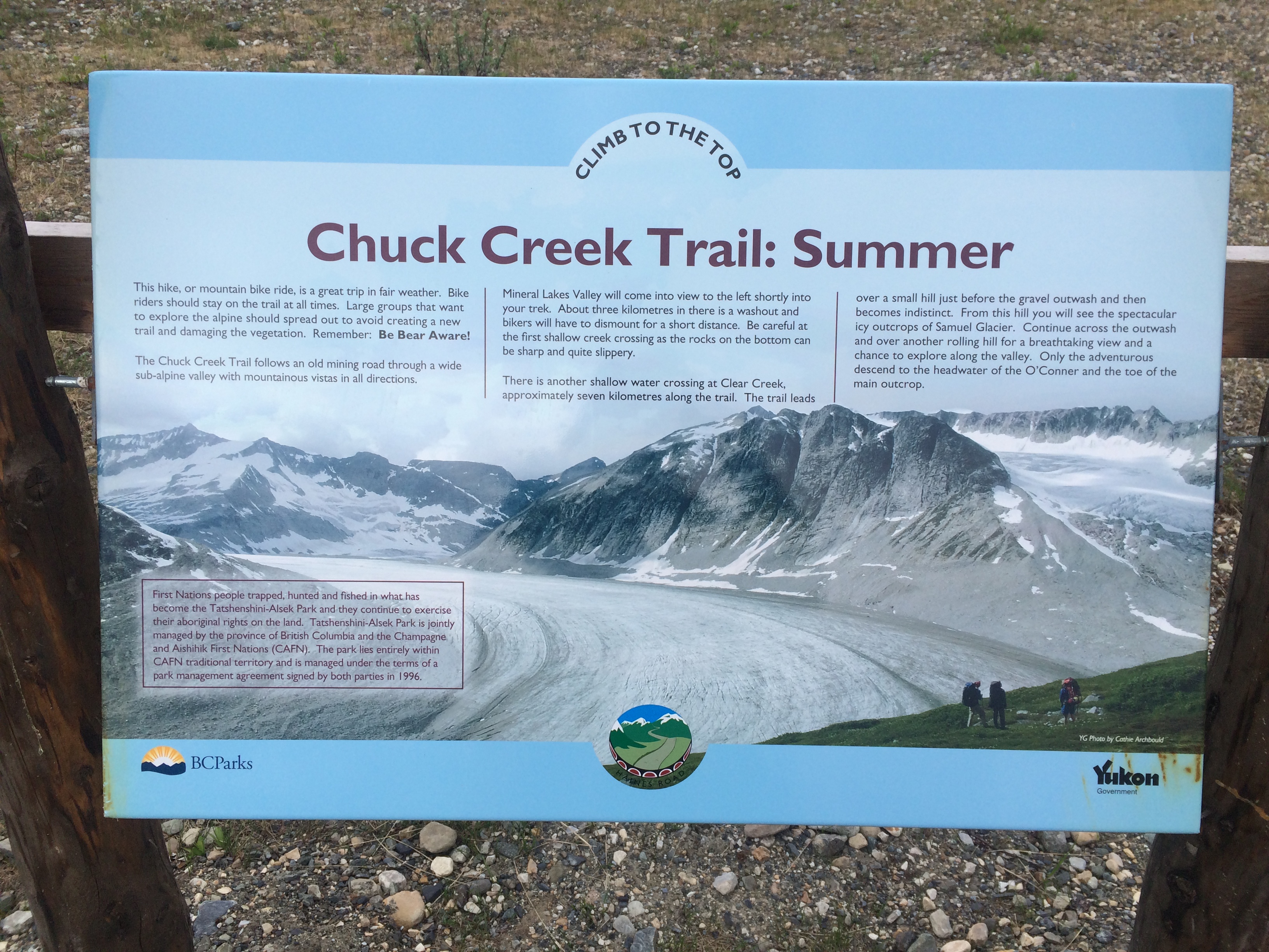
After a bit, I turn the truck around and head back south towards the trailhead for the Samuel Glacier, where and old mining road, after disappearing 4 or 5 kilometers in and turning into a true back country wilderness experience, leads to the wonderful Samuel Glacier, some 10 or 11 kilometers from the highway.
After finishing a breakfast of eggs and tortillas grilled over the trusty MSR, I pack up the backpack as light as I can to help make up for the fact that I will be carrying my Sony X70 video camera. I have currently my Canon DSLR listed on eBay, so decide not to bring it in fear of damaging it before a critical sale. The unfortunate reality of this particular photographic situation, is that my only photo option for this trip is the ever stupid iPhone! Man that camera sucks. But it’s what I’ve got for this adventure and after a brief packing session, I am on the trail.
The trail consists of an old mining road that is very easy to follow and is in exceptionally good condition. The trail wanders slightly uphill into a high alpine valley surrounded by streams, rivers and peaks. Groundhogs and Marmots seem to be everywhere; Ptarmigans scare up out of the low lying brushy tundra around every corner. The place is alive! I keep my eyes peeled for Grizzly Bears and Wolves, and soon I come to the first stream crossing that I must remove shoes for. The water is bitterly cold, but is refreshing to hot feet. After a couple more kilometers, the trail disappears under a vast snowfield hundreds of meters wide. I figure this is where my feet get wet permanently and dive in. Across the snowfield, the trail is no where in sight. I spy a river below and bushwhack to it’s shores, where another full blown crossing is in order. The trail re-appears briefly and I follow it till it once again dives beneath snow and tundra bogs. Gaining a high ridge, I spy a trail of in the distance, following the fast moving river I had just crossed. Had I gone the wrong way? It occurs to me at this point that I am here a bit too early in the year. July or August would be best I reckon. I trudge onward.
Soon, there is no sign of trail nor of human travel of any kind. It is just me and my running shoes, the snowfields and tundra tussocks, the mudbogs and river crossing, the Marmots and Ptarmigans. It is now genuine wilderness and I begin to feel at home. At every river crossing I come to, I simply charge right in, shoes and all and accept the fact that I now have wet feet. Traveling the valleys and ridges of pure trail-less tundra tussocks and mudbogs is fatiguing to say the least. I am nearing what I see is the end of my journey: The highland I am traveling suddenly stop up ahead another kilometer or so and what lies beyond can only be one thing: Glacier.
The tundra gives way to an alluvial plane of gravel and glacial deposits, with braid after braid of swift and dangerous stream crossings. At the edge of the plane, where it meets up with the endless tundra, lies a snowbank fitted with a long string of animal tracks. Getting closer, I see that the tracks in question are one of Wolf. A big one too. The tracks could be no more than an hour old as they appear fresh and crisp and un- molested by the exceedingly hot midday sun. I marvel at them and spin my head around in anticipation of seeing the animal, but I am alone. I cross the alluvial gravel bed and once agin climb onto the steepening tundra for a rather quick jaunt to it’s edge where the magnificent Samuel Glacier comes into view. I decide to drop down the other side of the tundra ridge and camp on a small hummocked shelf just a couple hundred meters above creaking ice. I am exhausted and once in the tent, I sleep a fitful sleep as the overhead sun is blazing hot in this barren and endless alpine tundra land.
A while later, I emerge from the tent, sun still high, and walk to nearby stream for water and photographs and some video shots. I see the Samuel Glacier and it adjoining glacial arm like tentacles from an icy giant protruding from the massive fault block pyramids of the Alsek Ranges that extend into the largest glacially active non-polar area of our planet, and home to the largest unspoiled wilderness on earth. I am fulfilled with great and massive appreciation for this place and I am happy to call it my home; Haines is a mere 80 miles away.
Back to the tent for supper and more sleep, I awake the following morning at 3:30 am to a gathering storm. I pack quickly and soon I am again bounding over tundra and listening to the rushes of the strangely human-like squawking of the Rock Ptarmigans. The first time I ever heard these creatures talking was in the Tombstone Mountains in the high Yukon back in 2013. The sounds they make are vaguely human and sound like a babbling insane person speaking nonsense. The first time I heard them was in the middle of the arctic “night”, and it disturbed me so much, I thought I was being stalked by a maniacal stranger hell bent on harming me. Then I peered from my nylon domicile and spotted the strange bird making these sounds, Since then, I have come to listen for their cries in anticipation.
Eventually, I come to where I have to make a choice and decide to follow the “trail” along the river back to the vast snowfield. I cross the river back and forth a dozen times or more and soon come to the snow and then the real trail beyond. I am back at the truck by 9 am and happily changing into dry socks and shoes.
A slow and pleasant drive south via the magnificent Haines Highway finds me back at home by mid morning, where a shower, hot cup of coffee, and a reflection of a successful weekend are in order.
Lush Alpine VegetationOne of Many Alpine Rivers to be CrossedLone Wolf TracksTundra Overlooking the Samuel GlacierSamuel Glacier and Alsek Ranges PanoramaAlpine Camp SpotSupper with a ViewA.K.A. the Samuel Glacier TrailThe Good Trail Across the TundraEasy TrailMy Mobile GhettoThe Kelsall RiverKelsall PanoramaAnother River CrossingAlsek Ranges and Tundra


You must be logged in to post a comment.