Andromeda

West Shoulder Direct
The West Shoulder Direct on Mt Andromeda

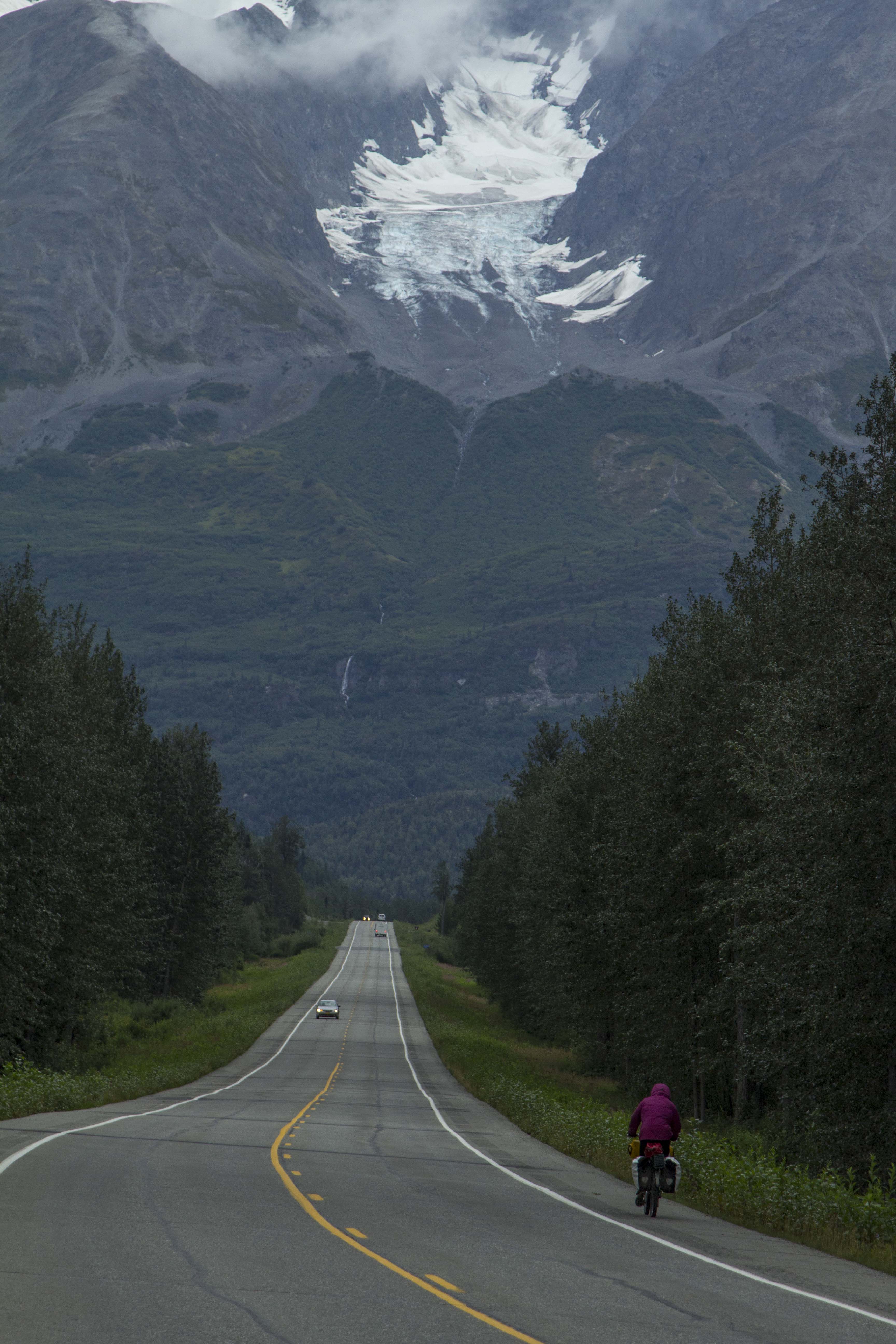
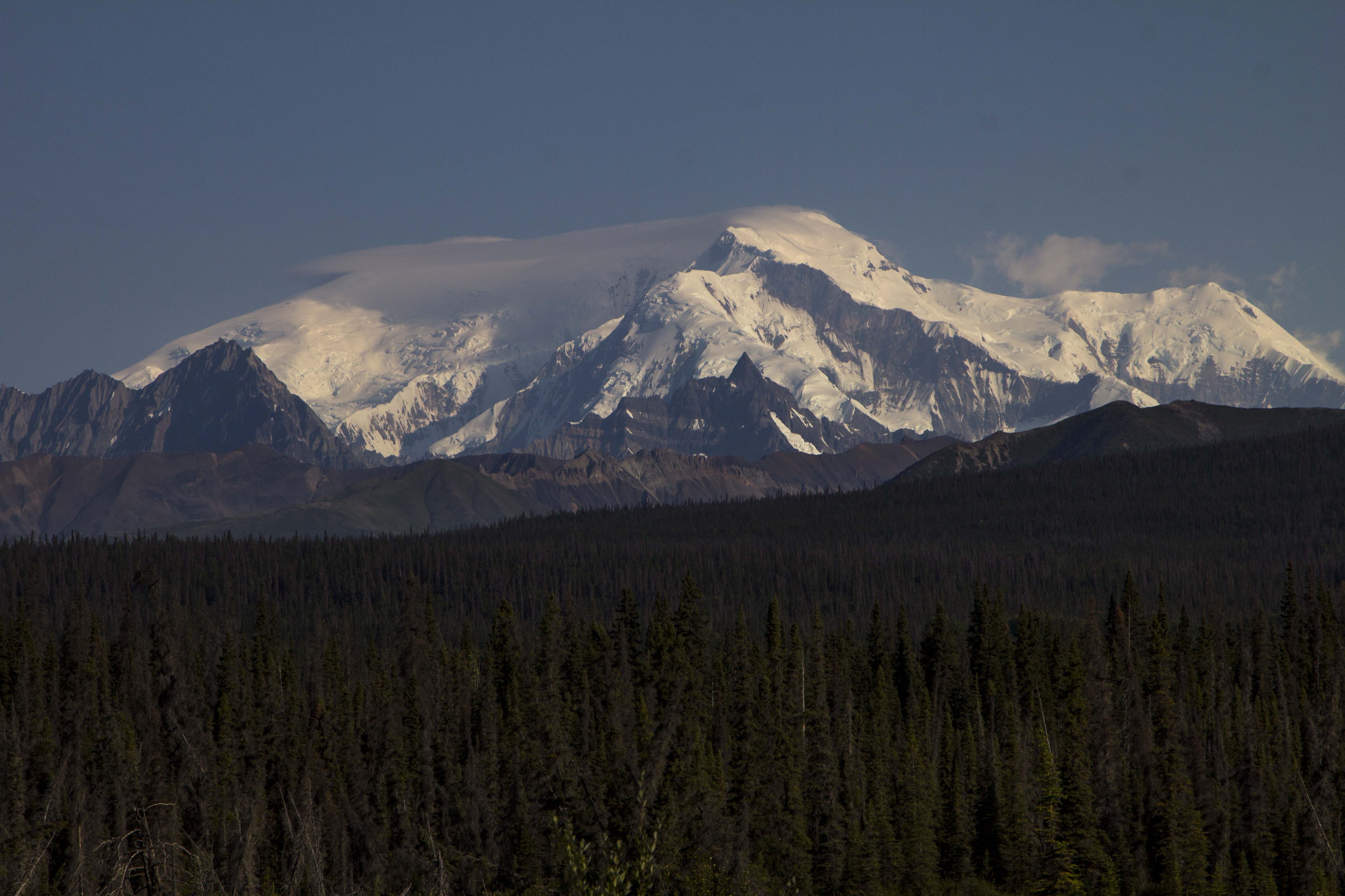
Nearly every summer, between 1985 and 1992, I would, with various friends, travel to Alberta, Canada to climb. These mountains, I believed, were the real  Rockies. The Canadian Rockies.  I had spent a fair amount of time stomping around what most American’s think of when they think Rockies, the Colorado Rockies, but to me, since these peaks did not have glaciers adorning them, they seemed fraudulent. I remember going to a slide show at the now defunct Alpine West climbing shop in Sacramento, and hearing the prolific Dave Nettles speak about the Canadian Rockies for the first time around 1984. Dave’s list of remarkable ascents during those years really fired me up and I looked up to him immensely. He spoke of the Rockies as if it was the Chamonix of North America; an easy two day drive from California, with world class alpine mountaineering almost always within a day’s hike from the road; in fact some of these routes were actually right next to the road. After my first trip there in ’85, I was hooked.

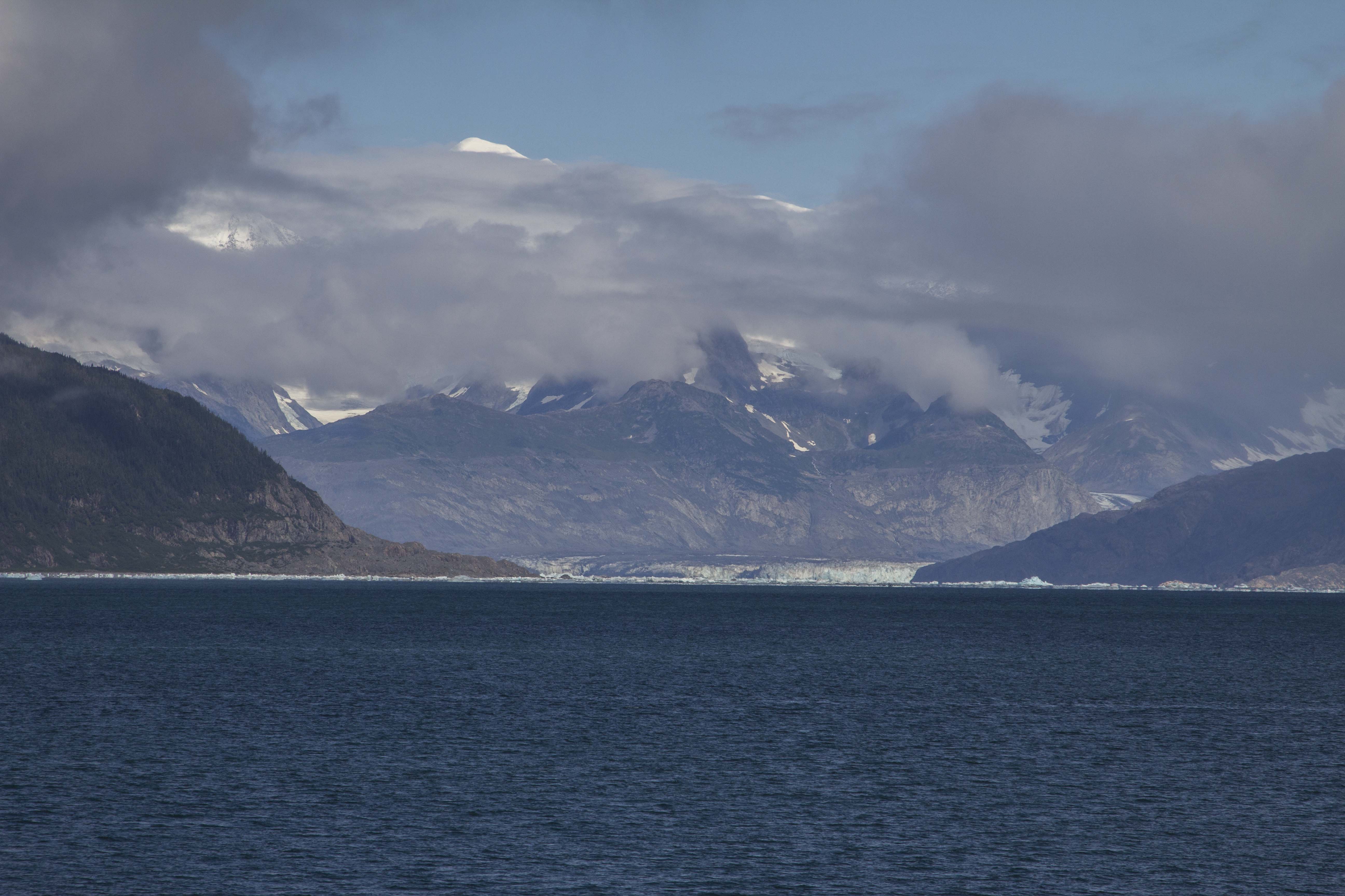
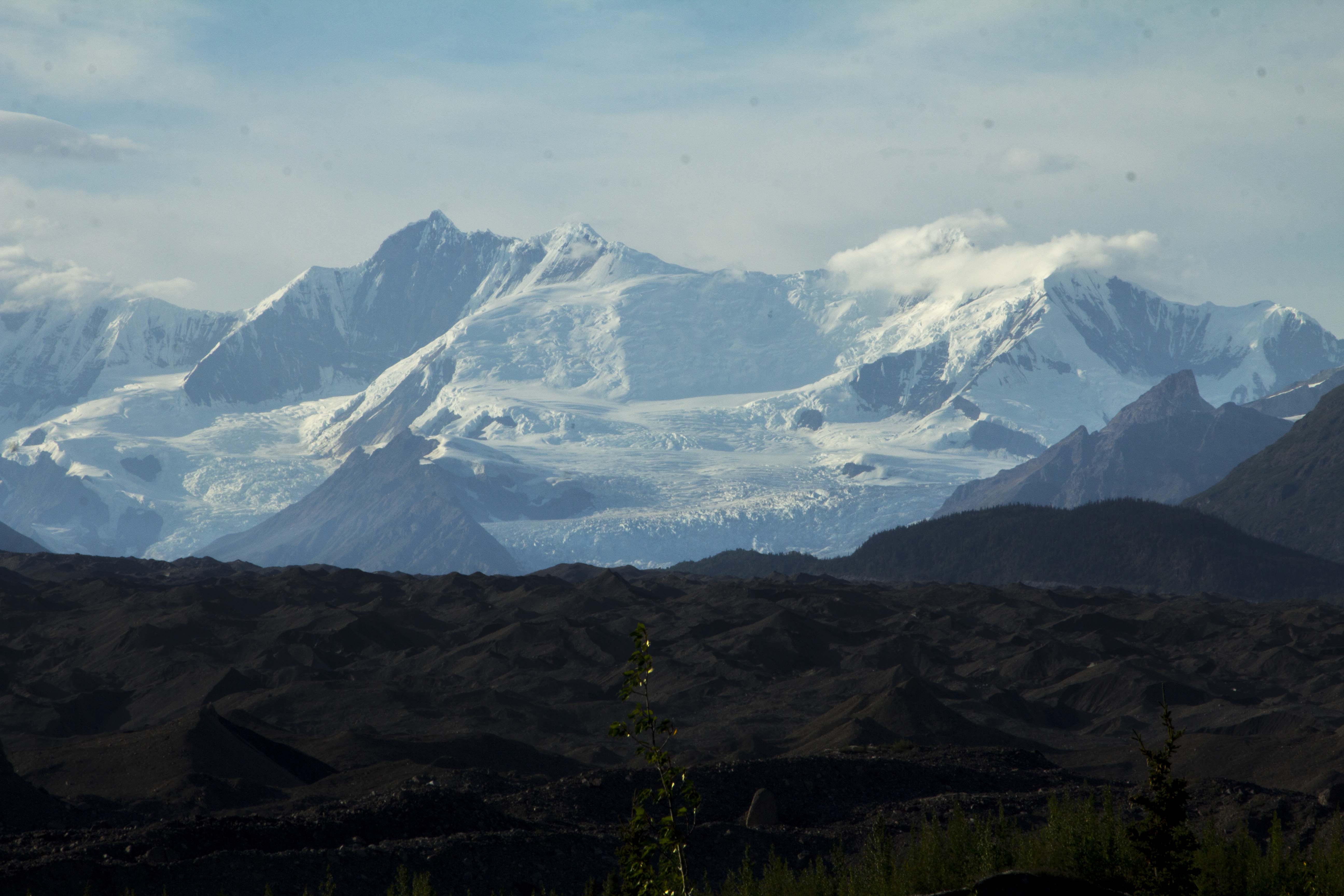
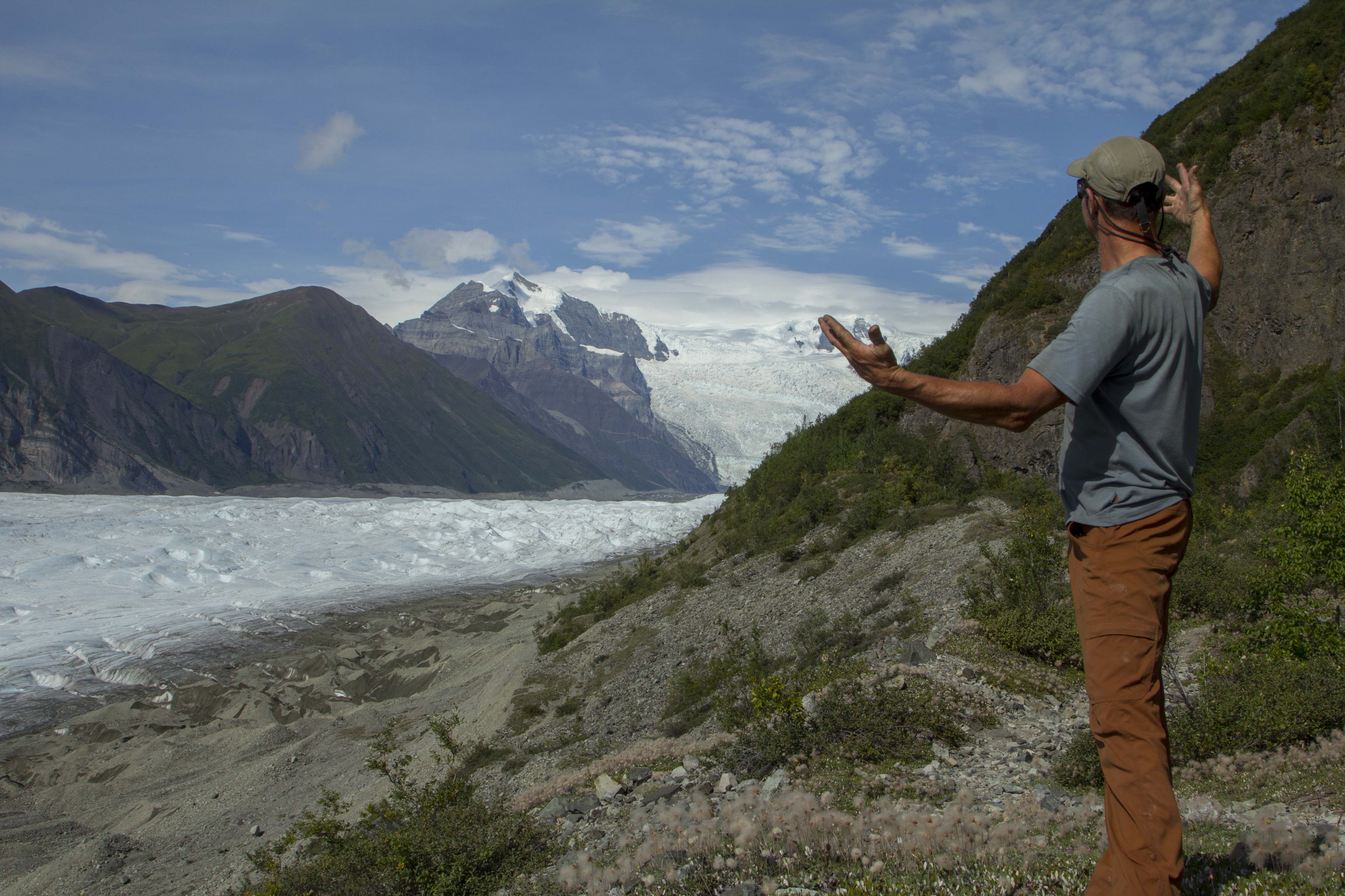
That first trip consisted of Ron Alexander and myself. We drove his old ’79 Datsun hatchback in a non stop frenzy all the way from Sacramento to Lake Louis in seemingly record time. The first time I laid eyes on these peaks, these glaciers, my eyeballs nearly burst. We hung around Banff for a day or so getting our bearings together and looking at maps and talking to local climbers; trying to get a handle on the magnitude of this place. After a spell, we decided that the place to be was at the Columbia Icefields. The Icefield is a massive mother glacier to many smaller, but still sizeable valley glaciers that flow from it’s womb, with some of the Rockie’s biggest, baddest routes gracing it’s flanks. We spent the afternoon at our camp in the Icefields Campground, sharpening tools and crampons, eating food, and gawking at the north face of Mt Athabasca, clearly visible from most anywhere in the area. The standard North Face route on this peak is a classic trial of alpine ice climbing consisting of an easy approach via it’s heavilly crevassed glacier, and after crossing the berghshrund, twelve or thirteen pitches of ice up to about 70 degrees or so, including a mixed pitch with steeper angles busting through the rock band nearing the summit. We figured this would be a good warm up, and the following morning at 2 am, we head off. By 6 am, we were crossing the ‘shrund and cruising the pitches above. Conditions varied greatly from styrofoam to hard blue ice to rotton honeycomb, to trecherous snow. There was a party above us, so we attempted to stay off to the side of the face as much as possible. For safety’s sake, we decided to belay in a traditional manner, each and every pitch on this route, which ultimately we would pay for in the length of time it took to climb this sucker. After passing through the crux gully near the top, it was a cruise to the summit and we were happily descending the NW ridge at dusk. Once it got dark, progress slowed and we found ourselves blindly stumbling around open crevasses all the way to the moraine. Finally, at midnight, we reach camp and collapse in our bags for a sleep of the dead. Our “warm up” took us 18 hours. We decide to drive up to Jasper the following day, just for grins really. After lunch at a diner in Jasper, with the North Face of Mt Edith Cavell clearly visible from our table, we reluctantly head back to California, climbing, on the way a couple more routes. It wasn’t till august of ’86 that we returned to up the ante a bit.

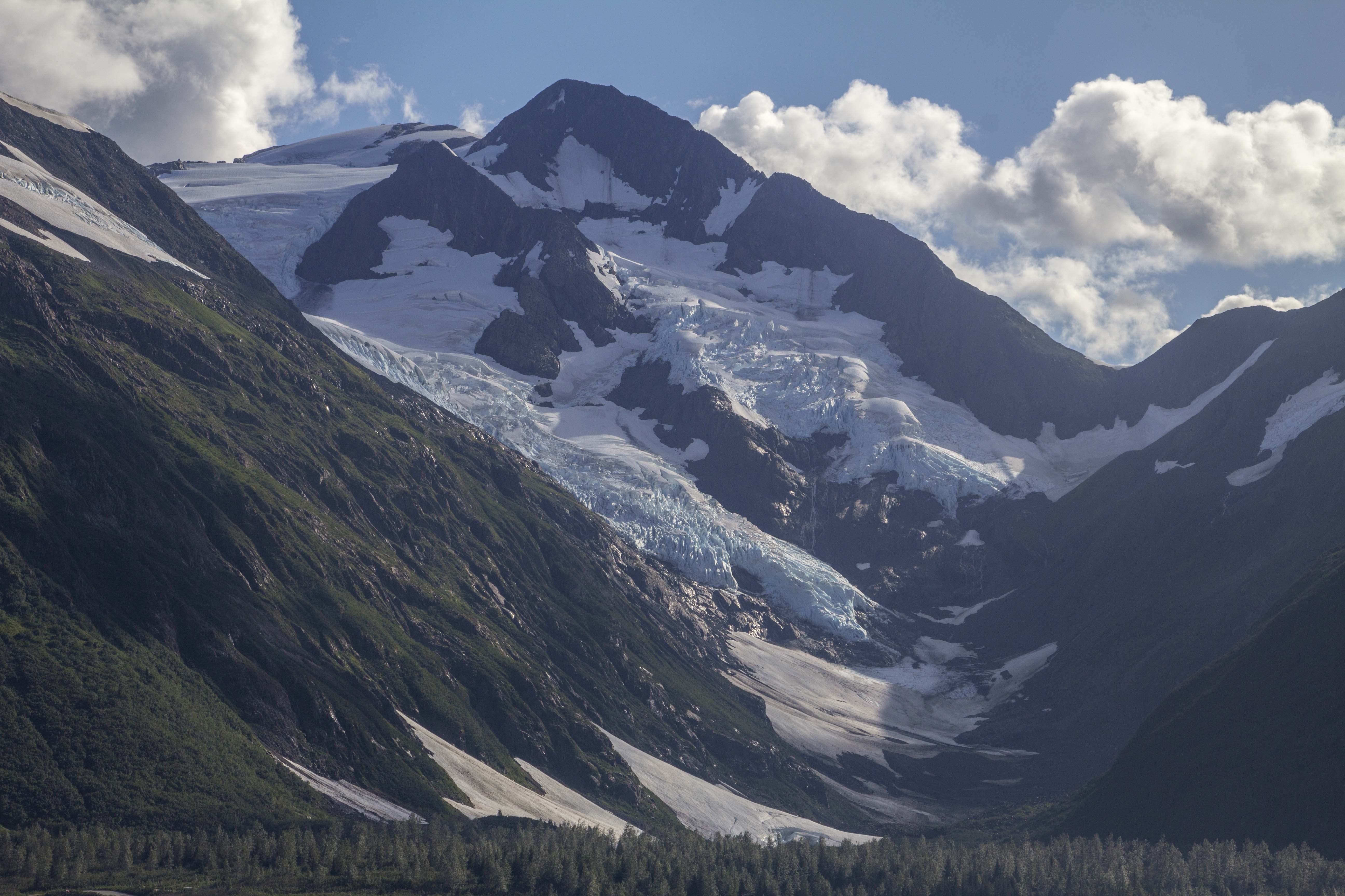
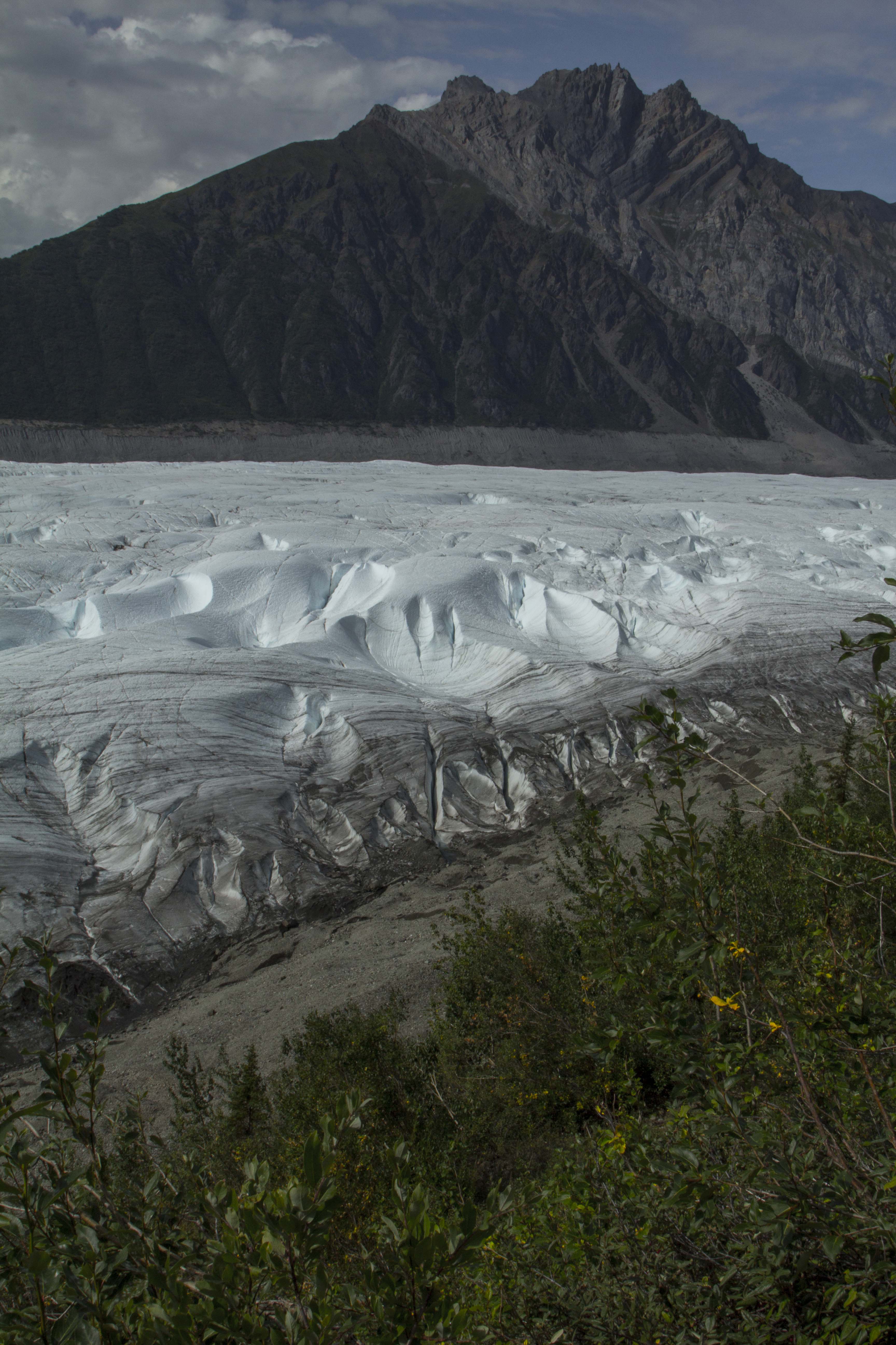
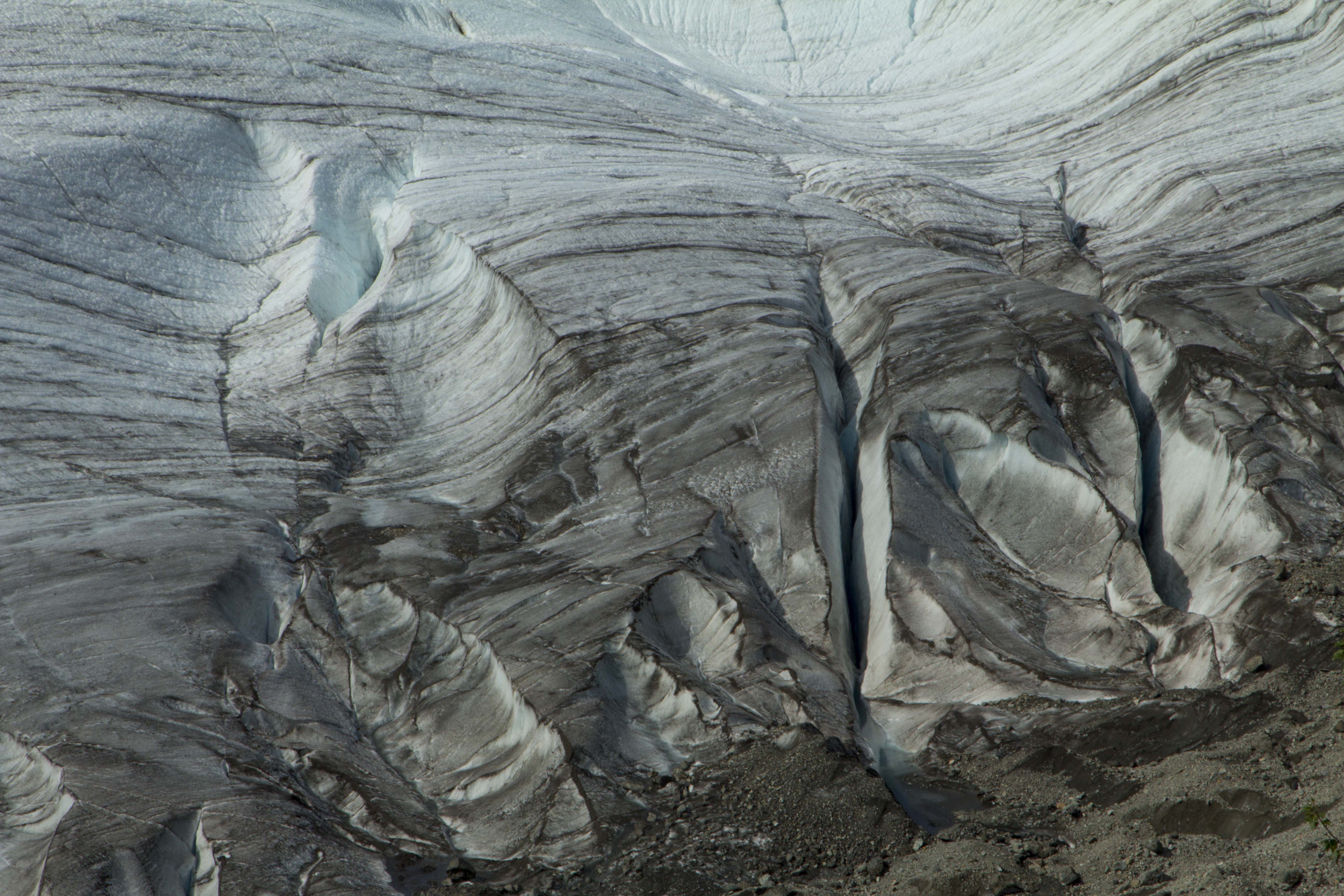
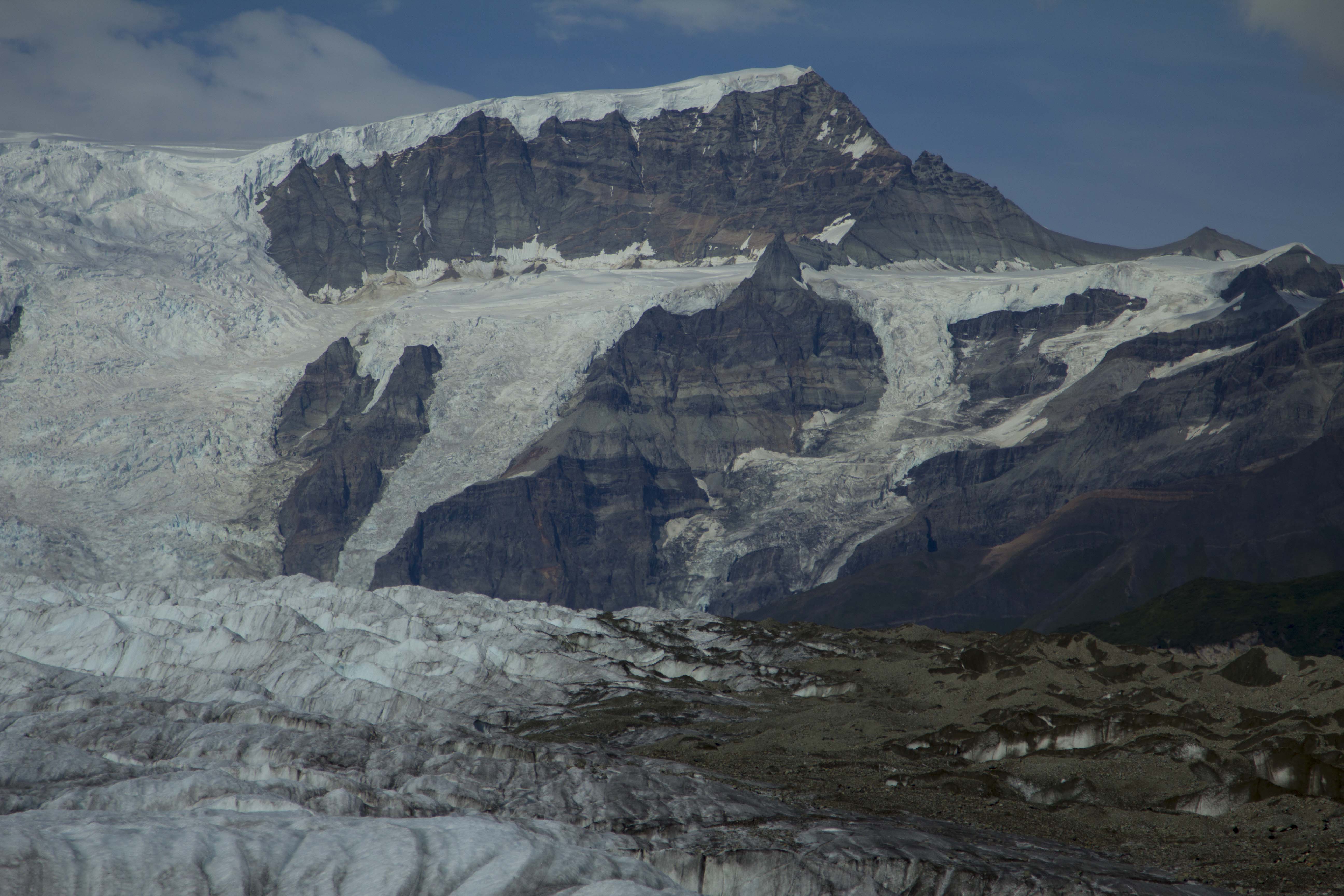
Later that fall, I spent most of my time free climbing in the Valley, mixing it up with the occasional wall route. About this time, the gully ice in the Sierra begins to form up nicely, and a trip to the East Side provides some relief from the monotony that the Valley can produce. After climbing the V-Notch on Mt. Sill, the North Couloir on North Peak, The Dana Couloir, and finally, the Gully on Mt Gilbert, I began to really crave getting back to the peaks of the Columbia Icefields. So that next August, we were on our way once again to Alberta. The question was: what to climb. There were so many… North Face of Mt Fay? The Scottish Gullies on Mt Columbia? The Supercouloir on Deltaform? The mighty Grand Central Couloir on Kitchener? I wanted to climb them all. After a botched attemp on Mt Fay, due to poor routefinding on the approach, which put us in the wrong gully (the gully in question turned into an 8 pitch route climbed with headlamps; topping out near sunrise, at the base of Mt Fay. So tired, we bailed), we decided on a route that Jeff Lowe had soloed the first ascent of back in 1971: The West Shoulder Direct on Mt Andromeda. At grade III 5.8 AI4, this climb is considered a moderate technical route by modern standards, and sits to the right of many other, harder routes, including the difficult Andromeda Strain. To it’s right, lie the Skyladder, a short snow/ice face of around 45 degrees. The West Shoulder Direct, as the name implies, climbs directly up the faint buttress on the northwest face of the western shoulder of the peak, and ending directly at the more northerly, false summit. It certainly looked appealing enough; it appeared to be several pitches of steepish ice, climbing up the flutings of the face, interupted by what looked like a pitch or three of mixed, followed by steepening ice all the way to the summit cornice. We arrived at the icefields late that night, and got a short night’s sleep, waking up early to scope out conditions and get organized. A light rack seemed in order and that is what we compiled: 3 ice screws, 2 KB’s, a LA, a Baby Angle, 3 wired nuts, and three camming units, plus the usual sling assortment and a picket for good measure.

Hitting the hay early, I dreamt that night of terrible avalanches and rockfall; at one point I awoke to the sound of seracs cascading down Kitchener’s north face, only a couple of miles up the road. I realized at that moment how the Grand Central Couloir got it’s name. At 2 am we were up and gulping down nuts and granola as we hoofed it down the access road to the toe of the glacier, which would allow us access to the Andromeda Glacier stuated directly above. By headlamp, a mundane scramble up the seemingly endless scree of the moraine finally gave way to the ice, and away we trudged, aiming directly for the berghshrund at the foot of the route. Ron and I stopped at the ‘shrund, and had another bite to eat. Looking up, we could now see that merely getting across would involve some effort: a five foot gap and the upper wall overhanging somewhat significantly, capped by a lip forming a ceiling. What a way to start the climb, I thought. We rope up, and taking the first lead, I climb as high up the lower wall of the ‘shrund as I can, and standing on the most protruding ice I can find, allow myself to fall inward. If I timed it perfectly, I hoped to plant my tools into the overhang above. If I failed, into the chasm I would go. As I fell against the face of Andromeda, I could tell immediately that she was going to cooperate, and my ice hammer sunk deeply into solid alpine styrofoam. A quick front point up and throught he ceiling, and we were established on the route. I continue upward for a full rope length of 55 degree ice, stopping once or twice to place a screw. Ron and I swung leads like this for three or four more pitches until things got a bit harder. Ron belayed me up from a solid Lost Arrow and a nut, perched on a perfect limestone platform just big enough for the two of us to stand. Above, a chimney filled with ice in it’s recess seemed to lead to a strange looking arrangement of smooth ice. It appeared, at least from a hundred feet away, to have bits of rock, barely penetrating it’s surface. I hoped it was not what I thought it was: bare rock covered with verglass. Struggling up the narrow chimney, and occasionally getting a tool into the shallow ice of it’s innards, I could finally see the strange features not far above me. It wasn’t verglass, but perhaps 2 inches of rotten alpine ice over some of the shattered rock that the Rockies are famous for. At the top of the chimny, I sent home a truck stop of a Baby Angle, and fearfully planted a tool into the sugary choss above. Stemming my feet on the arete of the chimney, I was able to move upward, until I suddenely found myself completely planted on the face above. This was dicey shit. With emphasis on “shit”. I tried carefully to not disturb the loose, shattered gravel beneath the ice; allowing myself only the shallow tool placements of the honeycombed ice. With positively no protection to be had for the next 60 feet, I had to either commit, or retreat to the bar at the Icefields Interpretive Center. So up I went, into it’s harrowing arena, gingerly placing each tool, each crampon, one after the other, until the 70 degree “Wall of Shit” was sent. At it’s top, I manage to get in a decent ice screw, and step to the right for a belay on a small ice fluting. I chop a stance in the ice and bring up Ron, who grins at me as he reaches the belay, saying that he’s glad he had not lead the pitch. If he had, he would have chosen the Icefields Bar, he said.

Another pitch of mixed climbing up a fairly solid corner, lead to fine alpine ice once again. Here, on the face, great flutings began to appear on either side of us, and the route continued, up between them, in a straight forward fashion. Four more pitches of this dreamy climbing gains us a small stance, of which above, the final section to the false summit could be seen. The ice is steep here, nearly 80 degrees, and overhanging at the top where a great cornice protrudes like a giant’s chapeau. The final pitch was 85 degree ice, steepening to past verticalat at the cornice. Soon, I can climb no more as the cornice blocks the way; I punch through the beast with my axe and see the alpenglow on the other side. I cut the hole bigger still, and wiggle my way through for a belly flop onto the flat false summit. Soon, Ron and I are practically running to the main summit; the sun is setting. We are happy that we are not climbing in the dark, but the descent is notoriously treacherous, and doing it in the dark will provide challenging, to say the least.  We have two choices really; downclimb the Skyladder, or downclimb the regular route. The Skyladder seems out of the question to me, at least in the dark. We both agree that the standard route, while not as straightforward as the Skyladder, should be less technical. It is dark by now, so we begin descending the East Ridge; traversing this way and that way, around gendarmes and outcrops of colapsing limestone. Skirting gullys and downclimbing choss, we arrive at a rappel. Down we go; 120 feet or more. More downclimbing. We get suckered, by way of darkness, into a dead end gulley that drops magnificently to the glacier below; this could be the top of the Andromeda Strain for all we know. Eventually we find the correct gully and descend into it’s bowels. This dead ends into  flat shelf that must be trversed to the north to re gain the ridge. We are going off of memory from what a Banff local had told us a couple of days earlier. After gaining the ridge proper again, more downclimbing ensues till a col is reached; below the col, a 50 degree ice slope of around three pitches lead to the Andromeda Glacier below.

Ron never told me just how blind he is. He wears glasses, but I never knew the extent to which his eyesight suffered. His night vision, he says, is real bad. I downclimb the 400 feet of blue ice all the way to the berghshrund and wait for Ron. It takes him considerable time, and I, sitting in the gaping crevasse, am getting quite cold. He finally arrives; he too is cold and looks wiped out. We rope up for the heavily crevassed section of the glacier below, and start weaving the needle; in, out, and around the gaping holes of the beast. There is always a danger of falling into a crevasse when there is a thin snow bridge covering it’s chasm. It had snowed a few days prior, and it being late August, put our current location just above the firn line, where the most dangerous snow bridges can occur. We are descending at a steady pace when suddenly I am jerked backwards with a violent tug. I am pulled to the deck immediately and manage to get my axe in and get my weight on top of it. Ron was no where in sight; somewhere, at there in the dark, Ron was dangling from the rope inside of a crevasse. I yell out to him and he replies that he is hanging in space and bleeding. Once, the year before, Ron and I were descending the North West Face of Mt Stanley after a successful climb, near the bottom of the glacier and tired, Ron had slipped on the 40 degree ice and I had caught the scene out of the corner of my eye and managed to catch his fall in the nick of time. We had been downclimbing simultaneously and putting in ice screws every so often. Ron would put them in and upon reaching them, I would pull them out. After pulling the last one, I was so fatigued I forget to tell Ron, so when he fell, there was only what I like to call the “Whymper Method” in place; The deadly and ridiculous technique of simul-climbing with a rope btween the two of you and no gear or protection in. If one of you go, both of you go. Not cool. 

  After setting up an anchor consisting of both my ice tools and the snow picket, I threw down another length of rope for Ron to prussik. In another half hour, Ron was out, shivering, bleeding from his lip, and eyes as wide as silver dollars. We took a break to re group and sip some water; it was now 1 am. Thankfully, the renainder of the descent went smoothly, and we finally reached the road. The worst part now, was walking the 2 miles back to camp in our plastic boots., but it seemed like managable suffering to me. Finally, 22 hours after we left camp, we returned and downed a couple of victory beers and quickly fell asleep. It had been a fine adventure for Ron and I, but somehow, over the next couple of years, Ron and I rarely spoke. I had moved to Moab, and Ron had essentially quit climbing, focusing soley on gaining his Master’s Degree in music. In 1990, I was heading to the Valley for the summer, and decided to give Ron a call. His Mother answered the phone and informed me that Ron had been hit by a car on his bicycle and had been killed. Ron was one of my early climbing partners, a friend, and a good man. I think of Ron often, still to this day, and he is missed.


The Last Leg of Summer

Up ahead, just past the top of the long, mellow hill we are climbing, I can see the junction of the Elliott and Richardson Highways, where we will turn south and enter the sublime alpine beauty of the Chugagh Mountains, Alaska’s splendid “coast range”.  Last night’s camp, just past Kenny Lake was a fine birch forest scene with good weather and flat ground. Located just minutes from town, we were happily snuggled into the tent by early evening and a good night’s sleep was to be had. As we approach the intersection, there is a roadhouse visible just a few yards to the north and we decide to stop in for a coffee and some browsing at the roadhouse “garage sale” they are having. Angela begins browsing in a serious fashion and soon her arms are filled with trinkets and goods: a bicycle seat, a bicycle helmet, a candle holder, and assorted other comodities. I cheerfully remind her that we are traveling by bicycle; she reluctantly shelves her armload and we hustle inside to see what we can see.

After some local chat and too much cheap coffee, we are back on the road and headed south, toward the Klutina River.  The last few days have been filled with their fair share of cool temps and lots of rain and mud; as a result there has been little activity in the form of bathing, swimming, and river laundry, and right now, that’s exactly what I need. The Klutina River is just another fine example of a spectacular, yet small, Alaskan drainage, filled with fast moving, glacial melt water the color of a grey, cloudy sky. The water is ice cold and sweet to the thirsty tongue.  Ever since I began stomping around in these northern woods, I have seldom treated water for drinking. If it is standing water, such as a lake, I always filter; but generally, fast moving, glacial fed rivers are considered excellent “as is”. The Klutina is no exception and I drink freely and fill all of my bottles. A quick body dunk in the runnel is about all I can stand before a serious head freeze develops. I rinse a few clothes and hang them from my bike for a drying session while pedaling, and Angela and I are happilly heading, once again, up and into the alpine zone of Alaska’s mountains. Onward, the pavement snakes; deep into a forested valley filled with Birch and Spruce, Cottonwood and Alder. There is not a dearth of trees in Alaska, especially in the south, where permafrost is a rareness. Black Spruce taiga appears occasionally, a hallmark of the permafrost zone, but in the warmer and wetter areas of southern Alaska, large White Spruce and hardwoods are far more common. In fact, as we converge on the lower slopes of the Chugagh, the trees are very large indeed; magnificent specimens of a rich and healthy environment.

Looking ahead, I can now see small glaciers adorning the rocky peaks; sitting there quietly, keepers of time, observers of pattern, practitioners of routine. Collect, pack, advance; sit, melt, retreat. Repeating it’s endless yearly cycles, filling the rivers’, allowing the Salmon, feeding the Bears’, making the world. This is the interminable rythym of The North; it’s scale of balance all things wild and free depend on. Soon we are climbing upward; around every bend in the road, another glacier, each one bigger than the last. One is hanging in space, threatening to collapse and feed the one below it, like a hand me down from an older brother. As we ascend, the clouds become thick and a mist develops that is all but rain. The vegetation becomes greener and thicker, yet more sparce. Soon it is all tundra, and the final climb to the nearly three thousand foot Thompson Pass engages. Even though we are wet, we are ecstatic. This is another new place for my visual feast, for I have not been here before. New places always excite me, especially in Alaska. At the pass, it is damp and cold: we don more clothing for the giant descent towards the sea. Soon we are whizzing down, mile after mile, at high speed. 35 miles per hour in fact. Eventually it flattens out and we find ourselves deep within lush forest of Alder and Hemlock. Large firns are sprouting from the forest floor; a sign that we are nearing ocean. We cross a small stream and see the first of the Chum and Silver Salmon runs; ahead a bit further, there is a small black bear having a feast on the Salmon eggs, not even bothering with the flesh of the several dozen carcass’ lying about.

As we near Valdez, it begins to rain again, as it would do for another couple of days; in fact, early on the trip, we had promised ourselves a motel room somewhere, so now, in the rain at Valdez, it seemed appropriate. So a night with hot showers, a soft bed, and a rain free envoronment were to be had. We head to the ferry terminal the next morning, only to find that AMHS (Alaska Marine Highway System) had changed they’re schedules in the few short days time period since we had called for information; that meant another night in Valdez. So off down a trail we go, leading to the inlet of a small brook, to the kelp covered gravel beaches of the Valdez Arm. We stop for a bit and take it in, then head back the way we came to find a spot for the tent. Coming across another creek, it is seething with Chums and Silver’s. The grass on the shores of the water are totally flattened: we have just missed the Bears. We cautiously walk the perimiter of the area and see Salmon lying on the bare earth, with fresh bear tooth punctures. They must have been here seconds earlier. Had we startled them off? The scene is fantastic: a bear feeding ground, surrounded by salt water and a lush scene dominated by the peaks and glaciers of Valdez.

We board the ferry in the morning and across the Prince William Sound we go. Incredible coastline and calving tide water glaciers dominate the experience and soon we are in Whittier. Miraculously, the clouds break, and the sun shines strong upon our backs. A painless hitch hike through the Whittier tunnel (mandatory) puts us at Portage Lake and a spectacle of more glaciers and icebergs. It is still early, and we decide to try to make it to Girdwood by nightfall, which, after a couple of hours of battling heinous head winds, we accomplish. We camp next to a fast moving river, with glaciers viewable from camp, directly across from the Alyeska skii hill. Another great Alaska camp indeed. The pedal into Anchorage the next morning was filled with the terrible traffic of the Seward Highway, famous for it’s dangerous nature. we persevere and soon find ourselves in the hills above Anchorage, staying at Angela’s friends’ house. They are wonderful hosts and treat us like kings and queens; that night a delicious supper of Silver Salmon that was caught in Prince William Sound just few days prior. Stacey even supplies us with a box for angela’s bike to be shipped and gives her a ride to the airport. Angela and I say our goodbye’s for now; she is heading the the lower 48, and I heading to Eagle River, where I will meet my buddy Sven and we will drive back to Fairbanks and begin the fall season of training dogs for the upcoming winter, of which I will be staying in Bettles, AK.

It has been a glorious summer; nearly 2800 miles of pedaling, both solo and with Angela, across mountains, glaciers, rivers, lakes, and ocean. I do love The North!

Last Leg of SummerIMG_7003 Last Leg of SummerIMG_7023 Last Leg of SummerIMG_7038 Last Leg of SummerIMG_7057 Last Leg of SummerIMG_7066 Last Leg of SummerIMG_7067 Last Leg of SummerIMG_7068 Last Leg of SummerIMG_7075 Last Leg of SummerIMG_7078 Last Leg of SummerIMG_7091 Last Leg of SummerIMG_7099 Last Leg of SummerIMG_7112 Last Leg of SummerIMG_7120 Last Leg of SummerIMG_7123 Last Leg of SummerIMG_7133 Last Leg of SummerIMG_7139 Last Leg of SummerIMG_7143 Last Leg of SummerIMG_7151 Last Leg of SummerIMG_7186 Last Leg of SummerIMG_7224 Last Leg of SummerIMG_7234 Last Leg of SummerIMG_7246 Last Leg of SummerIMG_7249

Bright Bike Verdict is In…

Image

This past summer has been one for the books. 2800 miles of pedaling through some of the most fantastic country in the world; through countless mountain ranges, swamps forests, and arctic plains, both solo and with my girl, Angela. It has been truly a summer to remember. Having a source for powering the phones and ipods was more than just a luxury, as we both had phone commitments from time to time and the mental luxury of having music once in a while proved outstanding. In the past, I had always used a solar panel, of which I am a fan. However, when it is cloudy, as is often the case in Alaska and the Yukon, this is of extremely limited use. No sun=no power. Simple as that. Additionally, one must spend the time to roll out these panels and the connected devices for a length of time to really work; in full sun. This is just not always practical while living for weeks or months at a time on a bicycle.

I recently purchased a dyno hub for my Surly, and hoped that it would be the means to power USB devices. However, dyno hubs put out the wrong voltage and amperage for the USB standard, and therefore additional hardware is required to make this work. Enter the BrightBike Revolution. It is a small USB port with connected wiring that connects to the dyno hub and does all of the converting for your USB devices to live a happy life. It is small, light and reasonably priced: at 120 dollars, it is nearly half the cost of devices I had used previously, at half the weight to boot. Mine simply zip ties to the down tube and is waterproof and reliable. So reliable in fact, that after 2800 miles of pedaling through endless rain and mud throughout the summer, it never once failed me. If you have on the bike USB charging needs, check it out. http://www.brightbikelabs.com/products/bright-bike-revolution

The Notch Couloir

Back in 1991, I split Moab in search of a hiatus, and found one in the form of a little cabin up in the back of Eldorado Canyon, near Boulder, Colorado. I shared it with two other dudes, Guy and Tony. I worked at a little bar downtown as a bouncer and had the whole upper canyon to myself most days. It was situated just past Supremacy Crack and The Web, was quiet, and out it’s front window, lay a million dollar view of the Rincon Wall. I spent most days in the canyon doing my usual soloing circuit or bouldering; but occasionally roping up for something worthy. Come February, there was a cold snap to be reckoned with and I figured if I was gonna be cold, I might as well be somewhere it didn’t matter, like high in the Mountains. So, at midnight, I left Boulder, in my old ’76 Chevy Van, and headed up to Estes Park and my goal of Long’s Peak, to solo the Notch Couloir on it’s East Face in Winter.

The Notch Couloir is a cleft on the left side of the East Face, interrupted primarily by the ledge system bisecting the face known as “Broadway Ledge”. To gain the Notch Couloir, one has to  start up a lower angle, but longer couloir, or gully, for 700 feet or so, then traverse Broadway for a spell, before entering the Notch Couloir proper. Sometimes this series of gullies and traverses are used by climbers looking to gain access to the  Diamond’s upper face, or conversely, it is sometimes used as a bailout for descent. In the summertime, when said rock routes are being climbed, these gullies do not pose much of a threat, the Lamb’s Slide, as the lower couloir is known, is generally easy snow early in the summer and by late summer most years it is a talus gully. The traverse across Broadway and the Notch Couloir itself, are generally rock and snow perspectively. However, by the end of August, the Notch Couloir turns to ice and a whole new animal is born.  It was this animal I was after.

The weather that fall and early winter was pretty mild, and it was reflected upon the number of routes I climbed in Eldo that season; it was no different up high in the mountains. In fact, the approach to the East Face was done almost entirely either on old, hard pack snow, or was simply snow free; no snowshoes or skis required.

As I drove up past Estes Park and into the realm of the Mountain Gods, my mind was filled with anticipation of the route. I figured the approach in the snow to be heinous, the Lamb’s Slide slog to be easy and cruise-worthy, the traverse out of Broadway straightforward, and the actual route of the Notch Couloir, probably Alpine Ice III, maybe up to 70 degrees or so… As it turned out, most of these notions were wrong.

I pull up to the trailhead around 2am and crawl in my sleeping bag and get an hour of shuteye. In those days, with an adventure mere hours away, a whole hour of sleep seemed like eternity and I awoke at 3 am, all fired up. I toss my axe, alpine hammer, and crampons into the pack, along with a few necessary clothes, snacks, and water, and hit the trail. I glance at the thermometer on my dashboard; 16 degrees F., about average for this time of morning, the second week of February, here in Colorado’s Northern Rockies.

Blazing up the trail in a couple of hours, I stop briefly at Chasm View Lake, and power down some calories before getting into the Lamb’s Slide. The slog to the base of the gully went by fast and soon I was happily slogging up the lower slopes, headlamp free and accompanied by the nearly full moon. Being here, in this place, alone, high in the mountains, with the moon lighting the distant peaks, an ice axe for company and the only thing stirring, my frozen breath escaping my mouth, is an extraordinary sensation.  It causes me to realize, once again, my own deep appreciation of these wild places and how small and fragile our lives and all lives really are. And of how deeply beautiful this planet is and of how fragile it really is.

My nearly overwhelming interlude of a greater appreciation for all that is in this haunting place, is suddenly interrupted by my ice axe, not sinking into frozen snow and neve, but instead, bouncing off of hard, blue ice. I swing again, and the tip of the old Chouinard standard penetrates a mere quarter inch. I readjust my mind to update my climbing style and mental awareness to meet these new, unexpected conditions. Adapt, adjust, prosper. Even though the angle of the ice is only 45 degrees or so, I switch to front pointing one foot and flat footing, french style, the other. Always my preferred technique on such a slope. Still with one axe, firmly planting overhead, front point, flat foot up, balance on free palm of other hand, remove axe, and repeat. I felt this was the best way to maintain my rhythm and speed; pulling out the ice hammer would have been awkward and, ultimately, I believe would slow me down by forcing another, slower technique of handling two ice tools on such seemingly moderate terrain. This seemed to be the ticket and I managed to gain a few hundred feet in the blink of an eye. I could see to top of the Lamb’s Slide from my new vantage point, and I could see the traverse to the right, leading overhead and onto the hopefully flat real estate of Broadway. As I moved upward from this spot, swinging the the old bamboo shaft in a truncated arc, I hear and see the tip plant itself solidly into the brittle, blue ice. I move my feet upward and balance. Suddenly, as I weight the axe, I hear the crack of the ice around my axe. I see an unusual sight as Vertical and horizontal fractures penetrate not only the surface of the couloir, but of my mind. Within a split second, my axe is no longer attached to the gully, but poised, in the air, mind fist tightly clenched around it. A plate of ice one inch thick, and a foot in diameter are still encased around the axe’s tip. I teeter there for a moment, as if the planet stopped spinning, and time itself seemed to freeze solid. But only for a millisecond. Then I was falling. Down.

Finding yourself in a weightless, gravity induced situation such as this is a funny thing, especially when it is nearly a given the end result will be certain death. The actual sensation is really one of euphoria, for lack of a better explanation. Time really does stand still, if only for a moment. A moment is all it takes…

At the moment of realizing what was happening, turn in my knees to keep my body facing inward, and try desperately to keep my knees bent to prevent my front founts from snagging as my body accelerated down the ice. The Lamb’s Slide has no real runout at the bottom, just a short bergshrund and rocky talus field below, which was 600 feet below me. As I slide, my life had mere moments left to live, and I struggled to somehow stop. Amazingly, stop is what I did; in a sea of ice, one lone atoll of softer snow jutted out from the Lamb’s Slide, as if put there for me to land. And land I did. Somehow. The patch, only a foot across, the slope, 45 degrees, and surrounded by ice, managed to field  a falling, sliding body, with sharp metal points sticking from it. Miraculously, I was totally unhurt, but badly shaken. My Axe was ripped from hand, leash and all; I could see it, high above me, maybe 200 feet up. It looks like I had fallen 500 or 600 feet total.

Then, another interesting thing happened: The sun, now beginning to rise, it’s bright crescent just barely surfacing the distant peaks, was like a second chance. It was life giving and rejuvenating to the point of tears to me. Somehow, I had managed to survive this madness. My drive and psyche had reached a peaking level, and without any more haste, I dig into my pack, sip some water, and untie my ice hammer. Only then do I gingerly move upward again, toward the old Chouinard Piolet. Going back to the same technique, I reach the Piolet, and now armed with two ice tools, motor up the Lamb’s Slide once again.

I move upward to the gullies’ top, and exit onto the rocky beginnings of Broadway. It is blocky and fifth class, so I rope up and throw in a couple of nuts for an anchor. This short pitch led to another traverse rightward, and I could now see into the Notch Couloir. It appeared to be hard ice and shot upward for several hundred feat, mixed, here and there, with a bit of rock for crampons to scrape. I attempt the second traverse, only to be thwarted by avalanche conditions on Broadway. Snow, piled at maximum angle, fluffed off for a thousand foot ride the moment I planted a foot. There seemed to be no way around this dilemma; I decide that enough is enough. Moving back to the anchors of the belay, I see that a rappel  will droop me straight down into the heart of the Lamb’s Slide., so down I go. Doing so, put me about 500 feet above the gullies’ start, which I down climb slowly and cautiously, as time is now no longer an issue. At the bottom, I scramble back over to Chasm View Lake, and sit there, quietly, and stare up at the mighty Diamond.

The drive back to Boulder and Eldo were totally forgettable, to the point I do not even remember driving. In fact, the whole next week was spent pretty much just hiking the canyon and being mesmerized by the towering sandstone walls. Climbing was not even considered at this point. A trip to Zion in another month to do a spectacular first ascent would change all of that… But that’s another story.

The Road to McCarthy – aka, “Is It Worth?”

I first fell in love with Alaska when I was 15. Those early high school years were spent dreaming and executing all acts of climbing and mountaineering. I even tried to start a climbing club in high school; not a single taker. Climbing was off the map in the mid eighties, at least among high school students. In the evenings, I would often engage in as much climbing literature as I could stomach; Habeler and Messner’s’ “The Lonely Victory”, Doug Scott’s “Big Wall Climbing” and Art Davidson’s “Minus 148” were books that took me to far away places with far away ideas. It was “Minus 148” that took it’s toll on me and gave me an ironed-in impression of Denali and Alaska. Now, stomping around in this wild place, the memories of that book have come alive and they are hunting me down.

After leaving the Paxson Lodge that rainy afternoon, the Denali Highway still fresh in our hearts, we pedal onward, in search of a flat and comfortable spot to call our own for the night. When I look for a camp, I try as I must to fulfill the rules I have created for myself.  An excellent camp must have at least two or three of the following:  It must be flat, have water nearby, have a view, be protected from the wind, and be as far off the road as possible. A camp spot rarely has all of these attributes, but if there are a couple, then it’s usually deemed acceptable. Angela and I pedal down the Richardson about 15 miles or so and find a fine gravel pit that meets a couple of the criteria and we throw down our scene. A Loon cries out from nearby Paxson Lake, and makes the spot that much better even.

We awake the following morning to outstanding weather and an earlier than usual start sends us 55 miles down the Richardson Highway to the Gulkana river and an early camp for an afternoon of bathing and river laundry. It feels so good to be in the river, the sun overhead and our clothing, now clean, drying on the clothesline I have set up. Unfortunately, the river camp is very moist, and our clothing does not dry till nearly 1 o’clock the following day, which puts us on the road late and provides for a short pedaling day. It all works out for the best, because weeks prior I had scoped out a camp for us when Sven, Bill, and I were on a dip netting mission, out at Chitina. Now, on this afternoon, Angela and I roll into this fine camp. It is extraordinary to say the least; it consists of perfect, flat forest right next to a steep 300 foot cliff/embankment that drops to the mighty Copper River below; infested with Salmon and running strong. It also sports unobstructed view of Mt’s Sanford, Drum, Wrangell, and the enormous Mt Blackburn, all encased in glacial ice, and piercing the deep blue, cloudless sky. To me, it is a camp site to behold.

The Wrangell Mountains are a special place to me; they are nearly as mighty as the Denali area of the Alaska Range, but are connected to the monster of the St Elias Range further to the east. They are also more remote, and, according to some bush pilots I spoke with, the most beautiful place in all Alaska. That makes it pretty damn special indeed.

We continue onward, down the Richardson, and turn in on the old Elliott cutoff; a dirt track leading, for ten miles, to the hamlet of Kenny Lake, an area of rare Alaskan agriculture featuring pastures, Pigs, Yaks, and Chickens. We stock up on a thing or two here at the tiny store, and continue down the Elliott, enroute to Chitina, one of my favorite spots in Alaska. On the last hill into town, the headwinds are so strong, we must pedal hard to go downhill. We roll on through, eager to get ourselves established onto the dirt and gravel of the McCarthy Road, and away from the troublesome traffic. Crossing the Copper River Bridge, one is greeted with a fine, Alaskan sight; the confluence of the Copper and Chitina River’s, the Chugach Mountains to the south and the Wrangells to the North, and the dip netter’s, still pulling late season Red’s from the icy waters’. True Alaska. We roll across the bridge and turn into the free campground there, the only one we were to stay at on this trip.

Some time back, I had an interest in scoping out the Kuskalana Glacier Trail, aka the Nugget Trail, which lies off of the McCarthy Road to the north and in from the western end by about 15 miles or so. The trail, built by miners near the turn of the century, ends at the Kuskalana Glacier and a tiny cabin there. Angela and I decide to pedal down the side road leading to the trails start and check it out for future adventure, as this time around we were a wee bit shy on time. The trailhead begins about 4 miles back, and requires one to cross Native Land and pay a fee, as we found out. Perhaps another time..  Back out to the McCarthy Road, I catch fine glimpses of the awesome Mt Blackburn, 16,000+’, which I believe is the fourth or fifth highest in Alaska. As we travel the road we are traversing it’s western, southern, and southeastern sides, and every time it appears from the road, it is as if Blackburn herself is mounted to a giant lazy suzan, rotating around me, not the other way around, showing off her  best.

The McCarthy Road seems blessed with many small creeks and rivers’, all crystal clears specimens, born of the ice and flowing to the Sea. There are fewer lakes, however. Angela feels at peace when she is swimming in a lake, so we are always keeping our eyes peeled for an opportunity to do so. We pass Moose Lake and pull in for a spell, but decide to push on to another lake further up called “Long Lake”. The lake turned out to be a little farther than expected, but soon it appeares and Angela declares the place her spiritual home. She fell in love with Long Lake. Unfortunately, we find no spot to camp on it’s shores, but a site within it’s view were to be had; again, with the best Loon calls I have ever heard that evening. Even Salmon enter the lake to spawn and the resulting Bears can often be seen catching their lunch. The next day was a fine one, with perfect weather and a short pedal to McCarthy, we were rolling through town by noon. About a half mile before reaching the tiny village, one is greeted by a mountainous site that can hardly be called simply “a nice view”. That will not do. In front of us lithe Kennicott Glacier and the Root Glacier, both giants and flowing from towering peaks, smaller peaks nearing the flanks of the grand centerpiece of Mt Blackburn. As the ice river rises up to it’s birth place, an enormous ice falls shows itself, the “Staircase Icefall” as it is known is a sea of jumbled and towering blocks and seracs, all destined to crumbled downward and become a pat of the valley glacier below.

We find McCarthy more than pleasing; a tiny little town full of laid back folks, tourists, flight seers, bush pilots, and mountain folk. We buy a few groceries at the happily unexpected grocery, and chat with a few folks before departing to find a camp of our own. A local tells us of a trail that leads to the toe of the Kennicott Glacier.. We head out and after getting temporarily lost, we find our way and are rewarded by a great field of gravel ind ice and water. The Kennicott’s tarn, the size of an Alaskan air strip, is under constant barrage from it’s gravel covered ice source just above, and great splashes can be heard very so often. We camp near the shores of the tarn and admire the unbelievable glacial view from our camp. Later, we hike out, away from the tent, at dusk, to inspect bear prints Angels had spotted earlier.

A day off of the bikes is in order and we decide to ride up the road 4 miles to the historic Kennicott Copper Mine, once the largest copper mining operation in North America. After passing through the mine area, we continue on a deterorating trail that soon requires the the bikes be parked behind a boulder and on foot we continue. We hike four, five six miles? up the valley, paralleling the Root Glacier, and high above it’s flanks. Eventually, we find a place that looks reasonable to descend, and down we go; crawling across the gravel covered ice hills to reach the main body of ice. Angela has never been on a glacier before, and it had been a while since I had last been on one this size. We cross out onto the flat ice, well below the firn line, and small, but open crevasses appear. A giant Mullion, the central body of exposed glacial water, is flowing wildly upon the giants back and we drink freely from it’s source. We ascend back up the loose scree to the trail and skedattle down valley to our bikes. A fast blast back to McCarthy takes only minutes and soon we are in camp once again. Our “rest” day consisted of riding ten or twelve miles and hike maybe thirteen or fourteen; we are spent. That night, very late, I got up and a bare twinge of the Aurora Borealis was beginning to appear. Summer was coming to an end.

The day following was Angela’s birthday, and it was raining badly. We take cover in the local coffee and burrito house and put off getting into the mud till past noon. The day was spent mostly in soaking wet conditions and endless amounts of mud. This signaled the impending end to my bottom bracket, rear hub, and drivetrain. We manage the day however; in the late afternoon, when we are ready to camp, an RV with two Europeans pull up and ask us about the road conditions to McCarthy. I tell them that the road is fine and they should have no problems with the road surface. As we were about to push on, the driver asks “Is it worth? I assumed that he meant is it worth the drive to visit a place such as McCarthy; I was taken aback and did not know what to say. Every where in Alaska (except Wasilla) “Is worth” in my opinion. The question of worth versus value is a question that I am constantly on the lookout for; everyones values are different, it seems. So that said, if one values what a place like McCarthy has to offer, then certainly “it is worth”. So I tell him: ‘ Look, if you are looking for 5 star accommodations, fine dining, a nightclub to attend to, or a theater, or a McDonalds, or a Walmart, then it is “not worth”, BUT, if you are looking to witness and experience some of the finest mountain scenery to be found on the planet, and have a great appreciation of all things wild and free, then sir, I promise you “It IS worth”!

The next morning we were back on pavement and headed back out to the Richardson Highway, in search of the next “worthy” wilderness.

McCarthy Roadrado Peak_1 McCarthy Roadrado Peak_2 McCarthy Roadrado Peak_3 McCarthy Roadrado Peak_4 McCarthy Roadrado Peak_5 McCarthy Roadrado Peak_6 McCarthy Roadrado Peak_7 McCarthy Roadrado Peak_8 McCarthy Roadrado Peak_9 McCarthy Roadrado Peak_10 McCarthy Roadrado Peak_11 McCarthy Roadrado Peak_12 McCarthy Roadrado Peak_13 McCarthy Roadrado Peak_14 McCarthy Roadrado Peak_15 McCarthy Roadrado Peak_16 McCarthy Roadrado Peak_17 McCarthy Roadrado Peak_18 McCarthy Roadrado Peak_19 McCarthy Roadrado Peak_20 McCarthy Roadrado Peak_21 McCarthy Roadrado Peak_22 McCarthy Roadrado Peak_23 McCarthy Roadrado Peak_24 McCarthy Roadrado Peak_25 McCarthy Roadrado Peak_26 McCarthy Roadrado Peak_27 McCarthy Roadrado Peak_28 McCarthy Roadrado Peak_29 McCarthy Roadrado Peak_30 McCarthy Roadrado Peak_31 McCarthy Roadrado Peak_32 McCarthy Roadrado Peak_33 McCarthy Roadrado Peak_34 McCarthy Roadrado Peak_35 McCarthy Roadrado Peak