RAVENS ON THE GULKANA

By Linus Lawrence Platt


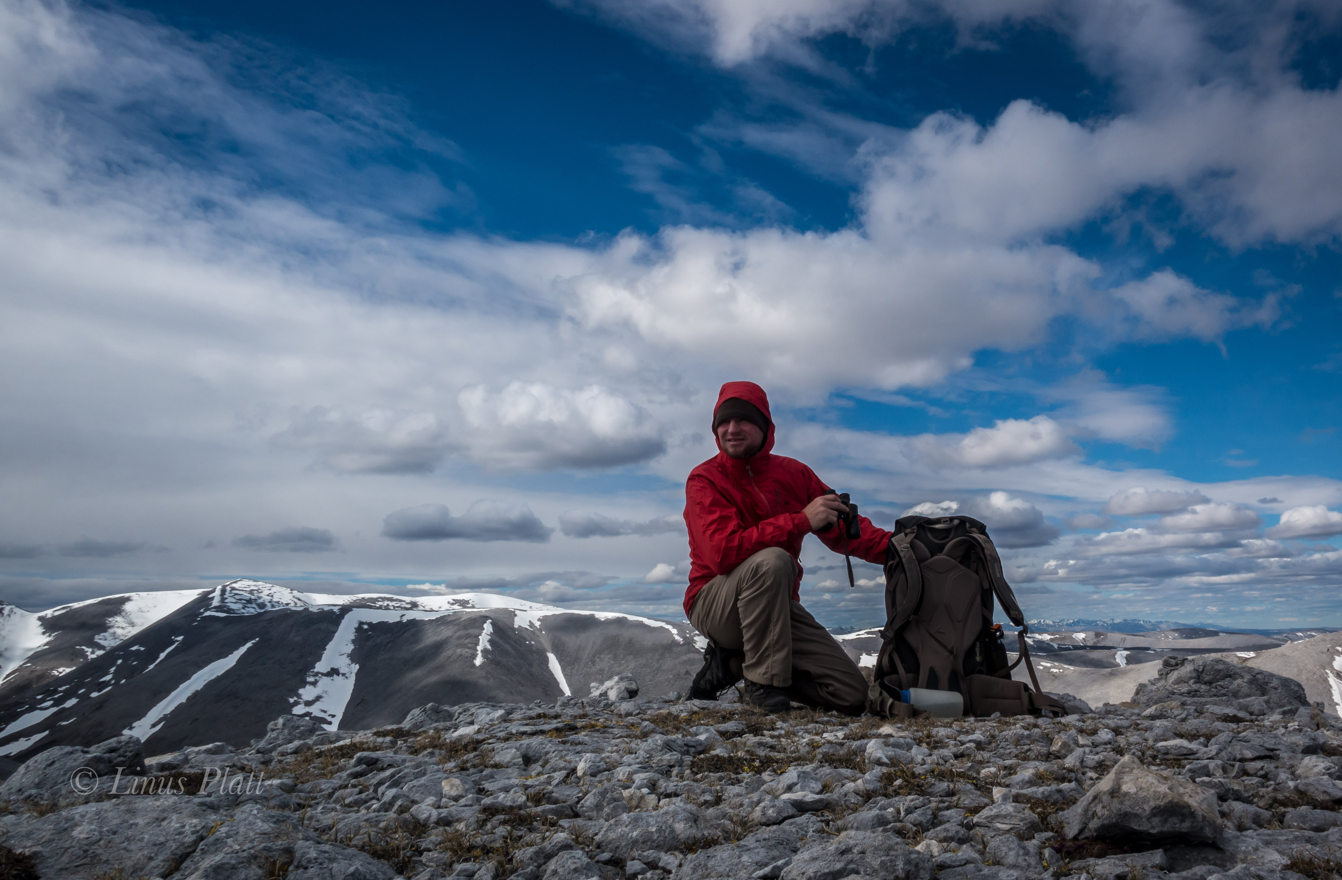
It had been over two years since the Over The Hill Expeditions gang had gotten together to hit the hills so to speak; in 2019 it was an attempt to climb and ski Mt Sanford (16,237′) the second highest peak in the Wrangell Mountains of South Central Alaska with Rich Page, Jeff Rogers, and Cameron Burns. It was trip filled with good times, friendship, and adventure regardless of our not reaching the summit. After the Sanford expedition, Rich and I conjured up a trip idea for an attempt on the East Ridge of Mt Hayes to take place the following spring, but the plandemic took shape, I lost my job, and the notion to climb Hayes pretty much went up in smoke. Disgusted with too many things about Haines, I built a custom tiny home/camper (dubbed The Raven), sold my house, and hit the road for Fairbanks to re-locate. It was later in the spring that the plan to do a packrafting trip of some sort in the summer or fall of 2021 was born.

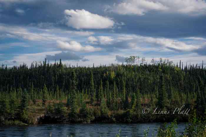
Rich, a former Denali guide from Colorado, managed to free himself from his business, Savage Gear, in North Conway, New Hampshire, of building packs and repairing outdoor gear and bought a plane ticket to Fairbanks for the end of August. Thinking a third person would be fun, I invited my friend Chris Gavin from Baltimore to join us on an adventure. Chris and I had first met in Fairbanks in 2017, and we had remained in contact ever since. We had often discussed doing some type of backcountry trip together, and when the notion of the Hayes trip was born, Chris agreed to be a team member, but of course that expedition never saw the light of day. For 2021, Rich and I mused over several possibilities, initially considering something in the Brooks Range, but the time frame for this trip dictated something further south, and we finally settle on paddling the Gulkana River from its source near Paxson Lake in the Alaska Range all the way to its terminus at the Copper River at the foot of the Wrangell Mountains in South Central Alaska. The Gulkana River is a beautiful Class II-IV river that flows through the dense boreal forests of Central Eastern Alaska, ancestral home to the Athabascans, and a major tributary to the world famous Copper River.

After losing my job in March 2020, I spent an entire year building The Raven, remodeling the house for re-sale, and modifying and repairing both vehicles for my departure in April 2021. It was an exhausting period with little time for much else. For me, leaving Haines and relocating to the interior was no simple task; I had two trucks, a home built truck cabin, and a cargo trailer that held my carpentry tools and the bulk of my belongings. It took the last year in Haines selling, giving away, and throwing out material possessions to make this happen. In a time when most Americans are busy collecting things and spreading out, I am quite content, ecstatic in fact, to be reducing my world load and becoming as compact and efficient as possible. Even still, not one, but two trips had to be made to Fairbanks. The first would be in the Toyota truck pulling the cargo trailer and stashing both at my good friend Tony’s place in Fairbanks, then flying back to Juneau, taking the ferry back up to Haines, and repeating the process; the second time armed with the Ford F250 and The Raven, my custom made truck cabin built with Alaskan winters in mind. Of course, with Canada closing its borders to “non-essential” travel (all travel is essential, for one reason or another) this made for a tricky escape out of Southeast Alaska. Luckily, my buddy Sven wrote me up a semi-fake employment agreement, and by the skin of my teeth, I made it across the Canadian border 40 miles from Haines. When I finally got back across the Alaskan border and arrived in Tok, I literally got out of the truck and kissed the ground. Back in the Real Alaska… After arriving in Fairbanks, I got a post office box, changed my driver’s license, car insurance address, and vehicle registration. And just like that, I was now a resident of Fairbanks, ensuring the Canadian Border Robots would give me a pass on the 2nd trip. My primary concern after the fact is that they would remember me from the week prior (I have a very unique and somewhat memorable name) Alas, it was a non-issue and and before I knew it, The Raven and I were camped along the Gerstle River near the Alaska Range in one of my favorite parts of the state. All said and done the escape from Haines was literally the single most difficult task yet in my lifetime. Not long after, Angela boards a ferry with her truck bound for Whittier, and makes the drive to Fairbanks. She too had felt the need for something different than what Haines has to offer.

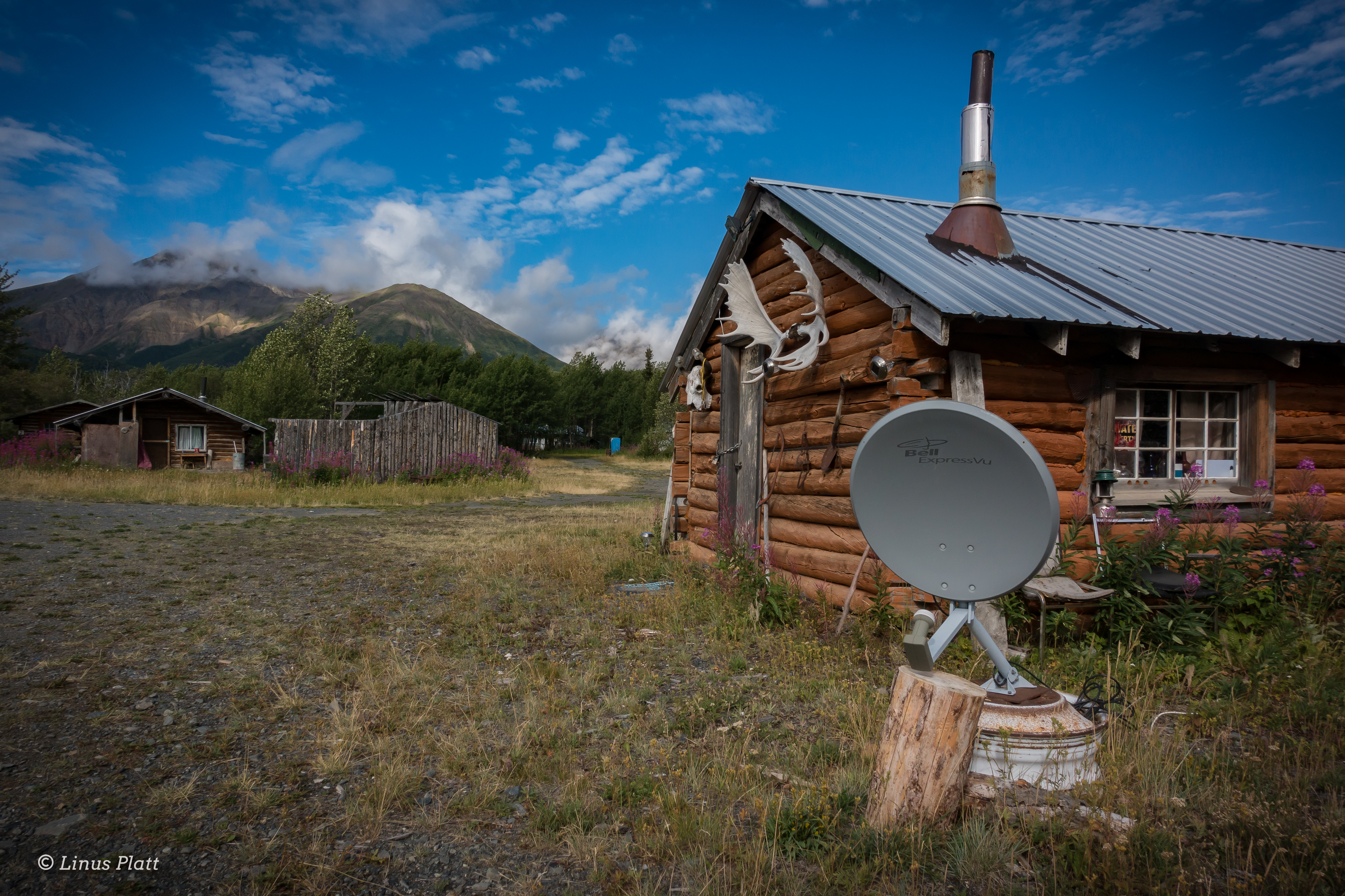
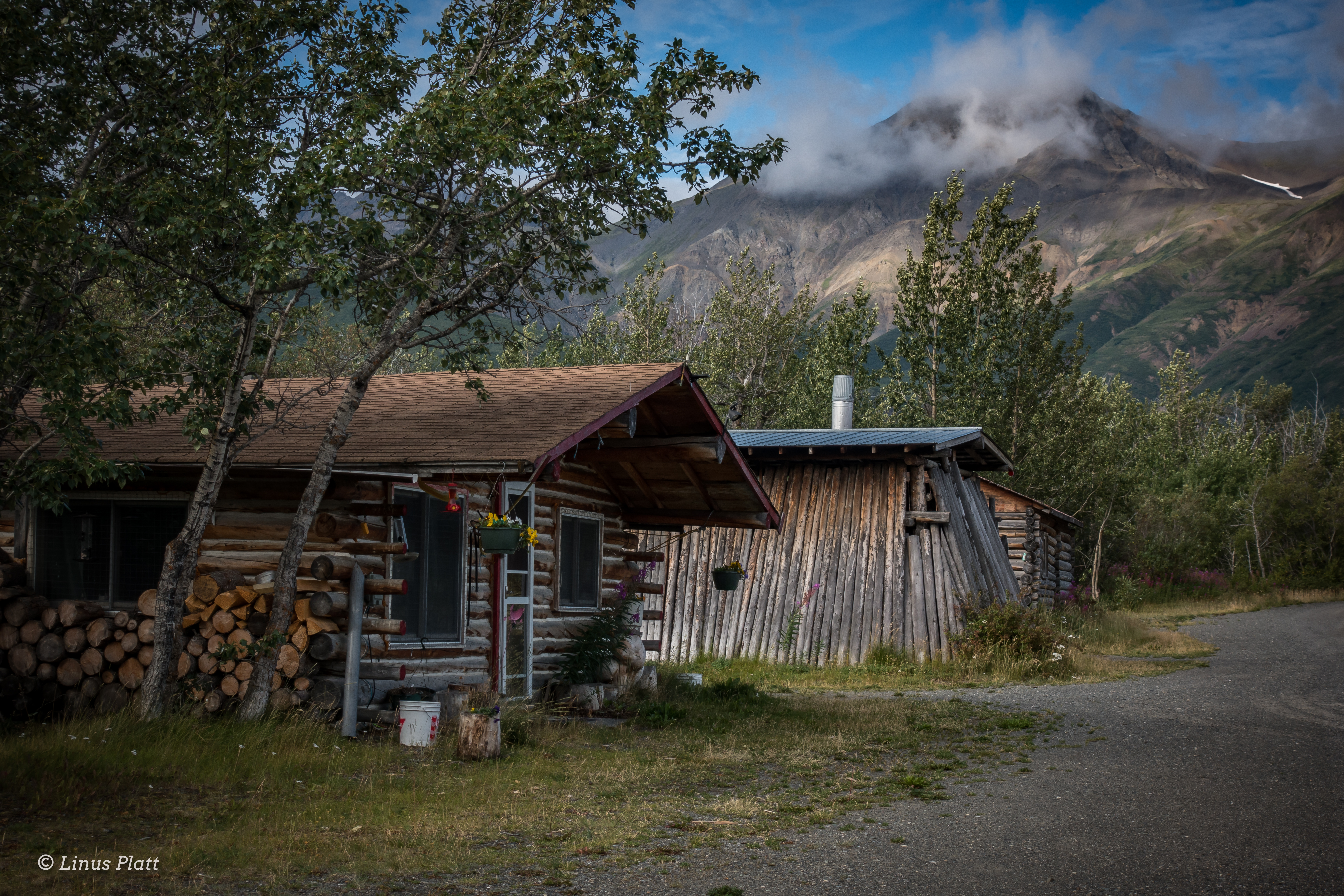
Haines, Alaska… well sort of Alaska; it feels a bit more like a Canadian province than a de facto Alaskan town, is a beautiful place indeed, but contrary to the arrogance of its locals, Haines does not in fact have the monopoly on “Alaskan Beauty”. In fact the Central Interior with its majestic mountains, enormous glaciers, rivers, forests, and expansive valleys are far more appealing to this soul. As are the people and the weather; I found Haines, and by a margin, the people (especially the outdoor adventure community) of Haines to be somewhat cavalier and impudent. Obviously this does not apply to everyone; there are a number of Haines-folk whom I hold in high regard and have the deepest respect for (you know who you are). The winters are heinous for the most part, where it will snow, then rain on top of snow, then freeze, then turn to ice, then repeat… all winter. I’ll take minus 20 degrees F in the semi-dry subarctic climate of the central interior over the plus 30 degrees F and 90 percent humidity of Haines any day of the week. After nearly 8 years living in Haines, I’d had enough. So back to from which I came was in order (I’d lived in Fairbanks for a stint prior to taking up in Haines).

The entire spring and summer was filled with many, many work and carpentry projects for my good friend Sven at his Hostel, converting an old cabin into a genuine public espresso shop, getting my own scene together on my friend Tony’s land at a place I now dub The Raven’s Roost, cutting firewood for the impending winter, and countless other activities regarding work and life preparation. In between all of this, I still managed a day trip to the Alaska Range, a three day fly-in trip to the Brooks Range, a two day pack rafting trip on the upper Chatanika River with Sven, another 2 day driving trip to the Brooks, and several other hikes and forays into the fantastically beautiful White Mountains just outside of Fairbanks. The Raven’s Roost is a good place to throw down for an undetermined amount of time; it sits on several acres of boreal forest, is mostly quiet and private, is close to town (3-5 miles), and on appropriate days, just down the hill from my place, one can see all the high peaks of the Central Alaska Range dominating the skyline.

By the time late August rolled around, I was deeply ready for a needed break; I had only paddled once all summer, and it was a good one. Sven and I paddled a great two-day trip down the upper Chatanika, a beautiful class II paddle on the edge of the White Mountains where we paddled for almost 11 hours straight the first day, finally landing on a good camping beach where we roasted sausages on an open fire, sipped whiskey, and had some laughs.

On August 26th Chris Gavin flies in and having a few hours to kill, we step out for Thai food at the consistently great Lemongrass Restaurant, followed by a tour of my Raven tiny home. Once Rich arrives a few hours later, it’s game on to get organized and gear together at Sven’s hostel. The next couple days are spent roaming town in search of this and that, generally followed by a steak or Sockeye Salmon BBQ from when Sven and I had dip-netted in Chitina weeks before.

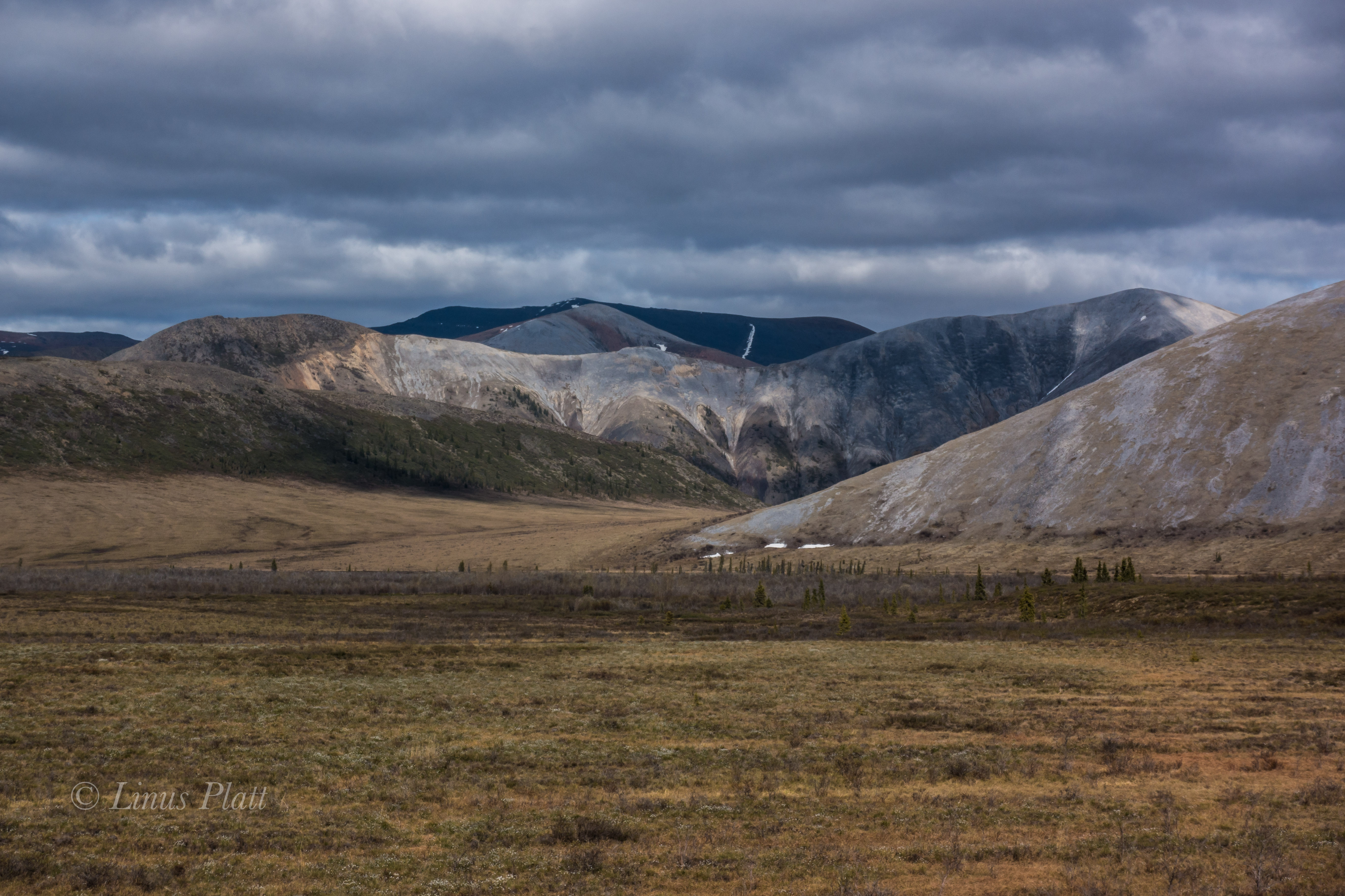
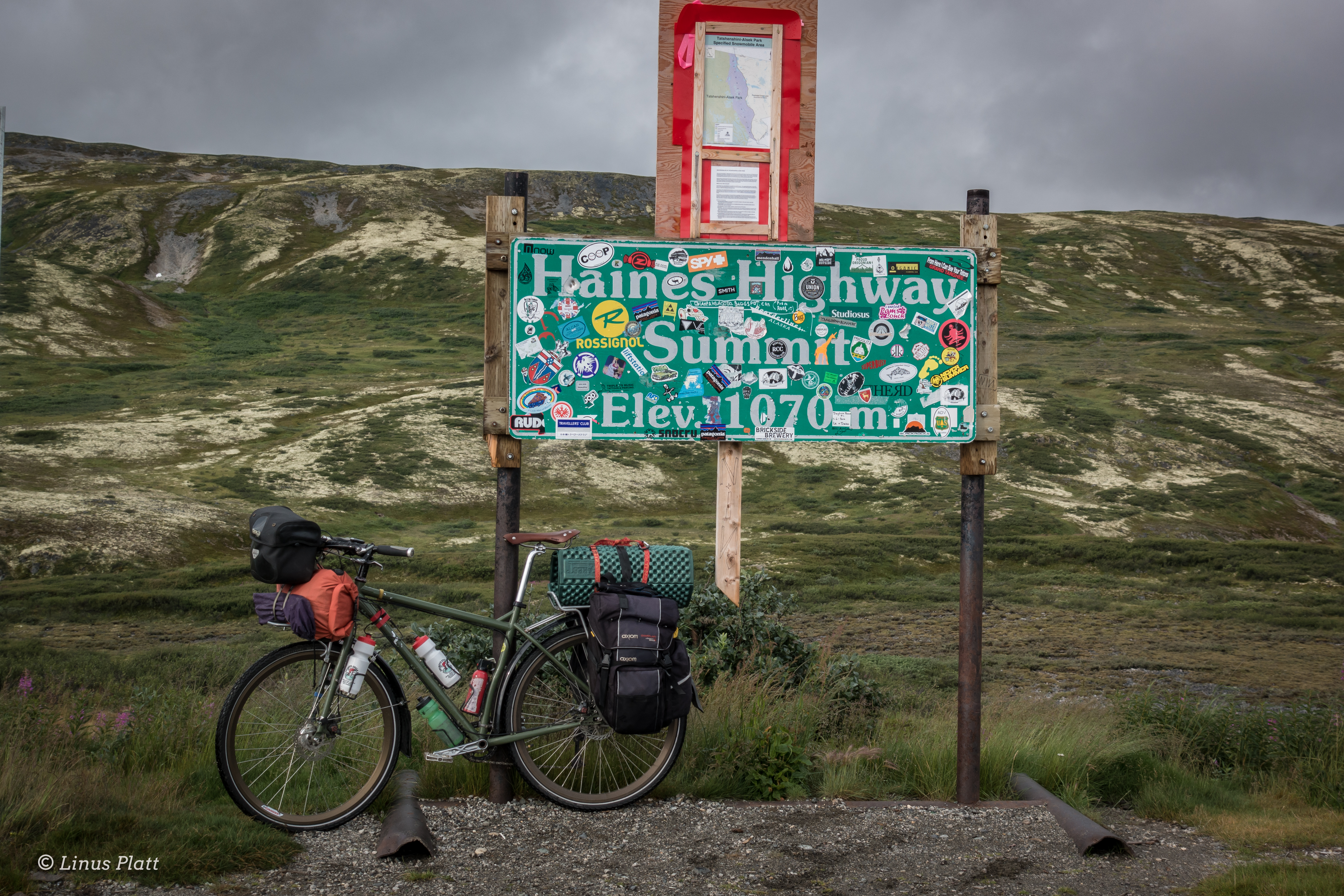
August had been a typical rain-fest, and honestly the weather was downright miserable (this IS Alaska after all) in the days before we headed out for the drive down the Richardson Highway toward Paxson Lake, but as luck would have it, the clouds part the morning we start driving and one might even consider it a beautiful day. With Chris and Rich driving my Toyota pickup, and me in the lead driving my big Ford diesel, we caravan south through arguably my favorite part of the state. It is here that the Richardson passes through the Central/Eastern Alaska Range and has been the scene of many mountaineering and hiking adventures over the years. Our destination and put in is Paxson Lake, just south of Isabel Pass on the Richardson Highway about three hours south of Fairbanks.

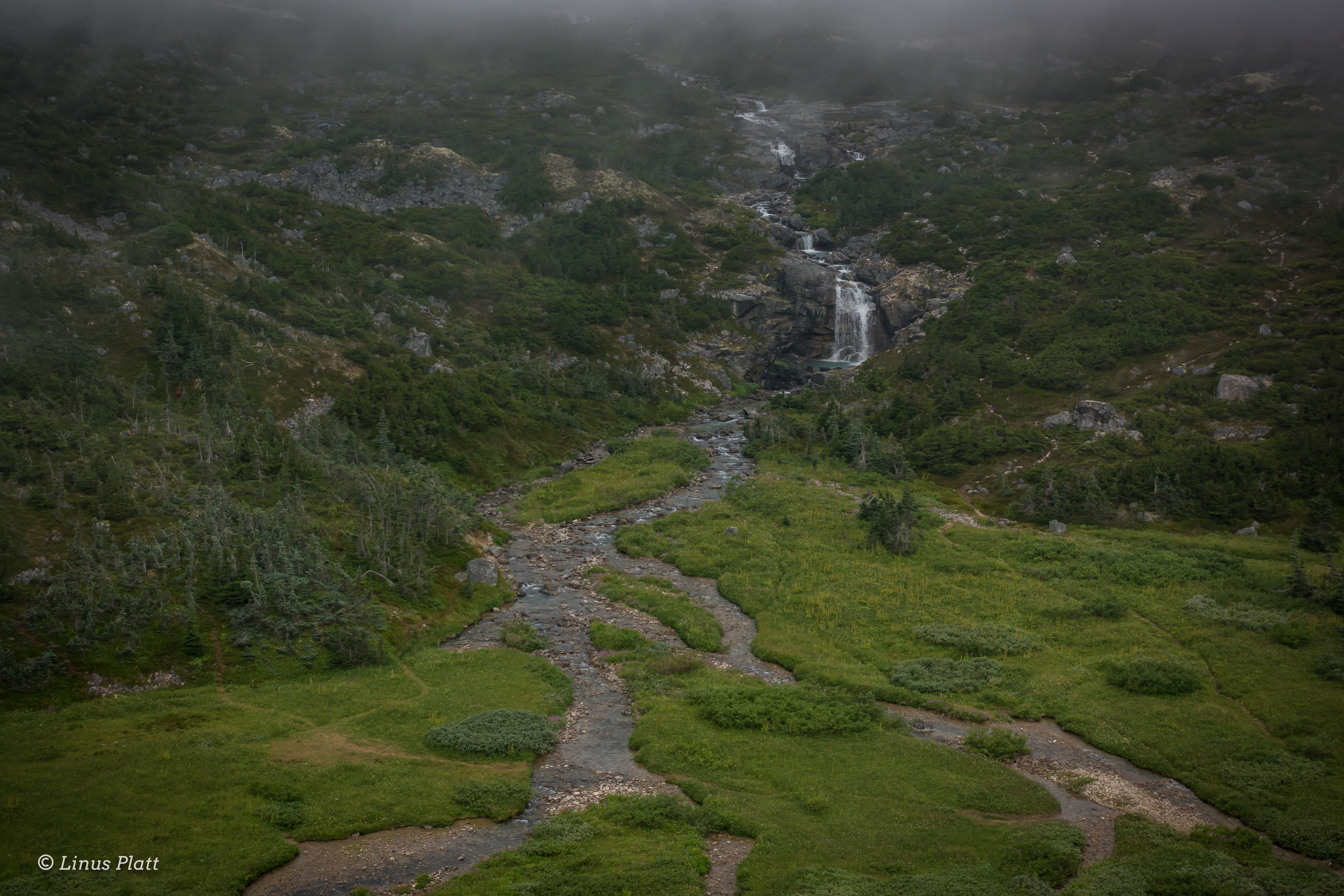
Paxson Lake is fairly large glacially fed lake in Alaska’s interior that is about 12 miles long by about 4 miles wide, and is home to Lake Trout, Dolly Varden, Northern Pike, Burbot, two species of Whitefish, Arctic Grayling, and hoards of spawning Sockeye Salmon from June through September. There is also a King Salmon run in June. The BLM operates a campground and a boat ramp on the east side of the lake, so we opted to spend the night here and get ready for the several mile flat lake paddling tomorrow. The Gulkana River begins its life born from Summit Lake a few miles to the north, where it runs very thin down a treacherous class IV canyon before entering Paxson Lake, where it drains at the Lake’s southern end.

Late that night, from a deep slumber within my tent, I hear Chris outside trying to wake us as the Aurora Borealis is out and wildly going off. I dress quickly and scamper out; the sky is ablaze with one of the true gifts from the north. Chris and I decide to take a walk to the lake shore to catch the show, and seeing the brilliance dancing above the peaks of the Central and Eastern Alaska Range reminded me of why I live in such a beautiful, challenging, and sometimes inhospitable place. Alaska is a genuine treasure 12 months out of the year, and calling its interior my home is something I am extremely happy about and proud of. After the show fizzles down, we walk back to camp and hit the rack.

The morning of September 1st, Chris and I do our truck shuttle to Sourdough Camp further south down the Richardson Highway; luckily we have two trucks so this is an easy operation, save for one minor detail. When Sven and I had gone to Chitina to dip net for Sockeye weeks earlier, there was and still is a major road re-construction of the Richardson, with multiple delays along a 20 mile stretch. I had completely forgotten about this fact when Chris and I rallied south, but ultimately it only added about an hour to the task.

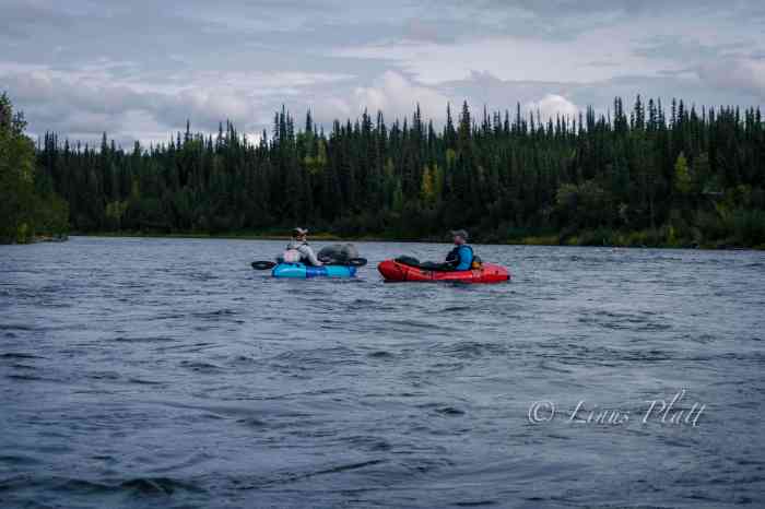
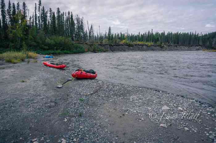
Back at Paxson, Rich has everything laid out and we pack the boats, inflate, and hit the water.
It feels good to paddle and luck is on our side with no headwind. After a couple of hours on the lake, we reach the beginning of the Gulkana where hundreds of Sockeye are spotted in the depths beneath our rafts. This clearly a spawning bed, with as many dead fish as alive. We pull off to a bear trampled area and have a welcomed lunch.

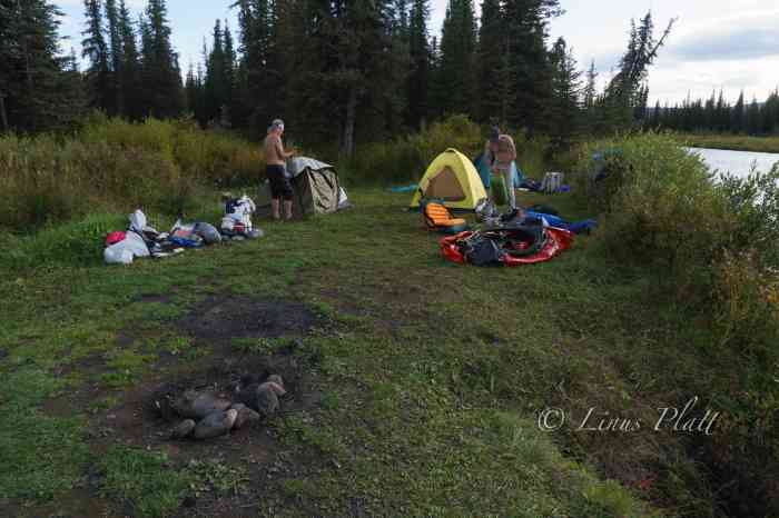
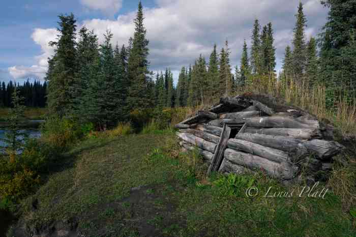
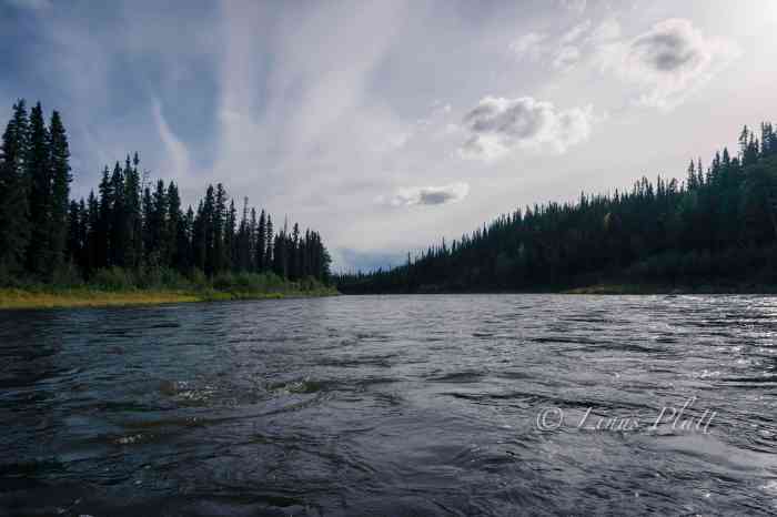
The next section is the real beginning of the Gulkana proper with long, fast and fun sections of class II waves and rollers. After a spell, an old trappers cabin from the late 19th century gold rush era appears and adorning a nice flat and grassy camp spot. We pull off and settle in for the night. The weather is now certifiably glorious and watching the sun set behind the Taiga sees me happily drifting to sleep. Later in the evening, a Cow Moose and Calf zip right past my tent and fjord the river. More Alaska wonderment that makes everything seem all the more special.

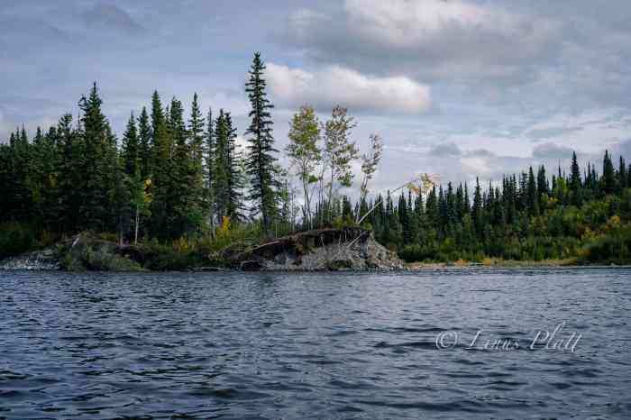
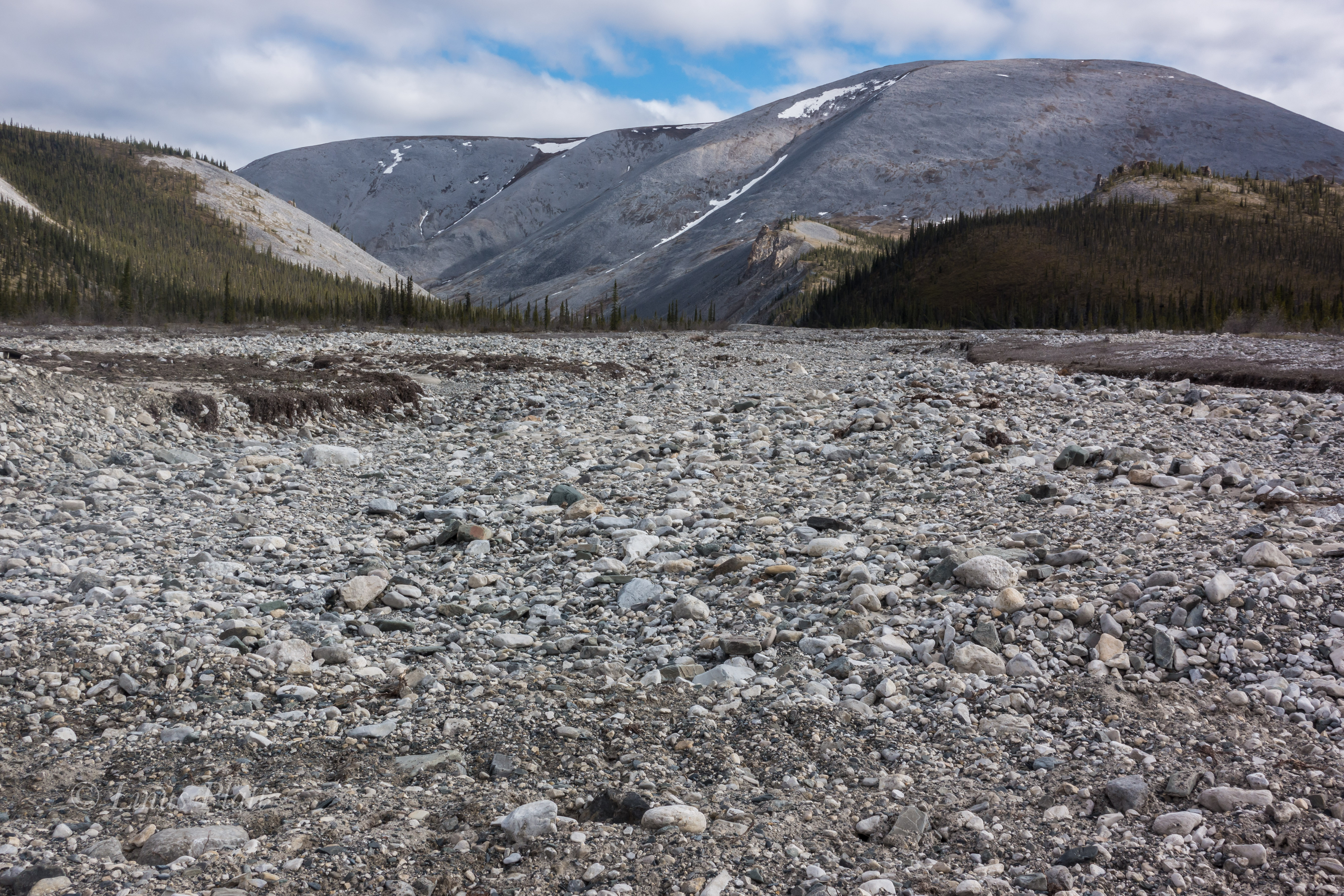
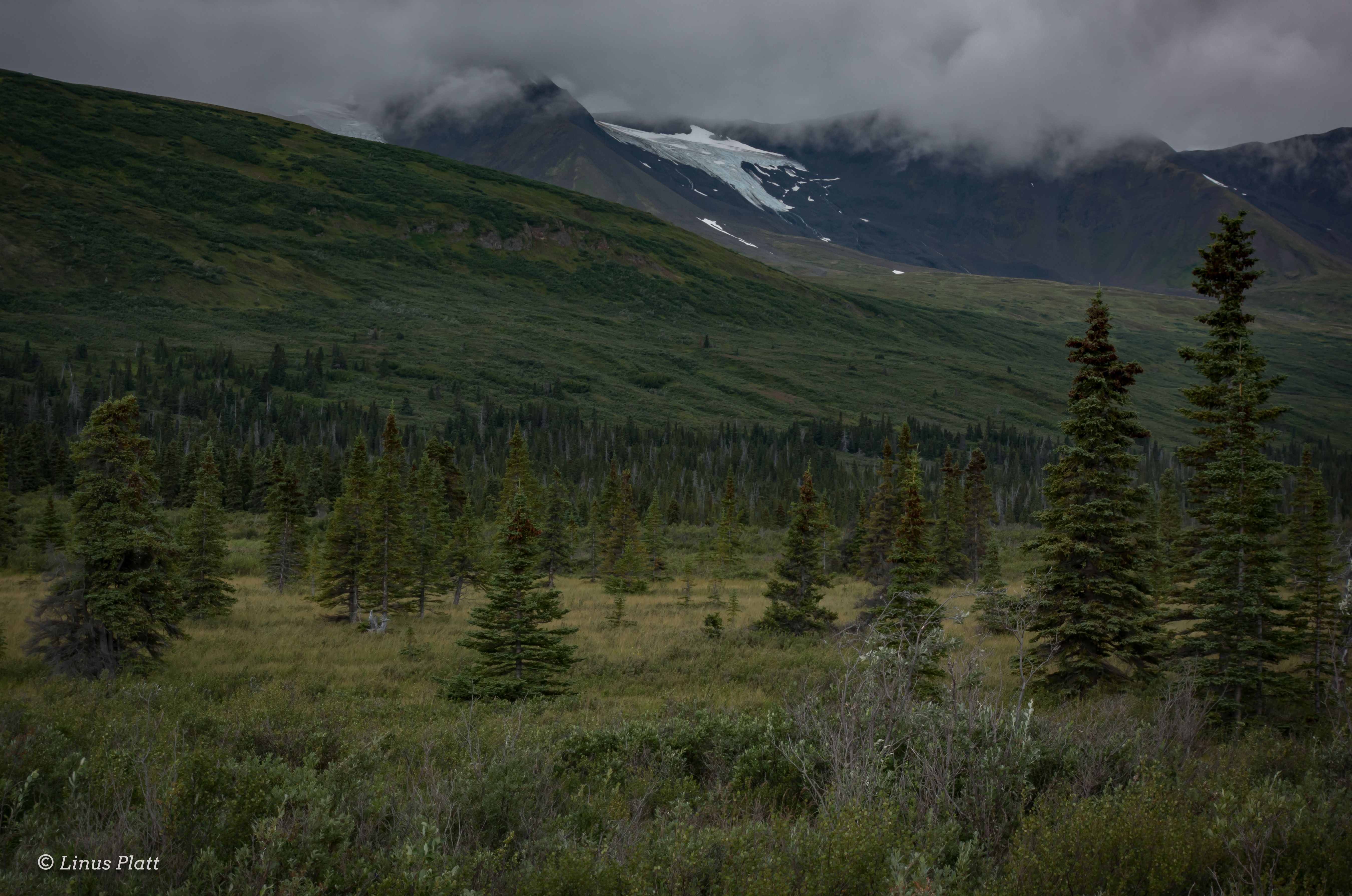
The morning brings ethereal mist and mesmerizing light over the enchanted Alaska landscape, and later in the morning we see more Moose both in the river and in the woods on shore. The critters are out and about. This next section is fairly slow and twisty as the river makes its way through the thick taiga of the upper Copper River Basin; an immense area that once held the enormous prehistoric Lake Atna that formed during the Wisconsin Glaciation period more than 40,000 years ago. The lake was formed when what is now the Childs Glacier grew and subsequently dammed what is now the Copper River. After the glaciation period ended, the glacier receded, draining the lake. The Lake Atna basin is fairly flat and covered in Boreal forest with several remnant lakes remaining, one of the largest of these being Lake Louise, a popular fishing and camping destination for Alaskans during both summer and winter. Later, a few splashy sections follow here and there just to make sure one is paying attention, which we must do in order to spot the take out for the upcoming Gulkana Canyon portage. I had been eager to get to this place in order to scout the Gulkana’s biggest rapids in hopes of running them, but after close inspection, I decide that it is better to portage and live to paddle another day. These class III/IV boilers and pour offs looked dangerous to me, and being at least 40 trail-less miles from the highway means be fucking careful.

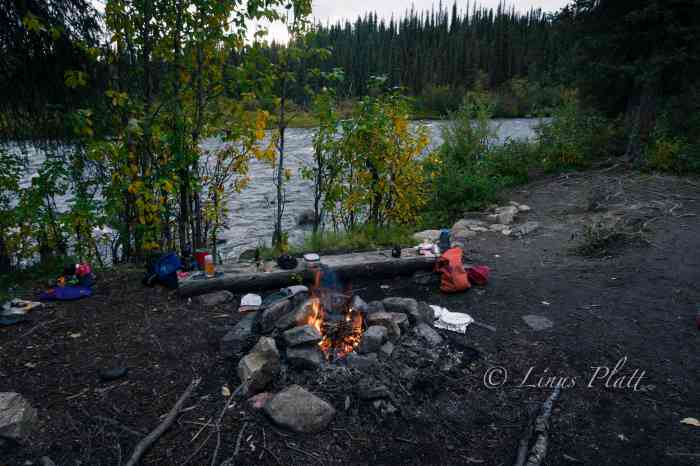
This section of the river at the canyon was a special place for sure; the roar of the rapids, the granite walls and boulders, the Bear trails, fishing holes, and great camping spots impose upon us the idea of doing no paddling at all the following day and instead do some hiking, fishing, and relaxing.

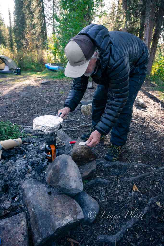
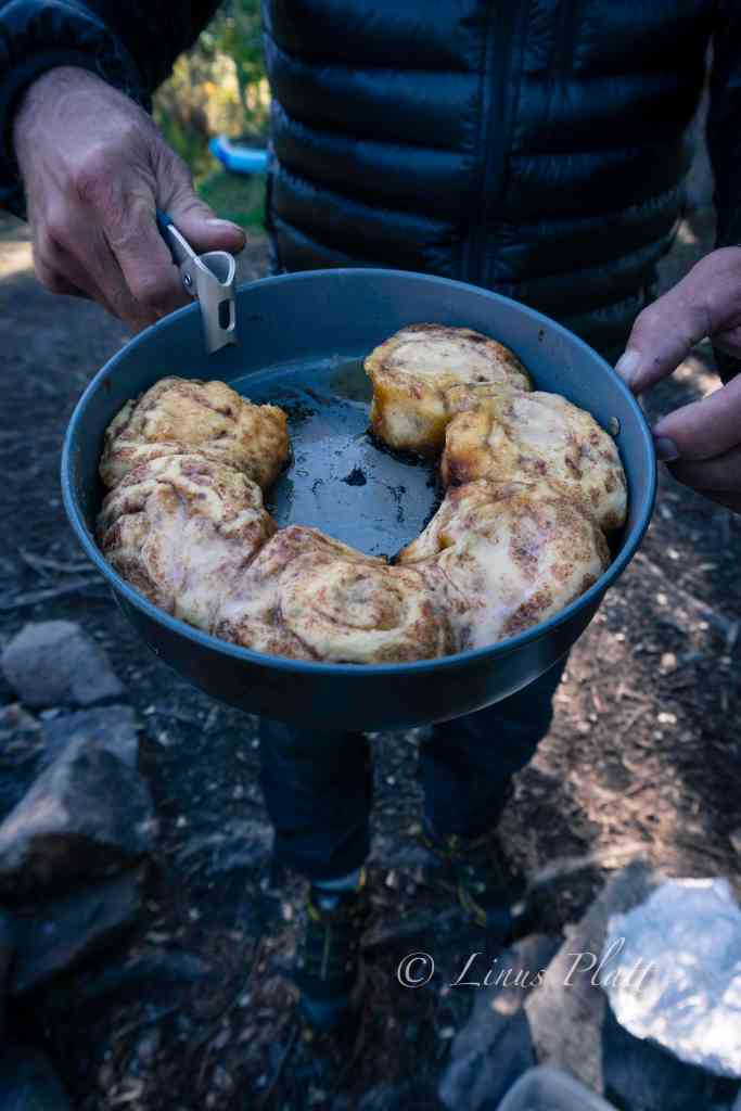
A nice late sleep in the morning followed by a lengthy round of coffee finds us wandering Bear trails up river to have a good hard look at the Class III/IV chaos in the main canyon. The roar is deafening in spots and there are good side trails leading to the waters edge for close inspection of the drops and hydraulics. I had it in my mind that I might reconsider running the canyon rapids today. One very noticeably absent feature of this canyon is any trace of a real eddy line. On the contrary, there is a significant undercut that looks difficult to avoid. I stick to my decision not to run it, and Chris, who also had notions of running it today, decided to duck out as well in the interest of group safety being this far out from rescue or medical attention. Rich did bring along his Garmin InReach GPS communicator for emergencies, but regardless, pushing the envelope seemed a bit reckless to me. It might have been different if I had been paddling a ton all summer, but sadly this was simply not the case. Upon returning to camp, Rich surprises us by whipping up a batch of Cinnamon rolls on the MSR stove, complete with sweet frosting and hot coffee. We sit with our treats and listen to the roar of the river and I watch as a pair of mated Ravens chase one another through the treetops, each one changing the conversation between them frequently with yet another sequence from their extended vocabulary. The Ravens always have a special place in this world to my thinking and Ravens on the Gulkana that much more so.

A bit later, Chris and I decide to hike up to Canyon Lake, for which there is actually a trail, which in most parts of the Alaska backcountry is pretty much unheard of. The “trail” as it turns out is a muddy, rutted Moose path complete with anticipated bushwhacking. We reach the tiny little lake and being somewhat underwhelmed by it’s size and presence, we turn back and head back to camp. Later, we glance at the map, and Canyon Lake is a much, much bigger body of water no more than 5 minutes further past the pond we visited. Ah well…

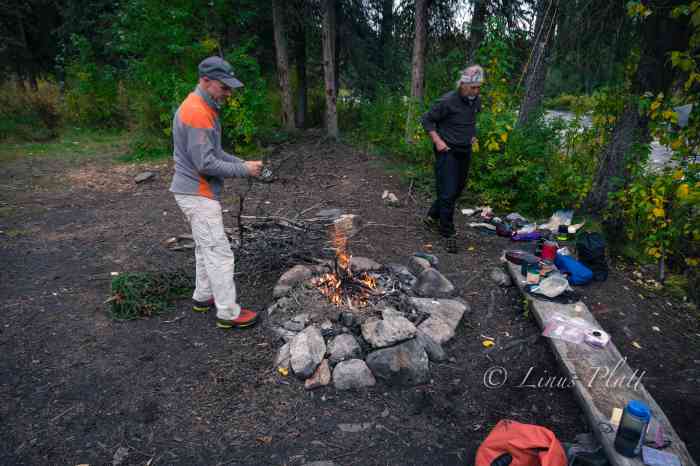
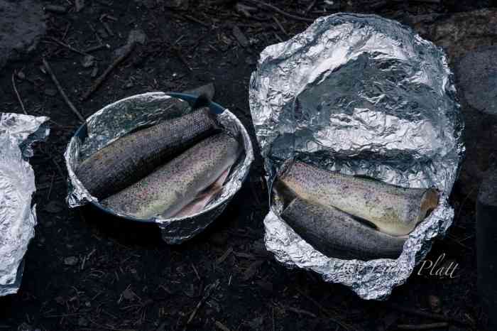
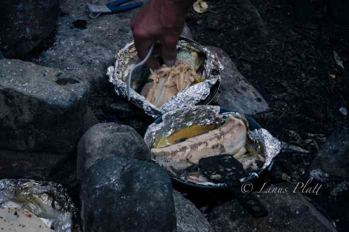
Next, we decide to partake in an effort to catch some fish for an anticipated fish taco feast later in the evening. Chris and I grab rod and reel and head downstream to a hole we had spotted earlier on our hike. The very first cast I nab a 17″ Rainbow Trout, and over the course of about 10 minutes, had another smaller Rainbow, and two nice Graylings. All caught using spinning gear with a small sized spoon. Four fish is plenty to feed the three of us for supper I reckon. After cleaning the fish, I build up an existing campfire ring with more river rocks to create a nice oven-like enclosure. Next, a trip up the hillside to a stash of firewood I had spotted earlier, and we were ready. I crank up the fire, wrap the fish in aluminum foil, sprinkle with olive oil and salt, and crack open the bottle of whiskey for a round of shots between us as we feed the fire and wait for the ensuing coals to develop. Soon we are munching delicious fish tacos and feeling quite content. Later, Rich, in his usual Denali mountain guide style, puts together a grand cheesecake adorned with fresh blueberries picked on site, and serves it up adorning his fake hillbilly halloween teeth set. A good laugh was had by all and as darkness set upon us, we hit the sack. At 2 am I hear Chris outside rummaging around and rapping about the explosion in the sky. I’m out of the tent in a flash and setting up camera and gawking at the miracle above. The Aurora was out and taunting us again, this time spread across the sky in a dazzling display of brilliance and color from horizon to horizon.

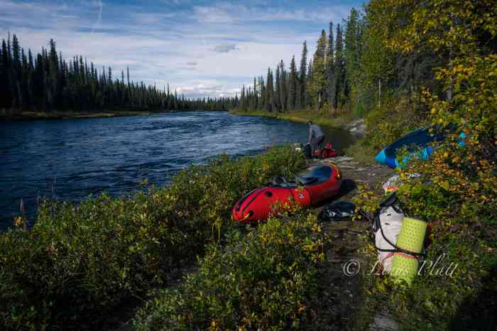
In the early morning hours, I wake to the pitter patter of a steady rain on the tent, shrug it off, and roll back asleep. At 9 am, still in the tent, the rain seems to be letting up, but the silence in camp is tell tale; no one in camp is eager to get up and pack things up wet. As many hundreds of nights I’ve spent in the wilderness and packing it in wet, the task eventually becomes routine, yet is never enjoyable no matter the level of efficiency. After a damp round of coffee and breakfast, we pack it in and hit the water. The rain has all but stopped, but there is a chill in the air that has mostly been absent so far on this journey. For the first time, I’m wearing gloves and beanie, and under my drysuit are layered clothing. The river is outstanding today… loads and loads of twisty rapids, beautiful scenery, and the ever present sensation of being deep into an Alaska back country adventure.

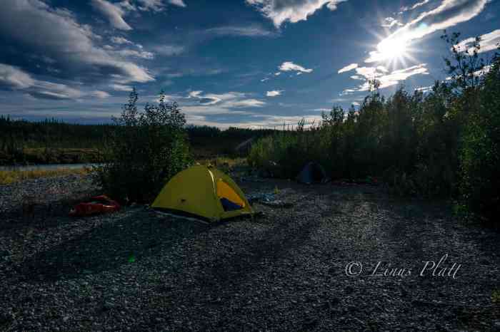
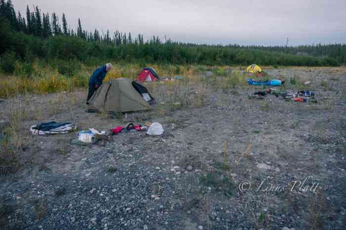
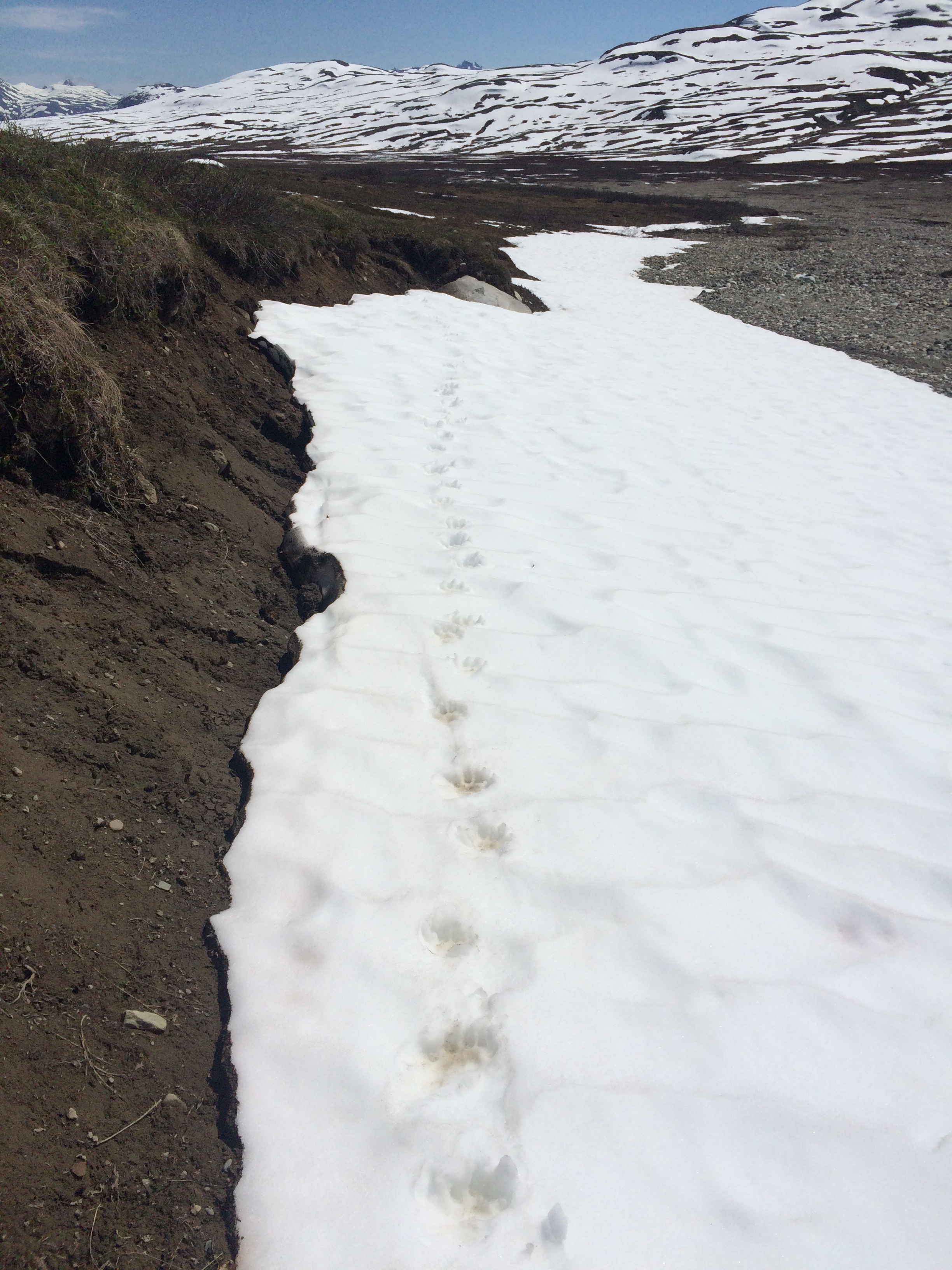
In looking for a camp spot on rivers, I like the sort of gravel beach that meets certain criteria; the size of the gravel need be small, not too many fist sized rocks, but a good mix of gravel, a little sand, and possibly a few larger rocks for a wind break if a fire is desired, and I always look for stashes of driftwood to make said fire. Additionally, I look for ones that are elevated a bit from river level… not much, perhaps only a foot or two to keep a potentially fluctuating water level at bay. Of course it must also afford flat areas for pitching tents and such. Luckily, the Gulkana is graced with many of these aforementioned bivouacs. On this day, it seemed we had been paddling for a very long time; it wasn’t any longer than the other days, but we were all feeling a bit exhausted and felt accordingly, so when an ideal camp appears meeting the above requirements, we pull off, set up tents, and build a nice fire, mostly just for the psychological comfort a camp fire can provide. The nearby river line is dotted with extremely large King Salmon skeletons and skulls, remnants from the run many weeks earlier. A Grizzly Bear track or two lets us know we share this beach with others. The sun sets and a brilliant display of color paints the sky over a vast section of taiga adjacent to our camp as I crawl into my nylon cocoon and sleep like the dead.

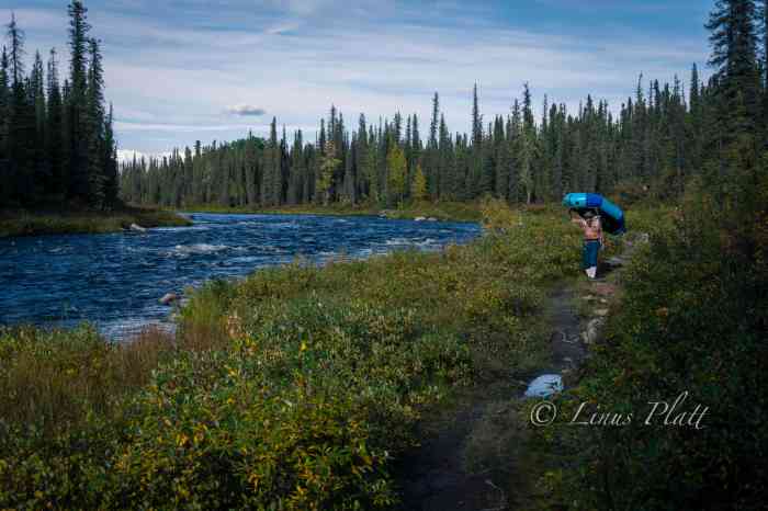
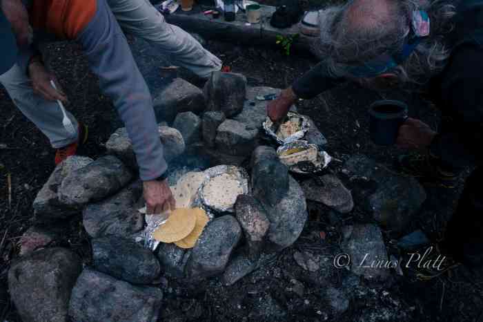
The next day, we anticipate making it to Sourdough where the truck is, and within a few hours, it comes around, and after deflating packrafts and peeling off drysuits, we pack the truck loosely, pile in, and head to Glennallen about 35 miles down the Richardson. After picking up dinner supplies, diesel fuel, and beer, we drive back north to Sourdough and setup a fine truck camp and have a feast of New York Strip, baked potatoes, and a much welcomed salad. Anything but the usual backcountry food and freeze dried meals we normally carry was a treat to the tastebuds and body.

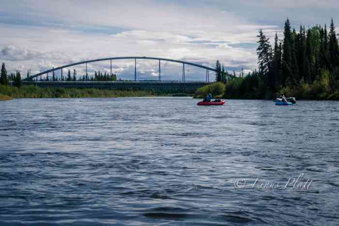
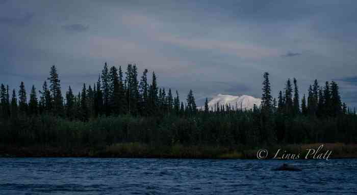
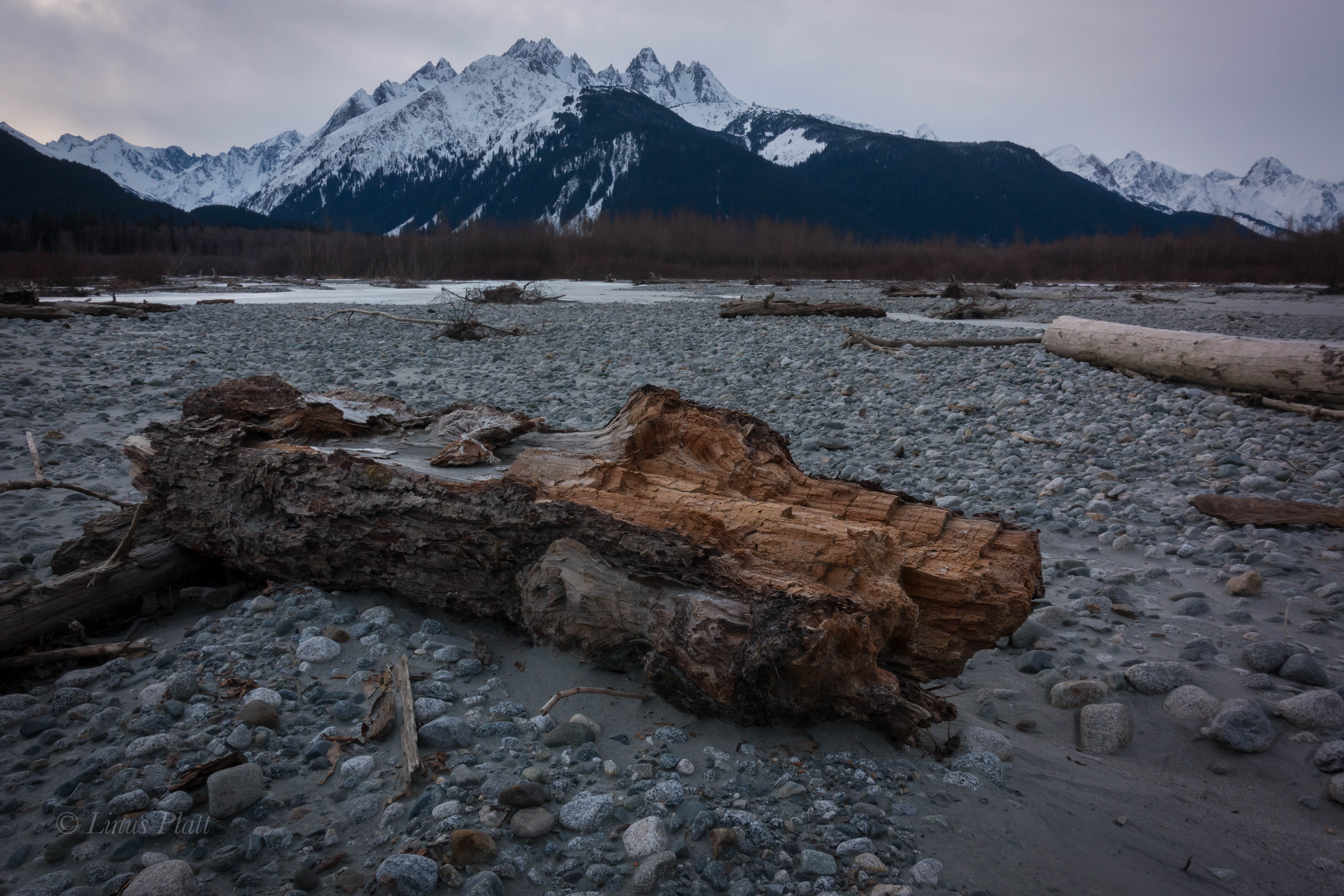
After breakfast and coffee, we decide to keep paddling to at least the Gulkana River bridge near the native village of Gulkana, where the Richardson Highway passes over the river. Many of the accounts we had read spoke only of the section of river north of Sourdough, as the BLM designates that section as “wild and scenic”, which is really nonsense, since the entire river certainly meets that description. To our absolute delight, the section of river south of the “scenic and wild” designation, and the section that few people paddle, turns out to be possibly the best section of the entire 85 miles of river. The river at this point is twisty, fast flowing, and full of many, many class II/III splashy sections. Furthermore, the beauty of this portion is really outstanding, with countless 300 foot high cut banks displaying the colorful geology of the area. Additionally, the fall colors are mesmerizing. Mother nature has painted the landscape all measures of gold and orange hues. The river is big here as well, with hidden boulders and pour offs difficult to see from upriver, commanding one pay close attention. Another long day ends at a good beach camp with a striking view of Mt Drum (12,010′) gracing the horizon.

The following day, we arrive at the Gulkana Bridge, where we ponder the options of either stopping here and hitching to the truck, or continue on to the Copper River and paddle down it a day or so to the community of Copperville. For whatever reason, there was some tension developing between us, and after some poorly concocted discussion, we decide to keep going, which pleased me as I really want to paddle the Gulkana in its entirety. After a couple hours, I see the big, open drainage containing the mighty Copper River, and soon the Gulkana’s crystal clear water slices into the glacial silt of the Copper, creating an often seen phenomena in Alaska when two rivers of different origins merge. Both the Copper and the Gulkana are born of the ice, so it might make one wonder why the Gulkana is clear and the Copper is silty, and as far as my thinking takes me, it is because the Gulkana passes through Paxson Lake near it’s headwaters where the glacial silt is filtered, where as the Copper is a wild and raging specimen shooting directly from glacier to sea.

The Copper River is a beast of a river, born straight from the monolithic mass of Mt Sanford, and known for its treachery, volume, and history, both modern and ancient. It is also known for being festooned with one of the worlds largest Sockeye Salmon runs, As soon as I hit the main Copper channel, everything feels like it went up a notch or three. I suddenly feel intimidated as the sheer size and volume of this mighty river is a whole different experience compared to the little Gulkana. Several days earlier, at a Bear print covered beach where we ate lunch, I managed to paddle off, leaving my PFD behind, and it wasn’t noticed for at least an hour downstream. Now here, on the Copper River, without a PFD, and Rich’s rental packraft, an old school Alpacka boat with a leaky spray deck taking on water, we pull off onto an island in the middle of the river to contemplate the situation.

The main channel we must take looks a tad uncivilized for both Rich and I with our said equipment disabilities. Chris was the only one in the group currently equipment-rich, but we all decide to ponder the possibility of escape. The issue is the main channel that separates us from the highway side of the river. The water is fast and cold. I am suddenly thrown into a psychological battle with myself as a similar scenario last summer on the Klehini River with Angela arises in my thoughts. We decide that the best way is to start a Hairy Ferry (paddling upstream in order to make a crossing) at the most upstream point on the island. Chris goes first, with Rich and I downstream with throw lines in hand ready for a rescue if needed. I see Chris paddle as hard as he can, fighting the current in an attempt to keep the boat pointed upstream. If the not done correctly, the bow will catch the current and turn downstream. If that happens, our plan will fail, and a commitment to the raging channel will ensue, putting us in a much more dire situation. Chris makes the next island, where he pulls boat up on gravel and pulls out throw bag for the next participant, which is me. I paddle like my life depends on it (it does) as adrenaline carries me to the second island. Once again, Chris and I are in rescue mode as Rich makes the third crossing. Since we are on yet another island, we must duplicate these maneuvers one more time, this time matters most as wave train in the main channel could grab us if we are not extremely careful. After another adrenaline fueled crossing, we are on the western bank of the Copper River, and an unknown number of miles from the highway. Had we continued down river to Copperville, we would have been all set to simply hitch hike to the truck at Sourdough, but here, we are at the confluence of the Gulkana and Copper Rivers essentially in the wilderness, unwilling to paddle further, with an unknown and trail-less escape to the highway, which we have no idea it’s distance.

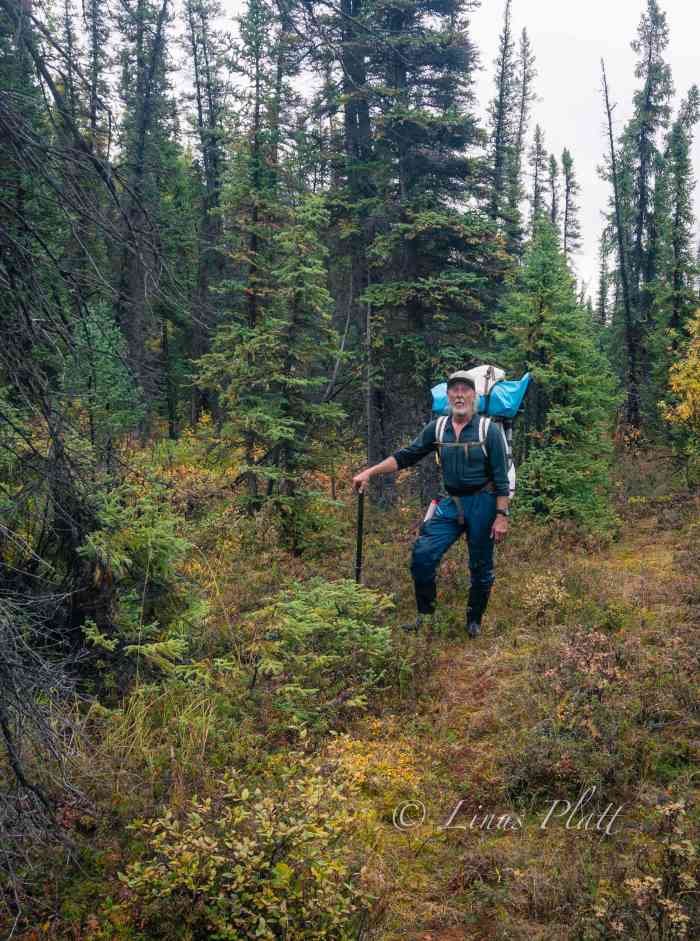
We shortline the boats up a sizable embankment utilizing our rescue ropes and find a pretty nice flat section overlooking the river in which to make a camp. We are all in good spirits since the escape incident went without harm or injury, and we polish off the last of the whiskey, eat a quiet supper and get some sleep. In the wee hours of the morning, it rains solidly, and thus, coercing the three of us to sleep late as per normal during the wet spells. After packing up everything into packs, we shoulder the monster loads, and follow a faint Bear trail north, where we turn west when a drainage appears. Soon we are soaked to the bone from bushwhacking in the wet taiga, but soon it appears we are on track and heading due west toward the Richardson Highway. After an hour or so, I hear trucks on the highway, and without further adieu, we stand on the shoulder of the pavement, feeling pretty ragged and worn. I toss down my bloated pack and begin to stomp north with my thumb out as Rich and Chris guard our packs.

After two separate rides, the first being a couple of Native folks from Gakona, and the second, a Native man from Slana, I’m at Sourdough and walk the quarter mile to the truck. Soon I’m back with Rich and Chris, where we decide to drive to Glennallen for supplies and afterward make the drive back north to Paxson Lake where the other truck is. The next morning a nice
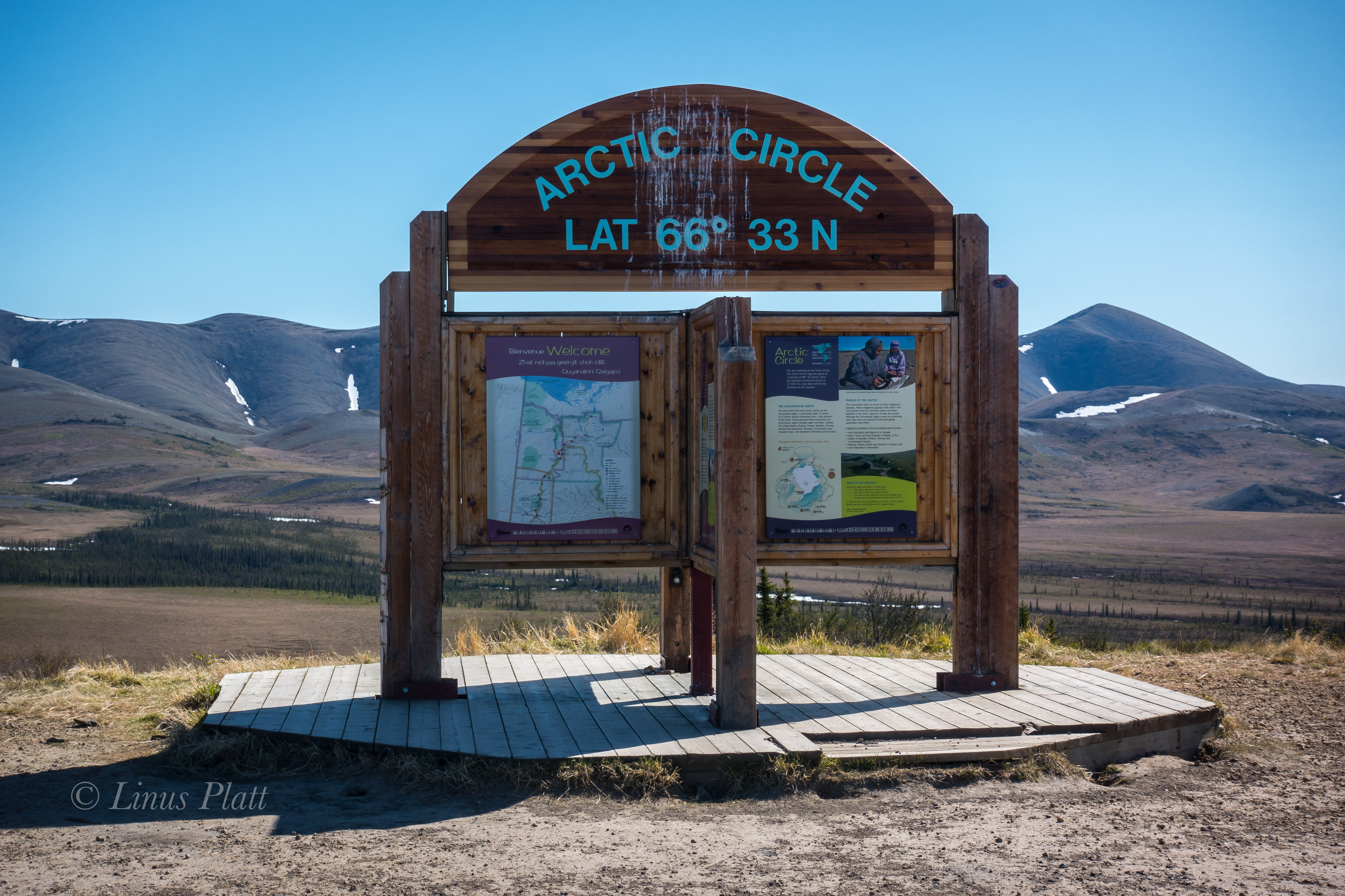
late start sees us happily entering the Denali Highway, 135 miles of glorious dirt road traversing the Central Alaska Range. It had been a few years since I had been out here and was shocked at the sheer number of hunters. Dozens upon dozens of hunting towns of RV’s and 4-wheelers are scattered about the landscape, making it clear there are literally thousands of people out here for the Caribou hunt.

Over a decade ago I rode my bicycle to Alaska starting in my home of 21 years in Moab, and after 3800 miles of pedaling, I found myself on the Denali Highway on a hilltop camp over looking the giants of Mt Hayes and Mt Deborah, the Clearwater Mountains, and the headwaters of the mighty Susitna River. It was at this exact hilltop camp, found by pushing my bicycle up old ATV and game trails, that I fell in love with Alaska and it was at that very moment I vowed to make it my home forever. It was mesmerizing to see this exact place again years later and even more so with the fall colors of the Willow, Blueberry, and Tundra on fire… I named this place Revelation Hill and without a doubt in every way it changed my life forever.

That nigh, camped at Brushkana Creek near the western end of the road, we witnessed yet another spectacular showing of the Northern Lights. Time after time, it never fails to remind me of what a gift the far north is to me. Late that afternoon, we roll back into Fairbanks, where I drop off Chris and Rich at Sven’s and I head home to The Raven to sleep in my own bed for the first time in 12 days. In all, we paddled over 85 miles and spent 8 days on the river including the rest day at the Gulkana Canyon.

A couple days later, the three of us embark the final paddling adventure of the season and hit the Upper Chatanika and repeat the trip Sven and I had had done back in June. Once again, the fall colors are off the hook, and the water levels are surprisingly high, making for an outstanding paddle. That said, the night time temps are dropping and I can feel Old Man Winter poking his head in the door. A couple days later, Rich and Chris board airplanes bound for home and I head home to Raven’s Roost, a hot cup of tea, and a ponder of the coming winter.

Northbound: Leaving Haines and Into the Far Yukon

Getting on the road by 10:00 am or so following town chores and paying bills, I am happily cruising up the Haines highway and northbound for the Yukon and beyond. I approach the Eagle Preserve at 20 mile and the engine alternator idiot light comes on… funny, never saw that before on this truck. I pull off the road and pop the hood for an inspection. Using a volt meter, I check voltages of the battery with both with the engine running and not running. A nominal voltage of 12.4 with the engine running indicates that the alternator is not doing it’s job. In fact, it has shit the bed… Reluctantly, I turn around and baby the 30 year old Toyota back to town to re-group. Pulling into the parts store, I am amazed that they have one in stock. 142 bucks and two hours later, I have the alternator installed and the last bolt tightened and I am on the pavement rolling north once again.

At the Canadian the border, there is a length of vehicles waiting I have never seen here before. After an hour wait, I am flagged in and questioned. I am asked to exit the vehicle and wait inside while my car is searched, which the Canadian border cops do with abandon. Again, I have never experienced this before. Another hour and I am free to go after they come to terms with the fact that I have nothing to hide.  Two hours to get into Canada. I am beyond happy to have the Chilkat Valley behind me. Driving over the Haines Summit and into the high country sees me smiling and as the Yukon border comes ’round. I am washed over by an array of mixed feelings; most of me is extremely happy to be on the road and rolling away from Haines, but part of me dreads the inevitable slash of loneliness that will undoubtedly come in short order. In fact, as I near the Tahkini River, the dreaded sensation enters me, invades my space and riddles my ravaged heart with bullet holes. I shuffle this back to a place of inner strength that is there for survival reserves and continue.  I get to the Tahkini and make a fine camp there; it was a familiar camp as I had spent time there on past trips. The evening colors around 1 am filter the sky orange and pink and patches and fills my heart and soul with much needed color and softens the dramatic episodes within me. I sleep.

I awake to the warmth of sunshine and something splashing in the river. I pack up and pull out onto the Alaska Highway again heading towards Whitehorse. These feelings I cannot seem to shake and I hope that once past Carmacks or Dawson, they will fade. In Whitehorse waiting for the Fireweed Bookstore to open, I am accosted by a pair of drunks jabbering nonsense at me. Soon, my maps and food are purchased and I am driving the wide open spaces of the North Klondike Highway bound for Carmacks. A torrential rain storm ensues. The roadway becoming a slab of dangerous water; I slow down but other traffic does not. I won’t be bullied by these vehicles and I pull off when I can, but it is up to them to pass if they wish to drive at unsafe speeds. Camping that night in the Taiga forests among Aspen and Willow, tiny yellow birds flutter my camp and a Red Squirrel chirps in the forest nearby. These trips, when I am by myself, which is 95 percent of the time, tend to promote moving along, bound for a destination and goal. It is sometimes difficult to just set back, especially these past weeks, as the creeping dreaded sensations that have filled me lately prevail when I have come to a stop. So I simply keep moving. Regret is futile, and yearning for an undeniably uncertain future is equally so. I have no past, and working toward the future like some kind of mystic jewel seems pointless; I simply am. My heart and desire are too big for this world and most cannot deal with my intensity and passion… the heart is the only guiding force. Chalk it all up to a lifetime of amazing experiences. I am the wind…

The morning sees me drifting closer to Dawson City; nearing the Klondike river at the entrance to the mind bogglingly beautiful Dempster Highway, I spot a pair of bright blond Grizzlies grazing the grass on the side of the highway. So beautiful these magnificent creatures; I often wonder what attracts them to the highway like this… is there something that grows only near the road that they find edible and tasty? I pass the Dempster and head to Dawson for fuel and a snoop around and maybe a nice espresso drink. It had been 4 years since I had been to Dawson, and not much had changed. That is a good thing. Dawson is a gem in the far north to me; it is a place of historical significance, color and interest. I get an Americano at the lovely Alchemy Cafe and soon I am back down the highway the 25 miles to the start of the Dempster. My plan is to hike into Grizzly Lake in the Tombstone Mountains and spend the night there, taking photographs and shooting video. But when I get to the trailhead, there is a notice that the trail is closed. This is the second time that this happened… I was here in 2013 to not only hike to Grizzly Lake, but to also ride the Ogre all the way to Inuvik in the Northwest Territories. Neither happened on that trip. After pedaling for three days, the road was washed out north of the Ogilvie River, and I was forced by the road crews to turn back. The Grizzly Lake Trail was closed due to high Bear activity in the area at that time; this time it was closed due to heavy snow still on the ground. So in 2013, I stashed my backpack under a rotting Spruce log and continued my bike trip up to Deadhorse and beyond. But today I was in my truck, bound for who knew where. I walk into the forest and immediately locate the pack I had stashed 4 years prior, and skedattled up the gravel Dempster to my favorite section. It is a place where the second of three continental divide crossing occur on the Dempster. A place north of the Blackstone River in the Taiga Range; birth home to Engineer Creek, Mountain Goats, Grizzly Bears, and Caribou. I am looking for a peak to climb in the area, and a ridge leaving the pass right from the road directly on the continental divide leads to an un-named summit of perhaps 6,000-7,000 feet. I decide on it, but first I wish to continue north and do it on the way back. A couple miles down the road is a beautiful alpine canyon situated directly at tree line with the headwaters of Engineer Creek flowing through it’s guts. I find a wonderful camp and set down upon it happily. Glassing the slopes nearby, I spot a heard of a dozen strong Mountain Goats, including several babies who seem to be happy to be jumping around and playing wildly amidst the high and treacherous slopes they are perched. This area north of the Blackstone in the continental divide country is by far my favorite part of the Dempster experience. Late that night, perhaps around 1 am, I awake with a yearning to leave the tent and go on a “night” stomp. I exit the tent and walk across the road and disappear into the muskeg and Taiga. Tussock tundra appears and I run as fast as I can towards a barren hillside, where Willow Ptarmigan scatter. Being spontaneous is what sometimes drives me, for better or worse. It is simply fun, and nothing beats the sensation of just making a snap decision and going for it. I look out over the alpine valley I am in and it occurs to me that every Human on this planet is going through some form of struggle largely unknown to the rest of us. I am not alone…

With my cup of Green Tea in the morning, I make a toast to the South, East, West, and of course, the North in thanks and offering of gratitude. I drive north again, this time paralleling the Ogilvie River at at point further that I got on my bicycle in 2013. A Grizzly slowly walk across the road in front of me a couple hundred meters off and disappears into the Taiga, and more Ptarmigan flutter about at road’s edge.

Many miles after leaving the high country, the road drops into river valley’s and enters First Nation native hunting lands. The Dempster at this point climbs to a high point on Ogilvie Ridge, where unobstructed views of the Ogilvie and far, far off, the Peel River, heading to the great und vast McKenzie River flowing to the Arctic Ocean. The road continues along this high Taiga bench for many, many miles. It is dry up here. And exposed. And monotonous… till finally Eagle Plains comes around where I gas up the Toyota and continue on. Soon the Arctic Circle appears and beyond are the rounded tundra summits of the Richardson Mountains, which, in essence are an extension of the British Mountains in the Yukon which are an extension of the Brooks Range in Alaska. The Richardson’s are unique in three ways; They are the final continental divide crossing on the Dempster, dumping all water from them on the northeastern side into the Arctic Ocean, they form the border of the Yukon and Northwest Territories, and they are the last formidable geologic uplift barrier between the interior and the arctic plains of the Canadian “north slope”.  Beyond which lie the extremely remote communities of Inuvik and Tuktoyaktuk. The road travels directly north along the western escarpment of the Richardson’s for many miles, traversing some of the most incredible Arctic scenery I have ever seen; in fact it equals the Brooks Range in beauty and remoteness.  Although it is not nearly as big as the Brooks, it is even more remote really. Soon the road turn east and climbs over Wright pass at the final continental divide and crosses into the Northwest Territories. This place is absolute magic. It is quite chilly here, this far north at the continental divide. The last time I was in a similar place was in 2013 on the summit of Atigun Pass in the Brooks Range on The solstice at midnight. It was cold then too… The road continues through the Richardson Mountains, revealing tundra, high peaks, wild flowers, and wild rivers. After descending the last great decline out of these magnificent mountains, the Canadian Arctic slope appears in the distance, extending for hundreds of miles to the McKenzie Delta. I pull off the road, some 30 kilometers into the Northwest Territories and notice the immense trail of numerous Grizzly prints decorating each side of the road. At night these massive creatures must use this road as a path. There are more Grizzly prints here than I have ever seen anywhere in my life.

Finally, after saying farewell to the NWT’s and wishing to continue on to the Arctic slope, but becoming increasingly paranoid about the 30 year old Toyota Truck’s engine with a quarter million miles on it, I turn back and drive back to from which I came. Passing once again the Arctic Circle and gassing up in Eagle Plains again, a few hours later I am back in my favorite and stunning alpine valley north of the Blackstone River. I am exhausted and plan on a peak climb in the morning. In the tent, I sleep like a dead man.

After crossing a short bit of tundra in the morning, I begin climbing up the class 1-2 talus of the ridge line to where it nearly flattens out but continues in a westerly stretch for about a half mile before the final summit pyramid rises abruptly and ends. After 4 hours from the truck, I stand on the unknown summit and marvel at the other peaks around me and the strange and unknown alpine valley’s that separate them. I decide to descend a different route in order to walk out one of these valleys following a creek where I hope to see signs of animals. The decent was treacherous; some of the loosest scree and talus I have ever encountered kept my attention level extremely high and after considerable time and effort, I find myself at the head of this glorious alpine valley, flowing within it the beautiful little creek mentioned. On the way down valley, I see no animal prints of any kind, but spot a pair of caribou antlers lying in the tussock. The are from a small and possibly younger animal, with part of the skull still attached; taken down by wolves I imagine. After a bit I am back at the truck and I blast off again, this time bound south for Dawson, where contrary to my intentions to keep this an alcohol free trip, I decide to duck into a tavern and have a beer. I order my beer and when I go to pay for the beverage in U.S. dollars, the First Nation’s woman in the chair next to me starts ridiculing me for being an American. She proceeds to stick her finger in her mouth indicating forced vomiting, therefore expressing her displeasure. I tell her, “I’m not American, I’m Alaskan”; she was not pleased and continued the harassment. After a bit, I told her she didn’t know me and that she was a no good judgmental SOB (as it were). I left my lone beer sitting there on the bar and left. All I wish for is friendship, love, and understanding – hard resources to find on this here planet. Later, at a makeshift camp, the cops show up to kick me out, but tell me where I might go for a low profile and free bivy.

That night, I toss and turn and sleep eludes me nearly completely. Tomorrow I will ferry across the Yukon River and drive the Top of the World road (AKA the Ridge Road) and into the deep interior of Alaska. I had ridden this road on my bicycle a few years ago and found it to be one of the toughest rides in the north. I’m happy that the old ‘Yota and me will be traversing this together this time.

Leaving Haines-07702
Tahkini River… Yukon Territory

Leaving Haines-07726
Klondike Woods Camp

Leaving Haines-07733

Leaving Haines-07739
Tombstone Mountains, Yukon

Leaving Haines-07748

Leaving Haines-07759
Blackstone River Ice Pack

Leaving Haines-07764Leaving Haines-07773Leaving Haines-07778Leaving Haines-07781

Leaving Haines-07787
The Blackstone uplands and the start of the Taiga Ranges

Leaving Haines-07790Leaving Haines-07794Leaving Haines-07804

Leaving Haines-07881
The Dempster Highway

Leaving Haines-07883

Leaving Haines-07887
The View From Ogilvie Ridge

Leaving Haines-07907
Eagle Plains

Leaving Haines-07910Leaving Haines-07927

Leaving Haines-07948
The Beginning of Canada’s Arctic North Slope

Leaving Haines-07952
Grizzly Tracks, Richardson Mountains, Northwest Territories

Leaving Haines-00584Leaving Haines-08909

Leaving Haines-08913
The Un-named Peak North Of The Blackstone Uplands

Leaving Haines-00585Leaving Haines-09726Leaving Haines-09727Leaving Haines-00580

Leaving Haines-00608
Caribou Antlers


An Exerpt

A paragraph from the book I just can’t seem to actually finish… maybe that is the point; maybe it is not supposed  to be finished…

“Just south of the lodge known as Bell II, I look through a clearing in the forest and see for the first time Canada’s great and glaciated Coast Range. Craggy peaks engulfed in ice and nary a road any where near them, I feel a washing aesthetic come over me, similar to seeing for the first time in many years the Canadian Rockies weeks earlier. I am coming home to a place I have never been, and a heartache for all things wild and free develops within, and a budding sense of realism penetrates all that this pedal north is becoming. Thoughts of my past life in Moab are becoming a distant memory, with visions of the North encompassing all of me and all I will become. This place, the Cassiar, her mighty rivers and expansive forest, begin to feel oddly familiar. There is a vague yet noticeable tinge of something ancient in these forests; something unexplainable that has catapult me into a womb of wilderness and animals. I see a Black Bear, then another, then another. The concepts of the modern world drifting from my heart; the destruction I feel I have left behind, the crying of a world gone mad, and the never ending forest are all I see now. In retrospect, I am quite certain that it was at this point my life changed forever. Never again could I be satisfied or feel safe in a world full of madness and decay. Here, my heart lost in a sea of timber and mountains, I see nothing but balance and I could never again return to what I had left behind. I was still a long way from Alaska, and if what I was experiencing here was only a precursor, I felt I might simply explode when I arrived in what the Athabascan’s call, “The Great Land”.”

Kicking Horse

alaska-wilderness-jagged-mountains

     Adjacent to the tiny village of Haines, Alaska, and across the emerald saltwaters of the Chilkat Inlet, lie the deceptively remote and jagged peaks of the Chilkat Mountains. These peaks are of a particularly steep and heavily glaciated nature and include the enormous mass of the Cathedral group that includes the mighty Mt Emmerich, clearly visible from town. Emmerich is the visual centerpiece of this group and rises out of the Kicking Horse River valley just east of it’s convoluted mass. The Kicking Horse River is a river born of the ice; it’s scant origins flowing from the snout of the Garrison Glacier situated at the northeastern end of the range, where it flows for a relatively short distance to it’s confluence with the heavily braided and Salmon infested Chilkat River. At the point where this confluence occurs, the Chilkat narrows to perhaps a half mile across, and on this 9th day of February 2017, winter temperatures has frozen the Chilkat solidly enough to allow crossing on foot.

     This winter in Haines has been one of mostly consistently cold temps, with snow on the ground for the entirety of the winter season so far; only once or twice has rain been allowed passage to our winter Alaskan landscape. This is the way I like it and having the rivers frozen over has gained me the chance to explore the “far side” of the Chilkat several times this season. The far, or wilderness side of the river gains access to the peaks of the Chilkat and home to a wolf pack twenty strong. Once, last fall, I had the ultimate pleasure of viewing, with binoculars, several wolves attempting to take down two separate Moose. Ultimately, both moose escaped with lives intact. The visual experience left a deep impression on me and the deep wilderness just across the river has been enchanting me ever since.

     Earlier in the winter, I had the pleasure of wandering across the river in other places; once at 10 mile and across to the dense Alder thickets of the Tahkin River, and another time near to 8 mile where once across and beyond the barrier of Cottonwoods lining the shore, I found open snow covered meadows full of Moose, Wolf, Lynx, and Rabbit tracks a plenty. For me though, these were just to test the waters of crossing the Chilkat and the ultimate goal was to reach the confluence of the Kicking Horse River. While there are other, more remote rivers that flow from the Cathedrals, the Kicking Horse to me was one that had a special interest. It was more accessible and equally as wild. So today it was to be…

     Parking on the Haines Highway at the state fish and game run fish wheels, I meander out onto the ice and instantly feel the bitterness of the biting wind. The surface is a mixture of crystal clear ice several inches thick and more opaque sections requiring more care in regard to judging the thickness. As I walk the slippery clear sections, I look to see the bottom of the river a few feet below and imagine the thousands of Salmon swimming upstream as they do every year as they have for thousands. Chinook, Chum, Pink, Sockeye, and Coho all run in these waters. Soon I am near the other side and the frozen Kicking Horse is a mere 300 feet ahead. However, there is a channel of open and running river water just in front of me, blocking access to my destination. Further east, I can see that the channel slides under the winter ice pack and disappears. How thick is this newer ice I ask myself? I walk further downstream to where the ice re-appears and gingerly step into this new zone. I can see immediately that is is very thick and soon I am completely across the Chilkat and standing on the gravel shores of the braided Kicking Horse confluence.

     It feels downright sublime to be standing here and looking up the Kicking Horse for the first time; gravel bars and Alder thickets lead to a narrowing of the river before it disappears into the bowels of the wilderness. I walk these frozen river banks, occasionally crossing thinly veiled ice sheets over rocky surface, boots crunching loudly and the stiff breeze from earlier dissipating. A long stretch of snow leads to the forest where hundreds of Wolf tracks appear. At least part of the pack has traveled through here recently. I look around and see more Wolf tracks than I have ever seen and realize that the Kicking Horse must be some sort of Wolf highway; a passage leading from the wilderness of the Cathedrals to the shores of the Chilkat herself.

     I travel further into the corridor till passage is barred by river ice with a couple inches of running water. Here, the forest at river’s edge are many dead Cottonwoods stripped of their bark and treetops. They stand like monuments guarding the inner access to the wildness beyond, Mt Emmerich towers over head, displaying intricate ridge lines, towers, gendarmes, and gullys. This is the closest I have ever been to this peak and I am awestruck by it size and complexity.

     This is my turning around point and it is getting late and the temperature is dropping, so back through the Adler thickets and gravel bars and the multitudes of Wolf tracks to the frozen Chilkat, where an easy stomp back to the highway is in order.

     The Kicking Horse has always held a great deal of fascination for me and today was a teaser that strengthened that notion.

     I will return …

kicking-horse-2kicking-horse-3kicking-horse-4kicking-horse-5kicking-horse-6kicking-horse-7kicking-horse-8kicking-horse-9kicking-horse-10kicking-horse-11kicking-horse-12kicking-horse

The Great Northern Golden Triangle: The Ogre Pulls Off Another One

After getting mentally and physically prepped for the last couple of weeks, I awake one Monday morning and decide that leaving several days early on a ride of the North’s “Golden Triangle” is in order. My boss and co-workers seem to have no issue with the notion, and off I go to take care of last minute details at home.

Some folk’s call the ride in question the ”Alaska Golden Triangle”, which is a misconception since most of the ride occurs in Canada’s Yukon Territory. The route however, starts in Alaska, crosses British Columbia, traverses about 180 miles of the Yukon’s mighty interior, crosses back into B.C., and finally ending in Alaska at Skaguay. The first few miles and the entirety of my first day pedaling consist of the Chilkat and Klehini River corridors through the beautiful Chilkat Valley, ending at the Canadian/ U.S. border and the beginning of the climb up to Haines Summit, more locally known as Chilkat Pass. This Pass separates the interior of Northern B.C. and the Yukon from the coastal and heavily glaciated Chilkat Mountains and Alaska’s ice capped Coast Range, of which temperate and maritime systems exist at their feet. It is in this coastal region that Haines, and my home exist.

Going to bed a bit late and waking casually, I dress in my normal bicycle traveler garb consisting of loose fitting nylon pants, t-shirt, Loose fitting long-sleeve shirt, and lace up cross training footwear. Onto the Ogre, I spin into town to meet with Angela and grab some coffee and breakfast before commencing to the endless highway.

After a casual time at Sarah J’s eatery in Haines, I say goodbye to Angela and begin the flat and pleasant cruise up the highway in hopes of finding a good camp near the border. Hours later, a faint path appears on the river side of the road leading through the Alder thickets and ends abruptly on the Cotton Grass flats above the Klehini River. A great camp with views of the Saksaia Glacier and fine and tasty drinking water direct from the river has me smiling on this first evening of the trip.

Many bicycle travelers it seem have a burning desire, especially in the northern tier, to seek out camping in “official” and pay campgrounds where other people gather. To my thinking, this never really made any sense, not here in the northern wilderness, where some of the best and most plentiful free range camping are to be had for the taking. Why pay to sleep when one can create their own world wherever one wishes? Many claim it is their fear of Bears. After spending more nights out in the Alaskan and Yukon bush than I can count, I believe that the Bears have far more to fear from Humans than the contrary. Of course extreme occurrences can happen, but being smart about the way one camps greatly diminishes these chances. In fact, I believe that having Bear problems are increased in public camping areas where Bears may be conditioned to Humans and their glorious trash. As far as the social thing is concerned, well, to each there own. Camping alone in these wild places allows me breathing room and a purposeful reflection towards the natural world and creates in me a great and humbling respect for it. This is where I can watch the river flow and the Falcon soar; hear the wind blow and smell the sweetness of the North in the air unencumbered by a Human world that tends to feel dominance toward all I see before me. That said, loneliness could from time to time drop in for an unexpected visit. But not tonight.

The morning sees rain pattering the rain fly of the tent and I must say I dread it, since today is a big climb up to Chilkat Pass, where I am hoping to spend more than a day hiking and bagging a peak or two if the weather cooperates, But, cooperating it is not and I pack up my little world and spin the mile up the road to the Canadian Customs gate and soon I am climbing upward into the big grind known as “Marinka’s Hill”, the primary climb up to the pass. The rain shows no sign of letting up and I don rain gear and continue, sweating as much on the inside of the clothing as the rain on the opposite. As the storm intensifies, I realize there will be no hanging around and leisurely climbing mountains, but instead, waiting the fury out tent bound. Just past Three Guardsmen Lake, in a low hollow just before the main summit, I pitch my tent and dive in. For the next 18 hours I read, eat, drink a beer or two, and sleep. The following morning the rain is continuing, but I must go on and the tent is put away wet and the pedaling continues. At the pass proper, the rain stops, clouds open, and glorious sunshine reveals itself, if only for a few minutes. Then it begins again. But heavier this time. Soon torrential downfalls of drops appear, and for a moment, even the roadway ahead is barely visible to my eyes. Although a part of the journey, especially in the North, rain can make the difference between pure suffering and pure bliss on a bicycle voyage.

Later, after the rain lets up, I cross the Yukon’s Takhanne River and set up a pleasant camp next to the water and bathe my foul clothing and myself. Snacking on my supper that evening, I watch a Hawk harass the Swallows at the entrance to their mud nests burrowed deep into the ancient riverbank. Clouds gather and then part again while the sun peeks in to cast great and colorful splashes of yellow and orange against the rocky mountainsides before me. Patches of deep blue sky swirl around the sun/cloud union like a predator in pursuit. At midnight, a Loon cries out from somewhere nearby, and the only thing stirring now is the soft and occasional breeze gently touching the tops of the Spruce and Aspen stands situated nearby camp.

To my ears, the call of the Loon is one of the most enjoyable and haunting sounds coming from the forest and lakes. It is nearly as engaging as the sound of the Wolf howling in the dark of night. And as I pedaled the next morning up a monstrous Yukon hill, one of the biggest of the trip, the Loons were creating a symphony of joyous monotony pushing me upward and over that mound and deeper into the great Yukon interior I love so much. I meet a 64 year old French man on a decrepit bicycle, heavily loaded and carrying an axe for which to chop twigs for his home made hobo stove. He has spent a great deal of his life traveling by bicycle in various parts of the planet, and travel in these parts is not alien to him. Later in the day, I take a side trip to the ancient native village of Klukshu. A side trip of about a half mile leads to the small but Salmon heavy Klukshu River, where native people have been harvesting Chinook, Sockeye, and Coho Salmon for millennia. I arrive at the bank of the tiny river; a Sockeye splashes about as it sees me, there is not a soul around but the fish and myself, lest a Bear hidden in the forest nearby. The village is deserted. There is something going on here that is unexplainable; there is an ancient sensation that I am somehow connected to that feels both like sadness and deep connected love. The air feels thick with history and community. Tears swell my eyes as I sit next to the river; this strange place I have never been feels like home. It is strange indeed. If there is such a thing as past lives, then I’m certain I was a Native North American. I pedal onward and past the equally haunting and beautiful Kathleen Lake and the beginning of the colorful and rugged Kluane Range, forefront to the overwhelmingly enormous St Elias Range and Mt Logan. Home to the second tallest peak in North America and some of the biggest and expansive ice fields and glaciers on Earth. The Yukon is a mind-blowing place indeed. Soon I am rolling into Haines Junction for a meal and some re-supply on food and luxuries.

Now I am into the thick of things. The Alaska Highway is traffic heavy compared to the mellow Haines Highway, where trucks shipping supplies from Canada to Alaska whiz by at maximum speed and clueless tourons barely in control of bloated recreational homes-on-wheels as big as my house meander down the pavement, gawking at the scenery and not watching the road, too lazy or disinterested to actually stop and explore beyond their steering wheel, most of these southern travelers never really see much at all.

The pedaling is flat and windless; miles fly by. The Ogre slithers along in silence. The endless boreal forest of the interior swallows me up and I am one with it. Arctic Ground Squirrels scurry in and out of the roadway as if attempting to throw themselves under passing vehicles. I often hear bicycle travelers complain about the sometimes endless and monotonous stretches of Alaska and the Yukon’s boreal timberland, saying that it is a dread to ride through it. Beats riding through most anywhere down south if you ask me. I connect with this forest; to me, this boreal play land is an endless supply of tranquility, animals, lakes, rivers, muskeg, swamp, taiga, streams, and beauty. There is a living breathing force here that cannot be ignored. To me, there is nothing monotonous about it. Riding through endless highway traffic and Human civilization is monotonous, dangerous, and disturbing-nowhere to camp either.

The climate and terrain is changing rapidly from a wet mountain environment, to an almost desert like boreal landscape that reminds me somewhat of western Colorado. A several mile gravel section of road appears near the Native village of Champagne, and I unknowingly watch as the last stream goes past and some 25 miles later, I am running low on water. At the 61 mile mark for the day, I emerge on the banks of Stoney Creek; a crystal clear mountain stream perfect for both drinking and bathing, and with an endless supply of ripened Raspberries growing adjacent to it’s flanks. I call this lovely place home for the evening and settle in with a sizeable grin adoring my mug, all the while snacking on raspberries for dessert.

In Whitehorse, I’m tossed into a world I have not seen in a long time. Since moving to Haines nearly three years ago, I have not left at all, except to go see an orthopedic last year when I broke my ankle at work. Haines is a quiet little Alaskan town; very little commotion at all. Whitehorse on the other hand, although quite tame by modern city standards, was abrupt, fast, and in my face a bit. I actually like Whitehorse. It is a small city of about 40,000 souls, with tons of mountain bike and hiking trails, the glorious Yukon River, and surrounded by endless wilderness. But on this day, to me here and now, I just wanted to get through it and back to my forest. Pedaling through town finds me along the Yukon River and past the hydro power dam and on the shores of Schwatka Lake, a Human made reservoir with float planes and powerboats here and there, but still a beautiful and serene place to be camped. That night, I awake about 1:00 am and noticed the first star in the northern sky since late April. Summer is slowly closing down and the days are getting a hair shorter each cycle. Before you know it, there will be some of the white stuff back on the ground, the tourists will be back in Florida, Texas and all parts south, and the Bears will be heading to their high country denning grounds to await the next round of Salmon entering the rivers in May.

Heading south on the Klondike Highway in the morning, I pedal all the way to Spirit Lake and devour a breakfast there before spinning down into Carcross (Caribou Crossing) and the beginning of what is known as the “southern lakes region” of the Yukon. In this part of the Province, there are many, many extremely long, deep, cold water lakes; meltwater remnants of the massive glaciers that covered this part of the Yukon a millennia ago. These lakes are a thing of beauty to say the least. Encased in wilderness, and rising from them mighty mountain ranges so remote, few have seen their endless and omnipotent shores outside of a powerboat. Soon, I can see the coastal mountains rising from the horizon and the beginnings of small yet prominent glaciers adorning their sides. The road now traverses the Windy Arm of Tagish Lake and around the bulk of Tutshi Lake, where this highway begins to tilt upward a bit, and the Yukon/B.C. border comes and goes. More climbing in the distance I can see, for White Pass is ahead, separating Canada from Alaska and the end of my Journey at Skaguay.

Finding no outstanding place to camp, I reluctantly pedal mile after mile, passing mediocre spots hoping the Golden Camp Spot will appear. After 76 long and exhausting miles, the fabled glory camp does not appear, and I throw down my nylon ghetto onto a deserted gravel pit and enjoy myself regardless, happy to be off the bike once and for all for the day.

Up bright and early the following morning I am sore, and there are rapidly moving clouds and wind coming through, but I feel good. It is only about 20 miles to White Pass from here according to my calculations. The road turns gently and ever so slightly upward from here and the landscape changes once again from the sub-alpine boreal forest to the higher and more colorful alpine arena of tundra, swiftly moving streams, and low lying brush and stunted Pine and Spruce. The route follows a glorious emerald river, adorned with many rapids and small waterfalls. A Bald Eagle soars overhead, and a Gull meanders behind, perhaps hoping to reap any benefits the Baldy might conjure. The wind picks up and it is a struggle to keep the Ogre upright on the hills. At timberline, the first of many low lying alpine lakes appear, and the stiff breeze grows fierce. Glaciers show themselves briefly during interludes in the cloud cover and before long they disappear once again into the thick alpine mist. Near the pass, I clamber over granite boulders to get a good look at Summit Lake and onslaught of the storm; wind and whitecaps embellish the lakes surface. A Gull scares up and hovers over me, squawking loudly that I must leave. She must be protecting a nest. I wish her well and skedaddle back to the bike and finish the last bit of the climb to the pass. At the top, a great and magnificent alpine meadow sits below and decorated with a mighty waterfall, so picturesque it is difficult to believe it real. At the pass, the weather is foul, and thoughts of espresso and a hot meal entice me. I peer at the highway ahead and it is a steep downhill for 14 miles to the sea. I had ridden up this massive hill back in 2013 when I rode from Skaguay to Deadhorse to Valdez, so I had gained a healthy respect for it’s magnitude. After tossing on my jacket and sporting hat and gloves, I fly downward and into the fantastic canyon, past more waterfalls and jagged peaks and soon there is no more. A gigantic cruise ship appears a half mile off; perched in the waters of the upper Lynn Canal, it’s passengers flooding the streets of Alaska’s biggest tourist attraction. I meander through the insanely crowded streets attempting not to hit or be hit by those not paying attention, which are many. It is a shock to the senses again. Haines will feel quiet and pristine compared to this insane asylum. Later, after a meal and some casual town observation, I board the marine vessel Le Conte for an hour ride down the canal to Haines, where a six mile ride from the ferry terminal deposits me back at my quiet little crib.

All in all, I had ridden most of this trip previously: the Alaska Highway portion back in 2011 when riding from Moab to Fairbanks, and the Klondike Highway/White Pass section in 2013 on the way to the arctic. Only the Home stretch of the Haines Highway over Chilkat Pass were new, but it is an outstanding pedal through some of the most beautiful countryside the North has to offer. I may even ride it again. Complete with a side trip to Klukshu, some exploring of random dirt roads in the forest and the pedaling in Whitehorse and looking for camp spots, I had pedaled about 385 miles over eight days. I can’t think of any reason why one would attempt to do it any faster; there would be too much to be missed, and in my opinion, far less enjoyable. These trips are not a race folks; they are to be felt and appreciated.

The Ogre pulls off another one.


_DSC0996
Klehini River Camp

_DSC1472
Stormbound

_DSC1477
Chilkat Pass Climb

_DSC1482
Haines Summit AKA Chilkat Pass

_DSC1486
Stickered Sign

_DSC1487
Alpine Tundra Landscape

_DSC1495
The Green Hut Emergency Shelter Near The Pass

_DSC1497
White Spruce And B.C. Glacier

_DSC1499
Norther British Columbia

_DSC1504
Takhanne River Yukon

_DSC1506
Takhanne Camp

_DSC1899
Apen Stands

_DSC1905
Entering The Native Village Of Klukshu

_DSC1918
Moose Antlers And Satellite Dish

_DSC1920
Cabin and Fish Drying Hut

_DSC1924
Cache and Fish Hut

_DSC1926
Aspen Groves

_DSC1930
Mountains Near Kathleen Lake

_DSC1935
Kluane

_DSC1936
The New Grocery Store In Haines Junction

_DSC1940
Alaska Highway Gravel Near Champagne

_DSC1941
Takhini River Area Yukon Interior

_DSC1944
Good Snacks

_DSC1948
Wild Rasberries At Stoney Creek

_DSC1950
Takhini Bridge Graffiti

_DSC1970
Love These!

_DSC1984
Carcross

_DSC1994
Tagish Lake

_DSC2712
Historic Abandoned Mining Structure Along Windy Arm

_DSC2724
Summit Lake

_DSC2728
Summit Creek

_DSC2736
White Pass Area

_DSC2744
Looking Down From White Pass

_DSC2746
White Pass

_DSC2750
Moore Creek Near Skaguay


Spontaneity

One of the key players from my “new” life in Alaska as a home owner has been largely absent these past two years. It is something that sparks my soul and makes precious life even more so. It is something to maintain a youthful and vibrant self and outlook. It is spontaneity. Seems these last many, many months, every move in my life needs to be planned, calculated, examined, and inspected, largely taking any playfulness out of it. Spontaneity is what makes trips and adventures youthful and fun.

Spontaneity is what I crave. Adventure is what I crave.

I wake up Monday morning, 4 days before my planned departure date for my two week bike ride into the Yukon. I am not feeling it; I want to go now. I dress for work as usual, but hope that my employer Dave and the rest of the crew will see fit to set me free upon myself so I may leave right away. Everyone at work gives me the thumbs up, wishes me well, and I drive home casually with a grin on my face to pack the bike, smoke some Salmon, shop for supplies, and relax a bit.

The next morning I awake and am totally ready: everything is in order, Angela is coming by at 8 for some coffee and I will hit the road. It is raining a bit, but hey, it’s Alaska in the summer, that’s what is does here! I’ll be out of range for the next couple of weeks; when I return, I’ll do a full write up and photo share here on JRB.

Stay tuned!!

A Wolf’s Pursuit

Today I was blessed with the witnessing of a very special and rare sight…

Five minutes walk from my house, down on the beaches of the Chilkat Estuary, I was scanning the wilderness side (western side) of the Chilkat Inlet and spotted a moose standing in the brackish waters. Seemed strange to me… why would a Moose be standing in salty water where no Moose food grows? Then I see the wolf; trotting a medium pace up to, then past the position of the Moose. Soon the Wolf is gone and the Moose emerges from the water and disappears. Soon, the Moose is back and galloping a hard trot along the beach. Behind it I count 4, no 5… wait, six Wolves behind the creature in hot pursuit. Great splashes fly airborne as the Moose enters the off limits area of normal Wolf pack pursuit. The Moose stands by. Then, unexpectedly, another Moose is flying up the beach, perhaps just stumbling across this scene and is soon given chase by the six strong pack. The second Moose gallops hard for nearly a mile, with two Wolves near attack, when it too suddenly and violently plunges into the safety of the drink. The Wolves scatter, but I bet one of those Moose will be food for the pack before too long… A helluva a site today.


Sadly, no pictures….

A Weekend in British Columbia – The Samuel Glacier

Let’s see now: I moved to Haines on November 3rd 2013 and it is now June 8th 2016. Now mind you, other than going to Juneau twice to see quack doctors about my broken ankle (I am not a fan of going to Juneau), and once heading up to Haines Junction in the Yukon with my Mom and Angela  for a day trip, I have not really left Haines since that chilly day rolling down from Fairbanks in November more than 31 months back.

Seems my attitude has been at an all time low and a need for adventure has been halted due to my buying a house that I really cannot afford. Seems I have no time or money to enjoy the very reason I live here in Alaska. Things have been difficult for me at work as a result and finally, something had to give. Summer has finally arrived in Alaska, with temperatures in the 60’s and 70’s and daylight exceeding 22 hours now, I decide to break free for a weekend and head up to the Haines Summit area of  British Columbia for a couple days of exploring and such. “The Pass” as it is locally known, is the dividing factor in separating the temperate maritime environment of the Chilkat Valley and Peninsula from the rugged alpine interior of B.C. and the Yukon. The Canadian border being 40 miles from Haines leads to the climb up Three Guardsmen Pass, and finally the higher Haines Summit being another 10 miles beyond. One Enters B.C., climbs the pass, then another 25 or 30 miles brings one to the mighty Yukon. The area around the pass is an area of high peaks, alpine tundra, glaciers, rivers, Ptarmigan, Marmot, Wolf, and Grizzly Bear. It is my kinda place to say the least.

After a quick visit with my buddy Gene on his sailboat in the Haines Harbor, I fire up the truck and head north. After a quick stop at Canadian Customs where I am grilled by the always grouchy Canadian Border Patrol, I am soon spinning the vehicle up the majestic landscape higher and higher to the land of rock and ice.

That evening I camp near the outlet of Kelsall Lake along side the mysterious Kelsall River. The mosquitos are thick, but the calls of the Loon and of the distant Coyote’s lull me to sleep. At 4am I pack up and continue north, into the Yukon just because I can. Being in the Yukon again is a fulfilling and sensational feeling once again. I really love the Yukon; there really is no place like it. It has a very distinct and isolated, yet remarkable feeling about it. It’s being up in the interior again that is putting wind in my sails…

After a bit, I turn the truck around and head back south towards the trailhead for the Samuel Glacier, where and old mining road, after disappearing 4 or 5 kilometers in and turning into a true back country wilderness experience, leads to the wonderful Samuel Glacier, some 10 or 11 kilometers from the highway.

After finishing a breakfast of eggs and tortillas grilled over the trusty MSR, I pack up the backpack as light as I can to help make up for the fact that I will be carrying my Sony X70 video camera. I have currently my Canon DSLR listed on eBay, so decide not to bring it in fear of damaging it before a critical sale. The unfortunate reality of this particular photographic situation, is that my only photo option for this trip is the ever stupid iPhone! Man that camera sucks. But it’s what I’ve got for this adventure and after a brief packing session, I am on the trail.

The trail consists of an old mining road that is very easy to follow and is in exceptionally good condition. The trail wanders slightly uphill into a high alpine valley surrounded by streams, rivers and peaks. Groundhogs and Marmots seem to be everywhere; Ptarmigans scare up out of the low lying brushy tundra around every corner. The place is alive! I keep my eyes peeled for Grizzly Bears and Wolves, and soon I come to the first stream crossing that I must remove shoes for. The water is bitterly cold, but is refreshing to hot feet. After a couple more kilometers, the trail disappears under a vast snowfield hundreds of meters wide. I figure this is where my feet get wet permanently and dive in. Across the snowfield, the trail is no where in sight. I spy a river below and bushwhack to it’s shores, where another full blown crossing is in order. The trail re-appears briefly and I follow it till it once again dives beneath snow and tundra bogs. Gaining a high ridge, I spy a trail of in the distance, following the fast moving river I had just crossed. Had I gone the wrong way? It occurs to me at this point that I am here a bit too early in the year. July or August would be best I reckon. I trudge onward.

Soon, there is no sign of trail nor of human travel of any kind. It is just me and my running shoes, the snowfields and tundra tussocks, the mudbogs and river crossing, the Marmots and Ptarmigans. It is now genuine wilderness and I begin to feel at home. At every river crossing I come to, I simply charge right in, shoes and all and accept the fact that I now have wet feet. Traveling the valleys and ridges of pure trail-less tundra tussocks and mudbogs is fatiguing to say the least. I am nearing what I see is the end of my journey: The highland I am traveling suddenly stop up ahead another kilometer or so and what lies beyond can only be one thing: Glacier.

The tundra gives way to an alluvial plane of gravel and glacial deposits, with braid after braid of swift and dangerous stream crossings. At the edge of the plane, where it meets up with the endless tundra, lies a snowbank fitted with a long string of animal tracks. Getting closer, I see that the tracks in question are one of Wolf. A big one too. The tracks could be no more than an hour old as they appear fresh and crisp and un- molested by the exceedingly hot midday sun. I marvel at them and spin my head around in anticipation of seeing the animal, but I am alone. I cross the alluvial gravel bed and once agin climb onto the steepening tundra for a rather quick jaunt to it’s edge where the magnificent Samuel Glacier comes into view. I decide to drop down the other side of the tundra ridge and camp on a small hummocked shelf just a couple hundred meters above creaking ice. I am exhausted and once in the tent, I sleep a fitful sleep as the overhead sun is blazing hot in this barren and endless alpine tundra land.

A while later, I emerge from the tent, sun still high, and walk to nearby stream for water and photographs and some video shots. I see the Samuel Glacier and it adjoining glacial arm like tentacles from an icy giant protruding from the massive fault block pyramids of the Alsek Ranges that extend into the largest glacially active non-polar area of our planet, and home to the largest unspoiled wilderness on earth. I am fulfilled with great and massive appreciation for this place and I am happy to call it my home; Haines is a mere 80 miles away.

Back to the tent for supper and more sleep, I awake the following morning at 3:30 am to a gathering storm. I pack quickly and soon I am again bounding over tundra and listening to the rushes of the strangely human-like squawking of the Rock Ptarmigans. The first time I ever heard these creatures talking was in the Tombstone Mountains in the high Yukon back in 2013.  The sounds they make are vaguely human and sound like a babbling insane person speaking nonsense. The first time I heard them was in the middle of the arctic “night”, and it disturbed me so much, I thought I was being stalked by a maniacal stranger hell bent on harming me. Then I peered from my nylon domicile and spotted the strange bird making these sounds, Since then, I have come to listen for their cries in anticipation.

Eventually, I come to where I have to make a choice and decide to follow the “trail” along the river back to the vast snowfield. I cross the river back and forth a dozen times or more and soon come to the snow and then the real trail beyond. I am back at the truck by 9 am and happily changing into dry socks and shoes.

A slow and pleasant drive south via the magnificent Haines Highway finds me back at home by mid morning, where a shower, hot cup of coffee, and a reflection of a successful weekend are in order.


IMG_1092
Lush Alpine Vegetation

IMG_1105
One of Many Alpine Rivers to be Crossed

IMG_1111
Lone Wolf Tracks

IMG_1116
Tundra Overlooking the Samuel Glacier

IMG_1122
Samuel Glacier and Alsek Ranges Panorama

IMG_1127
Alpine Camp Spot

IMG_1129
Supper with a View

IMG_1143
A.K.A. the Samuel Glacier Trail

IMG_1089
The Good Trail Across the Tundra

IMG_1086
Easy Trail

IMG_1084
My Mobile Ghetto

IMG_1077
The Kelsall River

IMG_1070
Kelsall Panorama

IMG_1097
Another River Crossing

IMG_1093
Alsek Ranges and Tundra

The Swift Cabin

Some time back, my former co-workers Dave and Ben Swift told me about a cabin that they had built with their father Paul Swift many years ago. The cabin was built in an area that I and been cutting firewood in and I knew the area some what. Located up a faint trail off of a four wheel drive road at mile 13 of the Haines Highway, it was built by hand utilizing logs and timbers of Spruce and Pine from the forest it is located in. Anything that the forest did not provide, had to be hauled in on foot up the 1500 foot climb up from river level through the steepening forest to the cabin site.

Angela and I had plans to go on a hike today, so we decided to drive up river for a hike across some Pine covered ledges overlooking the Chilkat River I had discovered and traversed a couple of weeks earlier. Upon arriving to the scene, we decided we wanted to do something different. I remembered the cabin Dave and Ben told me about, so another mile drive up river brought us to the four wheel drive logging road and the start of our forest walk.

Up the old road we go; some erosion and boulders had drifted into the roadway over the winter. Mental note: must remove boulders before firewood season this year in order to get the truck up here. Soon we come to the blotch of spray paint marking the trails entrance into the forest, and soon we are deep within it. The hike is ever slightly steepening for about 35-45 minutes and eventually one gains a flat shelf perched below the final steep section of the ridge. The cabin is located here and is in a nice location with obstructed views of the Chilkat below. A worthy hike indeed to a true blue Alaska wilderness cabin.


The 59th Parallel

As winter marches forward, I am finally beginning to have a little more time to shoot and edit video. The shots in the following film were taken entirely in the Haines area of Alaska, which is where I live. Ninety percent of the shots were taken with the Sony PXW-X70 with a handful of shots from my old Canon 60D DSLR since they were on hand for the content I needed. Plus maybe one shot from the Sony FS-700. The purpose of this short is both as an artistic expression, and to show the stock video clips I sell in action.

The 59th Parallel (2015)

Unshakable

This place; the cold and damp mountain air, the crunch of the ice below my feet, the wolf tracks I am following, the not so distant peaks and their adorning glaciers, these forests, and the creatures that live in them all have a hold on me that is unshakable. The weather today is the type that makes any Alaskan winter day a stellar one. At 21 degrees, it is cold, but not too cold, and the clear blue Alaskan sky, and it’s wisp of distant clouds have become a play up for the jagged peaks of the Chilkat Mountains; their glaciers visible in a clean and striking fashion to anyone who may ponder their geographic position, and strikes in my heart and mind, an acuity  that they are the creators of all life in this magnificent place. It is the glaciers. They are a gift; a cosmic bank account of life. They create the kind of river’s that Salmon swim to spawn, bringing the Eagles, the Wolve’s and the Bear’s. These are the things that have brought the  Human’s here as well, over 12,000 years prior.

It has been some time since I have been immersed in a large, cosmopolitan chaos, save a stint in both Anchorage and Fairbanks earlier in the year. This I do not miss. Walking along the banks of this river, with the mighty peaks and glaciers above, I cannot imagine myself living anywhere else, and cannot imagine why so many others do. I am grateful that few have the desire to live in a place such as this; if it were different with people to want this kind of life, one of natural beauty and simplicity, this place would not be what it is. It would be San Francisco or Seattle, or even Anchorage. These places were once fantastic places of natural splendor as well, long before humanity got it’s grip around it, dammed the rivers, killed off the Grizzlies and Wolve’s, and polluted the landscape with a chaotic sprawl of freeways, factories, and skylines filled with concrete and steel. This, has not yet happened here. Yet. I hope, for the sake of the Bear, Eagle, Wolf, and Human, that  it never, ever does.

In the forest it is dark, not errily so, but has a quality that resembles a dream that one cannot quite get a hold of; a reminder of a distant realm in which fantasies are conjured and aspirations are taken ahold. This forest is a prdoct of the those brilliant glaciers and all that precipitation that formed them. At 50 inches a year, Haines gets fairly wet, but is actaully in a dry zone compared to places further south on the coast. Juneau, an hour ferry ride south, for example, gets an average annual rainfall of around 65 inches, and Ketchikan, even further south, recieves yet more. The rain, and at higher elevations, the snow, is what defines this place. It is what has created the Muskeg bogs and the giant ferns and the gigantic Sitka Spruce, Western Hemlock and Cedar, and the massive Cottonwood trees engulfing the landscape here. I gaze out over the frozen river to it’s disatnt shore and visualize a world that allows things to grow and prosper in natural balance, free from the manipulization of corrupt human hands.

I grew up believing and later knowing that all places wild and free were special ones and as I grew older, began to slowly realize that these places were becoming smaller and fewer. The towns that edge some of these places, towns such as Haines, Talkeetna, Coldfoot, or Seward, are in existance still because of an occurance of a conumdrum; a paradox. These towns, and many, many more like them, exist, in part, to extract oil, timber,fish or metal from it’s surroundings, and left unchecked, serve to only desroy. They also exist to present to the “Eco-Tourism” faction to countless persons from such places like San Francisco or Seattle, and places across the globe. To show these people a lancscape that has not been destroyed; yet. Herein lies the paradox, yet there is a further potential contraditction. Will these “eco tourists” return home with a new, greater respect for these wild places in there hearts and let them be? Will they go further than that and even go to bat for said places and fight for them from the destruction of corporate gain? Or even still, will these people look at these places with an eye of opporotunity for exploitation. The latter has been historically more accurate, but I can only hope that by educating the people that come here, these forests and mountains will continue to be the sacred, magical places that they still are, and continue to be the home to more Bears and Wolves than Humans. This is what I wish for…