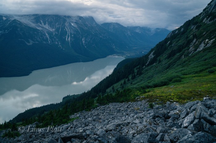
Upper Lynn Canal featuring the tiny town of Haines, Alaska below. Panorama taken from just below Mt Ripinski’s summit utilizing 4 separate 6K RAW images from Sony a6300 with 16-50mm kit lens stitched together in Adobe LR…

…A Life Simplified Is A Life Fully Lived
Upper Lynn Canal featuring the tiny town of Haines, Alaska below. Panorama taken from just below Mt Ripinski’s summit utilizing 4 separate 6K RAW images from Sony a6300 with 16-50mm kit lens stitched together in Adobe LR…
As mentioned here before, for me, the primary reason for living in Haines is its close proximity and access to the incredible Yukon Territory. I could care less for the Sea and it’s subsequent maritime weather and inherent jungle. Instead, I prefer the deep interior with its immediate access to the alpine, it’s well defined and cold winters, its clear, crisp winter nights, its commonly seen Aurora Borealis, and its plethora of wild animals. I care not for cruise ships, inflated prices, and difficult access to the alpine landscape. Consequently, I tend to spend the bulk of my spare time on the north side of Chilkat Pass aka Haines Summit.
For Angela’s birthday we decide that a juant to the Yukon is in order, but an issue with a forgotten passport once on the road sees us turning the truck around in search of an alpine adventure within the confines of the narrow strip of land in the area surrounding the upper Lynn Canal. My good friend and workmate Tully has spent a great deal of time in the alpine areas above and beyond Chilkoot Lake and has expressed nothing but gratitude that this area exists. After showing me a photo of a small alpine lake sitting on the very edge of steepening mountain sides and overlooking the Chilkoot region and surrounding ranges, Angela and I decide that a closer look is in order. Tully had described the approach to me some time back to this place he calls Wolverine Lake, but my memory is foggy and we figure on finding said place regardless.
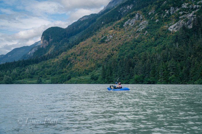
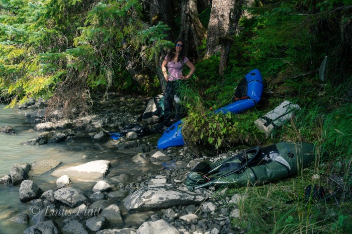
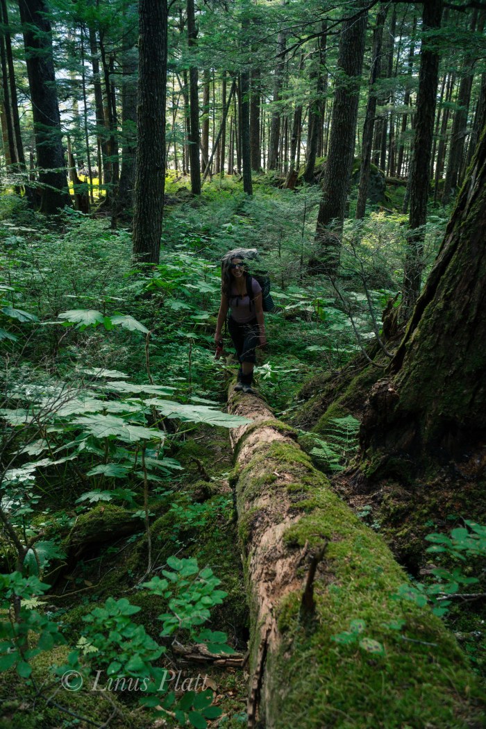
Driving in to Chilkoot is nothing short of chaotic. Fishermen, RV’s, tourists, tour busses, Bear watchers, campers, boaters, and riffraff clutter this overused area; its one of the finest examples of a Salmon filled Alaskan river with the ability to witness Bears fishing all through the summer. There are so many people here during July and August that I generally stay clear of this place. Once past the jumbling madness of the roadside river and boat ramp at lake’s shore, we find ourselves paddling packrafts across the lake a short distance to access the forest and the steep approach to Wolverine lake. We find a good place to stash the boats and ExtraTuffs upon a fallen Spruce, repack our bags, and begin trudging up the ever steepening hillside studded with the usual artifacts that a temperate rainforest has to offer. Soon it becomes very steep and in places requires both hands and feet to clamber up and over rotting logs, granite boulders, and dense thickets. It is tiring hiking for sure, but still relatively easy comparitively.
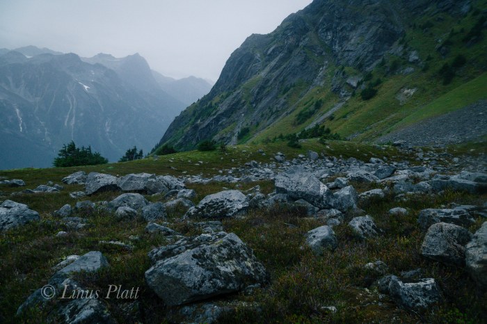
A vertical granite cliff of a couple hundred feet appears and we decide to skirt it on its left where a right leaning ramp leads to a boulder strewn sub-alpine valley. We think that Wolverine Lake is up at the top of this valley and pursue a jaunt of boulder hopping, which after the steep and cluttered hike down low, feels a welcome relief. Nothing makles me happier than to be on bare rock and boulders for travel. Up higher, the boulder field ends in another dense forest where we begin to doubt the location of the lake. It occurs to me that we are perhaps in the wrong drainage all together. We are exhausted and it is getting late; we decide that we must make our way up and over the ridge to our left to get to the proper drainage, but the means of navigating this requires some serious and painful bushwacking. An hour or so of battling some of the most heinous Devil’s Club and Alder thrashing I have yet to encounter puts us on a traverse into another boulder fiels in what we hope is the correct drainage. Boulder jumping once again upward sees us gaining altitude quickly. A young Black Bear darts from the Alder thicket just ahead and dashes across the tundra into another thicket. A group of 8-10 Mountain Goats are on a high bench off to our left. We are thirsty, tired, and in need of a camp.
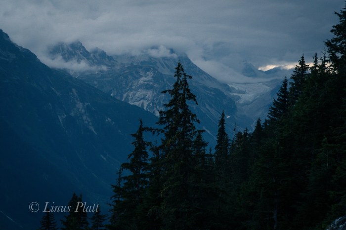
After topping out the last of the hikeable terrain, we find no Wolverine Lake but instead a beautiful but dry alpine cirque surrounded by high granite walls. We can hear water and begin descending into the bowl where we are thankful to find find a massive snow bank and small alpine pond – we have water. Setting up the tent on a ridge of tundra just as dusk hits, we dive in and spend the evening eating, drinking wine, talking, and listening to the rain come down, which it does for the entire night.
After coffee and breakfast the rain slows and we pack up camp and begin the slippery descent. Steep rock slabs must be negotiated before entering the forest and the ensuing bushwacking can begin. A thrash of epic proportions concludes us arriving at our boats torn to shreds. My arms looke like I was in a knife fight in an Anchorage bar, and Devil’s Club thorns embedded in hands, legs, and thighs. Exhausted, we paddle the short distance to the truck and call it another epic 30 hour Alaska adventure… In retrospect, had we stayed in the original drainage before bushwacking over the ridge, we would have run smack dab into our destination. Chalk it all up to adventure exploration in SE Alaska…


These last weeks have flown by so fast in preparation for the upcoming Over The Hill Expeditions trip to climb and ski Mt Sanford in Alaska’s Wrangell Mountains, that I barely noticed that the departure date is just next week! Gear is together, money is (well, mostly) together, and fitness, well… ahem, uh, well…
So… the last Saturday before I leave to drive up north to pick up Rich, Cam, and Jeff in Anchorage, I decide that a jaunt up Mt Ripinski is in order; Angela also wants to go, so that is even better. Ripinski is a coastal, non-glaciated peak sitting directly on the waters edge of the mighty Lynn Canal; it’s summit clearly seen from most anywhere near or in Haines. It’s summit is a 3600′ rocky point amidst small rolling hollows of tundra and outcroppings, where Mountain Goat, Wolf, and Grizzly Bear all roam.
From the end of Young Road in Haines, at an approximate elevation of 400′, the trail climbs rapidly to it’s summit 4.5 miles and 3200′ later. It is considered a local classic and the views from the summit encompass the Chilkat Range, the Lynn Canal, the Chilkat Inlet, the Chilkoot Inlet and lake, the Alaska Coast Range, Skagway, and many of the area’s surrounding glaciers. It’s the best bang for your buck view-wise around.
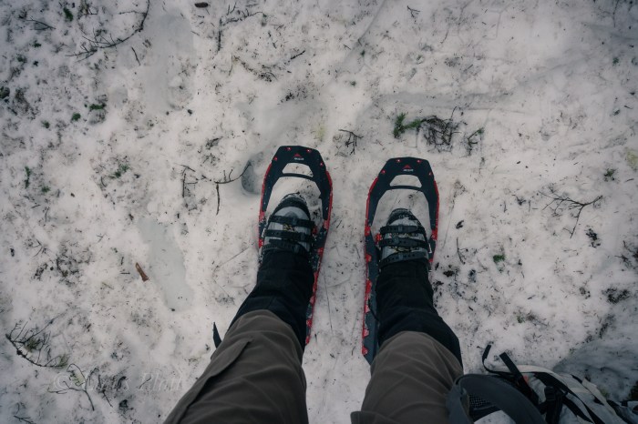
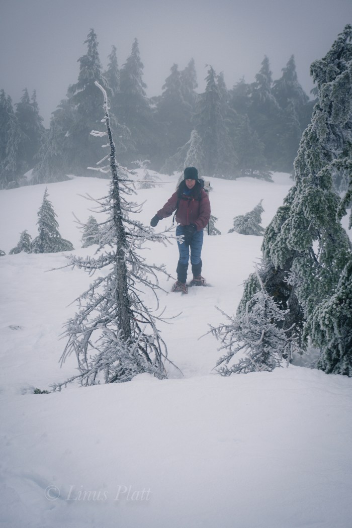
Leaving Mountain Market at about 9:30 am, we head for the trail and begin to stomp up the muddy, root infested path to snow line, where we swap running shoes for mountain boots and snowshoes. The forest is becoming increasingly engulfed in a mystical dream state of fog; the trees appear tortured from they’re entombment in rime ice; an indication of the severity of the wind coming off the Pacific waters of the icy Lynn Canal below.
Soon we are lost and grappling with creating a zigzagging, weaving line through the struggling stunted alpine Spruce at timber-line; the snow very deep and the steepness increasing to the point I would gladly trade in my snowshoes for an ice axe and a set of ‘pons. Alas, we stumbe into the second meadow, where we lose the trail again, but finally find “The Overlook”, a place on the edge of a great chasm overlooking town when the weather is clear. Not today however, as visibility has been reduced now to about 10 meters, and the wind, now picking up velocity and numbing my fingers severely.
We somehow manage, after me considering bailing several times, to find the final summit climb up a spiny, rocky ridge. On top, visibility is basically zero, and the wind raging. I put the camera away and go into survival mode, donning all layers and with special attention to my hands, which now are useless chunks of lumber somehow attached to my arms. We aren’t even sure we are on the summit, so we blindly stagger further, where I slip off a steep edge of snow that is completely invisible to my eyes in this torrential whiteout. No harm done and we scramble back in the direction from which we came, ponder for a moment at the highest rocky point, and then skedaddle. The whiteout seems to be increasing, but the further we descend, the warmer my hands become, and soon we find our tracks near the overlook and enter the trees below.
Back in the forest below the snow line, I’m too tired to put my running shoes back on and finish up the stomp in my expedtion boots back to the truck. Angela looks tired, but happy, and I feel the same. Just another semi-epic day-adventure in Alaska…
Up next: Mt Sanford departure in T-Minus 7 days.
Stay tuned!


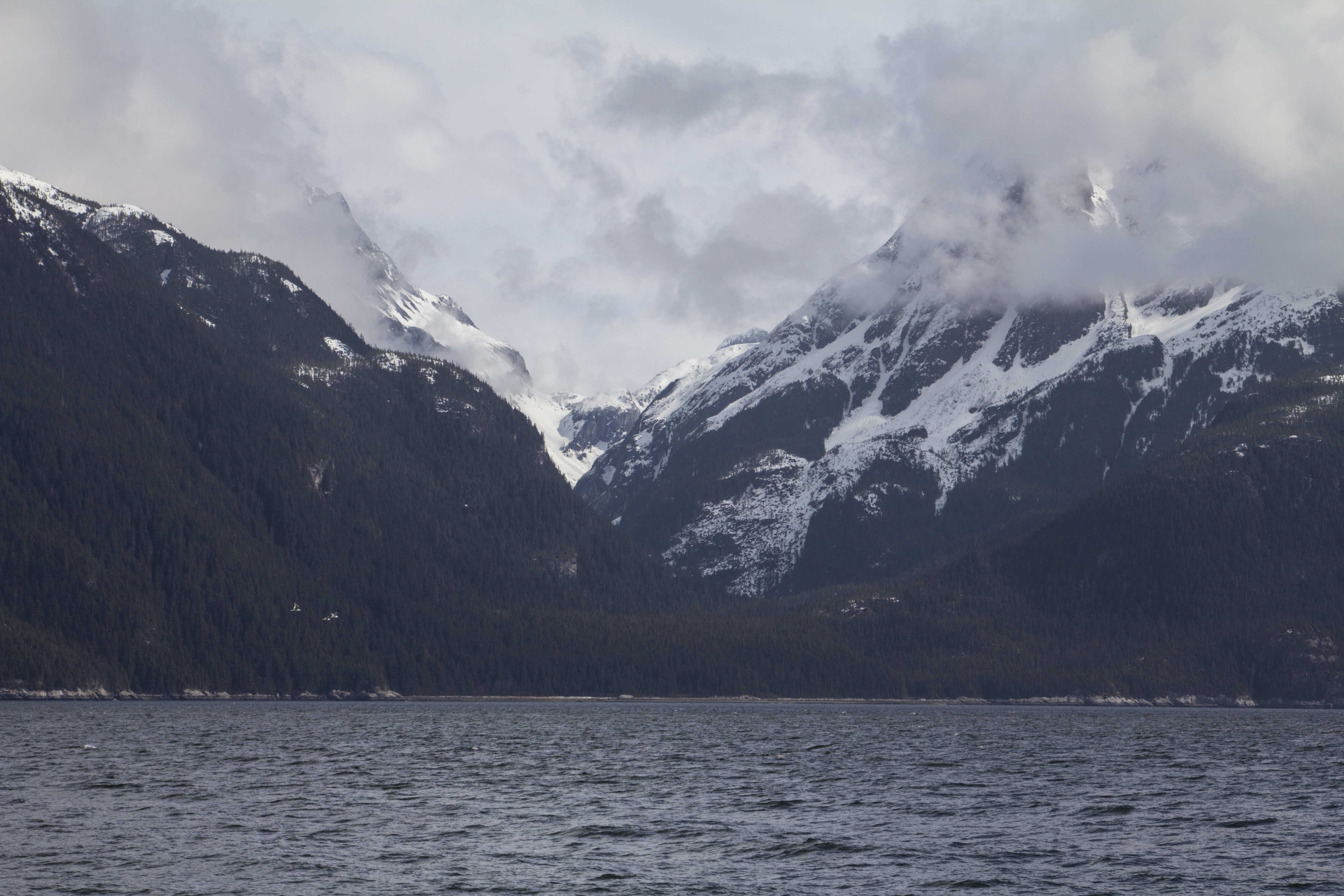
After 43 long months of not seeing my family in California, it was time to head south out of the Great Alaskan Empire, and into the realm of family and old friends not forgotten. It was a strenuous voyage of ferrys and plane rides, airports and freeways, but eventually I was home to catch up with my Mom, Sister, Nephew, Pop, brother-in-law Dutch and old time friends not seen in quite some time. Catching up with John Boyer of Edible Pedal in Sacramento, and Debra Banks of Rivet Cycle Works was a joy. My old friend and climbing partner Dennis even drove up from the Bay Area so the two of up could discuss our plans for an Alaska Range climbing trip this coming August. Ten days later finding myself looking back with fondness of my visit upon an Alaska Marine Vessel heading north from Juneau, I am once again in awe of the magnitude of the Upper Lynn Canal and it’s mountains, waterways, and glaciers. Two days in Juneau prior to being aboard this vessel, I had the pleasure of catching up with another old friend not seen in many years. Amelia was in Juneau visiting her boyfriend James and the three of us celebrated with beers and lunch along Juneau’s waterfront.
Now in the waters of southeast Alaska once again, I am getting the fond sensation of being home. The Alaskan air is crisp and cold, but I spend a great deal of the boat ride home outside perched on the vessels decks gazing at the scene unfolding. It is breathtaking to see it again. Back in my crib later, I sift through mile after mile of unseen footage and unfortunately few photos. For some reason I had been so preoccupied with shooting video to make a living with I had neglected much in the way of photos or even snapshots of my family. This makes me feel deeply sad, and I vow to not let that happen next time.
The next couple days are spent not only in front of the computer editing and working, but getting out a bit exploring, shooting video with friends Gene and Michele, shooting photos and stomping around the hills.
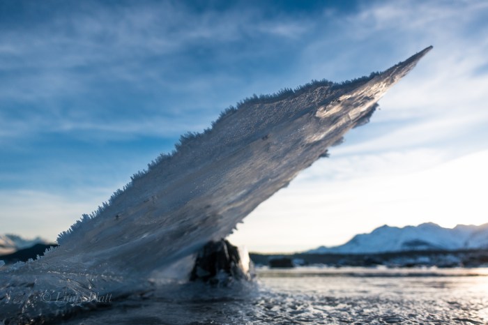
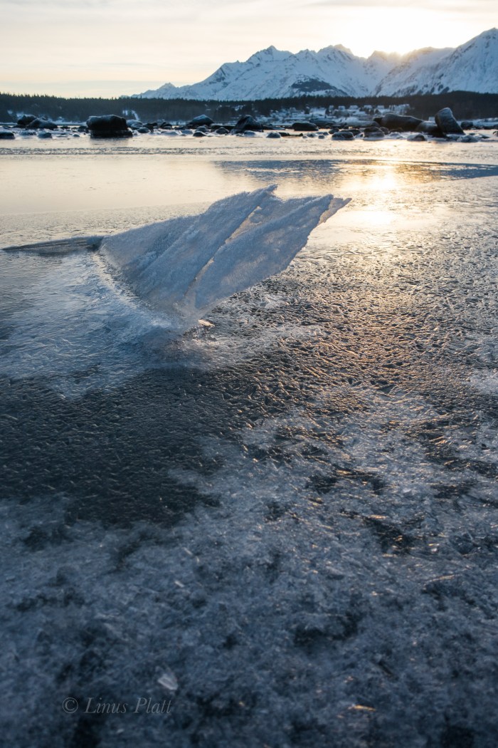
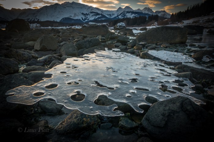
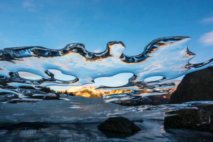
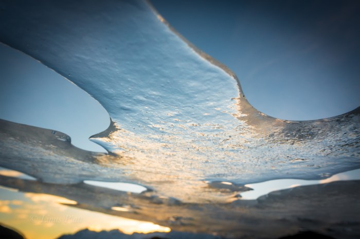
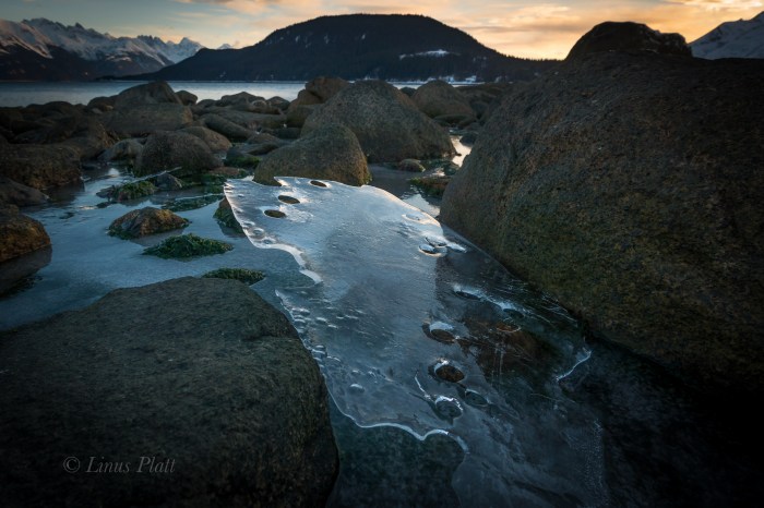
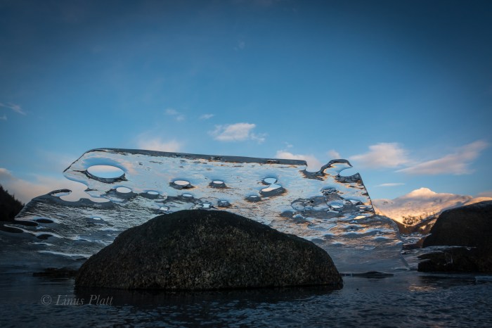
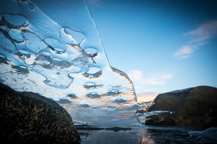
It has been two or three years since we have had a “real” winter here in Haines, and this winter is a real treat and a joy for me to call it such: Winter! The temps have been, more or less, consistently cold, and there has been snow on the ground for many weeks. The resulting ice at Picture Point along thee Lynn Canal and the Chilkat Estuary beaches has been extraordinary.
Going back to work next week after three solid weeks off will be another challenge upcoming. I keep reminding myself of the upcoming adventures to be had that need paying for to drive me back. The Lost Coast in May, and the Alaska Range trip with Dennis in August I look forward to immensely.
In the meantime, I have ice…


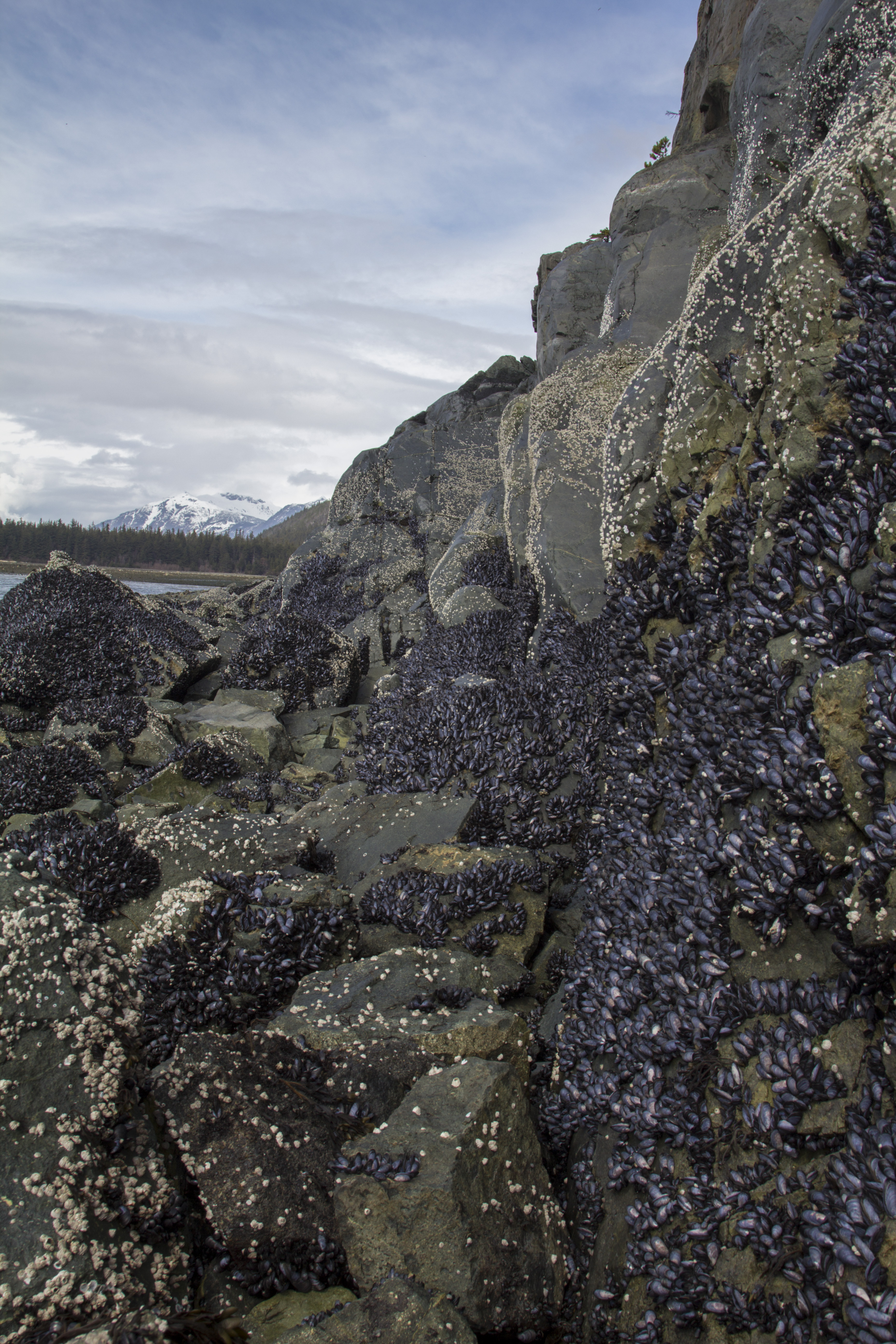
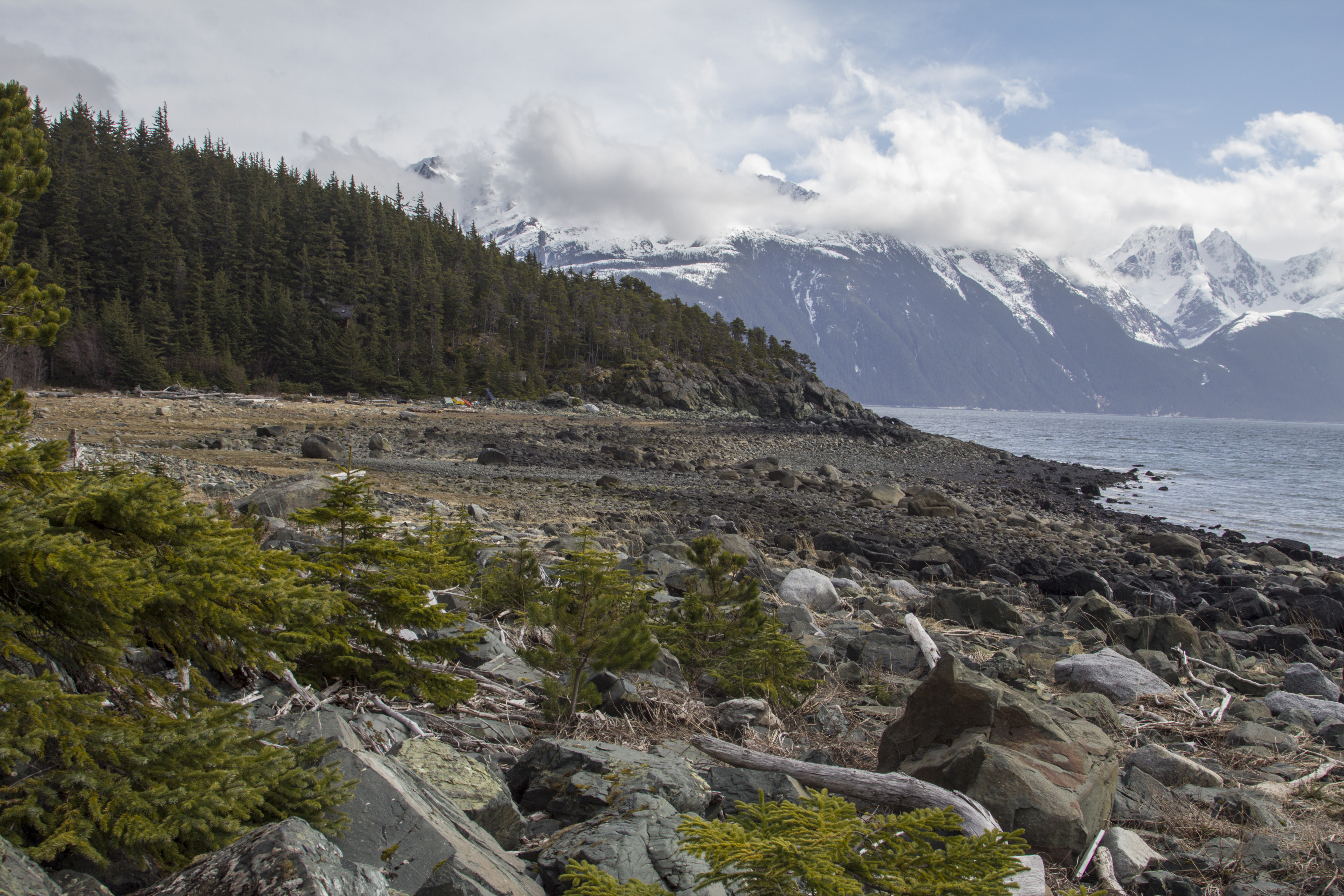
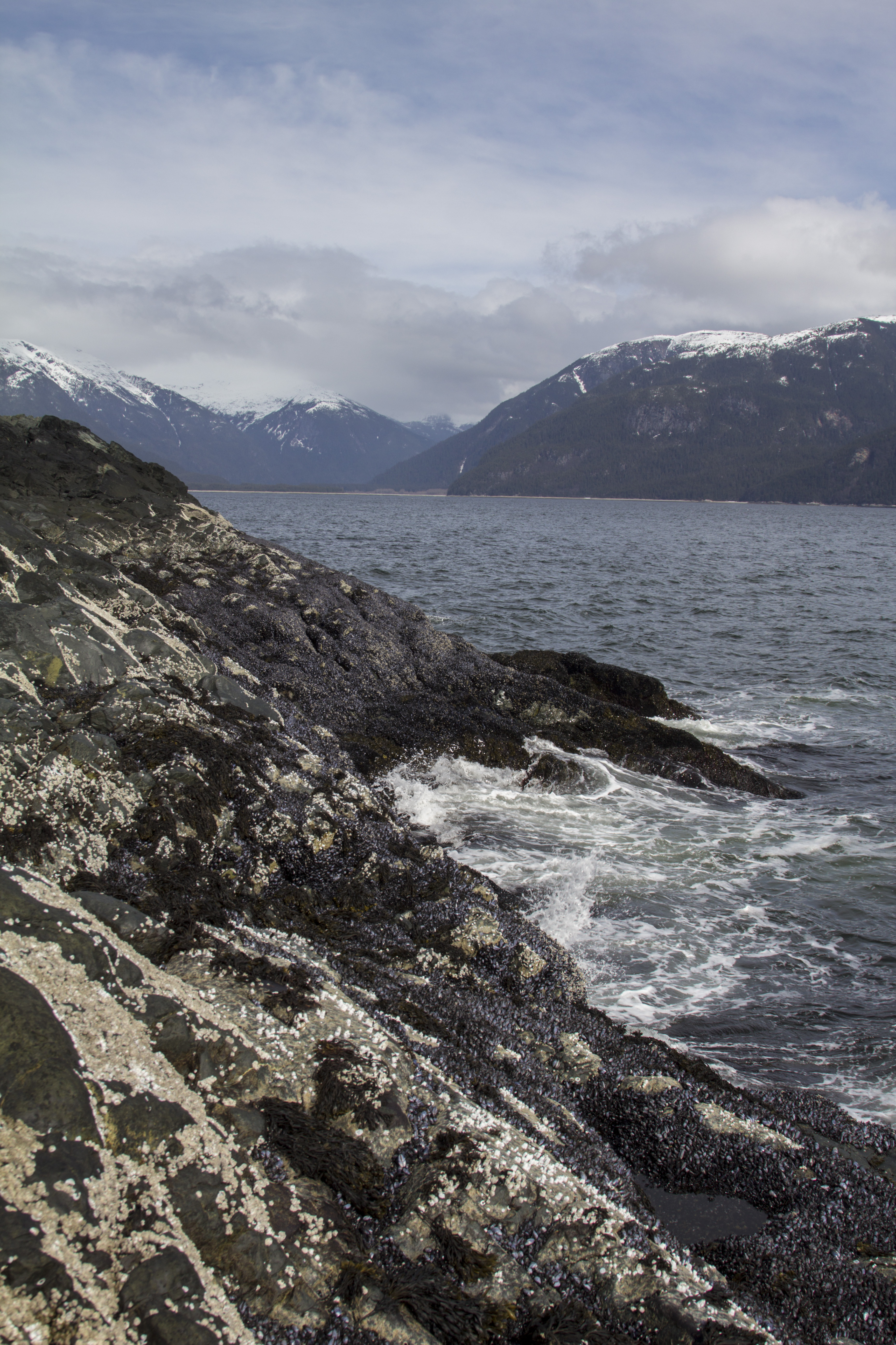
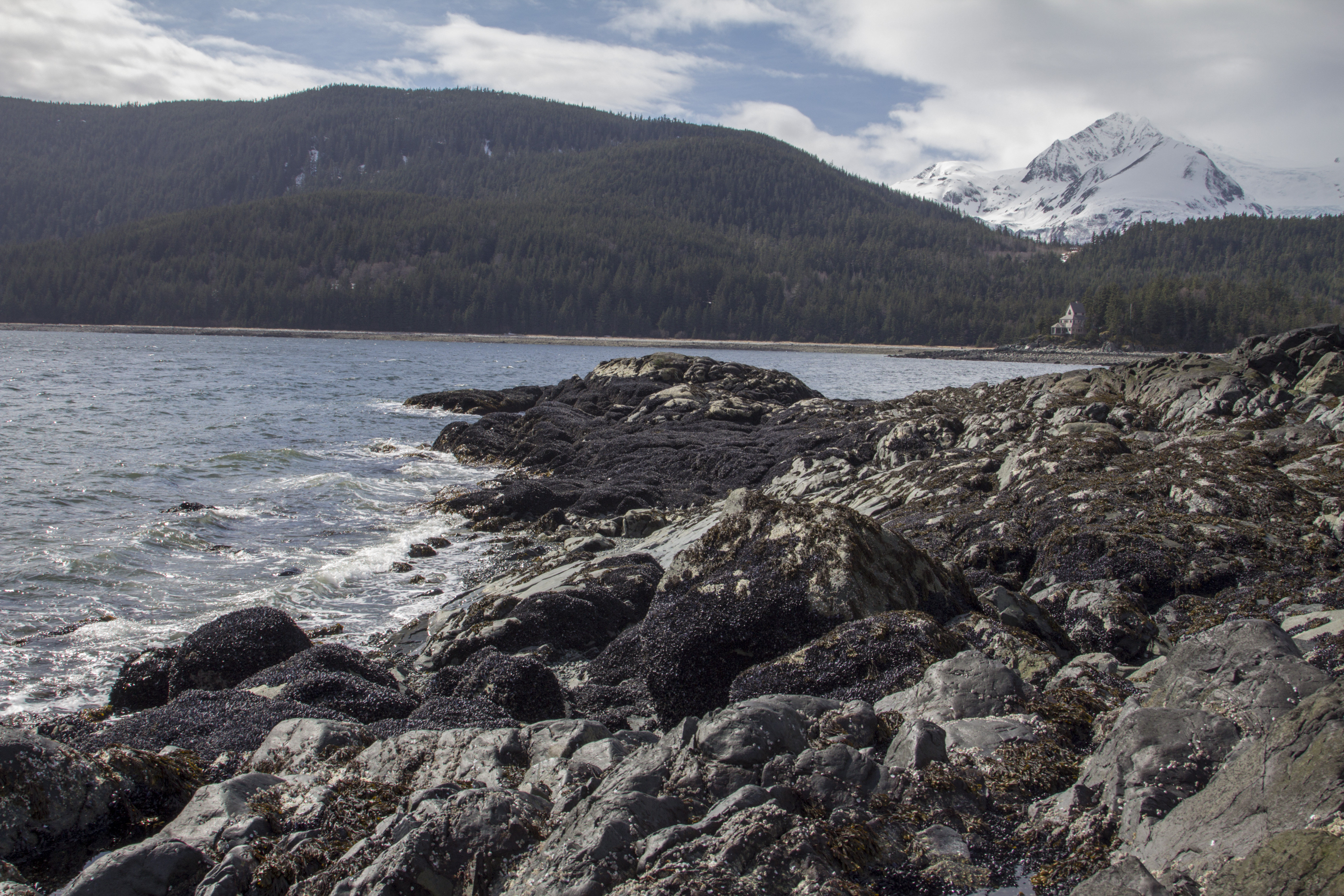
Another day to explore.. What to do, I ask myself? After putting another coat of drywall mud on my neighbor Kathleen’s ceiling, I load up the camera and fishing pole and set out. Sometime back, I drove out to Mud Bay and noticed several cabins, houses and dwellings with all sorts of solar panels and windmills adorning the beaches adjacent to said structures. These little set of homes are where the incoming tide from the Lynn Canal meets the long, forested ridge of Mt Riley’s south end, and it it fascinated me. These homes appeared to be accessible by foot alone and the possibility of setting out on foot and along the rocky coast line to reach the remote part of the Chilkat Peninsula and it’s coast line of the Canal might be a pleasure to see. I set out, crossing the muddy tidal flats of Mud Bay itself, and emerging at the first of the dwellings, I veer south along the rocky coastline and find myself entangled in a sea of rocks; literally millions of barnacles adorn these seaside rocks, and a footstep cannot be taken without some measure of disturbance. I gain the rocky point separating the Lynn from Mud Bay, and the omnipotent Coast Range of Southeast Alaska is dominant and towering. The surf is high, with mighty waves crashing. The views are whimsical and there affect on me great. After wandering the rocks for a spell, I emerge onto a beach head with some solar panels visible, indicating someone’s boat access only cabin. I figure that a stomp through the woods is a better alternative than retracing footing along the rocky shores for a return back. Into the rainforest I go, passing the cabin in question and bushwacking through Devil’s Club and Alder thickets. After a short bit, a trail engages my feet and I am happily trudging through the forest. The trees here are enormous and the forest floor covered with thick moss. It occurs to me; winter is over and springtime in Haines has indeed arrived. Finally, I can see the reaches of Mud Bay through the trees and another house, cabin, woodshed, and other adornments come into view. The trail I am on appears to dead end into this property and unwilling to commit to trespassing on someone’s beautiful setting, I once agin succumb to the great bushwack. Soon I am rambling down a set of back country stairs to the flats below and cross the tidal flats once more and back to the road to the truck. Not a bad way to spend a few hours.
It is still fairly early, So I drive north and find myself again at the Chilkoot river, where I proceed to fish for Dolly Varden under the blazing spring Alaska sky. No fish caught, but that’s OK. Soon the Salmon will be running…


“The more I see as I sit here among the rocks, the more I wonder about what I am not seeing.” ― Richard Proenneke
The untold tales of paths trodden, fears conquered and battles won.
tracking inner and outer landscapes along the road to creating community
Adventures starting in the heart of Alaska
...A Life Simplified Is A Life Fully Lived
More than just a Summer in Alaska
Indulge- Travel, Adventure, & New Experiences
News and opinions on the environment in the Haines area and greater North.
Exploring and Photographing the Alaska Range
The Adventures of a Man, His Heart, and His Bike
Mapping the bicycle travel revolution.
Just another WordPress.com site
A fine WordPress.com site
Just another WordPress.com site
Since 1999
Iowa City ~ (319) 338-8900

You must be logged in to post a comment.