Heartbreak Ridge: Takhin River, Alaska

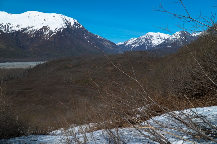
Since moving to Haines from Fairbanks nearly 5 years ago, I have been fascinated by a local piece of wilderness called the Takhin River Valley; a river born of the Takhin Glacier high at the western end of the Takhinsha Mountains at the far northern most tip of Southeast Alaska. The nearby Tsirku River is born from the Tsirku Glacier far into the western reaches of the range where massive ice sheets dominate the landscape. Further down stream a Tsirku feeder, the Le Blondeau Glacier, comes very close to the Takhin Headwaters and is separated from it by a 500 foot high, two mile wide swath of an ancient moraine covered in Alder thickets and Devil’s Club, and is know locally as Heartbreak Ridge.  I had heard many folks talk of the Tsirku… it is of fairly easy access by bush plane, or by foot, is big enough for a full size raft at spring and summer water levels, and is fairly tame overall. But I never ever heard anyone speak of it’s sister, the Takhin. After asking around about it, I discovered that there is a locally operated bush airstrip about 3/4 the way up the Takhin Valley known as the Fox Airstrip, but it seemed there was no way to gain plane access to the headwaters at the Takhin Glacier itself.

Last year I decided that the best way to investigate was to hike up the Tsirku on foot from the Devil’s Elbow, where one can park a vehicle, and attempt to get to the Le Blondeau and have a look at Heartbreak Ridge. At the time, I had no packraft, and made many dicey river crossings on foot until deep snow, and high water blocked passage about a mile and a half from the landing strip near the Le Blondeau. After spending a night in the upper Tsirku watching and listening to a pair of Wolves, I packed out, vowing to return better equipped.

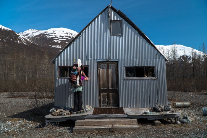
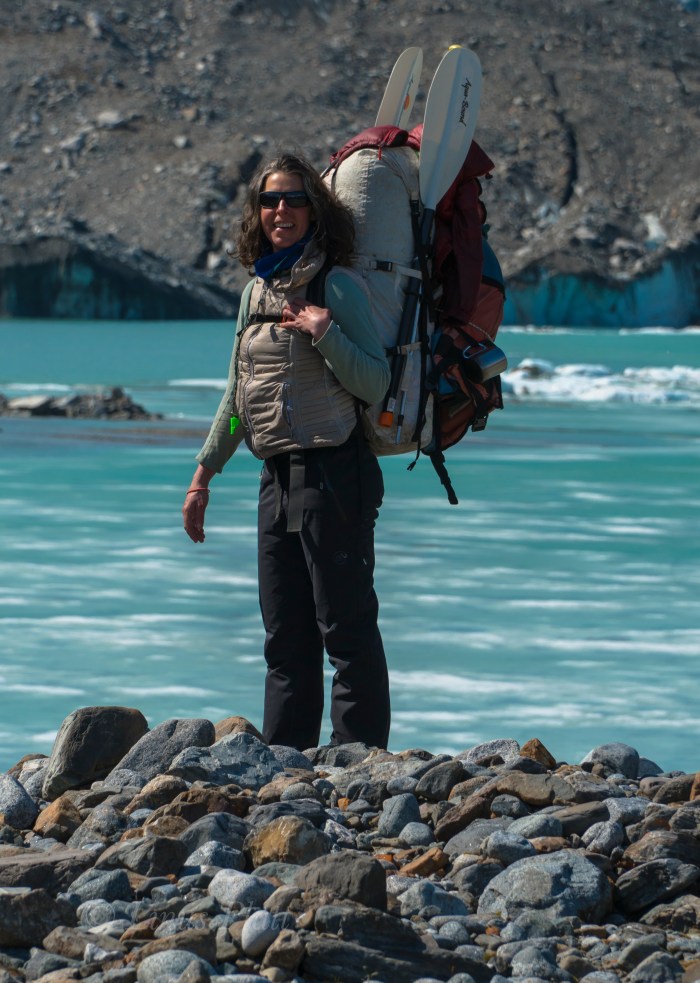
This year, Angela and I, armed with packrafts, hired Drake Olsen and his Super Cub to get us landed on the tiny gravel air strip near the Le Blondeau near what is locally known as Horse Camp, a group of seasonal tin cabins from which hunting and guided Tsirku River trips begin.  It’s from this place we could easily hike to Heartbreak Ridge, and begin it’s Alder thrashing, which more than one person had guessed would be “extreme”.

The tiny Super Cub plane holds one pilot, one passenger, and a wee bit of gear. That’s it… so Drake takes Angela in first; it is about a 20-25 minute flight in and I wait by the Haines landing strip for his return, eagerly anticipating viewing the Takhin from the air to inspect for any obstacles we may encounter. The Super Cub re-appears, and in minutes gear is loaded and we are airborne and slicing through the crystalline sky along the lower reaches of the Takhin. Drake flies as low as possible so we can look for log jambs, wildlife, gravel bars, and any other thing of interest on the ground. We pass the fantastic Bertha Glacier and her giant iceberg filled tarn; the lake is still partially frozen over. It is May 17th 2018…

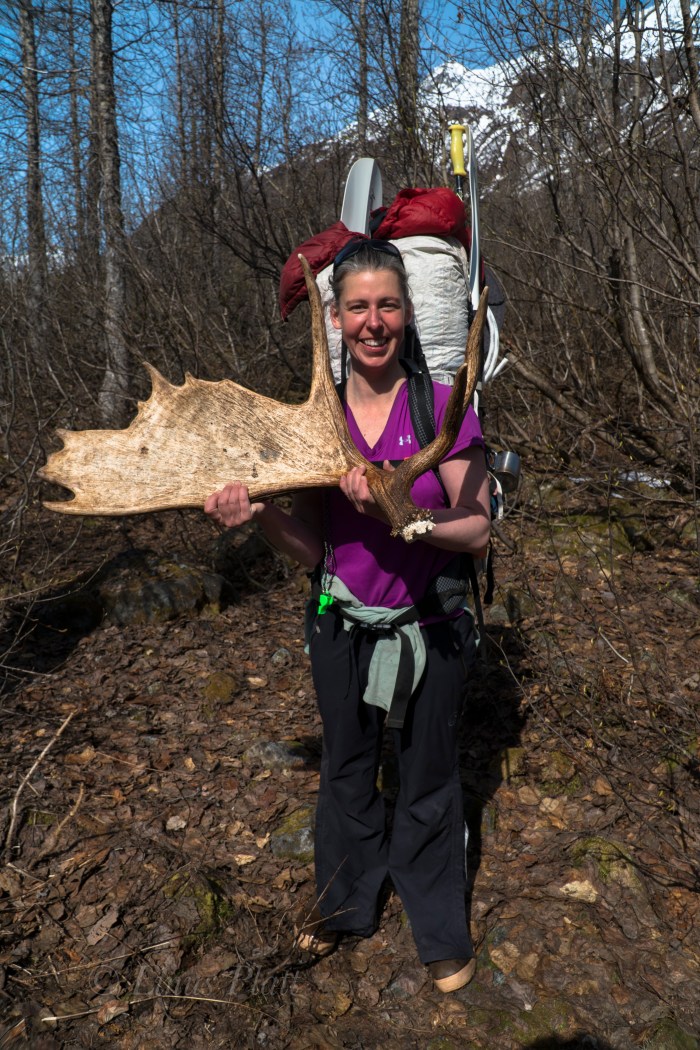
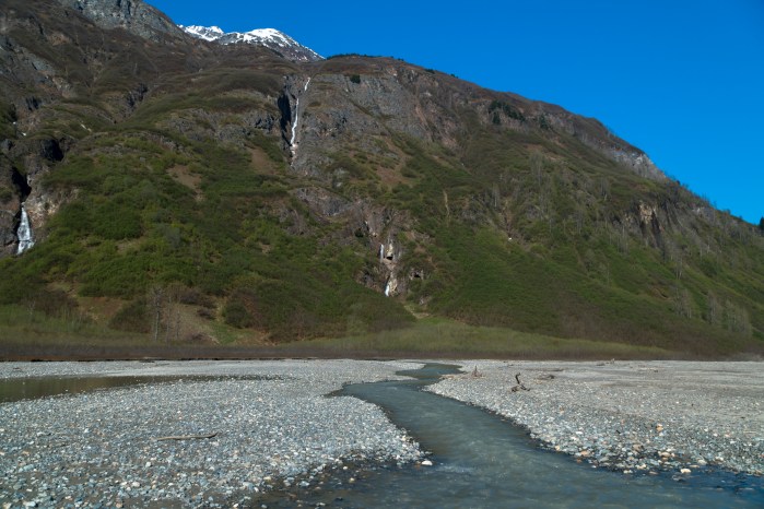
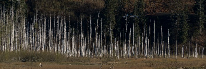
After Drake drops me off,  Angela and I watch as he hits the air and disappears over the ridge and is gone. We shoulder packs and begin walking the Gravel bars of the Tsirku in search of a supposed trail leading through the forest to Horse Camp. After a bit of wandering and doubling back, we find the trail and find ourselves deep within the confines of the bush. A large Moose antler is found on the ground, likely dropped the previous Winter. The cabins of Horse Camp are dilapidated and run down… animals have had their way with them and are in pretty bad shape. The tarn of the Le Blondeau Glacier is partially frozen over, and great slabs of icebergs are float here and there. The views of the glacier and peaks are amazing… one peak, known as Tomahawk, has gorgeous plumes and flutings descending from its jagged and corniced summit. Not all mountain ranges have these flutings, but are common in Alaska, The Andes, and Himalaya. Truly a signature of deeply glaciated peaks and severe weather.

We stomp around the east side of the lake all the way to just shy of the ice and right up against the mountain where we believe the easiest passage through the two miles of Alders might be. After having spoke with some people who had seen it, and seeing it from the air myself, I estimated it would take us about 4 hours to get through it, over Heartbreak Ridge, and to the toe of the Takhin Glacier.  Soon, we cannot go any further and so we dive into the Alders to our left and begin the extreme thrashing. The paddles sticking out the tops of our packs make the going much worse.  Alders are notoriously bad for this sort of bushwhacking and this is no exception. We gain a lateral snowfield and follow it, postholing in knee deep snow to ankle breaking downed Alders beneath.  Two hours later we come to a stream where we break for snacks and water before committing to more thrashing. Occasionally, we find old avalanche chutes to traverse up, then down, up, then down, avoiding short sections of thickets. It is time consuming and exhausting to say the least. Hours later, we are at the base of the final climb up Heartbreak Ridge proper. It’s nothing short of a heinous and evil Alder thrash. Did I mention Devil’s Club? We gots that too folks. Lots of it. We emerge on top, bloody, sweating, exhausted… and ornery.  The Alder thrashing we did last year on the approach to Mt Archibald in the Yukon was actually worse, but this was sustained.  It had kicked our ass, but we did it. In fact, I do not believe any one in recent memory (or ever) has gone over Heartbreak Ridge during the non-winter months (skis, snowmachines, etc) The view down to the Takhin Glacier is breathtaking and the descent looks steep and dangerous. After the initial loose and steep drop in, it is easy going and soon we are on the rubble covered glacier and boulder hopping to the toe to find our camp.

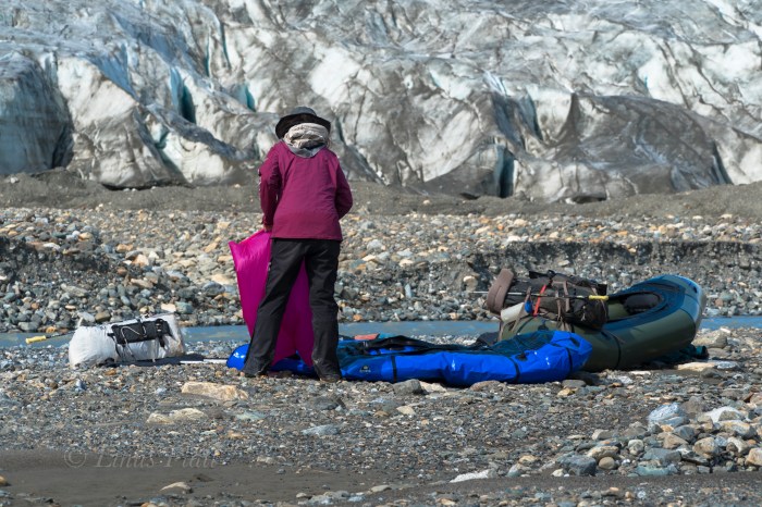
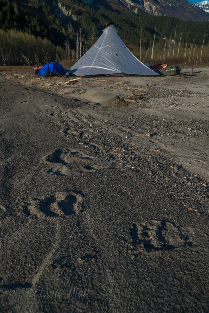
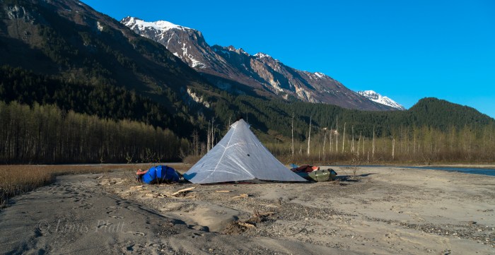
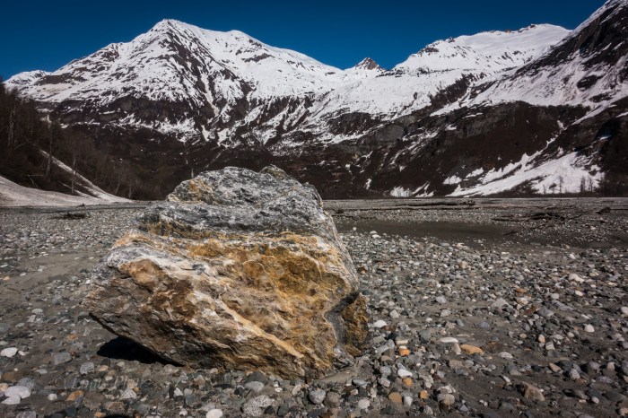
After reaching the snout of the Takhin Glacier, a gaping ice cave appears and the very utmost of the Takhin River is born, emerging as a rapid and icy tongue from it’s innards. We thought since the goal of this trip was to packraft the entire Takhin from it’s beginning, it would be especially cool to start from inside the ice cave and emerge in true fashion. However, it looks dicey so we decline, stumbling off to find a camp spot. We pitch the awesome Hyperlight Mountain Gear Ultamid 4 that was loaned to us by the company for testing and inspecting; I find it extremely light, easy to setup, and bombproof. Many thanks to HMG for this shelter. After camp is constructed and I lay in my sleeping bag, it occurs to me that it took us over ten hours to get from the landing strip on the Tsirku to the Takhin Glacier; I severely underestimated Heartbreak Ridge.

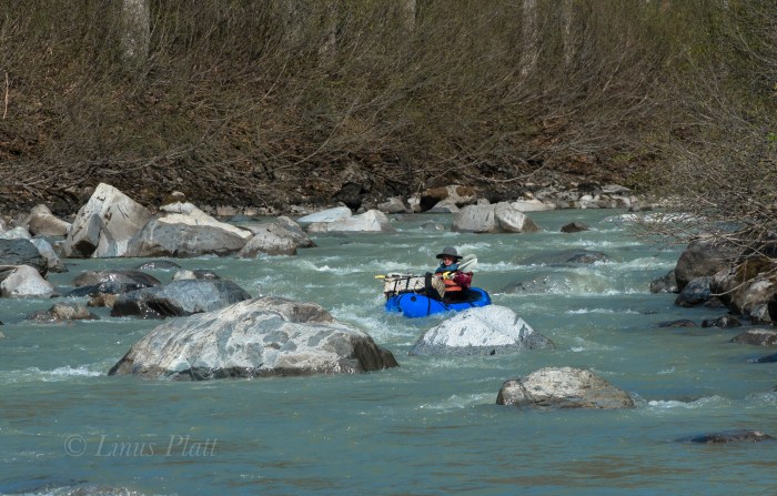
The morning sees the weather in fine shape with early morning light splattering the fluted ridges high above us. We walk for about a half mile downstream on the gravel bars in search of water deep enough to put the boats in.  Since it is morning and the temps still chilly, the water has not yet come up, but we finally find adequate water and we inflate the rafts. A pleasant float downstream on class I-II, puts us in a forested area, where log jams and shallow water force us once again on foot. Another paddling section begins and a mishap with a strainer and a missing paddle ensues. We thought that the paddle had floated away, but was in fact stuck underwater in the submerged thicket. We were soaked and needed to dry out. Luckily it was hot out… too hot in fact and we were both getting somewhat sunburned. back in the water, we paddle through another alluvial fan and spot a large Mountain Goat about 200 meters off walking right towards us. We eddy out and watch silently; the Goat stops and finally takes notice to us. We stare back and forth and the Goat decides these strange creatures near by are best not to get tangled with and starts trotting south and away from us. What a magnificent animal…

Back on foot again to avoid low water levels, we decide the best way to travel is to mount the inflated rafts to the tops of our backpack and hanging down with the bottom of the boat facing behind you; doing this makes one look like a giant alien Beetle. We walk through the open forest like this for a spell and I spot a Grizzly 100 meters away (close!) staring us down. I freeze, Angela freezes. It appears to be a lone male Grizzly, not giant, but not small either. We stare at each other for several seconds and the Bear flips 180 and bolts the opposite direction. After that, I decide that the Bear spray will go in one pocket, and the Colt 1911 .45 in the other.

Eventually, we begin paddling again, and even though the water is low, we are able to float big sections and simply drag the boats through the shallow areas and then jump back in. Soon we come to end of the big braided section of the Takhin near where the Fox Airstrip is, and realize that it is getting late and that we are very tired. We pitch the ‘Mid on a sandbar riddled with Grizzly prints and attempt to sleep. Soon however, a great wind pick up and after a bit, blows a steady 30 knots, showering us with sand and dust. It was miserable, but we hunkered into our bags deeper and got through it. Eventually it died off and we drifted into needed slumber.

Another fine morning of gorgeous weather finds us paddling immediately and entering the “Boulder Field” we had heard about from one person who claims to have jet boated up the Takhin. The river slices through the tight forest here and turns into a different animal than we had previously seen.  Small rapids appear… class II-III; twists and turns and rocks and holes all become the experience. The paddling is excellent; this is what we came for.  One nasty looking class III section with a big rock at it’s bottom that would surely flip you we decide to portage around. Following that, the Takhin turns into one set of glorious Class II-III rollers after another for several miles. It is an instant classic Alaskan paddle in my mind. We pass the Dickinson, Willard, and Bertha Glaciers, and into the final twists of the river a few mile before it’s confluence with the Chilkat River, where enormous log jams bar passage and force us out of the boats. We drag the rafts through the sand past Wolf and Bear prints and back into the water where more Class II rollers and some technical navigation around strainers and timber force a keen and sharp attention. Angela has a mishap with a pesky log and flips the boat, but all is well. We stop for a breather and laugh about the incident as we pour the water from our Extra-Tuffs and wring out our wool socks.

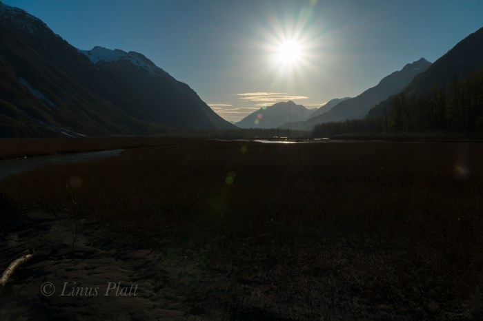
Back in the water and around the next bend in the river, we can now see the peaks of the Tahshanuk, indicating that we were extremely close to the Chilkat. We ponder for a moment if we should spend another night, or just simply paddle down the Chilkat back to the Haines airport where the truck is parked. After reaching the mother Chilkat, a great wind picks up and it is decided instantly that paddling home is the ticket; three days and 35 miles of bushwhacking and paddling behind us, our weather window had closed, and it was time to end this adventure and begin looking forward to the next…


Takhin River 2018-1

Takhin River 2018-2
First views of he Takhin from the air
Takhin River 2018-3
Bertha Glacier
Takhin River 2018-4
Tsirku landing strip

Takhin River 2018-5Takhin River 2018-6Takhin River 2018-7

Takhin River 2018-8
Horse Camp

Takhin River 2018-9

Takhin River 2018-10
Angela stomping around the Le Blondeau tarn

Takhin River 2018-11Takhin River 2018-12Takhin River 2018-13

Takhin River 2018-14
Le Blondeau Glacier

Takhin River 2018-15

Takhin River 2018-16
The bushwhacking and traversing begins

Takhin River 2018-17Takhin River 2018-18

Takhin River 2018-19
Final climb up Heartbreak Ridge
Takhin River 2018-20
First view of the Takhin Glacier

Takhin River 2018-21Takhin River 2018-22

Takhin River 2018-23
The true headwaters of the Takhin River via the ice cave

Takhin River 2018-24

Takhin River 2018-25
Camp at the Takhin Glacier snout

Takhin River 2018-26Takhin River 2018-27Takhin River 2018-28Takhin River 2018-29Takhin River 2018-30Takhin River 2018-31Takhin River 2018-32Takhin River 2018-33Takhin River 2018-34Takhin River 2018-35Takhin River 2018-36Takhin River 2018-37Takhin River 2018-38

Takhin River 2018-39
The Grizzly was spotted moments after this picture was taken

Takhin River 2018-40Takhin River 2018-41Takhin River 2018-42

Takhin River 2018-43
HMG Ultamid 4 and Grizzly prints

Takhin River 2018-44Takhin River 2018-45Takhin River 2018-46Takhin River 2018-47Takhin River 2018-48Takhin River 2018-49

Takhin River 2018-50
Angela re-aquainting herself with handgun use

Takhin River 2018-51

Takhin River 2018-52
Paddling

Takhin River 2018-53

Takhin River 2018-54
Just Rolling By

Takhin River 2018-55

Takhin River 2018-56


Tsirku Dreams

“The Less I Have, The More I gain… Off The Beaten Path I Reign…”


After a day outing to explore the possibilities of a foot journey into the upper Tsirku River region of northern Southeast Alaska, and scouring maps and extensively discussing the area of the upper Tsirku River with Dan Egolf in Haines, I decide that a  trip up into it’s innards was in order. It is springtime and the river is still somewhat low, but will be rising fast due to the onset of summertime temperatures.

The area I wish to see is an area of historical significance in regards to local area mining operations regarding primarily Gold, but also Tungsten and Silver; these prospects date as far back as the 1890’s, and continue to be a source of local mining activity. Last year, while flying back from Alaska’s ephemeral Outer Coast in a friend’s DeHavilland Beaver, I spotted a magnificent peak with a thin, serpent-like glacier flowing from it’s summit and into the Tahkin River valley. It is a beautiful and mysterious mountain to me; I do not know even if it has been climbed, but I wish to. Having given much thought on how to approach such a mountain, I figure that bushwacking up the dense Tahkin River corridor was completely out of the question. Seems landing a bush plane anywhere near by is also problematic. After looking at the map, I see that the source for the Tahkin River is the Tahkin Glacier, which is separated by a narrow, ancient moraine from the Le Blondeau Glacier, one of the Tsirku River’s sources; it’s main source being the Tsirku Glacier many miles further up stream; a massive example of a meticulous icefield glacier with many forks, lobes, and peripherals. Along the way to the Tsirku Glacier, one will find several other un-named valley glaciers spilling from the high peaks and into the Tsirku Valley, adding more and more water.

But today, I merely wanted to see if I could somehow make it up to the Le Blondeau and see if it might be possible to cross over the moraine in question in order to gain access to the upper Tahkin River. I figure that if it is possible, a packraft will be necessary to descend from the valley after climbing the beautiful Serpentine Peak.

These past weeks have presented me with challenges and inquiry regarding matters of the heart that reflect within me the ultimate need to express myself, to find truth, and to seek happiness on this mysterious planet. Wilderness has always been the major component in my existence here; without it, I feel lost and empty. And today, with a heavy heart, I walk into her, seeking the nurturing convalesce of her Earth womb. To even maybe capture visual glimpses of the other wild creatures within.

So today I lift a light 35 pound pack and begin the stomp up the Tsiku’s gravel bars and alluvial river flats; these glacial rivers can often times be heavily braided, wide, and treacherous. The Tsirku is a good example of this. Back some 20 or 30 years, a prospector walked a front end loader from the Devil’s Elbow all the way to Cottonwood and Nugget Creeks, forming a sort of road in places, but in others, not so much. The river has re-claimed much of it, and not only is much impassible when the water is anything but at it’s lowest, the channels themselves have changed a great deal and are continually evolving. At first I am able to follow faint ATV tracks leading away from the Devil’s Elbow, a point at which the Tsirku makes a dramatic near U-turn before opening itself into a massive river delta at it’s junction to the mother Chilkat.

The first three miles are straightforward: river flats, ATV tracks, and high gravel bars with only a few scant stream crossings to navigate, and I am soon far from the truck and at the entrance to the real wilderness. The first real river crossing is at a place the Tsirku is starting to gain momentum and takes a hard S-turn across the valley. Dense Alaskan jungle and steep cliff’s come direct to waters edge and one is forced into the water to fjord it’s icy current. The water looks deep, fast, and strong. I donn my water shoes, strip down to my birthday suit, shoulder the pack, and gingerly step into the ice coldness of the raging river. Soon I am in crotch deep water moving at a swift 4-6 knots. I am barely able to maintain a footing, but am now fully committed. My 190 pound frame is suddenly knocked from it’s foundation and I go down fast. The ski pole I am holding in one hand struggles for penetration among the bowling ball sized river rocks. My body and my pack plunge into the Tsirku, but only for a mere second as I am able to miraculously get back on my feet. Somehow, I am able to get to shallower ground and and eventually haul myself ashore. I am shaking wildly from adrenaline and the freezing water. After drying off and inspecting the pack and determining no real damage, I ponder the possibility of what I am trying to accomplish. If there are more of these crossings, and if the temperature increases and the water rises even slightly, I might be trapped back in the Upper Tsirku River drainage. Or worse, come into serious injury or peril if attempting overcome such obstacles.

Another crossing about a mile past, this time much easier, brings me to a place where the massive glaciers of the Takhinsha Range come into view and their razor sharp prickly summits penetrates the endless sky. The striking sight propels me to continue scrambling among the softball sized rocks and endless gravel bars, in search of… something. Wolf tracks appear, many of them in fact. A sure sign that I am getting deeper in. Another river crossing, this time treacherous, but  I manage, just barely. It occurs to me that I must re-cross these on the way back out tomorrow, the next day, or the day after that. If the water rises any, I will be in peril.

I look closely at the map, and guess that I have come about 10 miles or so; looking up valley to the base of the mighty peaks, I clearly see the Le Blondeau Glacier… both her forks, and the imposing icefall looming above one of them. I can just barely make out her tongue peeping out from around the low moraine separating the Tsirku from the Tahkin. The glacier has definitely shrunk according to the map, but not as much as I had expected. At least it was visible from this point in the river valley.

I come to another river crossing; this one is moving much faster that the previous braids, and appears to be deep. I have come more than ten miles, all of it essentially off trail and have fjorded 4 major river crossings and countless smaller ones. I am exhausted and cannot even consider attempting this in my state. So I pitch my tent, savor the salami, green beans, cheese and chocolate, and lay in my sleeping bag. I am not paying attention to my surroundings, and thoughts of the previous week continue to voilate my headspace. I grab my binoculars and scan the upper river flats ahead of my camp. Way off, I spot two Wolves. They are in a solid trot, but the lead turns and runs back to tackle the follow. They play fight for a moment before all eyes and ears are at full attention to whatever creaks in the woods nearby, and soon they are gone. A mated pair I assume, roaming this homeland valley of theirs.


“…And The Earth Becomes My Throne, I Adapt To The Unknown. Under Wandering Stars I’ve Grown. By myself, But Not Alone. I Ask No One.”


As the sun drifts behind the peaks and the shadows grow ever longer, the temperature drops and evasive thoughts enter me again. I feel fortunate and alive to be here, but silmutaneously alone and empty. The boundary between sanity and madness splits my heart in two, and a quiet desolation drifts over the Tsirku River valley and pierces deep within me. I am wide open, my heart is the sky. My body, a vessel. Hours pass without sleep, and the haunting echo of rockfall rattles the valley. It is dark for a brief time, then light begins to fill the peaks again; the morning alpenglow paints the summits and accentuates the seracs in a kaleidoscopic array of color and light. I manage to drift into sleep for a period, but soon I am awake again and realize that I am cold, so I decide to get up and inspect the world. Crawling out of the tent, I look at the dicey river crossing I am confronted with… a walk up and down the shore, reveals no place better in which to cross. If I could manage this crux of a crossing, would I be able to reverse it coming back? The thought penetrated me while I packed the tent and sleeping bag. I shouldered the pack, and in an instant, decided the risk was a foolish one. I turn to the Le Blondeau and and wish her farewell; The adjacent peaks beginning now to come alive with color.

On the way back out, I decide to attempt to find a better route, but in the process, make it worse and I encounter even more full sized river crossings, one of which swept me completely off my feet and dunked me into it’s icy depths. A close call by any standards, I am becoming fearful of the next and last of the crossings about a mile further down valley; it is the one that first knocked me from my feet in order to let me know who is in charge. I try not to think of it and traverse a willow flat with some of the largest Grizzly prints I have ever seen upon it. There is something very big roaming around here.

Soon I am at the dreaded crossing, and a look around reveals a shallower fjording upstream a bit. It was still nerve-wracking, but I managed it with out getting swept away, and a few hours later, I was stumbling across the final sandy river bottom to the truck. On the drive home traveling the swamps and wetlands of the Little Salmon River corridor, a young Black Bear ambles across the road, A cow Moose and yearling graze the willow thickets near the junction of the Porcupine Road, and me, being so tired I can barely drive, head home to grab some shut-eye.


sirku Re-Visited-4sirku Re-Visited-3sirku Re-Visited-2sirku Re-Visited-5sirku Re-Visited-6sirku Re-Visited-7sirku Re-Visited-8sirku Re-Visited-9sirku Re-Visited-10sirku Re-Visited