Leaving The Yukon- Wrangell Dreaming

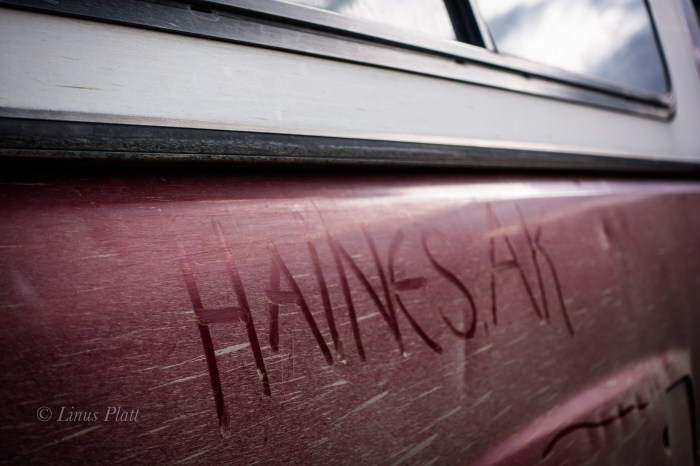
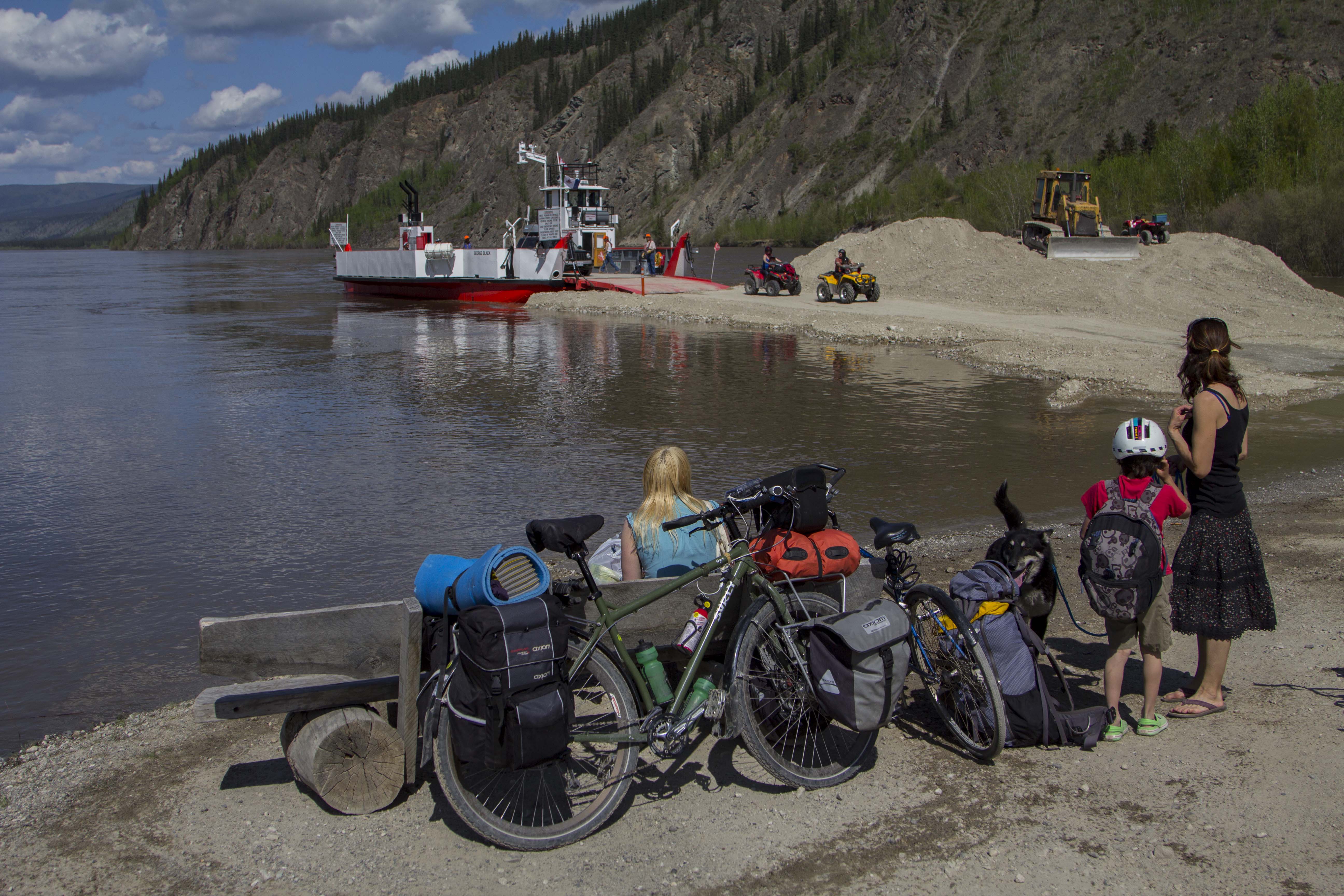
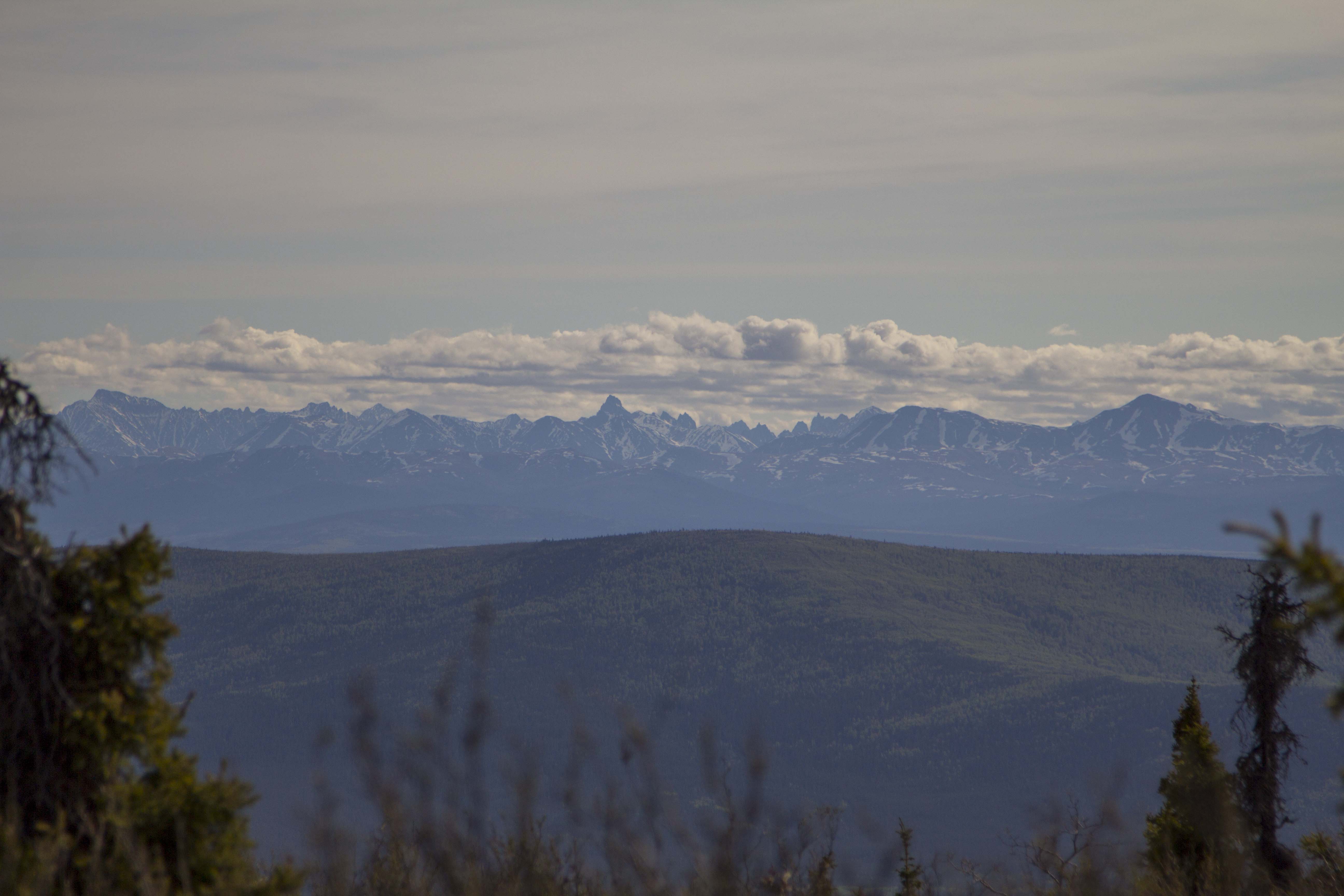
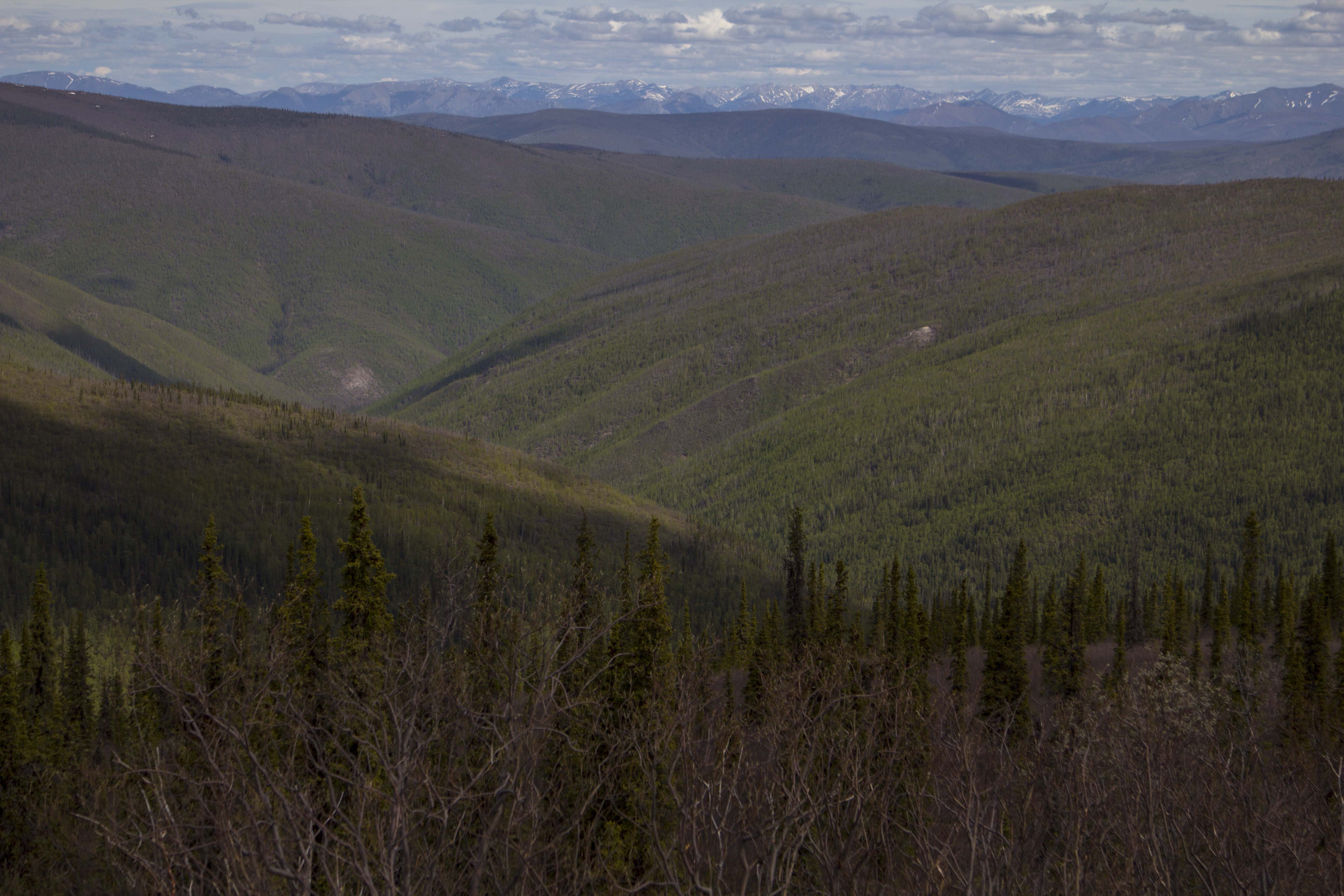
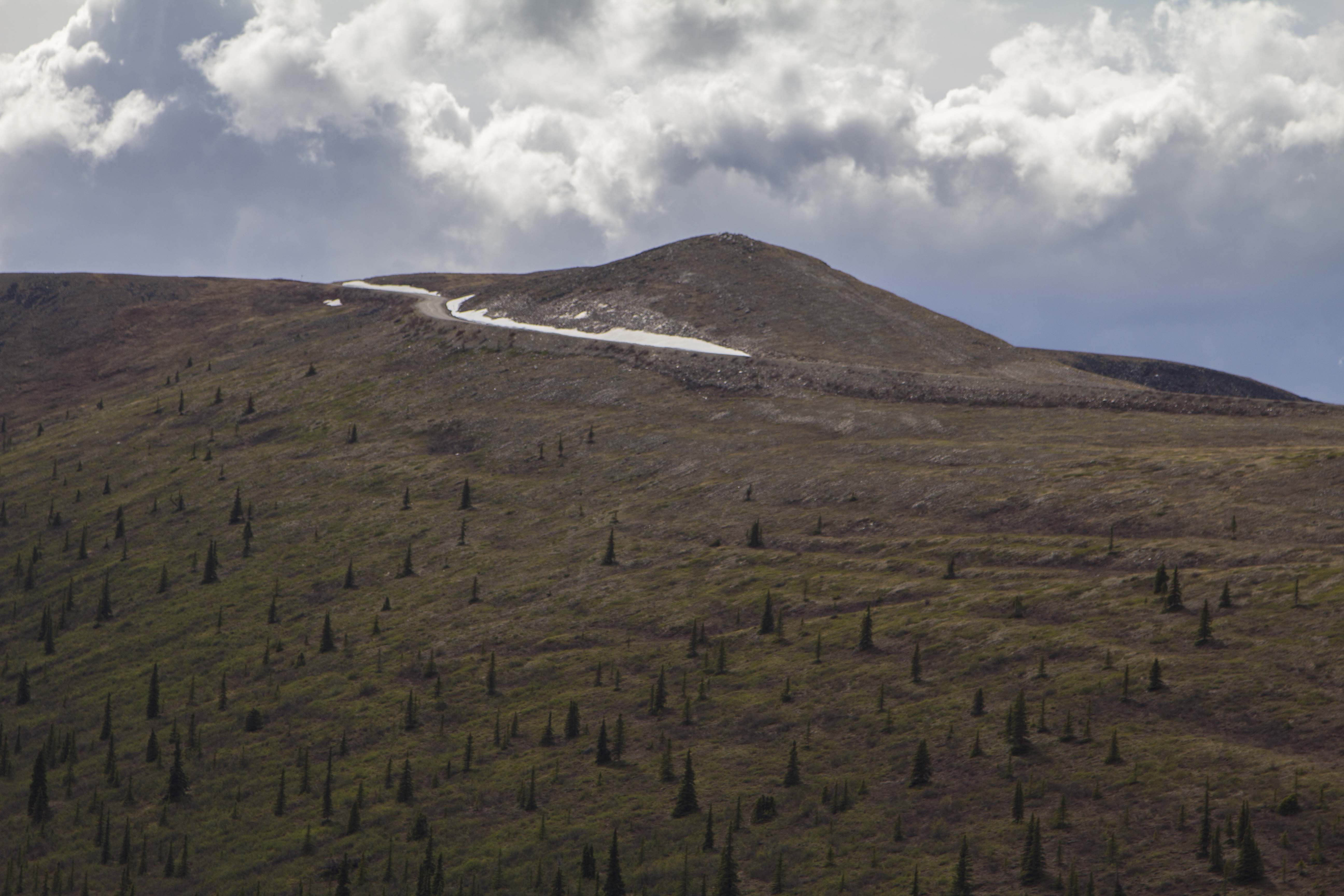
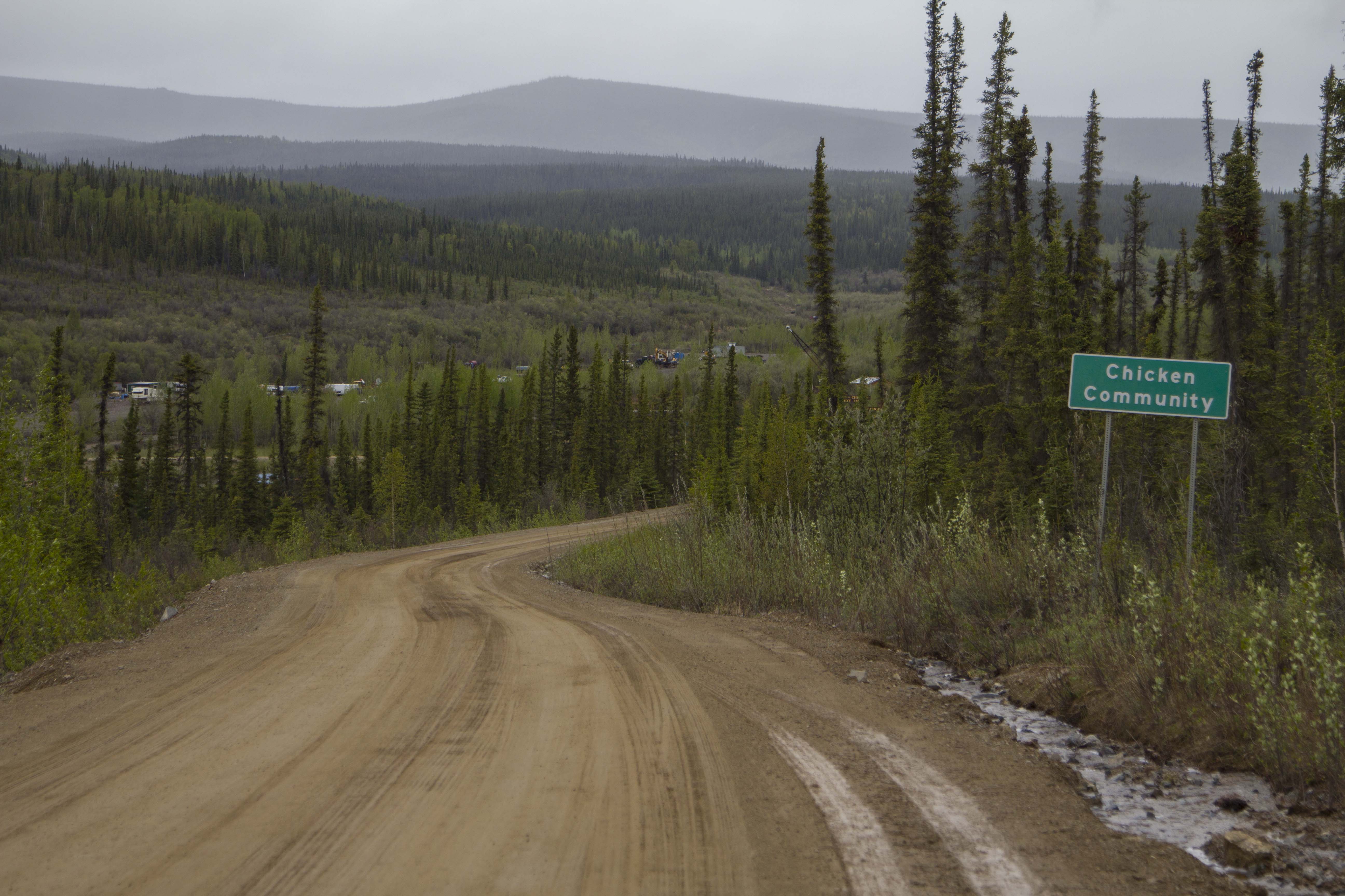
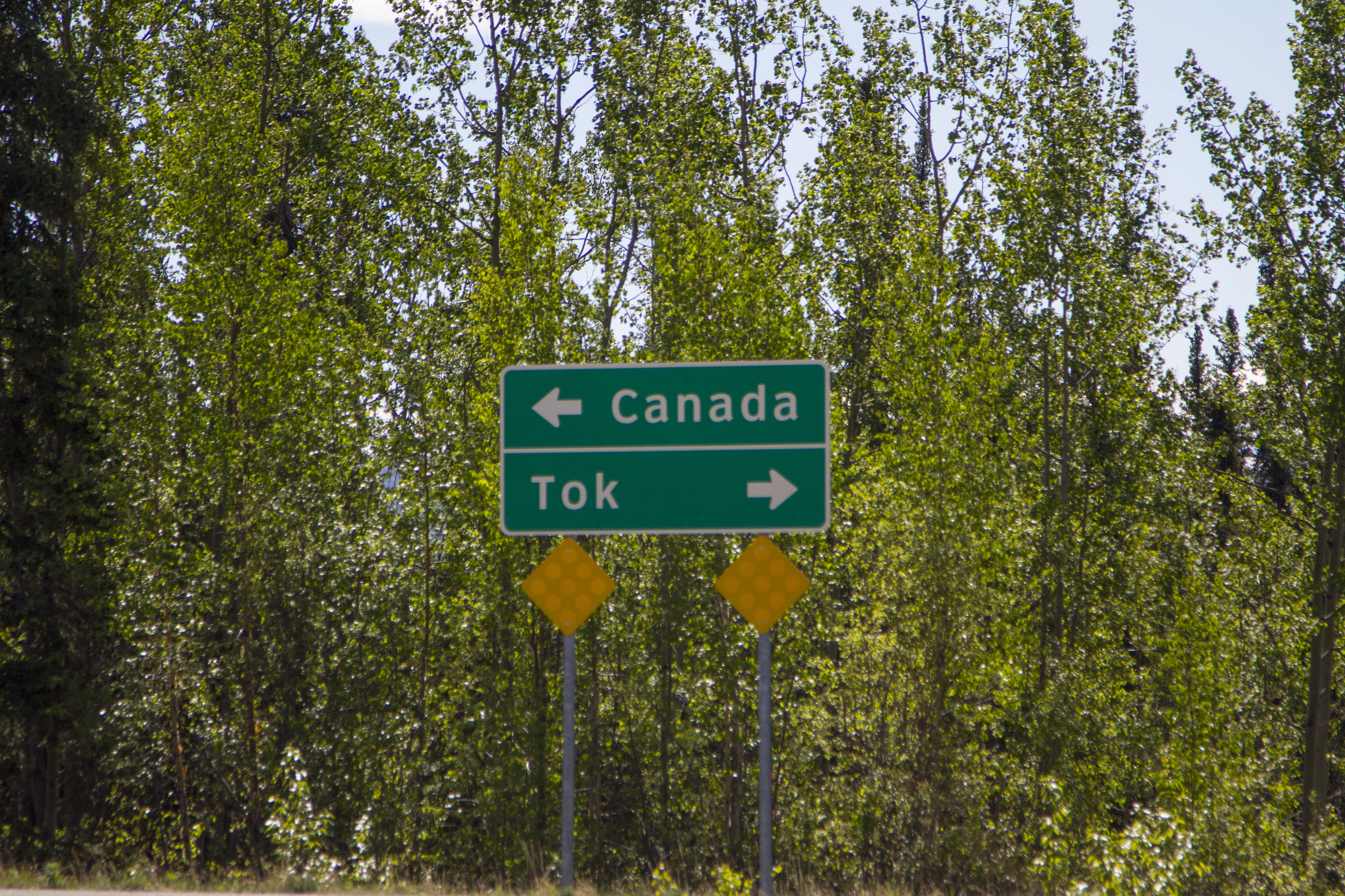
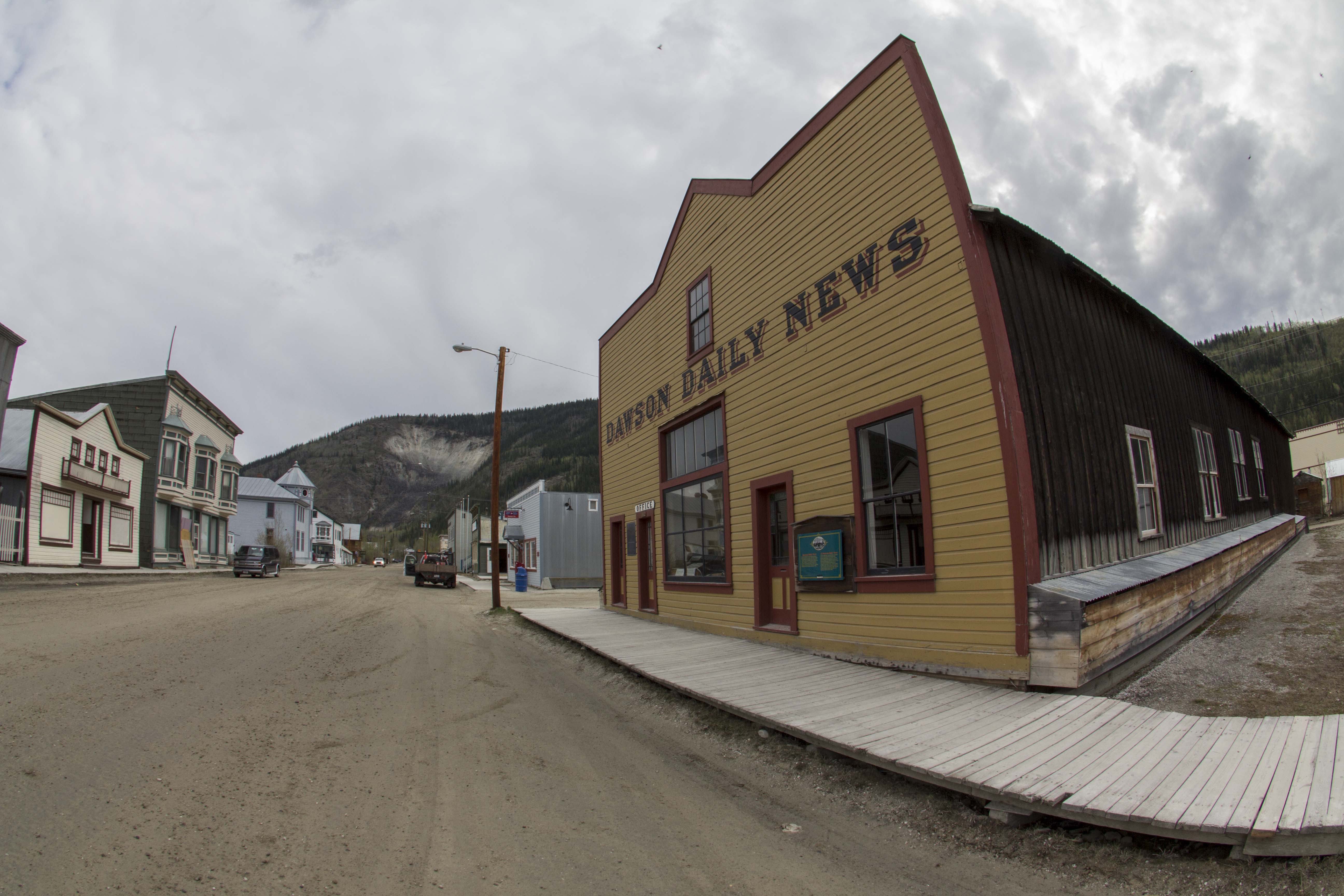
After an icy morning dunk in the Yukon River to scrub both body and clothing, I head to the RV park in Dawson to use one of their clothes dryers and then blast through town to pick up a cup of coffee and some supplies. The dirt streets of town are quiet and pleasant, with only the sound of the Yukon ferry doing it’s early morning chores on the swelling river. After my clothes have dried, I board the truck onto said boat and in moments I am easing the Toyota up the big climb out of the Yukon River drainage and up to the high forested spines of the Ridge Road, Also known more commonly as the Top of the World Highway.  I remember this grueling 8 mile climb mounted to the inexhaustible Ogre back in 2013. I found the TOTW road to be an epic ride; one massive hill climb after another, up and down, rarely flat, always challenging, and doing so for 120 miles before the final assault at the border consisting of a 12 degree climb to it’s apex, before a descent to the border crossing itself, after of which there is a long descent into the Forty Mile River region of eastern Alaska. This area has the small and interesting communities of both Chicken and Eagle, Alaska, and is an area of heavy mining activity, vast plateaus of forested wilderness, wild rivers, and the Forty Mile Caribou herd. Once past the river region beyond Chicken, the road flattens for a bit through vast and swampy Taiga valleys, followed by more endless up and down hill climbing. Eventually, one comes to see a lone peak in the distance; it is a high point in this part of Alaska called Mt Fairplay which the Taylor Highway (The TOTW Highway becomes known as the Taylor Highway once entering Alaska) skirts on it’s northerly shoulder. It is at this magnificent high point that one is treated (assuming a clear day) to glorious views of the entire Alaska Range from Mt’s Hayes and Deborah, past Denali, and all the way to the start of the Wrangell-St Elias. It is a grand view of beginnings of the greatest chain of mountains on the continent. Soon one descends slightly to the remainder of the hill climbs that signal final descent into the Tetlin Valley and the Tanana River. Once to the Tanana, the community of Tok is not far off.

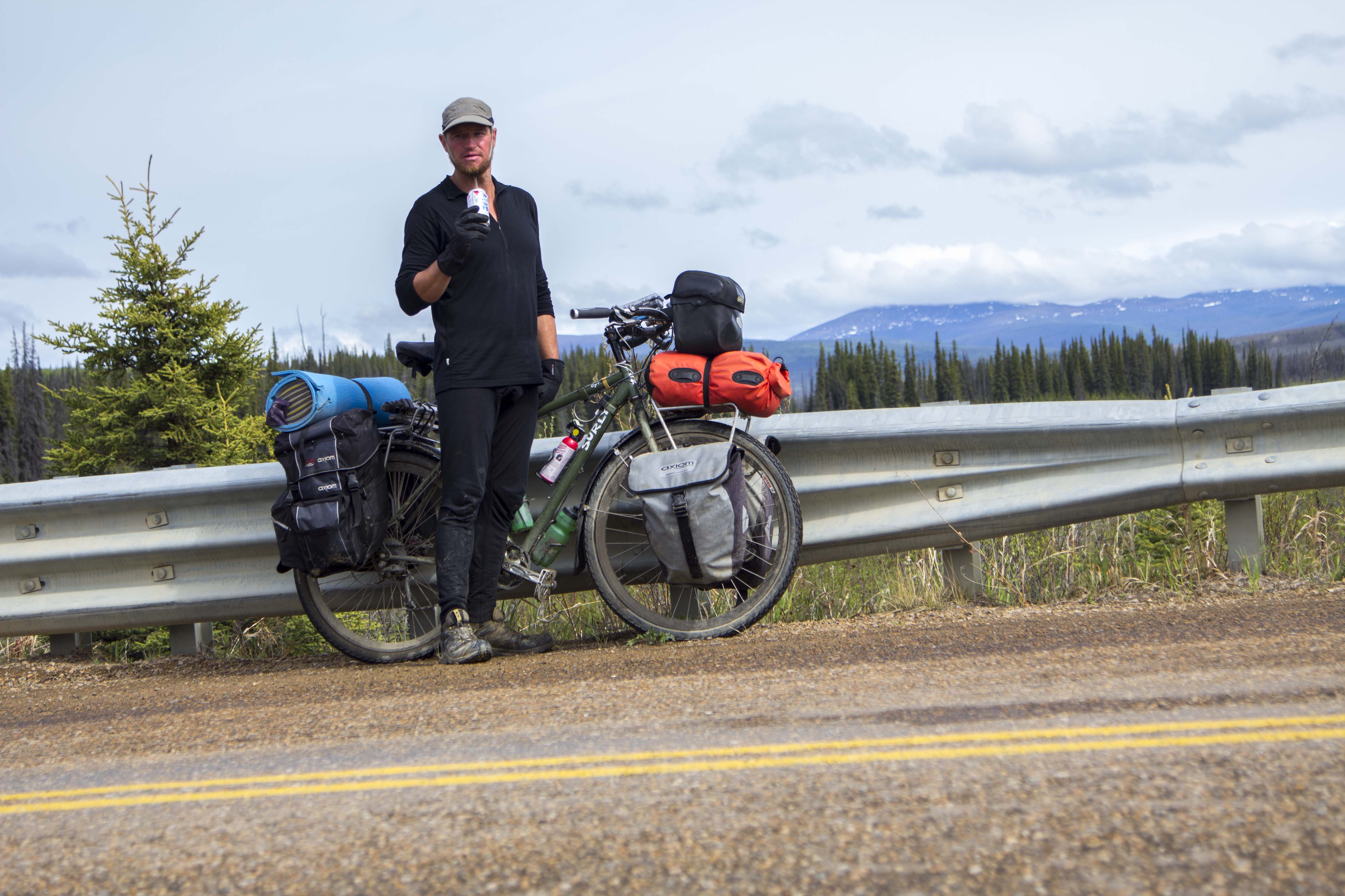
I chill out in Tok for a couple of hours simply trying to get a grasp at my next move and keep my mind calm. Looking over my maps, it occurs to me that the Nabesna Road is not far away… perhaps 70 miles down the Tok Cut-Off, which I had neither ridden or driven before. So to me at this time a moment of excitement hits me as I am now prepared to explore one of the many, many areas of Alaska that I had never been. That always gets me in a good mood, and soon I am spinning down the Tok Cut-Off, a beautiful highway that essentially splits the Alaska Range from the Wrangell Mountains to the south. It follows beautiful river drainages and sports mature boreal forest galore. Tall alpine peaks adorn both sides of the path, and a dull sight is never at hand. It is getting late and I pull down a dirt road along the Little Tok River to find a wonderful camp next to a deep blue pool in the river, where Grayling are surfacing everywhere. After setting up my camp, I grab the fishing rod and commence to catching my supper. I build a fire and wrap the Grayling in tin foil with some onions and butter, whip up some tea, and proceed to shoot a time lapse of the deepening hues of the midnight sky. Sleep comes around and I dream once again of being in high peaks surrounded by wilderness and animals in the most glorious vast areas of this amazing continent.

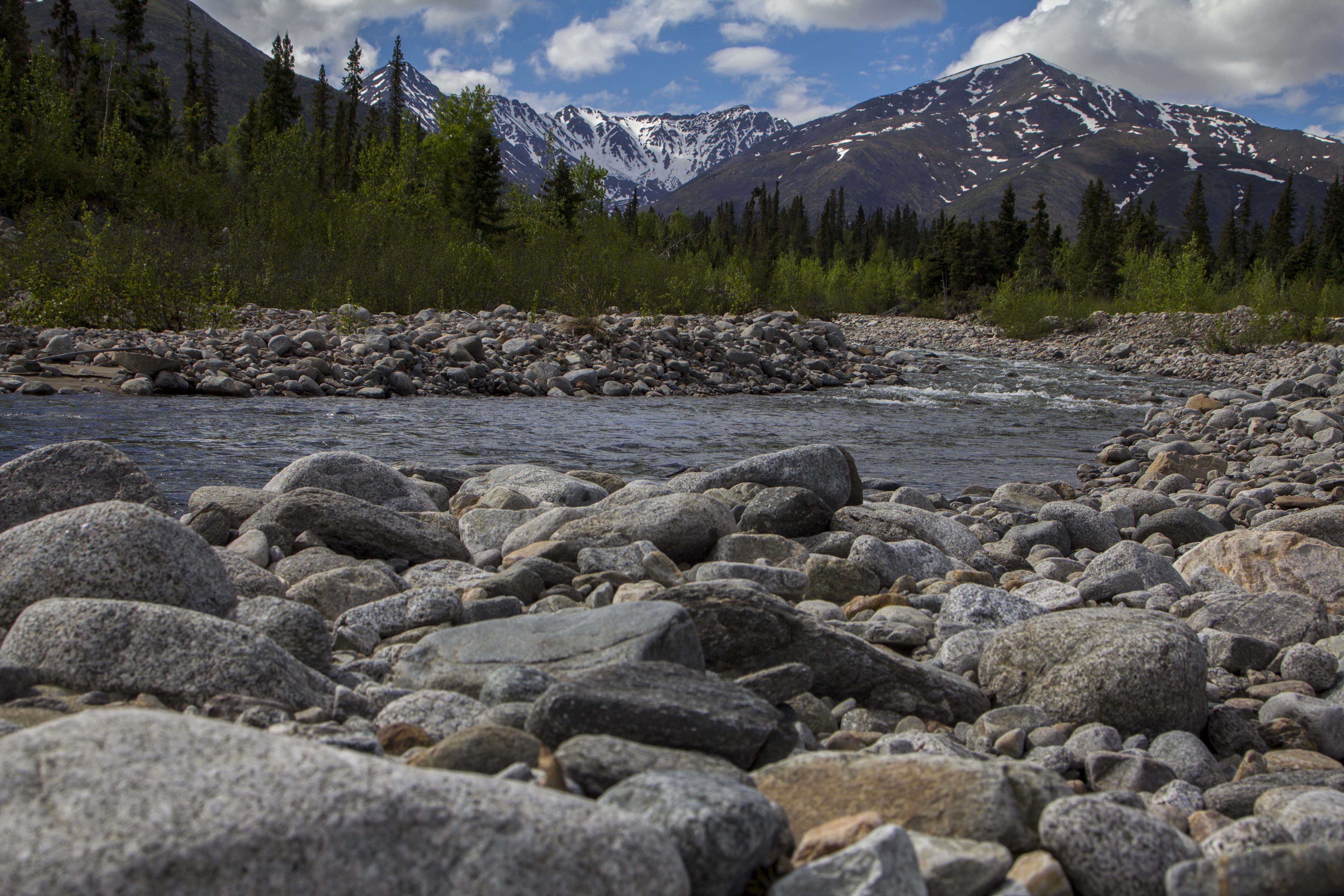
I seem to only sleep maybe 5 hours a night this time of year, at least for a week or so at a time, when it catches up to me and I then sleep for ten hours or more for a day or two. This morning was another early one for me, and I have the truck packed up and rolling down the Cut-Off by about 5 am. Stopping at a roadside lake, a walk to the shore reveals Swans, Geese, Moose, and literally thousands of fish swimming and visible from shore. I see what appears to be spawning colors; I grab the rod from the truck, not because I wish to eat, but because I must know what these fish are. After a couple of casts, I pull in a Grayling, and release it. Another cast, another Grayling. Finally, two more casts produce yet another Grayling. I inspect the beautiful fish; Grayling are by far the most common fish in the Alaskan interior and are easily identifiable due to the very long and undeniably prominent dorsal fin; No other freshwater fish has a dorsal like this. This is fine and good, but is still have not found the information I seek. I peer into the water hard to inspect and can only assume that these are a small variety of spawning Sockeye, or Red Salmon. The nearby Slana River flows into the Salmon infested Copper River to the southwest, and forms sloughs that feed this lake. The Copper River is famous for it’s amazing runs of Sockeye, so I must then assume that this fish I see are such.

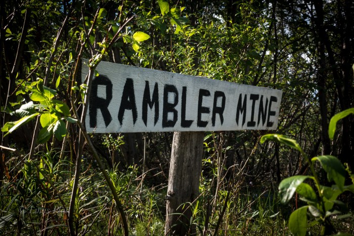
Soon I am pulling onto the Nabesna road and park the truck in a pullout and off the road a fair bit, as It will be here for a couple days at least. My plan is to ride the Ogre to the end of the road 42 miles out and into the Wrangell’s, camp out, inspect the abandoned Rambler Gold Mine, and then pedal back to the truck; maybe three days I think.

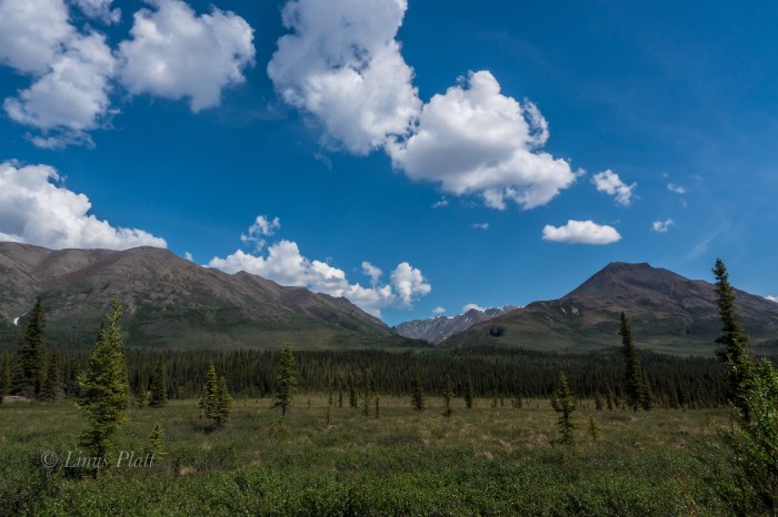
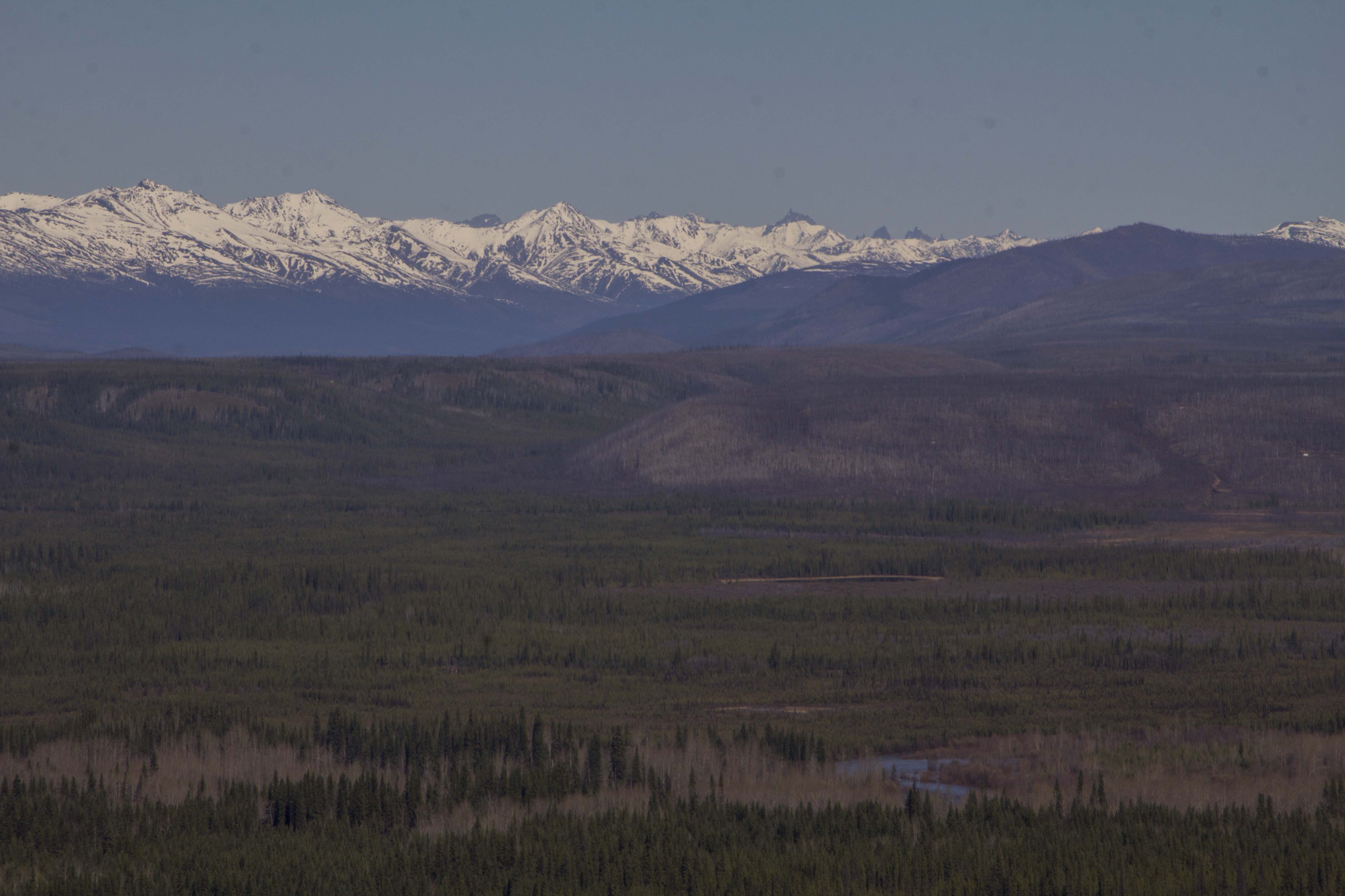
The Nabesna Road is one of only two roads that penetrate the Wrangell Mountains in Alaska, and is the northerly of the two. Angela and I and ridden the other one to the south a few short years ago all the way to McCarthy and hiked up the Root Glacier for several miles before pedaling back out to Chitina and on to Valdez. The Nabesna however, comes in from the north and travels Taiga forest and tundra with unbelievable views of the 16,237’ Mt Sanford, the second highest volcano in the United States behind the 16,421’ Mt Bona, and also 14,163’ Mt Wrangell and the beginnings of the high glaciated plateaus that lead to the enormous centerpiece of the Wrangell’s, the 16,391’ Mt Blackburn. These peaks are nothing short of Himalayan in size, rise nearly 14,000 feet from their bases, and feature massive glaciers and ice sheets. They also support large populations of Dall Sheep, Grizzly Bear, and Moose. Lynx, Wolverine, and Caribou also grace these ephemeral mountains. It is a true rugged mountain sub arctic environment and true deep wilderness in North America. It is also an area of amazing geologic wonder, being primarily volcanic, but segments are also of a fault block uplift, and the combination produces unequalled beauty in one of the most striking set of mountains one is likely to encounter. It is also very lightly traveled by Humans. It simply is not an area tourists go, regardless of the fact that the entire region is contained within the Wrangell-St Elis National Park, the largest national park in the United States, from exploring this mighty region. The combination is what drives me… remote and largely untraveled regions of Alaska that feature gifts of wilderness, solitude, and beauty.

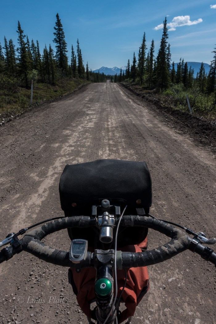
After casually getting my gear and bike together, the Ogre and I are rolling the Nabesna past the Slana River and onto the vast Taiga plateau that marks the beginning of the slight ascent into the high country. The beast beneath me bucks wildly for a bit till she tames down some and soon we are synchronized into a union of one pedal stroke after another. It has been quite some some since I had ridden the old girl fully loaded. It is extremely hot… 83 degrees in fact, and a hot, cloudless blue sky penetrates me and I feel sunburned already. Layer after layer of sunscreen, but sweating does me no favors. It is fairly dry in this area as well. In fact for the first 20 miles, there are no good streams for drinking from, so one must be prepared for this scenario. The first 15 or 16 miles of the Nabesna are either paved or chip seal, but soon after, the main dirt road section appears and the Ogre and I glide along it’s length silently.

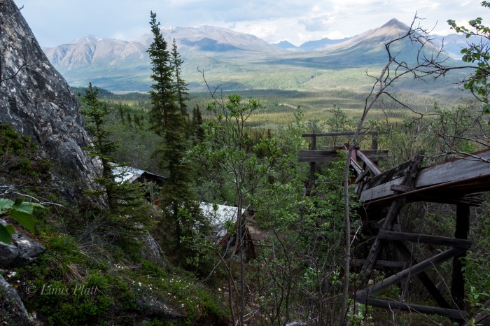
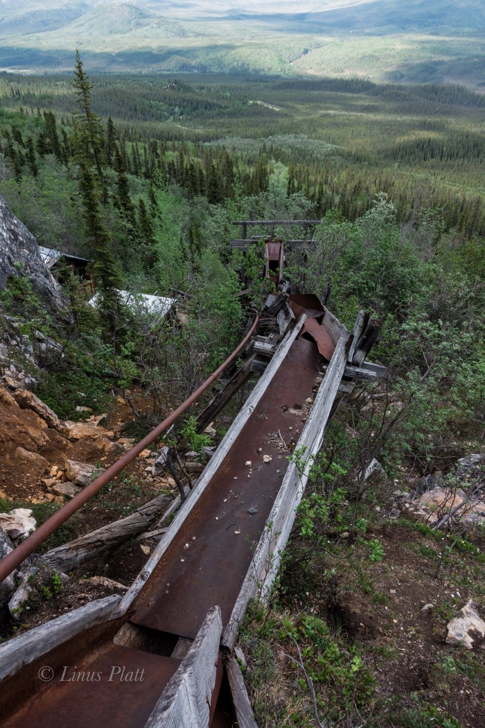
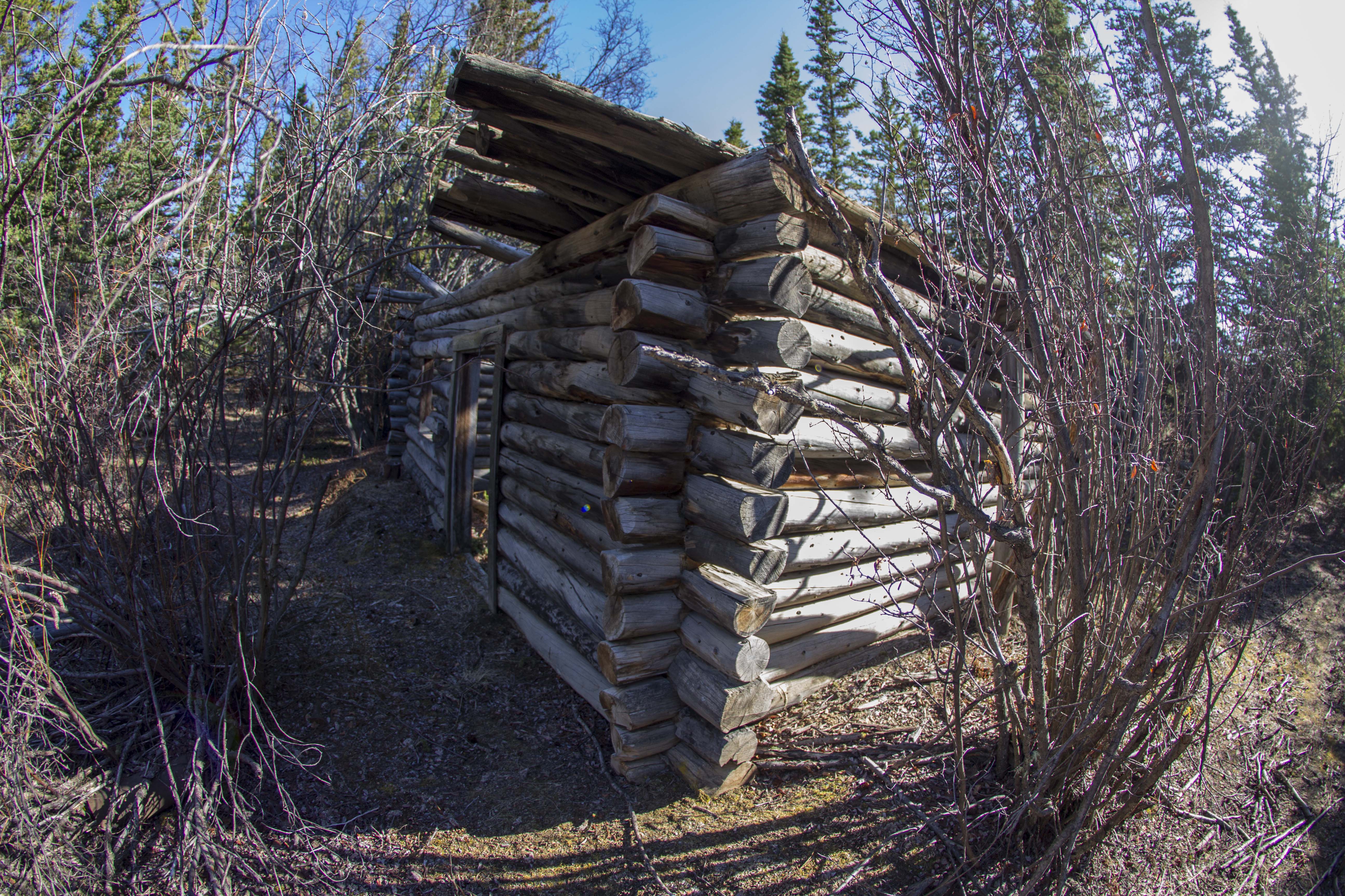
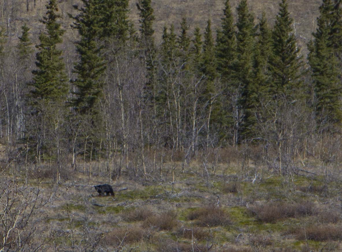
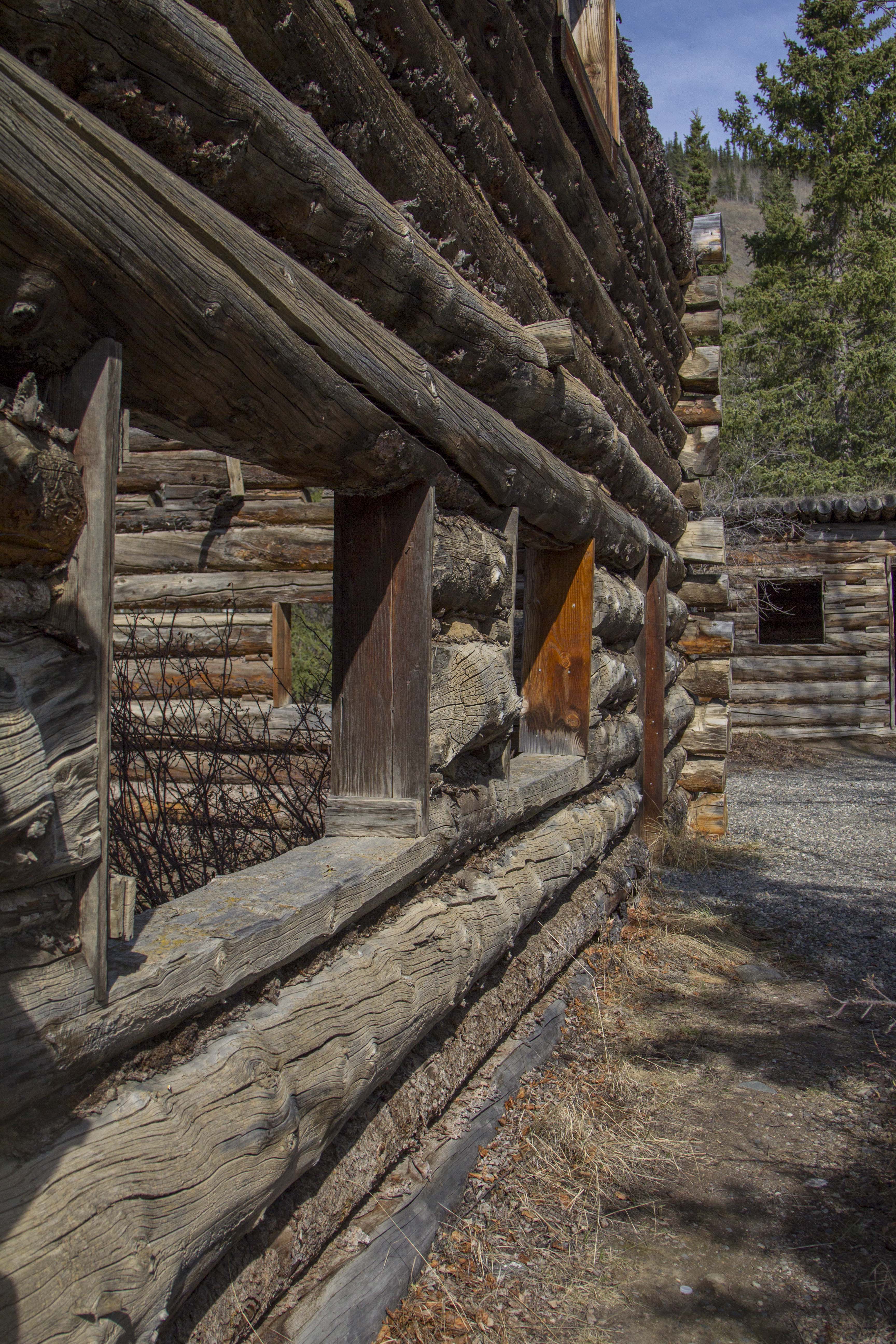
Between expanses of Taiga, long stretches of tussock tundra dominate the landscape, leading for as far as the eye can witness into forays of untold peaks, valleys and wilderness. Finally a clear crystalline creek appears, jutting from a deep cleft in the barren mountainside and tumbling feverishly to the road, where it meets up with moi and I drink copious amounts and fill all of my bottles. I tend to carry many bottles on bike trips as I consume huge amounts of water in an attempt to remain hydrated, and today is definitely no exception. I find the heat to be stifling and although the Nabesna, for the first 30 miles is relatively flat, I am sweating bullets and feel deeply overheated. At 29 mile, the Sportsman’s Paradise Lodge comes around and I drop in for a root beer. I walk inside and say hello to Doug, the owner if the lodge, and grab my icy drink from the cooler. As I sit at the bar, I pop out my debit card, as I have forgotten cash… Doug says “nope”, “We got no connection for that sort of thing out here, but don’t worry, I’ll cover ya… Just make sure to send me two dollars in the mail when you get a chance. Ain’t no one ever stiffed me yet” he says. The sweetness and chill of the root beer are unbelievably refreshing, and aside from Doug’s chain smoking cigs inside the lodge, we had a pleasant conversation regarding the local wildlife, weather conditions, and the current Sockeye run at the Copper River near Slana. After finishing my beverage, I reluctantly leave the coolness of the lodge and continue pedaling the remaining 13 miles to the end of the road, the last three or four of which included some steep hill climbing and descending. At the end of the Nabesna road is an old air strip, lodge, two bed and breakfast type places, and a couple cabins, all of which are closed up or abandoned. The place is deserted. From here, an old jeep trail leads a few miles back to the Nabesna Gold Mine and the Rambler Gold Mine. I am extremely exhausted and I find no where acceptable to camp; the dirt track becoming narrower and narrower, with no water and no where to pitch a tent. Large piles of Grizzly scat appear and I start singing to myself and decide that the Bear spray belongs in my hand and not in the pannier. Eventually I decide that I am far too tired to continue and I must turn back pedal the three miles to Skookum Creek for a decent camp. I figure if I do this, I  might lose motivation to come back here in the morning, so I decide, regardless of my exhausted state, that I must hike the 500 vertical feet and 3/4 mile up to the Rambler mine. I park the steed and begin the uphill stomp. I am so tired I can barely pull it off, but as I near the mine a second wind takes me and soon I am ambling about the old buildings, sluice boxes, ore cart rails, mine shafts, and mining debris from another and forgotten era in Alaskan History. The Rambler mine was active, and abandoned in the 40’s, and now sits as an untouched monument to a short lived gold rush memory that created the settlement of Nabesna. The views from the mine are nothing short of spectacular; the Nabesna River clearly visible, it’s source, the Nabesna Glacier just out of view, but the endless deep wilderness of the region unfolds dramatically as far my eyes can take me.

I pedal in a dilapidated state all the way back to the best camp on the whole road at Jack Creek, which unfortunately means I must pedal all of the hill climbs again today to reach it. I manage to do it and once to Jack Creek, I strip down to my birthday suit and fire myself into the drink. The water is ice cold and the shock hits me hard, but my body is refreshed and clean and I meander off to get my camp set. Sleep comes easily and I am awake at 4 am… pedaling back to the truck by 5, and at the truck by 11. The entire journey including hiking to the mine took only 23 hours, however it should be noted that there are more mines and many more trails to discover and explore in the area and a trip of several days would not be considered lengthy. As noted previously, like a Shark, I am on the move.

Later on, after de-rigging my vessel and loading up, I drive through Glenallen, where hoards of tourists and dip netters clog the town and highway. I am all too happy to leave it behind and mosey on up the Richardson Highway bound for my absolute favorite place in all Alaska: The Central and Eastern Alaska Range.

TOW-Nabesna-FB-00638
Zen Cairns At The Top Of The World
TOW-Nabesna-FB-00659
Old Mining Equipment On The Tundra
TOW-Nabesna-FB-01286
Top Of The World Abandoned Tanker
TOW-Nabesna-FB-01689
For The Home Team
TOW-Nabesna-FB-01699
The Little Tok River
TOW-Nabesna-FB-02696
Lake Of A Zillion Fish
TOW-Nabesna-FB-02732
Mt Sanford 16,237″
TOW-Nabesna-FB-02740
The Nabesna Road
TOW-Nabesna-FB-02742
Wrangell High Country Taiga and Tundra
TOW-Nabesna-FB-02743
One Of Several Stream Crossings
TOW-Nabesna-FB-02745
The Ogre
TOW-Nabesna-FB-02747
The Rambler Mine
TOW-Nabesna-FB-02760
Rambler Mine Ore Cart
TOW-Nabesna-FB-02764
Mine Shaft
TOW-Nabesna-FB-02766
The Nabesna Valley As Viewed From The Rambler Mine
TOW-Nabesna-FB-02771
Mine Structures
TOW-Nabesna-FB-02787
Skookum Creek
TOW-Nabesna-FB-02796
The Skookum Volcano

Curveball

So I left Dawson City behind.. a town rich in it’s past and present history. I’ll be back. Hopefully to engage the elusive Dempster again at some point. Leaving town around 4:00 pm and crossing the Yukon River on the constantly running free ferry, I was thrown into a world of steep hill climbing that would not let up for another 110 miles. Right off the ferry, the road turns skyward, straight up at angle of about 10-12%. For 8 miles straight without mercy. Near it’s “top”, there is a rest area of sorts and I call it home for the evening. Over the course of the next days’ 68 miles of pedaling, I must have gained and lost 5000′ of elevation, without really gaining or losing any. This highway, a dirt path through the forest for 110 miles, connecting Dawson City, Yukon, and Chicken, Alaska, is known as “The Top of The World Highway”. And for good reason too. The path leads across the bald, tundra coated, ridges and summits of the western Yukon and eastern Alaska “hill country”. The views are stupendous; I now am looking across to the continental divide, 150 miles to the north east. In fact, from this vantage, I can see the Tombstone Mountains that I was forced to retreat from just days earlier. Only this time my view of them is from the directly opposite side and over 200 miles past. It is a  truly remarkable place. After landing in Chicken, in a rainstorm of rainstorms, mud, landslides and all, I secure a Salmon Burger from the tiny grill located there; It is a real surprise to find the food quite fantastic. I chat with the locals a bit and down a couple of beers. I must go back into the forces of the rain, hill climbs, mud, and misery. Back on the bike, the storm eases up a bit, and I begin to find a rhythm that breeds peace. A big bull moose crosses the road in front of me and magic is afoot once again.

The next day, after crossing the flanks of Mt. Fairplay, I turn the corner and am greeted with an unexpected surprise. The almighty Alaska Range is standing before me, clearly demonstrating my subordinance. Once again, I am in awe.

Finally reaching Tetlin Junction at the merging of the Taylor Highway and the Alaska Highway, it occurs to me that the hill climbing is over for the next several days, as, if memory serves me correctly, the stretch between Tok and Fairbanks is flat pedaling, but a spectacle of the foothills of the Alaska Range. This combo makes for some blissful times indeed.

I spend a couple of nights in Tok, at my old camp in the woods to the southwest of the school. I always have, and do now, find Tok and this part of Alaska in particular, very satisfying. It’s close proximity to the Alaska Range, great country side, and a relaxed atmosphere is unique, even for Alaska. It’s winter’s are another matter, however. Locals confirm it’s reputation as a scene of brutal cold; Winter time temps of -60F are not just occurrences, they are outright common. Land is cheap here, there is no sales tax, no property tax, no building codes, and no jobs. Sounds like a good place to retire to for part of the year.

Moving on, I head north along the northern and eastern flats below the impending Alaska Range. The creeks are plentiful and crystal clear, and I drink copious amounts of water from them; gorging myself on their nectar. Another night of thunderstorms and another morning of packing it up in the rain today. It is getting to be routine. I am finding myself able to pack it in with my eyes closed. Later in the day when the sun is out, I pull out the fly and it dries while I snack. No big deal.

I am now in Delta Junction, camped on the gravel beaches of the wildly braided Tanana River, looking to the south at the appearances of my favorite mountains on Earth.The central Alaska Range’s  Mt’s Deborah, Hayes, and Kimball, all are reaching upward in an attempt to put on a show for me, but the storm just won’t have it. I have never seen this side, the north side of these peaks, and I decide to camp here tonight in hopes of catching a time-lapse of these marvelous peaks in the morning, with the sunlight splattered across their eastern escarpment and embellishing their glacially clad, icy armor.

What’s up next, You ask? Perhaps an adventure up the Steese Highway for a trailride on the Pinnel Mountain Trail and the Circle-Fairbanks Trail. Or perhaps it is time again to settle the score with the Arctic once and for all, and head up the Haul Road, into the Brooks Range. I don’t know yet.

You’ll know, when I know…

Well, now I know, well, sort of… Life just threw me a curveball.  I awoke this morning and while packing up and getting ready for a northward stint, I noticed that the envelope containing 90% of my cash is gone. I knew instantly that this was not a case of misplacing it within my kit, but one of absolute disappearance. I spend the entire morning on the phone to all places past I had visited and with no avail. I suspect it is a case of carelessness on my part; possibly left at the counter of a shop somewhere in Tok, or who knows where. Maybe it fell out of my bag when I pulled over to take a photograph. I just do not know, and suspect I never will. Either way, it is gone, and so is this journey, at least in it’s current fashion. Again, Ill let You know when I know. If by chance there is a person out there who knows something of an envelope labeled only “Trip”, that contains nearly 4000 dollars in cash, gimme a call.. Please! (435) 260-1990.

That’s all I have to say at the moment.

IMG_0800 IMG_0814 IMG_0827 IMG_0840 IMG_0845 IMG_0858 IMG_0862 IMG_0871 IMG_0875 IMG_0877 IMG_0883 IMG_0886 IMG_0892 IMG_0899 IMG_0906 IMG_0909 IMG_0911 IMG_0916 IMG_0934 IMG_0939 IMG_0940 IMG_0942 IMG_0950 IMG_0979 IMG_0986 IMG_0993 IMG_1005


Klondike Treasure

I really like Whitehorse, really, I do. But the hustle and bustle of even a cool town can wear me down. I’m not much for seeing the usual tourist sites of a given local, generally getting on with my business, and then heading for the hills. I had numerous things to attend to, however. The 11 litter MSR bladder I had lovingly carried through many thousands of miles, had sprung a leak. Besides, previously having traveled with a trailer made it possible to simply strap the apparatus to the top of the trailer and carry on; but traveling with panniers is another thing altogether, and the bladder concept wasn’t as useful now. So I needed water bottles. I needed to purchase a phone card, do laundry, buy food, convert U.S. dollars into Canadian fun tickets, make phone calls, buy a reading book, and get my load straightened out. Without much fanfare, I accomplished these tasks and skinned out by 1:00 pm.  In all honesty, Yukon hospitality has been hit or miss for me in the past and now as well. It seems 2/3 ‘rds of the folks I meet are friendly and open. And all of the first nations peoples I talk with are open to conversation, it’s always been this way. There seems to be that reserved crowd who just don’t dig folks on bicycles around. For example: at the Braeburn Lodge, the proprietor, an enormous bellied, white bearded dude, who could have passed as Santa Clauses’ cousin, sporting a Harley Davidson T-shirt, simply grunted when I spoke, and barely gave me the time of day. He sure took my money for the regionally famous Braeburn Cinnamon Bun that I purchased though. Paradoxically, when speaking to a First Nation’s man in Carmacks, we chatted and chuckled, and he wanted to know why I didn’t have a fishing pole with me, as some mighty fine suppers’ could be had ahead. Why don’t I have a fishing pole I contemplated?

A ways past Braeburn, the terrain opened up to an unexpected valley of agriculture. Soon though, the North Klondike Highway turned upward once again, and we rose into the Spruce, and my favorite forests, revealing rivers and meadows. I take a short 2 track leading into said forest, and it dead ends into a splendid old cabin, long since forgotten. It looks to have been built during the Klondike gold rush years at the turn of the century, but it could have been a tad bit more recent, I don’t really know. Rusted tin cans, old miner’s boots, fragments of tools, and a caved in sod roof, rounded out this historic and peaceful camp. I walk down the hill, after setting up camp, and a spectacular site unfolds before me.. Fox Creek, teeming with Grayling, and surrounded by meadows and high mountains to the west are a treat to my eyes and senses. What a place to have lived at one time.

After a bit, the mighty Yukon River herself appears, and after following her course at river level for a short while, the road climbs upward, diagonally across the ancient alluvial plane, and settles down upon the flat bottomed benches overlooking the great river. Sprouting from this bench, are great forests of Spruce as big as any I have ever seen.

Onward, a car pulls over and two fellows I had met previously, from Juneau, inform me that there is a big Grizzly just up the road. I say farewell and cautiously pedal on. Not much further, I spot the large brown mass, way further off than I expected. The creature is perhaps 800 meters away, on a hillside, digging for rodents; it looks to be a big one too.. perhaps 800 lbs. I say farewell again, and off I go. The North Klondike Highway, from Whitehorse to Dawson City, largely follows the relative path of the Dawson Overland route taken by gold seekers of the great Klondike Goldrush of 1898. The treasure I seek on this passage is not gold, but animals. Today I spotted a large rabbit; like none I have seen before, with large furry white feet and belly, brown back, and shorter ears than I am accustomed to seeing. This was no cottontail or jackrabbit. I mention this to locals and they say it is an Arctic Hare.

The daytime temperatures are nearing the mid 80’s.. This seems astronomical for this time of year to me, and the locals tell me that the ice breakup was literally last week! It went from winter to summer almost overnight, skipping spring altogether. Wacky.. This part of the Yukon is definitely drier than other parts of The North, it reminds me bit of central and western Colorado at around the 6,000′ to 8,000′ elevations, although here, the mean elevation is nearer to 2,000′. Today, as I passed through the areas north of McGregor Creek, I spot the Klondike Treasure I have been so anxious to see.. In addition to the big Grizzly spotted the other day, today I spy another Arctic Hare, two separate Black Bears, And another creature that has been so elusive to my eyes until now. I was pedaling along on a flat straightaway, ipod cranking out the Allman Brother’s “An Evening With The Allman Brothers”, and I see up ahead, maybe 300 meters off, a dark shape, clearly cruising the tree-lined corridor of the Klondike Highway. I thought it was a bear at first, perhaps even two bears considering the movement I was witnessing. I stop way early in order to change the lens on my camera from a 10mm wide angle to a 24-105mm telephoto zoom. I put the camera around my neck and pedal on, cautiously. Getting to within around 75 meters or so, it dawns on me: It is a Wolf.

At first, the wolf does not see or hear me, (one of the real advantages of bicycling The North) and I am able to fire off a couple shots of the camera. Then it looks up, we lock eyes for a solid 5 or 6 seconds, then the Wolf turns and gallops into the brush. I cautiously pedal a bit more, as I wish to continue on, just as  as the Wolf. It re appears from the thicket and we stare at each other for a bit, and then it is gone. What an exhilarating experience seeing this magnificent creature.. It was mostly black, with bits of grey streaking, and a long, long, bushy tail that too was black and grey. It’s face was grey around the eyes and it’s snout was as black as a northern winter’s night. I pedal on, and after 65 miles of hammering, I am exhausted and in need of a place to call home. I spot another Blackie, and just passed there is a small two track leading into the woods. Not spectacular camping tonight, but it will do. After supper, I go looking around and spot both Grizz and Blackie prints. I am truly where I want to be!  The next morning, en route to Dawson, I catch the views of three more Hares, a fat, wallowing, Porcupine, and another elusive creature, the Black Marten.

I met a couple of guys from Dawson City, Jordan and Cafrey, who were hitchhiking back after a visit with friends in Carmacks. They mention for me to stop by “The Pit” for a round of drinks when I get to town. Anyhow, I’ll  be in Dawson by tomorrow night. Dawson is the farthest north town in the Yukon accessible by car, so I guess you could call it the hub of the northern Yukon. It has much the same appearance as I’m sure it did 100 years ago. It’s streets are dirt, sidewalks wood, and false fronts galore. Many of the old, original buildings are sinking or leaninginto the melting permafrost.  I grab a couple of beers and head to the outskirts to camp.

The Dempster is now weighing heavily on my mind. The plan is to go to Dawson for a day or so, then head back out and up the Dempster, hike into the Tombstone Mountains for 2 or 3 days for a peak bag and some photography, then continue for a pedal up to Inuvik, above the Arctic Circle, in the Northwest Territories near the Arctic Ocean, over 500 miles from Dawson, then, turn around and pedal back. Am I biting off more than I can chew?

Only time will tell…

IMG_9090 IMG_9120 IMG_9125 IMG_9148 IMG_9158 IMG_9162 IMG_9188 IMG_9199 IMG_9206 IMG_9213 IMG_9227 IMG_9237 IMG_9244 IMG_9253 IMG_9258 IMG_9259 IMG_9263 IMG_9277 IMG_9708 IMG_9709 IMG_9716 IMG_9720 IMG_9721 IMG_9729 IMG_9732 IMG_9733 IMG_9735 IMG_9736 IMG_9838 IMG_9839 IMG_9840 IMG_9841 IMG_9842 IMG_9843 IMG_9844 IMG_9845 IMG_9846