I first fell in love with Alaska when I was 15. Those early high school years were spent dreaming and executing all acts of climbing and mountaineering. I even tried to start a climbing club in high school; not a single taker. Climbing was off the map in the mid eighties, at least among high school students. In the evenings, I would often engage in as much climbing literature as I could stomach; Habeler and Messner’s’ “The Lonely Victory”, Doug Scott’s “Big Wall Climbing” and Art Davidson’s “Minus 148” were books that took me to far away places with far away ideas. It was “Minus 148” that took it’s toll on me and gave me an ironed-in impression of Denali and Alaska. Now, stomping around in this wild place, the memories of that book have come alive and they are hunting me down.
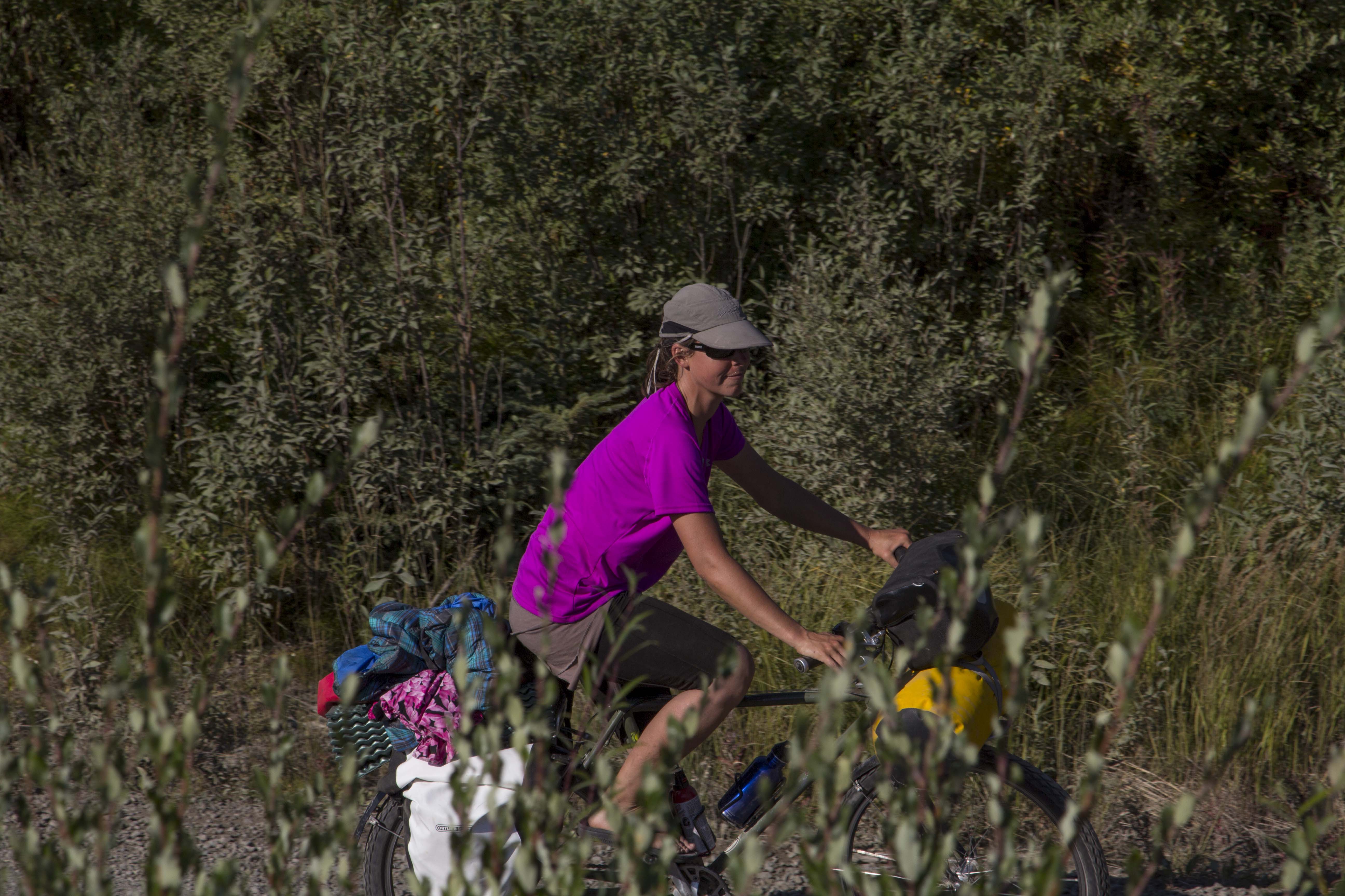
After leaving the Paxson Lodge that rainy afternoon, the Denali Highway still fresh in our hearts, we pedal onward, in search of a flat and comfortable spot to call our own for the night. When I look for a camp, I try as I must to fulfill the rules I have created for myself. An excellent camp must have at least two or three of the following: It must be flat, have water nearby, have a view, be protected from the wind, and be as far off the road as possible. A camp spot rarely has all of these attributes, but if there are a couple, then it’s usually deemed acceptable. Angela and I pedal down the Richardson about 15 miles or so and find a fine gravel pit that meets a couple of the criteria and we throw down our scene. A Loon cries out from nearby Paxson Lake, and makes the spot that much better even.
We awake the following morning to outstanding weather and an earlier than usual start sends us 55 miles down the Richardson Highway to the Gulkana river and an early camp for an afternoon of bathing and river laundry. It feels so good to be in the river, the sun overhead and our clothing, now clean, drying on the clothesline I have set up. Unfortunately, the river camp is very moist, and our clothing does not dry till nearly 1 o’clock the following day, which puts us on the road late and provides for a short pedaling day. It all works out for the best, because weeks prior I had scoped out a camp for us when Sven, Bill, and I were on a dip netting mission, out at Chitina. Now, on this afternoon, Angela and I roll into this fine camp. It is extraordinary to say the least; it consists of perfect, flat forest right next to a steep 300 foot cliff/embankment that drops to the mighty Copper River below; infested with Salmon and running strong. It also sports unobstructed view of Mt’s Sanford, Drum, Wrangell, and the enormous Mt Blackburn, all encased in glacial ice, and piercing the deep blue, cloudless sky. To me, it is a camp site to behold.
The Wrangell Mountains are a special place to me; they are nearly as mighty as the Denali area of the Alaska Range, but are connected to the monster of the St Elias Range further to the east. They are also more remote, and, according to some bush pilots I spoke with, the most beautiful place in all Alaska. That makes it pretty damn special indeed.
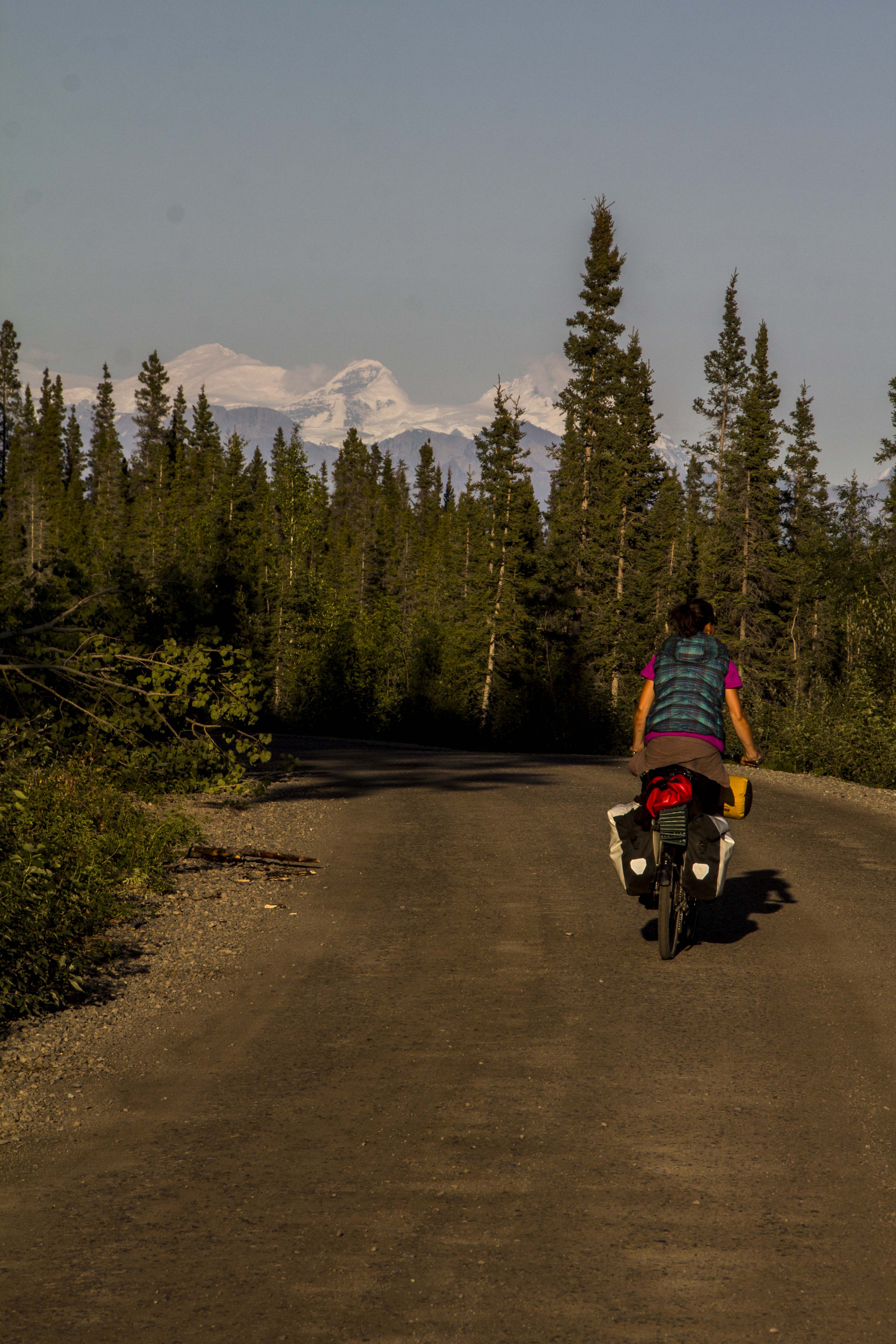
We continue onward, down the Richardson, and turn in on the old Elliott cutoff; a dirt track leading, for ten miles, to the hamlet of Kenny Lake, an area of rare Alaskan agriculture featuring pastures, Pigs, Yaks, and Chickens. We stock up on a thing or two here at the tiny store, and continue down the Elliott, enroute to Chitina, one of my favorite spots in Alaska. On the last hill into town, the headwinds are so strong, we must pedal hard to go downhill. We roll on through, eager to get ourselves established onto the dirt and gravel of the McCarthy Road, and away from the troublesome traffic. Crossing the Copper River Bridge, one is greeted with a fine, Alaskan sight; the confluence of the Copper and Chitina River’s, the Chugach Mountains to the south and the Wrangells to the North, and the dip netter’s, still pulling late season Red’s from the icy waters’. True Alaska. We roll across the bridge and turn into the free campground there, the only one we were to stay at on this trip.
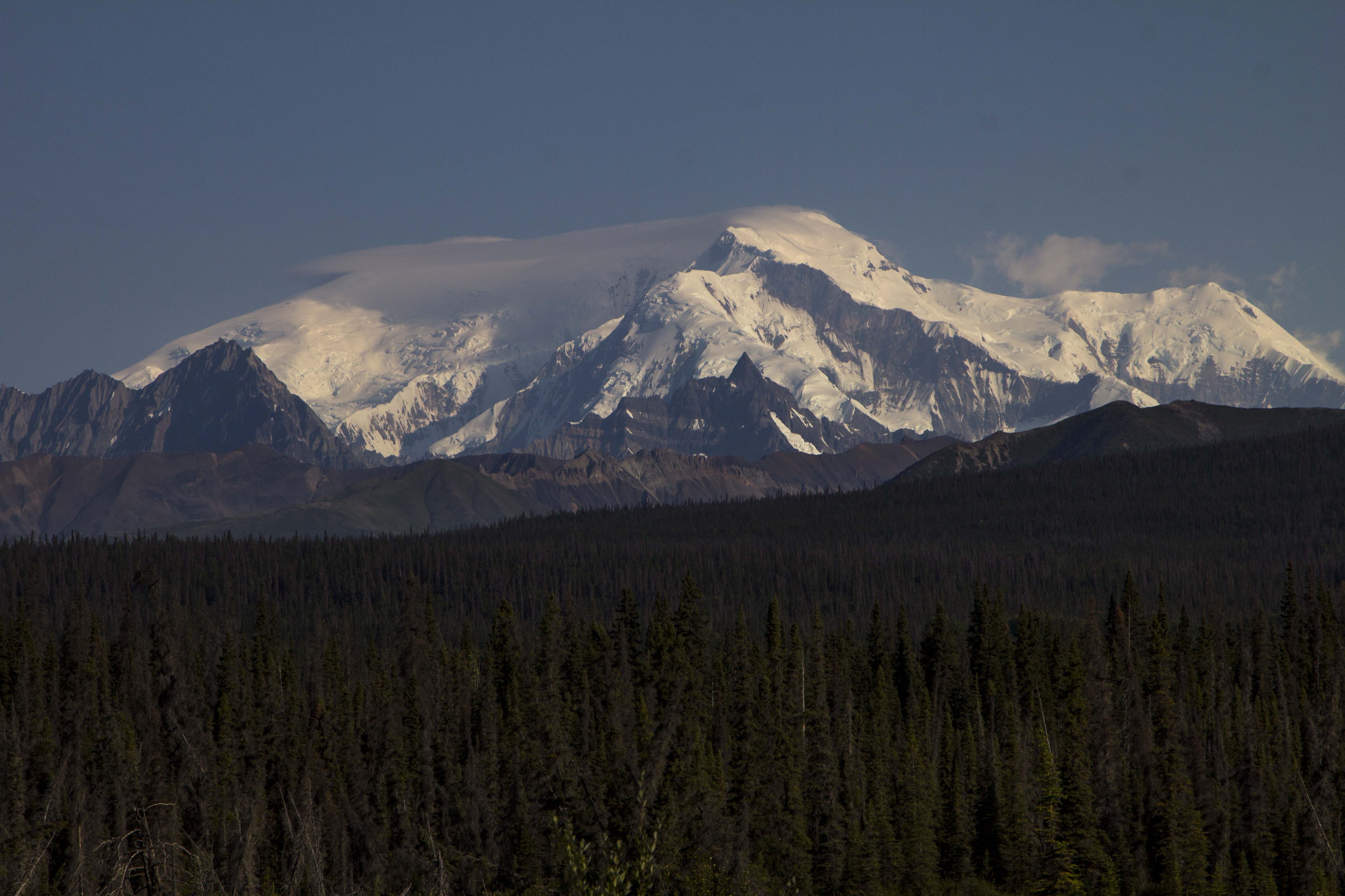
Some time back, I had an interest in scoping out the Kuskalana Glacier Trail, aka the Nugget Trail, which lies off of the McCarthy Road to the north and in from the western end by about 15 miles or so. The trail, built by miners near the turn of the century, ends at the Kuskalana Glacier and a tiny cabin there. Angela and I decide to pedal down the side road leading to the trails start and check it out for future adventure, as this time around we were a wee bit shy on time. The trailhead begins about 4 miles back, and requires one to cross Native Land and pay a fee, as we found out. Perhaps another time.. Back out to the McCarthy Road, I catch fine glimpses of the awesome Mt Blackburn, 16,000+’, which I believe is the fourth or fifth highest in Alaska. As we travel the road we are traversing it’s western, southern, and southeastern sides, and every time it appears from the road, it is as if Blackburn herself is mounted to a giant lazy suzan, rotating around me, not the other way around, showing off her best.
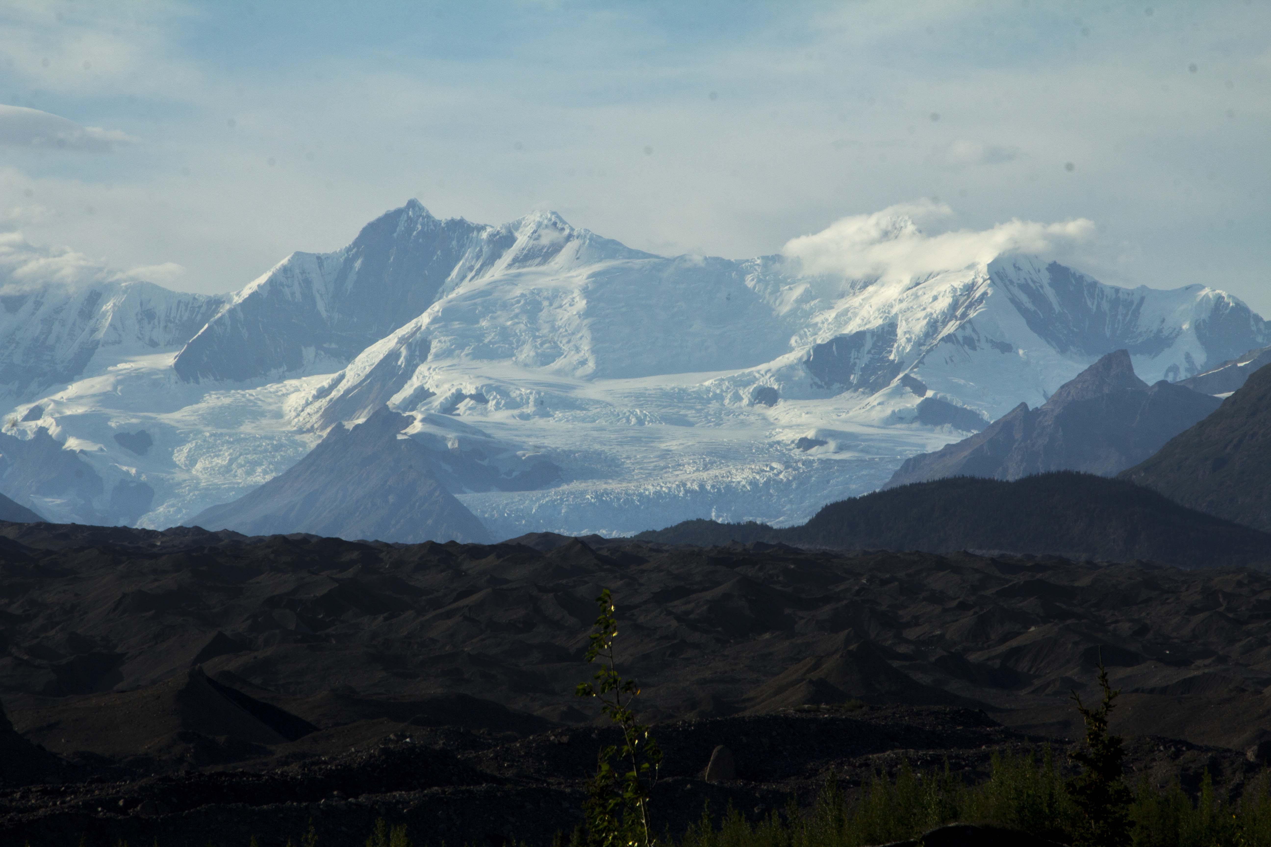
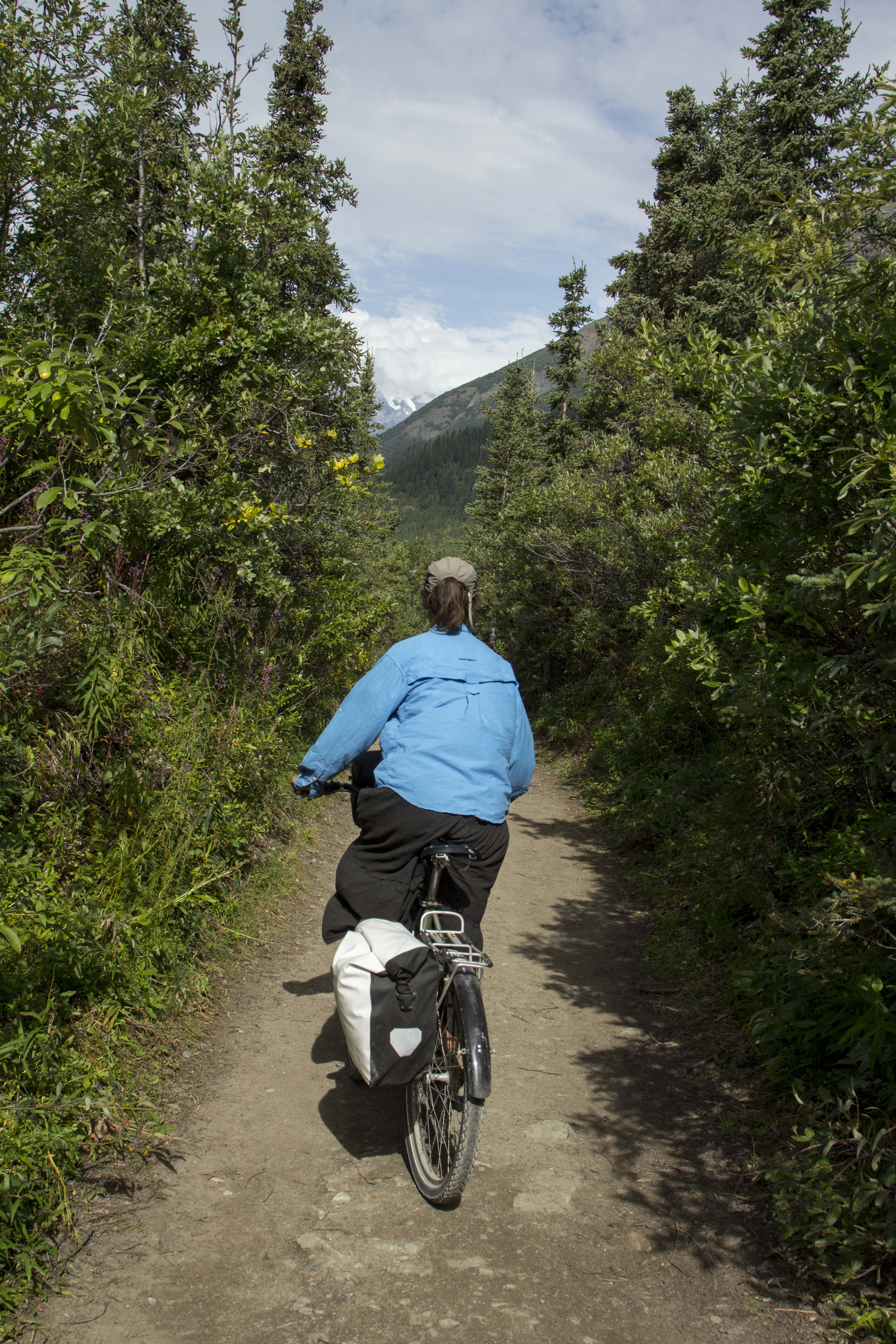
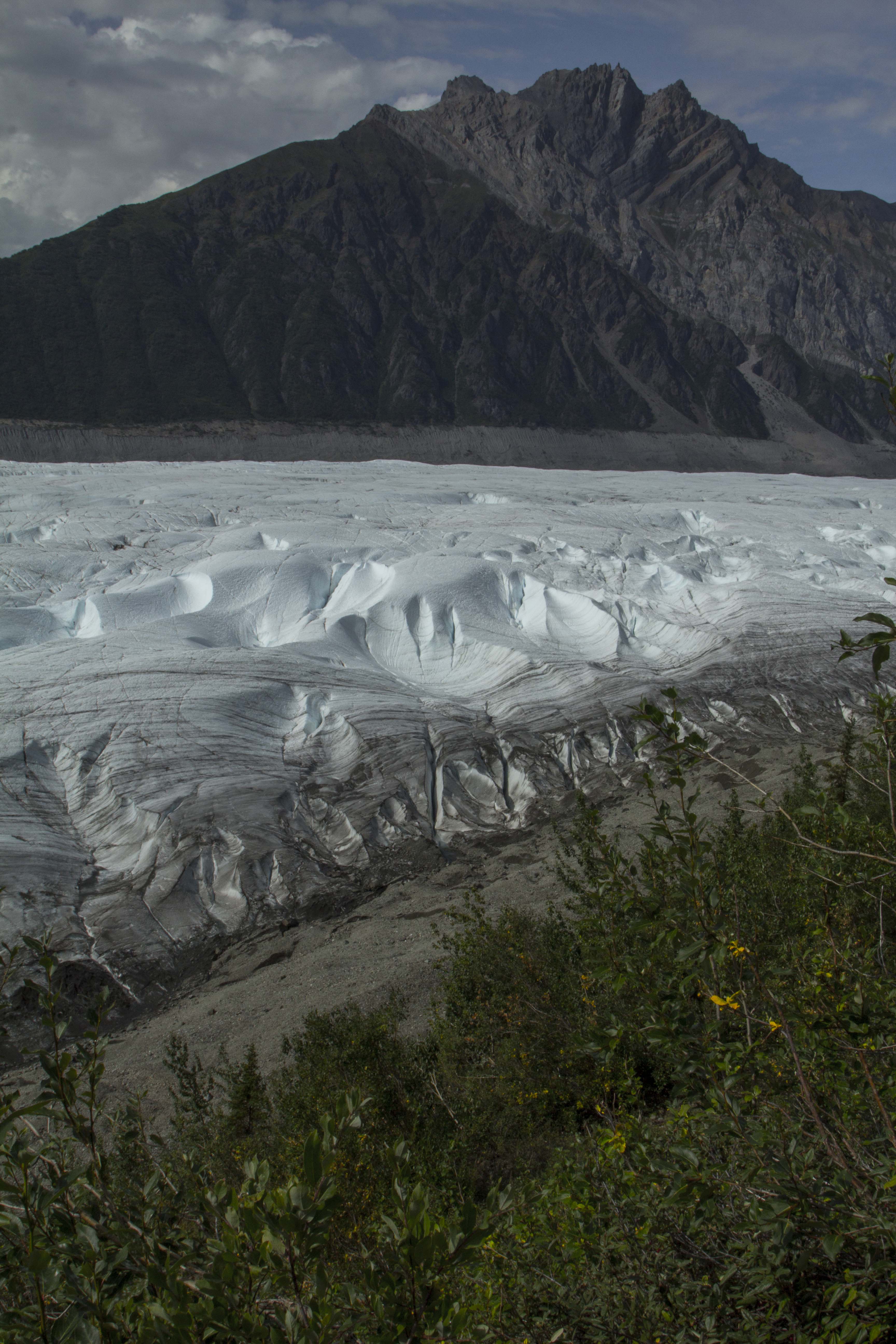
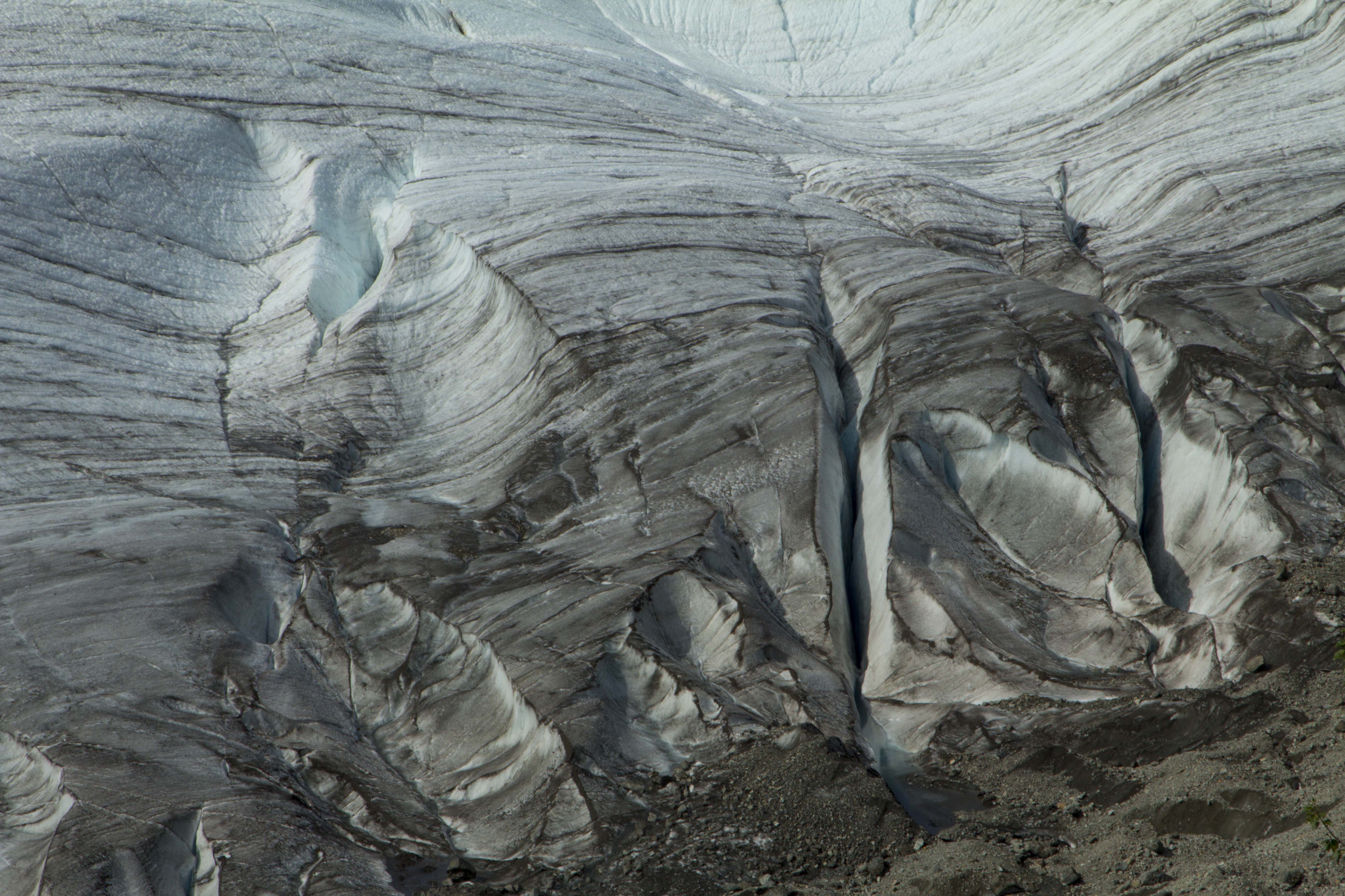
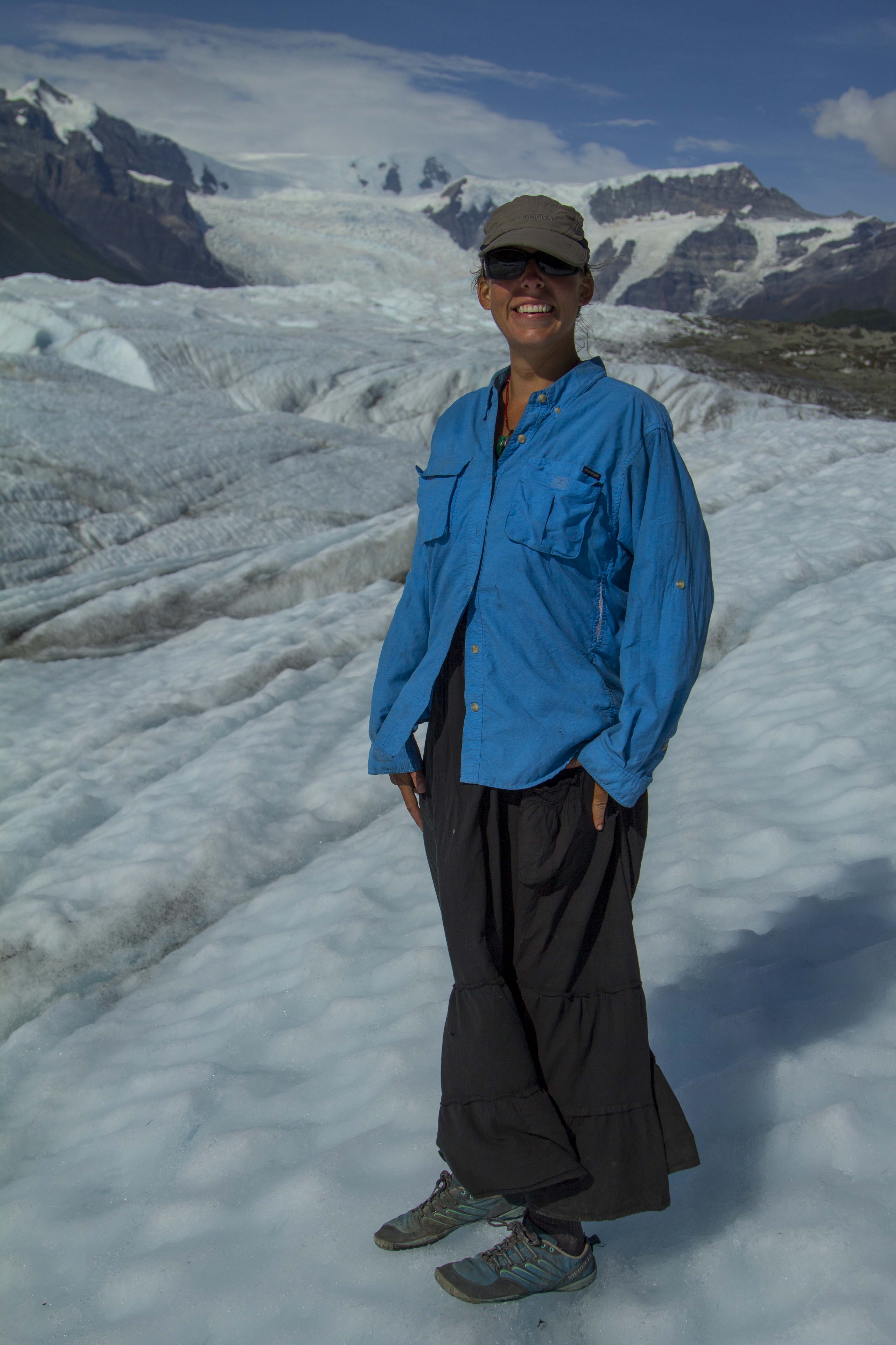
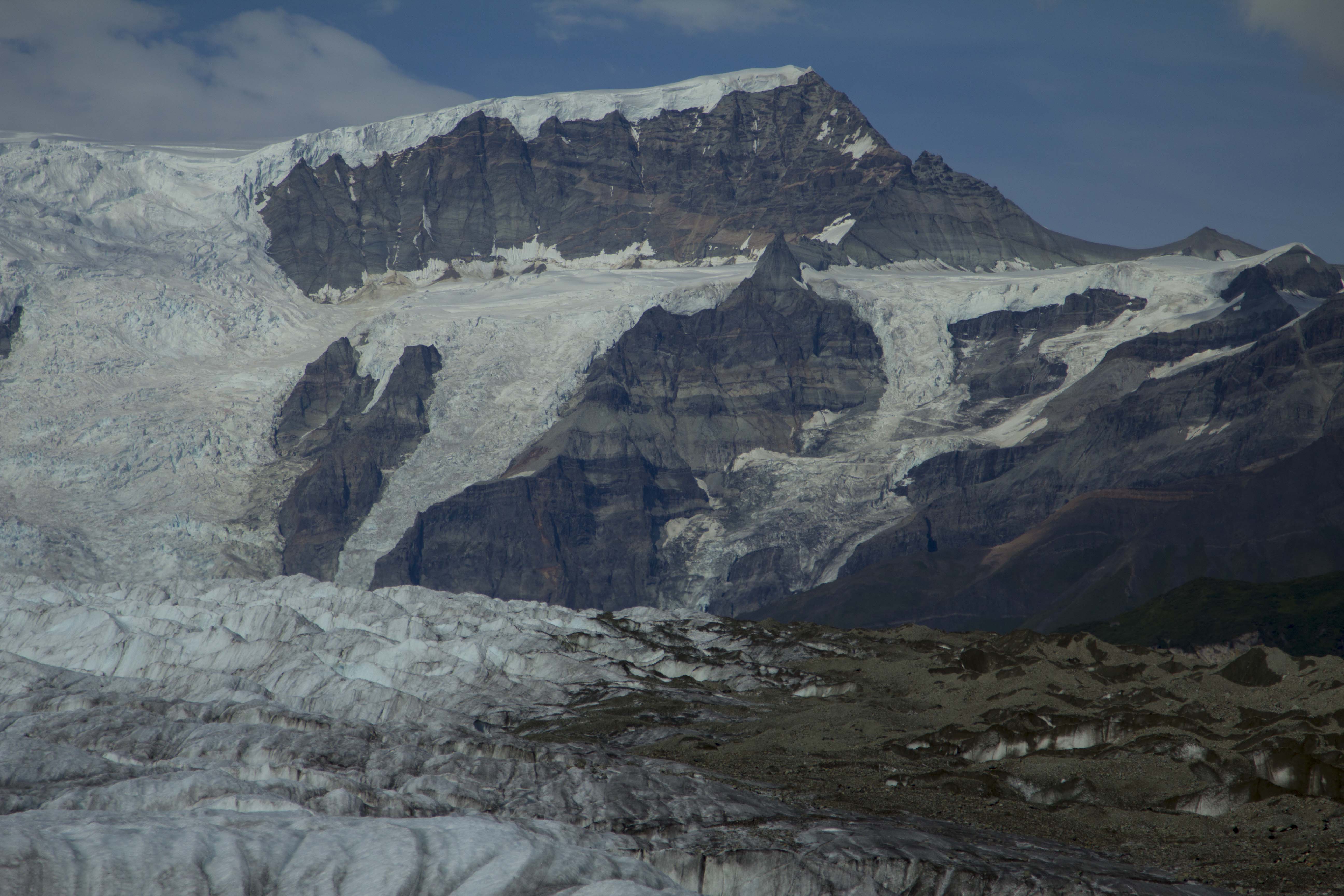
The McCarthy Road seems blessed with many small creeks and rivers’, all crystal clears specimens, born of the ice and flowing to the Sea. There are fewer lakes, however. Angela feels at peace when she is swimming in a lake, so we are always keeping our eyes peeled for an opportunity to do so. We pass Moose Lake and pull in for a spell, but decide to push on to another lake further up called “Long Lake”. The lake turned out to be a little farther than expected, but soon it appeares and Angela declares the place her spiritual home. She fell in love with Long Lake. Unfortunately, we find no spot to camp on it’s shores, but a site within it’s view were to be had; again, with the best Loon calls I have ever heard that evening. Even Salmon enter the lake to spawn and the resulting Bears can often be seen catching their lunch. The next day was a fine one, with perfect weather and a short pedal to McCarthy, we were rolling through town by noon. About a half mile before reaching the tiny village, one is greeted by a mountainous site that can hardly be called simply “a nice view”. That will not do. In front of us lithe Kennicott Glacier and the Root Glacier, both giants and flowing from towering peaks, smaller peaks nearing the flanks of the grand centerpiece of Mt Blackburn. As the ice river rises up to it’s birth place, an enormous ice falls shows itself, the “Staircase Icefall” as it is known is a sea of jumbled and towering blocks and seracs, all destined to crumbled downward and become a pat of the valley glacier below.
We find McCarthy more than pleasing; a tiny little town full of laid back folks, tourists, flight seers, bush pilots, and mountain folk. We buy a few groceries at the happily unexpected grocery, and chat with a few folks before departing to find a camp of our own. A local tells us of a trail that leads to the toe of the Kennicott Glacier.. We head out and after getting temporarily lost, we find our way and are rewarded by a great field of gravel ind ice and water. The Kennicott’s tarn, the size of an Alaskan air strip, is under constant barrage from it’s gravel covered ice source just above, and great splashes can be heard very so often. We camp near the shores of the tarn and admire the unbelievable glacial view from our camp. Later, we hike out, away from the tent, at dusk, to inspect bear prints Angels had spotted earlier.
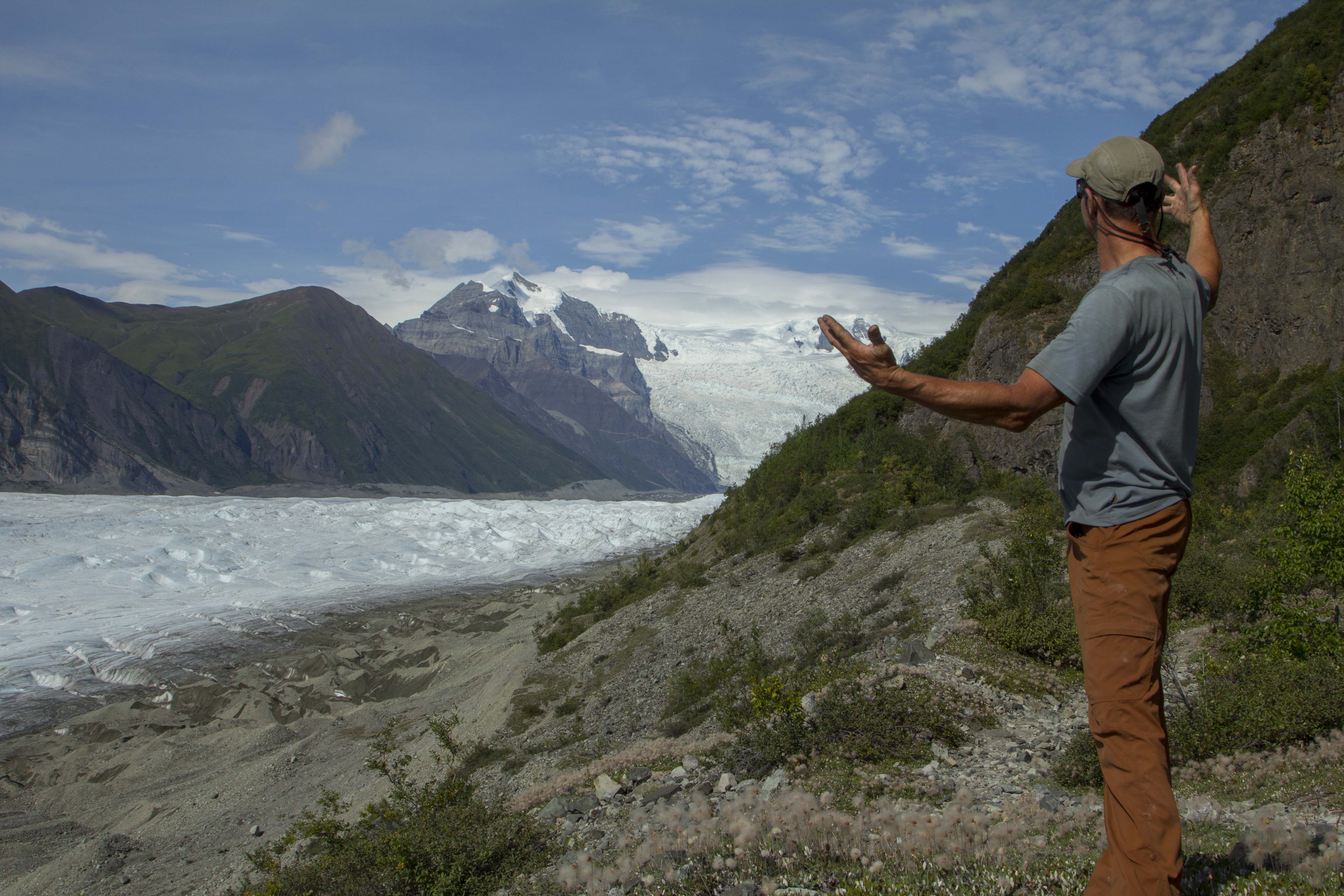
A day off of the bikes is in order and we decide to ride up the road 4 miles to the historic Kennicott Copper Mine, once the largest copper mining operation in North America. After passing through the mine area, we continue on a deterorating trail that soon requires the the bikes be parked behind a boulder and on foot we continue. We hike four, five six miles? up the valley, paralleling the Root Glacier, and high above it’s flanks. Eventually, we find a place that looks reasonable to descend, and down we go; crawling across the gravel covered ice hills to reach the main body of ice. Angela has never been on a glacier before, and it had been a while since I had last been on one this size. We cross out onto the flat ice, well below the firn line, and small, but open crevasses appear. A giant Mullion, the central body of exposed glacial water, is flowing wildly upon the giants back and we drink freely from it’s source. We ascend back up the loose scree to the trail and skedattle down valley to our bikes. A fast blast back to McCarthy takes only minutes and soon we are in camp once again. Our “rest” day consisted of riding ten or twelve miles and hike maybe thirteen or fourteen; we are spent. That night, very late, I got up and a bare twinge of the Aurora Borealis was beginning to appear. Summer was coming to an end.
The day following was Angela’s birthday, and it was raining badly. We take cover in the local coffee and burrito house and put off getting into the mud till past noon. The day was spent mostly in soaking wet conditions and endless amounts of mud. This signaled the impending end to my bottom bracket, rear hub, and drivetrain. We manage the day however; in the late afternoon, when we are ready to camp, an RV with two Europeans pull up and ask us about the road conditions to McCarthy. I tell them that the road is fine and they should have no problems with the road surface. As we were about to push on, the driver asks “Is it worth? I assumed that he meant is it worth the drive to visit a place such as McCarthy; I was taken aback and did not know what to say. Every where in Alaska (except Wasilla) “Is worth” in my opinion. The question of worth versus value is a question that I am constantly on the lookout for; everyones values are different, it seems. So that said, if one values what a place like McCarthy has to offer, then certainly “it is worth”. So I tell him: ‘ Look, if you are looking for 5 star accommodations, fine dining, a nightclub to attend to, or a theater, or a McDonalds, or a Walmart, then it is “not worth”, BUT, if you are looking to witness and experience some of the finest mountain scenery to be found on the planet, and have a great appreciation of all things wild and free, then sir, I promise you “It IS worth”!
The next morning we were back on pavement and headed back out to the Richardson Highway, in search of the next “worthy” wilderness.


You must be logged in to post a comment.