Chitina

Alaska is renowned for many things; big mountains, big rivers, and big Salmon to name a few.  In fact Alaska has many, many of each. The Copper River is one such crick, born of the glacier and thrust knowingly towards a great and mighty sea to the south. It’s waters fast, deep, silty and cold; all the hallmarks of a great and fearsome Alaskan River. Being the tenth largest river in the United States, it is also home to one of the greatest Salmon runs in the world, and in a place festering with mighty river’s running full of the hardest working fish in North America, that’s saying something.  July and early August are the time of Red Salmon or Sockeye as it is known;  to me, the very tastiest of all Salmon’s. Theses beautiful fish congregate in large numbers at the mouth of the Copper, near Cordova, at the Gulf of Alaska. Over the course of a few short weeks, they swim, upriver, in search of their ancestral spawning grounds, to the place of their birth, to continue the cycle of life. Along the way, people have been harvesting these fantastic creatures for sustenance for thousands of years.

2 o’clock in the afternoon, Sven, Billy, and I pile into Sven’s truck and head south for the 6 hour drive from Fairbanks to Chitina, a tiny hundred year old fishing and mining community, born from the days of the mighty Kennicott. Chitina is a beautiful place indeed; nestled in a deep valley, surrounded by high forested and craggy walls, giant glaciated peaks of the Wrangell Mountains, festooned with wildlife, and situated at the confluence of the Copper and Chitina Rivers’.  On the drive down, we stop at a pullout with mind numbing Alaska scenery, an eyeful of the central and eastern Alaska Range and it’s plentiful glaciers. It had been a couple of years since I had been to this place and it was as magnificent as I had remembered. We arrive in Chitina later, and meet up with Sven’s friends Cynthia and Diane. We will be crashing at Cynthia’s cabin and they will be joining us tomorrow, at the river. The last time friends were here, a couple of weeks past, they had caught their limit between the 4 of them: 70 fish! That’s a lot of cleaning and filleting, but in  the end, it is a freezer full of the best eating there is.

The trail in from the road to the good dip netting spots are 5 or 6 miles down river, however, Sven’s four wheeler ATV makes fairly quick work of ferrying 4 people, dip nets, gear and ice chests to the chosen location. By 8 o’clock, we have our ropes tied to the shore trees and to ourselves, and the nets are in the water. The river was intimidating at first; it is the sort that, if one fell in, you might be a goner. It is super fast and cold, with hidden logs, rocks, and all sorts of strainers, waiting to snag anything that happens to be in the water big enough to catch. It is also full of glacial silt; it’s appearance is that of fast, cold mud. It’s visibility is zero. But it is full of Salmon; I hope. After a couple of hours, Diane has managed to net 2 fish, a small one and a good sized one, and for the next 5 hours we were only able to land 3 more, for a total of 5 fish. Not the fish bonanza we had hoped for, as the cost of the trip necessitates a good yield. The river was definitely higher than normal; this probably attributed to the low numbers. One never knows when it comes to the Salmon running. One day they could be so strong that, could you see through the murky water, one might be able to walk across the river, supported only on the backs of the working Salmon. On other days, scarcely a few seem to be near by. Perhaps when the water is so high, they hide out in the eddy’s and holes, saving energy, awaiting the lower water and easier swimming, upriver and towards their goal.

By mid afternoon, we, with our 5 fish, decide to head out as it is a long drive home. As Sven is ferrying loads back to the truck, I clean the fish, pour the last bits of diesel fuel into the truck, and clean up. While the fishing was of limited success, the day was a fulfilling one, hanging with friends, taking in the best Alaska has to offer, and generally enjoying ourselves all around. Additionally, 3 of the 5 of us had seen bears today. Sven and Diane had seen a big Blackie earlier, and in the afternoon, Billy had come across a Griz crossing the trail and headed to the river, no doubt attracted the pungent odor of the Salmon. Afterwards, we say goodbye to our Chitina friends and hit Uncle Tom’s Tavern in Chitina, for a celebration beer; and afterwards, a long and tiring drive to Fairbanks, but with smiles on our faces.

IMG_3603 IMG_3606 IMG_3615 IMG_3630 IMG_3631 IMG_3634 IMG_3639 IMG_3657 IMG_3663 IMG_3674 IMG_3682 IMG_3684

Synopsis

In the event of the unexpected, unexpected events will follow. Like a chain reaction; an ability to become flexible and malleable at any turn or ripple in the fabric of what we perceive to be absolute, is what is in order. That is why I am in Fairbanks. I have landed here. After the unfortunate event of losing nearly all of my expedition funds, I felt like giving up; consorting to failure, and returning “home”. I guess by “home”, I mean where my truck is parked in Bellingham, filled with my tools to make money with, and the remainder of my material life. At the convincing of Angela and my Mother, plus a bit of financial support, I continued on. And on I will continue. After pedaling through the Brooks Range and witnessing the Arctic, I have been recharged, and my thirst for wilderness and travel greater than ever before. To simply sit in these places, where quiet reigns supreme, the main thoughts in my head are ones of wonder and fulfillment. Yes, part of me still wishes for the previous alternative of continuing on some short journey’s northward, up to Circle, Alaska and an exploration of the historic Circle-Fairbanks Trail. Or perhaps an even more remote foray into the bowels of the Pinnel Mountain Trail. I would like to experience these places eventually, but alas, it is not to be on this go…  I am in Fairbanks, working, making friends and connections, relaxing my mind, and getting ready for the next leg of this journey; the journey of my life. Angela will be here on the 26th and we will continue south towards the Denali area, into the high country that I love so much. To the land of the Dall Sheep, the Caribou, the Grizzly Bear. Places where there is only tundra and peaks, streams and lakes, animals and sky; away from the traffic and the commotion of Fairbanks; away from Fred Meyer’s, away from the public library and away from the chainsaw and the hammer. Back to the roots of my soul and beyond shadows of the mountain tops.

The weather in Fairbanks recently, has been of record heat; Alaska’s interior is notorious for it’s hot, dry spells in Summer, but in recent past, it has been downright cruel, by Alaska standards. 95 degree heat, no wind, no rain, and in the fashion of pouring salt into a sore wound, terrible forest fires have been  raging on, filling the entire Tanana Valley with a thick layer of smoke that would make even a hardened Los Angeles veteran choke. It sure put a hurt on me. Then, like magic, the clouds rolled in, and, in a rainstorm unlike I have normally seen in the north, unleashed a fury of water that seemed violently thick, yet refreshing to the earth, and the fires.  Now, the weather is cool, slightly damp, and smoke free. It is like summer took a drastic turn into another season altogether. While summer is not quite over yet, it is beginning to feel a bit like fall already. The days are getting shorter as well; last night at 1:00 am, it was a bit to much of a strain on my eyes to read “Mountain of My Fear”, so I closed the book, and my eyes, and dreamed of mountains instead.

The Haul Road (Into the Arctic)

There are only two roads, in North America, that one might pilot a vehicle of some sort, which lead to this continents Arctic area’s. As far as I know, there is only one other road in the world that leads into the Arctic outside of North America, the Arctic Highway in Norway, which might just be the northern most connecting road in the world. The two roads in question are the Dempster Highway in the Yukon and Northwest Territories, of which I attempted to ride weeks prior, and the Dalton Highway, AKA “The Haul Road” in Alaska.  Both of these paths’ through the wilderness are of the dirt and gravel variety, however, there are bits of pavement and chip seal surfaces as well, scattered about, here and there. The Haul Road, remote indeed, was built in 1974 as a supply line to the north slope oil fields at the Arctic Ocean, and parallels the Trans-Alaska Pipe-Line, was not open to use by the general public until 1996. Up to that point, the truckers had it solely to themselves. The Haul Road, as it was called in the 70’s, traverses a rugged landscape north of Fairbanks and leads to Deadhorse, Alaska. It crosses terrain varying from the endless, forested hill country beginning at Fairbanks, to Taiga swamps and open tundra, crosses many, many rivers and streams, and penetrates the “Alaskan Rockies”, the continental divide at the bastion of true roadless Alaskan wilderness, the mighty Brooks Range. The Brooks, since I was a teenager, has been a source of great mystery and a true icon of the remote and windswept tundra of northern Alaska. It has also been a dream to visit that whimsical place since that time.

Saturday morning I am up, gearing up.  At Sven’s, all is quiet. There is not a soul stirring, most likely all are sleeping late from the inevitability of staying up too late in the bright Alaskan night time. Two night prior, I give a food bag to Sven’s trucker friend, Tommy. He is heading up the Haul Road to Deadhorse and will drop of my feedbag at Coldfoot. This will alleviate the need to carry 10 to 12 days worth of food, but cutting that amount in half. Thank You Tommy!  I slowly pack my things and secure the Ogre for a lengthy trip into the wilderness. I pedal out of Sven’s area and on to downtown Fairbanks in hopes of finding some breakfast. After Eating, I head north, up the Steese Highway, toward Fox and Livengood. The coming onslaught of slim eating over the next week, prompts me to catch yet another grubstake near the edge of town and off I go, north.

That day was filled with some of the worst up and down hill climbing on a bicycle I had ever encountered and was indeed thankful for all the food I consumed; every calorie accounted for as I pedaled hill after hill after hill. Finally crossing Snowshoe Summit at the apex of Alaska’s White Mountains, I am rewarded with a long downhill and a natural stream of spring water shooting from a pipe near the road’s edge. The water is clear, cold, and delicious. Onward, passing a few creeks and abandoned cabins, I look for a camp. I pull onto a dirt track next to the Tatalina River and dive into the water after setting up. I am then greeted by terrible swarms of Alaska’s favorite insect. That night, I talk and drink Rum with pipeline workers from Pumpstation #7, just a few miles south.

The next day, more of the same hill climbing ensued, only worse this time. The hills are 12-14%, made up of loose, unconsolidated gravel, and the truck traffic is thicker than usual due to the summer time road maintenance. This day turned out to be the hardest of the entire Haul Road. By day’s end, I was so exhausted, I could do nothing but dismount the Ogre and push the dead beast upward and over the hilltops, coast down the other side and repeat. I was jello.

More big hills the following morning, lead, thankfully, to the Yukon River, where , once across, the road flattens out a bit and some nice forested Alaskan countryside sprouts from the earth like Grandfather Forest’s beard. Eventually, however, the hills re appeared and the grinding continued. After 70 miles, I find a gravel pit to call home right on the fringe of Finger Mountain and south of the Arctic circle maybe 25 miles. I am now seeing the first bits of true Arctic Tundra.. permafrost meltwater lakes, unglaciated Tors of granite, and windswept mountain passes are now within my eyesight.

The next day, the landscape changes dramatically to the type of high country I so desire. After crossing the imaginary Arctic Circle, I cross over a small mountain pass and catch my first glimpses of the mighty Brooks Range. I drop into the valley below, and am greeted with magnificent spruce forest, and creeks filled with 24 inch Grayling. There is drinking water everywhere, a far cry from the relative dryness of the last few days out of Fairbanks. In fact the dryness was accentuated by the fact that north central Alaska has been experiencing one of the hottest, driest spells in history this week. The second day out of Fairbanks it tipped the scales at 94 degrees! This new landscape was what I came  here for… unparalleled high country filled with river’s, mountains, forest, and animals.

I roll into Coldfoot, the half-way point on this path, nestled in the Koyakuk River valley, in the heart of the entrance to the Brooks Range. I find a decent camp next to the river and go into “town” to find my food box. The box is not there.. Tommy had not made the trip, but had relayed the box to a friend of his to drop, but so far, it has not shown. There is a bar and a restaurant here and the food is decent and the folks here are nice and the scenery is unbeatable, so I have no problem sitting tight for a spell. Over a couple of beers, I meet Tom and Jane, a couple of extremely nice folks from the Hood Canal area of Washington state. They have flown up here from the states in their Cessna 180, and offer to take me on a short flight over the Brooks tomorrow if I wasn’t doing anything. Are you kidding? This notion makes me grin as wide as wide can be, and I accept. I meet with them the next day and, by noon or so, we are in the sky, flying over what can only be described as pure and simple wilderness bliss. Huge, craggy peaks, endless tundra mountains and rivers of a proportion that I can barely comprehend unfold before my very eyes. I hold back the tears of joy as I witness a childhood dream come true. There are no words to describe how my heart feels in this place, even from an airplane. How will I feel when I am actually in it? After about an hour, we head back to the Coldfoot landing field, and I thank Tom and Jane for their generosity. I wish them the best, and I hop on my bike, high as kite from the last hour’s experience, and eagerly pedal directly into what I had just witnessed, looking now for a direct contact with the landscape before me, which is exactly what I got.

A couple of hours pedaling through mind boggling, awesome  scenery, I decide to get off of the Haul Road proper, and get onto the pipeline pad road, which offers a bit more of the deeply spooky solitude that this unbelievable place can offer. Eventually the road dead ends when the pipeline disappears underground, which will dictate me backtracking to the Haul Road for a couple of mile. BUT, at it’s end, a spectacular campsite is to be had, on the Koyakuk, and facing a “sunset” view of the mighty southwest face of Sukakpak Mountain, an impressive chunk of pre cambrian limestone real estate. After swimming in the Koyakuk, I set up the camera for an evening time-lapse of Sukakpaks’ dramatic episode of color and changing light. I feel I have finally entered the place on this leg where I want to be; The High Country.

The following day is the creme de la creme; 40 miles of dead flat, yet scenery of a mesmerizing nature ensue. I see Eagles, Moose, and Fox, but no Bear, Caribou, or Wolf. The river becomes heavily braided; the forest begins to thin out. Signs of a changing ecosystem; of a different stature, more rugged than the previous mile, unfold. The weather begins to change too.. Thunderclouds build, then unleash, I retreat under a bridge and watch the storm from beneath, sitting next to river ice pack still 36 inches thick, here on June 20th. The storm breaks and and so do I. A few short miles and I pass the final spruce tree in this part of North America. No more trees at all, in fact. It is all tundra and the road begins to climb. Up, up, I go; the road flattens once again onto the spectacular Chandler Shelf, a flat area of a couple hundred square miles of tundra in the heart of the Brooks, just below the continental divide of Atigun Pass, Alaska’s Highest and most northerly road pass at 4800′. As I near Atigun’s summit, the storm once again decides to unleash it’s fury. High winds, sideways rain, and plummeting temperatures commence. I top out at 9:30 pm and find a patch of snow free tundra a way off the road and pitch my tent right there on Atigun’s high point. Even with guying the tent, I still have to brace the 4-season Easton shelter from the inside to prevent poles from snapping. Finally, the wind dies off and I drift to sleep, dreaming that night of being yet deeper into this range of magic mountains in the North, father in than I am now, traveling high valleys among Grizzly Bear and Caribou.

I awake to a deeply silent atmosphere of near whiteout conditions; it is eerily calm. I pack up, and descend the pass slightly to the shelf on the north side and park the Ogre for a hike up to a ridge top. The tundra here is short and squat and is easily traveled upon. It is festooned with tiny wildflowers of all shapes and colors.  I pass the remains of a young Caribou, probably taken by Wolve’s. Farther up, I glimpse down great gully’s of rock towards a massive creek with outstanding waterfalls feeding it’s need to descend into the Atigun River and beyond into the Arctic Ocean. The peaks are mere 6000 footers, but are massive just the same. The Brooks is a dry region, as is the Arctic in general. It really is mostly an Arctic desert. There are a few small glaciers scattered in a couple of places in the Brooks, namely, the Arrigetch Range to the west and the Romanofz Moutains to the north east. But not here. There are thin gully’s of snow descending from the rocky summits of these peaks, providing a striking contrast to their nearly black and orange coloring. Eventually, I descend back to the bike, and continue on, down Atigun Canyon, and onto the great Arctic Plains of the Alaska’s North Slope.

The next two days are flat tussock tundra, starkly beautiful, and swelling with my favorite insects. I still see no Bears, but, plenty of Fox and Caribou.  Alas, I spot a herd of twenty strong Musk Ox; the pre-historic, ice age creatures of the North American Arctic; an iconic figure of strength and endurance in this vast, untamed arctic landscape.

The next day, rolling into Deadhorse, it is 28 degrees F, and 40 MPH winds, but othersise uneventful. Deadhorse is the center of North America’s largest oilfield, which stretches for over 70 miles to the west. Camping looks grim, so I stay at the Prudhoe Bay Hotel, which, for 125 bucks, includes 3 meals and free laundry. I figure it is a good deal here at the end of the continent and decide to pull the trigger. After a fitful night sleep in a strange bed, I pedal out of town a couple of miles and lay the bike down and put out my thumb…

…Later, after no success in hitching a ride back to Fairbanks, I catch an hour and a half flight back to Fairbanks, where, as it turns out, I have a job waiting for me to start right away. So, without time for rest or reflection, I begin work..  Operating a chainsaw in the woods 8 hours a day.  Thing could be worse…

I am happy, but tired…

IMG_2459
Dalton Mud
IMG_2512
Cotton Grass
IMG_2542
Tundra Near Finger Mountain
IMG_2612
The Grayling Filled Jim River
IMG_2650
The Brooks From Above
IMG_2654
Pilot Tom
IMG_2666
Tom and Jane From Washington State
IMG_2701
Sukakpak Mountain

IMG_2429 IMG_2433 IMG_2440 IMG_2443 IMG_2455 IMG_2456 IMG_2558 IMG_2567 IMG_2577 IMG_2579 IMG_2582 IMG_2609 IMG_2610 IMG_2616 IMG_2624 IMG_2634 IMG_2671 IMG_2679 IMG_2681 IMG_2698 IMG_2715 IMG_3124 IMG_3129 IMG_3139 IMG_3142 IMG_3144 IMG_3149 IMG_3162 IMG_3167 IMG_3169 IMG_3188 IMG_3198 IMG_3206 IMG_3218 IMG_3223 IMG_3227 IMG_3230 IMG_3240 IMG_3243 IMG_3254 IMG_3257 IMG_3277 IMG_3290 IMG_3296 IMG_3298 IMG_3317 IMG_3324 IMG_3334 IMG_3345 IMG_3347 IMG_3357 IMG_3361 IMG_3371 IMG_3385 IMG_3399 IMG_3413 IMG_3415 IMG_3434 IMG_3438 IMG_3446 IMG_3447 IMG_3450 IMG_3463 IMG_3465 IMG_3470 IMG_3475 IMG_3480 IMG_3484 IMG_3505 IMG_3515 IMG_3517 IMG_3524

Brooks Range Teaser

Well, I’ve returned from pedaling from Fairbanks to Deadhorse, across the Brooks Range and into the Alaskan arctic; that be told, I’m tired and possibly starting a job for a couple of weeks to earn cash for the continuing journey. I do not have time to do a full update at the moment, but soon come, so check back!  Here’s a couple of teaser shots from the Brooks Range…

IMG_3358 IMG_3163 IMG_3363

← Back

Thank you for your response. ✨

Sven’s Base Camp

I bailed out of Delta Junction, a little bewildered and unsure of what next lay ahead. The pedaling is mostly flat, but follows the Tanana River Valley pretty much all the way to Fairbanks. The following morning, I got a fantastic view of the Centarl Alaska Range, but then, it was gone and it was flat forest pedaling for the remainder of the ride into Fairbanks, where I have been a resident now for a few days, getting rested, fed, and organized. After looking online for a Hostel to pitch my tent at, I came across the one I was sure was right for me. I was right! Sven’s Base Camp is a neat little place right in town, so it’s kinda noisy, but it has wall tents, cabins, a teepee, showers, a kitchen hut, and a tenting area. It is surrounded by woods and is shady and somewhat private. It is a relaxing place and is close to amenities one may need. Sven is really nice guy in his mid thirties who moved here from Switzerland 15 years ago. He spends his summers here running the day to day at the Base Camp, but in the winter, he lives in Bettles, AK, a bush village up off of the Haul Road, where he has a Dog Mushing tour business.  He say’s he has around 30 dog’s, but only one accompanies him to Fairbanks in the summer. She’s a real sweetheart girl-dog named Blaze. Sven has made everyone here feel right at home. We have talked a little in regards to me doing a little work around the Base Camp in exchange for a place to stay, and to possibly make a little money as well.

There is another guy staying here, Jim, who is to begin a job on the north coast as an electrician. He and I are  talking of perhaps taking a quick overnighter down the Chena River in a canoe and do a little fishing. Not totally sure on this though as my plan is to leave tomorrow morning for the Haul Road and the Arctic. Sven’s friend, Tommy, who is a Haul Road trucker, picked up my food box containing six days worth of supplies for me this morning, and will drop off at Coldfoot. Thanks Man!

IMG_1948 IMG_1951 IMG_1957 IMG_1960 IMG_2370 IMG_2371 IMG_2375 IMG_2376 IMG_2397 IMG_2405 IMG_2406 IMG_2407 IMG_2409 IMG_2410 IMG_2411

← Back

Thank you for your response. ✨

Keep Calm and Carry on

I awoke last night around midnight and lay quietly in the forest. My deep fears festering in the darkest hours of night. Not literally, since it does not actually get dark, but metaphorically. I kept thinking to myself, “How could I be so foolish.” “Where did the envelope go”. Too many possibilities to contemplate. Like in needle in the monstrous haystack of Alaska. I do have a few bucks left, and family and friends have been extremely supportive. But another question kept itching the back of my skull. Is this a sign?  Should I call it quits? Am I in over my head? Or am I just a monumental screwup? These questions kept me awake last night. Angela confirmed to me the notion that these hours can be the worst on a temporarily troubled mind. I know it to be so.

I have decided that I will carry on, the torch of my spirit and the handlebars of my bike. Keep calm and carry on…

Curveball

So I left Dawson City behind.. a town rich in it’s past and present history. I’ll be back. Hopefully to engage the elusive Dempster again at some point. Leaving town around 4:00 pm and crossing the Yukon River on the constantly running free ferry, I was thrown into a world of steep hill climbing that would not let up for another 110 miles. Right off the ferry, the road turns skyward, straight up at angle of about 10-12%. For 8 miles straight without mercy. Near it’s “top”, there is a rest area of sorts and I call it home for the evening. Over the course of the next days’ 68 miles of pedaling, I must have gained and lost 5000′ of elevation, without really gaining or losing any. This highway, a dirt path through the forest for 110 miles, connecting Dawson City, Yukon, and Chicken, Alaska, is known as “The Top of The World Highway”. And for good reason too. The path leads across the bald, tundra coated, ridges and summits of the western Yukon and eastern Alaska “hill country”. The views are stupendous; I now am looking across to the continental divide, 150 miles to the north east. In fact, from this vantage, I can see the Tombstone Mountains that I was forced to retreat from just days earlier. Only this time my view of them is from the directly opposite side and over 200 miles past. It is a  truly remarkable place. After landing in Chicken, in a rainstorm of rainstorms, mud, landslides and all, I secure a Salmon Burger from the tiny grill located there; It is a real surprise to find the food quite fantastic. I chat with the locals a bit and down a couple of beers. I must go back into the forces of the rain, hill climbs, mud, and misery. Back on the bike, the storm eases up a bit, and I begin to find a rhythm that breeds peace. A big bull moose crosses the road in front of me and magic is afoot once again.

The next day, after crossing the flanks of Mt. Fairplay, I turn the corner and am greeted with an unexpected surprise. The almighty Alaska Range is standing before me, clearly demonstrating my subordinance. Once again, I am in awe.

Finally reaching Tetlin Junction at the merging of the Taylor Highway and the Alaska Highway, it occurs to me that the hill climbing is over for the next several days, as, if memory serves me correctly, the stretch between Tok and Fairbanks is flat pedaling, but a spectacle of the foothills of the Alaska Range. This combo makes for some blissful times indeed.

I spend a couple of nights in Tok, at my old camp in the woods to the southwest of the school. I always have, and do now, find Tok and this part of Alaska in particular, very satisfying. It’s close proximity to the Alaska Range, great country side, and a relaxed atmosphere is unique, even for Alaska. It’s winter’s are another matter, however. Locals confirm it’s reputation as a scene of brutal cold; Winter time temps of -60F are not just occurrences, they are outright common. Land is cheap here, there is no sales tax, no property tax, no building codes, and no jobs. Sounds like a good place to retire to for part of the year.

Moving on, I head north along the northern and eastern flats below the impending Alaska Range. The creeks are plentiful and crystal clear, and I drink copious amounts of water from them; gorging myself on their nectar. Another night of thunderstorms and another morning of packing it up in the rain today. It is getting to be routine. I am finding myself able to pack it in with my eyes closed. Later in the day when the sun is out, I pull out the fly and it dries while I snack. No big deal.

I am now in Delta Junction, camped on the gravel beaches of the wildly braided Tanana River, looking to the south at the appearances of my favorite mountains on Earth.The central Alaska Range’s  Mt’s Deborah, Hayes, and Kimball, all are reaching upward in an attempt to put on a show for me, but the storm just won’t have it. I have never seen this side, the north side of these peaks, and I decide to camp here tonight in hopes of catching a time-lapse of these marvelous peaks in the morning, with the sunlight splattered across their eastern escarpment and embellishing their glacially clad, icy armor.

What’s up next, You ask? Perhaps an adventure up the Steese Highway for a trailride on the Pinnel Mountain Trail and the Circle-Fairbanks Trail. Or perhaps it is time again to settle the score with the Arctic once and for all, and head up the Haul Road, into the Brooks Range. I don’t know yet.

You’ll know, when I know…

Well, now I know, well, sort of… Life just threw me a curveball.  I awoke this morning and while packing up and getting ready for a northward stint, I noticed that the envelope containing 90% of my cash is gone. I knew instantly that this was not a case of misplacing it within my kit, but one of absolute disappearance. I spend the entire morning on the phone to all places past I had visited and with no avail. I suspect it is a case of carelessness on my part; possibly left at the counter of a shop somewhere in Tok, or who knows where. Maybe it fell out of my bag when I pulled over to take a photograph. I just do not know, and suspect I never will. Either way, it is gone, and so is this journey, at least in it’s current fashion. Again, Ill let You know when I know. If by chance there is a person out there who knows something of an envelope labeled only “Trip”, that contains nearly 4000 dollars in cash, gimme a call.. Please! (435) 260-1990.

That’s all I have to say at the moment.

IMG_0800 IMG_0814 IMG_0827 IMG_0840 IMG_0845 IMG_0858 IMG_0862 IMG_0871 IMG_0875 IMG_0877 IMG_0883 IMG_0886 IMG_0892 IMG_0899 IMG_0906 IMG_0909 IMG_0911 IMG_0916 IMG_0934 IMG_0939 IMG_0940 IMG_0942 IMG_0950 IMG_0979 IMG_0986 IMG_0993 IMG_1005


Success and Failure on the Dempster

After a relaxed evening camped on the outskirts of Dawson, I get my nylon ghetto packed up and myself into town for the prep errands necessary for the Dempster Highway. Make calls, update website, buy groceries, get package together to leave at Interpretive Center for a passer by to pick up and drop off at Eagle Plains. Out of town by 3:30 pm… Pedal the 25 miles back to the Dempster I had ridden yesterday.

About 5 miles from the Dempster, a monstrous thunder storm ensues, dropping copious amounts of rain along with it. At the Dempster junction, there is the Klondike River Lodge, but it has unfortunately burned down this last winter. I figure it will at least serve me to stand under the fuel pump overhangs and dry off a bit.  The storm rages on, and a French-Canadian Man pulls up in a ragged truck, just to make sure I am not in peril. I assure him I am fine and away he goes, heading south.  The storm continues to increase it’s fury, and I find myself gaining courage in investigating the seemingly abandoned trailers across the compound. The trailers are empty, dry, and warm. But I am apprehensive about invading someone else’s space even if they are clearly not around. So I stick to the porch… and drink up some of my precious beer supply-next beer, Inuvik.

About 8:00 pm, the storm passes over and I decide to roll on down the Dempster a bit and find my home for the evening. An old gravel pit will do just fine, and I camp.

The following morning is glorious.. I feel so lucky to be here now. It is early in the season and I am positive I am the first and only cyclist on the Dempster this year.  I pedal across the North Klondike River and dive into the Dempster.  Rolling through the upper Yukon’s boreal forests and into the heart of the Tombstone Mountains, I stop at the trailhead for Grizzly Lake, where I stash a backpack I have been carrying all this time in order to make a 2 or 3 day trip into the wilderness.  I had planned on doing this now in fact, but there is way too much snow too contemplate. Besides, the trail has been closed due to flooding. I hope this is not an omen of things to come. So, for now, I stash the pack in hopes of hiking in to Grizzly Lake on the way back from Inuvik.

On down the road, I stop at a fine little stream and strip down for a wash. Suddenly, an unexpected tour bus rolls past, slowly at first, I am standing there naked and wet and grinning and waving. The driver accelerates quickly in order to avert his touron’s eyes from the crazy, blasphemous Mountain Man, who is grinning shamelessly at them.

I pedal most of the steep climb of North Fork Pass to the Tombstone Mountain Overlook. At 4800′, it is the Dempster’s highest summit. I camp here due to it’s spectacular views and shoot a time-lapse of an approaching storm, moving over Tombstone Mountain and Mt Monolith.

I awake the 2nd morning to clear skies, but that changes very quickly. However, the weather manages to hold for several more hours, and I am able to pedal on, unmolested by the rain. Over the last bit of the summit, and crossing the Continental Divide, I am thrown into a world of fairytale peaks surrounded by tundra.

The Dempster Highway is the northern most road in Canada, and one of the 2 northern most roads in North America, the other, being the Haul Road (Dalton Highway) in Alaska. Like the Haul Road, the Dempster also crosses the Arctic Circle and additionally crosses and enters the largest river delta in Canada, home to the 10th largest river in the world and the third largest in the western Hemisphere: The McKenzie River. It ends at the community of Inuvik, Canada’s northern most village accessible by vehicular land travel. It is a dirt and gravel road that traverses 500 miles, one way, some of the most intense wilderness one can encounter.

Eventually, I pass through a small,yet majestic little range called the Taiga Ranges, a beautiful set of high alpine mountains, with the Dempster passing through it’s boreal forests, river valley’s, and above timberline area’s, where Marmots and Collared Pika’s chirp as I wheel past. It is stung scenery and I climb the 2nd pass of the Dempster, Windy Summit, at 3500′, and down it’s back side for a ride of many miles through more forest and unbeatable mountain scenery.  The Ogre glides silently northward, as if a giant magnet is pulling us both, onward and into the Arctic.  I see a moose, then another. Then a Blackie, then a Hare. Then I spy a Golden Eagle, a first for me. Ptarmigan’s are squawking at me, no, singing to me as I move into their turf. I see wolf tracks, then tracks of the moose it is following.

It begins to rain, briefly, but stoutly, and after 76 dirt road miles today, I pull into Engineer Creek Campground which is closed, and I utilize it’s cooking shelter to dry off, cook supper, and get re organized. Fantastic Dolomite cliffs festoon the nearby ridge, known locally as Sapper’s Hill. I find out that the road up ahead is washed out and closed. My only hope is that a bicycle and it’s operator might find a place to wiggle past said washout, and pedal dance onward.  At the moment, I am just about one quarter of the way to Inuvik; if I can keep up the pace, I’ll have made the trip in 8 days. Then there’s the return trip.  Backtracking has always been tough for me and I’m sure that the return trip to Dawson of 500 miles will be no less challenging. Ultra long distant travel via bicycle has it’s ups and downs like anything. The biggest struggle for me, at times, is simply the mental willpower to keep going, when you haven’t had a decent meal in 4 days and your stock is low, everything you own to wear is filthy and your body stinks like hell and you are sore everywhere, especially the backside. Did I mention the rain? Everything is soaked, including your tent and sleeping bag, not to mention you. But I love it, really. I love being in these places that it affords. It is an experience similar to that of multi day big wall climbing, where, one is immersed into the vertical realm for days on end, complete with it’s discomforts. This is no different, except that there is no fear factor, really, not when compared to scaling the big stones.

I decide to sleep in the abandoned campgrounds’ screened in cooking hut, and investigate the road damage in the morning.

I awake, and feel as though I have had a stay at the Hilton, and have a leisurely breakfast and pack up the Ogre in a nice, dry, state. However, 2 1/2 miles up the road, the entire trip changes course. After crossing the Ogilvie River, and passing the “Road Closed” signs, I am greeted by a man in a pickup, who pulls up next to me.

“Can’t You read?”.

Yes Sir! I CAN read, Yep!

“Can Ya’ swim?”.

Uh, Yessir, I can swim too!

“Well, that’s what You’ll be doin’ on up ahead, cuz The Ogilvie is runnin’ across the road now. I can’t let You pass on till the water drops and we can do repairs. I might be later today, but it might not be. Best you hole up back at that campground and settle in. I’ll let you know when the road is open”.

He was very firm on this and was not about to let me pass, so I turn tail back to the cook hut and here I now sit, writing and waiting. Even if the road were open, I would be cutting it very close on food, as I do not believe my food package ever made it out of Dawson, since no one is heading this way due to the washout and it being seriously early season. In fact, the river’s are half froze over still, and the lakes are too.  If the road does not open by tomorrow morning, I will have no choice but to high tail it back to Dawson, get re grouped, and head for Alaska.  This is a major disappointment for me as I want to see this Canadian Arctic soo badly…

Sometime later, a pickup with 4 nice folks from Idaho drop in and inform me that the road crew has told them that the road will be closed for at least 2 or 3 more days. I must turn back. The only question is how…Even though my short stint with this part of the Yukon has been thwarted, I am thrilled to have seen even a little of it. I have seen enough to know just how glorious it truly is and I shall return. I toss my bike into the back of their truck, and what took me 3 days to pedal, flies by at warp speed and I am deposited back into the land of Robert Service and Jack London; Good ‘ol Dawson City.  I drop by the Interpretive Center, and there is my food box, still waiting.

Off to Alaska…

IMG_0151 IMG_0165 IMG_0171 IMG_0181 IMG_0187 IMG_0197 IMG_0200 IMG_0215 IMG_0224 IMG_0227 IMG_0647 IMG_0648 IMG_0659 IMG_0661 IMG_0674 IMG_0678 IMG_0680 IMG_0683 IMG_0690 IMG_0691 IMG_0693 IMG_0701 IMG_0706 IMG_0715 IMG_0720 IMG_0723 IMG_0733 IMG_0734 IMG_0749 IMG_0751 IMG_0755 IMG_0760 IMG_0762 IMG_0769 IMG_0773 IMG_0776 IMG_0777 IMG_0780

Klondike Treasure

I really like Whitehorse, really, I do. But the hustle and bustle of even a cool town can wear me down. I’m not much for seeing the usual tourist sites of a given local, generally getting on with my business, and then heading for the hills. I had numerous things to attend to, however. The 11 litter MSR bladder I had lovingly carried through many thousands of miles, had sprung a leak. Besides, previously having traveled with a trailer made it possible to simply strap the apparatus to the top of the trailer and carry on; but traveling with panniers is another thing altogether, and the bladder concept wasn’t as useful now. So I needed water bottles. I needed to purchase a phone card, do laundry, buy food, convert U.S. dollars into Canadian fun tickets, make phone calls, buy a reading book, and get my load straightened out. Without much fanfare, I accomplished these tasks and skinned out by 1:00 pm.  In all honesty, Yukon hospitality has been hit or miss for me in the past and now as well. It seems 2/3 ‘rds of the folks I meet are friendly and open. And all of the first nations peoples I talk with are open to conversation, it’s always been this way. There seems to be that reserved crowd who just don’t dig folks on bicycles around. For example: at the Braeburn Lodge, the proprietor, an enormous bellied, white bearded dude, who could have passed as Santa Clauses’ cousin, sporting a Harley Davidson T-shirt, simply grunted when I spoke, and barely gave me the time of day. He sure took my money for the regionally famous Braeburn Cinnamon Bun that I purchased though. Paradoxically, when speaking to a First Nation’s man in Carmacks, we chatted and chuckled, and he wanted to know why I didn’t have a fishing pole with me, as some mighty fine suppers’ could be had ahead. Why don’t I have a fishing pole I contemplated?

A ways past Braeburn, the terrain opened up to an unexpected valley of agriculture. Soon though, the North Klondike Highway turned upward once again, and we rose into the Spruce, and my favorite forests, revealing rivers and meadows. I take a short 2 track leading into said forest, and it dead ends into a splendid old cabin, long since forgotten. It looks to have been built during the Klondike gold rush years at the turn of the century, but it could have been a tad bit more recent, I don’t really know. Rusted tin cans, old miner’s boots, fragments of tools, and a caved in sod roof, rounded out this historic and peaceful camp. I walk down the hill, after setting up camp, and a spectacular site unfolds before me.. Fox Creek, teeming with Grayling, and surrounded by meadows and high mountains to the west are a treat to my eyes and senses. What a place to have lived at one time.

After a bit, the mighty Yukon River herself appears, and after following her course at river level for a short while, the road climbs upward, diagonally across the ancient alluvial plane, and settles down upon the flat bottomed benches overlooking the great river. Sprouting from this bench, are great forests of Spruce as big as any I have ever seen.

Onward, a car pulls over and two fellows I had met previously, from Juneau, inform me that there is a big Grizzly just up the road. I say farewell and cautiously pedal on. Not much further, I spot the large brown mass, way further off than I expected. The creature is perhaps 800 meters away, on a hillside, digging for rodents; it looks to be a big one too.. perhaps 800 lbs. I say farewell again, and off I go. The North Klondike Highway, from Whitehorse to Dawson City, largely follows the relative path of the Dawson Overland route taken by gold seekers of the great Klondike Goldrush of 1898. The treasure I seek on this passage is not gold, but animals. Today I spotted a large rabbit; like none I have seen before, with large furry white feet and belly, brown back, and shorter ears than I am accustomed to seeing. This was no cottontail or jackrabbit. I mention this to locals and they say it is an Arctic Hare.

The daytime temperatures are nearing the mid 80’s.. This seems astronomical for this time of year to me, and the locals tell me that the ice breakup was literally last week! It went from winter to summer almost overnight, skipping spring altogether. Wacky.. This part of the Yukon is definitely drier than other parts of The North, it reminds me bit of central and western Colorado at around the 6,000′ to 8,000′ elevations, although here, the mean elevation is nearer to 2,000′. Today, as I passed through the areas north of McGregor Creek, I spot the Klondike Treasure I have been so anxious to see.. In addition to the big Grizzly spotted the other day, today I spy another Arctic Hare, two separate Black Bears, And another creature that has been so elusive to my eyes until now. I was pedaling along on a flat straightaway, ipod cranking out the Allman Brother’s “An Evening With The Allman Brothers”, and I see up ahead, maybe 300 meters off, a dark shape, clearly cruising the tree-lined corridor of the Klondike Highway. I thought it was a bear at first, perhaps even two bears considering the movement I was witnessing. I stop way early in order to change the lens on my camera from a 10mm wide angle to a 24-105mm telephoto zoom. I put the camera around my neck and pedal on, cautiously. Getting to within around 75 meters or so, it dawns on me: It is a Wolf.

At first, the wolf does not see or hear me, (one of the real advantages of bicycling The North) and I am able to fire off a couple shots of the camera. Then it looks up, we lock eyes for a solid 5 or 6 seconds, then the Wolf turns and gallops into the brush. I cautiously pedal a bit more, as I wish to continue on, just as  as the Wolf. It re appears from the thicket and we stare at each other for a bit, and then it is gone. What an exhilarating experience seeing this magnificent creature.. It was mostly black, with bits of grey streaking, and a long, long, bushy tail that too was black and grey. It’s face was grey around the eyes and it’s snout was as black as a northern winter’s night. I pedal on, and after 65 miles of hammering, I am exhausted and in need of a place to call home. I spot another Blackie, and just passed there is a small two track leading into the woods. Not spectacular camping tonight, but it will do. After supper, I go looking around and spot both Grizz and Blackie prints. I am truly where I want to be!  The next morning, en route to Dawson, I catch the views of three more Hares, a fat, wallowing, Porcupine, and another elusive creature, the Black Marten.

I met a couple of guys from Dawson City, Jordan and Cafrey, who were hitchhiking back after a visit with friends in Carmacks. They mention for me to stop by “The Pit” for a round of drinks when I get to town. Anyhow, I’ll  be in Dawson by tomorrow night. Dawson is the farthest north town in the Yukon accessible by car, so I guess you could call it the hub of the northern Yukon. It has much the same appearance as I’m sure it did 100 years ago. It’s streets are dirt, sidewalks wood, and false fronts galore. Many of the old, original buildings are sinking or leaninginto the melting permafrost.  I grab a couple of beers and head to the outskirts to camp.

The Dempster is now weighing heavily on my mind. The plan is to go to Dawson for a day or so, then head back out and up the Dempster, hike into the Tombstone Mountains for 2 or 3 days for a peak bag and some photography, then continue for a pedal up to Inuvik, above the Arctic Circle, in the Northwest Territories near the Arctic Ocean, over 500 miles from Dawson, then, turn around and pedal back. Am I biting off more than I can chew?

Only time will tell…

IMG_9090 IMG_9120 IMG_9125 IMG_9148 IMG_9158 IMG_9162 IMG_9188 IMG_9199 IMG_9206 IMG_9213 IMG_9227 IMG_9237 IMG_9244 IMG_9253 IMG_9258 IMG_9259 IMG_9263 IMG_9277 IMG_9708 IMG_9709 IMG_9716 IMG_9720 IMG_9721 IMG_9729 IMG_9732 IMG_9733 IMG_9735 IMG_9736 IMG_9838 IMG_9839 IMG_9840 IMG_9841 IMG_9842 IMG_9843 IMG_9844 IMG_9845 IMG_9846

Into the Yukon

Finally off the boat in the late afternoon, Skagway seems to be a serious tourist trap so I catch a Foster’s oil can, and head for the hills. White Pass (3296′) climbs all of it’s elevation gain in about 9 or 10 miles. Fresh off the boat from sea level, I am catapult into a hill climb like no other. My legs are not strong yet, but my spirit is high and I climb, slowly and methodically, towards the pass. About a mile from the true summit, with most of the climbing done, I choose to camp; a mediocre roadside pullout, but with 4 feet of snow everywhere, it will have to do. In the AM I wake, pack, and get on to the top via it’s last mile of climbing and sail down the other side and into B.C. Coming into view to the east is a peak of sizable proportions bearing a jagged glacier, exposing it’s innards in the form if giant seracs and expansive crevasse fields. A few miles later  comes the Canadian Customs office, where they grill me hard. Back in the 80’s, when I was going to the Canadian Rockies a lot, I would get waved through into Canada, but upon returning to the U.S., I would be searched and treated like an axe murderer. Now it seems, the tides have turned. Glad to be allowed in, I continue pedaling on and into the great Yukon.  I wander on, taking in this place, smelling it with my heart, seeing it with my mind. I roll into the tiny village of Carcross, and a First Nation’s woman tells me of a cow Moose and her two sow’s, down by the water. They have taken refuge here near town, an escape from the chasing and harassment from the Bears and the Wolve’s she says.

That nigh I set up an early camp in the Carcross Desert, an area of unfitting sand dunes in the North. Not a desert though, it is the remains of an ancient glacial Tarn. That night I hear Wolve’s and I now feel more at home than ever.

Later the next morning I roll by a little lodge roadside and decide to stop in for some breakfast. While sipping coffee and consuming an extraordinarily delicious omelet, I chat with the owner, Richard Tran. He and his father, Henry Tran, bought the place some time back and now have a good thing going. Called the Spirit Lake Wilderness Lodge, they have a great little restaurant, camping, fishing, and Yukon hospitality that cannot be beat.  Richard tells me that the Spirit Lake Lodge has been popular among the bicycle touring crowd since they opened. If you are passing through, give ’em a check out.  Later, I pass abook on the side of the road, discarded or forgotten, it is a Mandolin player’s guide to classic rock songs. How fitting. On I pedal and it begins to rain; then it begins to snow, but lightly. It feels good nonetheless, and I am thrilled to be traveling such splendid country once again.

Early afternoon, I roll into Whitehorse; last time I was here, I fell in love with Whitehorse. I wish I could live here, but it is difficult for American’s to get work here, I imagine. The last time I was here, the Yukon River was a flowing, mighty beast. Now, 6 weeks earlier in the year, it is a frozen, semi flowing beast.

In the morning the sun shines brightly and not a cloud to be seen, I can tell right away that this is going to be an extraordinary way to get started on the North Klondike Highway, enroute next to Dawson City…  Onward.

IMG_8979Skag to White jpg's
Breaching Gray Whale
IMG_8997Skag to White jpg's
Skagway

IMG_8985Skag to White jpg's IMG_8999Skag to White jpg's IMG_9002Skag to White jpg's IMG_9009Skag to White jpg'sjustrollingby IMG_9014Skag to White jpg's IMG_9056Skag to White jpg's IMG_9048Skag to White jpg's IMG_9035Skag to White jpg's IMG_9025Skag to White jpg's IMG_9074Skag to White jpg's IMG_9070Skag to White jpg's IMG_9068Skag to White jpg's IMG_9067Skag to White jpg's IMG_9062Skag to White jpg's IMG_9088Skag to White jpg's IMG_9085Skag to White jpg's IMG_9084Skag to White jpg's IMG_9083Skag to White jpg's IMG_9078Skag to White jpg's

A Favorable Landscape

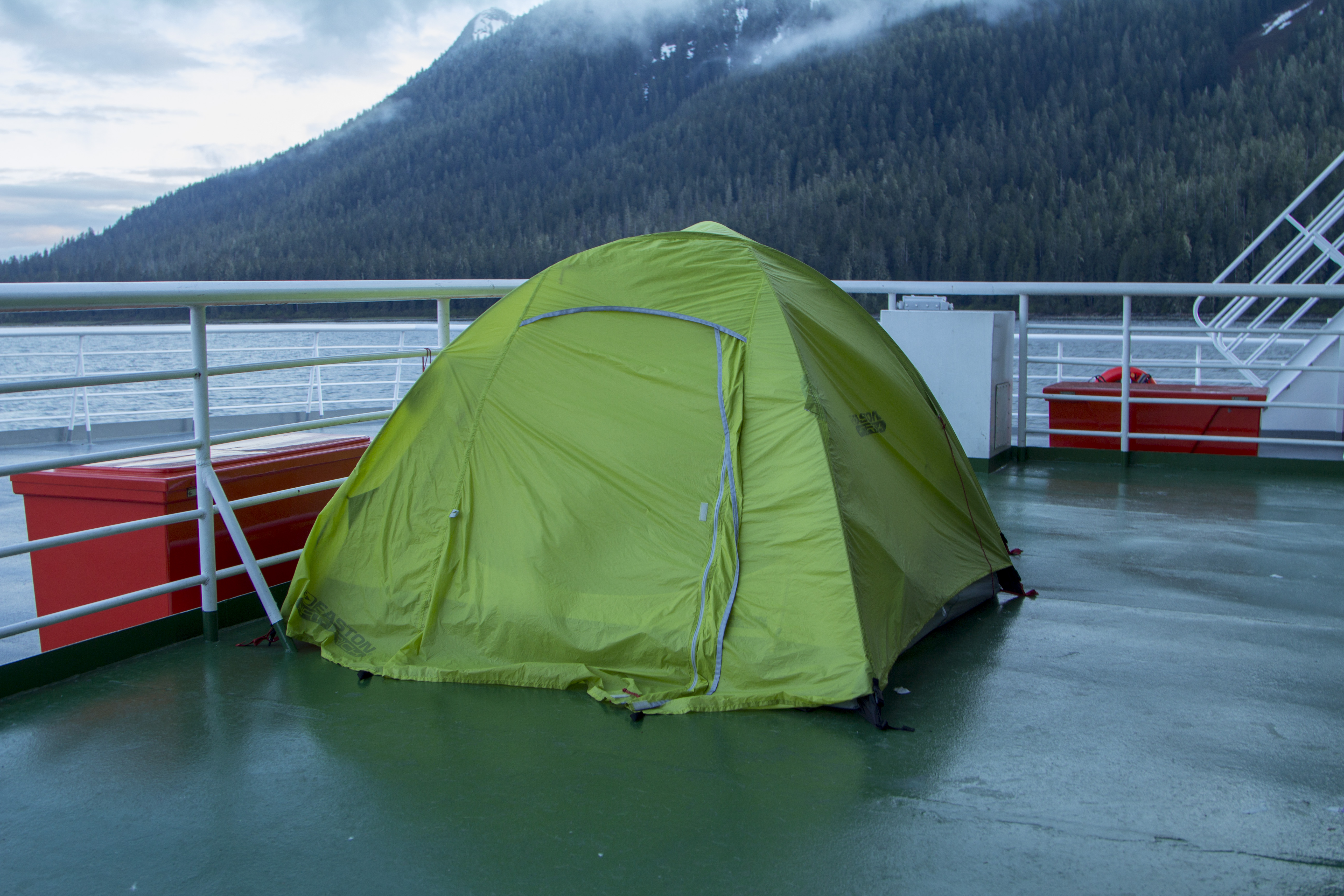
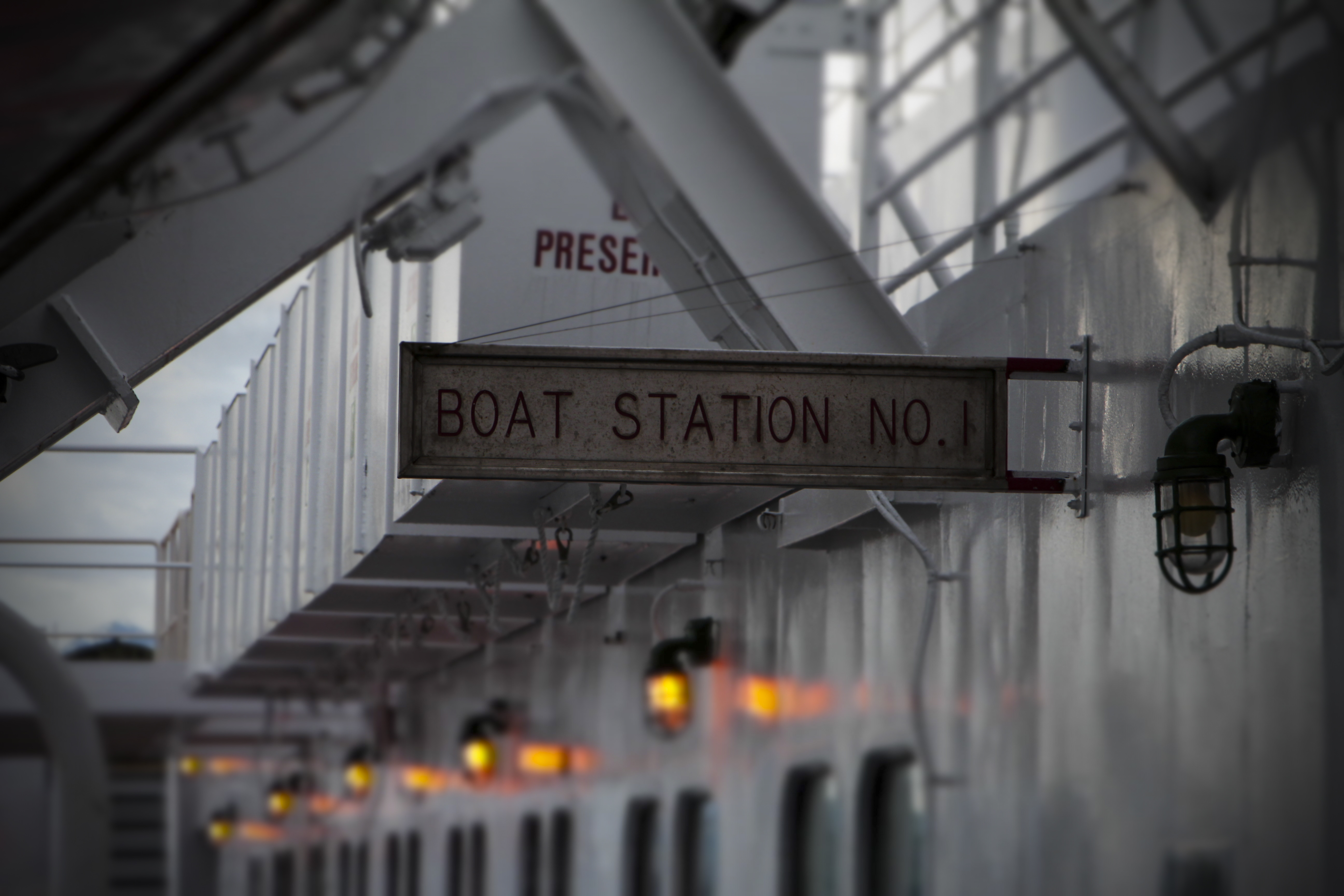
After nearly 30 hours aboard the Marine Vessel Columbia, I feel as though I am finally entering a place of magic; one that has little visible damage from the throes of humanity; a landscape that has all the smells and sounds that are favorable to me.   My tent has been pitched on the upper deck of the vessel’s stern, not under the shelter of the cabin deck’s overhang, but flat up against the railings of the utterly exposed rearward partition of the boat’s Solarium deck.  The last time I sailed, on the M/V Kennicott, the entire Solarium was located inside, away from the elements.  This vessel seems to be a bit more modern, but seemingly lacks some of the fundamental niceties of the Kennicott.  There is less space to merely hang out, but more room for paying cabin guests, it seems.  This boat is 418′ long, is powered by two 6000 horsepower diesel engines, and can travel at speeds up to around 18 knots.The campers are crammed outside on the Solarium, under it’s overhangs, perched on foldout lawn chairs, sleeping bags lining the deck, one after the other.  If one wants relative security for belongings and a wee bit of privacy, a tent is in order; and if a tent is in order, then you are out in the elements.  So be it.  That is where I am headed anyway and that is where I desire to be…  It is where I belong.  However, after 2 hours of wandering the ship, I head back to camp to find I have chosen perhaps the worst spot on the vessel to erect a dwelling.  It is situated to the far starboard side of the vessel, beyond the relative shelter of the hull body, fully encapsulated to the southbound wind created by the ships’ steady forward motion.  Hastily, I break camp and scurry to the more sheltered, and quieter, deck below.  I feel as though this bivouac is better suited to my needs and walk away smiling.

Finally aboard, I am relaxed and can reflect on the months prior; hell, the 24 hours prior…  Pat and his buddy Jason take Dennis and I out for a fine day of Cod fishing in the Pacific waters around the eastern San Juan Islands.  We catch the daily limit of Ling Cod and head back to Bellingham for an evening of swill and fabulous fish tacos.  The Cod is delicate, nutritious, and tasty.   The next morning I am up and packing; preparing for a journey I have envisioned since the last time I departed this favored landscape.  After parking my truck at Pat’s mom’s house (Thank You, Claudia!), I head to the ferry terminal and get situated.   Now, on the ship, I am bearing witness to the great northern country I love so intrinsically.  There will be stops along it’s journey to Skagway, Alaska, at Ketchikan, Wrangel, Petersburg, Juneau, and Haines, finally sailing to port in Skagway, and the beginning, so to speak of my own personal journey northward further yet.

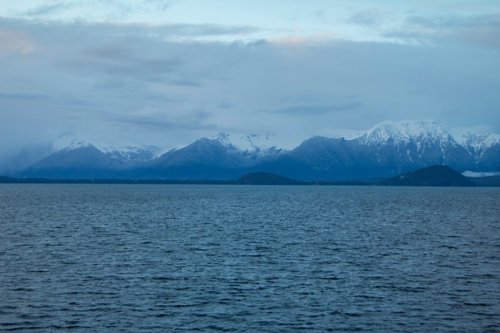
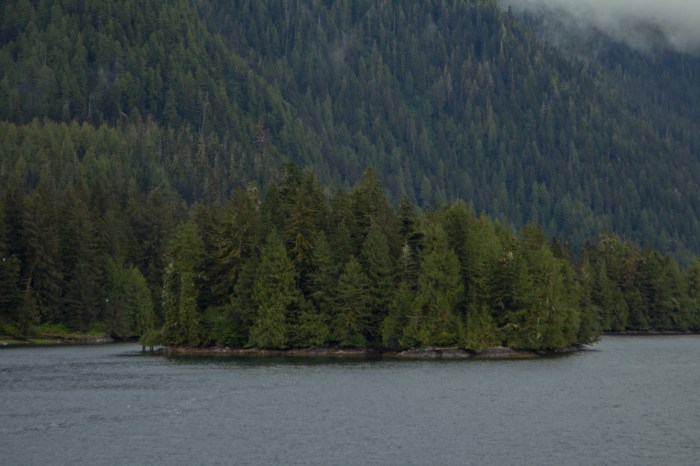
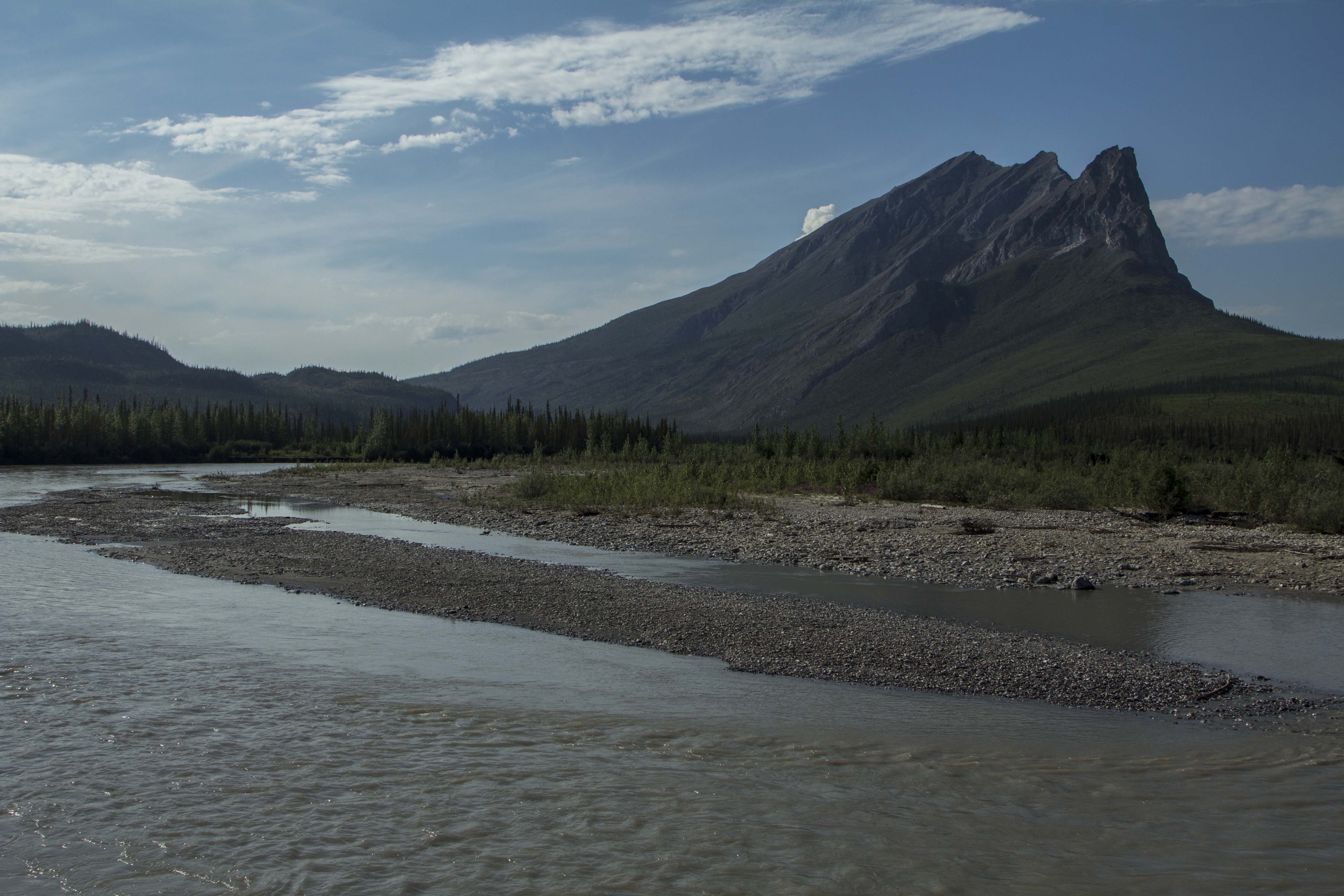
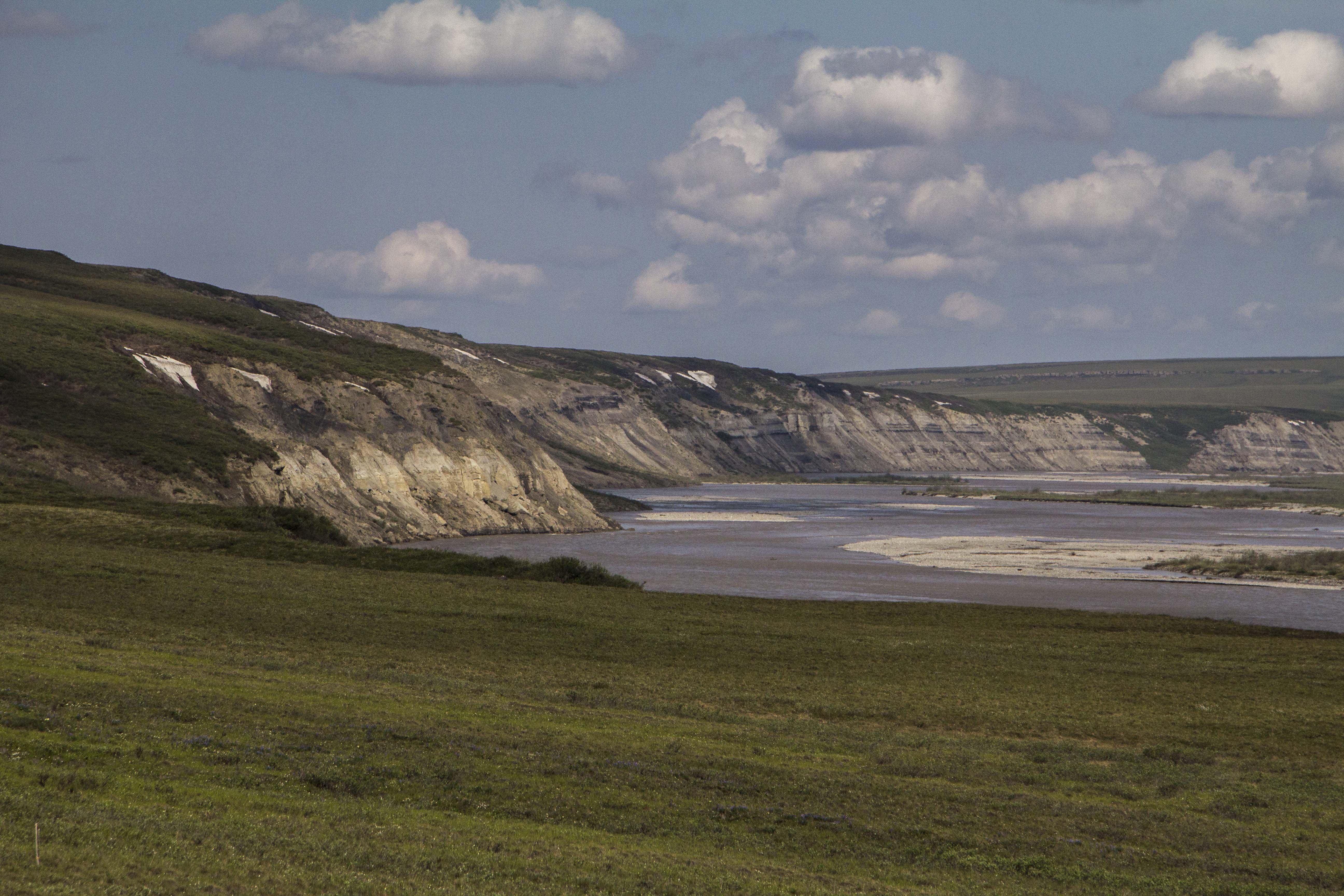
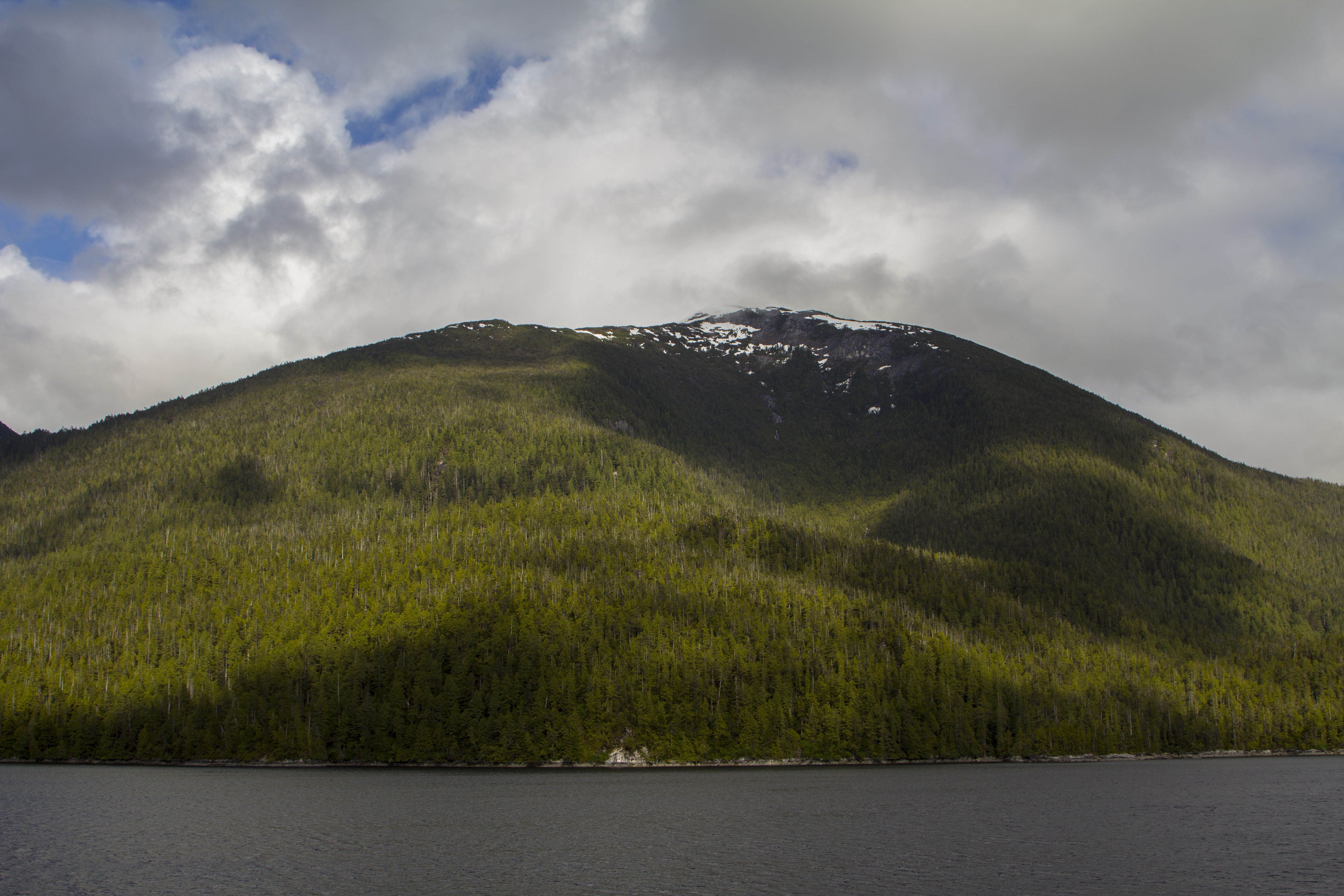
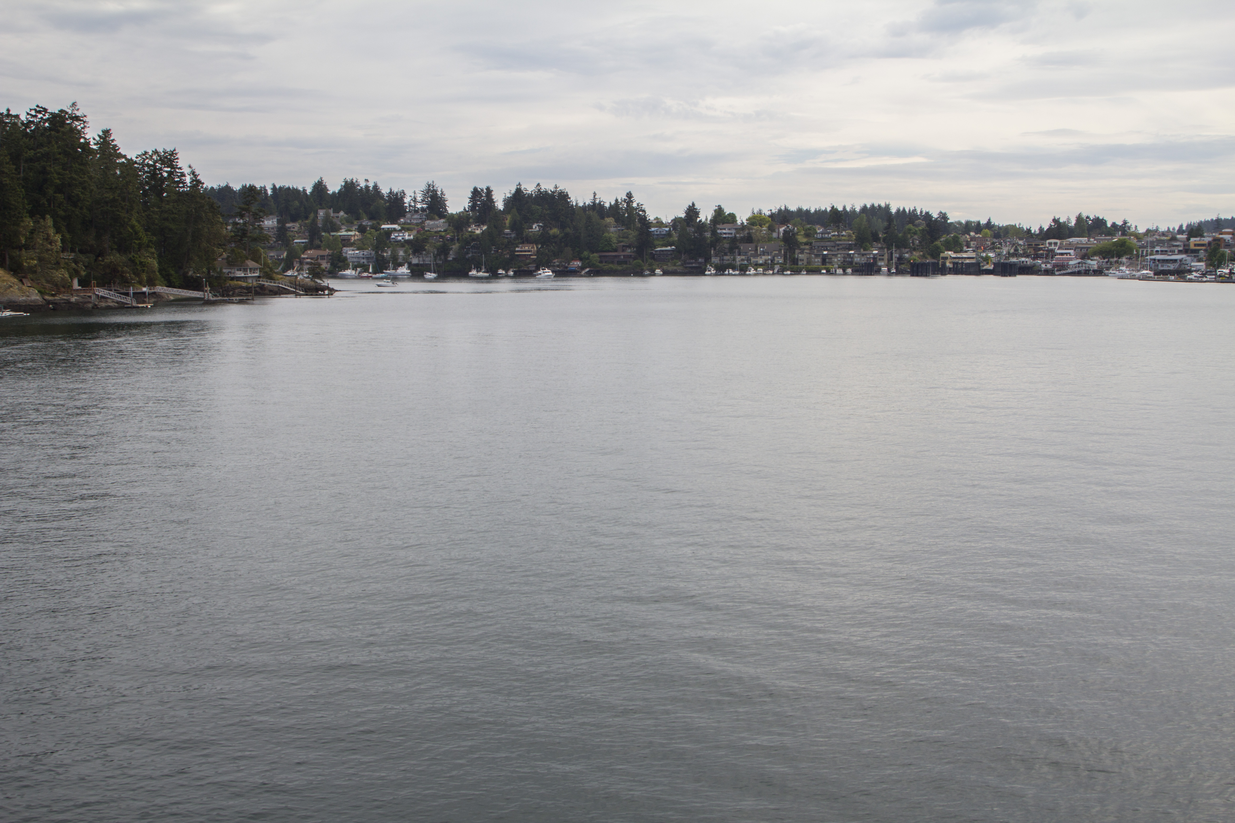
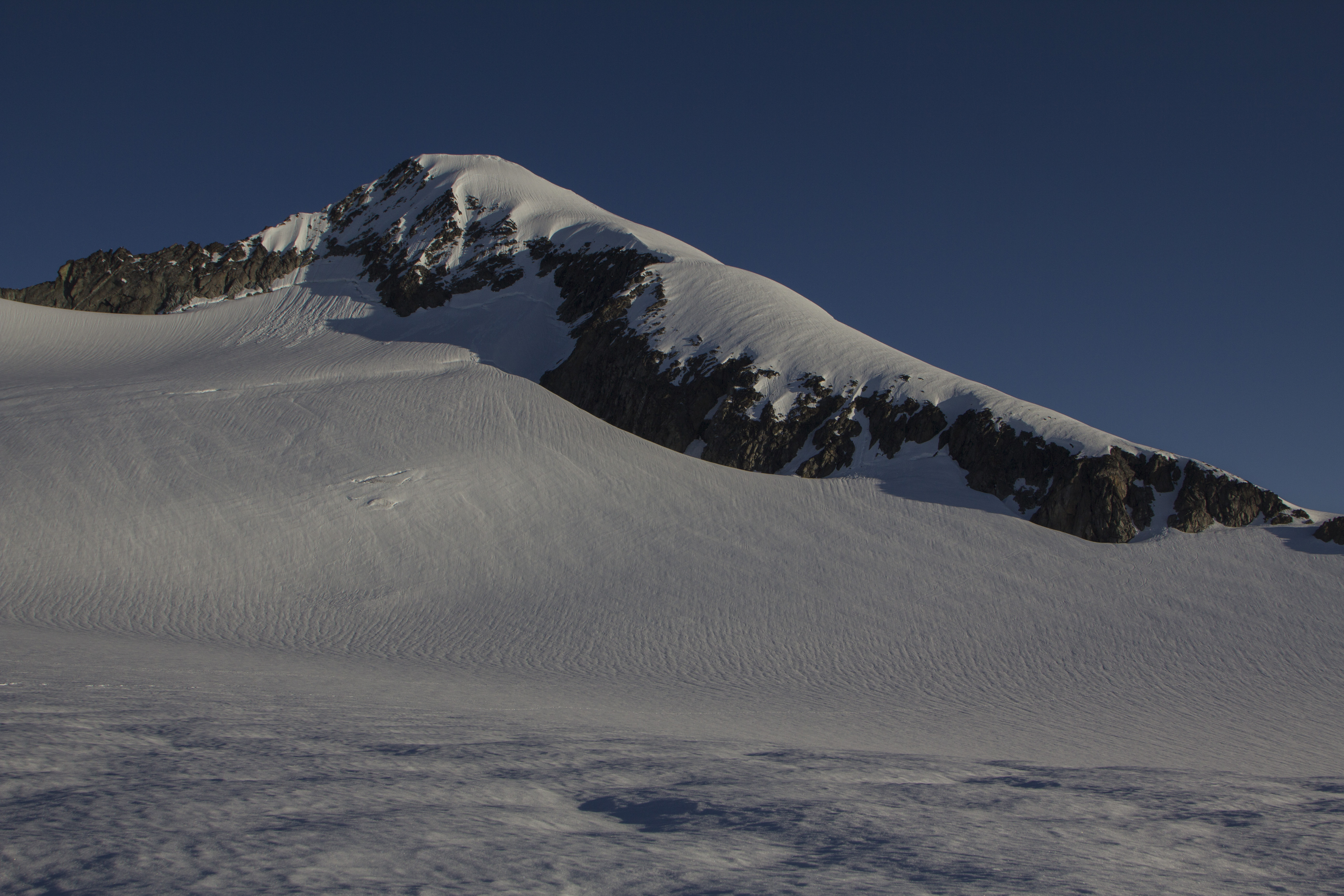
British Columbia’s wilderness west coast is the stuff dreams are made of.   The water is deep turquoise in color, it’s beaches scattered with driftwood, deep, intense forest abounds it’s shores, and Eagles, Bears and Wolves scavenge it’s edge ward advance into the mighty North Pacific.   After sailing furlong through narrow straits and passages, with land close at hand, we begin to enter a thoroughfare of more openly water, while quite beautiful, it’s expanses become slightly monotonous. Suddenly the mindset is broken to reveal two Orca’s surfacing 200 meters westward, in the deep water’s of the channel.  On the far side of the vessel, through the clouds and mist, I see the lower bits of B.C.’s daunting Coast Range, home to Mt. Waddington and some of British Columbia’s largest glacial ice sheets.

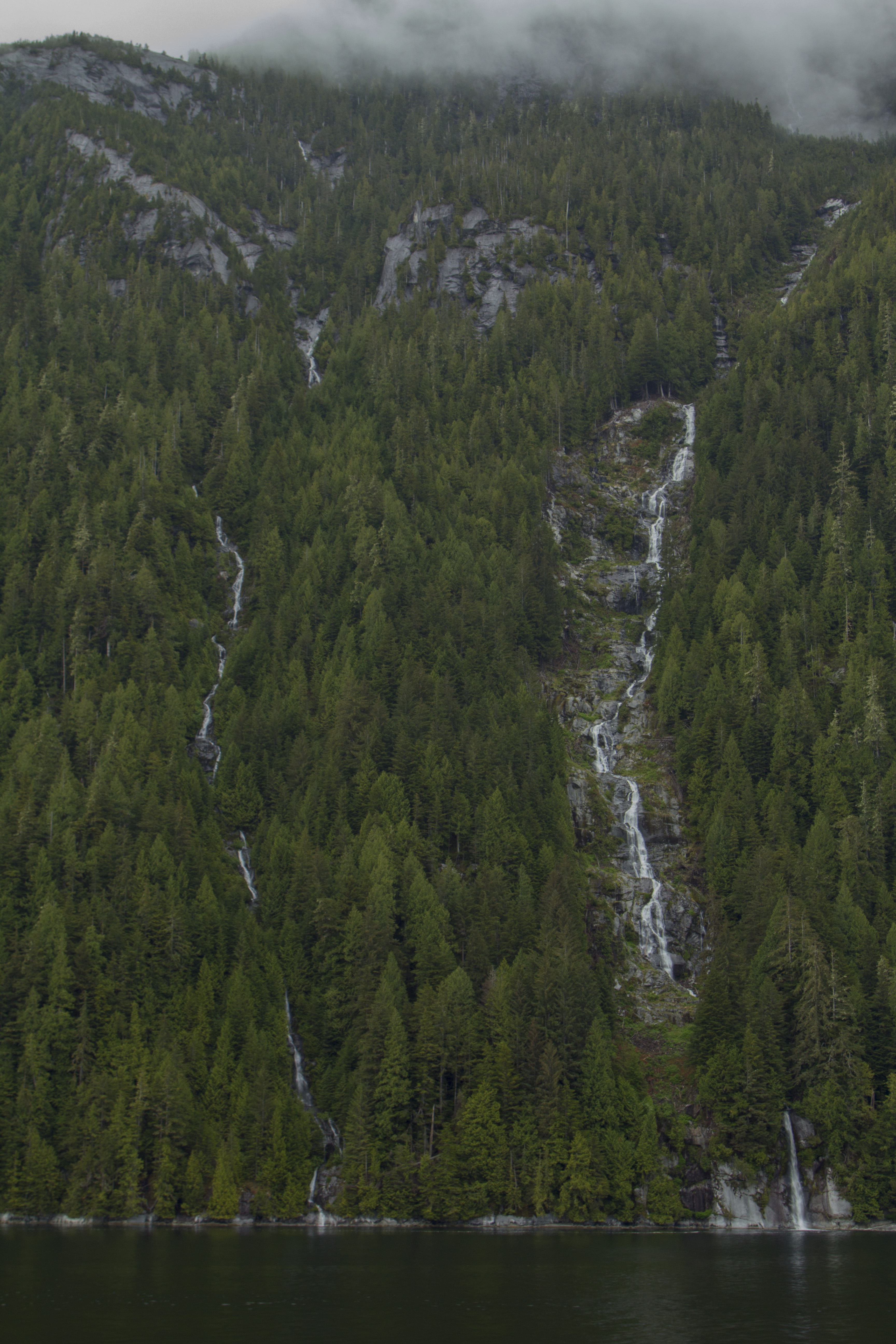
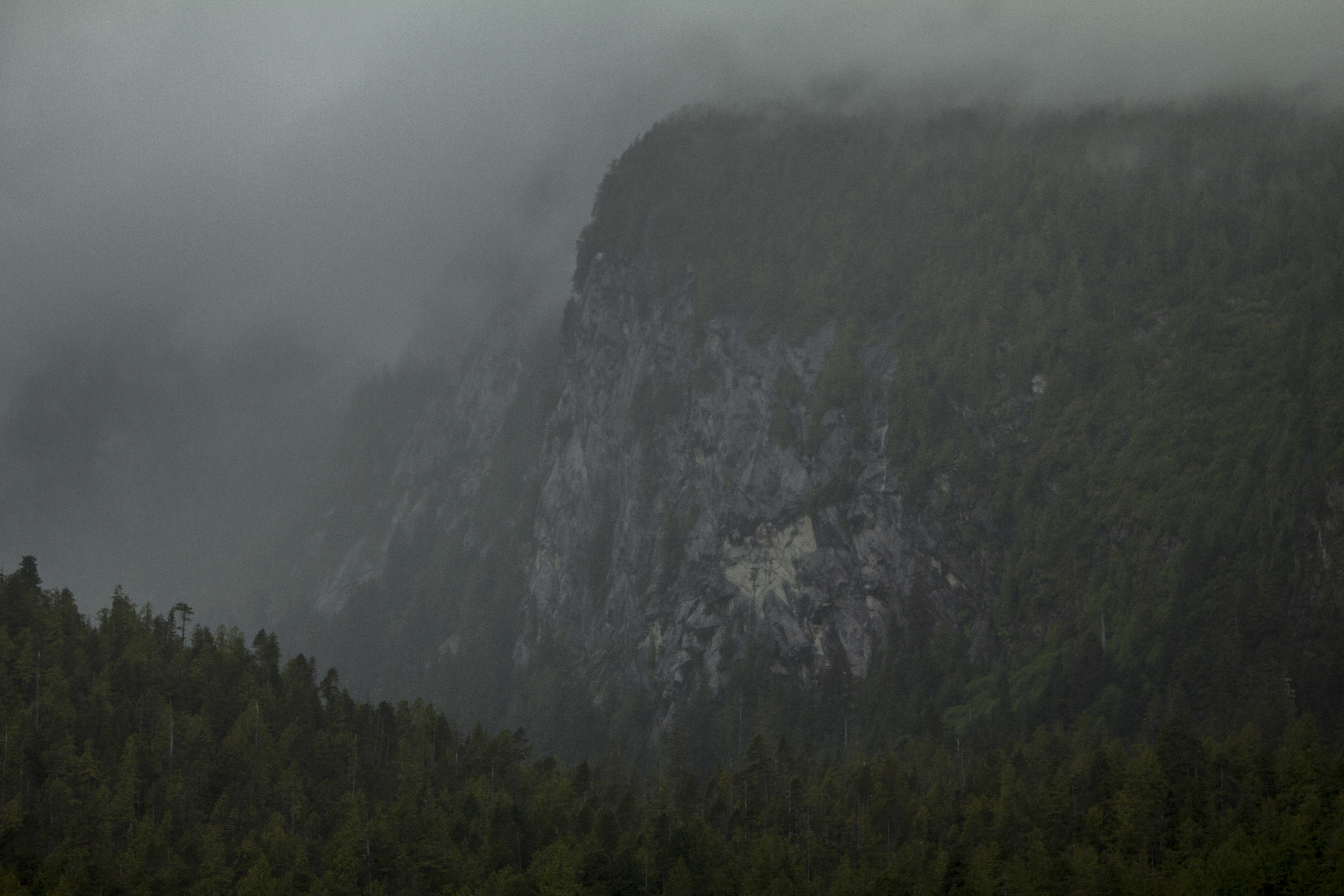
We pass by the Bella Bella entrance; gateway to the pristine Bella Coola Valley, where friends Greg and Allison live on their farm, also home to more Grizzly Bears than anywhere in B.C.  That Afternoon, sliding up the narrow channels just south of Prince Rupert, in the Princess Royal Channel, the watery boulevard turns magically into an avenue of waterfalls.  Dozens of them, ranging from 200′ to over 1000′ in length, some multi tiered.  There are immense granite walls abounding the area, nearly always dumping themselves into the deep channel of the sea.   Later, we pass through the  expansive Dixon Entrance and sail smoothly into Alaska’s lower water’s, passing by the village of Wrangel, situated at the mouth of the mighty Stikine River, one of North America’s great, wide, Salmon rivers, of which I witnessed first hand previously while pedaling the fantastical esoteric Cassiar Highway back in 2011.

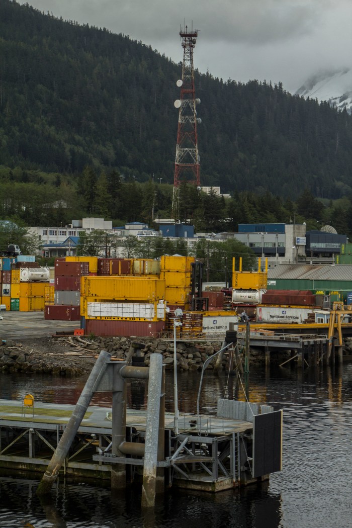
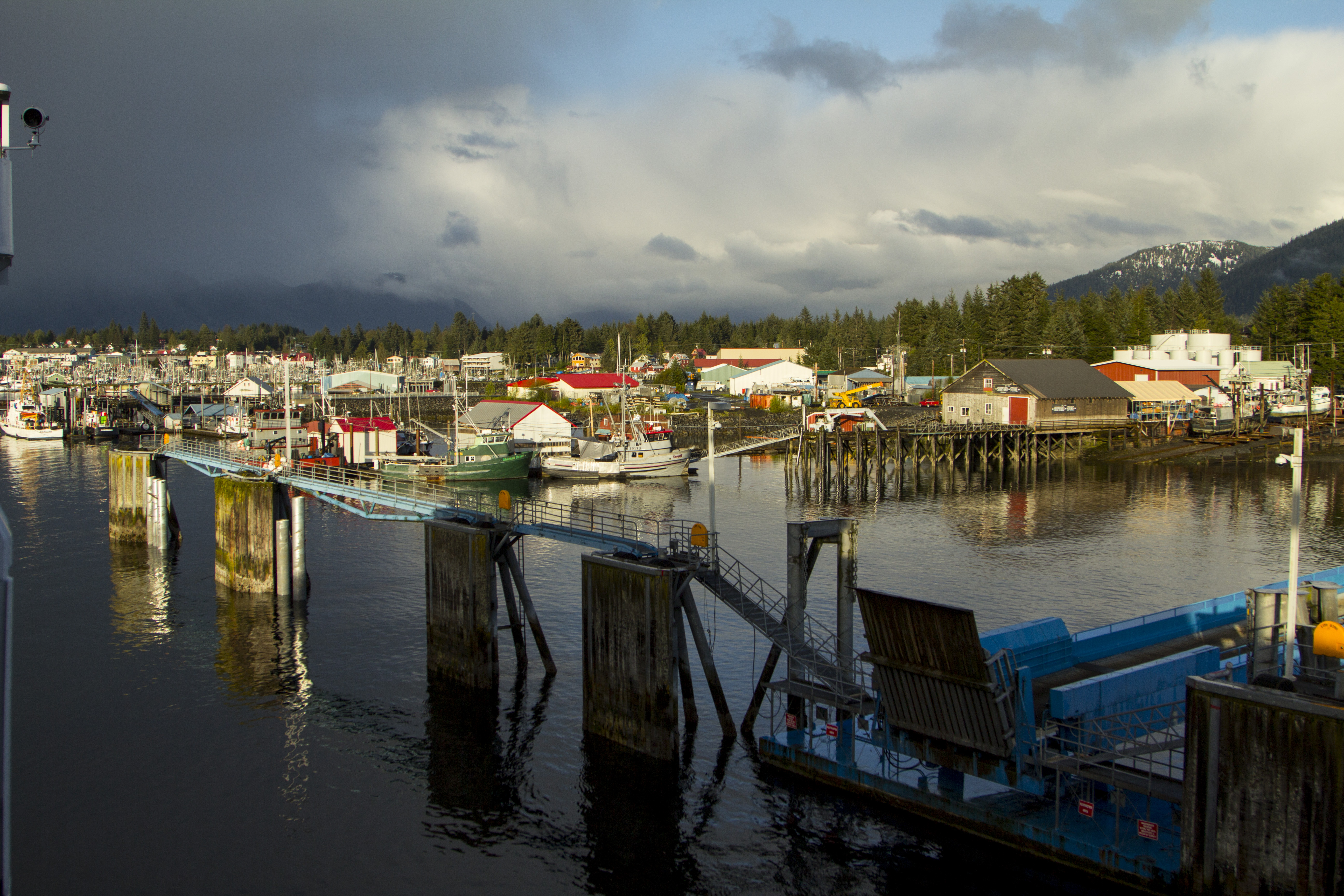
In The morning, at 5:30, I gaze out over the bow and spy the overblown cruise ships sitting fat in the water and it dawns on me where we are; we arrive, at 7:00 am, in Ketchikan.    I remember that there is an excellent grocery store mere yards from the port, and, in need of food that is not over processed and over priced, I embark on an Alaskan shopping shindig.

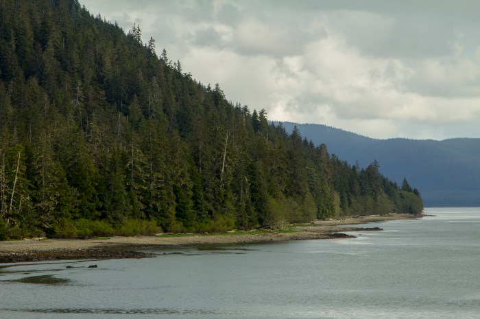
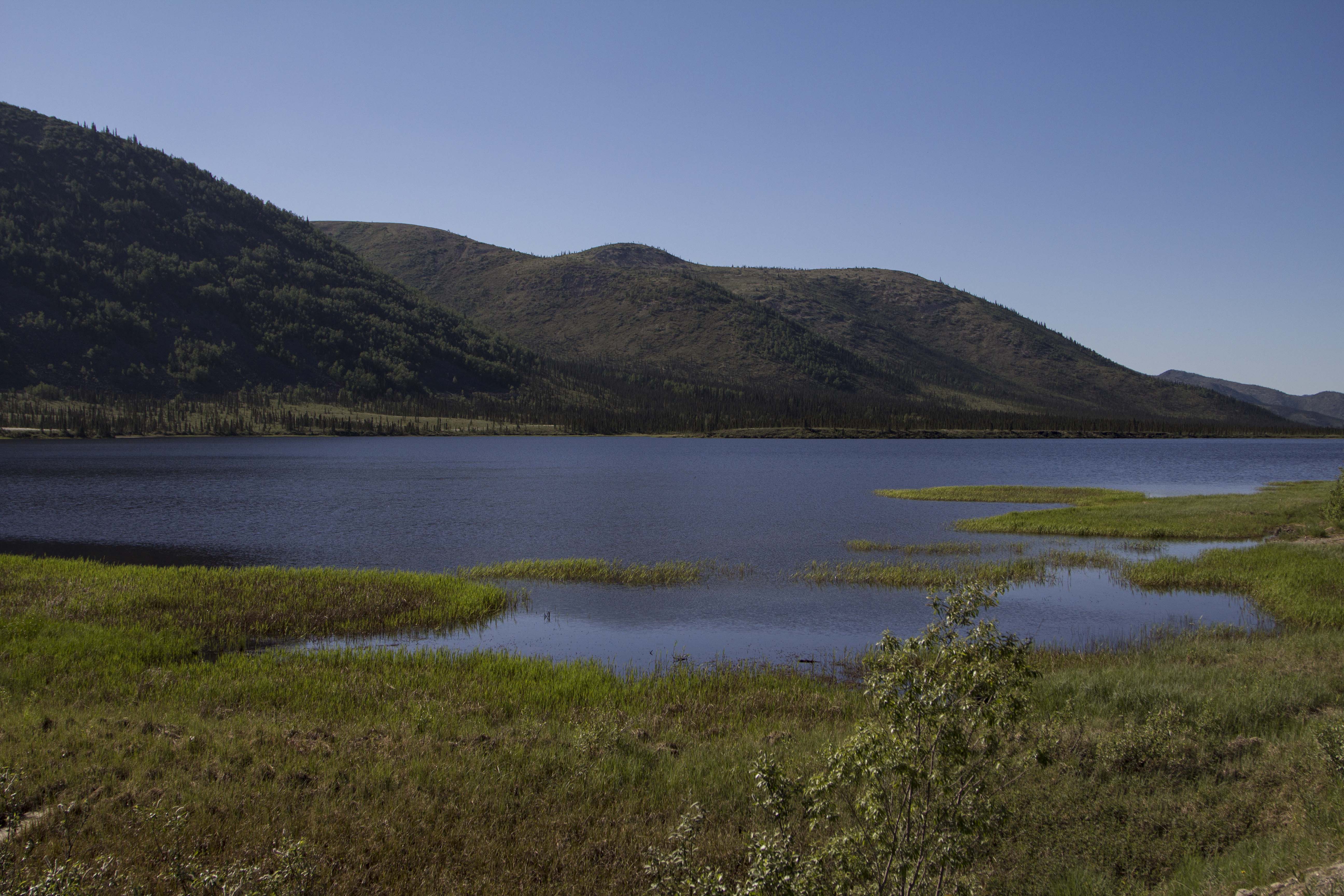
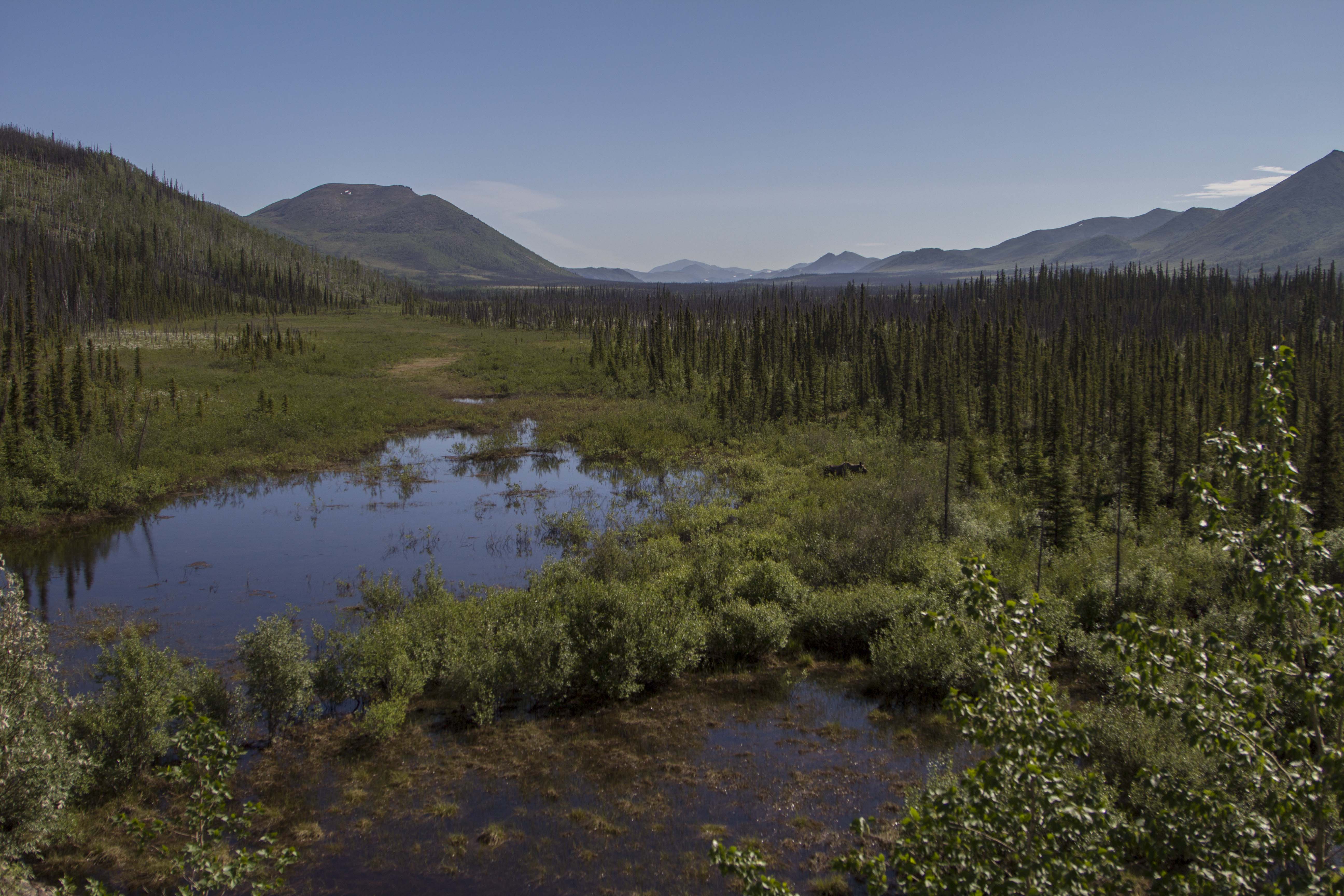
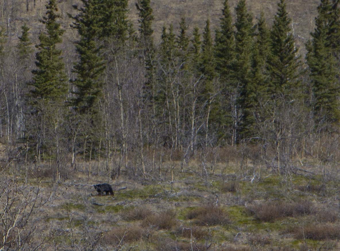
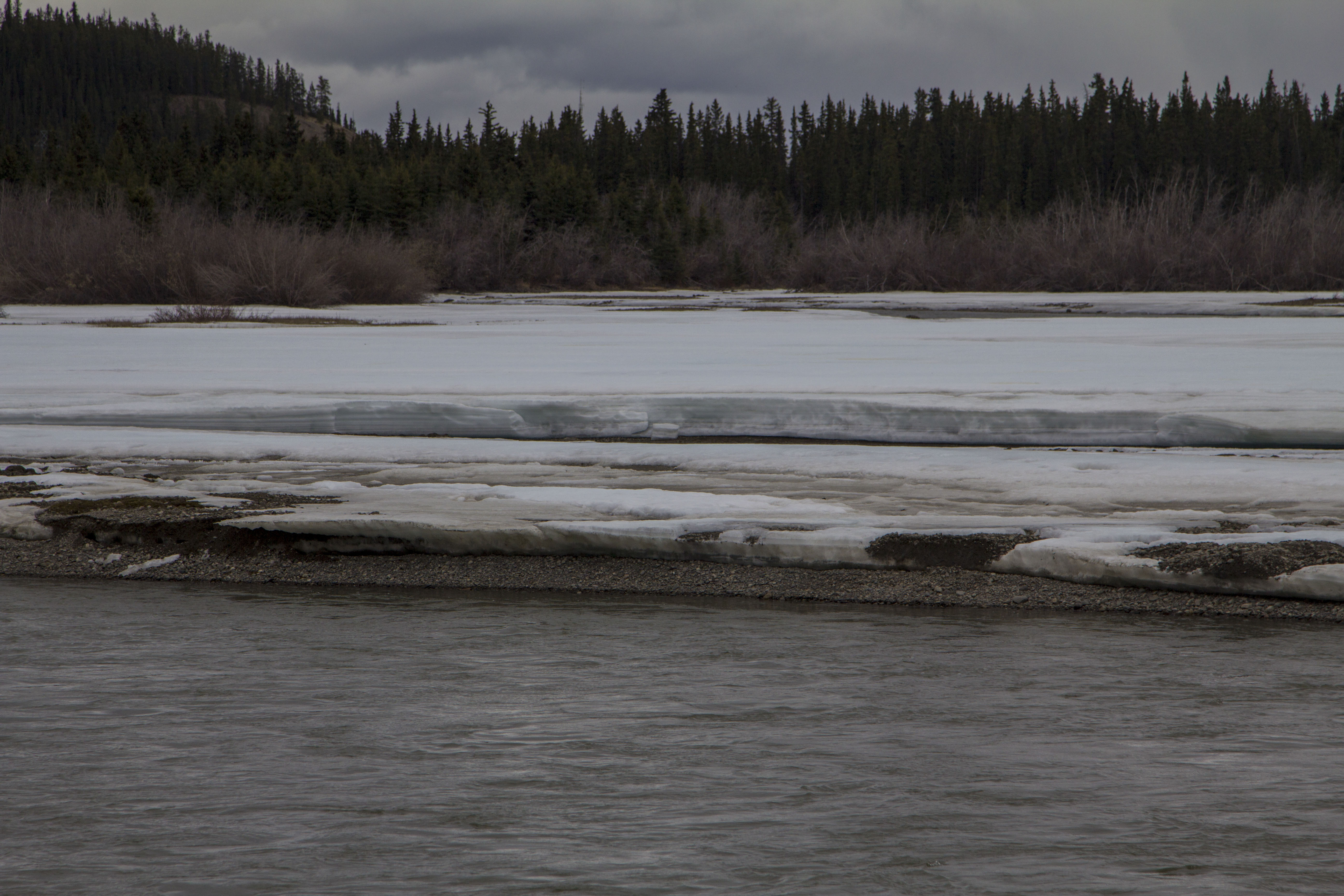
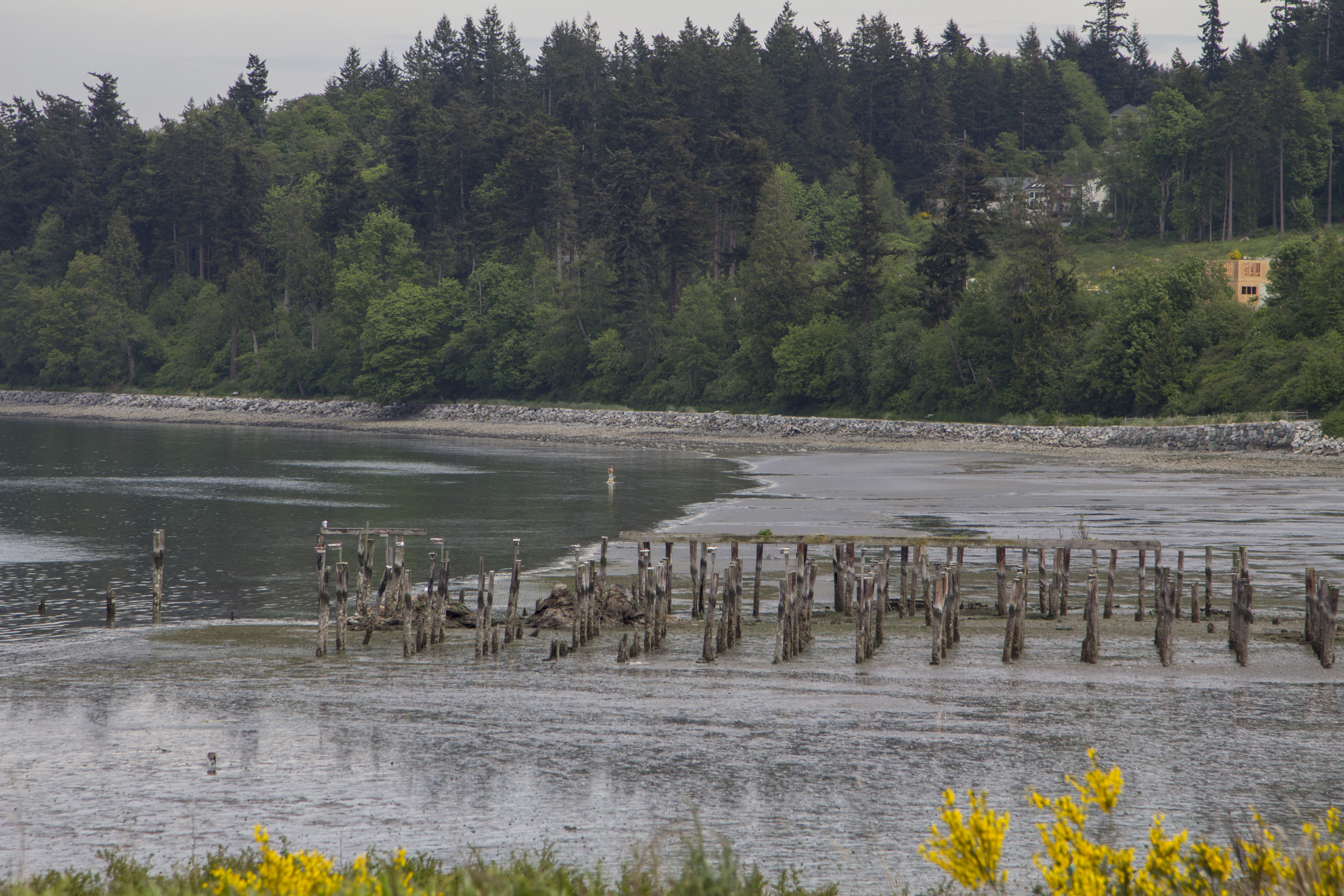
North of Ketchikan, the passage begins to widen slightly, revealing splendid beaches abounding with driftwood and wildlife, signifying a channel that is considerably shallower than had been previously.  The Inside Passage, as it is known, is a whimsical place of seemingly endless forest.  Amongst it’s channels, islands, bay’s, inlets, and stretches of open sea, the northwest coast of this continent presents literally thousands of miles of coastline.  Nearly all of it is wilderness, and beckoning my higher self to a simpler time of fishing and foraging.  Even though I am aboard a diesel powered vessel, I have come home.  In my opinion, unless one is embarked on a life journey of living wholly within the simple, yet often rigorous and uncomfortable means of hunting and gathering through the unlimited boundaries of nature, one is merely a product of a destructive economy. A tourist.  Most of us are, and I am no exception.  And when I say unlimited boundaries, I mean only within the said practices of a proper, aboriginal human, not on the whims of an industrialized, separated, and economy based, modern human. This, I believe has very finite limits that are now nearly reached. The Grizzly’s, Salmon, Wolve’s, Eagle’s, Polar Bear’s, Musk Ox, and Walrus, all see this.  I, as most, have spent the greater part of a lifetime taking from our planet, our mother ship.  I wish to somehow do better.  Obviously, a portion of humanity has pondered this virtuous dilemma since the beginning of the Industrial Age, and even longer I suspect.  To doubt and to question the status quo and it’s “happening-right-now” destructiveness toward all that is greater is something that appears to be scornful thought amongst the vast majority of our peers.  It is required, however.  This, I believe, is how evolution ultimately occurs, at least at this stage of human domination.

After being in this splendid landscape for more than a few hours, I have noticed something peculiar. With living in the city, I have nearly always needed to express myself on a much more intense level; it was easy to look around and feel the need to set forth some ideas about a positive change in the way the human race looks at itself and equally importantly, the world around it. In other words, living in the city, surrounded by crime, pollution, derangement, and the obvious notion that the greater portion of the human race has removed itself from nature, rendering itself out of balance, it has been easy for me to feel the need to write about it’s woes and faults, to express my displeasure with a world gone totally mad and devouring itself.

The peculiarity I feel, is that, now, being here, I remember these notions, but no longer feel them, because I am now bearing witness to a greater-than-human faction, a world that evolves out of pure and simple balance. The world of the forest , the Sea Otter, the Wolf, the Bear, the Eagle.  And sometimes the occasional human.  There are still those who wish to travel to these places to merely see it from the comforts of their artificial homes and RV’s. It seems to me that these creatures are looking to the natural world to see how the other half lives. Sort of like rich kids going for a drive trough the ghetto to catch a glimpse of something they have no desire to be a part of.  I do not feel this way…  I am more akin to be heading in the opposite direction and am attempting to become more apart of the natural world that humanity as a whole has left behind millennia ago.  Being in these places makes my heart sing and my mind settle.  Being here, now, in these landscapes, with these wild neighbors, once again makes me realize that the human world has become insanely complex, and in serious need of rebuttal from “the other half”.

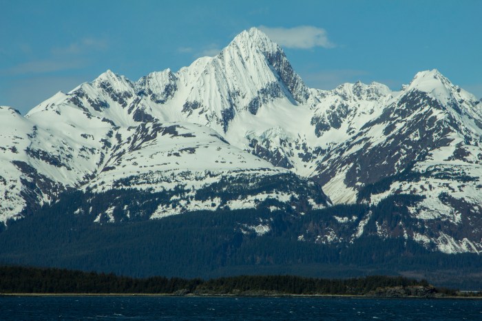
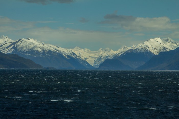
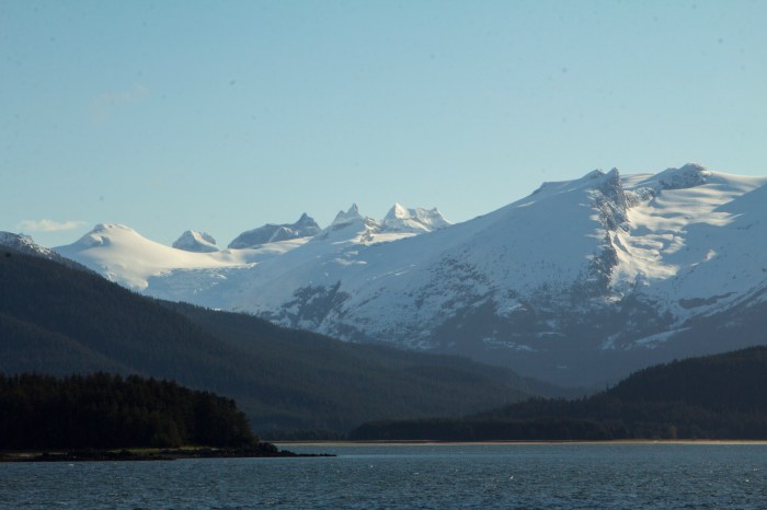
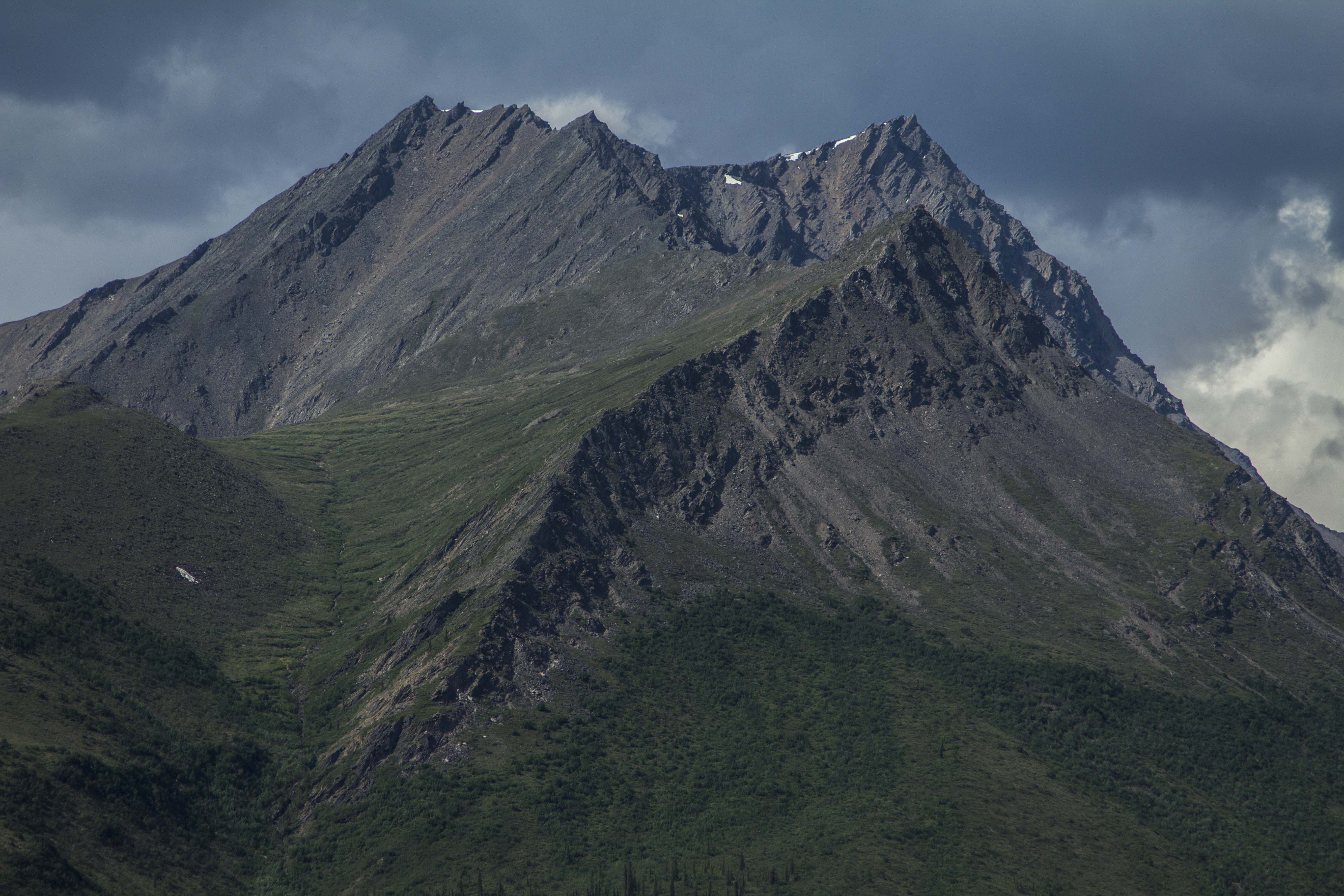
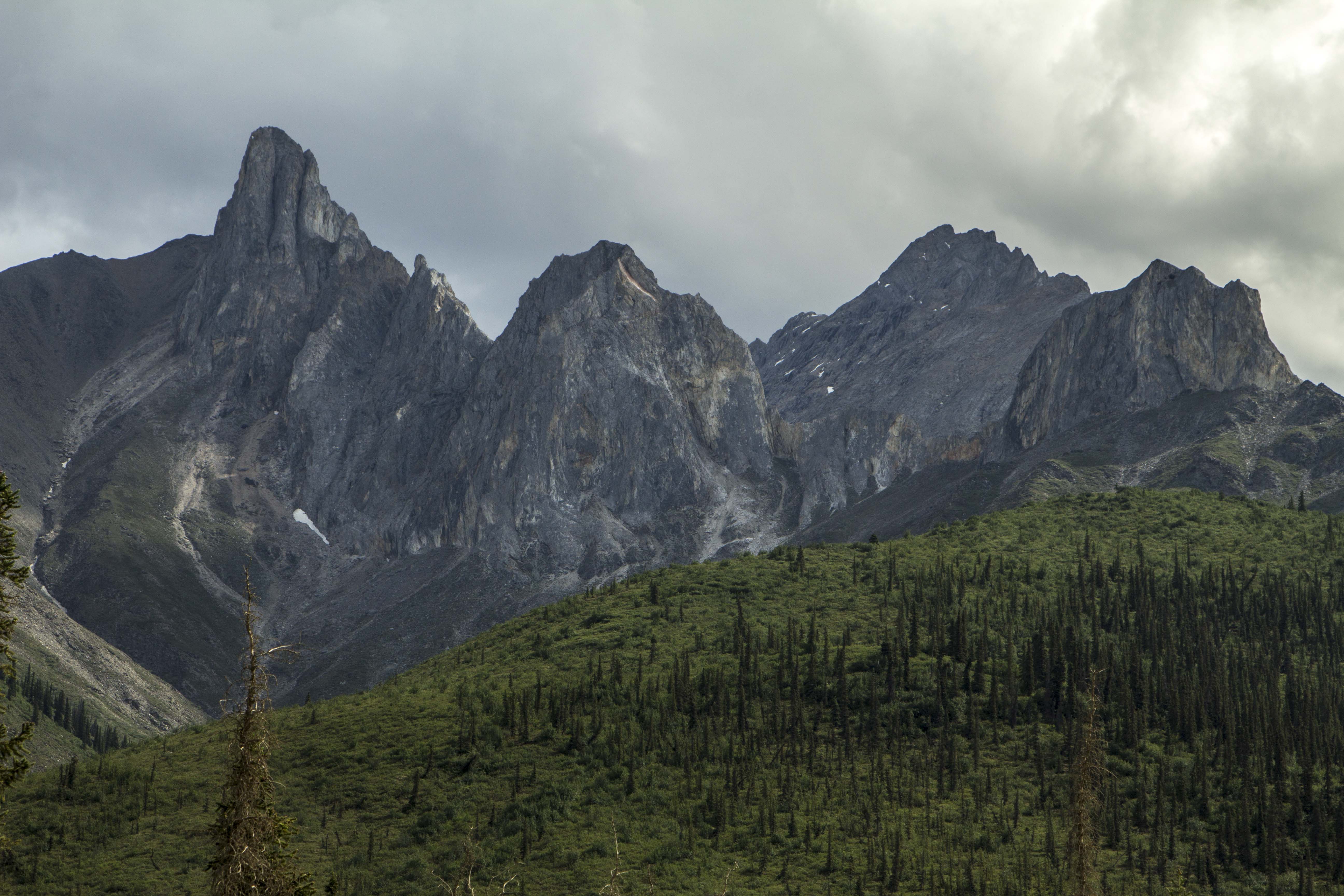
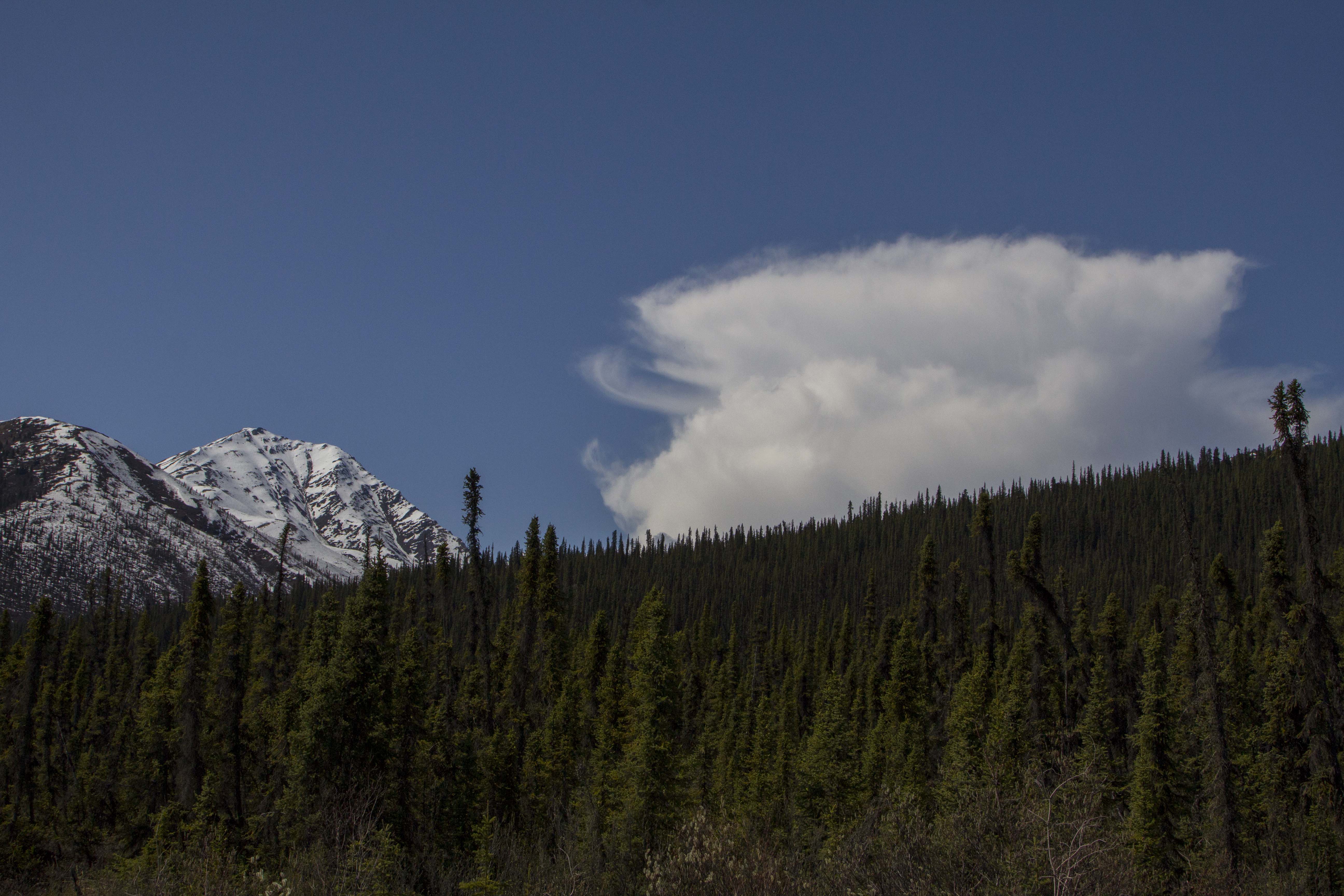
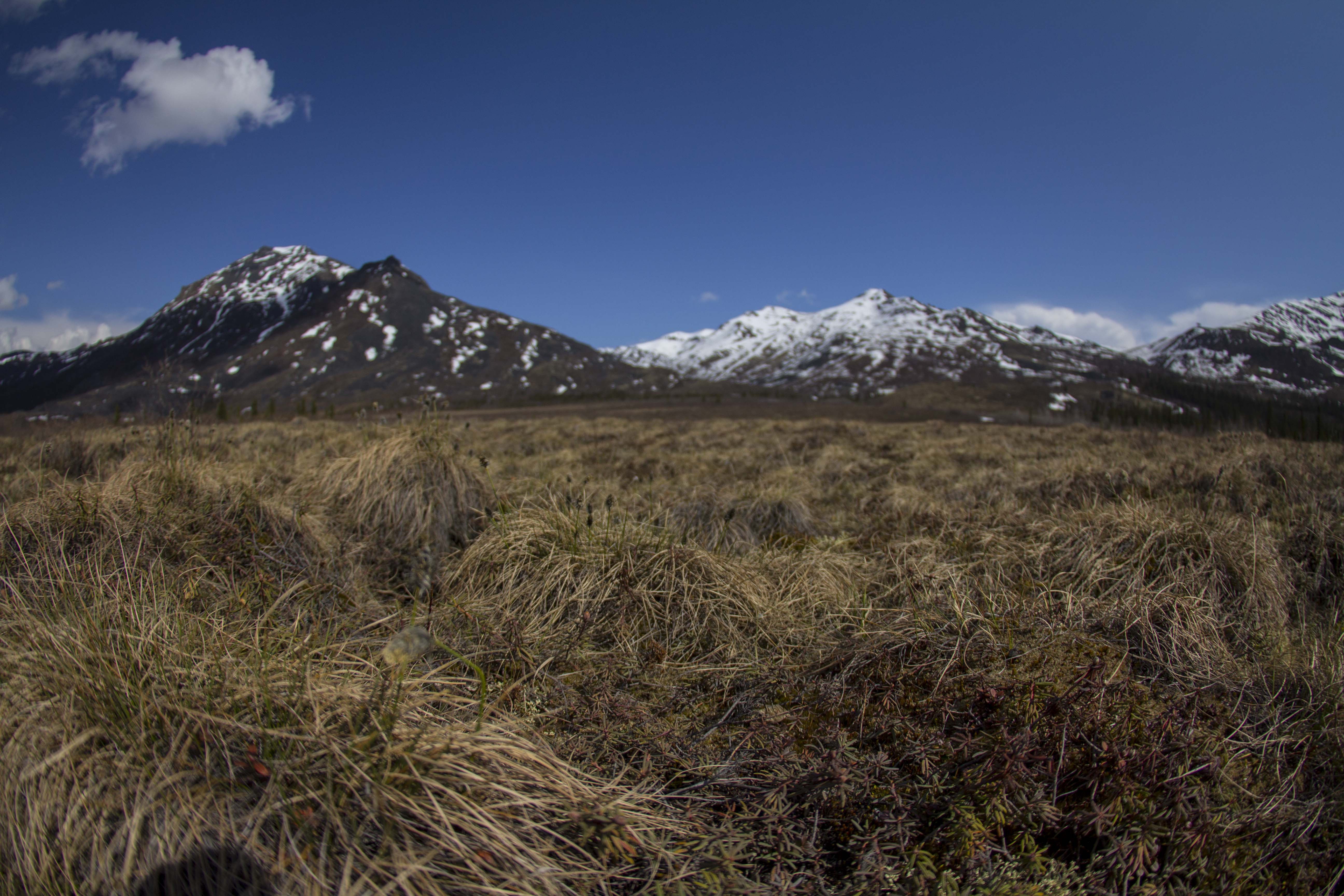
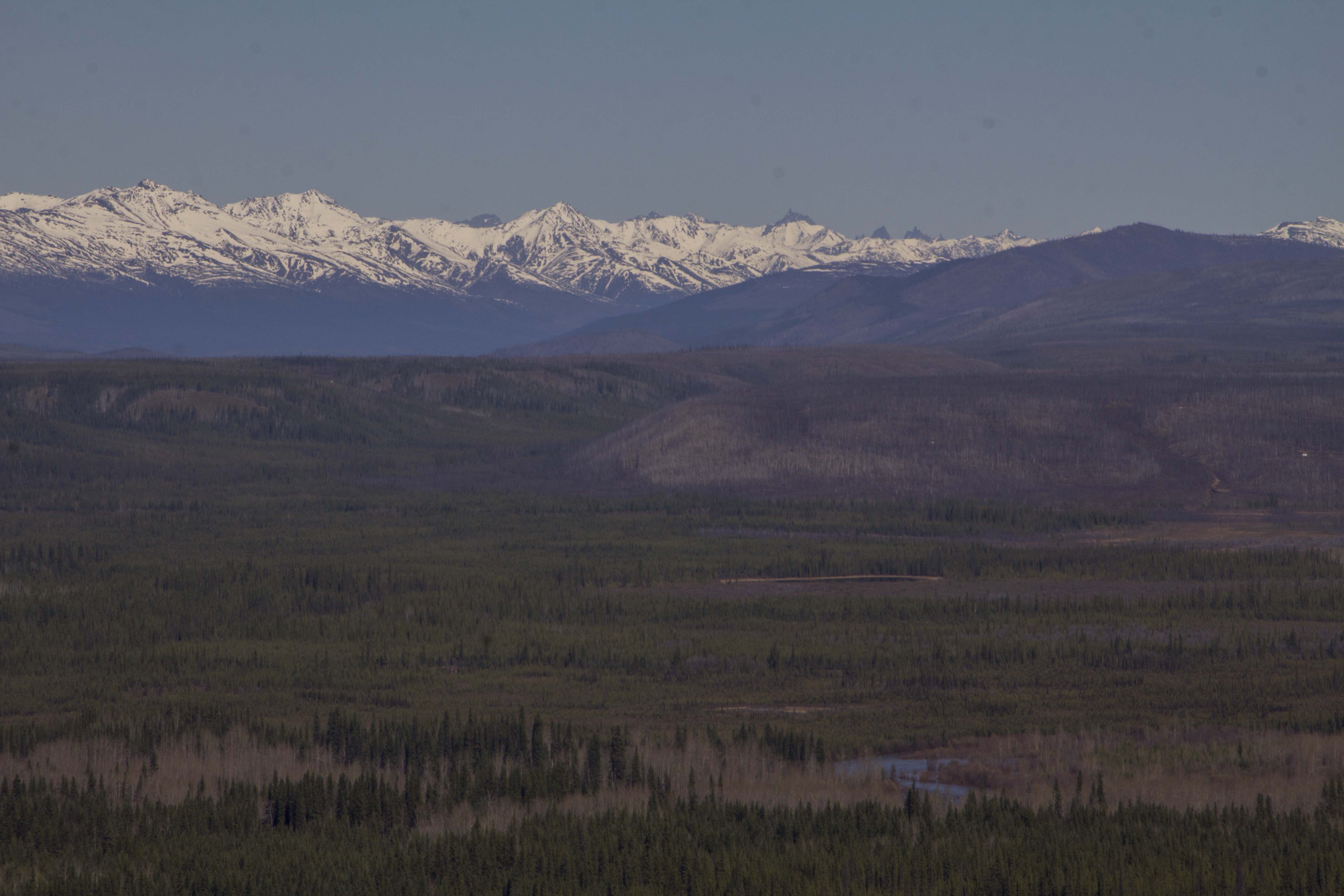
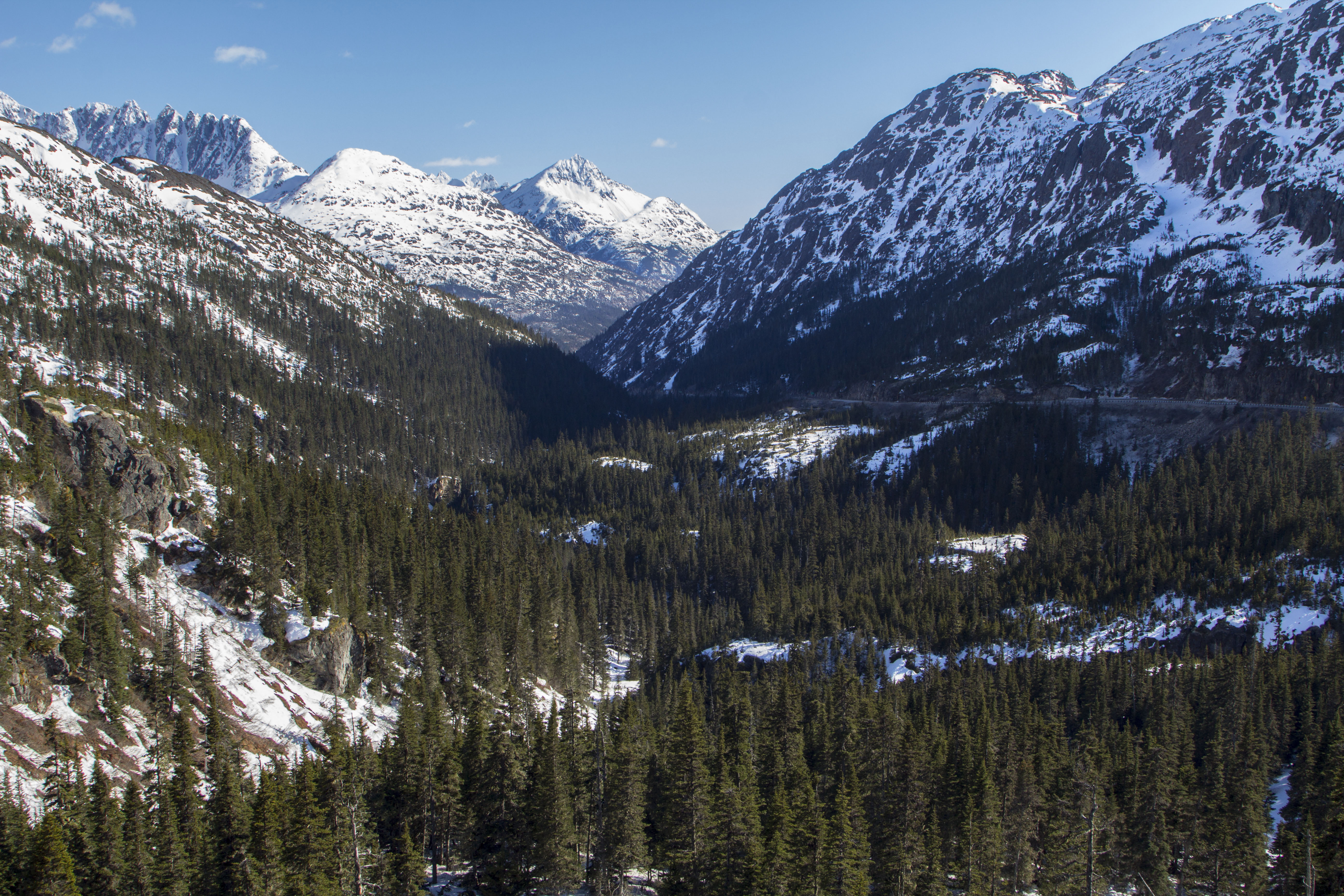
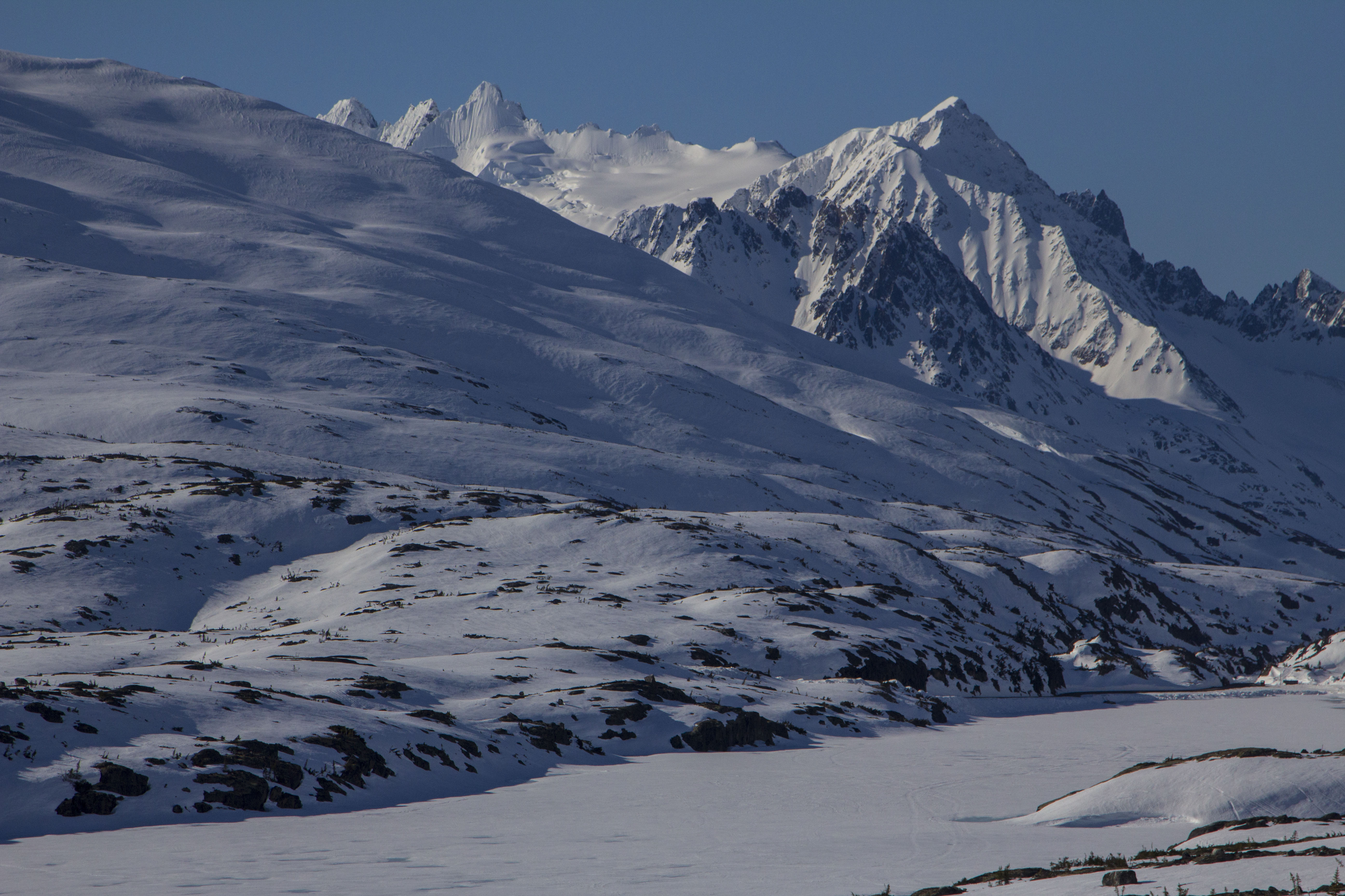
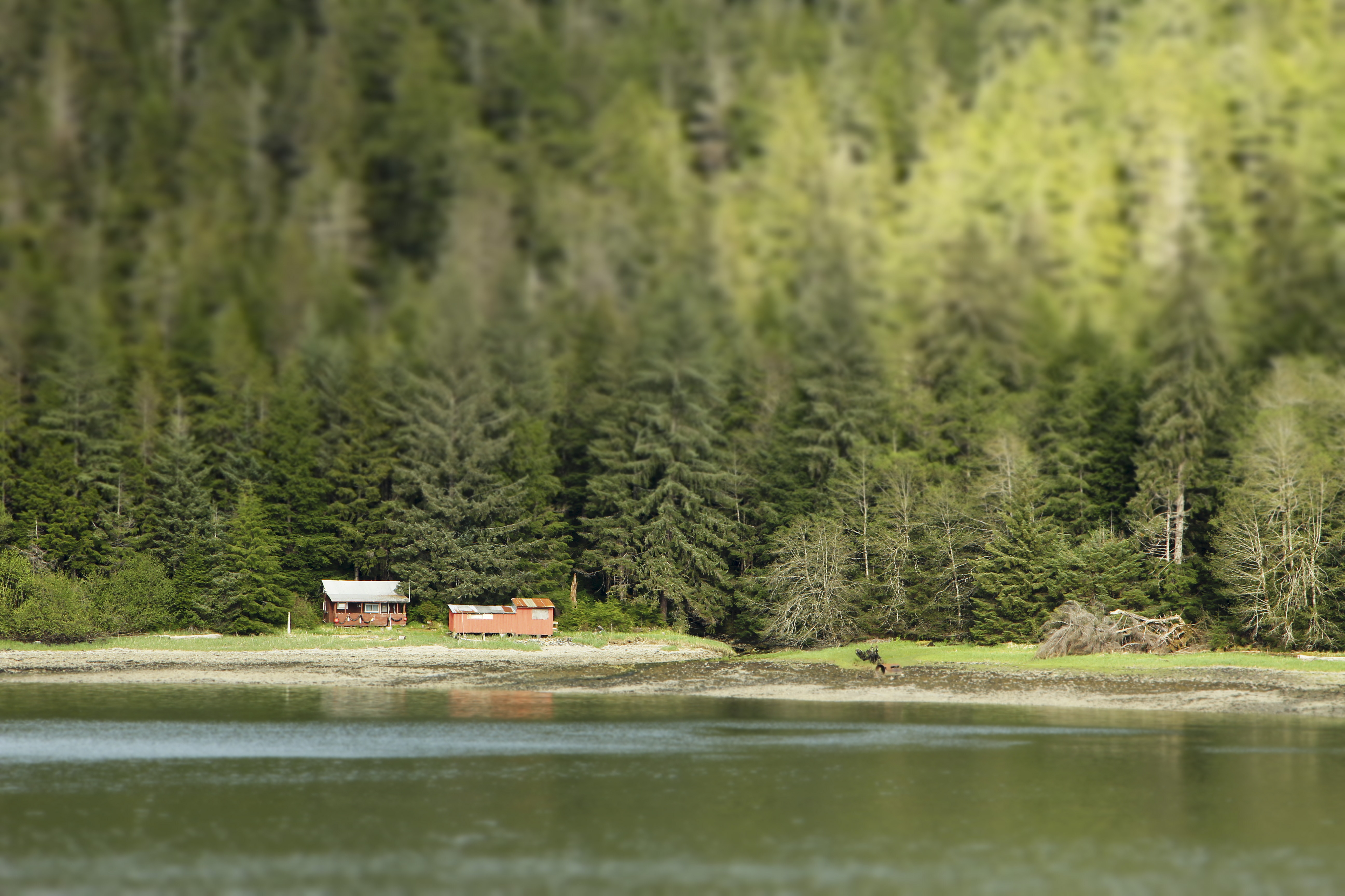
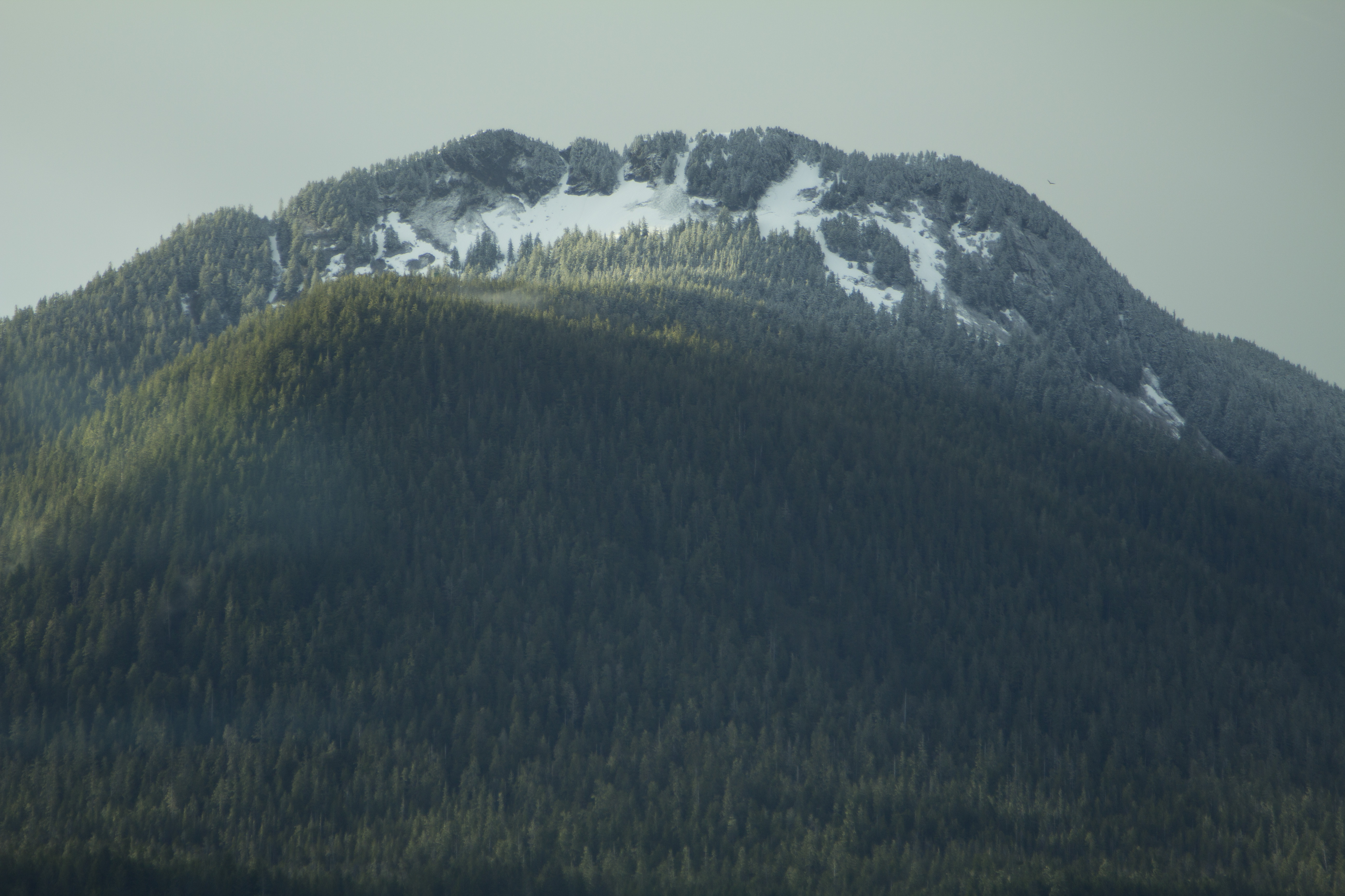
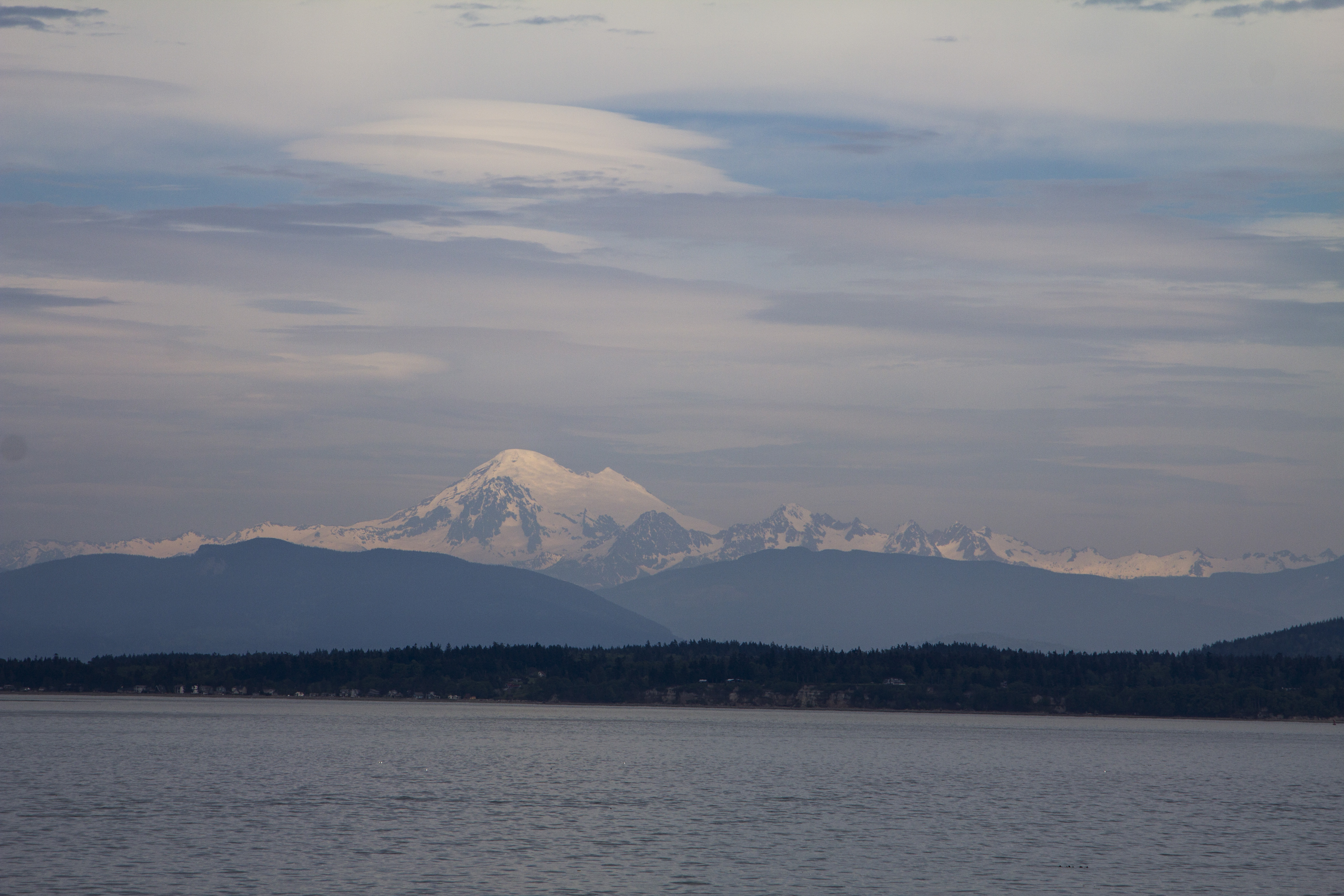
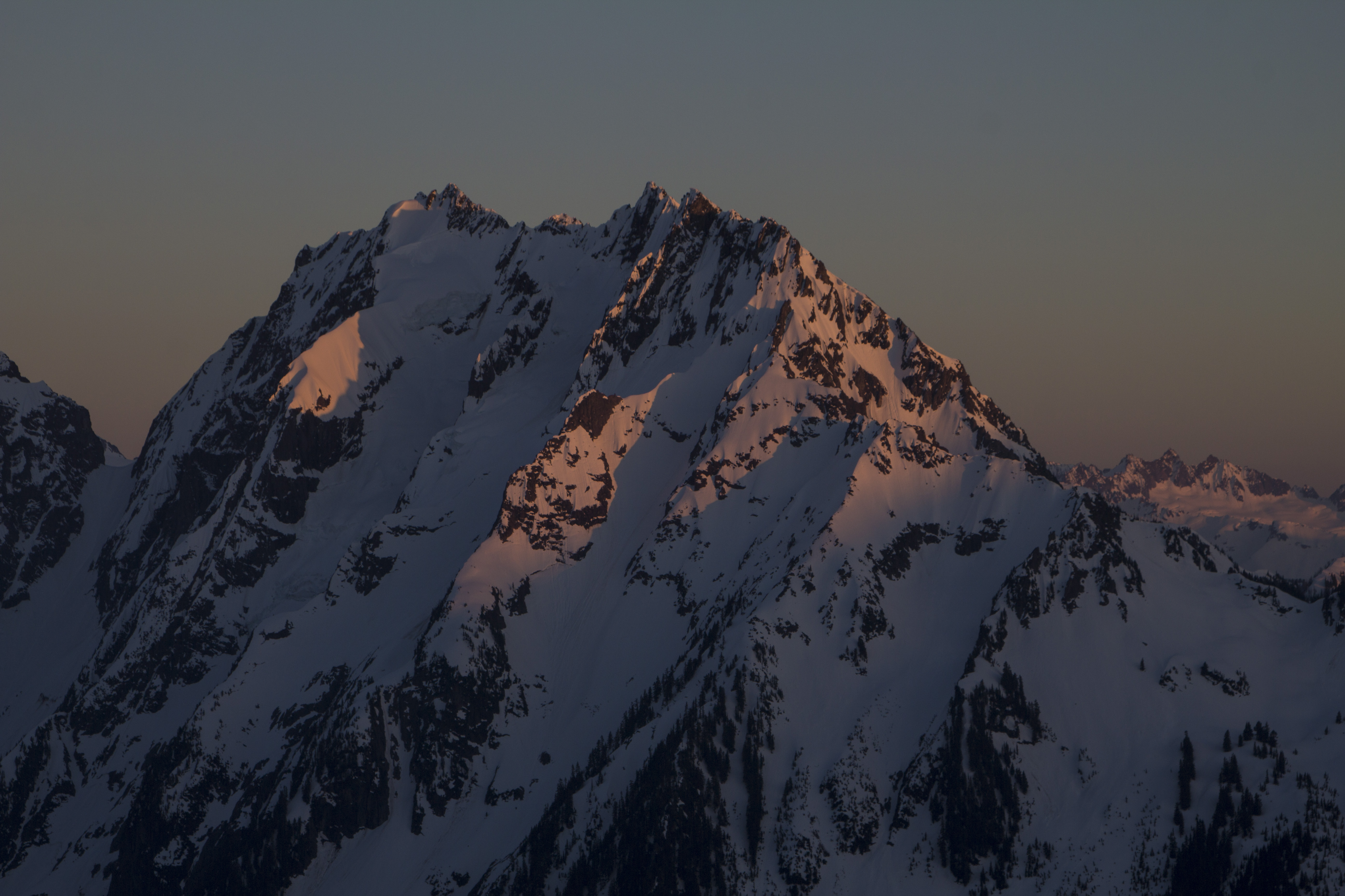
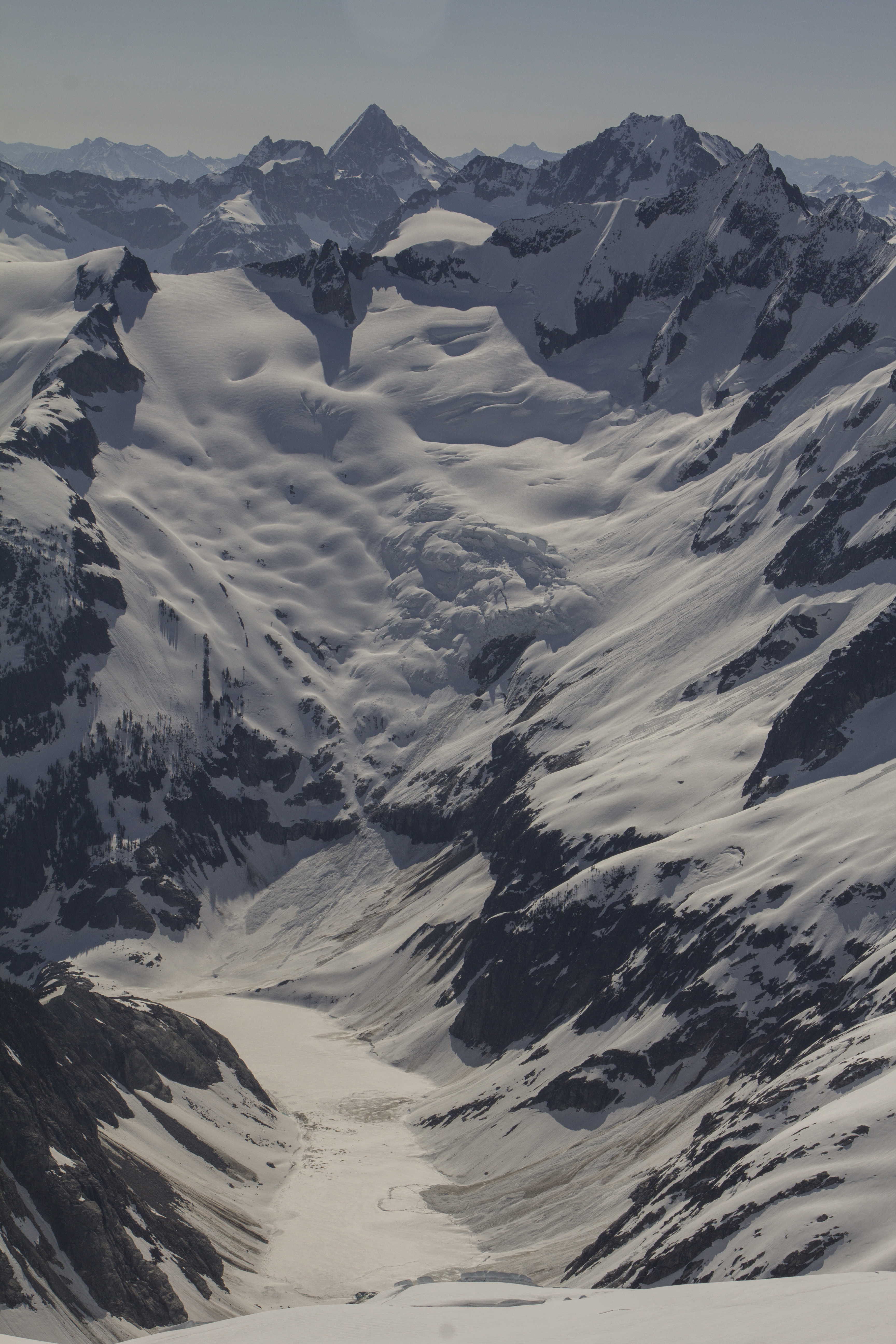
Sailing northward, we cast ourselves into the confines of the Wrangel Narrows; a channel so skinny, even a river of equal size would not be considered large. We are very close to each shore, 200 feet maybe. Just south of Petersburg, I spy tiny homes built upon the beach head, with fishing boats parked out front and an array of solar panels of to one side, as to face the midday sun. These dwellings, this place, this… situation, is how I want to live again.  We pass by immense Sitka Spruce, some of which have Bald Eagles perched atop. Petersburg is a stunningly gorgeous place. I have seen it in print more than once of it being called “Little Norway”.  I see this.  Earlier, we were delayed by the passing of a tugboat pulling a monstrous load, and as such, we fell behind schedule; as a result, the planned hour layover has been reduced to a half hour.  I decline to go ashore and decide to stay and write. Twenty air miles west of here is the B.C. border, and sports the northern Coast Ranges’ biggest peaks, including the fabled Devil’s Thumb, a fantastic spire of granite, with no easy route to it’s summit, sticking from the Baird Icecap.  If it were not for the impending storm, a glimpse of it may be had just north of here, but it is not to be, as is often the case in The North.  Instead, the following morning, cold and clear, the Mendenhall Glacier at Juneau appears, a stoic reminder that all water, frozen or otherwise will always flow toward the sea. Further north, the jagged spires of the peaks jutting from the Juneau Icefield satisfy my need to see ice. The snow line is very low, and it occurs to me that I am arriving in the early season. Yesterday, it snowed in Whitehorse; pedaling over White Pass may be challenging and bitter. Moving northward yet further, massive peaks appear bearing vertical expanses of granite with hanging glaciers flanking their sides. This is the start of the Lynn Canal and the back side of the Glacier Bay area. Across the bow, miles ahead, a valley glacier reveals itself, flowing from massive peaks. This one’s a keeper; it looks to be a few miles wide and many miles long. This latitude and proximity to the North Pacific make for some of the largest glaciers in the Northern Western Hemisphere. Only the mighty St Elias has larger; yet, ultimately, these peaks before me now, are actually connected to the St Elias, and are merely a few miles away. With every turn of the ship, I am blown away by another massive set of peaks, and more rivers of glaciated ice. I am in awe…

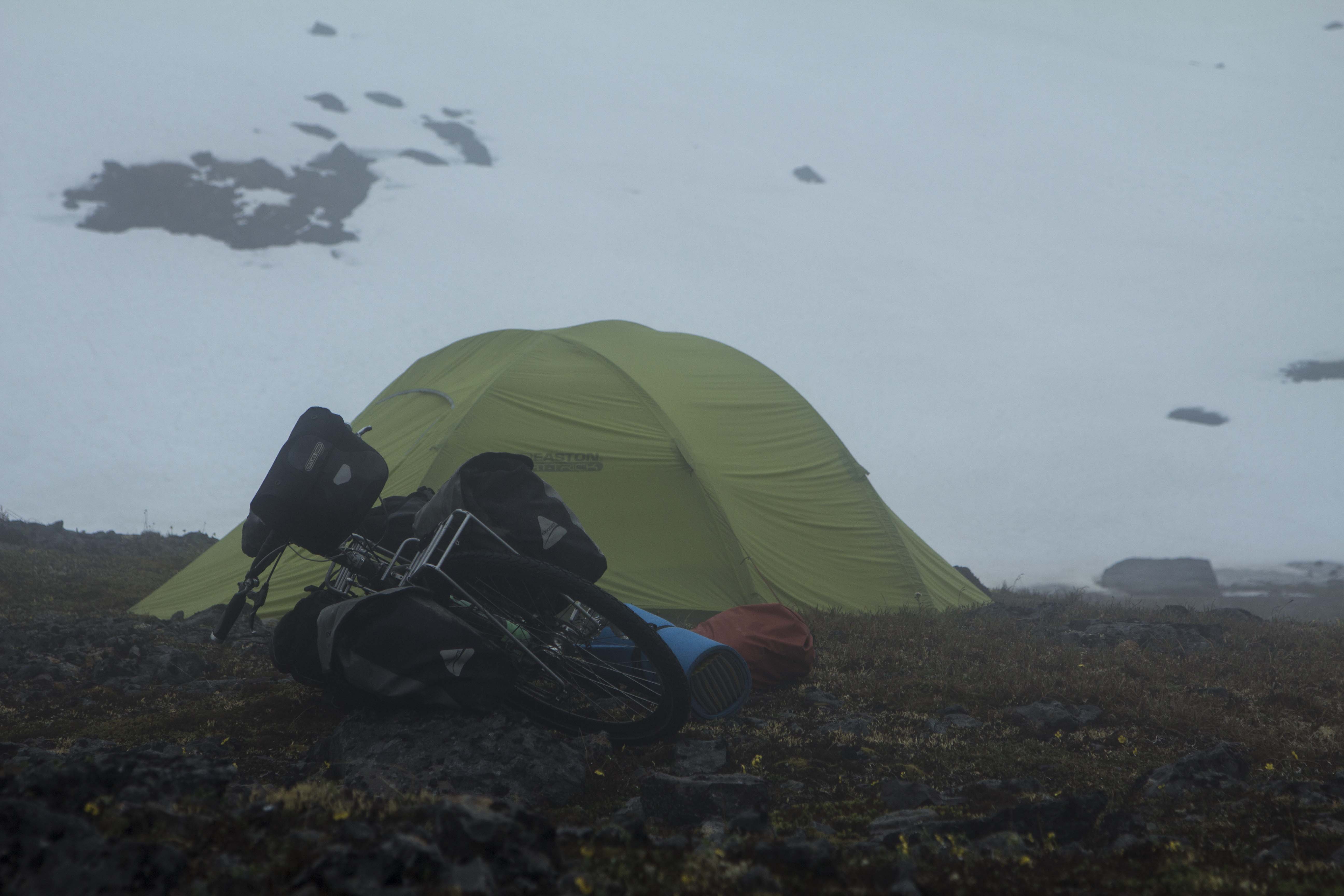
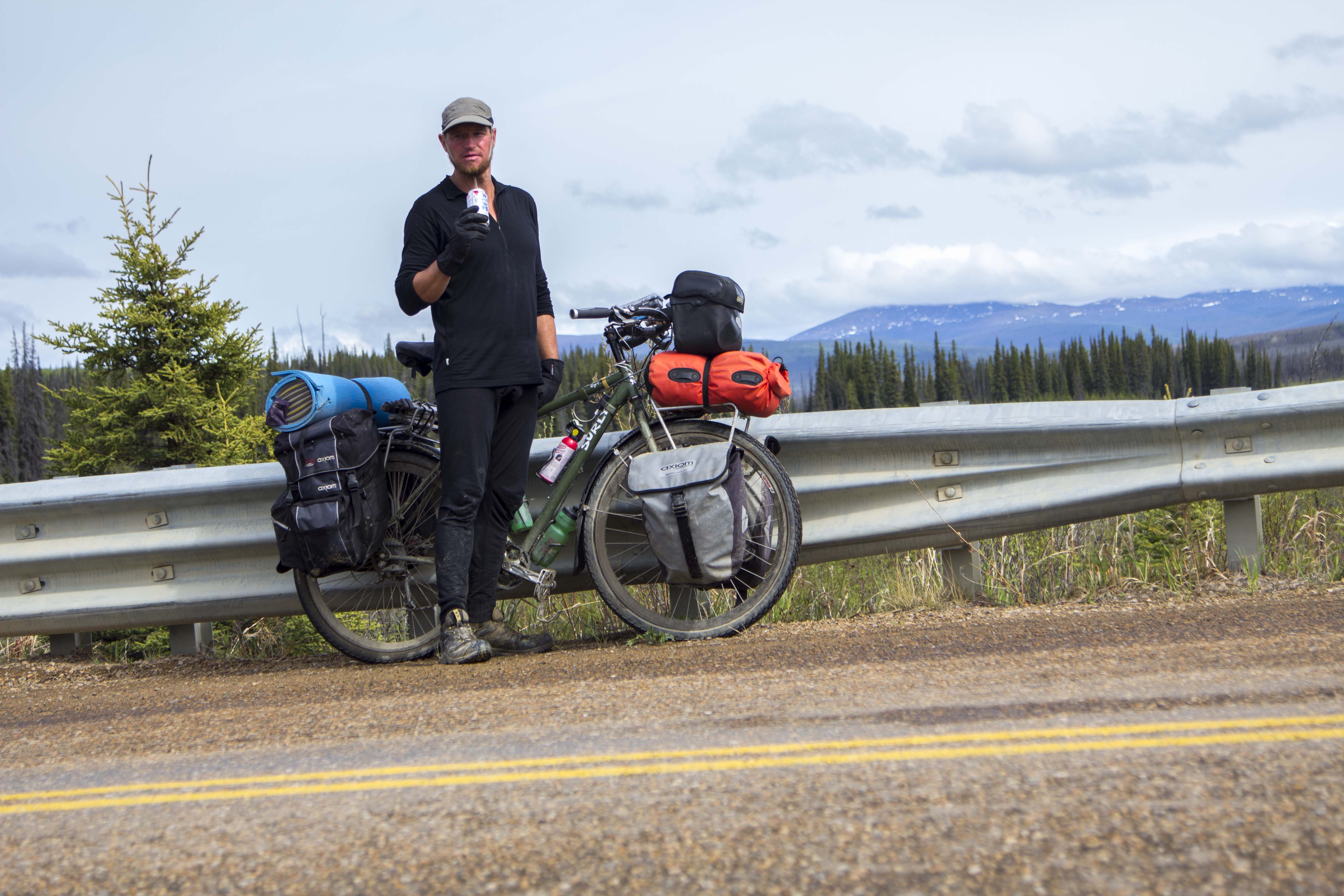
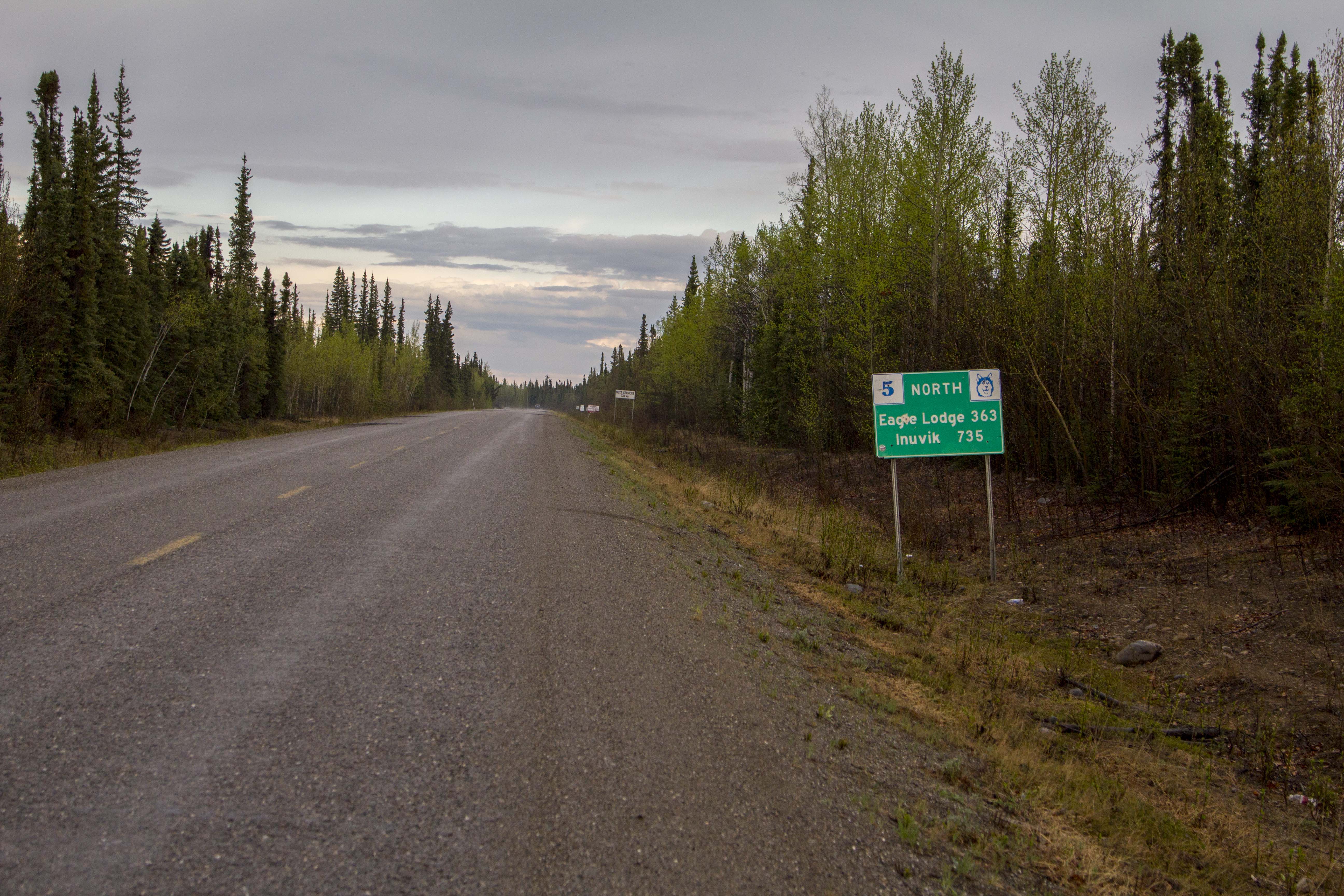
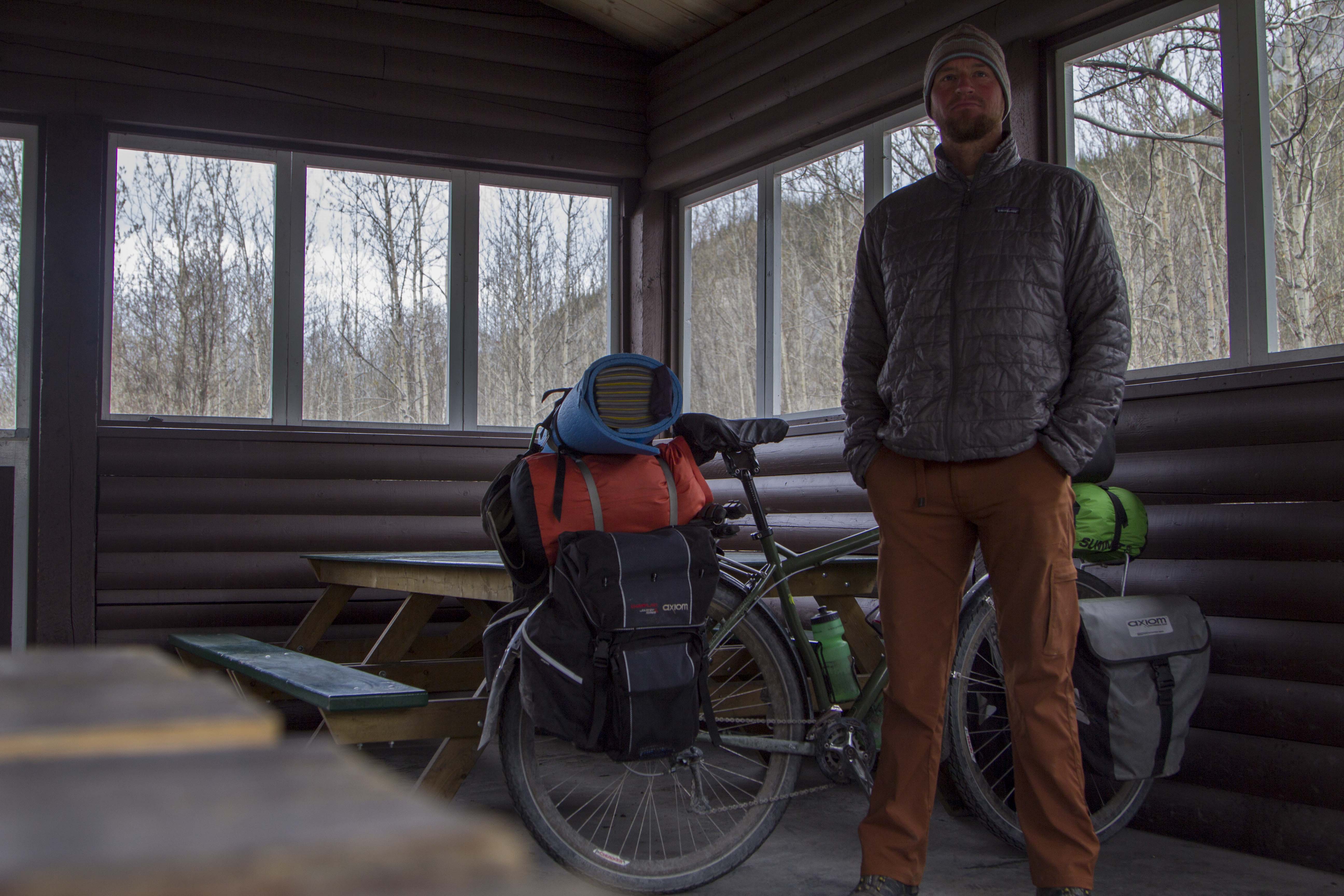
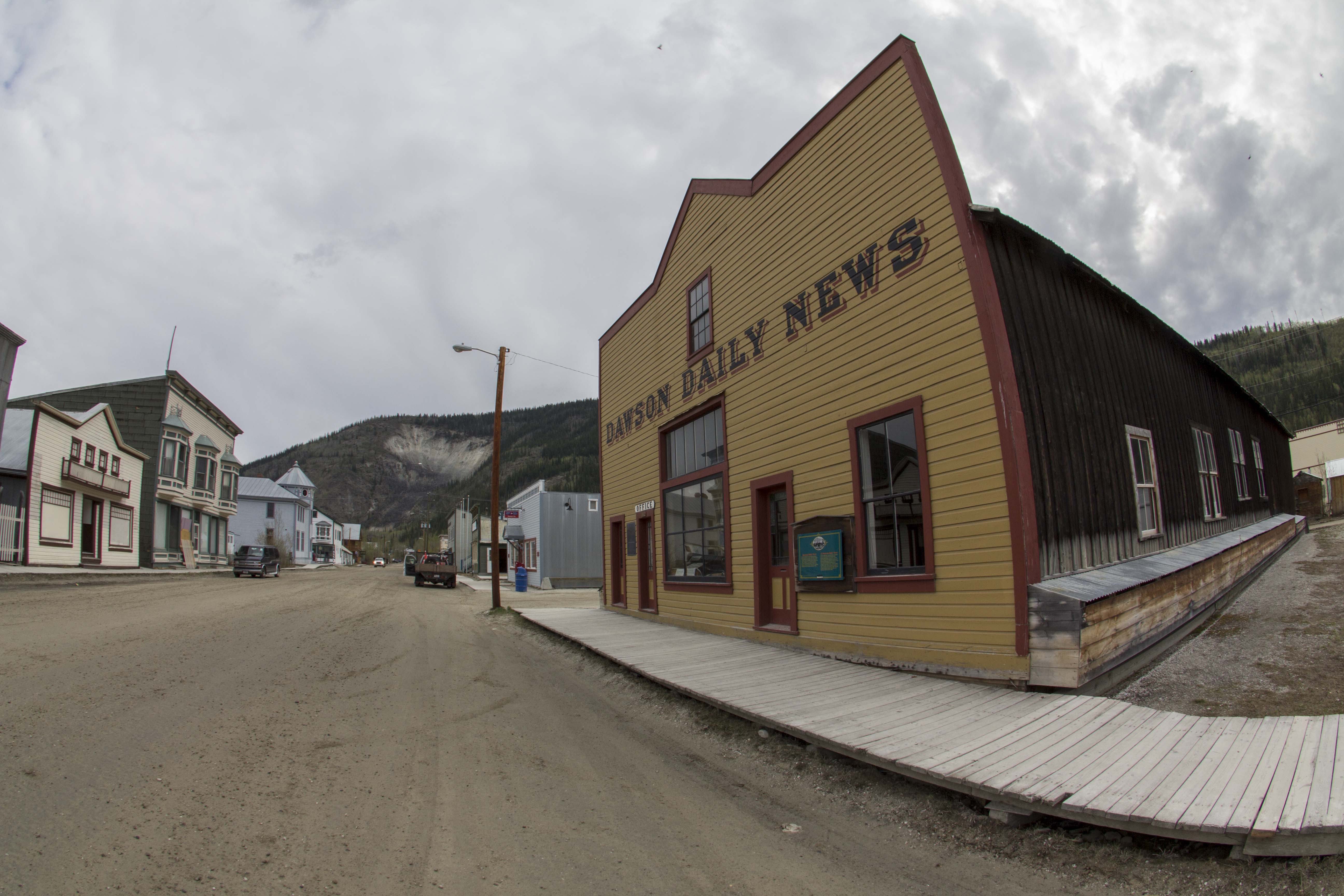
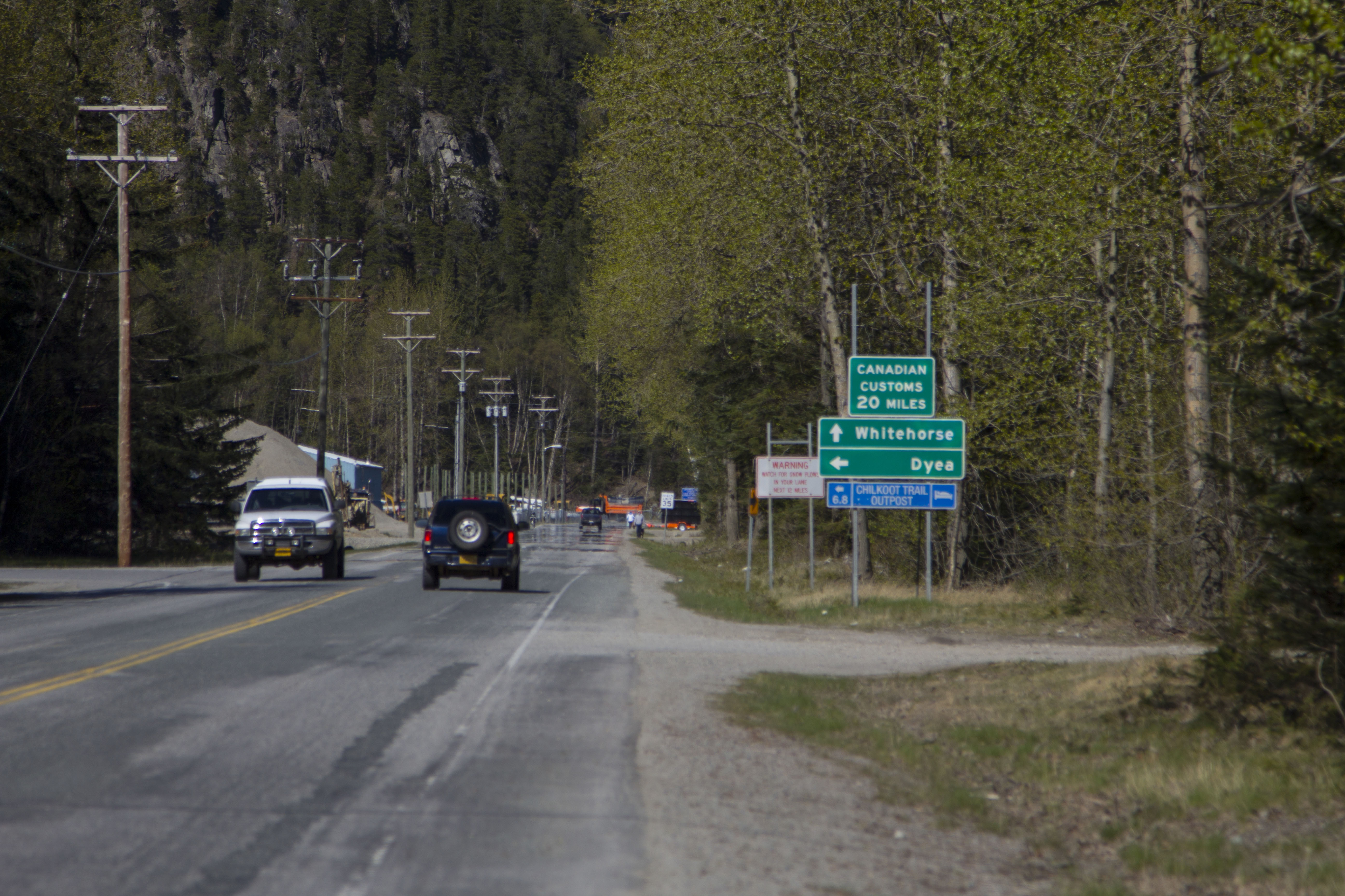
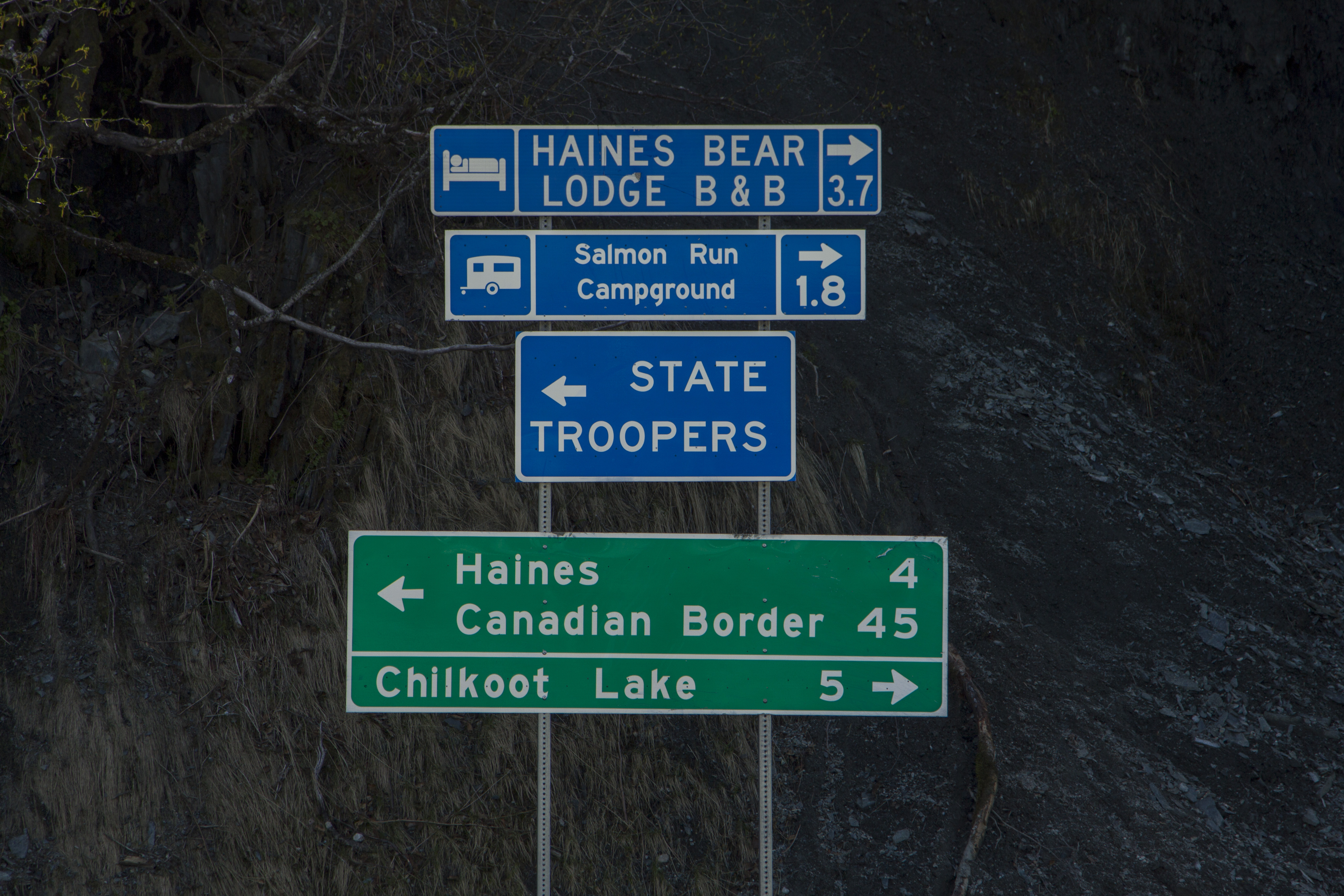
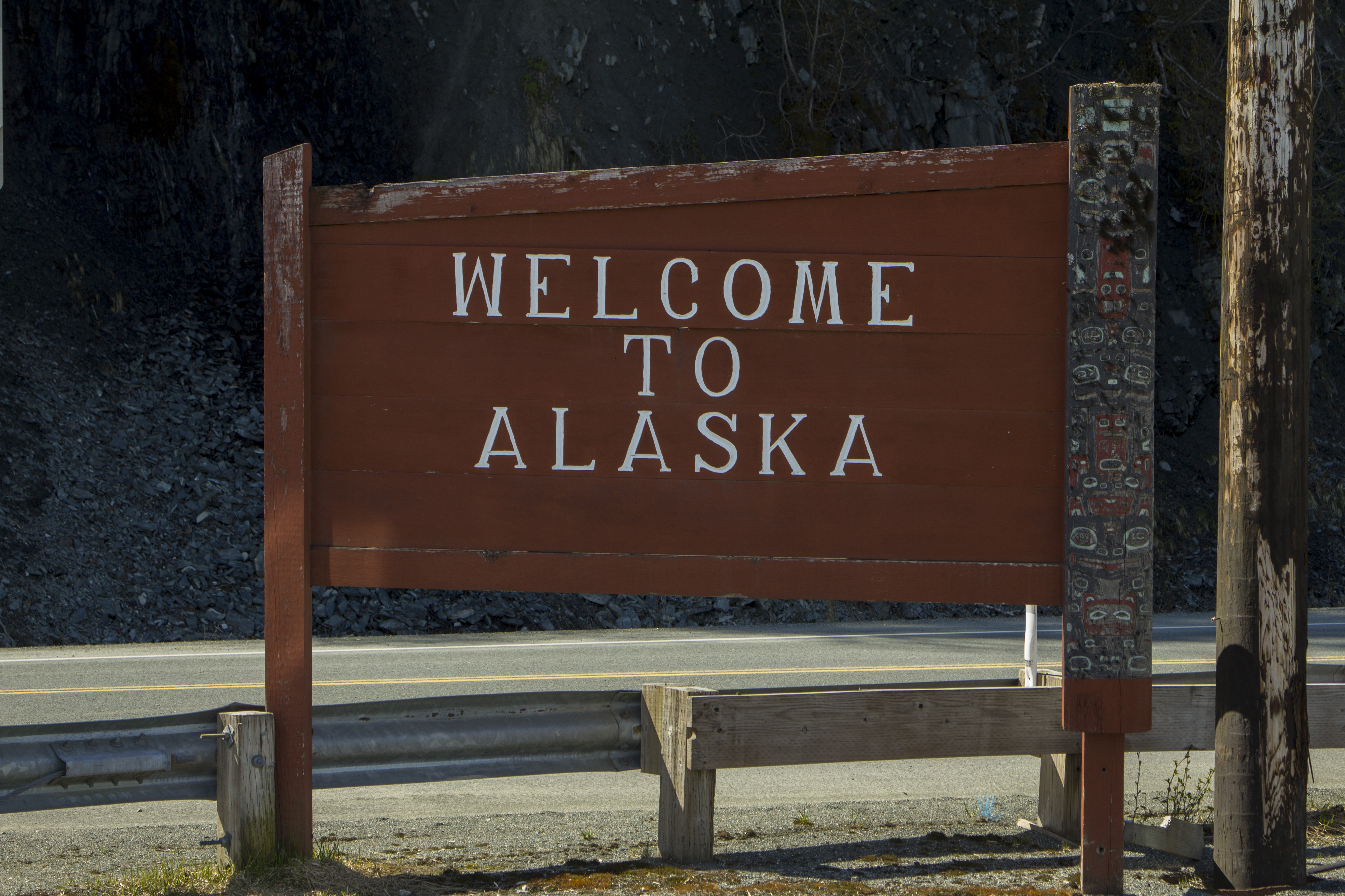
In a couple of hours we will be in Haines, a town that I could live in I think.  We will then sail to port in Skagway, hopefully by mid afternoon.  I believe I have all that I need, minus beer, so spending time in Skagway will have to be of some other journey, as I think I might just pedal off this ship, heading North, and not look back.

 Haines Area_1 Lynn Canal Area Lynn Canal Area_1 Lynn Canal Area_2 Haines Area M_V Columbia_9 Mendenhall Glacier and Juneua Juneau Icefields Area Juneau Icefields Area_1 Juneau Icefields Area_2 Petersburg III Petersburg II Petersburg IV M_V Columbia_31 M_V Columbia_3 Forest of the Wrangel Narrows Tiny Houses near Petersburg M_V Columbia_25 M_V Columbia_26 Petersburg Ketchikan Water Pigs Ketchikan Loading Docks M_V Columbia_14 M_V Columbia_21 M_V Columbia_22 M_V Columbia_16 M_V Columbia_17 M_V Columbia_18 M_V Columbia_19 Boat Station 1 M_V Columbia_11 M_V Columbia_1 M_V Columbia_12 M_V Columbia_13 M_V Columbia_15

San Juan Island

After spending the morning in Anacortes at a coffee shop, writing and sorting photos, I managed to catch the 2:40 pm ferry to San Juan Island.

IMG_8671
Friday Harbor

Friday Harbor is a small community situated on the east side of the island, and reminds me a little of Homer, AK. It is part fishing village, part tourist destination, part normal town, yet seems to have a for-real alternative feel to it, and that pleases me.

I’m here to visit my old friend Ben, whom I knew from Utah over the years.  Ben works as a local carpenter and lives a simplistic lifestyle, in the woods, and off the grid. His current living situation involves a wall tent erected on a framed, wooden platform with his solar panels mounted to the tent’s roof; primarily for lights and refrigeration.

I call Ben after getting off the ferry, and in minutes he whips around the corner in his pickup and we head to his workplace to look at some re-claimable lumber. The next morning, Ben convinces me to accompany him to the yoga class he frequents in town.  It has been a long while since my body has experienced this type of movement and it was difficult for me, yet enjoyable. My Angela (Aote) also teaches and guides, among other things, yoga as well, and going to this class in Friday Harbor reminds me of, and makes me yearn for Angela’s instruction. I am certain she would like it here on “the Island”.

Later, after breakfast, we go back to Ben’s workplace and load his flatbed trailer with said re-claimed lumber.  Then it starts to rain, Washington style, and he shows me around a bit.  Later, at his place, we sip tea and discuss topics ranging from solar energy to bike trips in Alaska. Back in the 90’s, Ben rode his bicycle from Moab to Fairbanks and back. It was a journey of over 6000 miles

Monday morning, Ben heads to his work and I to mine.. I head up north to Roche Harbor and then down the spectacular west coast of the island, for excellent views of Vancouver Island and Haro Strait.  Today I will catch the ferry back to the mainland and catch up with Dennis and Pat to do some fishing and get ready for Alaska..

IMG_8615
The Massive Mt Baker
IMG_8622
This is Ben!
IMG_8592
The awesome camp in Anacortes

IMG_8665 IMG_8663 IMG_8662 IMG_8660 IMG_8655 IMG_8652 IMG_8646 IMG_8638 IMG_8632 IMG_8629 IMG_8627 IMG_8626 IMG_8623 IMG_8620 IMG_8619 IMG_8613 IMG_8611 IMG_8610

← Back

Thank you for your response. ✨

Eldorado Peak

The day has finally come; obligations, chores, work and goodbyes taken care of, I head out of town and on to Martinez to fetch my friend Dennis. Hook up onto Highway 101 and wind up the coast to Crescent City and up a beauty of a road to Grant’s Pass. Up I-5 through Seattle and on to Bellingham to re group at Pat’s house. A couple of beers and an Avocado Tostada, put Dennis and I back on the road that night to the Eldorado Peak trailhead.

A crack of 8 start, an obligatory log crossing to get started, puts us on the undeveloped climber’s trail leading directly upward and into the bowels of the North Cascades. The route we have chosen, the East Ridge of Eldorado Peak, rises 6800 feet from the road. We are heading to the ridge separating the 2 lower basins beneath the Eldorado Glacier. This ridge is situated at about 6,000′, which makes our approach 4000′ in about a mile. That’s damn steep.

The approach was steep indeed; an undeveloped climber’s trail without switch backs, heading nearly straight up for 2000′, ending at the dreaded “Boulder Field”. Luckily for us, it was mostly melted out at the start, but higher, a post holing episode of monstrous proportions ensued. We post hole in deep snow for hours.

That evening at our bivy, the sky is clear as a bell, and the magnificent alpenglow become the stuff of fantasy. A 360 degree view of all the high peaks of the North Cascades are a dizzying notion to my mind. I want to climb them all. To me, there is nothing finer than being  in big, alpine, glaciated peaks.

A 5:00 am start see’s us descending slightly to the level of the Eldorado Glacier, then up said mass to it’s junction with the Inspiration Glacier, to form the largest continuous ice sheet not on a volcano in the lower 48. These peaks are fault block, glaciated, and made of Granite. This combo makes for my favorite kind of mountains.

Eventually, we climb up the last bit of it’s knife edged ridge, and on to Eldorado’s Icy summit; at just under 8,900′, we are just about as high as Carson Pass in California, but here, in the Cascades, this elevation and latitude and close proximity to the ocean, create an alpine environment that is unparalleled. The glaciers here are sizable indeed.

We descend the 6800 feet in a few short hours, that, over the last bit, had taken us 13 hours to ascend. Back at the truck by 5:00 pm, we head off to Pat’s for the evening. In the spirit of keeping the adventure alive, we experience a tire blowout on the drive out. A quick roadside fix and we are at Pat’s in Bellingham by 6:30.

Tomorrow I head out to San Juan Island to visit with my old friend Ben; then off to catch the ferry to Skagway and start pedaling to the Arctic…  Onward.

IMG_8487
Mt Johannesburg
IMG_8526
Eldorado Peak

Tomorrow I head out to San Juan Island to visit with my old friend Ben; then off to catch the ferry to Skagway and start pedaling to the Arctic…  Onward.IMG_8412 IMG_8414 IMG_8418 IMG_8421 copy IMG_8422 IMG_8424 IMG_8427 IMG_8433 IMG_8442 IMG_8456 IMG_8463 IMG_8471 IMG_8476 IMG_8488 IMG_8489 IMG_8501 IMG_8521 IMG_8522 IMG_8532 IMG_8537 IMG_8565 IMG_8570 IMG_8578 IMG_8582 IMG_8584

IMG_8586

← Back

Thank you for your response. ✨

A Great Appreciation

In 5 short days, I will be headed north to Washington state, where, with my old friend Dennis, we will do some mountaineering in the North Cascades to the east of Bellingham. Afterwards, a visit to another old friend on San Juan Island to catch up, and then off to board a Marine Vessel to the Great White North. Good times abound..

All of these upcoming Adventures are the result of hard work and perseverance over these past many months; it’s payoff time.

However, there is another factor that needs to be recognized in the throes of the months of preparation for said adventures, and that is the one of gratitude of the generosity and helpfulness of those around me who have been ever enduringly supportive of my serious need for stomping around in the wilderness. Life is always an exchange of give and take; this is no exception. I have given my hand, my family and friends have given theirs. And for this I thank you all. Listing all the names seems pointless as all those around me have been so supportive, some more than others, and you all know who you are. Thank You all very much!

Eldorado Peak
Eldorado Peak