Living in Haines for the past six years has given me great thirst for the remote and mysterious Takshanuk and Alsek Ranges on the SE fringes of the St Elias mountains. This is an area of smaller peaks and moderately sized glaciers that give way to the monster peaks and glaciation of the the bigger icefields to the west all the way to the remote outer coast at the Gulf of Alaska. The areas between the Kelsall Valley to the east and the St Elias Range to the west are riddled with remote valleys, seldom seen rivers, and rarely climbed or even seen peaks. It is an extremely convoluted area that sparks my imagination and love for this magnificent landscape. One of the easier to access areas that involves a variety of travel on both land, glacier, and river is the Samuel Glacier region that gives birth to the short but spectacular Parton River. Access via the Chuck Creek trail is straightforward, scenic, and enjoyable.
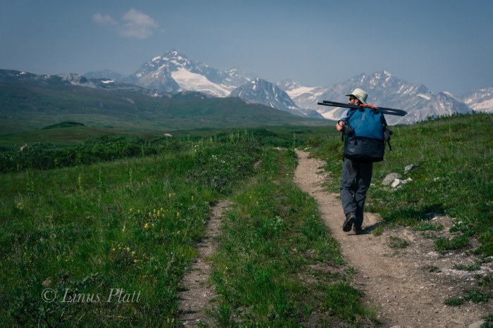
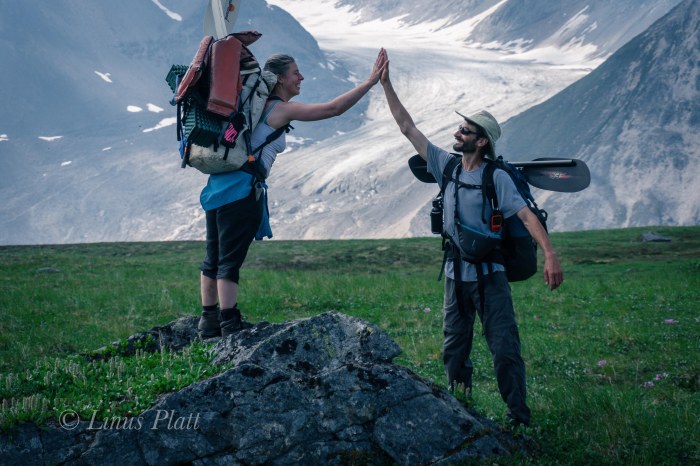
On July 5th 2019, Angela, Tully, and myself set out on foot armed with hiking, camping, and packrafting gear to explore this area with the intention of camping in the glaciated upper valleys of the Parton River and packrafting back to the truck at Horse Camp on the Tatshenshini River the following day.
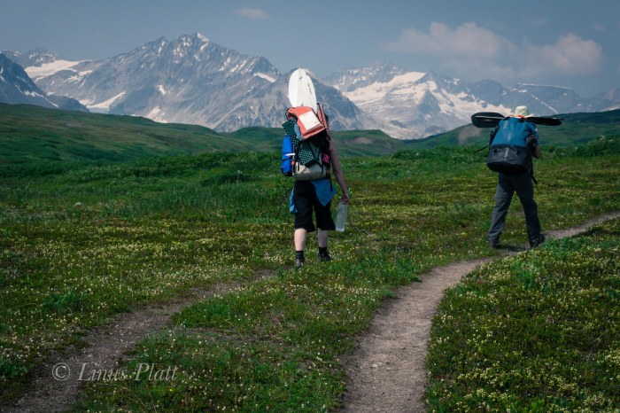
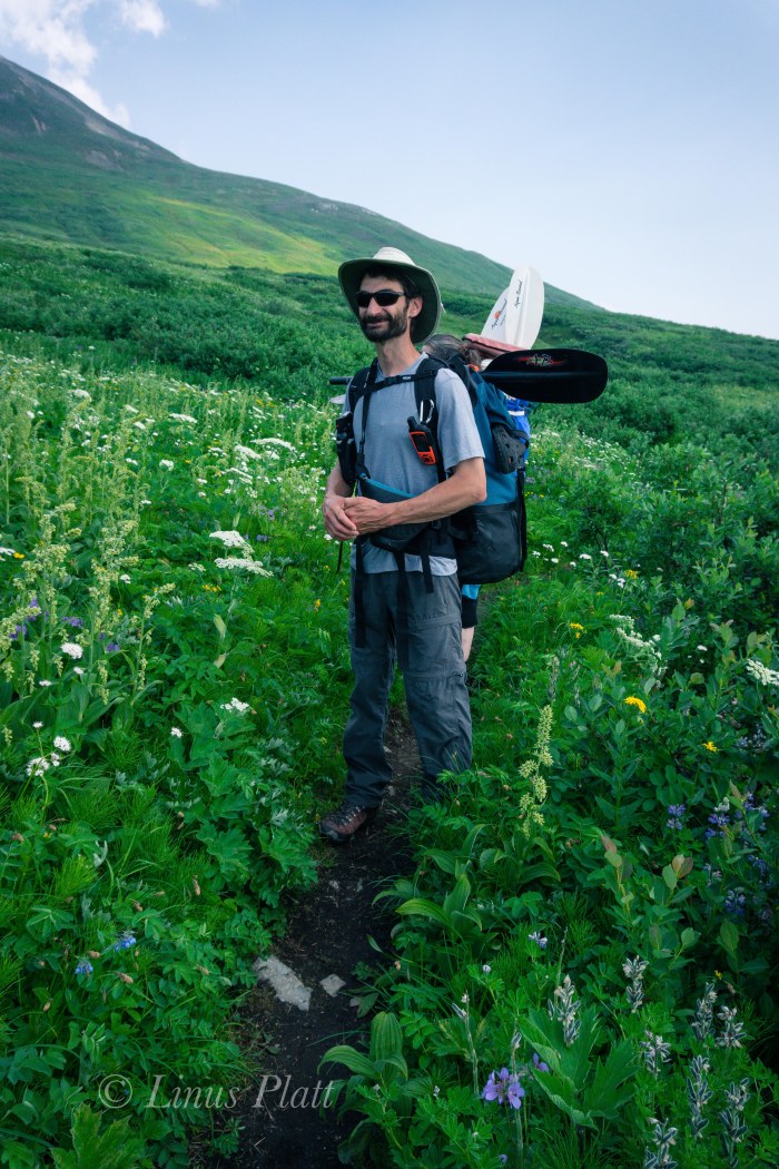
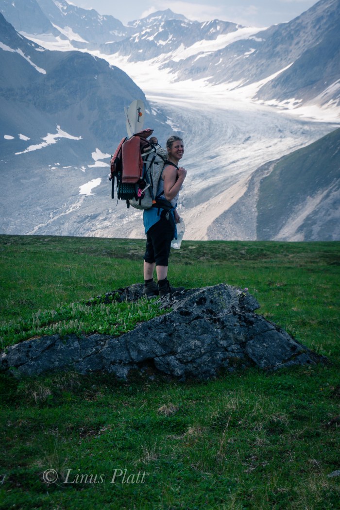
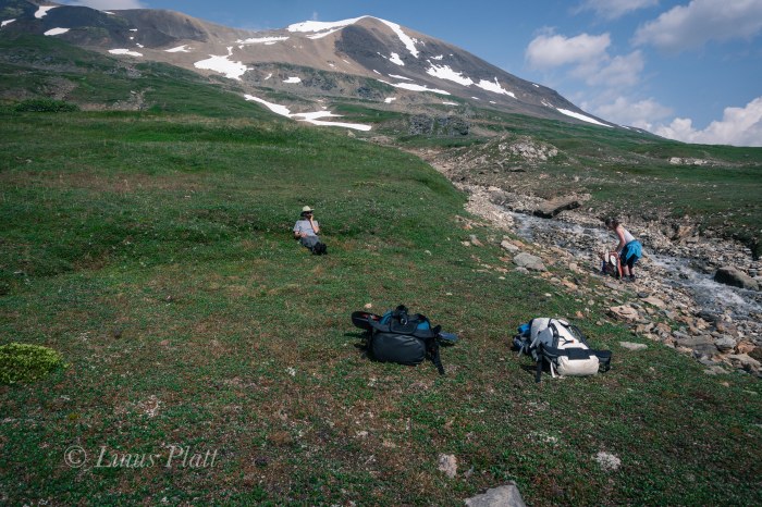
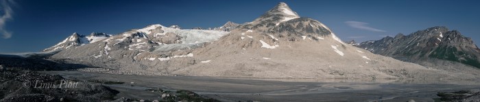
Immediately after leaving the trailhead, the bugs and heat are overwhelming; it is downright hot and the Black Flies and Horse Flies are swarming in droves around our sweaty bodies. But the landscape is dreamy and the smoke from the forest fires further north seem to be clearing somewhat. The wildflowers are blooming in full force and the stream crossings managable. We see a few people along the trail, but for the most part, it is quiet. After about 5 miles, the trail dissipates and cross country travel on the tundra leads to an overlook into the headwaters of the O’Connor River and the southern arm of the Samuel Glacier. It is here we must turn north and travel high tundra benches to gain the central arm oif the Samuel Glacier, cross over its flanks, and drop into the upper Parton River region, where, after 13 miles of travel, we find a spectacular camp along the shores of a great glacial tarn with close views of flowing glaciers and jagged peaks.
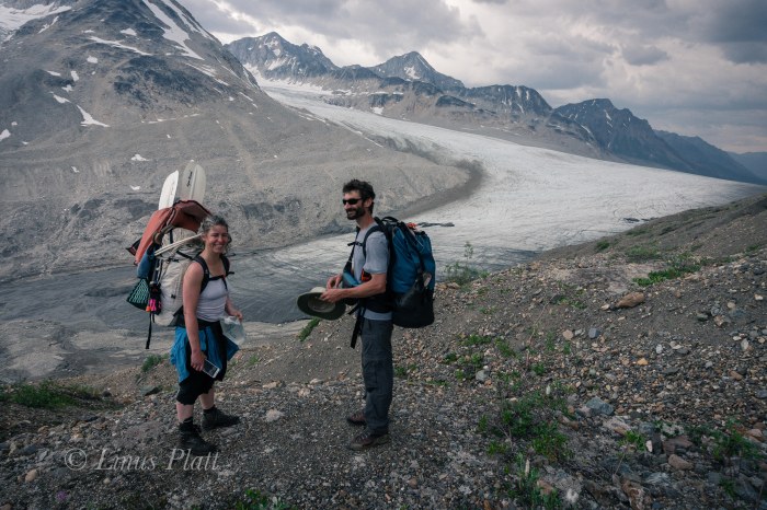
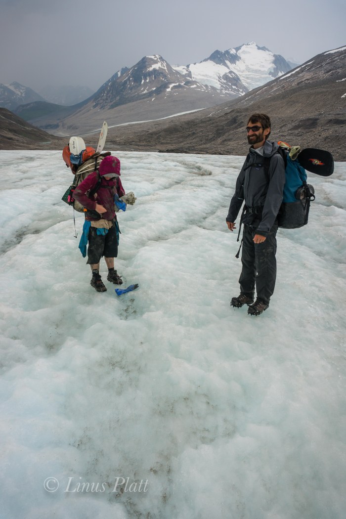
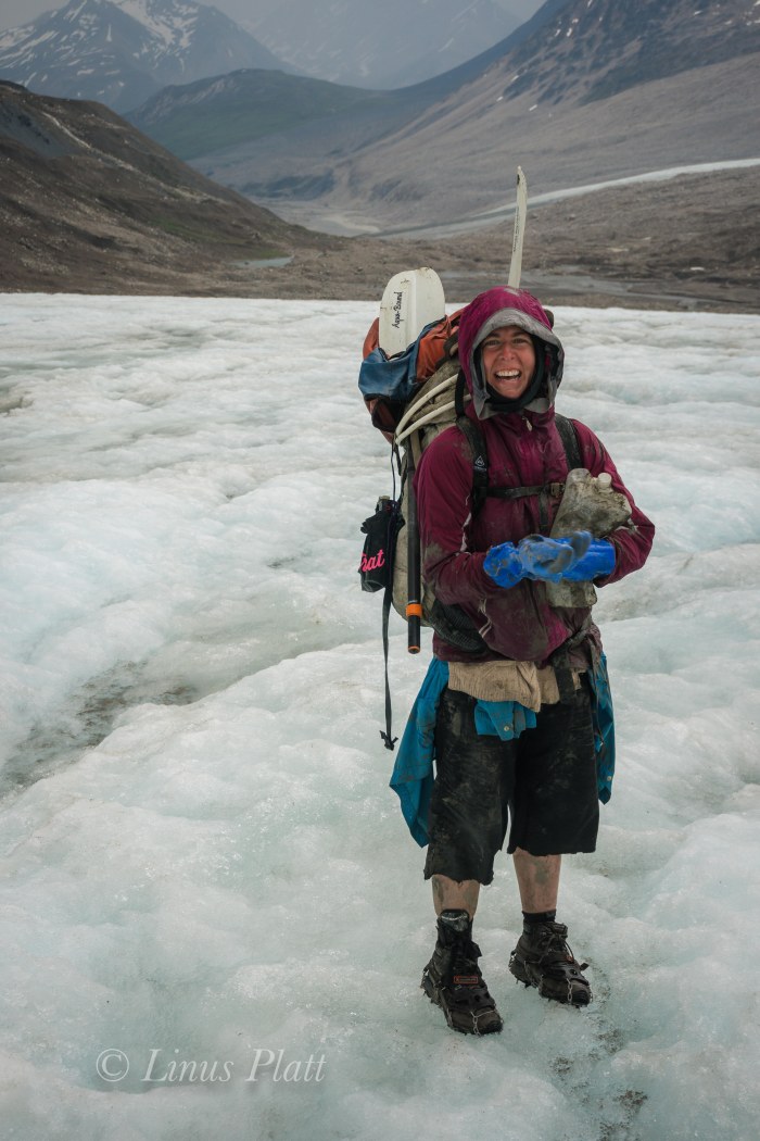
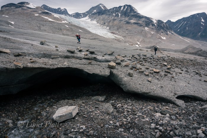
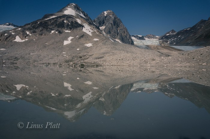
Before we reach the glacier however, a 500 foot slope of steep and loose glacial moraine must be descended to the ice; it is a bit dicey, but soon Tully and I are at glaciers edge. Angela is still about half way through the ordeal when a thunder shower of epic proportions descends upon our weary and unprepared selves. The weather forcast called for no rain, and since it was a short trip, I opted to leave rain gear behind, and soon, the torrent has us totally soaked and doesn’t seem to be stopping; Tully and I huddle under the lip of the ice in hopes of staying drier, but it is futile. Angela emerges from the mist a soaked and muddy mess and the rain continues to thrash us. The possibility of hypothermia is very real and I’m getting genuinely concerned. Suddenly the drops become somewhat lesser, so we shoulder our packs, hop onto the ice, and start hoofing it. The rain stops completely and soon we are dry and happy and admiring the notion of crossing this sizeable glacier at it’s toe in July in running shoes. There are no crevasses to speak of so it is a safe passage all the way to the headwaters were were set up camp next to a large granite boulder. We see another party camped about a mile down valley and want to give everyone space, so we call this lovely spot home for the evening. The weather is grand once again, and I even sleep outside under the northern sky where I can eyeball the peaks and glaciers of this incredible and spiritual place. I would have to say it it is one of the finest camp sites of my life. The blue of the ice and the starkness of the granite are mezmerizing to me.
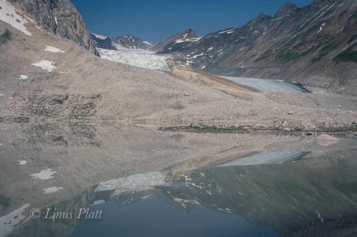
Morning time is coffee time and sitting on the shores of this glass smooth glacial tarn is spent talking and joking about nearly getting into a bad situation in the previous afternoon’s thunder shower. We sip our cold coffee (we did not bring a stove) and look about this incredible little valley with it’s six glaciers, numerous peaks, and two lakes. I vow to back here and climb at least one of these glaciated granite peaks. We pack up and head down valley, where we are greeted by the party ahead; turns out it is Dan Humphreys, Gina St Clair, and several others from Haines. They are not here to packraft, but to hike up the valley above and cross over the mountains by way of West Nadahini Creek back to the Haines Highway in a 4 day through hike.
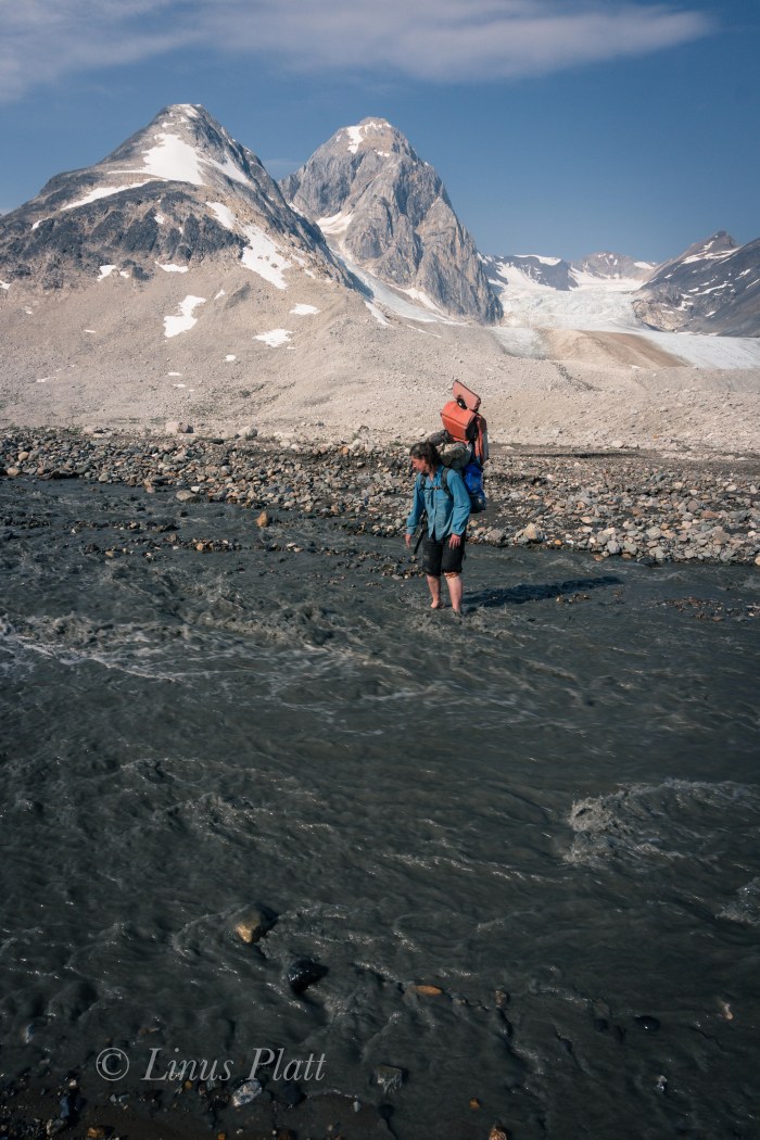
After scouting out the upper Parton where it leaves this tarn, we descend slightly and make a dicey river crossing on foot, where we then walk the troubling looking class IV territory as the tumbling torrent finagles it’s way through the terminal moraine of a long gone ancient glacier. perhaps 2 or 3 miles down river from Dan and Gina’s camp, we find a good spot to stop and inflate the boats. Up ahead, there is some fun looking terrain consisting of some class II rollers. We roll through only to find several miles of flat, unintersting terrain riddled with bouts of butt dragging and boat hauling through shallow braided channels. I am becoming frustrated with the lack of actual paddling and the Horse Flies are increasing their intensity. I’m feeling ornery, but the thin braids finally give way to a single channel deep enough for real paddling. The river however is flat in dull… up ahead, we can see the river entering the canyon and losing altitude. The roar of the rapids ahead has us thinking. We pull over to grab some lunch and watch as a large Bull Moose crosses the channel and thrashes about with the irritating Horse Flies. Soon he is gone and so are we, paddling almost immediately into enjoyable class II/III waves and rollers. This is what we came for! This river is steep, and the intensity does not let up nor are there many places to eddy out. It becomes more and more intense and it occurs to me that during this record heat and afternoon thunder storms, the river is much bigger than “normal”. This torrent is really pushing hard. The river is running so strong and fast, there are very few boulders sticking out of the water; instead it becomes a twisting set of massive hydraulics, deep holes, and monster waves with substantial consequences at every hit. I had been told this river maxes out at about class III, but it definetely feels more like class IV to me. This is BIG water today.
Finally, and eddy appears and I pull off while Tully and Angela appear coming around upstream; they are wild eyed and some concerns about the river ahead are voiced. The roar of the rapids is defeaning. We must continue on… a quick thumbs up and the battle through the hydraulics begins again. One giant wave sends me into a big hole with a boulder sticking out of it; invisible from above. I nearly flip the boat but manage to swing it around. Things are getting hairy to say the least. I pull off again just slightly and let Angela and Tully pass and give them both some room figuring I’ll pull up the rear. Back into it, it is becoming more and more intense and soon it commands ALL attention. Catching air off of giant hydraulics increases my speed substantially and soon I am within sight of two empty boats ahead of me with both Angela and Tully swimming for their lives. There is nothing I can do for either of them and keep paddling another half mile where it mellows to class II and and eddy appears on river right. I get my boat to shore and out of the corner of my eye I see Tully’s boat coming right at me. I lunge for it and touch it, but but am knocked off my feet. After barely making it onto the shore once again, I see it far down stream, heading for Dry Bay and the Gulf of Alaska. I see angela’s boat next… this time in the middle off the torrent. Instinctively, I dive into the water and swim after it, and for a split second, I regret the move, but I grab hold of the boat and struggle for a quarter mile to get it to shore. Breathing as hard as I ever have in my life, I ditch the boats and begin stomping through the boreal spruce forest enroute upstream to find my companions. I spot Tully with Angela not far behind thrashing through the willow thickets up ahead. We are all together and safe, but now minus two paddles and one boat, our only option is to hike out to the highway where the truck is parked perhaps 4 or 5 long bushwhacking miles away.
Angela and Tully – a harrowing experience and a close call for them both. Angela lost only a paddle, but Tully lost everything; a packraft, a backpack full of camping gear, his phone, an expensive camera, etc. We begin the arduous bushwhack to the road via Bear trails next the river bank and keep an eye out for Tully’s boat, hoping it might have snagged itself on a strainer or somehow managed to eddy out. Exhaustion is taking its toll on all of us, but we continue on, shouting out every 30 seconds or so “Hey Bear!” in an attempt not to startle one. After a couple of miles, the river turns NW and flattens out, sending water into several shallow braids that makes for traveling in-water feasable; I find it easier to simply wade through the shallower braids of the river than to attempt to navigate the heainous willow thickets shore-wise. Tully and Angela are back behind me a ways, so they do not see what I see down river just yet. Its Tully’s boat, backpack and all, hung up on a shallow gravel bar. I swim toward it and rescue it as fast as I can in fear of it somehow sprouting fins and swimming away from me. It is full of water and is going nowhere. After getting it to shore, I see the others up river.
Somehow, I had it in my head that the truck was parked just past the confluence with the Tatashenshini River, so when we arrived at the Tat, Angela and I swim across, while tully navigates his vessel and we continue further down stream. Tully questions my notions that the truck is down stream, and I assure him that it is. Tully’s instincts were spot on, and after another hour of thrashing, we realize that the truck is nowhere near where we are or where we are heading. We are so exhausted that each step is becoming an excercise in agony; the willow thickets becoming more and more challenging with each minute. We come back to the Tatshenshini and head north along it’s shores, seeing several Beaver along the way and swatting their tails at us each time. I pass a Moose skull and suddenly spot the truck not far off. Days later I realized from inspecting the map the err of my judgment. There is an old faint dirt road heading to the river crossing at Horse Camp and the truck, but in our exhasted state of mind, must have walked right past it. Lesson learned. Somehow, I had not completed my homework…
The drive home was a real challenge due to exhaustion, but looking back, we had one helluva fine 36 hours of real northern adventure. I totally and completely live for this stuff, and sometimes the pain and discomfort of fatigue and stress are what makes a trip more than a trip in a tense and potentially dangerous situation. Yet it is this philosophy that keeps me meandering this wilderness time after time to experience the spirit of The North and all her glorious treasures, wether it be mountaineering and alpinism, skiing, packrafting, or just simply going on a pleasant and simple day hike. It all counts and adds value to my life here. In the end, we walked almost 20 miles, paddle some 10-12 miles of river including some stuff at the boundaries of my paddling ability, endured intense heat, terrible insects, powerful thunder storms, saw wildlife and good friends, camped in one of the most spectacular places in The North, had great adventure, and lost two paddles, one hat, and a pair of cheap sunglasses.
I’ll take it…


Many thanks Chris… Looking forward to an adventure with you one day my friend!
What an intense adventure and beautifully recounted story.
Thanks so much for the kind words Adam! This part of the planet is a special place indeed and I can’t imagine living anywhere but here. I encourage you to have a look for yourself sometime… Best of luck on all of your own journey’s!
Hello, my name is Adam from ParagonTrails, and I’ve just discovered your blog! I’m honestly in awe of this location, and the scale of Samuel Glacier is insane! Alaska really has some natural treasures, and you’re so lucky to be able to explore them! I’m looking forward to more awesome posts in the future, and I’m going to check out the rest of the website. Have Fun and Happy Trails! 😀