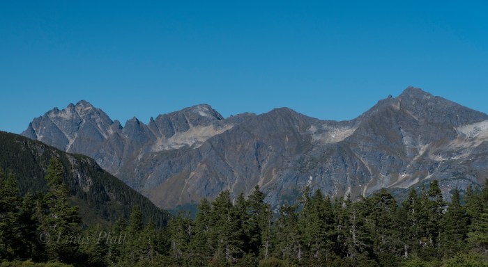
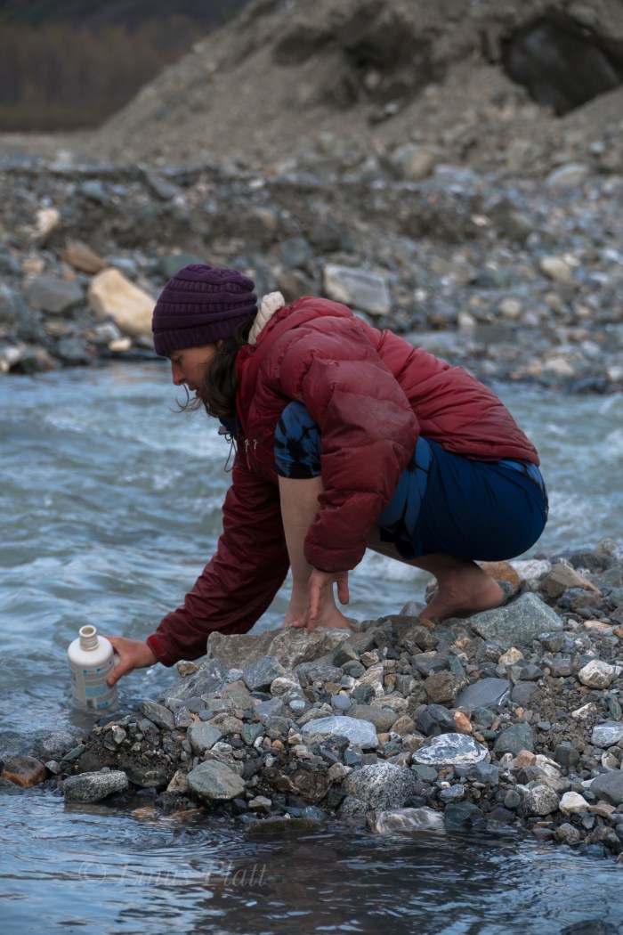
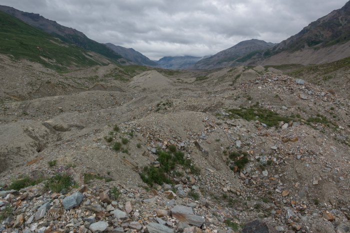
These last weeks have flown by so fast in preparation for the upcoming Over The Hill Expeditions trip to climb and ski Mt Sanford in Alaska’s Wrangell Mountains, that I barely noticed that the departure date is just next week! Gear is together, money is (well, mostly) together, and fitness, well… ahem, uh, well…
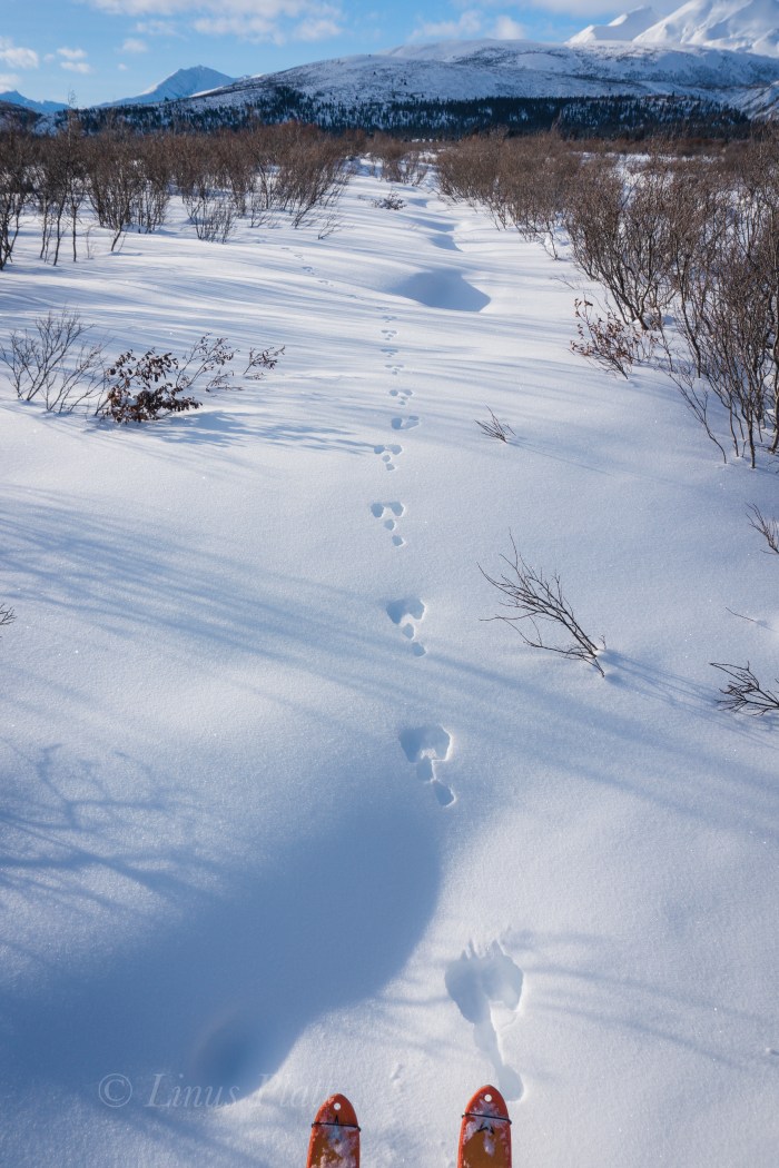
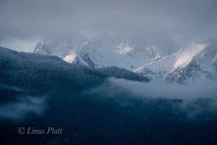
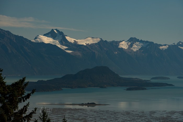
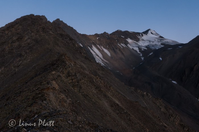
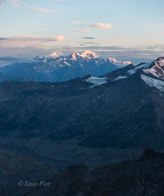
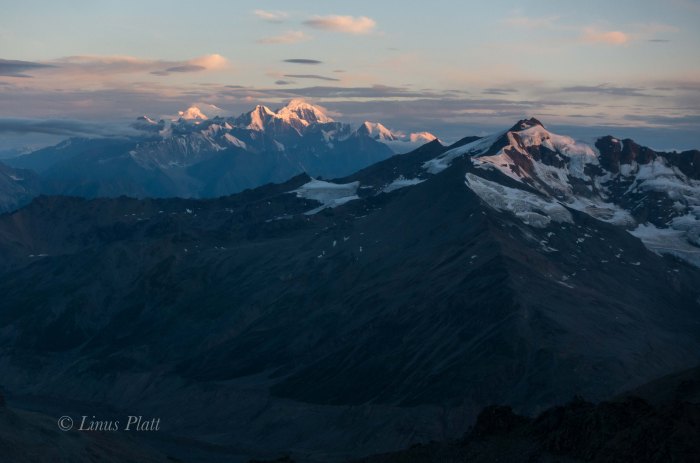
So… the last Saturday before I leave to drive up north to pick up Rich, Cam, and Jeff in Anchorage, I decide that a jaunt up Mt Ripinski is in order; Angela also wants to go, so that is even better. Ripinski is a coastal, non-glaciated peak sitting directly on the waters edge of the mighty Lynn Canal; it’s summit clearly seen from most anywhere near or in Haines. It’s summit is a 3600′ rocky point amidst small rolling hollows of tundra and outcroppings, where Mountain Goat, Wolf, and Grizzly Bear all roam.
From the end of Young Road in Haines, at an approximate elevation of 400′, the trail climbs rapidly to it’s summit 4.5 miles and 3200′ later. It is considered a local classic and the views from the summit encompass the Chilkat Range, the Lynn Canal, the Chilkat Inlet, the Chilkoot Inlet and lake, the Alaska Coast Range, Skagway, and many of the area’s surrounding glaciers. It’s the best bang for your buck view-wise around.
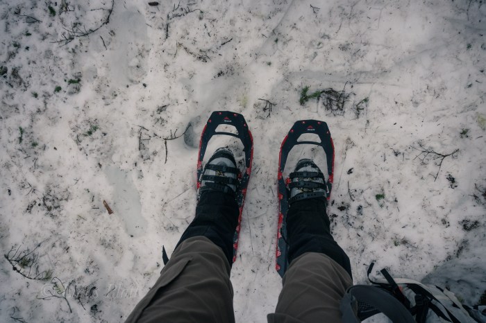
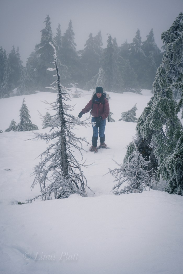
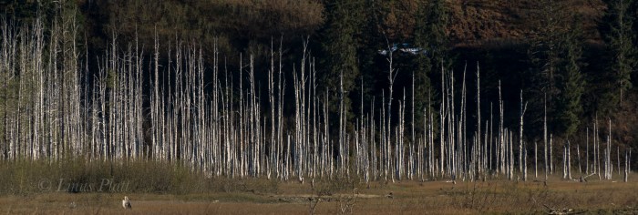
Leaving Mountain Market at about 9:30 am, we head for the trail and begin to stomp up the muddy, root infested path to snow line, where we swap running shoes for mountain boots and snowshoes. The forest is becoming increasingly engulfed in a mystical dream state of fog; the trees appear tortured from they’re entombment in rime ice; an indication of the severity of the wind coming off the Pacific waters of the icy Lynn Canal below.
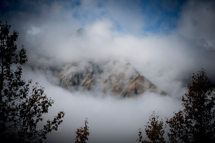
Soon we are lost and grappling with creating a zigzagging, weaving line through the struggling stunted alpine Spruce at timber-line; the snow very deep and the steepness increasing to the point I would gladly trade in my snowshoes for an ice axe and a set of ‘pons. Alas, we stumbe into the second meadow, where we lose the trail again, but finally find “The Overlook”, a place on the edge of a great chasm overlooking town when the weather is clear. Not today however, as visibility has been reduced now to about 10 meters, and the wind, now picking up velocity and numbing my fingers severely.
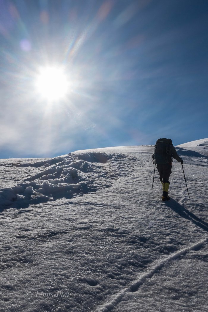
We somehow manage, after me considering bailing several times, to find the final summit climb up a spiny, rocky ridge. On top, visibility is basically zero, and the wind raging. I put the camera away and go into survival mode, donning all layers and with special attention to my hands, which now are useless chunks of lumber somehow attached to my arms. We aren’t even sure we are on the summit, so we blindly stagger further, where I slip off a steep edge of snow that is completely invisible to my eyes in this torrential whiteout. No harm done and we scramble back in the direction from which we came, ponder for a moment at the highest rocky point, and then skedaddle. The whiteout seems to be increasing, but the further we descend, the warmer my hands become, and soon we find our tracks near the overlook and enter the trees below.
Back in the forest below the snow line, I’m too tired to put my running shoes back on and finish up the stomp in my expedtion boots back to the truck. Angela looks tired, but happy, and I feel the same. Just another semi-epic day-adventure in Alaska…
Up next: Mt Sanford departure in T-Minus 7 days.
Stay tuned!
Down low below the springtime snow lineAnd so it beginsDonning boots and snowshoes
Tortured treesA silent rime forest
The final summit climbMt Ripinski from Main St downtown Haines
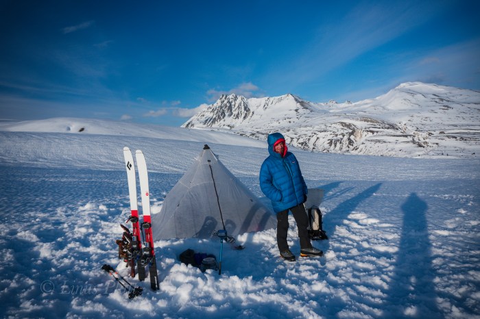
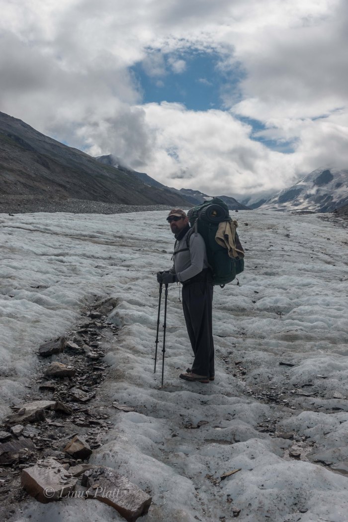
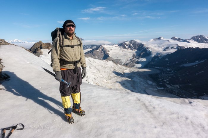
Mt Sanford practice run this weekend… 2 day ski tour out by Copper Butte… glorious views from our camp, followed by skiing some 25 degree ice and windslab in mountaineering boots and a full pack… Get some!
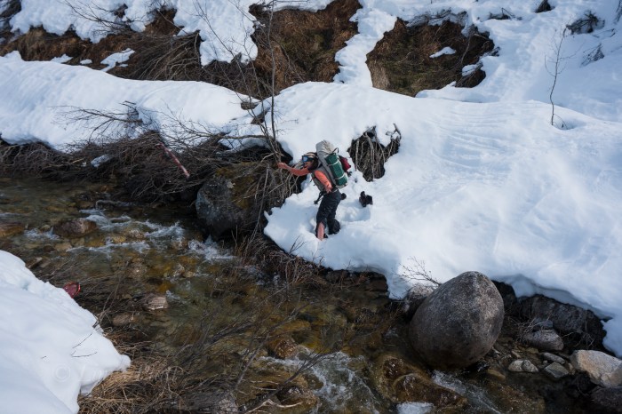
Angela hucks her snowshoes across the creek… spring touring at it’s finest!
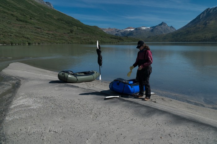
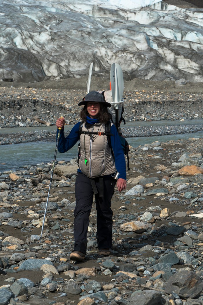
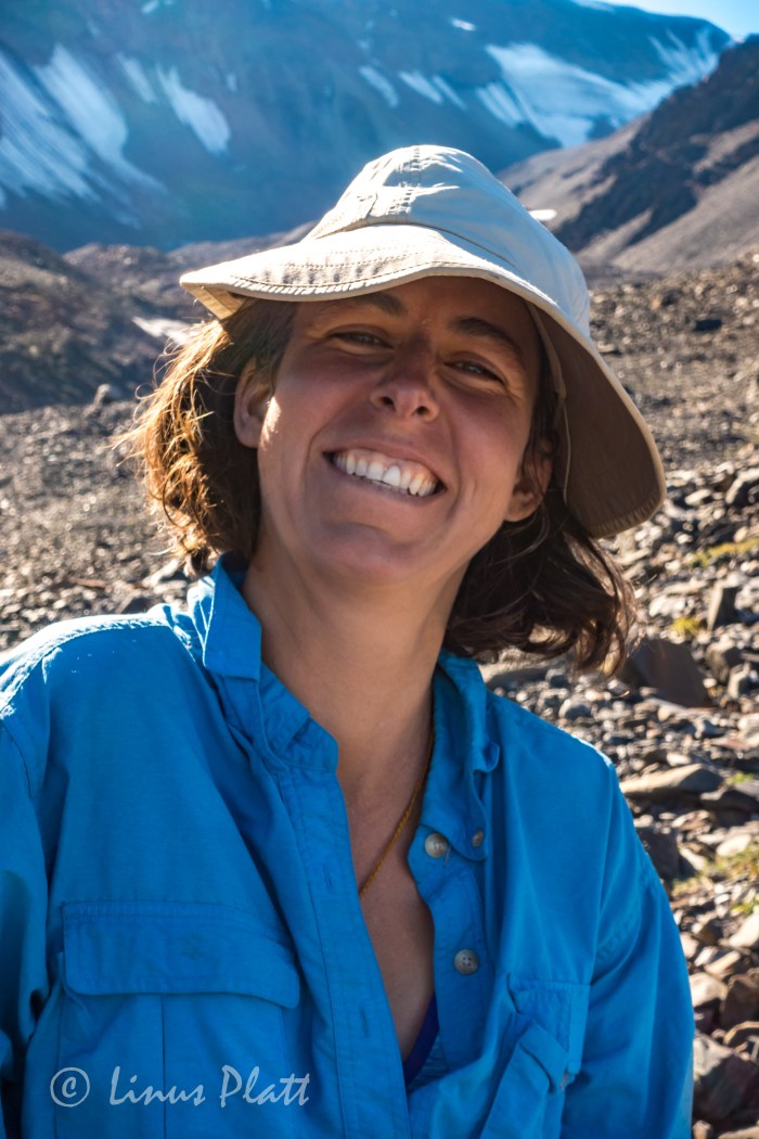
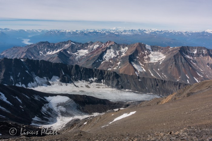
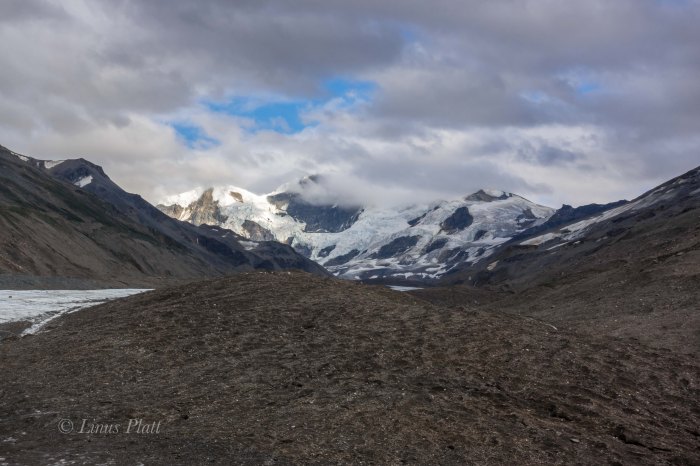
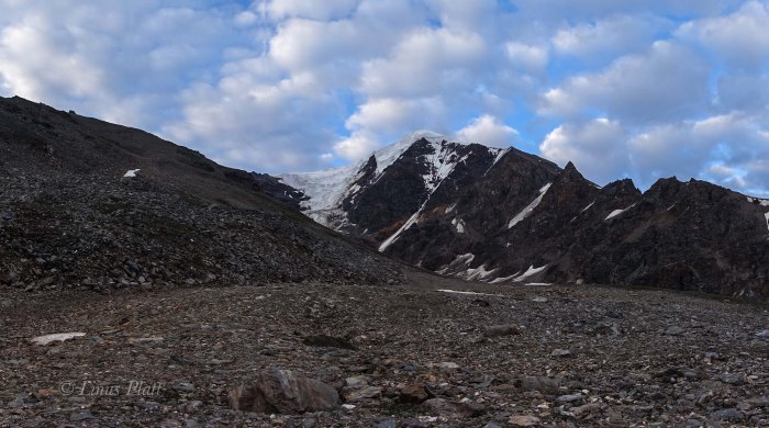
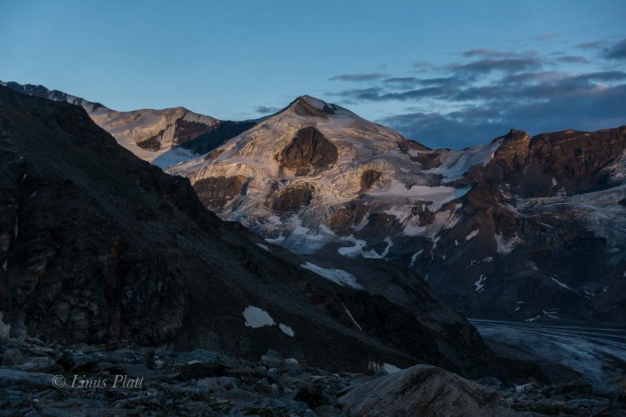
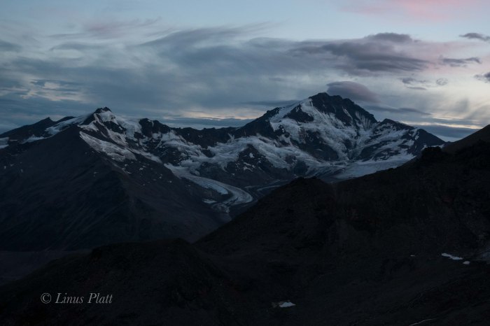
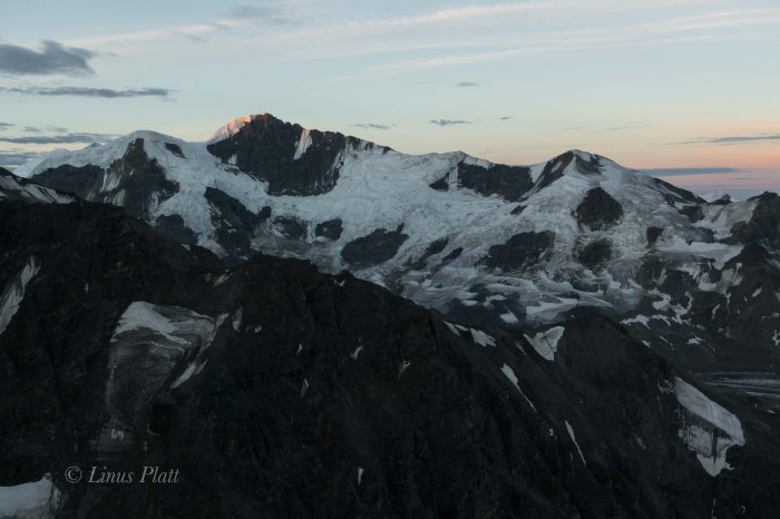
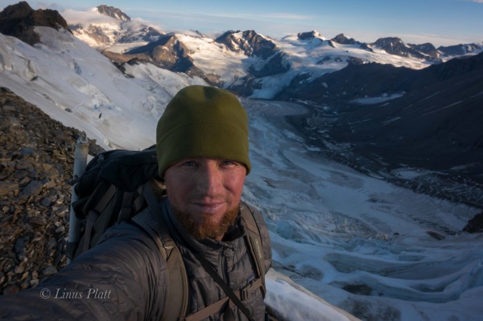
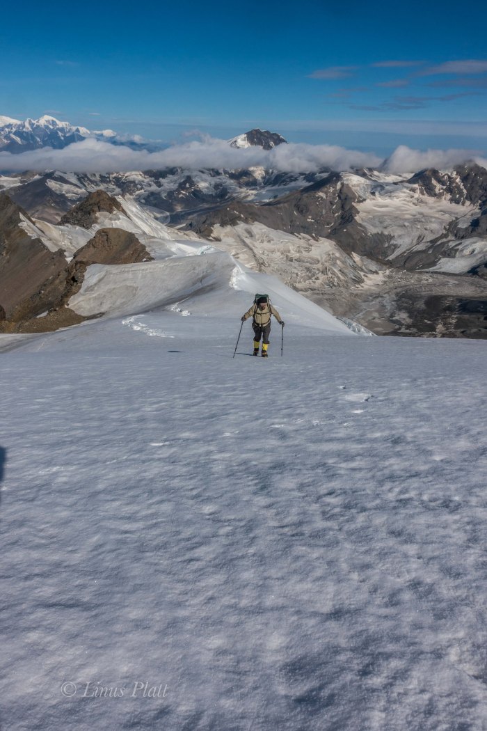
2019 marks the first year of trips by the newly formed Over The Hill Expeditions. This years objective, primarily to get the ball rolling, get to know one another, and become organized both as a team and entity, will be Alaska’s Mt Sanford, which is the 6th highest peak in Alaska and thus the United States. The first week of May 2019,we will be leaving Chistochina, Alaska via bush plane to the foot of the Sheep Glacier at around 5500′ of elevation. Our plan is to ski up, then down the 11,000′ of glacier bagging Sanford’s 16,237′ summit in the process. This years team will consist of Rich Page, Cameron Burns, Jeff Rogers, and Linus Platt. Our ages range from 26 to 61 and we plan on being on the mountain for approximately 2 weeks. Cam Burns, a noted writer of climbing, skiing, and adventure, will be compiling a story of the trip for Senior Hiker Magazine, while Linus Platt will be shooting as many photographs and video he can to document the expedition.Our statement at Over The Hill Expeditions is to set forth the concept that over 50 years of age is synonymous with alpine mountaineering, exploration of Earth’s wild places, and high adventure, while utilizing our experience to navigate safely the challenges these trips afford us; retirement age people in the U.S. are a distinct and formidable denominator in our population, and we aim to demonstrate that youth is not the only factor in goal oriented physical accomplishments. We encourage and seek like minded climbers, mountaineers, and adventurers to share in our forays and also seek acknowledgment and support from the outdoor industry that we are a capable and enduring team.
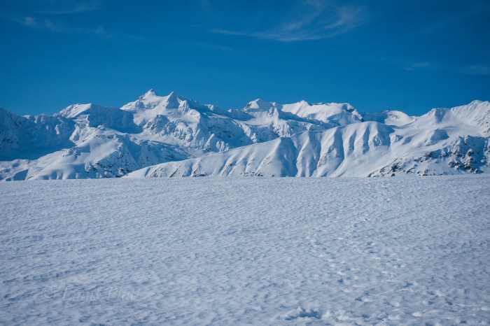
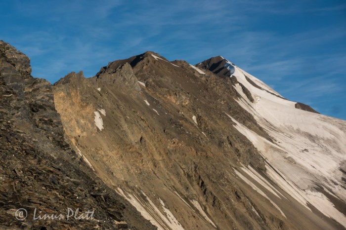
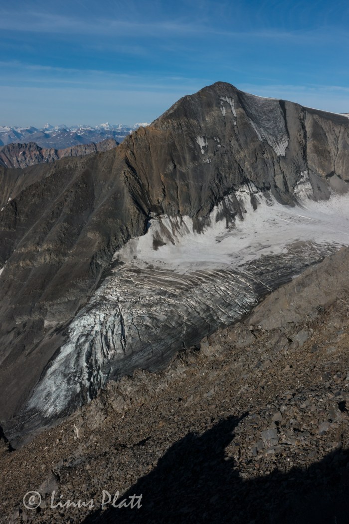
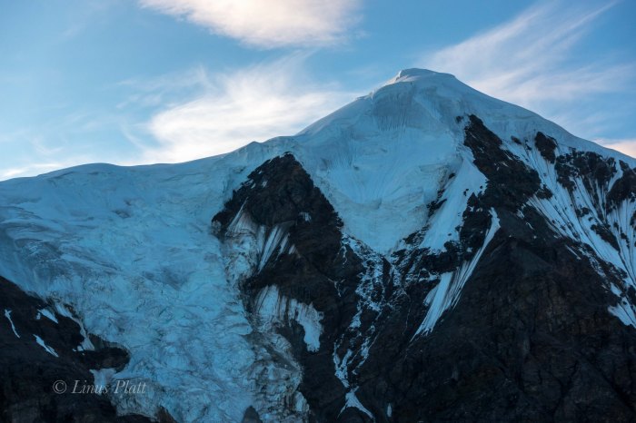
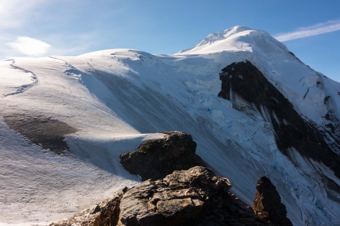
Mt Sanford’s East Face with the beautiful and skiable Sheep Glacier route following the right skyline…
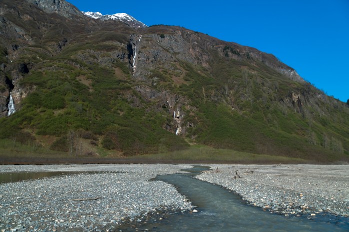
Winter is a great time of year for exploring local wilderness generally too out of reach during summer months. Some of the local watersheds and glacial valleys become severely overgrown with dense thickets of Alder and Devil’s Club, essentially turning these locations into Alaskan Jungles
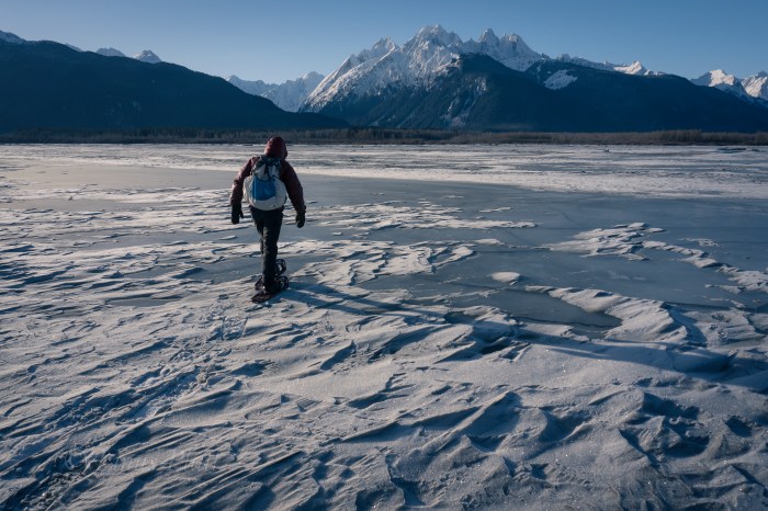
I’ve been up the Kicking Horse River on several occasions during the winter months in past years and this year is no exception… The Chilkat River is covered in anywhere from 4-10 inches of solid ice, making acces to the confluence of the Kicking Horse a simple matter. In summertime, a packraft or other vessel is neccesary to cross the raging highwater torrent. Not today; an easy (if slippery) stroll to the other side from 7 mile Haines Highway sees Angela and I snowshoeing up the Kicking Horse (also mostly frozen, making for easy travel) and all the way to the base of Mt Emmerich.
One day before winter ends, I would like very much to ski or snowshoe all the way to the Garrison Glacier for an overnighter.
Today is an exemplary day; crystal clear blue skies, plenty of snow on the ground, and temps in the mid 20’s beckons a long day out. Once reaching the Sitka Spruce at the base of The Cathedrals and Mt Emmerich, we eat a snack, take in this special and not often visited place, and happily agree to come back for a closer look before the snow melts.
Frozen ChilkatMt Emmerich and The Cathedrals
The Skeleton Forest
Crystals
Angela doing some “snowshoeing” across an open spot on the Kicking Horse RiverEntering the upper valley
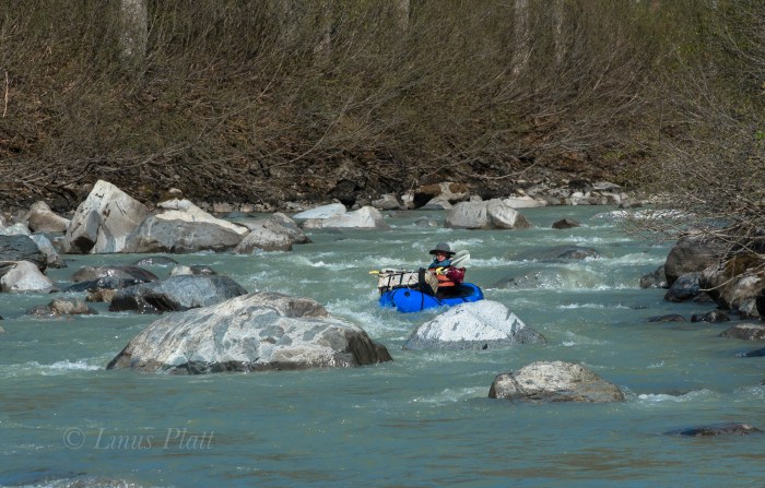
As one drives north over and beyond Chilkat Pass, a broad and beautiful alpine valley is entered; the beginnings of the White and Black Spruce, Aspen, and high Tundra dominate the landscape here. Once past Kelsall Lake, the road climbs up and over an ancient moraine and drops to an expansive river filled valley; the birthplace of the fantastic Tatshenshini River at Goat Creek and the terminus of the short but spectacular Parton River. Fitness training and gear testing for an upcoming alpine adventure sees me driving up near the Yukon border for a solo ski into the Parton River region. I wish to scout the take out of the Parton River area for a future summer packrafting trip trip and get a layout of the landscape.
For me, the primary reason as an American to live in Haines is the access to the great and mighty Yukon Territory; a land full of wilderness, mountains, rivers, glaciers, and animals. Similar to the interior of Alaska, it too offers a lifetime of exploring, climbing, and packrafting that beckons me as often as I can muster.
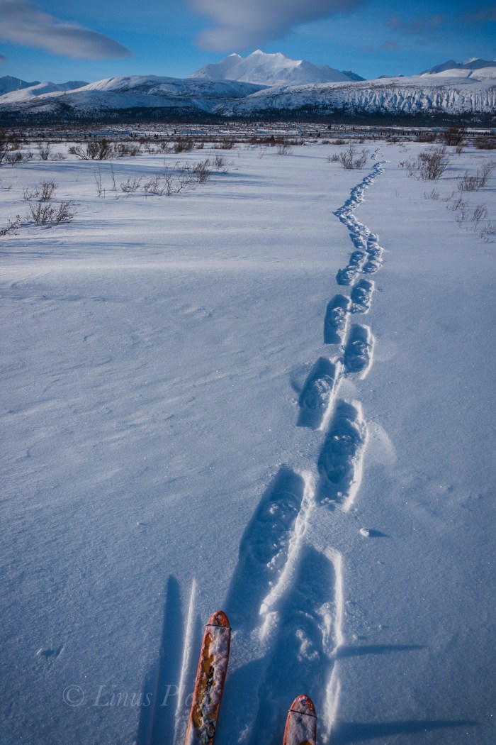
Parking the truck on the shoulder of the Haines Highway, a short one mile ski down a dirt road leads to the first of three put-ins for the Tatshenshini known as Bear Camp. Here, the Tat is frozen and I ski across happily and pick up the faint and snow covered old mining road beyond; shortly after, I come to the frozen Parton River and once again ski across and beyond into the fields of stunted arctic Willow and deep snow. Someone else has been in the area recently, and at first I begin to follow a relatively fresh set of snowshoe tracks, but soon veer off course to find my own way.I spot Arctic Hare tracks and soon spot Wolf, Lynx, andPtarmigan tracks… A couple of miles skiing in and out of the Willow thickets and up and over several creeks finds me entering the White Spruce of the Parton River corridor where it enters a canyon to the south and it’s headwaters lie.
A quick snack and a few clicks of the camera see me skiing back to the Parton River, this time further upstream to inspect the river herself. Always fun skiing down frozen rivers this time of year… easy skinning with no obstructions gives me the opporotunity to inspect the area for log jams, debris, and other future packrafting concerns.
With the sun getting low, I head back down stream, cross the Tatshenshini, and skin back to the truck just in time to see the beginning evening Alpenglow.
Till next time…
Someone’s been this way…Arctic Hare…The Parton River…White Spruce Landscape…
Ok… the cat is out of the bag, as it were – Armed with a couple of friends, I’ll be heading to climb and ski Mt Sanford in May 2019. Sanford is the third highest volcano in Alaska, and the sixth highest peak in the United States at 16, 237′. We will be skiing up, and down the Sheep Glacier on it’s north side… This is the first time I’ve mentioned here on JRB, but there will be coming updates as the trip unfolds.
Working on a fun little logo for our team for this and future expeditions…
An early winter stomp up in Northern BC at Kwatini Creek in search of skiable snow produces little snow but a great hike up Kwatini Canyon past the old cabin there and into the alpine… complete with a mountaineering finish. A perfect day marred only by me pretty much destroying my brand spanking new (first time wearing) Arcteryx bibs…😫😢
Grizz prints on the Haines highway near the BC borderThe old cabin at Kwatini CreekWillow-whackingAngela busts a sane move crossing in ice bridge sans cramponsIce is nice!Ice blobulesAngie bringing up the rear on the “mountaineering finish”Nearing the top of the gully leading to the sub-arctic plateau above
“Climb the mountains and get their good tidings. Nature’s peace will flow into you as sunshine flows into trees. The winds will blow their own freshness into you, and the storms their energy, while cares will drop away from you like the leaves of Autumn” – John Muir, 1901.
Klehini River near the AK/BC BorderGhost ForestFirefall Tundra and Swirling MistAutumn Colors at Rainy Hollow BCLate Run Sockeye at Klukshu, YukonMush Lake TrailAutumn Colorizing and Yukon MountainsYukon GoldStoked to Be…Deep ForestA Serene and Peaceful Scenario…Glorious Yukon Light and WeatherFall Aspens…Razor Sharpness and Crisp Colors
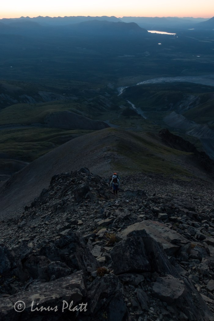
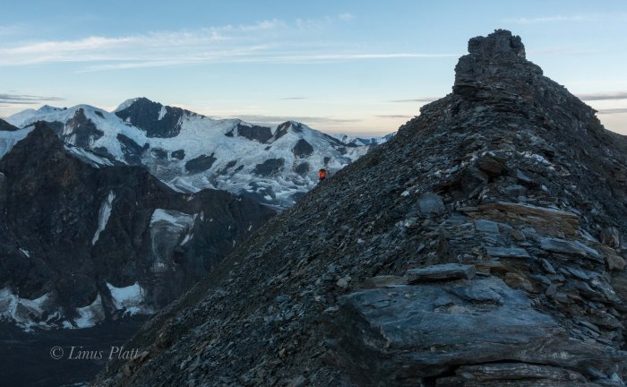
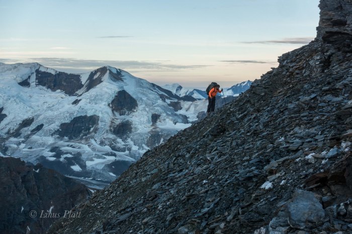
It had been quite some time since I had been up on 7 Mile Saddle; the views of the Chilkat Range and glaciers, the Lynn Canal, Coast Range, and the craggy peaks NE of the upper Chilkoot River are catastrophically fantastic. The saddle itself, a series of alpine meadows interspersed with bouts of tundra and stunted Mountain Hemlock and Spruce. The summit of Peak 3920 lie just above, and all within a couple hours hike from the Haines Highway. The stomp up to the saddle although only about three miles, but gains over 2800 feet in that short distance, meaning it is a very steep stomp indeed. Having only weekends to utilize these days, and wanting to maximize my training for the upcoming Sanford Expedition, I decide that a fast overnighter to 7 Mile is in order; I’ve never camped up there before, but had always wanted to, so I load up the pack with the intention of not going light, but instead loading it up rather stoutly for “training” purposes. Camera gear, tripod, lenses, binoculars, more food than I could possibly eat, and a bit of wine to enjoy the alpenglow with.
The weather is nothing short of spectacular on this mid September day; a time in Haines that generally exhibits pouring rain and temps in the mid 30’s, producing brutal conditions. Not today – the sun is out and the sky is serene. I stomp up to 7 mile with the relatively heavy pack, stopping often to take in the views and use the camera. Once on top, a fine camp is found amongst the tundra overlooking the commanding Chilkat Range, with the sun setting and the glow becoming me. The temperature drops and supper is prepared as darkness envelops the landscape; soon I am in my down cocoon, eye lids glued shut, and generating Z’s. In the morning dawn, the temperature is hovering around 20 degrees F and I am up firing the stove for water and coffee. The early light splattering the glaciers on the other side of the Chilkat Vally is awe-inspiring and soon I am packed and dashing down the trail… Back to the truck by 8:30 am, the sun is shining brightly once again, promising another rare Autumn day of golden
Looking out to the snout of the Garrison Glacier…Mt Selby, The Coast Range, and the Chilkat Peninsula…A view out to Chilkoot country…Hyperlight, hyper-real…Mt Emmerich looming behind camp…The vast and complex Takhinsha Range…
Proof that I am in fact an old schooler…Chilkat River, Kicking Horse River, and Mt Emmerich prominent…Morning light…The Chilkat Estuary and Lynn Canal beyond…
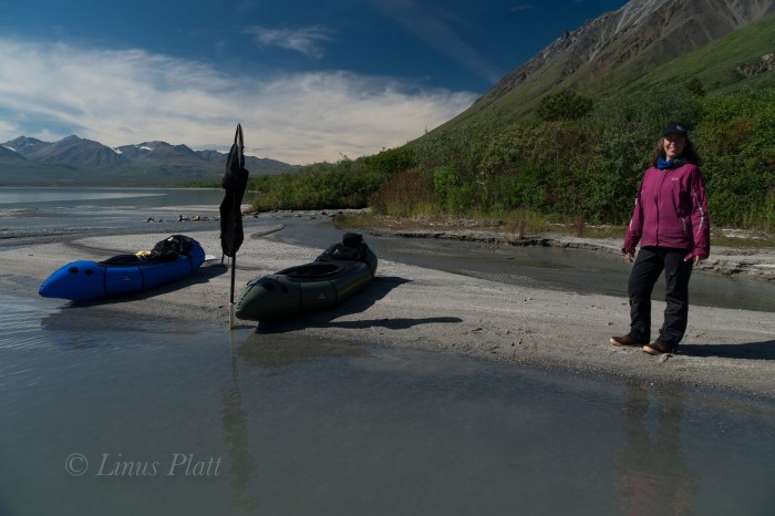
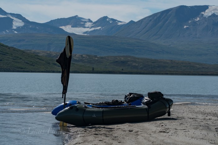
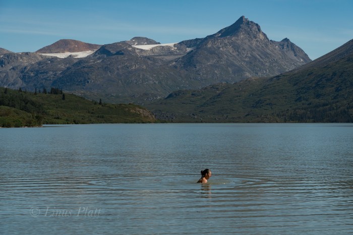
Looking for a bit of fun and adventure finds Angela and I heading north out of town and up into the high country to parts unknown. We packed the truck with bicycles, packrafts, hiking paraphernalia and some snacks. About halfway up Marinka’s Hill, we stop to gawk at the Northern Takhinsha/Southern Alsek’s baring their blue and stoney ice in the spectacular late summer light. I have never seen these peaks so devoid of the previous winter’s snow. The result is visually striking; the glaciers are on full display and the rocky summits piercing the deep blue hue above. Once past Three Guardsmen, it is decided a paddle across the mystical Kelsall Lake is in order, and soon we are bouncing the truck down the 4WD track to it’s shores.
Once in the water, a pleasant paddle two or three miles to the inlet stream that feeds the lake comes around and we stop for lunch and a swim on the sandy beach below the glacier of Kelsall Peak. Back in the boats, a great wind swells up and we fight the lateral rollers all the way back to the truck and happily scurry back over The Pass and head back home.
Takhinsh/Alsek RangeBare IceHappy To Call This Place My Home…Mountain Hemlock
Getting Boats PreppedThe Enchanting Kelsall LakeKelsall Peak and Glacier
Since moving to Haines from Fairbanks nearly 5 years ago, I have been fascinated by a local piece of wilderness called the Takhin River Valley; a river born of the Takhin Glacier high at the western end of the Takhinsha Mountains at the far northern most tip of Southeast Alaska. The nearby Tsirku River is born from the Tsirku Glacier far into the western reaches of the range where massive ice sheets dominate the landscape. Further down stream a Tsirku feeder, the Le Blondeau Glacier, comes very close to the Takhin Headwaters and is separated from it by a 500 foot high, two mile wide swath of an ancient moraine covered in Alder thickets and Devil’s Club, and is know locally as Heartbreak Ridge. I had heard many folks talk of the Tsirku… it is of fairly easy access by bush plane, or by foot, is big enough for a full size raft at spring and summer water levels, and is fairly tame overall. But I never ever heard anyone speak of it’s sister, the Takhin. After asking around about it, I discovered that there is a locally operated bush airstrip about 3/4 the way up the Takhin Valley known as the Fox Airstrip, but it seemed there was no way to gain plane access to the headwaters at the Takhin Glacier itself.
Last year I decided that the best way to investigate was to hike up the Tsirku on foot from the Devil’s Elbow, where one can park a vehicle, and attempt to get to the Le Blondeau and have a look at Heartbreak Ridge. At the time, I had no packraft, and made many dicey river crossings on foot until deep snow, and high water blocked passage about a mile and a half from the landing strip near the Le Blondeau. After spending a night in the upper Tsirku watching and listening to a pair of Wolves, I packed out, vowing to return better equipped.
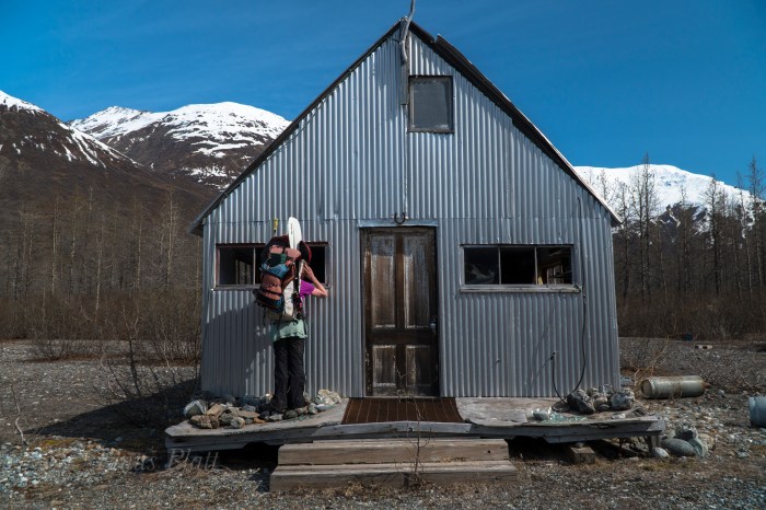
This year, Angela and I, armed with packrafts, hired Drake Olsen and his Super Cub to get us landed on the tiny gravel air strip near the Le Blondeau near what is locally known as Horse Camp, a group of seasonal tin cabins from which hunting and guided Tsirku River trips begin. It’s from this place we could easily hike to Heartbreak Ridge, and begin it’s Alder thrashing, which more than one person had guessed would be “extreme”.
The tiny Super Cub plane holds one pilot, one passenger, and a wee bit of gear. That’s it… so Drake takes Angela in first; it is about a 20-25 minute flight in and I wait by the Haines landing strip for his return, eagerly anticipating viewing the Takhin from the air to inspect for any obstacles we may encounter. The Super Cub re-appears, and in minutes gear is loaded and we are airborne and slicing through the crystalline sky along the lower reaches of the Takhin. Drake flies as low as possible so we can look for log jambs, wildlife, gravel bars, and any other thing of interest on the ground. We pass the fantastic Bertha Glacier and her giant iceberg filled tarn; the lake is still partially frozen over. It is May 17th 2018…
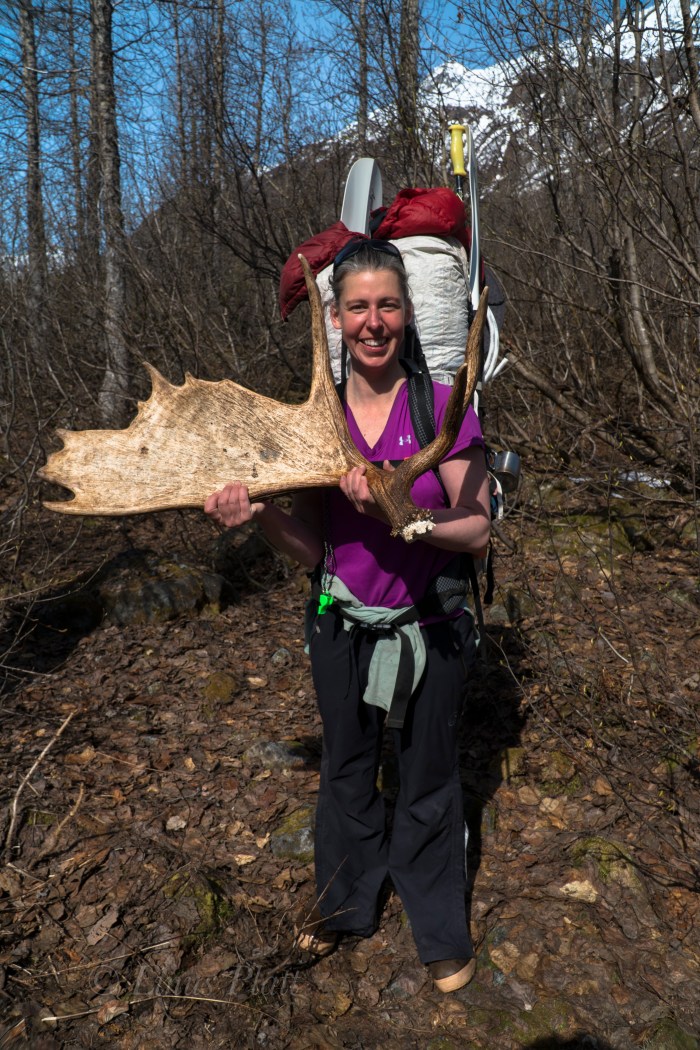
After Drake drops me off, Angela and I watch as he hits the air and disappears over the ridge and is gone. We shoulder packs and begin walking the Gravel bars of the Tsirku in search of a supposed trail leading through the forest to Horse Camp. After a bit of wandering and doubling back, we find the trail and find ourselves deep within the confines of the bush. A large Moose antler is found on the ground, likely dropped the previous Winter. The cabins of Horse Camp are dilapidated and run down… animals have had their way with them and are in pretty bad shape. The tarn of the Le Blondeau Glacier is partially frozen over, and great slabs of icebergs are float here and there. The views of the glacier and peaks are amazing… one peak, known as Tomahawk, has gorgeous plumes and flutings descending from its jagged and corniced summit. Not all mountain ranges have these flutings, but are common in Alaska, The Andes, and Himalaya. Truly a signature of deeply glaciated peaks and severe weather.
We stomp around the east side of the lake all the way to just shy of the ice and right up against the mountain where we believe the easiest passage through the two miles of Alders might be. After having spoke with some people who had seen it, and seeing it from the air myself, I estimated it would take us about 4 hours to get through it, over Heartbreak Ridge, and to the toe of the Takhin Glacier. Soon, we cannot go any further and so we dive into the Alders to our left and begin the extreme thrashing. The paddles sticking out the tops of our packs make the going much worse. Alders are notoriously bad for this sort of bushwhacking and this is no exception. We gain a lateral snowfield and follow it, postholing in knee deep snow to ankle breaking downed Alders beneath. Two hours later we come to a stream where we break for snacks and water before committing to more thrashing. Occasionally, we find old avalanche chutes to traverse up, then down, up, then down, avoiding short sections of thickets. It is time consuming and exhausting to say the least. Hours later, we are at the base of the final climb up Heartbreak Ridge proper. It’s nothing short of a heinous and evil Alder thrash. Did I mention Devil’s Club? We gots that too folks. Lots of it. We emerge on top, bloody, sweating, exhausted… and ornery. The Alder thrashing we did last year on the approach to Mt Archibald in the Yukon was actually worse, but this was sustained. It had kicked our ass, but we did it. In fact, I do not believe any one in recent memory (or ever) has gone over Heartbreak Ridge during the non-winter months (skis, snowmachines, etc) The view down to the Takhin Glacier is breathtaking and the descent looks steep and dangerous. After the initial loose and steep drop in, it is easy going and soon we are on the rubble covered glacier and boulder hopping to the toe to find our camp.
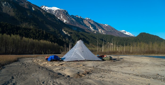
After reaching the snout of the Takhin Glacier, a gaping ice cave appears and the very utmost of the Takhin River is born, emerging as a rapid and icy tongue from it’s innards. We thought since the goal of this trip was to packraft the entire Takhin from it’s beginning, it would be especially cool to start from inside the ice cave and emerge in true fashion. However, it looks dicey so we decline, stumbling off to find a camp spot. We pitch the awesome Hyperlight Mountain GearUltamid 4 that was loaned to us by the company for testing and inspecting; I find it extremely light, easy to setup, and bombproof. Many thanks to HMG for this shelter. After camp is constructed and I lay in my sleeping bag, it occurs to me that it took us over ten hours to get from the landing strip on the Tsirku to the Takhin Glacier; I severely underestimated Heartbreak Ridge.
The morning sees the weather in fine shape with early morning light splattering the fluted ridges high above us. We walk for about a half mile downstream on the gravel bars in search of water deep enough to put the boats in. Since it is morning and the temps still chilly, the water has not yet come up, but we finally find adequate water and we inflate the rafts. A pleasant float downstream on class I-II, puts us in a forested area, where log jams and shallow water force us once again on foot. Another paddling section begins and a mishap with a strainer and a missing paddle ensues. We thought that the paddle had floated away, but was in fact stuck underwater in the submerged thicket. We were soaked and needed to dry out. Luckily it was hot out… too hot in fact and we were both getting somewhat sunburned. back in the water, we paddle through another alluvial fan and spot a large Mountain Goat about 200 meters off walking right towards us. We eddy out and watch silently; the Goat stops and finally takes notice to us. We stare back and forth and the Goat decides these strange creatures near by are best not to get tangled with and starts trotting south and away from us. What a magnificent animal…
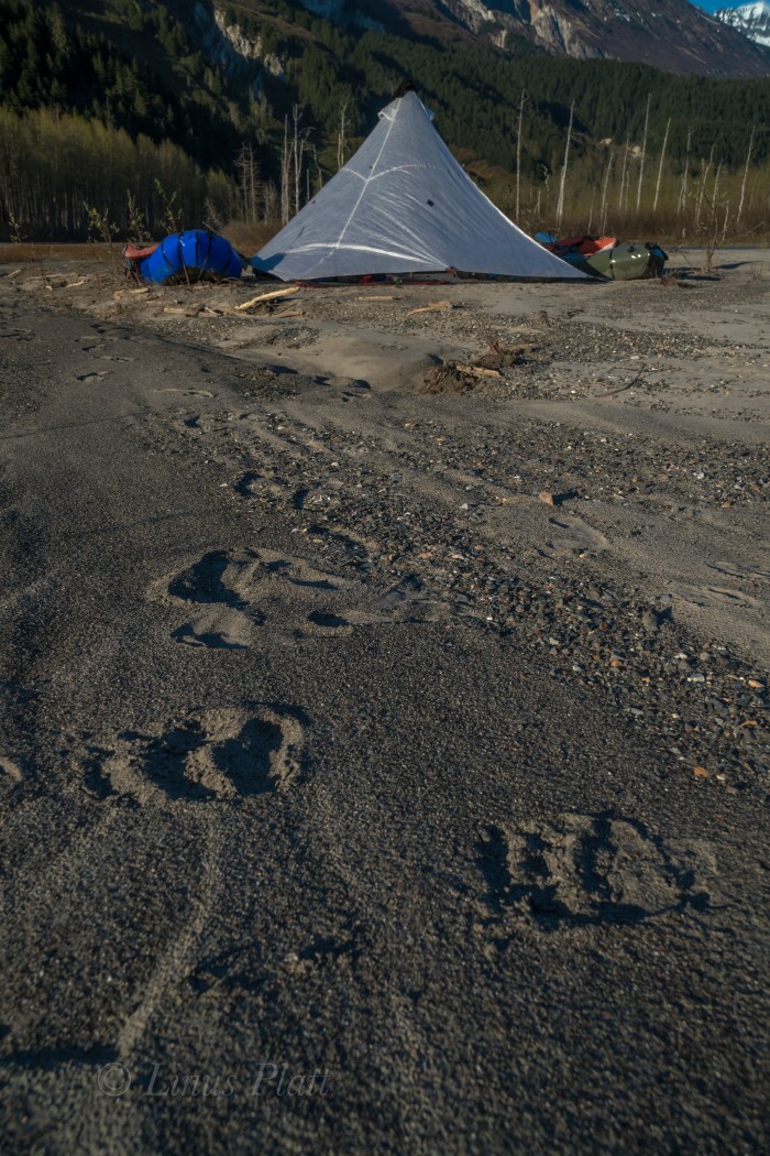
Back on foot again to avoid low water levels, we decide the best way to travel is to mount the inflated rafts to the tops of our backpack and hanging down with the bottom of the boat facing behind you; doing this makes one look like a giant alien Beetle. We walk through the open forest like this for a spell and I spot a Grizzly 100 meters away (close!) staring us down. I freeze, Angela freezes. It appears to be a lone male Grizzly, not giant, but not small either. We stare at each other for several seconds and the Bear flips 180 and bolts the opposite direction. After that, I decide that the Bear spray will go in one pocket, and the Colt 1911 .45 in the other.
Eventually, we begin paddling again, and even though the water is low, we are able to float big sections and simply drag the boats through the shallow areas and then jump back in. Soon we come to end of the big braided section of the Takhin near where the Fox Airstrip is, and realize that it is getting late and that we are very tired. We pitch the ‘Mid on a sandbar riddled with Grizzly prints and attempt to sleep. Soon however, a great wind pick up and after a bit, blows a steady 30 knots, showering us with sand and dust. It was miserable, but we hunkered into our bags deeper and got through it. Eventually it died off and we drifted into needed slumber.
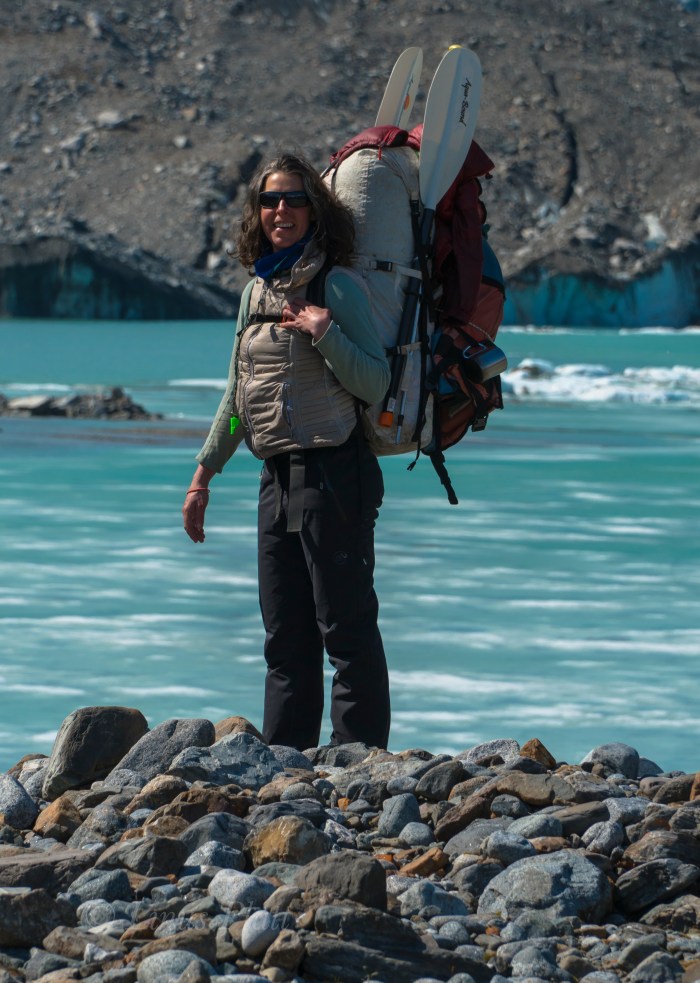
Another fine morning of gorgeous weather finds us paddling immediately and entering the “Boulder Field” we had heard about from one person who claims to have jet boated up the Takhin. The river slices through the tight forest here and turns into a different animal than we had previously seen. Small rapids appear… class II-III; twists and turns and rocks and holes all become the experience. The paddling is excellent; this is what we came for. One nasty looking class III section with a big rock at it’s bottom that would surely flip you we decide to portage around. Following that, the Takhin turns into one set of glorious Class II-III rollers after another for several miles. It is an instant classic Alaskan paddle in my mind. We pass the Dickinson, Willard, and Bertha Glaciers, and into the final twists of the river a few mile before it’s confluence with the Chilkat River, where enormous log jams bar passage and force us out of the boats. We drag the rafts through the sand past Wolf and Bear prints and back into the water where more Class II rollers and some technical navigation around strainers and timber force a keen and sharp attention. Angela has a mishap with a pesky log and flips the boat, but all is well. We stop for a breather and laugh about the incident as we pour the water from our Extra-Tuffs and wring out our wool socks.
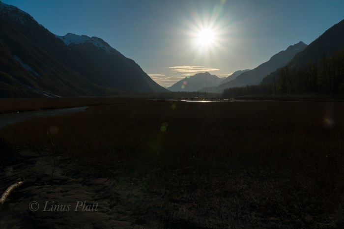
Back in the water and around the next bend in the river, we can now see the peaks of the Tahshanuk, indicating that we were extremely close to the Chilkat. We ponder for a moment if we should spend another night, or just simply paddle down the Chilkat back to the Haines airport where the truck is parked. After reaching the mother Chilkat, a great wind picks up and it is decided instantly that paddling home is the ticket; three days and 35 miles of bushwhacking and paddling behind us, our weather window had closed, and it was time to end this adventure and begin looking forward to the next…
First views of he Takhin from the airBertha GlacierTsirku landing strip
Horse Camp
Angela stomping around the Le Blondeau tarn
Le Blondeau Glacier
The bushwhacking and traversing begins
Final climb up Heartbreak RidgeFirst view of the Takhin Glacier
The true headwaters of the Takhin River via the ice cave
Camp at the Takhin Glacier snout
The Grizzly was spotted moments after this picture was taken
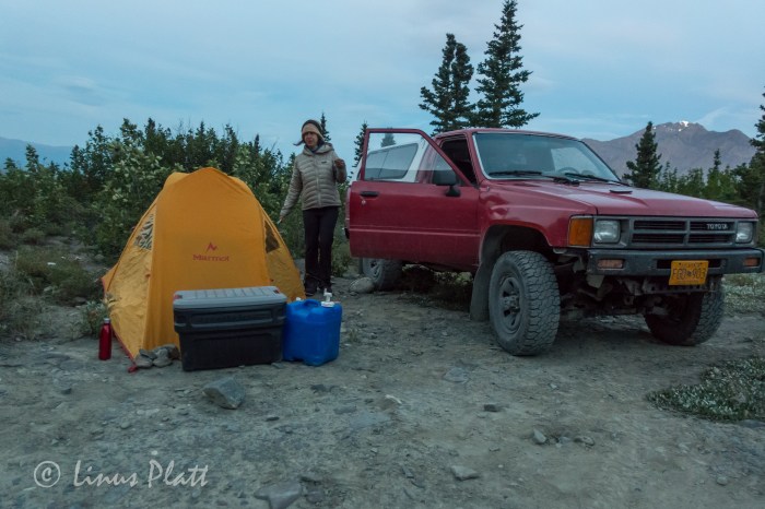
It had been a grand summer in the northern interior, but is was time to head south to meet up with Angela and have an adventure in the Yukon, so after tying up loose ends in Fairbanks and getting the archaic Toyota back into travel mode, I say goodbye to Sven and all the great folks I had met during my stay in Fairbanks this summer, gas up, and hit the highway. Driving south and seeing once again the massive central Alaska Range dominating the skyline, it is decided nearly instantly that I wish to head back to Delta for a few days to have a closer look around to do my own thing, shoot some photos and video, and look for animals. That evening at my familiar camp along the Delta River, another sublime sunset graces the southern horizon and showcases the white giants I dream of so often.
The areas around Delta Junction had fascinated me for sometime, and a venture with Dennis up nearby Donnelly Dome just south of town had wet my appetite for the vast tundra and river valleys of the region. It’s an area of concentrated wildlife, dense forest mixed with open tundra, raging glacial rivers, and giant mountains. In the morning following, I whip up some tailgate coffee and breakfast and soon head south to an area surrounding Donnelly featuring herds of wild Bison, Caribou, Moose, Grizzly Bear, and a vast network of dirt roads unexplored by yours truly. After stomping the brush filled valley below Donnelly and scaring up a large bull Moose near the Alaska Pipeline, I decide to drive up a dirt road I had spied some weeks prior that led past an old military installation and winding down to Jarvis Creek, but a sizable pool of water and it’s inherent mud hole prevents passage to the places I seek. So I stomp the area on foot on search of anything of interest. Grizzly tracks lead from and abandoned military bunker where once inside, I scare up several big Owls who are surprised by my presence and flee the scene entirely. Walking through the thickets, a large bull Caribou trots past not far off and climbs a short brushy hill to get a better look at me. Such a magnificent animal in silhouette against the storm encumbered sky; he smells the air briefly before descending the north side of the escarpment and soon is gone from my sight. Another Caribou appears and gallops fast to catch up, and soon I am alone walking the old dirt road en-route back to the truck. It begins to rain in earnest and soon it I am engulfed in a frigid downpour; in the dry and warm confines of the truck, I call Angela to solidify our plans to meet in the Yukon in another week or so for a climb up Mt Archibald in the beautiful and enchanting Kluane region less than a three hour drive from Haines. But for me, the drive will take a full day or so, but I have time to kill and decide to take my time and explore and maybe even climb a peak on the way south. I drive the old truck back north to Delta and back to my camp along the Delta River, where it rains hard for most of the night.
The next day is spent driving slowly, stopping often, exploring dirt roads and gawking at one of my favorite parts of Alaska. This place has the sensation to me of an ancient and somehow significant nature; people have lived in these vast northern valleys for thousands of years, flourishing in this striking and beautiful land. So many rivers, creeks, and un-named mountains here… It is a staggering thought to try to encompass all of its geography into my psyche. There is a thousand lifetimes of exploring to do here, and I can only hope to come back again and again to see and experience as much of it as I can in this one life. I pull down a dirt road and scope out an area for a hike and possible peak climb in an area north of Tok about 20 miles. Feeling satisfied that I have my bearings about me, I head down the road to Yerrick Creek, one of my favorite creeks in the area, to gather drinking water and bathe my stinking carcass. After a pleasant bath I drive to Tok for supplies and head back up valley to a sweet camp along the Yerrick. Once again, that night it rains a rain that can only be described as intense. Morning arrives and the rain shows little signs of dissipating, so I pack the truck and ponder my next move.
I decide to head back to Tok and do some laundry and fuss around town some where I drop into the visitor’s center for a look at the weather forecast that tells of inclement weather gaining momentum; after a walk through the old Tok cemetery during a rush of raindrops, I decide that the best way to spend my time before Archibald is to simply head back to Haines and catch up on much needed house projects that have been neglected all summer. Driving south of Tok through the maze of high forested ridges and immense wetlands, I emerge into the great taiga filled river valleys of the Robertson River, Johnson River, White River, and the beautiful Donjek River, all giant glacial fed braided specimens born of true and unrelenting wilderness. The Kluane region is now at hand and a pair of blonde Grizzlies graze at road’s edge as I pass. I camp down an old dirt road overlooking the fantastic St Elias Range where a small herd of Dall Sheep can be seen on a neighboring hillside grazing in the midnight twilight. Passing near Haines Junction the following day, the mass of Mt Archibald comes clear and its steep and glaciated east face dominates my view. Back in Haines hours later, I settle into my little house and fondly breathe in its strangeness; I have not been here for over two months, and it seems foreign to me. Nonetheless, a good nights sleep is to be had, and now preparing myself for the new electrical breaker panel that needs to be installed at the power lines adjacent to my house was in order. Five days later, the breaker panel is installed, the truck worked on, and gear and supplies gone through for the next Yukon adventure with Angela mostly taken car of.
The day before departing again back into the Yukon, Angela comes over and we spend several hours organizing gear and prepping for the Archibald climb. It feels good to be in a state of anticipation of an adventure goal once again, and soon we are ready. The plan is to leave late morning or even mid-day and casually head to Haines Junction to re-group and find the dirt road that leads Thunderegg Creek where we will spend the night before the hike in to our basecamp for Mt Archibald. Casually driving up the Haines Highway and up and over Haines Pass, AKA Chilkat Summit, it feels good to be in the high country once again. We take our time stopping from time to time to explore a little here and there and taking in the peaceful valley where the stimulating Klukshu River flows; it is a tiny river with runs of large King Salmon, but none are seen here today. It is a place of crossroads where cultures of the Aishihik and Champagne peoples would meet with the Chilkat Tlingits to trade goods and furs for the highly sought after Hooligan fish oil. In Haines Junction to gas up, we get to the visitor’s center just before closing time to secure our permits for backcountry travel, but are told that we need no permit to enter the area we are going as it is just outside of the Kluane National Park boundaries. Suits us fine, and we hit the Little Green Apple, Haines Junction’s tiny grocery store, for our supper supplies and hit the road north towards Thunderegg Creek.
Thunderegg creek is the drainage that flows from the un-named glacier that grows from Mt Archibald’s southeastern flanks and is named so for the marvelous round “eggs” of stone that grace the corridors of the raging river. In the morning, we pack up casually and shoulder our relatively light packs and begin the stomp up valley towards the glacier. The accounts we had read on-line gave a thin description of a faint game trail that peters out into thickets of Alder, Willow, and Aspen that must be navigated in order to avoid the impassable shores of Thunderegg Creek. Soon we find the trail disappearing and the thrashing through Alder thickets begins. The descriptions mentioned that the bushwhacking should last “no more than an hour”. True to the description, we emerge from this dense northern jungle in short time to find ourselves clamoring up an exposed ridge where two drainages parallel one another. At the ridge’s top, flat walking lead to a decision: either continue bushwhacking higher to where tree line ends and the glacier and moraine begin, or bushwhack down and to the left into the drainage of the creek that flows from the ice. It seems the downward option is our best bet, and another great and thrashing jungle session begins. The going is slow and methodical; it is very dense, but it is fairly short and soon we are deposited into the dry and rocky creek bottom, sans creek. We had hoped for water here, but none is found. An uphill trudge of about an hour and a half brings us to the very base of Archibald herself, where sprouts of tundra meadows appear. We ponder camping here, but realize quickly that not only is there still no water here, but the base of the Southeast Ridge that we intend to climb would be much better gained higher up the moraine. Getting both dehydrated and exhausted, we trudge on in hopes that drinking water and a suitable bivouac will reveal itself. Following the lead of the description we had read, drinking water could be found at the base of the terminal moraine; we gain the base of the massive scree to find none at all. Working up and around the lower portion of the moraine, a decision is made that we must go up and over this beast to find salvation. Another 20 minutes of scrambling and we are on top of the moraine and looking down slightly to a flowing creek of fine glacial drinking water. Dumping packs, we scamper downward to the creeks edge and fill ourselves with the glorious liquid. Bringing no tent along on this adventure due to the outstanding weather forecast and wishing to save every once of burden from our backs, we spy a small shelf situated at the exact starting point of our proposed climb. It is stupendously perfect. After moving rocks around for a few minutes, we have ourselves a perfectly flat and relaxing spot to throw down our sleeping bags; but it is hot. Very hot. The sun will not be behind the rim for another two hours and all we want to do after supper is go to sleep for our 3 am wake up call for the climb. So we wait… After the sun begins it’s descent behind Archibald’s summit ridge, we close our eyes and…. not sleep. We are both gifted with a bout of insomnia that allows us just scant minutes here and there of real rest. This seems to happen to me a lot on these high mountain bivy’s. Not sure why, but it seems I am just too much in awe of the glorious alpine setting and can’t seem to get my eyes or mind to sleep. Occasionally, when I am camped in these high glacial cirques, there exists sometimes the sensation of faint voices; like souls wandering these glaciers and whispering slightly. It is a strange phenomenon and Angela speaks of it as well… a curious thing these voices. The northern summer twilight that never really gets dark soon gives way to a display of the Aurora Borealis that sets our hearts on fire as we gawk in awe at it’s offering. Soon, the Aurora dissolves into the early morning dawn as the 3 am alarm goes off and we are up packing, cooking oatmeal and tea, and rubbing the lack of sleep from our bewildered eyes.
Following Dall Sheep trails up endlessly steep and sliding scree, we emerge on the top of the lower ridge to find a staggering sight: the un-named peaks to the west of Archibald are adorned with glaciers exhibiting broken seracs and icefalls, lit up by a full moon rising above their rarely seen summits. A post-Aurora alpenglow that sears the sky with streaks of pink and orange light outlines the mountain horizon to the east and north. The sight fills me with the notion of being a part of this grand and ethereal landscape that is not to be taken lightly. I find that being in these place gives me a sense of deep spiritual and emotional connection to the natural world that allows me completeness as a Human Being living on this strange and beautiful planet.
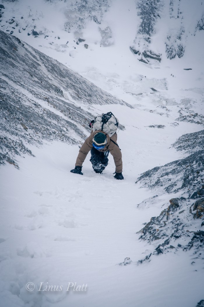
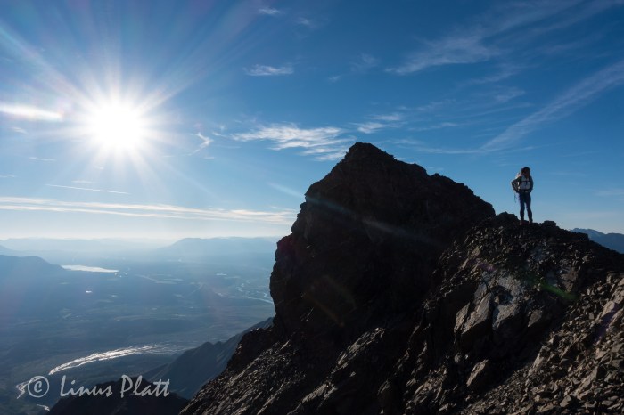
The southeast ridge of Mt Archibald is a long and rocky ridge, perhaps 3 miles in length and rising nearly 6000 feet from Thunderegg Creek to it’s 8,491 foot summit. This ridge is a steep and sometimes narrow feature sporting many sizable ‘summits” along it’s way, several gendarmes up to class 4-5 climbing, and near it’s top, the glacial ice from it’s east face creeps over the top of the upper ridge where steep and exposed snow and ice climbing accesses Archi’s true summit. It is a big mountain with a huge elevation gain for a peak of its height, and requires a variable set of skills to reach its summit. One must be comfortable with loose rock, exposed class 4 rock climbing, route finding, and snow and ice climbing skills. Given the length and elevation gain of Archi’s bulk, exceptional fitness is also a must.
A short scramble from our perch atop the lower ridge and we are surmounting the first of many gendarmes, most of which are in the solid class 3 range. Up and over, side hilling scree, of traversing back and forth across rock ranging from shattered Schist, to loose scree, to blocky talus generally accomplishes dealing with these many features and false summits. The hardest part of this ridge is the elevation gain… then loss, which one must deal with when going up and over these false ridge summits.
After a couple of hours of traversing and scrambling, the sun begins to crest just above the distant horizon and the ridge begins to get steeper, looser, and more exposed. Sections of steep scree lead to flatter sections of the ridge, where Dall Sheep sleeping platforms appear; there are several spots grouped together and have been manicured by hoof to produce flat and comfortable sleeping arrangements. Most are right on the apex of the ridge itself where wind and exposure are a way of life for these magnificent and hardy animals.
Higher up, another steep gendarme is negotiated by means of traversing left and scrambling the steep, exposed and shattered rock diagonally and then climbing directly upward and over it’s tiny summit; a brief down climb leads to another short traverse on it’s right flank to a point where the ridge eases off once again before climbing abruptly to the base of what had been described as the crux of the route: a true summit in it’s own right, a sub-peak of sizable proportions that bars access to the upper ridge, and the final stretch of chaotic mass of shattered debris below the steep and forbidding summit snow and ice where the glacier bends itself agonizingly over the summit ridge’s lip. Once the bulk of the gendarme is reached, the climbing turns to extremely exposed and loose class 4 climbing. We brought no rope so great care was taken climbing through this section. Once gaining the broken, tiny summit of this mammoth sub-peak, a view towards the final rib of snow and ice can be seen for the first time on the climb; it appears to be a steep knife-edge leading directly to the Archibald’s summit.
We are extremely lucky today to have the unbelievably outstanding weather we are experiencing, and from this point on the upper ridge, a view west reveals completely unobstructed and crystalline views of the entire Mt Logan massif and all of the big peaks of one of the most expansive glaciated mountain ranges on the planet. After moving through a section of broken towers and blocks, we find a pool of drinking water and fill our bottles and eat; we are both getting tired.
Another long, steep section of extremely loose scree forms a knife-edge and leads to a long flat section of ridge where, at its end rises the final snow and ice where the summit lie just beyond. After donning crampons and ice axe, we begin up the steep snow, Angela above of me front pointing then plunging the axe’s shaft, and repeating till there was no more. We are standing on the tiny summit; in fact it is just barely big enough for both of us to sit. The weather is striking and the views are mind blowing; however, I had been developing vision problems for the last hour or so from sunscreen dripping into my eyes, and now sitting here on Archibald’s summit, the pain is increasing, and my vision getting very bad indeed. We have 6000 feet of dangerous and time consuming ridge to down climb and here I am with only one working eyeball. We snap some photos and then begin the long and arduous descent back down the snow rib and the long loose section leading to the big gendarme. By the time we reach the dangerous class 4 sections, my vision is really bad and the pain increasing still. I have one semi-working eye in which to navigate the down climbing past a deadly exposed section, where if one fell or slipped, it would be the end of you. After managing, I stay close to Angela and she down climbs the bad section; relief hits us both and we are soon traversing and side hilling the long mid section of the route; I have managed to sort of “ski” the scree in my mountain boots, making downward progress a little less tiring, ice axe in hand just in case. After a few more hours, we are at the top of the Dall Sheep trail that leads back to the bivi. I am so tired, I can barely stand, but commit to this last section with abandon. Angela does the same and when we reach our bivi site, we collapse for a brief spell and ponder what we are doing.
Again, my eyes are inflamed and I cannot see at all out of the left eye, leaving only my bad right one still working, which has been of poor vision since childhood. We decide that hiking back to the truck is in order and the possibility of seeking medical attention a reality. After packing up our alpine ghetto, we shoulder our packs, our bodies scream, and we begin descending the debris covered glacier towards the dry creek bed and the route home. The going is slow, but soon we are at the point where we had bushwhacked from the ridge and into the drainage. Not feeling like going up through the thickets, we opt to stay in the dry bed in hopes that we may find a way to navigate around the toe of the buttress and it’s inherent Alder thickets. After stomping down through the Bear tunnels and shouting “Hey Bear!!” every so often so as to not startle one and provoke an encounter, we find ourselves on the shore of Thunderegg Creek. Fed by the glacier we had just come from, this specimen is no creek, but a dangerous and massive river, dark chocolate with debris, very deep, very fast, and very cold. We walk it’s shores for a very short time before realizing that we are trapped by the dense thickets leading directly to the edge of the raging torrent. Everything we had done to avoid the bushwhack just exploded in our faces and the only option left is to aim uphill and attack the matrix of the dense and unforgiving web of Alder, Aspen, Willow and small Spruce. Not 50 feet into it, we are encountering the worst bushwhacking of our lives. I once was a part of a conversation with some Washington climbers years ago about how the locals had a “bushwhacking rating system” for back country travel and mountaineering approaches in Washington state. I thought it was kind of of funny at the time, but now, after living and stomping in Alaska and the Yukon for a few years, it is no joke. This thicket we are in is definitely “class 5+” bushwhacking. Add a full pack and a pair of trekking poles to the mix and you’ve got some real fun. After about an hour or so of this, we emerge on a faint trail that leads to the cliffs at Thunderegg where the truck is parked and rest awaits.
The exhaustion we feel is overwhelming, and my eye is in horrible pain; perhaps the worst pain I have ever felt. It is late and we decide that staying here for the night is the best option, since the closest clinic is in Haines Junction or possibly even Whitehorse over 100 miles away. Oddly, there is phone reception here and Angela gets on the telephone and inquires about the clinics and general eye care with a nurse in Whitehorse. Not only would the drive be horrendous, but the cost of such an endeavor would be very difficult for me. We hunker down for the evening in the tent, sipping a cup of wine and me trying desperately to hold on. The pain is overwhelming. After a few agonizing hours, I pass out and wake hours later to my eye feeling slightly better, but still not good. We pack it in, drive out the long and sustained 4WD road back to the highway and head into Haines Junction for some grub and decide to head home and go to the SEARHC clinic in Haines.
The drive back over the pass is striking as always; the tundra surrounding the peaks laid out like a sub –arctic blanket and the peaks themselves jutting proudly to meet the sky. The drive from the alpine at the pass down the Chilkat corridor to Haines is always an interesting one to me as witnessing the transition from one ecosystem to another is always a joy, even with one eye. At the clinic in Haines, the visiting eye doctor examines my eyes and runs me through a series of tests that determines that the sun screen was in fact the culprit, and that applying some eye drops and rest will alleviate the pain and irritation. The entire experience, from the sleepless bivouac and the early morning Aurora, to a long and arduous route and it’s subsequent beautiful summit, to a terrible bushwhack and a murderously painful eye condition, has been one of great significance in a lifetime of outrageous adventures spent in an array of wilderness places that continue to touch our hearts and souls. It is being in these places that both Angela and I seek, both on a physical and spiritual plane.
The Kluane area of the western Yukon remains one of my most revered place on this planet; it is a place where some of the largest glaciers on Earth are born from some of the mightiest and remote mountains… it is home to scores of Grizzly Bears, Black Bears, Wolf, Lynx, Dall Sheep, Moose, and has an ancient Human cultural spanning thousands of years. The wilderness here is far reached and commands respect from any creature passing through it. It is a place near my home and one that I will return to visit time and time again to explore and experience magic.
The Ridge Between BushwhacksAngela entering the TundraDall Sheep trails On The Lower Southeast Ridge Of Mt Archibald
The Bivi
The Lower RidgeThe Upper Ridge And The Summit Of Archi
.
A Magic Moment
Mt Logan Dominating the Far Skyline
The Exposed Class 4-5 Crux Of The Route
At The Watering Hole Up High
Angela Putting On CramponsThe Steep Snow Rib Just Below The Summit
The Last Few FeetAngela On The Tiny Summit
On The SummitThe Long and Un-Named Glacier And Our Bivi WAY down At The EndThe St Elias Range And Mt Logan Far Off
It had been raining now for days in Delta Junction, and I felt that we might be close to wearing out our welcome at the Delta Public Library and at the coffee lounge at the IGA food market, if for nothing else than for simply being; loitering as it were. I figured the troopers would show at any moment to arrest us for vagrancy. Of course that is just me being sarcastic, as Alaska in general, and this part of Alaska specifically is certainly a place where one can do as they please without vexation from others. Folks here respect individuality and personal rights and property. In fact, we had been camped along the Delta River on the outskirts of town for a long spell now. Our tents and some belongings left there daily as we meander around town and take up space at the library. This practice has resulted in absolutely zero harassment, theft, damage, or chaos of any kind. One of the many, many reasons I am proud to call Alaska my home. Some years back I had been camped on this same river beach on a long bicycle journey, and as I eat my lunch and listen to the rippling river, gun shots are heard alarmingly close. I look back toward the tree line at rivers edge and see a man leaned across the hood of his truck, pistol in hand and firing again. This time a great cloud of dust and debris explode not 20 feet from my position and I realize that either his is shooting at me (and is a terrible aim), or he is not shooting at me but does not see me. I assume the latter and scream at him. He looks more surprised than I do and screams back a shaken apology and gets in his trucks and skedaddles fast. Another time on this same beach, on yet another long bicycle journey, I had lost an envelope containing some 4000 dollars in cash. No shit… not stolen… lost. This beach has always been a strange yet somehow beckoning place to me… I simply can’t explain it, but I always like camping here when I am in the area. We had been killing time here for several days and except for a jaunt up Donnelly Dome during a brief, hours long lull in the storm, we had become a fixture in this tiny Alaskan town. The foray up Donnelly was a pleasant and rewarding surprise: as soon we pull into the parking area off the dirt road south of Delta about 20 miles, a massive Bull Moose trots past us, not 30 feet away and paying not the slightest bit of attention to either Dennis nor I and our dropped and gaping jaws. Donnelly’s summit, a mere 2500 feet above the surrounding tundra sports some arresting views of the countryside below, and were it not stormy, I’m sure the views of the Alaska Range some 40 miles to the south would have been nothing short of incredibly spectacular. At the summit, a Marmot skull sits upon a small stone, as if to peer southward to the omnipotent Alaska Range. Was it an omen? Was the creature’s skull a sign of imminent death in those magnificent mountains. I thought not and held the little critter’s head piece in my hand for a bit before setting it back down and retreating to the truck. Later in Delta, a weather report brings a light ray of hope in our little world and we hit the sack and prep for another mountain adventure to the south.
In the morning, I awake to a stillness and warmth that has been absent these last days; I peer from my tent to see a crystalline sky of deep blue and a calm that follows it. Walking out onto the beach, the central range has a clarity to it not seen yet on this trip: the massive peaks of Mt Hayes, Shand, Moffit, Balchen, and Deborah rise from the tundra with intent and sharpness, with not a wisp of mist or cloud surrounding their stature. The summits and ridges are sharp and full of contrast and color. This is a rare sight in these parts and I shout to Dennis in his tent of the spectacle. Soon we are up, packed, and off to our favorite diner for a celebratory omelette and endless cups of coffee. After a relaxing breakfast, there is nothin left to do but to begin the hour drive south on the Richardson Highway to the little 4WD dirt road I had discovered weeks earlier and the beginning of our hike onto the Castner Glacier and our goal deep within these mysterious mountains. We gas up and head south. On the drive down, a tourist has stopped at the bottom of a long full speed hill with a long lens poking from the vehicle’s window, shooting photos of a Moose foraging in a roadside pond. He is stopped squarely in the middle of the road in a high speed section and I pass doing 60 leaning on the horn. Soon we are at the dirt road, and the Toyota crawling along slowly, bouncing from rock to rock, emerges at the rough path and ends at the beginning of a faint game trail with the treacherous and thunderous Castner Creek roaring past with violence and intensity.
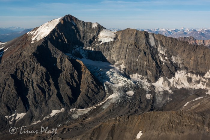
Our goal on this adventure is a peak known as the White Princess; a striking glaciated triangular peak of 9,800 feet, and one of the highest in the Delta Mountains. Descending from the summit of it’s 4000 foot west face are two distinct ridges, the Northwest Ridge and the Southwest Ridge. Our goal of the Northwest Ridge sits above a fork of the Castner Glacier called the M’Ladies fork, called so due to it’s origins from the cirque below the neighboring M’Ladies Mountain. After studying the maps purchased from the UAF in Fairbanks, and after reading scant accounts on the internet, it appears that our goal is to head up the Castner for about 8 miles to where the Castner splits into three separate forks, all leading to different cirques and several different peaks. From the fork in the glacier, another three or so miles up the M’Ladies Branch will take us to the base of our route. The first mile is flat and pleasant and meanders the Castner Creek corridor to the toe of the glacier, where a massive ice cave penetrates the snout of the beast and from it spits out the raging river beside us. A short scramble up the scree and mud to it’s left brings us to the top of the moraine and the debris covered serpent we will be traveling for many miles ahead.
After breaking through the Alder thicket near the top of the moraine, we are greeted with a sobering sight. Now, I am no stranger to traveling upon debris covered glaciers, full of scree, talus, medial moraines, crevasses, and moulins, but what lay ahead was another matter all together. For as far as the eye could see, all the way back to the M’Ladies Branch, lie what can only be described as an endless field of unstable talus, mud, Alder thickets, and boulders. I have never seen a glacier so entombed in such a disastrous array of debris and ankle busting madness… for miles. It becomes clear that the Castner is a big, dying glacier that has become entrenched in more chaos than I thought possible. All accounts I had read were all done in the earlier months; meaning most trips into this region have been done on skiis, allowing relatively sane passage along this corridor and into the high cirques, but we were here in July. The thought of endless mile after mile of this sort of blistering travel filled me with dread. However, what must be done must be done, and the beginnings of a very long day of tedious route finding, side hilling loose scree, and heinous bushwhacking through Alder and Willow thickets ensues. After navigating the initial moraine and figuring out a path of least resistance, we emerge on the far right side of the glacier/moraine where dense thickets are growing. Off to the right of these thickets, steep mud slopes lead far below to the emerging ice and it is at this delicate spine that we must adhere to in order to make this trek feasible. Hours of meandering the Willows and mud fields brings us to more open areas where the glacier is obviously now just below the surface of this undulating and heaving mass of mud, Willows, and scree. A small ridge is gained and we stick to it’s intent; the sides of which peel off to both sides to ice caves and mud fields. Eventually we come to where we are high enough on the glacier to where it is now simply a matter of traveling monotonous talus and it feels a welcome relief. Miles from the truck, and hours later, we emerge at the fork in the glacier, where we find exhaustion and fatigue taking it’s toll and decide to make a bivi.
Glacial moraines are not always the most forgiving places to sleep, resulting in some time spent clearing areas out for our bivi sacks by moving the razor sharp rocks and layering them appropriately into level and reasonably comfortable slumber platforms. Once this was accomplished, supper was prepared and we eagerly crawled into our sleeping bags just as the evening alpenglow engulfed the imposing North Face of M’Ladies Mountain and the un-named peaks to the south. It was a lovely sight for my eyes as I drifted into much needed sleep. I dream that night of Dall Sheep and glaciers…
The morning we sleep somewhat late since we are under no pressure to get going early, as the 3 miles of glacier travel in front of us to move our bivi to the base of the route should only take a few scant hours. This feels luxurious and after a relaxing breakfast, we are moving back onto the ice; the sky above filled with a mixture of blue and scattered clouds. The ice of the glacier crunching beneath our crampon-less boot soles and the swooshing of the many runnels of moulins flowing on the surface of the ice. Once in a while, one of these glacial rivers disappears into a “sink hole”, where the water travels to the bottom of the glacier to become a part of it’s ever growing subterranean river. Peering into these dark and bottomless holes is downright spooky; if one were to fall in, you would certainly be done for. Dennis suggests we set up a rope and rappel into one for photographic and filming purposes, but the thought of even entering one of these icy tombs frightens me endlessly. Being who I am, I feel always best when I am in the Alpine Zone, far above the tree line, high on a cliff, or on a mountain top. Tight places, caves, tunnels and whatnot have always been something I drastically avoid: my phobia of these places sometimes even invades my sleep. We continue up glacier and large boulders appear; marbled Schist ranging from a dull grey, to shining silver with great veins of quartz meandering through it, to swirls of bright orange and red, indicating there are a variety of minerals in these mountains.
Soon, we come to where we are looking directly up at the western arm of the Northwest Ridge of the Princess; between the bottom of the ridge and where we now stand are great cliffs of shattered rock and an enormous waterfall cranking past the entrance to the upper valley where another large, but dying glacier flows from the Princess’s massive, if crumbling and treacherous West face. A desperate looking scree slope rises to the north of these menacing obstacles perhaps 500 feet to where there is green tundra and small alpine meadows. This, I’m thinking will be a splendid spot for our new bivi. Upwards to the scree finds us both clamoring foolishly; two feet up, one foot back, until at the nasty looseness culminates into an apex of sorts where what seems like class 5 scree leads directly to the lush and welcoming tundra. After some time scouting and going up another level higher to the base of the ridge proper, we find some level tundra and a small stream for water and call this home. Early to bed for a 3 am alpine start is in order; the weather is continuing to improve and after lying there in my bag wide awake for several hours, the sky clears completely, and one of the finest displays of Alaska midnight alpenglow I have ever witnessed takes hold. The giant peaks of the Hayes Range thirty miles on the other side of the Delta River Valley are immersed into the pink glowing alpine madness; the West Face of the White Princess shows a magnificent transformation that earlier appeared hideous and grotesque, now exhibiting a beauty and elegance that emphasized it’s massive hanging glacier and heavily crevassed summit pyramid. M’Ladies Mountain is not left out of the grandness either, nor is Mt Silvertip, Mt Blackcap, Triangle Peaks, or any of the countless un-named peaks in this region. The sight is incredible, but only adds to my sleeplessness, as I am compelled to shoot photos till after 1 am… the alarm will sound in just two hours.
I drift to fitful sleep and what seemed a second later, the alarm goes off and I am up, shouting to Dennis at his bivi a couple hundred feet away that it is time to get a move on. After much time spent simply getting to a point where we can begin boiling water for tea and oatmeal, we finally do so and begin the trudge uphill beyond the tundra and into the seemingly endless talus towards the top of the lower ridge. It is already 4:30 am and it takes us another 2 hours just to reach the beginning of the exposed and treacherous looseness of the scree and mud knife edge that leads to one false summit after another.
Now one thing I know about alpine climbing is that in order to climb decent snow and ice, one must get out of camp at an extremely early hour. This means having one’s proverbial shit together for a lightning fast escape from camp after waking. For whatever reason, this did not happen on this morning and I felt we were on the route far later that to be desired; I knew the snow and ice conditions would be crap by the time we were upon them. Once to the ridge top, the sides dropped away to glaciers on either side; so steeply in fact that a fall here would be certain death under any circumstance. After each section, a small gendarme would have to be negotiated on one side or the other, and at other times, small summits would appear and endless loose talus would have to be climbed to go over it’s top, where we would then wistfully descend to yet another saddle, looking upwards toward yet another summit on the ridge. The last major summit to be climbed up and over was a big one and consisted of extremely loose scree and gained close to 900 feet of elevation, before descending it’s top and losing another 500. After this reluctant descent, we find ourselves deposited at the start of the ice and the first views into the hidden cirque containing the upper Castner Glacier, the NW Face of Blackcap, and a daunting set of sliver thin seracs clinging suspended like from the groaning and fractured ice below us. Directly underfoot lay the top of a great ice couloir; not far below it is a mighty bergshrund of epic proportions where darkness prevails just inside it’s frigid caverns. The couloir that lie below this fracture appears rock hard solid ice coated with a black film of sand and debris pitched back at an angle of about 70 degrees. Far below, perhaps 2000 feet, lay a field of steepening seracs and agonizing crevasses to reveal one of the more chaotic sections of glacier I had seen yet in this range.
Donning crampons and axes, we front point above the lower ridge line to where a crevasse must be negotiated and a traverse to the far left brings us to more open views of the airy cirque below. The exposure is greater here as well and once across the icy gap, we find the ridge flattens to a long and even stretch of neve and crevasses that are mostly easy to spot an avoid. Still unroped, we climb a steeper 45-50 degree bit of nice firm neve for about 300 feet which places us at the beginning of yet another long crevasse field. After probing into this area and finding holes, we decide to rope up and work our way across this crevassed plateau towards the rising and dominant summit pyramid. A great cornice sticks out from the summit and avalanche debris can be seen on the slopes below, perhaps 500 feet from the top. Off to the right, a serac that we could see clearly from our bivi has peeled away from the main body of the glacier and hangs precariously over the staunches of the west face, threatening to drop the entire 4000 feet at any give time, in fact this whole area to our right is a time bomb of falling seracs and ice. As we move further upwards and getting closer to the pyramid, the hanging tongue of the glacier can now be seen up close before spilling over the side and into the bowling alley chutes of the audibly disintegrating west face. We had both heard the ice falling from this tongue last night; it would come in waves… almost in perfect rhythm. A crash, then silence… repeat. As we enter the crevasse field, the neve gives way to deepening snow and crevasses that are not only skimmed over lightly making for dangerous conditions, but are hard to spot as well. After a spell, the summit block is near and Dennis expresses his concern with the route I had chosen to climb it via it’s more direct western side. I mention that if he thinks we should climb the longer and easier looking east side, then I am OK with that. I ask Dennis to lead the way and off into the worsening snow conditions we go, aiming for the east ridge and it’s juncture with the summit area. It was getting colder the higher we climbed, but it was late morning now and the intensity of the sun was incredible. The snow was softening and endless amounts of sunscreen and glacier cream had to be applied; sunglasses were adorned more sternly and as we trudged into the deepening snow, crevasses began to be a bit of an issue as my leg poked into one… then another. Dennis too was poking through to have a peek into the glacier from time to time. We neared the upper east ridge and soon I could see up it’s spine toward the summit; what now became obvious was that the east ridge was a corniced knife edge and would require much more care than had previously thought. In fact, the climbing looked dangerous and time consuming. I declared that we must return and instead of descending the treacherous crevasse field to re-join our original line, took the lead and began an arduous traverse across the base of the summit pyramid, working my way through the avalanche debris we had seen earlier. The conditions continued to worsen and now instead of merely being a nuisance from post holing, it was now what I would certainly call breakable crust. If you put your weight uopn the snow and stepped up, it would hold you for a half second before giving way and sending your leg deep within, sometimes all the way to one’s crotch. To alleviate this madness, I developed a technique twhere instead of hoping the crust would hold, I would forcibly thrust my foot through it and stomp the snow beneath to hold my weight; usually this was no more than 12”-16” below the surface. It was far better than giving mercy to the crust and the velocity of one’s weight depositing your foot 36” under. By the time we got across the avalanche debris, we were beginning to climb the lower slopes of the summit block. We were both working terribly hard and in between the sounds of my own gasping, I hear Dennis cussing wildly and damning this place all to hell. Tensions build between us and all I can think of to say is that this is all a part of mountaineering, and listening to the bitching is making it harder. I put it out of my mind and soon we are at the lip of a large crevasse creating a steeper pitch to the summit ridge. We stop to re-group and set up a belay where I lead up and over the final obstacle; suddenly there is no more going up and all sides around us peel off in every direction. To the north the summits of Blackcap and Old Snowy rise from the surrounding icefields, and beyond lie the endless tundra to the north. The Hayes group off to the west appear Himalayan in size and block all views of the western range including Denali herself. To the south and east, the magnificent icefields and serpents twist and wind down rarely seen corridors leading to rarely visited rivers and deep wilderness. The north faces of some of the visible peaks are nothing short of spectacular; there is a sea of ice before us. Most of these ice entombed peaks are un-named and rarely climbed and the sense of isolation here is somehow unexpected, yet glorious. These peaks of the Eastern Range are small compared to their western counterparts, but are ever omnipotent in their own right and absolutely command respect; this place, these peaks, the glaciers below us touch my heart in a way that makes me feel both very small, yet very big as my place on this planet reveals itself to be an important one and the unexplainable beauty of this place sinks into me so deeply it can never be extracted. I love Alaska and it’s mountain ranges, it’s animals and people, it’s wilderness, and endless possibilities. There is simply no other place like it.
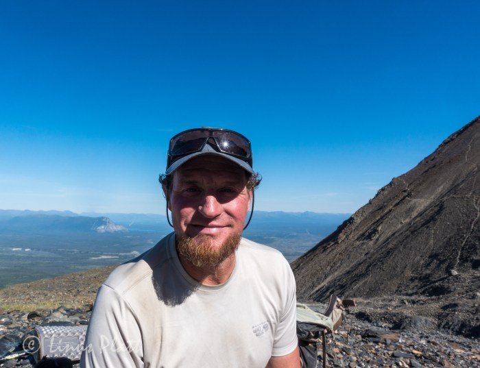
After consuming calories and taking some photos, Dennis and I shake hands in celebration and descend the summit pyramid; the task is almost as difficult as the ascent was, but soon we are out of the treacherous snow conditions and happily cramponing somewhat firmer neve utilizing french technique and front pointing down the steeper sections to the ridge, where more crevasse negotiation takes place before we come to a place where 3000 feet of scree lead off the south side of the ridge to the glacier below. We opt for this alternate descent so that the endless gendarmes and false summits may be avoided all together, but this is an unknown route down, and I am a little apprehensive. After considering the alternative, I jump off the ridge and commit to the scree. After descending several hundred feet, I wave to Dennis and he commits to scree as well. Some of this stuff is small enough and loose enough that one can actually “ski” down it; boot soles kicking off tiny avalanches of ball bearing rocks and then attempting to stay on it’s surface. The technique works surprisingly well, and after about an hour, I am near the ice not far below. I wait for Dennis for a bit and when he arrives he says he wishes to traverse to a shelf off to the right as he believes it will lead back to our bivouac. I feel that descending to the glacier and stomping it’s length is a better alternative, so Dennis and I part ways for the remainder of the descent. Pretty soon, Dennis is out of sight and I am trudging along the muddy scattered surface of the glacier below the west face of the White Princess. Looking up, I see the littered path of the constant icefall heard the night before; the ice gullies and chutes a debris field for exploding ice chunks and rockfall, I figure it to be suicide to attempt to climb this face. In camp by 4:30 pm, I spot a mother Dall and her two babies on the edge of our bivi, but there is no sign of Dennis. I am too tired to eat and crawl into my sleeping bag and fall asleep almost instantly. Later, I awake to Dennis’ footsteps. We chat for a bit before he stumbles off to find his own sleeping bag to caress. Sometime later, I feel raindrops on my face and dig into my bivi sack deeper for cover. Sleep takes me completely and when I awake, it is 5 am and raining.
We decide that hanging out in our bivi sacks for the weather to improve sounded like a torturous idea; not only that, but my ankle injury from two years previous was flaring up; it was time to get out, but the thought of the death march back to the truck was daunting to say the very least. I downright dreaded it. The initial scree slopes from our bivi down to the glacier were painfully slow and detrimental to my ankle, but soon the glacier appears and we are making headway down to the fork. After 8 hours of battling this beast, I make it back to the truck. Dennis is somewhere behind me, and I decide to bath in the icy cold Castner Creek, make a sandwich, and take a nap. Two hours later, Dennis comes rolling in and we fire up the “Yota and head north for Delta, where more sandwiches, a six pack of beer, and a glorious sunset over the Alaska Range impresses upon us a time for relaxation and deep sleep. The next morning, we casually head back to Fairbanks, where Dennis’ previous foot injury and my ankle injury are needing rest. Dennis fly’s back to California a day or so later, and I rest up for more unknown solo adventure and begin to think about heading south a bit, for in another 10 days, I will be meeting Angela in the Yukon for a climb up Mt Archibald in the Kluane region… but that’s another story.
Dennis at the end of the rough dirt road at Castner CreekLinus just before starting the “Death March”The raging Castner CreekThe ice cave from which Castner Creek is born at the toe of the Castner GlacierDennis nearing the toe of the Castner GlacierLinus at the snout of the Castner GlacierDennis at the snout of the Castner GlacierThe beginning of the Death March up the CastnerBeautiful exposed ice caves along the wayEndless scree, talus, and WillowWillow thickets separating the lower and upper sections of the approachGetting higher on the glacier
Taking a break near the M’Ladies BranchColorful boulders and high morainesThe Broken Glacier… now buried under debrisInteresting moraine features nearing the M’Ladies BranchThe Castner’s medial moraine and the M’Ladies branch forking off to the right.Debris covered ice at the forkLooking up towards the main Castner forkOur first view of the lower face on M’Ladies MountainMarbled SchistM’Ladies showing herselfM’Ladies Branch biviLinus at the bivi after the Death MarchLooking up the M’Ladies Branch of the Castner GlacierDennis setting up his biviDennis Belillo… “Sure glad that Death March is over…”Evening light on M’Ladies
Breakfast bivi
Finally on the ice…Looking up the Silvertip Branch of the Castner Glacier and the giant and complex Mt SilvertipThe lower reaches of the East Face of Triangle PeakThe waterfall and shattered cliffs guarding the upper valley below the West Face of the White PrincessDennis on the second day of the approachNearing the bivi site and the West Face of White Princess
The second biviA Dall Sheep inspects our biviWhite PrincessTraingle PeakUn-named Peak between M’Ladies and Triangle PeaksThe NW Ridge of the White Princess follows the left skylineMt Silvertip at 1 amThe West Face of the White Princess and the NW Ridge on left
M’Ladies Mountain
The Hays Group, Central Alaska RangeDennis approaching one of several gendarmesDennis nearing the top of the lower ridge
The lower section of the NW Ridge of the White Princess
The hanging glacier and the upper part of the NW RidgeLooking down into the hidden cirque of the Upper CastnerMt Silvertip and the Hayes Group looming behind thirty plus miles off…The Upper Castner Glacier far below the NW RidgeLinus at the start of the upper NW Ridge of the White PrincessDennis really glad all that nasty scree is behind us…
The summit of the White Princess 2500 feet higherOne of the level sections of the upper routeThe White PrincessThe beginning of steeper climbingDennis on the lower part of the upper ridgeThe Hayes Group from the NW Ridge of the White Princess
Crevasses below the steep summit pyramid of the White PrincessBlackcap MountainDennis traversing the avalanche slopes below the summit
Looking south from the summitLooking southeast from the summit of the White PrincessLinus on the summit of the White PrincessDennis on the summit of the White PrincessOn the glacier below the West Face of the White Princess during the descent
Back in Delta Junction after the White Princess with the alpenglow lighting up the central Alaska Range- Mt Hayes on the right
Selling stock video is always hit or miss… It provides a small supplemental income that I hope one day will blossom enough to allow me to stop building homes for a living and have more time for climbing, hiking, and biking adventures, exploration, and creativity such as film making and writing. SO, if you feel up to it, click on the link below and browse my footage and photos… Thank You!
Up next: The White Princess – An account of one of this summers climbing adventures!


You must be logged in to post a comment.