The Hula Horn

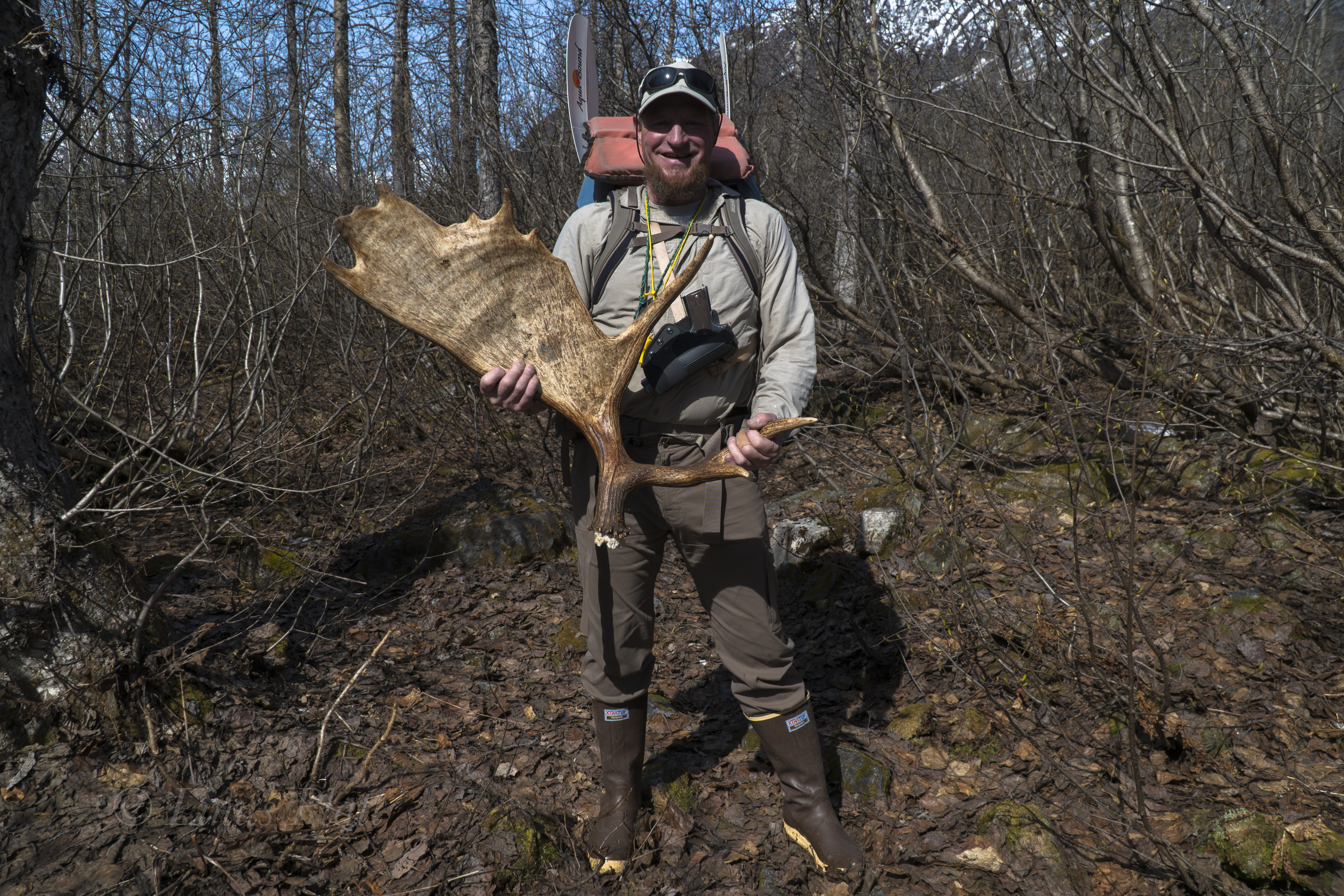
One of the biggest factors in Leaving Haines after 8 consecutive winters living there and moving back to Alaska’s vast interior was simply a matter having access to both the Alaska Range and the Brooks Range. Fairbanks is a great focal point for both, especially for the central and eastern parts of the Alaska Range, and equally so to the monumental Brooks Range, one biggest and most remote mountain regions on the planet; a place to fill a dozen lifetimes worth of exploring.

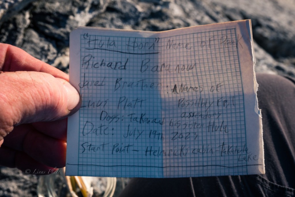
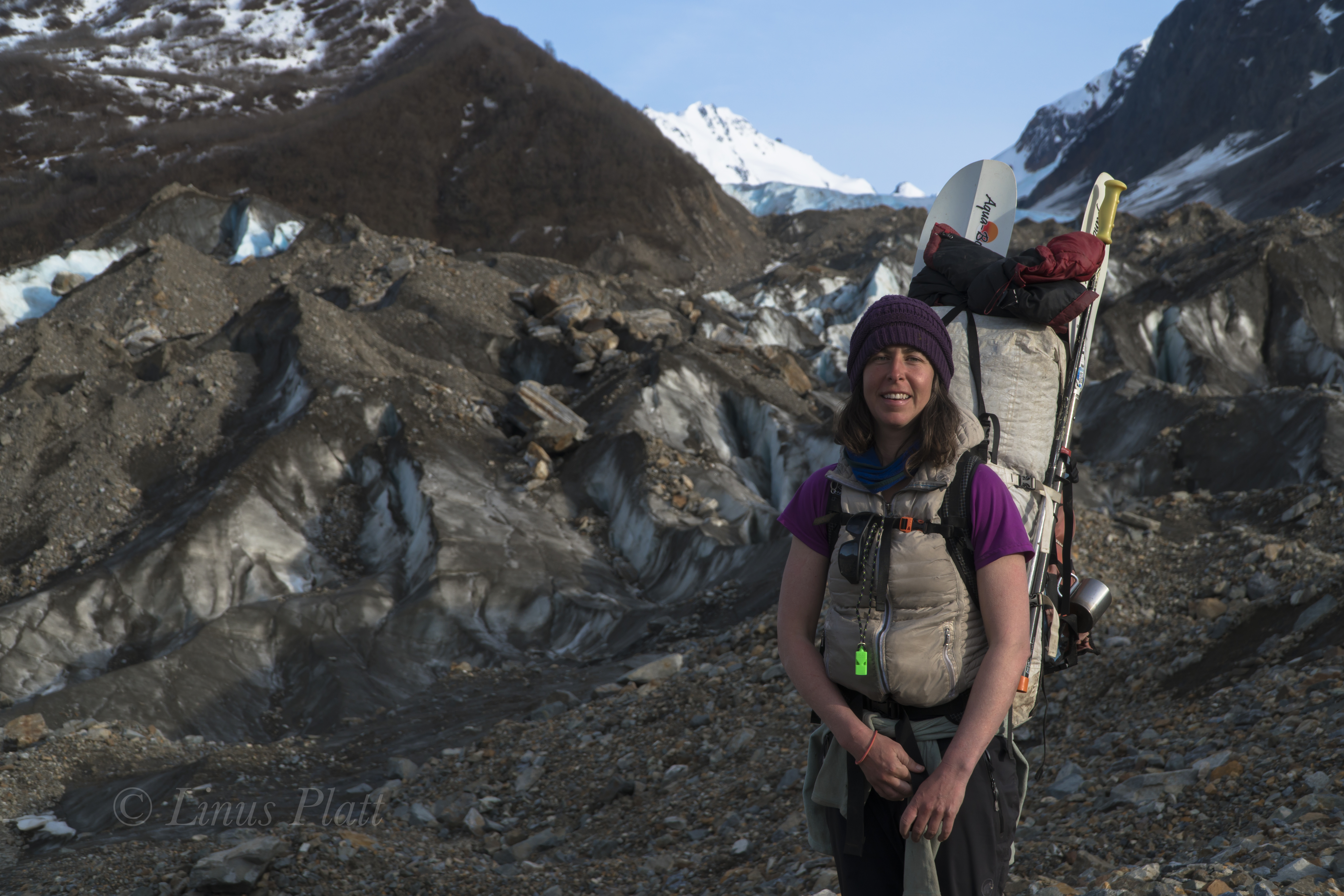
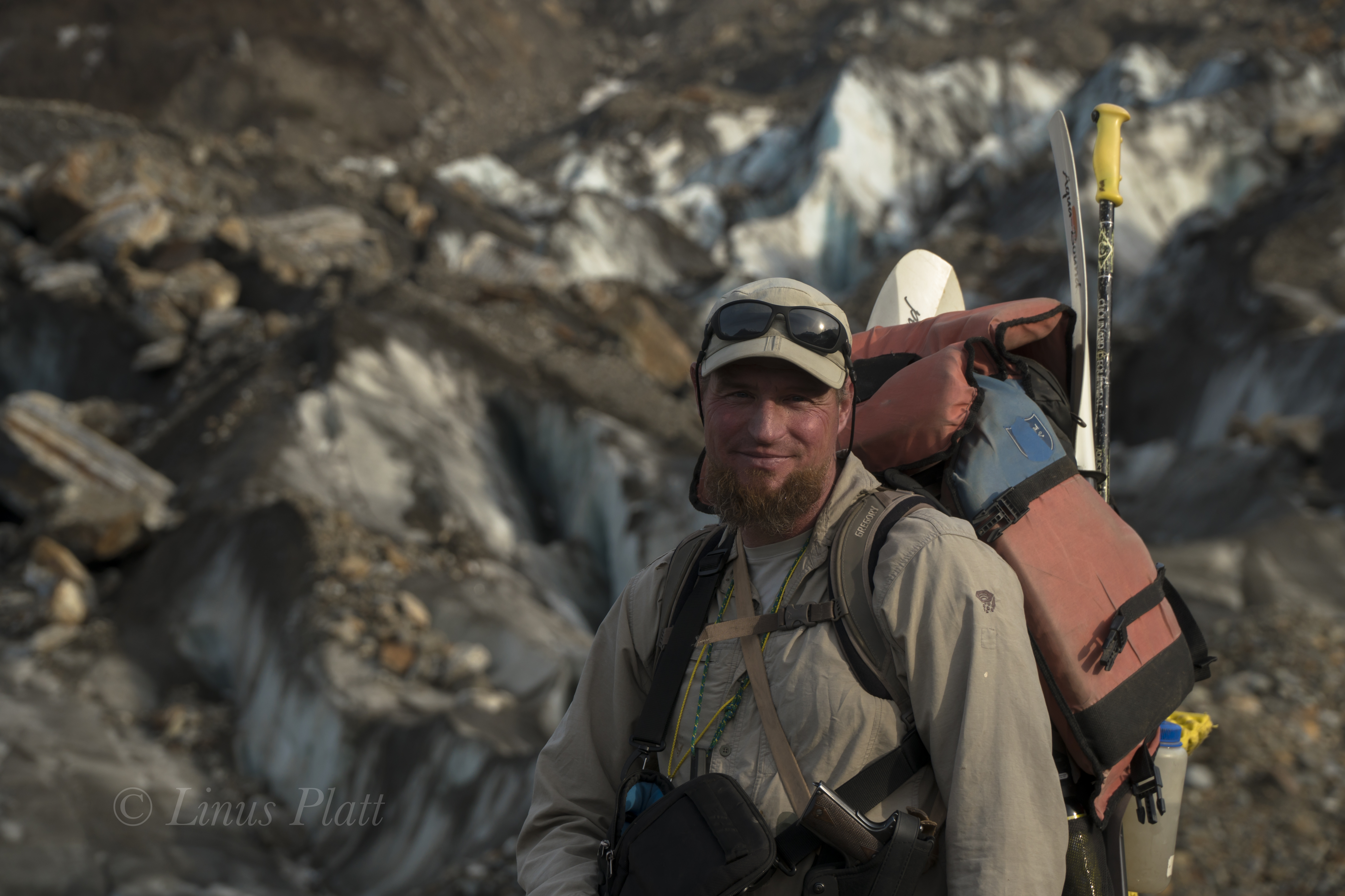
For me, summer 2023 was getting off to a late start. At least that’s how it felt. What was originally proposed as a start to our work projects at Takahula Lake in mid-late June, began in earnest here in Fairbanks the first week of July. I spent that time cutting trees and clearing a site for a future cabin build here on my property in the Goldstream Valley to the north of Fairbanks. Eventually, my workmate Richard Baranow arrives in town, and along with our other workmate Jared Brantner, we embark on several days of material purchasing and logistics for three people, two dogs, and over 12,000 pounds of food, tools, building materials, and supplies for 8 weeks worth of construction projects. Our project site is a cabin situated on the shores of Takahula Lake, located within the Gates of the Arctic National Park and adjacent to both the Alatna River and the Arrigetch Peaks region.

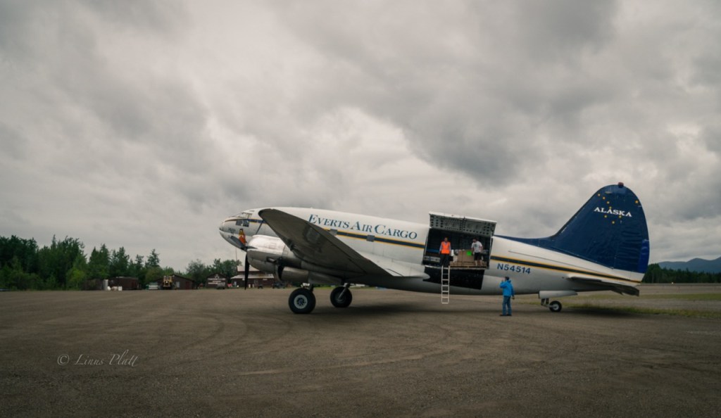
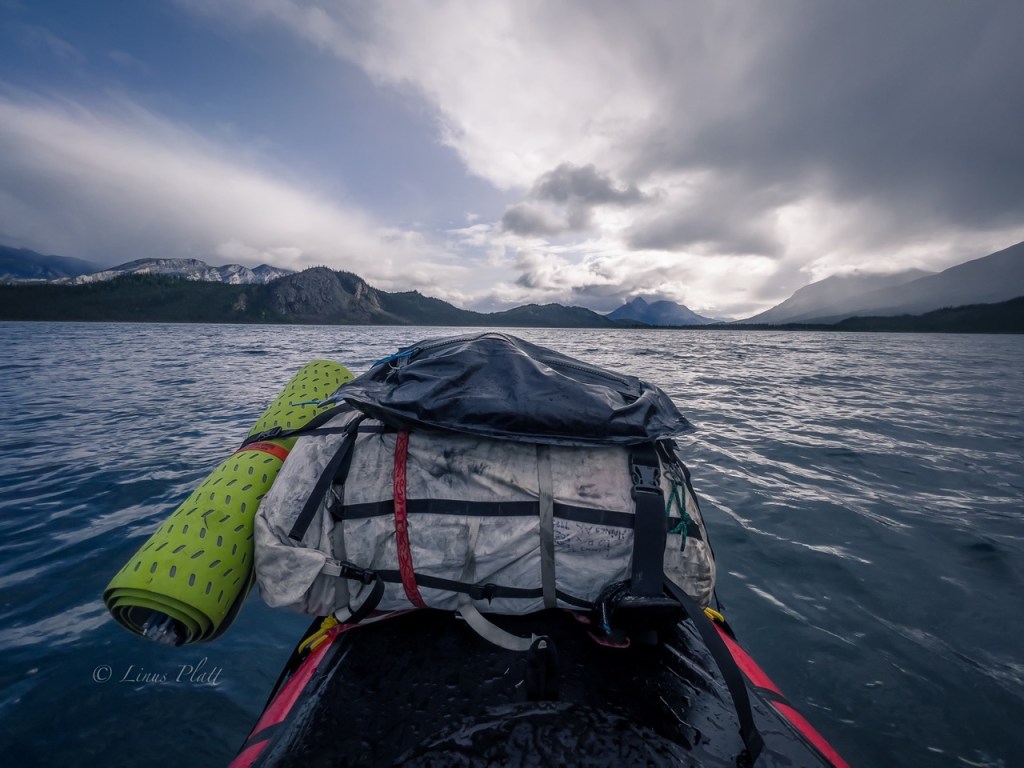
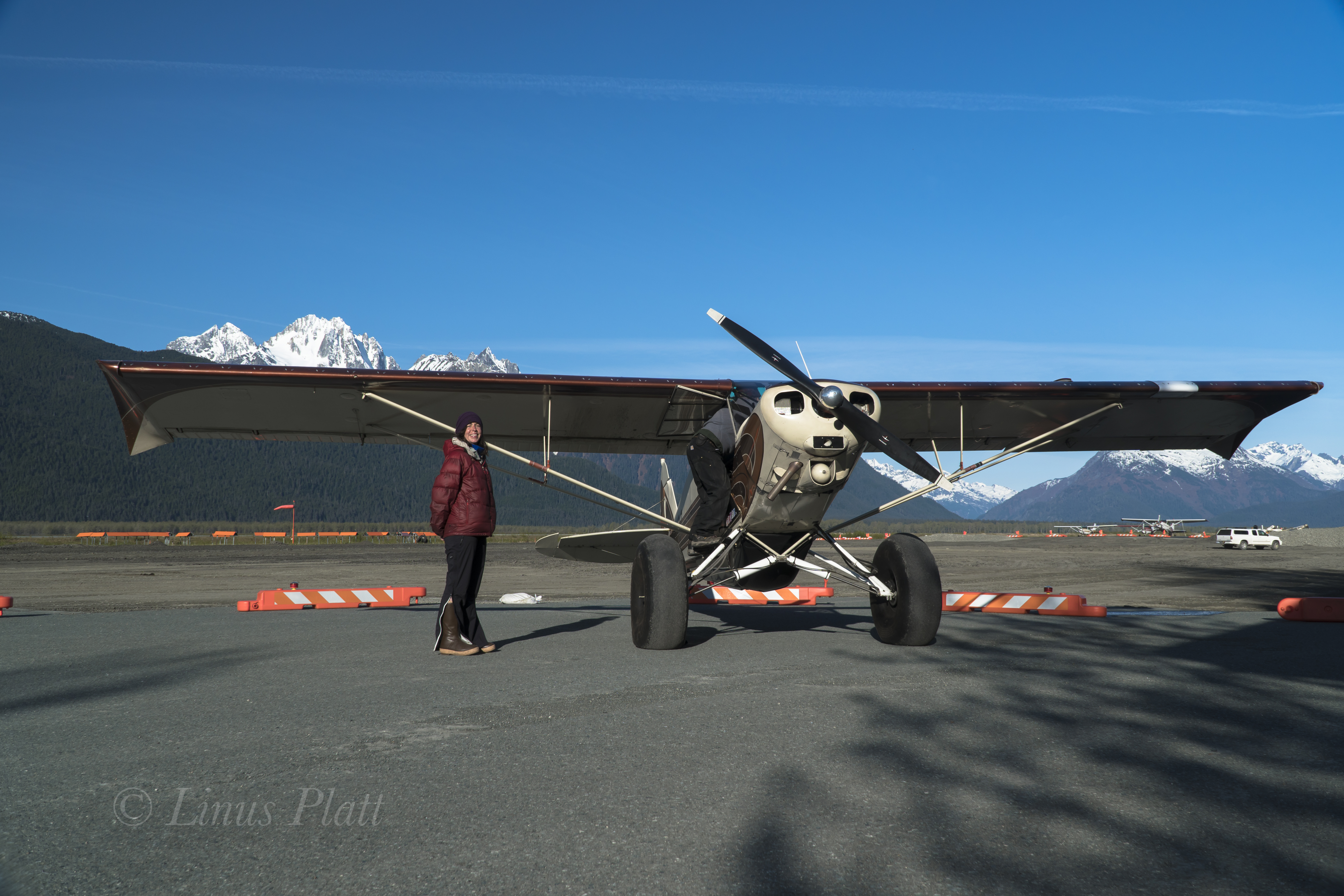
Bettles, Alaska, located over 200 miles north of Fairbanks, is a tiny village situated along the prominent and historic Koyukuk River and home to less than thirty people. Angela has been living there recently for her new job at the Bettles weather watch station, but with all the chores at hand unloading airplanes and organizing, we barely have time to see one another. The launching point for a most trips into this part of the Brooks Range generally begin here, with an airstrip that can receive both small and large aircraft; and from which smaller bush planes can take one deeper into the heart of the Brooks. From Fairbanks, we charter a Cessna Caravan via Wright Air Service to get the three of us, the two dogs Taka and Hula, all of our personal tools and gear, and a weeks worth of food to Bettles. For the remainder of our nearly 10,000 pounds of lumber, food, and building materials, a Curtiss C-46 Commando is employed and scheduled to arrive in Bettles that very same day. Once in Bettles, the task of unloading and organizing everything was at hand so it could all be flown the 60 plus miles to Takahula Lake with smaller 1000 pound loads via DeHavilland Beaver, an aircraft of legendary status in the world of remote Alaska bush flying. After a couple days of rain in Bettles, I say a quick goodbye to Angela, and we climb into the Beaver with dogs, food, and tools bound for Takahula Lake

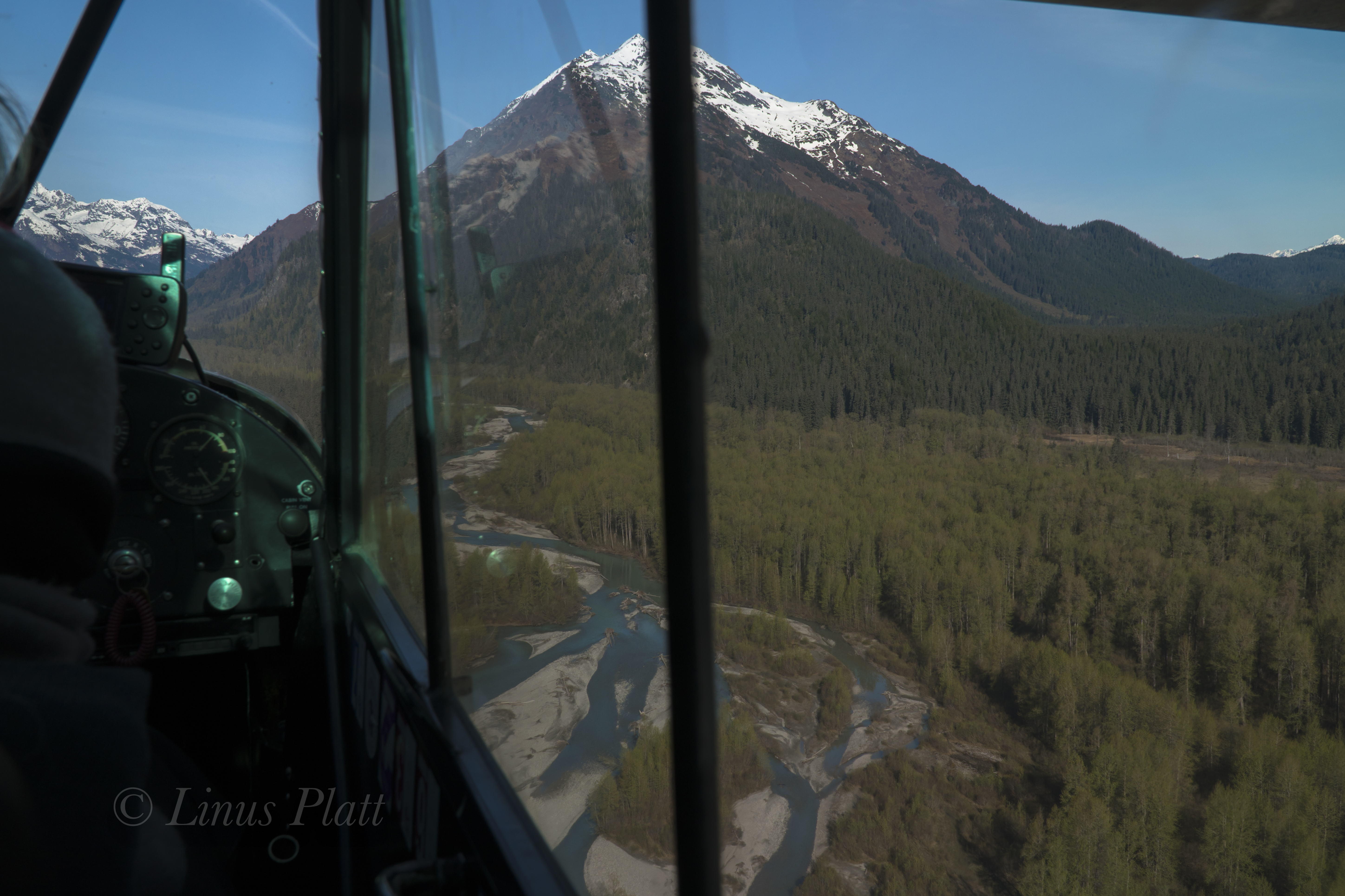
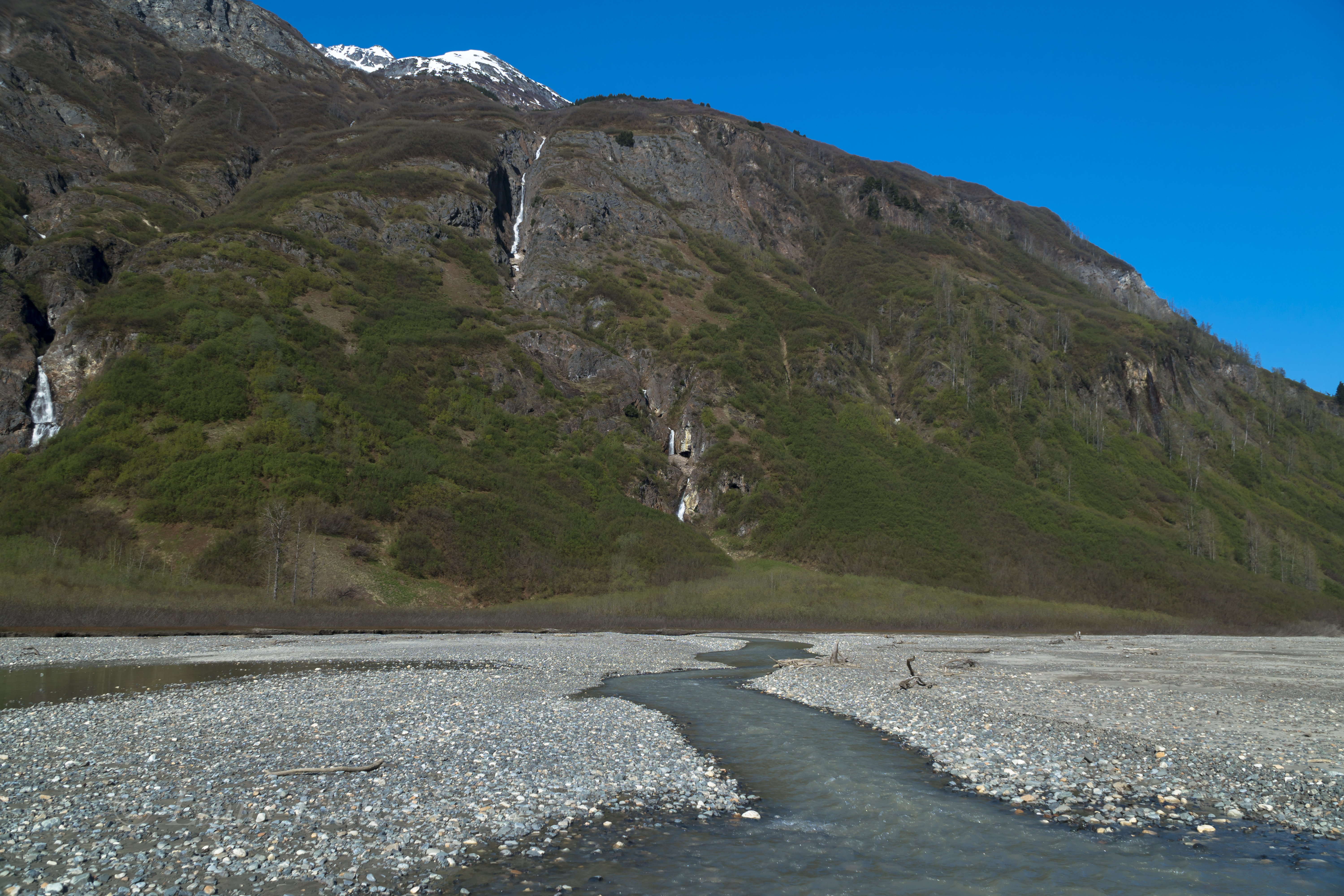
Heading west and flying just south of the massive Brooks Range divide, we follow the Koyukuk River before crossing both the Wild and John Rivers, then sneaking past the Alatna Hills and up The Malamute Fork that eventually leads to the Iniakuk River and the Alatna River, one of the central Brooks Range’s primary water systems. We turn north, just past Iniakuk Lake, where we drop into and continue up the Alatna river until Takahula comes into view. Flying over the Brooks Range region in the summer is a special treat, with literally hundreds of rivers, creeks, and ponds visible among the endless valleys and countless summits both un- named and many un-climbed. It’s vastness is quite overwhelming and getting ones mind around it’s true size is somewhat mind boggling. Soon, the 1957 DeHavilland Beaver touches its floats down on the lake surface and we find ourselves taxiing towards the obvious cabin on the northeast corner of the Lake. The next several days are spent organizing load after load from Bettles, getting our camp up and running, and handling some preliminary work details to align the summer’s work projects.

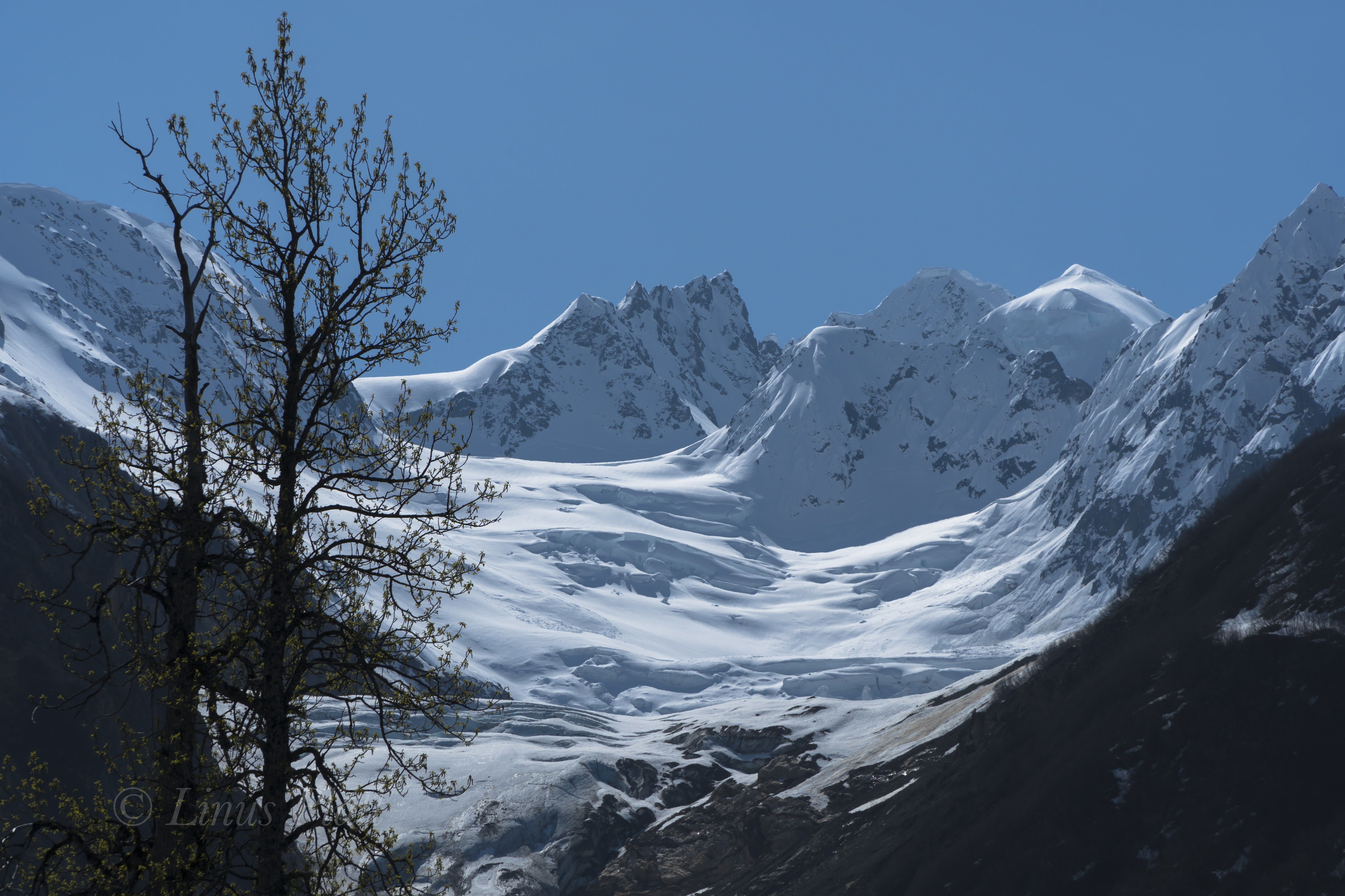
Across the lake, a prominent, sharp limestone peak commands our attention every single day after work as we eat our supper on the cabin porch overlooking the lake. Richard names it the Hula Horn after his lovely pooch Hula, whose namesake is also born of the region. After a couple of weeks of hard labor and accomplishing a portion of our set goals, we decide that a break is in order, and we set our eyes on the Hula Horn, which according to Richard, is most likely unclimbed.

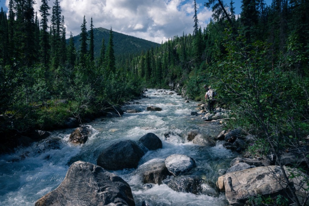
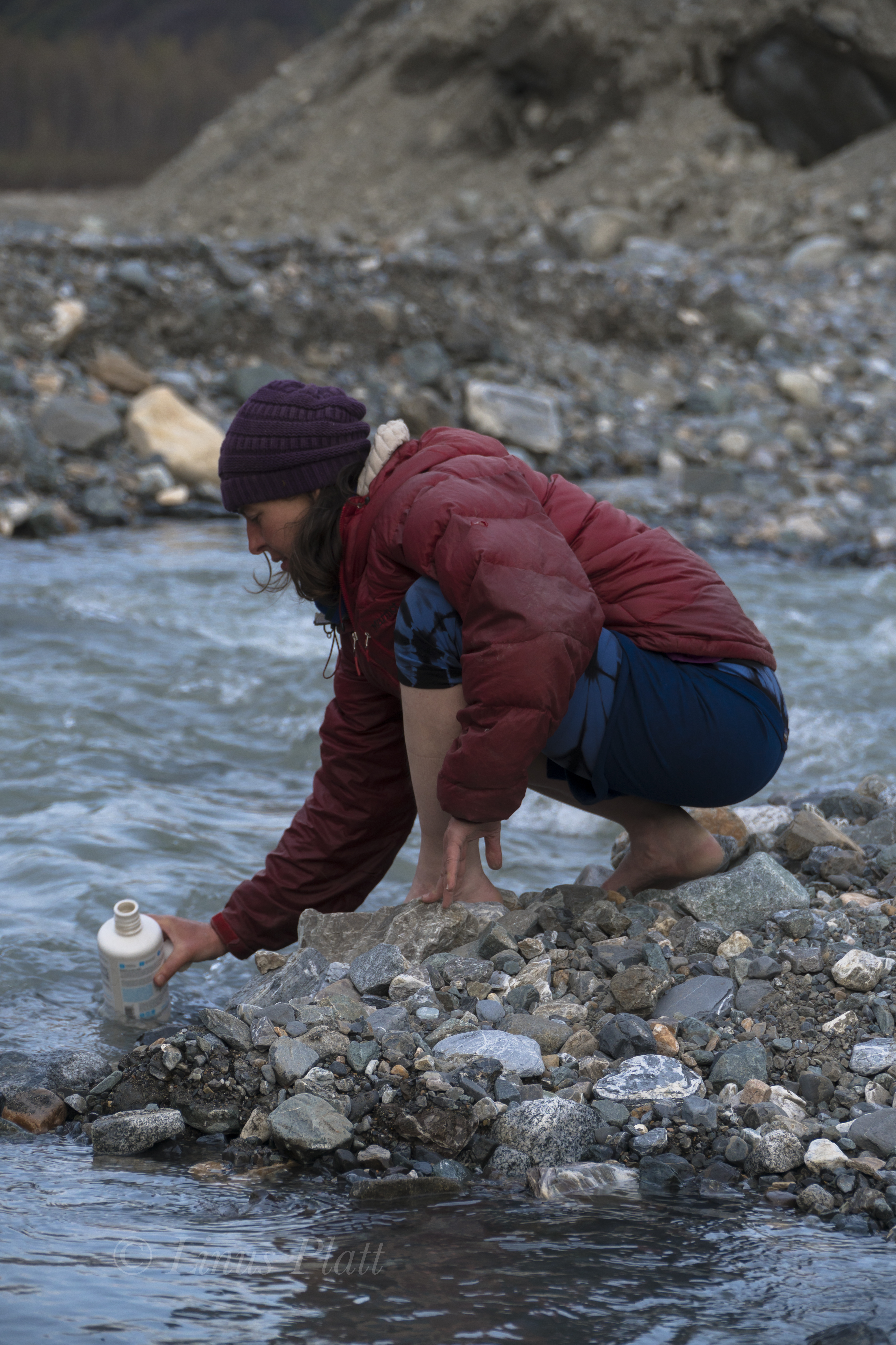
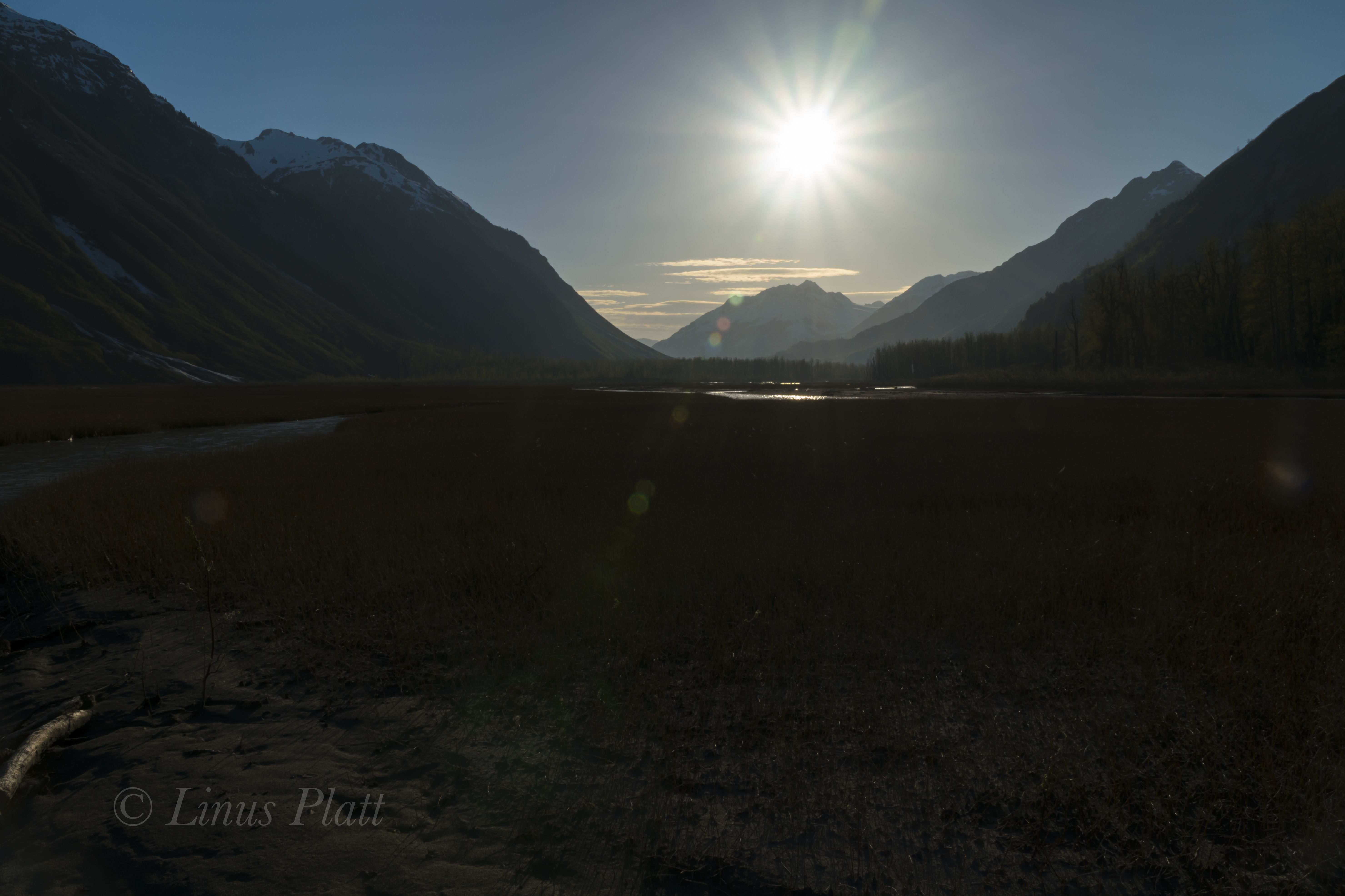
The following day at around noon, we load up the canoes and paddle to the southwest side of the lake, where there is a large beach and is a popular spot for folks coming down the Alatna River to be picked up. It is one of the very few camp spots on the lake, and is thus overused and worn. We stash our canoes here and begin hiking north along the shore of the lake, searching for a way around the obvious tussock swamp adjacent to it. Once found, we make our way through the low lying taiga and aim for a high rocky point on the ridge, where once gained, a short thrash down a gully system leads us to the edge of the beautiful Takahula River. Regretting not bring a pair of running shoes or sandals for river crossings, I roll up pant legs and cross the knee deep torrent of ice cold mountain water barefoot. Richard has brought a lightweight pair of hip waders and crosses with the two dogs in tow with ease. Jared manages the crossing in his socks, and soon we are hiking up the sparse boreal forest towards another high point where just below, another river crossing awaits. This river, an un-named creek at the foot of the Hula Horn itself, we name Freya Creek, after Taka and Hula’s mother. Freya Creek is much narrower than the Takahula River, but it is deep, fast, and icy. In fact, it is narrow enough to allow Richard to go first with his deluxe hip waders, then once across, he rolls them up and tosses them to each Jared and I to use. Soon we are aiming for lightly vegetated areas comprised of mostly lichen and moss; interestingly, these areas tend to be dry and very easy to travel upon. Eventually, the going gets steep and we are skirting a great limestone cliff of perhaps 150 feet in height; at it’s top, the terrain is steeper yet, where it becomes what one might call class III or IV moss. At the top of the steepest section, we now find ourselves at tree line just below the North Ridge leading up the Hula Horn. A short scramble past a lone Spruce tree puts us on the firm tundra and lichen covered ridge, where we rest for a spell and take in the outstanding views of Takahula Lake, Takahula Peak, the Alatna River, and the several dozen un-named peaks surrounding the area.

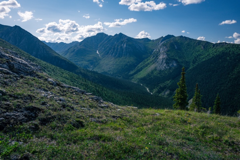
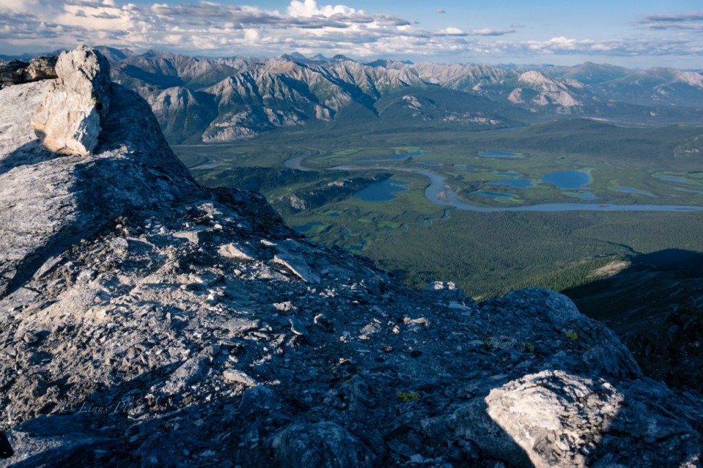
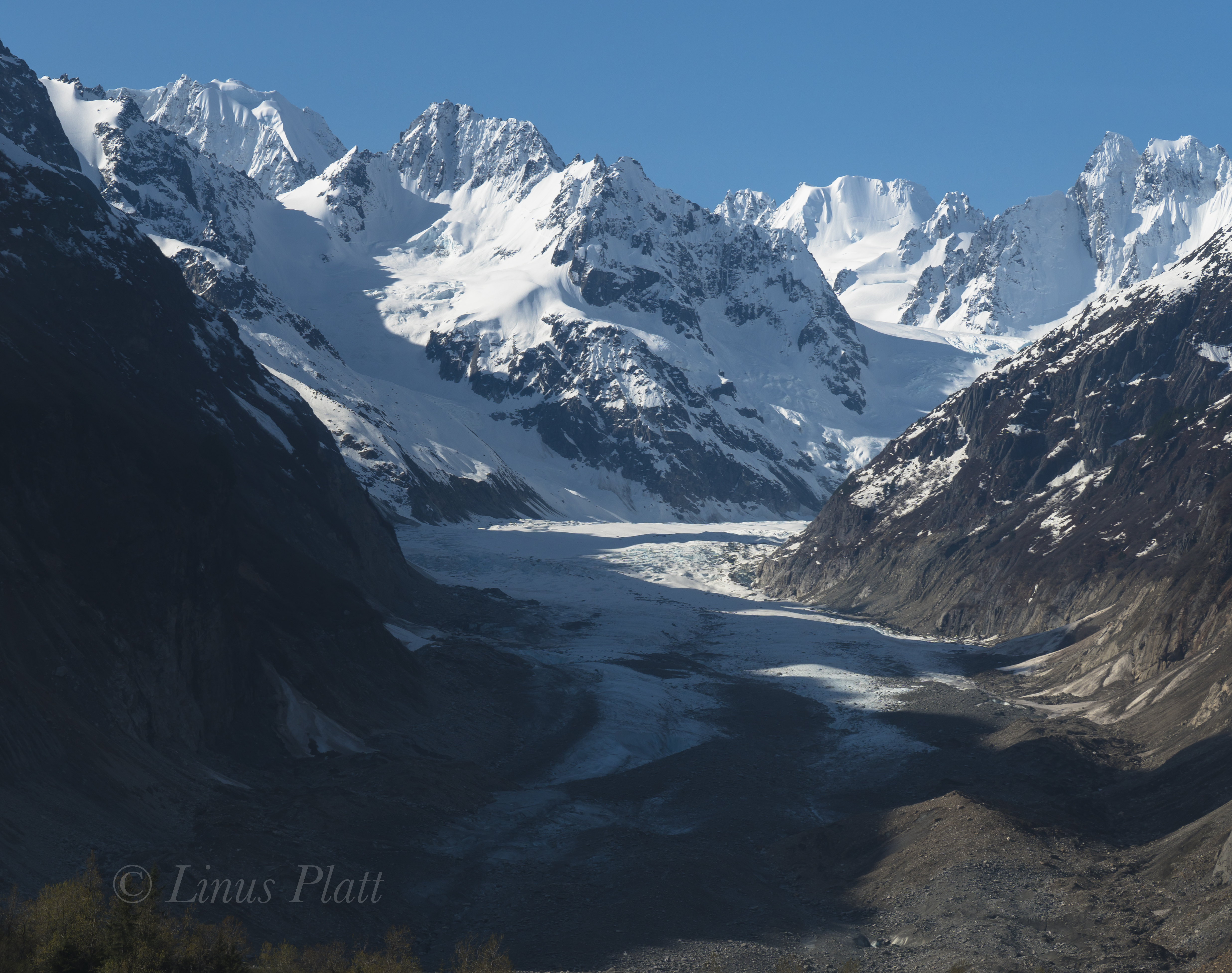
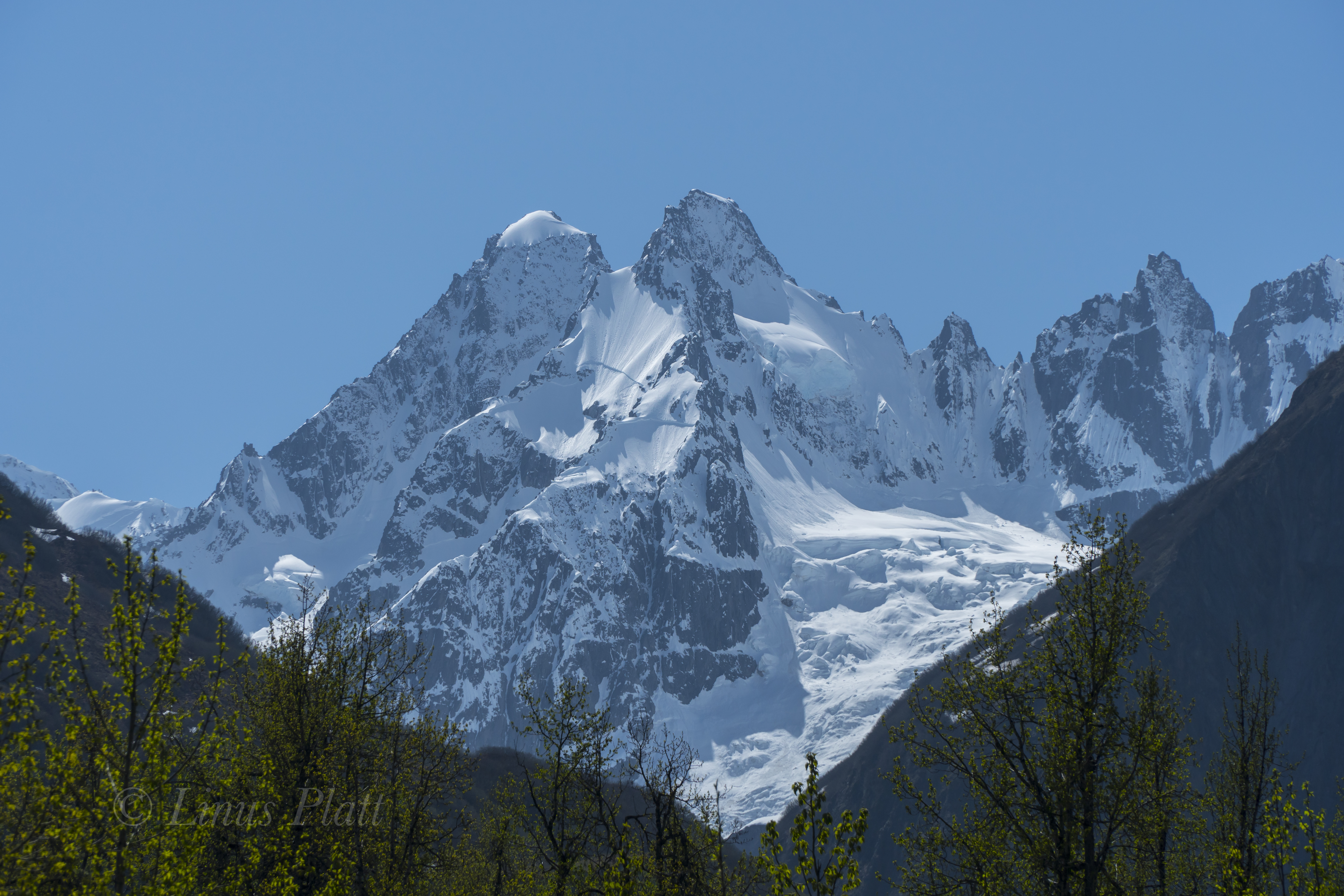
From the ridge, the walking is incredibly casual where one meanders open tundra, Caribou trails, and skirting small limestone outcroppings to one side or the other. After a good long section of these pleasantries, the route becomes, steep, loose, and muddy. Jared being many years younger than both Richard and I is far, far ahead of us, and I catch a glimpse of him and the dogs on a shelf about a half mile off and many hundreds of feet higher. Richard and I are running low on water, but a seeping spring oozing from a mud entrenched limestone shelf provides relief to our searing throats and near empty water bottles. Ahead, the route continues its steepness; yet treacherous sections force us to begin skirting and scrambling to the west side of the ridge, where after a multitude of nuanced zig zags deposits us below a cliff band below the summit block. Jared is seen up near the summit, and the dogs are left below, where Richard ties them up out of harms way. Up a short limestone crack system with a couple of moves of class IV rock climbing and we are standing on the narrow rocky summit. The view from the top is mesmerizing; the long and jagged line of granite of the fabled Arrigetch Peaks stretches out before us, and way, way off to the west, the thin outline of Mt Igikpak (8510′), one of the highest peaks in the Brooks can be just barely seen. Igikpak lies in a remote region near the headwaters of the wild Noatak River, and was first climbed in 1968 by David Roberts, Chuck Loucks, and Al De Maria. Since then it has only seen a handful of ascents. To the south, endless valleys, rivers, and un-named peaks stretch for as far as the eye can see, leading to more unseen rivers and drainages feeding the Yukon River region of central Alaska. To the north and east massive peaks dot the horizon before the landscape gives way to the arctic plain commonly referred to as the North Slope. We build a cairn, sign our newly made summit register, and begin the long descent down the zig zagging traverses and rocky scrambles that lead to easier walking along the tundra covered ridge. Once back in the forest, the mosquitos come out in hordes and we make haste back to the canoes, where a paddle across the lake at almost 2 am in the Alaska twilight has me nearly passing out from exhaustion. 14 hours after starting the Hula Horn, we are back at the cabin sipping beer and eyeballing the peak we had just climbed.

The next day is spent doing absolutely nothing, but over the following days and weeks, we put a good dent in our primary work goal for the summer: a 16′ X 25′ wooden framed deck with a steel framed vinyl storage tent erected on its top, which is to serve as storage for the entire cabin site and 5 acre property, holding everything from tools and building materials, to hiking and backcountry gear, to hunting and fishing equipment, to fuel, propane, paints, goods, and supplies of most anything imaginable that one may need at a remote Brooks Range outpost.

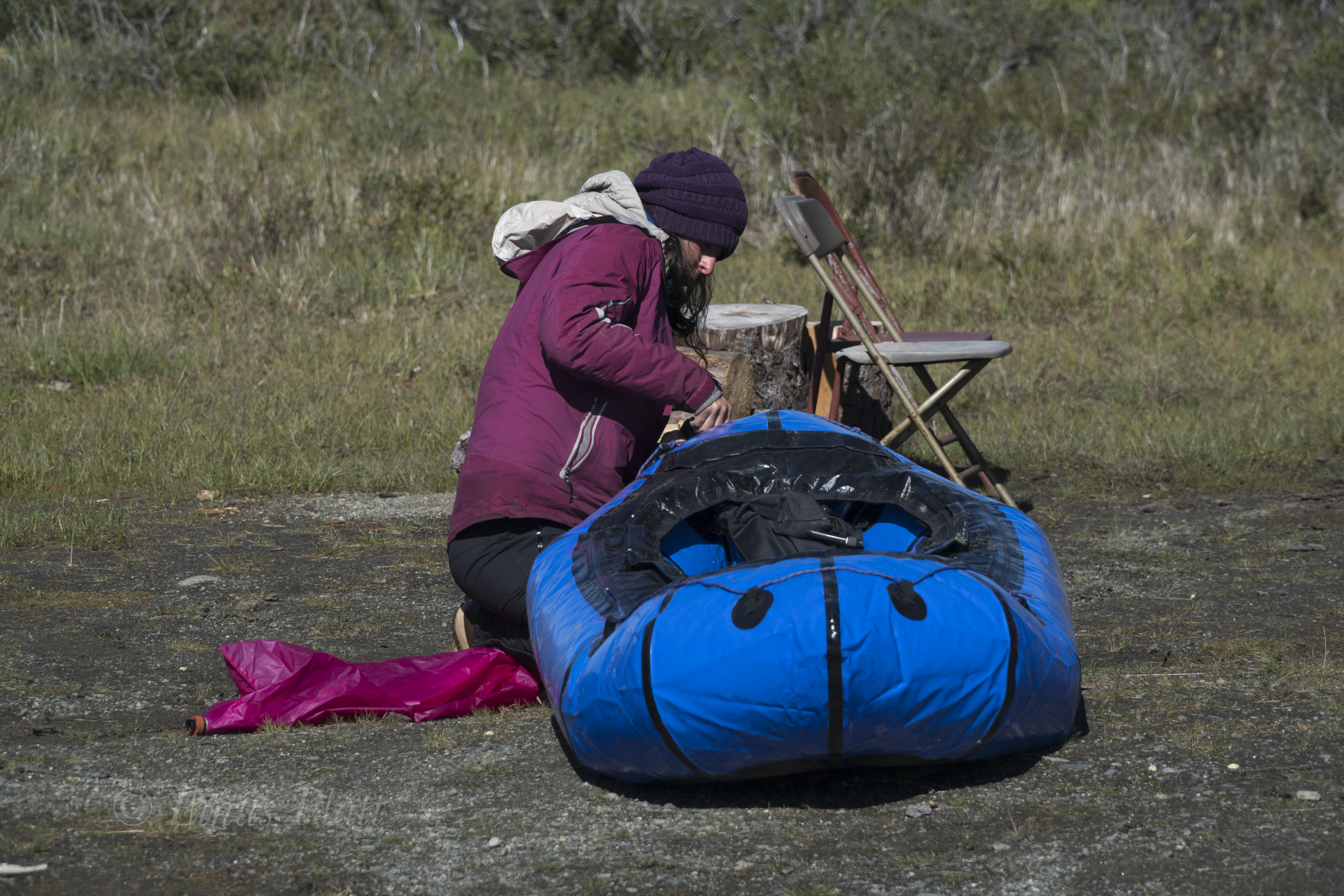
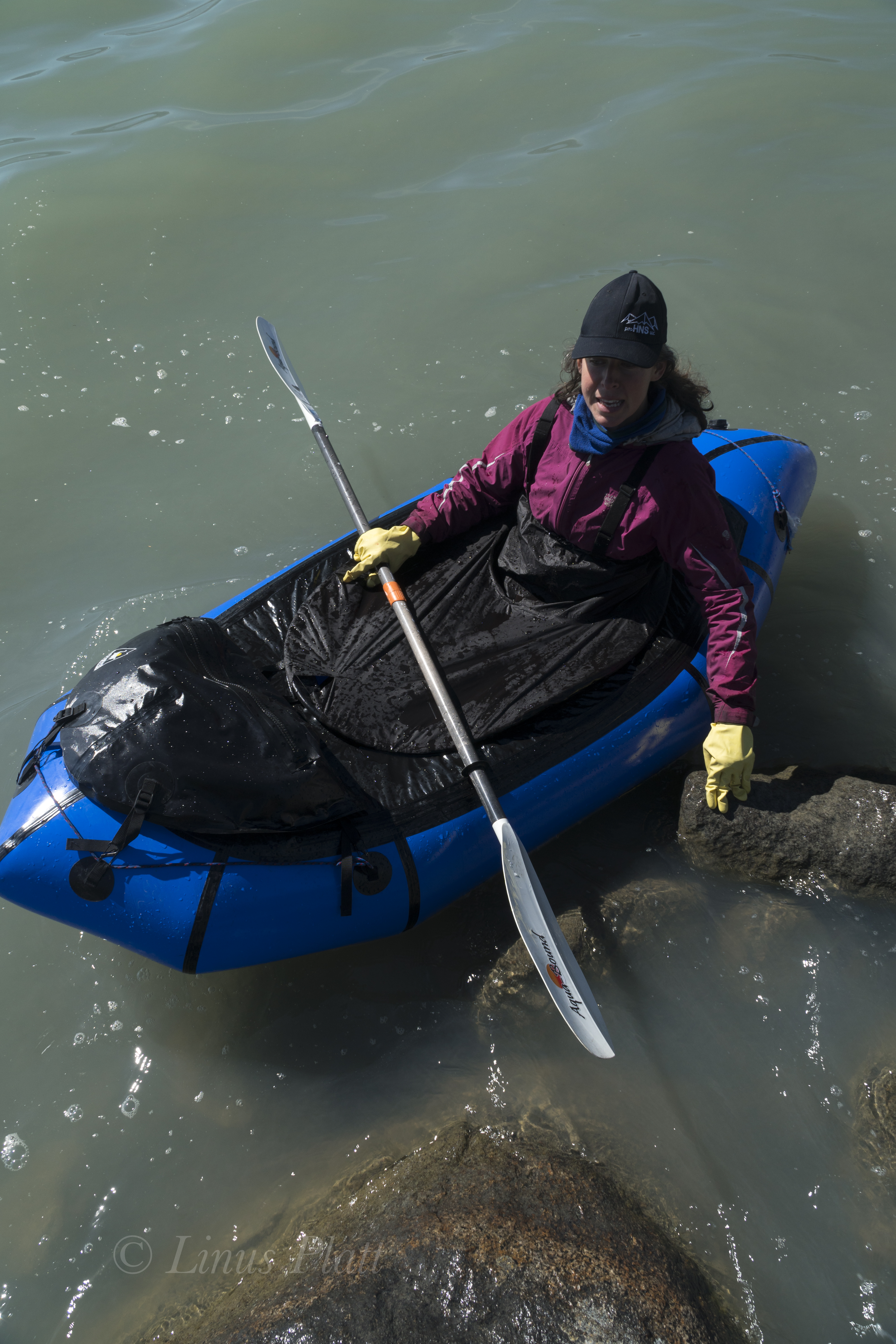
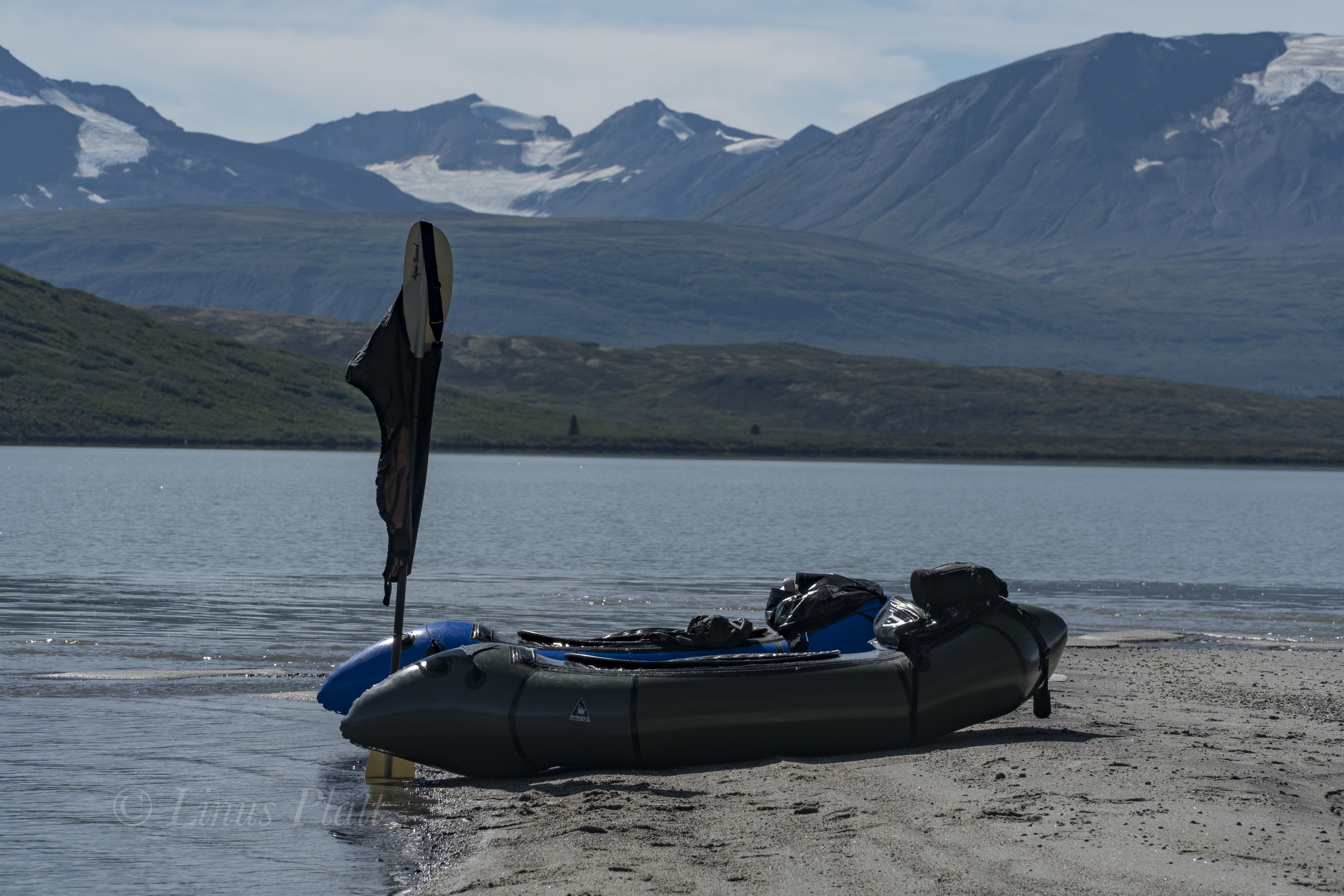
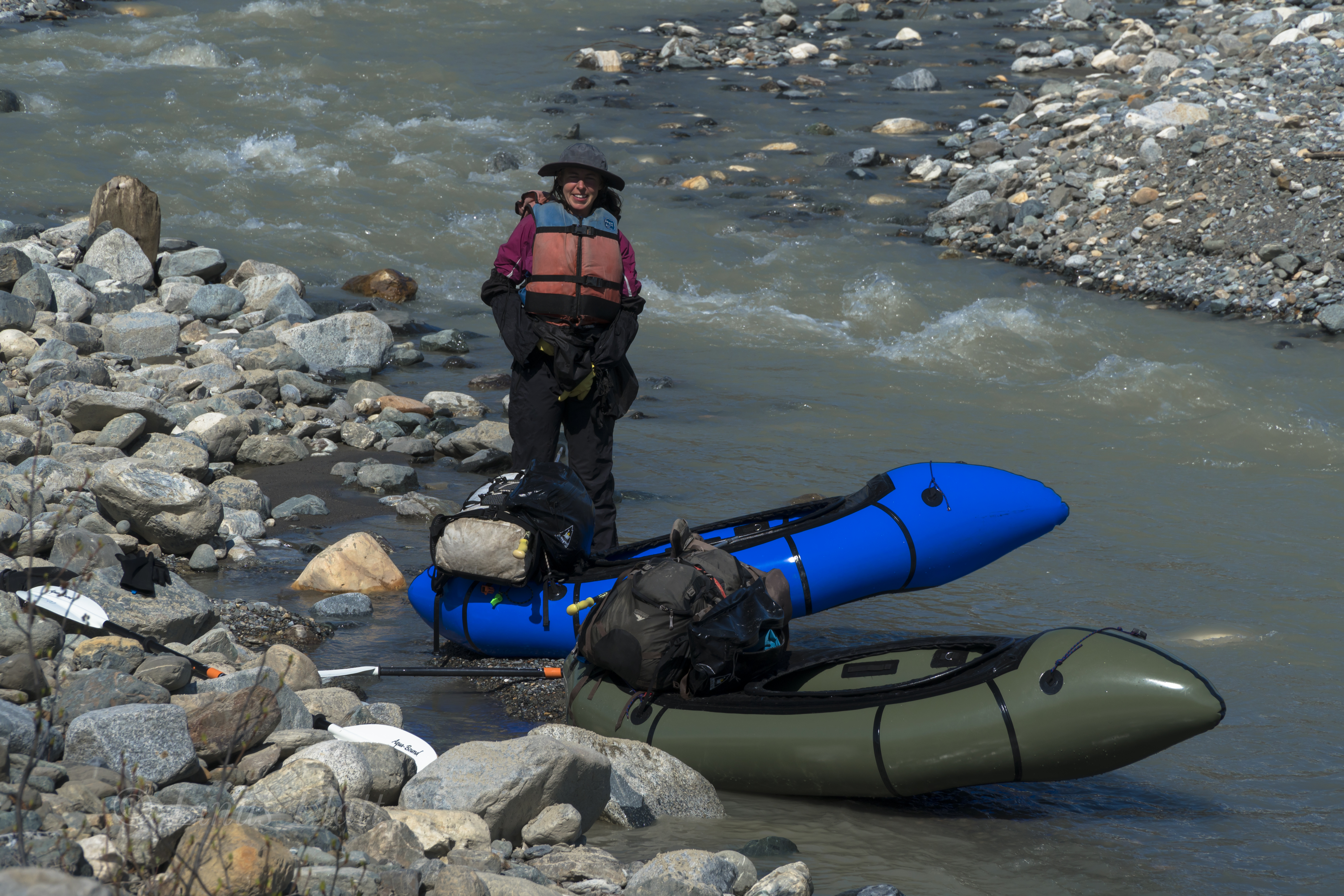
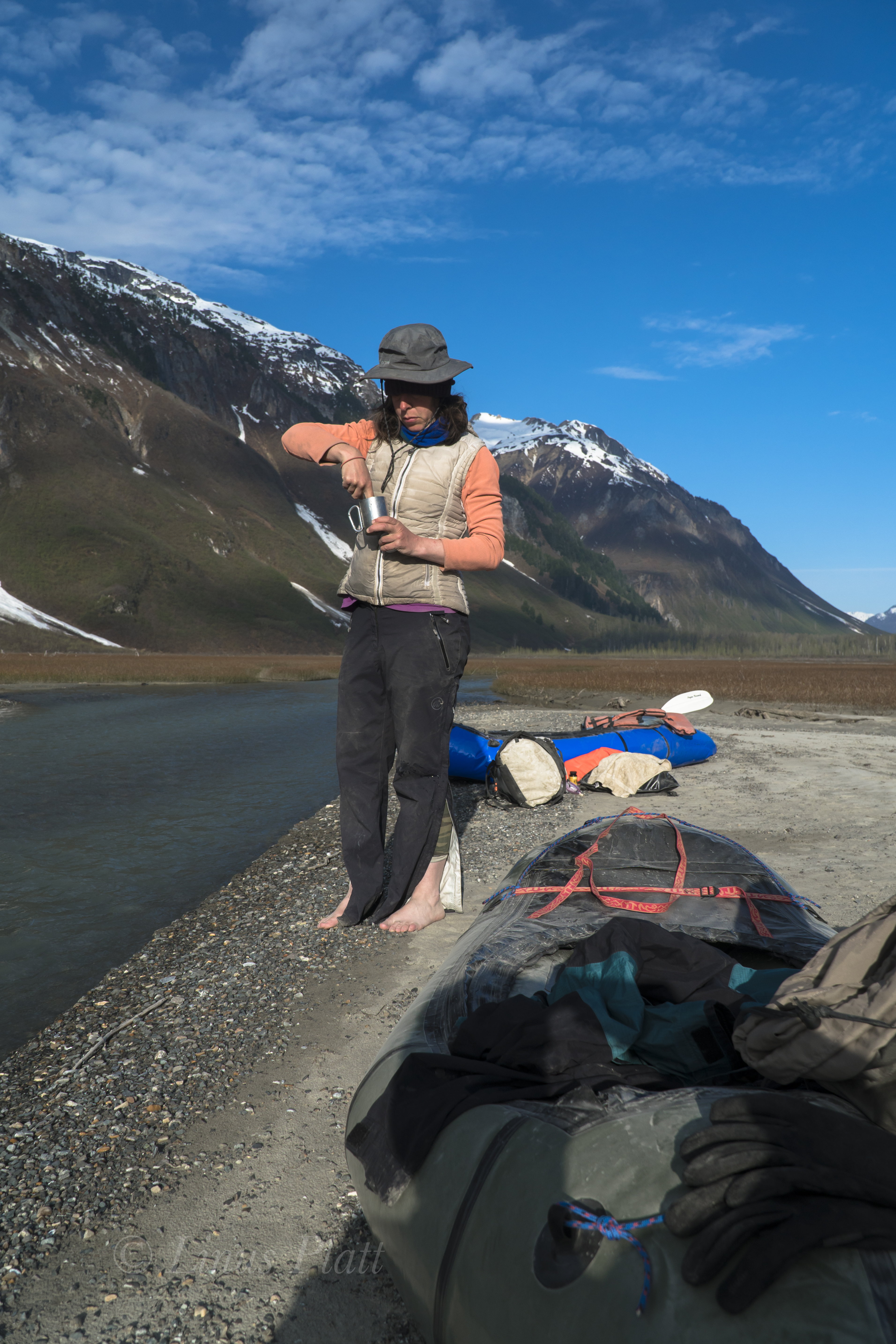
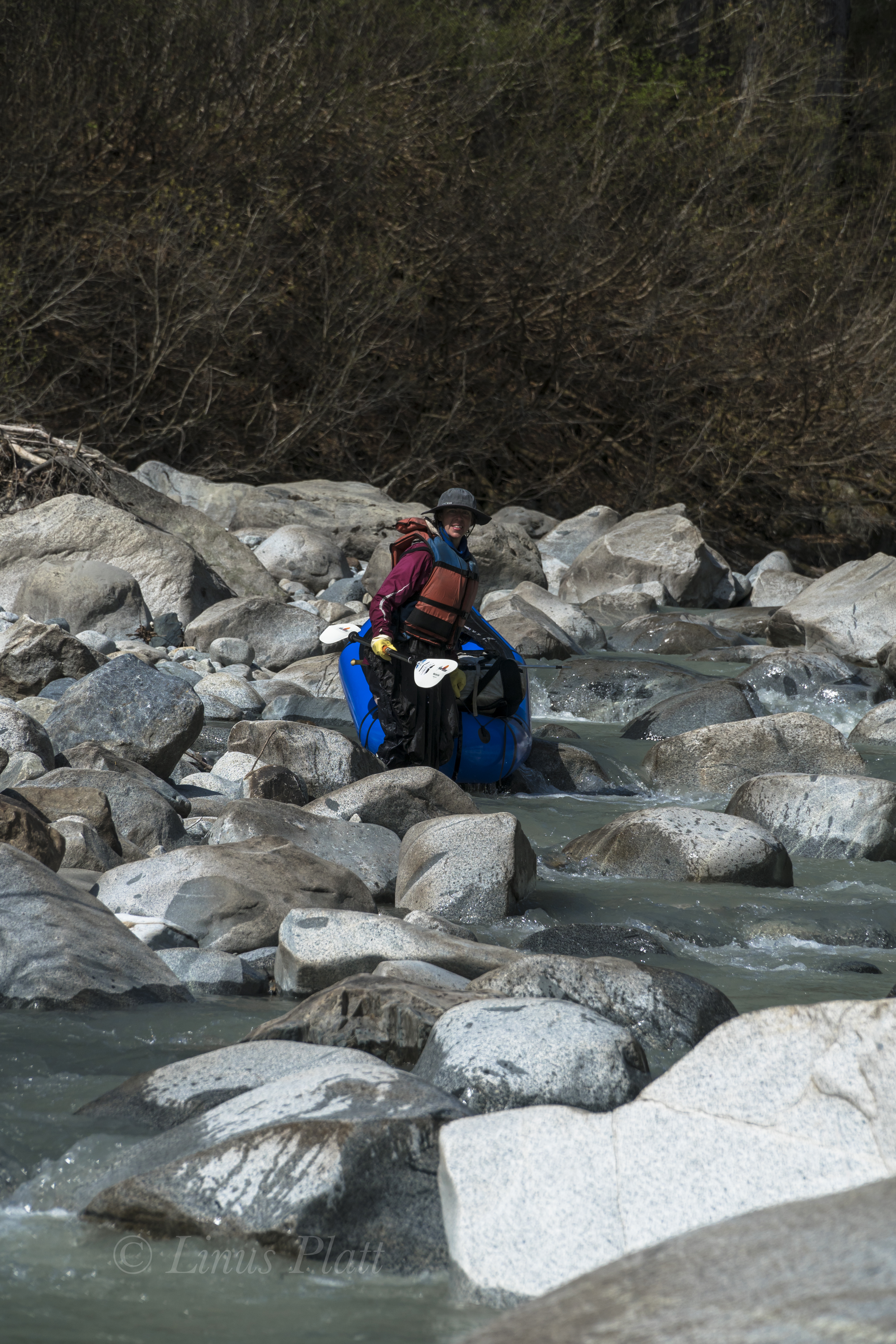
A couple of days before we are scheduled to be picked up and flown out, I decide to head up the Takahula River solo to inspect and potentially packraft it. So late one morning I pack up my backcountry kit, inflate my raft, and paddle across the lake where I’m able to easily hike over the ridge to the Takahula drainage below. At river’s edge, a crossing is unrealistic and an epic bushwhack ensues up river, where I’m forced up a hillside to avoid the worst of it. Eventually the thrashing subsides slightly as I’m gaining altitude and the forest is thinning. A great set of rocky and turbulent rapids steers me up to a rocky vantage and some spectacular views of the previously unseen mountains to the northwest near the Takahula headwaters come into sight. Looking back downstream, I now see the Hula Horn; this time from an impressive alternate perspective. It’s elegant and complex lateral ledges and zig zags ever so visible. I descend the rocky point into an open stone filled valley situated at the foot of Takahula Peak near it’s west- north-west shoulder. The sun comes out and walking the rocky tundra is a pleasure; I half expect to spot a Bear, Moose, or Caribou traveling its confines, but never do. Up ahead, the roar of another hefty rapid entices me to inspect, where I find an undercut bank preceded by voluminous drops and tight maneuvering. I feel fearful of paddling these features as it has been two full years since I have done any paddling at all, and now being here alone on an extremely remote river that has likely never been packrafted before, I am reticent as I eyeball these rapids and passageways.

I’m getting tired from the bushwhacking and meandering, and when an exceptional camp spot is stumbled upon, I decide to pitch my tent and call it a day. After supper, I walk downstream slightly to inspect a potential put-in for paddling tomorrow should I accept the challenge. The little spot is ideal as it has a nice even sandy approach into the river channel with low initial consequences. I navigate back to my camp, where a night of bad dreams about dangerous rapids interrupt any chance for good rest. Early in the wee hours, a steady rain begins to fall, and feeling unrested and uneasy, I mentally cancel any possibility of paddling the beautiful Takahula River on this trip. Later, and in a steady rain, I pack up my sopping wet camp and begin the long thrash back up to the ridge above Takahula Lake, and back down to a mellow paddle to the cabin.

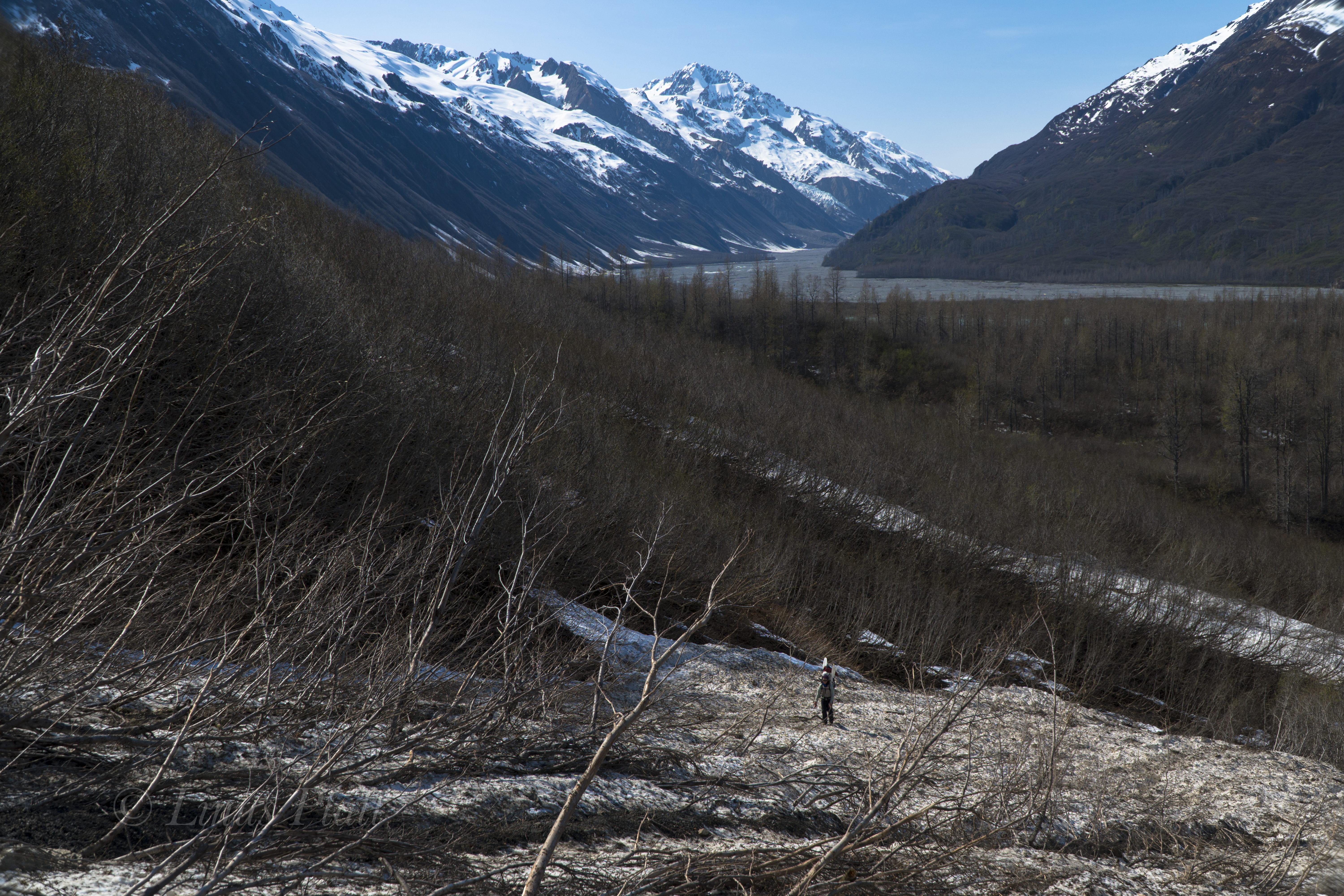
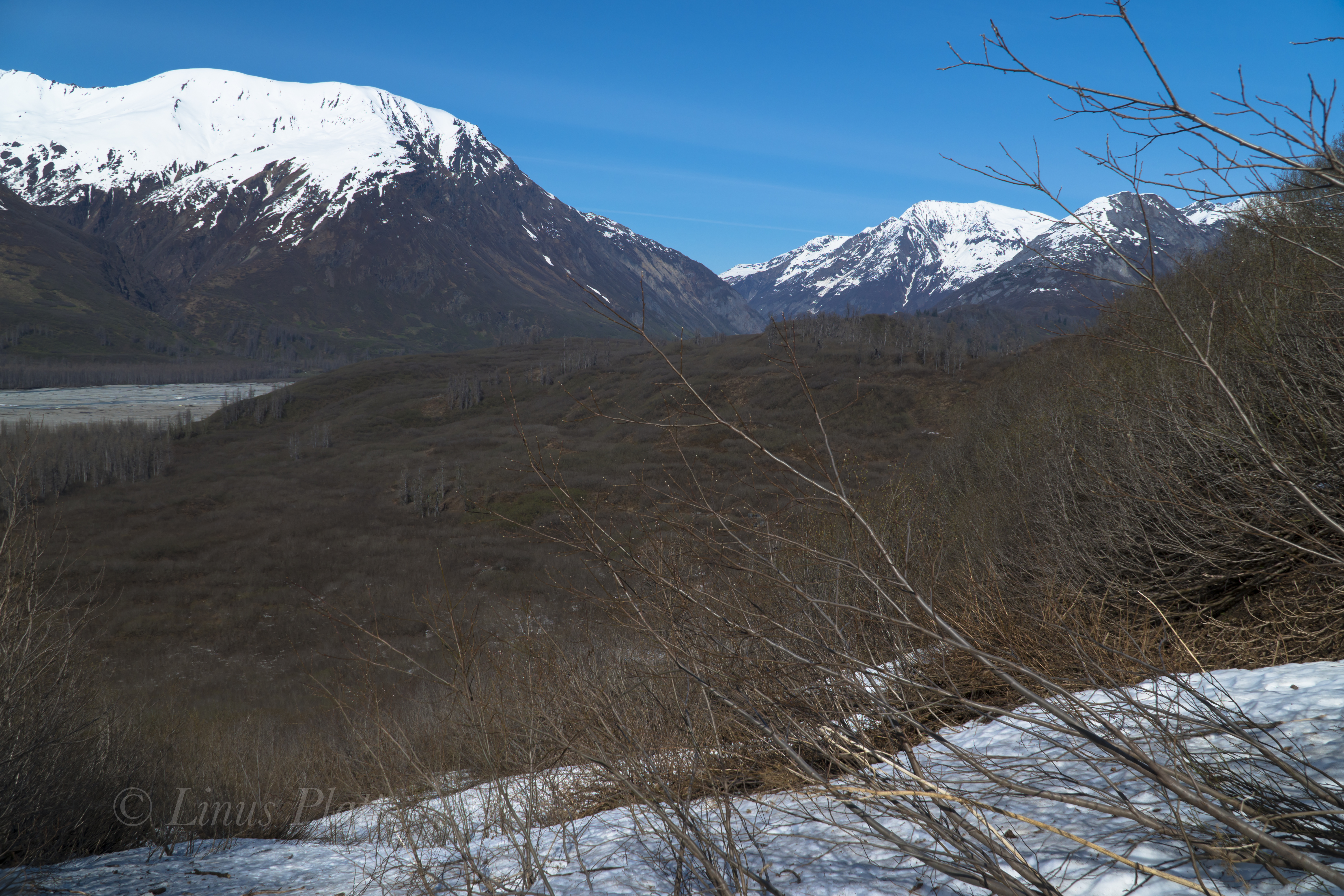
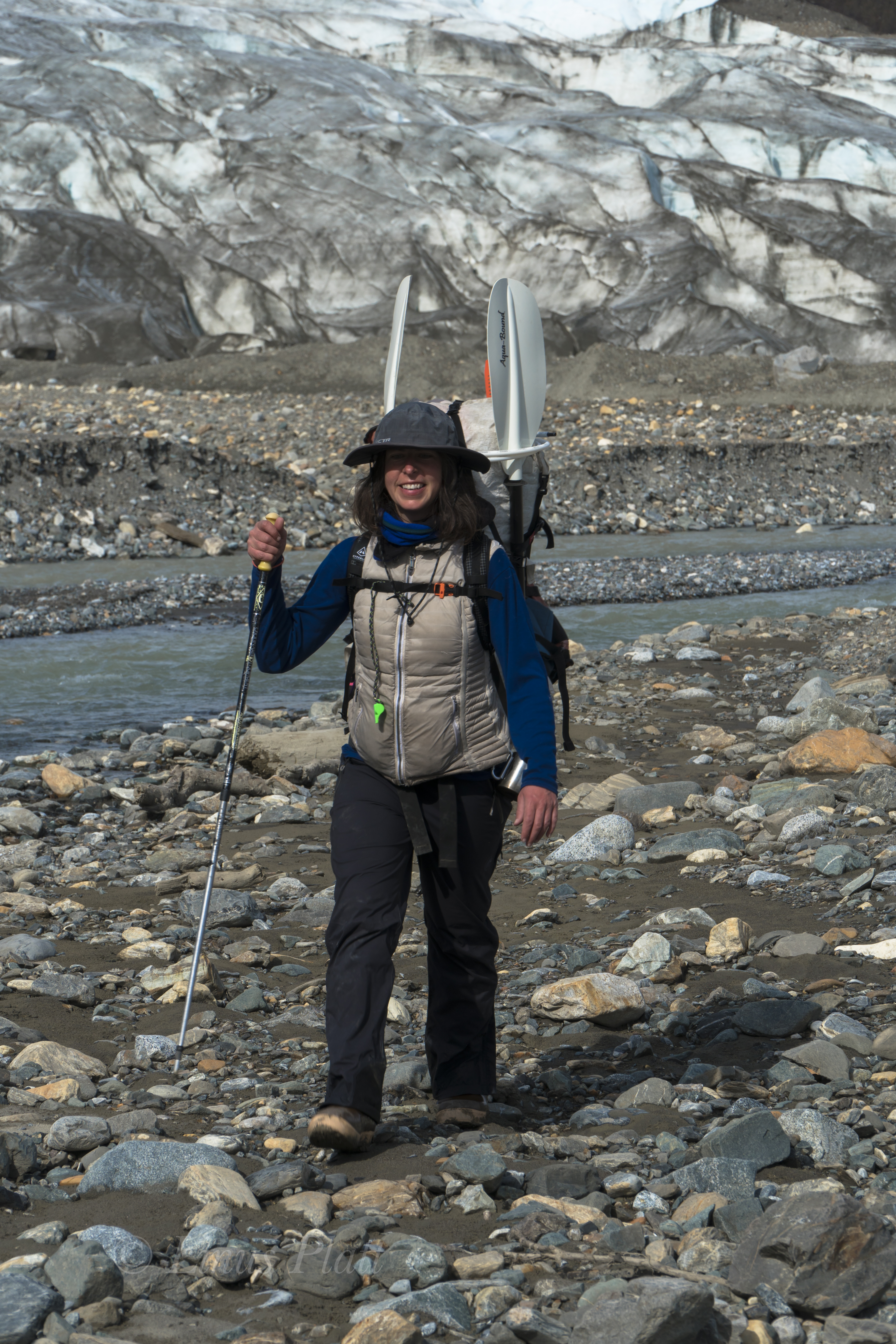
A few days later I’m back in Fairbanks installing gravel over the cabin site I had prepared back in June, getting myself rested, and preparing for my friend Chris Gavin’s arrival for he and I to head down to the Alaska Range for a week or two of late season packrafting before winter unveils its grinning face.

Parton Me

 As one drives north over and beyond Chilkat Pass, a broad and beautiful alpine valley is entered; the beginnings of the White and Black Spruce, Aspen, and high Tundra dominate the landscape here. Once past Kelsall Lake, the road climbs up and over an ancient moraine and drops to an expansive river filled valley; the birthplace of the fantastic Tatshenshini River at Goat Creek and the terminus of the short but spectacular Parton River. Fitness training and gear testing for an upcoming alpine adventure sees me driving up near the Yukon border for a solo ski into the Parton River region. I wish to scout the take out of the Parton River area for a future summer packrafting trip trip and get a layout of the landscape.

For me, the primary reason as an American to live in Haines is the access to the great and mighty Yukon Territory; a land full of wilderness, mountains, rivers, glaciers, and animals. Similar to the interior of Alaska, it too offers a lifetime of exploring, climbing, and packrafting that beckons me as often as I can muster.

Parking the truck on the shoulder of the Haines Highway, a short one mile ski down a dirt road leads to the first of three put-ins for the Tatshenshini known as Bear Camp. Here, the Tat is frozen and I ski across happily and pick up the faint and snow covered old mining road beyond; shortly after, I come to the frozen Parton River and once again ski across and beyond into the fields of stunted arctic Willow and deep snow. Someone else has been in the area recently, and at first I begin to follow a relatively fresh set of snowshoe tracks, but soon veer off course to find my own way.  I spot Arctic Hare tracks and soon spot Wolf, Lynx, and  Ptarmigan tracks… A couple of miles skiing in and out of the Willow thickets and up and over several creeks finds me entering the White Spruce of the Parton River corridor where it enters a canyon to the south and it’s headwaters lie. 

A quick snack and a few clicks of the camera see me skiing back to the Parton River, this time further upstream to inspect the river herself. Always fun skiing down frozen rivers this time of year… easy skinning with no obstructions gives me the opporotunity to inspect the area for log jams, debris, and other future packrafting concerns. 

With the sun getting low, I head back down stream,  cross the Tatshenshini, and skin back to the truck just in time to see the beginning evening Alpenglow.

Till next time…

Parton River Ski
Someone’s been this way…

Parton River Ski-2
Arctic Hare…

Parton River Ski-6
The Parton River…

Parton River Ski-3
White Spruce Landscape…

Parton River Ski-4

Parton River Ski-5
Where the Parton River enters the wilderness…

Kelsall Lake

Looking for a bit of fun and adventure finds Angela and I heading north out of town and up into the high country to parts unknown. We packed the truck with bicycles, packrafts, hiking paraphernalia and some snacks. About halfway up Marinka’s Hill, we stop to gawk at the Northern Takhinsha/Southern Alsek’s baring their blue and stoney ice in the spectacular late summer light. I have never seen these peaks so devoid of the previous winter’s snow. The result is visually striking; the glaciers are on full display and the rocky summits piercing the deep blue hue above. Once past Three Guardsmen, it is decided a paddle across the mystical Kelsall Lake is in order, and soon we are bouncing the truck down the 4WD track to it’s shores.

Once in the water, a pleasant paddle two or three miles to the inlet stream that feeds the lake comes around and we stop for lunch and a swim on the sandy beach below the glacier of Kelsall Peak. Back in the boats, a great wind swells up and we fight the lateral rollers all the way back to the truck and happily scurry back over The Pass and head back home.

Kelsall Lake-1
Takhinsh/Alsek Range

Kelsall Lake-2
Bare Ice

Kelsall Lake-3
Happy To Call This Place My Home…

Kelsall Lake-4
Mountain Hemlock

Kelsall Lake-5

Kelsall Lake-6
Getting Boats Prepped

Kelsall Lake-7
The Enchanting Kelsall Lake

Kelsall Lake-8
Kelsall Peak and Glacier

Kelsall Lake-9Kelsall Lake-10Kelsall Lake-11Kelsall Lake-12Kelsall Lake-13

Kelsall Lake-14
Angela Fires Down A Burrito

Kelsall Lake-15Kelsall Lake-17Kelsall Lake-19

Kelsall Lake-20
Brrrrr…

Heartbreak Ridge: Takhin River, Alaska

Since moving to Haines from Fairbanks nearly 5 years ago, I have been fascinated by a local piece of wilderness called the Takhin River Valley; a river born of the Takhin Glacier high at the western end of the Takhinsha Mountains at the far northern most tip of Southeast Alaska. The nearby Tsirku River is born from the Tsirku Glacier far into the western reaches of the range where massive ice sheets dominate the landscape. Further down stream a Tsirku feeder, the Le Blondeau Glacier, comes very close to the Takhin Headwaters and is separated from it by a 500 foot high, two mile wide swath of an ancient moraine covered in Alder thickets and Devil’s Club, and is know locally as Heartbreak Ridge.  I had heard many folks talk of the Tsirku… it is of fairly easy access by bush plane, or by foot, is big enough for a full size raft at spring and summer water levels, and is fairly tame overall. But I never ever heard anyone speak of it’s sister, the Takhin. After asking around about it, I discovered that there is a locally operated bush airstrip about 3/4 the way up the Takhin Valley known as the Fox Airstrip, but it seemed there was no way to gain plane access to the headwaters at the Takhin Glacier itself.

Last year I decided that the best way to investigate was to hike up the Tsirku on foot from the Devil’s Elbow, where one can park a vehicle, and attempt to get to the Le Blondeau and have a look at Heartbreak Ridge. At the time, I had no packraft, and made many dicey river crossings on foot until deep snow, and high water blocked passage about a mile and a half from the landing strip near the Le Blondeau. After spending a night in the upper Tsirku watching and listening to a pair of Wolves, I packed out, vowing to return better equipped.

This year, Angela and I, armed with packrafts, hired Drake Olsen and his Super Cub to get us landed on the tiny gravel air strip near the Le Blondeau near what is locally known as Horse Camp, a group of seasonal tin cabins from which hunting and guided Tsirku River trips begin.  It’s from this place we could easily hike to Heartbreak Ridge, and begin it’s Alder thrashing, which more than one person had guessed would be “extreme”.

The tiny Super Cub plane holds one pilot, one passenger, and a wee bit of gear. That’s it… so Drake takes Angela in first; it is about a 20-25 minute flight in and I wait by the Haines landing strip for his return, eagerly anticipating viewing the Takhin from the air to inspect for any obstacles we may encounter. The Super Cub re-appears, and in minutes gear is loaded and we are airborne and slicing through the crystalline sky along the lower reaches of the Takhin. Drake flies as low as possible so we can look for log jambs, wildlife, gravel bars, and any other thing of interest on the ground. We pass the fantastic Bertha Glacier and her giant iceberg filled tarn; the lake is still partially frozen over. It is May 17th 2018…

After Drake drops me off,  Angela and I watch as he hits the air and disappears over the ridge and is gone. We shoulder packs and begin walking the Gravel bars of the Tsirku in search of a supposed trail leading through the forest to Horse Camp. After a bit of wandering and doubling back, we find the trail and find ourselves deep within the confines of the bush. A large Moose antler is found on the ground, likely dropped the previous Winter. The cabins of Horse Camp are dilapidated and run down… animals have had their way with them and are in pretty bad shape. The tarn of the Le Blondeau Glacier is partially frozen over, and great slabs of icebergs are float here and there. The views of the glacier and peaks are amazing… one peak, known as Tomahawk, has gorgeous plumes and flutings descending from its jagged and corniced summit. Not all mountain ranges have these flutings, but are common in Alaska, The Andes, and Himalaya. Truly a signature of deeply glaciated peaks and severe weather.

We stomp around the east side of the lake all the way to just shy of the ice and right up against the mountain where we believe the easiest passage through the two miles of Alders might be. After having spoke with some people who had seen it, and seeing it from the air myself, I estimated it would take us about 4 hours to get through it, over Heartbreak Ridge, and to the toe of the Takhin Glacier.  Soon, we cannot go any further and so we dive into the Alders to our left and begin the extreme thrashing. The paddles sticking out the tops of our packs make the going much worse.  Alders are notoriously bad for this sort of bushwhacking and this is no exception. We gain a lateral snowfield and follow it, postholing in knee deep snow to ankle breaking downed Alders beneath.  Two hours later we come to a stream where we break for snacks and water before committing to more thrashing. Occasionally, we find old avalanche chutes to traverse up, then down, up, then down, avoiding short sections of thickets. It is time consuming and exhausting to say the least. Hours later, we are at the base of the final climb up Heartbreak Ridge proper. It’s nothing short of a heinous and evil Alder thrash. Did I mention Devil’s Club? We gots that too folks. Lots of it. We emerge on top, bloody, sweating, exhausted… and ornery.  The Alder thrashing we did last year on the approach to Mt Archibald in the Yukon was actually worse, but this was sustained.  It had kicked our ass, but we did it. In fact, I do not believe any one in recent memory (or ever) has gone over Heartbreak Ridge during the non-winter months (skis, snowmachines, etc) The view down to the Takhin Glacier is breathtaking and the descent looks steep and dangerous. After the initial loose and steep drop in, it is easy going and soon we are on the rubble covered glacier and boulder hopping to the toe to find our camp.

After reaching the snout of the Takhin Glacier, a gaping ice cave appears and the very utmost of the Takhin River is born, emerging as a rapid and icy tongue from it’s innards. We thought since the goal of this trip was to packraft the entire Takhin from it’s beginning, it would be especially cool to start from inside the ice cave and emerge in true fashion. However, it looks dicey so we decline, stumbling off to find a camp spot. We pitch the awesome Hyperlight Mountain Gear Ultamid 4 that was loaned to us by the company for testing and inspecting; I find it extremely light, easy to setup, and bombproof. Many thanks to HMG for this shelter. After camp is constructed and I lay in my sleeping bag, it occurs to me that it took us over ten hours to get from the landing strip on the Tsirku to the Takhin Glacier; I severely underestimated Heartbreak Ridge.

The morning sees the weather in fine shape with early morning light splattering the fluted ridges high above us. We walk for about a half mile downstream on the gravel bars in search of water deep enough to put the boats in.  Since it is morning and the temps still chilly, the water has not yet come up, but we finally find adequate water and we inflate the rafts. A pleasant float downstream on class I-II, puts us in a forested area, where log jams and shallow water force us once again on foot. Another paddling section begins and a mishap with a strainer and a missing paddle ensues. We thought that the paddle had floated away, but was in fact stuck underwater in the submerged thicket. We were soaked and needed to dry out. Luckily it was hot out… too hot in fact and we were both getting somewhat sunburned. back in the water, we paddle through another alluvial fan and spot a large Mountain Goat about 200 meters off walking right towards us. We eddy out and watch silently; the Goat stops and finally takes notice to us. We stare back and forth and the Goat decides these strange creatures near by are best not to get tangled with and starts trotting south and away from us. What a magnificent animal…

Back on foot again to avoid low water levels, we decide the best way to travel is to mount the inflated rafts to the tops of our backpack and hanging down with the bottom of the boat facing behind you; doing this makes one look like a giant alien Beetle. We walk through the open forest like this for a spell and I spot a Grizzly 100 meters away (close!) staring us down. I freeze, Angela freezes. It appears to be a lone male Grizzly, not giant, but not small either. We stare at each other for several seconds and the Bear flips 180 and bolts the opposite direction. After that, I decide that the Bear spray will go in one pocket, and the Colt 1911 .45 in the other.

Eventually, we begin paddling again, and even though the water is low, we are able to float big sections and simply drag the boats through the shallow areas and then jump back in. Soon we come to end of the big braided section of the Takhin near where the Fox Airstrip is, and realize that it is getting late and that we are very tired. We pitch the ‘Mid on a sandbar riddled with Grizzly prints and attempt to sleep. Soon however, a great wind pick up and after a bit, blows a steady 30 knots, showering us with sand and dust. It was miserable, but we hunkered into our bags deeper and got through it. Eventually it died off and we drifted into needed slumber.

Another fine morning of gorgeous weather finds us paddling immediately and entering the “Boulder Field” we had heard about from one person who claims to have jet boated up the Takhin. The river slices through the tight forest here and turns into a different animal than we had previously seen.  Small rapids appear… class II-III; twists and turns and rocks and holes all become the experience. The paddling is excellent; this is what we came for.  One nasty looking class III section with a big rock at it’s bottom that would surely flip you we decide to portage around. Following that, the Takhin turns into one set of glorious Class II-III rollers after another for several miles. It is an instant classic Alaskan paddle in my mind. We pass the Dickinson, Willard, and Bertha Glaciers, and into the final twists of the river a few mile before it’s confluence with the Chilkat River, where enormous log jams bar passage and force us out of the boats. We drag the rafts through the sand past Wolf and Bear prints and back into the water where more Class II rollers and some technical navigation around strainers and timber force a keen and sharp attention. Angela has a mishap with a pesky log and flips the boat, but all is well. We stop for a breather and laugh about the incident as we pour the water from our Extra-Tuffs and wring out our wool socks.

Back in the water and around the next bend in the river, we can now see the peaks of the Tahshanuk, indicating that we were extremely close to the Chilkat. We ponder for a moment if we should spend another night, or just simply paddle down the Chilkat back to the Haines airport where the truck is parked. After reaching the mother Chilkat, a great wind picks up and it is decided instantly that paddling home is the ticket; three days and 35 miles of bushwhacking and paddling behind us, our weather window had closed, and it was time to end this adventure and begin looking forward to the next…


Takhin River 2018-1

Takhin River 2018-2
First views of he Takhin from the air

Takhin River 2018-3
Bertha Glacier

Takhin River 2018-4
Tsirku landing strip

Takhin River 2018-5Takhin River 2018-6Takhin River 2018-7

Takhin River 2018-8
Horse Camp

Takhin River 2018-9

Takhin River 2018-10
Angela stomping around the Le Blondeau tarn

Takhin River 2018-11Takhin River 2018-12Takhin River 2018-13

Takhin River 2018-14
Le Blondeau Glacier

Takhin River 2018-15

Takhin River 2018-16
The bushwhacking and traversing begins

Takhin River 2018-17Takhin River 2018-18

Takhin River 2018-19
Final climb up Heartbreak Ridge

Takhin River 2018-20
First view of the Takhin Glacier

Takhin River 2018-21Takhin River 2018-22

Takhin River 2018-23
The true headwaters of the Takhin River via the ice cave

Takhin River 2018-24

Takhin River 2018-25
Camp at the Takhin Glacier snout

Takhin River 2018-26Takhin River 2018-27Takhin River 2018-28Takhin River 2018-29Takhin River 2018-30Takhin River 2018-31Takhin River 2018-32Takhin River 2018-33Takhin River 2018-34Takhin River 2018-35Takhin River 2018-36Takhin River 2018-37Takhin River 2018-38

Takhin River 2018-39
The Grizzly was spotted moments after this picture was taken

Takhin River 2018-40Takhin River 2018-41Takhin River 2018-42

Takhin River 2018-43
HMG Ultamid 4 and Grizzly prints

Takhin River 2018-44Takhin River 2018-45Takhin River 2018-46Takhin River 2018-47Takhin River 2018-48Takhin River 2018-49

Takhin River 2018-50
Angela re-aquainting herself with handgun use

Takhin River 2018-51

Takhin River 2018-52
Paddling

Takhin River 2018-53

Takhin River 2018-54
Just Rolling By

Takhin River 2018-55

Takhin River 2018-56